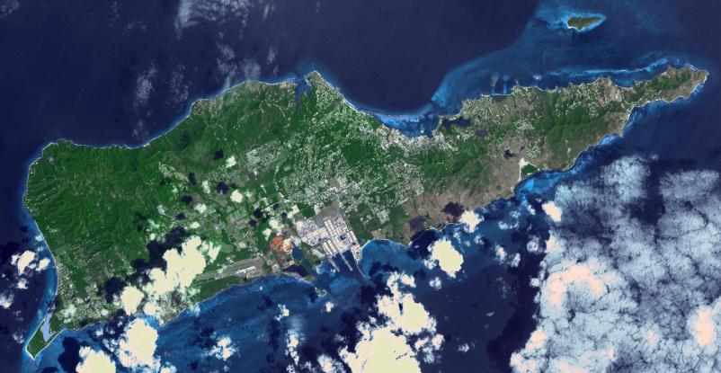
Saint Croix is a district of the U.S. Virgin Islands, in the Caribbean Sea. First inhabited by indigenous groups, the island was visited by Columbus in 1493. By the end of the 16th century, the island was uninhabited, the native population dispersed or killed. Starting in the 17th century, the island was successively claimed by the Spanish, the French, the French West India Company, and, for the next 200 years, the Danish West India Company. In 1801 the British invaded and took control; followed by Denmark-Norway a year later. Then again the British, and again Denmark in 1815. One hundred years later, in 1915, Denmark sold the Virgin Islands to the United States, and the inhabitants were granted US citizenship. Saint Croix was home to HOVENSA, one of the world's largest oil refineries. In 2012, the refinery closed, and tourism is now the main source of revenue (Wikipedia). The image covers an area of 18.7 by 36.2 km, was acquired March 10, 2011, and is located at 17.7 degrees north, 64.7 degrees west.
With its 14 spectral bands from the visible to the thermal infrared wavelength region and its high spatial resolution of about 50 to 300 feet (15 to 90 meters), ASTER images Earth to map and monitor the changing surface of our planet. ASTER is one of five Earth-observing instruments launched Dec. 18, 1999, on Terra. The instrument was built by Japan's Ministry of Economy, Trade and Industry. A joint U.S./Japan science team is responsible for validation and calibration of the instrument and data products.
The broad spectral coverage and high spectral resolution of ASTER provides scientists in numerous disciplines with critical information for surface mapping and monitoring of dynamic conditions and temporal change. Example applications are monitoring glacial advances and retreats; monitoring potentially active volcanoes; identifying crop stress; determining cloud morphology and physical properties; wetlands evaluation; thermal pollution monitoring; coral reef degradation; surface temperature mapping of soils and geology; and measuring surface heat balance.
The U.S. science team is located at NASA's Jet Propulsion Laboratory in Pasadena, Calif. The Terra mission is part of NASA's Science Mission Directorate, Washington.
More information about ASTER is available at http://asterweb.jpl.nasa.gov/.
 Planetary Data System


