
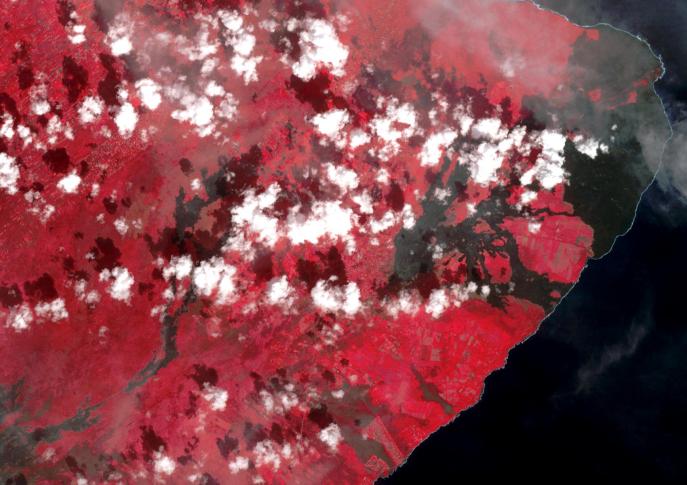
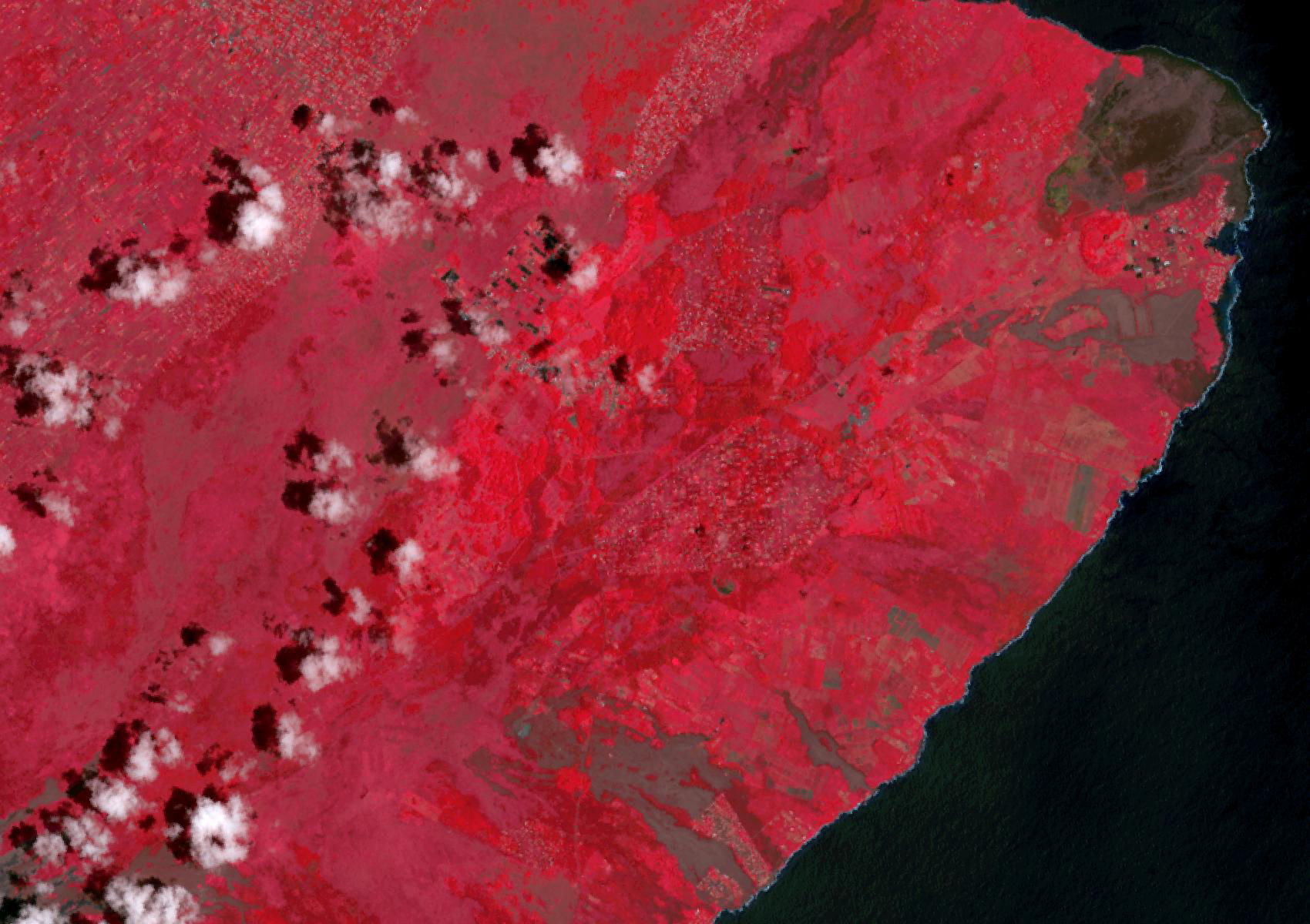
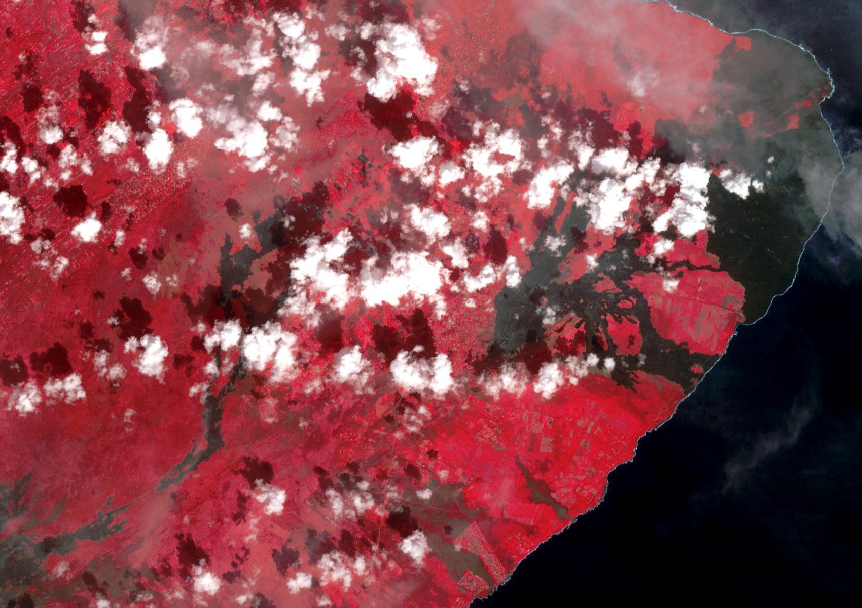
Before image (Sep. 5, 2013)
Click on the image for larger versionThe 2018 Kilauea, Hawaii eruption began in May on Kilauea's East Rift Zone. Lava fountains up to 100 meters high, lava flows, and volcanic gas continued until August. By the time the eruption ended, over 700 houses had been destroyed, and 35 square kilometers of land had been covered by lava flows. About 3.5 square kilometers (875 acres) of new land has been created in the ocean. The before image was acquired by Landsat 8 on September 5, 2013; the ASTER image was acquired November 14, 2018. The images cover an area of 18 by 25.5 kilometers, and are located at 19.5 degrees north, 154.9 degrees west.
With its 14 spectral bands from the visible to the thermal infrared wavelength region and its high spatial resolution of about 50 to 300 feet (15 to 90 meters), ASTER images Earth to map and monitor the changing surface of our planet. ASTER is one of five Earth-observing instruments launched Dec. 18, 1999, on Terra. The instrument was built by Japan's Ministry of Economy, Trade and Industry. A joint U.S./Japan science team is responsible for validation and calibration of the instrument and data products.
The broad spectral coverage and high spectral resolution of ASTER provides scientists in numerous disciplines with critical information for surface mapping and monitoring of dynamic conditions and temporal change. Example applications are monitoring glacial advances and retreats; monitoring potentially active volcanoes; identifying crop stress; determining cloud morphology and physical properties; wetlands evaluation; thermal pollution monitoring; coral reef degradation; surface temperature mapping of soils and geology; and measuring surface heat balance.
The U.S. science team is located at NASA's Jet Propulsion Laboratory in Pasadena, Calif. The Terra mission is part of NASA's Science Mission Directorate, Washington.
More information about ASTER is available at http://asterweb.jpl.nasa.gov/.
 Planetary Data System


