The first data from RainCube, a tiny weather satellite. RainCube is a prototype for a possible fleet of future small satellite missions that can track precipitation from space. RainCube "sees" objects by using radar, much as a bat uses sonar. The satellite's umbrella -- like antenna sends out chirps, or specialized radar signals, that bounce off raindrops, bringing back a picture of what the inside of the storm looks like.
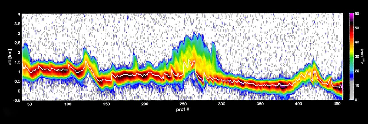
This graph shows a storm over the mountains in Mexico in late August 2018, as measured by RainCube's radar. The data shows a vertical snapshot of the storm -- the bright white line shows the ground, while the bright colors around it show the intensity of the rainfall, as well as the more reflective areas of the terrain. Brighter colors, like yellow or red, show areas of higher reflectivity, e.g. heavier rain.
For more information about CubeSat see www.jpl.nasa.gov/cubesat/.
