Click here for animation
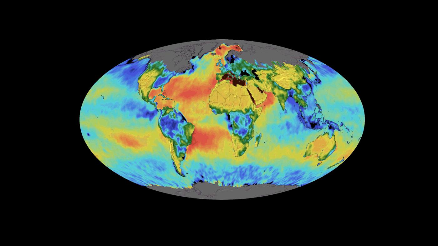
This animation shows a time lapse of sea surface salinity and soil moisture from NASA's Soil Moisture Active Passive (SMAP) satellite from April 2015 through February 2019.
SMAP is managed for NASA's Science Mission Directorate in Washington by NASA's Jet Propulsion Laboratory in Pasadena, California, with participation by NASA's Goddard Space Flight Center in Greenbelt, Maryland. JPL is responsible for project management, system engineering, instrument management, the radar instrument, mission operations and the ground data system. Goddard is responsible for the radiometer instrument. Both centers collaborate on the science data processing and delivery of science data products. JPL is managed for NASA by Caltech.
For more information about SMAP, visit http://smap.jpl.nasa.gov.
