My
List |
Addition Date
|
Target
|
Mission
|
Instrument
|
Size
|

|
2014-05-09 |
Earth
|
Terra
|
ASTER
|
1782x1754x3 |
|
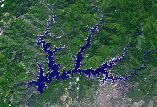
-
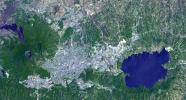
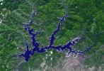
PIA18373:
-
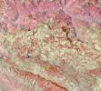
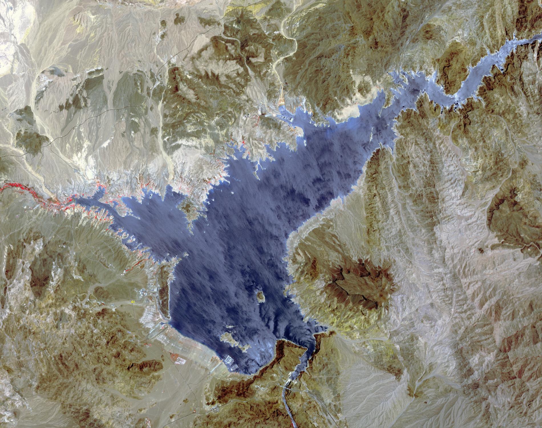
Nagarjuna Sagar Dam, India
Full Resolution:
TIFF
(9.381 MB)
JPEG
(513.8 kB)
|
|
|
2014-06-12 |
Earth
|
Terra
|
ASTER
|
3816x2292x3 |

|
-
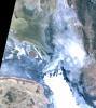
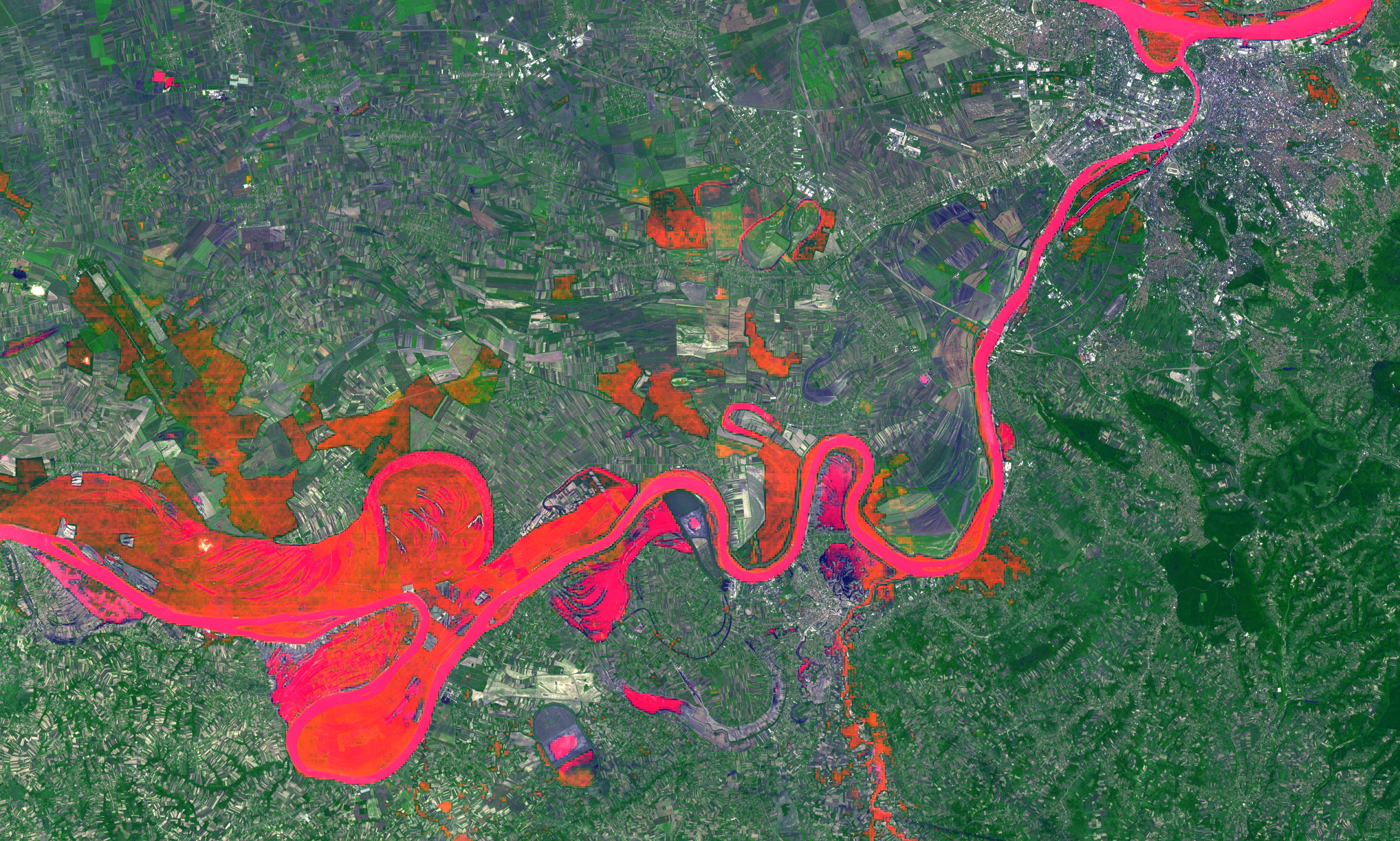
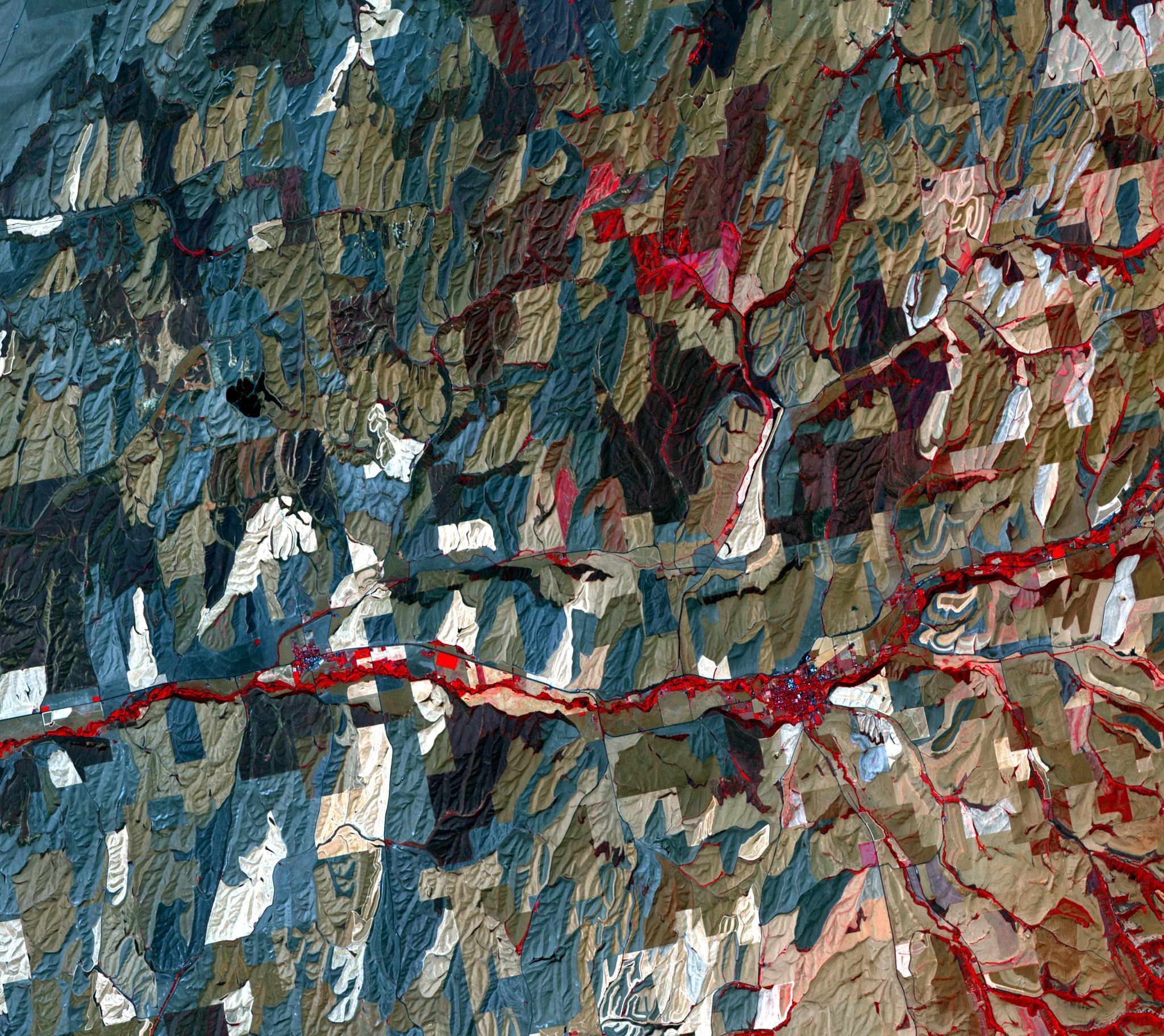
PIA18051:
-
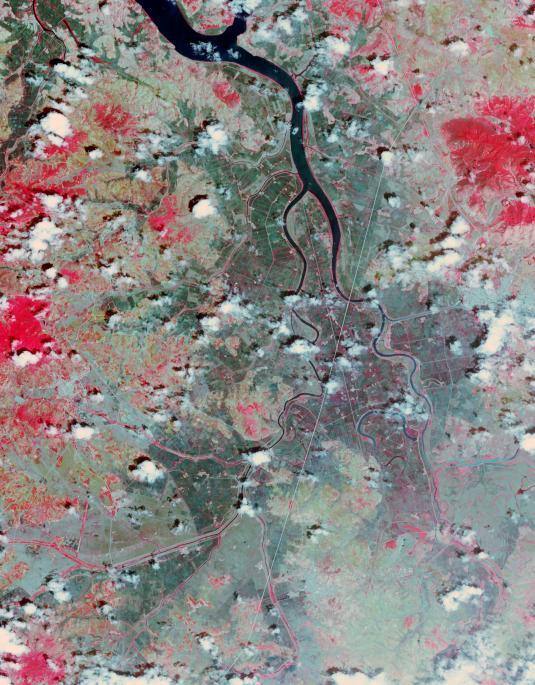
Historic Serbian Floods Eyed by NASA Spacecraft
Full Resolution:
TIFF
(26.25 MB)
JPEG
(1.819 MB)
|
|
|
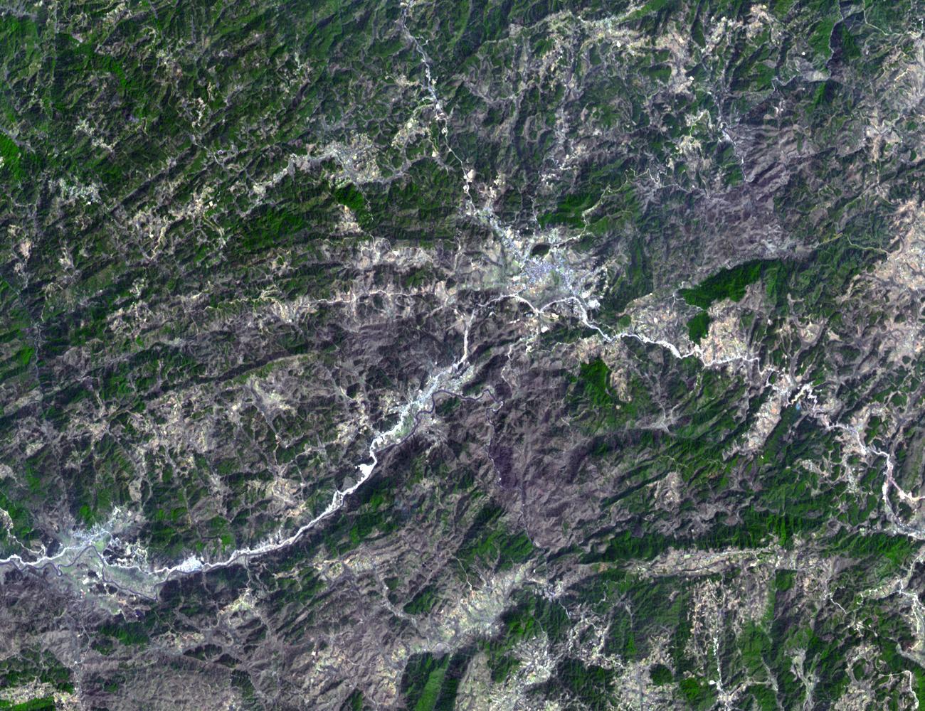
2014-05-20 |
Earth
|
Terra
|
ASTER
|
1504x1267x1 |
|
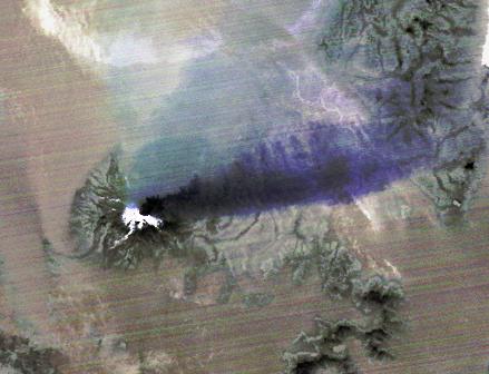
-
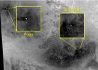
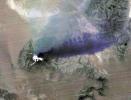
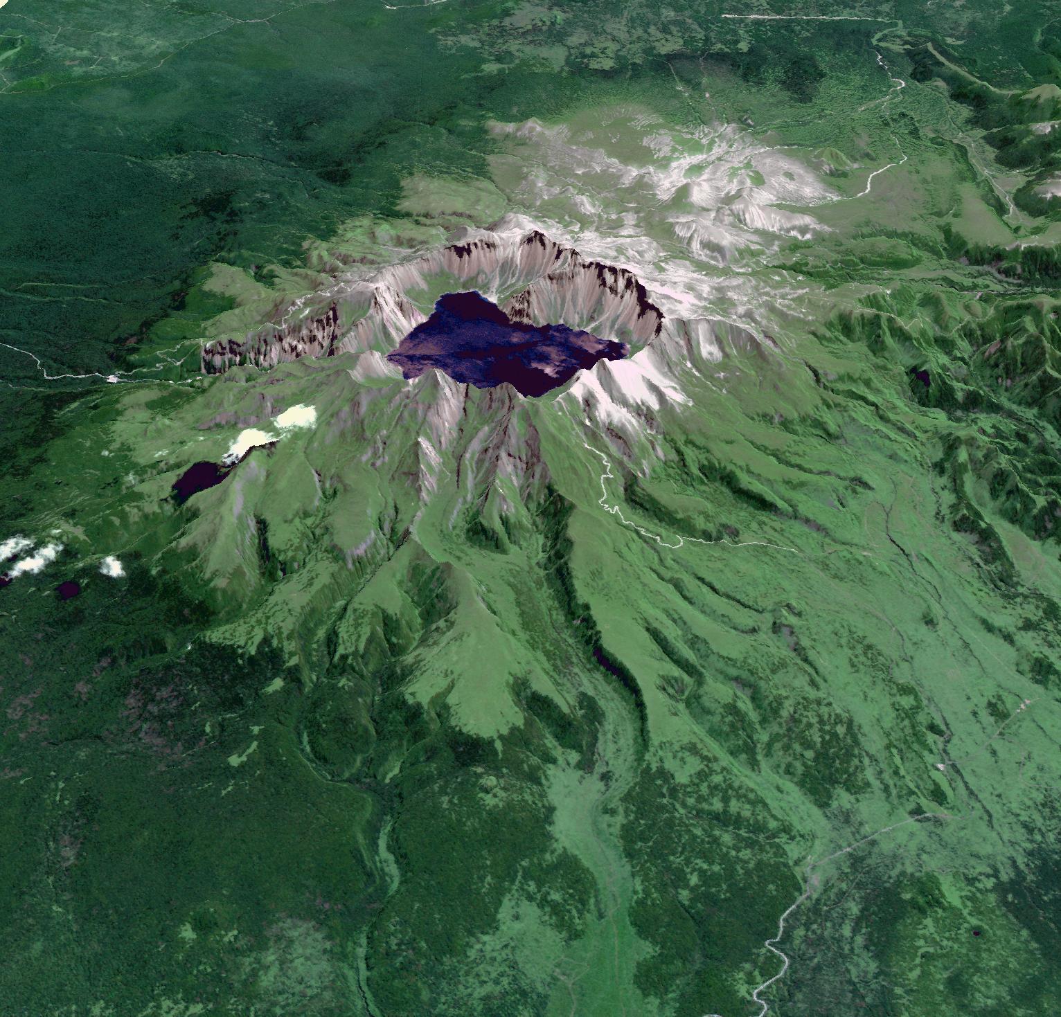
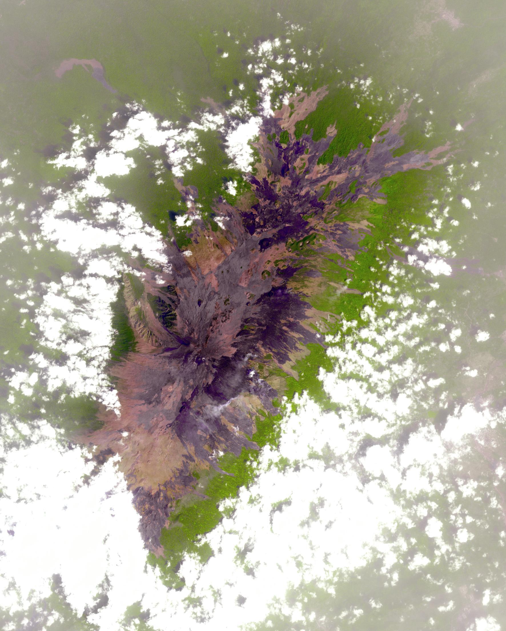
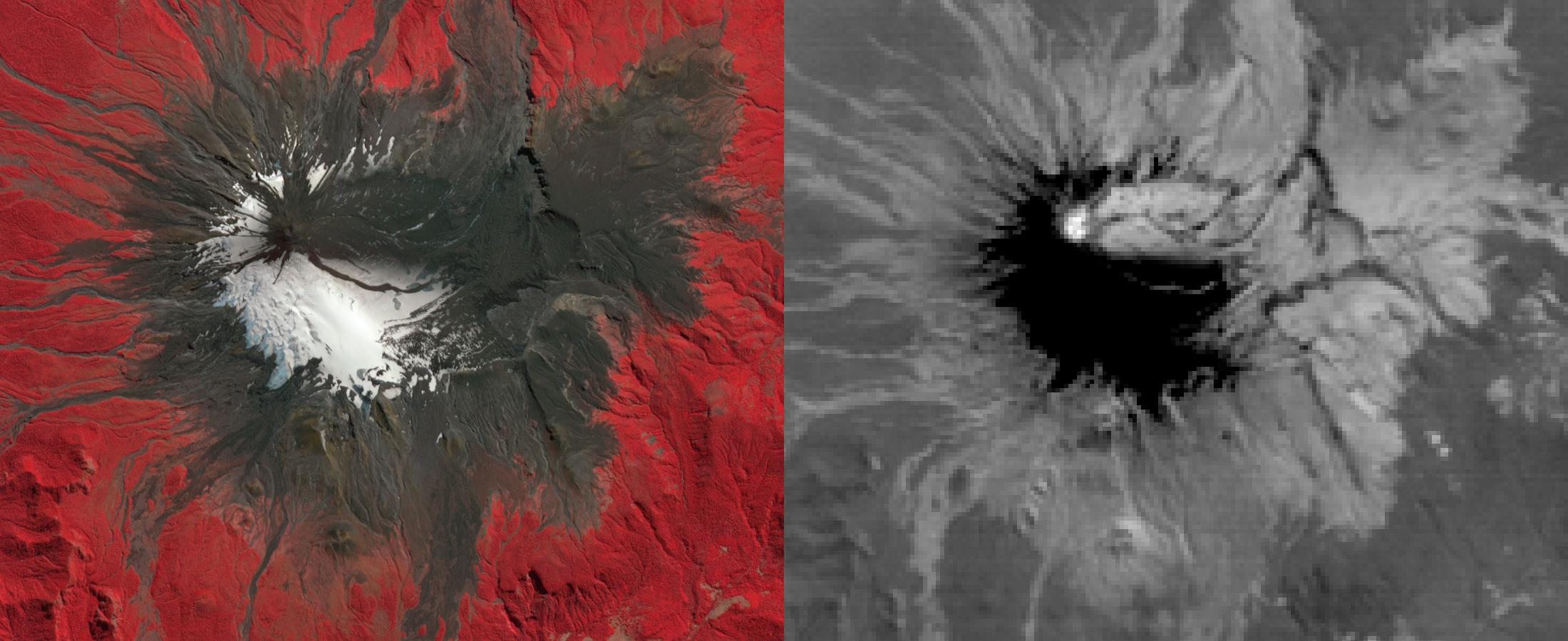
PIA18379:
-
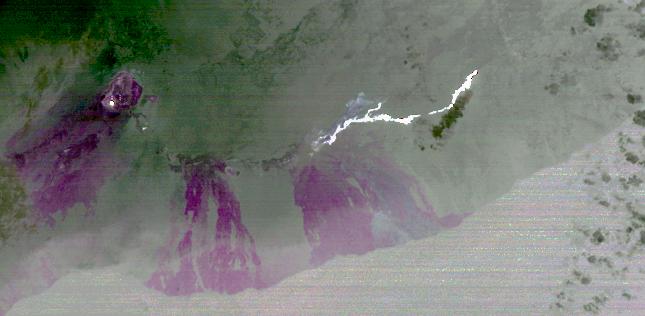
NASA Spacecraft Spots Signs of Erupting Russian Volcano
Full Resolution:
TIFF
(1.908 MB)
JPEG
(297.3 kB)
|
|
|
2014-05-16 |
Earth
|
Terra
|
ASTER
|
687x798x3 |
|
-
PIA18258:
-
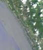
Shipbreaking, Bangladesh
Full Resolution:
TIFF
(1.645 MB)
JPEG
(124.2 kB)
|
|
|
2014-05-27 |
Earth
|
Terra
|
ASTER
|
2855x2360x3 |

|
-
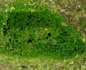
PIA18253:
-
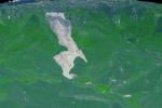
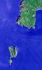
Kerguelen Islands
Full Resolution:
TIFF
(20.22 MB)
JPEG
(997.1 kB)
|
|
|
2014-06-10 |
Earth
|
Terra
|
ASTER
|
1188x793x3 |
|
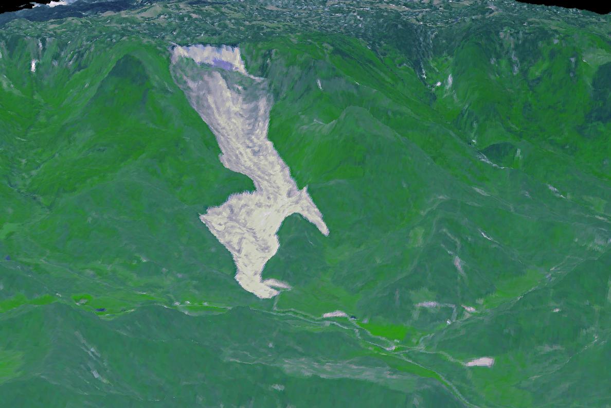
-
PIA18050:
-
Giant Arizona Landslide Spotted by NASA Spacecraft
Full Resolution:
TIFF
(2.828 MB)
JPEG
(108.6 kB)
|
|
|
2014-06-09 |
Earth
|
Terra
|
ASTER
|
1336x2153x3 |
|
-
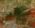
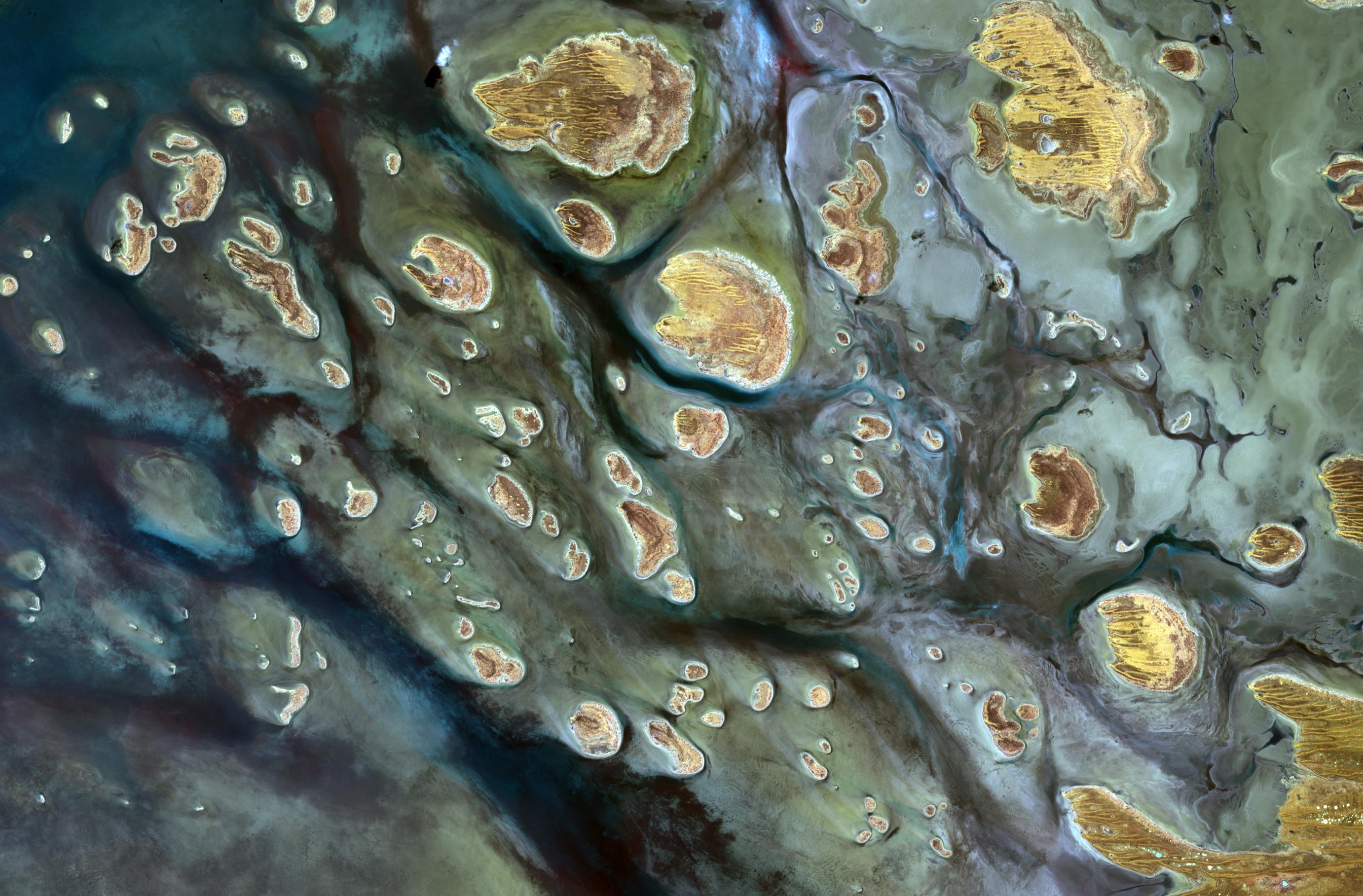
PIA18515:
-
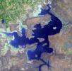
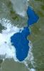
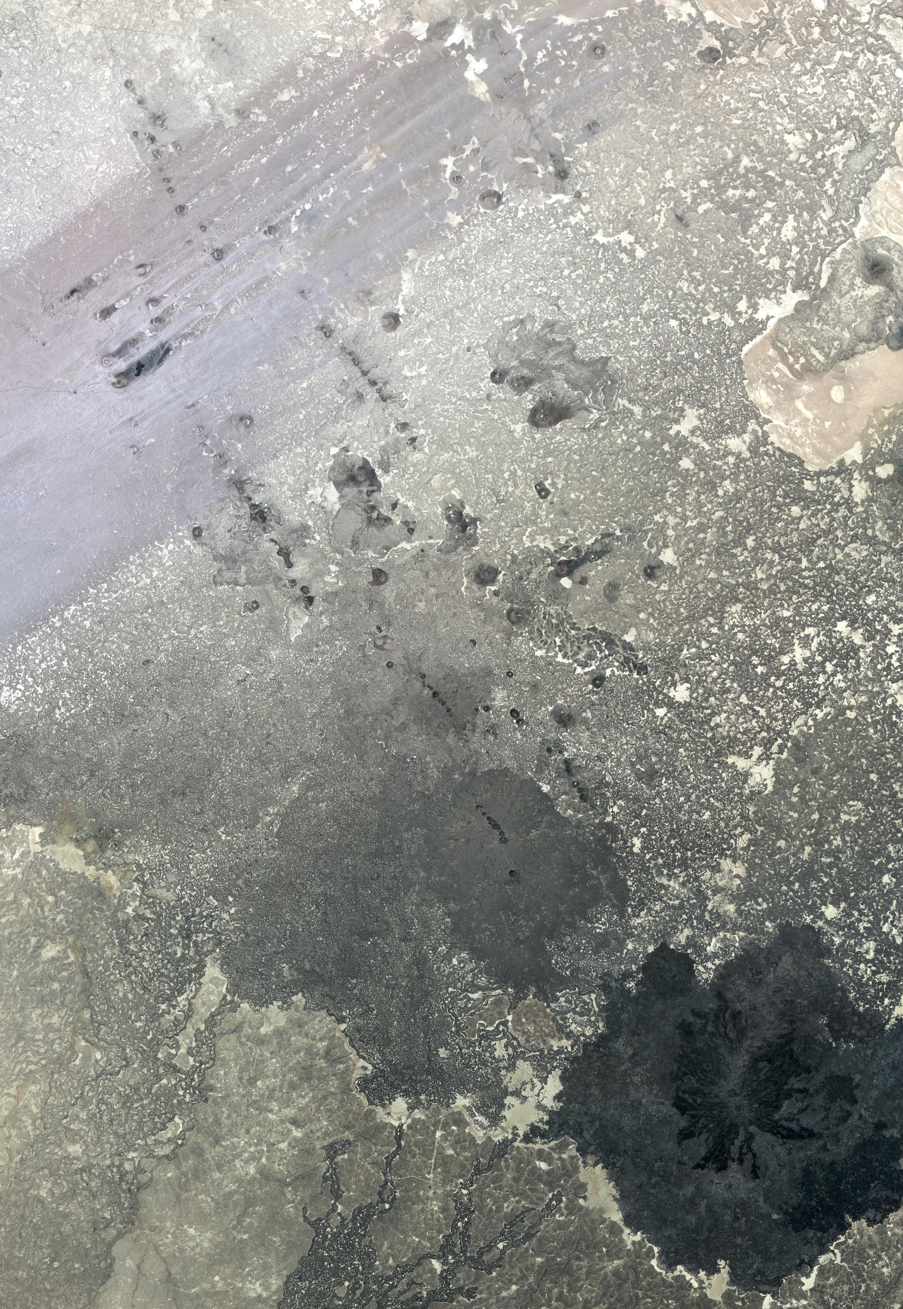
Lake Afrera, Ethiopia
Full Resolution:
TIFF
(8.632 MB)
JPEG
(416.1 kB)
|
|
|
2014-06-25 |
Earth
|
Terra
|
ASTER
|
2049x1824x3 |

|
-
PIA18494:
-
Palouse, WA
Full Resolution:
TIFF
(11.22 MB)
JPEG
(793.4 kB)
|
|
|
2014-07-14 |
Earth
|
Terra
|
ASTER
|
1532x1469x3 |
|
-
PIA18507:
-
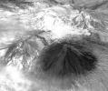
Baektu Mountain, China & North Korea
Full Resolution:
TIFF
(6.754 MB)
JPEG
(406.7 kB)
|
|
|
2014-07-23 |
Earth
|
Terra
|
ASTER
|
2620x1500x3 |

|
-
PIA18627:
-
Images Show Severity of California Drought
Full Resolution:
TIFF
(11.79 MB)
JPEG
(498.8 kB)
|
|
|
2014-07-28 |
Earth
|
Terra
|
ASTER
|
922x626x3 |
|
-
PIA18628:
-
NASA Spacecraft Eyes China Flooding
Full Resolution:
TIFF
(1.732 MB)
JPEG
(118.7 kB)
|
|
|
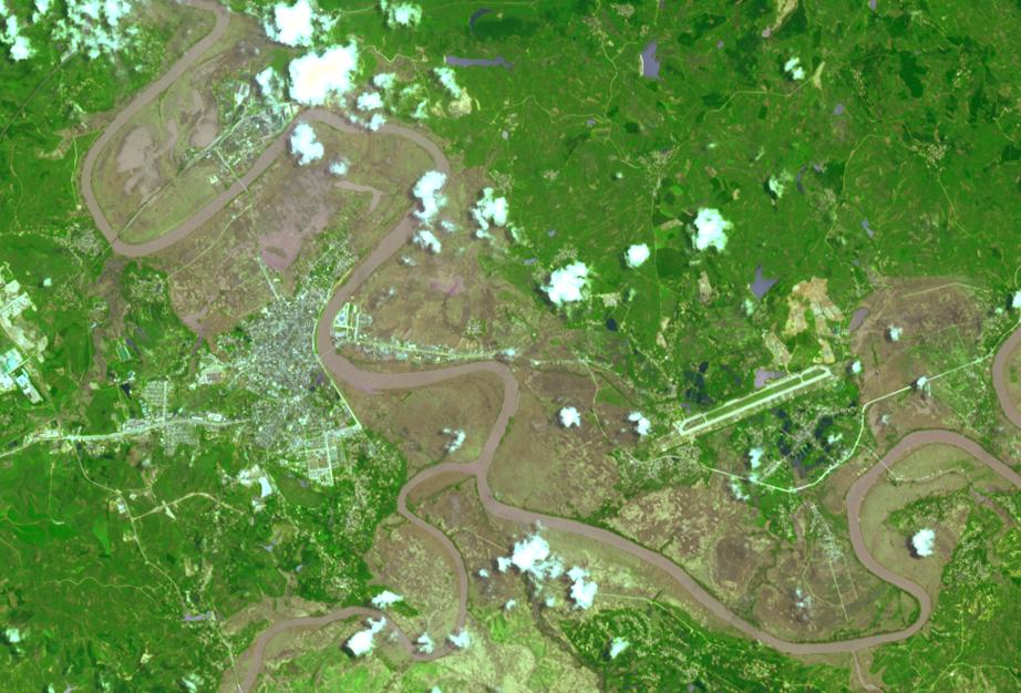
2014-08-05 |
Earth
|
Terra
|
ASTER
|
1412x1274x3 |
|
-
PIA18640:
-
Site of Destructive China Temblor Imaged by NASA Spacecraft
Full Resolution:
TIFF
(5.399 MB)
JPEG
(438 kB)
|
|
|
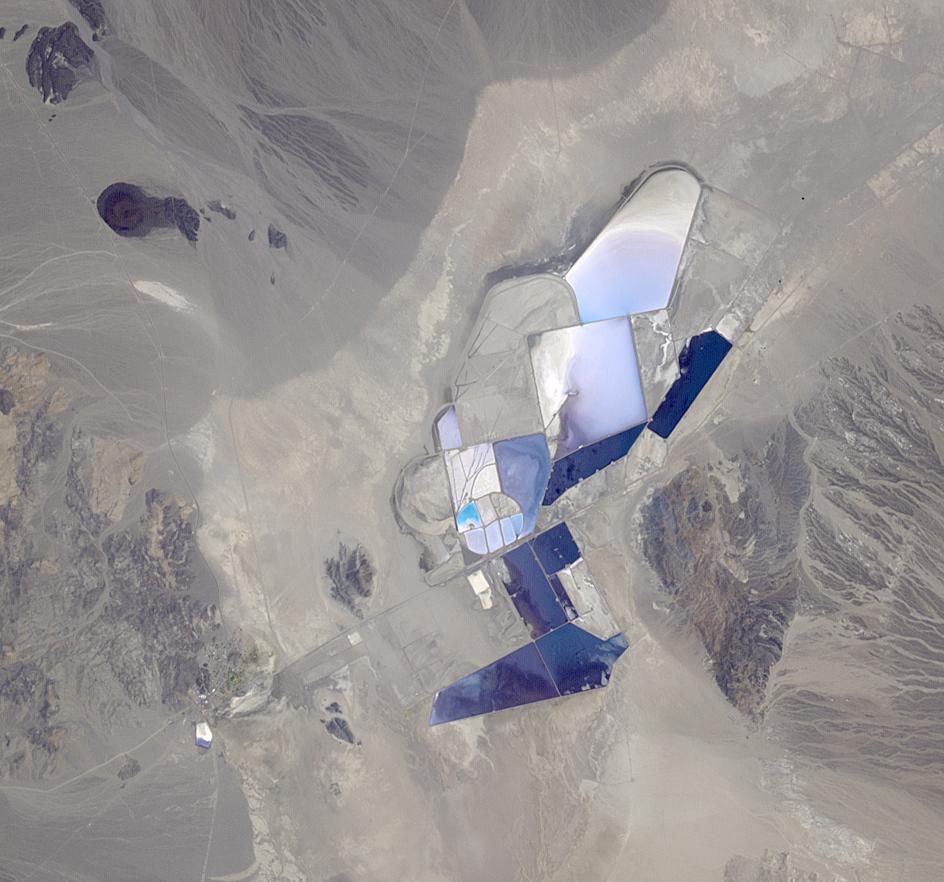
2014-08-05 |
Earth
|
Terra
|
ASTER
|
944x882x3 |
|
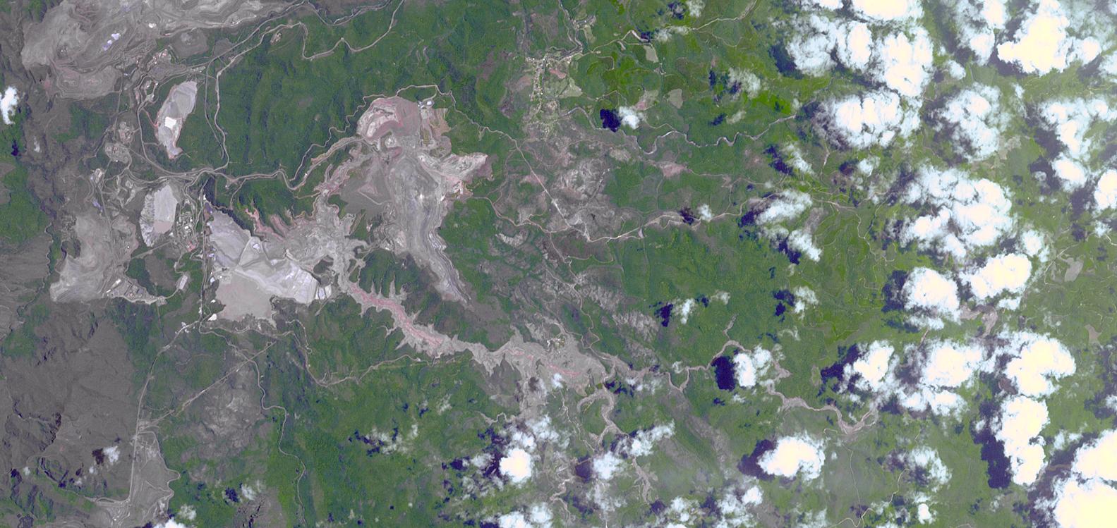
-
PIA18553:
-
Lithium Mining, Nevada
Full Resolution:
TIFF
(2.499 MB)
JPEG
(102.8 kB)
|
|
|
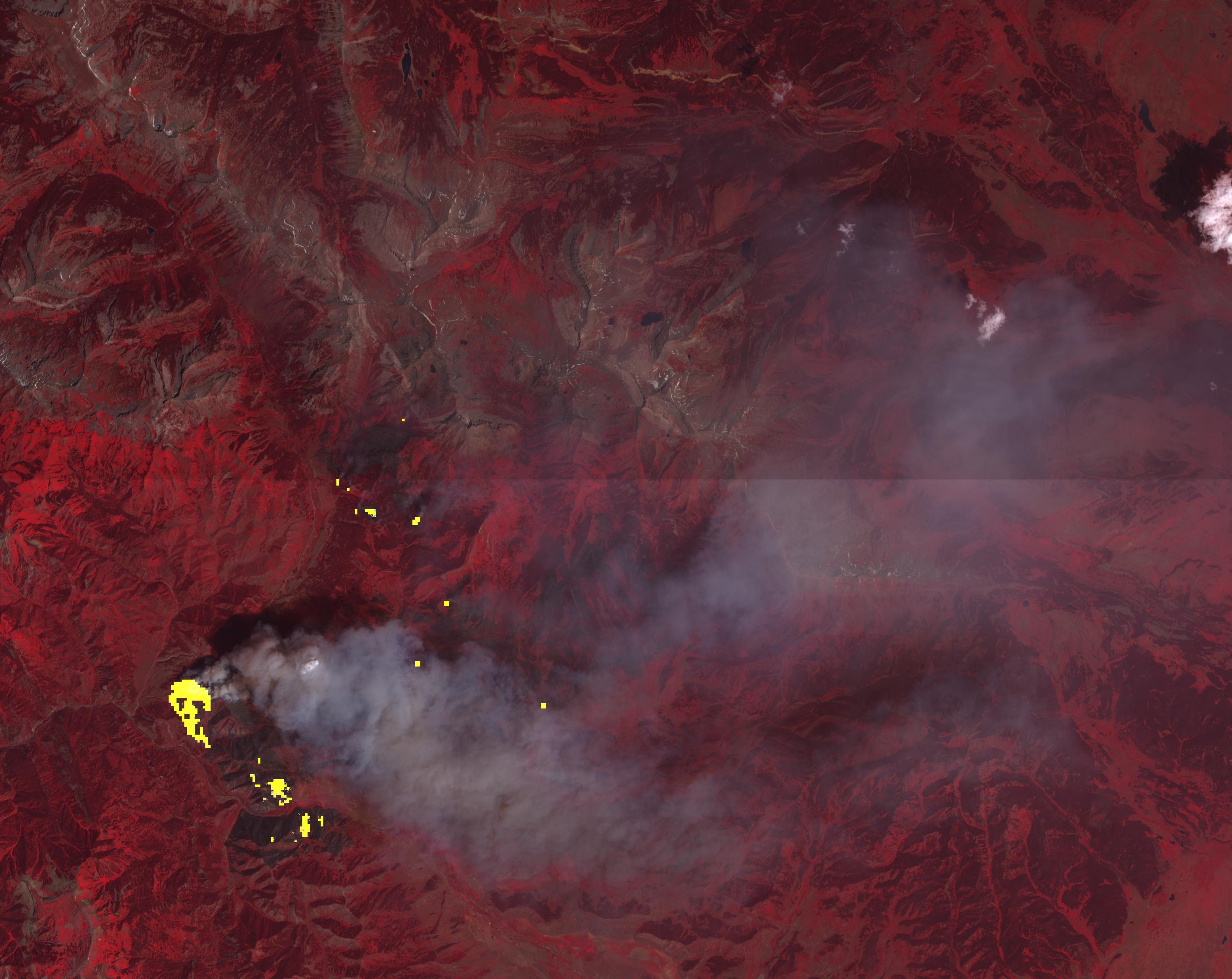
2014-08-06 |
Earth
|
Terra
|
ASTER
|
1366x1307x3 |

|
-
PIA18643:
-
Dominican Republic Wildfire Imaged by NASA Spacecraft
Full Resolution:
TIFF
(5.358 MB)
JPEG
(301.4 kB)
|
|
|
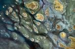
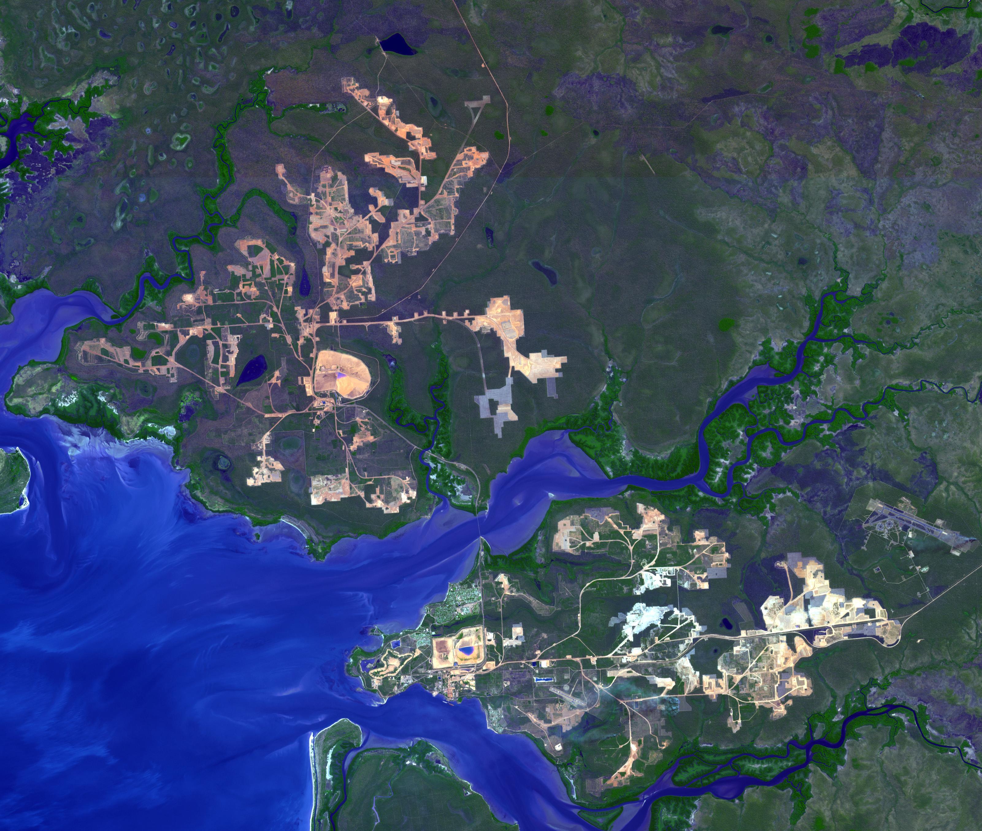
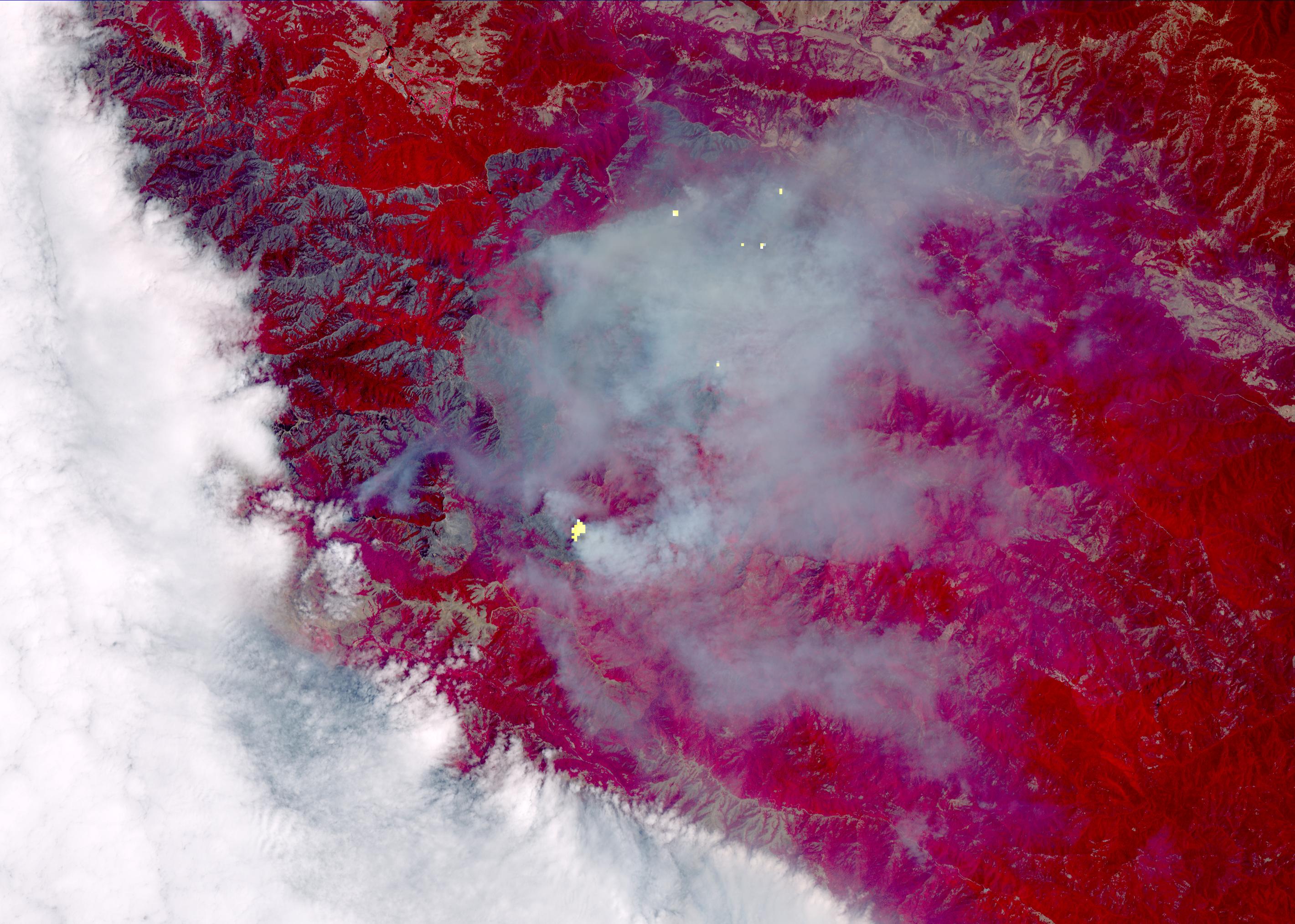
2014-08-21 |
Earth
|
Terra
|
ASTER
|
3202x2709x3 |
|
-
PIA18686:
-
Weipa, Queensland, Australia
Full Resolution:
TIFF
(26.03 MB)
JPEG
(1.143 MB)
|
|
|
2014-09-11 |
Earth
|
Terra
|
ASTER
|
2238x2550x3 |
|
-
PIA18710:
-
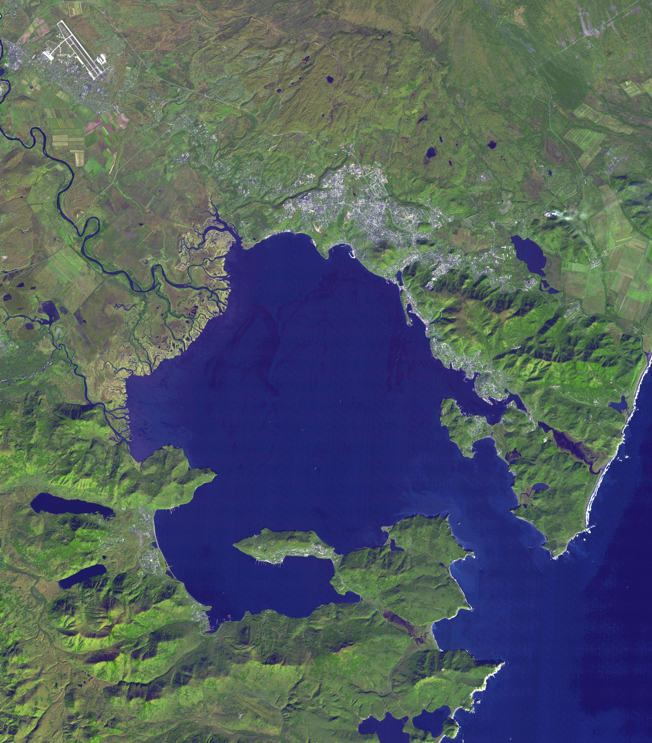
Petropavlovsk-Kamchatsky, Russia
Full Resolution:
TIFF
(17.13 MB)
JPEG
(959.4 kB)
|
|
|
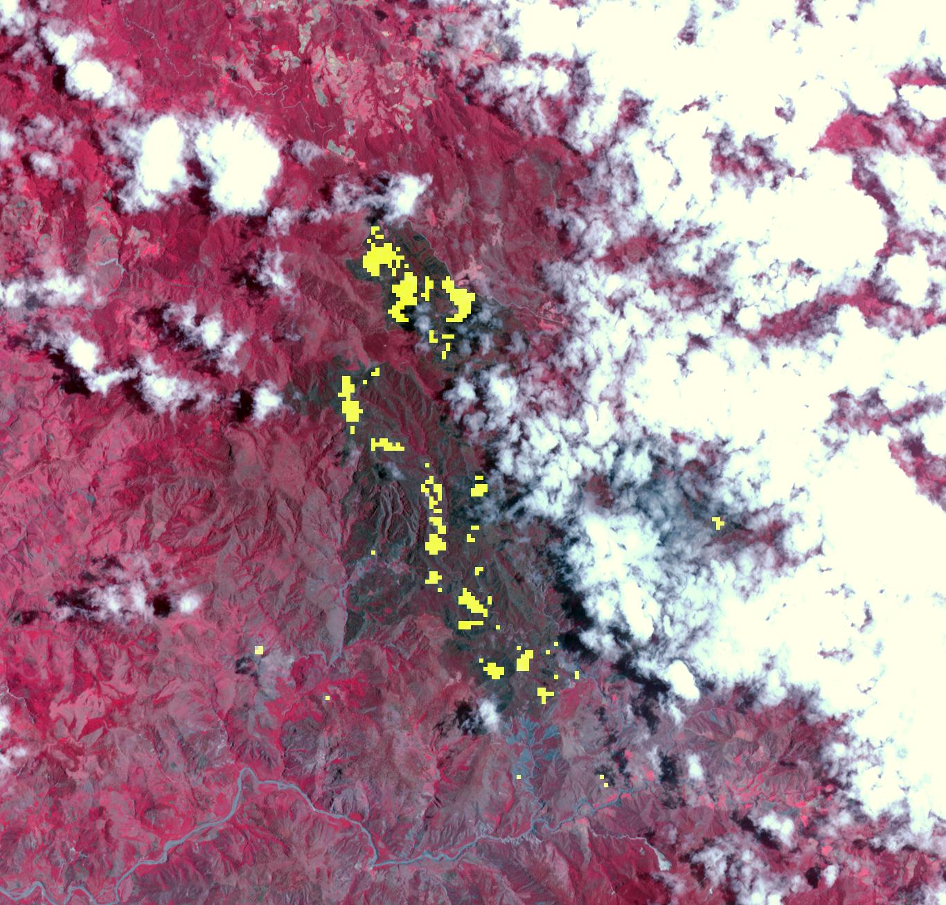
2014-09-24 |
Earth
|
Terra
|
ASTER
|
645x316x3 |
|
-
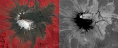
PIA18812:
-
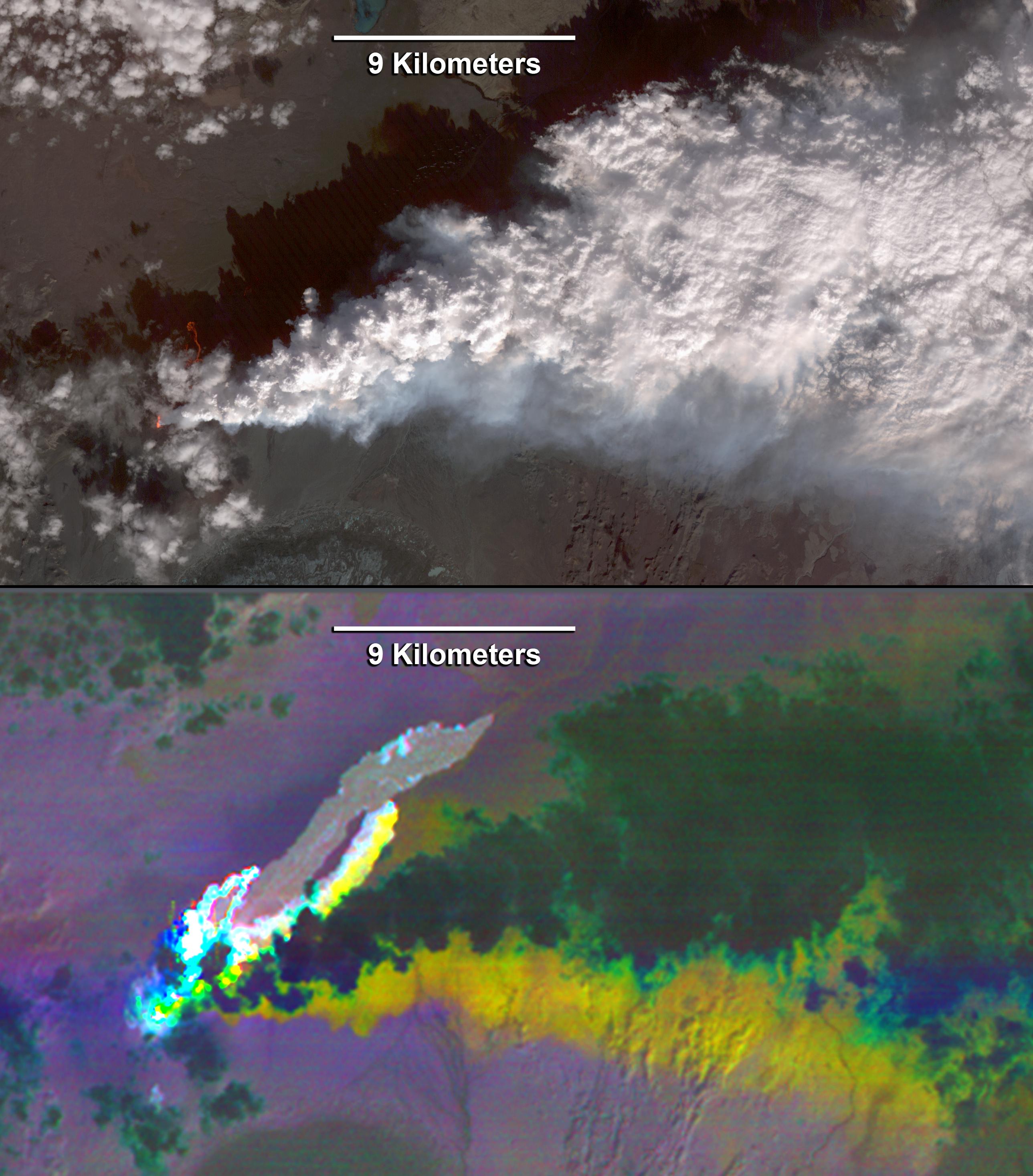
Progress of Hawaii Lava Flow Tracked by NASA Spacecraft
Full Resolution:
TIFF
(611.9 kB)
JPEG
(27.32 kB)
|
|
|
2014-09-24 |
Earth
|
Terra
|
ASTER
|
2460x2568x3 |
|
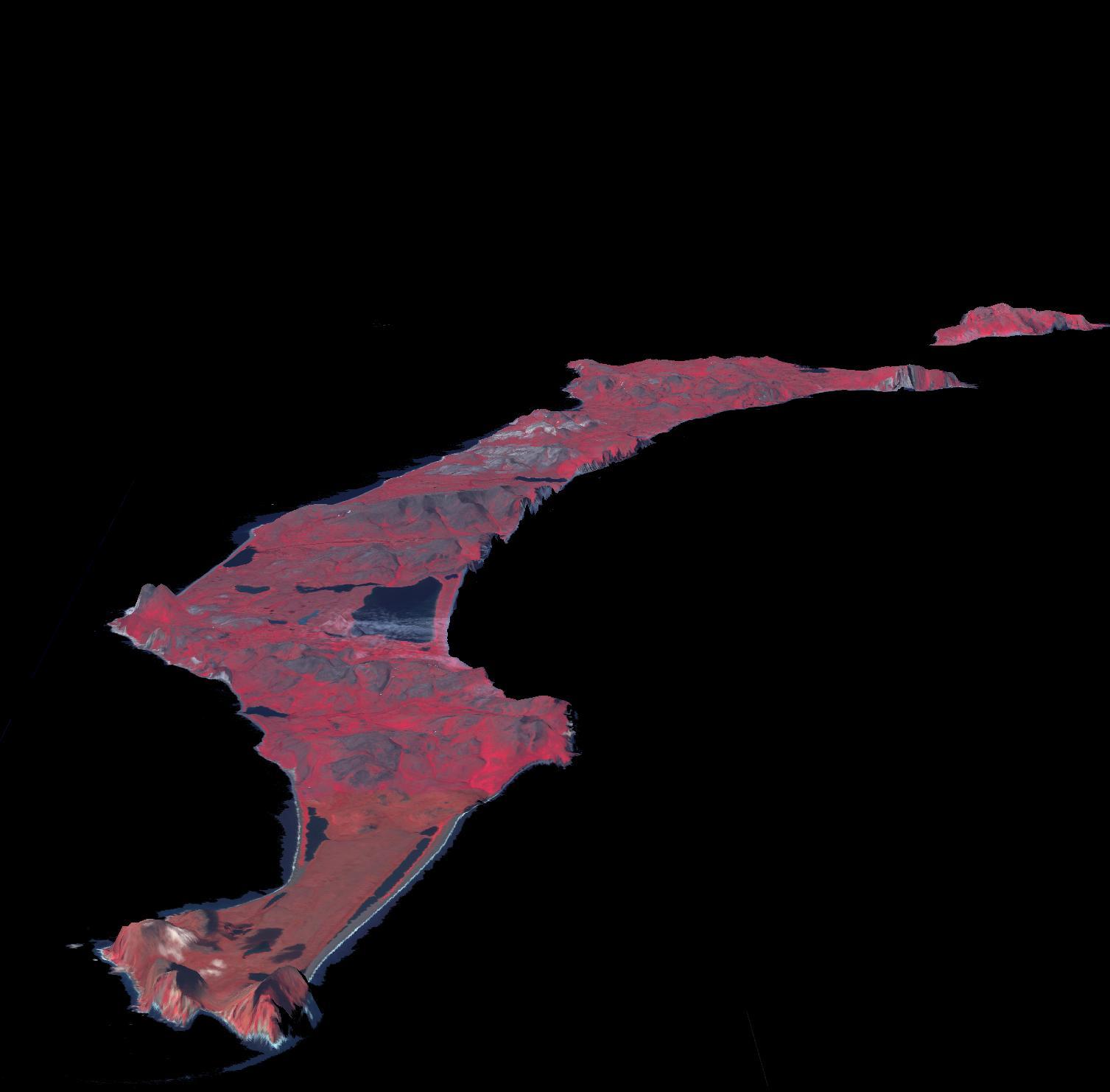
-
PIA18723:
-
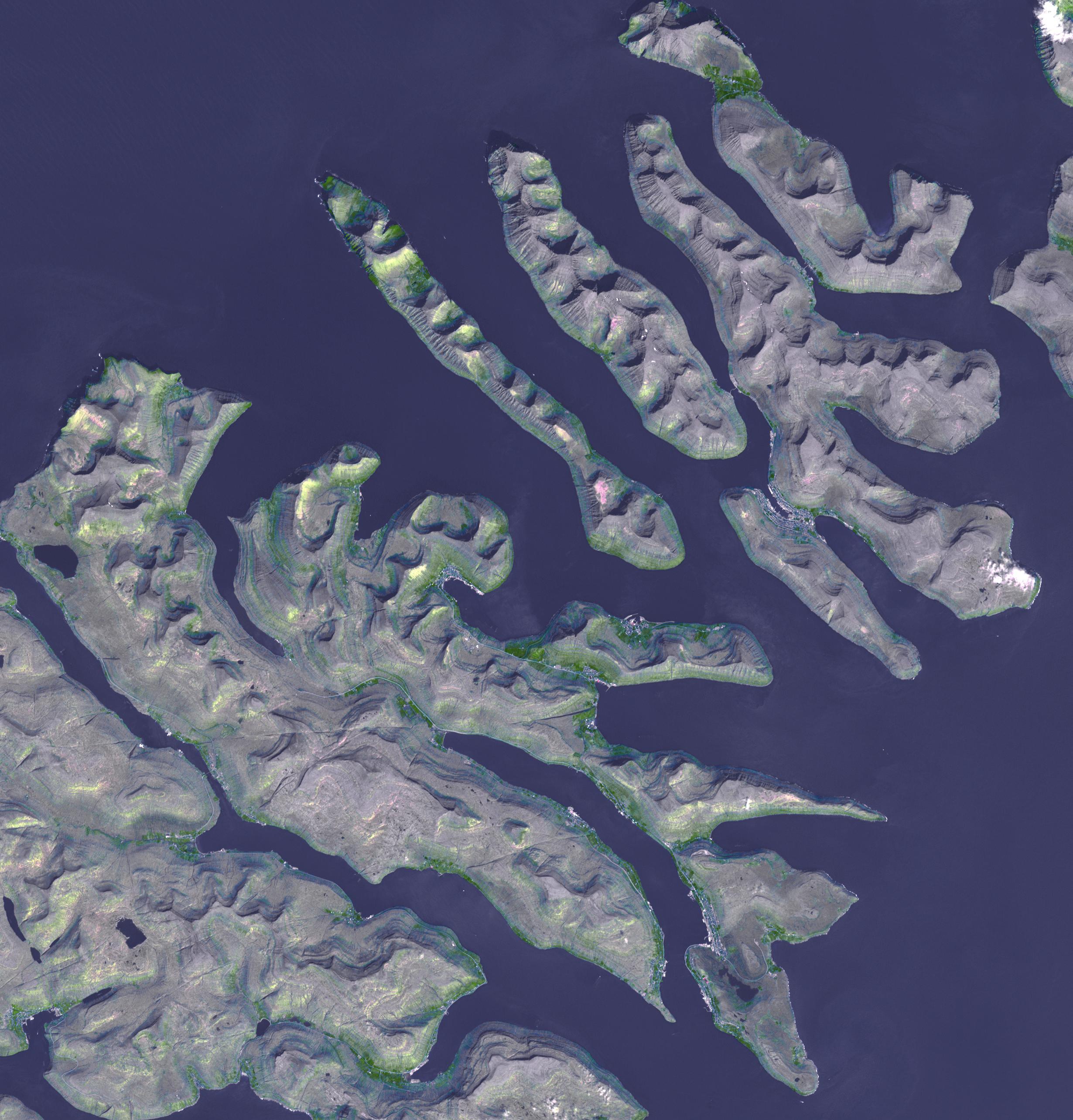
Faroe Islands
Full Resolution:
TIFF
(18.96 MB)
JPEG
(680.5 kB)
|
|
|
2014-09-25 |
Earth
|
Terra
|
ASTER
|
2577x2934x3 |

|
-
PIA18814:
-
Iceland's Bardarbunga Volcano Imaged by NASA Spacecraft
Full Resolution:
TIFF
(22.69 MB)
JPEG
(602 kB)
|
|
|
2014-10-09 |
Earth
|
Terra
|
ASTER
|
1772x2208x3 |
|
-
PIA18825:
-
Mount Cameroon
Full Resolution:
TIFF
(11.74 MB)
JPEG
(466.7 kB)
|
|
|
2014-10-20 |
Earth
|
Terra
|
ASTER
|
2182x1092x3 |
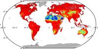
|
-
PIA18833:
-
NASA Spacecraft Maps Earth's Global Emissivity
Full Resolution:
TIFF
(7.151 MB)
JPEG
(256.6 kB)
|
|
|
2014-10-27 |
Earth
|
Terra
|
ASTER
|
2763x1817x3 |
|
-
PIA18764:
-
Lake Mackay, Australia
Full Resolution:
TIFF
(15.07 MB)
JPEG
(635.8 kB)
|
|
|
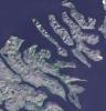
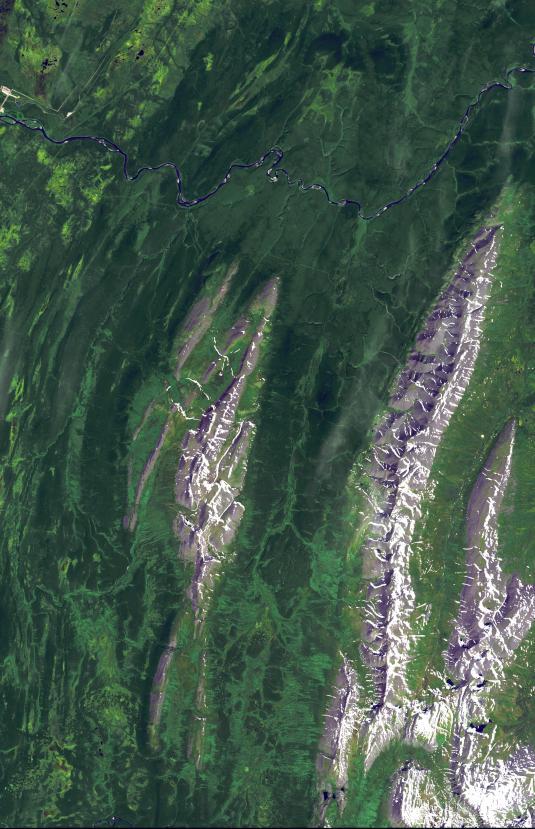
2014-11-24 |
Earth
|
Terra
|
ASTER
|
4190x3322x3 |
|
-
PIA18966:
-
Ellesmere Island, Canada
Full Resolution:
TIFF
(41.78 MB)
JPEG
(1.927 MB)
|
|
|
2015-01-07 |
Earth
|
Terra
|
ASTER
|
1408x905x3 |
|
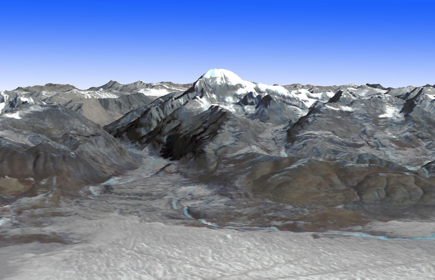
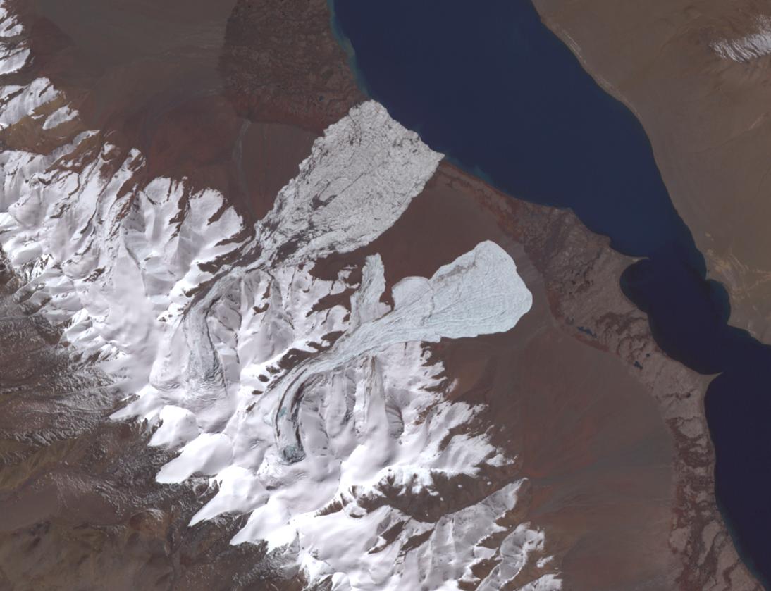
-
PIA19013:
-
Mt. Kailash, Tibet
Full Resolution:
TIFF
(3.824 MB)
JPEG
(160.4 kB)
|
|
|
2015-01-27 |
Earth
|
Terra
|
ASTER
|
610x686x3 |

|
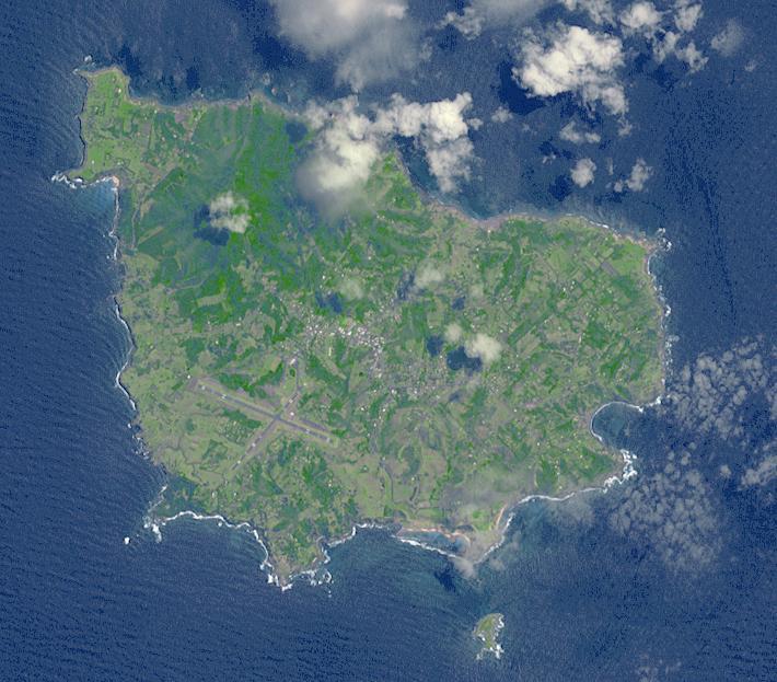
-
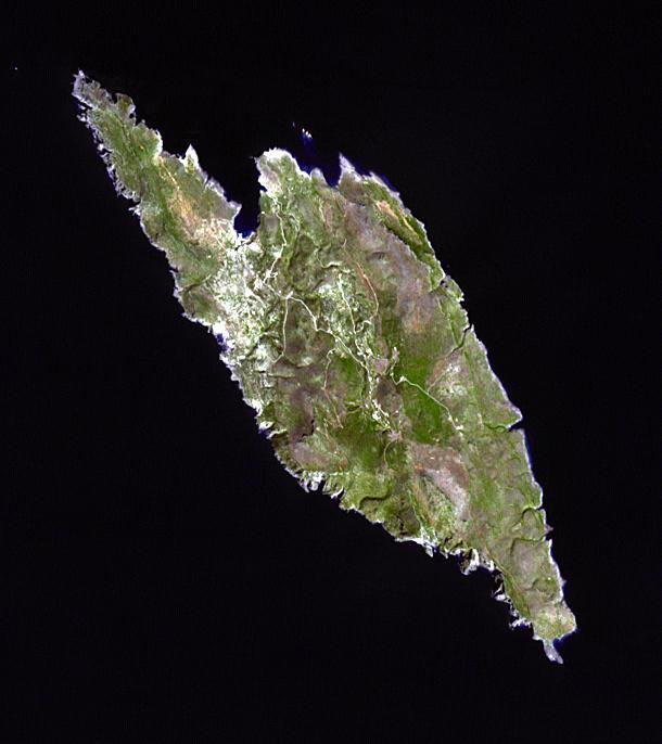
PIA19032:
-
Antikythera Island, Greece
Full Resolution:
TIFF
(1.256 MB)
JPEG
(40.88 kB)
|
|
|
2015-02-13 |
Earth
|
Terra
|
ASTER
|
1826x1814x3 |
|
-
PIA19209:
-
Portus, Italy
Full Resolution:
TIFF
(9.941 MB)
JPEG
(482.7 kB)
|
|
|
2015-02-26 |
Earth
|
Terra
|
ASTER
|
1844x1469x3 |
|
-
PIA19222:
-
Prince Patrick Island, Canada
Full Resolution:
TIFF
(8.13 MB)
JPEG
(867.6 kB)
|
|
|
2015-03-10 |
Earth
|
Terra
|
ASTER
|
2855x1538x3 |
|
-
PIA19237:
-
Lake Ilopango, El Salvador
Full Resolution:
TIFF
(13.18 MB)
JPEG
(1.159 MB)
|
|
|
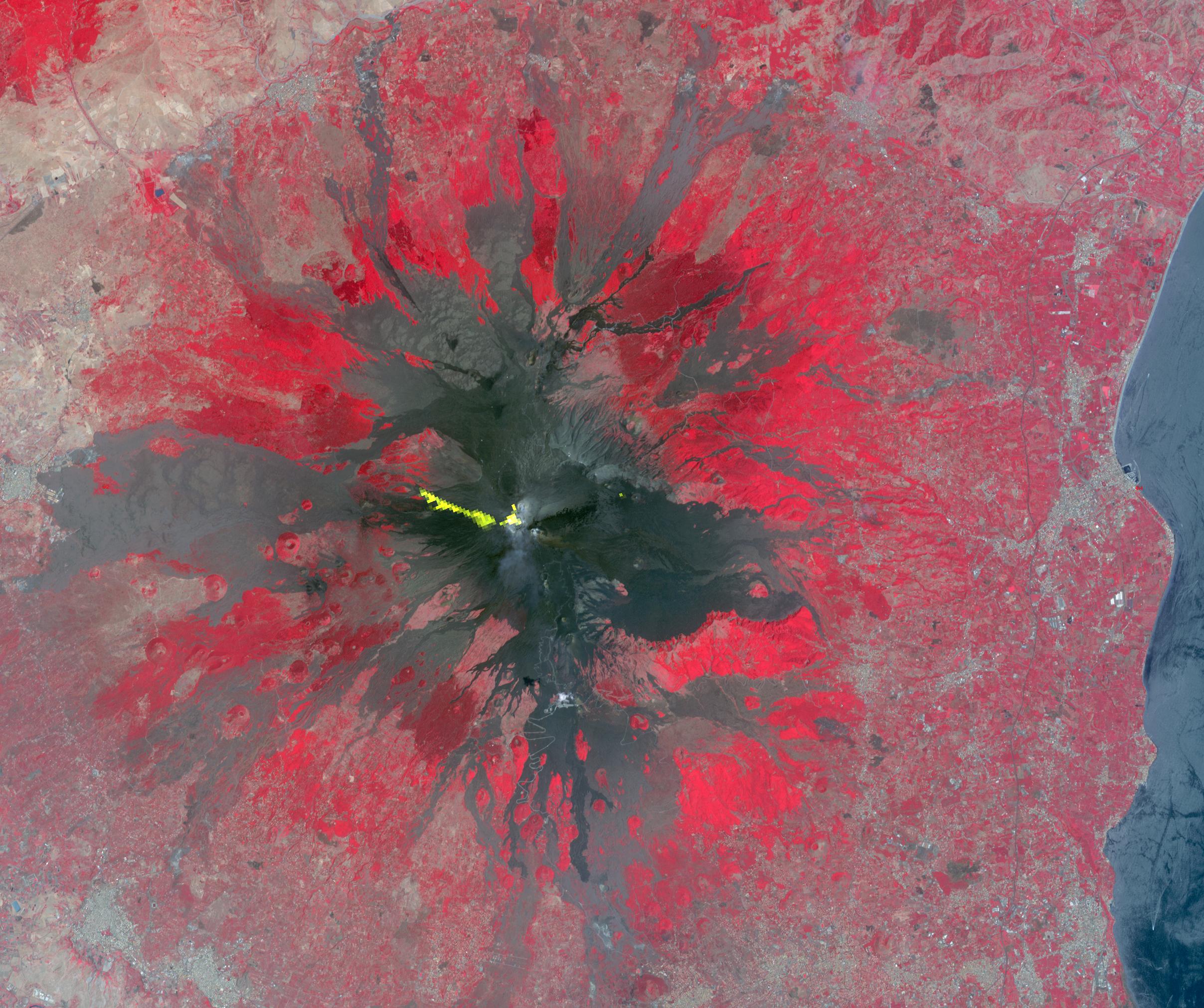
2015-03-13 |
Earth
|
Terra
|
ASTER
|
2200x900x3 |
|
-
PIA19241:
-
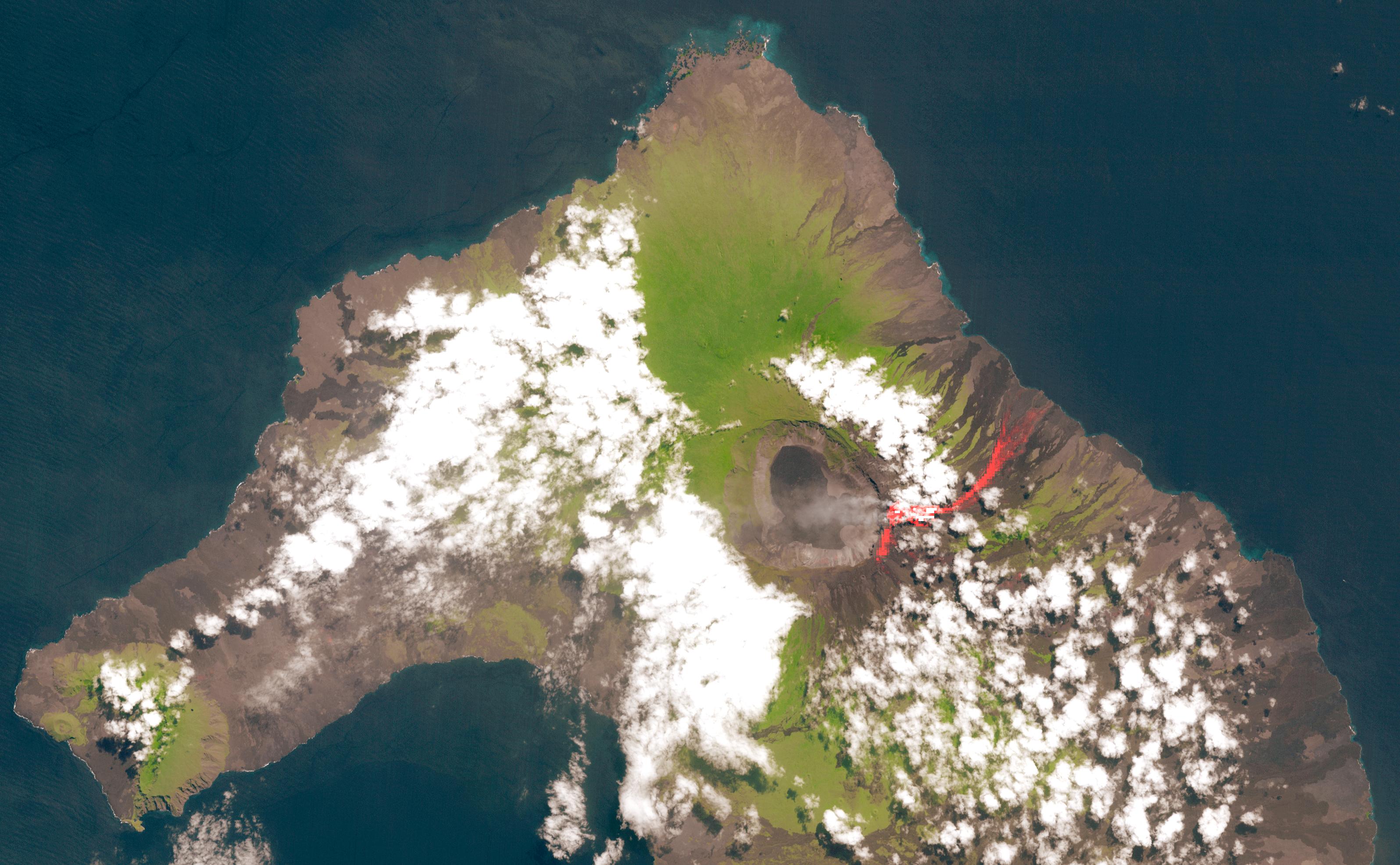
NASA Spacecraft Views Erupting Chilean Volcano
Full Resolution:
TIFF
(5.943 MB)
JPEG
(238.2 kB)
|
|
|
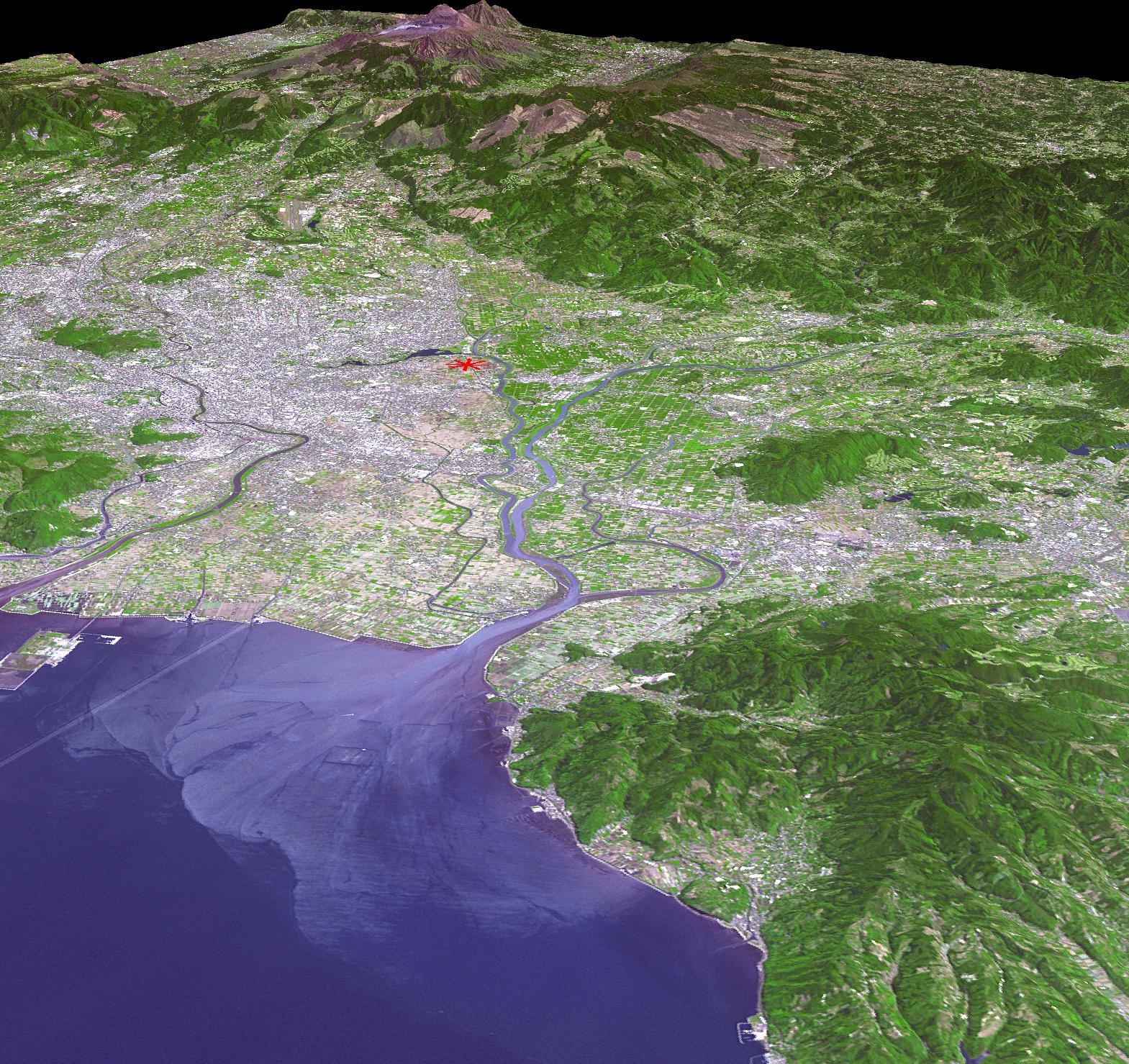
2015-03-16 |
Earth
|
Terra
|
ASTER
|
2490x1120x3 |

|
-
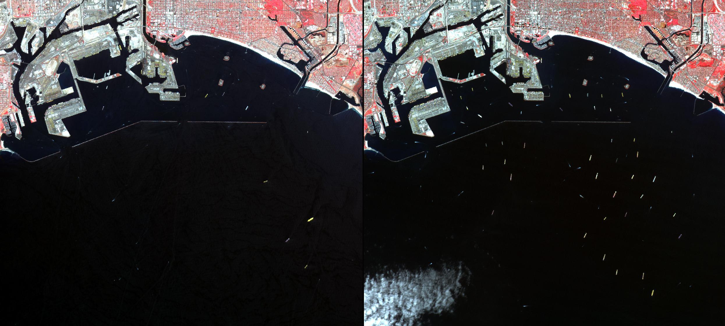
PIA19249:
-
Los Angeles - Long Beach Harbors, CA
Full Resolution:
TIFF
(8.37 MB)
JPEG
(333.3 kB)
|
|
|
2016-08-02 |
Earth
|
Terra
|
ASTER
|
2085x1716x3 |
|
-
PIA20723:
-
NASA Spacecraft Spots Aftermath of Destructive Wildfire in LA's Backyard
Full Resolution:
TIFF
(9.242 MB)
JPEG
(832.7 kB)
|
|
|
2015-04-02 |
Earth
|
Terra
|
ASTER
|
1618x694x3 |
|
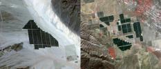
-
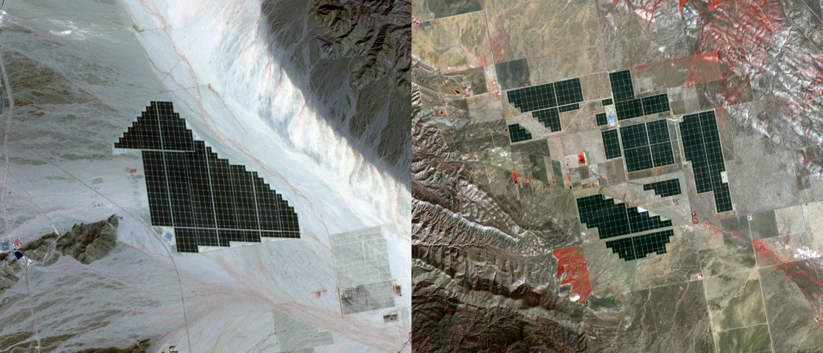
PIA19268:
-
California Solar Farms
Full Resolution:
TIFF
(3.37 MB)
JPEG
(194.4 kB)
|
|
|
2015-04-06 |
Earth
|
Terra
|
ASTER
|
1255x897x3 |
|
-
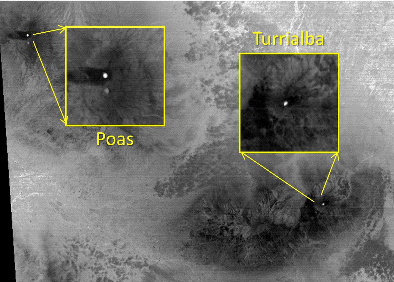
PIA19355:
-
Costa Rica's Turrialba Volcano, Continued Activity seen by NASA Spacecraft
Full Resolution:
TIFF
(3.379 MB)
JPEG
(167.9 kB)
|
|
|
2016-07-28 |
Earth
|
Terra
|
ASTER
|
2820x2240x3 |

|
-
PIA20721:
-
Wyoming Wildfire Spotted by NASA Spacecraft
Full Resolution:
TIFF
(17.15 MB)
JPEG
(537.7 kB)
|
|
|
2015-06-17 |
Earth
|
Terra
|
ASTER
|
535x365x3 |
|
-
PIA19492:
-
Lake Shasta, California
Full Resolution:
TIFF
(586.2 kB)
JPEG
(53.4 kB)
|
|
|
2015-04-24 |
Earth
|
Terra
|
ASTER
|
3547x2896x3 |
|
-
PIA19435:
-
Turtle Mtns., ND
Full Resolution:
TIFF
(30.83 MB)
JPEG
(2.203 MB)
|
|
|
2015-04-27 |
Earth
|
Terra
|
ASTER
|
439x336x3 |
|
-
PIA19382:
-
Chilean Volcanic Eruption Nighttime View
Full Resolution:
TIFF
(442.9 kB)
JPEG
(26.21 kB)
|
|
|
2015-05-13 |
Earth
|
Terra
|
ASTER
|
710x623x3 |
|
-
PIA19463:
-
Norfolk Island, Australia
Full Resolution:
TIFF
(1.328 MB)
JPEG
(85.01 kB)
|
|
|
2015-05-27 |
Earth
|
Terra
|
ASTER
|
3108x4504x3 |
|
-
PIA19479:
-
Lava Field, Syria
Full Resolution:
TIFF
(42.01 MB)
JPEG
(3.043 MB)
|
|
|
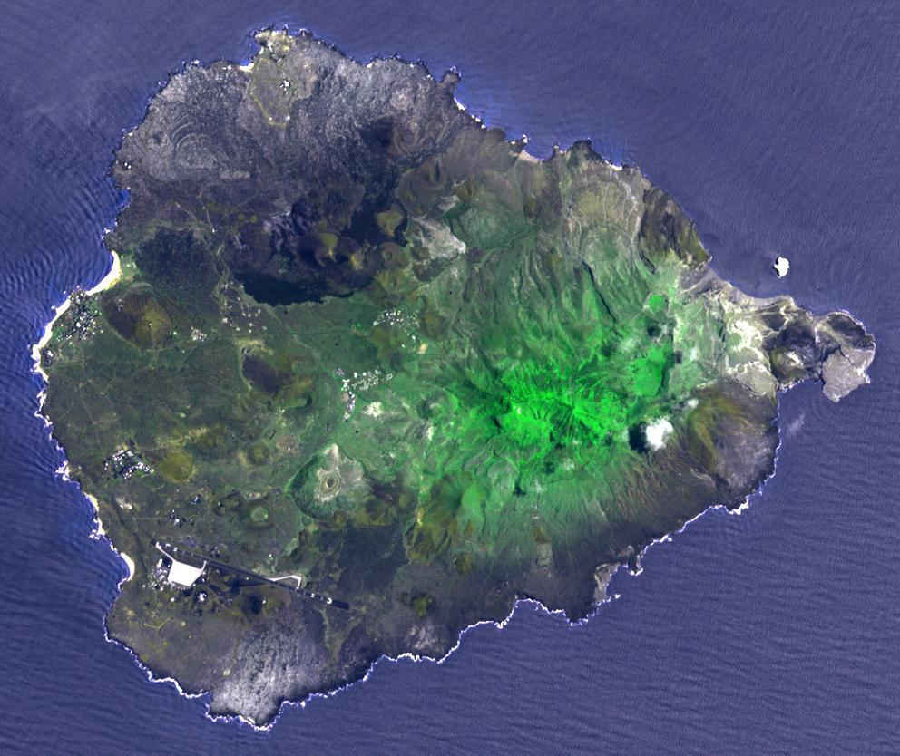
2015-06-02 |
Earth
|
Terra
|
ASTER
|
2448x1380x3 |
|
-
PIA19681:
-
NASA Spacecraft Views Aftermath of Texas Floods
Full Resolution:
TIFF
(10.14 MB)
JPEG
(531.8 kB)
|
|
|
2015-06-12 |
Earth
|
Terra
|
ASTER
|
3192x1972x3 |
|
-
PIA18564:
-
NASA Spacecraft Peers Into the Mouth of the Galapagos' Wolf Volcano
Full Resolution:
TIFF
(18.89 MB)
JPEG
(754.3 kB)
|
|
|
2015-06-29 |
Earth
|
Terra
|
ASTER
|
535x685x3 |
|
-
PIA19501:
-
North Korea Drought
Full Resolution:
TIFF
(1.1 MB)
JPEG
(90.65 kB)
|
|
|
2015-07-20 |
Earth
|
Terra
|
ASTER
|
1900x1500x3 |

|
-
PIA19731:
-
Lake Mead and Drought
Full Resolution:
TIFF
(8.553 MB)
JPEG
(506.7 kB)
|
|
|
2015-07-27 |
Earth
|
Terra
|
ASTER
|
992x834x3 |
|
-
PIA19738:
-
Ascension Island
Full Resolution:
TIFF
(2.366 MB)
JPEG
(138.3 kB)
|
|
|
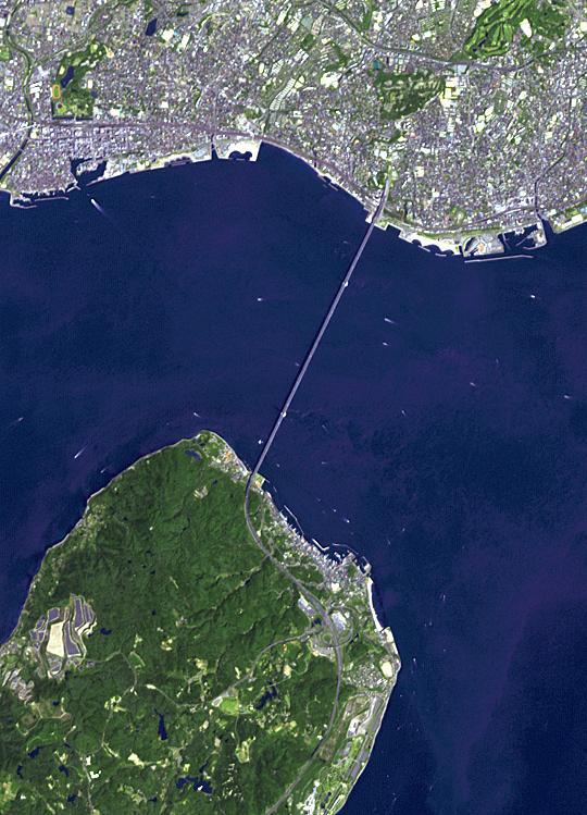
2015-08-10 |
Earth
|
Terra
|
ASTER
|
540x749x3 |
|
-
PIA19747:
-
Akashi-Kaikyo Bridge, Japan
Full Resolution:
TIFF
(1.183 MB)
JPEG
(88.22 kB)
|
|
|
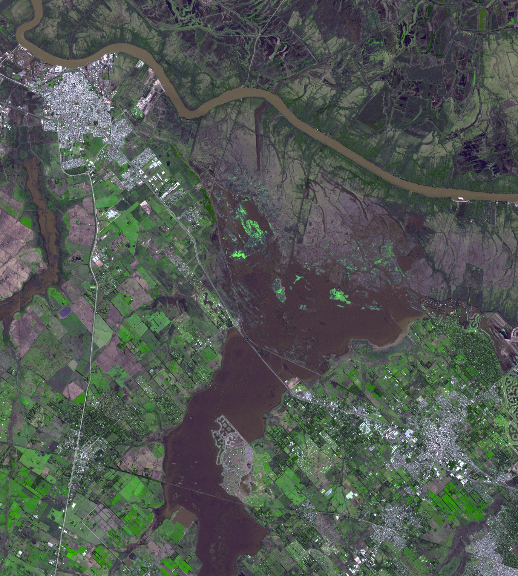
2015-08-19 |
Earth
|
Terra
|
ASTER
|
1734x1928x3 |
|
-
PIA19871:
-
NASA Spacecraft Tracks Argentine Flooding
Full Resolution:
TIFF
(8.542 MB)
JPEG
(640.1 kB)
|
|
|
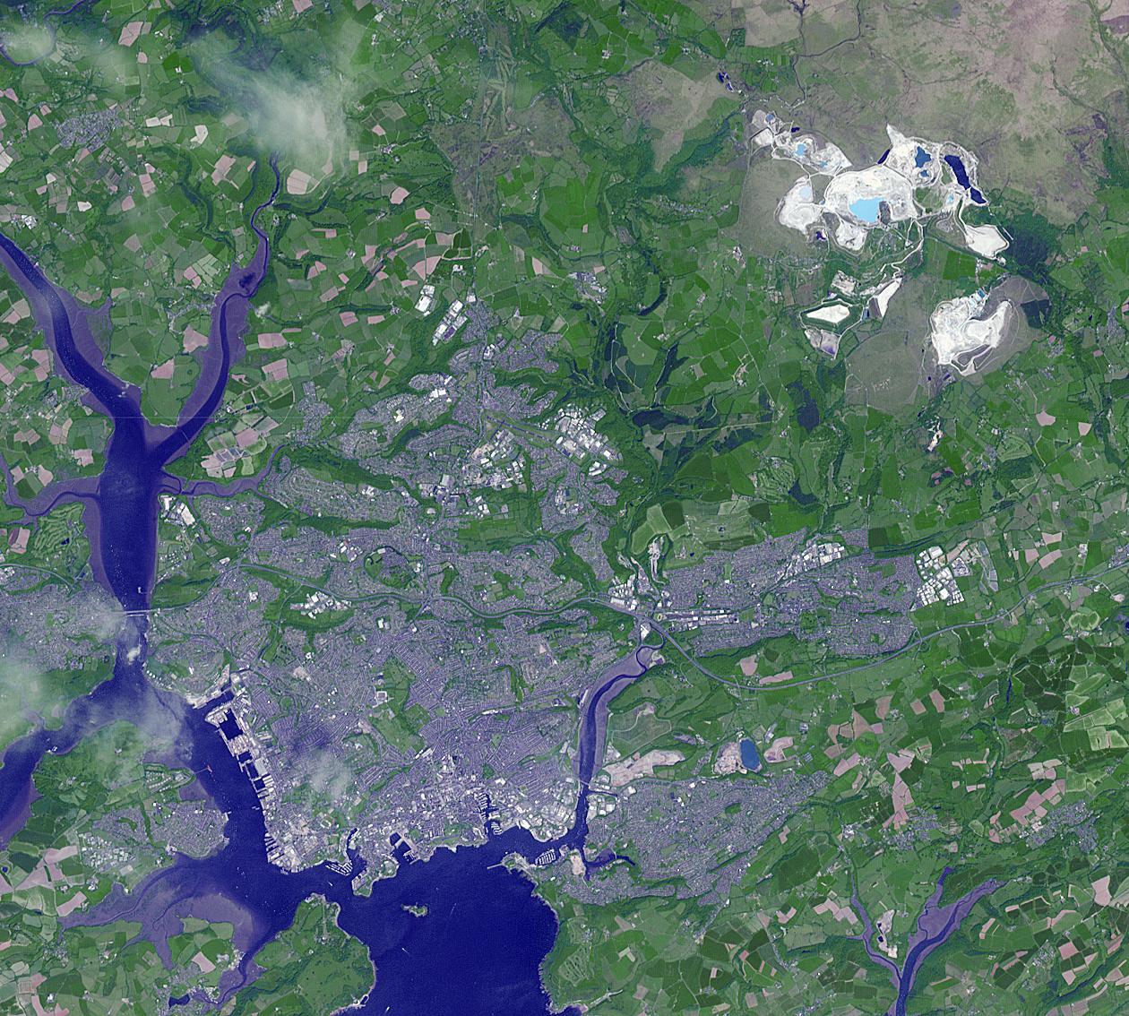
2015-08-21 |
Earth
|
Terra
|
ASTER
|
1260x1134x3 |

|
-
PIA19757:
-
Drakelands Mine, England
Full Resolution:
TIFF
(4.288 MB)
JPEG
(371.1 kB)
|
|
|
2015-08-25 |
Earth
|
Terra
|
ASTER
|
4236x9873x3 |
|
-
PIA15150:
-
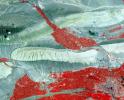
Wildfires Threatening Ancient Siberian Lake
Full Resolution:
TIFF
(78.82 MB)
JPEG
(2.448 MB)
|
|
|
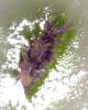
2015-08-25 |
Earth
|
Terra
|
ASTER
|
1821x2333x3 |
|
-
PIA15151:
-
Angry Ecuadorian Volcano Imaged by NASA Spacecraft
Full Resolution:
TIFF
(10.73 MB)
JPEG
(558.1 kB)
|
|
|
2015-09-10 |
Earth
|
Terra
|
ASTER
|
2574x2109x3 |

|
-
PIA19775:
-
Point Barrow, Alaska
Full Resolution:
TIFF
(12.47 MB)
JPEG
(655.8 kB)
|
|
|
2015-09-23 |
Earth
|
Terra
|
ASTER
|
1700x2100x3 |
|
-
PIA19786:
-
Salton Sea, California
Full Resolution:
TIFF
(5.858 MB)
JPEG
(360.4 kB)
|
|
|
2015-10-06 |
Earth
|
Terra
|
ASTER
|
535x829x3 |
|
-
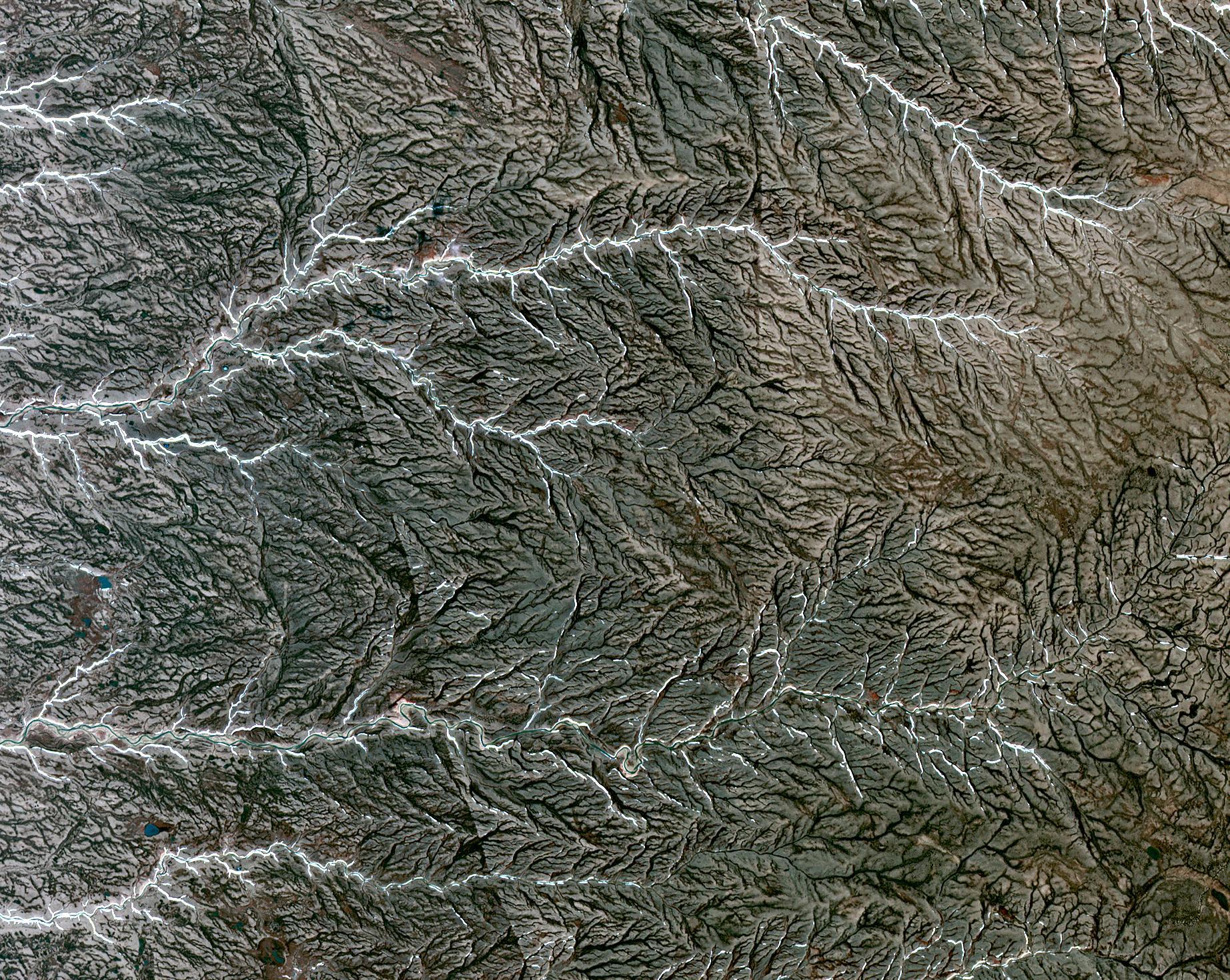
PIA19795:
-
Ural Mountains, Russia
Full Resolution:
TIFF
(1.331 MB)
JPEG
(92.24 kB)
|
|
|
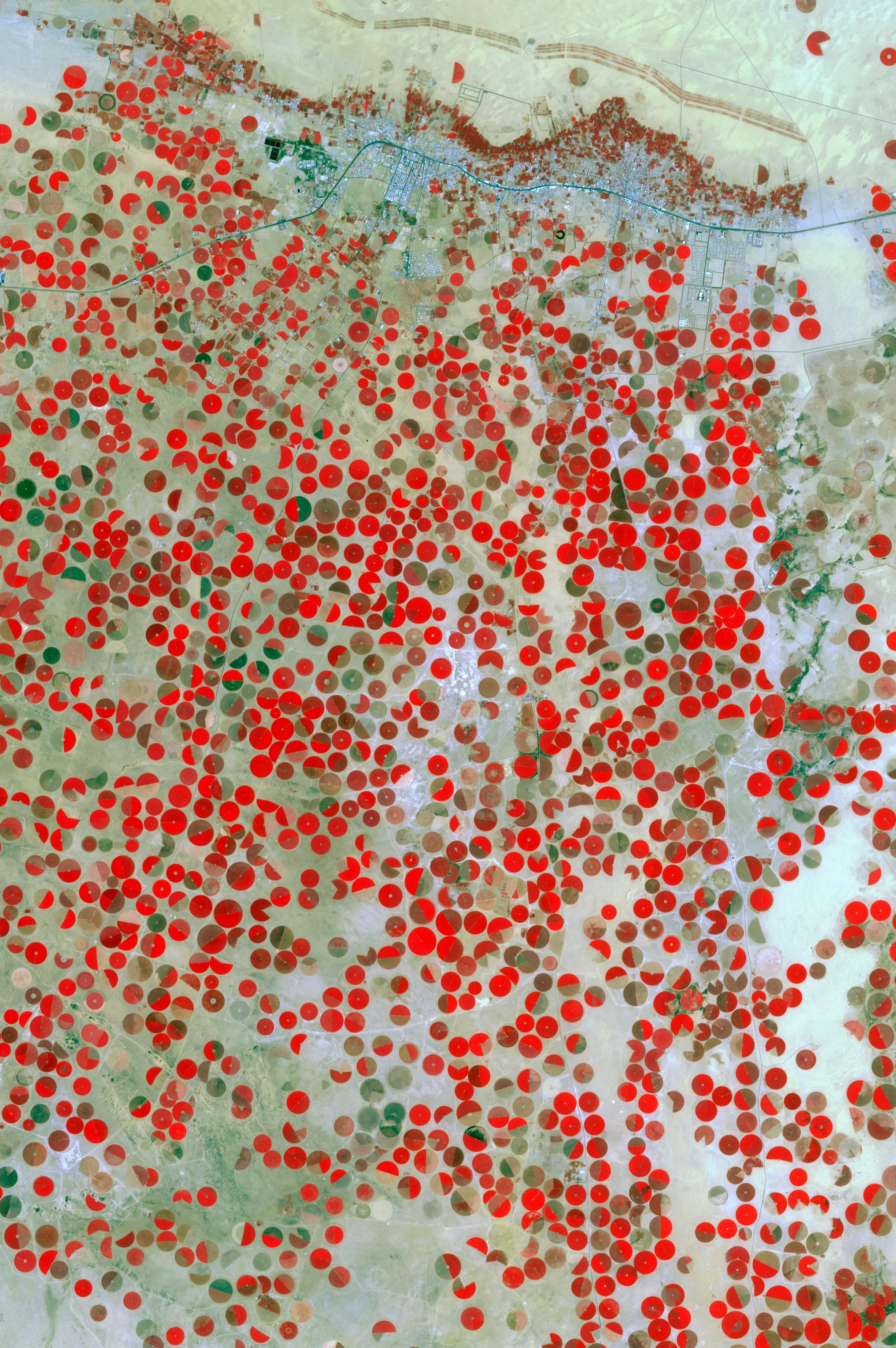
2015-10-20 |
Earth
|
Terra
|
ASTER
|
2034x3059x3 |
|
-
PIA20077:
-
Wadi Al Dawasir, Saudi Arabia
Full Resolution:
TIFF
(18.67 MB)
JPEG
(1.025 MB)
|
|
|
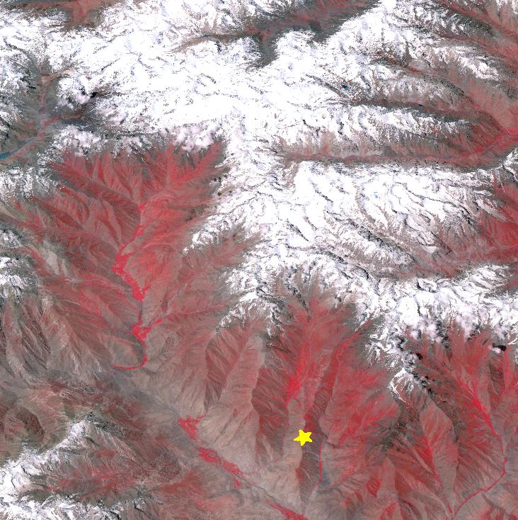
2015-10-27 |
Earth
|
Terra
|
ASTER
|
732x734x3 |

|
-
PIA20035:
-
Earthquake in Hindu Kush Region, Afghanistan
Full Resolution:
TIFF
(1.479 MB)
JPEG
(143.1 kB)
|
|
|
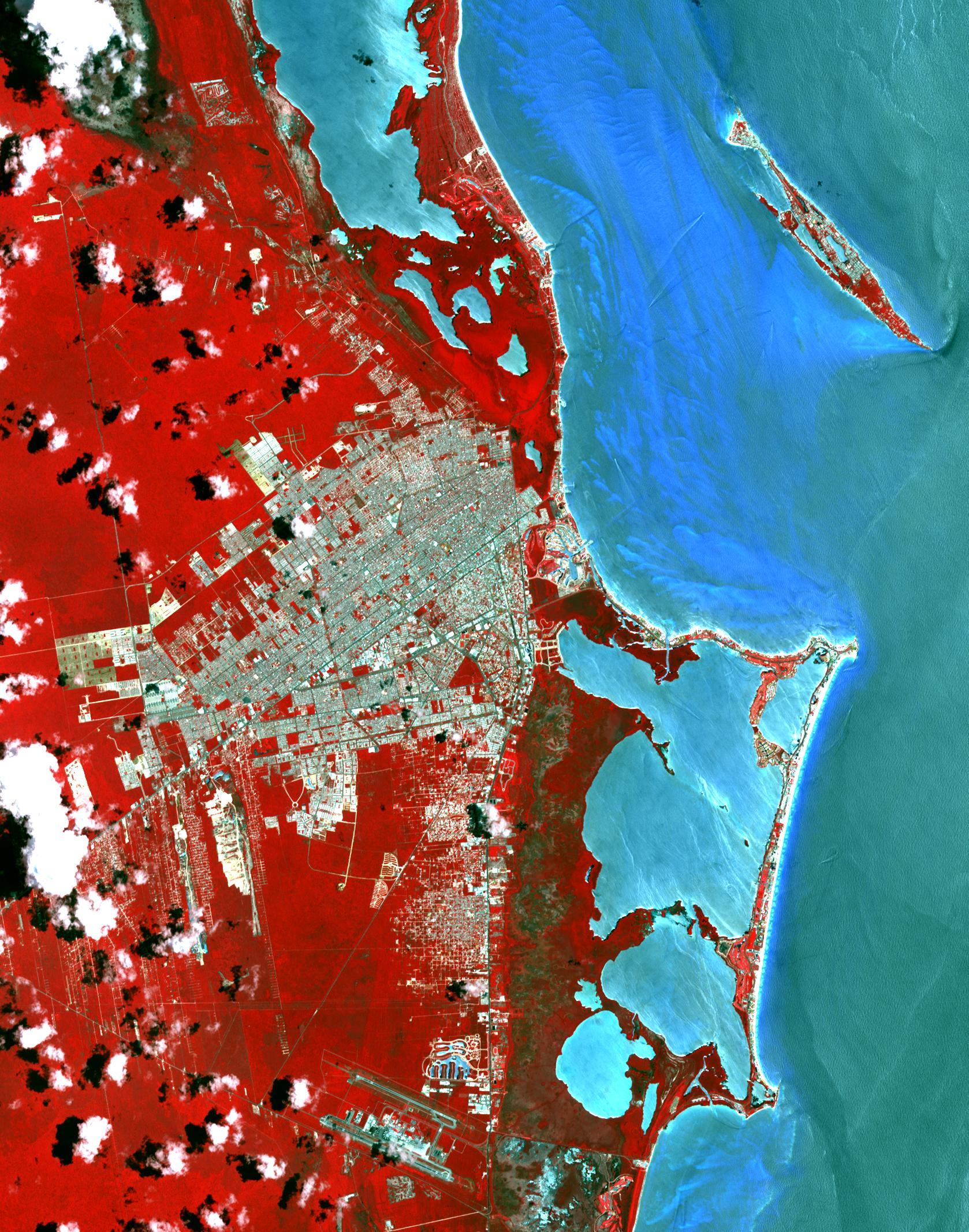
2015-11-02 |
Earth
|
Terra
|
ASTER
|
1678x2134x3 |
|
-
PIA20086:
-
Cancun, Mexico
Full Resolution:
TIFF
(10.75 MB)
JPEG
(711.6 kB)
|
|
|
2015-11-14 |
Earth
|
Terra
|
ASTER
|
1583x749x3 |
|
-
PIA20156:
-
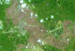
Flooding at Iron-Ore Mine, SE Brazil
Full Resolution:
TIFF
(3.558 MB)
JPEG
(217.6 kB)
|
|
|
2015-11-16 |
Earth
|
Terra
|
ASTER
|
2997x1845x3 |
|
-
PIA20104:
-
Orapa Diamond Mine, Botswana
Full Resolution:
TIFF
(16.6 MB)
JPEG
(972.6 kB)
|
|
|
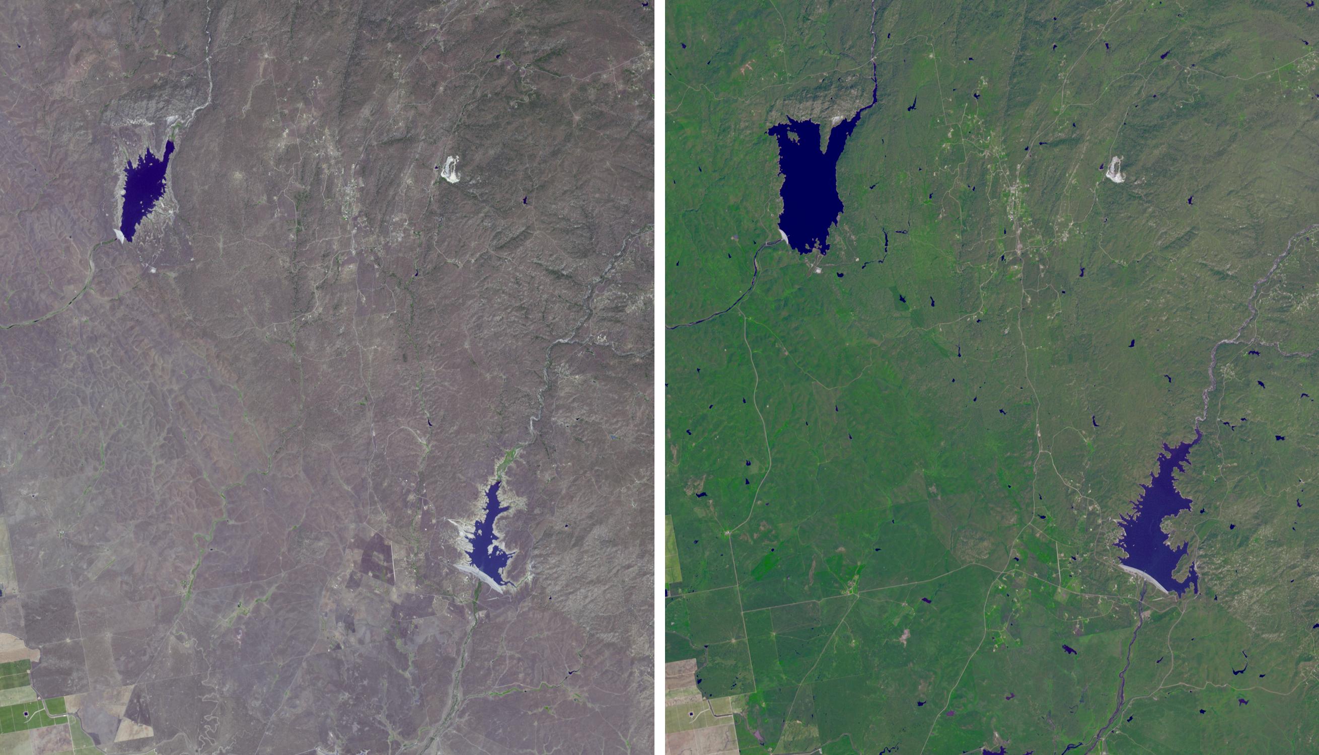
2015-12-09 |
Earth
|
Terra
|
ASTER
|
1600x1200x3 |
|
-
PIA20216:
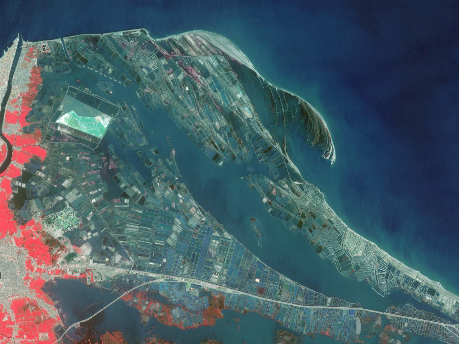
-
Nile Delta Fisheries, Egypt
Full Resolution:
TIFF
(5.762 MB)
JPEG
(253 kB)
|
|
|
2016-01-07 |
Earth
|
Terra
|
ASTER
|
3640x3300x3 |
|
-
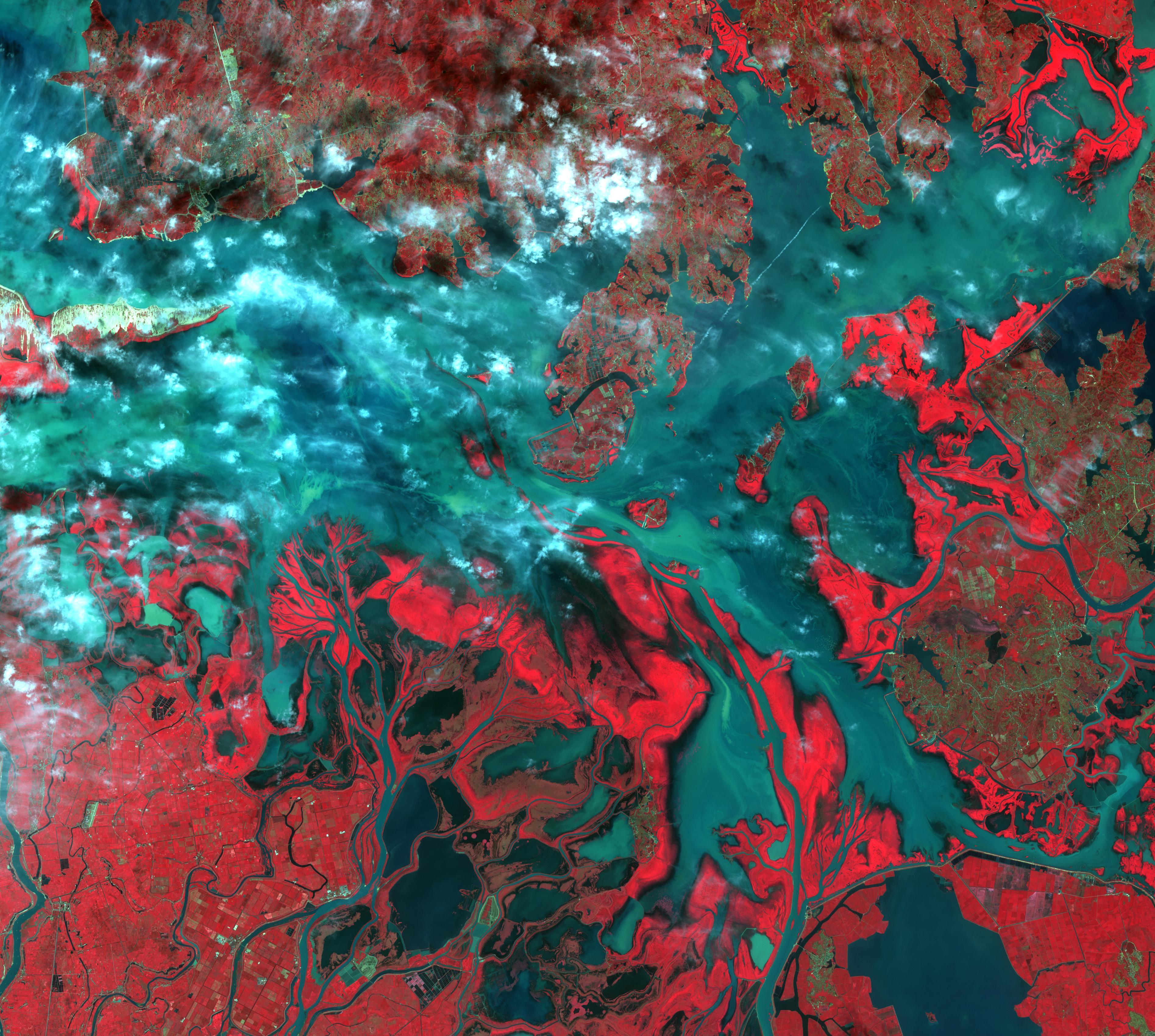
PIA20295:
-
Argentine Flooding Observed by NASA Satellite
Full Resolution:
TIFF
(27.22 MB)
JPEG
(1.895 MB)
|
|
|
2016-01-19 |
Earth
|
Terra
|
ASTER
|
3592x2652x3 |
|
-
PIA20363:
-
Effects of Devastating Australian Bushfires Seen by NASA Spacecraft
Full Resolution:
TIFF
(27.43 MB)
JPEG
(1.902 MB)
|
|
|
2016-01-15 |
Earth
|
Terra
|
ASTER
|
4224x4846x3 |
|
-
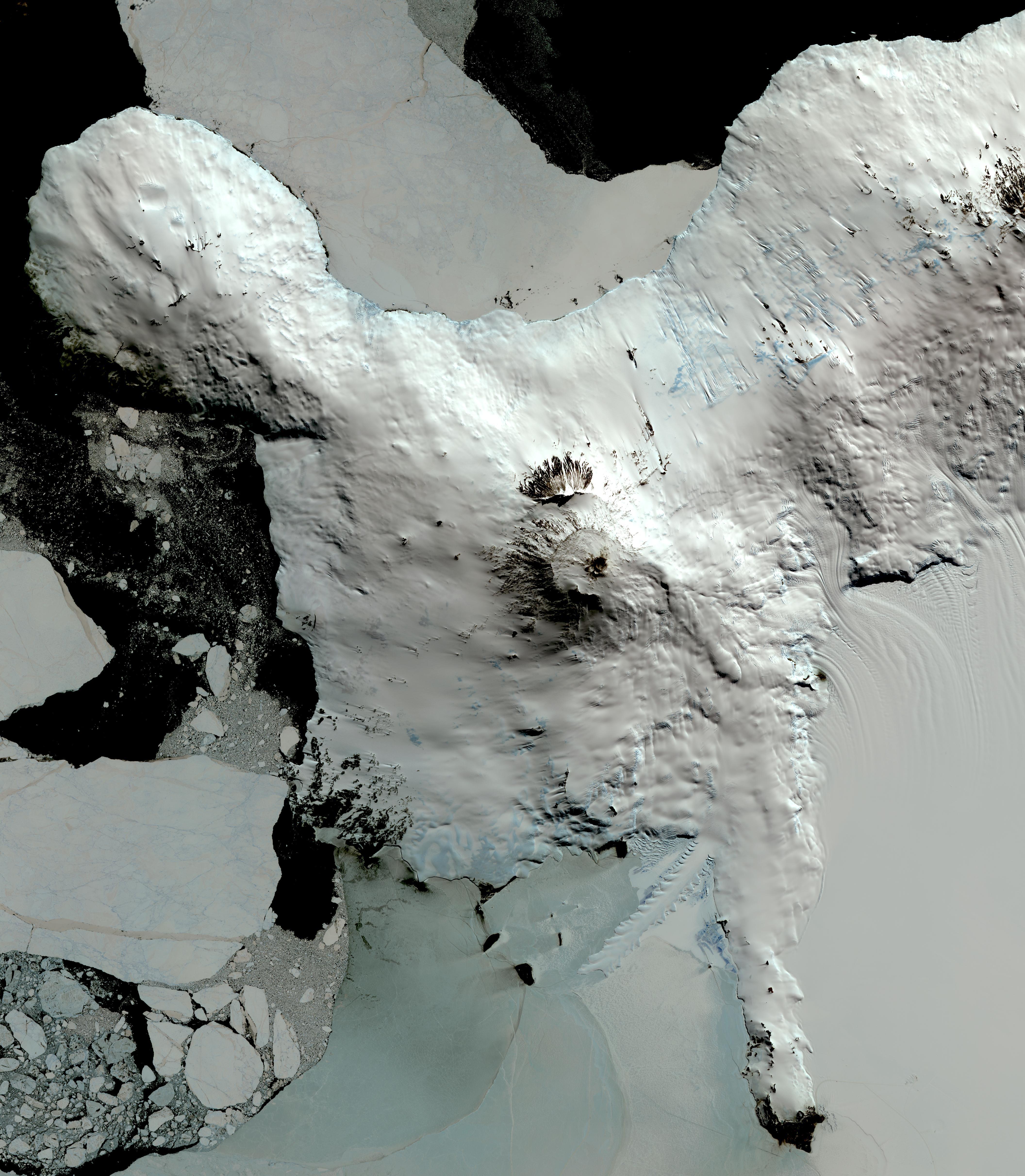
PIA20239:
-
Mt. Erebus, Antarctica
Full Resolution:
TIFF
(39.98 MB)
JPEG
(2.048 MB)
|
|
|
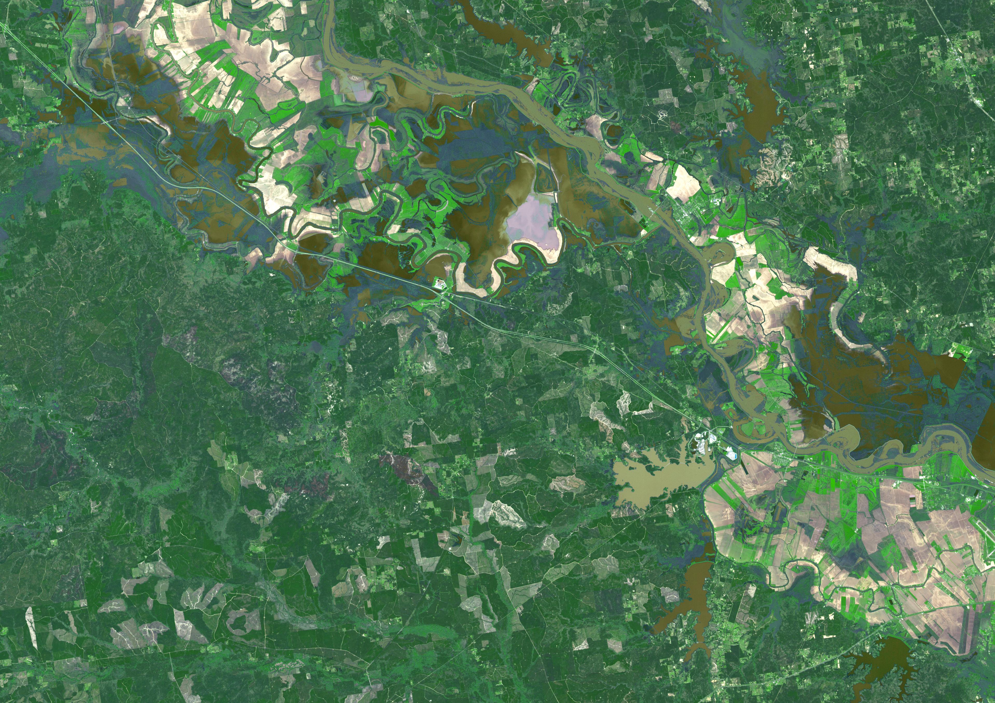
2016-01-20 |
Earth
|
Terra
|
ASTER
|
2532x2544x3 |

|
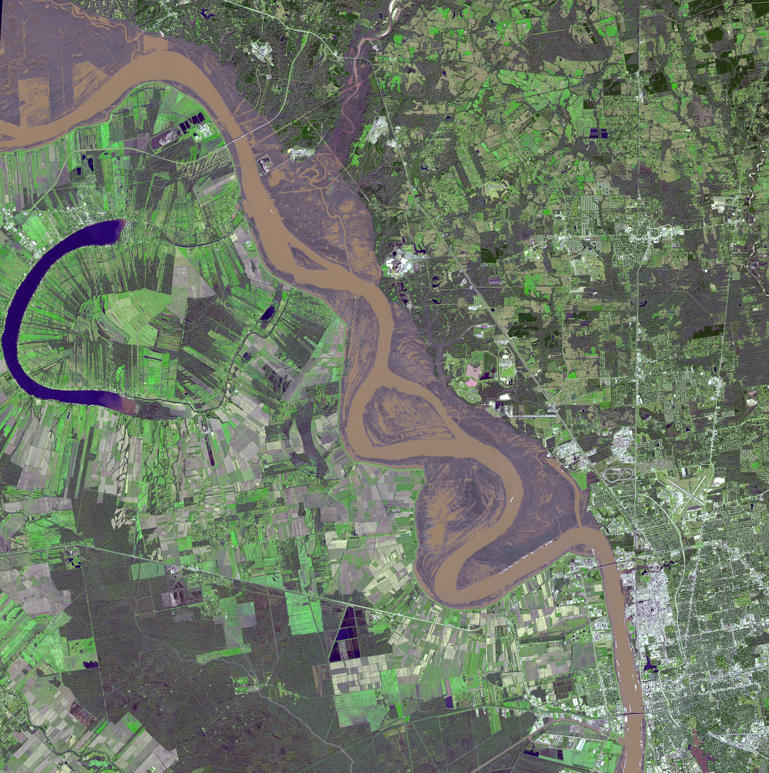
-
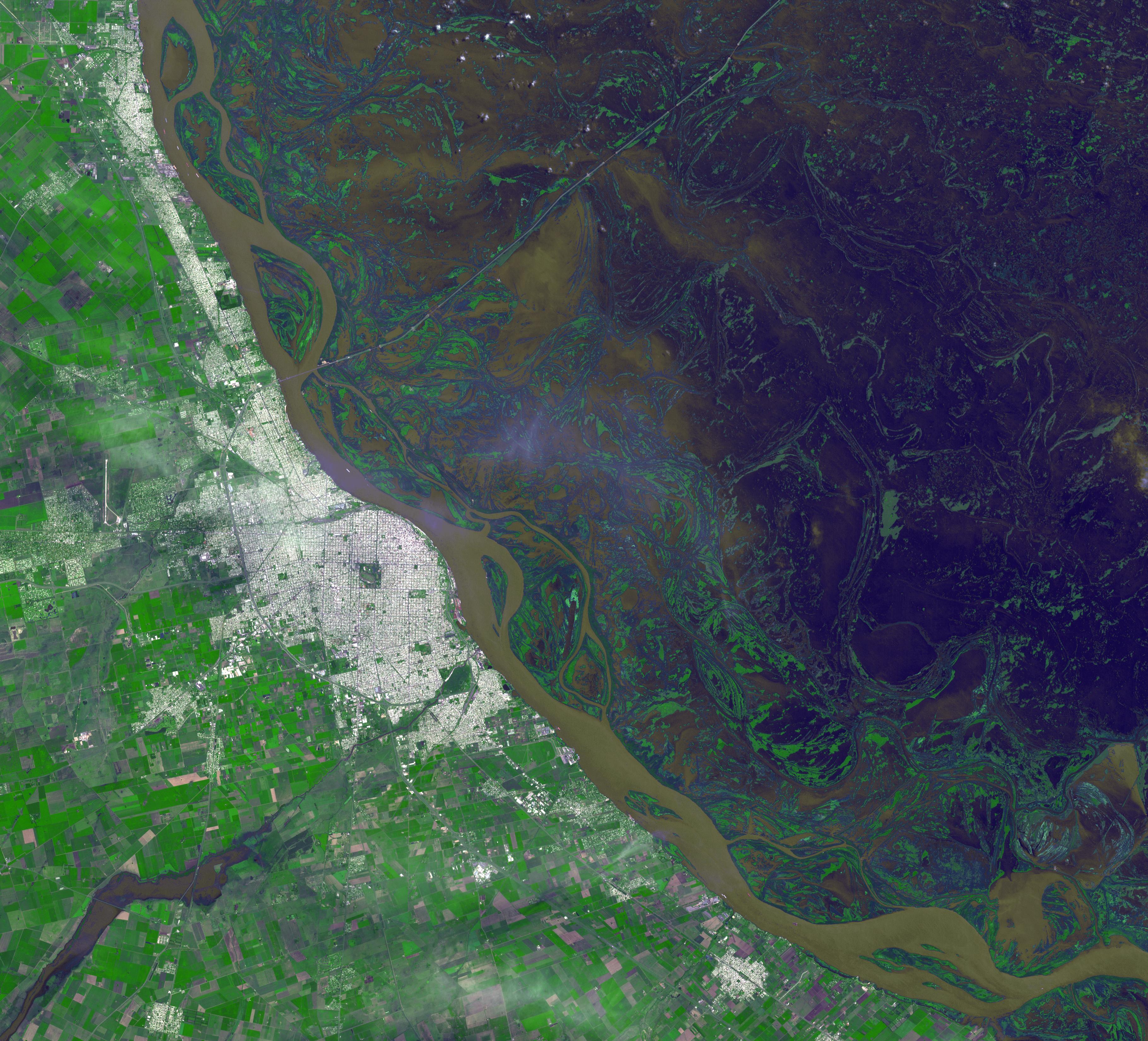
PIA20364:
-
Flooding on the Mississippi River Captured by NASA Spacecraft
Full Resolution:
TIFF
(19.33 MB)
JPEG
(1.766 MB)
|
|
|
2016-02-16 |
Earth
|
Terra
|
ASTER
|
3790x3400x3 |
|
-
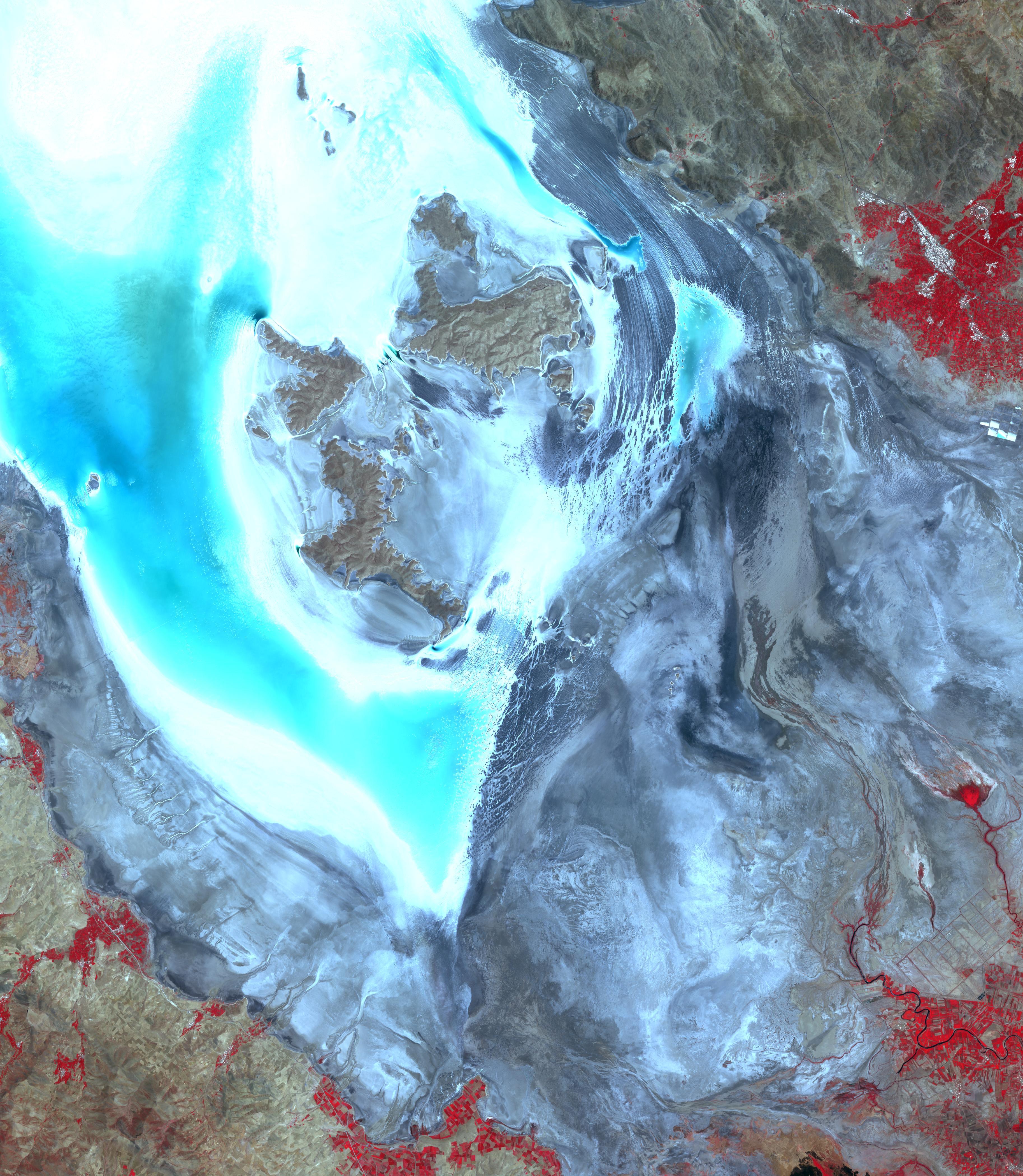
PIA20263:
-
Poyang Lake, China
Full Resolution:
TIFF
(38.67 MB)
JPEG
(1.709 MB)
|
|
|
2016-02-29 |
Earth
|
Terra
|
ASTER
|
1800x2304x3 |
|
-
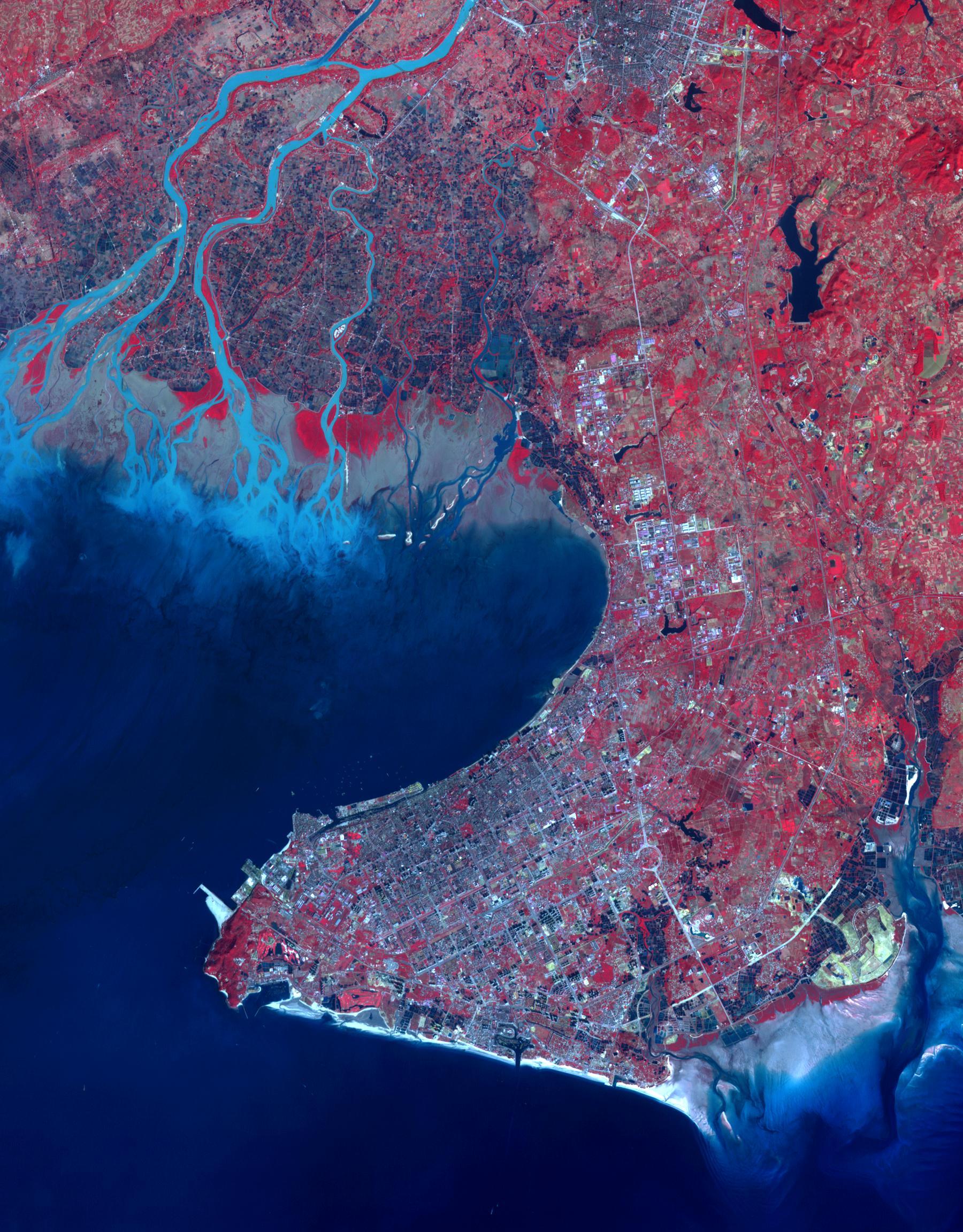
PIA20421:
-
Beihai, Guanxi, China
Full Resolution:
TIFF
(12.45 MB)
JPEG
(701.6 kB)
|
|
|
2016-03-02 |
Earth
|
Terra
|
ASTER
|
1238x1108x3 |
|
-
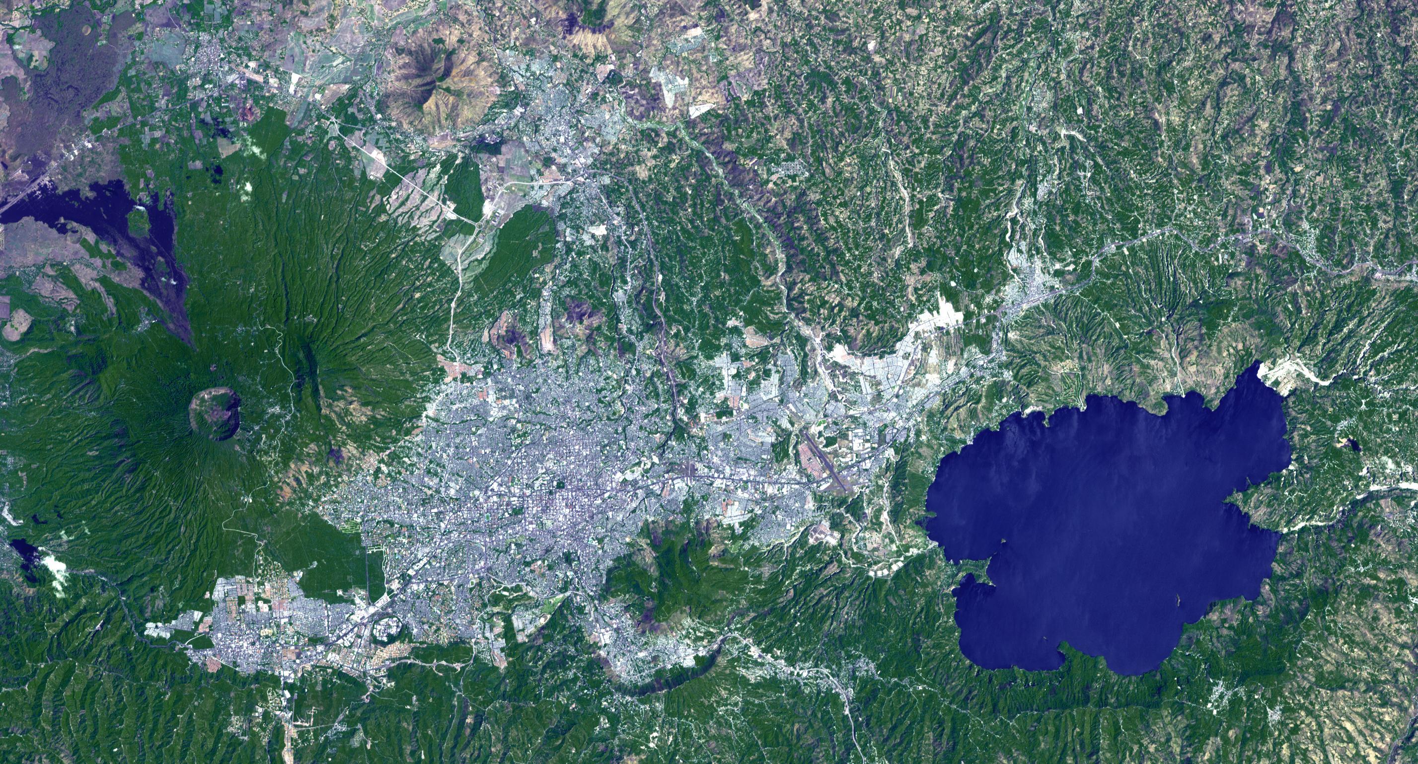
PIA20475:
-
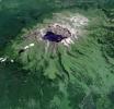
Momotombo's Fury in Nicaragua Captured by NASA Satellite
Full Resolution:
TIFF
(3.738 MB)
JPEG
(162.3 kB)
|
|
|
2016-03-16 |
Earth
|
Terra
|
ASTER
|
1300x1000x3 |
|
-
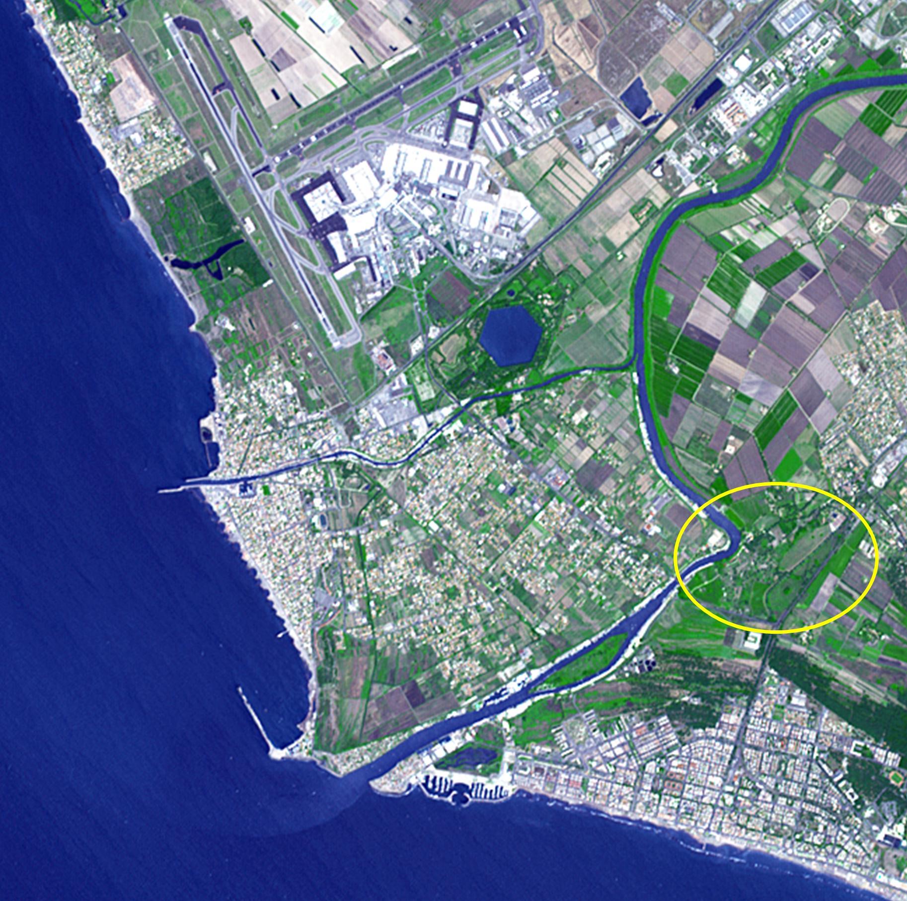
PIA20437:
-
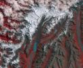
Mawsynram, India
Full Resolution:
TIFF
(3.902 MB)
JPEG
(336.3 kB)
|
|
|
2016-03-21 |
Earth
|
Terra
|
ASTER
|
3836x2710x3 |
|
-
PIA20533:
-
Persistent Flooding in Louisiana Imaged by NASA Spacecraft
Full Resolution:
TIFF
(23.38 MB)
JPEG
(1.729 MB)
|
|
|
2016-04-20 |
Earth
|
Terra
|
ASTER
|
1569x1479x3 |

|
-
PIA20591:
-
NASA Satellite Shows Site of Devastating Japan Quakes
Full Resolution:
TIFF
(6.964 MB)
JPEG
(633.3 kB)
|
|
|
2016-05-13 |
Earth
|
Terra
|
ASTER
|
2800x1400x3 |
|
-
PIA20665:
-
Signs of Life in Mighty New Zealand Volcano seen by NASA Spacecraft
Full Resolution:
TIFF
(5.634 MB)
JPEG
(460.3 kB)
|
|
|
2016-05-10 |
Earth
|
Terra
|
ASTER
|
544x568x3 |
|
-
PIA20610:
-
Nome, Alaska
Full Resolution:
TIFF
(927.5 kB)
JPEG
(83.04 kB)
|
|
|
2016-05-18 |
Earth
|
Terra
|
ASTER
|
1335x894x3 |
|
-
PIA20586:
-
Devastating Fort McMurray Wildfire in Canada seen by NASA Spacecraft
Full Resolution:
TIFF
(3.284 MB)
JPEG
(159.6 kB)
|
|
|
2016-05-27 |
Earth
|
Terra
|
ASTER
|
2415x2022x3 |
|
-
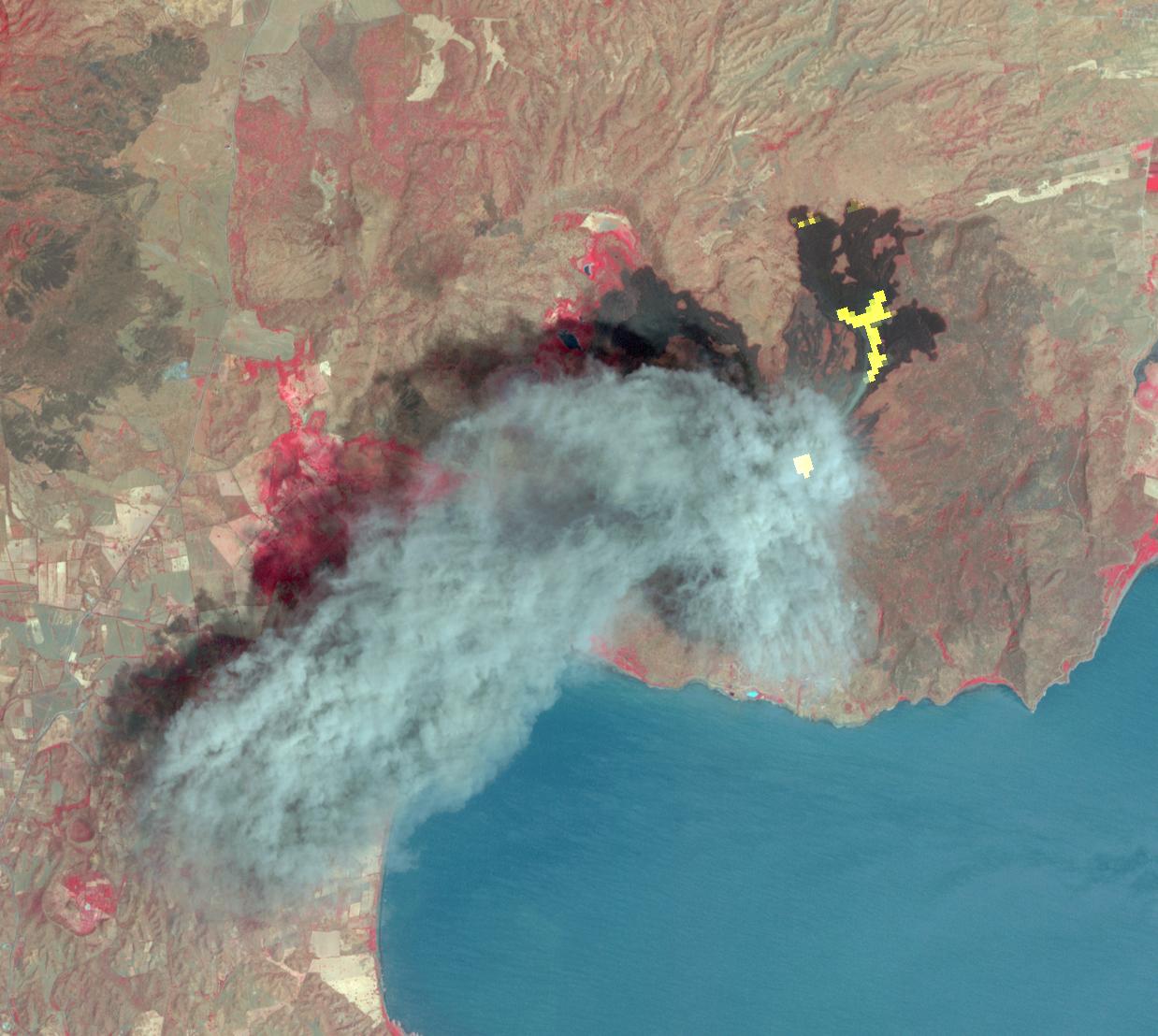
PIA14456:
-
Activity at Europe's Most Active Volcano Eyed by NASA Spacecraft
Full Resolution:
TIFF
(14.45 MB)
JPEG
(746.4 kB)
|
|
|
2016-05-24 |
Earth
|
Terra
|
ASTER
|
1507x1482x3 |
|
-
PIA20622:
-
St. Matthew Island, Alaska
Full Resolution:
TIFF
(1.266 MB)
JPEG
(86.54 kB)
|
|
|
2016-06-15 |
Earth
|
Terra
|
ASTER
|
3652x4200x3 |
|
-
PIA20637:
-
Lake Urmia, Iran
Full Resolution:
TIFF
(45.65 MB)
JPEG
(2.036 MB)
|
|
|
2016-06-22 |
Earth
|
Terra
|
ASTER
|
2160x1635x3 |
|
-
PIA20734:
-
Major Wildfire Near Santa Barbara seen by NASA Spacecraft
Full Resolution:
TIFF
(10.46 MB)
JPEG
(770.8 kB)
|
|
|
2016-07-01 |
Earth
|
Terra
|
ASTER
|
2200x2076x3 |
|
-
PIA20741:
-
Impact of Destructive California Wildfire Captured by NASA Spacecraft
Full Resolution:
TIFF
(12.45 MB)
JPEG
(885.2 kB)
|
|
|
2016-07-05 |
Earth
|
Terra
|
ASTER
|
3039x2821x3 |
|
-
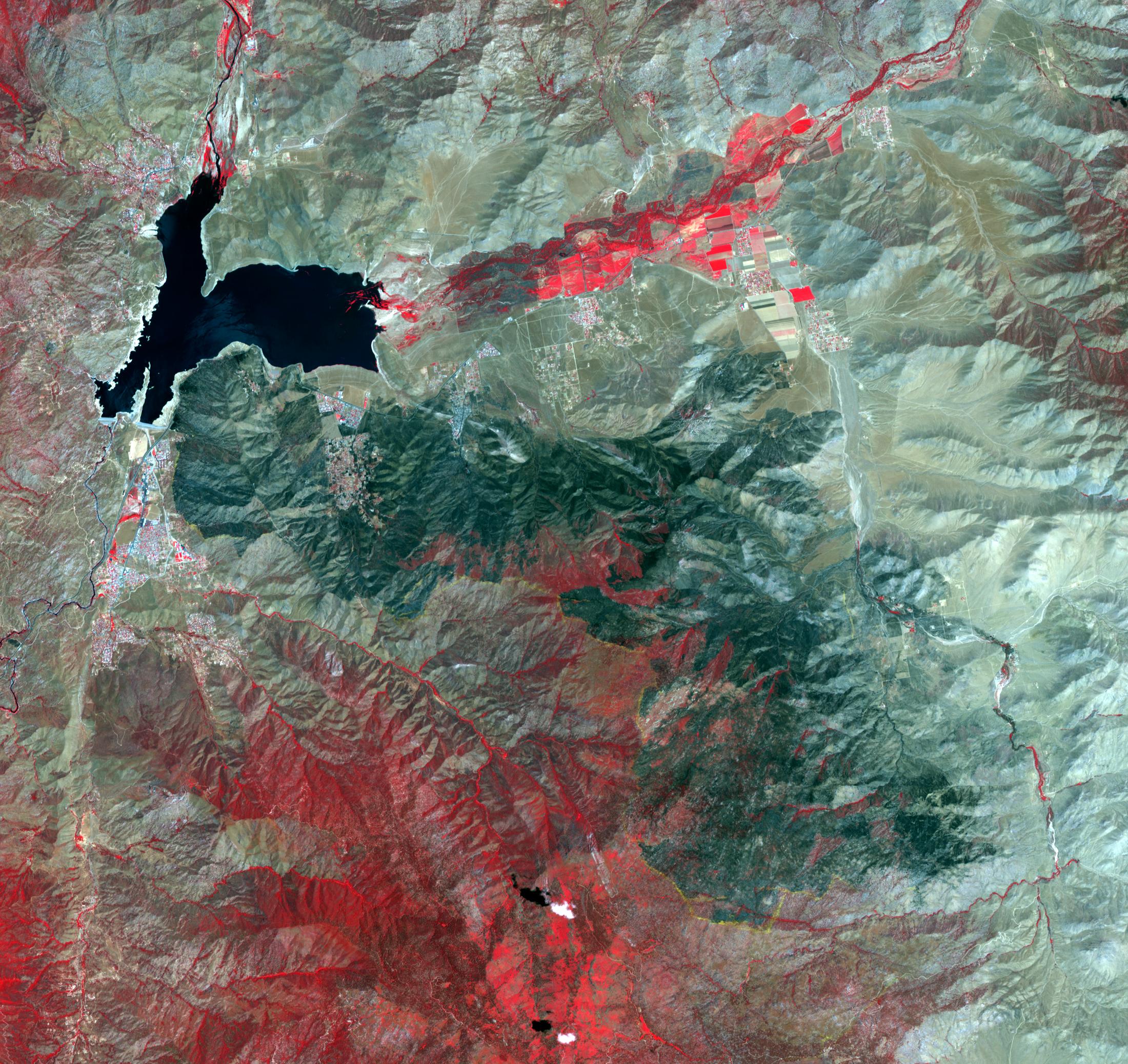
PIA20776:
-
Rostov, Russia
Full Resolution:
TIFF
(25.73 MB)
JPEG
(2.126 MB)
|
|
|
2016-07-26 |
Earth
|
Terra
|
ASTER
|
1753x1485x3 |
|
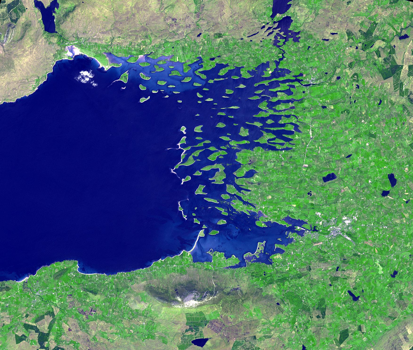
-
PIA18670:
-
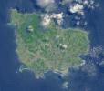
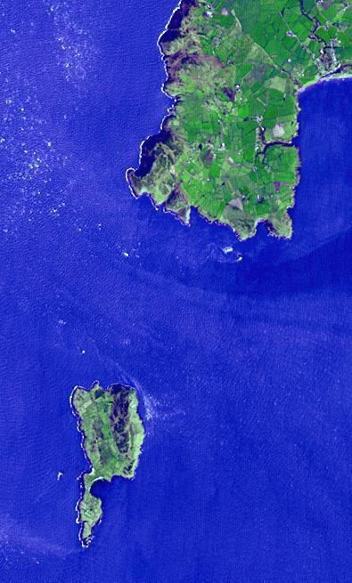
Clew Bay, Ireland
Full Resolution:
TIFF
(7.813 MB)
JPEG
(536.9 kB)
|
|
|
2016-08-09 |
Earth
|
Terra
|
ASTER
|
2841x2028x3 |
|
-
PIA20725:
-
Growing Wildfire Near Big Sur, California Imaged by NASA's Terra Spacecraft
Full Resolution:
TIFF
(13.66 MB)
JPEG
(749.1 kB)
|
|
|
2016-08-10 |
Earth
|
Terra
|
ASTER
|
1440x1584x3 |
|
-
PIA20804:
-
Lilongwe, Malawi
Full Resolution:
TIFF
(6.846 MB)
JPEG
(835.5 kB)
|
|
|
2016-08-24 |
Earth
|
Terra
|
ASTER
|
1299x1943x3 |
|
-
PIA20973:
-
Chiquicamata Mine, Chile
Full Resolution:
TIFF
(7.575 MB)
JPEG
(539.6 kB)
|
|
|
2016-09-07 |
Earth
|
Terra
|
ASTER
|
1812x1456x3 |
|
-
PIA20899:
-
Extent of California Blue Cut Fire Devastation Seen by NASA Spacecraft
Full Resolution:
TIFF
(7.918 MB)
JPEG
(602.8 kB)
|
|
|
2016-09-07 |
Earth
|
Terra
|
ASTER
|
546x411x3 |
|
-
PIA20986:
-
Five-Hundred-Meter Aperture Spherical Telescope, China
Full Resolution:
TIFF
(673.7 kB)
JPEG
(43.08 kB)
|
|
|
2016-09-16 |
Earth
|
Terra
|
ASTER
|
2062x1854x3 |
|
-
PIA20996:
-
Qassiarsuk, Greenland
Full Resolution:
TIFF
(11.47 MB)
JPEG
(698.3 kB)
|
|
|
2016-09-29 |
Earth
|
Terra
|
ASTER
|
1988x1101x3 |
|
-
PIA20900:
-
A Bird's Eye View of Australia's Heron Island
Full Resolution:
TIFF
(5.33 MB)
JPEG
(203.1 kB)
|
|
|
2016-09-30 |
Earth
|
Terra
|
ASTER
|
1403x1442x3 |
|
-
PIA21008:
-
Blackhawk Landslide, California
Full Resolution:
TIFF
(5.732 MB)
JPEG
(419.1 kB)
|
|
|
2016-10-05 |
Earth
|
Terra
|
ASTER
|
1094x839x3 |
|
-
PIA21069:
-
NASA Satellite Eyes Deadly Tibetan Landslide
Full Resolution:
TIFF
(2.297 MB)
JPEG
(101 kB)
|
|
|
2016-10-13 |
Earth
|
Terra
|
ASTER
|
2763x1493x3 |
|
-
PIA21014:
-
Cape Agulhas, South Africa
Full Resolution:
TIFF
(11.42 MB)
JPEG
(573.9 kB)
|
|
|
2016-11-08 |
Earth
|
Terra
|
ASTER
|
965x757x3 |
|
-
PIA21099:
-
Oklahoma Area Struck By Magnitude 5.0 Earthquake Imaged by NASA Satellite
Full Resolution:
TIFF
(2.185 MB)
JPEG
(191.1 kB)
|
|
|
2016-11-09 |
Earth
|
Terra
|
ASTER
|
2022x3012x3 |
|
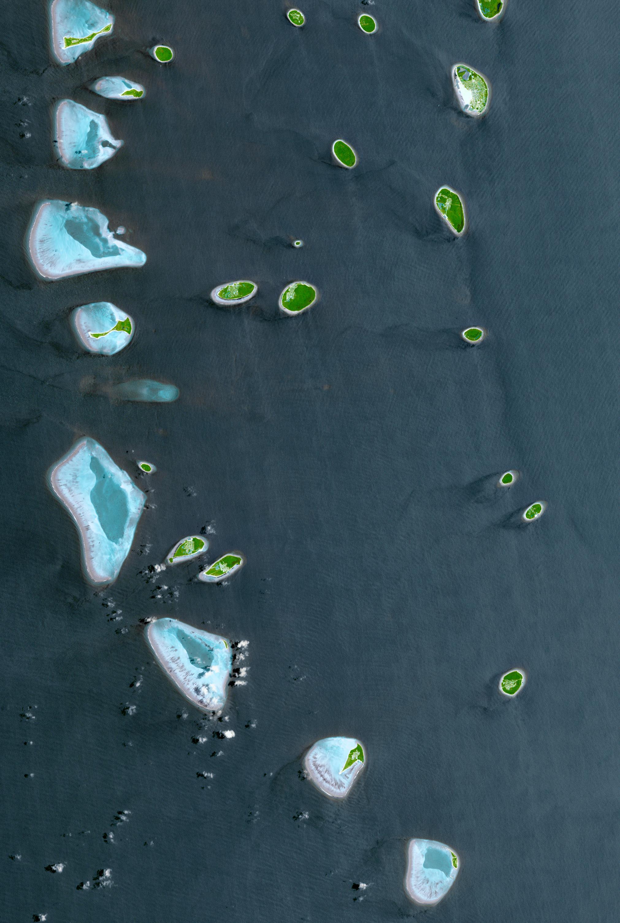
-
PIA21166:
-
Republic of Maldives
Full Resolution:
TIFF
(14.07 MB)
JPEG
(887.6 kB)
|
|
|
2016-11-15 |
Earth
|
Terra
|
ASTER
|
3684x2704x3 |
|
-
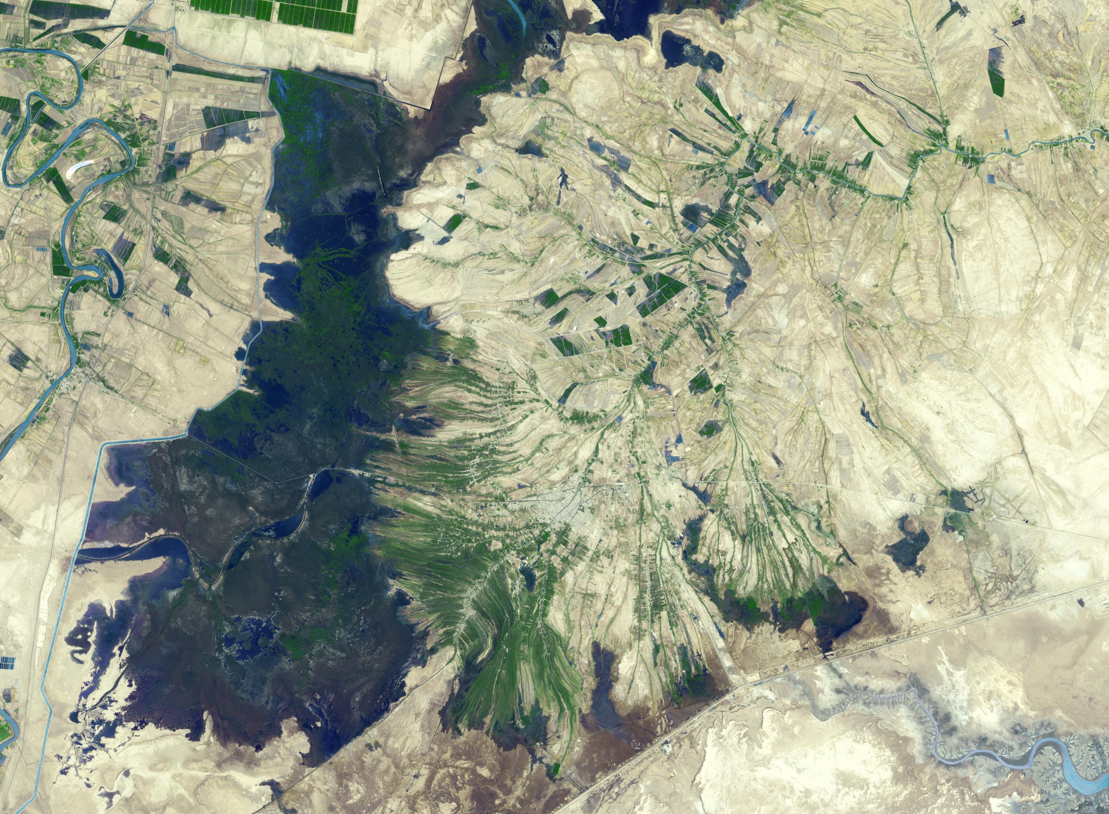
PIA21170:
-
Shadegan, Iran
Full Resolution:
TIFF
(29.9 MB)
JPEG
(1.611 MB)
|
|
|
2016-12-01 |
Earth
|
Terra
|
ASTER
|
395x655x3 |
|
-
PIA21182:
-
Bardsey Island, Wales
Full Resolution:
TIFF
(776.7 kB)
JPEG
(54.91 kB)
|
|
|
2016-12-12 |
Earth
|
Terra
|
ASTER
|
3087x2484x3 |
|
-
PIA21189:
-
Kashgar, China
Full Resolution:
TIFF
(23.01 MB)
JPEG
(1.747 MB)
|
|
|
2017-01-06 |
Earth
|
Terra
|
ASTER
|
3367x3672x3 |

|
-
PIA21284:
-
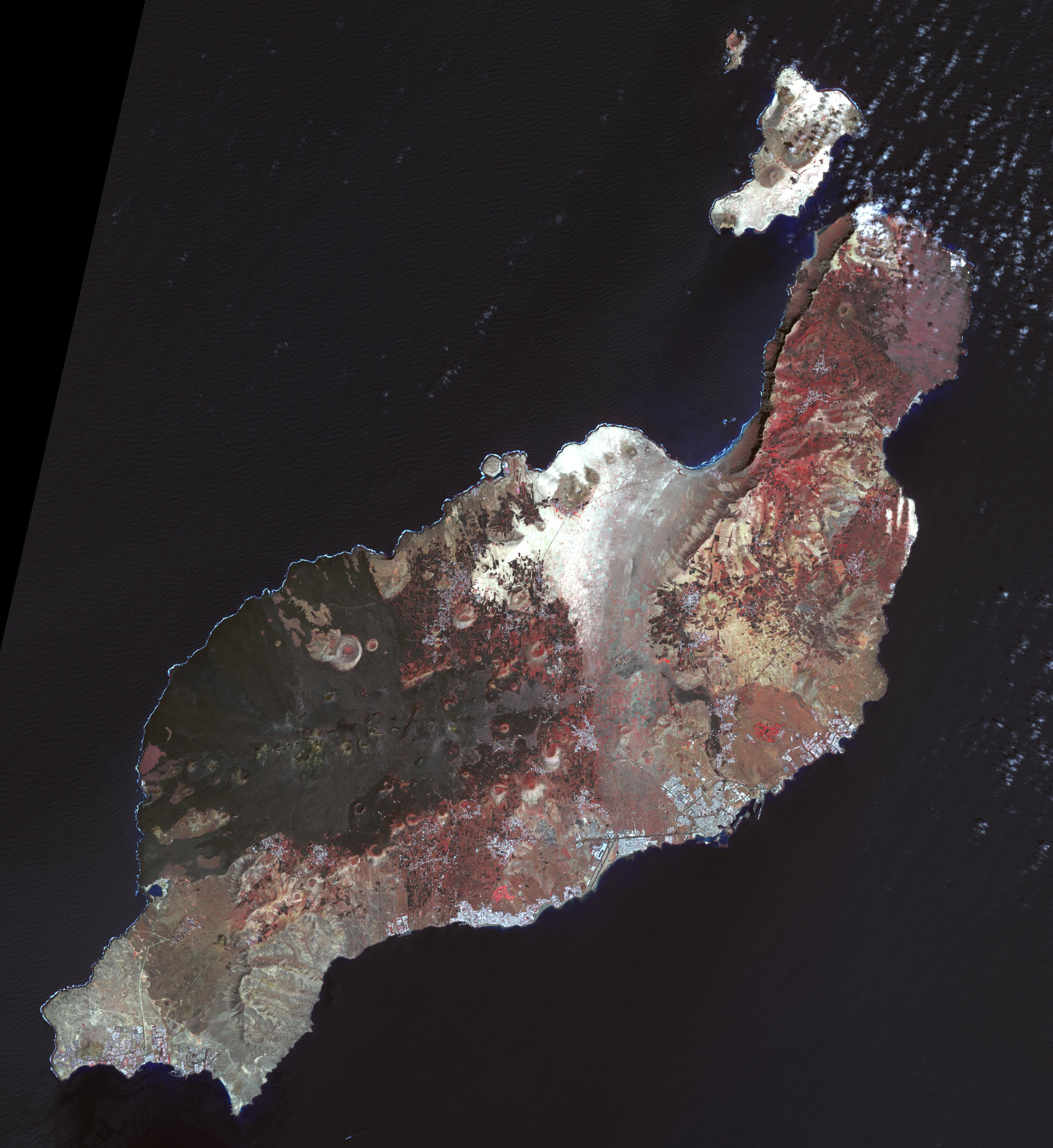
Lanzarote, Canary Islands
Full Resolution:
TIFF
(21.83 MB)
JPEG
(1.084 MB)
|
|
|
2017-02-01 |
Earth
|
Terra
|
ASTER
|
3996x3291x3 |

|
-
PIA21304:
-
Yamzho Yumco Lake, Tibet
Full Resolution:
TIFF
(38.47 MB)
JPEG
(2.052 MB)
|
|
|
2017-02-15 |
Earth
|
Terra
|
ASTER
|
2385x1968x3 |
|
-
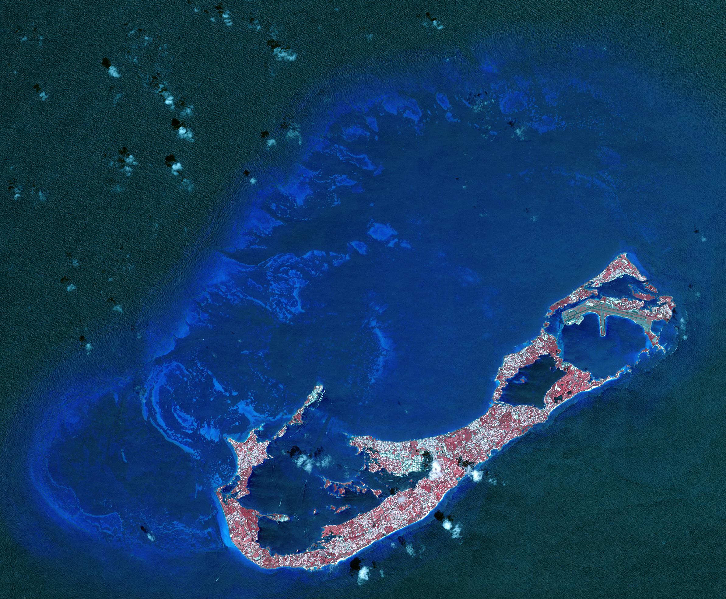
PIA21315:
-
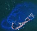
Bermuda
Full Resolution:
TIFF
(12.91 MB)
JPEG
(736.9 kB)
|
|
|
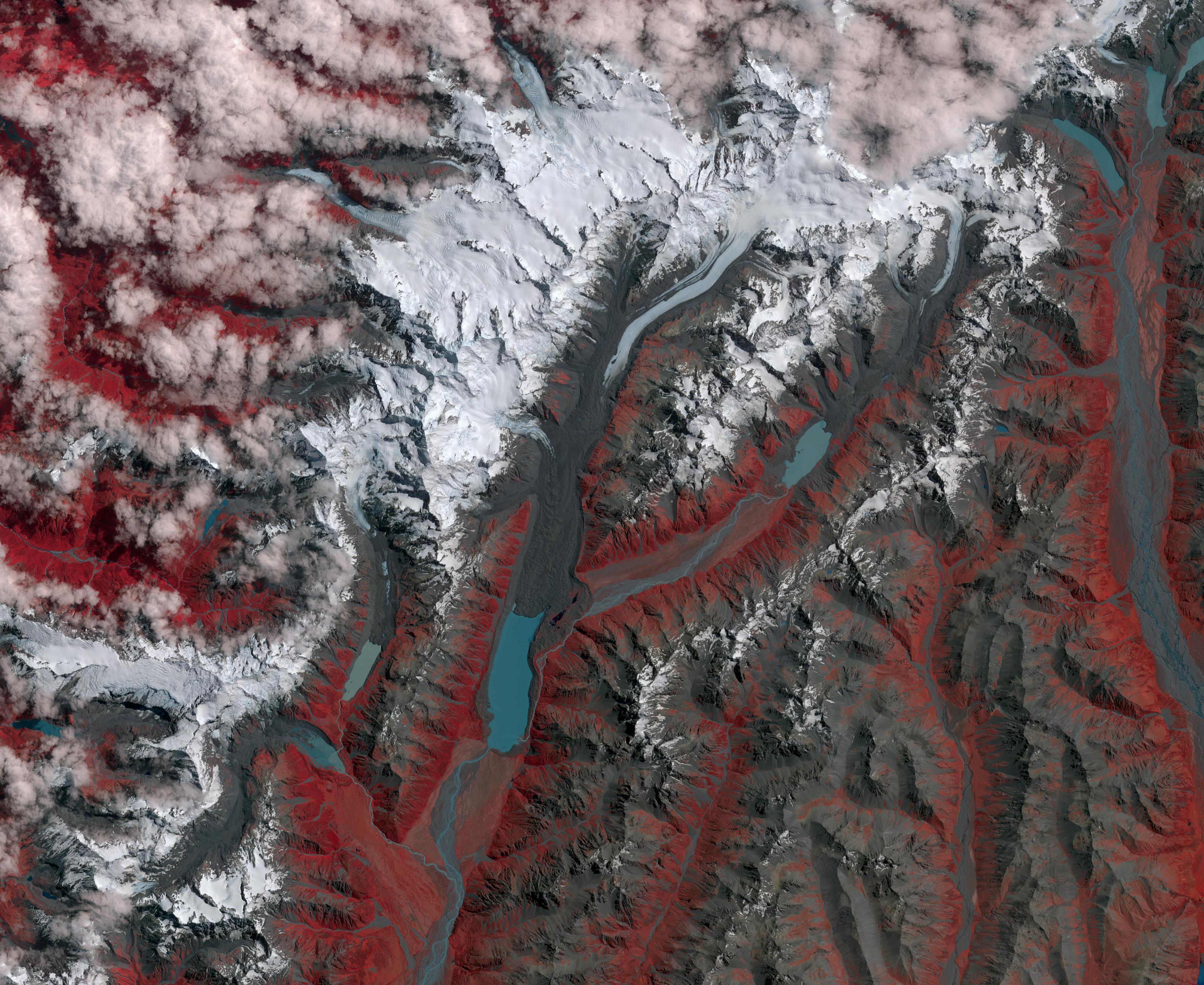
2017-03-09 |
Earth
|
Terra
|
ASTER
|
3168x2592x3 |
|
-
PIA21509:
-
New Zealand Glaciers
Full Resolution:
TIFF
(24.64 MB)
JPEG
(1.33 MB)
|
|
|
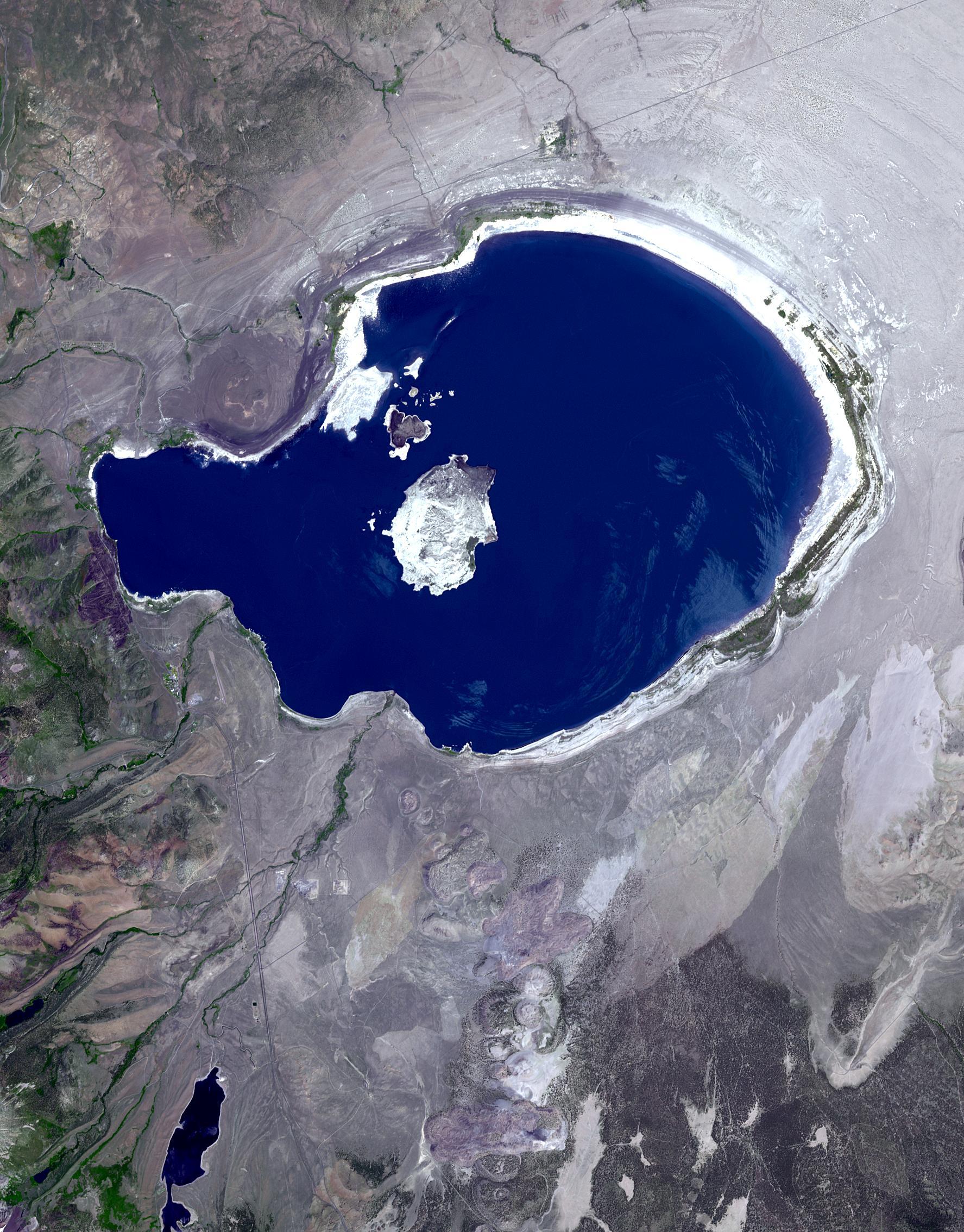
2017-03-24 |
Earth
|
Terra
|
ASTER
|
1775x2267x3 |

|
-
PIA21518:
-
Mono Lake, California
Full Resolution:
TIFF
(11.27 MB)
JPEG
(687.6 kB)
|
|
|
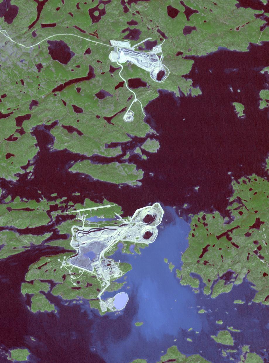
2017-04-13 |
Earth
|
Terra
|
ASTER
|
919x1243x3 |

|
-
PIA21536:
-
Diavik Mine, Canada
Full Resolution:
TIFF
(3.428 MB)
JPEG
(179.9 kB)
|
|
|
2017-04-28 |
Earth
|
Terra
|
ASTER
|
3262x3671x3 |
|
-
PIA21546:
-
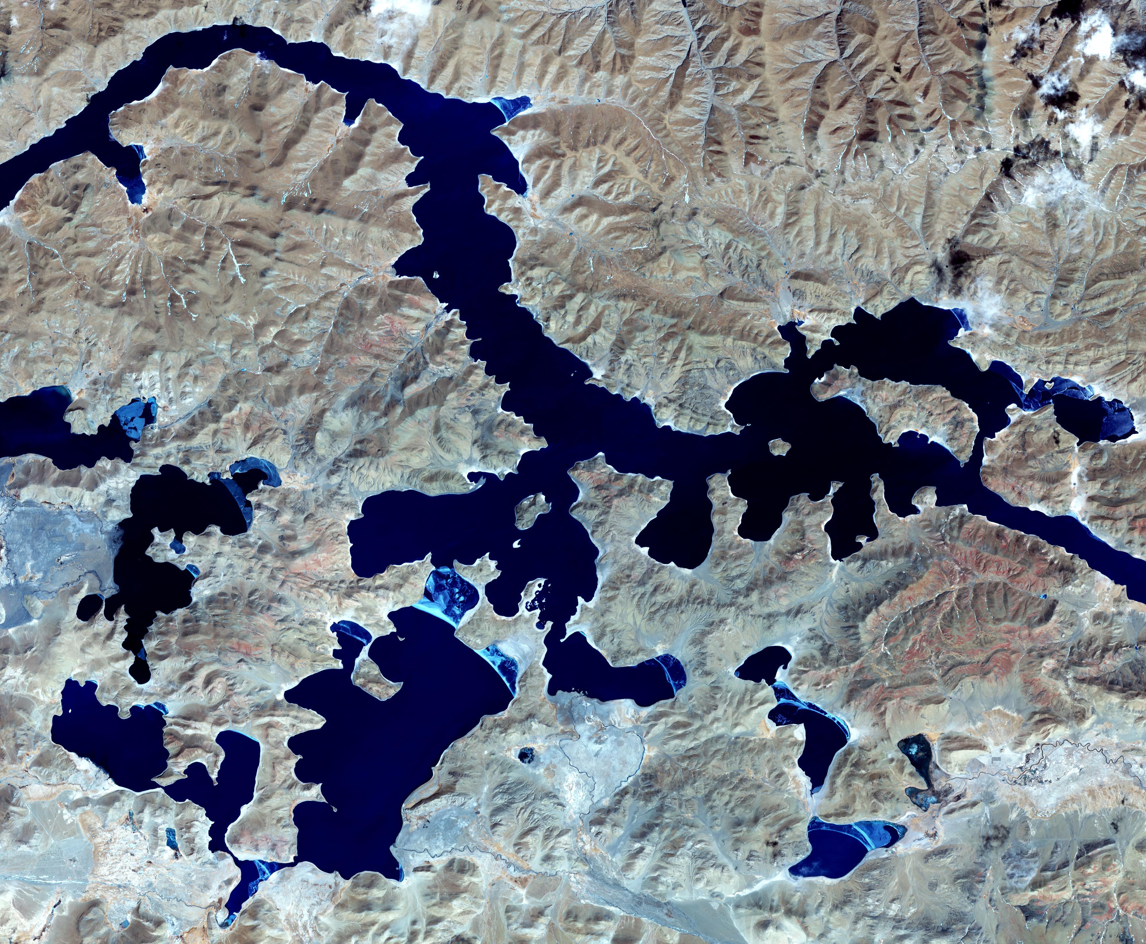
Lake Poopo, Bolivia
Full Resolution:
TIFF
(31.94 MB)
JPEG
(1.333 MB)
|
 Planetary Data System


