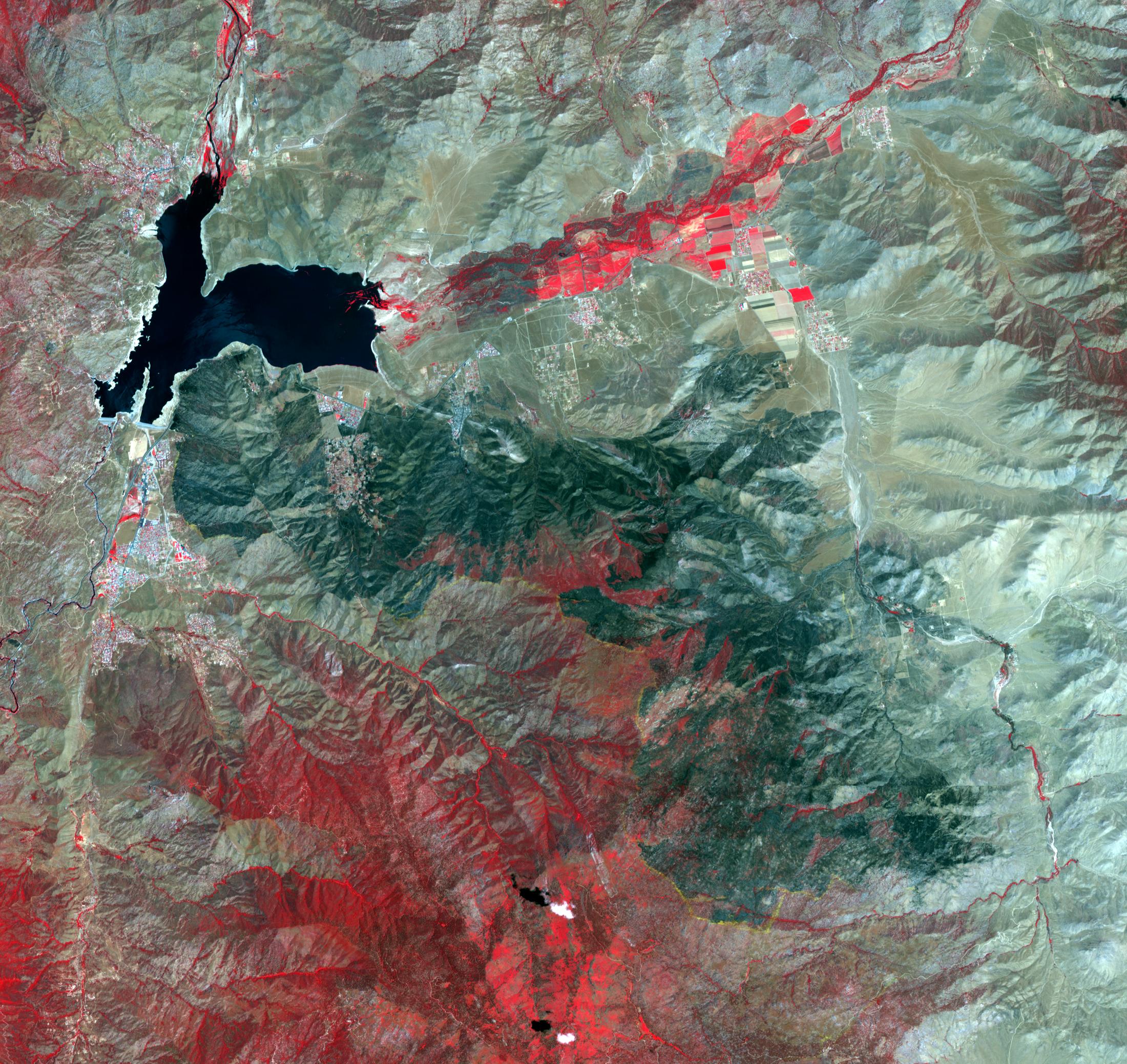
The Erskine wildfire, northeast of Bakersfield, California, is the state's largest to date in 2016. After starting on June 23, the fire has consumed 47,000 acres (19,020 hectares), destroyed more than 250 single residences, and is responsible for two fatalities. As of June 30, the fire was 70 percent contained; full containment was estimated by July 5. This image, obtained June 30 by the Advanced Spaceborne Thermal Emission and Reflection Radiometer (ASTER) instrument on NASA's Terra spacecraft, displays vegetation in red. The image covers an area of 19 by 21 miles (31 by 33 kilometers), and is located at 35.6 degrees north, 118.5 degrees west.
With its 14 spectral bands from the visible to the thermal infrared wavelength region and its high spatial resolution of 15 to 90 meters (about 50 to 300 feet), ASTER images Earth to map and monitor the changing surface of our planet. ASTER is one of five Earth-observing instruments launched Dec. 18, 1999, on Terra. The instrument was built by Japan's Ministry of Economy, Trade and Industry. A joint U.S./Japan science team is responsible for validation and calibration of the instrument and data products.
The broad spectral coverage and high spectral resolution of ASTER provides scientists in numerous disciplines with critical information for surface mapping and monitoring of dynamic conditions and temporal change. Example applications are: monitoring glacial advances and retreats; monitoring potentially active volcanoes; identifying crop stress; determining cloud morphology and physical properties; wetlands evaluation; thermal pollution monitoring; coral reef degradation; surface temperature mapping of soils and geology; and measuring surface heat balance.
The U.S. science team is located at NASA's Jet Propulsion Laboratory, Pasadena, Calif. The Terra mission is part of NASA's Science Mission Directorate, Washington, D.C.
More information about ASTER is available at http://asterweb.jpl.nasa.gov/.
 Planetary Data System


