My
List |
Addition Date
|
Target
|
Mission
|
Instrument
|
Size
|

|
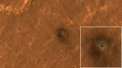
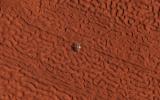
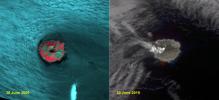
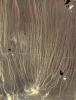
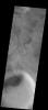
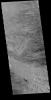
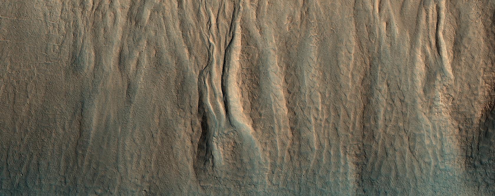
2020-01-16 |
Mars
|
Mars Reconnaissance Orbiter (MRO)
|
HiRISE
|
1680x666x3 |
|
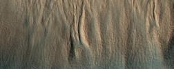
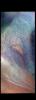
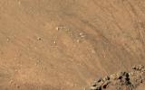
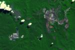
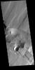
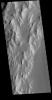
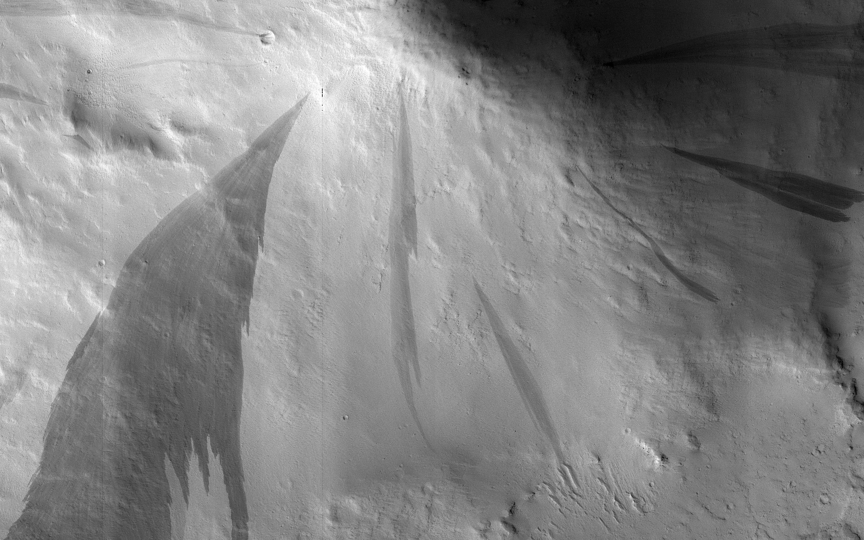
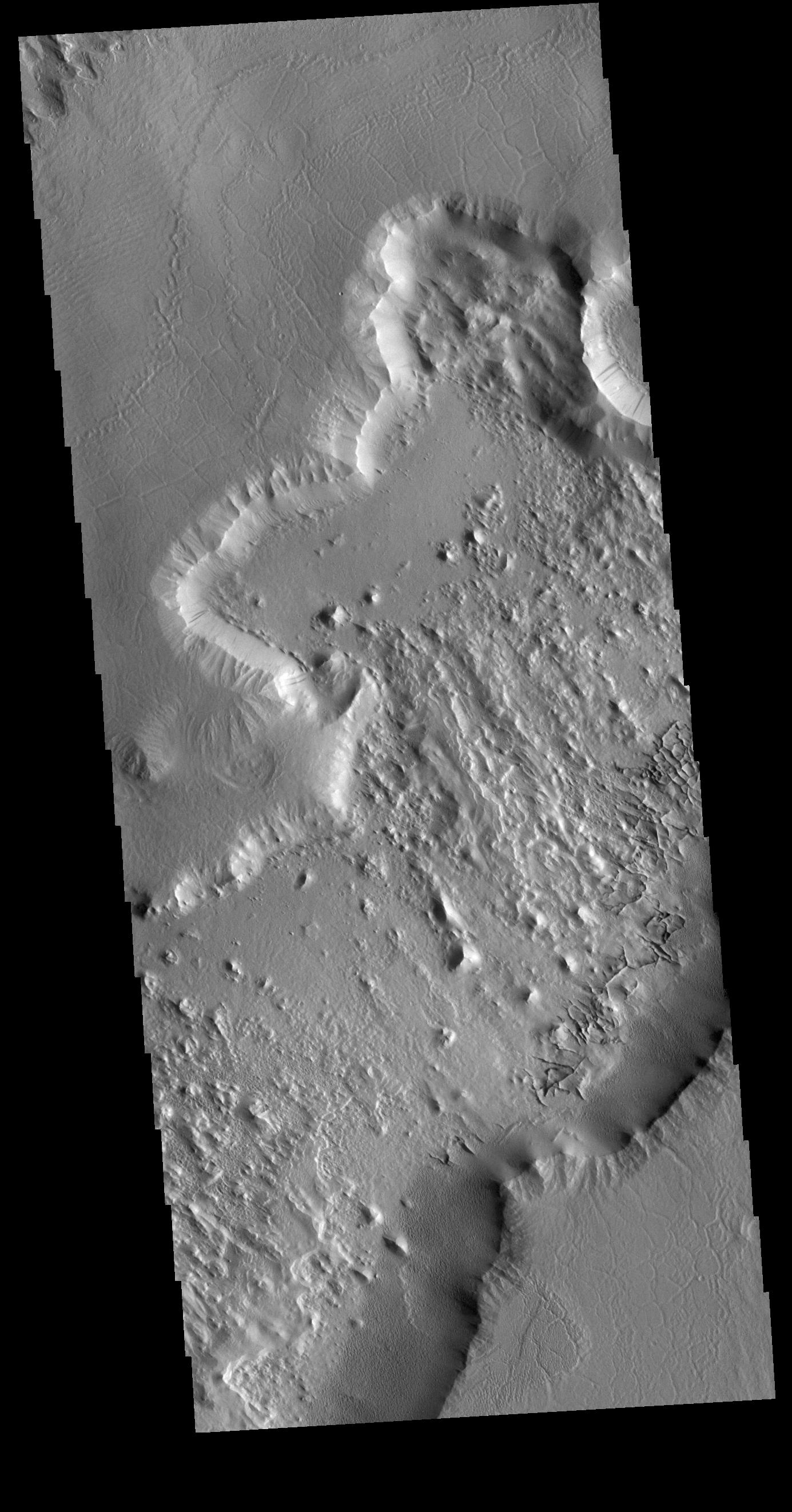
-
PIA23666:
-
A First Look at a Gullied Slope
Full Resolution:
TIFF
(3.358 MB)
JPEG
(298.5 kB)
|
|
|
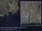
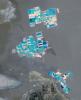
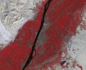
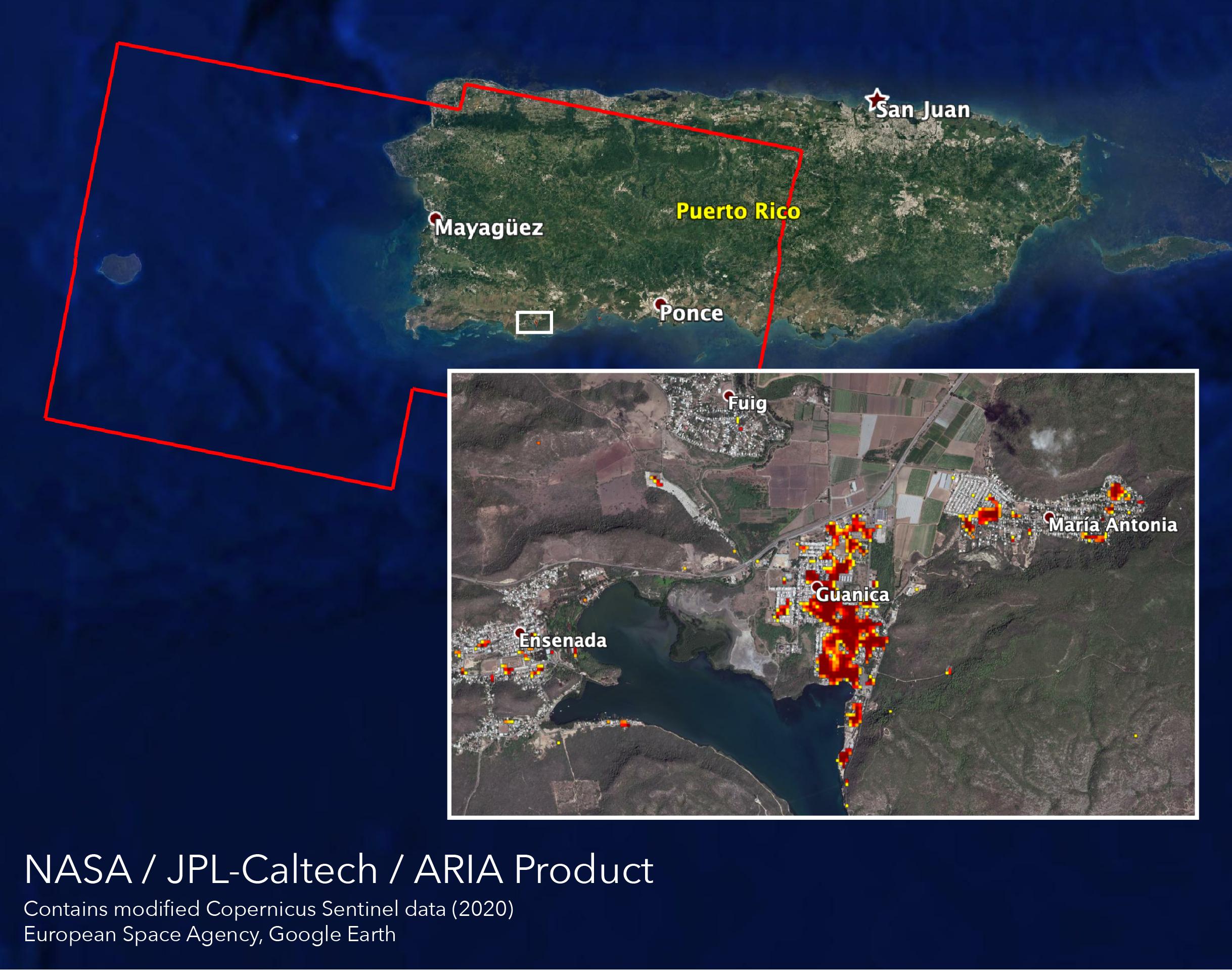
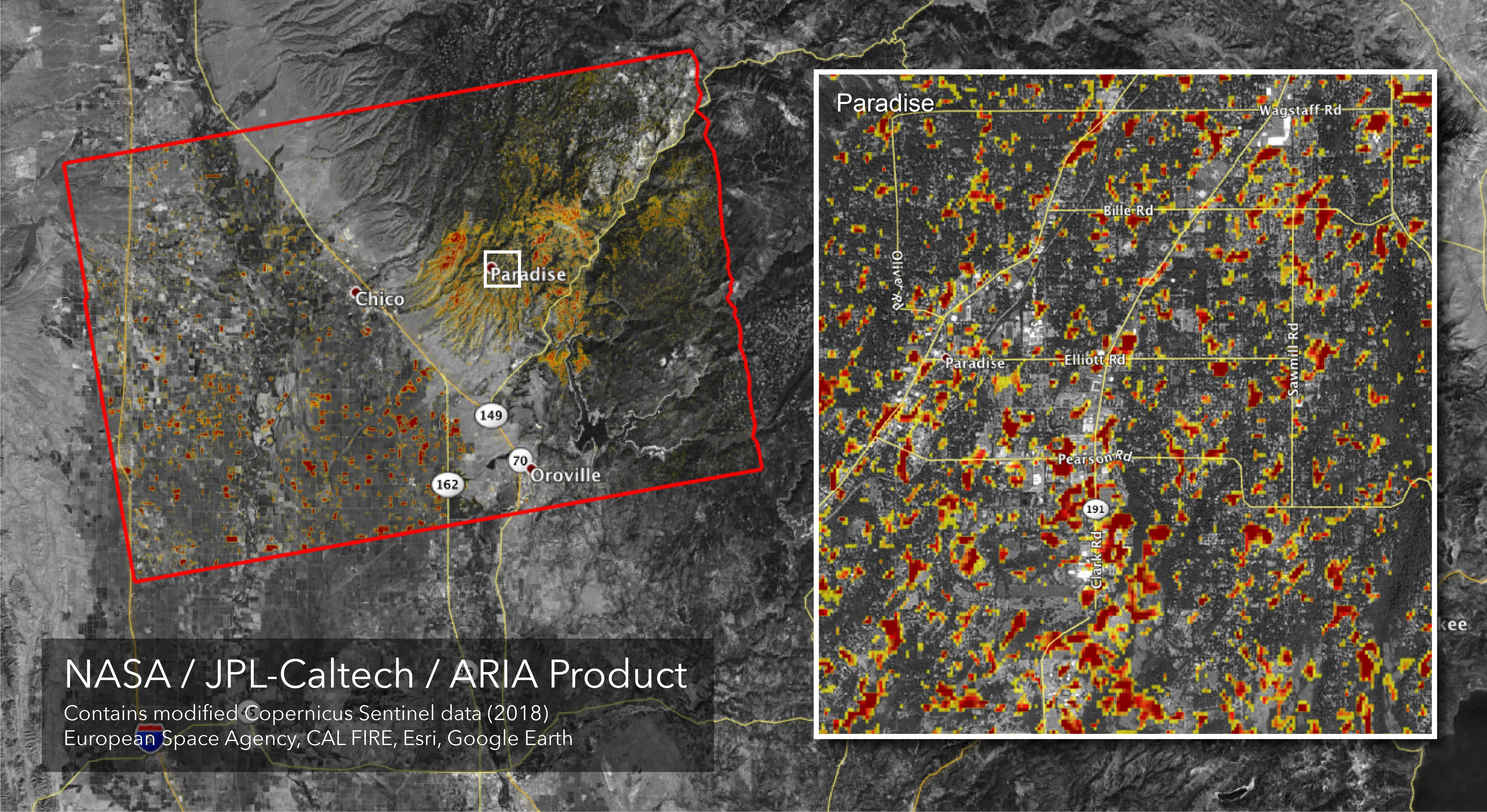
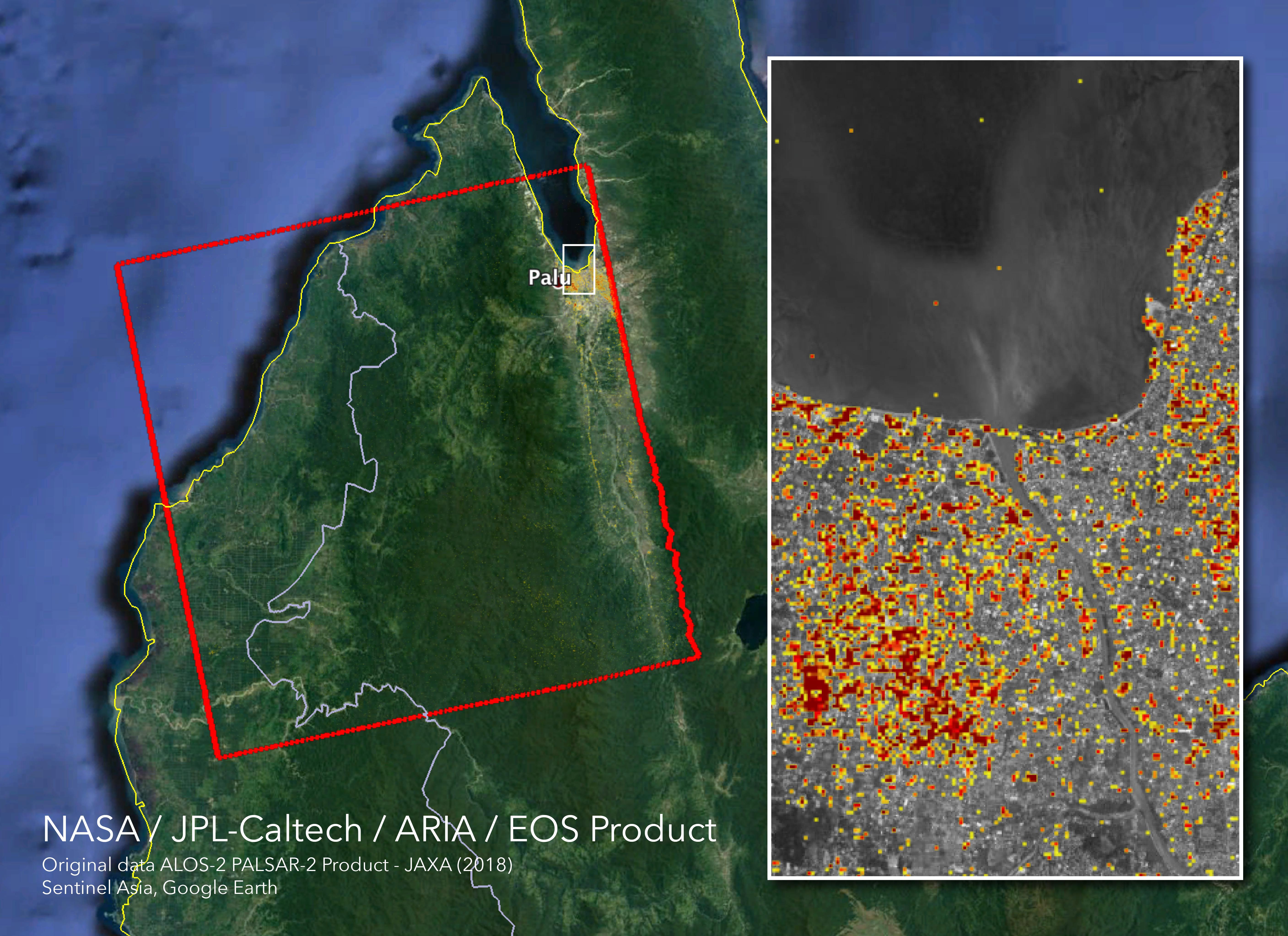
2020-01-15 |
Earth
|
ARIA
|
SAR
|
2437x1918x3 |
|
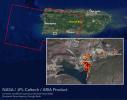
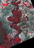
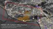
-
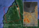
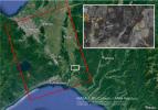
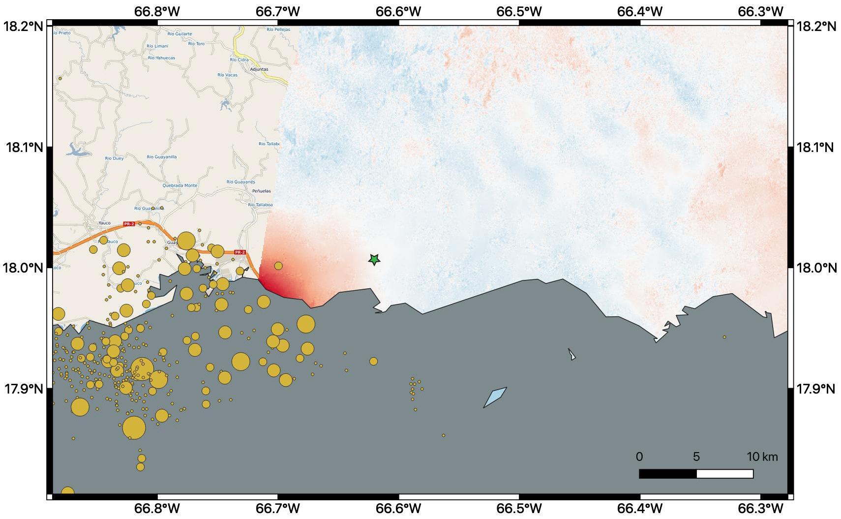
PIA23429:
-
ARIA Maps Damage of Western Puerto Rico After Quakes
Full Resolution:
TIFF
(8.865 MB)
JPEG
(483.7 kB)
|
|
|
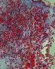
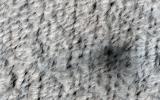
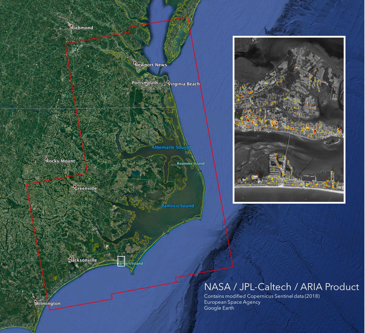
2020-01-10 |
Earth
|
ARIA
|
|
1710x1055x3 |
|
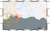
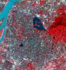
-
PIA23428:
-
Puerto Rico Quake Damage Visible From Space
Full Resolution:
TIFF
(2.476 MB)
JPEG
(189 kB)
|
|
|
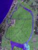
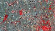
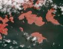
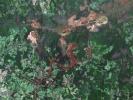
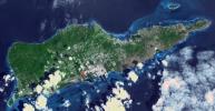
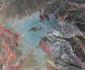
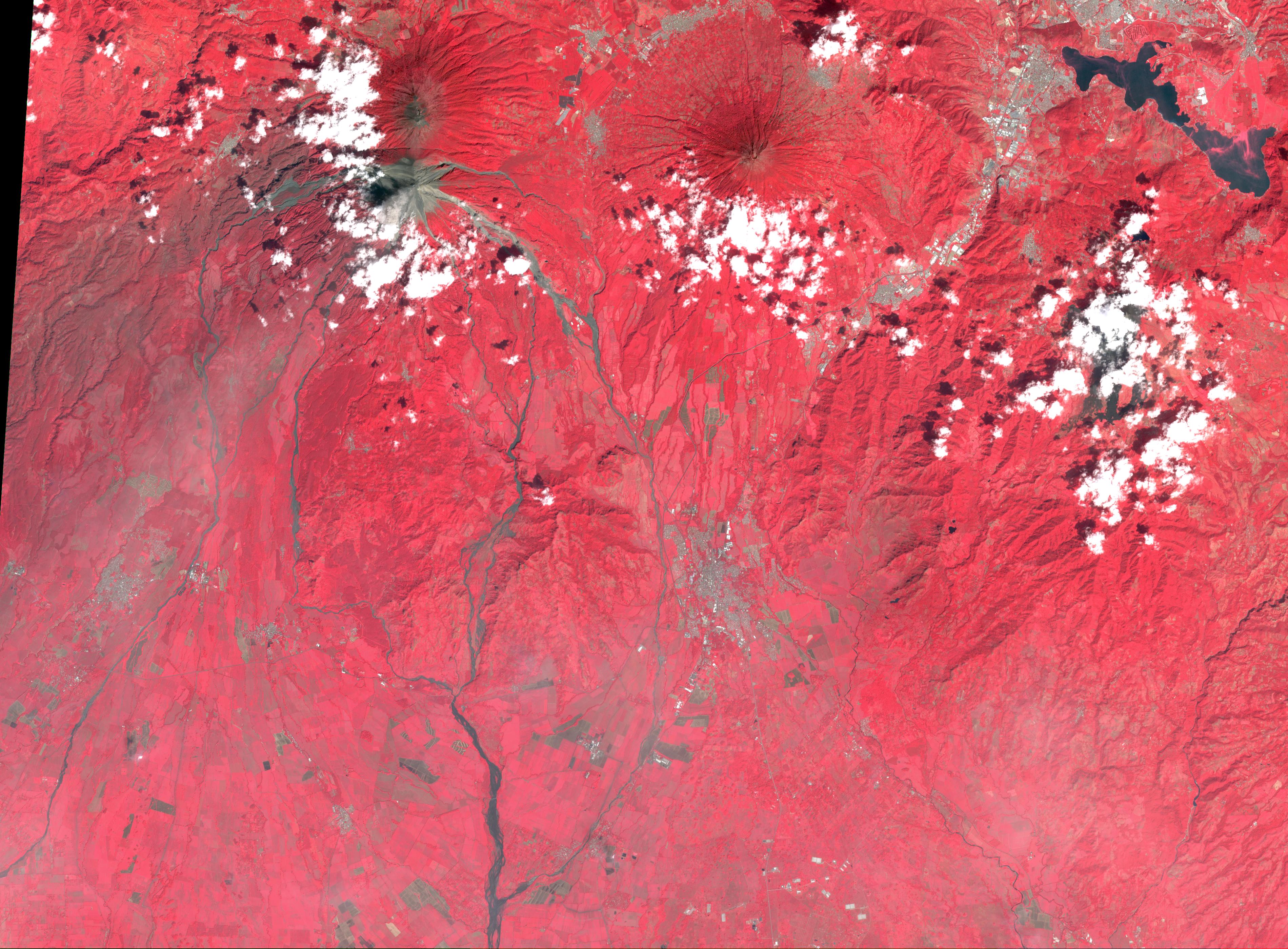
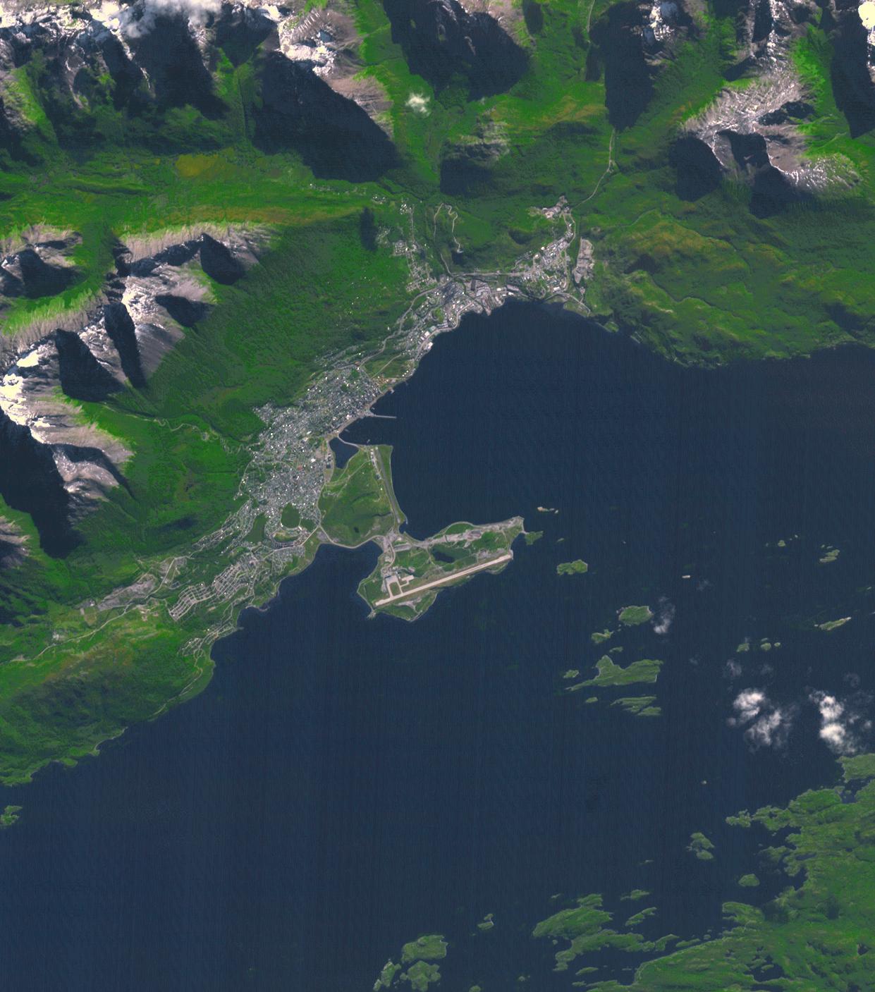
2020-01-08 |
Earth
|
Terra
|
ASTER
|
1587x990x3 |
|
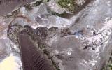
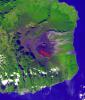
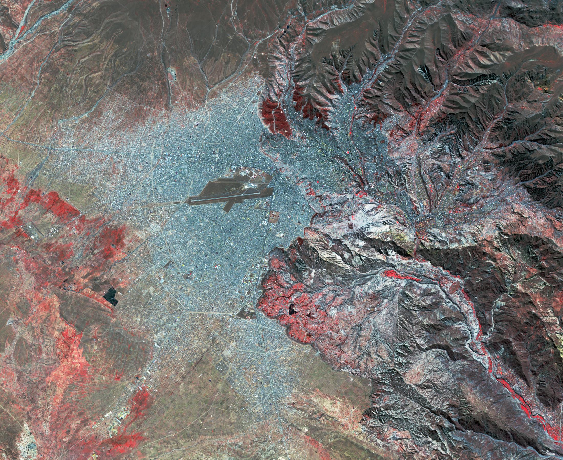
-
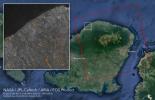
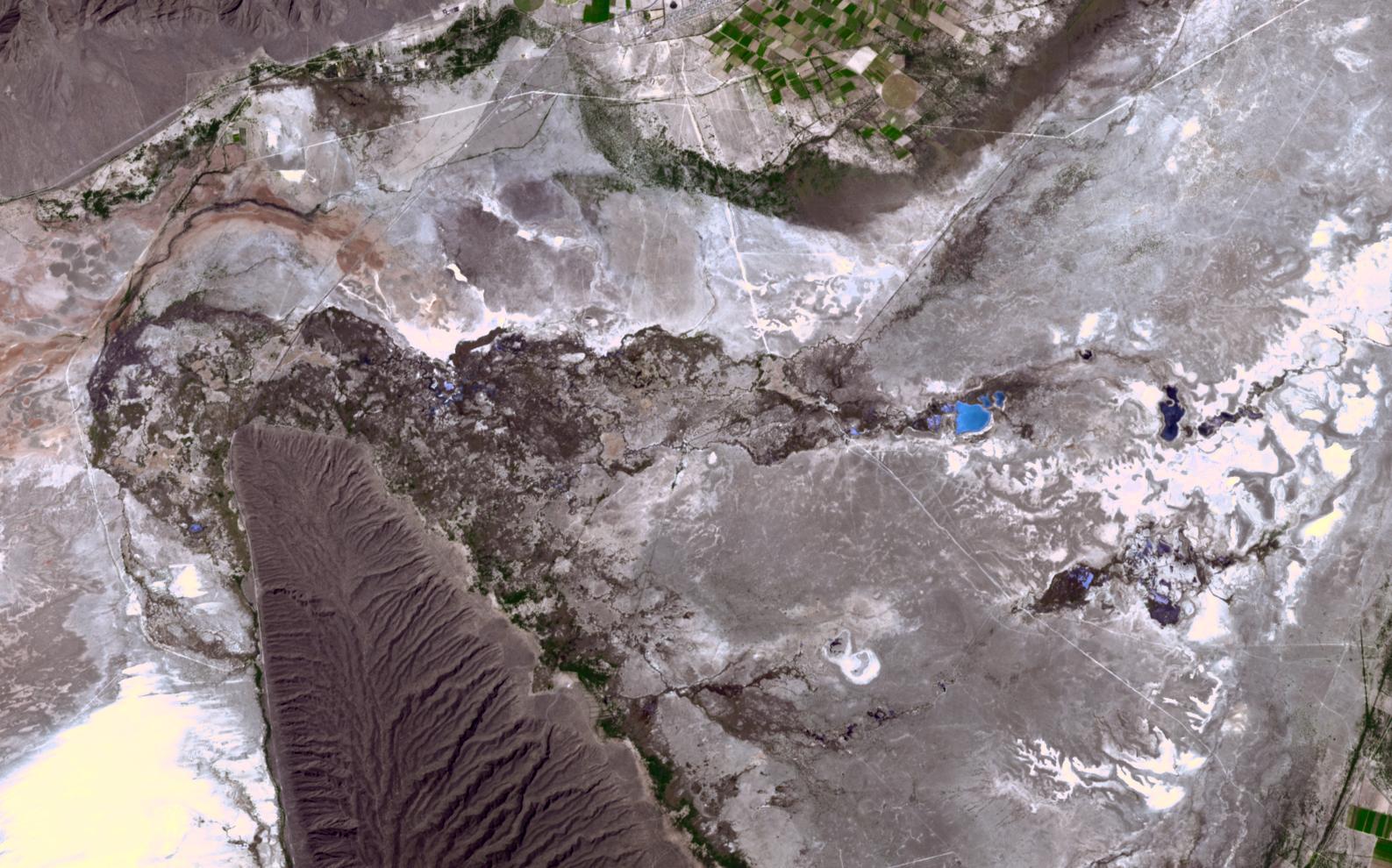
PIA23535:
-
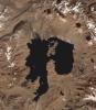
Cuatro Cienegas Basin, Mexico
Full Resolution:
TIFF
(4.715 MB)
JPEG
(283.2 kB)
|
|
|
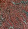
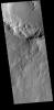
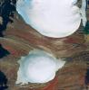
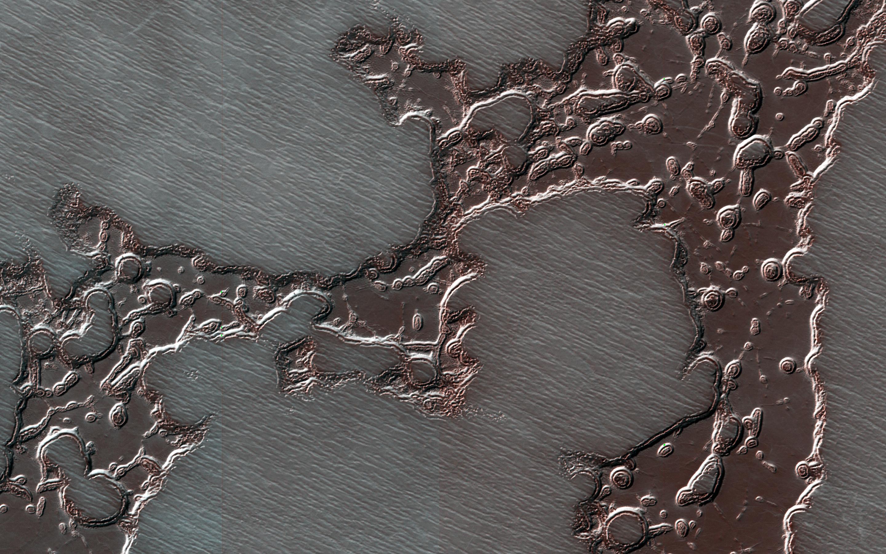
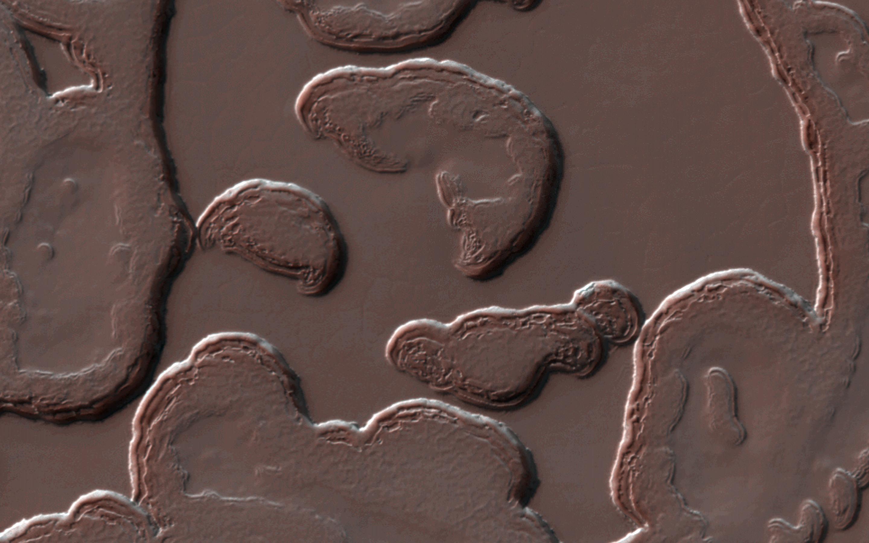
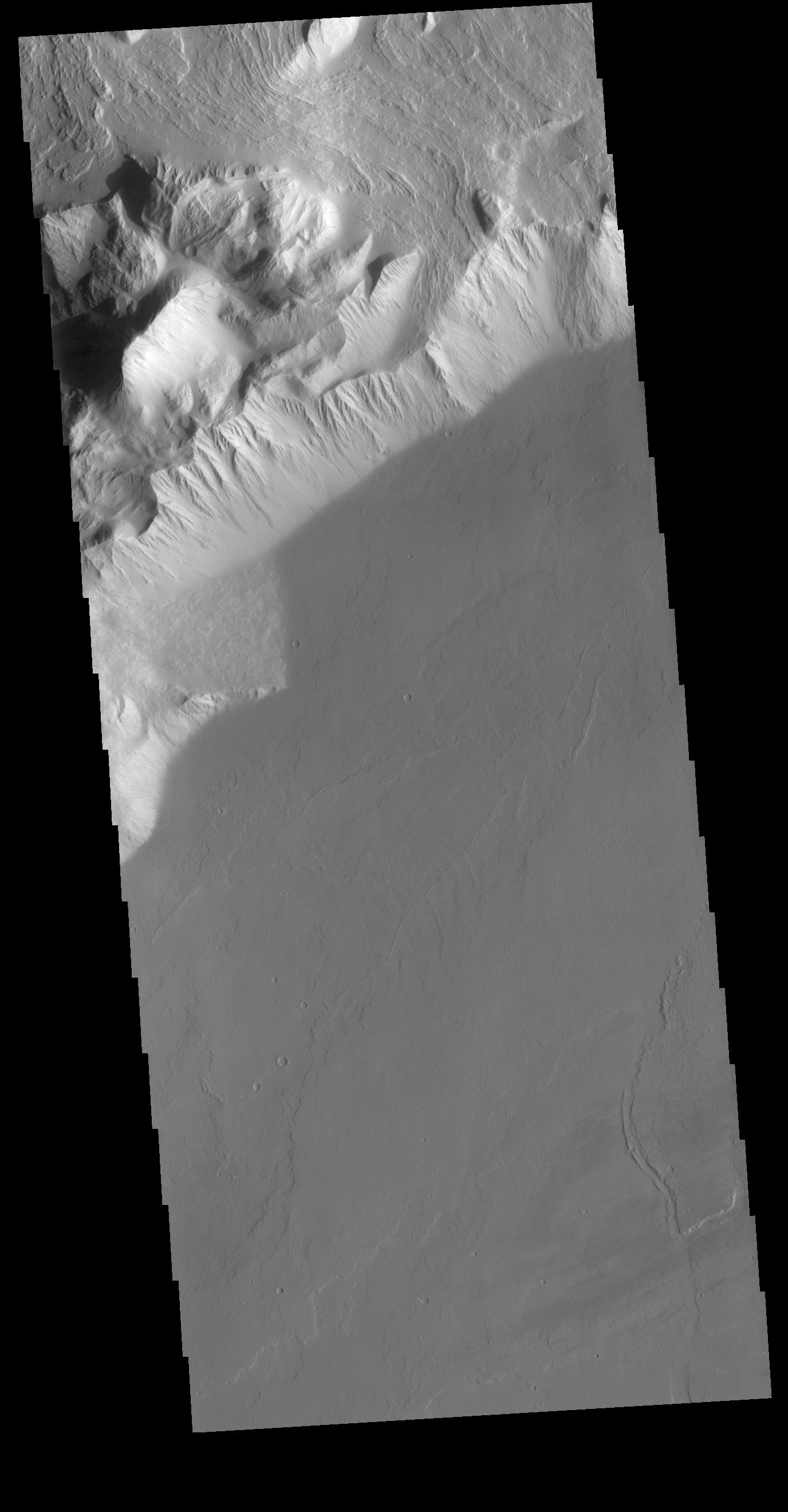
2019-12-27 |
Mars
|
2001 Mars Odyssey
|
THEMIS
|
491x1398x3 |

|
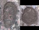
-
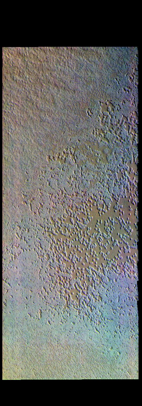
PIA23615:
-
Swiss Cheese - False Color
Full Resolution:
TIFF
(1.968 MB)
JPEG
(171.3 kB)
|
|
|
2019-12-26 |
Mars
|
2001 Mars Odyssey
|
THEMIS
|
498x1402x3 |
|
-
PIA23614:
-
South Polar Ice - False Color
Full Resolution:
TIFF
(1.987 MB)
JPEG
(106.1 kB)
|
|
|
2019-12-23 |
Mars
|
2001 Mars Odyssey
|
THEMIS
|
602x2721x3 |

|
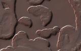
-
PIA23611:
-
Harris Crater - False Color
Full Resolution:
TIFF
(2.248 MB)
JPEG
(123.8 kB)
|
|
|
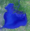
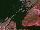
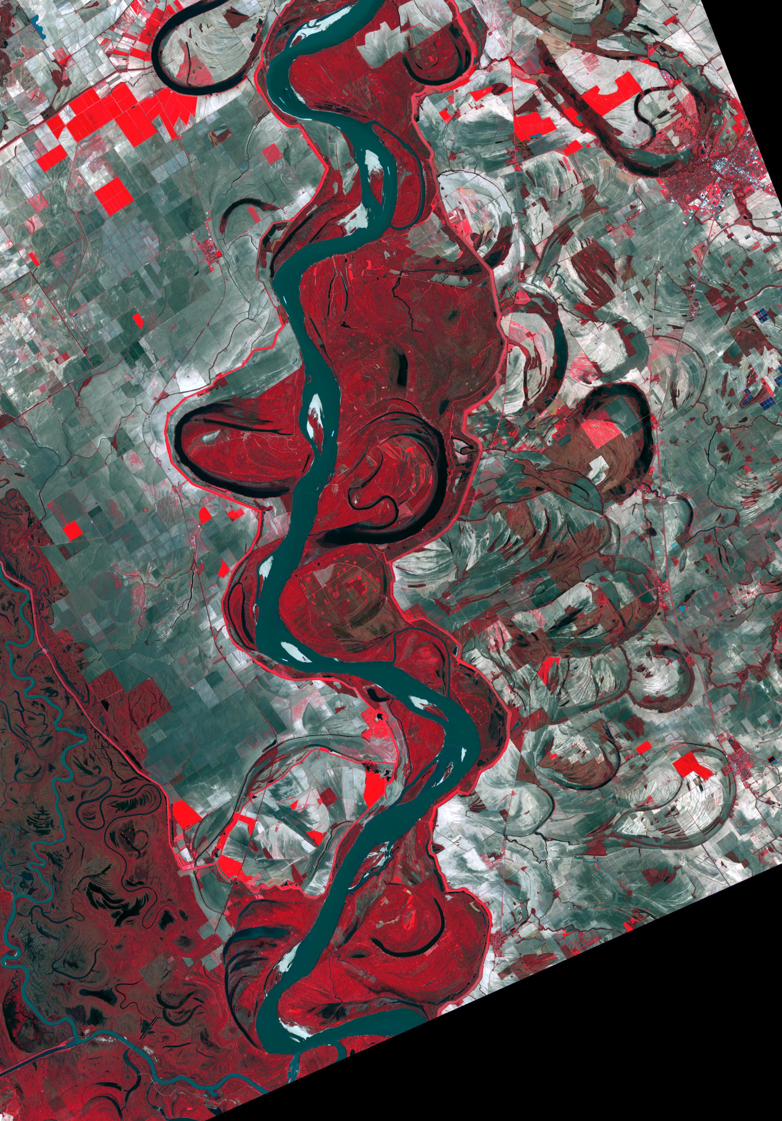
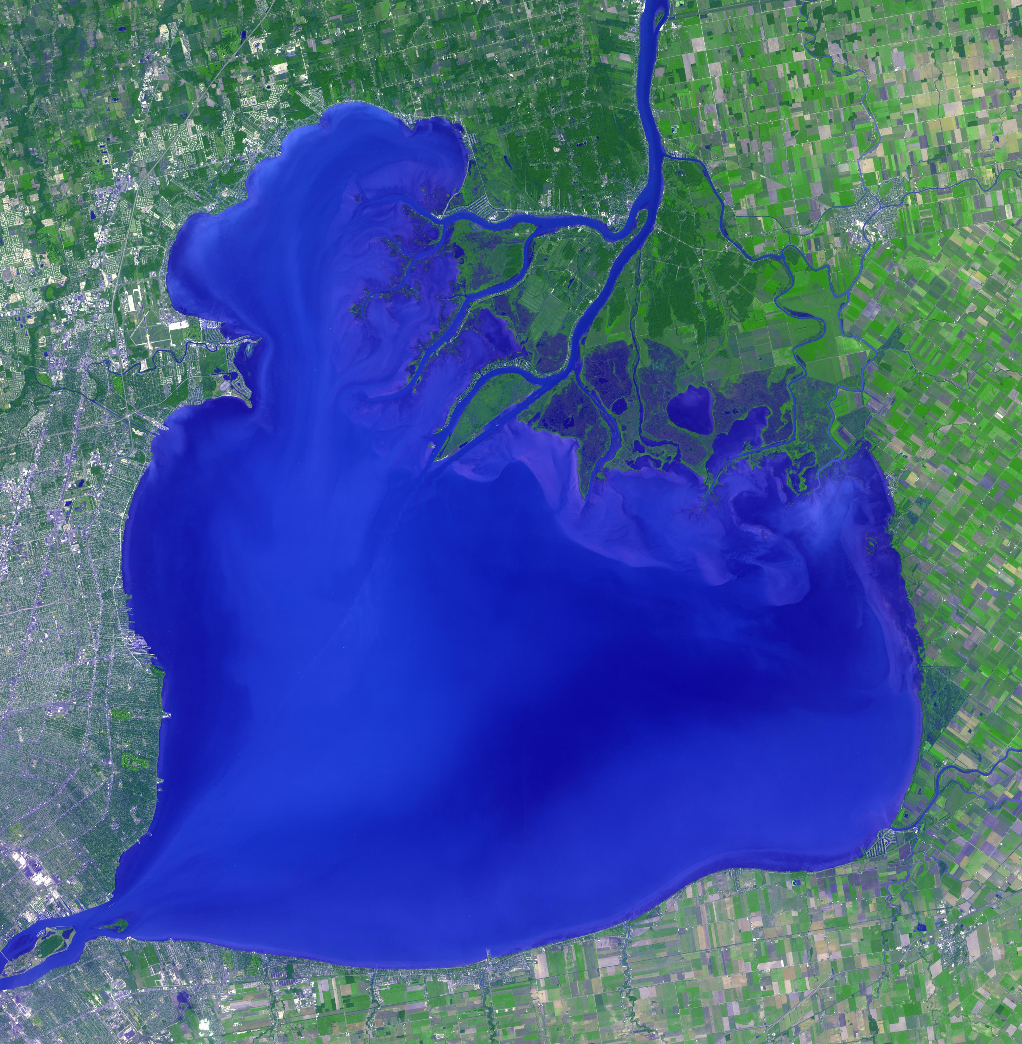
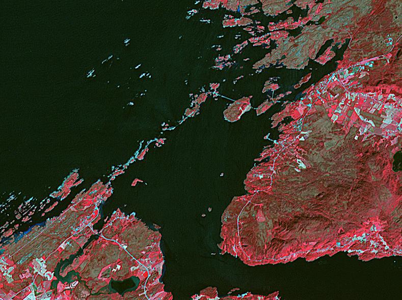
2019-12-16 |
Earth
|
Terra
|
ASTER
|
2616x3751x3 |
|
-
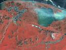
PIA23534:
-
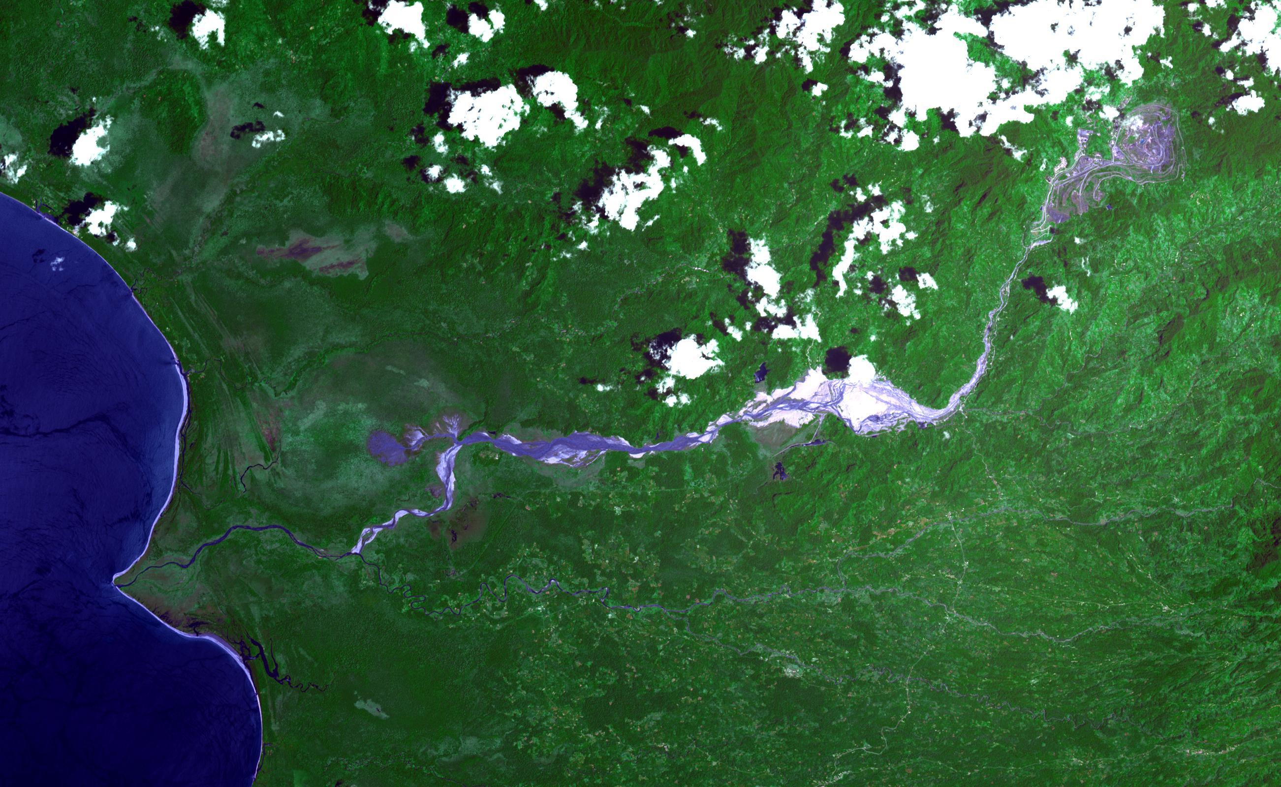
Mississippi River
Full Resolution:
TIFF
(29.45 MB)
JPEG
(1.536 MB)
|
|
|
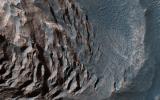
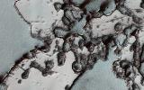
2019-11-27 |
Mars
|
Mars Reconnaissance Orbiter (MRO)
|
HiRISE
|
2880x1800x3 |
|
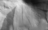
-
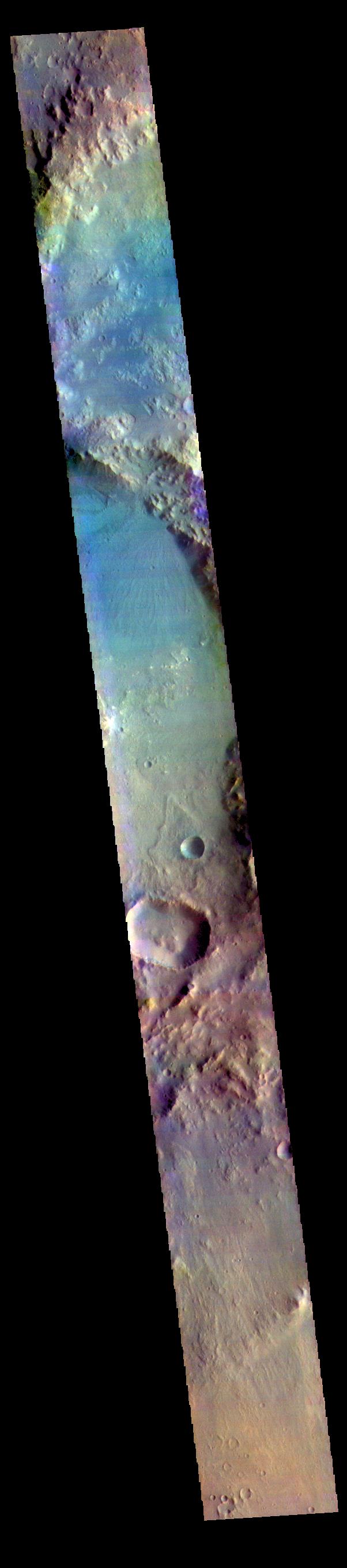
PIA23583:
-
Layered Sediments in Valles Marineris
Full Resolution:
TIFF
(15.56 MB)
JPEG
(1.212 MB)
|
|
|
2019-11-27 |
Mars
|
Mars Reconnaissance Orbiter (MRO)
|
HiRISE
|
2880x1800x3 |
|
-
PIA23581:
-
Polygonal Patterns Highlighted by Frost
Full Resolution:
TIFF
(15.56 MB)
JPEG
(1.276 MB)
|
|
|
2019-11-26 |
Earth
|
Terra
|
ASTER
|
4053x3461x3 |

|
-
PIA23533:
-
Anti-Atlas Mtns., Morocco
Full Resolution:
TIFF
(42.1 MB)
JPEG
(2.67 MB)
|
|
|
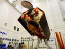
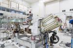
2019-11-20 |
|
Jason-CS
|
|
4608x3456x3 |
|
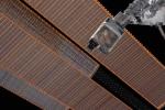
-
PIA23549:
-
Sentinel-6A in Its Clean Room
Full Resolution:
TIFF
(40.08 MB)
JPEG
(1.59 MB)
|
|
|
2019-11-14 |
Earth
|
Terra
|
ASTER
|
2445x2487x3 |
|
-
PIA23532:
-
Sichuan Basin, China
Full Resolution:
TIFF
(18.25 MB)
JPEG
(1.613 MB)
|
|
|
2019-11-07 |
Mars
|
2001 Mars Odyssey
|
THEMIS
|
1177x2592x1 |

|
-
PIA23539:
-
Olympia Undae
Full Resolution:
TIFF
(2.796 MB)
JPEG
(424.8 kB)
|
|
|
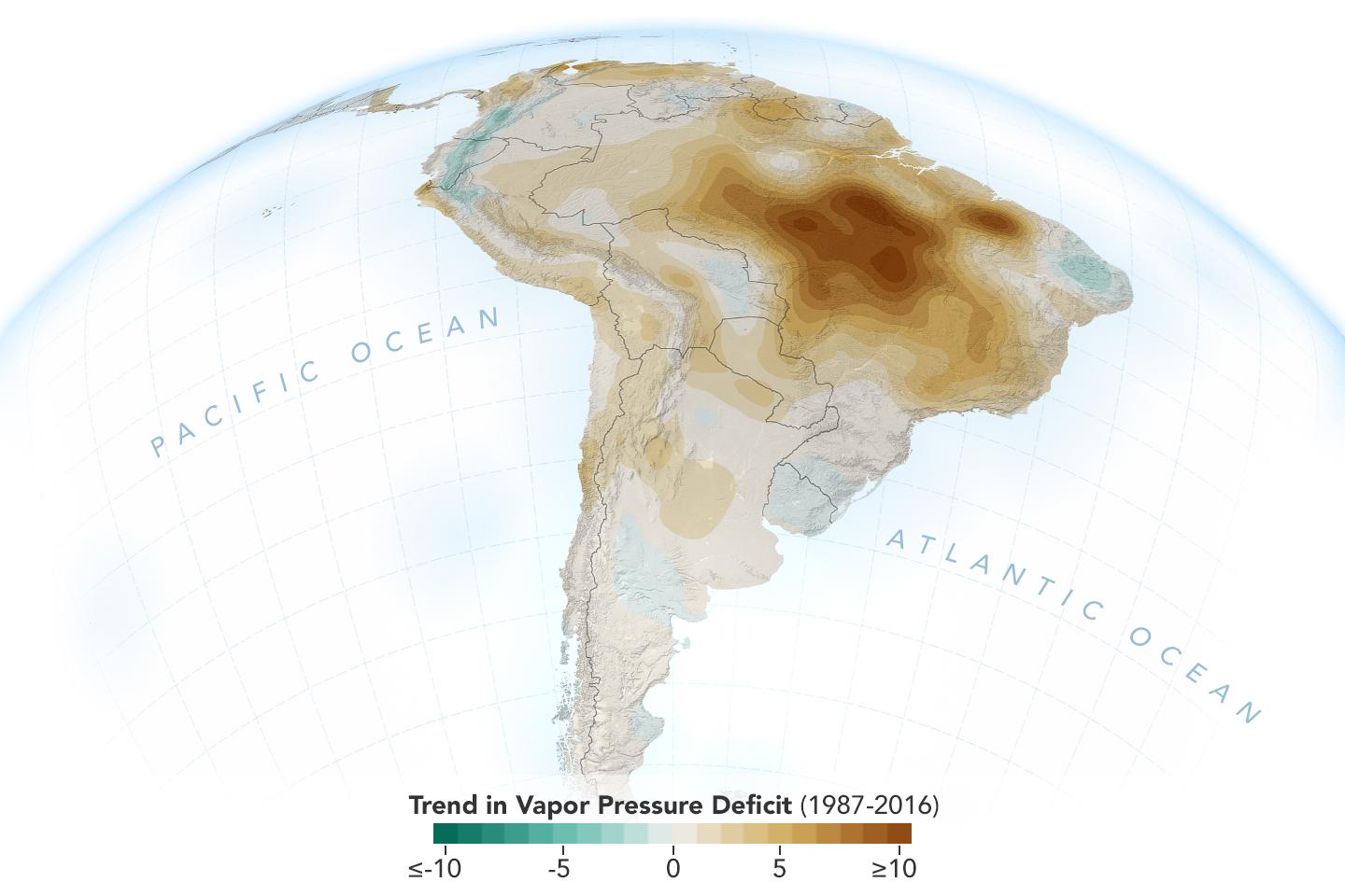
2019-11-05 |
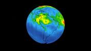
Earth
|
|
|
1440x960x3 |

|
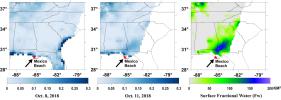
-
PIA23425:
-
New Study Shows Atmosphere in the Amazon Drying Out
Full Resolution:
TIFF
(1.789 MB)
JPEG
(96.3 kB)
|
|
|
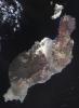
2019-10-31 |
Earth
|
Terra
|
ASTER
|
1165x1520x3 |
|
-
PIA23531:
-
Okata, Japan
Full Resolution:
TIFF
(5.314 MB)
JPEG
(352.6 kB)
|
|
|
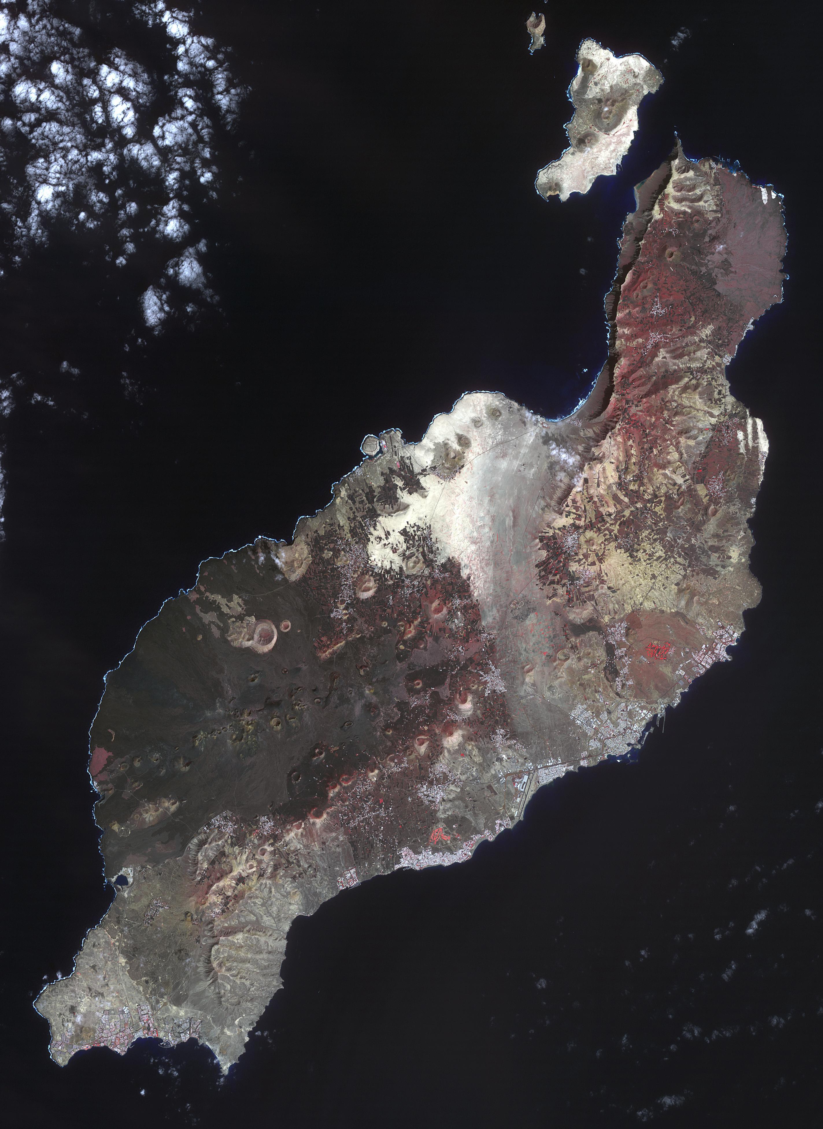
2019-10-21 |
Earth
|
Terra
|
ASTER
|
2847x3903x3 |
|
-
PIA23526:
-
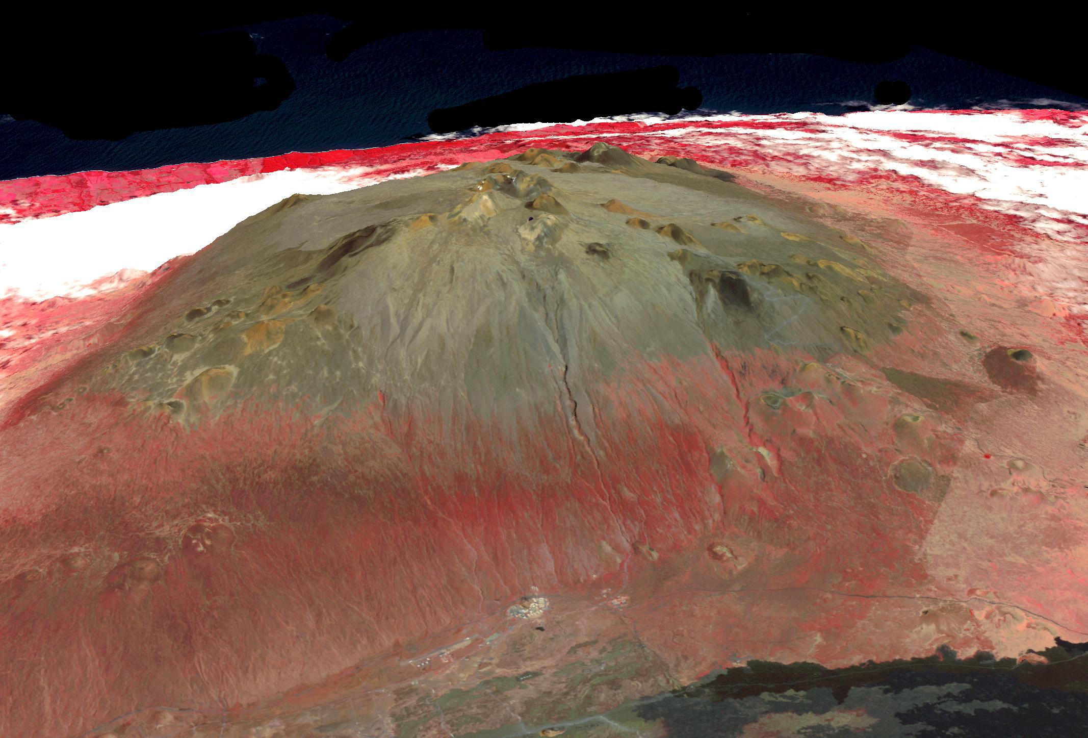
Lanzarote, Spanish Canary Islands
Full Resolution:
TIFF
(22.01 MB)
JPEG
(1.189 MB)
|
|
|
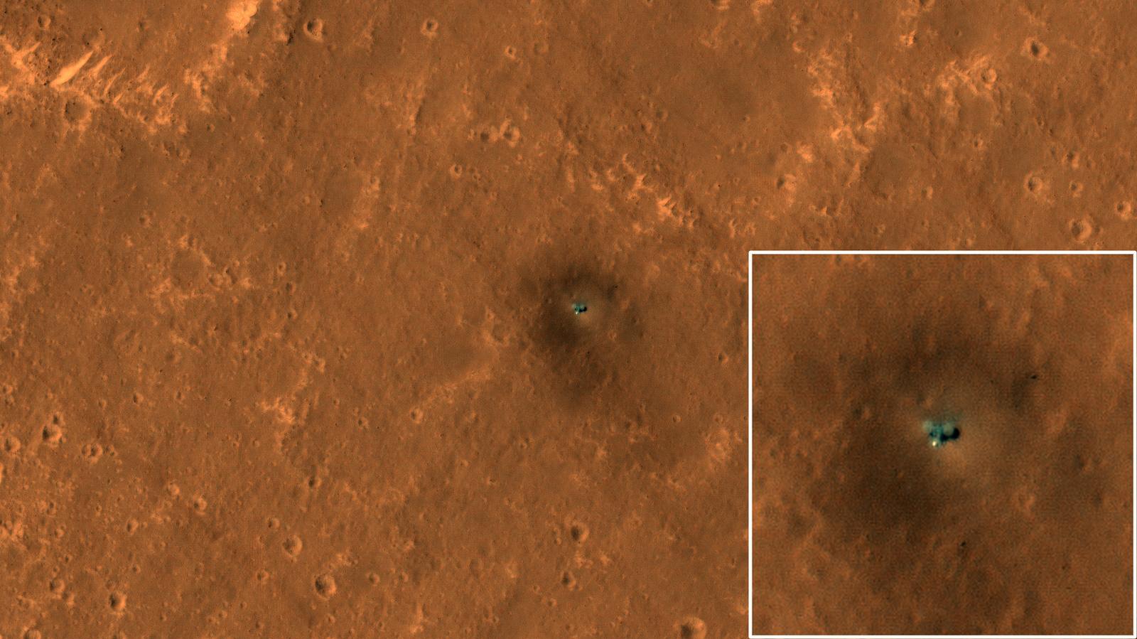
2019-10-16 |
Mars
|
Mars Reconnaissance Orbiter (MRO)
|
HiRISE
|
1600x899x3 |
|
-
PIA23376:
-
The Best View of InSight
Full Resolution:
TIFF
(3.819 MB)
JPEG
(177.6 kB)
|
|
|
2019-10-15 |
Earth
|
ARIA
|
SAR
|
3063x2249x3 |
|
-
PIA23424:
-
New ARIA Map Shows Damage from Typhoon Hagibis
Full Resolution:
TIFF
(13.95 MB)
JPEG
(960.9 kB)
|
|
|
2019-10-09 |
Earth
|
Terra
|
ASTER
|
2314x2930x3 |
|
-
PIA23490:
-
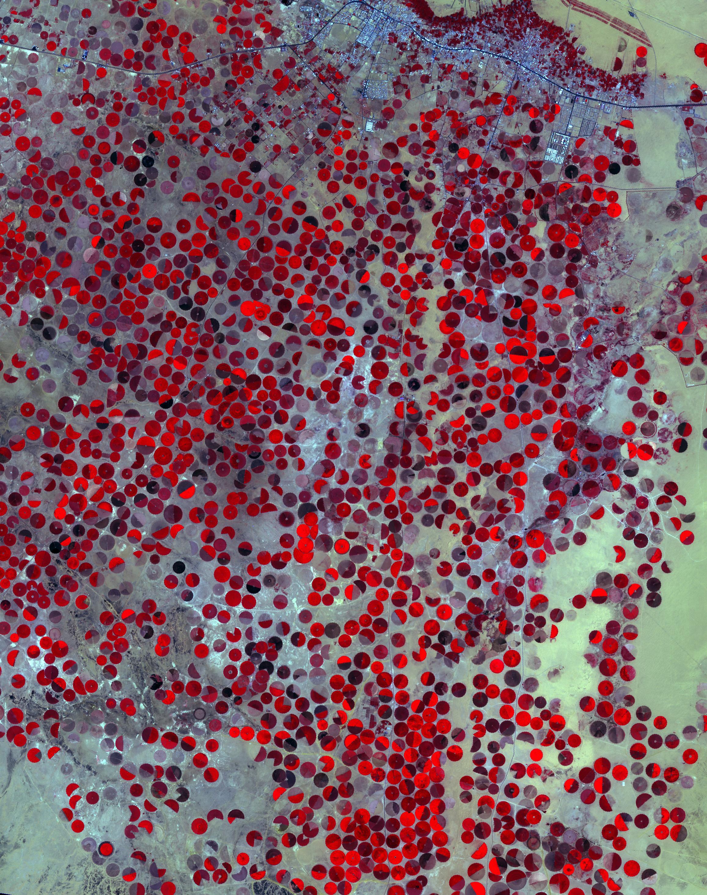
Wadi Al Dawasir, Saudi Arabia
Full Resolution:
TIFF
(20.35 MB)
JPEG
(1.282 MB)
|
|
|
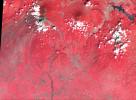
2019-09-19 |
Earth
|
Terra
|
ASTER
|
1280x720x3 |
|
-
PIA23460:
-
Mozu Tombs, Japan
Full Resolution:
TIFF
(2.766 MB)
JPEG
(315.1 kB)
|
|
|
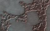
2019-09-19 |
Mars
|
Mars Reconnaissance Orbiter (MRO)
|
HiRISE
|
2880x1800x3 |
|
-
PIA23477:
-
Subliming Ice
Full Resolution:
TIFF
(12.56 MB)
JPEG
(565.1 kB)
|
|
|
2019-09-19 |
Mars
|
Mars Reconnaissance Orbiter (MRO)
|
HiRISE
|
2880x1800x3 |
|
-
PIA23476:
-
A New Crater on Mars
Full Resolution:
TIFF
(15.56 MB)
JPEG
(1.513 MB)
|
|
|
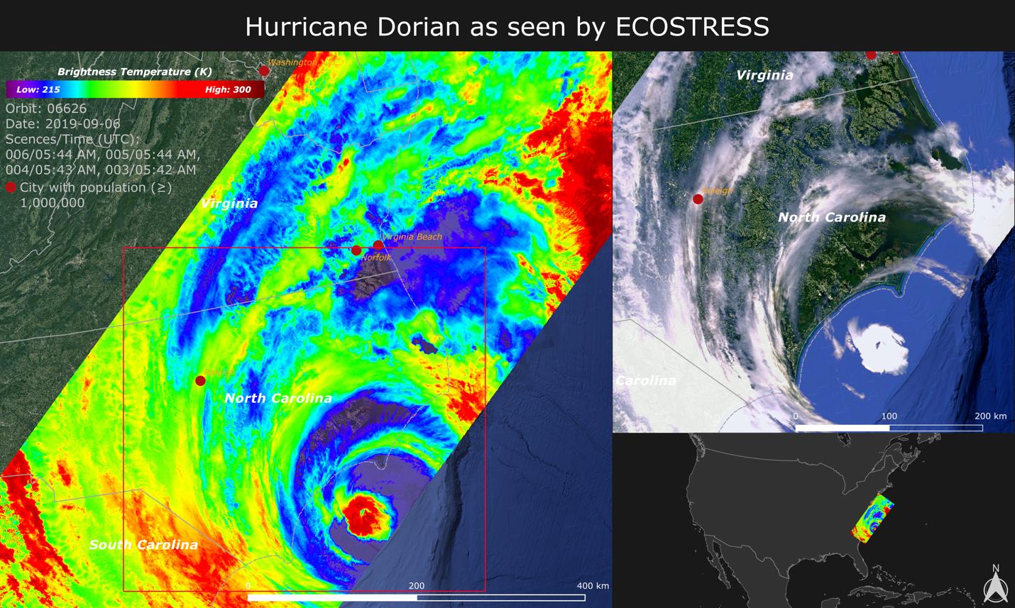
2019-09-18 |
Earth
|
ECOSTRESS
|
|
1430x857x3 |

|
-
PIA23422:
-
NASA Images Hurricane Dorian's Temperature from Space
Full Resolution:
TIFF
(3.196 MB)
JPEG
(252.8 kB)
|
|
|
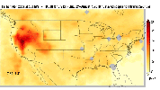
2019-09-12 |
Jupiter
|
Juno
|
JunoCam
|
4672x11064x3 |
|
-
PIA23436:
-
A Storm of Change
Full Resolution:
TIFF
(94.07 MB)
JPEG
(2.045 MB)
|
|
|
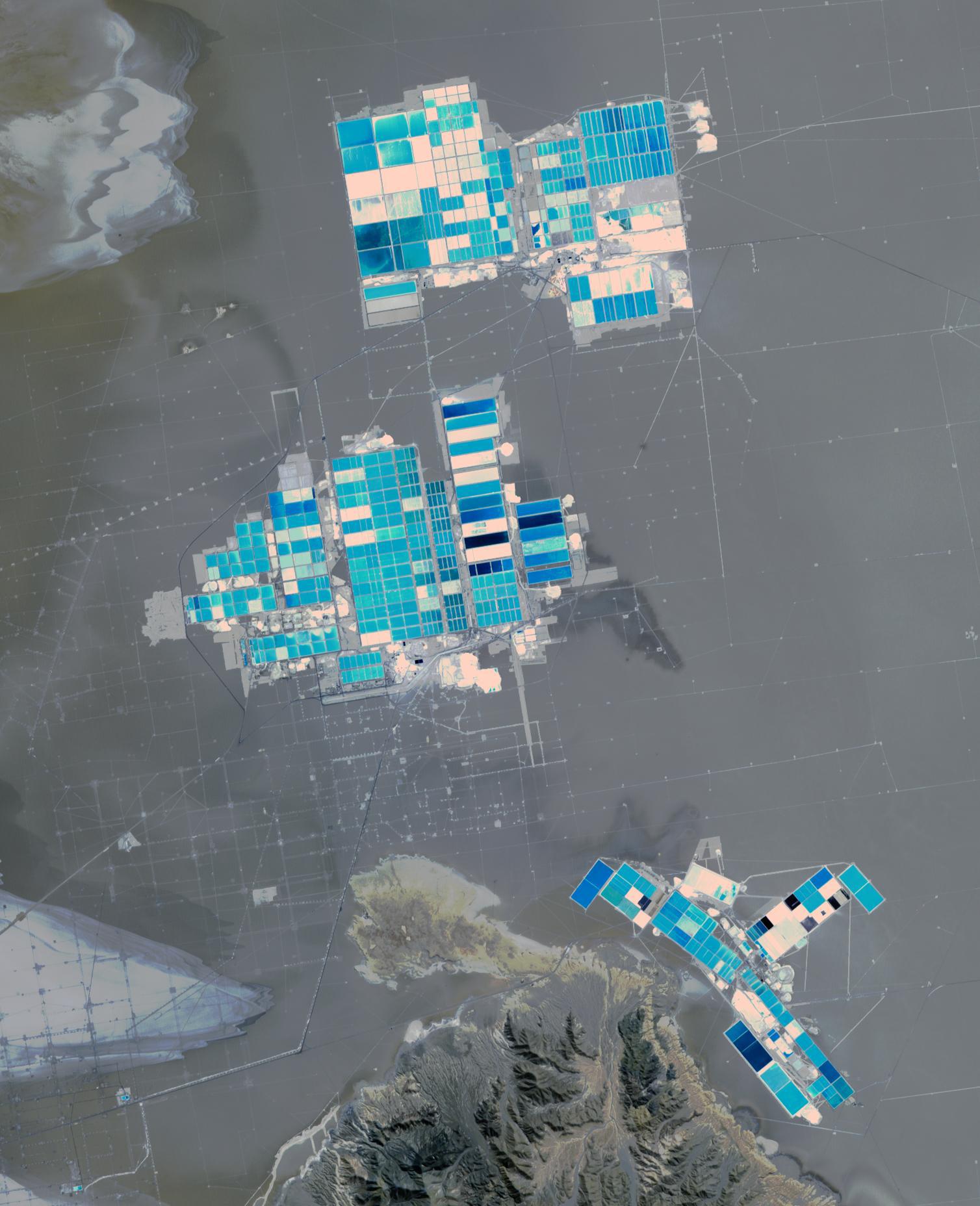
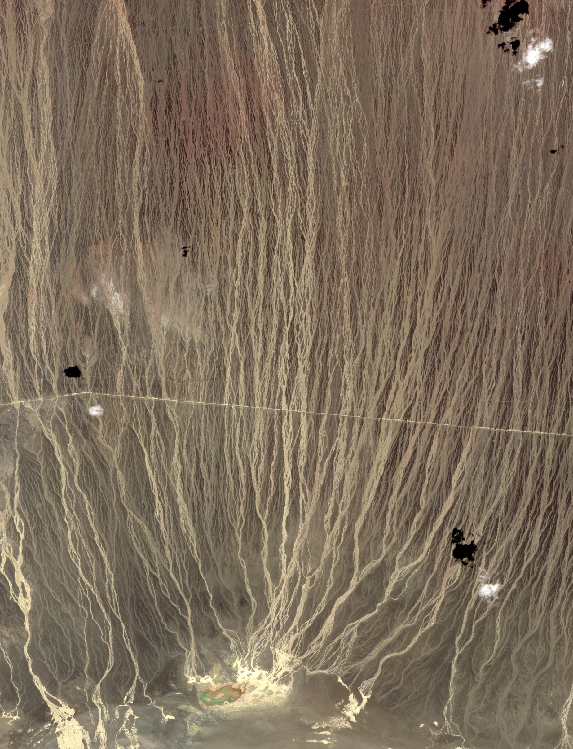
2019-09-05 |
Earth
|
Terra
|
ASTER
|
1508x1856x3 |
|
-
PIA23420:
-
Salar de Atacama, Chile
Full Resolution:
TIFF
(5.488 MB)
JPEG
(250 kB)
|
|
|
2019-08-23 |
Earth
|
Aqua
|
AIRS
|
1400x787x3 |
|
-
PIA23356:
-
NASA's AIRS Maps Carbon Monoxide from Brazil Fires
Full Resolution:
TIFF
(879.2 kB)
JPEG
(63.62 kB)
|
|
|
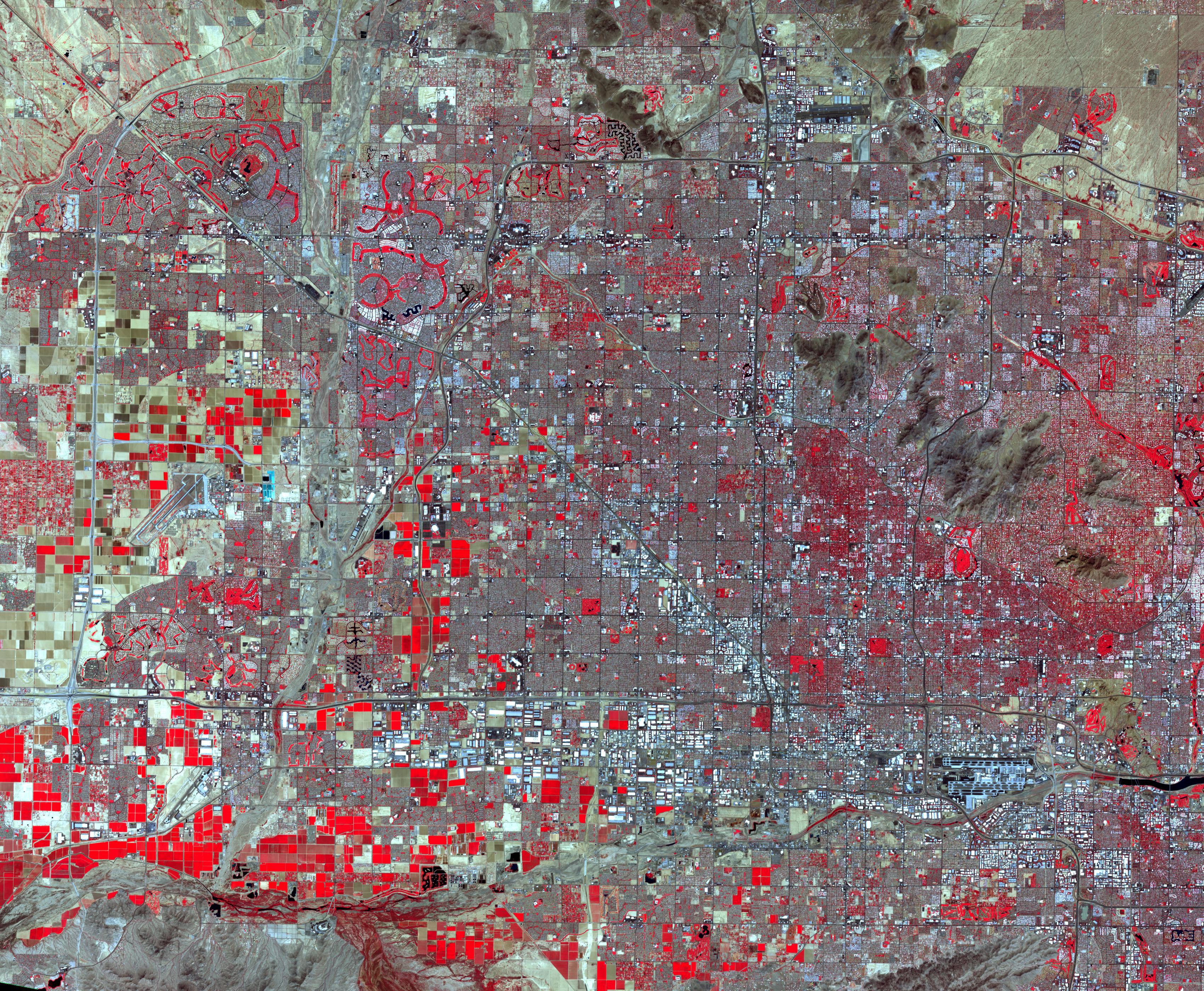
2019-08-20 |
Earth
|
Terra
|
ASTER
|
3400x2800x3 |
|
-
PIA23411:
-
Phoenix, AZ
Full Resolution:
TIFF
(28.57 MB)
JPEG
(2.744 MB)
|
|
|
2019-08-20 |
Earth
|
GRACE-FO
|
Microwave Ranging Instrument
|
2454x1516x3 |
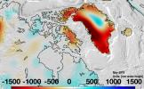
|
-
PIA23340:
-
Changes in Mass, Greenland
Full Resolution:
TIFF
(6.486 MB)
JPEG
(458.8 kB)
|
|
|
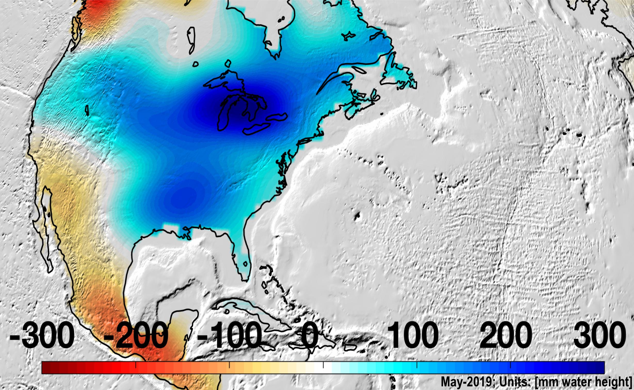
2019-08-20 |
Earth
|
GRACE-FO
|
Microwave Ranging Instrument
|
2457x1513x3 |

|
-
PIA22840:
-
Changes in Mass, North America
Full Resolution:
TIFF
(6.842 MB)
JPEG
(582.4 kB)
|
|
|
2019-08-07 |
Earth
|
Terra
|
ASTER
|
2134x1447x3 |
|
-
PIA23339:
-
Mauna Kea volcano, Hawaii
Full Resolution:
TIFF
(8.003 MB)
JPEG
(372.9 kB)
|
|
|
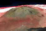
2019-07-24 |
|
Mars 2020 Rover
|
|
7360x4912x3 |
|
-
PIA23305:
-
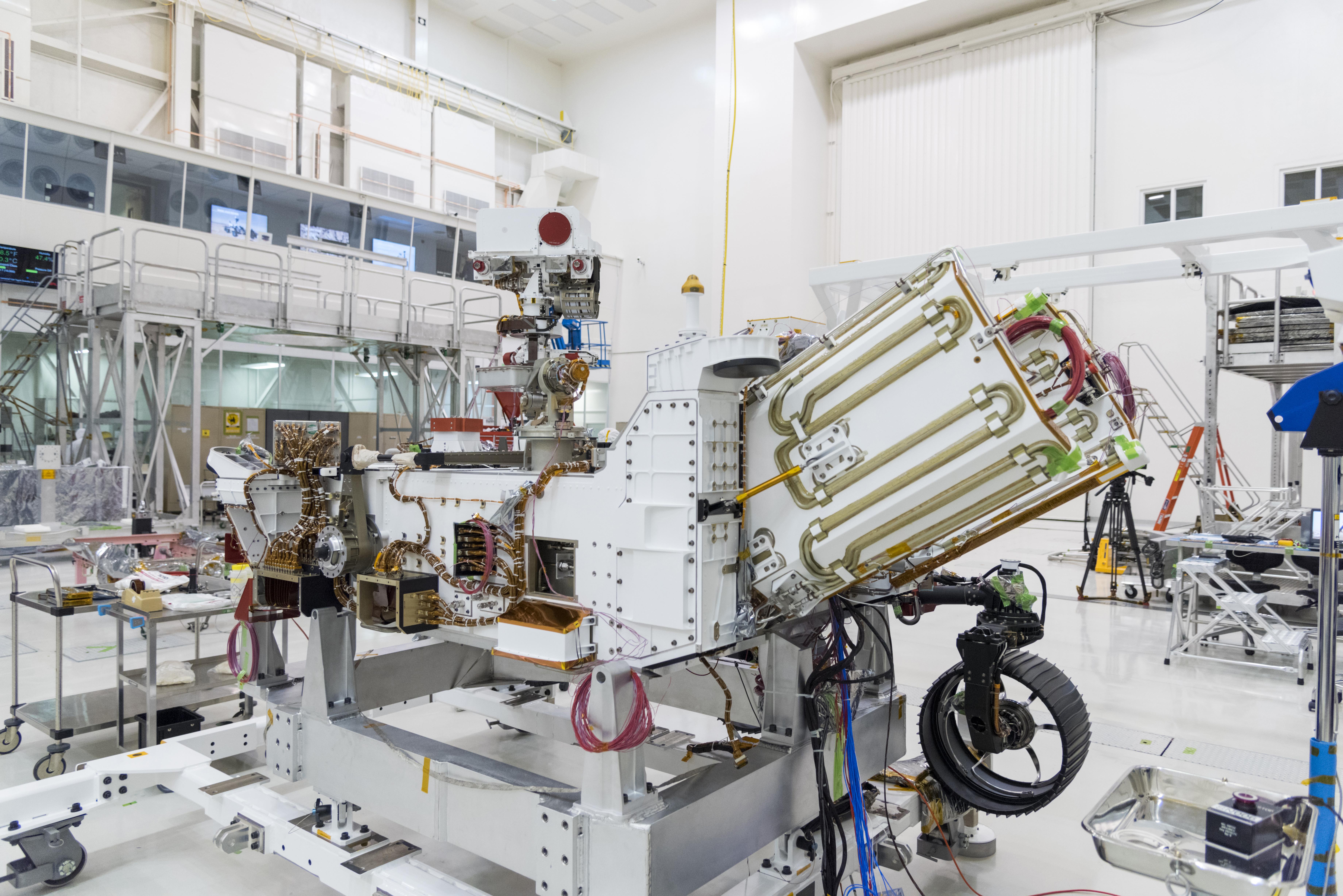
Power for Mars 2020
Full Resolution:
TIFF
(79.73 MB)
JPEG
(3.289 MB)
|
|
|
2019-07-17 |
Earth
|
Terra
|
ASTER
|
2603x1600x3 |

|
-
PIA23338:
-
Panguna Copper Deposit, Papua New Guinea
Full Resolution:
TIFF
(12.5 MB)
JPEG
(678 kB)
|
|
|
2019-07-12 |
Earth
|
ARIA
|
SAR
|
2754x1965x3 |

|
-
PIA23354:
-
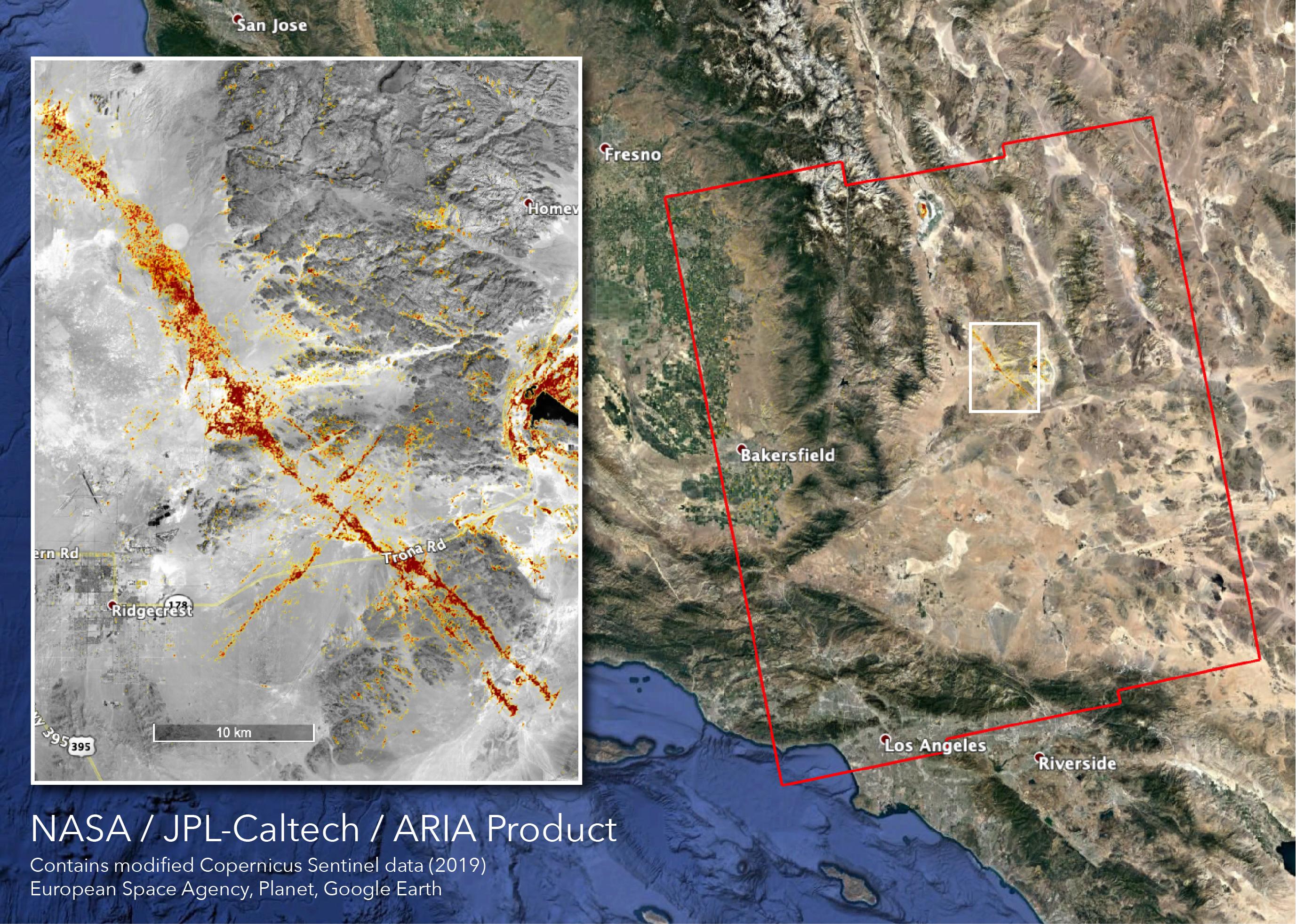
NASA's ARIA Team Maps California Quake Damage
Full Resolution:
TIFF
(15.93 MB)
JPEG
(1.011 MB)
|
|
|
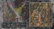
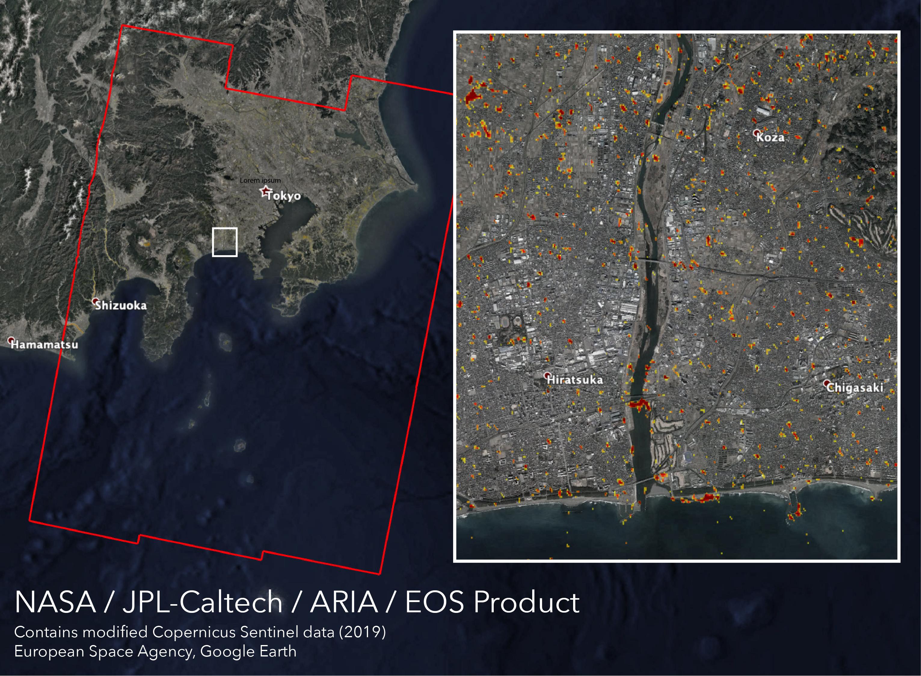
2019-07-09 |
|
|
|
1773x1028x3 |

|
-
PIA23149:
-
Satellite Data Can Be Used to Spot Failing Infrastructure
Full Resolution:
TIFF
(5.47 MB)
JPEG
(440.1 kB)
|
|
|
2019-07-01 |
Earth
|
Terra
|
ASTER
|
4200x1919x3 |
|
-
PIA23326:
-
Raikoke Island, Kuril Islands
Full Resolution:
TIFF
(19.62 MB)
JPEG
(623.5 kB)
|
|
|
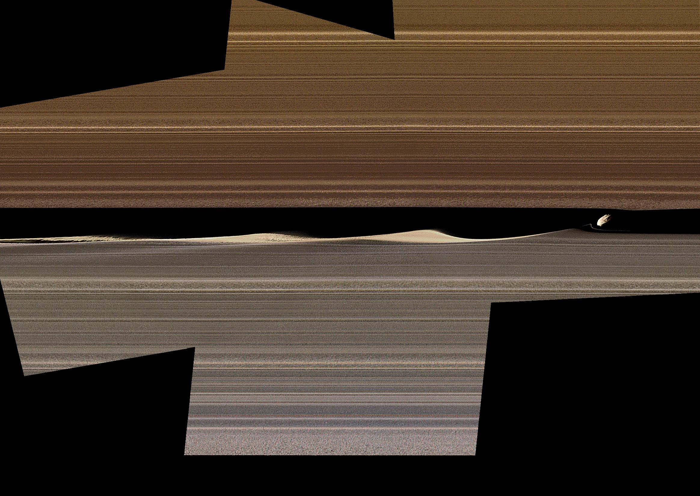
2019-06-13 |
Saturn
|
Cassini-Huygens
|
Imaging Science Subsystem
|
2328x1650x3 |
|
-
PIA23167:
-
Embedded Moons Sculpt Saturn's Rings
Full Resolution:
TIFF
(7.24 MB)
JPEG
(557.1 kB)
|
|
|
2019-05-23 |
Earth
|
Terra
|
ASTER
|
3426x3501x3 |
|
-
PIA23234:
-
Lake St. Clair, US and Canada
Full Resolution:
TIFF
(33.91 MB)
JPEG
(1.468 MB)
|
|
|
2019-04-29 |
Earth
|
Terra
|
ASTER
|
1849x2418x3 |
|
-
PIA23196:
-
Alluvial Fan, China and Mongolia
Full Resolution:
TIFF
(12.95 MB)
JPEG
(734.2 kB)
|
|
|
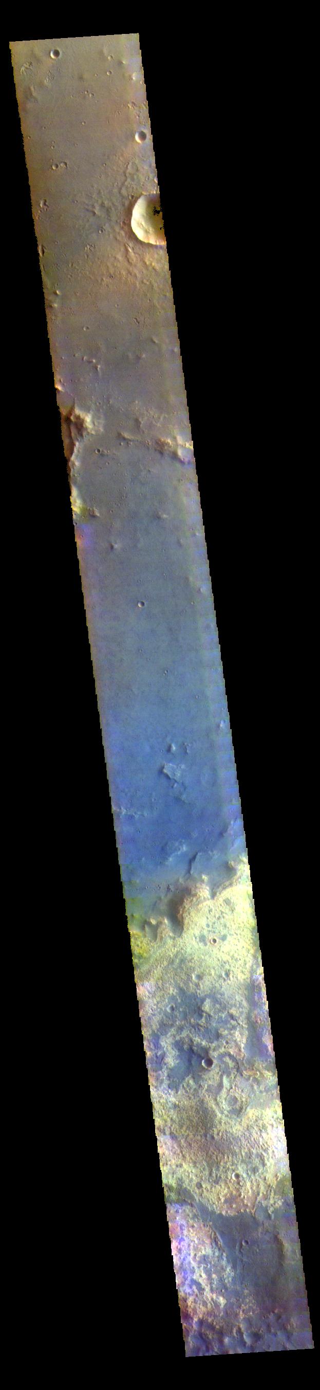
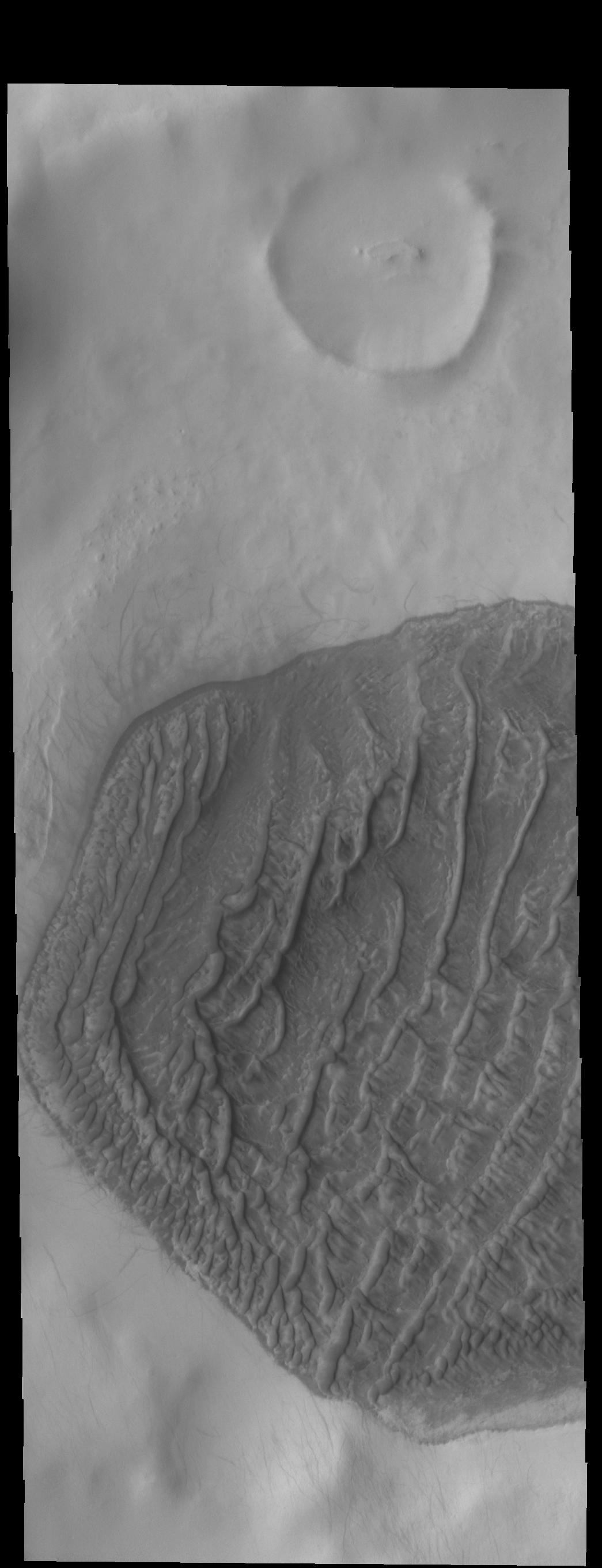
2019-04-24 |
Mars
|
2001 Mars Odyssey
|
THEMIS
|
1310x2687x1 |
|
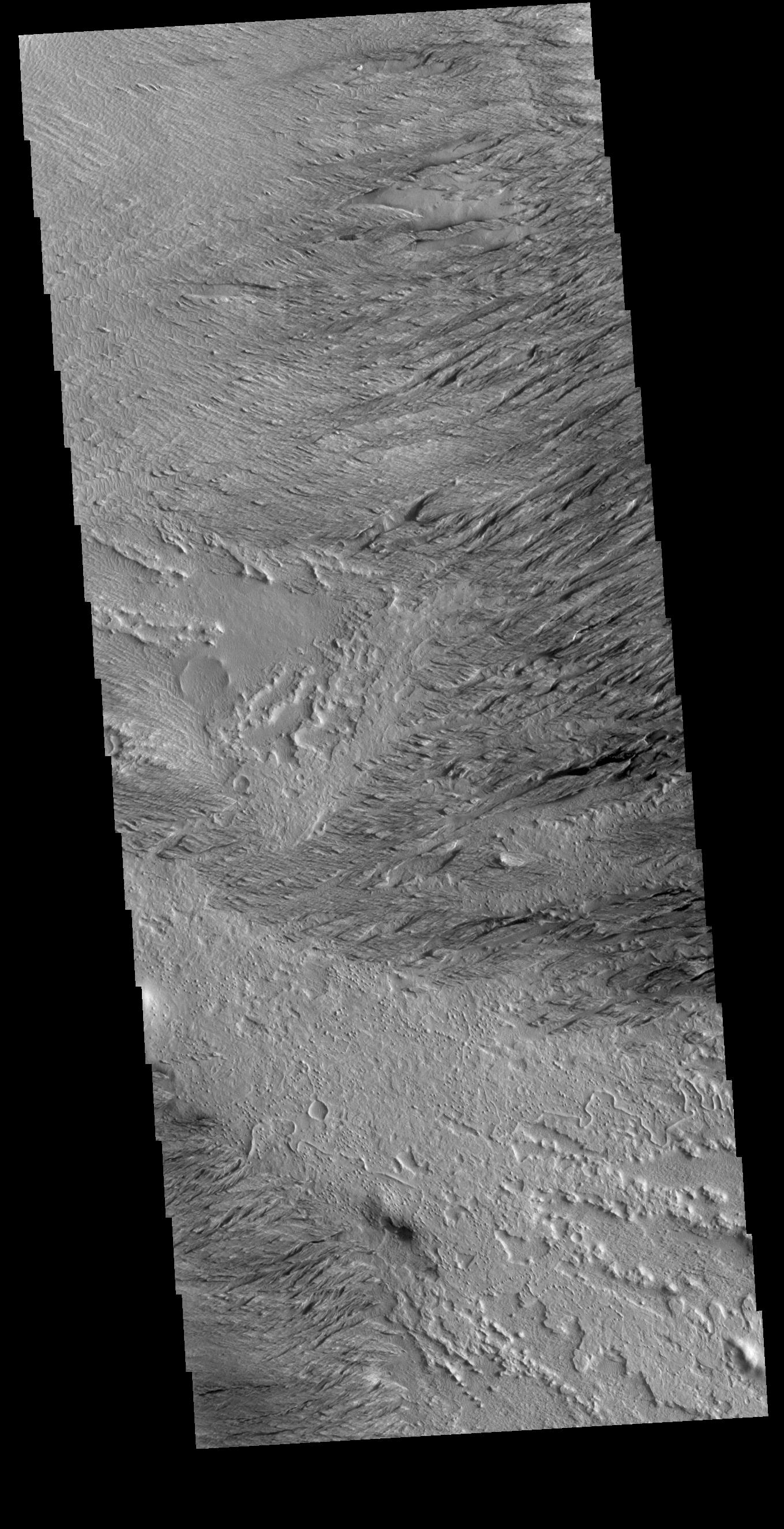
-
PIA23185:
-
Crater Gullies
Full Resolution:
TIFF
(2.575 MB)
JPEG
(351.5 kB)
|
|
|
2019-04-15 |
Earth
|
Terra
|
ASTER
|
2397x1885x3 |
|
-
PIA23118:
-
Cape Horn, Chile
Full Resolution:
TIFF
(12.19 MB)
JPEG
(534.4 kB)
|
|
|
2019-04-12 |
Earth
|
Terra
|
ASTER
|
2600x1151x3 |

|
-
PIA23143:
-
NASA's ASTER Images Sabancaya Volcano
Full Resolution:
TIFF
(8.687 MB)
JPEG
(443.8 kB)
|
|
|
2019-04-03 |
Mars
|
Mars Reconnaissance Orbiter (MRO)
|
HiRISE
|
2880x1800x3 |
|
-
PIA23103:
-
Dramatic Changes over the South Polar Cap
Full Resolution:
TIFF
(15.56 MB)
JPEG
(1.161 MB)
|
|
|
2019-03-28 |
Earth
|
Terra
|
ASTER
|
3202x3673x3 |
|
-
PIA23102:
-
Lake Karakul, Tajikistan
Full Resolution:
TIFF
(26.71 MB)
JPEG
(1.209 MB)
|
|
|
2019-03-20 |
Mars
|
2001 Mars Odyssey
|
THEMIS
|
976x2625x1 |
|
-
PIA23083:
-
Polar Layers
Full Resolution:
TIFF
(2.494 MB)
JPEG
(309.2 kB)
|
|
|
2019-03-14 |
Earth
|
Terra
|
ASTER
|
789x590x3 |
|
-
PIA23096:
-
Atlantic Ocean Road, Norway
Full Resolution:
TIFF
(1.36 MB)
JPEG
(110.5 kB)
|
|
|
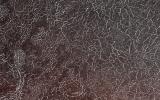
2019-03-04 |
Mars
|
Mars Reconnaissance Orbiter (MRO)
|
HiRISE
|
2880x1800x3 |
|
-
PIA23077:
-
The Slow Charm of Brain Terrain
Full Resolution:
TIFF
(15.56 MB)
JPEG
(1.528 MB)
|
|
|
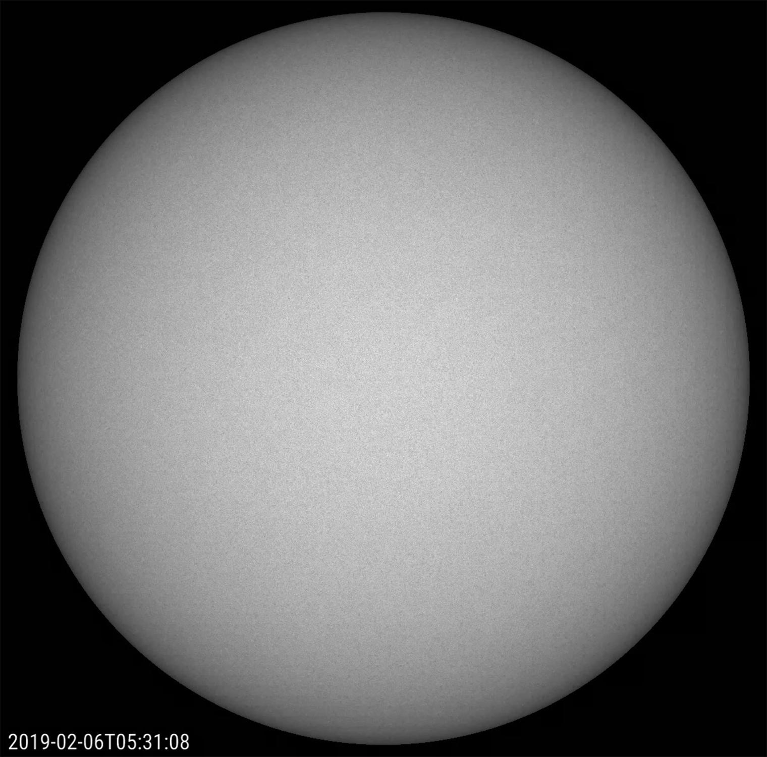
2019-03-04 |
Sol (our sun)
|
SDO
|
Atmosphere Imaging Assembly
|
1520x1500x3 |
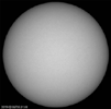
|
-
PIA21218:
-
Spotless February

Full Resolution:
TIFF
(1.689 MB)
JPEG
(190.5 kB)
|
|
|
2019-02-26 |
Mars
|
2001 Mars Odyssey
|
THEMIS
|
623x2703x3 |
|
-
PIA23053:
-
Chryse Planitia - False Color
Full Resolution:
TIFF
(2.335 MB)
JPEG
(125 kB)
|
|
|
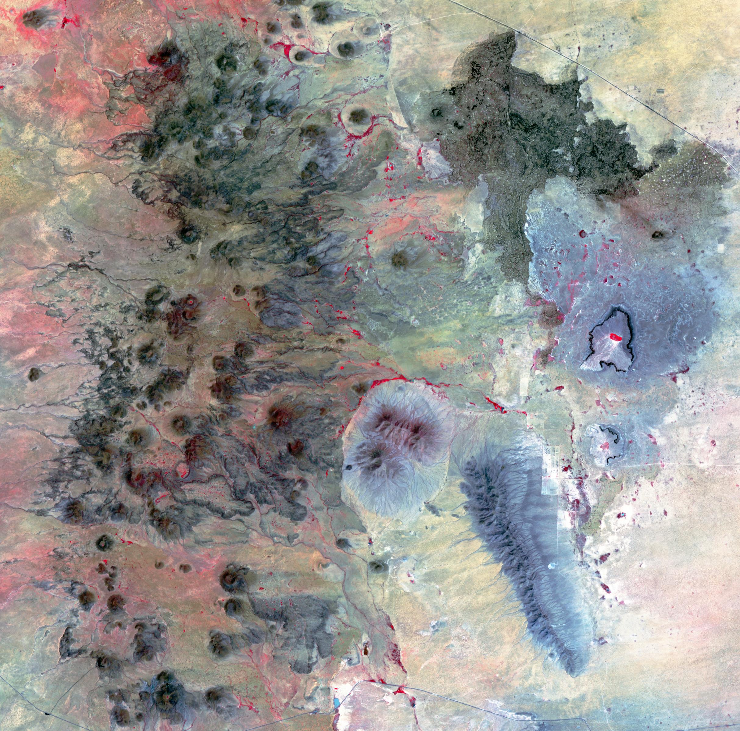
2019-02-21 |
Earth
|
Terra
|
ASTER
|
2427x2400x3 |
|
-
PIA23065:
-
Potrillo Volcanic Field, New Mexico
Full Resolution:
TIFF
(17.48 MB)
JPEG
(997.1 kB)
|
|
|
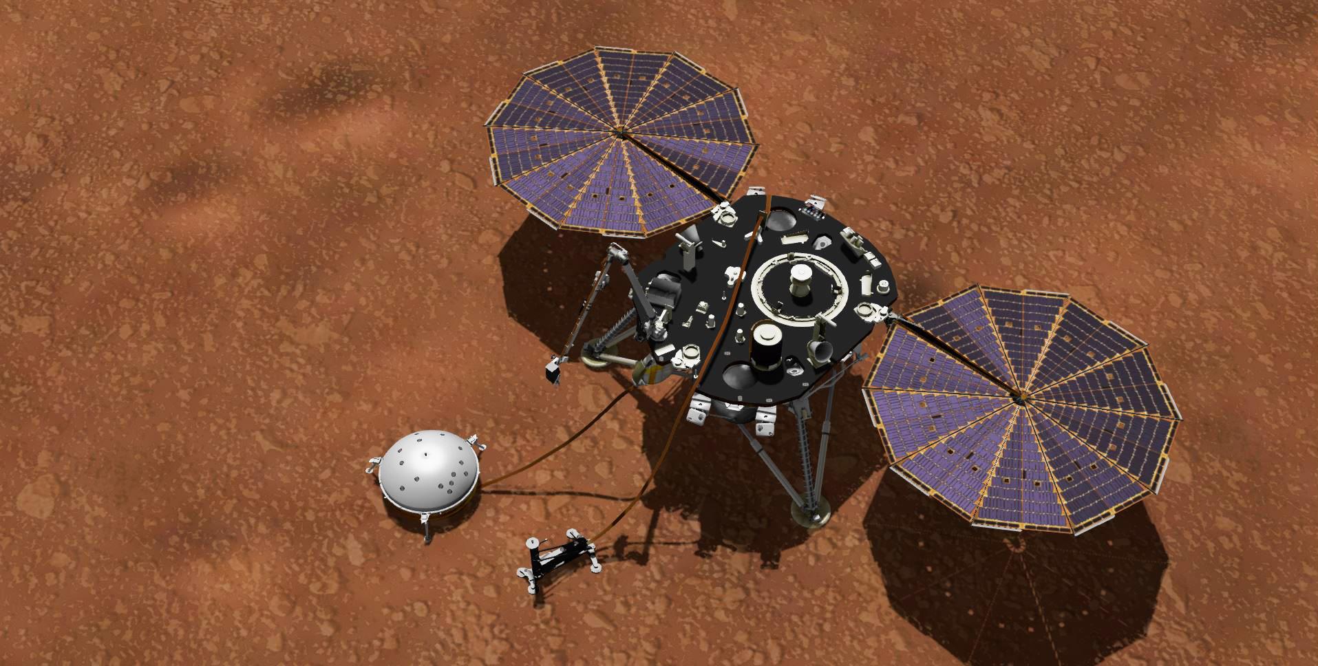
2019-02-19 |
|
InSight
|
|
1915x968x3 |
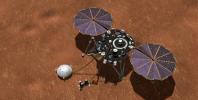
|
-
PIA22957:
-
InSight Collecting Mars Weather Data (Artist's Concept)
Full Resolution:
TIFF
(4.839 MB)
JPEG
(256.7 kB)
|
|
|
2019-02-14 |
Mars
|
2001 Mars Odyssey
|
THEMIS
|
1045x2722x1 |

|
-
PIA23035:
-
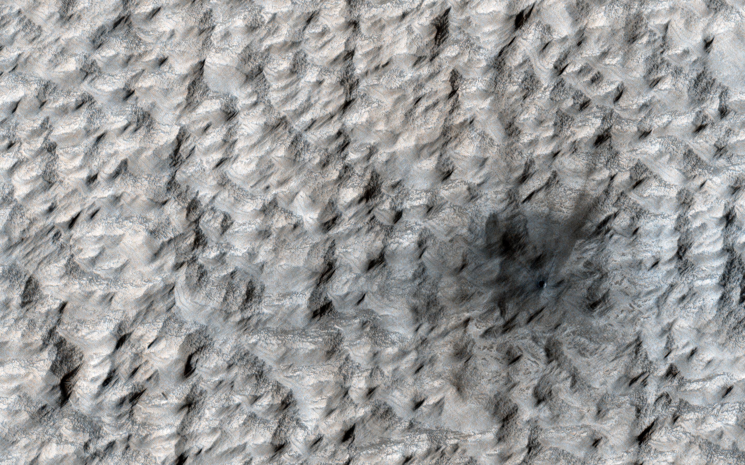
High Latitude Dunes
Full Resolution:
TIFF
(2.14 MB)
JPEG
(167.5 kB)
|
|
|
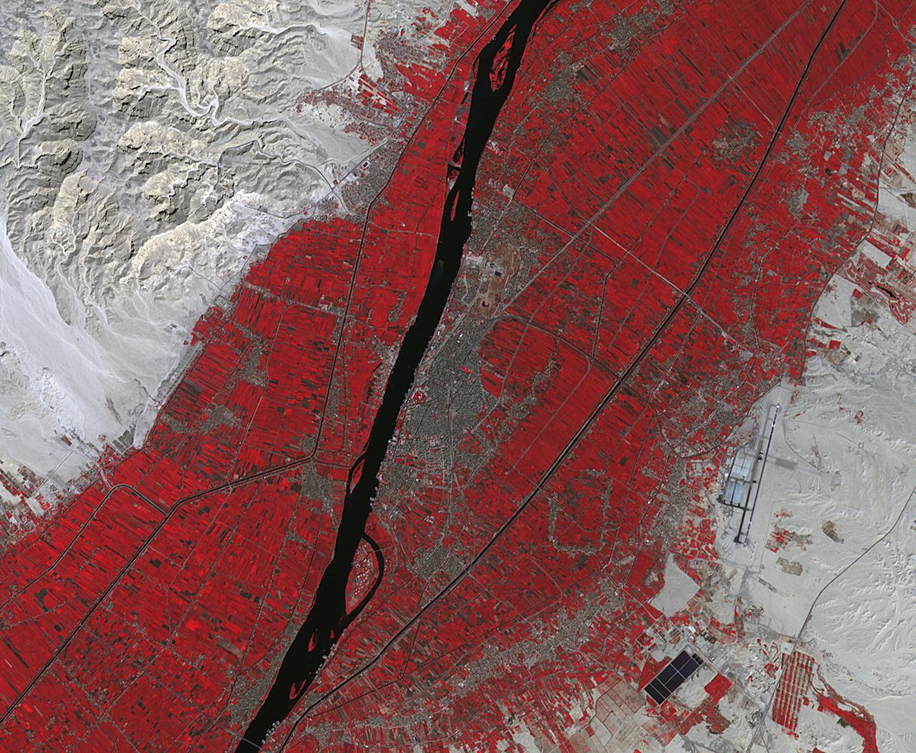
2019-02-07 |
Earth
|
Terra
|
ASTER
|
1284x1056x3 |
|
-
PIA23060:
-
Luxor, Egypt
Full Resolution:
TIFF
(4.069 MB)
JPEG
(308.9 kB)
|
|
|
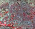
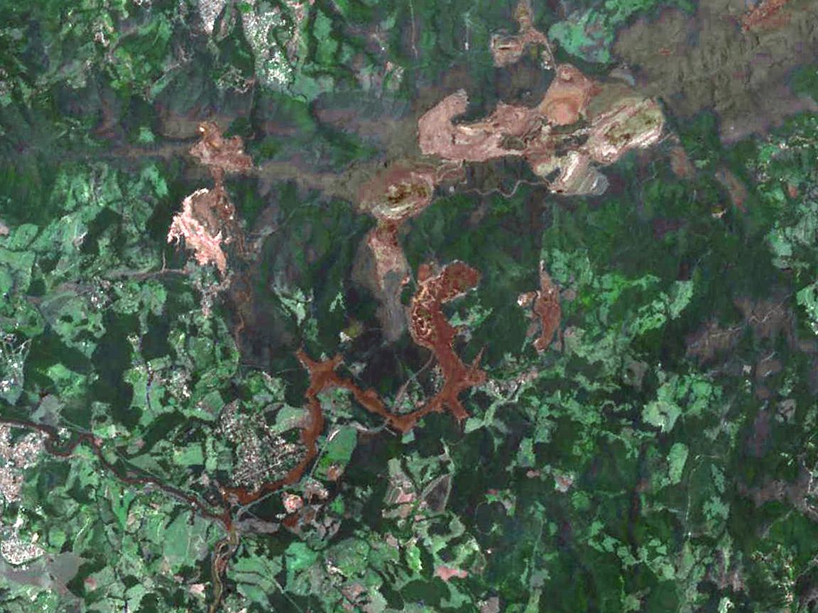
2019-02-06 |
Earth
|
Terra
|
ASTER
|
1152x864x3 |
|
-
PIA22824:
-
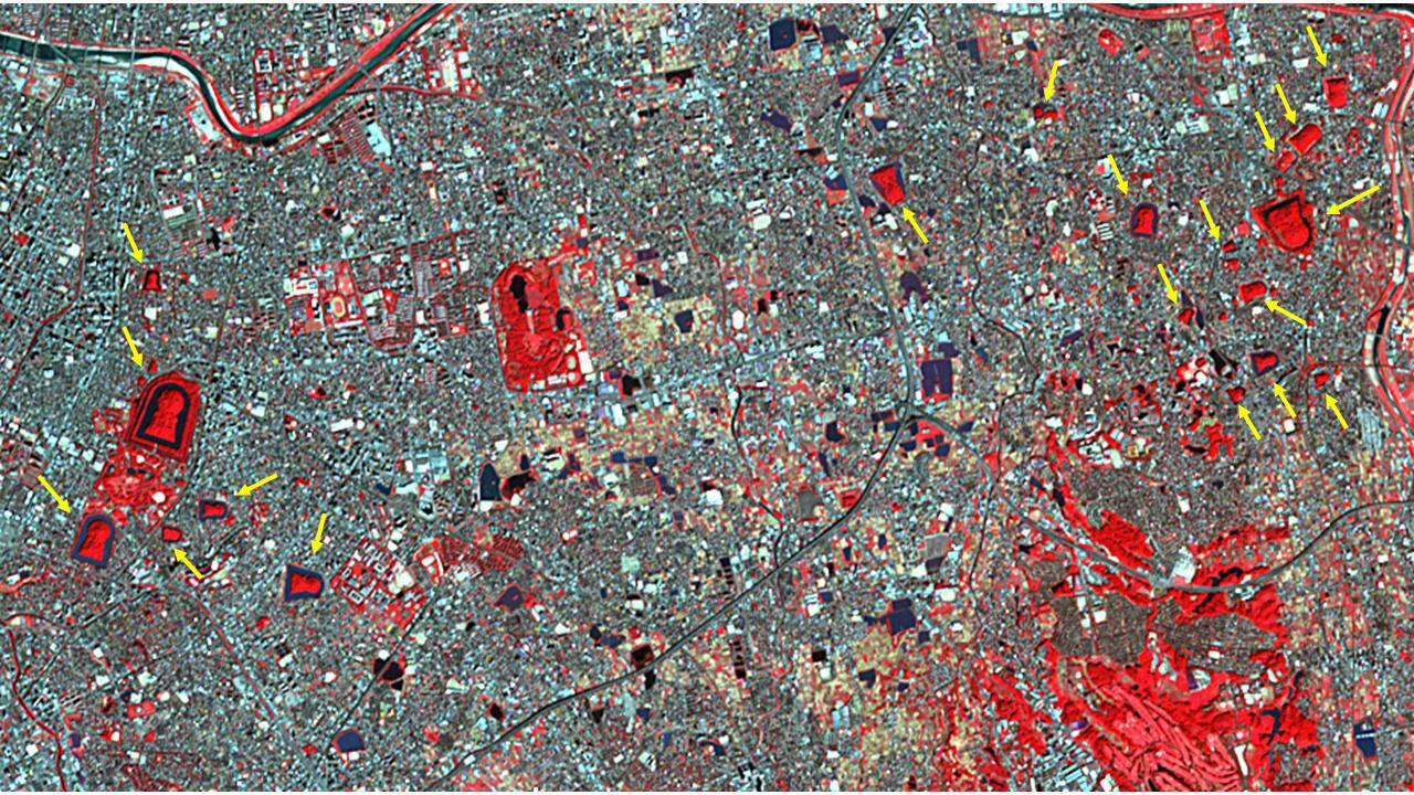
NASA's ASTER Shows Brazilian City After Dam Disaster
Full Resolution:
TIFF
(2.987 MB)
JPEG
(176.7 kB)
|
|
|
2019-01-30 |
Mars
|
2001 Mars Odyssey
|
THEMIS
|
1440x3300x1 |
|
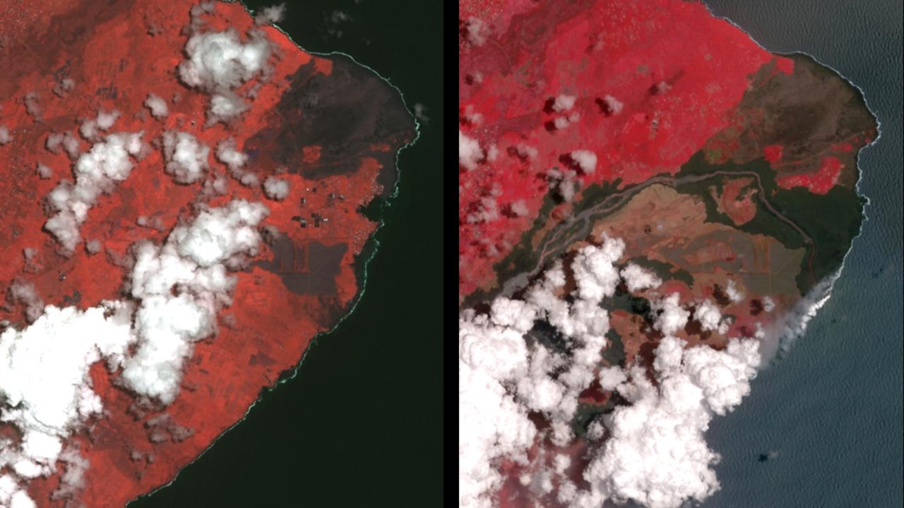
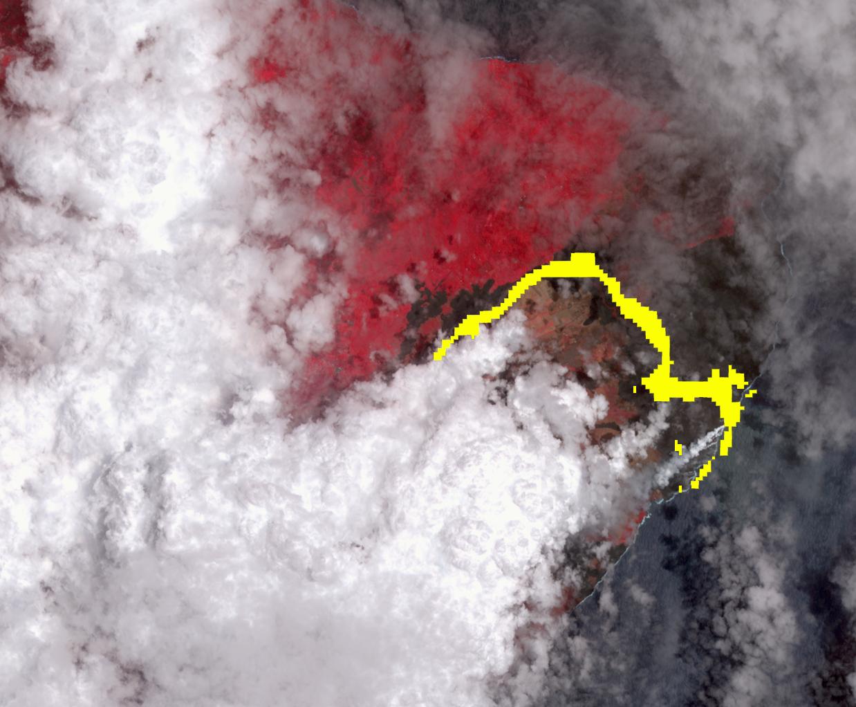
-
PIA23024:
-
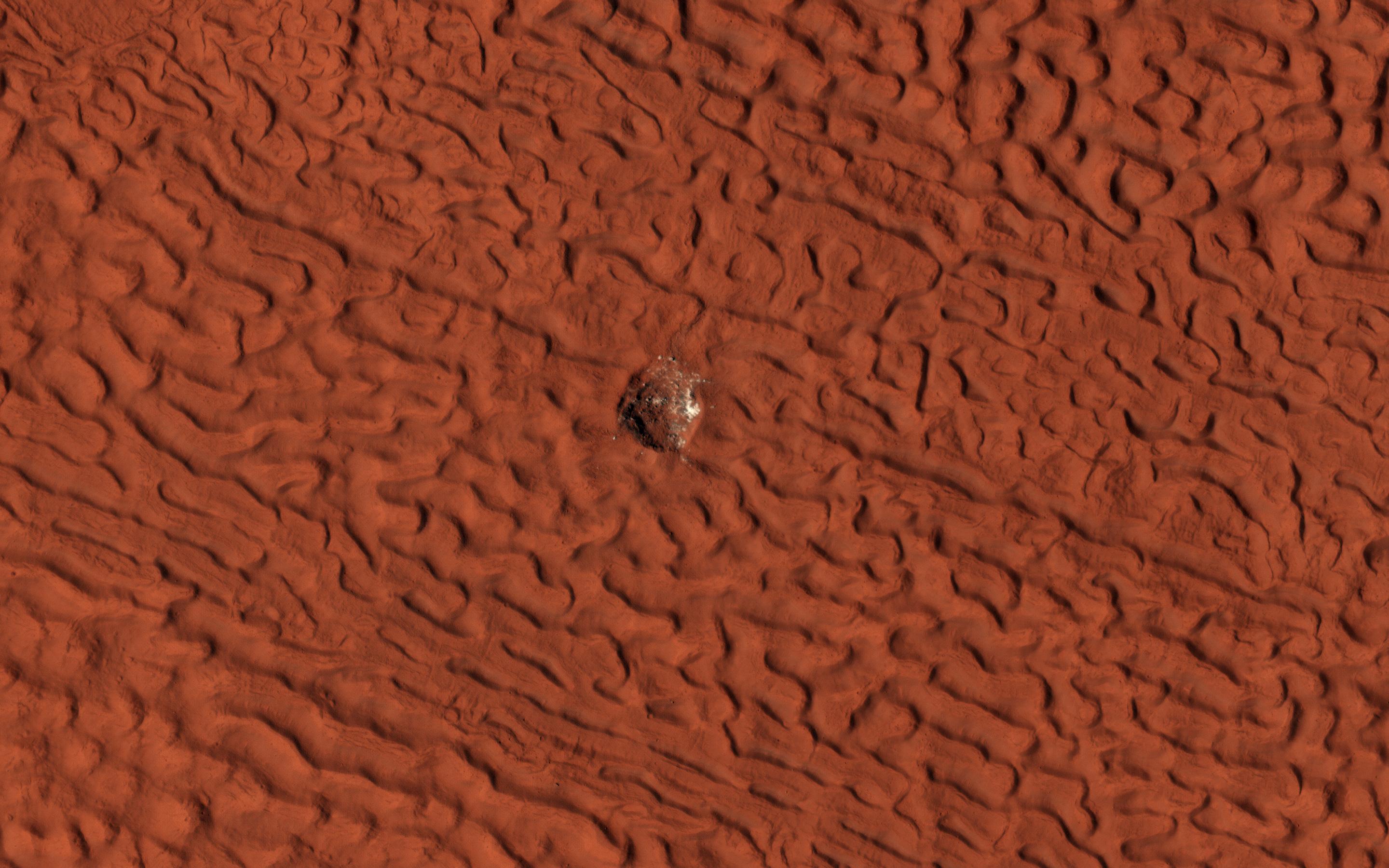
Dunes and Dust Devils
Full Resolution:
TIFF
(2.692 MB)
JPEG
(249.5 kB)
|
|
|
2019-01-23 |
Earth
|
Terra
|
ASTER
|
3198x3258x3 |
|
-
PIA23018:
-
October Revolution Island, Russia
Full Resolution:
TIFF
(28.69 MB)
JPEG
(1.255 MB)
|
|
|
2019-01-17 |
Earth
|
Terra
|
ASTER
|
904x815x3 |
|
-
PIA22821:
-
ASTER Images Post-eruption Anak Krakatau Volcano
Full Resolution:
TIFF
(1.844 MB)
JPEG
(64.95 kB)
|
|
|
2019-01-17 |
Jupiter
|
Juno
|
JunoCam
|
1080x1080x3 |
|
-
PIA22942:
-
Juno's Latest Flyby of Jupiter Captures Two Massive Storms
Full Resolution:
TIFF
(2.466 MB)
JPEG
(96.12 kB)
|
|
|
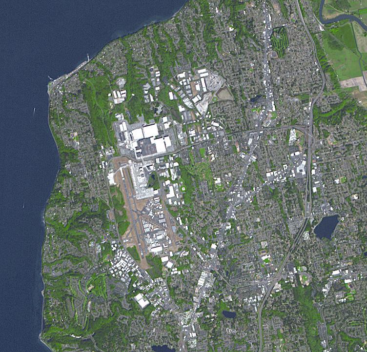
2019-01-08 |
Earth
|
Terra
|
ASTER
|
752x722x3 |

|
-
PIA23000:
-
Boeing Plant, Everett WA
Full Resolution:
TIFF
(1.63 MB)
JPEG
(147.1 kB)
|
|
|
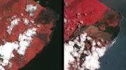
2018-12-21 |
Earth
|
Terra
|
ASTER
|
2772x1252x3 |
|
-
PIA22979:
-
ASTER Global Mosaic
Full Resolution:
TIFF
(7.881 MB)
JPEG
(746.2 kB)
|
|
|
2018-12-13 |
Earth
|
Terra
|
ASTER
|
1700x1200x3 |
|
-
PIA22899:
-
2018 Kilauea East Rift Zone Eruption
Full Resolution:
TIFF
(6.123 MB)
JPEG
(272.4 kB)
|
|
|
2018-12-11 |
Mars
|
Mars Reconnaissance Orbiter (MRO)
|
HiRISE
|
2880x1800x3 |
|
-
PIA22898:
-
The Eastern Slope of Asimov Crater's Central Pit
Full Resolution:
TIFF
(15.56 MB)
JPEG
(1.327 MB)
|
|
|
2018-12-11 |
Mars
|
Mars Reconnaissance Orbiter (MRO)
|
HiRISE
|
2880x1800x3 |
|
-
PIA22897:
-
Slope Streaking
Full Resolution:
TIFF
(5.191 MB)
JPEG
(859.4 kB)
|
|
|
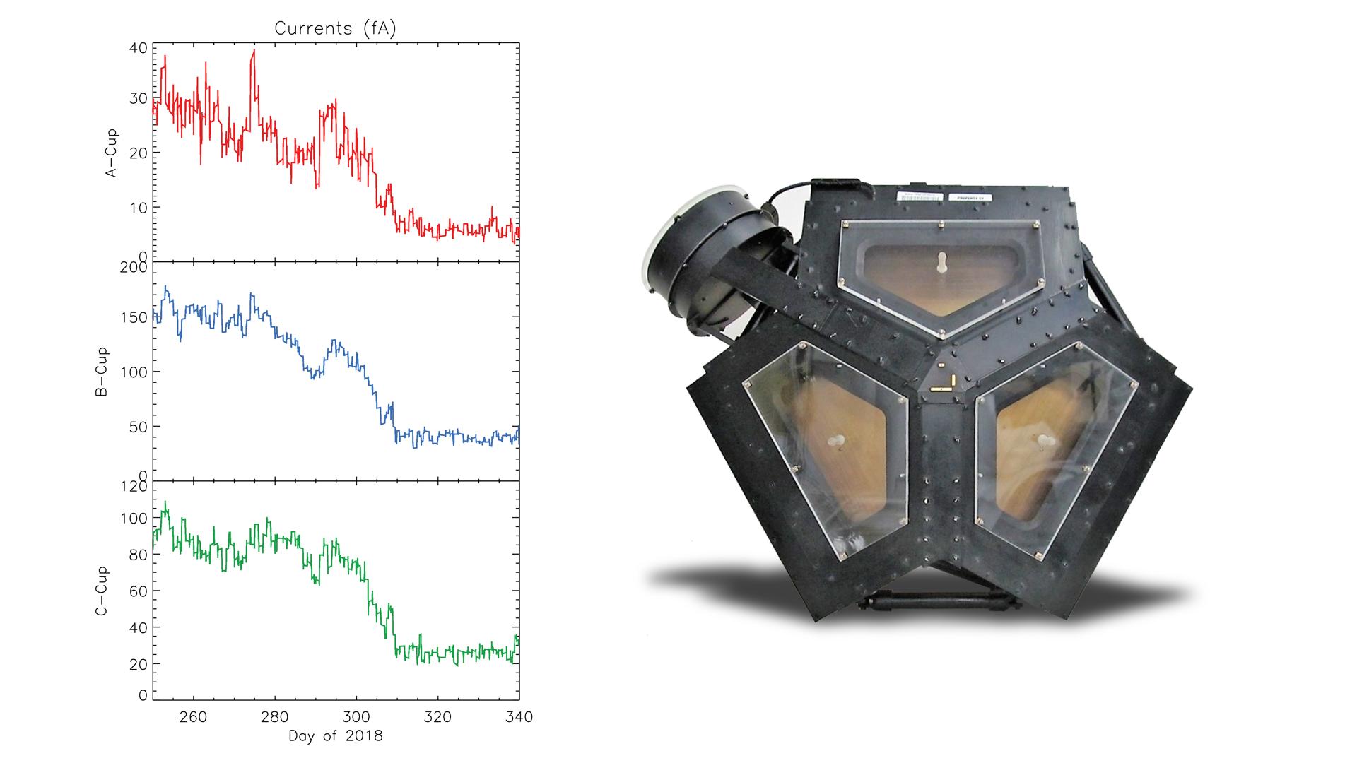
2018-12-10 |
|
Voyager Interstellar Mission
|
|
1484x1920x3 |
|
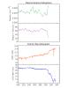
-
PIA22923:
-
Several Signs Pointing to Interstellar Space
Full Resolution:
TIFF
(545.3 kB)
JPEG
(170.9 kB)
|
|
|
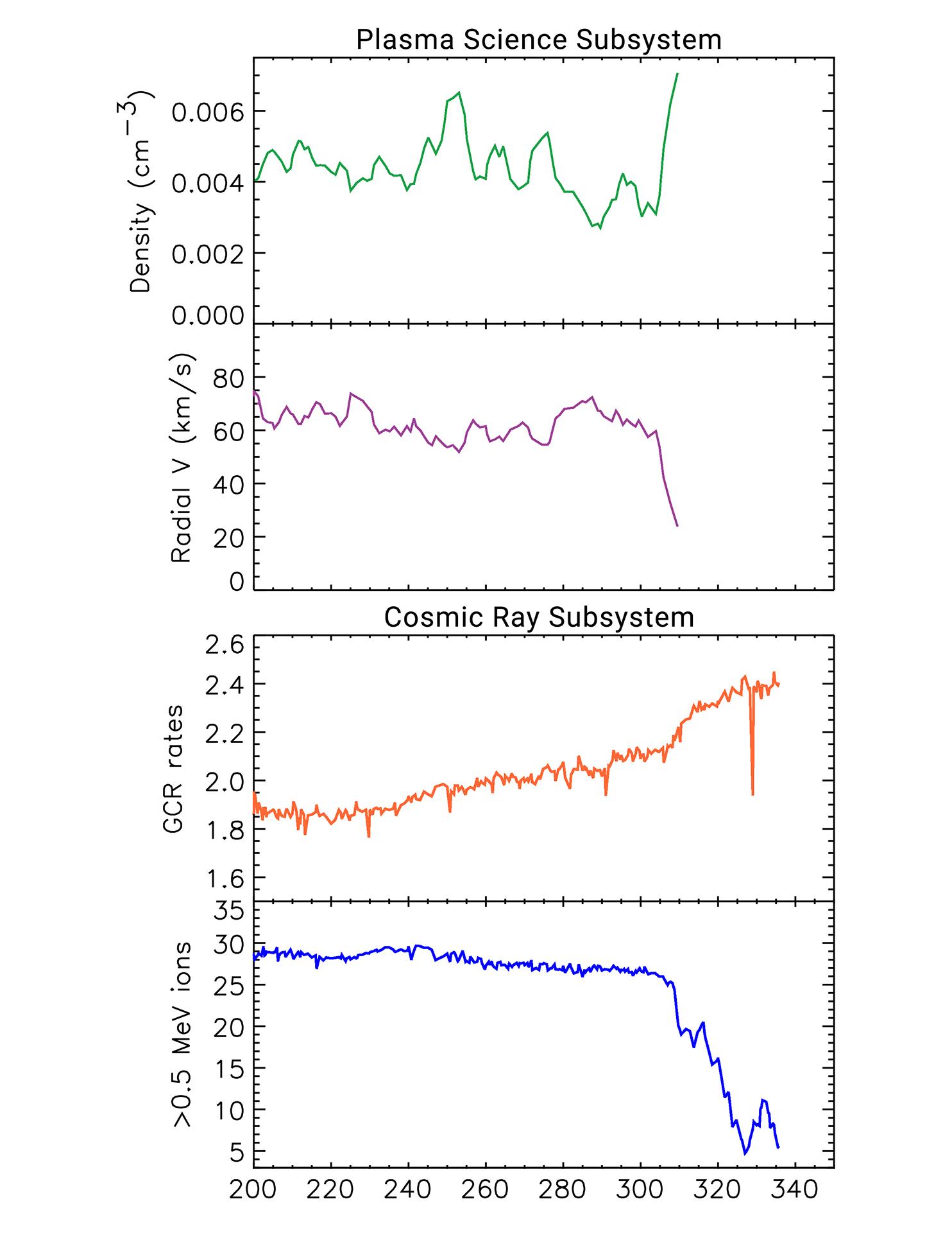
2018-12-10 |
|
Voyager Interstellar Mission
|
|
1920x1080x3 |
|
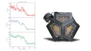
-
PIA22922:
-
Changes in the Plasma Environment in Three Directions
Full Resolution:
TIFF
(1.391 MB)
JPEG
(134.6 kB)
|
|
|
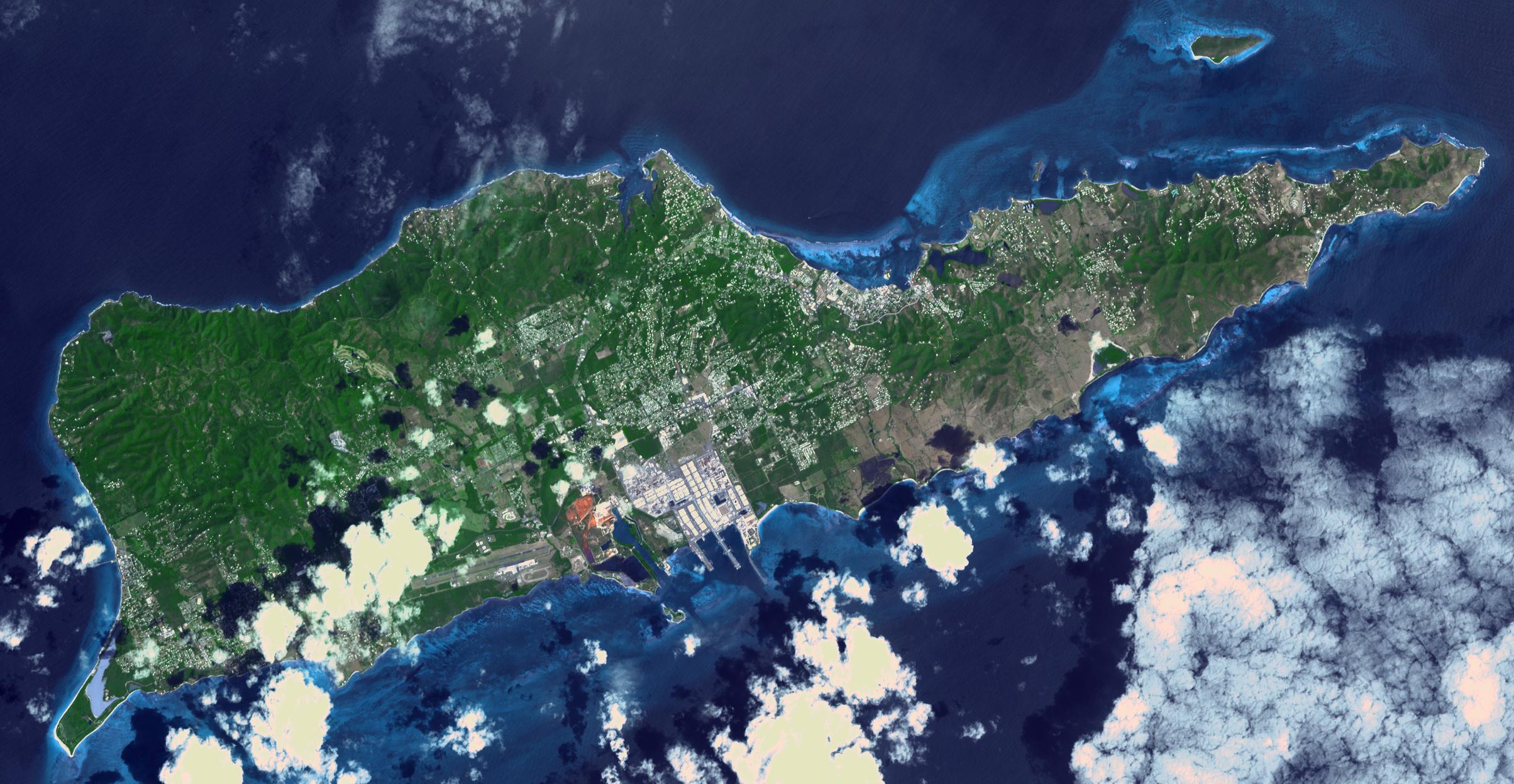
2018-12-04 |
Earth
|
Terra
|
ASTER
|
2408x1247x3 |
|
-
PIA22894:
-
St. Croix, US Virgin Islands
Full Resolution:
TIFF
(8.784 MB)
JPEG
(453.6 kB)
|
|
|
2018-12-03 |
Earth
|
Terra
|
ASTER
|
3800x2800x3 |
|
-
PIA22820:
-
NASA's ASTER Captures Lava Flow, Ash from Guatemala Volcano
Full Resolution:
TIFF
(29.07 MB)
JPEG
(1.594 MB)
|
|
|
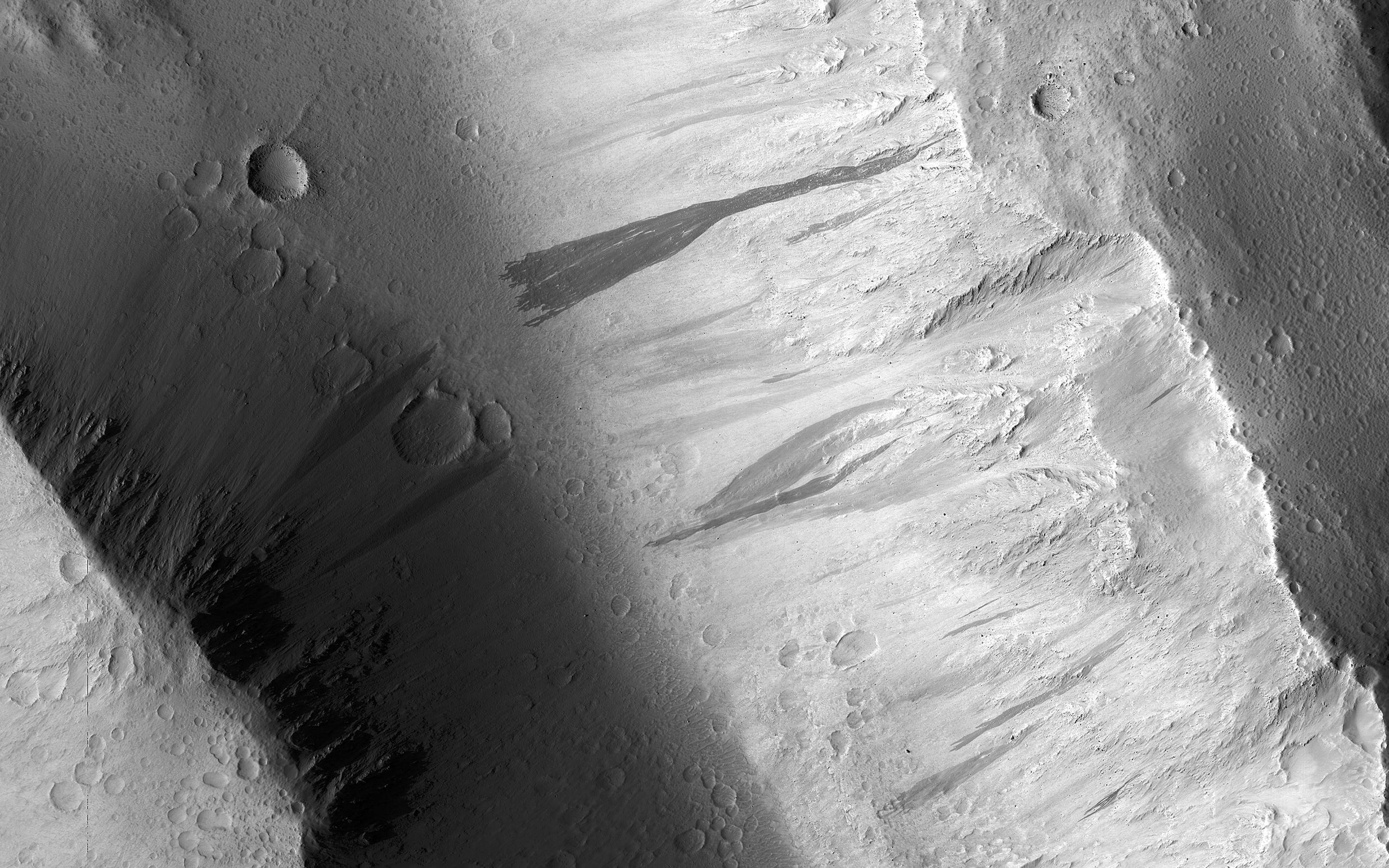
2018-11-27 |
Mars
|
Mars Reconnaissance Orbiter (MRO)
|
HiRISE
|
2880x1800x3 |
|
-
PIA22870:
-
The Changing Ice Cap of Mars
Full Resolution:
TIFF
(15.17 MB)
JPEG
(775.8 kB)
|
|
|
2018-11-19 |
Earth
|
ARIA
|
SAR
|
5949x3249x3 |
|
-
PIA22819:
-
Updated ARIA Map of CA Camp Fire Damage
Full Resolution:
TIFF
(21.68 MB)
JPEG
(3.068 MB)
|
|
|
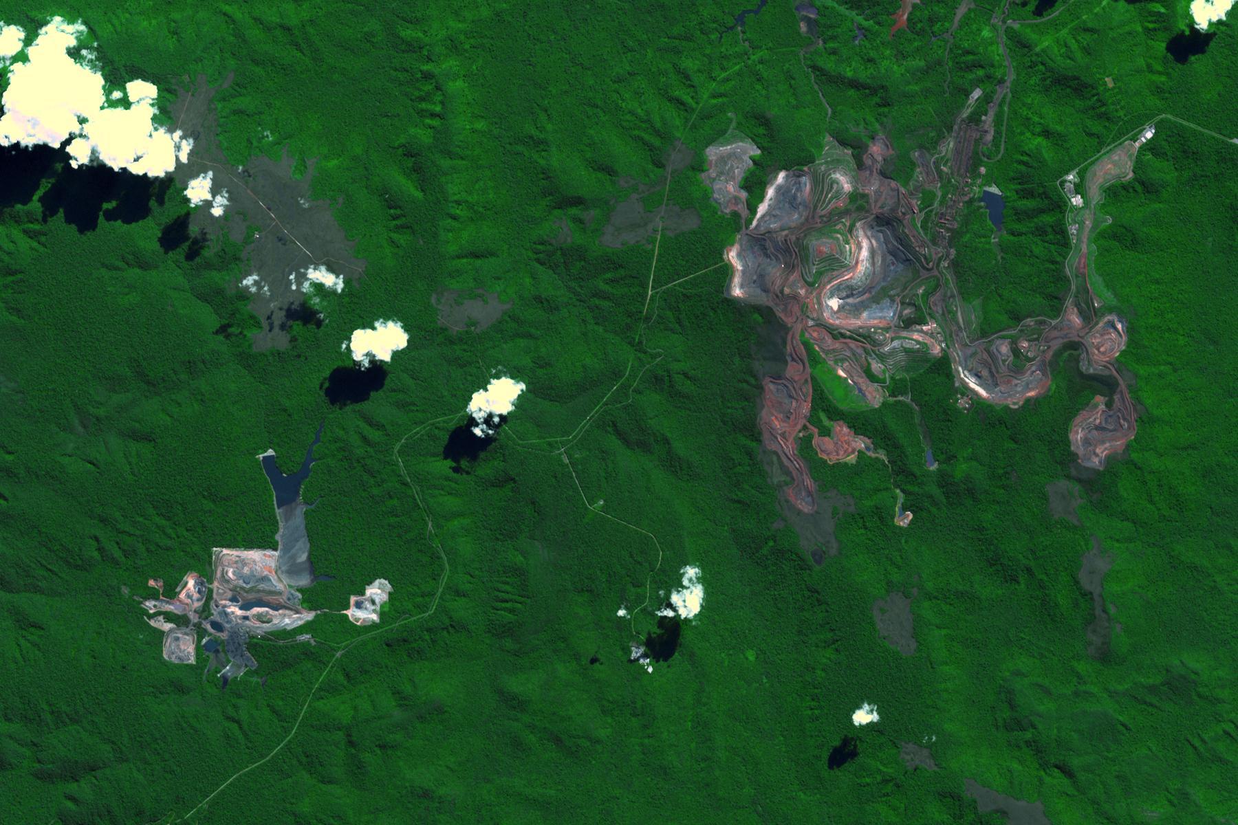
2018-11-13 |
Earth
|
Terra
|
ASTER
|
1800x1200x3 |
|
-
PIA22861:
-
Carajas Mine, Brazil
Full Resolution:
TIFF
(6.362 MB)
JPEG
(326.4 kB)
|
|
|
2018-11-12 |
Earth
|
ARIA
|
SAR
|
5176x2873x3 |
|
-
PIA22816:
-
NASA's ARIA Maps California Fire Damage
Full Resolution:
TIFF
(16.43 MB)
JPEG
(2.572 MB)
|
|
|
2018-11-02 |
Earth
|
Terra
|
ASTER
|
1929x2283x3 |
|
-
PIA22755:
-
NASA's ASTER Captures Piton de la Fournaise Eruption
Full Resolution:
TIFF
(10.21 MB)
JPEG
(703.5 kB)
|
|
|
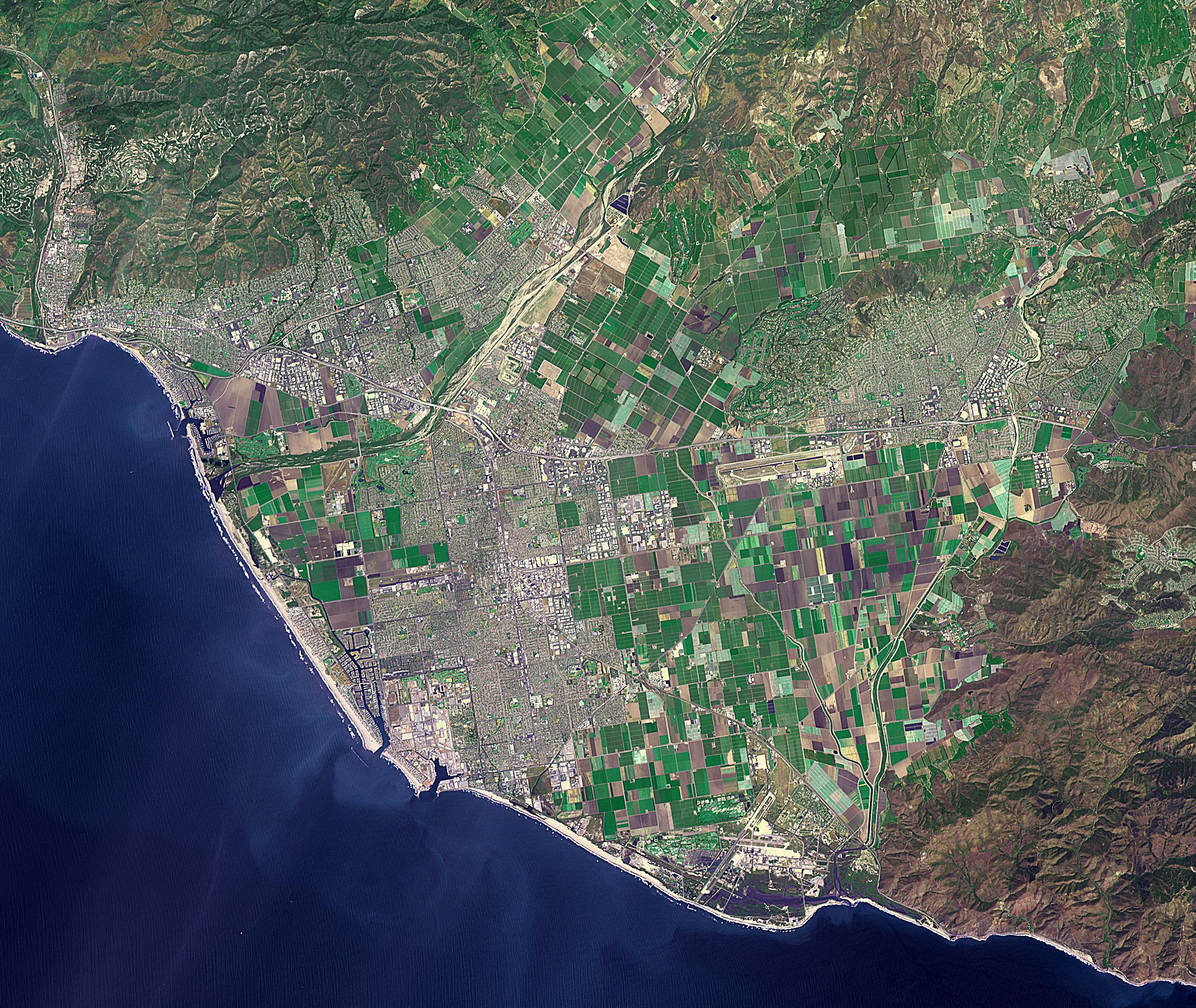
2018-10-31 |
Earth
|
Terra
|
ASTER
|
2274x1917x3 |
|
-
PIA22841:
-
Ventura, CA
Full Resolution:
TIFF
(13.08 MB)
JPEG
(1.297 MB)
|
|
|
2018-10-30 |
Mars
|
2001 Mars Odyssey
|
THEMIS
|
1327x2645x1 |
|
-
PIA22798:
-
Noctis Labyrinthus
Full Resolution:
TIFF
(2.361 MB)
JPEG
(248.8 kB)
|
|
|
2018-10-17 |
Earth
|
Terra
|
ASTER
|
4000x3069x3 |
|
-
PIA22795:
-
Air Mountains, Niger
Full Resolution:
TIFF
(32.05 MB)
JPEG
(2.448 MB)
|
|
|
2018-10-15 |
Mars
|
Mars Reconnaissance Orbiter (MRO)
|
HiRISE
|
2880x1800x3 |
|
-
PIA22729:
-
Dramatic Changes over the South Polar Residual Cap
Full Resolution:
TIFF
(12.63 MB)
JPEG
(368.5 kB)
|
|
|
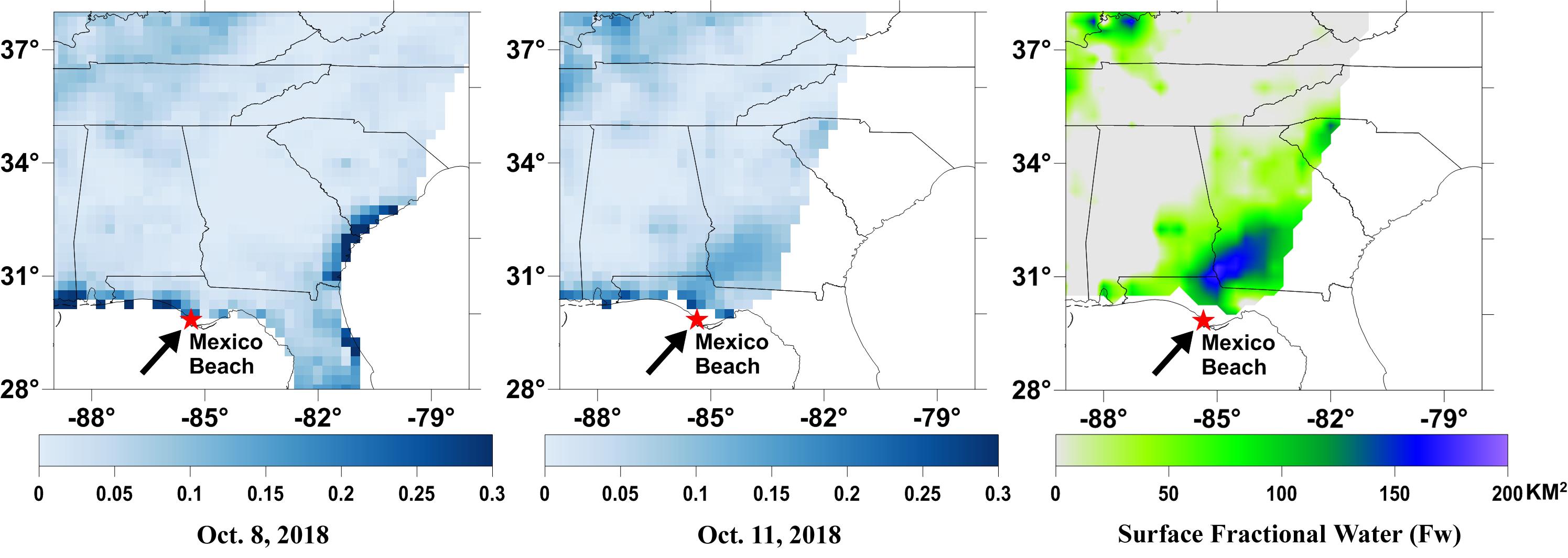
2018-10-11 |
Earth
|
SMAP
|
|
2991x1065x3 |
|
-
PIA22754:
-
NASA's SMAP Detects Flooding from Hurricane Michael
Full Resolution:
TIFF
(1.747 MB)
JPEG
(255.8 kB)
|
|
|
2018-10-05 |
Earth
|
Terra
|
ASTER
|
3426x4083x3 |

|
-
PIA22705:
-
NASA's ASTER Instrument Sees Aftermath of Typhoon Mangkhut
Full Resolution:
TIFF
(31.83 MB)
JPEG
(2.201 MB)
|
|
|
2018-10-05 |
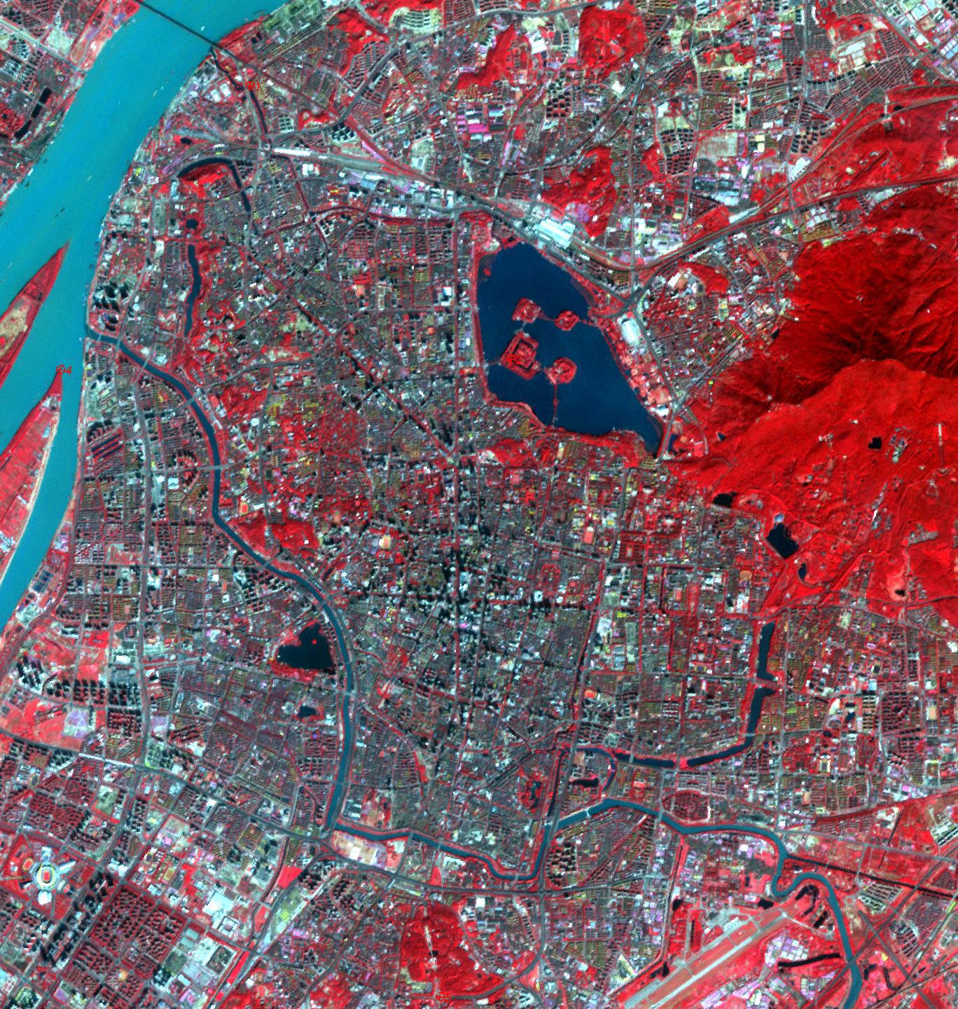
Earth
|
ARIA
|
SAR
|
5630x4092x3 |
|
-
PIA22746:
-
NASA's ARIA Maps Indonesia Quake, Tsunami Damage
Full Resolution:
TIFF
(38.03 MB)
JPEG
(1.997 MB)
|
|
|
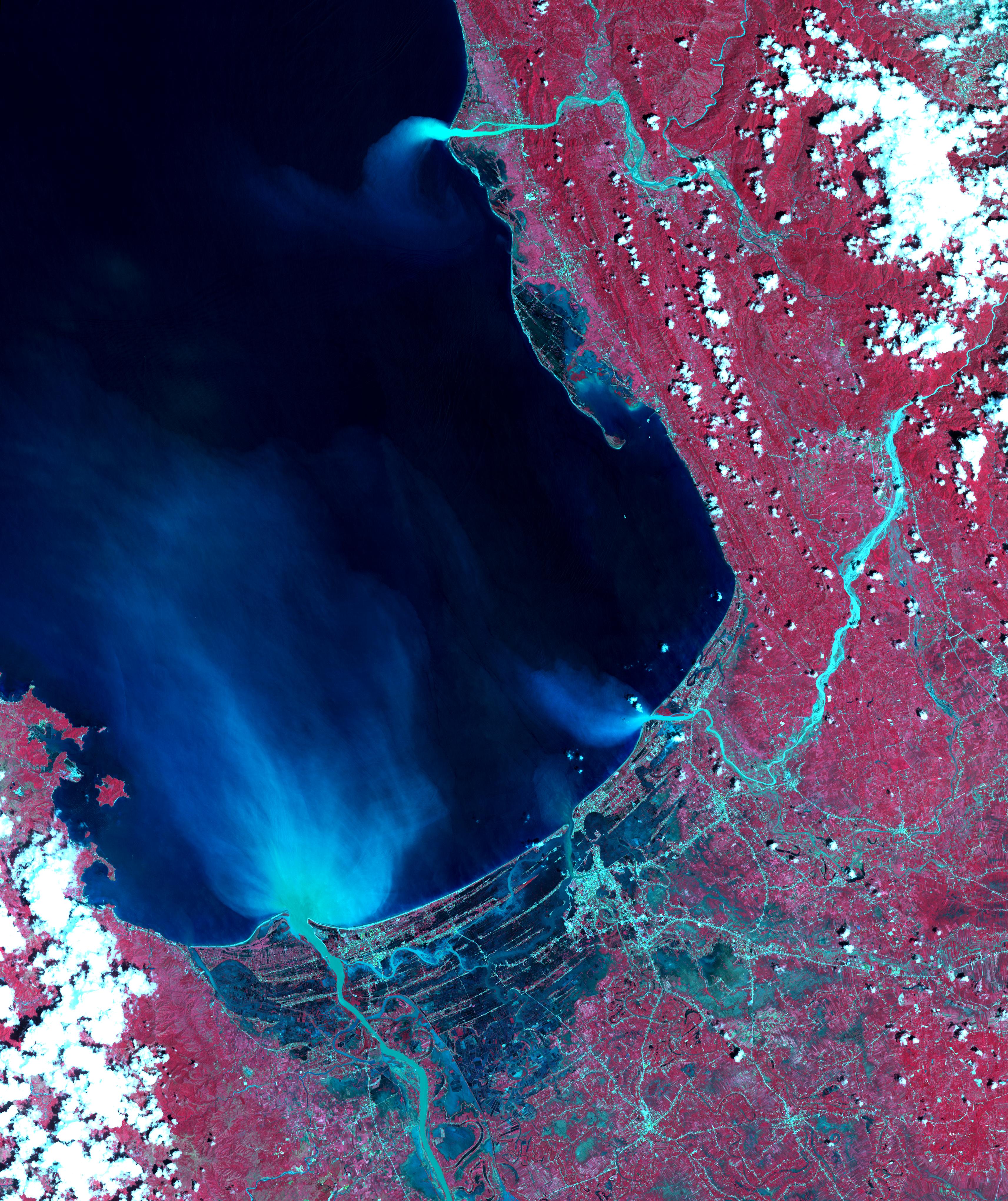
2018-10-04 |
Earth
|
Terra
|
ASTER
|
1368x1440x3 |
|
-
PIA22735:
-
Nanjing, China City Walls
Full Resolution:
TIFF
(5.912 MB)
JPEG
(576.4 kB)
|
|
|
2018-10-01 |
Mars
|
Mars Reconnaissance Orbiter (MRO)
|
HiRISE
|
2880x1800x3 |

|
-
PIA22783:
-
The Velvety Blue Dunes of Melas Chasma
Full Resolution:
TIFF
(15.56 MB)
JPEG
(679 kB)
|
|
|
2018-09-25 |
Earth
|
CubeSat
|
|
478x318x3 |
|
-
PIA22653:
-
Mini Mission RainCube is Sent into Earth Orbit
Full Resolution:
TIFF
(330.8 kB)
JPEG
(210.5 kB)
|
|
|
2018-09-19 |
Earth
|
Terra
|
ASTER
|
1917x1468x3 |
|
-
PIA22721:
-
Llullaillaco Volcano, Chile/Argentina
Full Resolution:
TIFF
(7.77 MB)
JPEG
(333.2 kB)
|
|
|
2018-09-17 |
Earth
|
ARIA
|
SAR
|
1233x1125x3 |

|
-
PIA22702:
-
NASA's ARIA Maps Damage from Florence
Full Resolution:
TIFF
(3.944 MB)
JPEG
(269.1 kB)
|
|
|
2018-09-14 |
Earth
|
Terra
|
ASTER
MODIS
|
804x1627x3 |

|
-
PIA22651:
-
Hurricane Florence Swath seen by NASA Spacecraft
Full Resolution:
TIFF
(2.219 MB)
JPEG
(125.9 kB)
|
|
|
2018-09-10 |
Earth
|
ARIA
|
SAR
|
1377x964x3 |
|
-
PIA22696:
-
Japan Earthquakes (ARIA Damage Proxy Map)
Full Resolution:
TIFF
(3.89 MB)
JPEG
(229.1 kB)
|
|
|
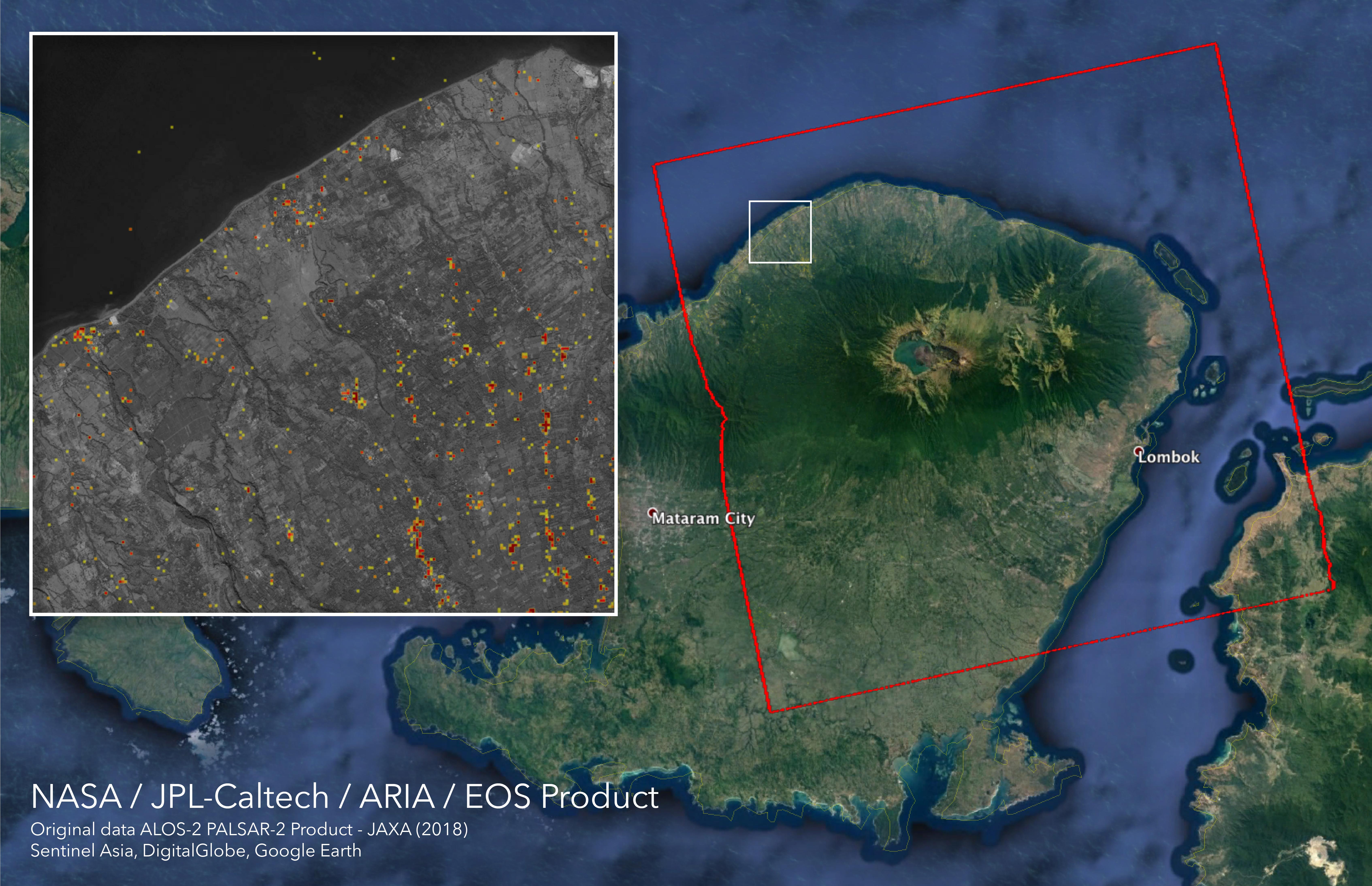
2018-09-05 |
Earth
|
ARIA
|
SAR
|
6776x4377x3 |
|
-
PIA22495:
-
ARIA Damage Proxy Map of Lombok, Indonesia Earthquakes
Full Resolution:
TIFF
(47.99 MB)
JPEG
(2.341 MB)
|
|
|
2018-09-05 |
Earth
|
Terra
|
ASTER
|
1241x1407x3 |

|
-
PIA22685:
-
Ushuaia, Argentina
Full Resolution:
TIFF
(4.45 MB)
JPEG
(201.4 kB)
|
|
|
2018-08-22 |
Earth
|
Terra
|
ASTER
|
2429x1856x3 |
|
-
PIA22672:
-
Gold Mining, Siberia
Full Resolution:
TIFF
(13.53 MB)
JPEG
(738.8 kB)
|
|
|
2018-08-20 |
|
2001 Mars Odyssey
|
THEMIS
|
1376x2640x1 |
|
-
PIA22659:
-
Olympus Rupes
Full Resolution:
TIFF
(2.125 MB)
JPEG
(215.2 kB)
|
|
|
2018-08-15 |
|
2001 Mars Odyssey
|
THEMIS
|
1386x2643x1 |
|
-
PIA22656:
-
Orcus Patera
Full Resolution:
TIFF
(2.519 MB)
JPEG
(231.4 kB)
|
|
|
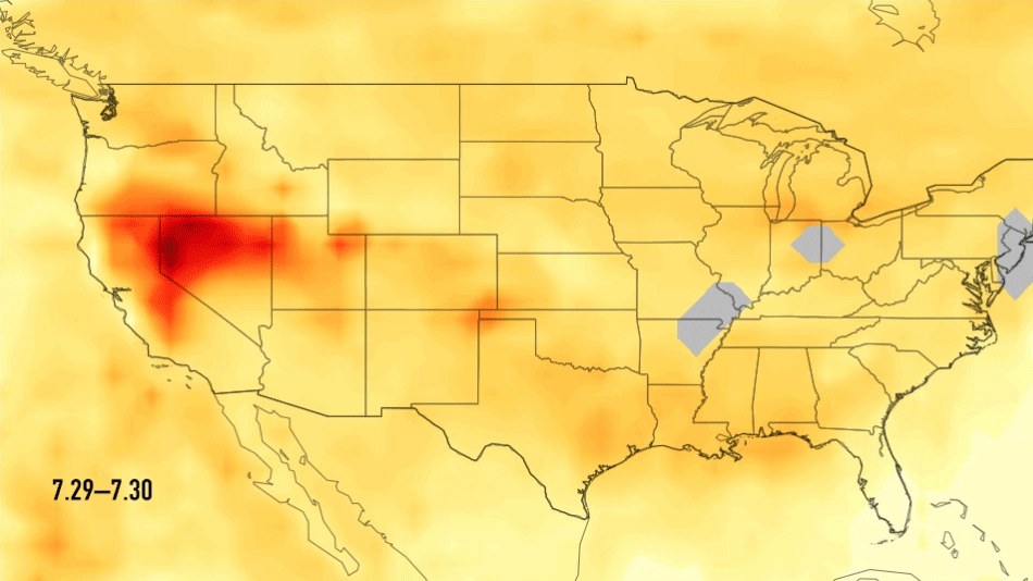
2018-08-14 |
Earth
|
Aqua
|
AIRS
|
950x534x3 |
|
-
PIA22492:
-
Carbon Monoxide Transport from California Wildfires, July 30-August 7, 2018
Full Resolution:
TIFF
(452.9 kB)
JPEG
(421.9 kB)
|
|
|
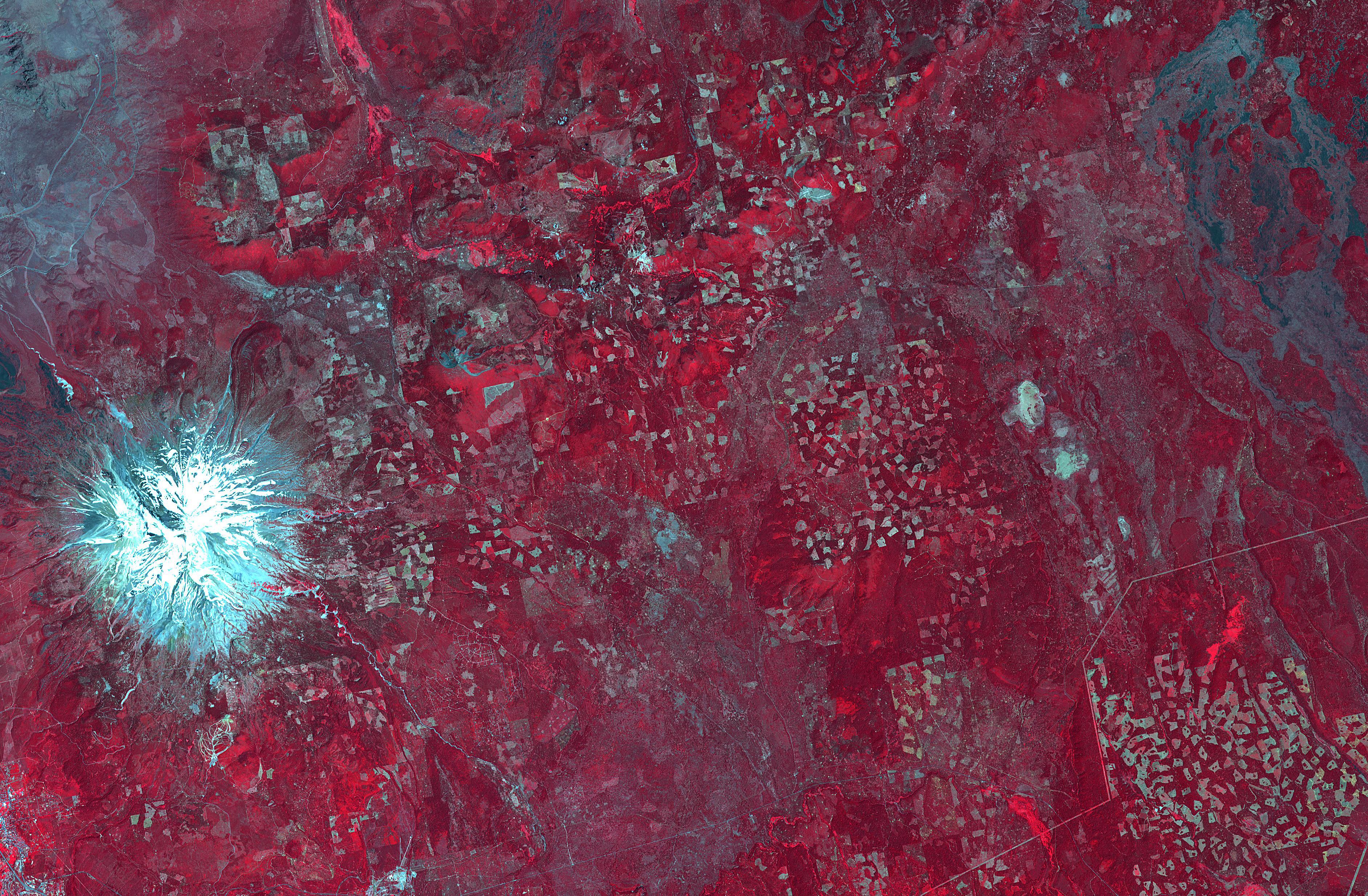
2018-08-08 |
|
Terra
|
ASTER
|
2200x1800x3 |
|
-
PIA21220:
-
La Paz, Bolivia
Full Resolution:
TIFF
(11.89 MB)
JPEG
(986.6 kB)
|
|
|
2018-07-28 |
Earth
|
Terra
|
ASTER
|
1280x720x3 |
|
-
PIA22593:
-
Dramatic Changes from Kilauea Leilani Estates Lava Flows Seen by NASA Spacecraft
Full Resolution:
TIFF
(2.739 MB)
JPEG
(114.3 kB)
|
|
|
2018-07-27 |
Mars
|
2001 Mars Odyssey
|
THEMIS
|
1359x2647x1 |
|
-
PIA22612:
-
Wind Etching
Full Resolution:
TIFF
(2.802 MB)
JPEG
(478.8 kB)
|
|
|
2018-07-26 |
Earth
|
Terra
|
ASTER
|
1238x1022x3 |

|
-
PIA22489:
-
Satellite Imagery Shows Hawaii Volcano Lava Flow
Full Resolution:
TIFF
(3.646 MB)
JPEG
(132 kB)
|
|
|
2018-07-24 |
Mars
|
2001 Mars Odyssey
|
THEMIS
|
1385x2644x1 |

|
-
PIA22609:
-
Many Textures
Full Resolution:
TIFF
(2.752 MB)
JPEG
(385.3 kB)
|
|
|
2018-07-24 |
Mars
|
Mars Reconnaissance Orbiter (MRO)
|
HiRISE
|
2880x1800x1 |

|
-
PIA22595:
-
The Dark Side of Dust Avalanches
Full Resolution:
TIFF
(5.191 MB)
JPEG
(858.4 kB)
|
|
|
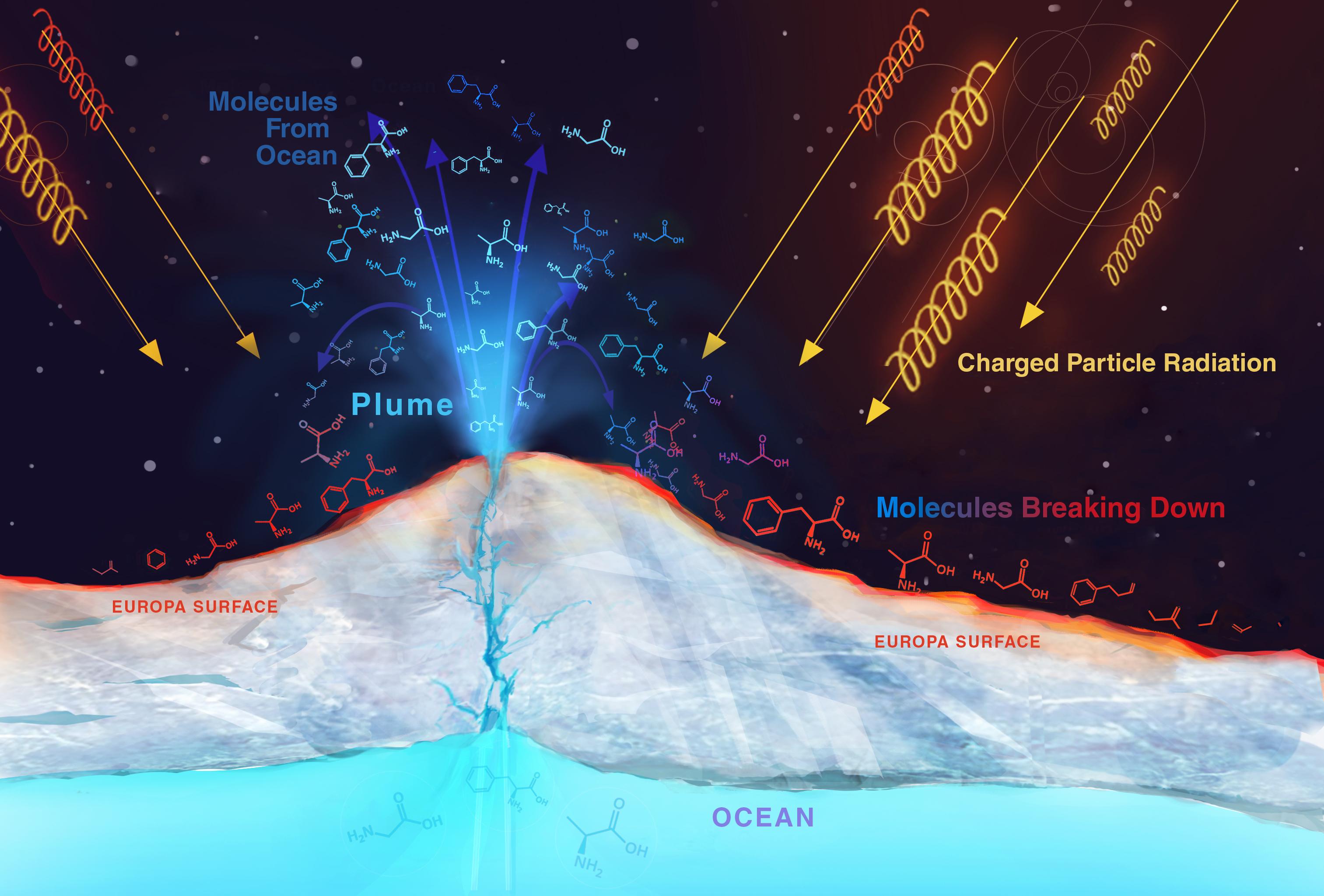
2018-07-23 |
Europa
|
|
|
3026x2049x3 |

|
-
PIA22479:
-
Radiation on Europa (Artist's Rendering)
Full Resolution:
TIFF
(11.34 MB)
JPEG
(404.5 kB)
|
|
|
2018-07-17 |
Earth
|
Terra
|
ASTER
|
3768x2469x3 |
|
-
PIA22613:
-
Logging in Northern California
Full Resolution:
TIFF
(27.92 MB)
JPEG
(2.401 MB)
|
 Planetary Data System


