My
List |
Addition Date
|
Target
|
Mission
|
Instrument
|
Size
|

|
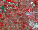
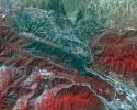
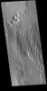
2017-08-14 |
Earth
|
Terra
|
ASTER
|
2424x3006x3 |

|
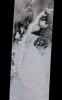
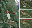
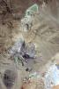
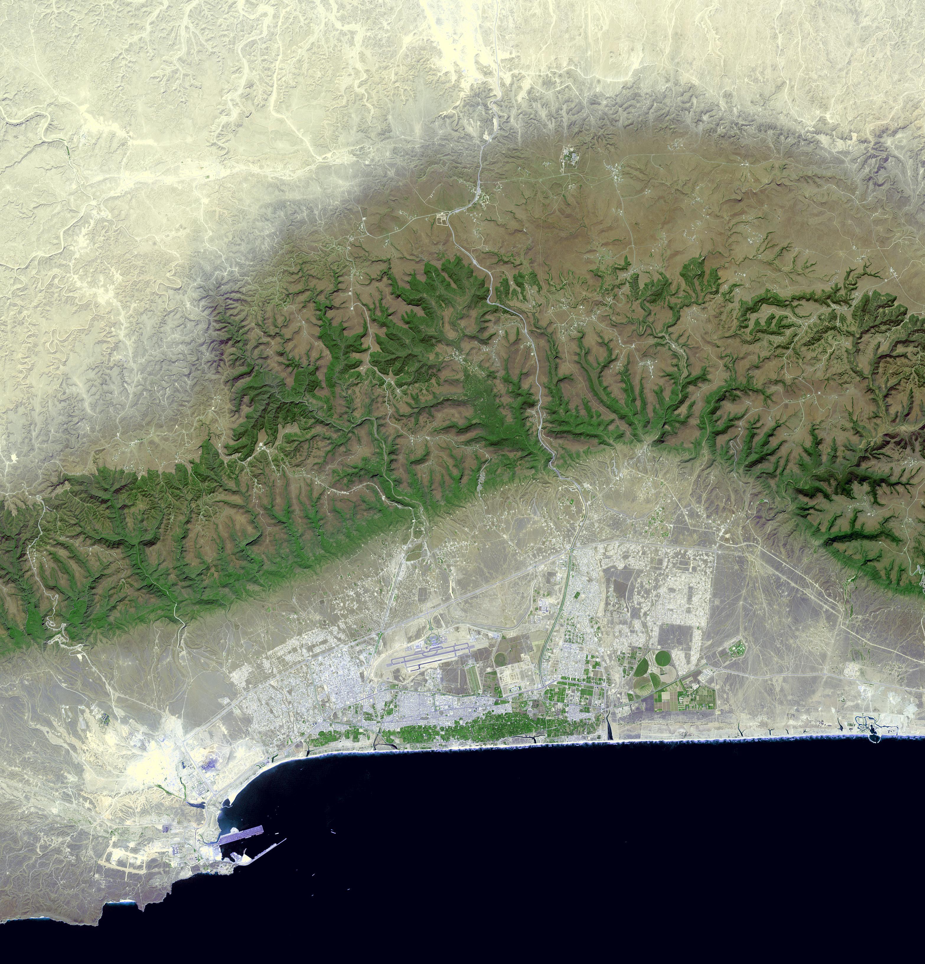
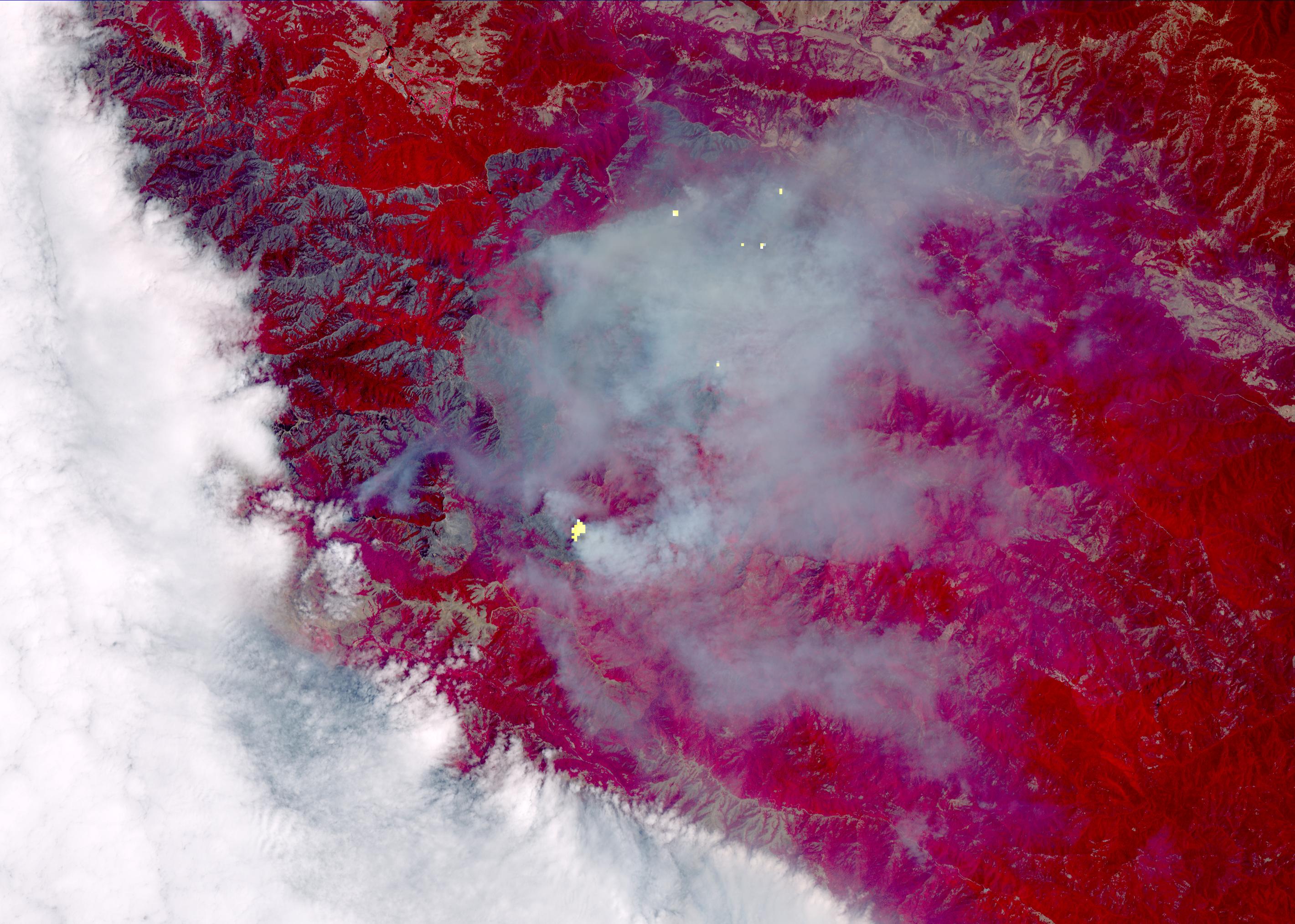
-
PIA21875:
-
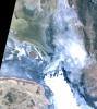
Idaho Wildfire Imaged by NASA's Terra Spacecraft
Full Resolution:
TIFF
(19.44 MB)
JPEG
(1.056 MB)
|
|
|
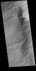
2017-08-11 |
Titan
|
Cassini-Huygens
|
Radar Mapper
|
14594x2578x1 |

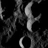
|
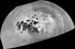
-
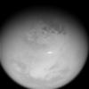
PIA21626:
Cassini's Final Titan Radar Swath
Full Resolution:
TIFF
(10.77 MB)
JPEG
(3.532 MB)
|
|
|
2017-08-09 |
Mars
|
Mars Science Laboratory (MSL)
|
Navcam (MSL)
|
511x510x1 |
|
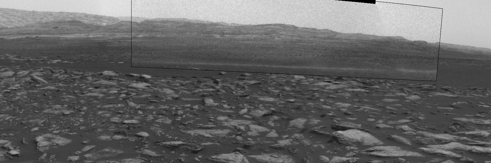
-
PIA21842:
-
Clouds Sailing Overhead on Mars, Unenhanced

Full Resolution:
TIFF
(261.1 kB)
JPEG
(15.55 kB)
|
|
|
2017-08-09 |
Mars
|
Mars Science Laboratory (MSL)
|
Navcam (MSL)
|
511x511x1 |
|
-
PIA21841:
-
Clouds Sailing Overhead on Mars, Enhanced
Full Resolution:
TIFF
(261.6 kB)
JPEG
(91.08 kB)
|
|
|
2017-08-09 |
Mars
|
Mars Science Laboratory (MSL)
|
Navcam (MSL)
|
511x511x1 |
|
-
PIA21840:
-
Clouds Sailing Above Martian Horizon, Enhanced
Full Resolution:
TIFF
(261.6 kB)
JPEG
(89.02 kB)
|
|
|
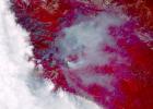
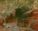
2017-08-01 |
Earth
|
Terra
|
ASTER
|
3133x3265x3 |
|
-
PIA21803:
-
Salalah, Oman
Full Resolution:
TIFF
(26.46 MB)
JPEG
(1.658 MB)
|
|
|
2017-07-31 |
Saturn
|
Cassini-Huygens
|
ISS - Wide Angle
|
1020x1020x1 |

|
-
PIA21337:
-
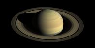
Good Old Summer Time
Full Resolution:
TIFF
(508.5 kB)
JPEG
(26.11 kB)
|
|
|
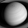
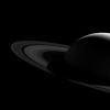
2017-07-28 |
Saturn
|
Cassini-Huygens
|
ISS - Narrow Angle
|
500x500x1 |
|
-
PIA21623:
-
Southern Auroras Over Saturn
Full Resolution:
TIFF
(162.7 kB)
JPEG
(14.36 kB)
|
|
|
2017-07-24 |
Saturn
|
Cassini-Huygens
|
ISS - Wide Angle
|
5001x5301x1 |

|
-
PIA21617:
-
Cassini "Noodle" Mosaic of Saturn
Full Resolution:
TIFF
(2.399 MB)
JPEG
(471.8 kB)
|
|
|
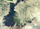
2017-07-14 |
Earth
|
Terra
|
ASTER
|
2317x1574x3 |
|
-
PIA21787:
-
Ijen Volcano, Indonesia
Full Resolution:
TIFF
(10.95 MB)
JPEG
(750.5 kB)
|
|
|
2017-06-28 |
Mars
|
Mars Reconnaissance Orbiter (MRO)
|
HiRISE
|
2880x1800x3 |
|
-
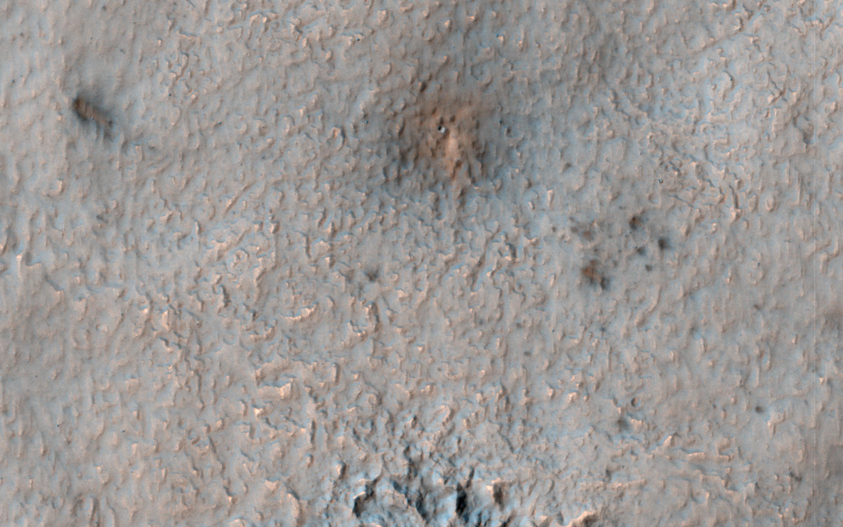
PIA21766:
-
"Elementary, My Dear Deposit..."
Full Resolution:
TIFF
(14.2 MB)
JPEG
(470.8 kB)
|
|
|
2017-06-20 |
Mars
|
Mars Reconnaissance Orbiter (MRO)
Mars Science Laboratory (MSL)
|
HiRISE
|
1403x789x3 |

|
-
PIA21710:
-
Curiosity Rover on Mount Sharp, Seen from Mars Orbit
Full Resolution:
TIFF
(3.322 MB)
JPEG
(215.9 kB)
|
|
|
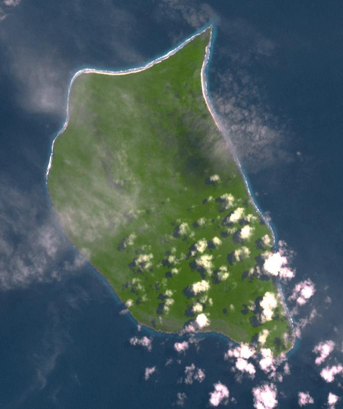
2017-06-15 |
Earth
|
Terra
|
ASTER
|
690x822x3 |

|
-
PIA21691:
-
Henderson Island, South Pacific
Full Resolution:
TIFF
(1.451 MB)
JPEG
(55.88 kB)
|
|
|
2017-06-02 |
Mars
|
Mars Reconnaissance Orbiter (MRO)
|
HiRISE
|
2880x1800x3 |
|
-
PIA21654:
-
Gullies and Craters and Dunes, Oh My!
Full Resolution:
TIFF
(15.56 MB)
JPEG
(1.217 MB)
|
|
|
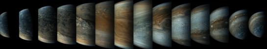
2017-05-25 |
Jupiter
|
Juno
|
JunoCam
|
23520x4320x3 |
|
-
PIA21645:
A Perijove Pass
Full Resolution:
TIFF
(186.9 MB)
JPEG
(5.35 MB)
|
|
|
2017-05-25 |
Jupiter
|
Juno
|
Ultraviolet Spectrograph
|
801x801x3 |
|
-
PIA21643:
-
Jupiter's Southern Lights
Full Resolution:
TIFF
(1.307 MB)
JPEG
(202.2 kB)
|
|
|
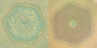
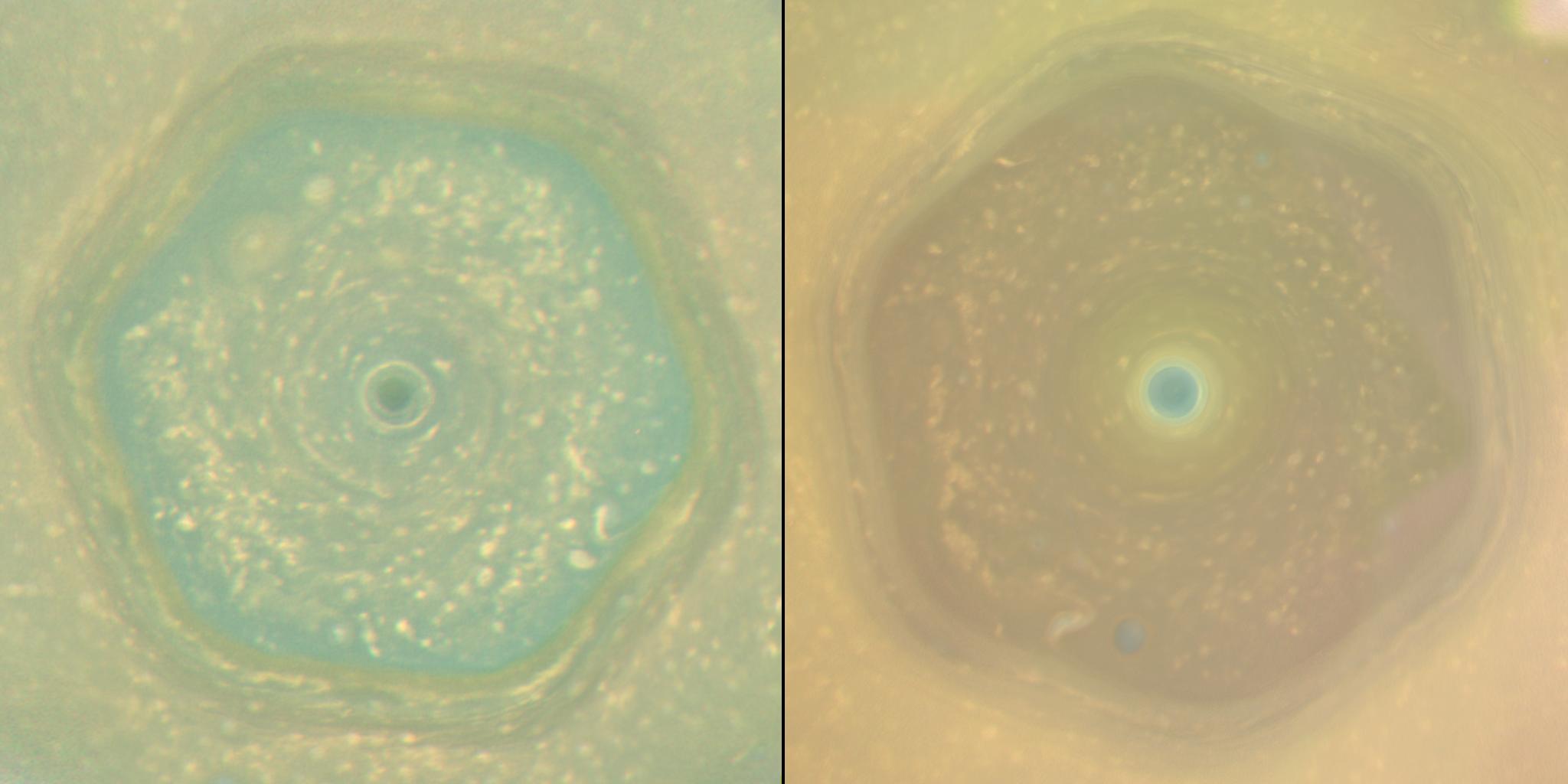
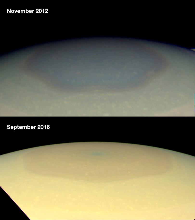
2017-05-24 |
Saturn
|
Cassini-Huygens
|
ISS - Wide Angle
|
2048x1024x3 |
|
-
PIA21611:
-
Saturn's Hexagon as Summer Solstice Approaches
Full Resolution:
TIFF
(4.705 MB)
JPEG
(105.3 kB)
|
|
|
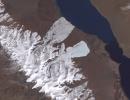
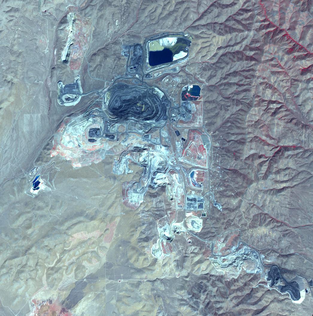
2017-05-15 |
Earth
|
Terra
|
ASTER
|
1046x1058x3 |

|
-
PIA21665:
-
Goldstrike Mine, Nevada
Full Resolution:
TIFF
(3.321 MB)
JPEG
(212.4 kB)
|
|
|
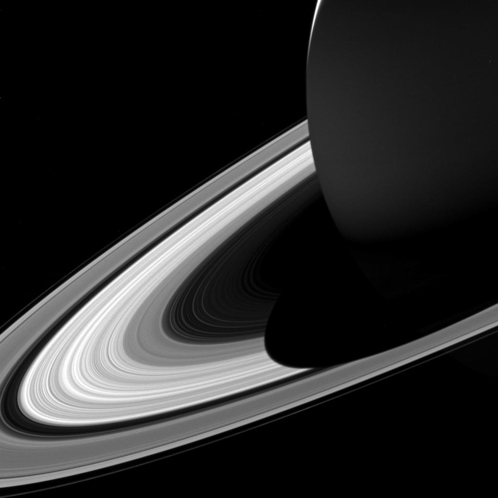
2017-05-15 |
S Rings
|
Cassini-Huygens
|
ISS - Wide Angle
|
1020x1020x1 |

|
-
PIA21328:
-
Short Shadow
Full Resolution:
TIFF
(539.3 kB)
JPEG
(52.71 kB)
|
|
|
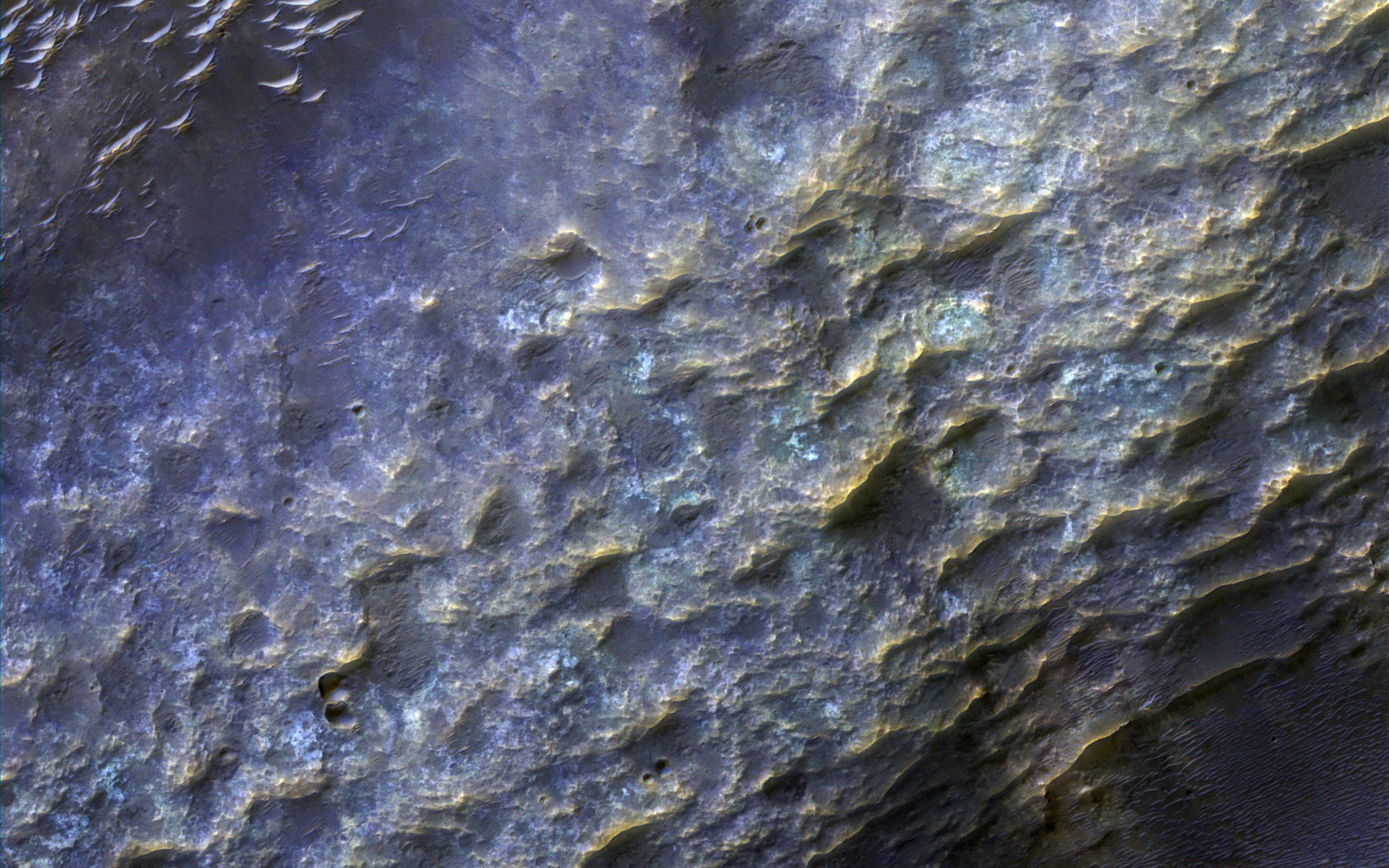
2017-05-09 |
Mars
|
Mars Reconnaissance Orbiter (MRO)
|
HiRISE
|
2880x1800x3 |
|
-
PIA21630:
-
An Ancient Valley Network
Full Resolution:
TIFF
(15.56 MB)
JPEG
(747.3 kB)
|
|
|
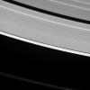
2017-05-03 |
Saturn
|
Cassini-Huygens
|
ISS - Wide Angle
|
1375x1273x1 |
|
-
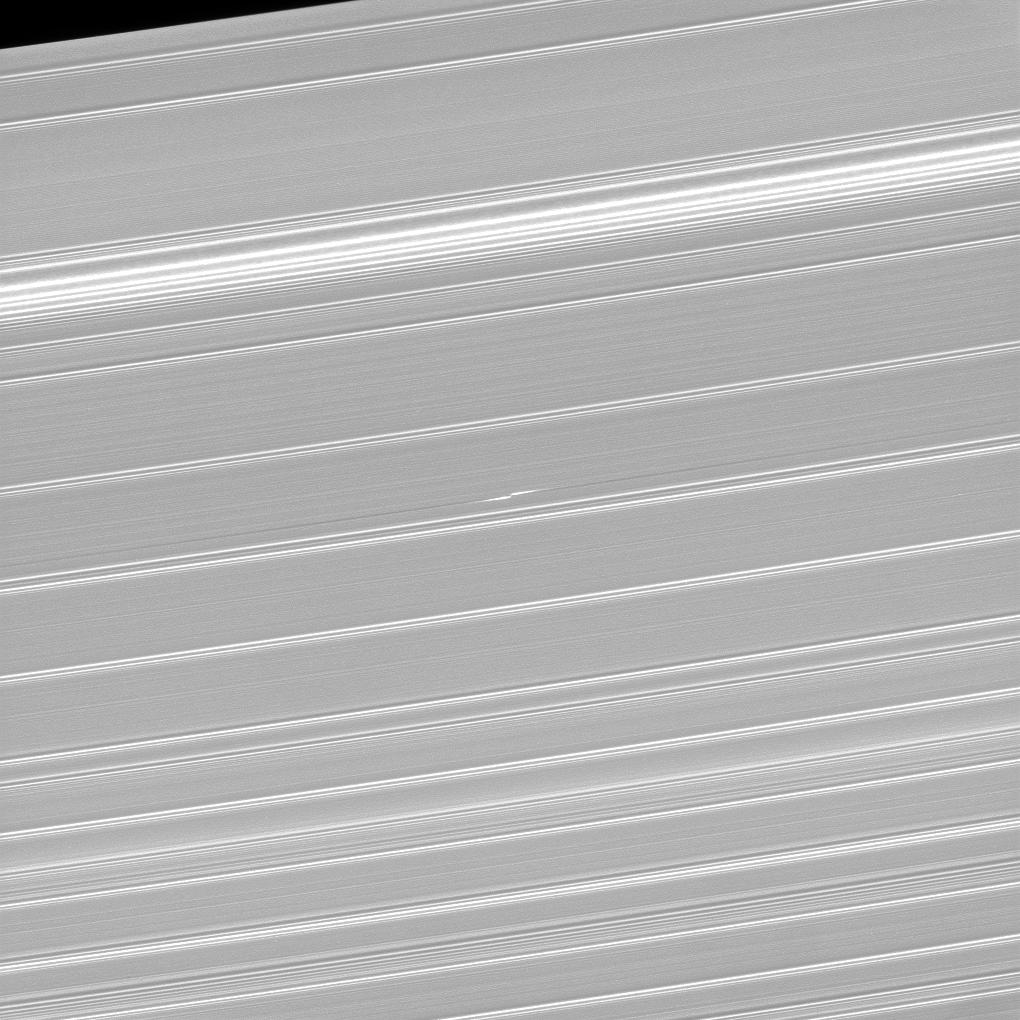
PIA21441:
-
Cassini's 'Porthole' Movie of Saturn
Full Resolution:
TIFF
(649 kB)
JPEG
(96.81 kB)
|
|
|
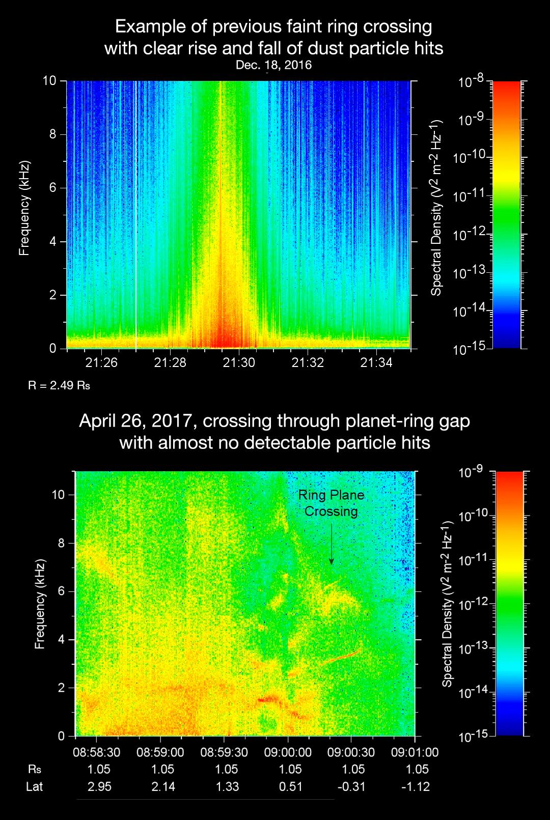
2017-05-01 |
Saturn
|
Cassini-Huygens
|
Radio and Plasma Wave Science Instrument
|
1080x1611x3 |
|
-
PIA21446:
-
The Sound of Science: Comparison of Cassini Ring Crossings
Full Resolution:
TIFF
(2.487 MB)
JPEG
(312.2 kB)
|
|
|
2017-04-28 |
Earth
|
Terra
|
ASTER
|
3262x3671x3 |
|
-
PIA21546:
-
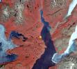
Lake Poopo, Bolivia
Full Resolution:
TIFF
(31.94 MB)
JPEG
(1.333 MB)
|
|
|
2017-04-19 |
Mars
|
Mars Reconnaissance Orbiter (MRO)
|
HiRISE
|
2880x1800x1 |
|
-
PIA21595:
-
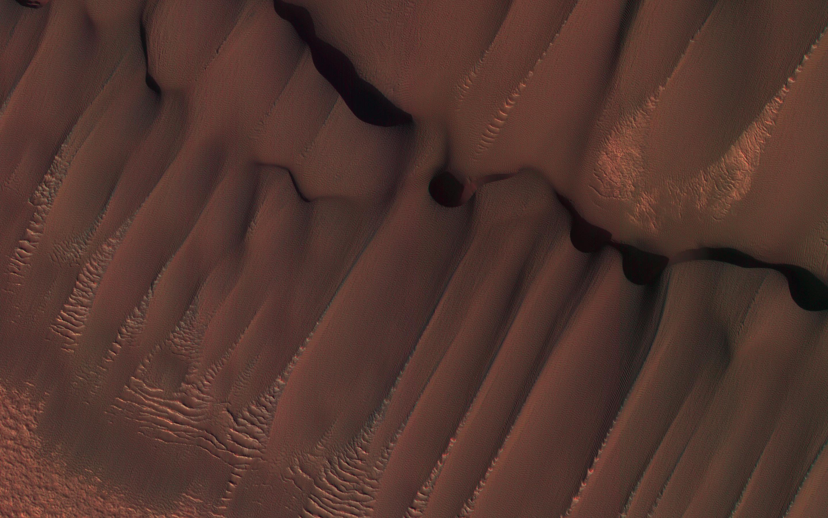
Dune Transition in the High Southern Latitudes
Full Resolution:
TIFF
(4.262 MB)
JPEG
(712.3 kB)
|
|
|
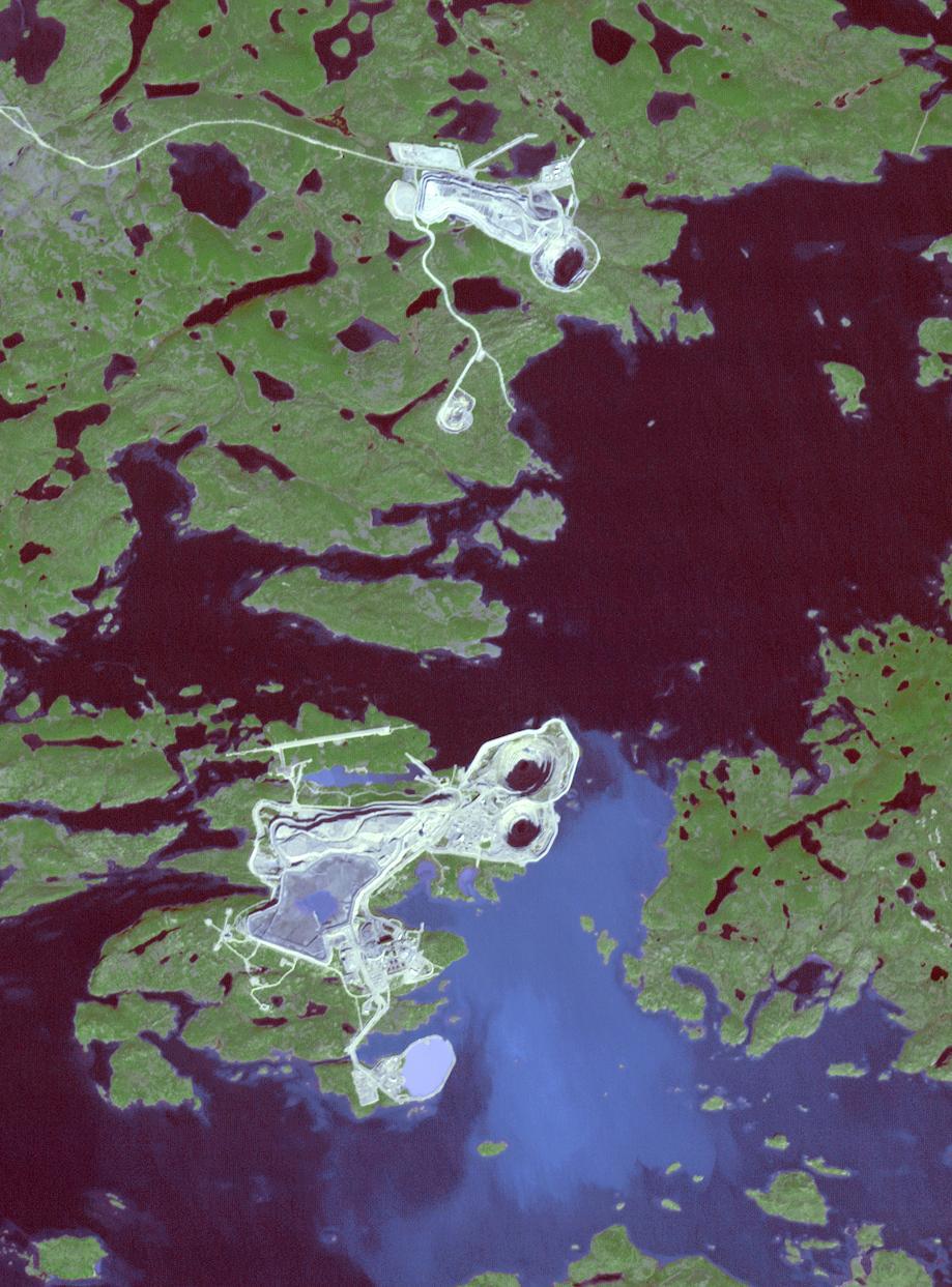
2017-04-13 |
Earth
|
Terra
|
ASTER
|
919x1243x3 |

|
-
PIA21536:
-
Diavik Mine, Canada
Full Resolution:
TIFF
(3.428 MB)
JPEG
(179.9 kB)
|
|
|
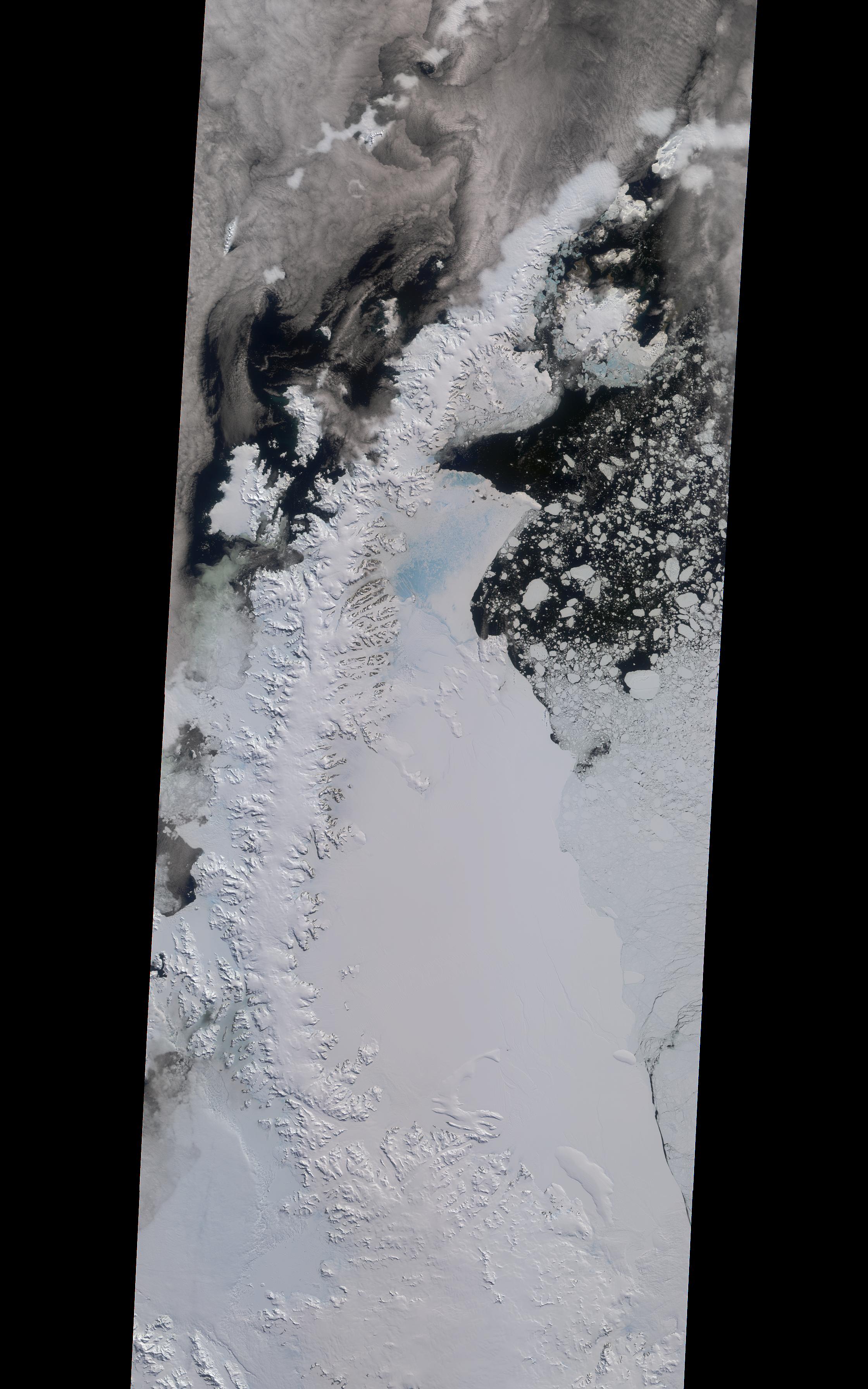
2017-04-11 |
Earth
|
Terra
|
MISR
|
2240x3584x3 |
|
-
PIA21581:
-
NASA's MISR Tracks Growth of Rift in the Larsen C Ice Shelf
Full Resolution:
TIFF
(13.35 MB)
JPEG
(776 kB)
|
|
|
2017-04-10 |
Mars
|
Mars Reconnaissance Orbiter (MRO)
|
HiRISE
|
2880x1800x3 |
|
-
PIA21580:
-
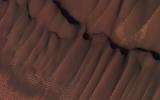
Clinoforms in Melas Chasma
Full Resolution:
TIFF
(15.56 MB)
JPEG
(1.148 MB)
|
|
|
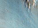
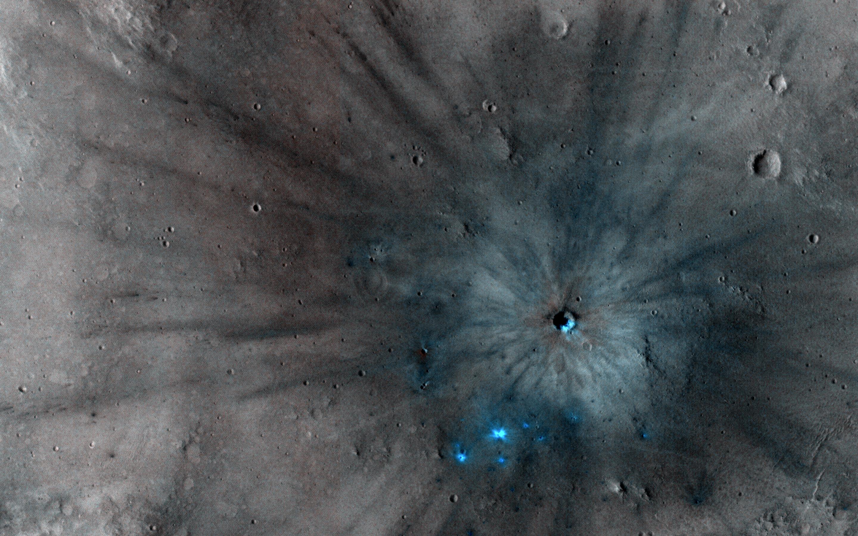
2017-04-05 |
Mars
|
Mars Reconnaissance Orbiter (MRO)
|
HiRISE
|
2880x1800x3 |
|
-
PIA21578:
-
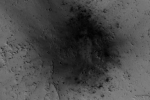
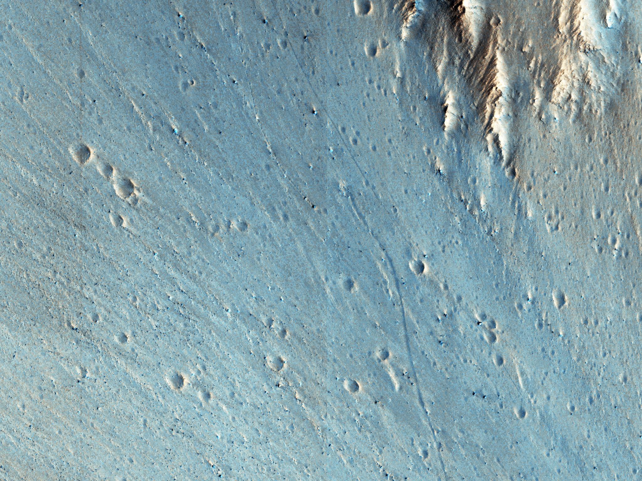
A New Impact Site in the Southern Middle Latitudes
Full Resolution:
TIFF
(14.35 MB)
JPEG
(694.7 kB)
|
|
|
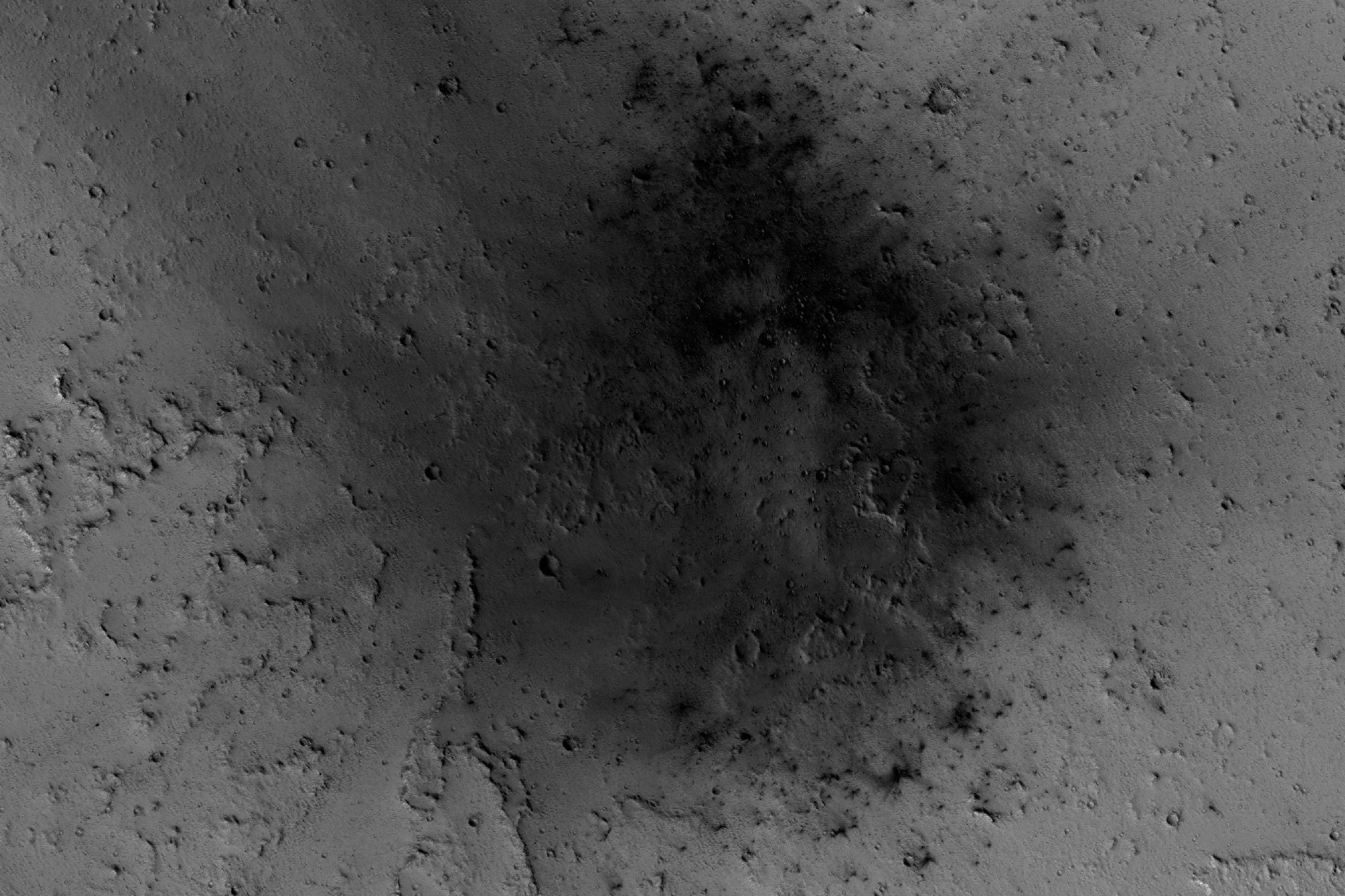
2017-04-04 |
Mars
|
Mars Reconnaissance Orbiter (MRO)
|
HiRISE
|
2880x1800x1 |
|
-
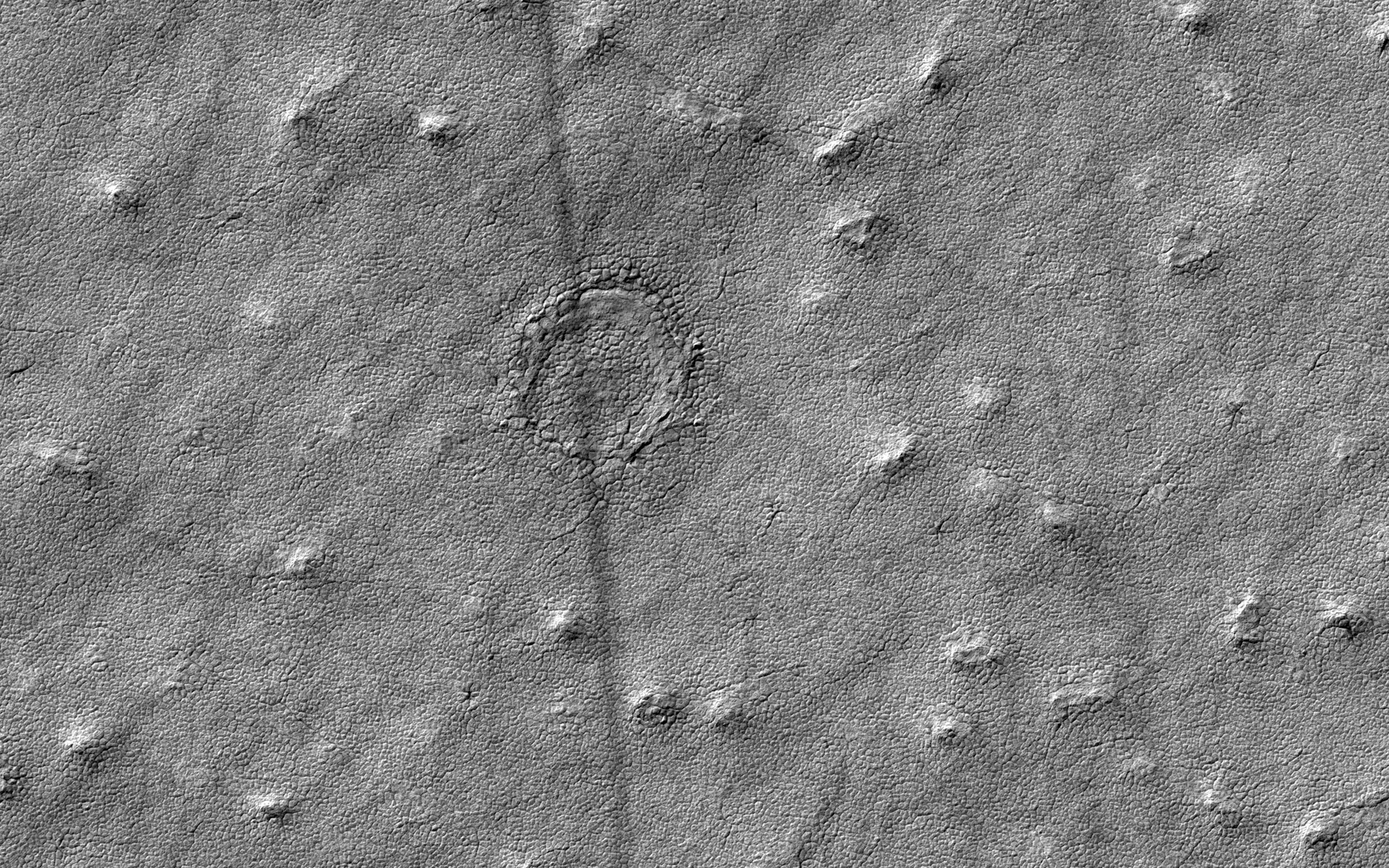
PIA21576:
-
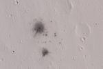
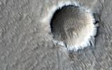
Is that an Impact Crater?
Full Resolution:
TIFF
(5.191 MB)
JPEG
(1.411 MB)
|
|
|
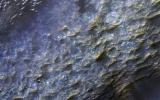
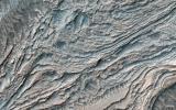
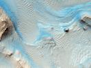
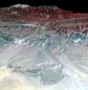
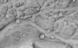
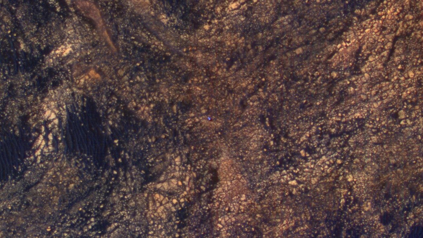
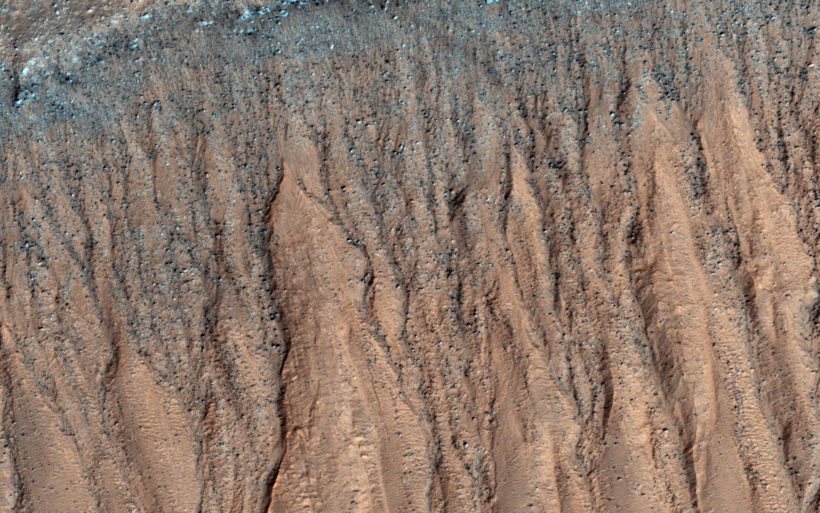
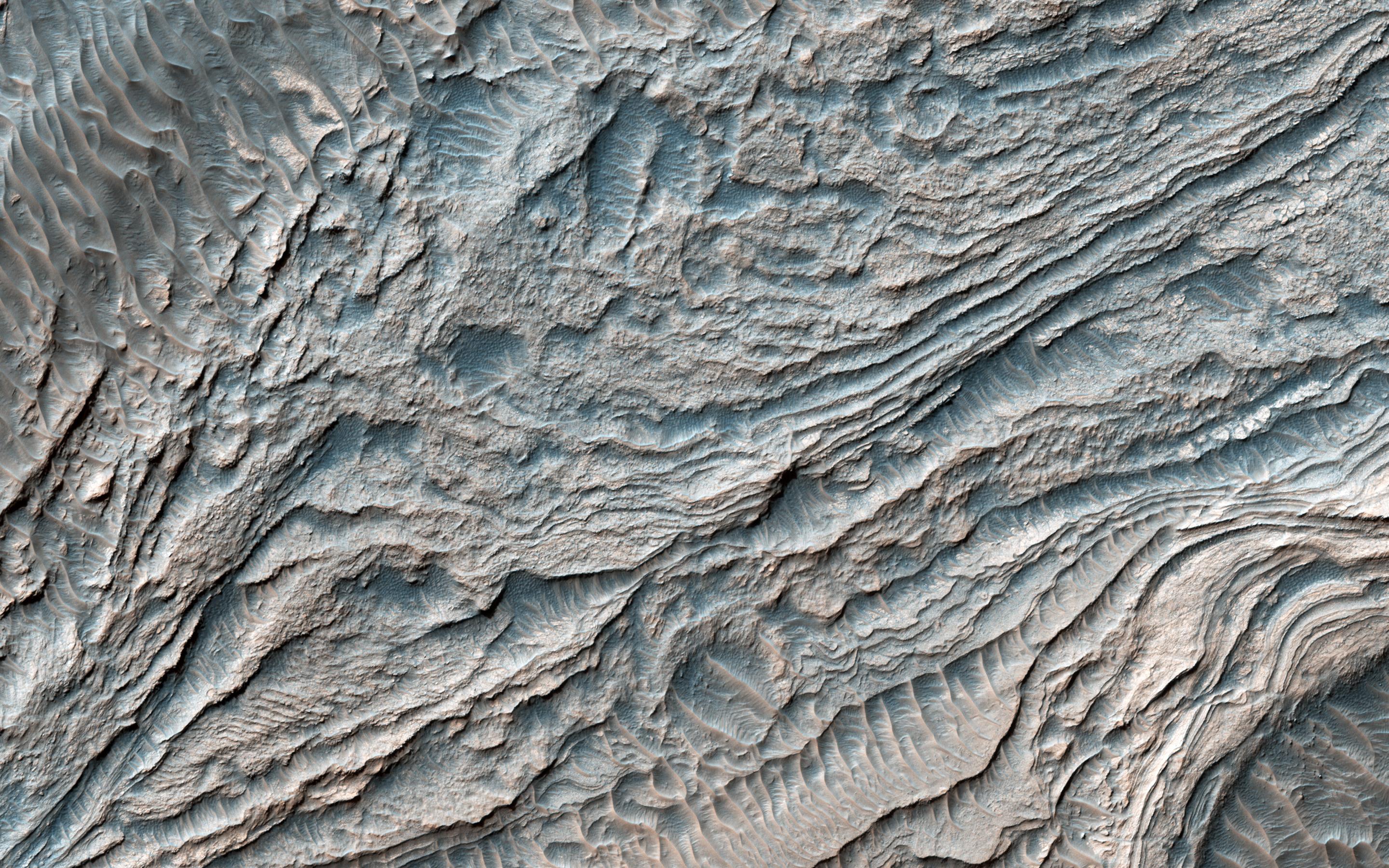
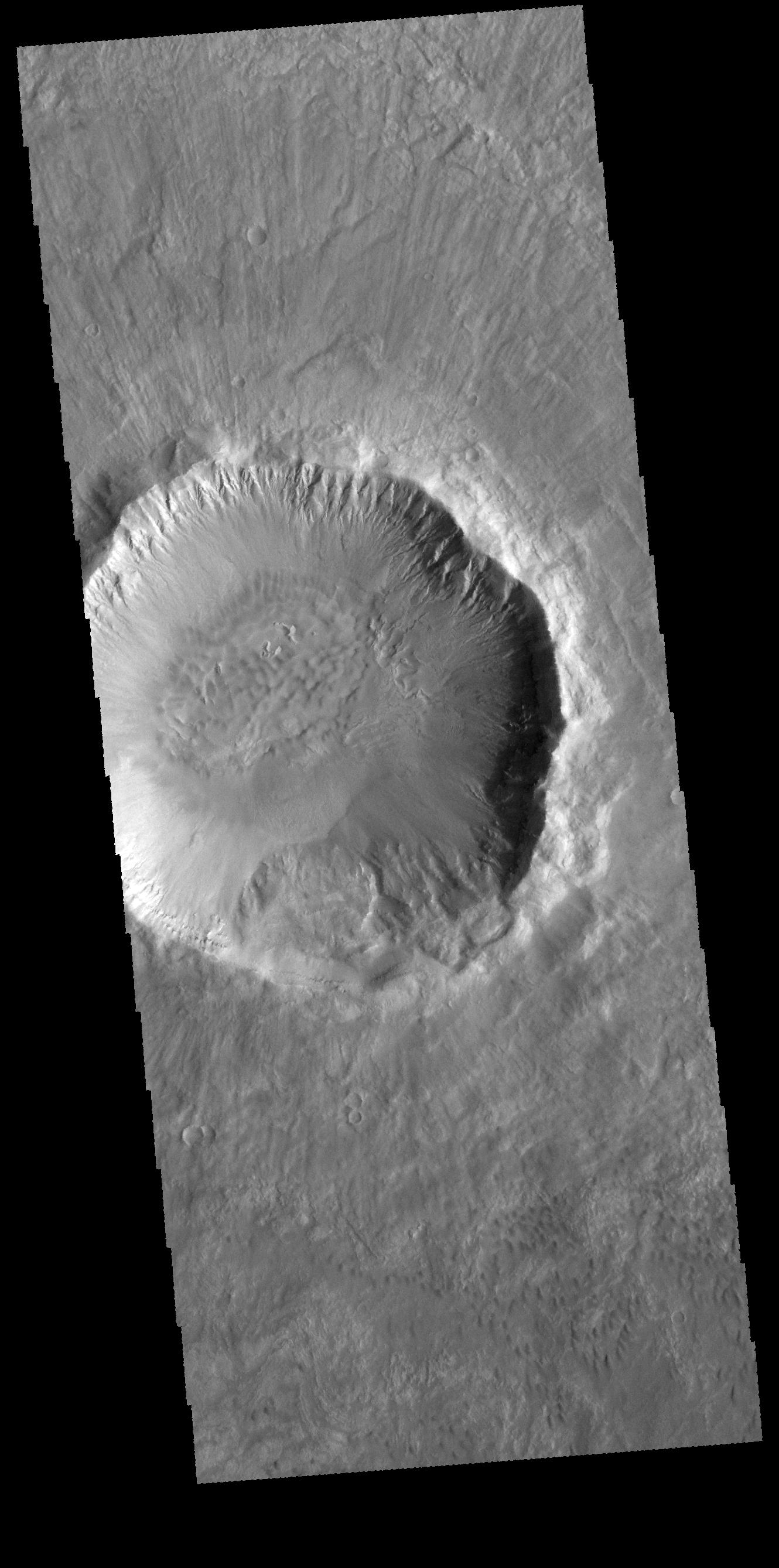
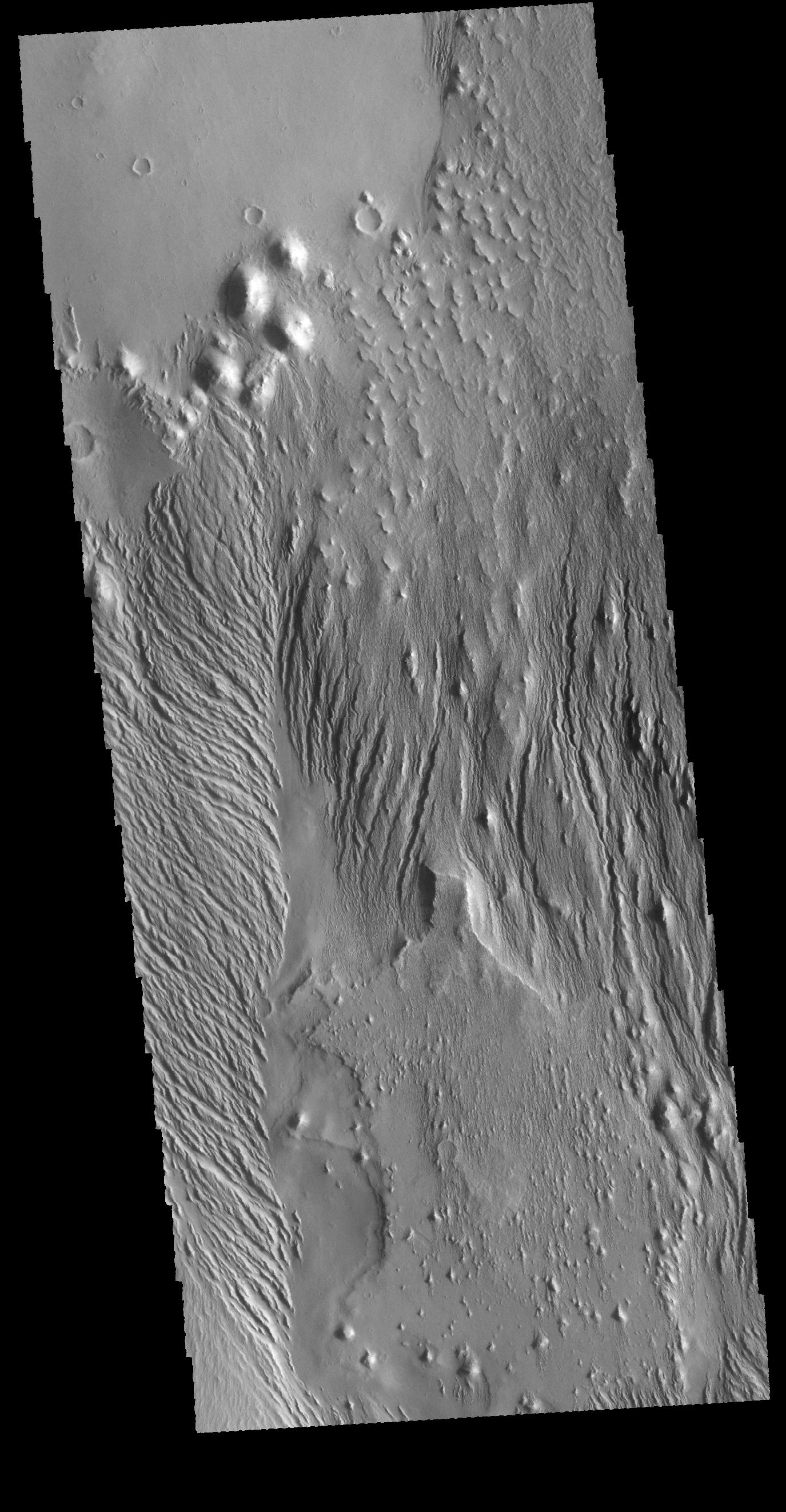
2017-03-31 |
Mars
|
Mars Reconnaissance Orbiter (MRO)
|
HiRISE
|
2880x1800x3 |
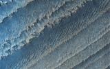
|
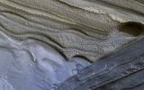
-
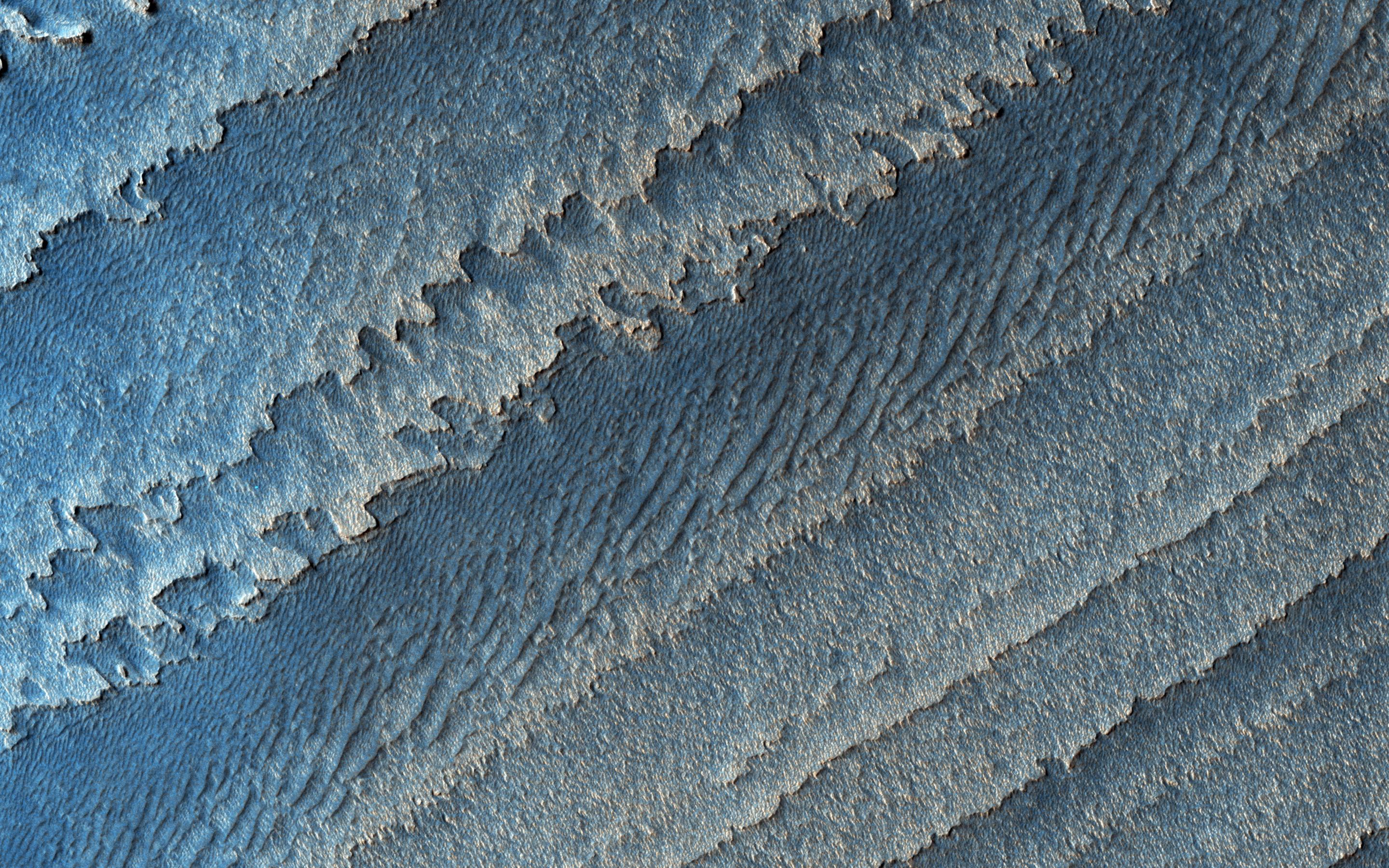
PIA21575:
-
Layers in Galle Crater
Full Resolution:
TIFF
(15.56 MB)
JPEG
(1.236 MB)
|
|
|
2017-03-29 |
Mars
|
Mars Reconnaissance Orbiter (MRO)
|
CTX
|
10000x5000x1 |
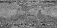
|
-
PIA21488:
-
Mars Global Coverage by Context Camera on MRO
Full Resolution:
TIFF
(48.71 MB)
JPEG
(8.229 MB)
|
|
|
2017-03-29 |
Mars
|
Mars Reconnaissance Orbiter (MRO)
|
CTX
|
10000x5000x1 |

|
-
PIA21487:
-
A Decade of Compiling the Sharpest Mars Map
Full Resolution:
TIFF
(48.71 MB)
JPEG
(8.229 MB)
|
|
|
2017-03-27 |
S Rings
|
Cassini-Huygens
|
ISS - Narrow Angle
|
1020x1020x1 |

|
-
PIA20525:
-
Checking in on Bleriot
Full Resolution:
TIFF
(912 kB)
JPEG
(134.7 kB)
|
|
|
2017-03-24 |
Earth
|
Terra
|
ASTER
|
1775x2267x3 |

|
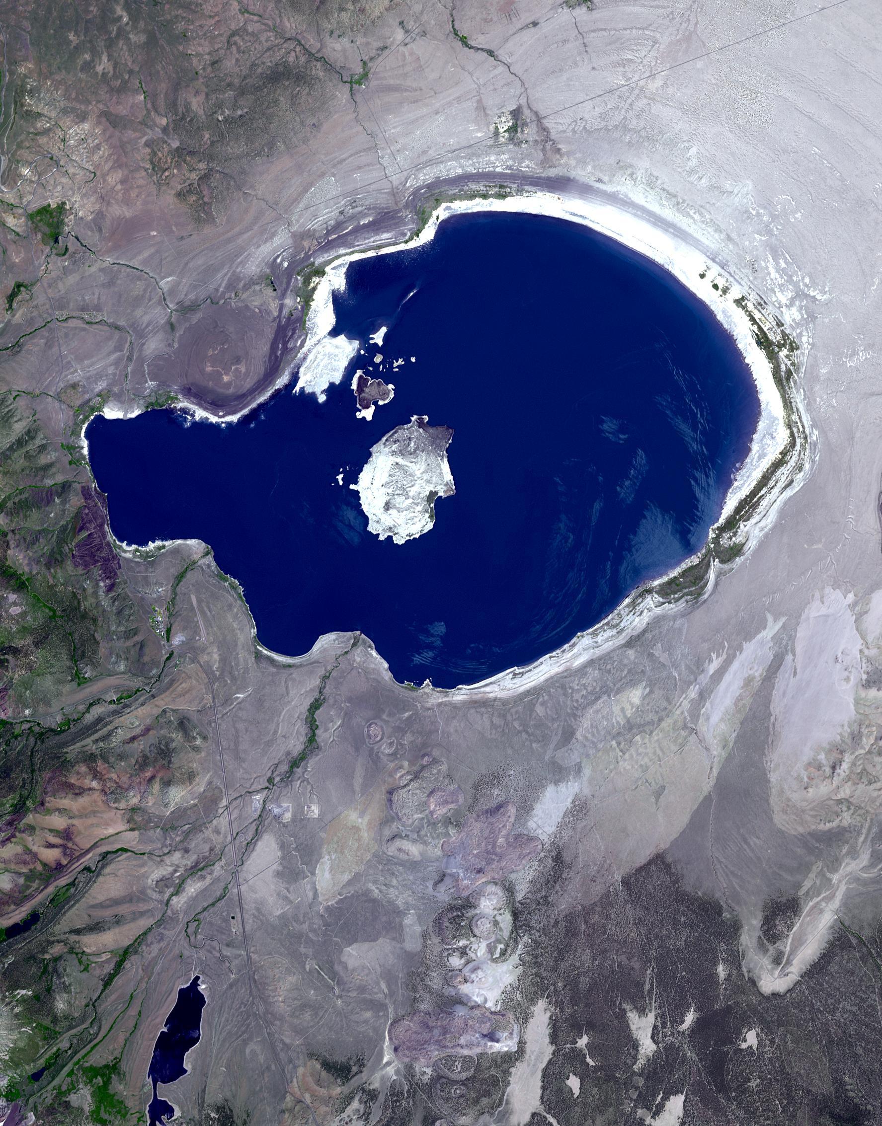
-
PIA21518:
-
Mono Lake, California
Full Resolution:
TIFF
(11.27 MB)
JPEG
(687.6 kB)
|
|
|
2017-03-23 |
Earth
|
ARIA
|
PALSAR-2
|
4481x2682x3 |
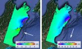
|
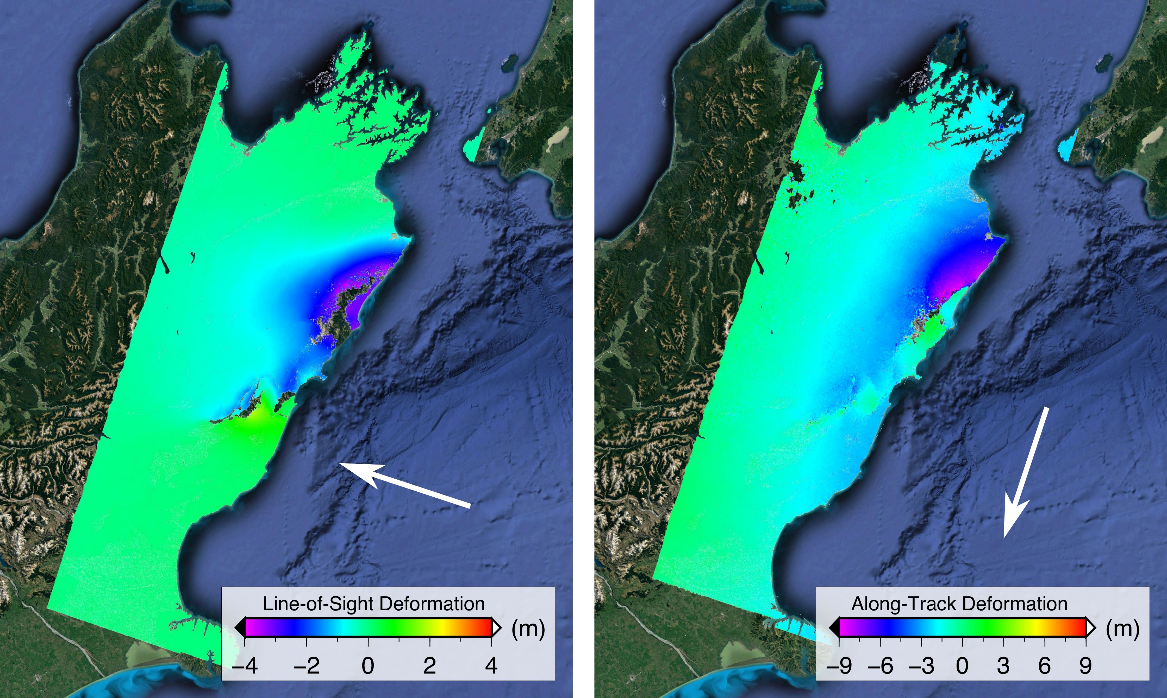
-
PIA21210:
-
Satellite Radar Show Complex Set of Faults Moved in 2016 New Zealand Earthquake
Full Resolution:
TIFF
(32.2 MB)
JPEG
(1.209 MB)
|
|
|
2017-03-21 |
Comet
|
Rosetta
|
OSIRIS
|
5333x3333x3 |
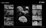
|
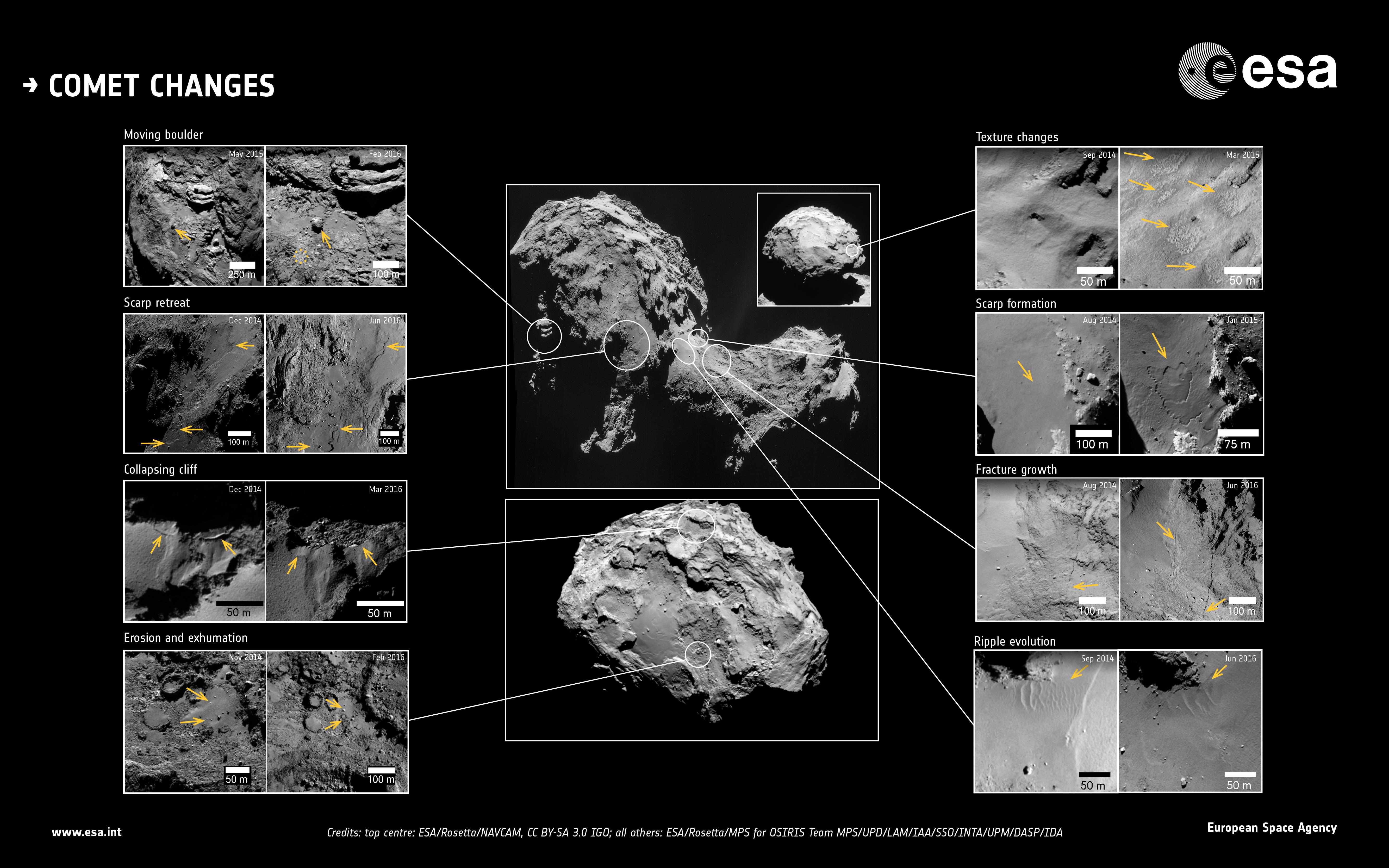
-
PIA21566:
-
Comet 67P Changes
Full Resolution:
TIFF
(11.38 MB)
JPEG
(1.559 MB)
|
|
|
2017-03-16 |
Pan
|
Cassini-Huygens
|
ISS - Narrow Angle
|
535x357x1 |

|
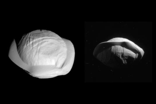
-
PIA21436:
-
Pan Revealed
Full Resolution:
TIFF
(72.16 kB)
JPEG
(9.056 kB)
|
|
|
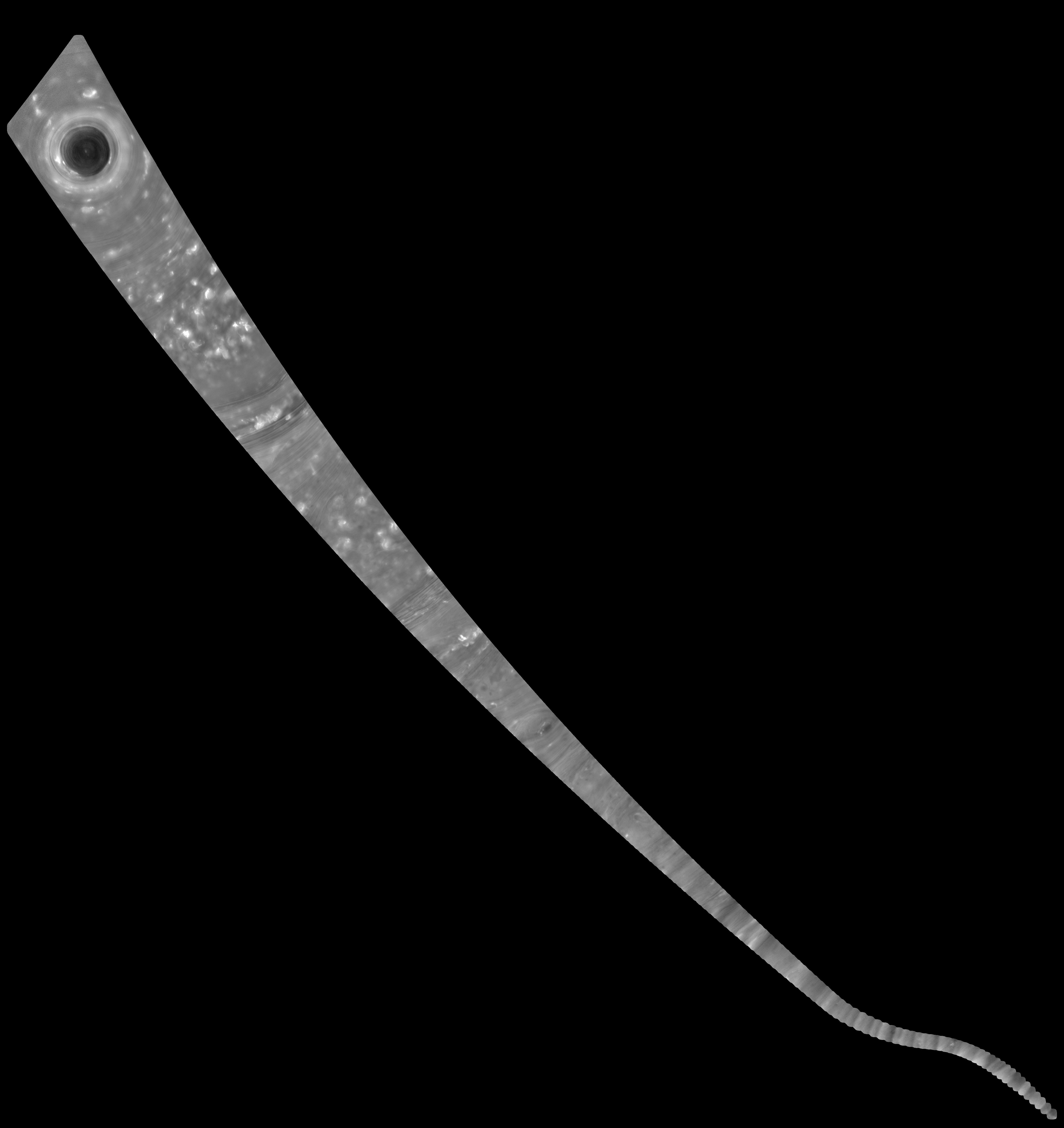
2017-03-15 |
Titan
|
Cassini-Huygens
|
ISS - Narrow Angle
|
1828x1200x1 |
|
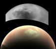
-
PIA21434:
-
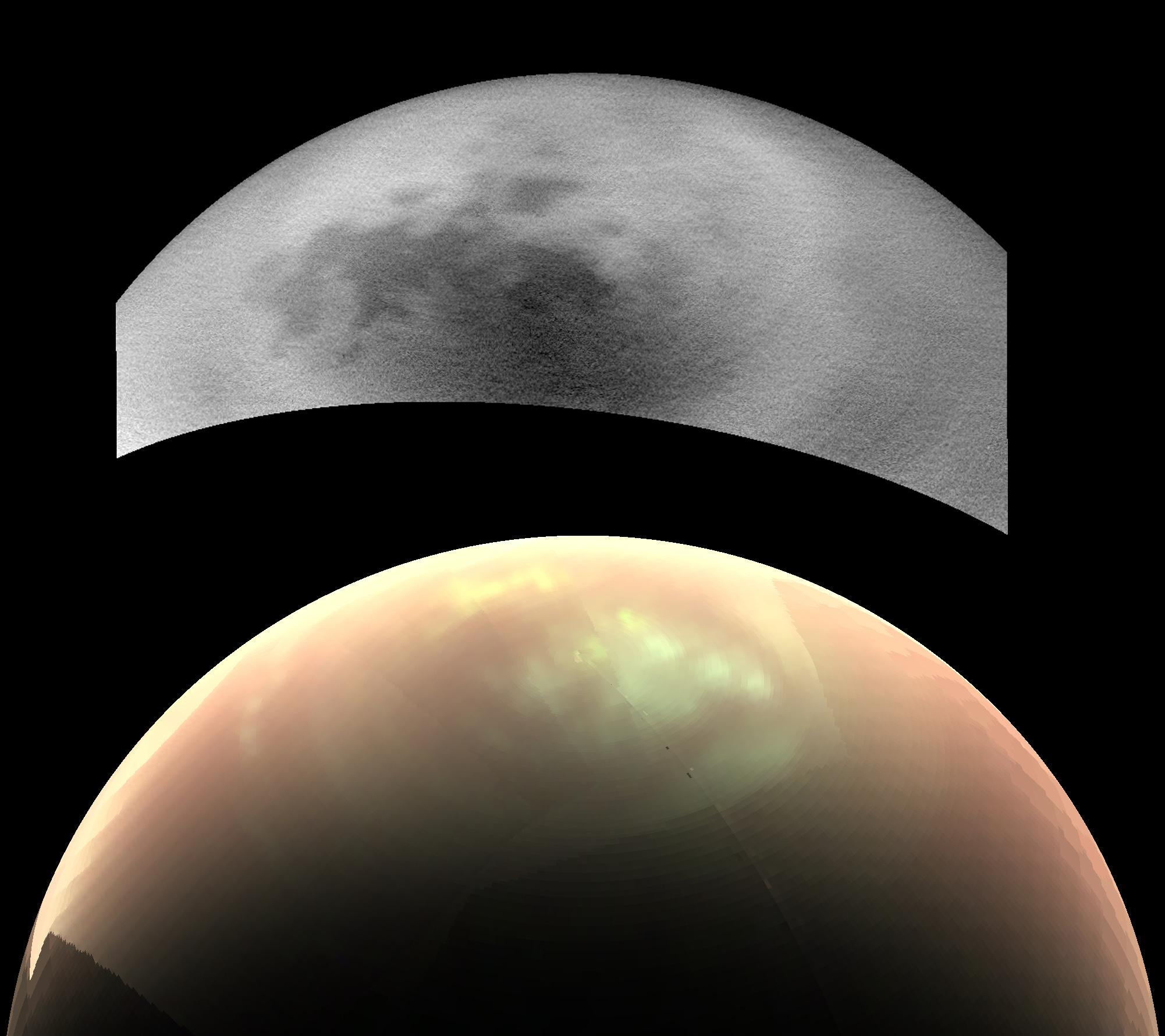
Titan: Kraken and Ligeia In Sharper Focus
Full Resolution:
TIFF
(1.573 MB)
JPEG
(202.8 kB)
|
|
|
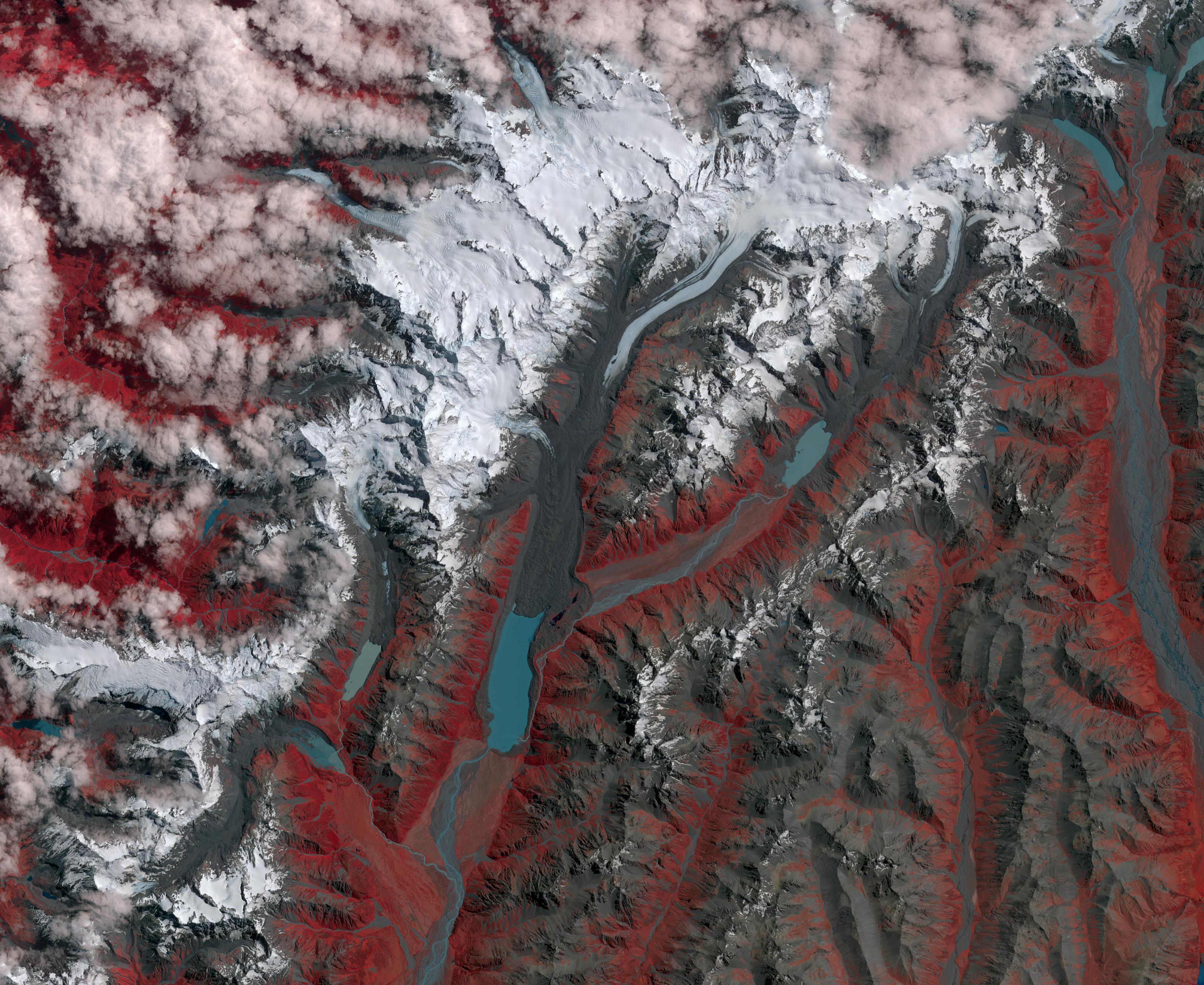
2017-03-09 |
Earth
|
Terra
|
ASTER
|
3168x2592x3 |
|
-
PIA21509:
-
New Zealand Glaciers
Full Resolution:
TIFF
(24.64 MB)
JPEG
(1.33 MB)
|
|
|
2017-03-09 |
Mars
|
Mars Reconnaissance Orbiter (MRO)
|
MARCI
|
1400x787x3 |

|
-
PIA21484:
-
Back-to-Back Martian Dust Storms
Full Resolution:
TIFF
(1.112 MB)
JPEG
(997.3 kB)
|
|
|
2017-02-28 |
Mars
|
Mars Reconnaissance Orbiter (MRO)
|
HiRISE
|
2880x1800x3 |
|
-
PIA21465:
-
North Polar Layers
Full Resolution:
TIFF
(15.56 MB)
JPEG
(886.7 kB)
|
|
|
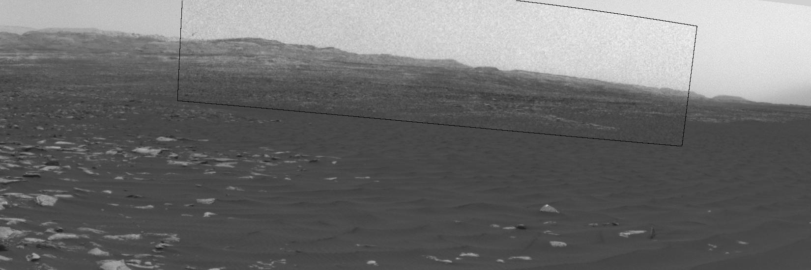
2017-02-27 |
Mars
|
Mars Science Laboratory (MSL)
|
Navcam (MSL)
|
1650x550x1 |

|
-
PIA21483:
-
Swirling Dust in Gale Crater, Mars, Sol 1613
Full Resolution:
TIFF
(673.4 kB)
JPEG
(80.89 kB)
|
|
|
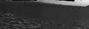
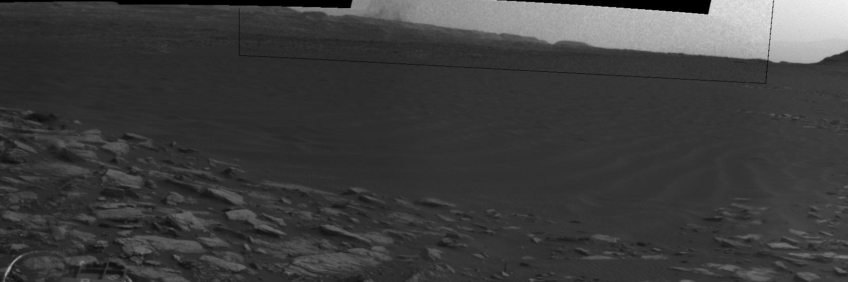
2017-02-27 |
Mars
|
Mars Science Laboratory (MSL)
|
Navcam (MSL)
|
1650x550x1 |
|
-
PIA21482:
-
Curiosity Observes Whirlwinds Carrying Martian Dust
Full Resolution:
TIFF
(691 kB)
JPEG
(105.6 kB)
|
|
|
2017-02-27 |
Mars
|
Mars Science Laboratory (MSL)
|
Navcam (MSL)
|
1650x550x1 |
|
-
PIA21481:
-
Dust Devil Passes Near Martian Sand Dune
Full Resolution:
TIFF
(664.3 kB)
JPEG
(66.26 kB)
|
|
|
2017-02-27 |
Mars
|
Mars Science Laboratory (MSL)
|
Navcam (MSL)
|
1650x550x1 |

|
-
PIA21270:
-
Martian Dust Devil Action in Gale Crater, Sol 1597
Full Resolution:
TIFF
(809.6 kB)
JPEG
(114.5 kB)
|
|
|
2017-02-22 |
|
Spitzer Space Telescope
|
TRAPPIST
|
1621x911x3 |
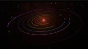
|
-
PIA21427:
-
TRAPPIST-1 Planetary Orbits and Transits
Full Resolution:
TIFF
(1.411 MB)
JPEG
(61.72 kB)
|
|
|
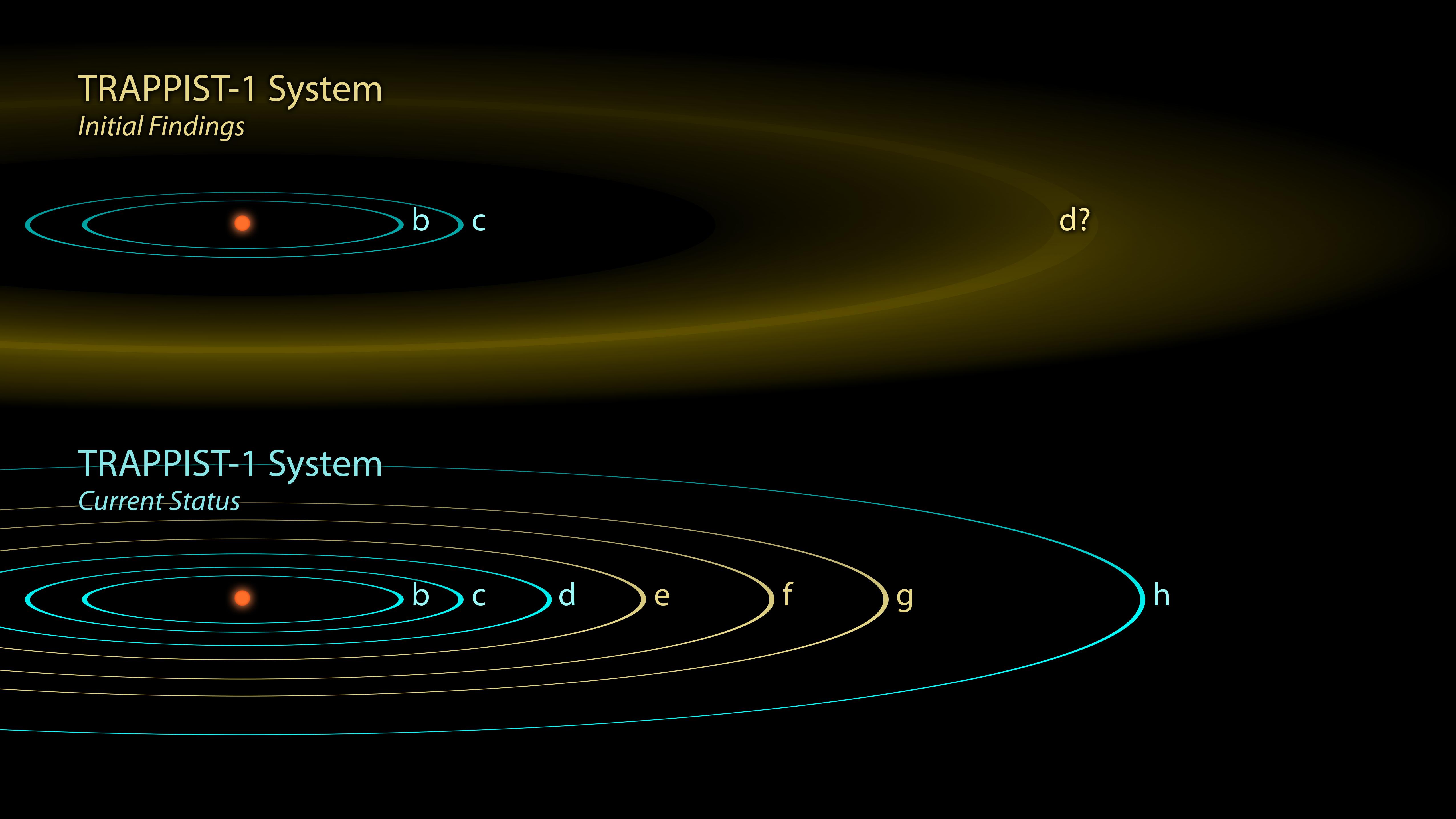
2017-02-22 |
|
Spitzer Space Telescope
|
TRAPPIST
|
5104x2871x3 |
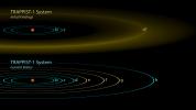
|
-
PIA21426:
-
The Discovery of TRAPPIST-1 Planets
Full Resolution:
TIFF
(3.828 MB)
JPEG
(491 kB)
|
|
|
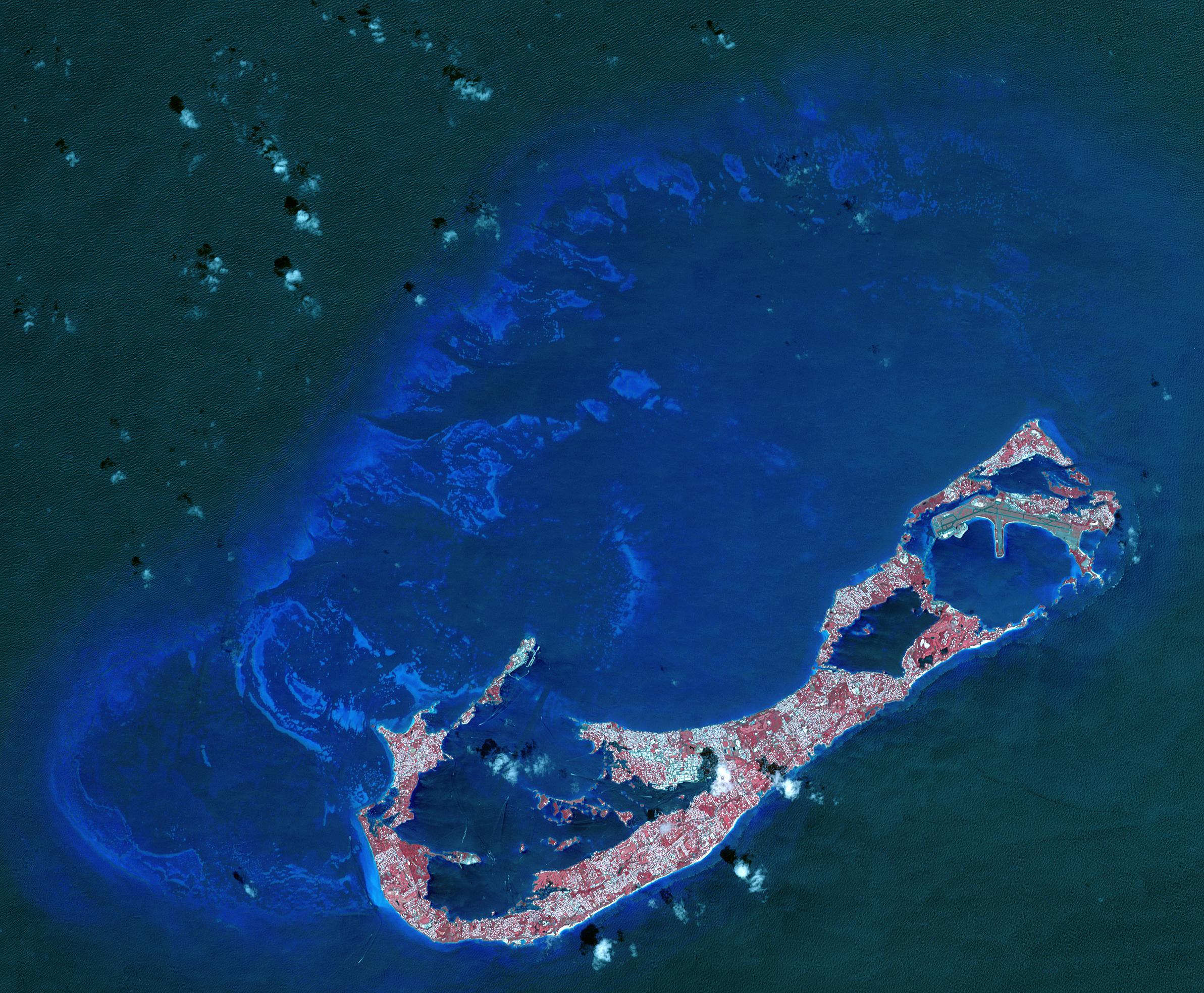
2017-02-15 |
Earth
|
Terra
|
ASTER
|
2385x1968x3 |
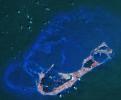
|
-
PIA21315:
-
Bermuda
Full Resolution:
TIFF
(12.91 MB)
JPEG
(736.9 kB)
|
|
|
2017-02-09 |
Mars
|
Mars Reconnaissance Orbiter (MRO)
|
HiRISE
|
2880x1800x3 |
|
-
PIA21451:
-
Unlocking an Impact Crater's Clues
Full Resolution:
TIFF
(15.56 MB)
JPEG
(1.016 MB)
|
|
|
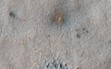
2017-02-08 |
Mars
|
Mars Reconnaissance Orbiter (MRO)
|
HiRISE
|
1992x1328x1 |
|
-
PIA21267:
-
Mars Reconnaissance Orbiter Observes Changes
Full Resolution:
TIFF
(2.19 MB)
JPEG
(494.5 kB)
|
|
|
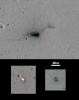
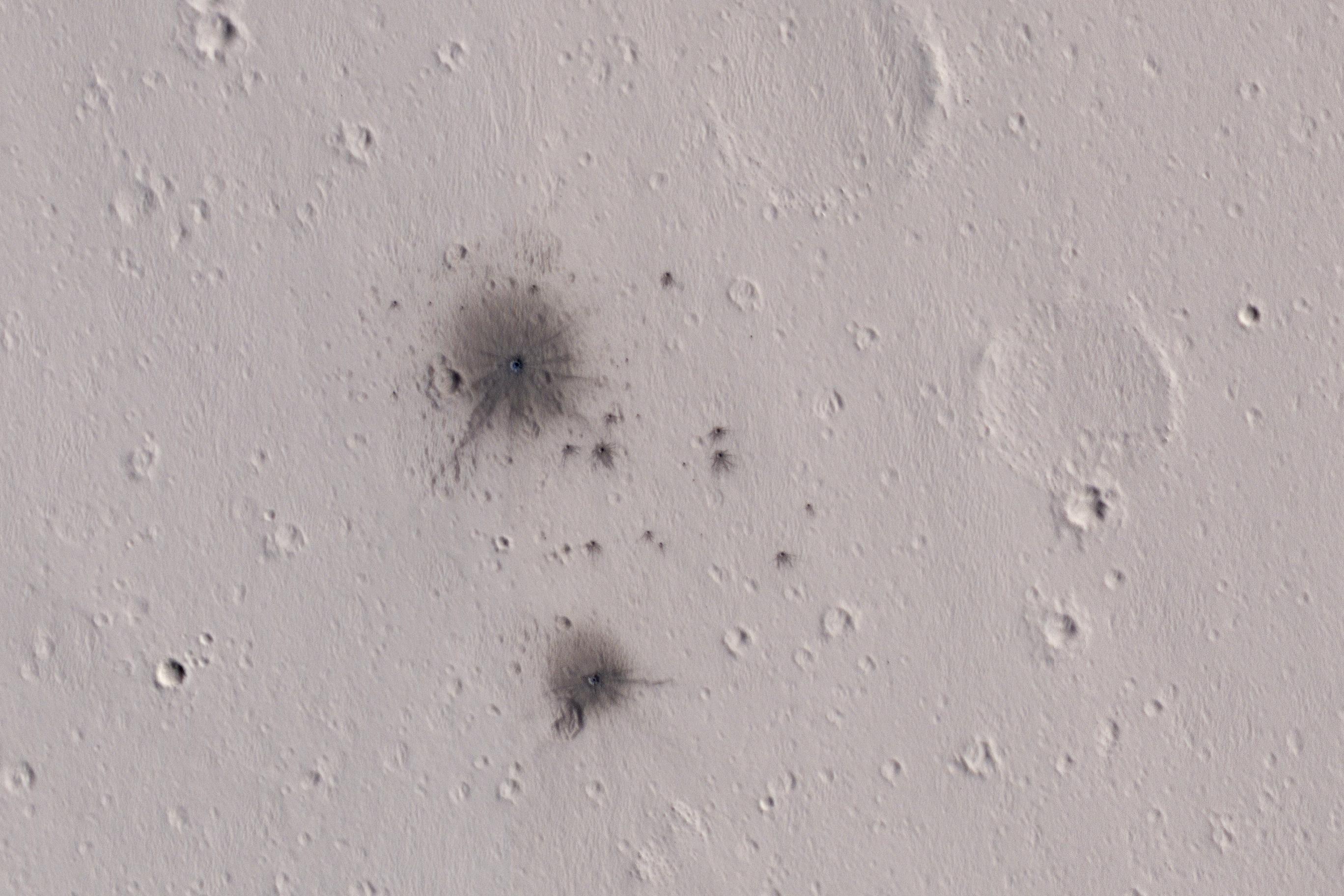
2017-02-07 |
Mars
|
Mars Reconnaissance Orbiter (MRO)
|
HiRISE
|
2736x1824x3 |
|
-
PIA11176:
-
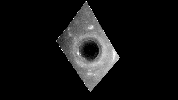
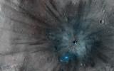
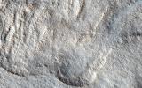
A Recent Cluster of Impacts
Full Resolution:
TIFF
(11.27 MB)
JPEG
(583.1 kB)
|
|
|
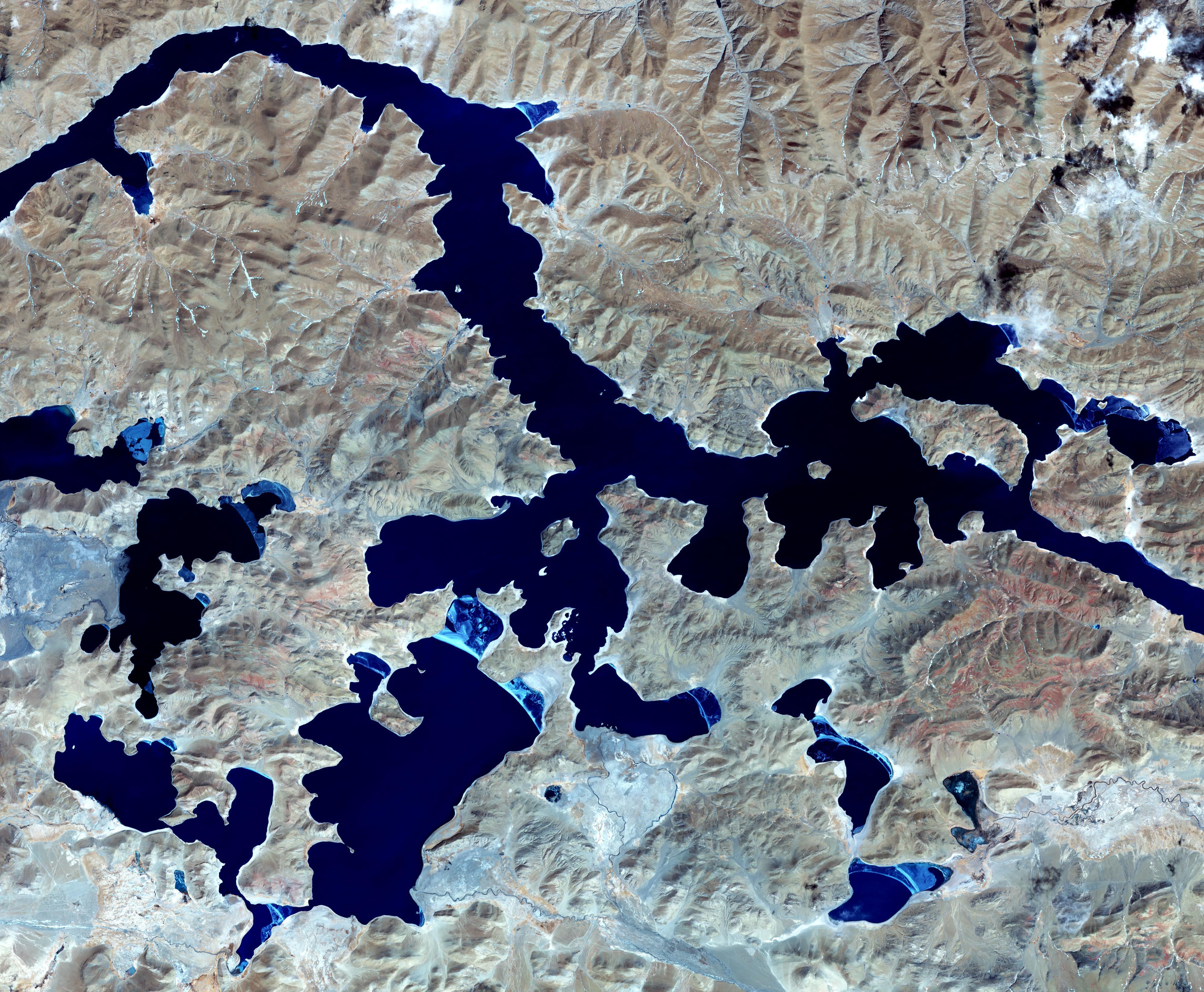
2017-02-01 |
Earth
|
Terra
|
ASTER
|
3996x3291x3 |

|
-
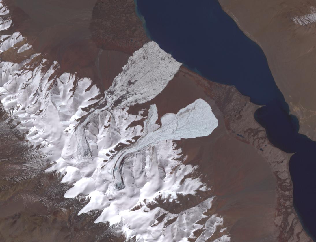
PIA21304:
-
Yamzho Yumco Lake, Tibet
Full Resolution:
TIFF
(38.47 MB)
JPEG
(2.052 MB)
|
|
|
2017-02-01 |
Mars
|
Mars Reconnaissance Orbiter (MRO)
|
HiRISE
|
2880x1800x3 |
|
-
PIA11181:
-
Dunes in Northern Summer
Full Resolution:
TIFF
(14.91 MB)
JPEG
(580.3 kB)
|
|
|
2017-01-06 |
Earth
|
Terra
|
ASTER
|
3367x3672x3 |

|
-
PIA21284:
-
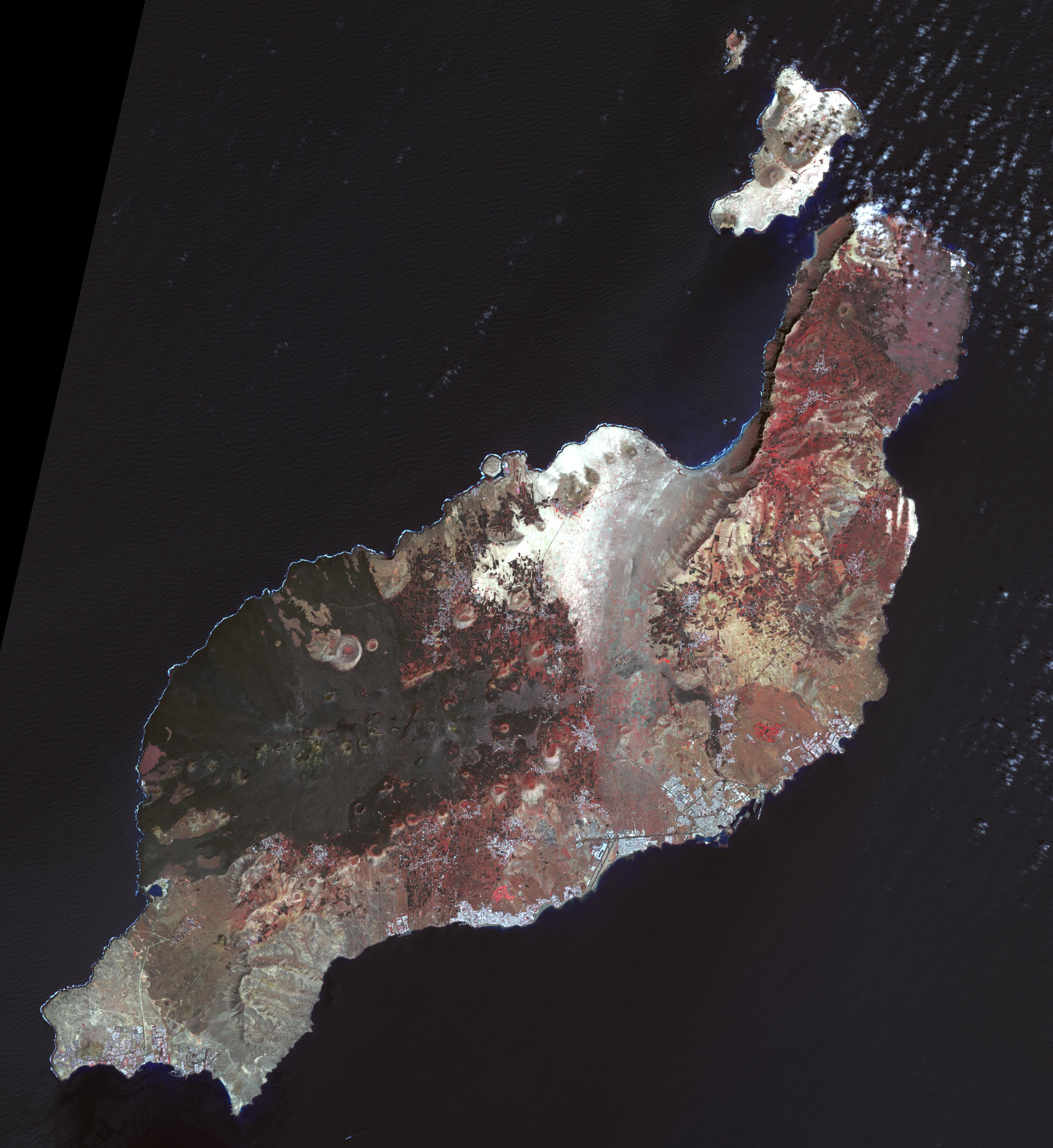
Lanzarote, Canary Islands
Full Resolution:
TIFF
(21.83 MB)
JPEG
(1.084 MB)
|
|
|
2017-01-02 |
Titan
|
Cassini-Huygens
|
ISS - Narrow Angle
|
1024x1024x1 |
|
-
PIA20516:
-
Send in the Clouds
Full Resolution:
TIFF
(795.6 kB)
JPEG
(58.94 kB)
|
|
|
2016-12-21 |
Titan
|
Cassini-Huygens
|
Imaging Science Subsystem
|
2002x1781x3 |
|
-
PIA21054:
-
Titan's Mystery Clouds
Full Resolution:
TIFF
(3.844 MB)
JPEG
(219.8 kB)
|
|
|
2016-12-14 |
Mars
|
Mars Reconnaissance Orbiter (MRO)
|
HiRISE
|
2880x1800x1 |
|
-
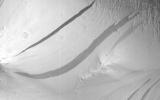
PIA21272:
-
Slope Streaks or RSL?
Full Resolution:
TIFF
(4.836 MB)
JPEG
(569.6 kB)
|
|
|
2016-12-13 |
Mars
|
Mars Science Laboratory (MSL)
|
|
1920x1080x3 |

|
-
PIA21255:
-
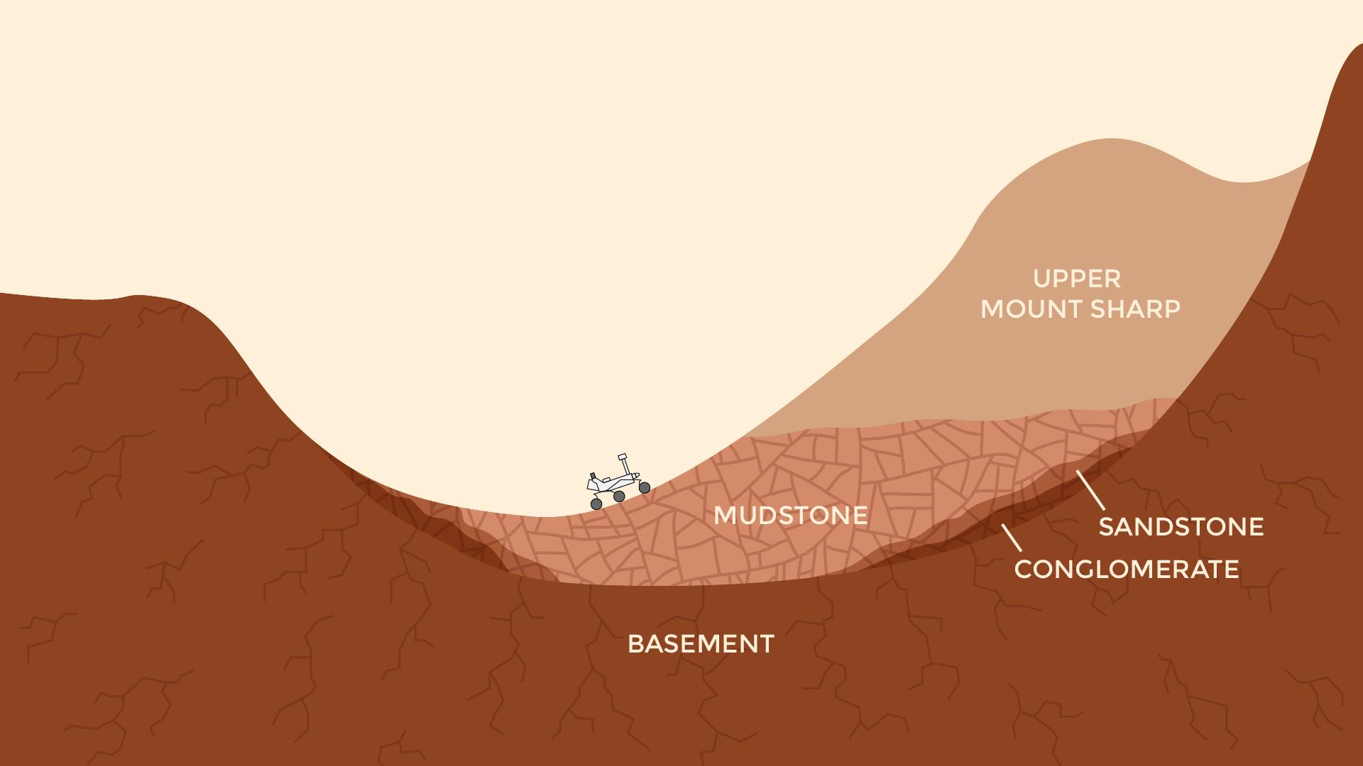
Now and Long Ago at Gale Crater, Mars (Illustration)
Full Resolution:
TIFF
(491.6 kB)
JPEG
(77.52 kB)
|
|
|
2016-12-12 |
Earth
|
Terra
|
ASTER
|
3087x2484x3 |
|
-
PIA21189:
-
Kashgar, China
Full Resolution:
TIFF
(23.01 MB)
JPEG
(1.747 MB)
|
|
|
2016-12-12 |
Daphnis
|
Cassini-Huygens
|
ISS - Narrow Angle
|
1020x1020x1 |
|
-
PIA20511:
-
Watching the Wavemaker
Full Resolution:
TIFF
(590.8 kB)
JPEG
(62 kB)
|
|
|
2016-12-01 |
Earth
|
Terra
|
ASTER
|
395x655x3 |
|
-
PIA21182:
-
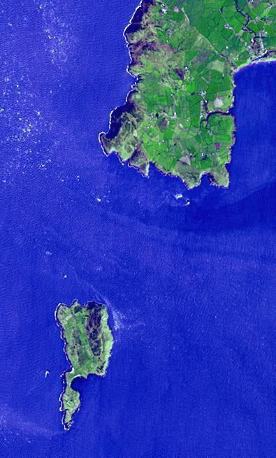
Bardsey Island, Wales
Full Resolution:
TIFF
(776.7 kB)
JPEG
(54.91 kB)
|
|
|
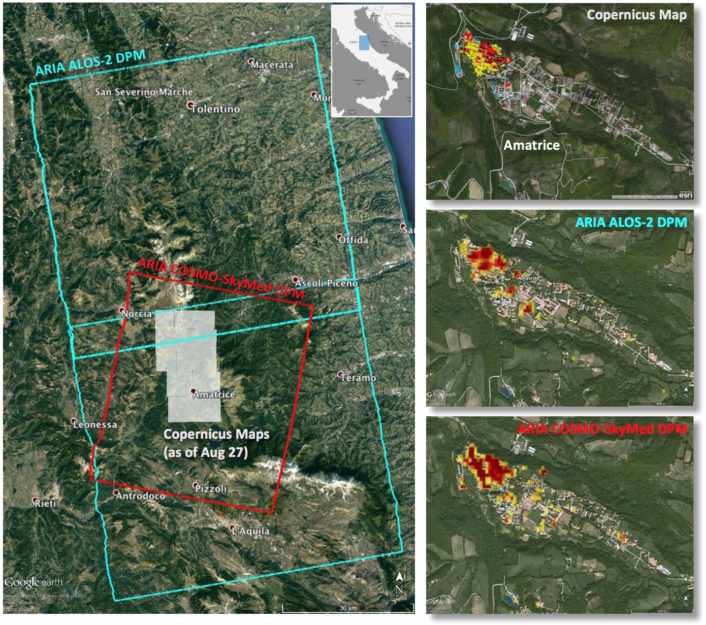
2016-11-16 |
Earth
|
ARIA
|
|
1119x1289x3 |

|
-
PIA15374:
-
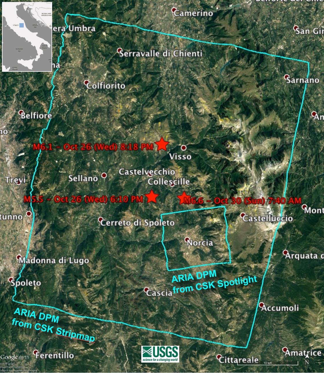
NASA’s Damage Proxy Map to Assist with Italy Earthquake Disaster Response
Full Resolution:
TIFF
(4.329 MB)
JPEG
(322.2 kB)
|
|
|
2016-11-15 |
Mars
|
Mars Reconnaissance Orbiter (MRO)
|
HiRISE
|
763x968x3 |
|
-
PIA21135:
-
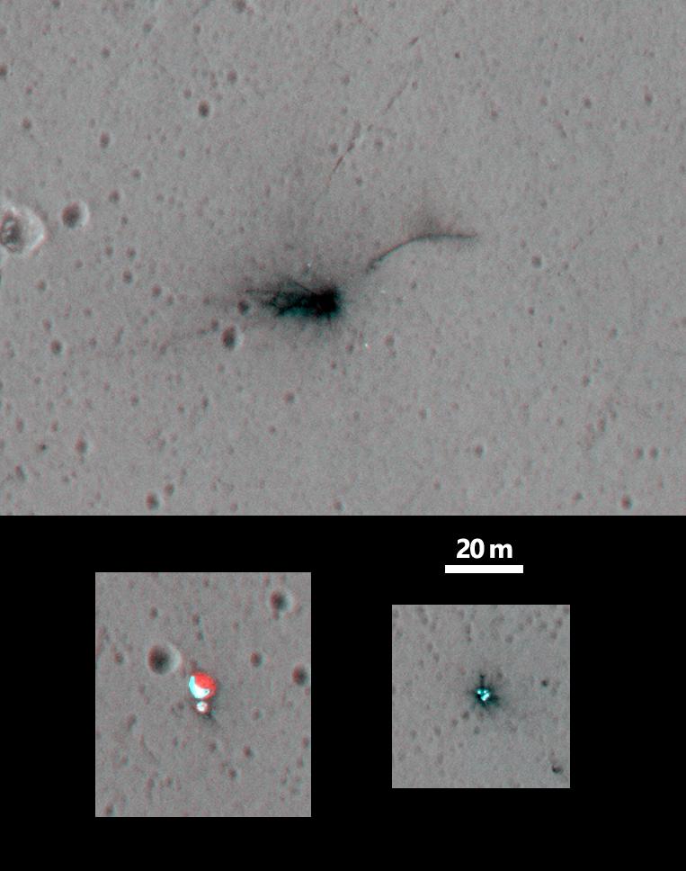
Schiaparelli Impact Site on Mars, Stereo
Full Resolution:
TIFF
(1.385 MB)
JPEG
(70.24 kB)
|
|
|
2016-11-15 |
Earth
|
Terra
|
ASTER
|
3684x2704x3 |
|
-
PIA21170:
-
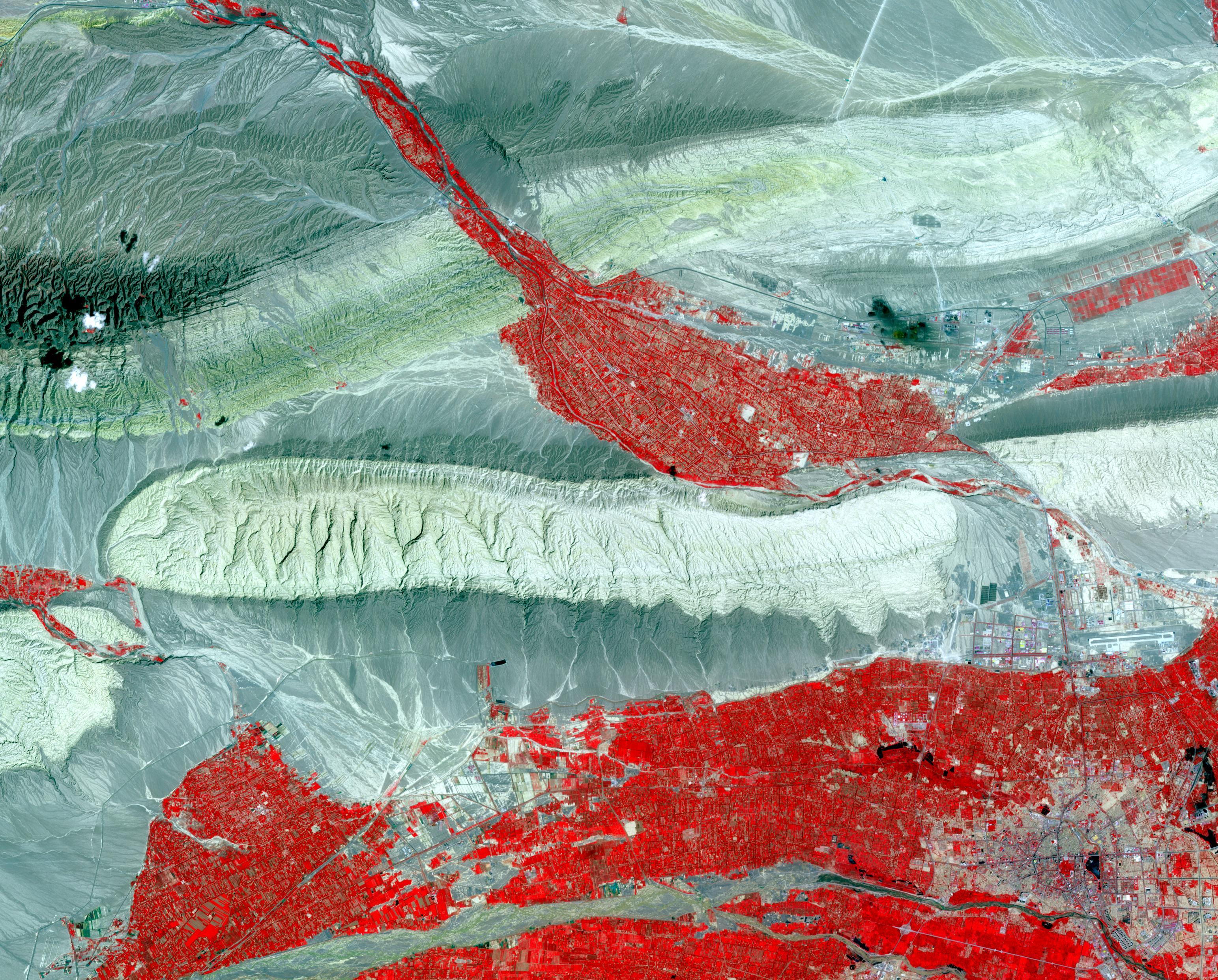
Shadegan, Iran
Full Resolution:
TIFF
(29.9 MB)
JPEG
(1.611 MB)
|
|
|
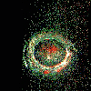
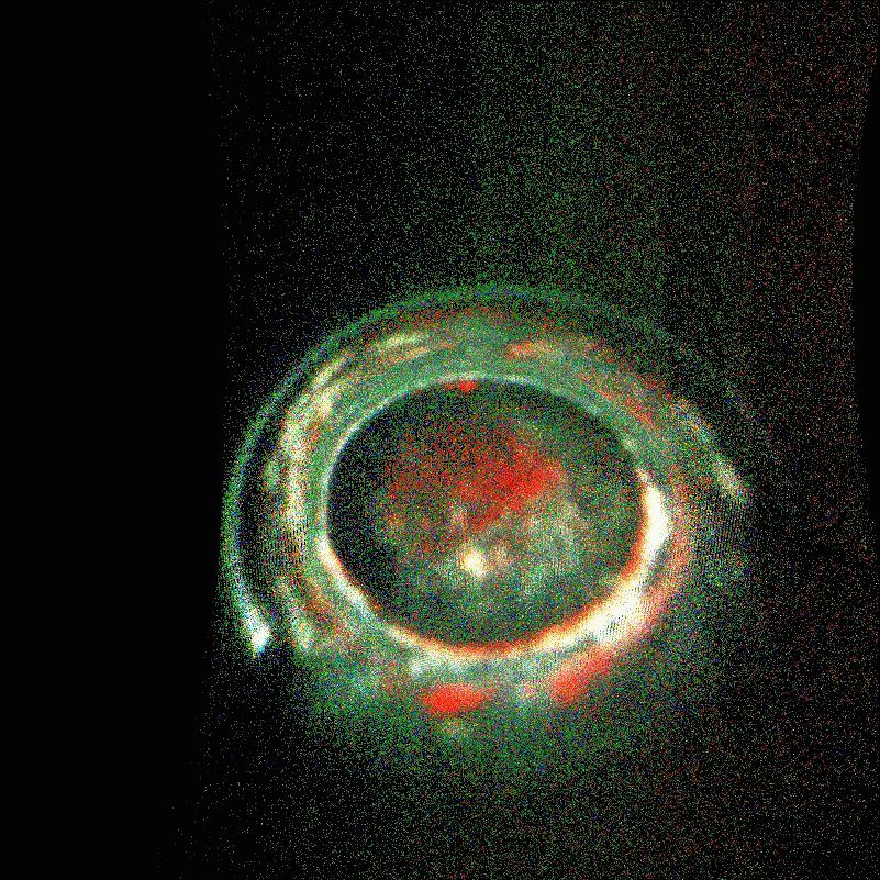
2016-11-10 |
OGLE-2015-BLG-1319
|
Spitzer Space Telescope
SWIFT
|
|
4800x2700x3 |
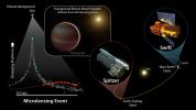
|
-
PIA21077:
-
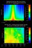
Brown Dwarf Microlensing Diagram
Full Resolution:
TIFF
(8.39 MB)
JPEG
(652.2 kB)
|
|
|
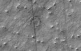
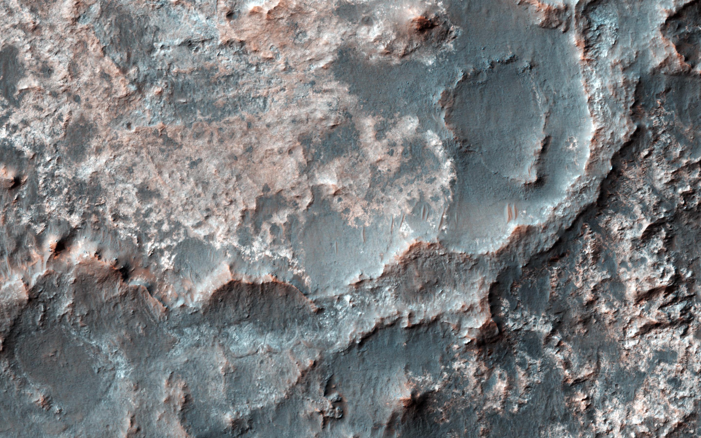
2016-11-09 |
Mars
|
Mars Reconnaissance Orbiter (MRO)
|
HiRISE
|
2048x1536x3 |
|
-
PIA21206:
-
A Glimpse into History
Full Resolution:
TIFF
(9.44 MB)
JPEG
(889.5 kB)
|
|
|
2016-11-09 |
Mars
|
Mars Reconnaissance Orbiter (MRO)
|
HiRISE
|
2048x1536x3 |
|
-
PIA21203:
-
Trundling Boulders
Full Resolution:
TIFF
(9.44 MB)
JPEG
(995.7 kB)
|
|
|
2016-11-09 |
Earth
|
Terra
|
ASTER
|
2022x3012x3 |
|
-
PIA21166:
-
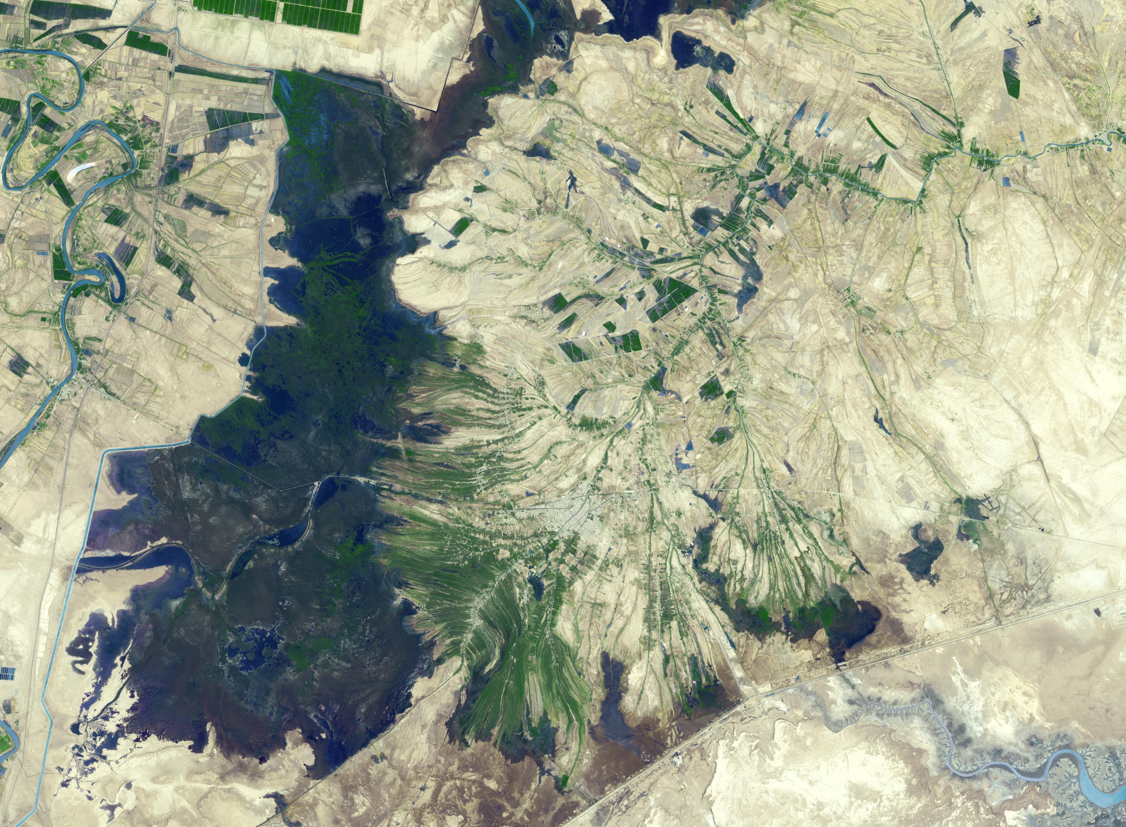
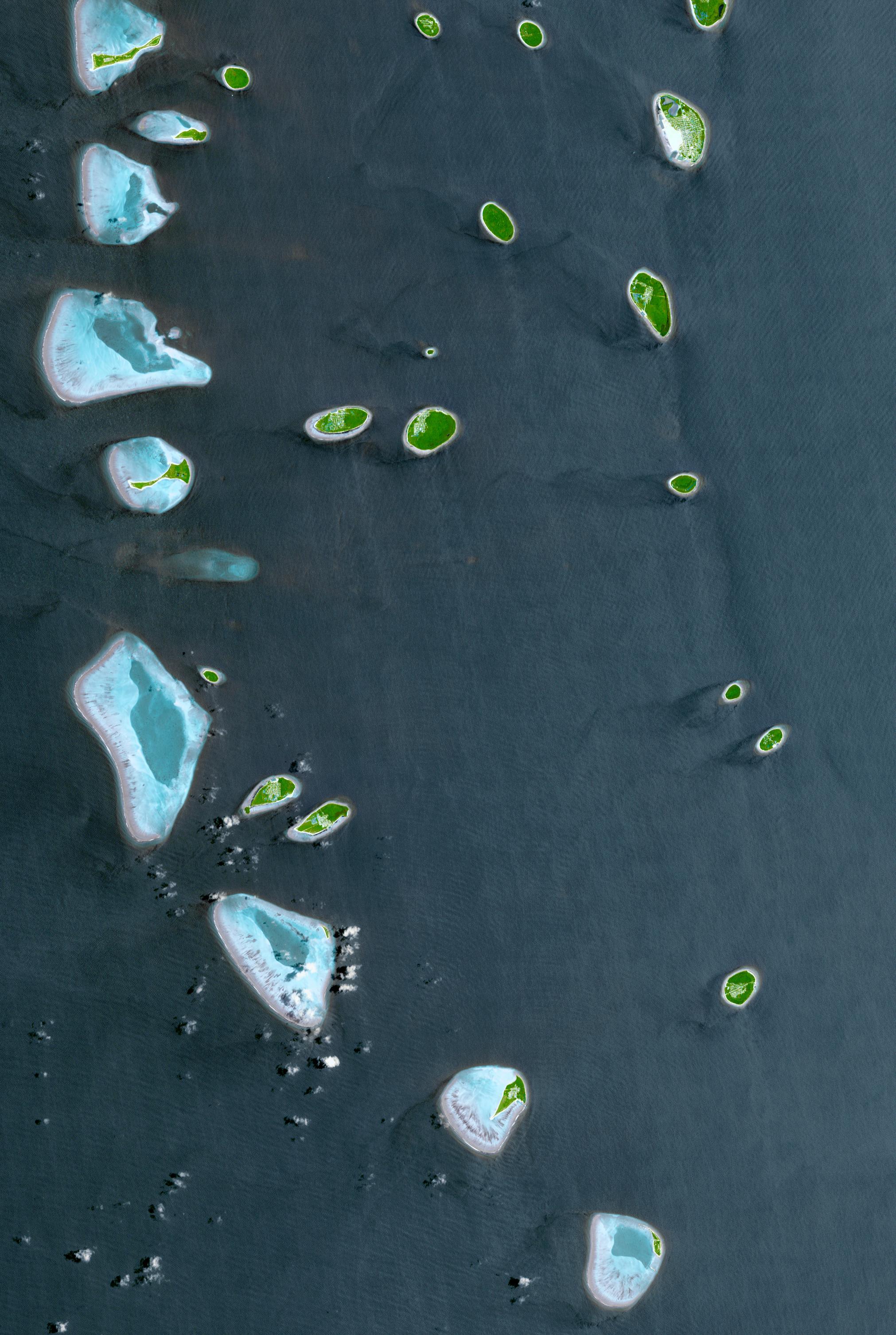
Republic of Maldives
Full Resolution:
TIFF
(14.07 MB)
JPEG
(887.6 kB)
|
|
|
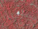
2016-11-08 |
Earth
|
Terra
|
ASTER
|
965x757x3 |
|
-
PIA21099:
-
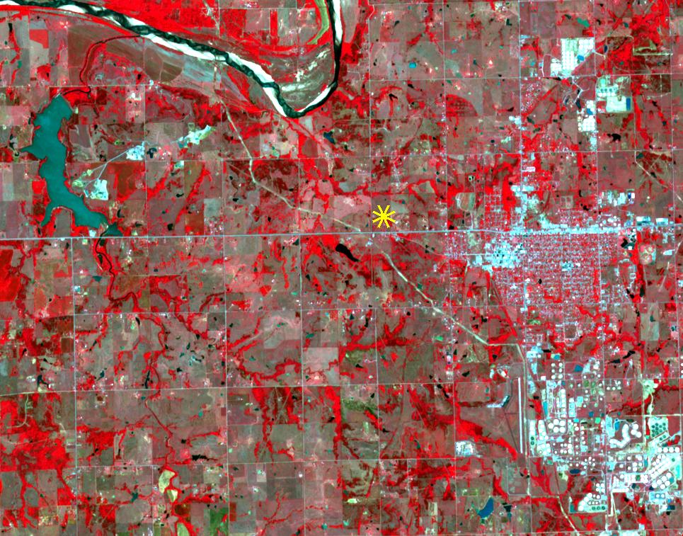
Oklahoma Area Struck By Magnitude 5.0 Earthquake Imaged by NASA Satellite
Full Resolution:
TIFF
(2.185 MB)
JPEG
(191.1 kB)
|
|
|
2016-11-01 |
Mars
|
2001 Mars Odyssey
|
THEMIS
|
1378x2640x1 |
|
-
PIA21155:
-
Olympus Rupes
Full Resolution:
TIFF
(2.817 MB)
JPEG
(438.7 kB)
|
|
|
2016-10-31 |
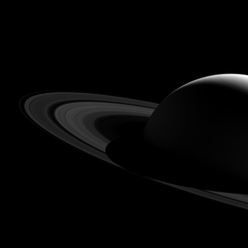
Saturn
|
Cassini-Huygens
|
ISS - Wide Angle
|
1020x1020x1 |
|
-
PIA20502:
-
View from Above
Full Resolution:
TIFF
(944.9 kB)
JPEG
(65.72 kB)
|
|
|
2016-10-27 |
Mars
|
2001 Mars Odyssey
|
THEMIS
|
1330x2677x1 |

|
-
PIA21152:
-
Palikir Crater
Full Resolution:
TIFF
(2.469 MB)
JPEG
(309.8 kB)
|
|
|
2016-10-21 |
Saturn
|
Cassini-Huygens
|
ISS - Wide Angle
|
810x910x3 |

|
-
PIA21049:
-
Changing Colors in Saturn's North
Full Resolution:
TIFF
(1.011 MB)
JPEG
(35.12 kB)
|
|
|
2016-10-21 |
|
Kepler
|
|
4800x2700x3 |

|
-
PIA21075:
-
Heartbeat Stars (Artist's Concept)
Full Resolution:
TIFF
(16.76 MB)
JPEG
(600 kB)
|
|
|
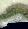
2016-10-13 |
Earth
|
Terra
|
ASTER
|
2763x1493x3 |
|
-
PIA21014:
-
Cape Agulhas, South Africa
Full Resolution:
TIFF
(11.42 MB)
JPEG
(573.9 kB)
|
|
|
2016-10-05 |
Earth
|
ARIA
|
|
1313x1164x3 |
|
-
PIA21091:
-
NASA-Produced Maps Help Gauge Italy Earthquake Damage
Full Resolution:
TIFF
(4.587 MB)
JPEG
(324.8 kB)
|
|
|
2016-10-05 |
Mars
|
Mars Reconnaissance Orbiter (MRO)
|
HiRISE
|
2880x1800x3 |

|
-
PIA21103:
-
A Transition from Depressed to Inverted Channels in Gorgonum Basin
Full Resolution:
TIFF
(15.56 MB)
JPEG
(896.6 kB)
|
|
|
2016-10-05 |
Earth
|
Terra
|
ASTER
|
1094x839x3 |
|
-
PIA21069:
-
NASA Satellite Eyes Deadly Tibetan Landslide
Full Resolution:
TIFF
(2.297 MB)
JPEG
(101 kB)
|
|
|
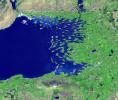
2016-10-04 |
Earth
|
Terra
|
MISR
|
493x1040x1 |

|
-
PIA21070:
-
Hurricane Matthew over Haiti seen by NASA's MISR
Full Resolution:
TIFF
(303.2 kB)
JPEG
(32.93 kB)
|
|
|
2016-09-30 |
Earth
|
Terra
|
ASTER
|
1403x1442x3 |
|
-
PIA21008:
-
Blackhawk Landslide, California
Full Resolution:
TIFF
(5.732 MB)
JPEG
(419.1 kB)
|
|
|
2016-09-29 |
Earth
|
Terra
|
ASTER
|
1988x1101x3 |
|
-
PIA20900:
-
A Bird's Eye View of Australia's Heron Island
Full Resolution:
TIFF
(5.33 MB)
JPEG
(203.1 kB)
|
|
|
2016-09-21 |
Mars
|
Mars Reconnaissance Orbiter (MRO)
|
HiRISE
|
2880x1800x3 |
|
-
PIA21065:
-
What Lies Beneath: Surface Patterns of Glacier-Like Landforms
Full Resolution:
TIFF
(15.56 MB)
JPEG
(1.393 MB)
|
|
|
2016-09-21 |
Mars
|
Mars Reconnaissance Orbiter (MRO)
|
HiRISE
|
2880x1800x3 |
|
-
PIA21064:
-
The Wind-Scoured Lava Flows of Pavonis Mons
Full Resolution:
TIFF
(15.4 MB)
JPEG
(549.7 kB)
|
|
|
2016-09-16 |
Earth
|
Terra
|
ASTER
|
2062x1854x3 |
|
-
PIA20996:
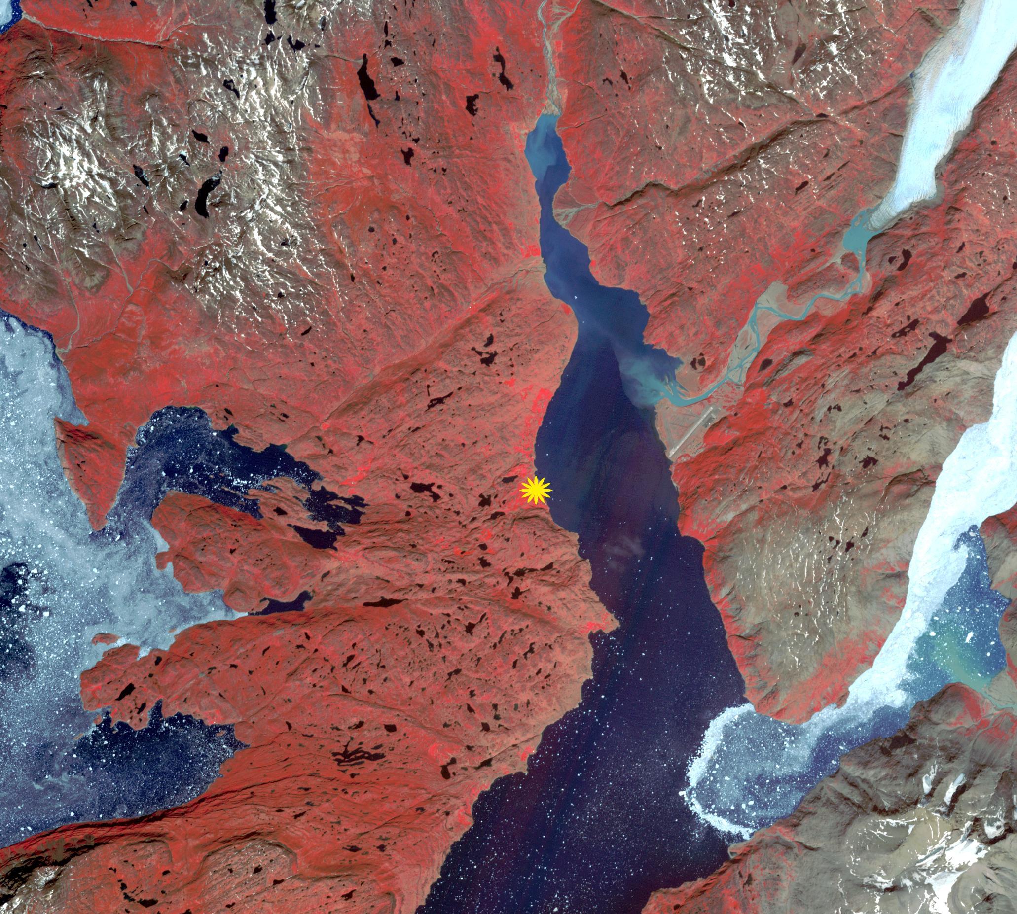
-
Qassiarsuk, Greenland
Full Resolution:
TIFF
(11.47 MB)
JPEG
(698.3 kB)
|
|
|
2016-09-15 |
Saturn
|
Cassini-Huygens
|
ISS - Wide Angle
|
2012x1024x3 |
|
-
PIA21046:
-
Saturn, Approaching Northern Summer
Full Resolution:
TIFF
(2.588 MB)
JPEG
(85.72 kB)
|
|
|
2016-09-12 |
S Rings
|
Cassini-Huygens
|
ISS - Wide Angle
|
1020x1020x1 |
|
-
PIA20498:
-
Barely Bisected Rings
Full Resolution:
TIFF
(221.8 kB)
JPEG
(21.35 kB)
|
|
|
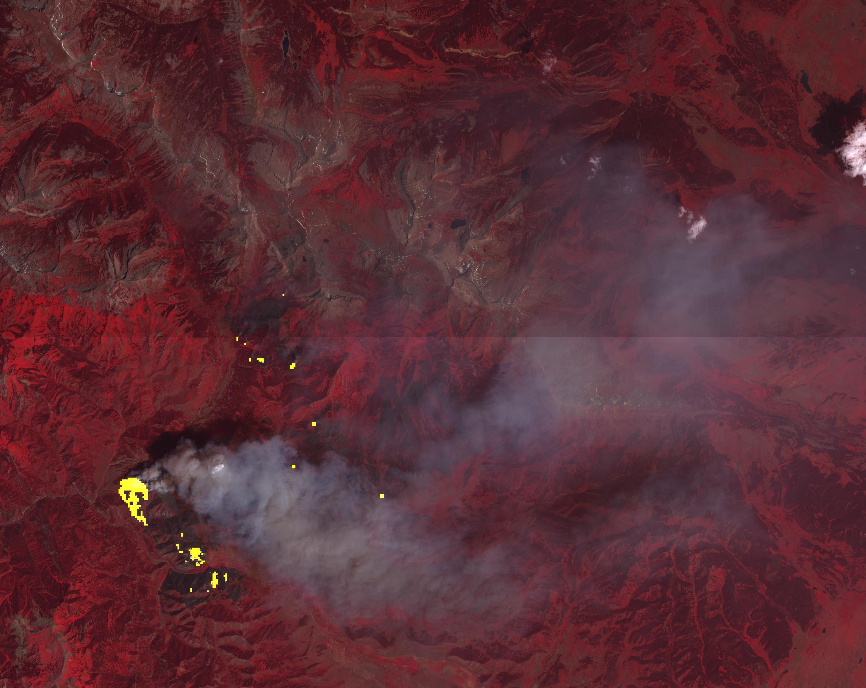
2016-09-07 |
Earth
|
Terra
|
ASTER
|
1812x1456x3 |
|
-
PIA20899:
-
Extent of California Blue Cut Fire Devastation Seen by NASA Spacecraft
Full Resolution:
TIFF
(7.918 MB)
JPEG
(602.8 kB)
|
|
|
2016-09-07 |
Earth
|
Terra
|
ASTER
|
546x411x3 |
|
-
PIA20986:
-
Five-Hundred-Meter Aperture Spherical Telescope, China
Full Resolution:
TIFF
(673.7 kB)
JPEG
(43.08 kB)
|
|
|
2016-09-01 |
Earth
|
ARIA
|
|
1390x1231x3 |

|
-
PIA20897:
-
New Satellite Damage Maps Assist Italy's Earthquake Disaster Response
Full Resolution:
TIFF
(5.135 MB)
JPEG
(388.6 kB)
|
|
|
2016-08-24 |
Mars
|
Mars Reconnaissance Orbiter (MRO)
|
HiRISE
|
2880x1800x1 |
|
-
PIA21023:
-
Ancient Streamlined Islands of the Palos Outflow Channel
Full Resolution:
TIFF
(5.191 MB)
JPEG
(1.097 MB)
|
|
|
2016-08-24 |
Earth
|
Terra
|
ASTER
|
1299x1943x3 |
|
-
PIA20973:
-
Chiquicamata Mine, Chile
Full Resolution:
TIFF
(7.575 MB)
JPEG
(539.6 kB)
|
|
|
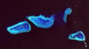
2016-08-18 |
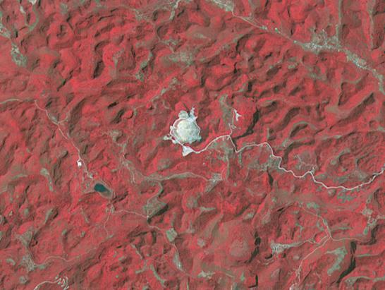
Ceres
|
Dawn
|
Framing Camera
|
1024x1024x1 |
|
-
PIA20875:
-
Dawn LAMO Image 153
Full Resolution:
TIFF
(639.6 kB)
JPEG
(121.2 kB)
|
|
|
2016-08-10 |
Earth
|
Terra
|
ASTER
|
1440x1584x3 |
|
-
PIA20804:
-
Lilongwe, Malawi
Full Resolution:
TIFF
(6.846 MB)
JPEG
(835.5 kB)
|
|
|
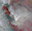
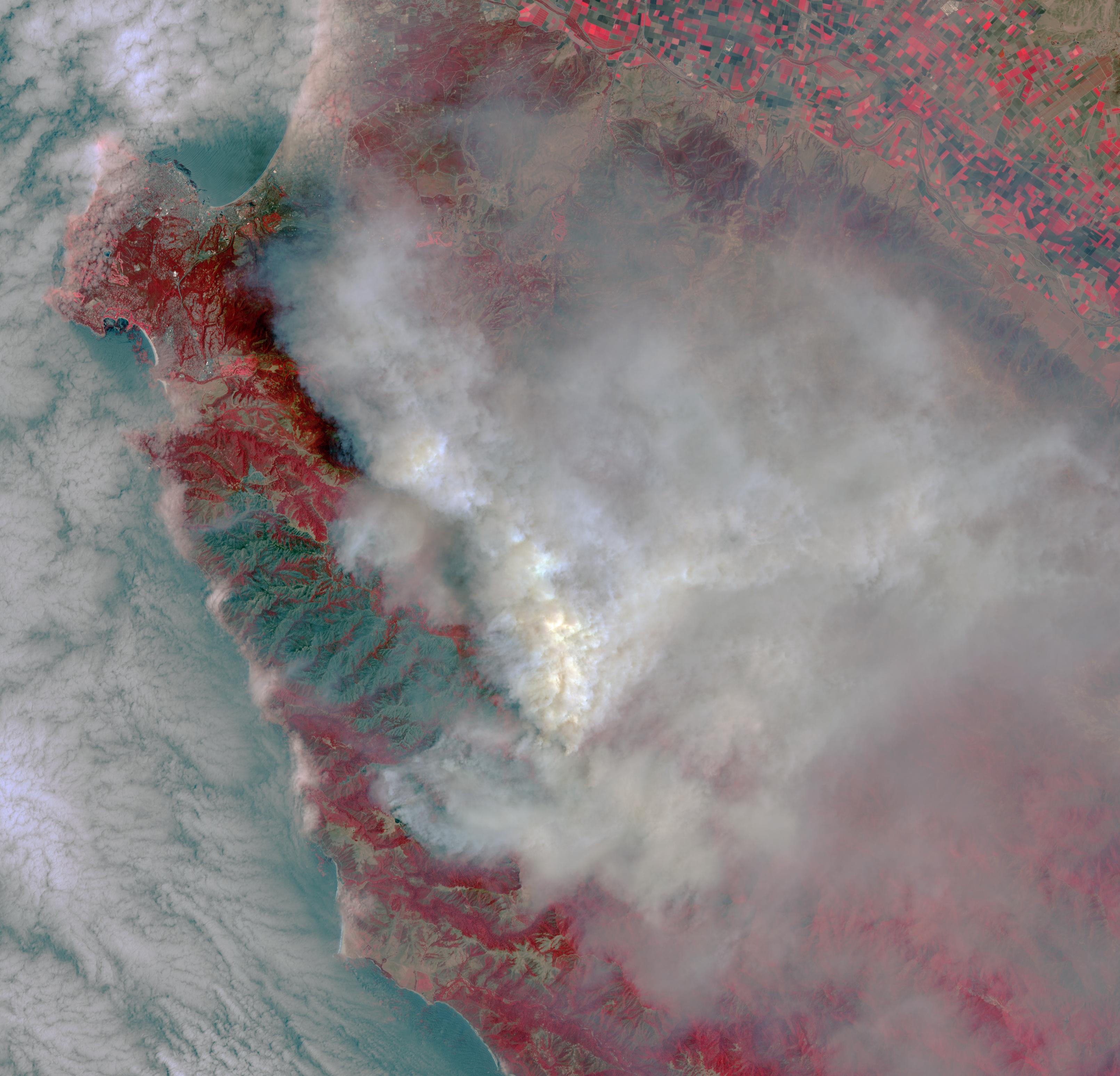
2016-08-09 |
Earth
|
Terra
|
ASTER
|
2841x2028x3 |
|
-
PIA20725:
-
Growing Wildfire Near Big Sur, California Imaged by NASA's Terra Spacecraft
Full Resolution:
TIFF
(13.66 MB)
JPEG
(749.1 kB)
|
|
|
2016-08-09 |
Mars
|
2001 Mars Odyssey
|
THEMIS
|
1375x2644x1 |
|
-
PIA20799:
-
Wind Etching
Full Resolution:
TIFF
(2.812 MB)
JPEG
(452.4 kB)
|
|
|
2016-08-02 |
Earth
|
Terra
|
ASTER
|
2085x1716x3 |
|
-
PIA20723:
-
NASA Spacecraft Spots Aftermath of Destructive Wildfire in LA's Backyard
Full Resolution:
TIFF
(9.242 MB)
JPEG
(832.7 kB)
|
|
|
2016-08-01 |
Earth
|
Terra
|
ASTER
|
3222x3096x3 |
|
-
PIA20722:
-
Destructive Wildfire Near Big Sur, California. Captured NASA's Terra Satellite
Full Resolution:
TIFF
(25.04 MB)
JPEG
(770.3 kB)
|
|
|
2016-07-28 |
Earth
|
Terra
|
ASTER
|
2820x2240x3 |

|
-
PIA20721:
-
Wyoming Wildfire Spotted by NASA Spacecraft
Full Resolution:
TIFF
(17.15 MB)
JPEG
(537.7 kB)
|
|
|
2016-07-26 |
Earth
|
Terra
|
ASTER
|
1753x1485x3 |
|
-
PIA18670:
-
Clew Bay, Ireland
Full Resolution:
TIFF
(7.813 MB)
JPEG
(536.9 kB)
|
|
|
2016-07-12 |
|
NuSTAR
|
|
3951x2222x3 |
|
-
PIA20697:
-
Black Hole with 'Wobbling' Disk (Artist Concept)
Full Resolution:
TIFF
(2.883 MB)
JPEG
(220.6 kB)
|
 Planetary Data System


