My
List |
Addition Date
|
Target
|
Mission
|
Instrument
|
Size
|

|
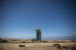
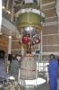
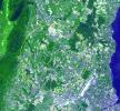
2014-06-30 |
Earth
|
OCO-2
|
OCO-2
|
4928x3280x3 |
|
-
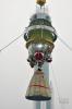
PIA18457:
-
Orbiting Carbon Observatory-2 Ready to Blast Off
Full Resolution:
TIFF
(48.52 MB)
JPEG
(1.025 MB)
|
|
|
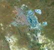
2014-06-25 |
Earth
|
Terra
|
ASTER
|
2049x1824x3 |

|
-
PIA18494:
-
Palouse, WA
Full Resolution:
TIFF
(11.22 MB)
JPEG
(793.4 kB)
|
|
|
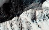
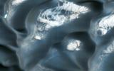
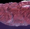
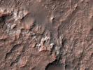
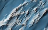
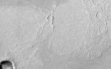
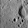
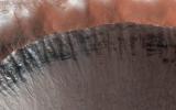
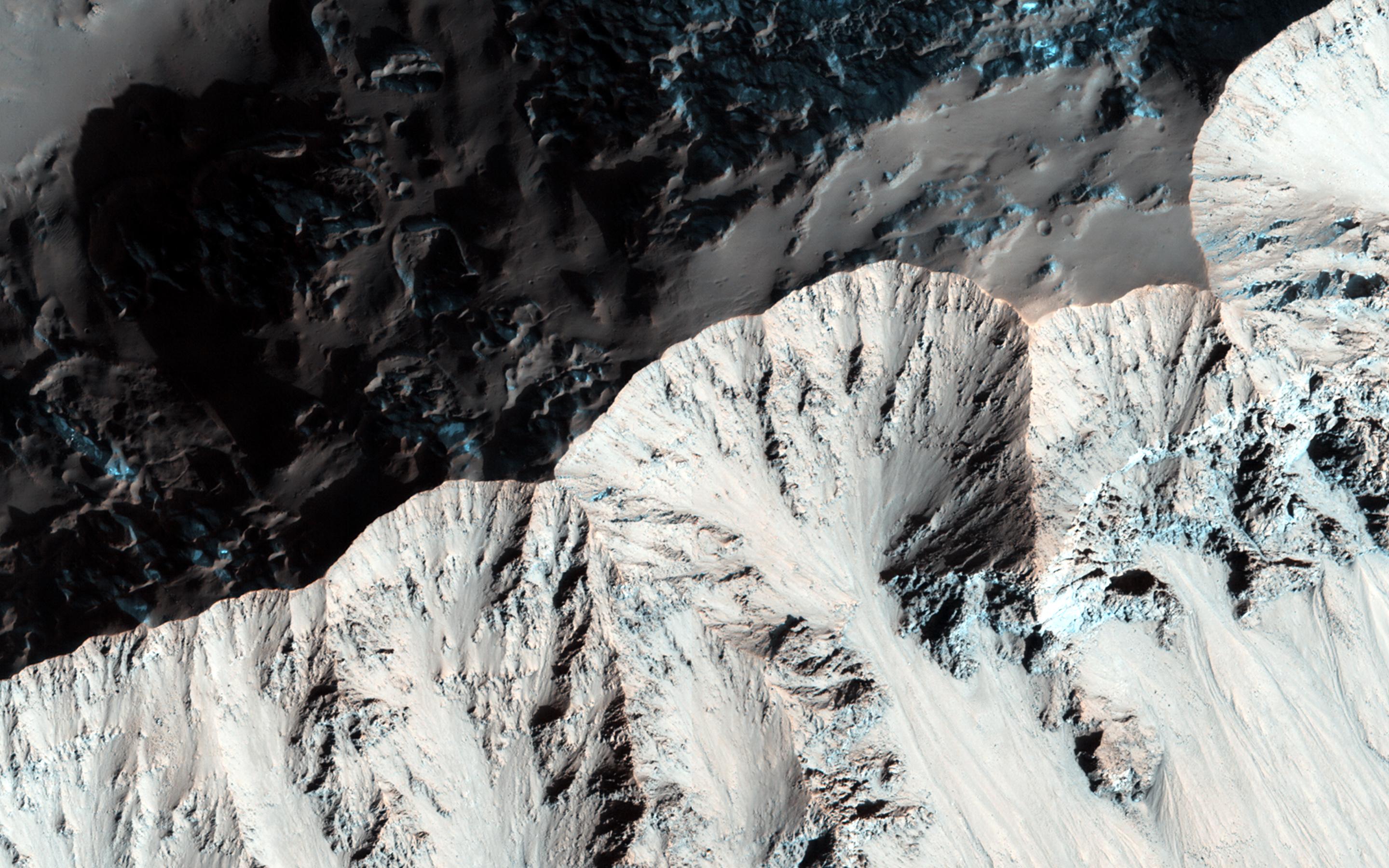
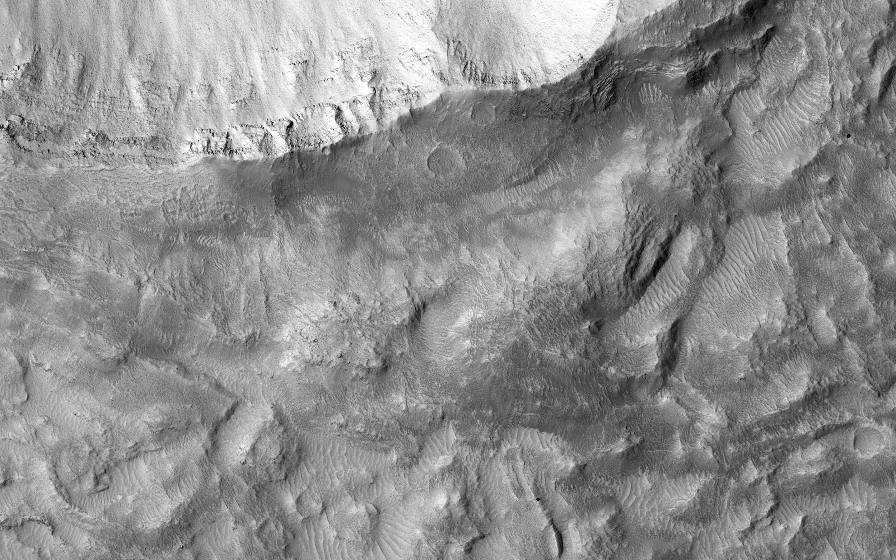
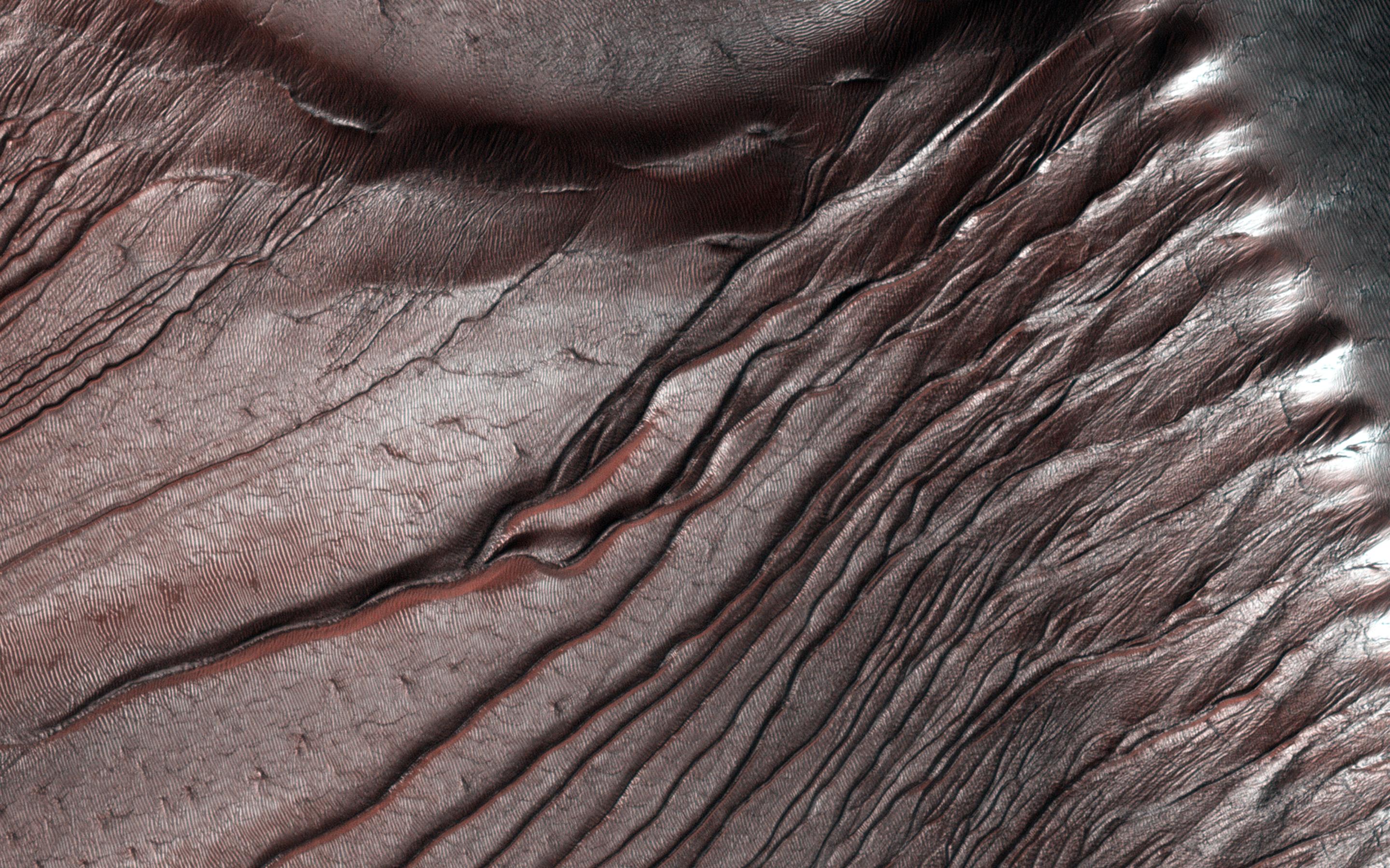
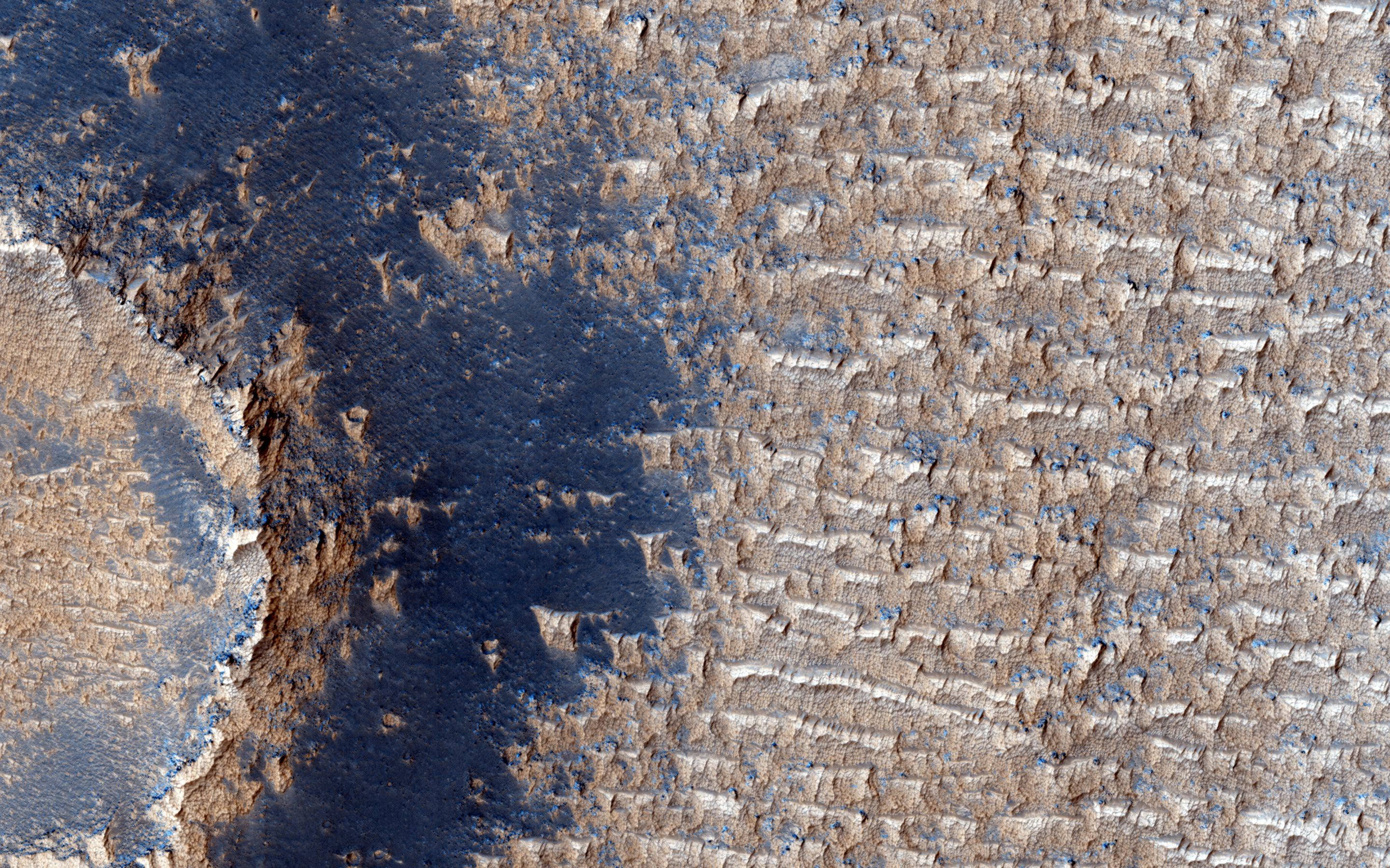
2014-06-18 |
Mars
|
Mars Reconnaissance Orbiter (MRO)
|
HiRISE
|
2880x1800x3 |

|
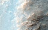
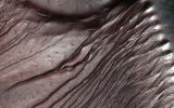
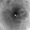
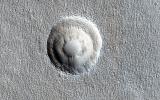
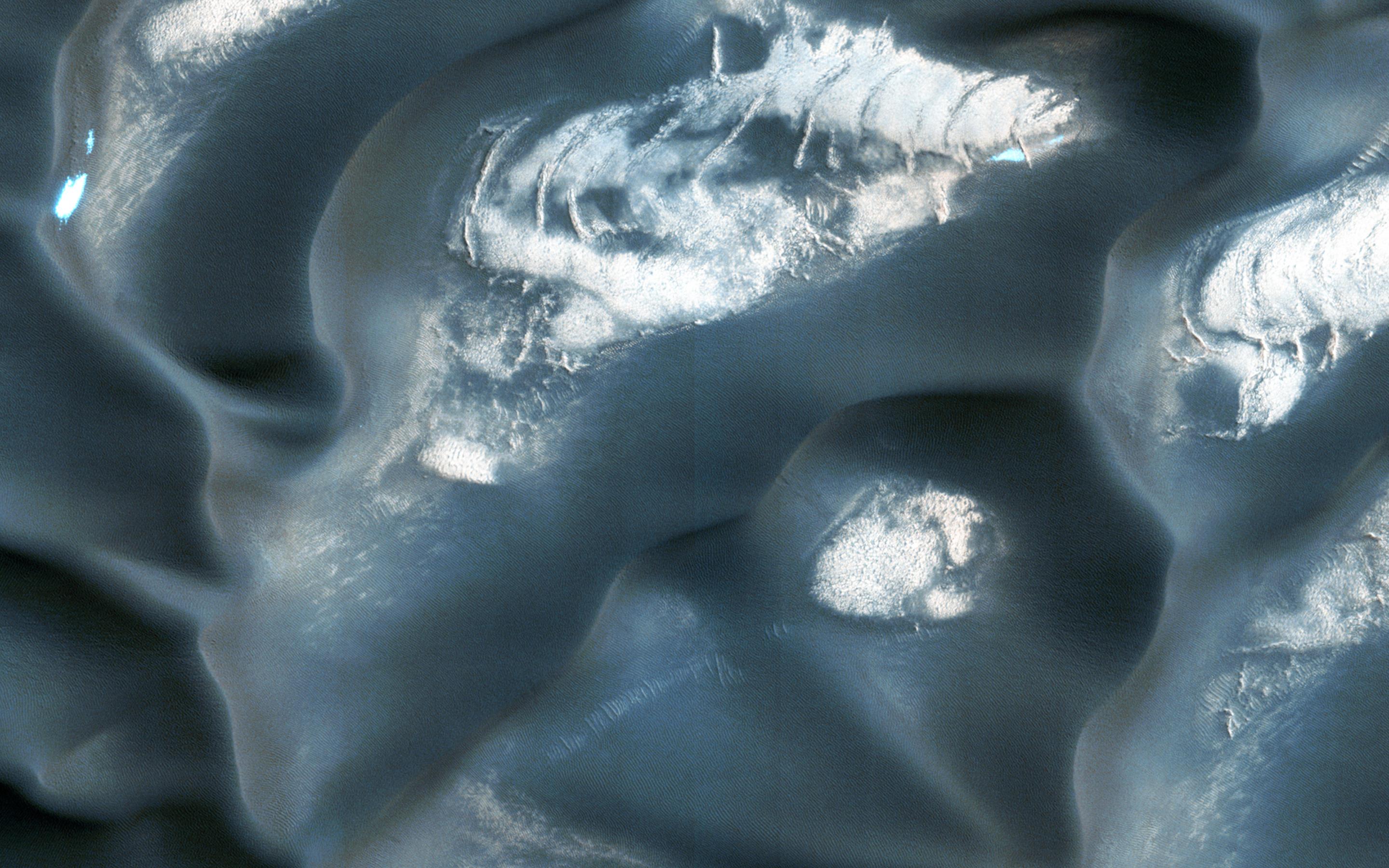
-
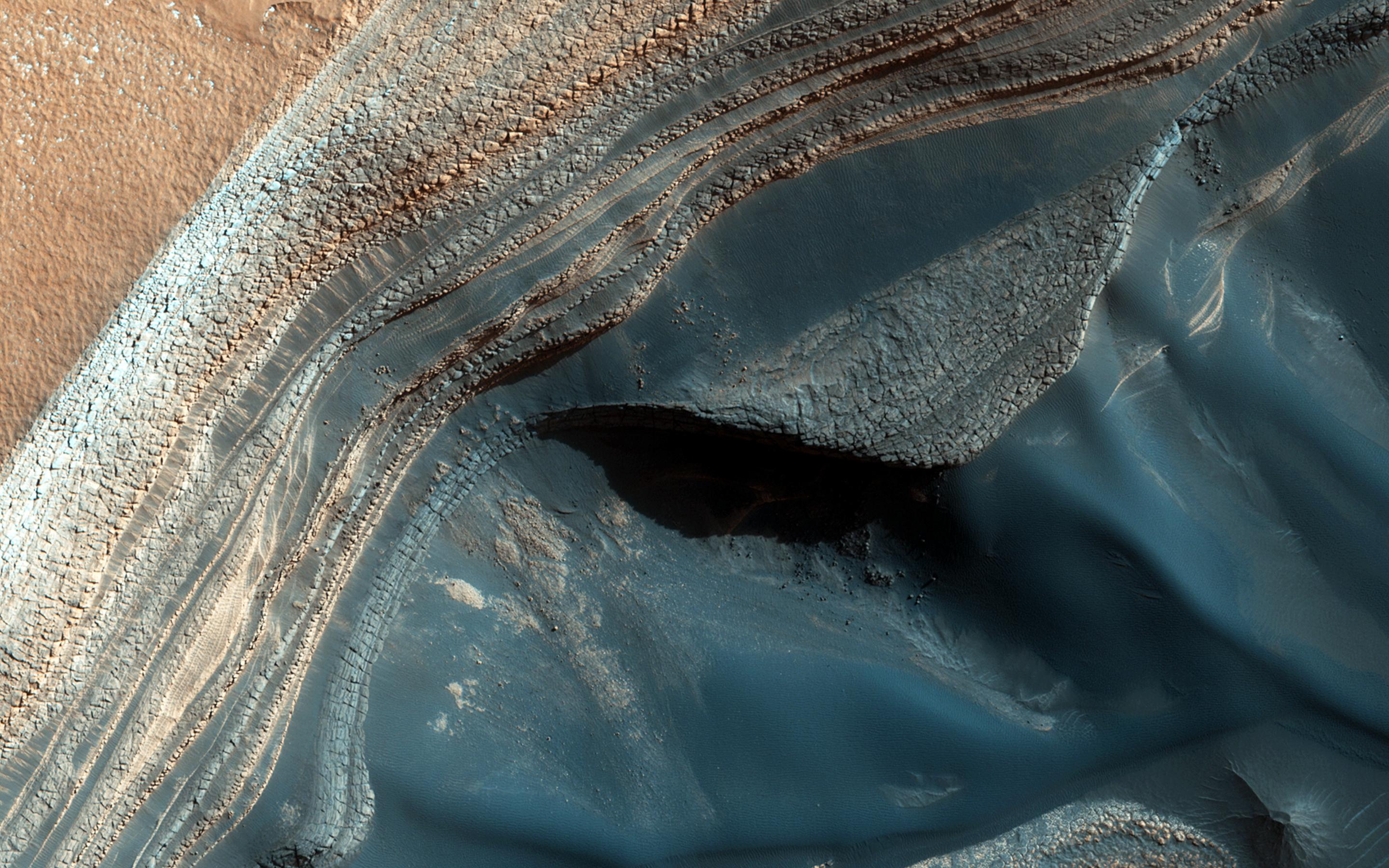
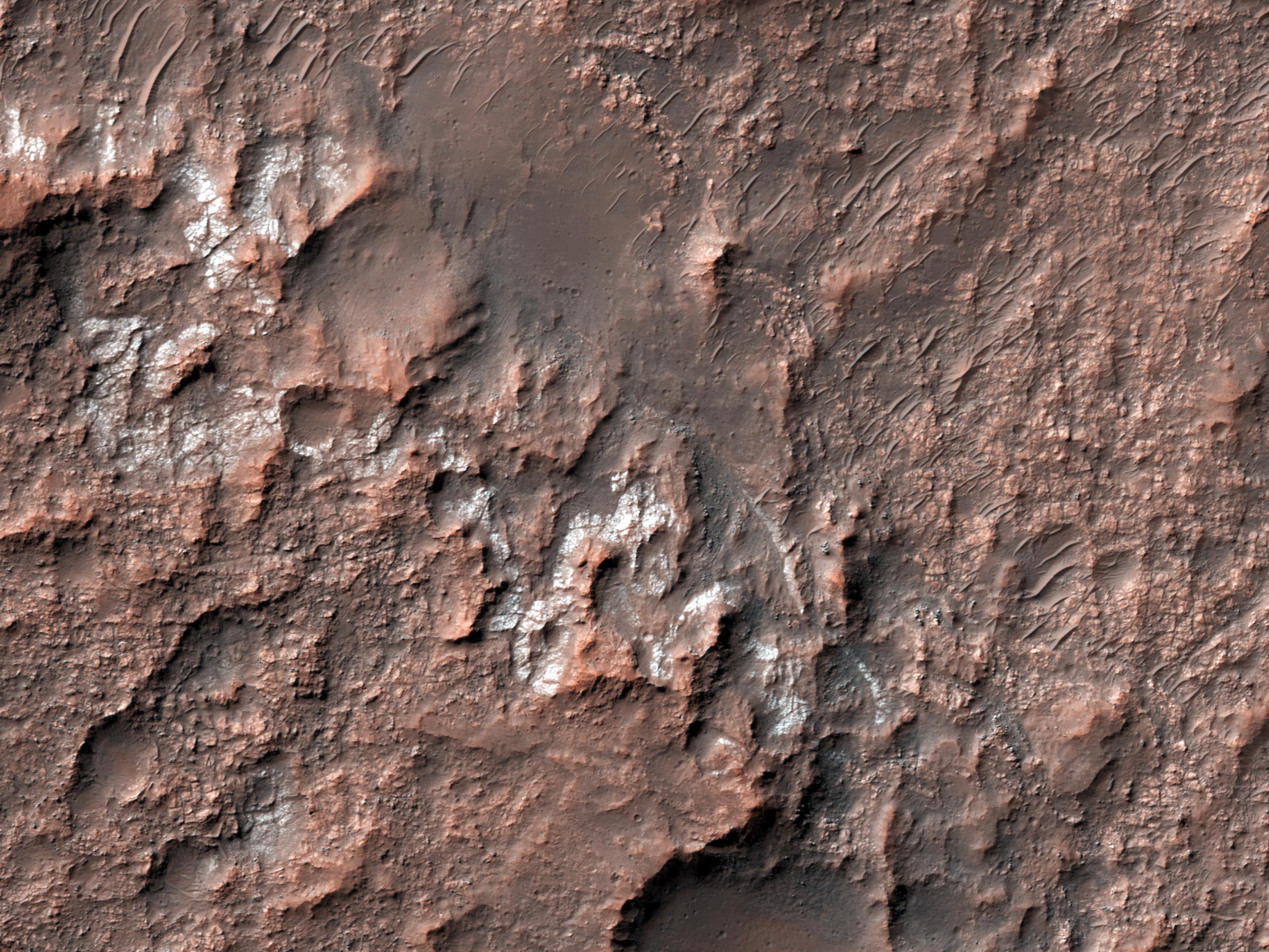
PIA18586:
-
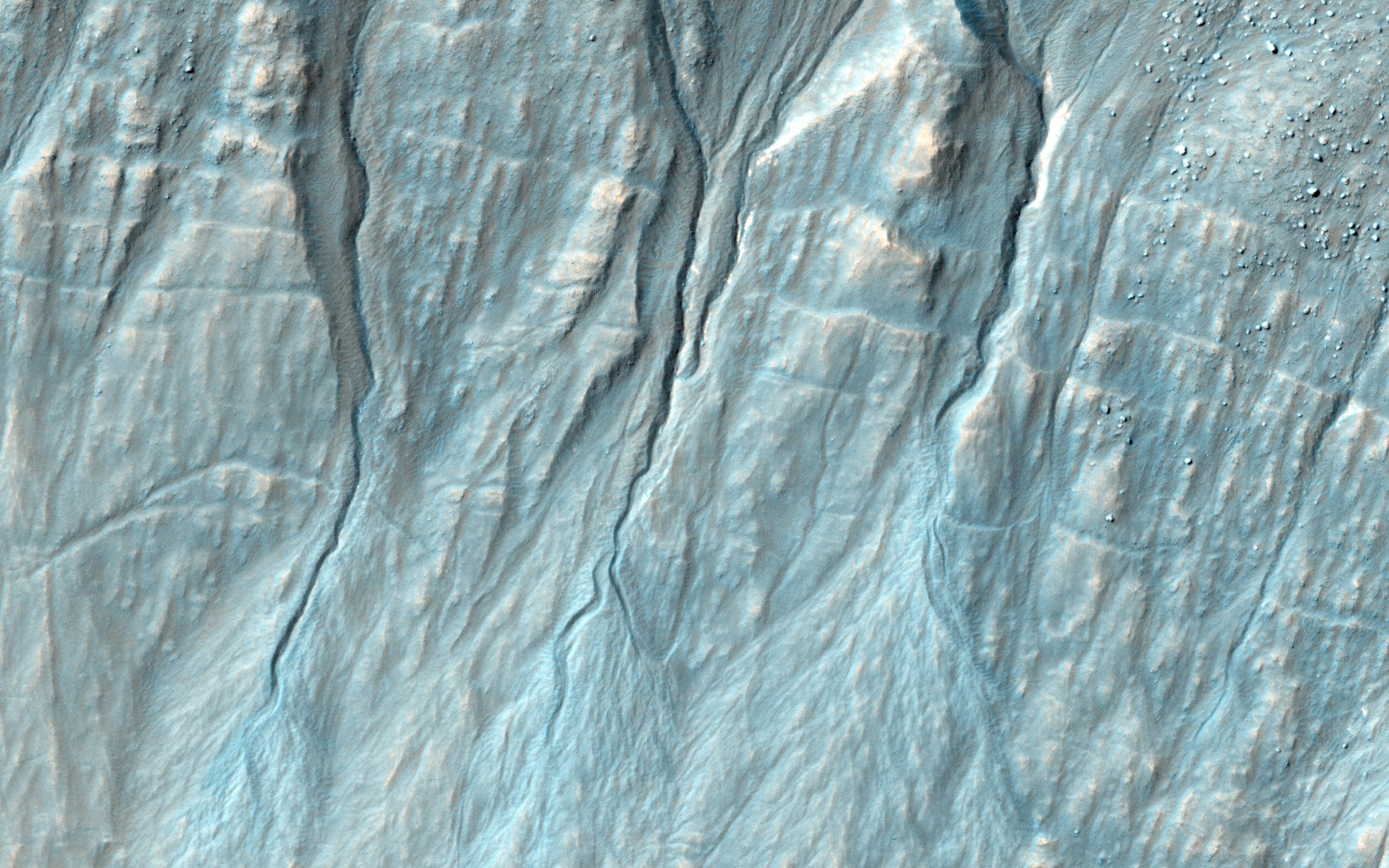
Blockfall on the North Polar Layered Deposits
Full Resolution:
TIFF
(15.56 MB)
JPEG
(790.1 kB)
|
|
|
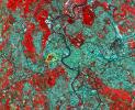
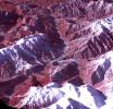
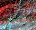
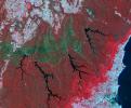
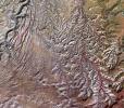
2014-06-12 |
Earth
|
Terra
|
ASTER
|
3816x2292x3 |

|
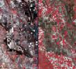
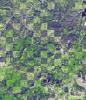
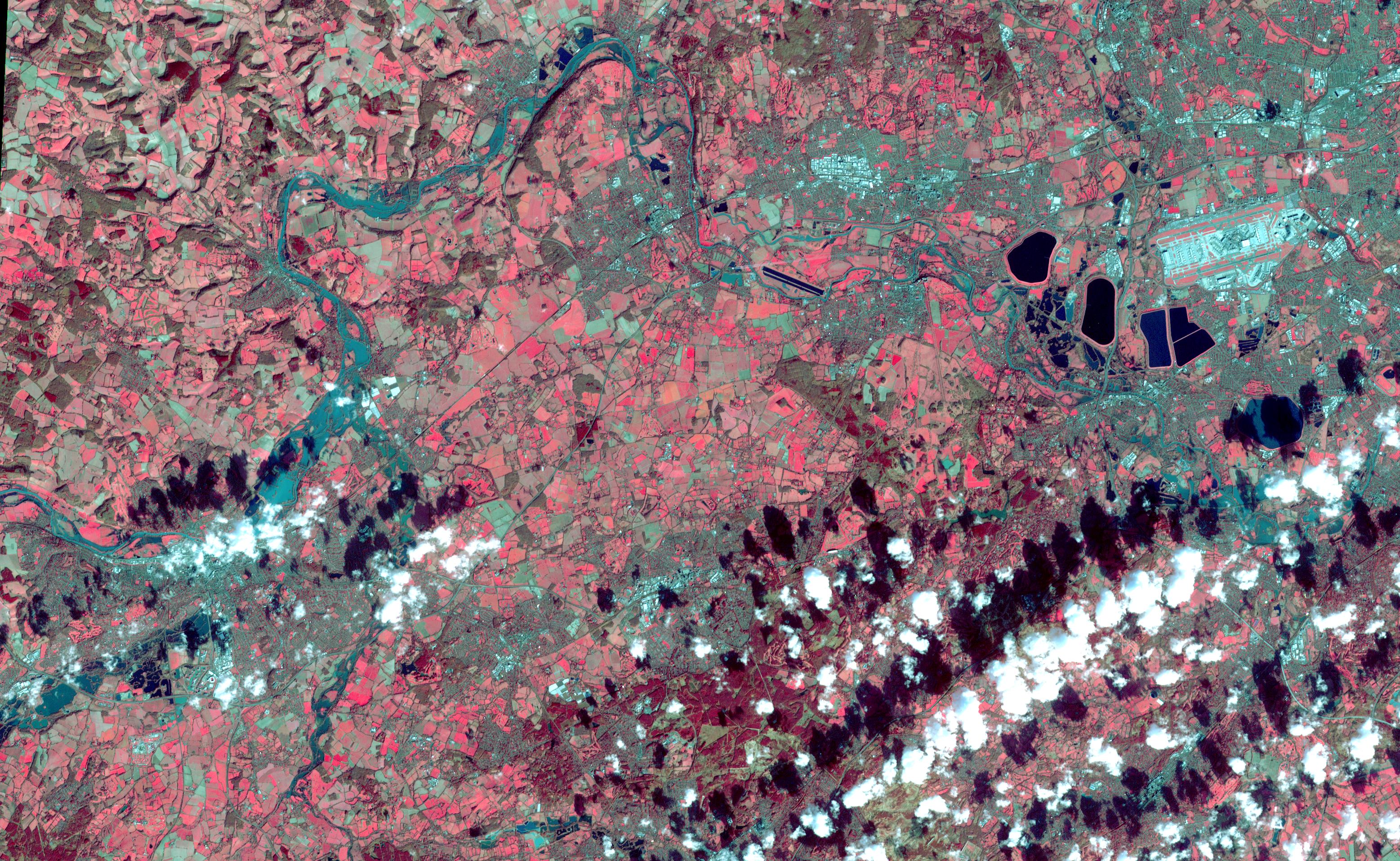
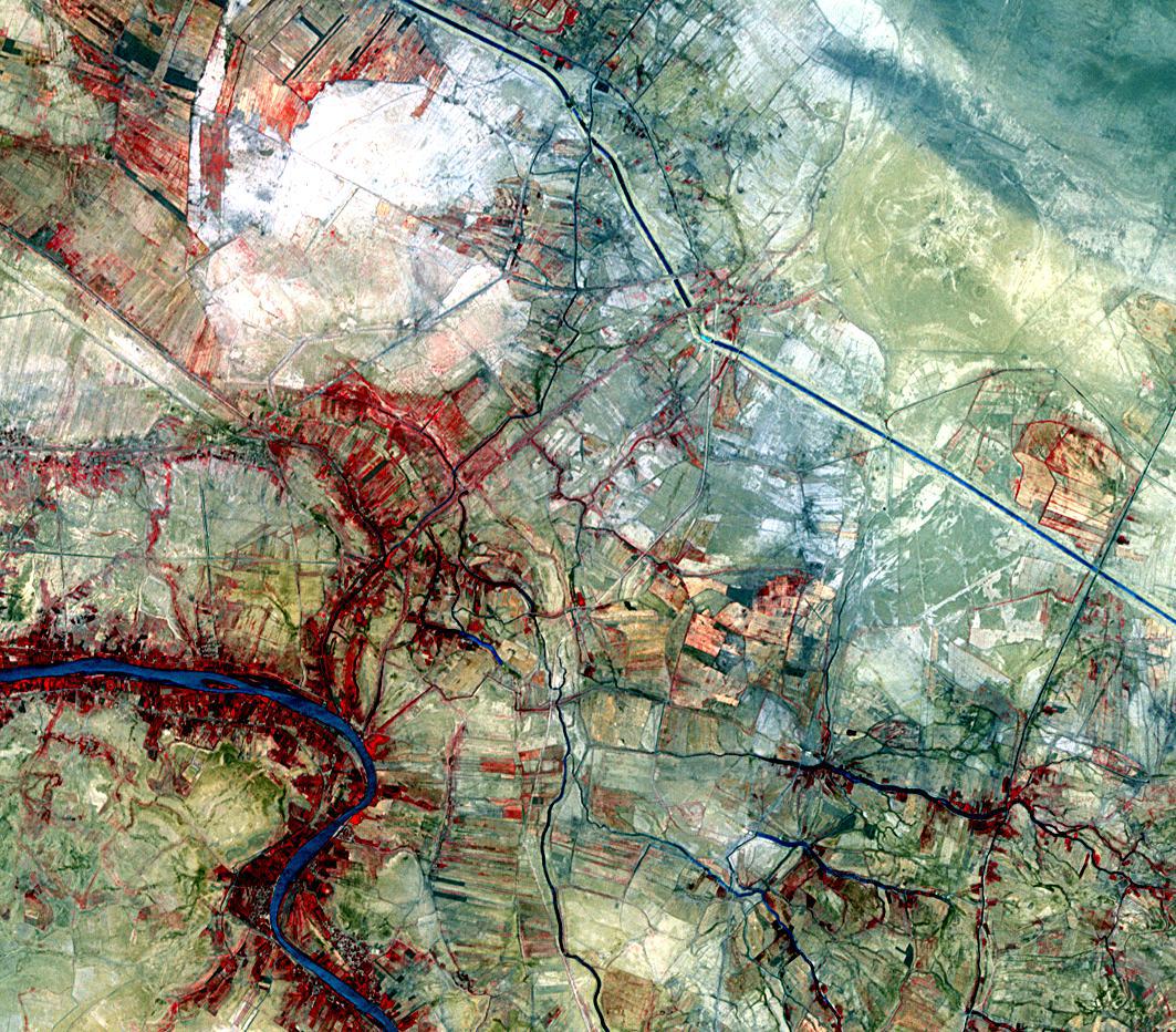
-
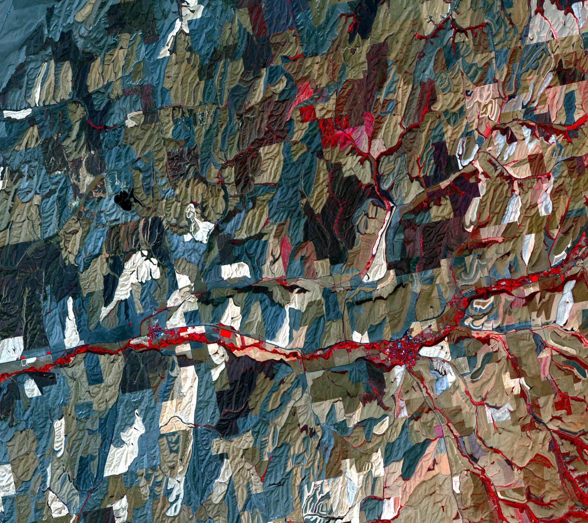
PIA18051:
-
Historic Serbian Floods Eyed by NASA Spacecraft
Full Resolution:
TIFF
(26.25 MB)
JPEG
(1.819 MB)
|
|
|
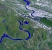
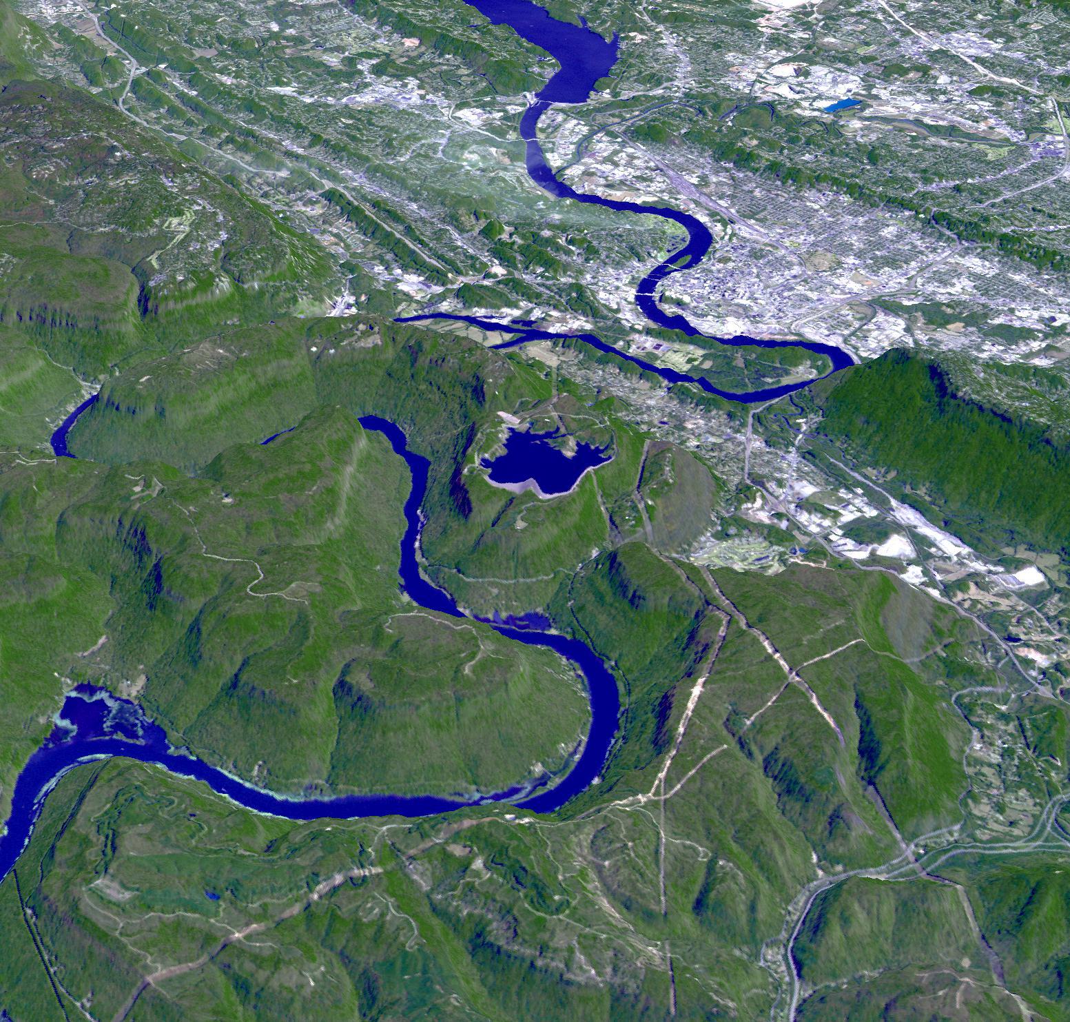
2014-06-10 |
Earth
|
Terra
|
ASTER
|
1188x793x3 |
|
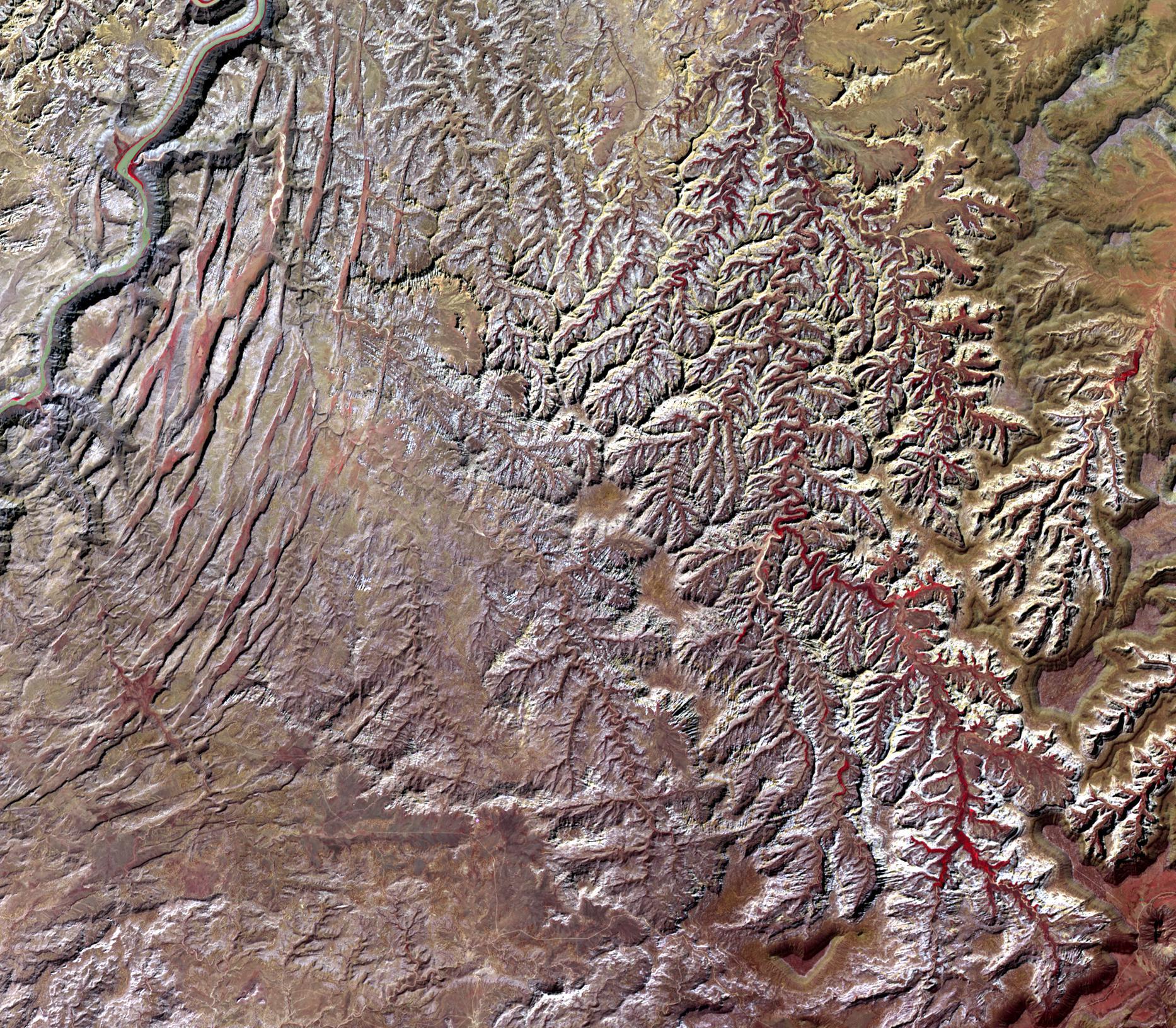
-
PIA18050:
-
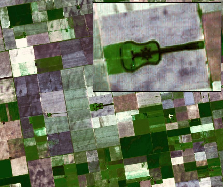
Giant Arizona Landslide Spotted by NASA Spacecraft
Full Resolution:
TIFF
(2.828 MB)
JPEG
(108.6 kB)
|
|
|
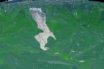
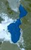
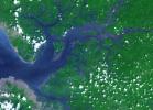
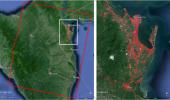
2014-06-09 |
Earth
|
Terra
|
ASTER
|
1336x2153x3 |
|
-
PIA18515:
-
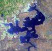
Lake Afrera, Ethiopia
Full Resolution:
TIFF
(8.632 MB)
JPEG
(416.1 kB)
|
|
|
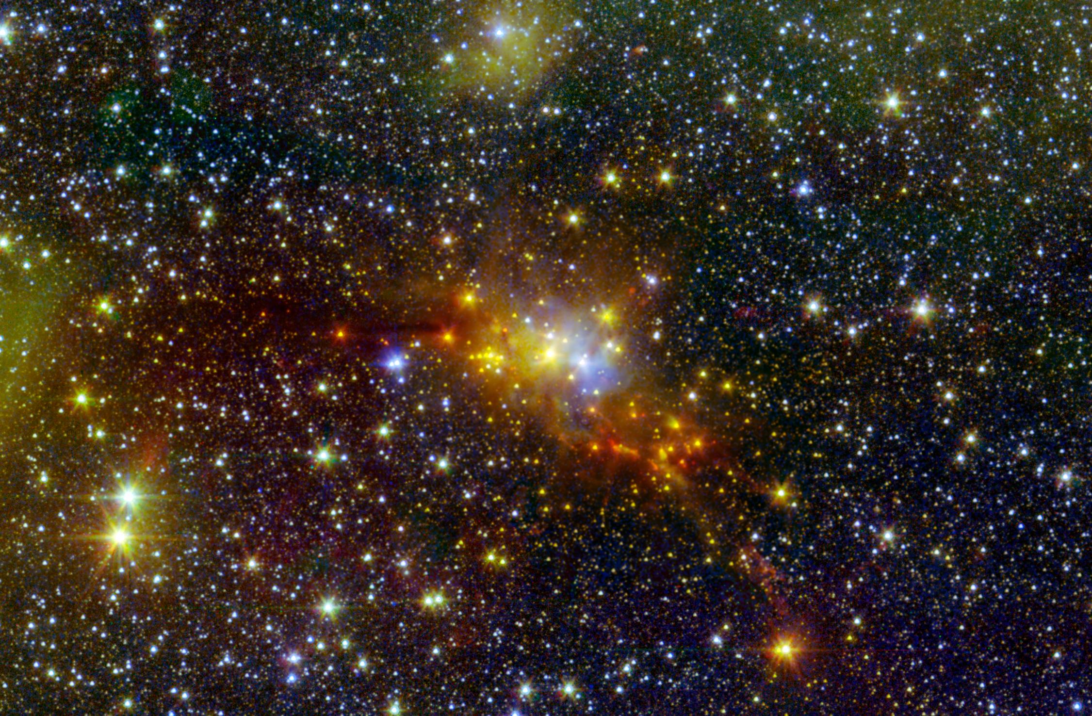
2014-05-28 |
|
Spitzer Space Telescope
|
IRAC
Two Micron All Sky Survey (2MASS)
|
2251x1476x3 |

|
-
PIA18014:
-
The 'Serpent' Star-Forming Cloud Spawns Stars
Full Resolution:
TIFF
(9.972 MB)
JPEG
(628.5 kB)
|
|
|
2014-05-27 |
Earth
|
Terra
|
ASTER
|
2855x2360x3 |

|
-
PIA18253:
-
Kerguelen Islands
Full Resolution:
TIFF
(20.22 MB)
JPEG
(997.1 kB)
|
|
|
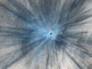
2014-05-22 |
Mars
|
Mars Reconnaissance Orbiter (MRO)
|
MARCI
|
1700x1700x3 |

|
-
PIA18380:
-
Impact Scar Detected in Mars Weathercam Image
Full Resolution:
TIFF
(8.674 MB)
JPEG
(222.2 kB)
|
|
|
2014-05-22 |
Mars
|
Mars Reconnaissance Orbiter (MRO)
|
HiRISE
|
2880x1800x3 |
|
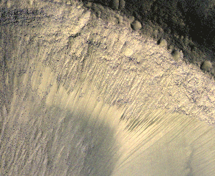
-
PIA18648:
-
What Gullies Can Say
Full Resolution:
TIFF
(15.56 MB)
JPEG
(696.7 kB)
|
|
|
2014-05-20 |
Earth
|
Terra
|
ASTER
|
1504x1267x1 |
|
-
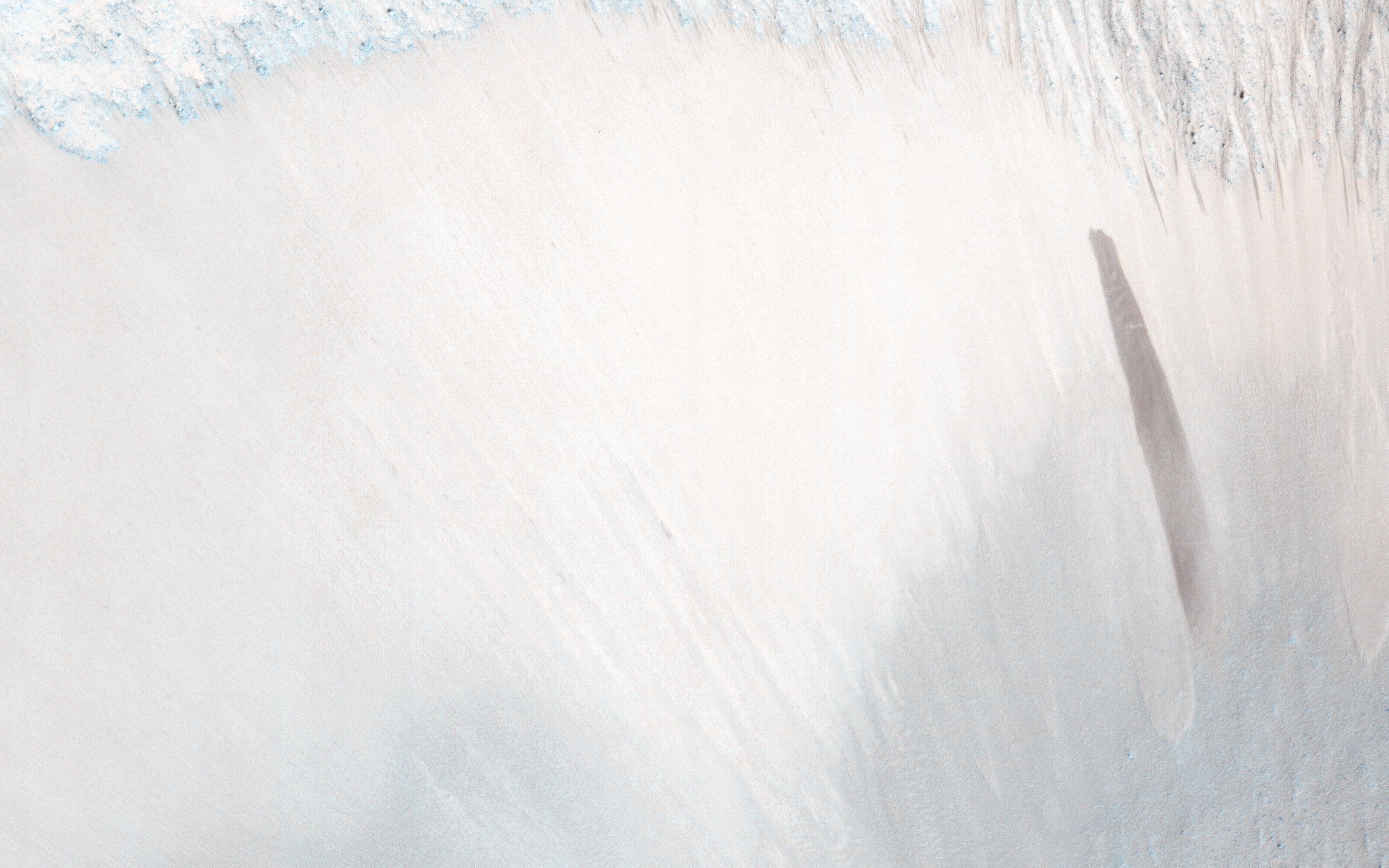
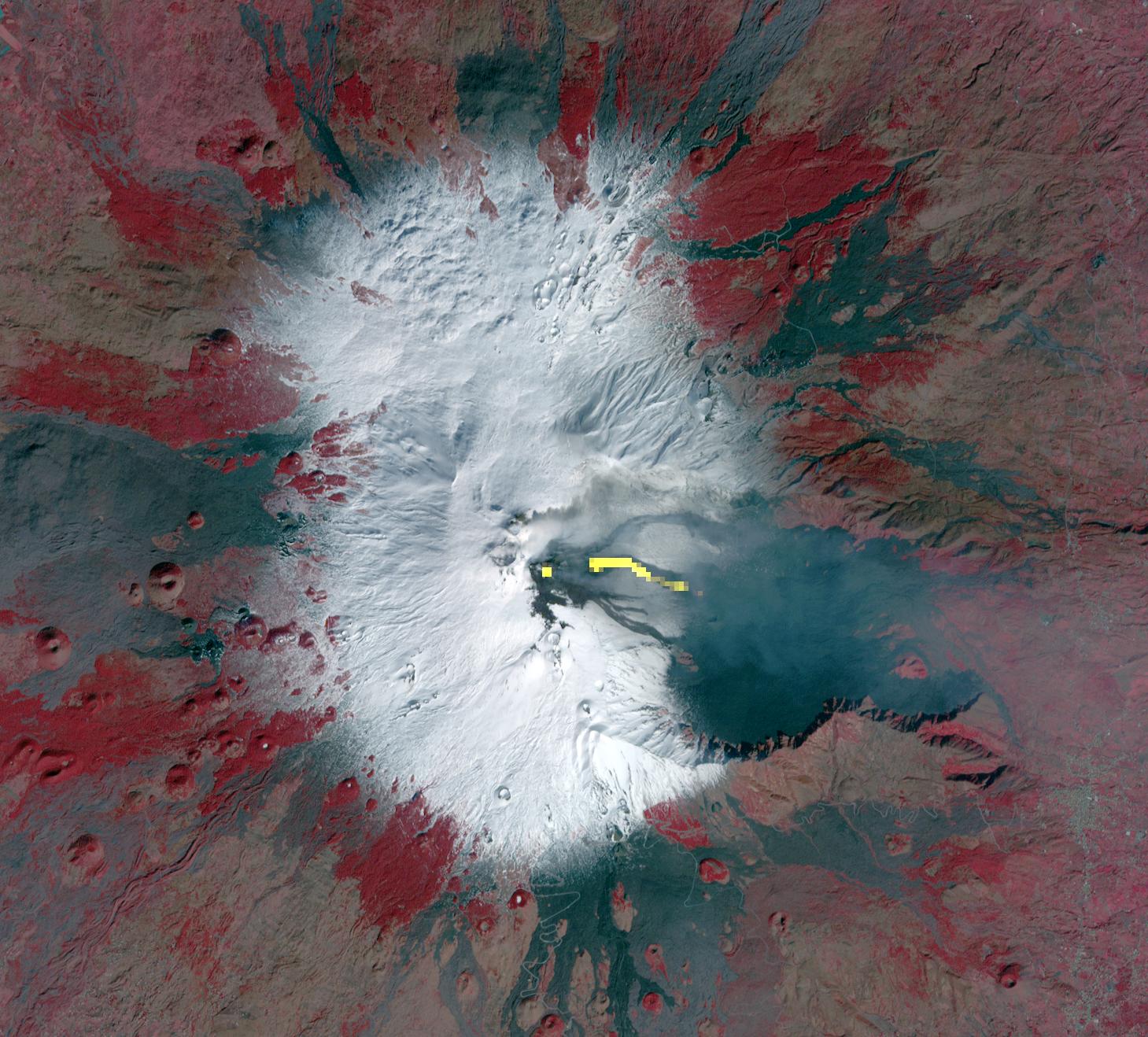
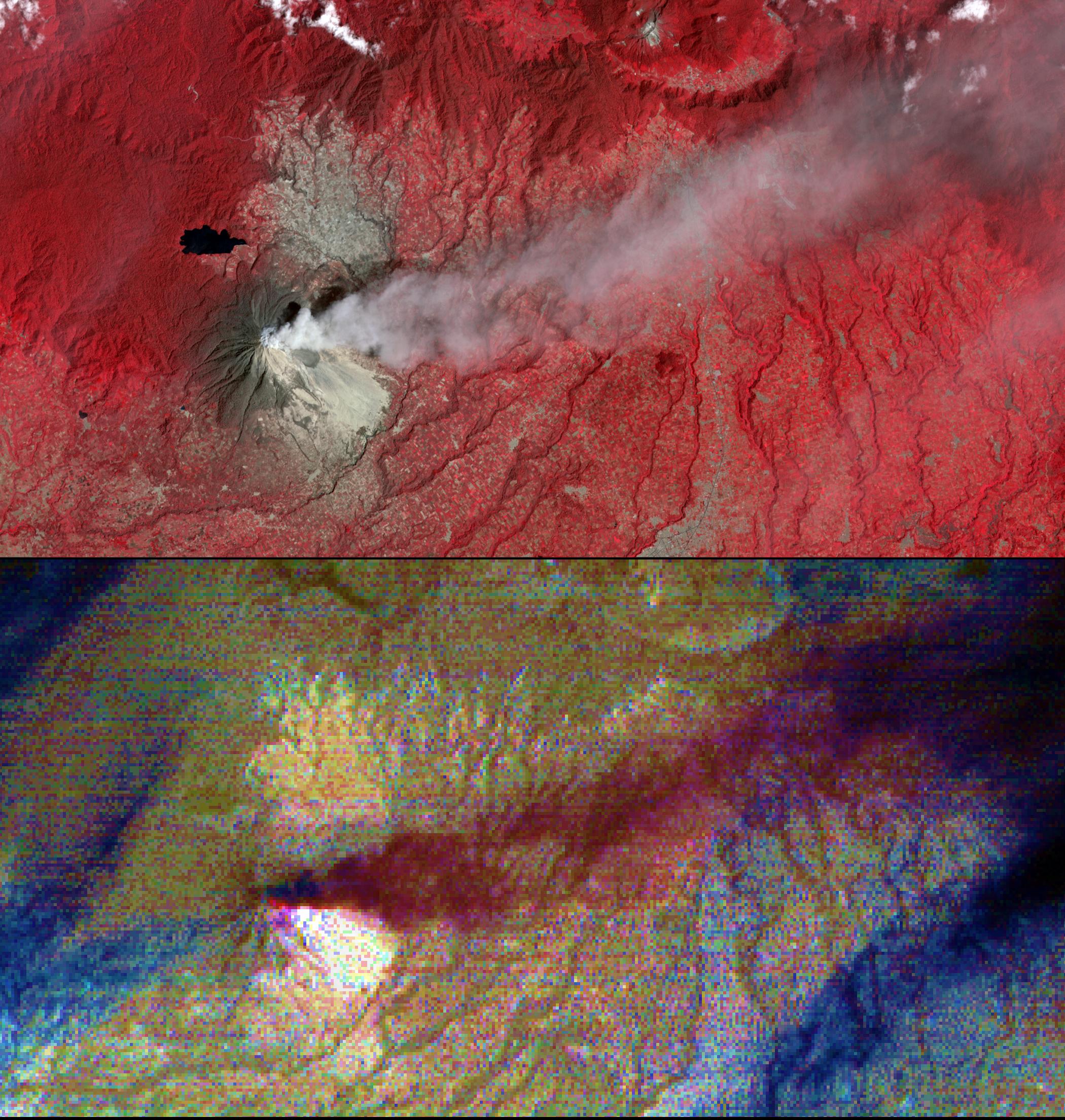
PIA18379:
-
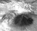
NASA Spacecraft Spots Signs of Erupting Russian Volcano
Full Resolution:
TIFF
(1.908 MB)
JPEG
(297.3 kB)
|
|
|
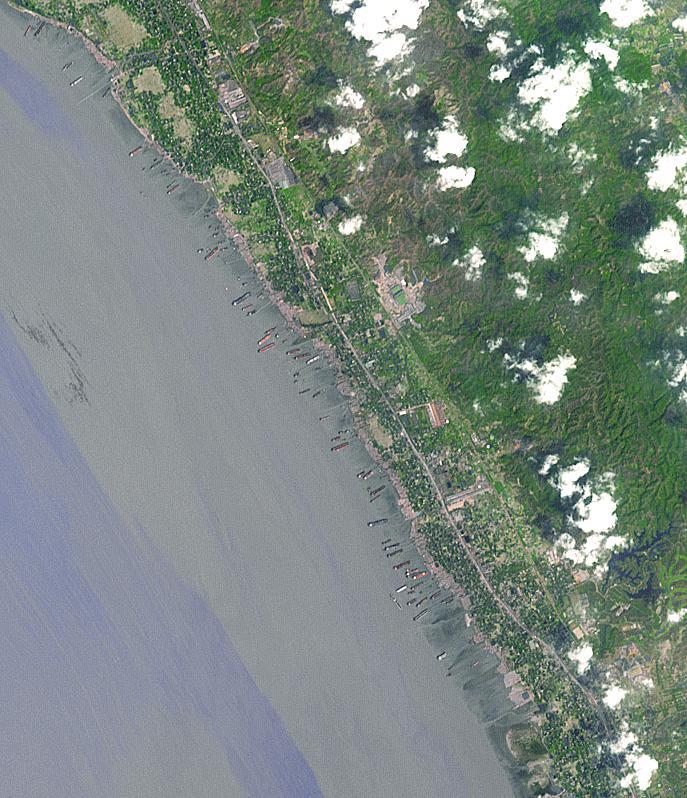
2014-05-16 |
Earth
|
Terra
|
ASTER
|
687x798x3 |
|
-
PIA18258:
-
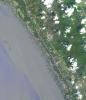
Shipbreaking, Bangladesh
Full Resolution:
TIFF
(1.645 MB)
JPEG
(124.2 kB)
|
|
|
2014-05-09 |
Earth
|
Terra
|
ASTER
|
1782x1754x3 |
|
-
PIA18373:
-
Nagarjuna Sagar Dam, India
Full Resolution:
TIFF
(9.381 MB)
JPEG
(513.8 kB)
|
|
|
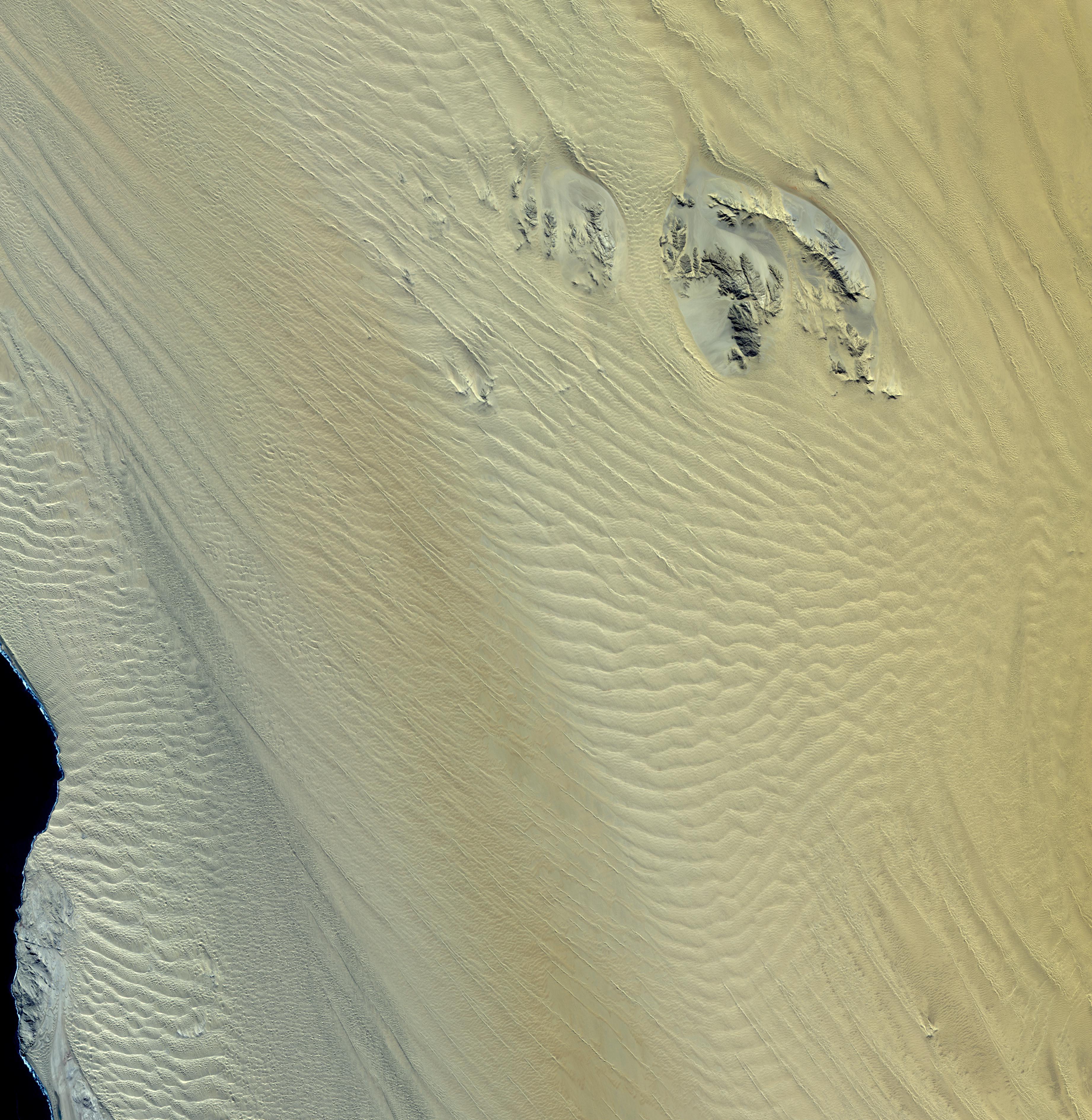
2014-05-02 |
Mars
|
2001 Mars Odyssey
|
THEMIS
|
2898x3568x1 |
|
-
PIA18233:
-
Polar Dunes
Full Resolution:
TIFF
(10.35 MB)
JPEG
(620.9 kB)
|
|
|
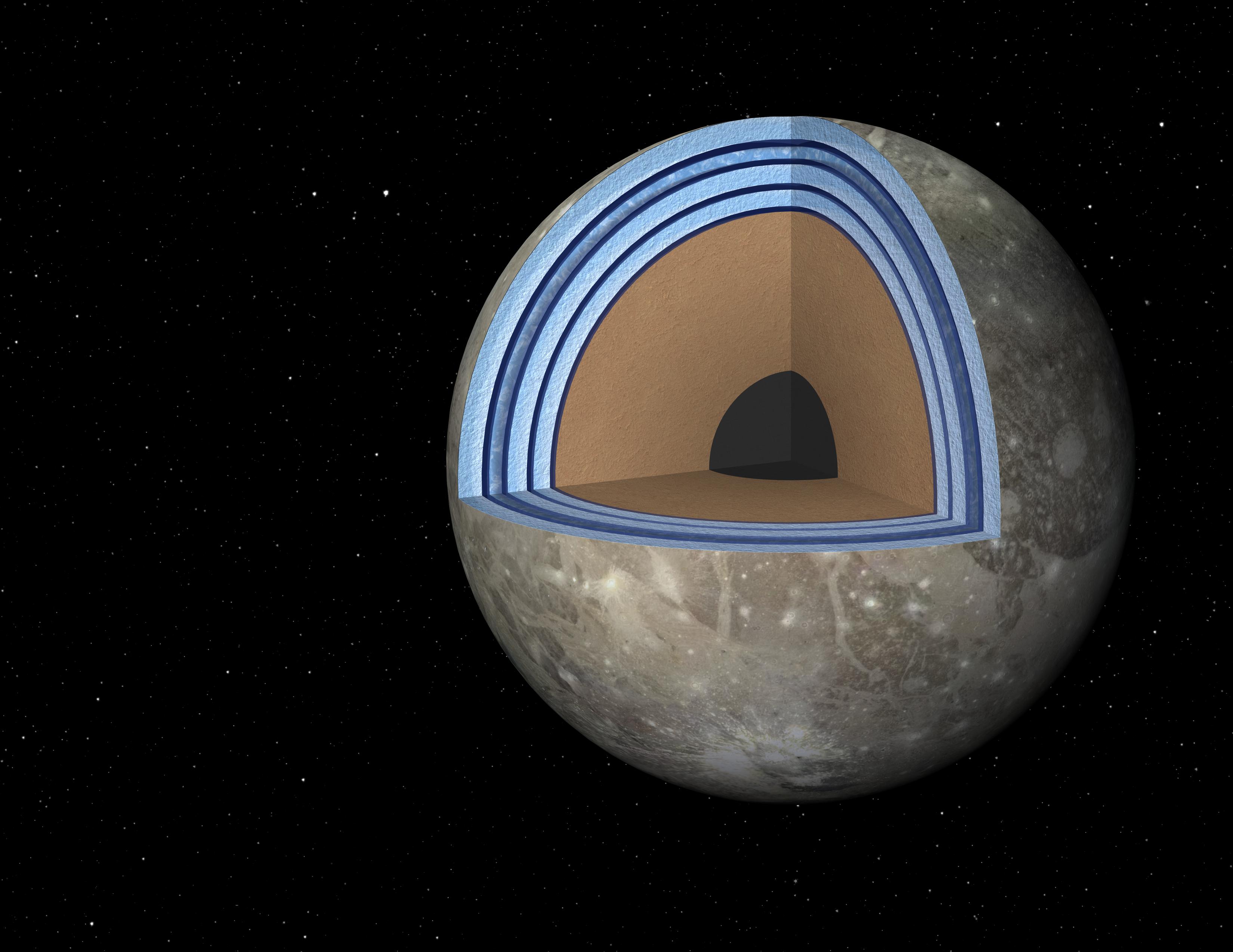
2014-05-01 |
Ganymede
|
|
|
3300x2550x3 |
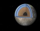
|
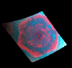
-
PIA18005:
-
Possible "Moonwich" of Ice and Oceans on Ganymede (Artist's Concept)
Full Resolution:
TIFF
(25.26 MB)
JPEG
(514.5 kB)
|
|
|
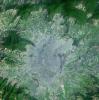
2014-05-01 |
Earth
|
Terra
|
ASTER
|
4400x4000x3 |
|
-
PIA18245:
-
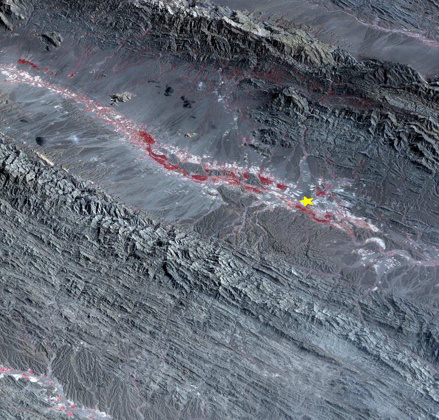
Ubinas Volcano Activity in Peruvian Andes
Full Resolution:
TIFF
(52.83 MB)
JPEG
(2.566 MB)
|
|
|
2014-04-30 |
Mars
|
Mars Reconnaissance Orbiter (MRO)
|
HiRISE
|
2880x1800x3 |

|
-
PIA18244:
-
The Active Dunes of Nili Patera
Full Resolution:
TIFF
(15.56 MB)
JPEG
(786.7 kB)
|
|
|
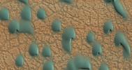
2014-04-30 |
Mars
|
Mars Reconnaissance Orbiter (MRO)
|
HiRISE
|
2880x1800x3 |
|
-
PIA18243:
-
Changing Dunes and Ripples in Olympia Undae
Full Resolution:
TIFF
(15.56 MB)
JPEG
(700.2 kB)
|
|
|
2014-04-28 |
Earth
|
Terra
|
ASTER
|
1517x1446x3 |
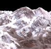
|
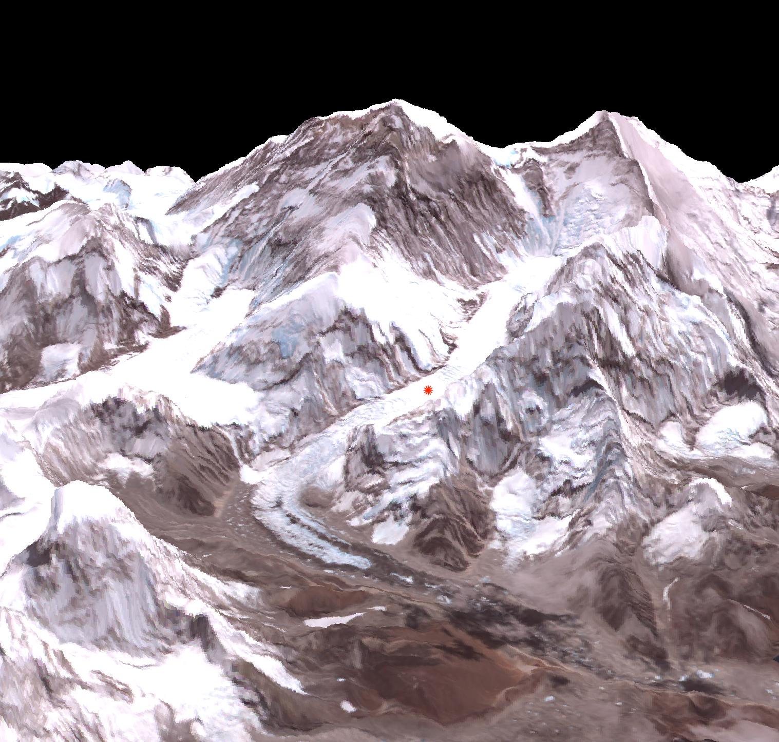
-
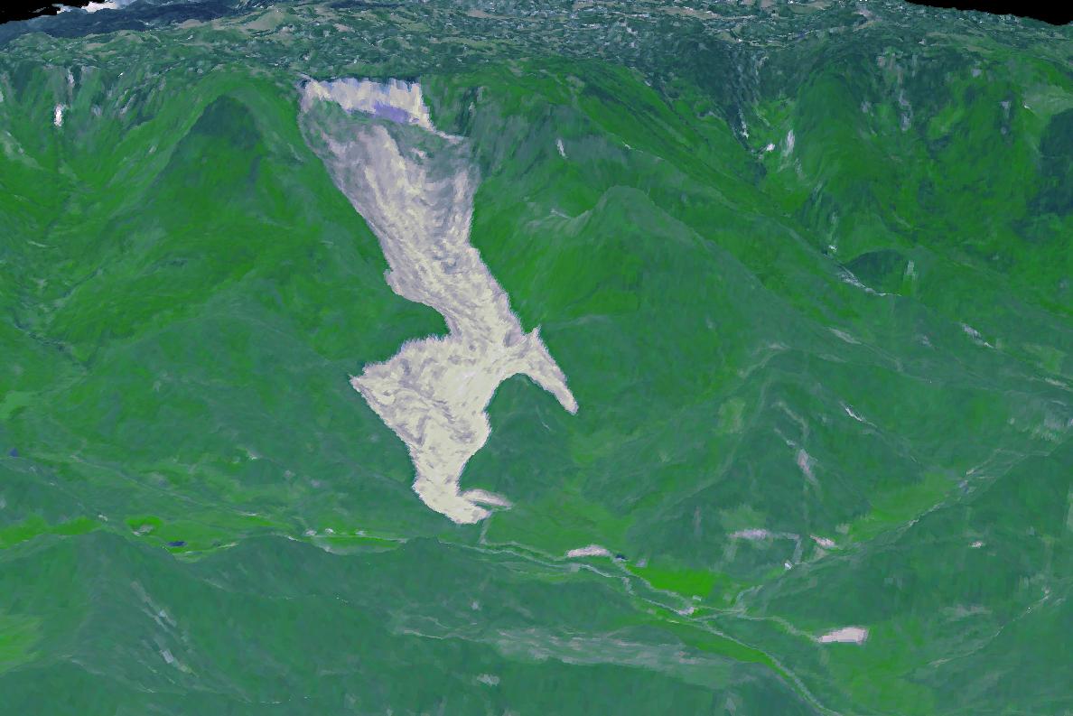
PIA18046:
-
Deadly Everest Avalanche Site Spotted by NASA Spacecraft
Full Resolution:
TIFF
(6.583 MB)
JPEG
(327.9 kB)
|
|
|
2014-04-28 |
Earth
|
Terra
|
ASTER
|
1868x2097x3 |

|
-
PIA18230:
-
Karst Landscape, China
Full Resolution:
TIFF
(11.76 MB)
JPEG
(857.2 kB)
|
|
|
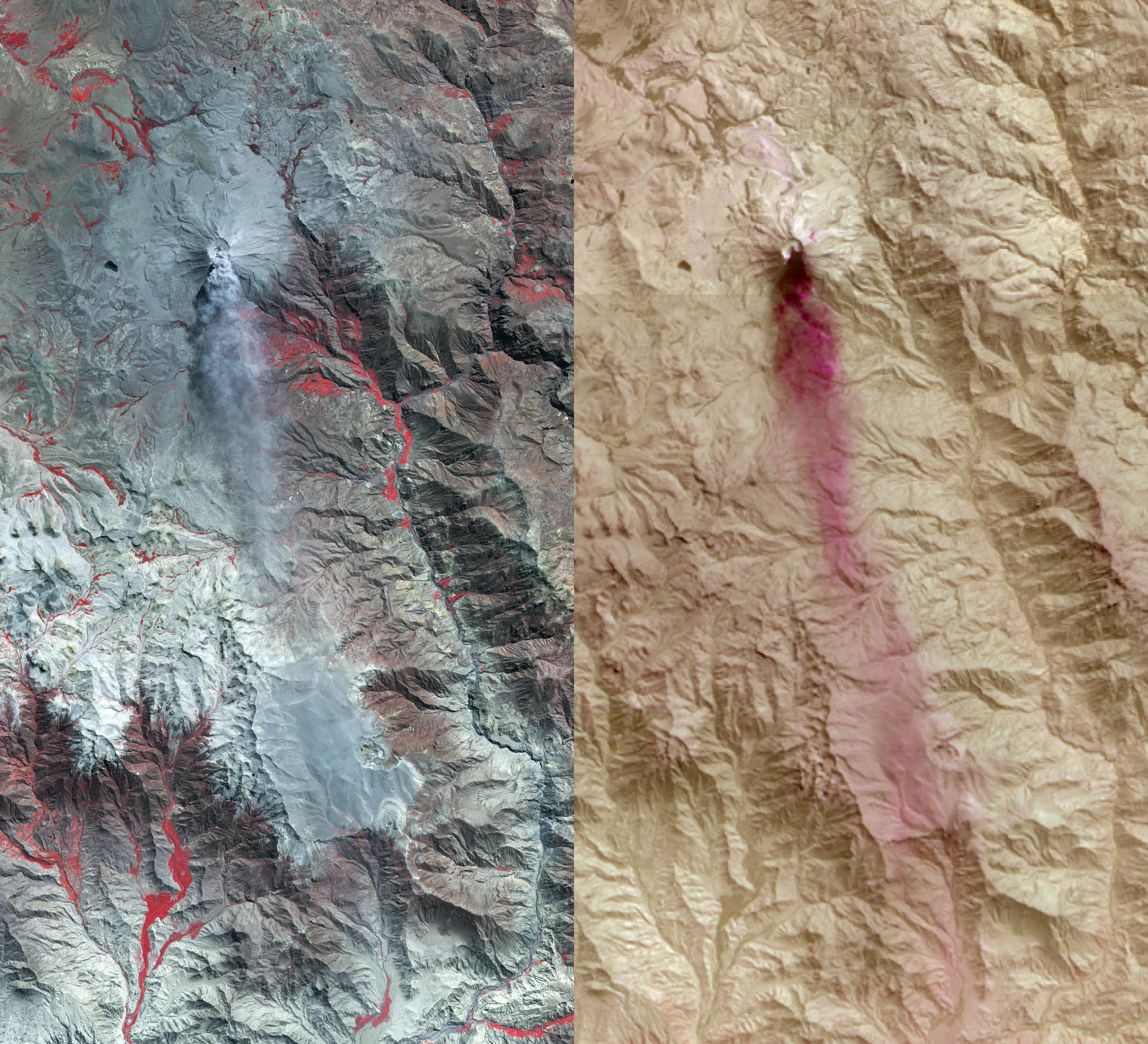
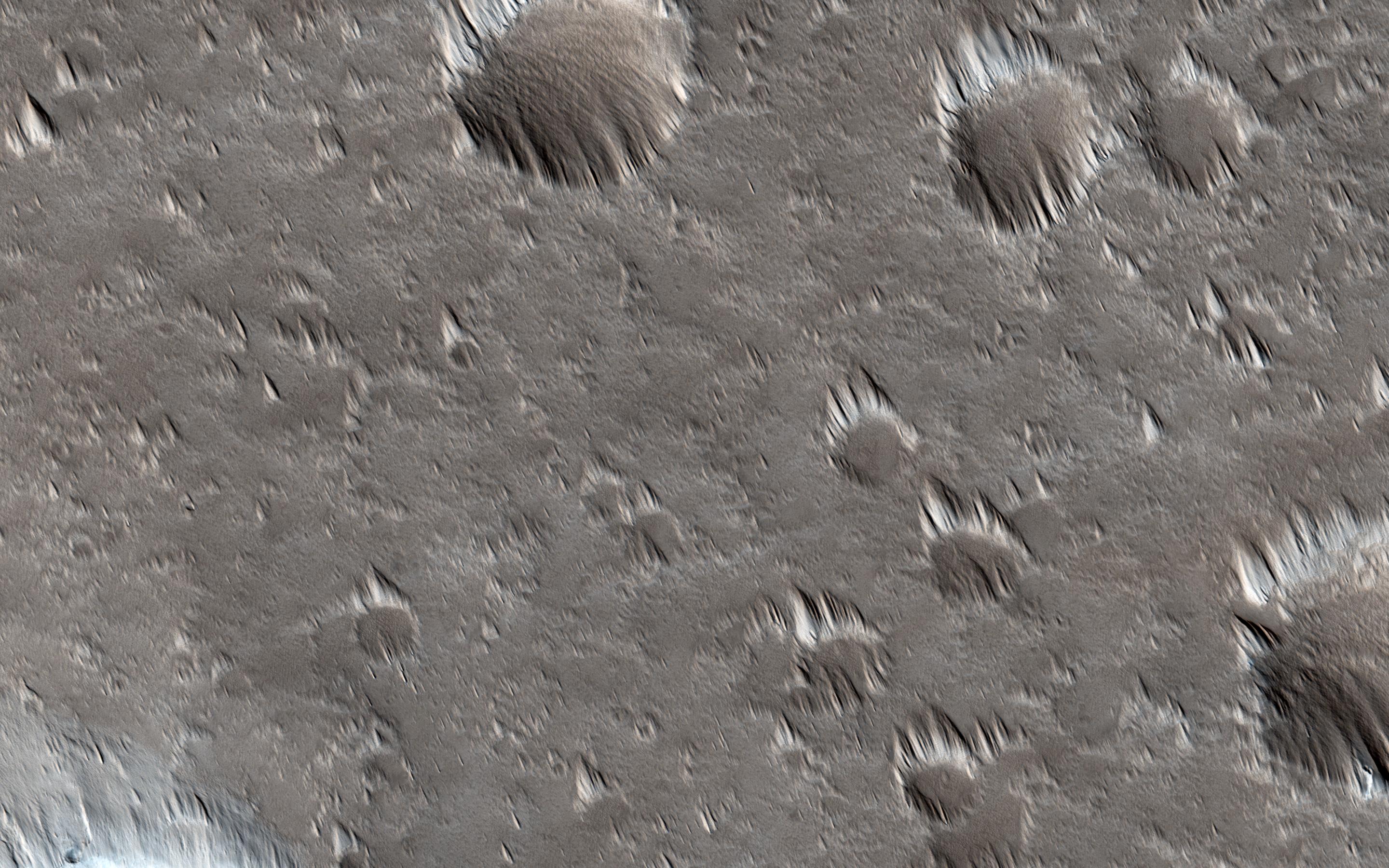
2014-04-16 |
Mars
|
Mars Reconnaissance Orbiter (MRO)
|
HiRISE
|
2880x1800x3 |
|
-
PIA18224:
-
A Surprise Landslump in Melas Chasma
Full Resolution:
TIFF
(15.56 MB)
JPEG
(662.5 kB)
|
|
|
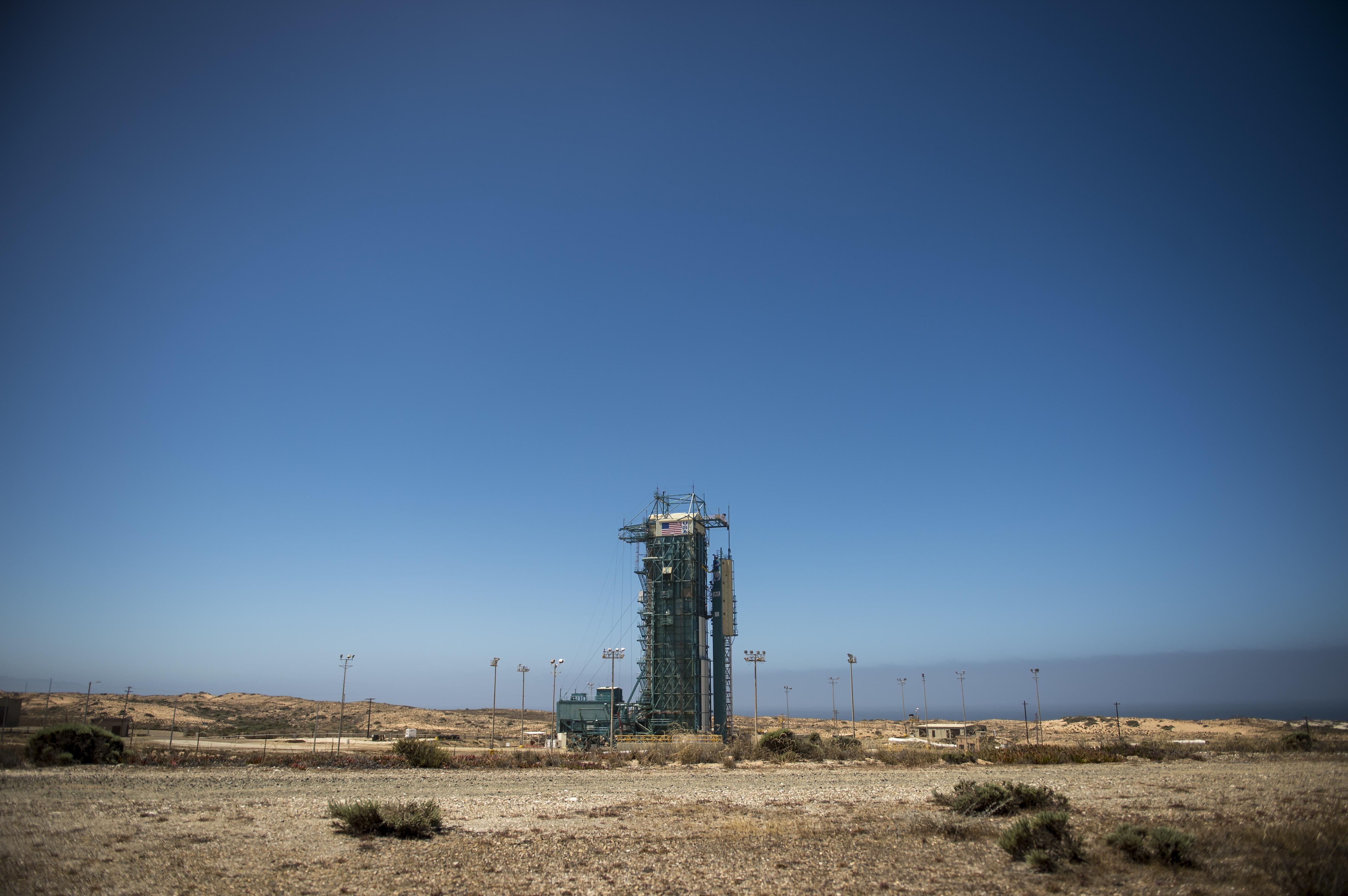
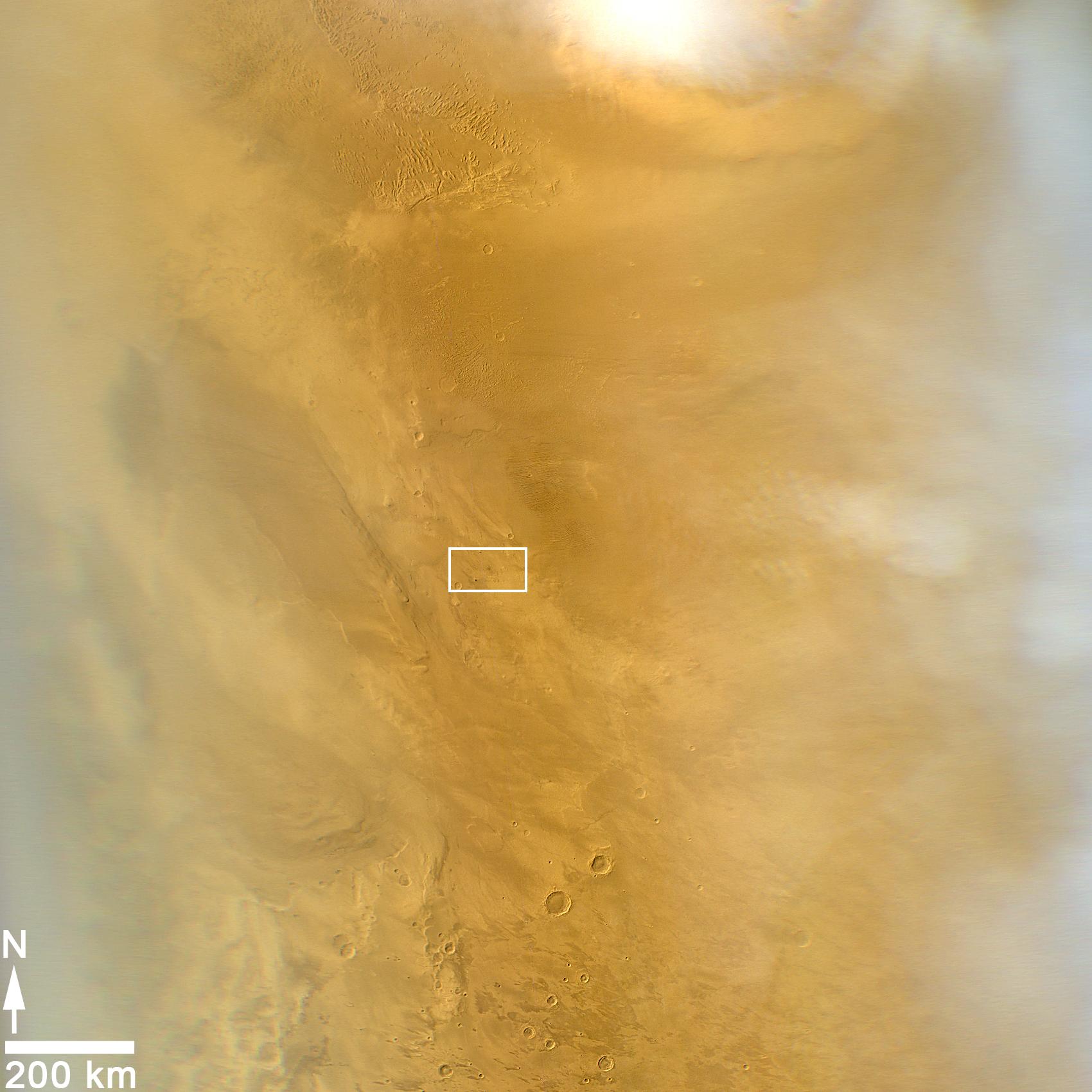
2014-04-15 |
|
OCO-2
|
OCO-2
|
1993x3000x3 |
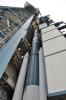
|
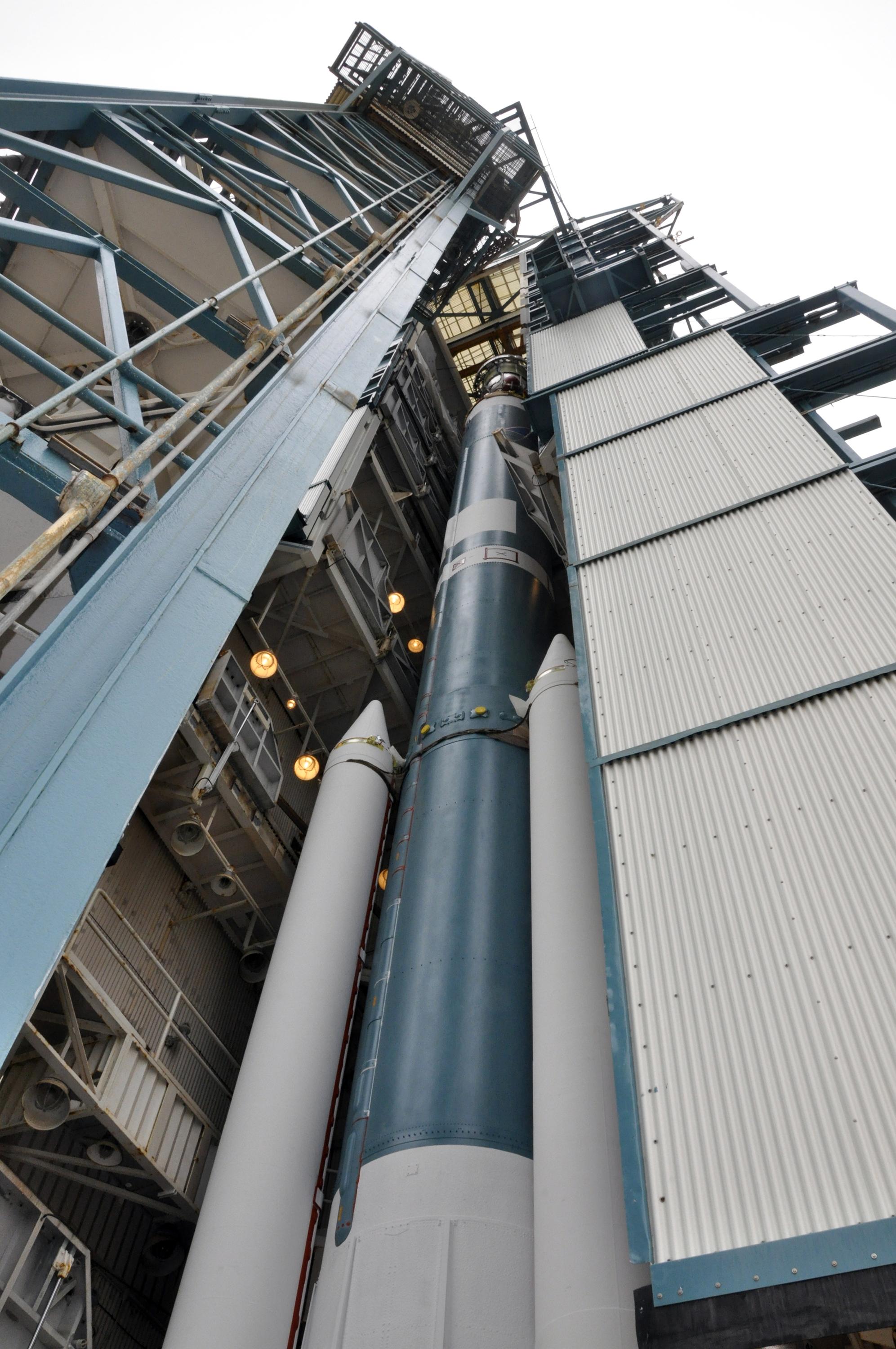
-
PIA18044:
-
Positioning NASA's OCO-2's Delta II Launch Vehicle Second Stage for Mating
Full Resolution:
TIFF
(17.94 MB)
JPEG
(616.3 kB)
|
|
|
2014-04-15 |
|
OCO-2
|
OCO-2
|
1993x3000x3 |
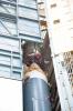
|
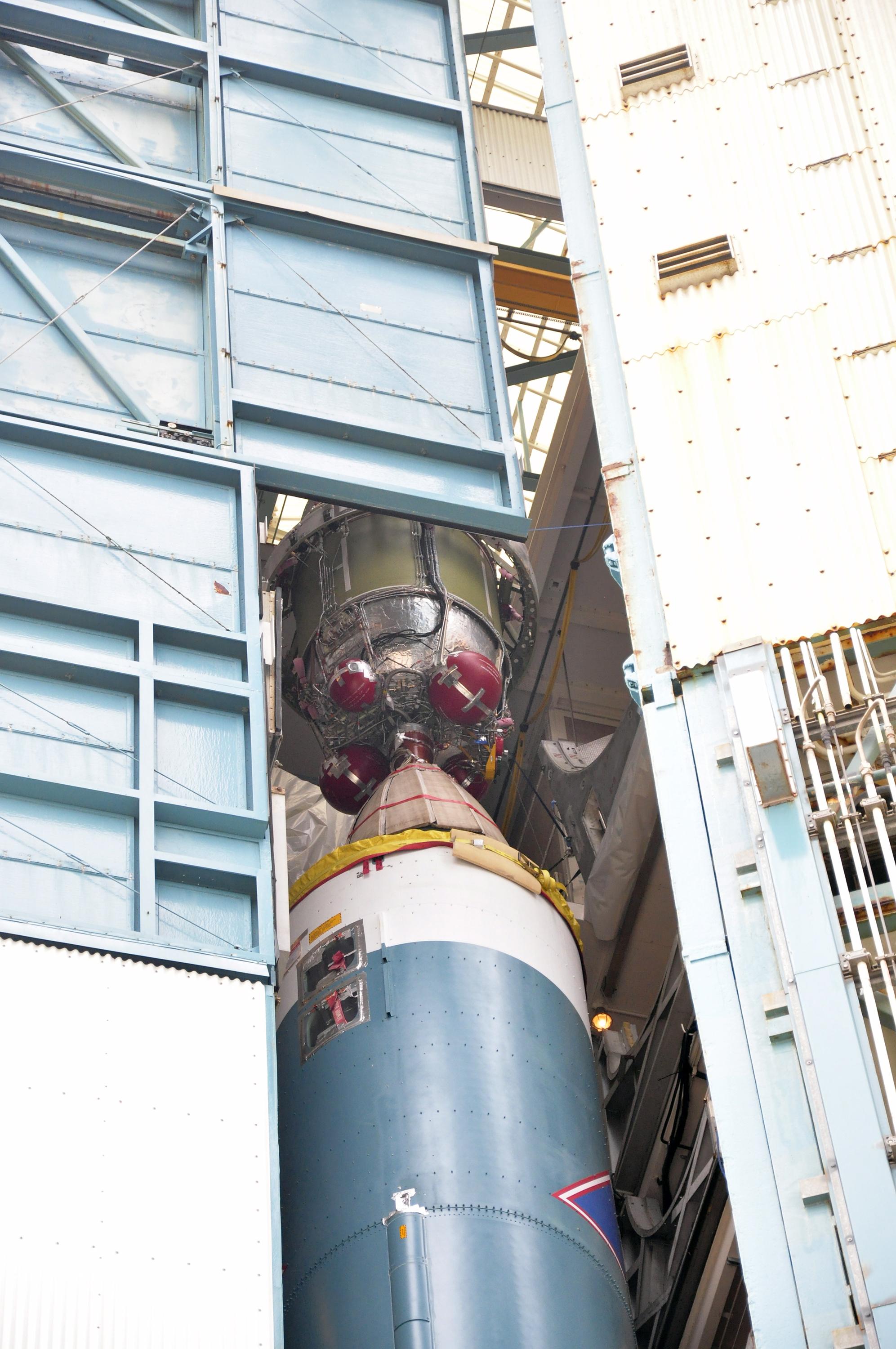
-
PIA18045:
-
Mating NASA's OCO-2's Delta II Launch Vehicle First and Second Stages
Full Resolution:
TIFF
(17.94 MB)
JPEG
(559.7 kB)
|
|
|
2014-04-15 |
|
OCO-2
|
OCO-2
|
1993x3000x3 |
|
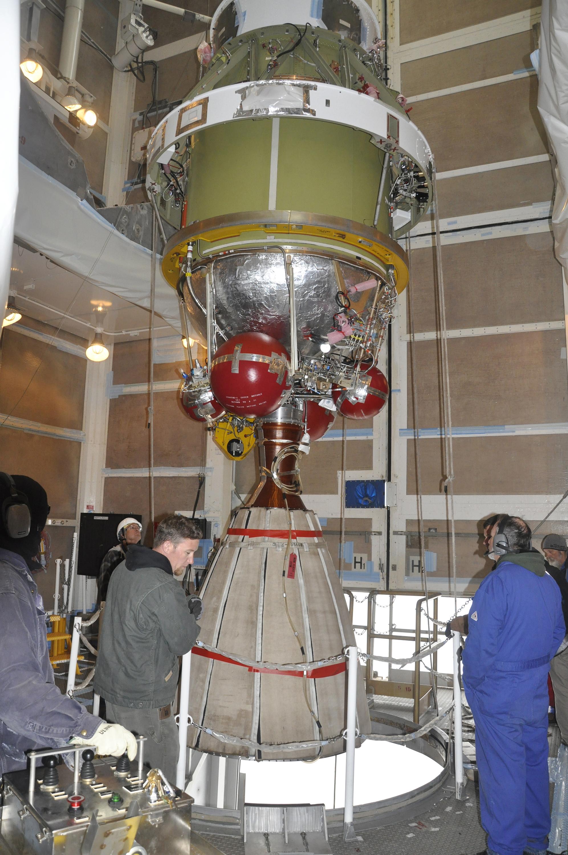
-
PIA18043:
-
Lifting NASA's OCO-2's Delta II Launch Vehicle Second Stage into Position for Mating
Full Resolution:
TIFF
(17.94 MB)
JPEG
(704.7 kB)
|
|
|
2014-04-15 |
|
OCO-2
|
OCO-2
|
1993x3000x3 |
|
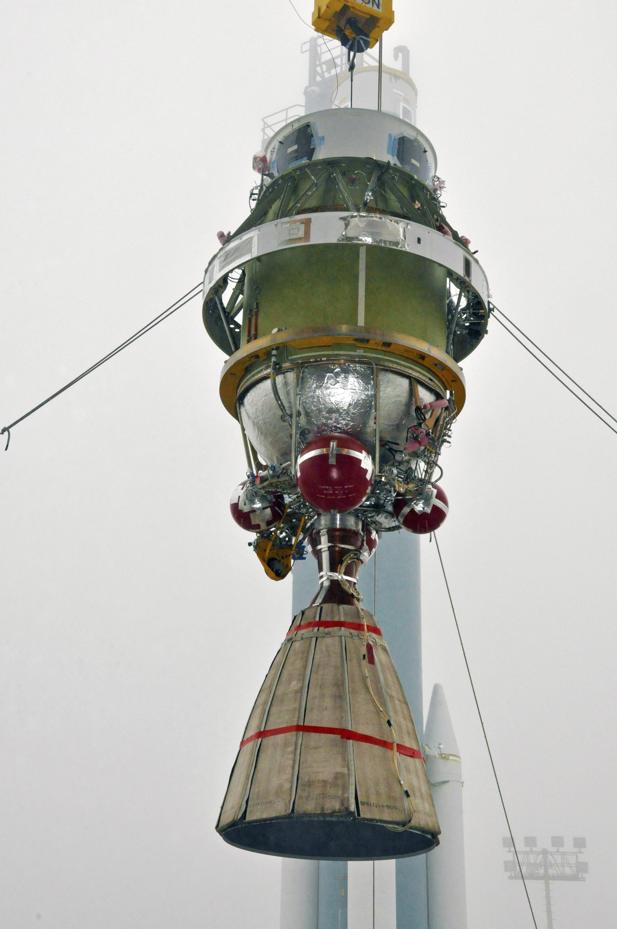
-
PIA18042:
-
Lifting of NASA's OCO-2's Delta II Launch Vehicle
Full Resolution:
TIFF
(17.94 MB)
JPEG
(478.9 kB)
|
|
|
2014-04-09 |
Mars
|
Mars Reconnaissance Orbiter (MRO)
|
HiRISE
|
2880x1800x3 |
|
-
PIA18122:
-
Opportunity Rover on Valentine's Day 2014
Full Resolution:
TIFF
(15.56 MB)
JPEG
(565 kB)
|
|
|
2014-04-07 |
Earth
|
Terra
|
ASTER
|
861x720x3 |

|
-
PIA18207:
-
Argentina Forest
Full Resolution:
TIFF
(1.861 MB)
JPEG
(98.52 kB)
|
|
|
2014-03-27 |
Earth
|
Terra
Landsat
|
ASTER
|
1610x1454x3 |
|
-
PIA18187:
-
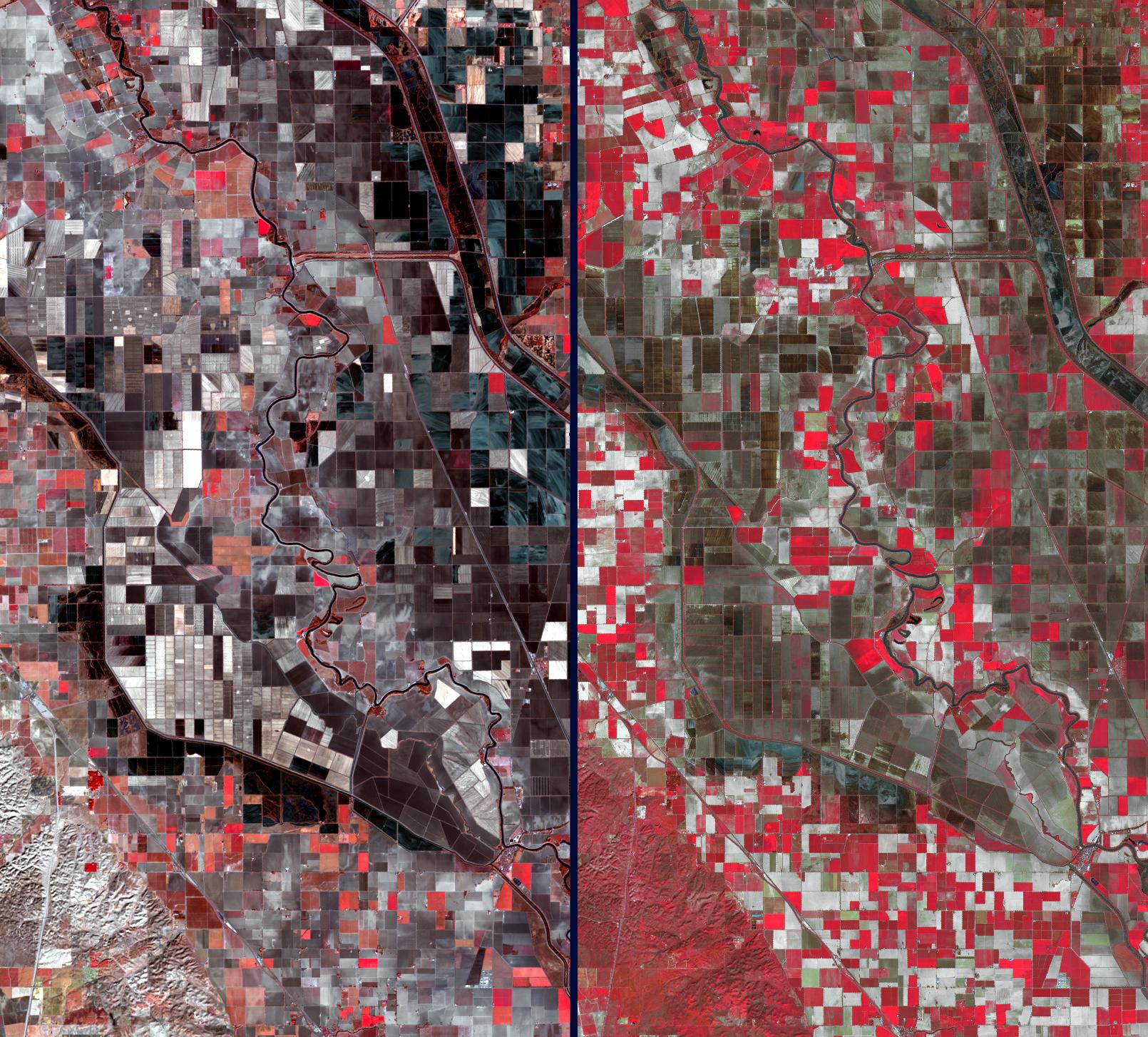
Stark Effects of California Drought on Agriculture seen by NASA Spacecraft
Full Resolution:
TIFF
(7.025 MB)
JPEG
(502.2 kB)
|
|
|
2014-03-26 |
Earth
|
Terra
|
ASTER
|
1382x1386x3 |
|
-
PIA18204:
-
Lake Sharpe, South Dakota
Full Resolution:
TIFF
(5.749 MB)
JPEG
(313.2 kB)
|
|
|
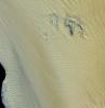
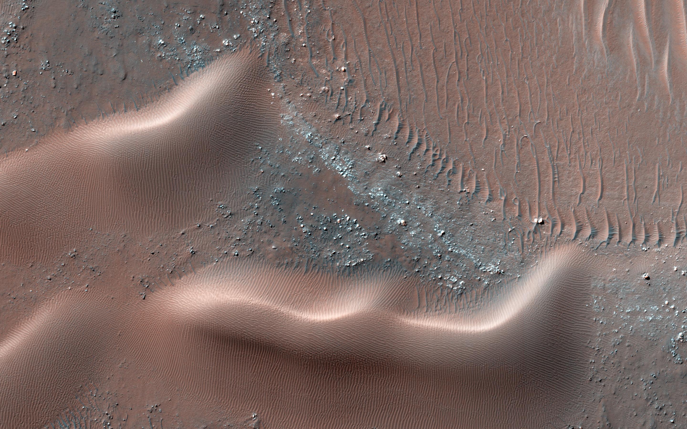
2014-03-19 |
Mars
|
Mars Reconnaissance Orbiter (MRO)
|
HiRISE
|
2880x1800x3 |
|
-
PIA17906:
-
A New Gully Channel in Terra Sirenum
Full Resolution:
TIFF
(15.56 MB)
JPEG
(754 kB)
|
|
|
2014-03-19 |
Mars
|
Mars Reconnaissance Orbiter (MRO)
|
HiRISE
|
800x800x3 |
|
-
PIA17958:
-
A New Gully Channel in Terra Sirenum, Mars
Full Resolution:
TIFF
(1.921 MB)
JPEG
(100.4 kB)
|
|
|
2014-03-17 |
Earth
|
Terra
|
ASTER
|
1451x1919x3 |
|
-
PIA18136:
-
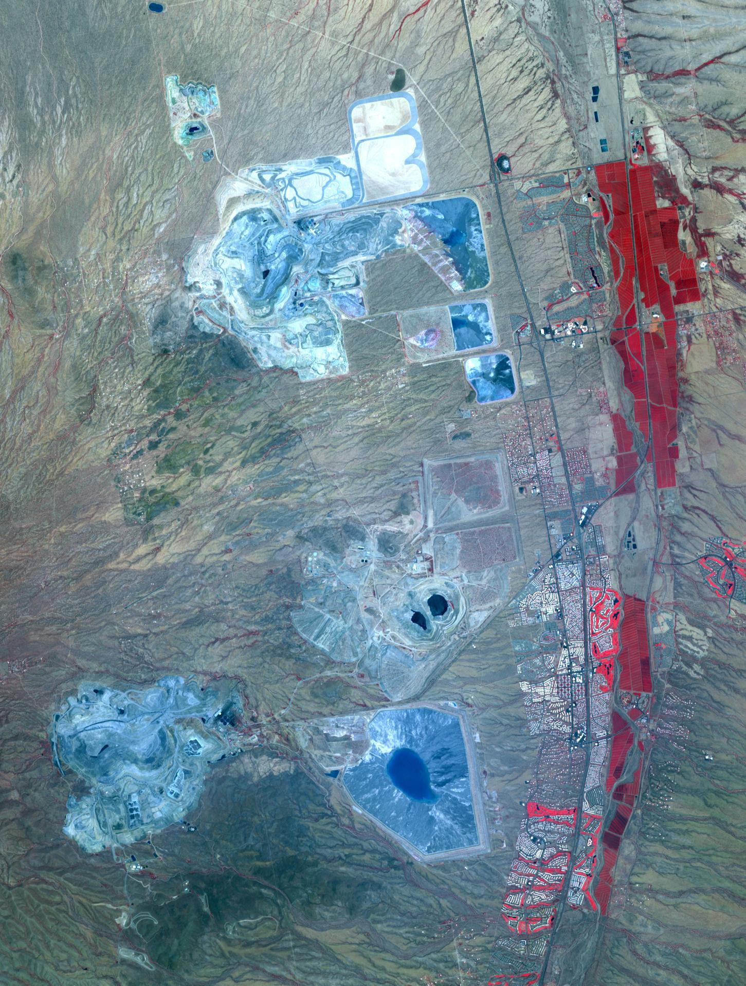
Arizona Copper
Full Resolution:
TIFF
(8.357 MB)
JPEG
(539.6 kB)
|
|
|
2014-03-12 |
Mars
|
Mars Reconnaissance Orbiter (MRO)
|
HiRISE
|
2880x1800x1 |

|
-
PIA17903:
-
Ejecta in Excess
Full Resolution:
TIFF
(5.191 MB)
JPEG
(877.3 kB)
|
|
|
2014-03-07 |
|
Kepler
|
|
2008x3000x3 |

|
-
PIA14446:
-
Kepler Team Marks Five Years in Space
Full Resolution:
TIFF
(18.08 MB)
JPEG
(216.7 kB)
|
|
|
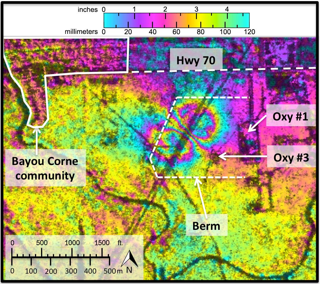
2014-03-06 |
Earth
|
UAVSAR
|
L-Band UAVSAR
|
1107x981x3 |
|
-
PIA18040:
-
NASA Radar Demonstrates Ability to Foresee Sinkholes
Full Resolution:
TIFF
(3.259 MB)
JPEG
(246.1 kB)
|
|
|
2014-03-04 |
Earth
|
Terra
|
ASTER
|
832x677x3 |
|
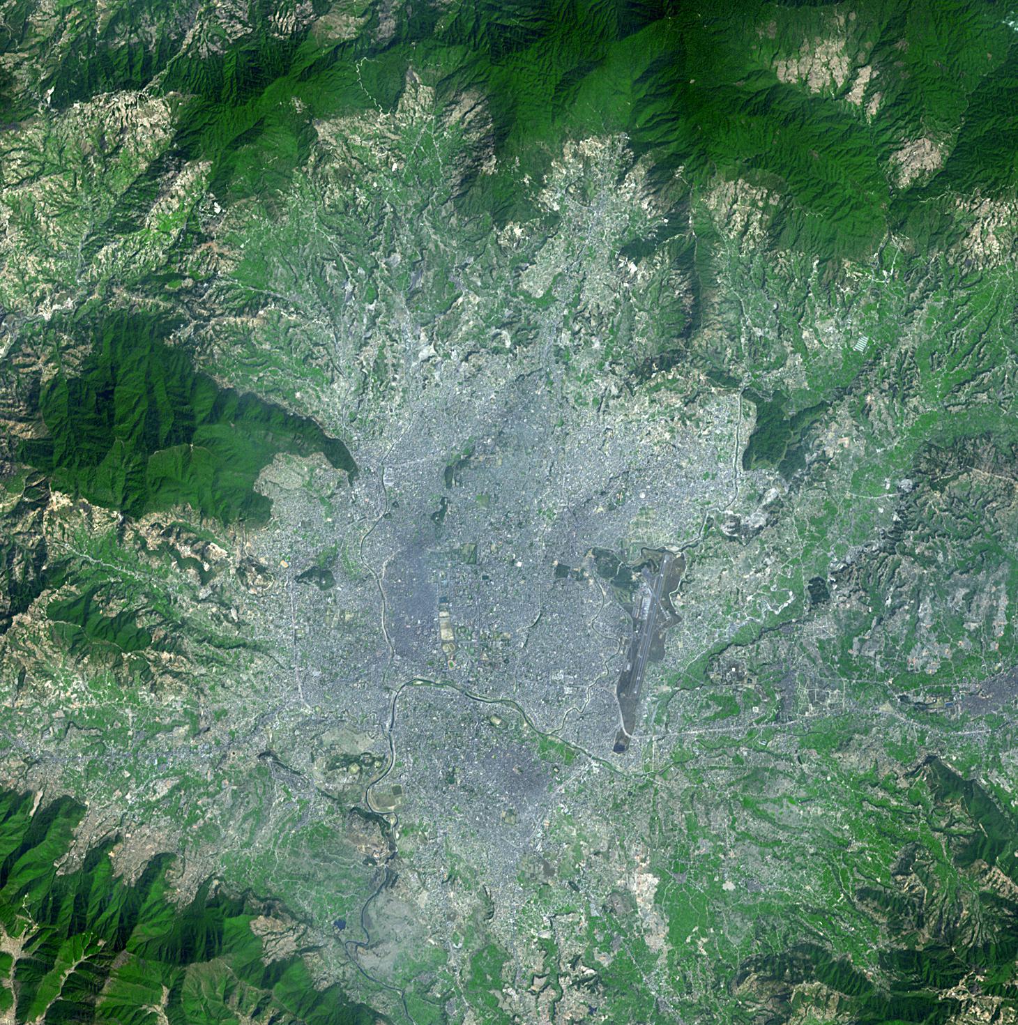
-
PIA18068:
-
Vatican City State
Full Resolution:
TIFF
(1.691 MB)
JPEG
(217.4 kB)
|
|
|
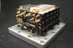
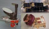
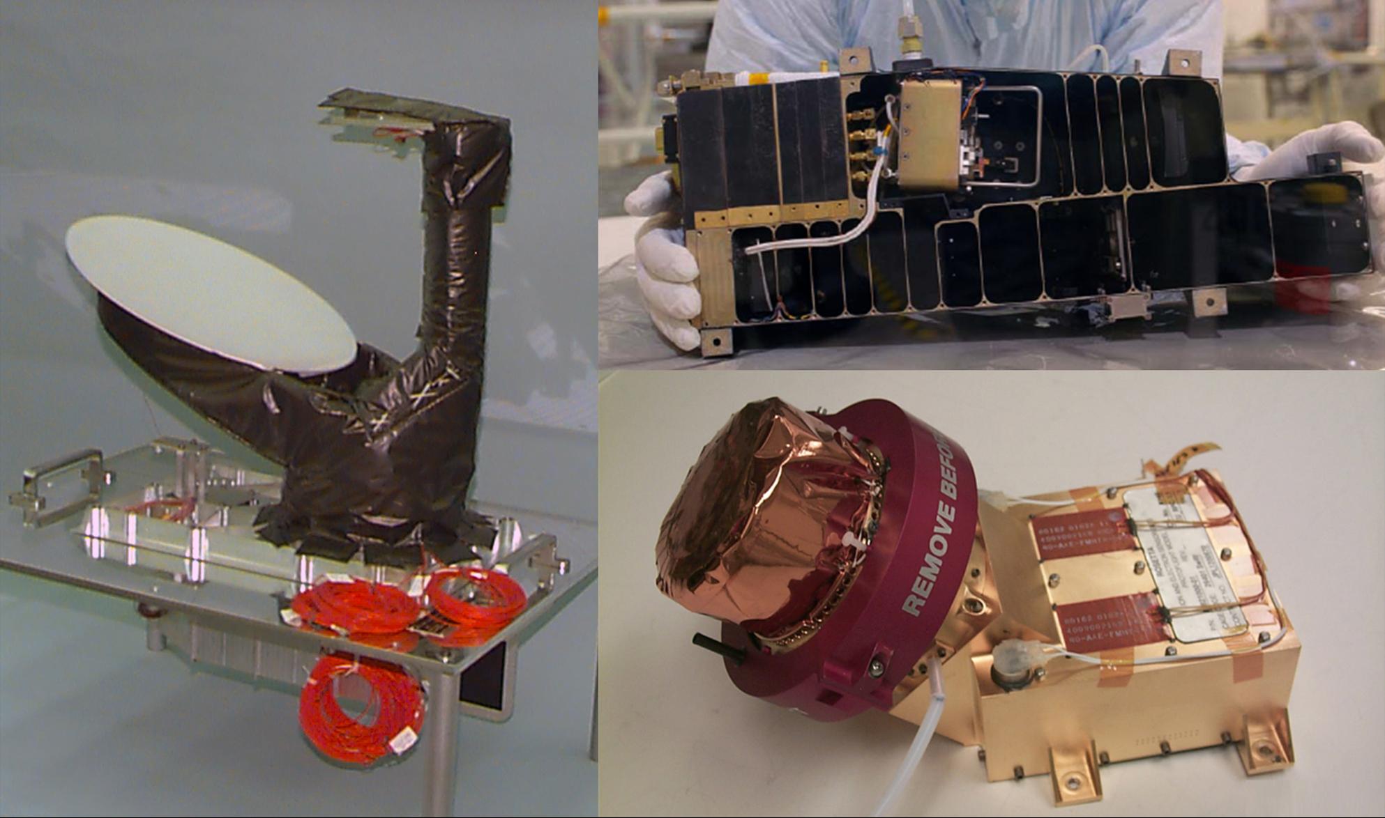
2014-02-27 |
|
MAVEN
|
Electra Relay Radio
|
2816x1872x3 |
|
-
PIA17952:
-
Electra Relay Radio on MAVEN Mission to Mars
Full Resolution:
TIFF
(15.82 MB)
JPEG
(905.7 kB)
|
|
|
2014-02-26 |
Earth
|
Terra
|
ASTER
|
2244x2334x3 |
|
-
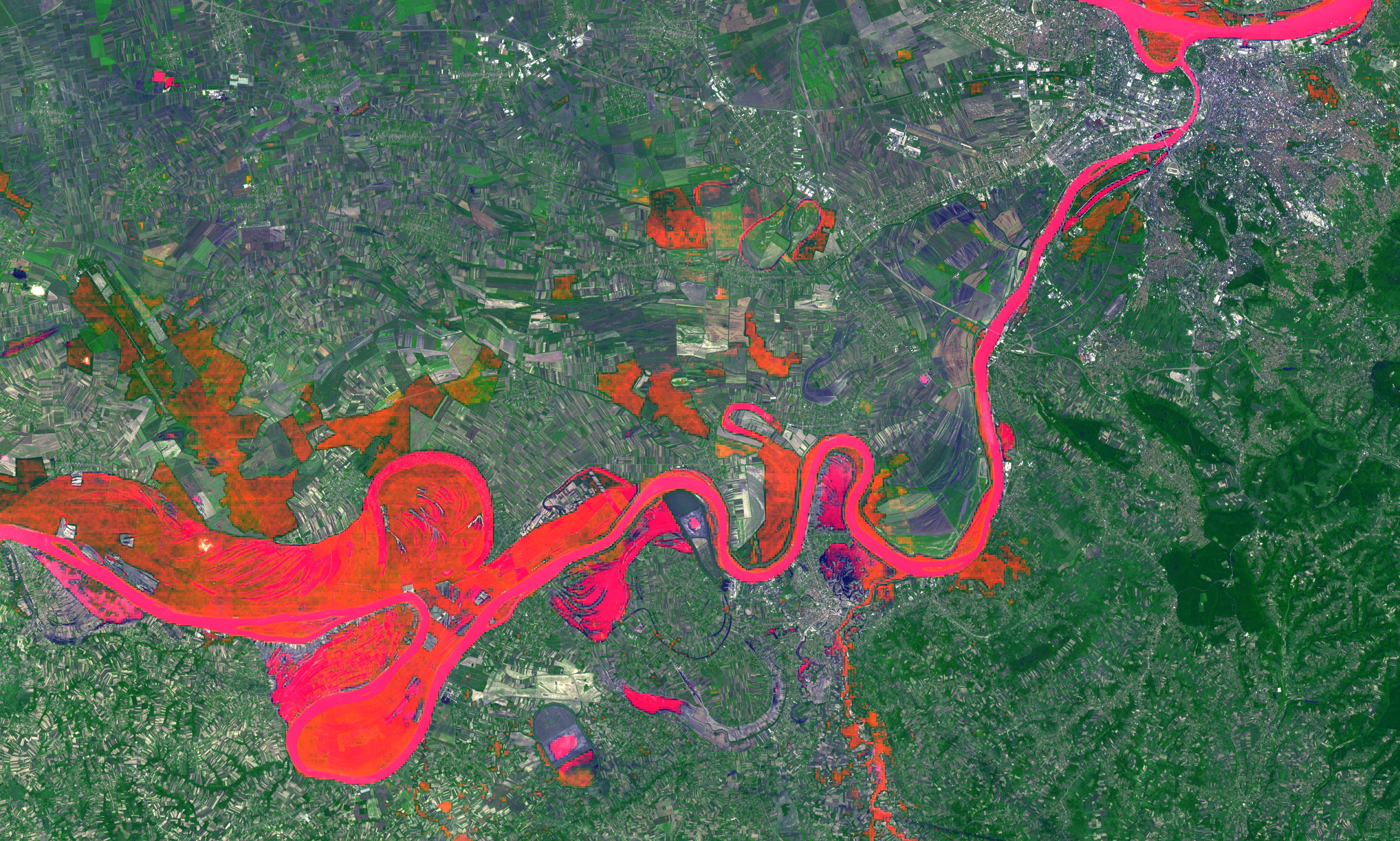
PIA18031:
-
NASA Spacecraft Eyes Bolivian Flooding
Full Resolution:
TIFF
(15.72 MB)
JPEG
(1.011 MB)
|
|
|
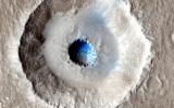
2014-02-26 |
Mars
|
Mars Reconnaissance Orbiter (MRO)
|
HiRISE
|
2880x1800x3 |
|
-
PIA18115:
-
Craters in an Icy Surface
Full Resolution:
TIFF
(15.56 MB)
JPEG
(984.6 kB)
|
|
|
2014-02-23 |
Earth
|
Terra
|
ASTER
|
1767x1536x3 |
|
-
PIA18020:
-
Ashy Aftermath of Indonesian Volcano Eruption seen by NASA Spacecraft
Full Resolution:
TIFF
(8.146 MB)
JPEG
(462.6 kB)
|
|
|
2014-02-19 |
Earth
|
Terra
|
ASTER
|
3114x1915x3 |
|
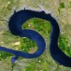
-
PIA17989:
-
U.K. Flooding Captured by NASA Spacecraft
Full Resolution:
TIFF
(17.9 MB)
JPEG
(1.517 MB)
|
|
|
2014-02-12 |
Earth
|
Terra
|
ASTER
|
504x336x3 |
|
-
PIA18067:
-
Nighttime Look at Ambrym Volcano, Vanuatu by NASA Spacecraft
Full Resolution:
TIFF
(508.4 kB)
JPEG
(19.25 kB)
|
|
|
2014-02-11 |
Earth
|
Terra
|
ASTER
|
1459x1318x3 |
|
-
PIA17979:
-
Latest Activity at Europe's Most Active Volcano Captured by NASA Spacecraft
Full Resolution:
TIFF
(5.771 MB)
JPEG
(317.1 kB)
|
|
|
2014-02-11 |
Earth
|
Terra
|
ASTER
|
2100x2210x3 |

|
-
PIA17978:
-
Angry Indonesian Volcano Imaged by NASA Spacecraft
Full Resolution:
TIFF
(13.93 MB)
JPEG
(800.8 kB)
|
|
|
2014-02-05 |
Earth
|
Terra
|
ASTER
|
1512x1458x3 |
|
-
PIA17971:
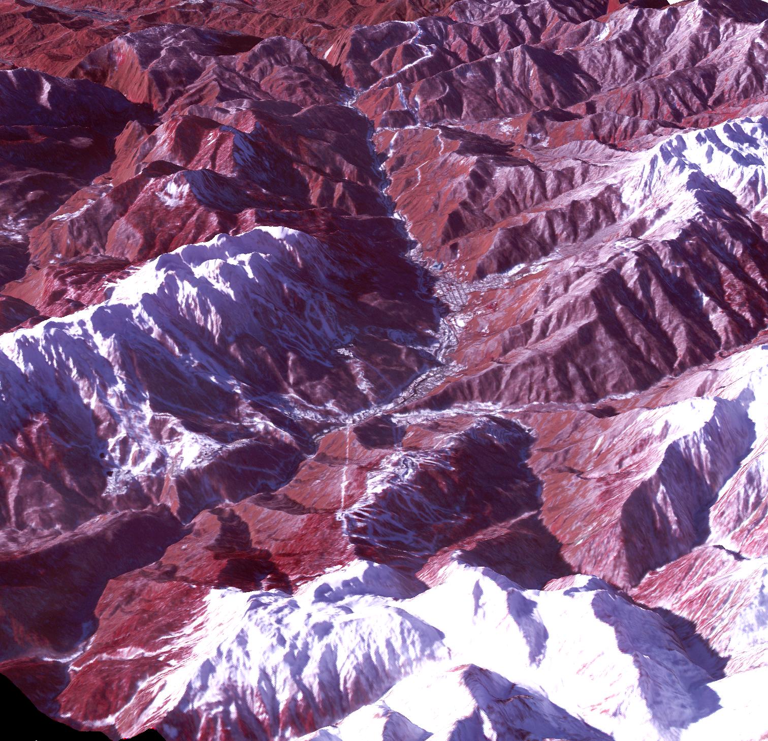
-
Sochi, Russia Winter Olympic Sites (Mountain Cluster)
Full Resolution:
TIFF
(6.616 MB)
JPEG
(438.9 kB)
|
|
|
2014-02-05 |
Earth
|
Terra
|
ASTER
|
1509x1447x3 |
|
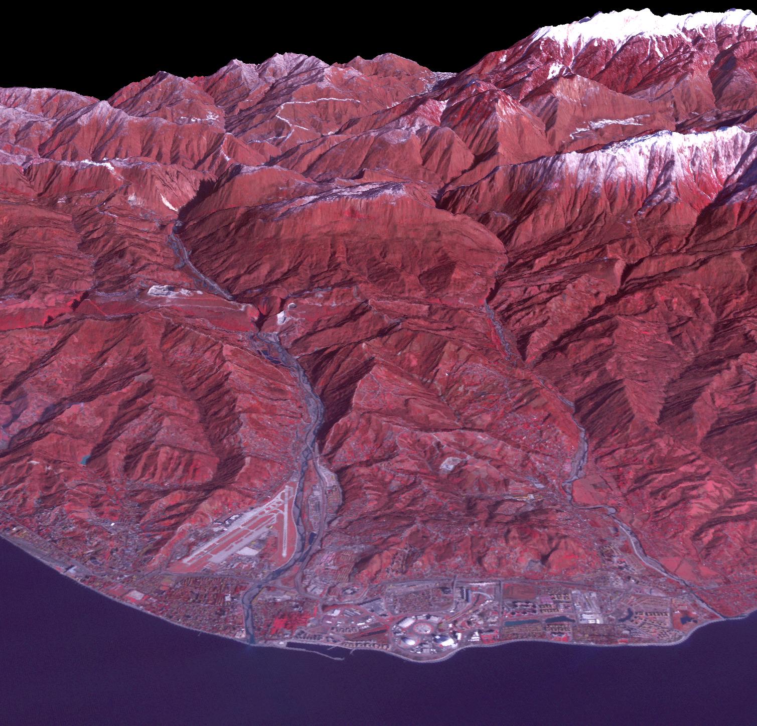
-
PIA17970:
-
Sochi, Russia Winter Olympic Sites (Coastal Cluster)
Full Resolution:
TIFF
(6.553 MB)
JPEG
(367.7 kB)
|
|
|
2014-02-05 |
Earth
|
Terra
|
ASTER
|
2974x2147x3 |
|
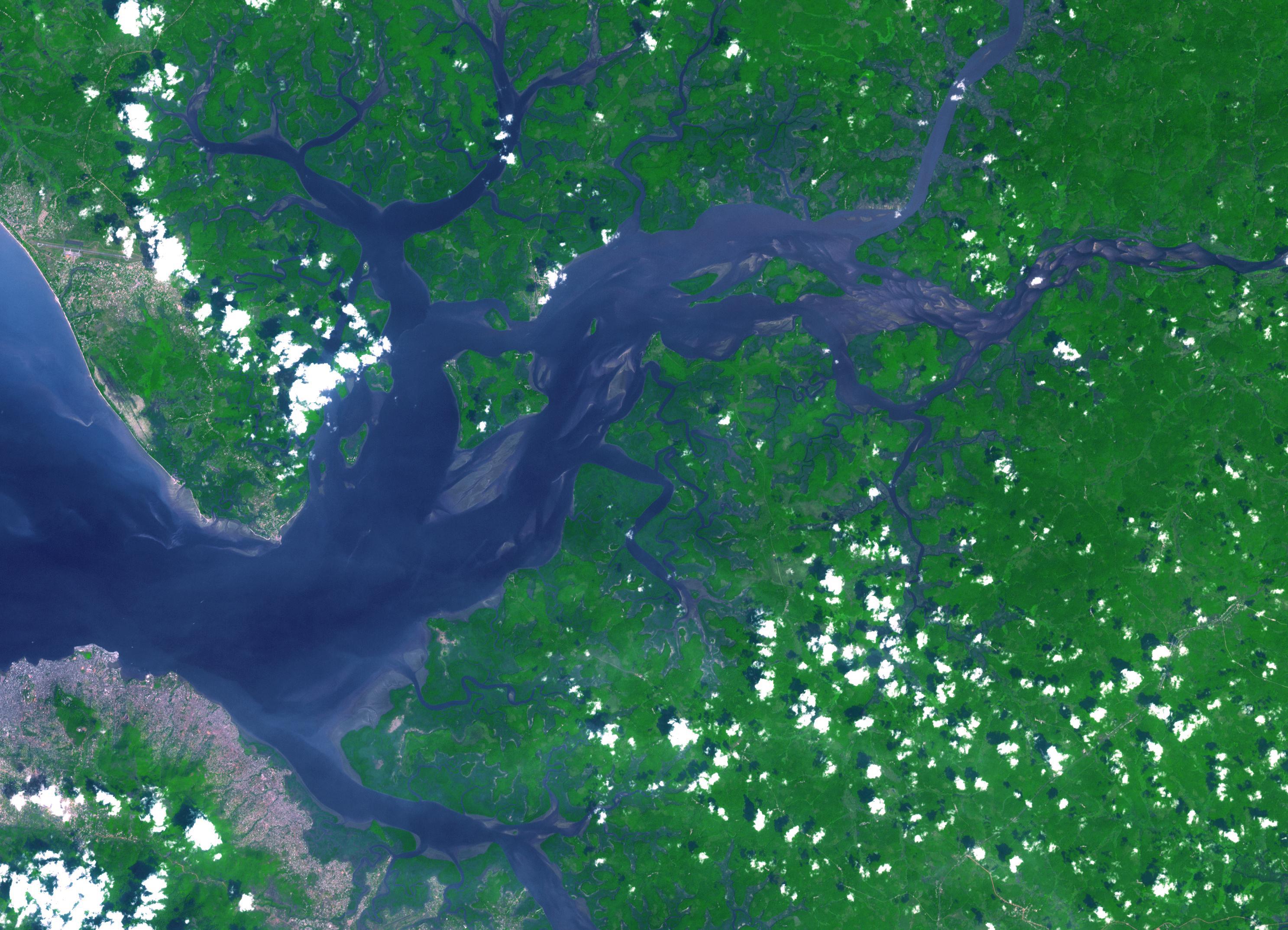
-
PIA17977:
-
Sierra Leone Estuary
Full Resolution:
TIFF
(19.16 MB)
JPEG
(856.5 kB)
|
|
|
2014-02-05 |
Mars
|
Mars Reconnaissance Orbiter (MRO)
|
HiRISE
|
1024x768x3 |
|
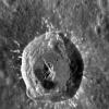
-
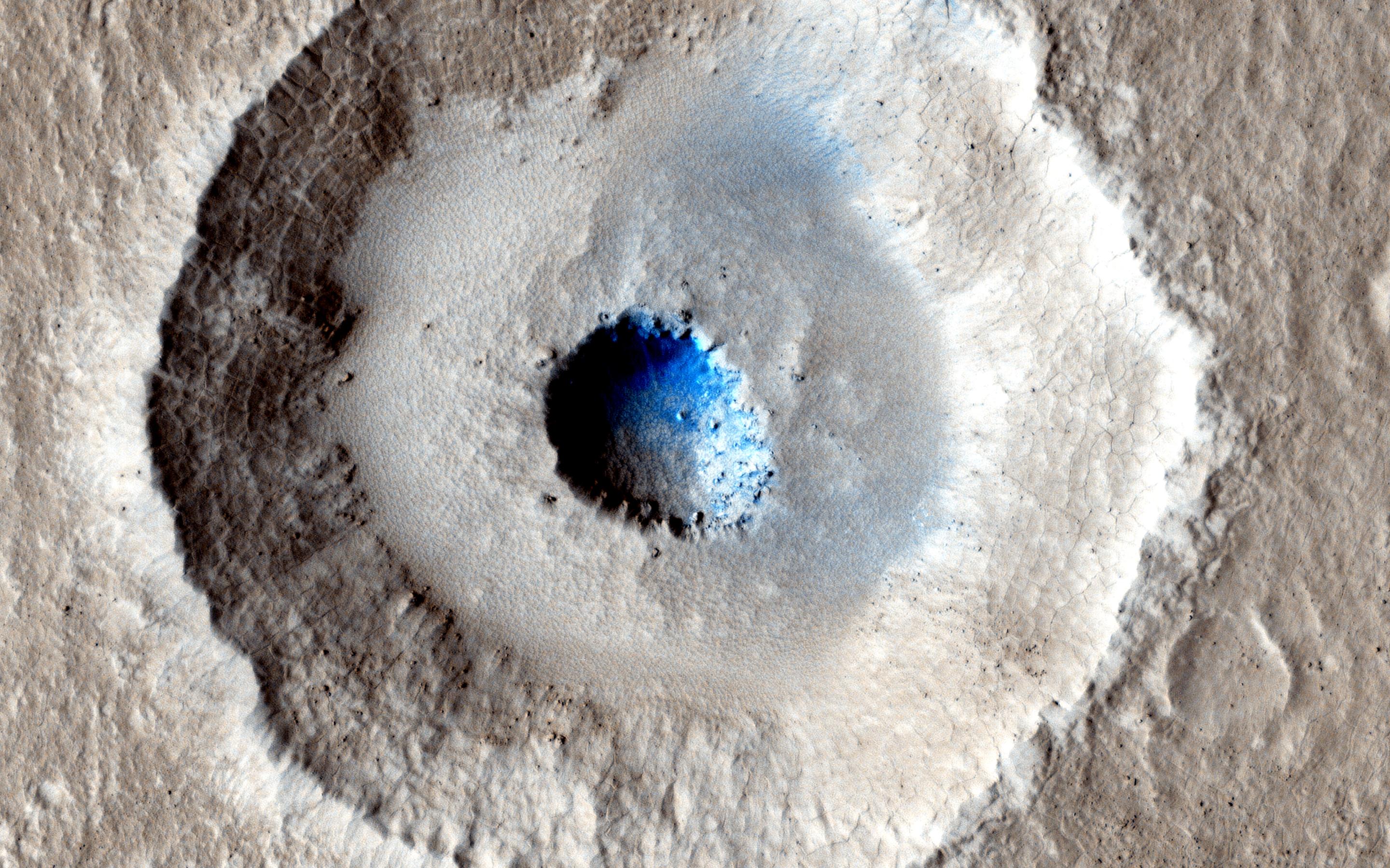
PIA17932:
-
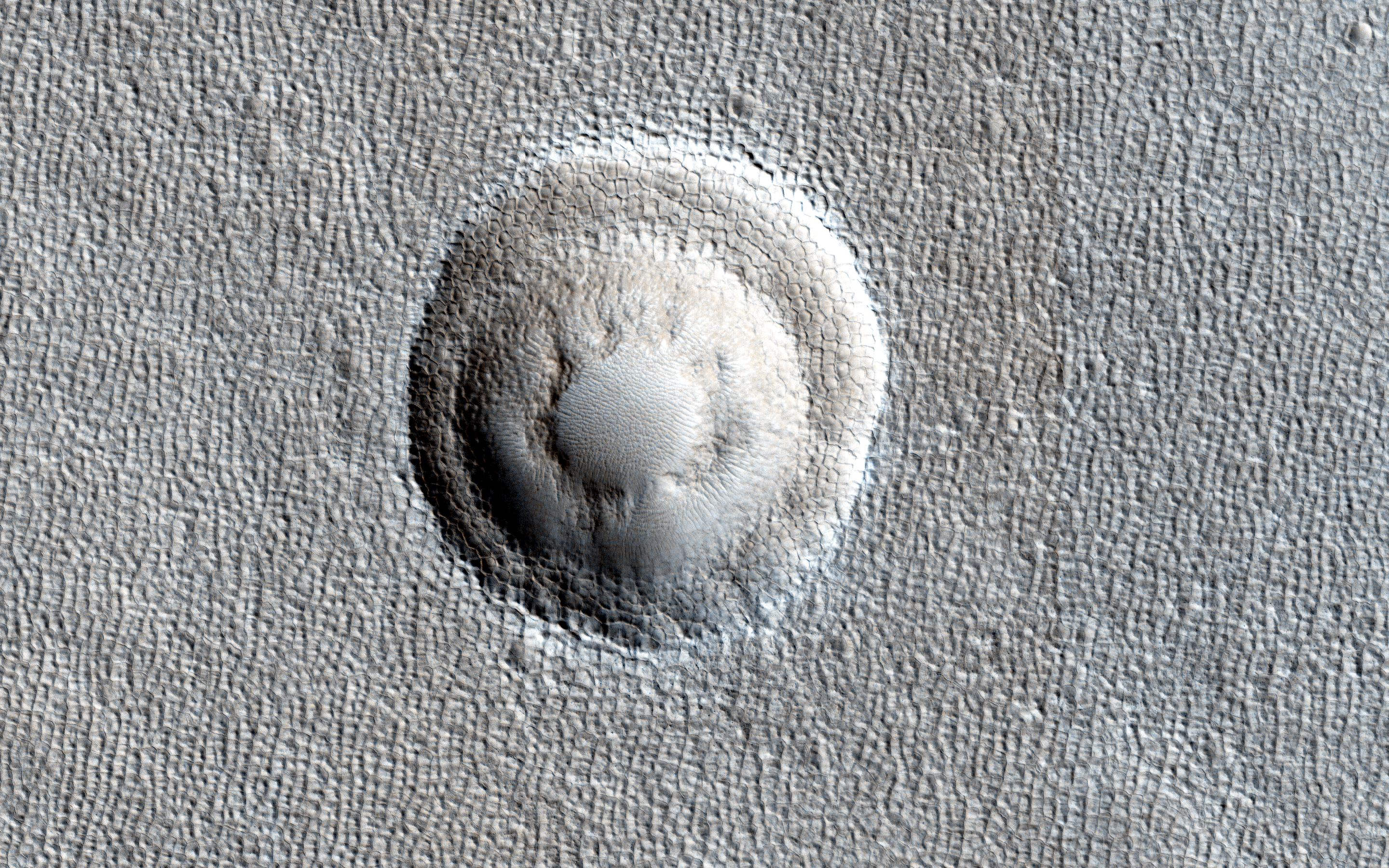
A Spectacular New Martian Impact Crater
Full Resolution:
TIFF
(2.36 MB)
JPEG
(200.7 kB)
|
|
|
2014-02-05 |
Mars
|
Mars Reconnaissance Orbiter (MRO)
|
HiRISE
|
2880x1800x3 |
|
-
PIA17986:
-
Fall Frost Accumulation on Russell Crater Dunes
Full Resolution:
TIFF
(15.56 MB)
JPEG
(962.1 kB)
|
|
|
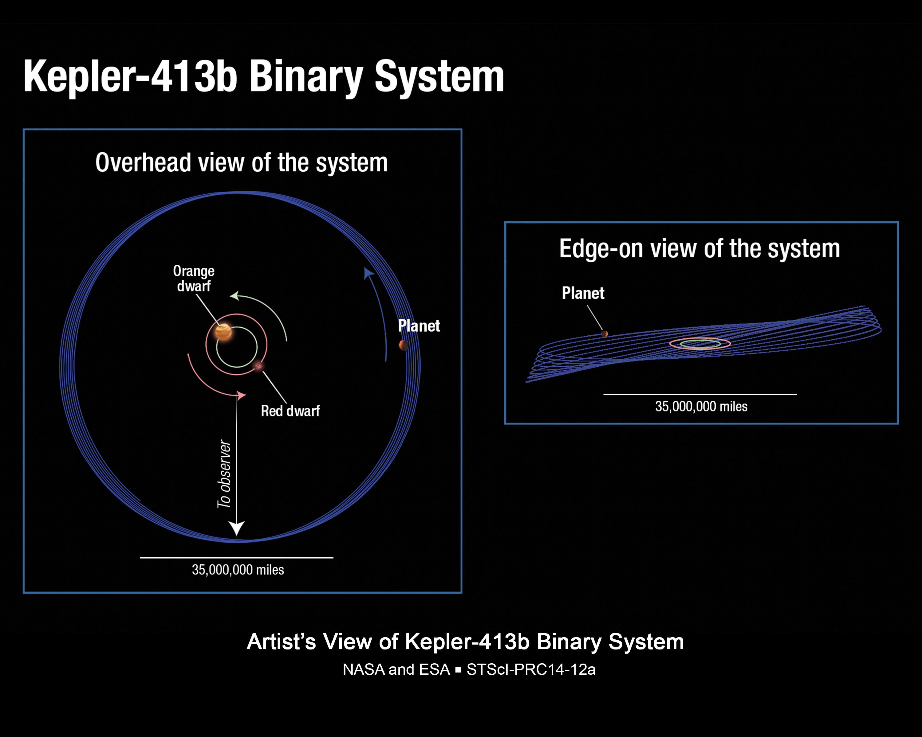
2014-02-04 |
|
Kepler
|
|
3000x2400x3 |
|
-
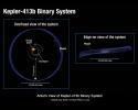
PIA17836:
-
Wobbly Planet Orbital Schematic (Illustration)
Full Resolution:
TIFF
(21.61 MB)
JPEG
(345.3 kB)
|
|
|
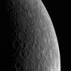
2014-01-29 |
Mercury
|
MESSENGER
|
MDIS - Narrow Angle
|
1020x1024x1 |
|
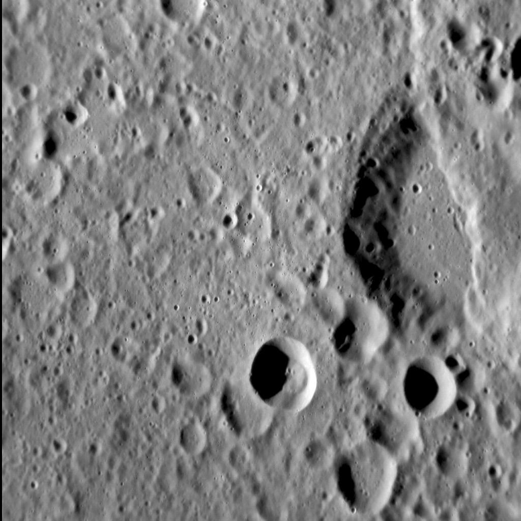
-
PIA17925:
-
Third Time's a Charm
Full Resolution:
TIFF
(1.046 MB)
JPEG
(181.5 kB)
|
|
|
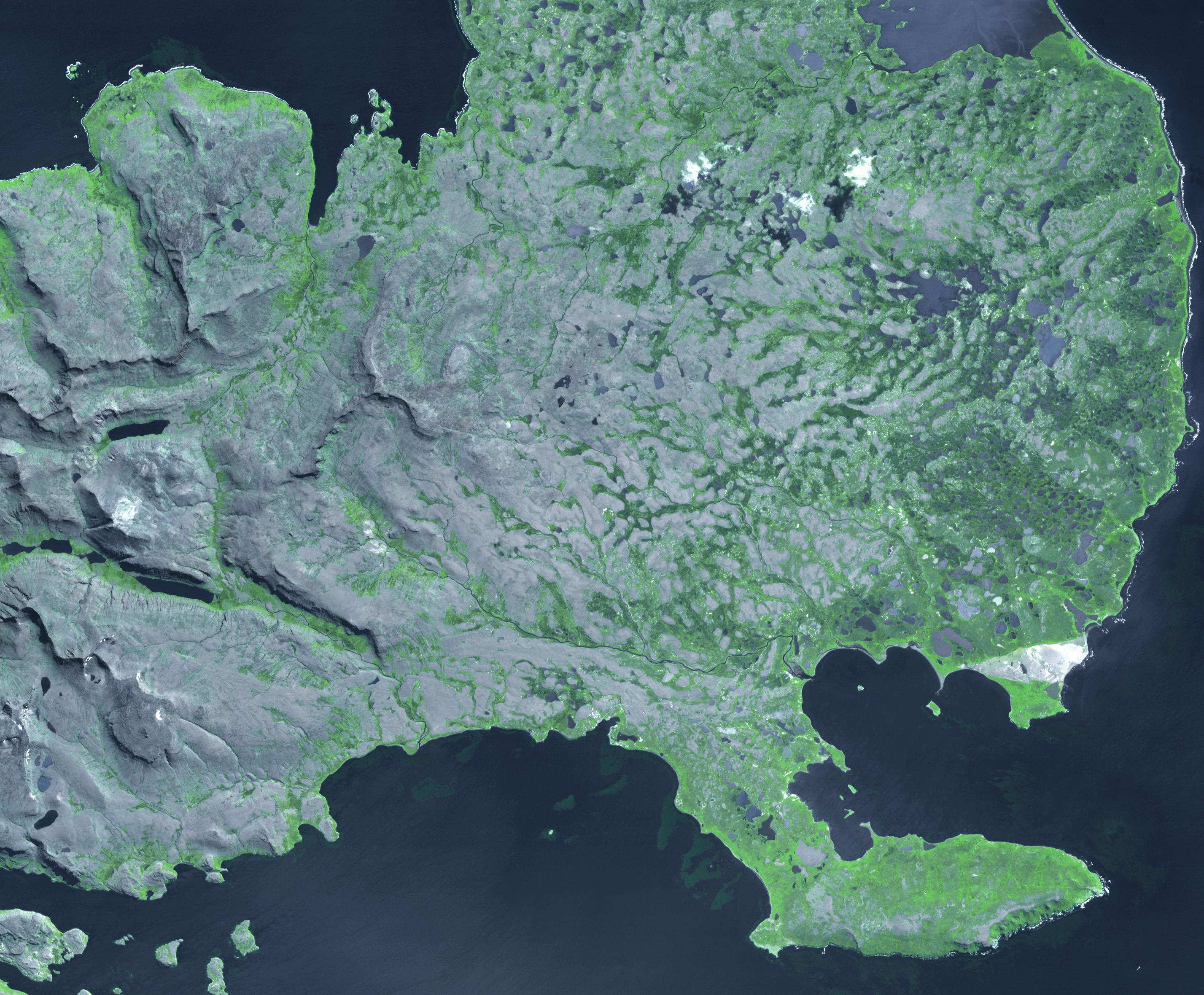
2014-01-28 |
Earth
|
UAVSAR
|
|
5184x3456x3 |
|
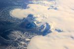
-
PIA17924:
-
NASA Radar Maps the Winter Pace of Iceland's Glaciers
Full Resolution:
TIFF
(53.78 MB)
JPEG
(1.748 MB)
|
|
|
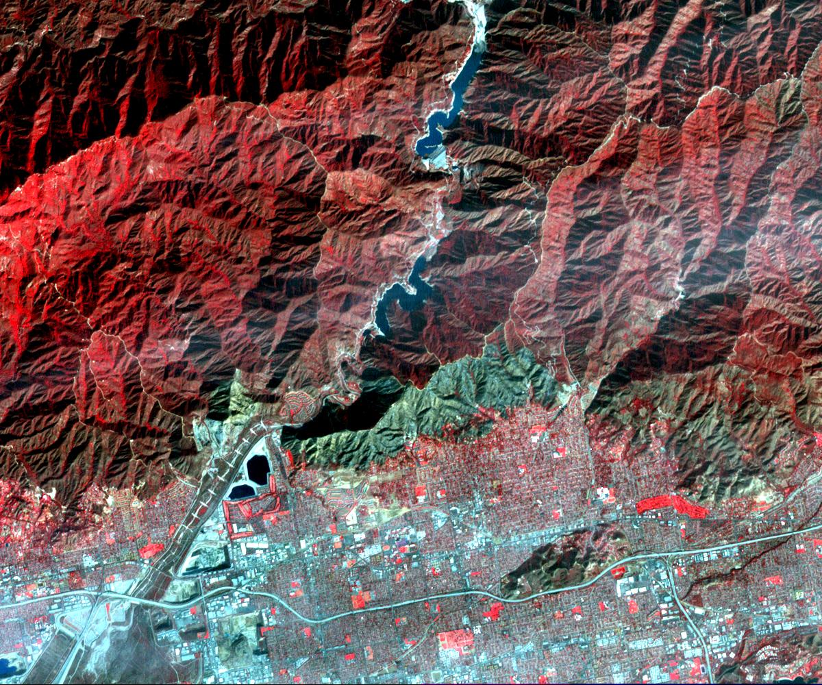
2014-01-28 |
Earth
|
Terra
|
ASTER
|
1200x1000x3 |
|
-
PIA17923:
-
NASA's Terra Spacecraft Images Destructive Colby Fire East of Los Angeles
Full Resolution:
TIFF
(3.602 MB)
JPEG
(342.4 kB)
|
|
|
2014-01-24 |
Comet
|
Rosetta
|
|
1986x1174x3 |
|
-
PIA17664:
-
U.S. Instruments Aboard Rosetta
Full Resolution:
TIFF
(6.997 MB)
JPEG
(193.1 kB)
|
|
|
2014-01-22 |
Earth
|
Terra
|
ASTER
|
1097x3072x3 |

|
-
PIA17899:
-
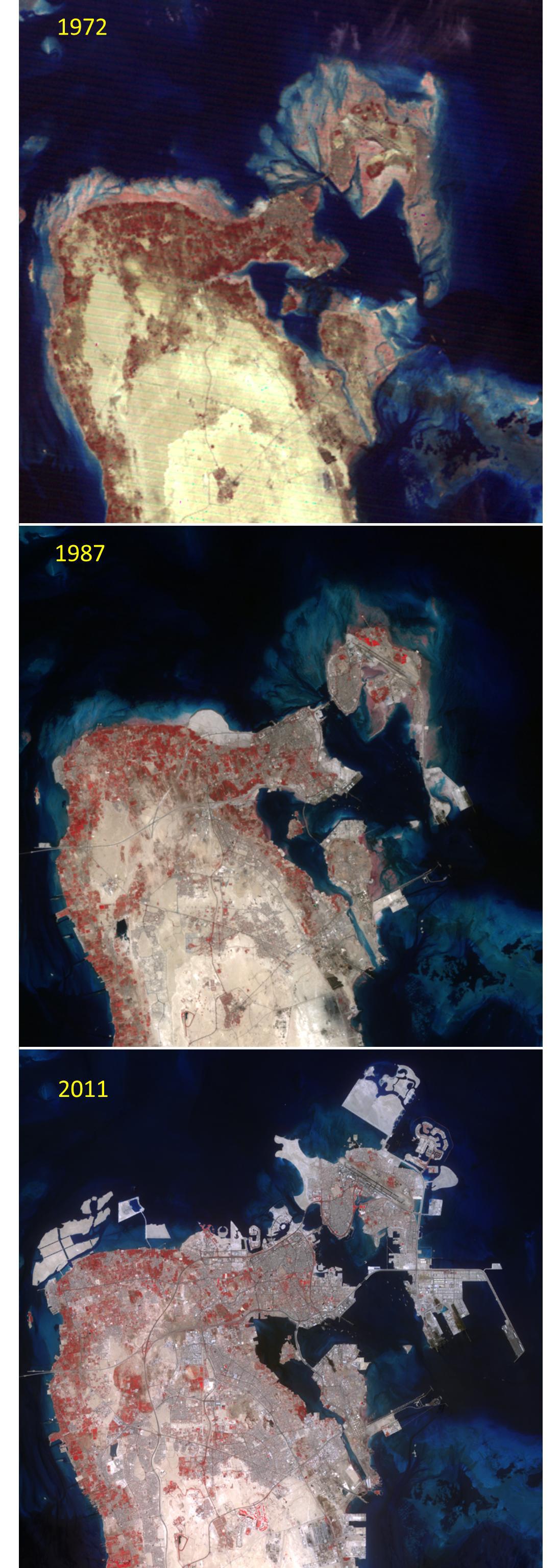
Kingdom of Bahrain
Full Resolution:
TIFF
(10.11 MB)
JPEG
(356.5 kB)
|
|
|
2014-01-15 |
Mars
|
Mars Reconnaissance Orbiter (MRO)
|
HiRISE
|
2560x1920x3 |
|
-
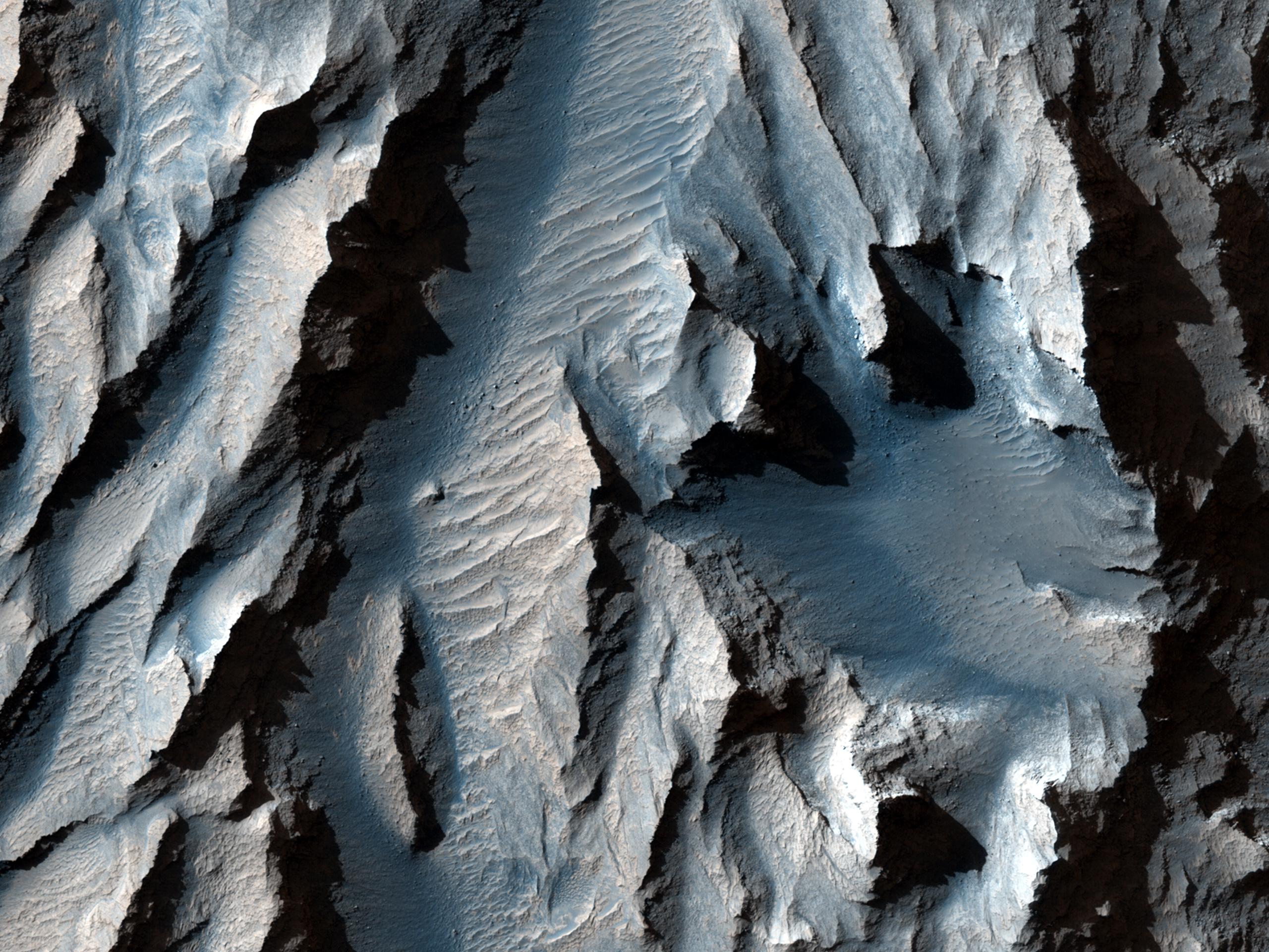
PIA17875:
-
Looking for Salts on Mars
Full Resolution:
TIFF
(14.75 MB)
JPEG
(849.3 kB)
|
|
|
2014-01-09 |
Mars
|
Mars Reconnaissance Orbiter (MRO)
|
HiRISE
|
2560x1920x3 |

|
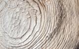
-
PIA17859:
-
The Obliquity of Mars (Periodic Bedding in Tithonium Chasma)
Full Resolution:
TIFF
(14.75 MB)
JPEG
(749 kB)
|
|
|
2014-01-08 |
Earth
|
Terra
|
ASTER
|
1466x1347x3 |
|
-
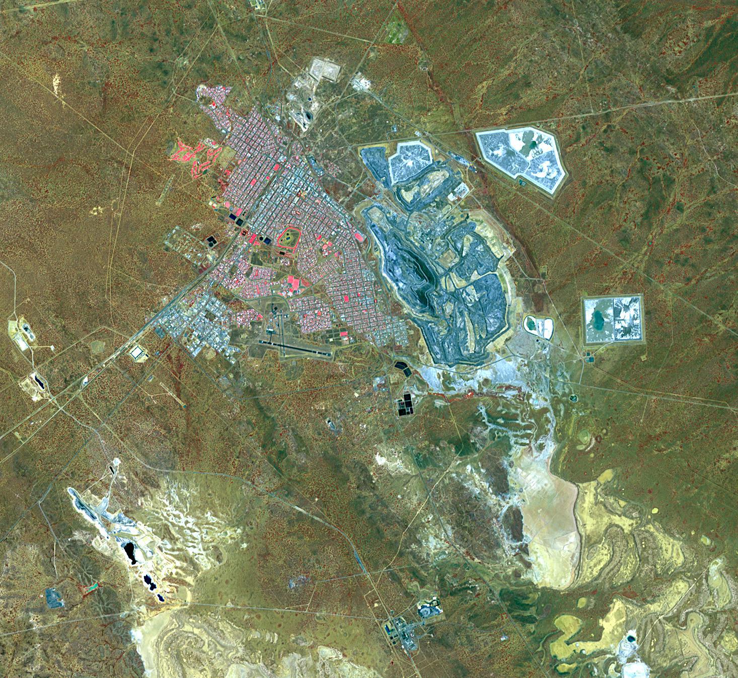
PIA17852:
-
Kalgoorlie-Boulder, Australia
Full Resolution:
TIFF
(5.926 MB)
JPEG
(526.7 kB)
|
|
|
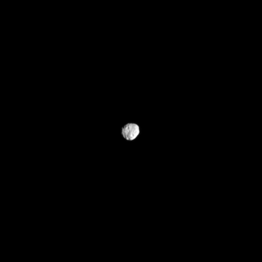
2014-01-06 |
Janus
|
Cassini-Huygens
|
ISS - Narrow Angle
|
900x900x1 |

|
-
PIA17146:
-
Janus from Afar
Full Resolution:
TIFF
(811 kB)
JPEG
(10.62 kB)
|
|
|
2013-12-18 |
Earth
|
Terra
|
ASTER
|
350x350x1 |
|
-
PIA17789:
-
Lava Flows from Latest Eruption of Mount Etna Spotted by NASA's Terra Spacecraft
Full Resolution:
TIFF
(122.8 kB)
JPEG
(16.98 kB)
|
|
|
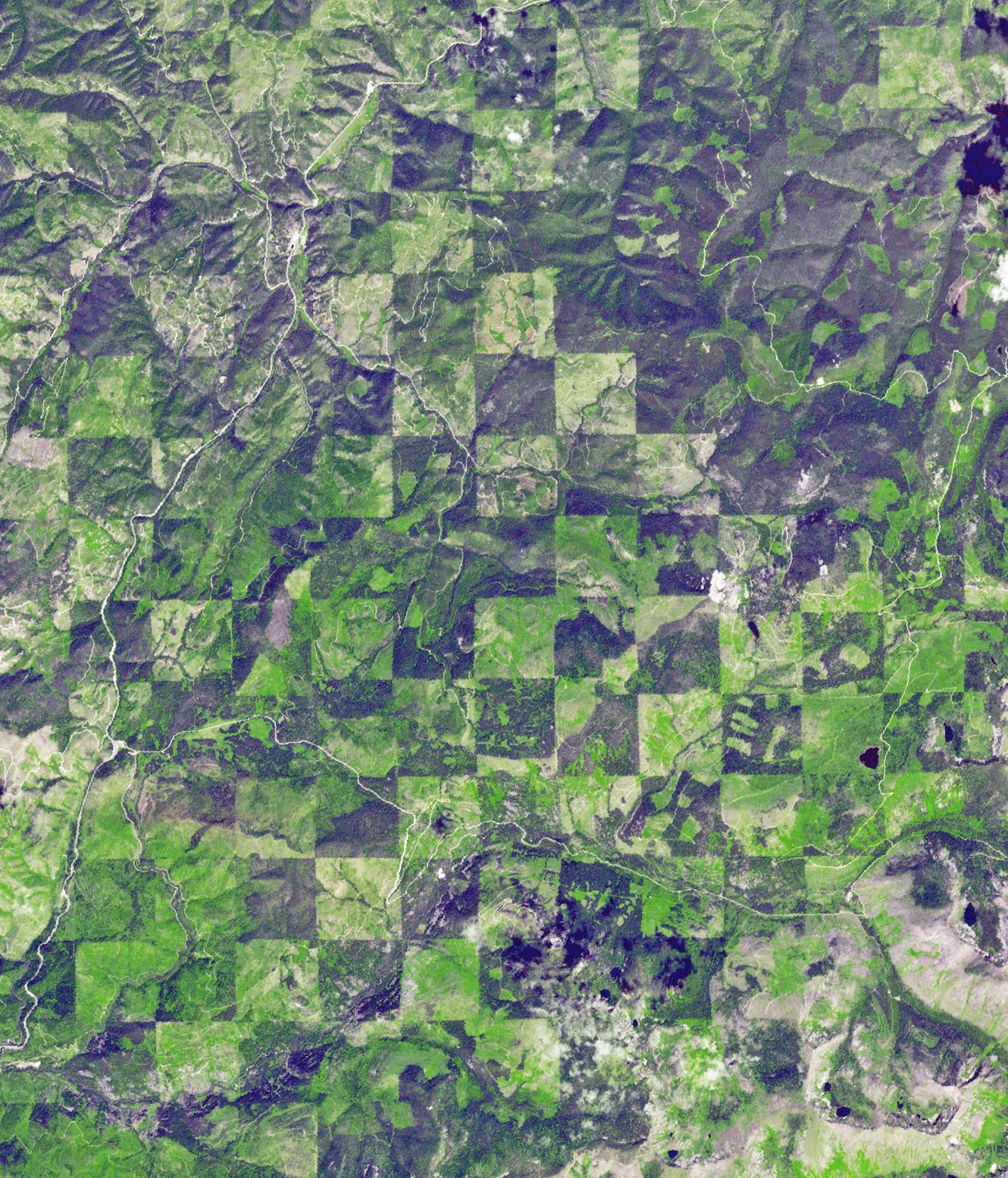
2013-12-16 |
Earth
|
Terra
|
ASTER
|
1330x1554x3 |
|
-
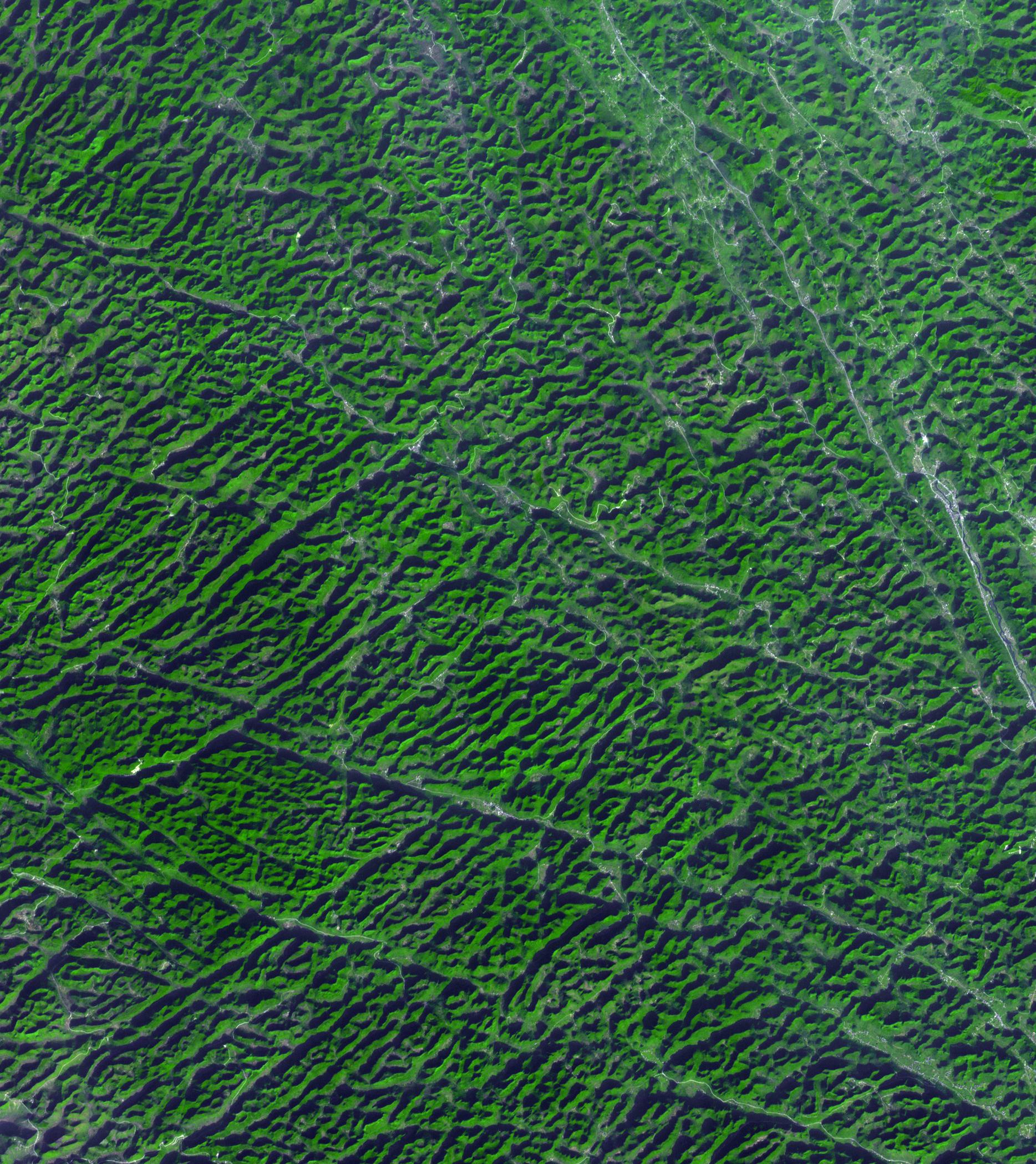
PIA17788:
-
Idaho-Montana Logging
Full Resolution:
TIFF
(6.203 MB)
JPEG
(583 kB)
|
|
|
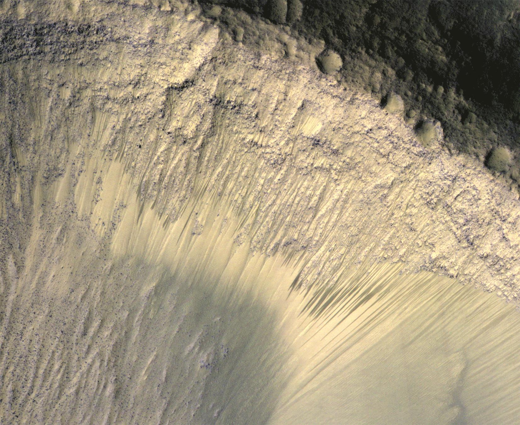
2013-12-10 |
Mars
|
Mars Reconnaissance Orbiter (MRO)
|
HiRISE
|
1653x1352x3 |
|
-
PIA17606:
-
Seasonal Changes in Dark Marks on an Equatorial Martian Slope

Full Resolution:
TIFF
(2.239 MB)
JPEG
(426.6 kB)
|
|
|
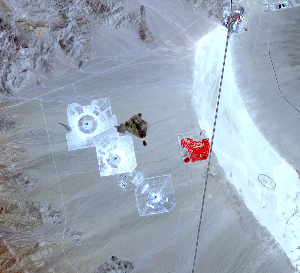
2013-12-05 |
Earth
|
Terra
|
ASTER
|
1054x959x3 |

|
-
PIA17746:
-
Ivanpah Solar Energy Plant, California
Full Resolution:
TIFF
(3.034 MB)
JPEG
(129.6 kB)
|
|
|
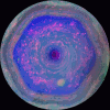
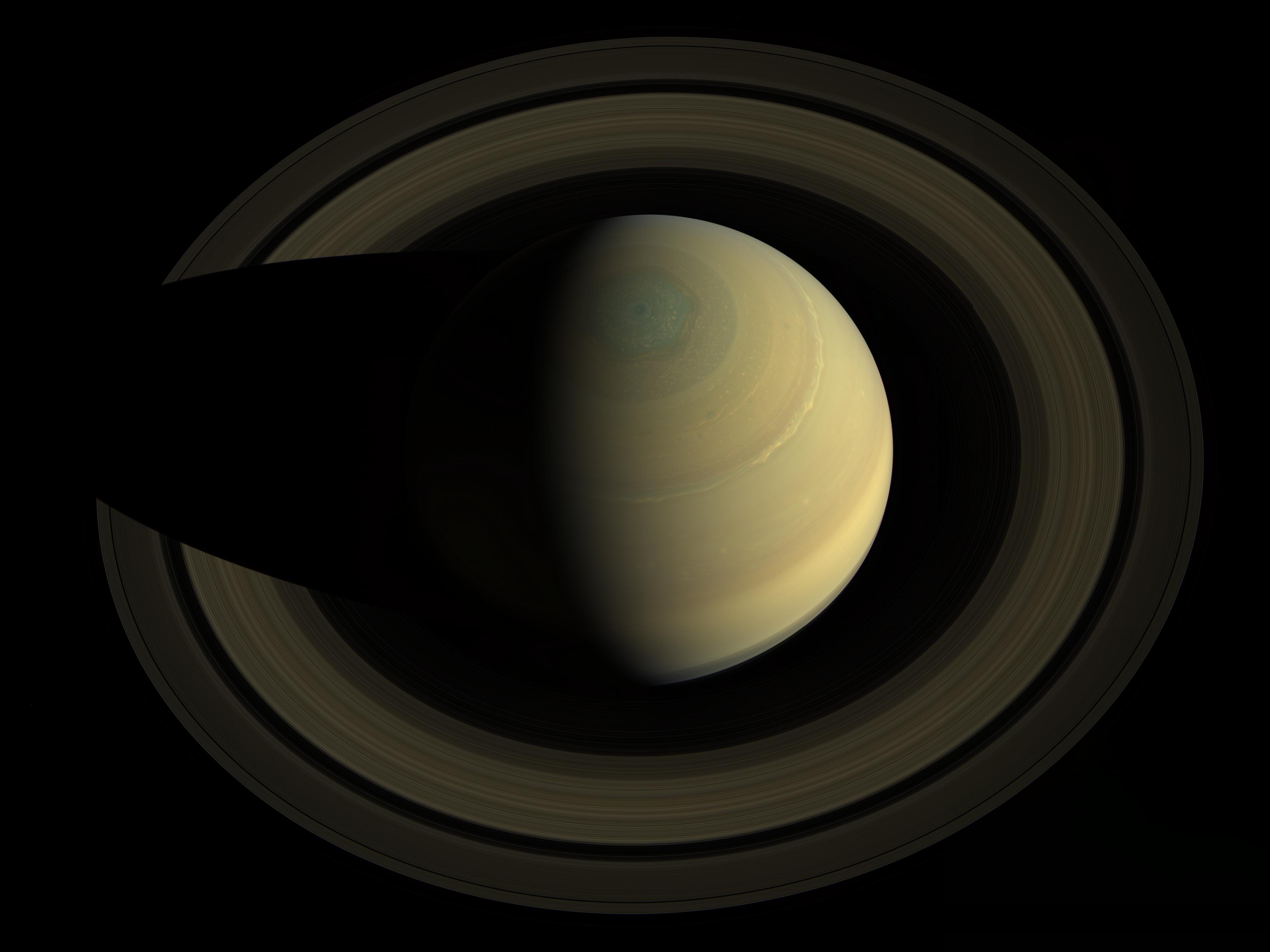
2013-12-04 |
Saturn
|
Cassini-Huygens
|
Visual and Infrared Mapping Spectrometer
|
1200x1140x3 |
|
-
PIA17654:
-
Looking Down on the Hexagon in Infrared
Full Resolution:
TIFF
(4.106 MB)
JPEG
(52.2 kB)
|
|
|
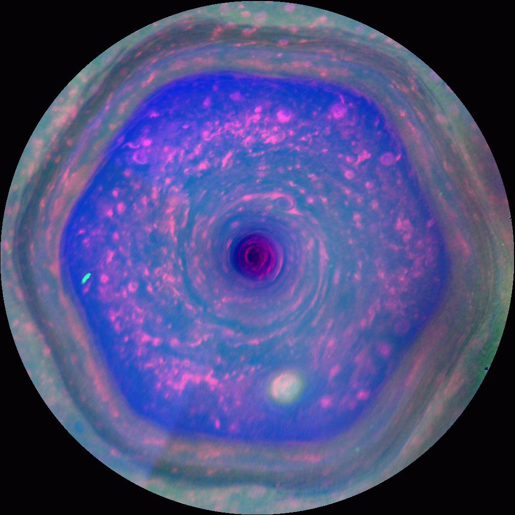
2013-12-04 |
Saturn
|
Cassini-Huygens
|
Imaging Science Subsystem
|
1024x1024x3 |
|
-
PIA17652:
-
In Full View: Saturn's Streaming Hexagon
Full Resolution:
TIFF
(1.051 MB)
JPEG
(109.6 kB)
|
|
|
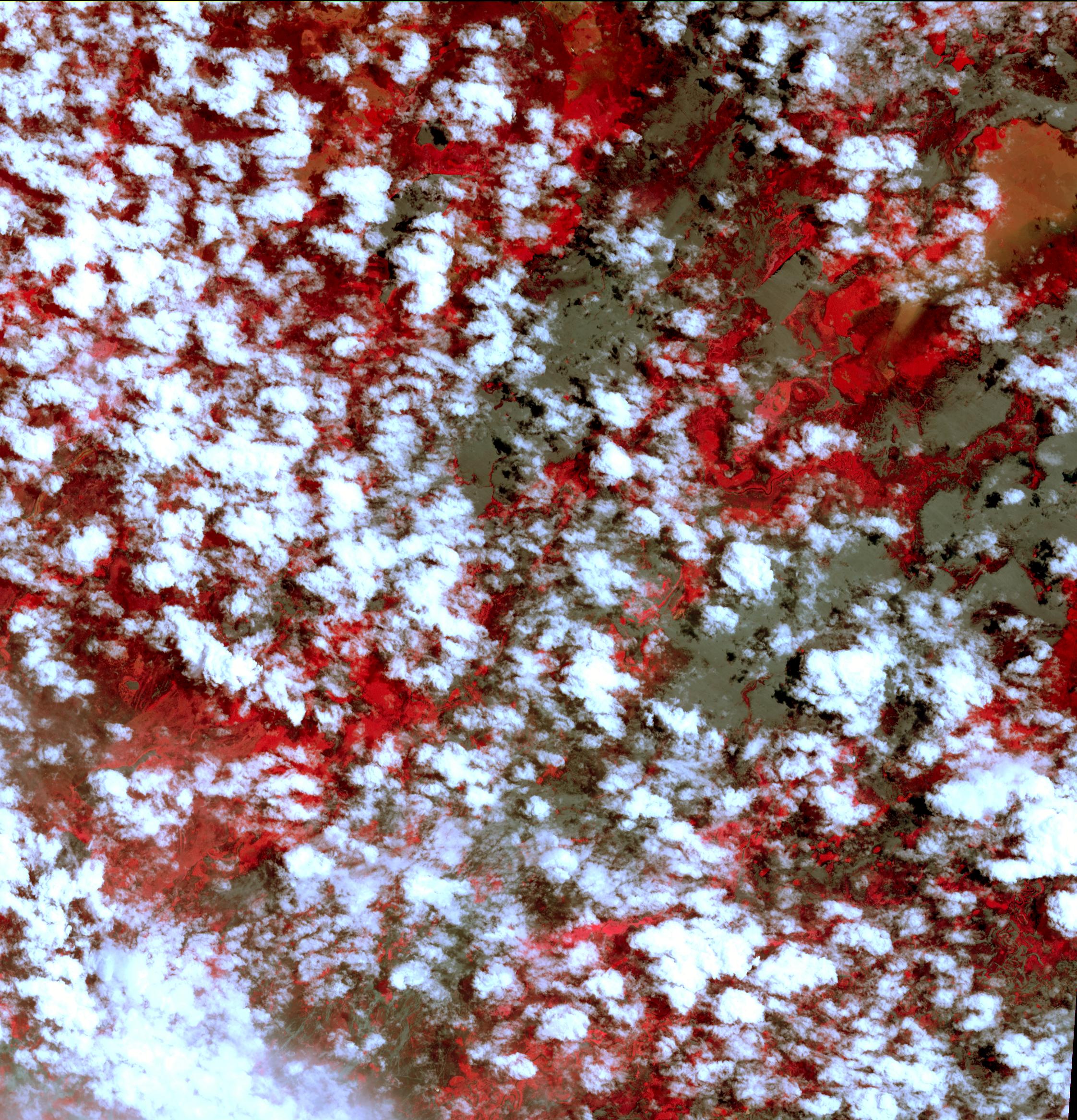
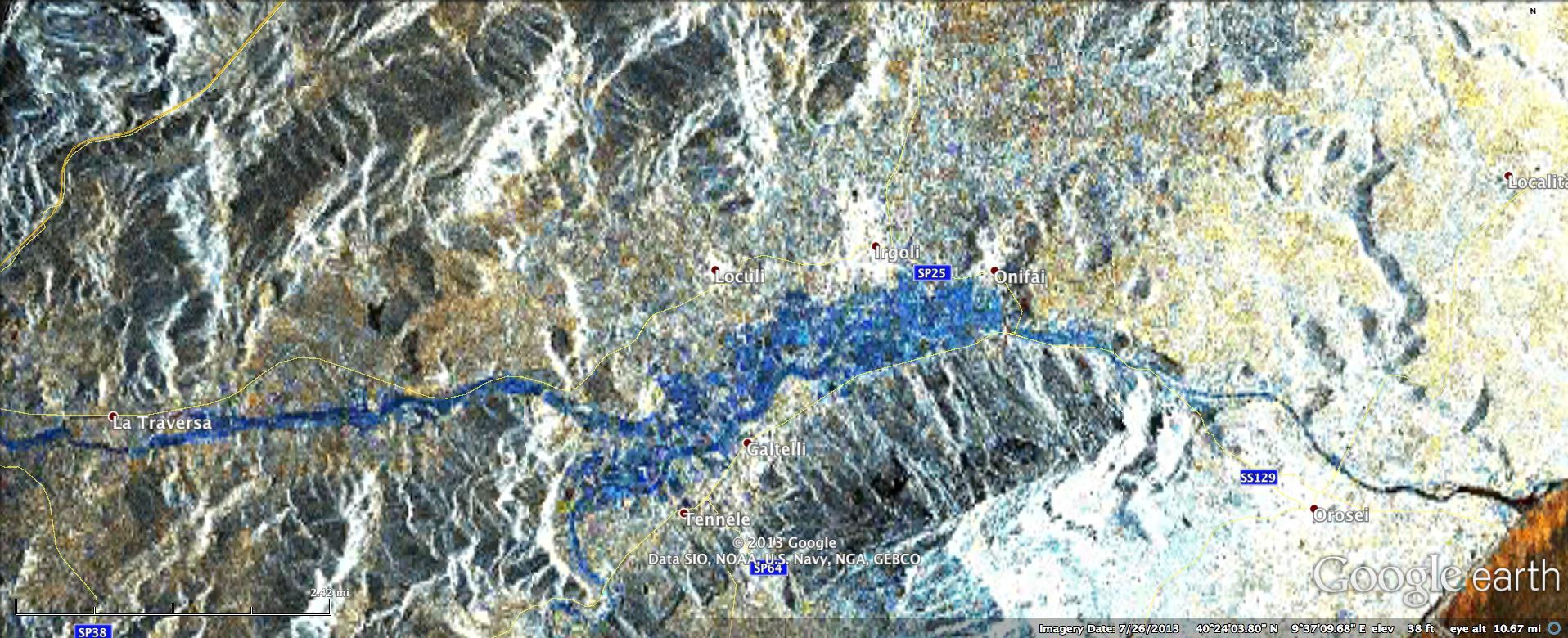
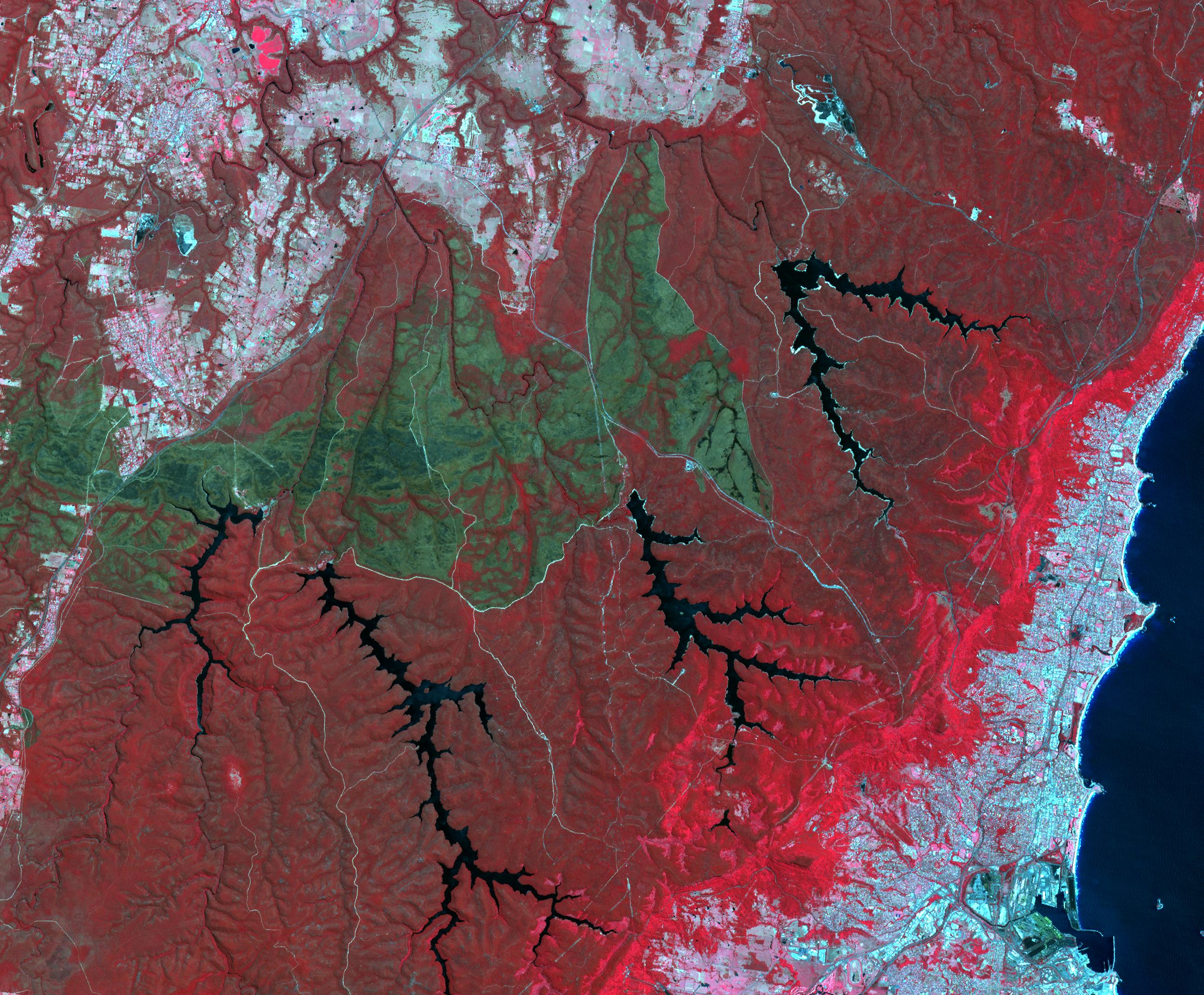
2013-11-26 |
Earth
|
ARIA
|
X-band Interferometric Synthetic Aperture Radar
|
1916x780x3 |

|
-
PIA17738:
-
NASA Produces Map to Aid in Italian Flood Response
Full Resolution:
TIFF
(4.485 MB)
JPEG
(344.8 kB)
|
|
|
2013-11-22 |
Earth
|
Terra
|
ASTER
|
2598x2147x3 |
|
-
PIA17721:
-
Australian Wildfire, NASA Spacecraft Image Aftermath
Full Resolution:
TIFF
(16.74 MB)
JPEG
(1.057 MB)
|
|
|
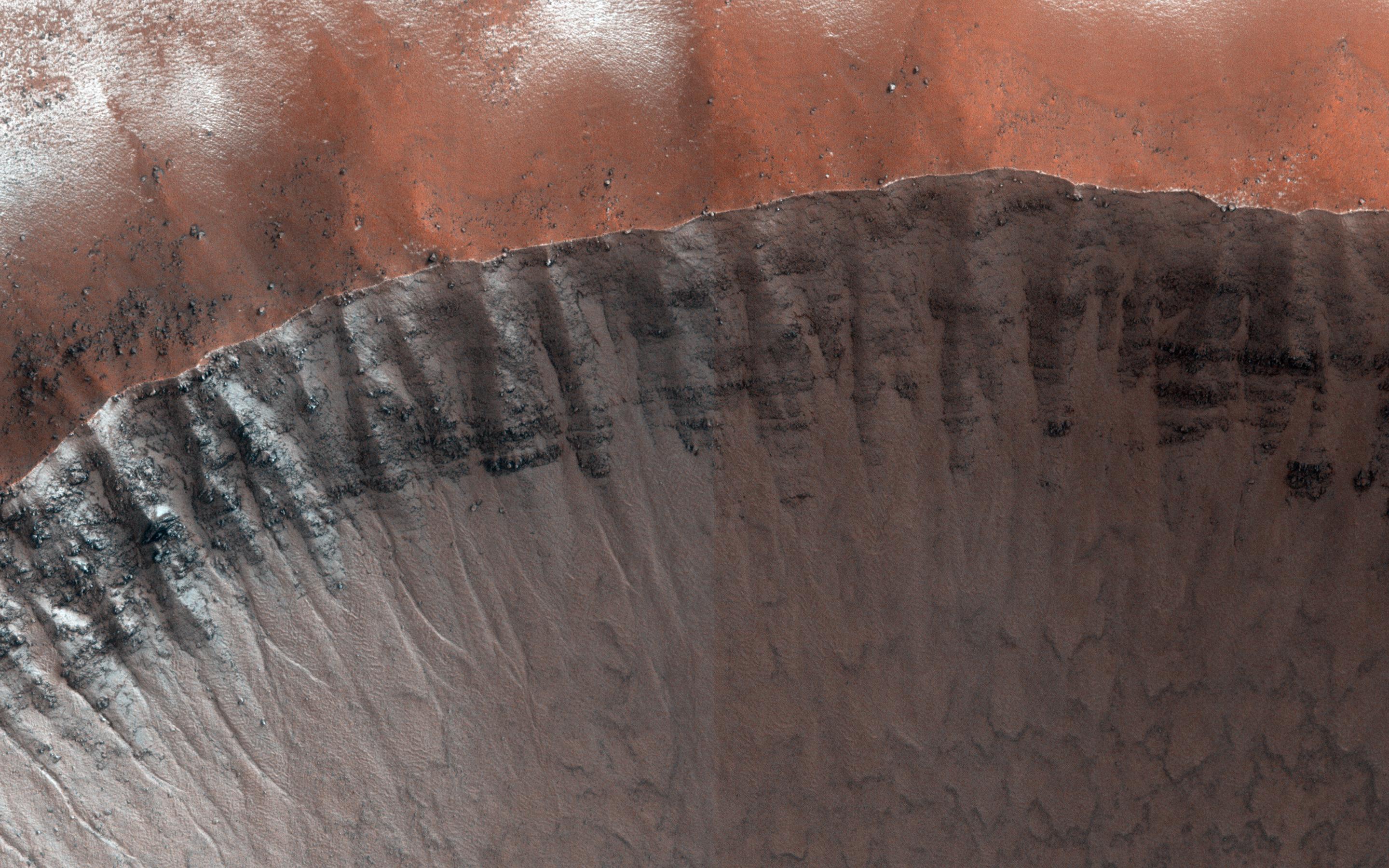
2013-11-20 |
Mars
|
Mars Reconnaissance Orbiter (MRO)
|
HiRISE
|
2880x1800x3 |
|
-
PIA17702:
-
Hydrated Sulfate Landslides in Ophir Chasma
Full Resolution:
TIFF
(15.56 MB)
JPEG
(801 kB)
|
|
|
2013-11-20 |
Earth
|
Terra
|
ASTER
|
960x900x3 |
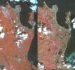
|
-
PIA17700:
-
NASA Spacecraft Shows Before/After of Typhoon Haiyan's Devastation
Full Resolution:
TIFF
(2.593 MB)
JPEG
(137.3 kB)
|
|
|
2013-11-19 |
Earth
|
Terra
|
ASTER
|
1553x1483x3 |
|
-
PIA17696:
-
150th Anniversary of the Battle of Chattanooga, Tennessee
Full Resolution:
TIFF
(6.912 MB)
JPEG
(532.9 kB)
|
|
|
2013-11-13 |
Earth
|
ARIA
|
X-band interferometric synthetic aperture radar
|
1623x956x3 |
|
-
PIA17687:
-
NASA-Generated Damage Map To Assist With Typhoon Haiyan Disaster Response
Full Resolution:
TIFF
(4.657 MB)
JPEG
(212.5 kB)
|
|
|
2013-11-13 |
Mars
|
Mars Reconnaissance Orbiter (MRO)
|
HiRISE
|
2880x1800x1 |
|
-
PIA17688:
-
Rafts of Lava with Strange Infrared Properties
Full Resolution:
TIFF
(5.191 MB)
JPEG
(1.161 MB)
|
|
|
2013-11-05 |
Earth
|
Terra
|
ASTER
|
3684x3780x3 |
|
-
PIA17632:
-
Namib Desert, Namibia
Full Resolution:
TIFF
(41.79 MB)
JPEG
(2.037 MB)
|
|
|
2013-10-30 |
Mercury
|
MESSENGER
|
MDIS - Wide Angle
|
1020x1024x1 |
|
-
PIA17621:
-
One Week Later
Full Resolution:
TIFF
(1.046 MB)
JPEG
(121.1 kB)
|
|
|
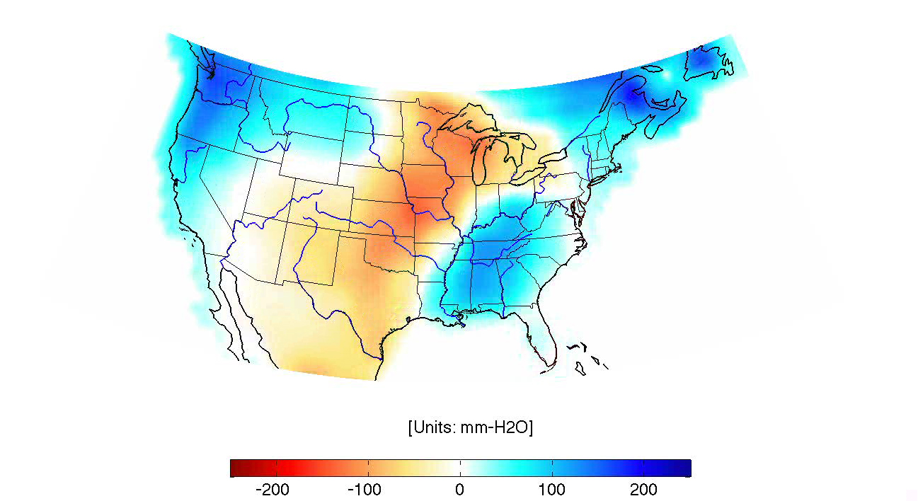
2013-10-26 |
Earth
|
GRACE
|
K-Band Ranging System
|
1297x708x3 |
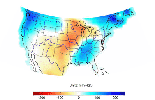
|
-
PIA14268:
-
GRACE Land Water Storage Monthly Changes over the United States, 2003 – Early 2013
Full Resolution:
TIFF
(690.1 kB)
JPEG
(464 kB)
|
|
|
2013-10-25 |
Saturn
|
Cassini-Huygens
|
Imaging Science Subsystem
|
3600x2700x3 |
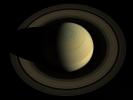
|
-
PIA17474:
-
Jewel of the Solar System
Full Resolution:
TIFF
(29.17 MB)
JPEG
(359.6 kB)
|
|
|
2013-10-23 |
Earth
|
Terra
|
ASTER
|
1063x932x3 |
|
-
PIA17576:
-
Ancient Uruk, Iraq
Full Resolution:
TIFF
(2.973 MB)
JPEG
(306.8 kB)
|
|
|
2013-10-17 |
Earth
|
Terra
|
ASTER
|
1866x1632x3 |
|
-
PIA17539:
-
Canyonlands National Park, Utah
Full Resolution:
TIFF
(9.139 MB)
JPEG
(910.1 kB)
|
|
|
2013-10-17 |
Mercury
|
MESSENGER
|
MDIS - Narrow Angle
|
1024x1024x1 |
|
-
PIA17531:
-
Shortened Surfaces
Full Resolution:
TIFF
(1.05 MB)
JPEG
(120.5 kB)
|
|
|
2013-10-17 |
S Rings
|
Cassini-Huygens
|
ISS - Narrow Angle
|
1016x1016x1 |

|
-
PIA17137:
-
Cool Shadow
Full Resolution:
TIFF
(1.033 MB)
JPEG
(42.37 kB)
|
|
|
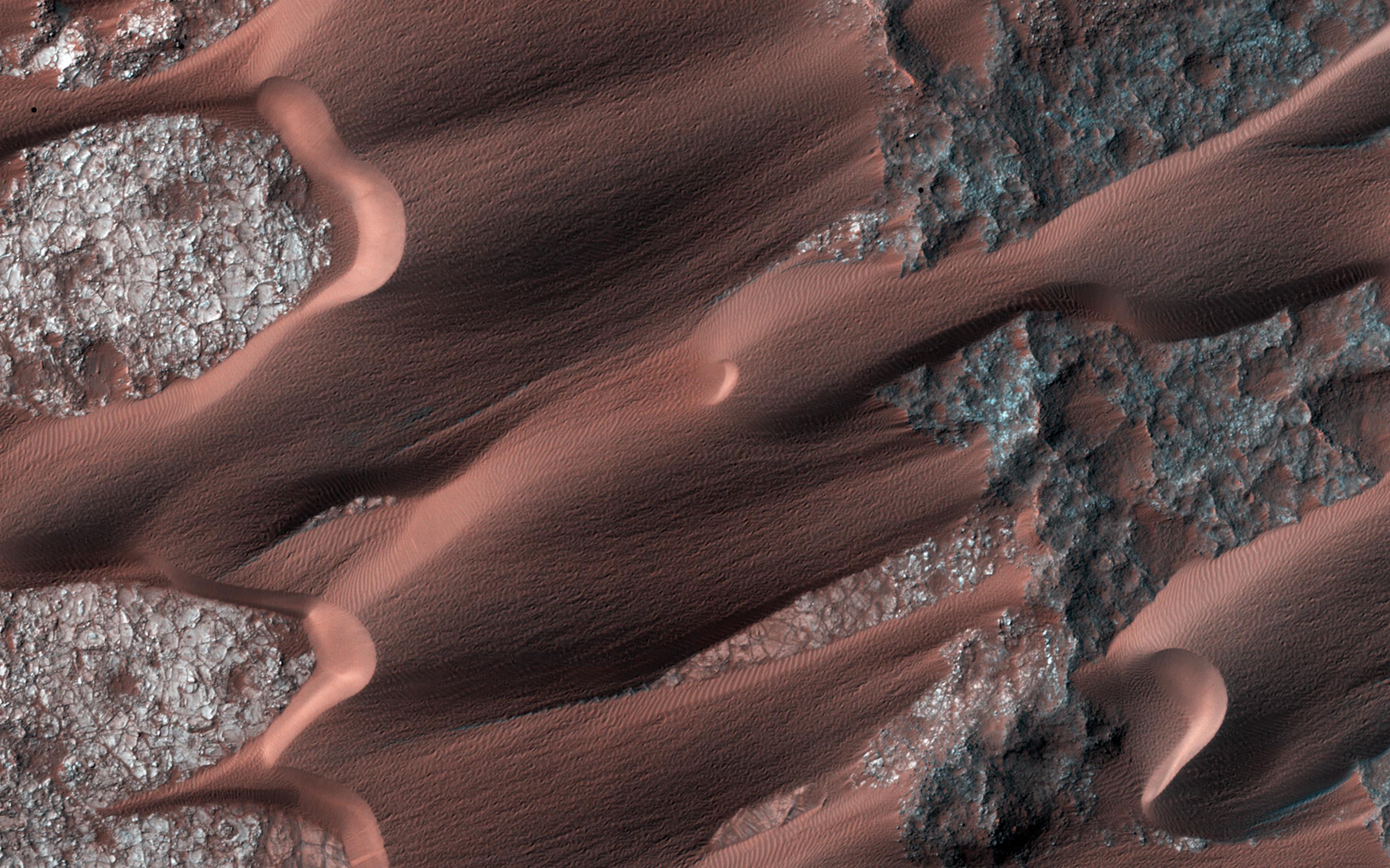
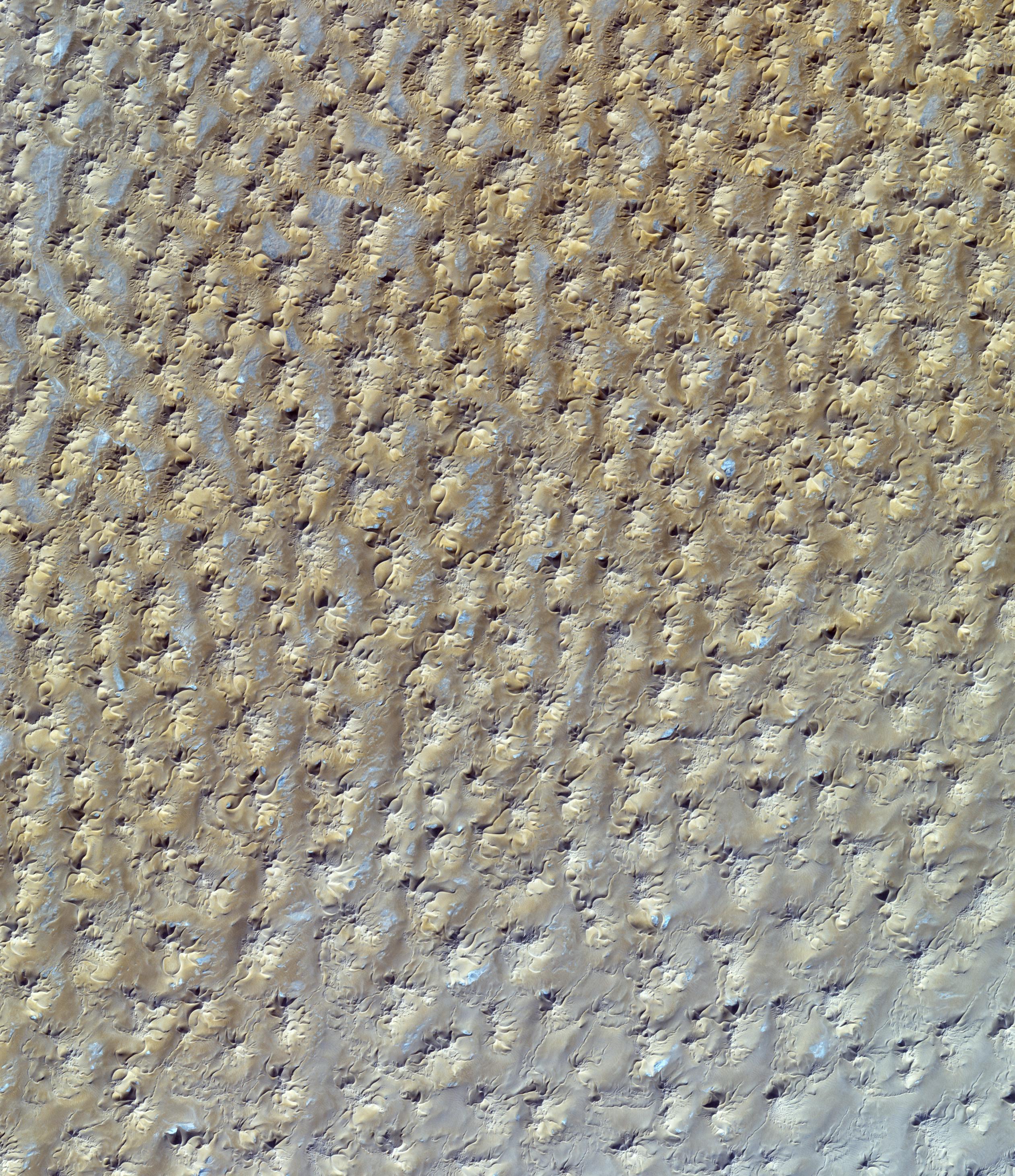
2013-10-02 |
Mars
|
Mars Reconnaissance Orbiter (MRO)
|
HiRISE
|
1898x1007x3 |
|
-
PIA17573:
-
Colorful Dunes
Full Resolution:
TIFF
(5.736 MB)
JPEG
(301.4 kB)
|
|
|
2013-09-26 |
Earth
|
Terra
|
ASTER
|
1460x1470x3 |
|
-
PIA17513:
-
Kathmandu, Nepal
Full Resolution:
TIFF
(6.441 MB)
JPEG
(572.8 kB)
|
|
|
2013-09-24 |
Earth
|
Terra
|
ASTER
|
1540x1472x3 |

|
-
PIA17505:
-
Region Hit by Large Pakistan Quake as Shown by NASA Spacecraft
Full Resolution:
TIFF
(6.803 MB)
JPEG
(654.9 kB)
|
|
|
2013-09-24 |
Earth
|
Terra
|
ASTER
|
2003x3287x3 |
|
-
PIA17504:
-
NASA Spacecraft Images Destructive Argentine Wildfire
Full Resolution:
TIFF
(19.76 MB)
JPEG
(1.663 MB)
|
|
|
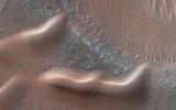
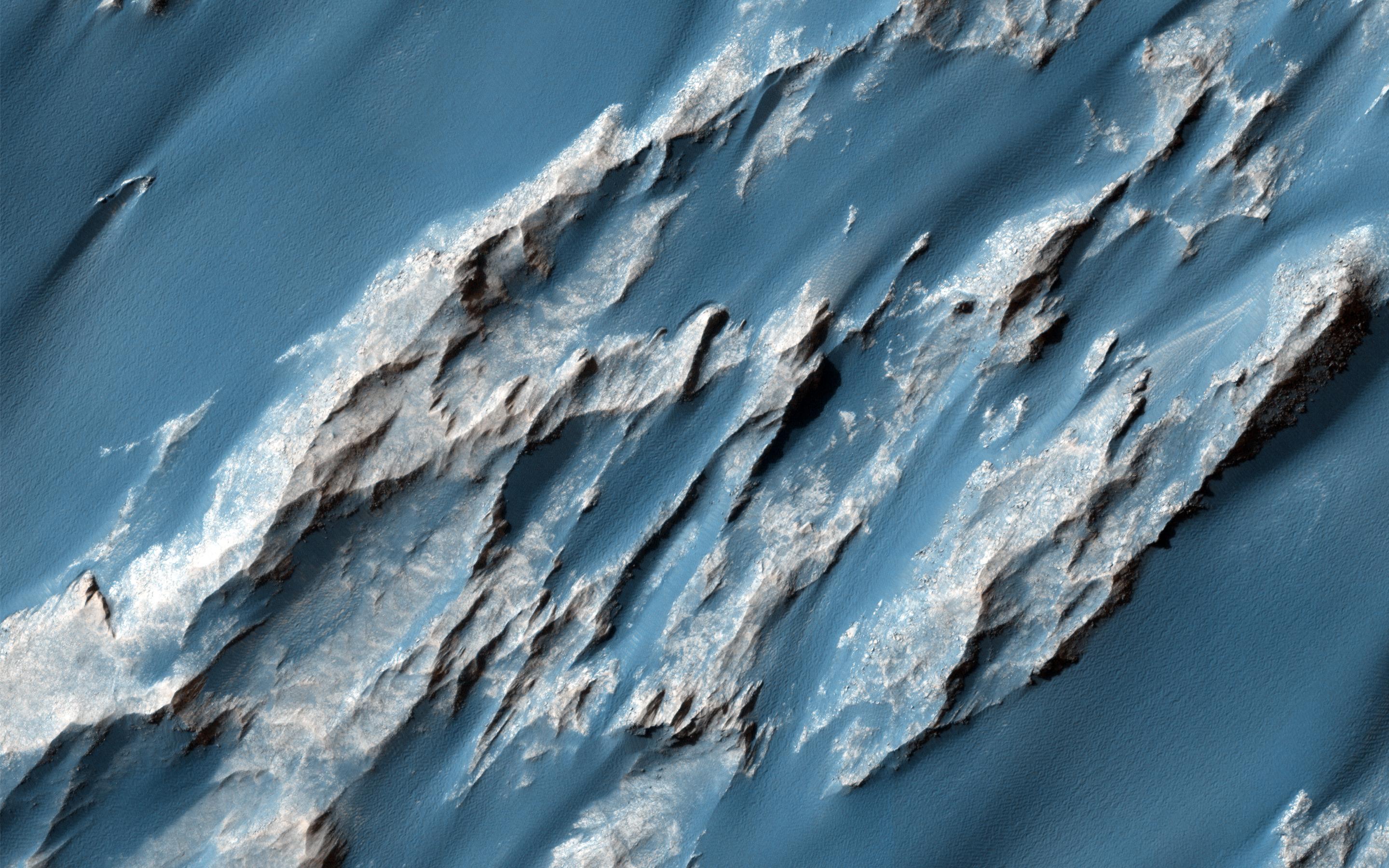
2013-09-18 |
Mars
|
Mars Reconnaissance Orbiter (MRO)
|
HiRISE
|
2880x1800x3 |
|
-
PIA17629:
-
Martian Glaciers and Brain Terrain
Full Resolution:
TIFF
(15.56 MB)
JPEG
(1.045 MB)
|
|
|
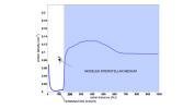
2013-09-12 |
Sol (our sun)
|
Voyager
|
|
1280x720x3 |
|
-
PIA17442:
-
Mystery of the Interstellar Magnetic Field (Artist's Concept)
Full Resolution:
TIFF
(2.766 MB)
JPEG
(78.79 kB)
|
|
|
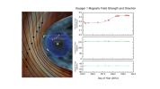
2013-09-12 |
Sol (our sun)
|
Voyager
|
|
1280x720x3 |
|
-
PIA17441:
-
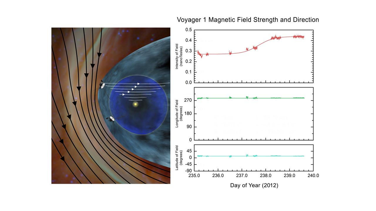
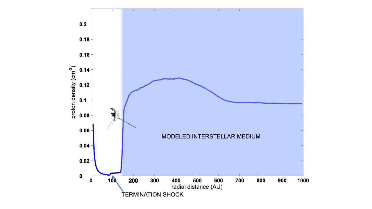
Observed Change in Density Shows Voyager is in Interstellar Space
Full Resolution:
TIFF
(2.766 MB)
JPEG
(44.37 kB)
|
|
|
2013-09-12 |
Mars
|
Mars Reconnaissance Orbiter (MRO)
|
HiRISE
|
2880x1800x3 |
|
-
PIA17631:
-
Terraced Craters and Layered Targets
Full Resolution:
TIFF
(15.56 MB)
JPEG
(1.341 MB)
|
|
|
2013-09-12 |
Mars
|
Mars Reconnaissance Orbiter (MRO)
|
HiRISE
|
2880x1800x3 |
|
-
PIA17630:
-
Layers, Bedrock Ridges, and Dark Sand in Schiaparelli Crater
Full Resolution:
TIFF
(15.56 MB)
JPEG
(908.3 kB)
|
|
|
2013-09-12 |
Earth
|
Terra
|
ASTER
|
3906x4518x3 |
|
-
PIA15639:
-
NASA Spacecraft Captures New Image of Third-Largest Wildfire in California History
Full Resolution:
TIFF
(52.96 MB)
JPEG
(1.606 MB)
|
|
|
2013-09-11 |
Earth
|
Terra
|
ASTER
|
2982x3573x3 |
|
-
PIA17459:
-
Kuwait Oil Fields
Full Resolution:
TIFF
(31.98 MB)
JPEG
(1.46 MB)
|
|
|
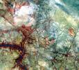
2013-09-10 |
Mars
|
Mars Science Laboratory (MSL)
|
Mastcam
|
4605x2258x3 |
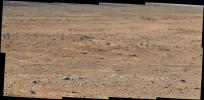
|
-
PIA17360:
-
'Darwin' Outcrop at 'Waypoint 1' of Curiosity's trek to Mount Sharp
Full Resolution:
TIFF
(31.21 MB)
JPEG
(1.826 MB)
|
|
|
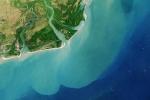
2013-09-09 |
Earth
|
OSTM/Jason-2
|
Altimeter
|
1100x960x3 |
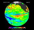
|
-
PIA17454:
-
'La Nada' Climate Pattern Lingers in the Pacific
Full Resolution:
TIFF
(3.169 MB)
JPEG
(108.7 kB)
|
|
|
2013-08-29 |
Earth
|
Landsat
|
|
2180x1453x3 |
|
-
PIA18155:
-
Zambezi River Delta
Full Resolution:
TIFF
(9.507 MB)
JPEG
(347.9 kB)
|
|
|
2013-08-28 |
Mars
|
Mars Reconnaissance Orbiter (MRO)
|
HiRISE
|
2880x1800x3 |
|
-
PIA17646:
-
Migrating and Static Sand Ripples on Mars
Full Resolution:
TIFF
(15.56 MB)
JPEG
(820.1 kB)
|
|
|
2013-08-23 |
Earth
|
Terra
|
ASTER
|
1026x949x3 |
|
-
PIA17434:
-
CERN Collider, France-Switzerland
Full Resolution:
TIFF
(2.922 MB)
JPEG
(325.5 kB)
|
|
|
2013-08-21 |
Mars
|
Mars Reconnaissance Orbiter (MRO)
|
HiRISE
|
2880x1800x3 |

|
-
PIA17642:
-
Looking for Changes in Dust Drifts West of Alba Mons
Full Resolution:
TIFF
(15.56 MB)
JPEG
(852.5 kB)
|
|
|
2013-08-21 |
Mars
|
Mars Reconnaissance Orbiter (MRO)
|
HiRISE
|
2880x1800x3 |
|
-
PIA17641:
-
Frosted Impact Crater in Late Northern Winter
Full Resolution:
TIFF
(15.56 MB)
JPEG
(822.3 kB)
|
|
|
2013-08-16 |
Earth
|
Terra
|
ASTER
|
2523x2922x3 |

|
-
PIA17411:
-
Star Dunes, Algeria
Full Resolution:
TIFF
(22.12 MB)
JPEG
(1.491 MB)
|
|
|
2013-08-08 |
Mars
|
Mars Reconnaissance Orbiter (MRO)
|
HiRISE
|
2880x1800x3 |
|
-
PIA17638:
-
Bright Dunes in Syria Planum
Full Resolution:
TIFF
(15.56 MB)
JPEG
(1.179 MB)
|
 Planetary Data System


