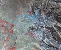
Landsat, July 30, 1986
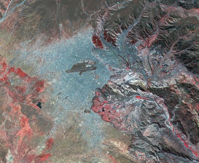
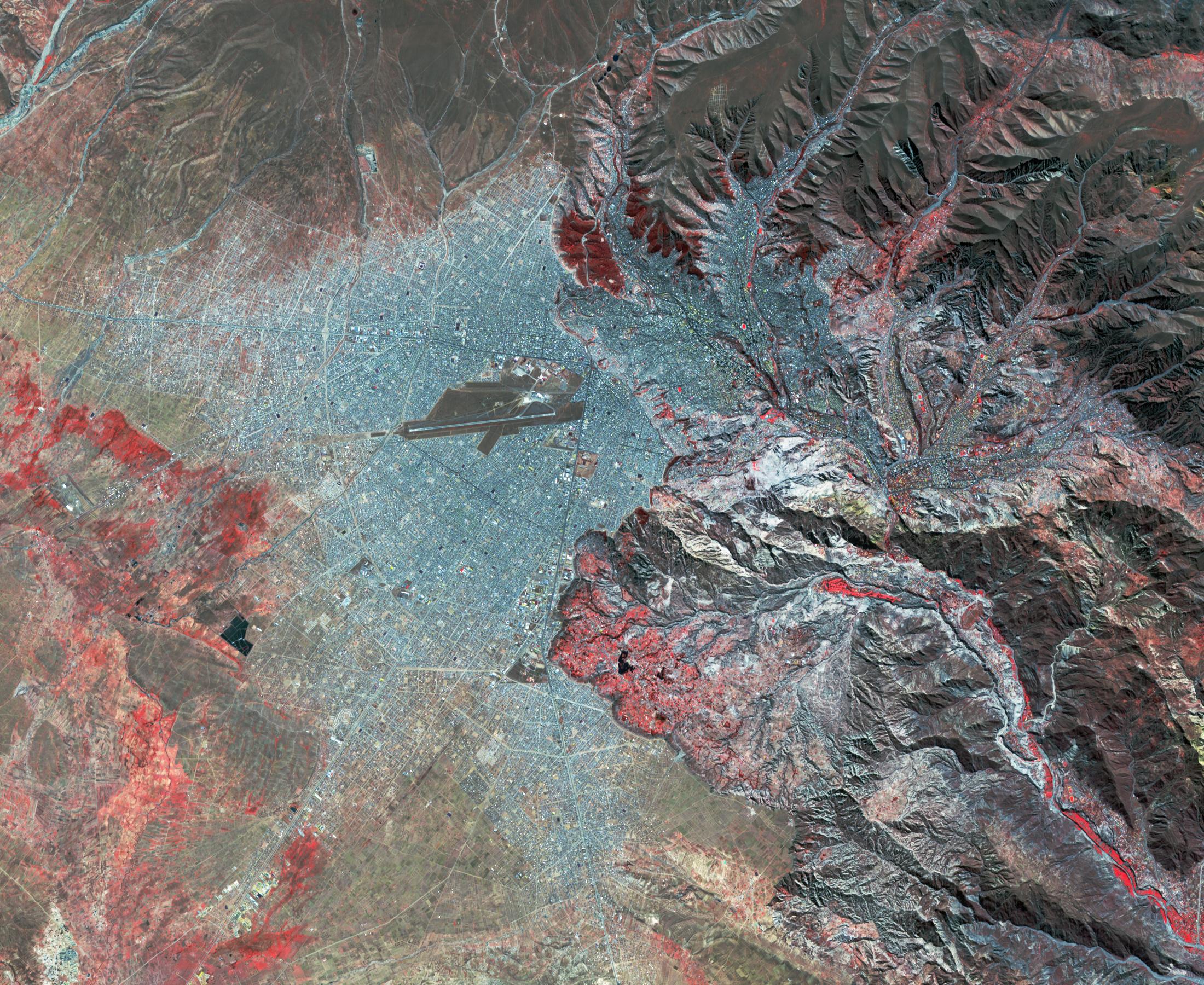
Click on the image for larger versionLa Paz, Bolivia is the highest capital in the world, located on the Andes' Altiplano plateau at more than 3500 meters above sea level. It is situated in a bowl-like depression, surrounded by high mountains. La Paz was founded in 1548 by Spanish conquistadors at the site of the Inca settlement of Laja. Like many South American cities, La Paz and its suburbs have seen remarkable growth in the last 30 years. From 1986 to 2017 the population grew from about 400,000 to over 2.3 million. The Landsat image was acquired July 30, 1986, and the ASTER image July 11, 2017. The images cover an area of 27 by 33 kilometers, and are located at 16.5 degrees south, 68.1 degrees west.
With its 14 spectral bands from the visible to the thermal infrared wavelength region and its high spatial resolution of about 50 to 300 feet (15 to 90 meters), ASTER images Earth to map and monitor the changing surface of our planet. ASTER is one of five Earth-observing instruments launched Dec. 18, 1999, on Terra. The instrument was built by Japan's Ministry of Economy, Trade and Industry. A joint U.S./Japan science team is responsible for validation and calibration of the instrument and data products.
The broad spectral coverage and high spectral resolution of ASTER provides scientists in numerous disciplines with critical information for surface mapping and monitoring of dynamic conditions and temporal change. Example applications are monitoring glacial advances and retreats; monitoring potentially active volcanoes; identifying crop stress; determining cloud morphology and physical properties; wetlands evaluation; thermal pollution monitoring; coral reef degradation; surface temperature mapping of soils and geology; and measuring surface heat balance.
The U.S. science team is located at NASA's Jet Propulsion Laboratory in Pasadena, Calif. The Terra mission is part of NASA's Science Mission Directorate, Washington.
More information about ASTER is available at http://asterweb.jpl.nasa.gov/.
 Planetary Data System


