My
List |
Addition Date
|
Target
|
Mission
|
Instrument
|
Size
|

|
2018-07-12 |
Mars
|
2001 Mars Odyssey
|
THEMIS
|
1371x2641x1 |
|
-
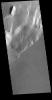
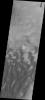
PIA22598:
-
Olympus Rupes
Full Resolution:
TIFF
(2.325 MB)
JPEG
(257.7 kB)
|
|
|
2018-07-09 |
Mars
|
Mars Reconnaissance Orbiter (MRO)
|
HiRISE
|
2880x1800x3 |
|
-
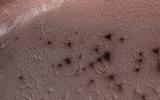
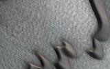
PIA22587:
-
Jamming with the 'Spiders' from Mars
Full Resolution:
TIFF
(15.56 MB)
JPEG
(1.352 MB)
|
|
|
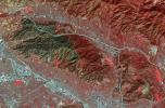
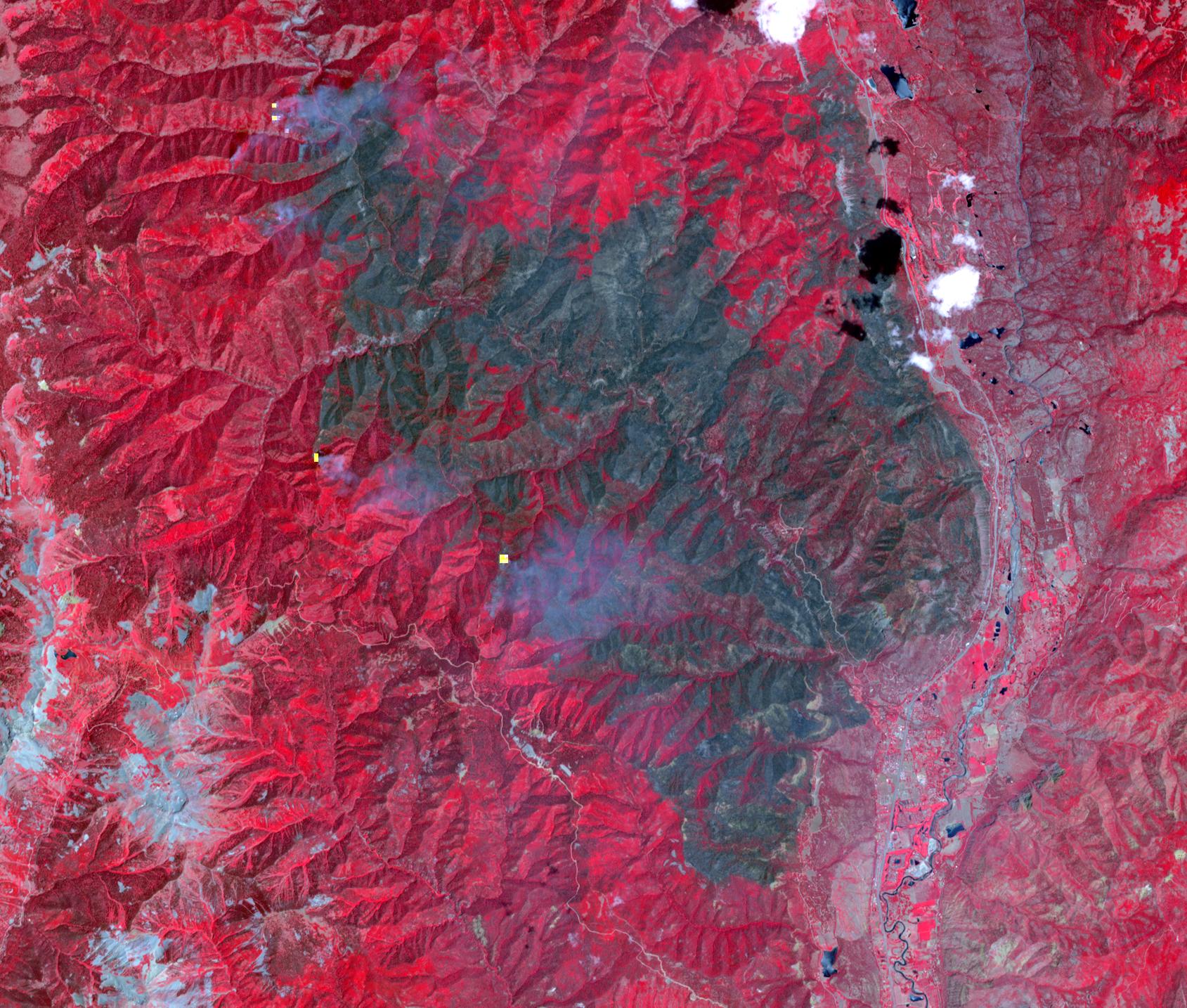
2018-06-28 |
Earth
|
Terra
|
ASTER
|
1689x1434x3 |
|
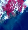
-
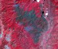
PIA22554:
-
Colorado Wildfire Imaged in Infrared by NASA Satellite
Full Resolution:
TIFF
(7.269 MB)
JPEG
(482.1 kB)
|
|
|
2018-06-28 |
Earth
|
Terra
|
ASTER
|
1533x1550x3 |
|
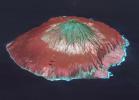
-
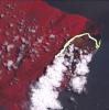
PIA22553:
-
Hawaii's Continuing Kilauea Eruption Seen in NASA Spacecraft Image
Full Resolution:
TIFF
(6.248 MB)
JPEG
(265.8 kB)
|
|
|
2018-06-26 |
Earth
|
Terra
|
ASTER
|
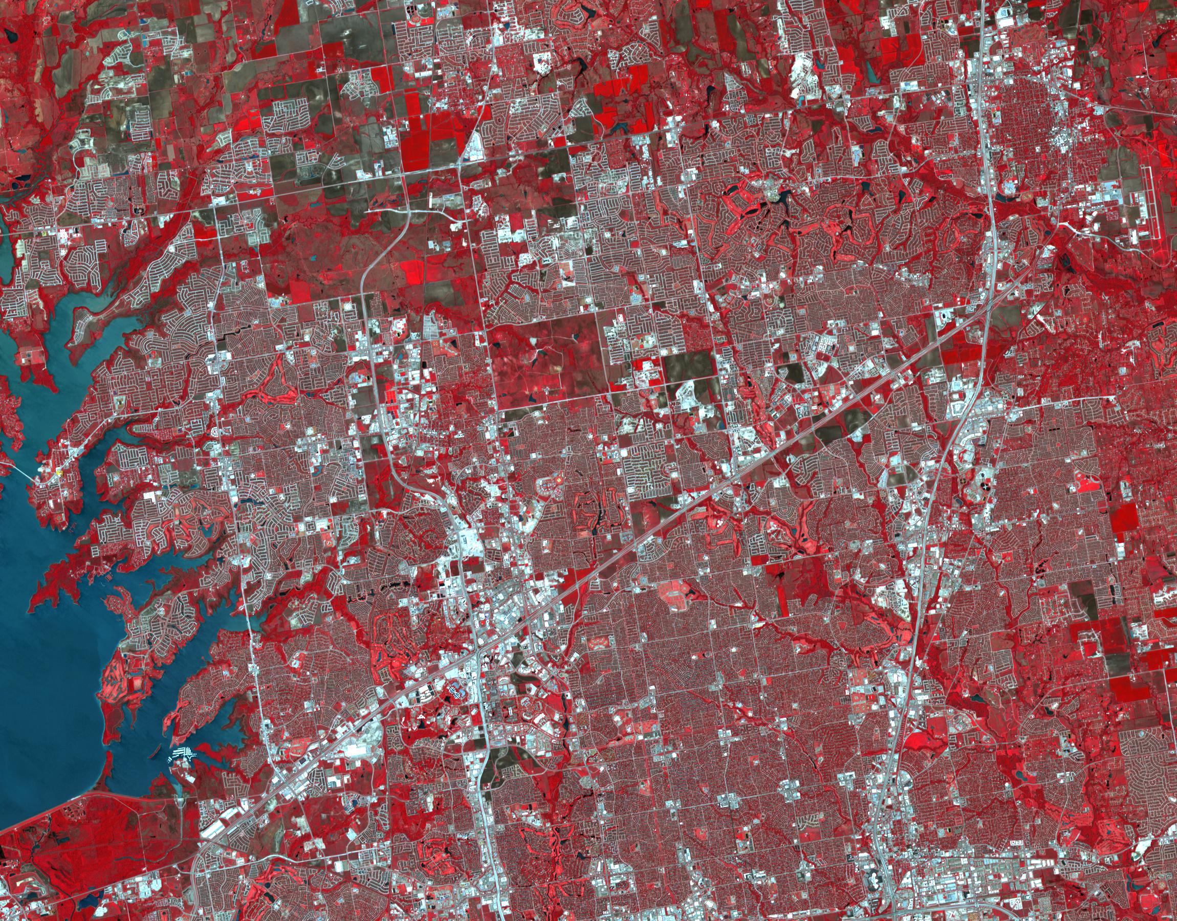
2300x1800x3 |
|
-
PIA22552:
-
Frisco, Texas
Full Resolution:
TIFF
(12.43 MB)
JPEG
(1.123 MB)
|
|
|
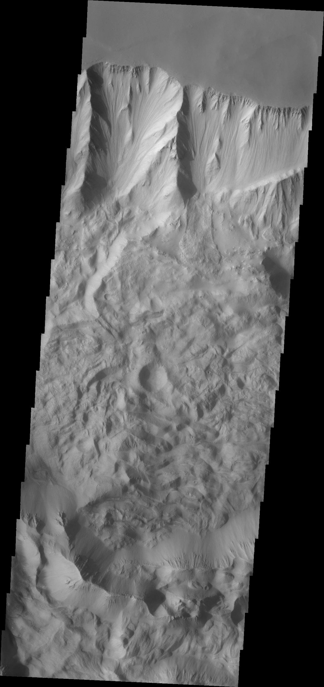
2018-06-25 |
Mars
|
Mars Reconnaissance Orbiter (MRO)
|
HiRISE
|
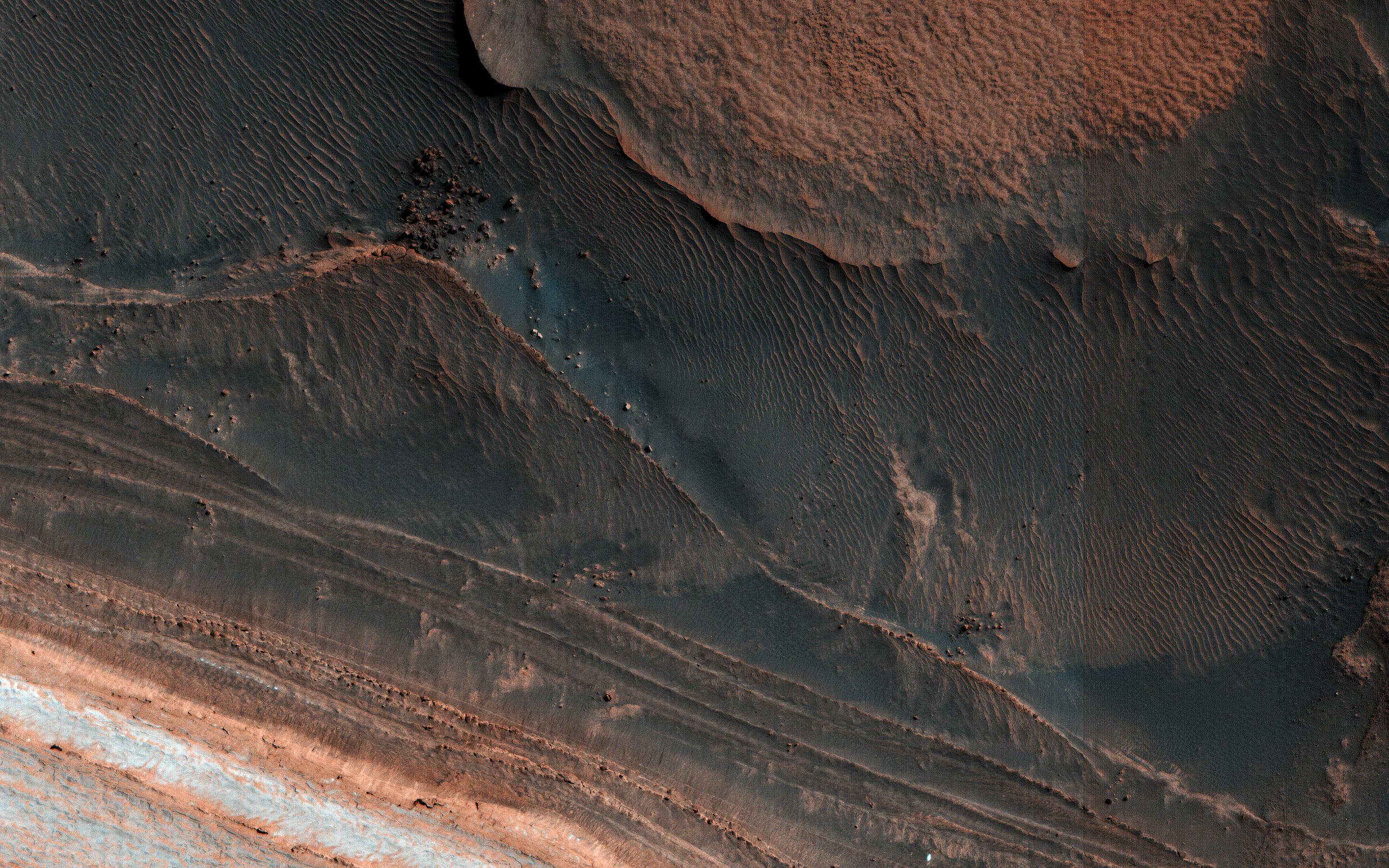
2880x1800x3 |
|
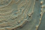
-
PIA22535:
-
Ice Block Avalanche
Full Resolution:
TIFF
(15.56 MB)
JPEG
(1.064 MB)
|
|
|
2018-06-20 |
Mars
|
Mars Science Laboratory (MSL)
|
Mastcam
|
2374x1083x3 |

|
-
PIA22330:
-
Duluth After Dust Storm
Full Resolution:
TIFF
(7.17 MB)
JPEG
(332.7 kB)
|
|
|
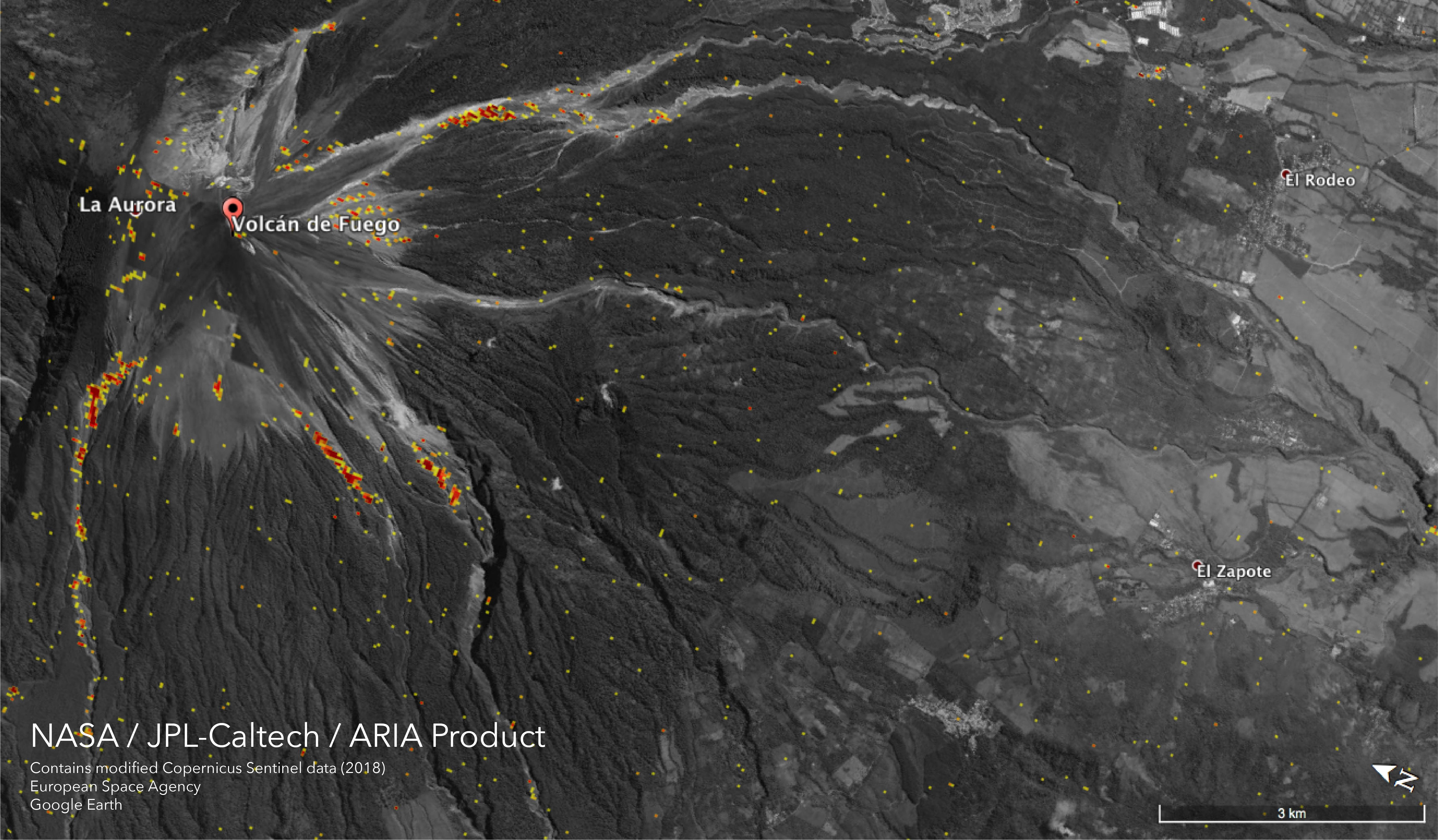
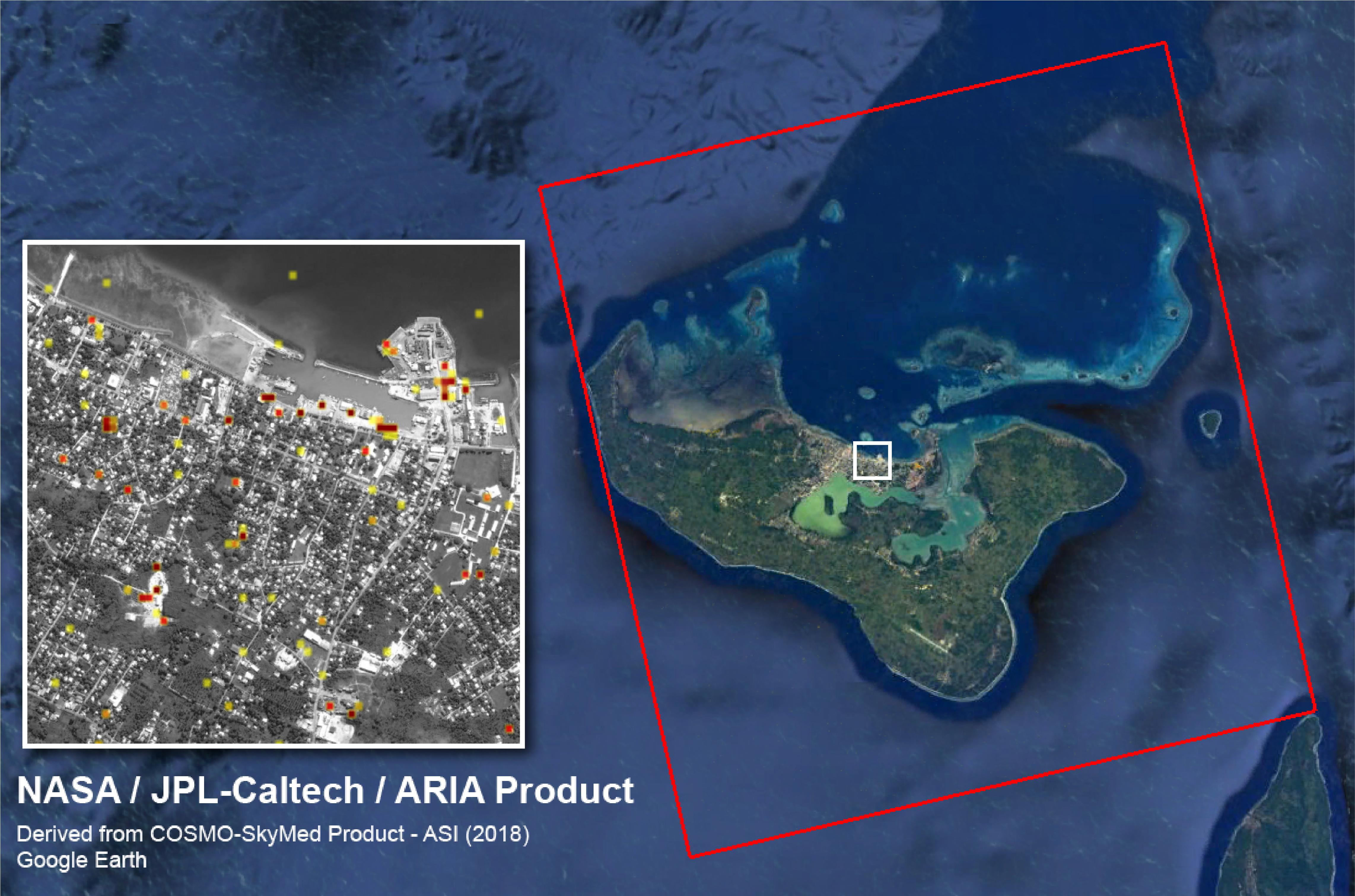
2018-06-15 |
Earth
|
ARIA
|
|
5493x3209x3 |
|
-
PIA22532:
-
NASA Damage Map Shows Effects of Destructive Guatemala Volcano Eruption
Full Resolution:
TIFF
(11.55 MB)
JPEG
(1.777 MB)
|
|
|
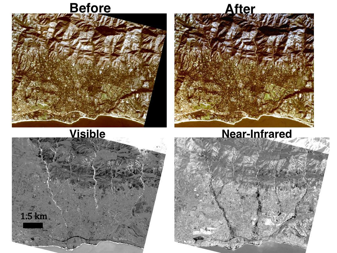
2018-06-11 |
Earth
|
GRACE-FO
|
Microwave Ranging Instrument
|
1032x409x3 |

|
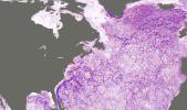
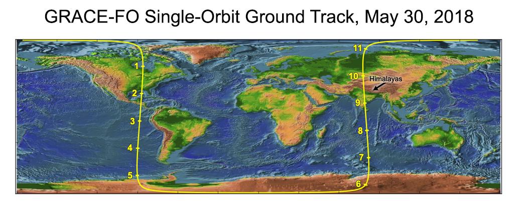
-
PIA22507:
-
Recently Launched Twin Satellites Create 'The Himalaya Plot'
Full Resolution:
TIFF
(1.074 MB)
JPEG
(92.2 kB)
|
|
|
2018-06-07 |
Mars
|
Mars Science Laboratory (MSL)
|
SAM
|
1920x1080x3 |
|
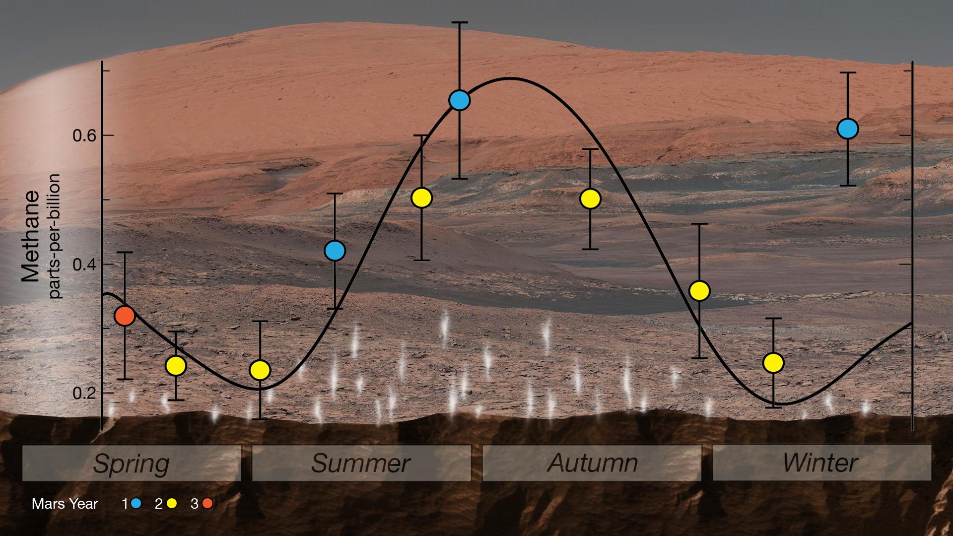
-
PIA22328:
-
Mars' Mysterious Methane
Full Resolution:
TIFF
(4.777 MB)
JPEG
(303.1 kB)
|
|
|
2018-05-25 |
Earth
|
Terra
|
ASTER
|
1459x1049x3 |
|
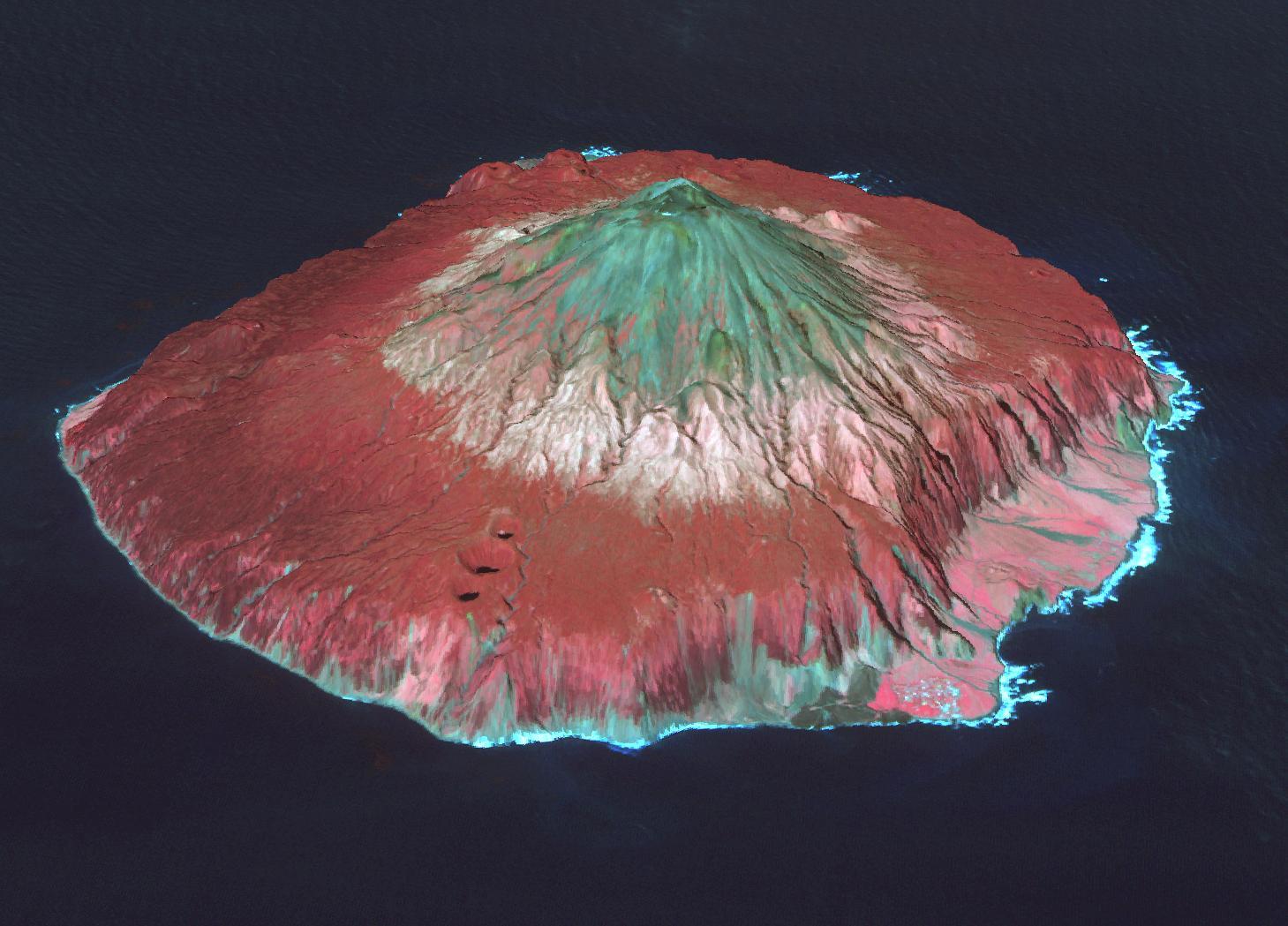
-
PIA22506:
-
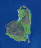
Tristan da Cunha Island
Full Resolution:
TIFF
(3.606 MB)
JPEG
(169.8 kB)
|
|
|
2018-05-24 |
Earth
|
Terra
|
ASTER
|
2177x2242x3 |

|
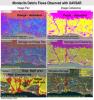
-
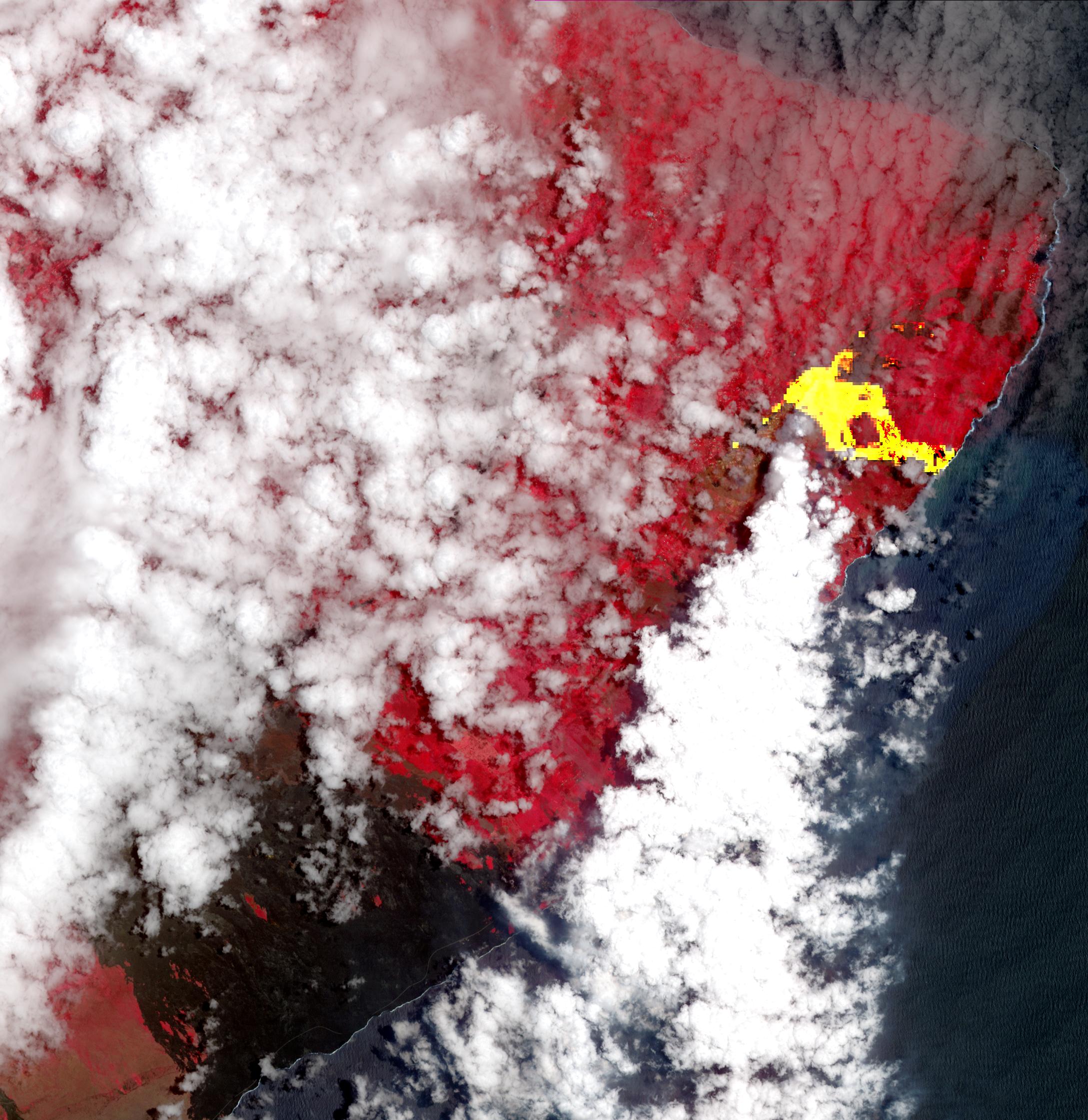
PIA22459:
-
New Image of Kilauea's Lava Flows taken by NASA Spacecraft
Full Resolution:
TIFF
(12.5 MB)
JPEG
(608.7 kB)
|
|
|
2018-05-07 |
Earth
|
Terra
|
ASTER
|
3856x4200x3 |
|
-
PIA22450:
-
Satellite View of Kilauea Eruption
Full Resolution:
TIFF
(36.72 MB)
JPEG
(2.512 MB)
|
|
|
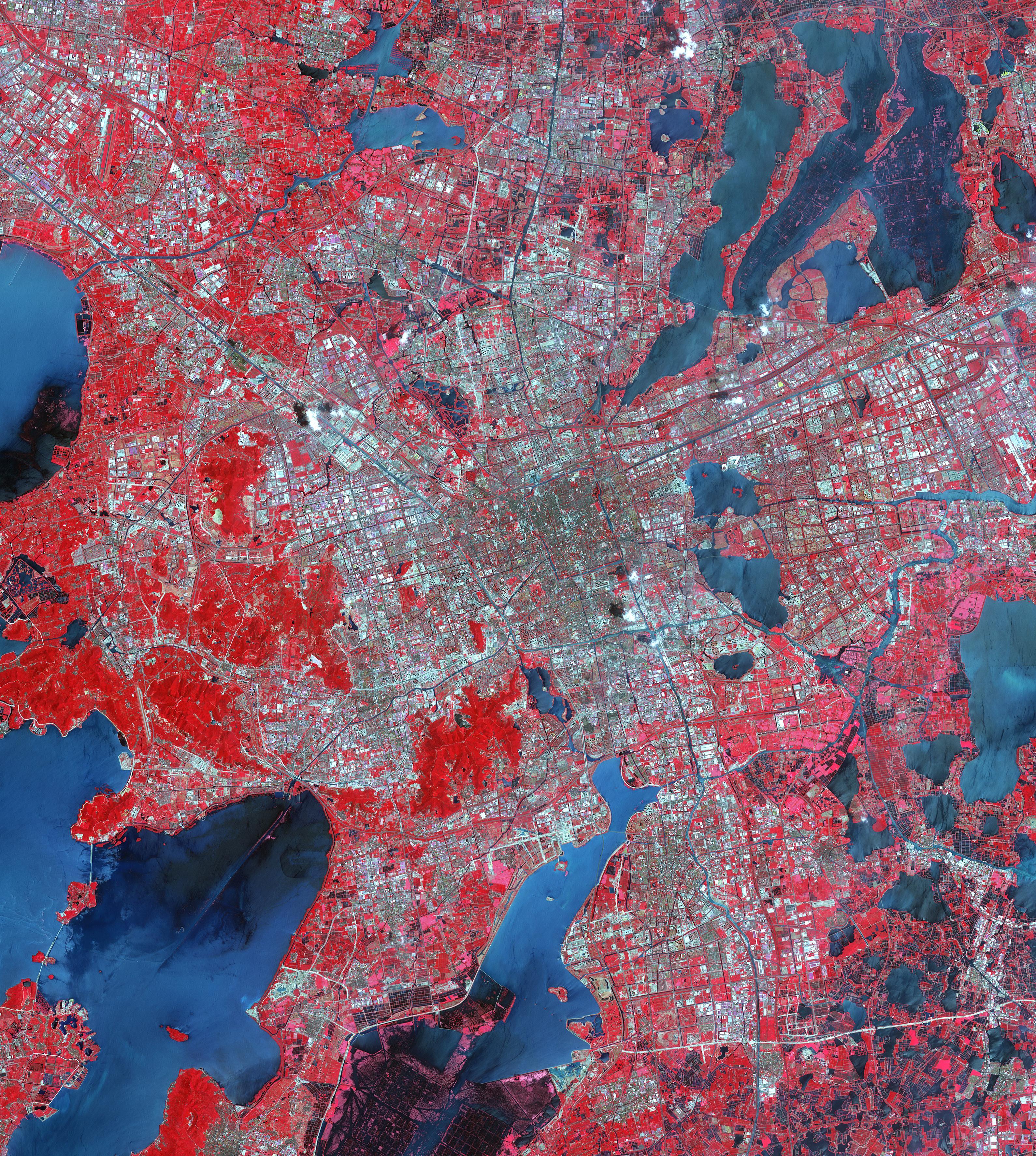
2018-05-03 |
Earth
|
Terra
|
ASTER
|
2149x1905x3 |

|
-
PIA22385:
-
Tsugaru Iwaki Skyline, Japan
Full Resolution:
TIFF
(12.29 MB)
JPEG
(793 kB)
|
|
|
2018-04-30 |
|
GRACE-FO
|
|
5976x5184x3 |
|
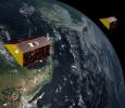
-
PIA22440:
-
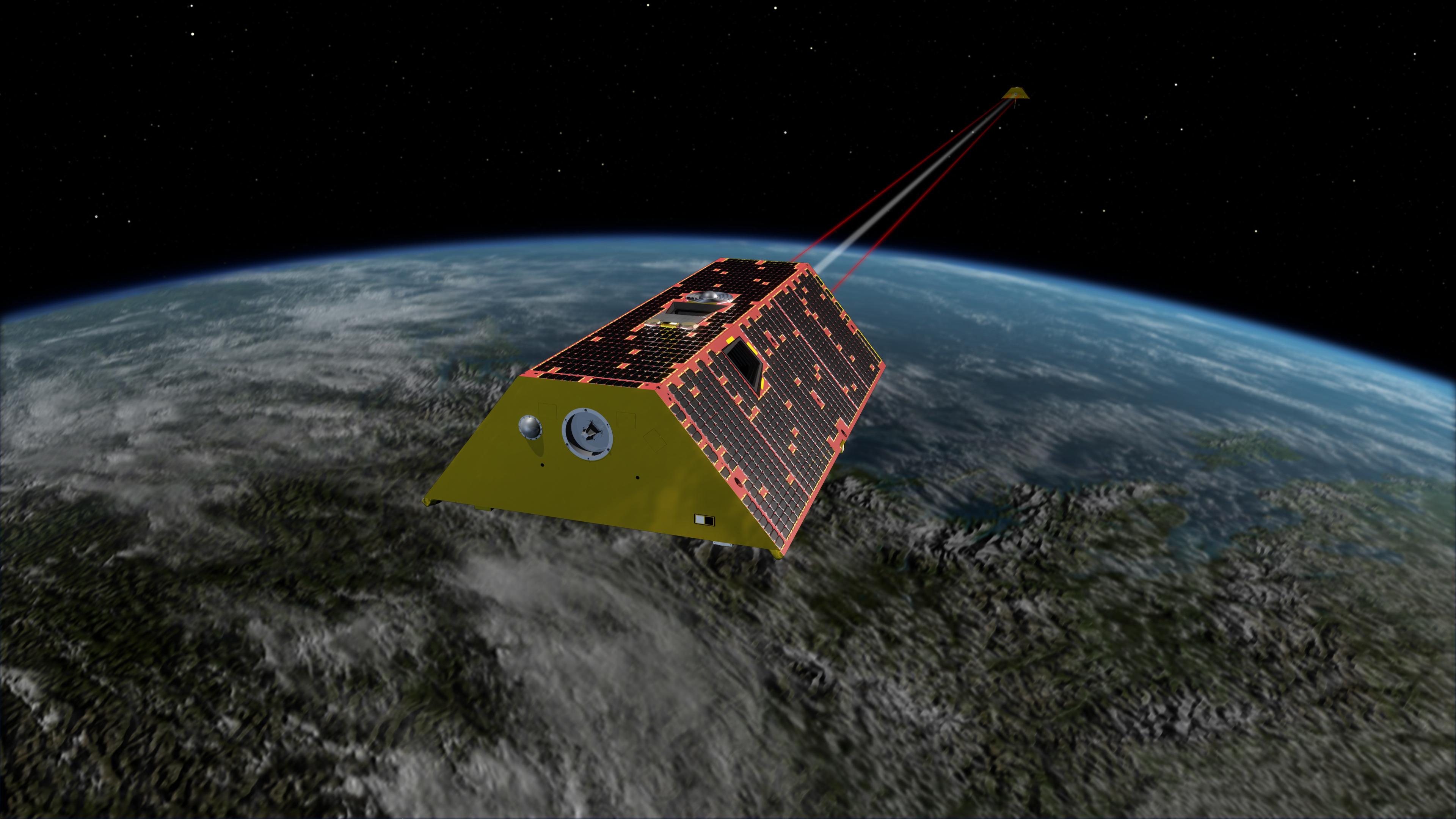
GRACE Follow-On Satellites (Artist's Concept)
Full Resolution:
TIFF
(60.67 MB)
JPEG
(2.559 MB)
|
|
|
2018-04-30 |
|
GRACE-FO
|
|
3840x2160x3 |
|
-
PIA22441:
-
GRACE Follow-On Satellites (Artist's Concept)
Full Resolution:
TIFF
(12.91 MB)
JPEG
(390.7 kB)
|
|
|
2018-04-30 |
|
GRACE-FO
|
|
3840x2160x3 |

|
-
PIA22445:
-
GRACE Follow-On Satellites (Artist's Concept)
Full Resolution:
TIFF
(14.24 MB)
JPEG
(517.3 kB)
|
|
|
2018-04-30 |
|
GRACE-FO
|
|
1920x1080x3 |
|
-
PIA22446:
-
GRACE Follow-On Satellites (Artist's Concept)
Full Resolution:
TIFF
(3.674 MB)
JPEG
(190 kB)
|
|
|
2018-04-30 |
|
GRACE-FO
|
|
1920x1080x3 |

|
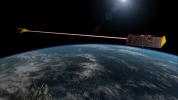
-
PIA22447:
-
GRACE Follow-On Satellites Separating from Spacecraft (Artist's Concept)
Full Resolution:
TIFF
(4.96 MB)
JPEG
(192.6 kB)
|
|
|
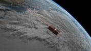
2018-04-25 |
|
GRACE-FO
|
|
3840x2160x3 |

|
-
PIA22431:
-
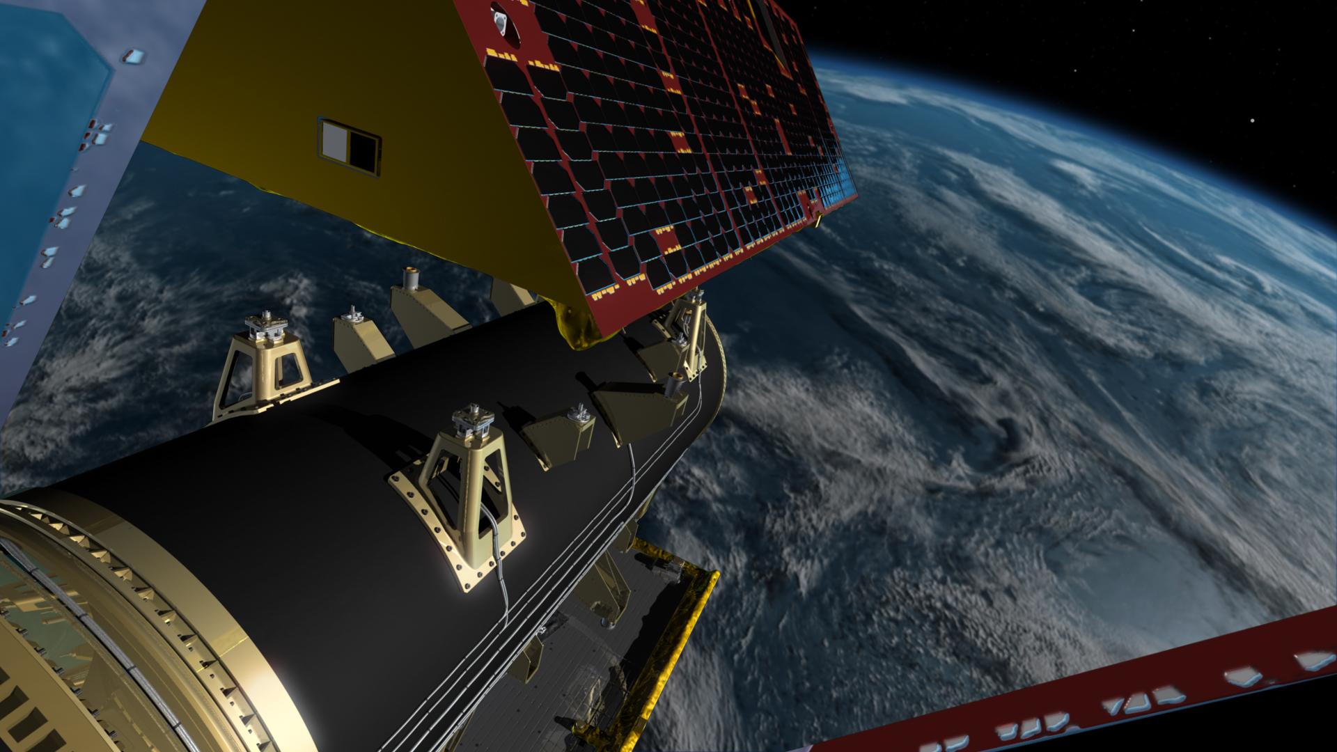
GRACE-FO Spacecraft (Artist's Rendering)
Full Resolution:
TIFF
(13.81 MB)
JPEG
(516.5 kB)
|
|
|
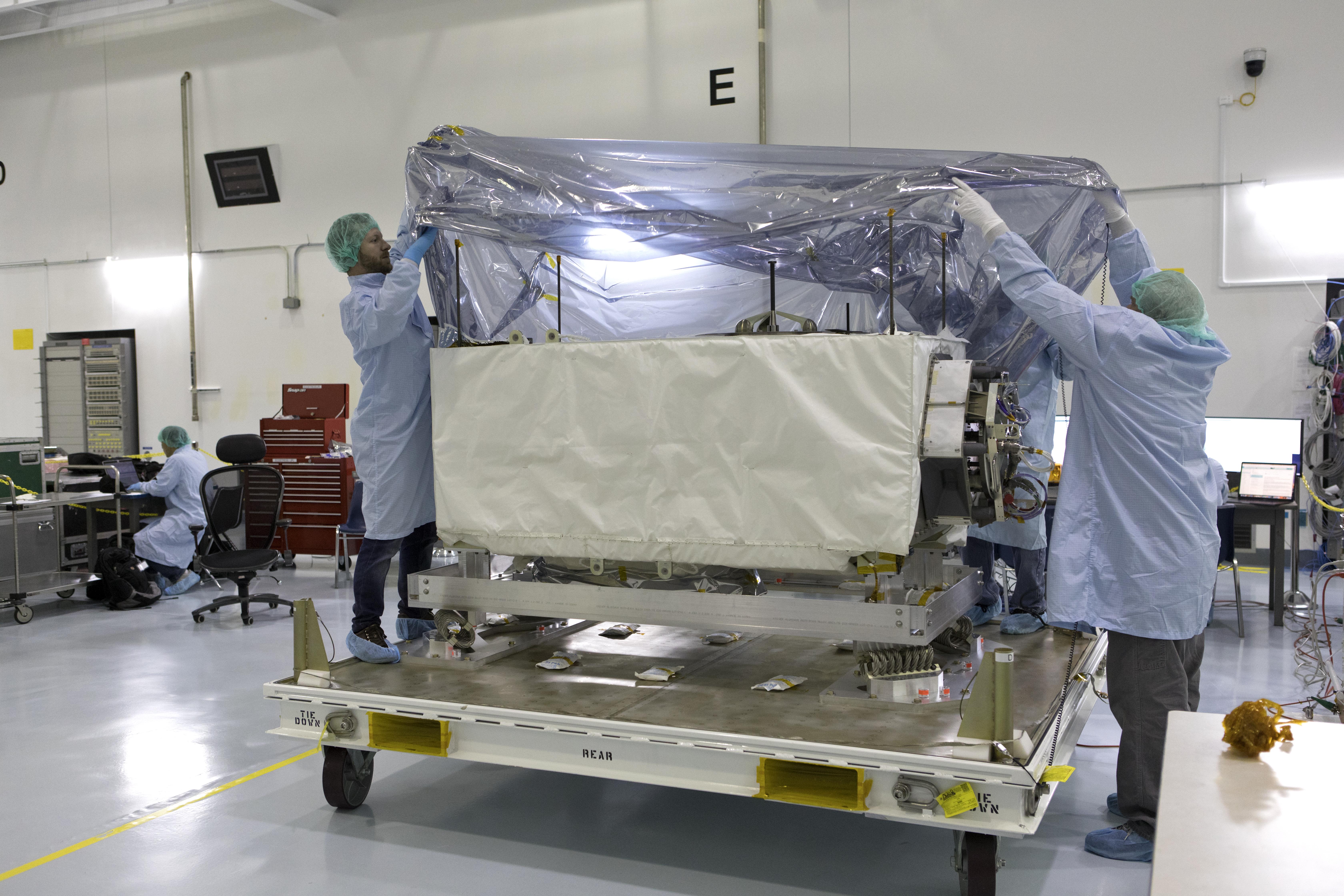
2018-04-17 |
|
ECOSTRESS
|
|
6720x4480x3 |
|
-
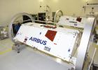
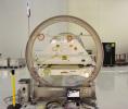
PIA22417:
-
NASA's ECOSTRESS Investigation Arrives at Launch Site
Full Resolution:
TIFF
(70.06 MB)
JPEG
(4.026 MB)
|
|
|
2018-04-17 |
|
ECOSTRESS
|
|
6720x4480x3 |
|
-
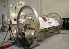
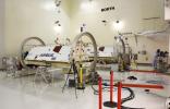
PIA22416:
-
NASA's ECOSTRESS Investigation Arrives at Launch Site
Full Resolution:
TIFF
(66.98 MB)
JPEG
(3.628 MB)
|
|
|
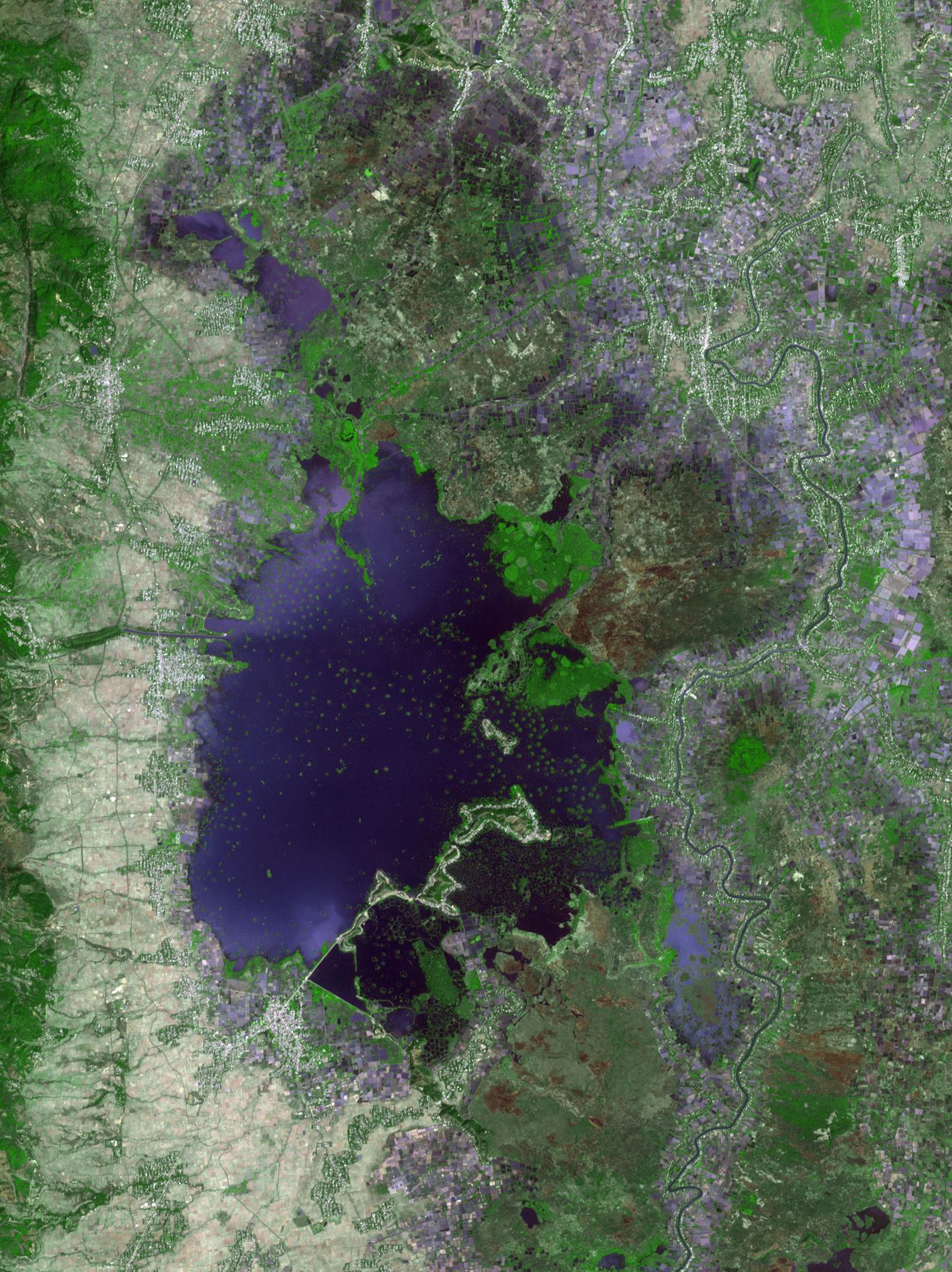
2018-04-13 |
Earth
|
Terra
|
ASTER
|
1365x1823x3 |
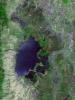
|
-
PIA22369:
-
Loktak Lake, India
Full Resolution:
TIFF
(7.468 MB)
JPEG
(529.7 kB)
|
|
|
2018-04-09 |
|
InSight
|
SEIS
|
1280x724x3 |
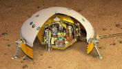
|
-
PIA22320:
-
Cutaway of SEIS (Artist's Concept)
Full Resolution:
TIFF
(2.781 MB)
JPEG
(238 kB)
|
|
|
2018-04-05 |
Mars
|
2001 Mars Odyssey
|
THEMIS
|
1154x2875x1 |
|
-
PIA22362:
-
Polar Winds
Full Resolution:
TIFF
(2.515 MB)
JPEG
(158.3 kB)
|
|
|
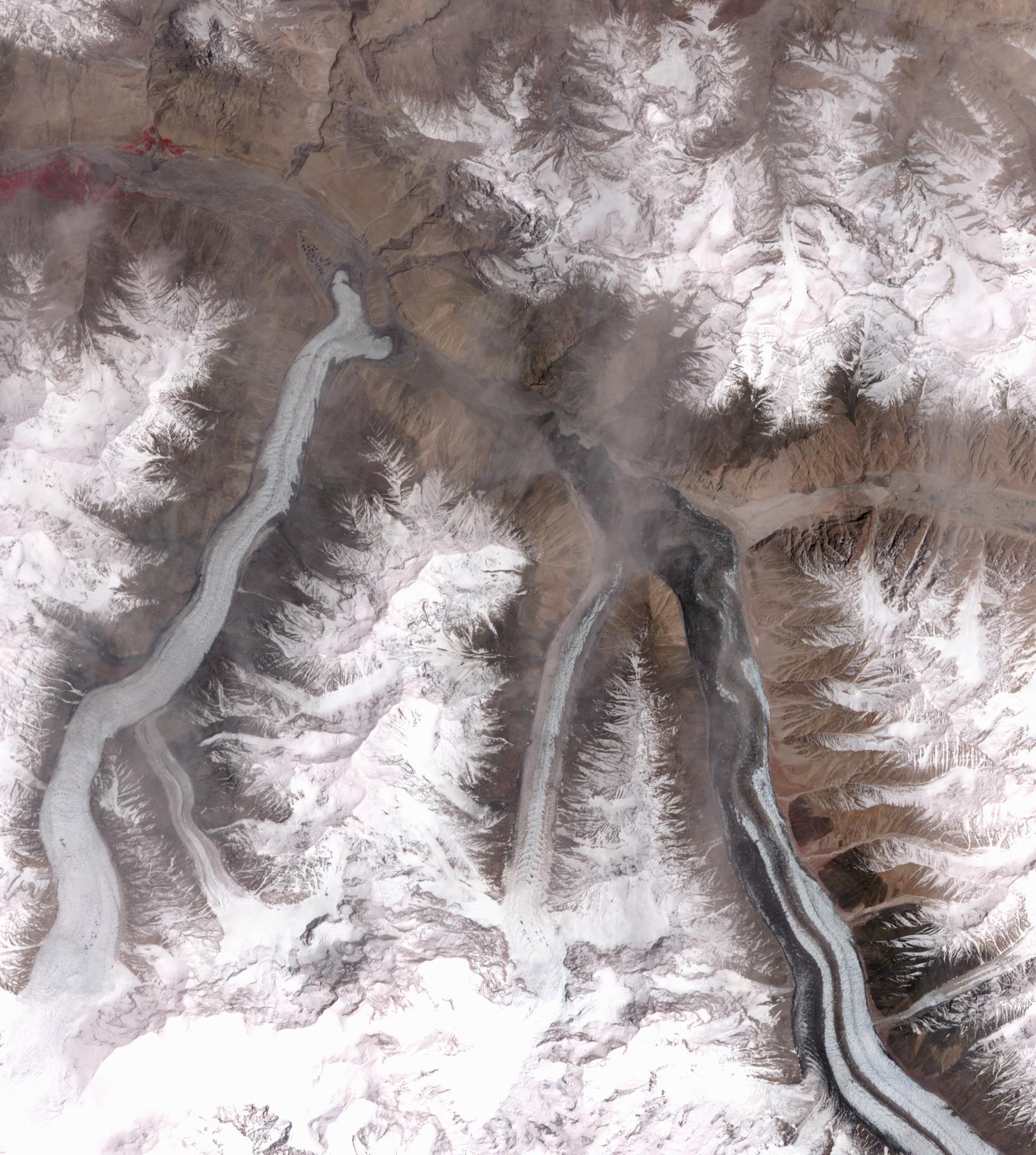
2018-03-26 |
Earth
|
Terra
|
ASTER
|
1664x1856x3 |
|
-
PIA22304:
-
Khurdopin Glacier, Pakistan
Full Resolution:
TIFF
(8.846 MB)
JPEG
(466.3 kB)
|
|
|
2018-03-15 |
Earth
|
|
|
1080x810x3 |
|
-
PIA22343:
-
Mapping the Extent of California's Deadly Jan. 2018 Mudflows
Full Resolution:
TIFF
(1.773 MB)
JPEG
(224.5 kB)
|
|
|
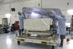
2018-03-12 |
|
GRACE-FO
|
|
6569x4693x3 |
|
-
PIA22341:
-
GRACE-FO Satellites in a Clean Room at Vandenberg Air Force Base
Full Resolution:
TIFF
(61.22 MB)
JPEG
(2.321 MB)
|
|
|
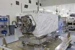
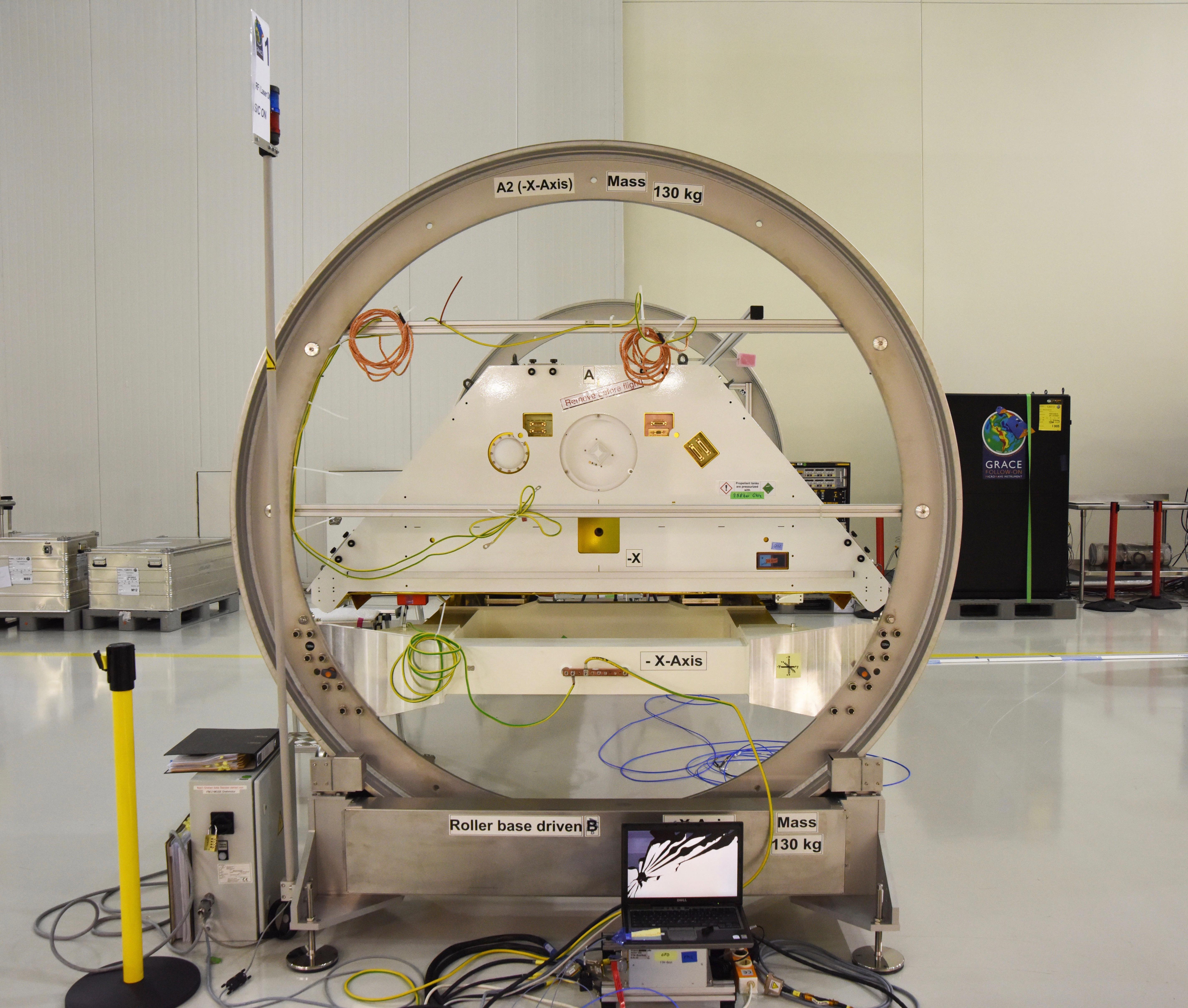
2018-03-12 |
|
GRACE-FO
|
|
6876x4912x3 |
|
-
PIA22340:
-
GRACE-FO Satellites in a Clean Room at Vandenberg Air Force Base
Full Resolution:
TIFF
(83.5 MB)
JPEG
(3.186 MB)
|
|
|
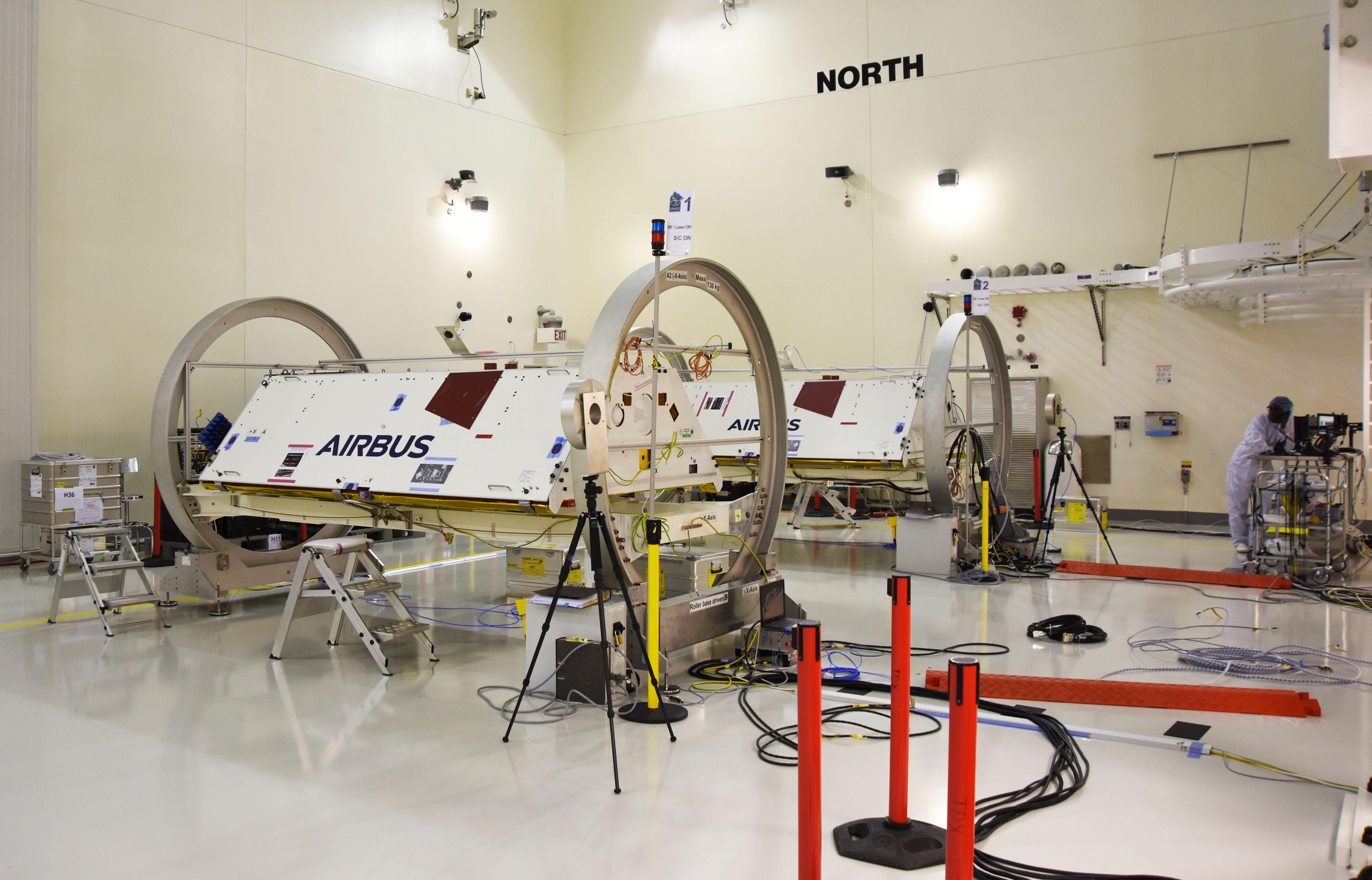
2018-03-12 |
|
GRACE-FO
|
|
5699x4834x3 |
|
-
PIA22339:
-
GRACE-FO Satellites in a Clean Room at Vandenberg Air Force Base
Full Resolution:
TIFF
(65.51 MB)
JPEG
(2.392 MB)
|
|
|
2018-03-12 |
|
GRACE-FO
|
|
5856x3757x3 |
|
-
PIA22338:
-
GRACE-FO Satellites in a Clean Room at Vandenberg Air Force Base
Full Resolution:
TIFF
(47.98 MB)
JPEG
(1.514 MB)
|
|
|
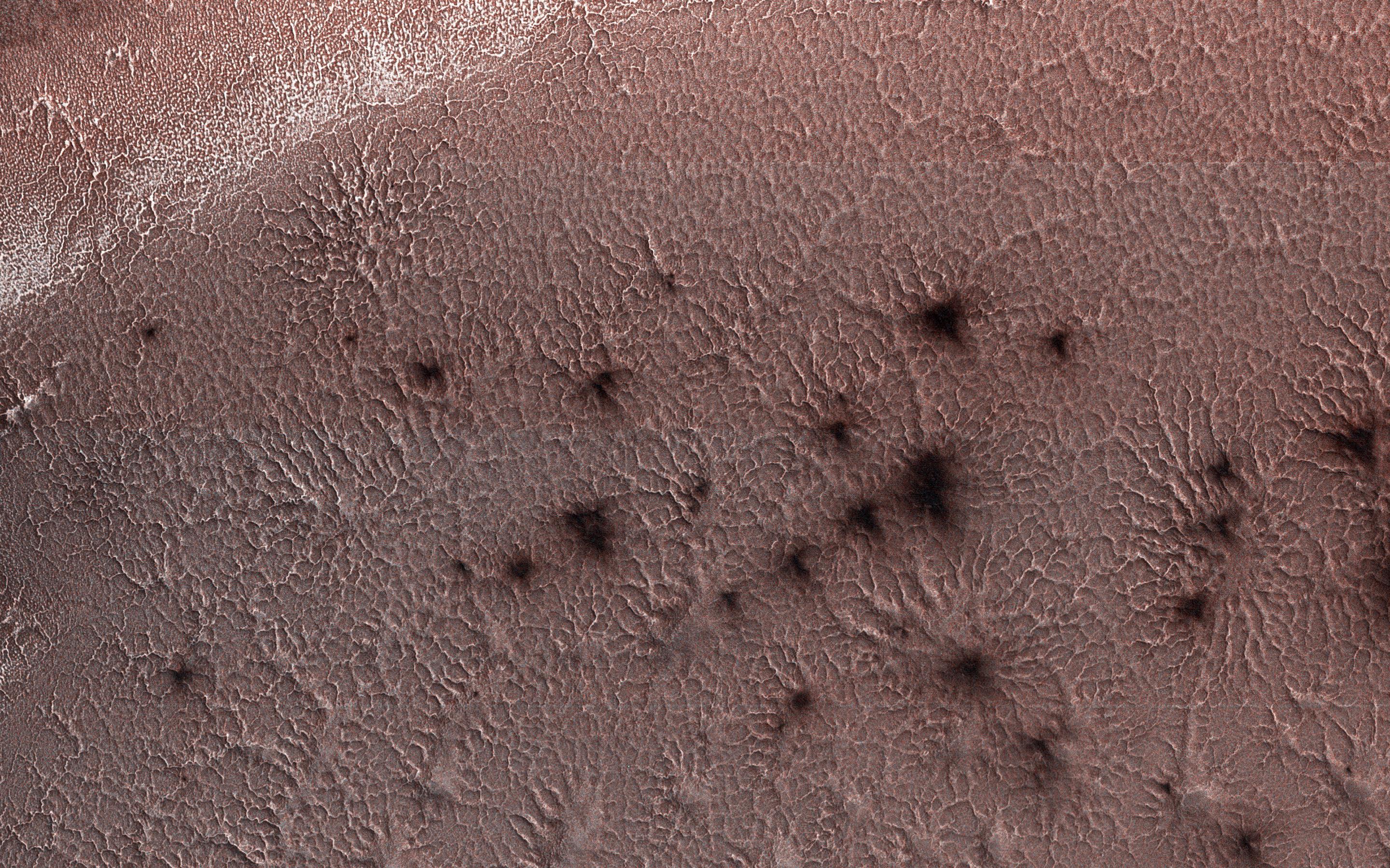
2018-03-09 |
Mars
|
2001 Mars Odyssey
|
THEMIS
|
564x2928x1 |

|
-
PIA22292:
-
Investigating Mars: Olympia Undae
Full Resolution:
TIFF
(1.653 MB)
JPEG
(387.4 kB)
|
|
|
2018-03-08 |
Mars
|
2001 Mars Odyssey
|
THEMIS
|
576x5897x1 |

|
-
PIA22291:
-
Investigating Mars: Olympia Undae
Full Resolution:
TIFF
(3.4 MB)
JPEG
(705.2 kB)
|
|
|
2018-03-07 |
Mars
|
2001 Mars Odyssey
|
THEMIS
|
586x6556x1 |

|
-
PIA22290:
-
Investigating Mars: Olympia Undae
Full Resolution:
TIFF
(3.67 MB)
JPEG
(486 kB)
|
|
|
2018-03-06 |
Mars
|
2001 Mars Odyssey
|
THEMIS
|
576x6521x1 |

|
-
PIA22289:
-
Investigating Mars: Olympia Undae
Full Resolution:
TIFF
(3.366 MB)
JPEG
(378.5 kB)
|
|
|
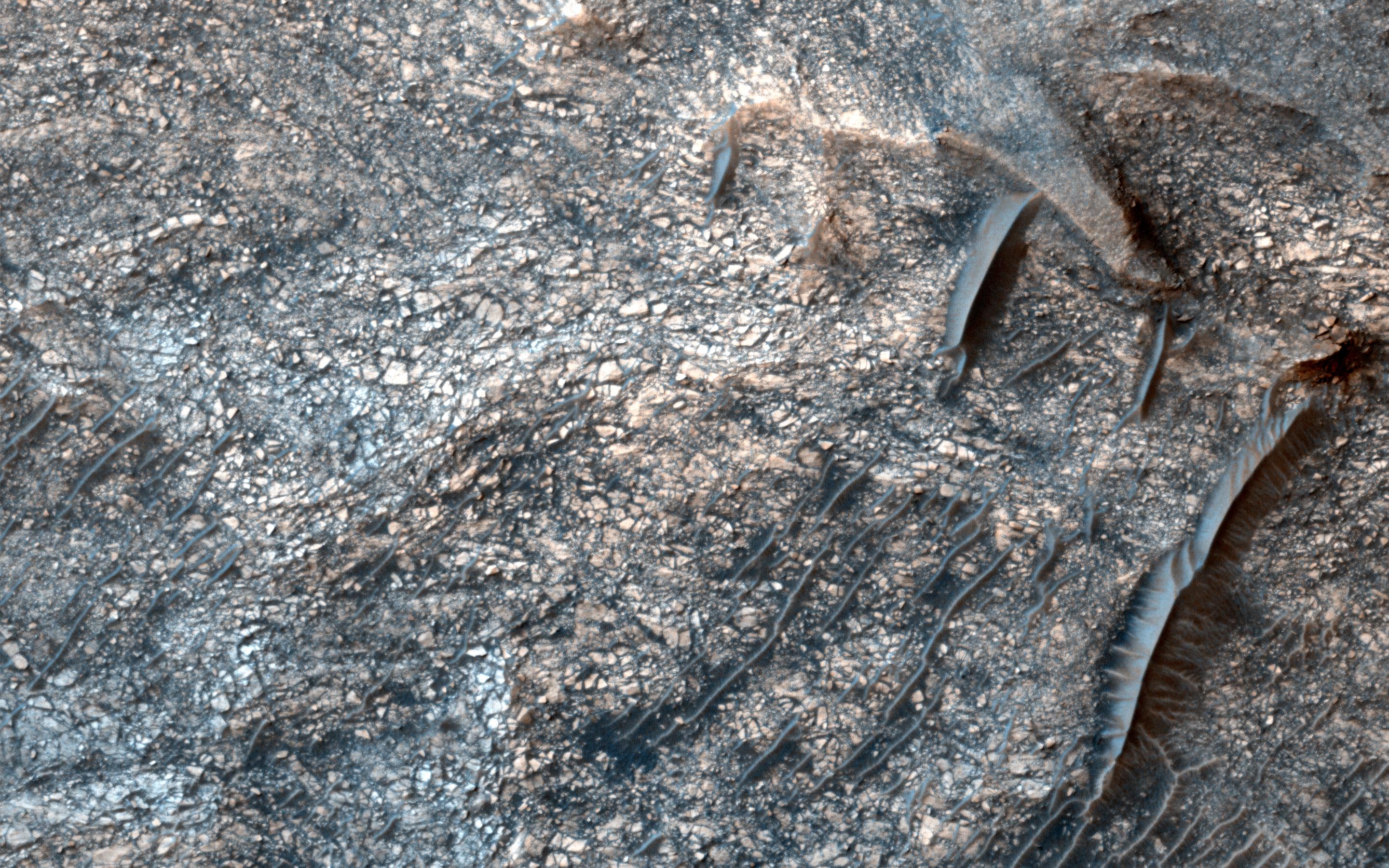
2018-03-06 |
Mars
|
Mars Reconnaissance Orbiter (MRO)
|
HiRISE
|
2880x1800x3 |
|
-
PIA22334:
-
The Case of the Martian Boulder Piles
Full Resolution:
TIFF
(15.56 MB)
JPEG
(1.248 MB)
|
|
|
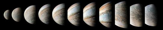
2018-02-22 |
Jupiter
|
Juno
|
JunoCam
|
9000x5400x3 |
|
-
PIA21979:
-
Time-lapse Sequence of Jupiter's South Pole
Full Resolution:
TIFF
(11.03 MB)
JPEG
(1.17 MB)
|
|
|
2018-02-22 |
Earth
|
Terra
|
ASTER
|
4410x4338x3 |

|
-
PIA22283:
-
Jebels Awenat and Arkenu, Libya
Full Resolution:
TIFF
(42.76 MB)
JPEG
(1.616 MB)
|
|
|
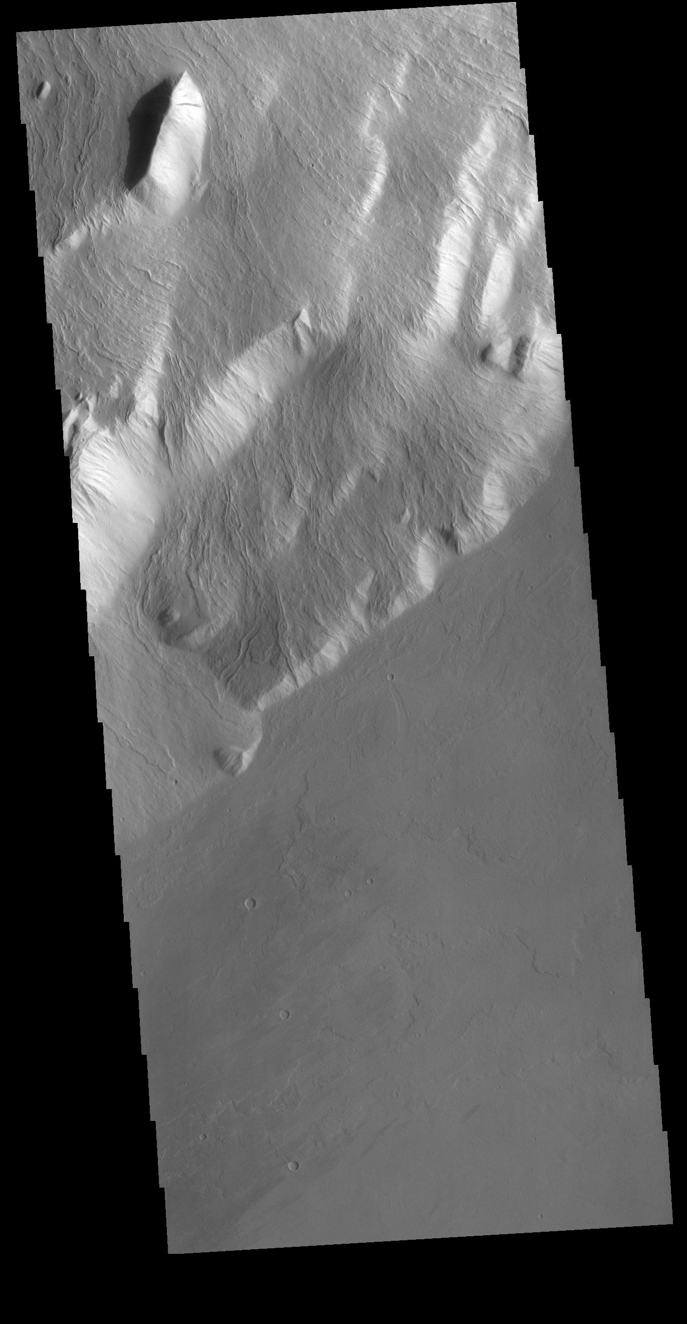
2018-02-22 |
Mars
|
2001 Mars Odyssey
|
THEMIS
|
1317x2779x1 |

|
-
PIA22280:
-
Investigating Mars: Ius Chasma
Full Resolution:
TIFF
(2.359 MB)
JPEG
(208.3 kB)
|
|
|
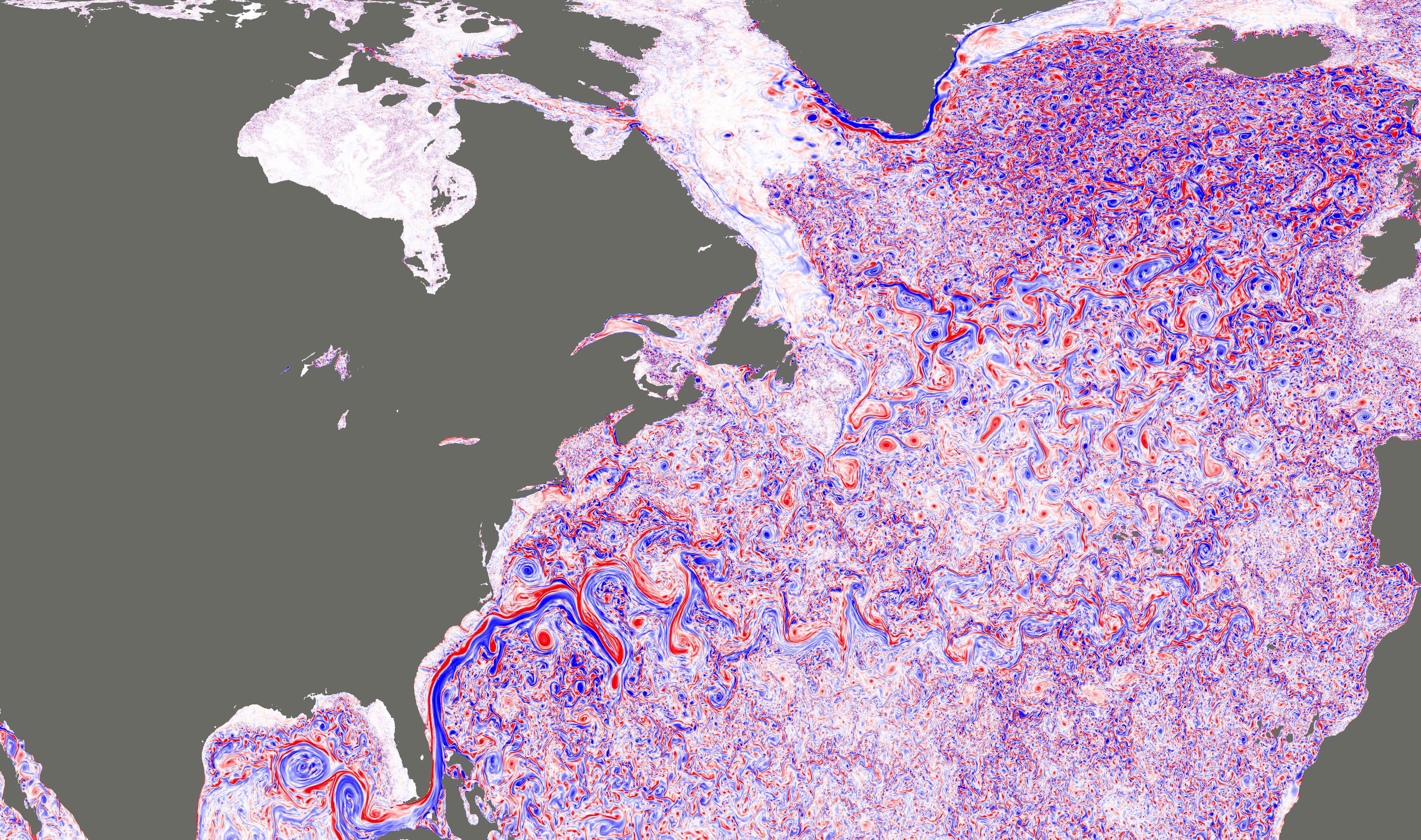
2018-02-21 |
Earth
|
|
|
3778x2234x3 |
|
-
PIA22256:
-
NASA Simulation Shows Ocean Turbulence in the North Atlantic
Full Resolution:
TIFF
(17.06 MB)
JPEG
(2.186 MB)
|
|
|
2018-02-21 |
Earth
|
ARIA
|
|
4568x3022x3 |

|
-
PIA22257:
-
Tonga Cyclone Damage Mapped by NASA's ARIA Team
Full Resolution:
TIFF
(22.99 MB)
JPEG
(1.141 MB)
|
|
|
2018-02-20 |
Mars
|
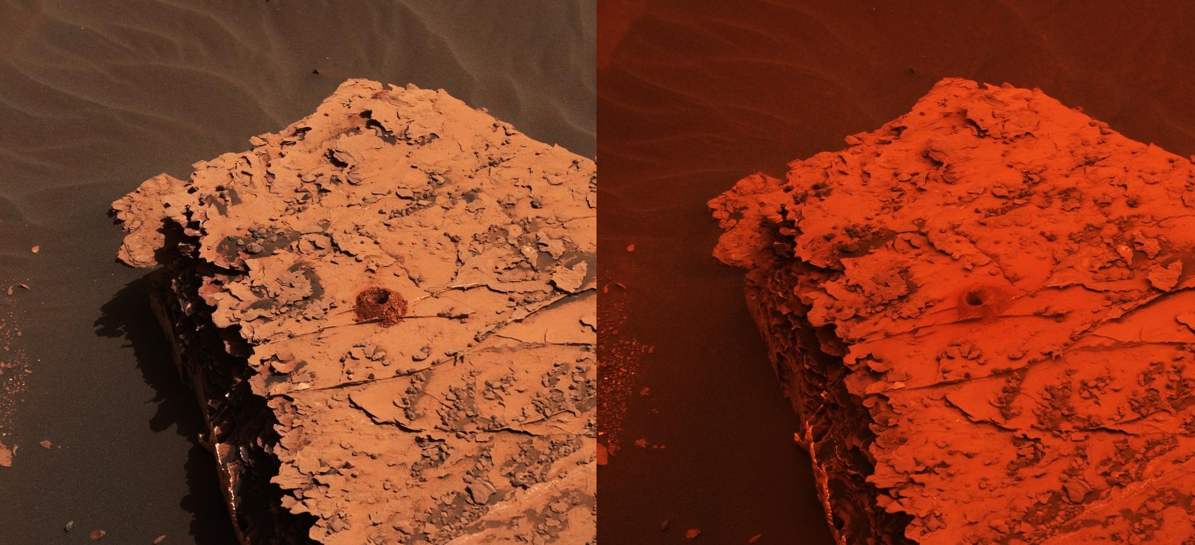
Mars Reconnaissance Orbiter (MRO)
|
HiRISE
|
4500x3000x3 |
|
-
PIA22255:
-
Icy Layers in Craters
Full Resolution:
TIFF
(40.52 MB)
JPEG
(1.724 MB)
|
|
|
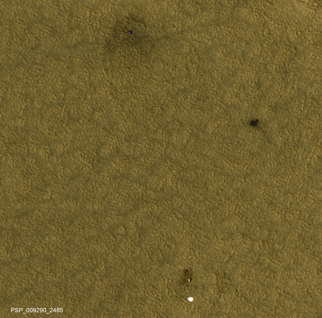
2018-02-20 |
Mars
|
Mars Reconnaissance Orbiter (MRO)
Phoenix
|
HiRISE
|
1286x1269x3 |
|
-
PIA22223:
-
NASA's Phoenix Lander on Mars, Nearly a Decade Later
Full Resolution:
TIFF
(2.81 MB)
JPEG
(1.781 MB)
|
|
|
2018-02-16 |
Mars
|
2001 Mars Odyssey
|
THEMIS
|
1311x2775x1 |
|
-
PIA22276:
-
Investigating Mars: Tithonium Chasma
Full Resolution:
TIFF
(2.589 MB)
JPEG
(253.5 kB)
|
|
|
2018-02-15 |
Mars
|
2001 Mars Odyssey
|
THEMIS
|
705x1546x1 |
|
-
PIA22275:
-
Investigating Mars: Tithonium Chasma
Full Resolution:
TIFF
(764.3 kB)
JPEG
(78.49 kB)
|
|
|
2018-02-14 |
Mars
|
2001 Mars Odyssey
|
THEMIS
|
1340x2920x1 |

|
-
PIA22274:
-
Investigating Mars: Tithonium Chasma
Full Resolution:
TIFF
(2.661 MB)
JPEG
(242.8 kB)
|
|
|
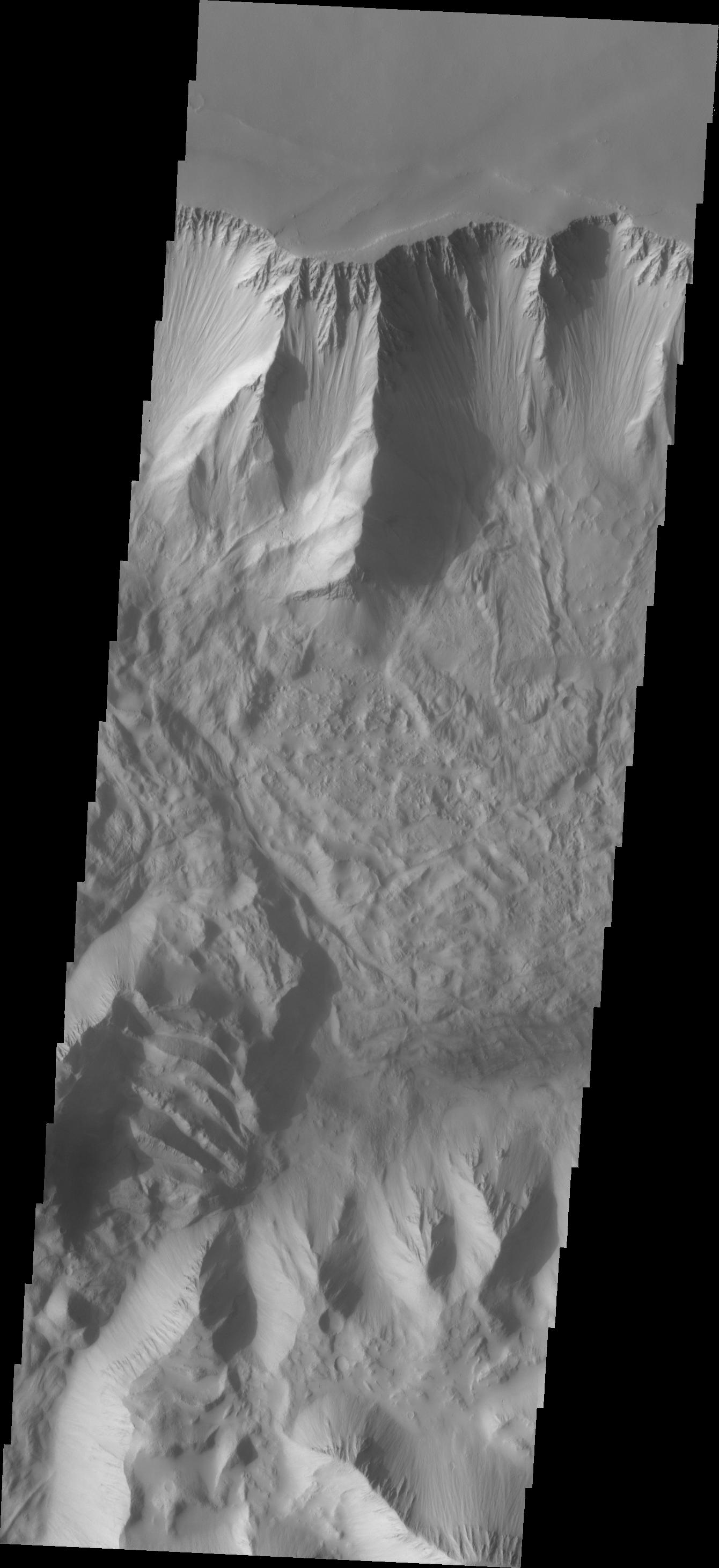
2018-02-13 |
Mars
|
2001 Mars Odyssey
|
THEMIS
|
1319x2773x1 |

|
-
PIA22273:
-
Investigating Mars: Tithonium Chasma
Full Resolution:
TIFF
(2.455 MB)
JPEG
(222.1 kB)
|
|
|
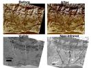
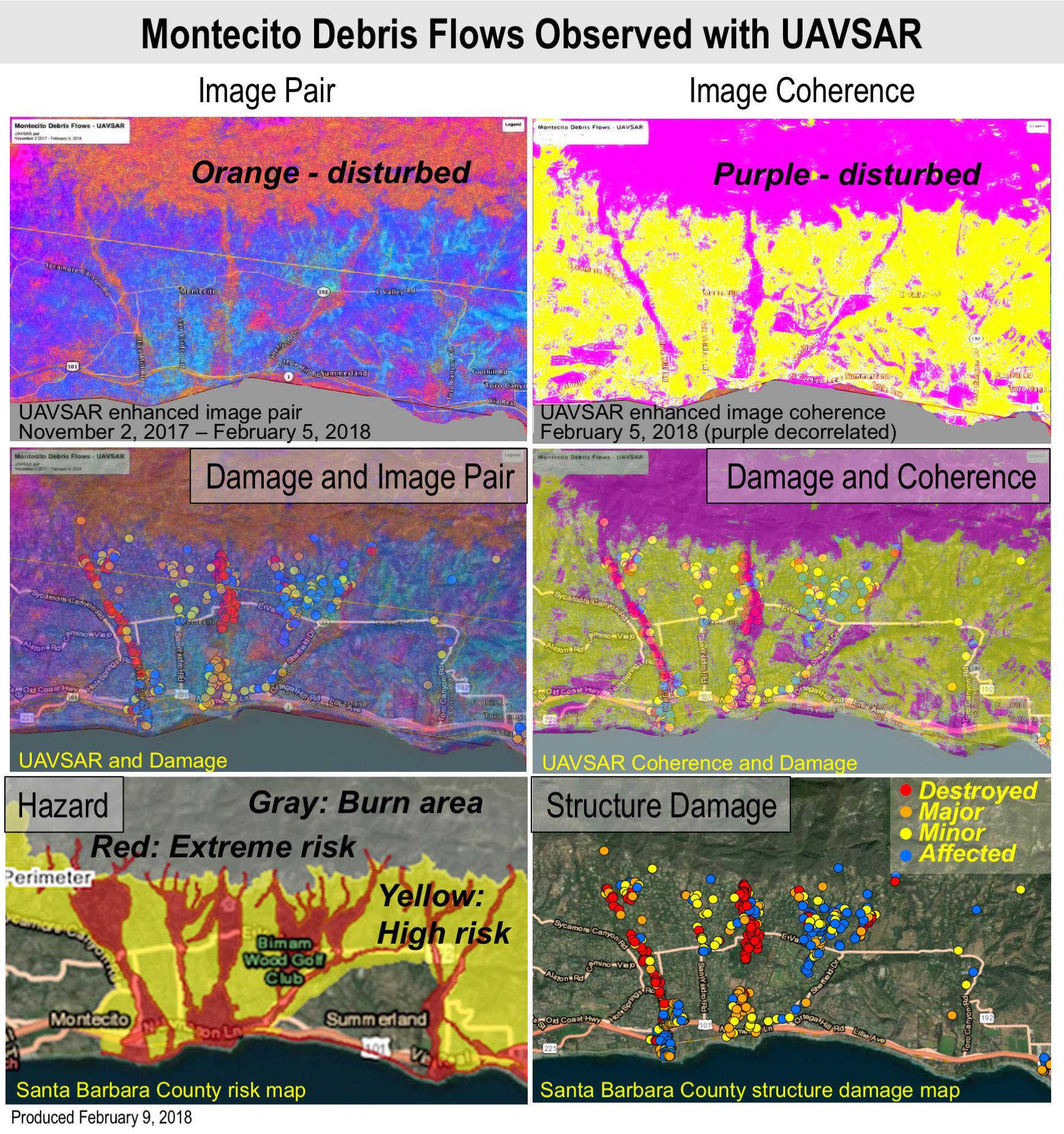
2018-02-12 |
Earth
|
UAVSAR
|
L-Band UAVSAR
|
1738x1853x3 |
|
-
PIA22243:
-
Effects of Deadly California Debris Flows Seen in Before/After Images from NASA's UAVSAR
Full Resolution:
TIFF
(8.922 MB)
JPEG
(598.4 kB)
|
|
|
2018-02-12 |
Mars
|
2001 Mars Odyssey
|
THEMIS
|
1333x2928x1 |
|
-
PIA22272:
-
Investigating Mars: Tithonium Chasma
Full Resolution:
TIFF
(2.539 MB)
JPEG
(225.5 kB)
|
|
|
2018-02-09 |
Mars
|
2001 Mars Odyssey
|
THEMIS
|
1312x2776x1 |

|
-
PIA22271:
-
Investigating Mars: Tithonium Chasma
Full Resolution:
TIFF
(2.606 MB)
JPEG
(250.7 kB)
|
|
|
2018-02-08 |
Mars
|
2001 Mars Odyssey
|
THEMIS
|
1376x3229x1 |
|
-
PIA22270:
-
Investigating Mars: Tithonium Chasma
Full Resolution:
TIFF
(2.678 MB)
JPEG
(240.7 kB)
|
|
|
2018-02-01 |
Earth
|
Terra
|
ASTER
|
3180x3548x3 |
|
-
PIA22266:
-
Suzhou, Jingsu, China
Full Resolution:
TIFF
(33.86 MB)
JPEG
(3.524 MB)
|
|
|
2018-01-30 |
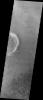
Ceres
|
Dawn
|
Framing Camera
|
1024x1024x1 |
|
-
PIA22091:
-
Spiderweb-like Fractures in Occator Crater
Full Resolution:
TIFF
(1.05 MB)
JPEG
(213.2 kB)
|
|
|
2018-01-30 |
Mars
|
2001 Mars Odyssey
|
THEMIS
|
1686x2899x1 |

|
-
PIA22262:
-
Investigating Mars: Kaiser Crater Dunes
Full Resolution:
TIFF
(3.101 MB)
JPEG
(327.9 kB)
|
|
|
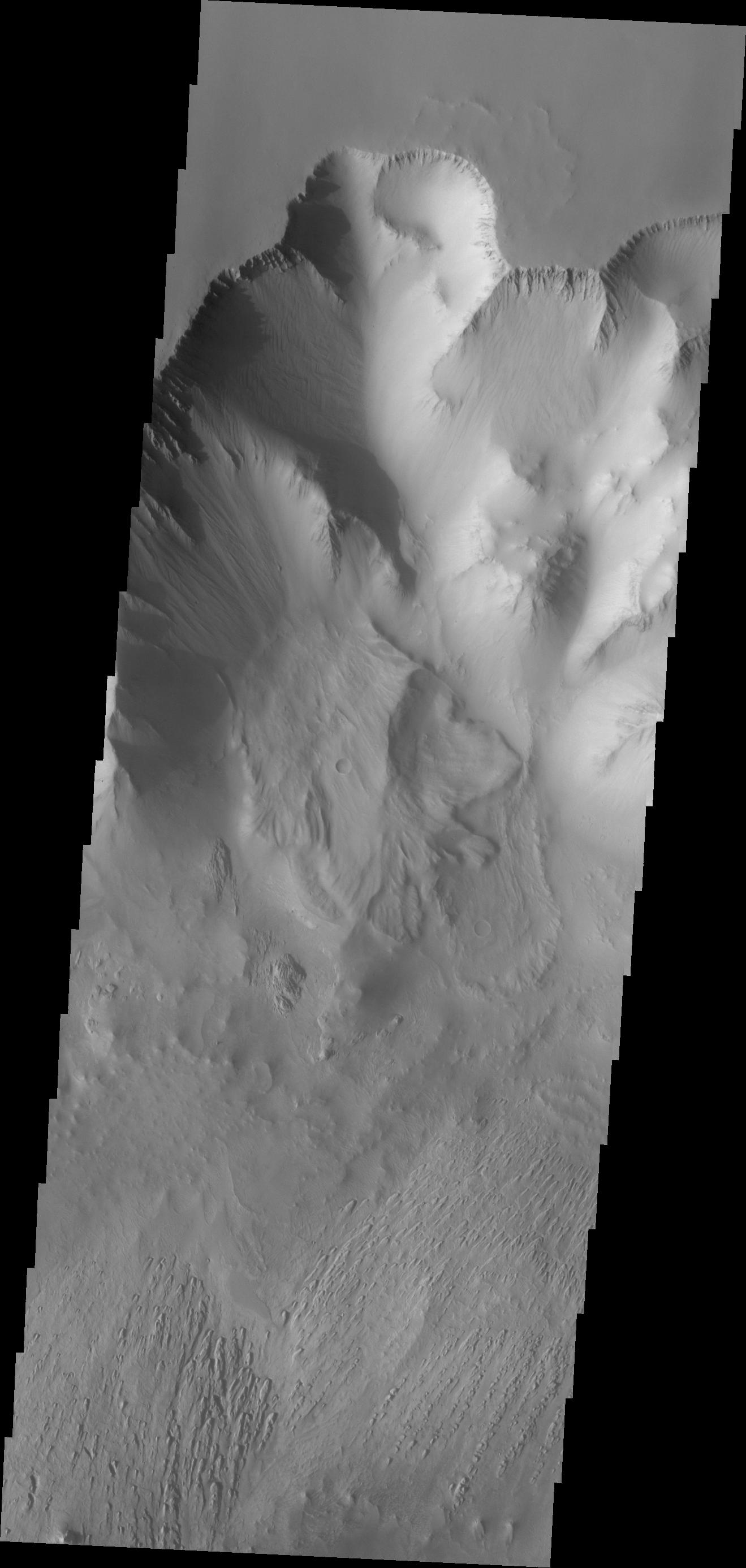
2018-01-29 |
Mars
|
2001 Mars Odyssey
|
THEMIS
|
1343x2963x1 |
|
-
PIA22261:
-
Investigating Mars: Kaiser Crater Dunes
Full Resolution:
TIFF
(2.382 MB)
JPEG
(204.5 kB)
|
|
|
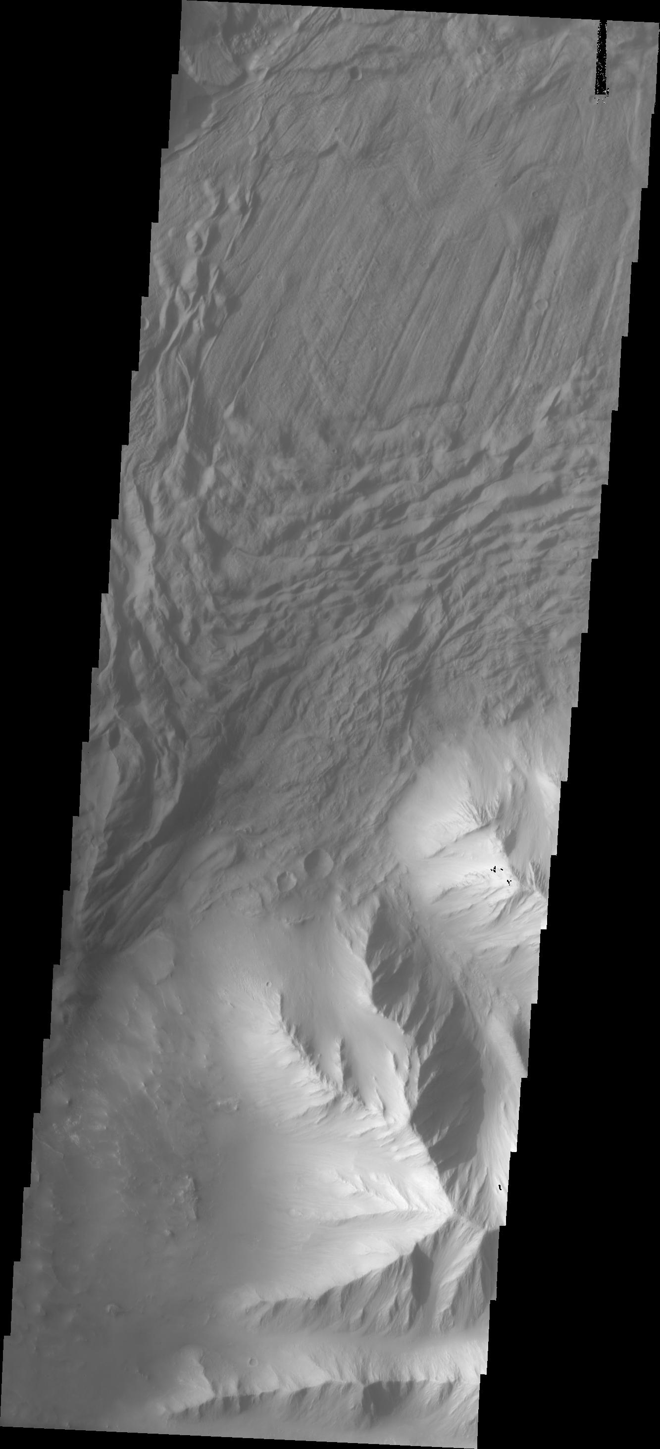
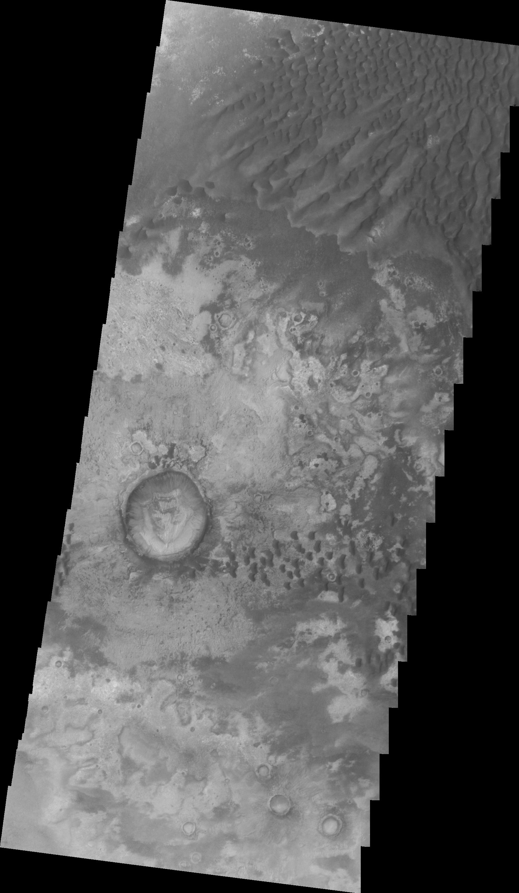
2018-01-25 |
Mars
|
2001 Mars Odyssey
|
THEMIS
|
1404x3274x1 |
|
-
PIA22174:
-
Investigating Mars: Kaiser Crater Dunes
Full Resolution:
TIFF
(2.773 MB)
JPEG
(234.5 kB)
|
|
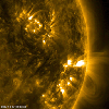
|
2018-01-18 |
Sol (our sun)
|
SDO
|
Atmosphere Imaging Assembly
|
1500x1602x3 |
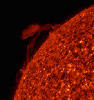
|
-
PIA22199:
-
Reversing Prominence

Full Resolution:
TIFF
(3.541 MB)
JPEG
(214.3 kB)
|
|
|
2018-01-12 |
Mars
|
2001 Mars Odyssey
|
THEMIS
|
1379x3232x1 |
|
-
PIA22165:
-
Investigating Mars: Candor Chasma
Full Resolution:
TIFF
(2.68 MB)
JPEG
(234.8 kB)
|
|
|
2018-01-10 |
Earth
|
Terra
|
ASTER
|
613x720x3 |
|
-
PIA22164:
-
Eigg, Scotland
Full Resolution:
TIFF
(1.077 MB)
JPEG
(54.62 kB)
|
|
|
2018-01-05 |
Earth
|
Terra
|
ASTER
|
4122x2206x3 |

|
-
PIA22189:
-
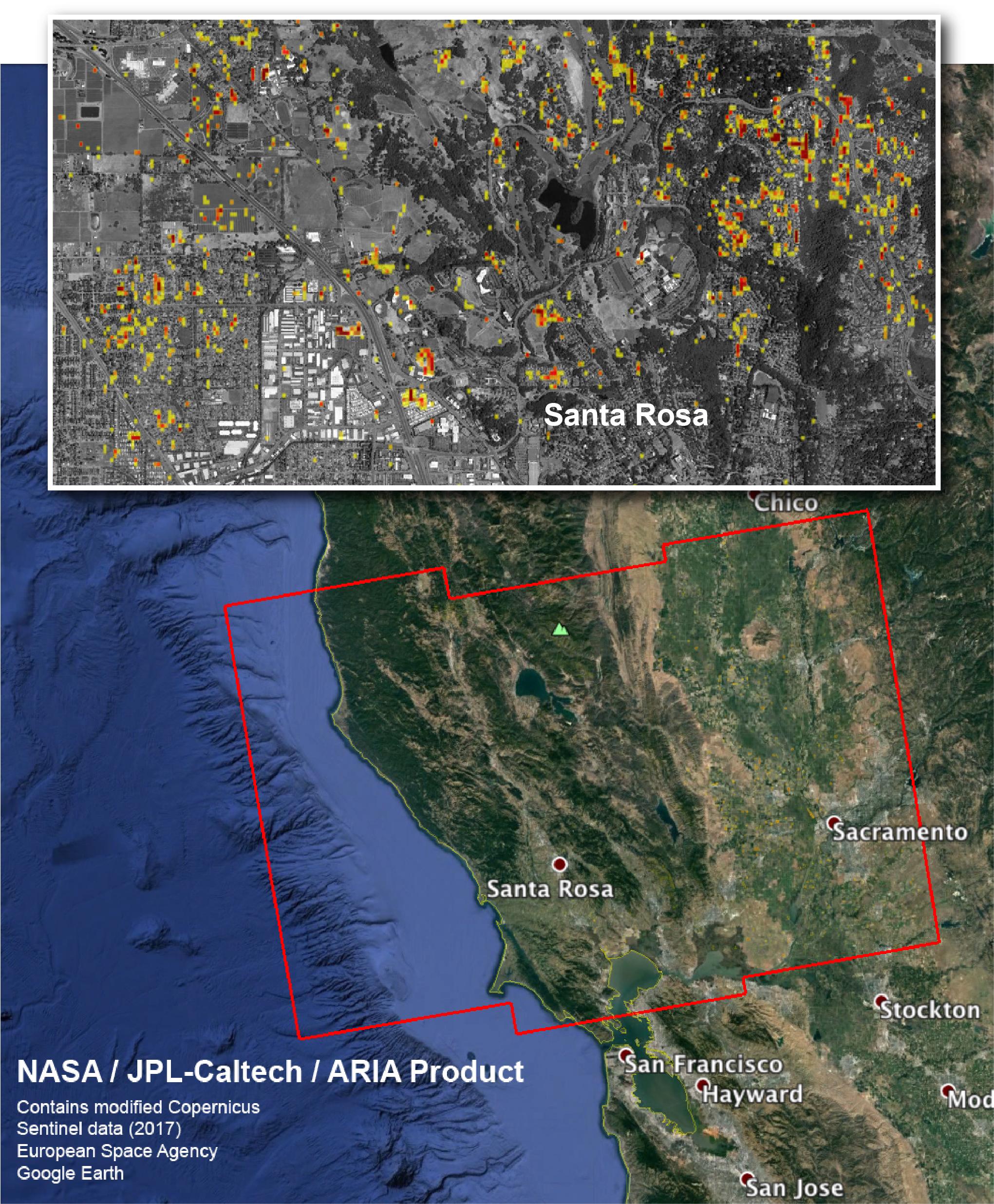
Devastation from California's Largest Wildfire Seen in New NASA Satellite Image
Full Resolution:
TIFF
(27.3 MB)
JPEG
(1.932 MB)
|
|
|
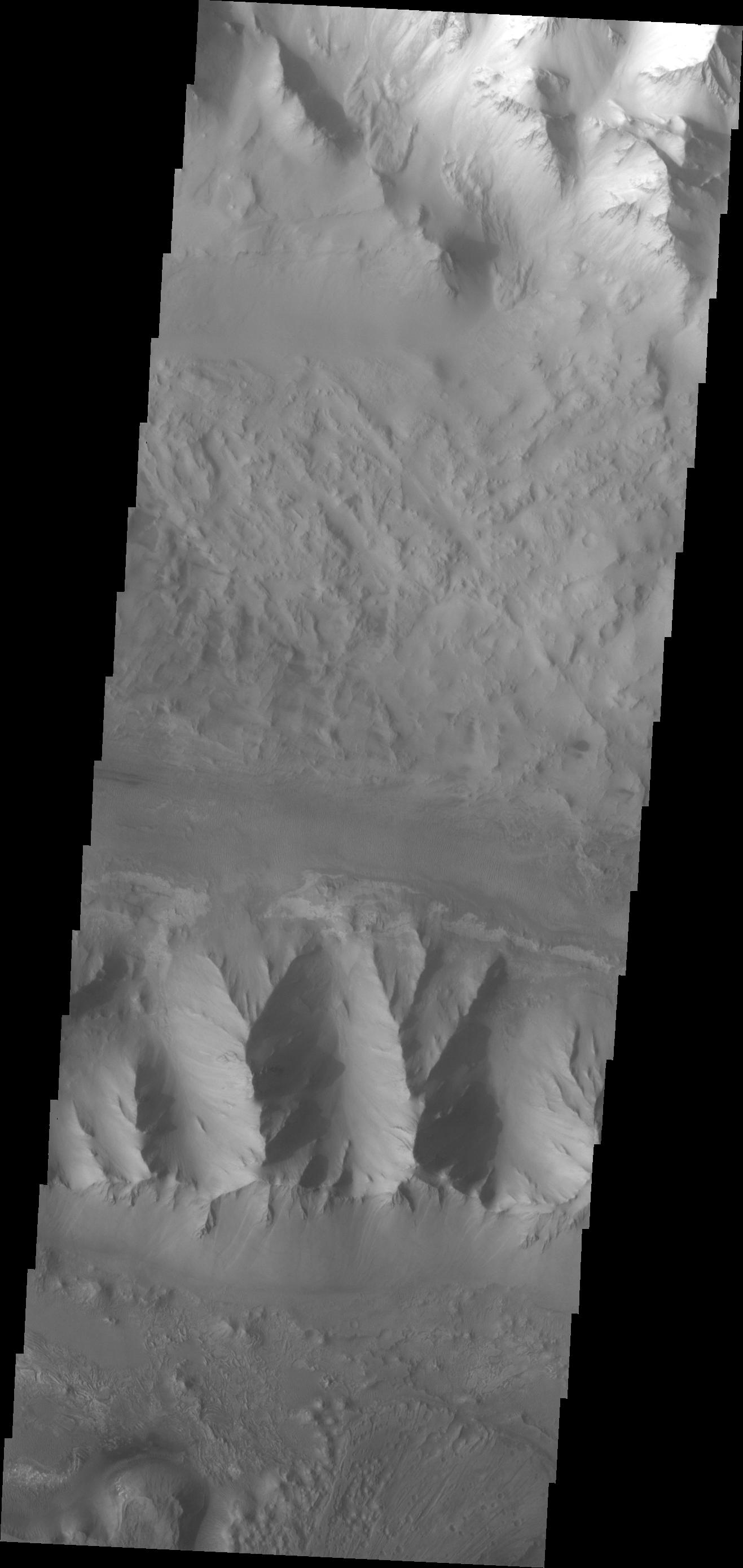
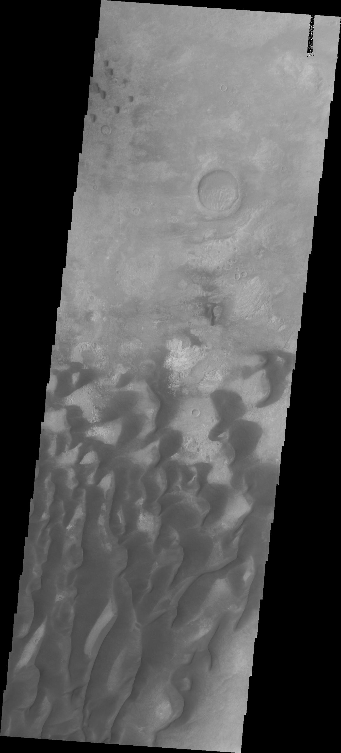
2017-12-29 |
Mars
|
2001 Mars Odyssey
|
THEMIS
|
1294x2770x1 |
|
-
PIA22154:
-
Investigating Mars: Arsia Mons
Full Resolution:
TIFF
(2.927 MB)
JPEG
(503.7 kB)
|
|
|
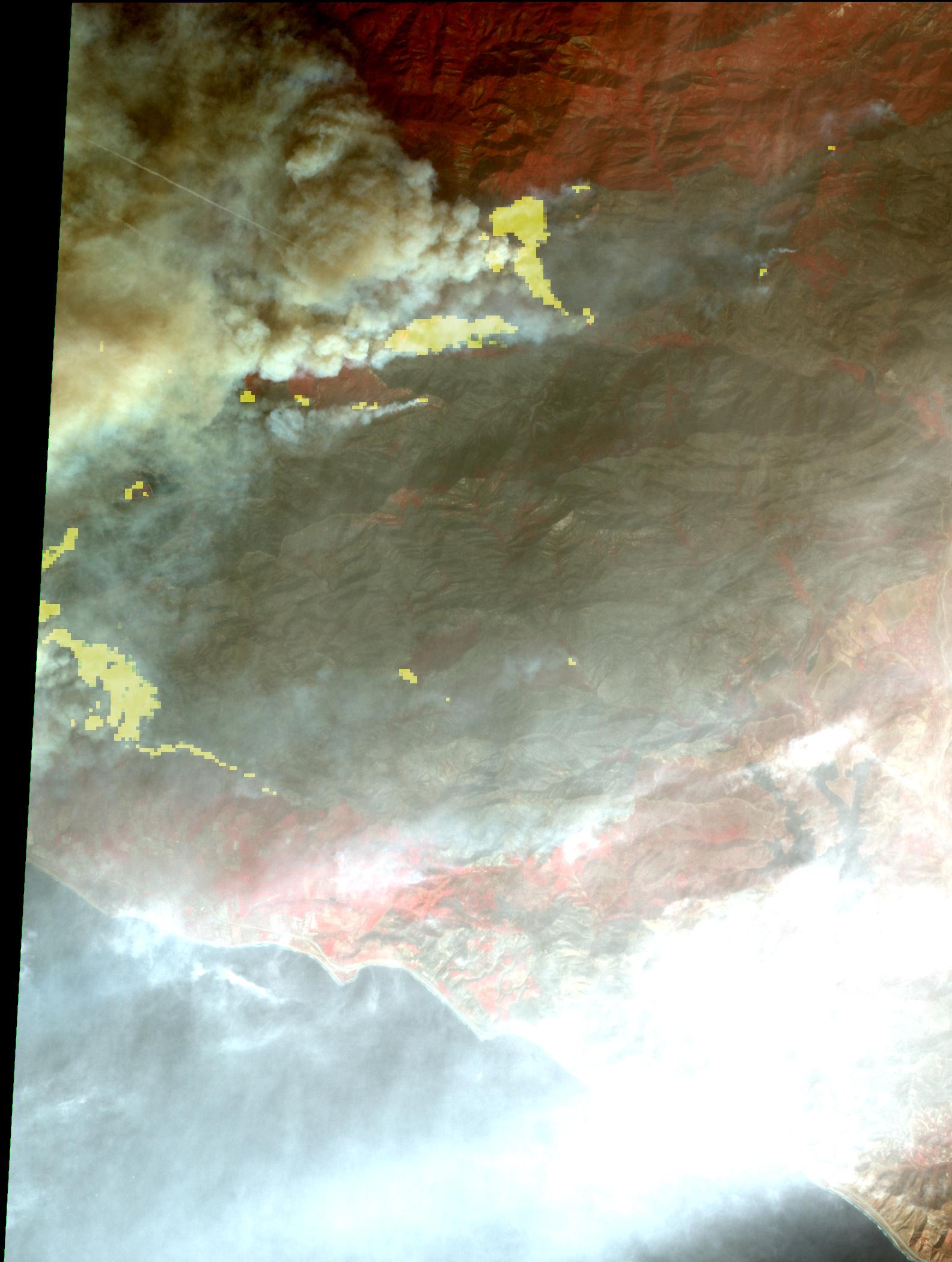
2017-12-18 |
Earth
|
Terra
|
ASTER
|
900x650x3 |
|
-
PIA22149:
-
Creek and Rye Fires, Southern California
Full Resolution:
TIFF
(1.756 MB)
JPEG
(234 kB)
|
|
|
2017-12-14 |
|
Kepler
|
|
1152x648x3 |

|
-
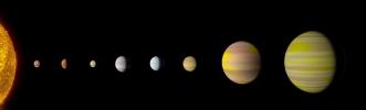
PIA22193:
-
Kepler-90 System Compared to Our Solar System (Artist's Concept)
Full Resolution:
TIFF
(645.6 kB)
JPEG
(50.32 kB)
|
|
|
2017-12-14 |
|
Kepler
|
|
8700x2628x3 |
|
-
PIA22192:
-
Kepler-90 system (Artist's Concept)
Full Resolution:
TIFF
(10.73 MB)
JPEG
(573.3 kB)
|
|
|
2017-12-14 |
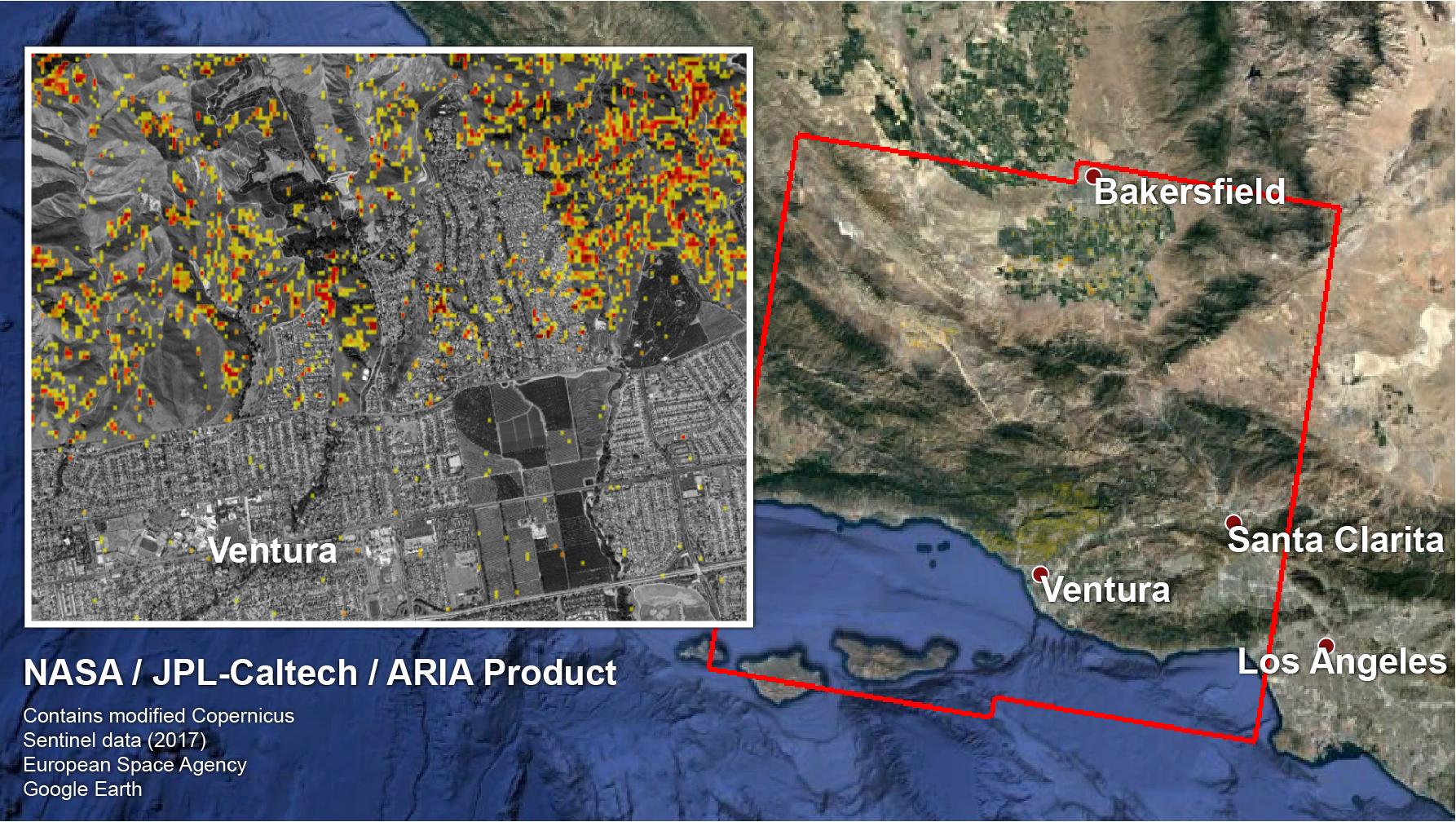
Earth
|
ARIA
|
|
1786x1008x3 |
|
-
PIA22191:
-
NASA-Produced Map Shows Extent of Southern California Wildfire Damage
Full Resolution:
TIFF
(4.691 MB)
JPEG
(384.9 kB)
|
|
|
2017-12-14 |
Mars
|
2001 Mars Odyssey
|
THEMIS
|
692x1548x1 |
|
-
PIA22142:
-
Investigating Mars: Rabe Crater
Full Resolution:
TIFF
(715.2 kB)
JPEG
(74.12 kB)
|
|
|
2017-12-11 |
Earth
|
Terra
|
ASTER
|
1584x2100x3 |
|
-
PIA22122:
-
Destructive Thomas Fire Continues Its Advance in New NASA Satellite Image
Full Resolution:
TIFF
(6.455 MB)
JPEG
(267.7 kB)
|
|
|
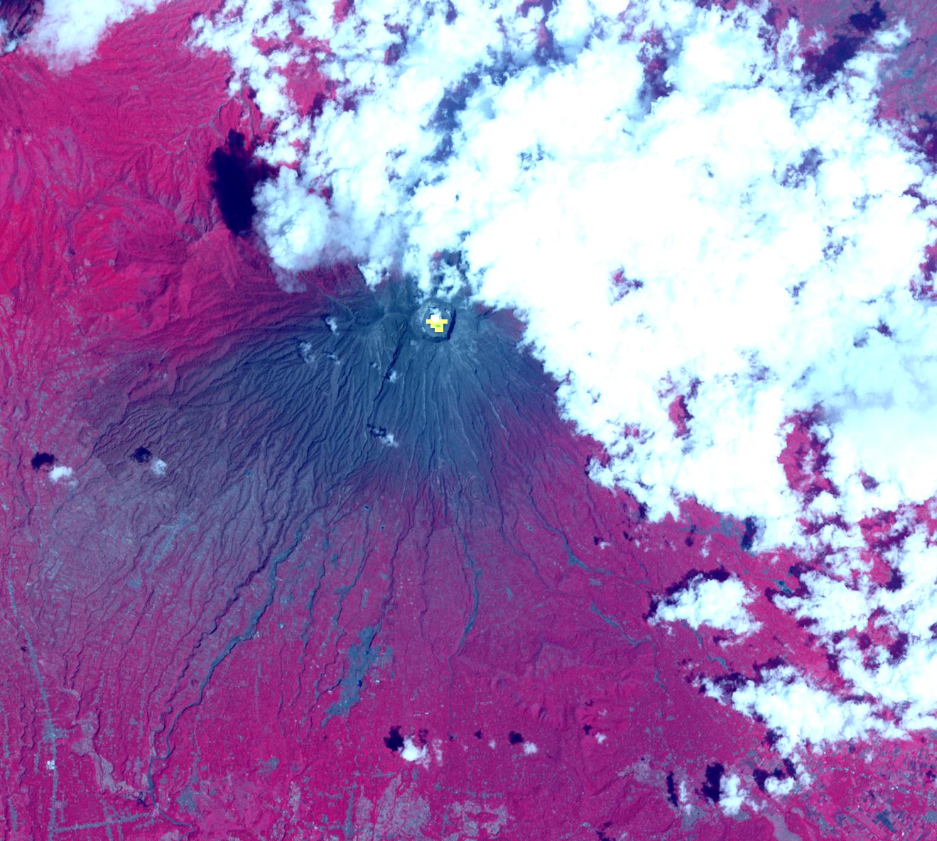
2017-12-10 |
Earth
|
Terra
|
ASTER
|
1319x1185x3 |

|
-
PIA22121:
-
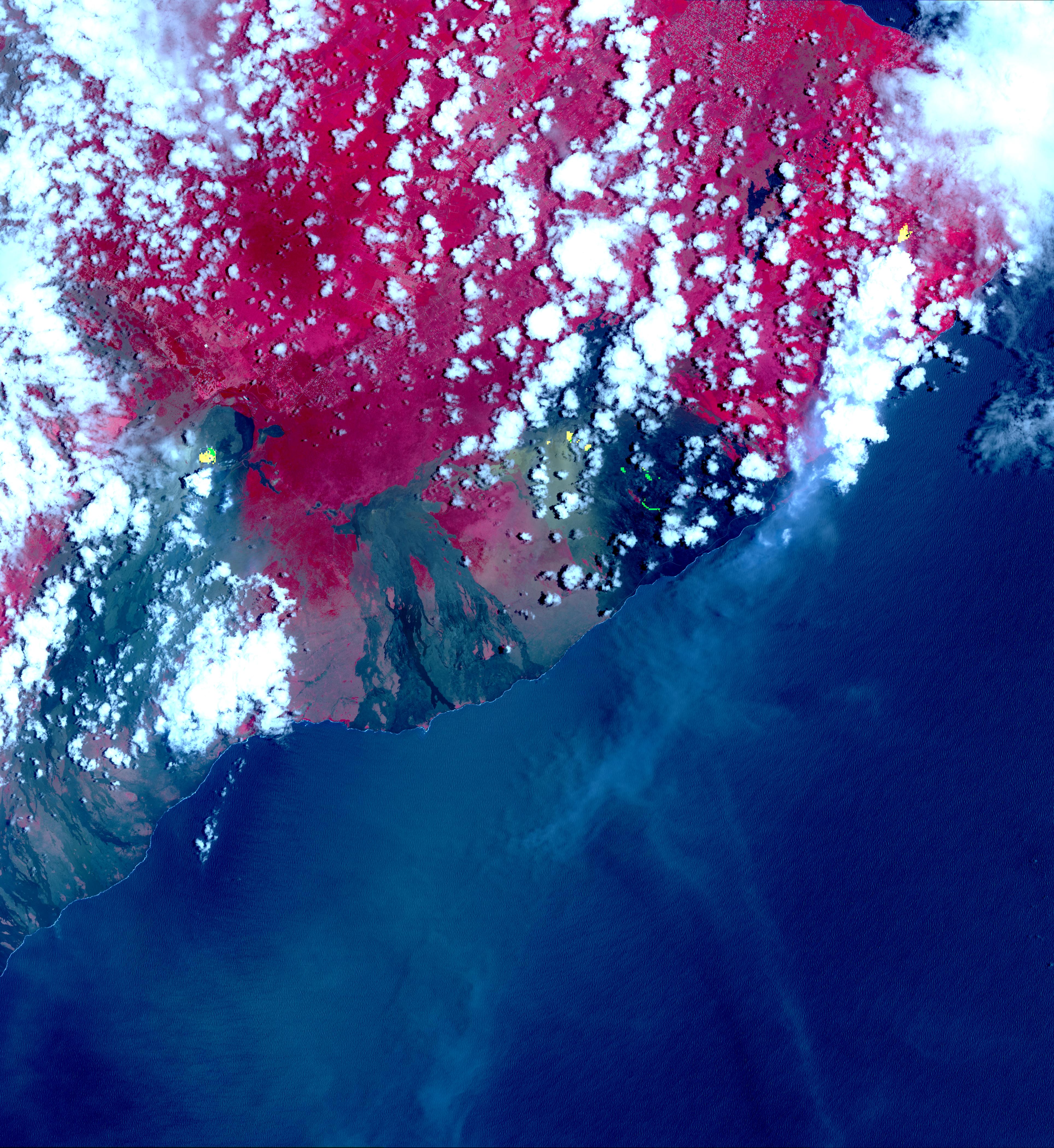
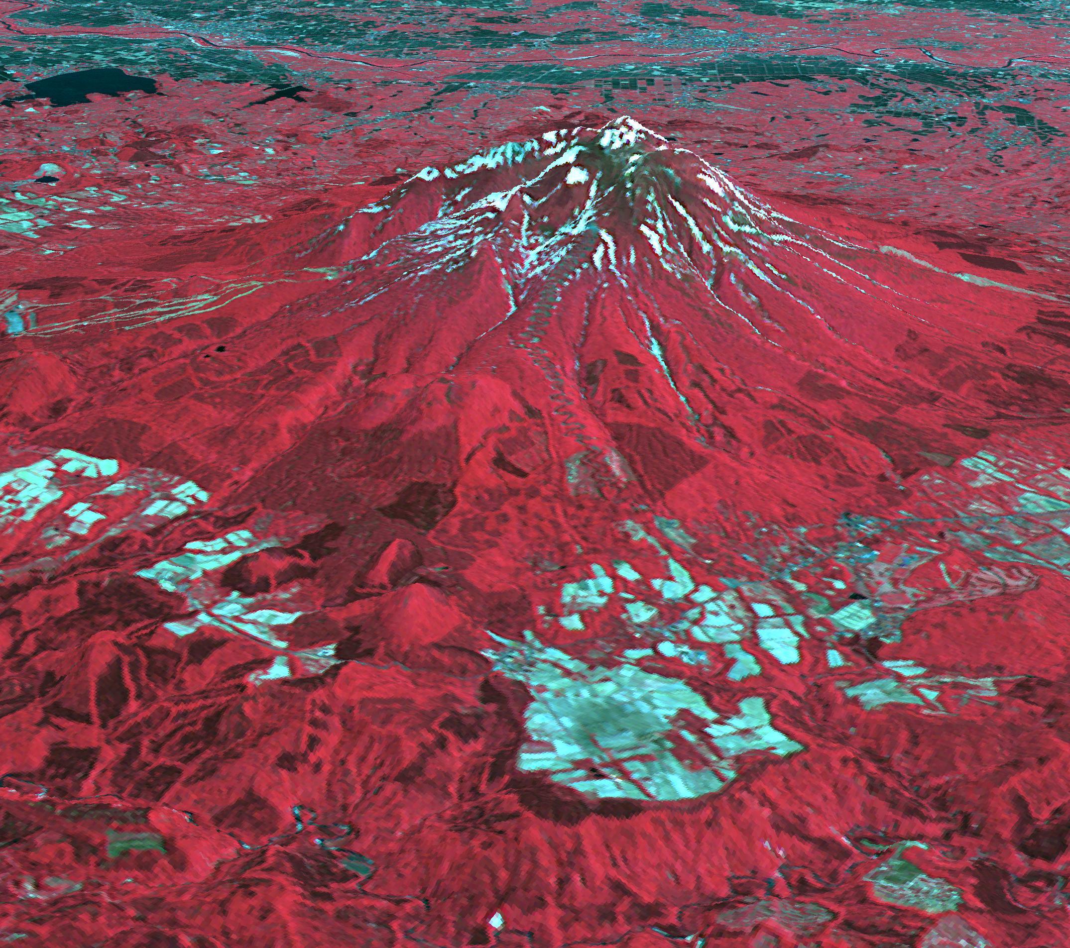
Indonesia's Active Mount Agung Volcano Imaged by NASA Spacecraft
Full Resolution:
TIFF
(4.073 MB)
JPEG
(241.9 kB)
|
|
|
2017-12-07 |
Mars
|
2001 Mars Odyssey
|
THEMIS
|
1299x2772x1 |

|
-
PIA22137:
-
Investigating Mars: Melas Chasma
Full Resolution:
TIFF
(2.723 MB)
JPEG
(308.2 kB)
|
|
|
2017-11-28 |
Earth
|
Terra
|
ASTER
|
2318x1015x3 |
|
-
PIA22133:
-
Run Island, Indonesia
Full Resolution:
TIFF
(5.182 MB)
JPEG
(234.8 kB)
|
|
|
2017-11-15 |
Earth
|
Terra
|
ASTER
|
1846x1561x3 |
|
-
PIA22112:
-
Iran-Iraq Border Quake Region Imaged by NASA Satellite
Full Resolution:
TIFF
(8.572 MB)
JPEG
(780.8 kB)
|
|
|
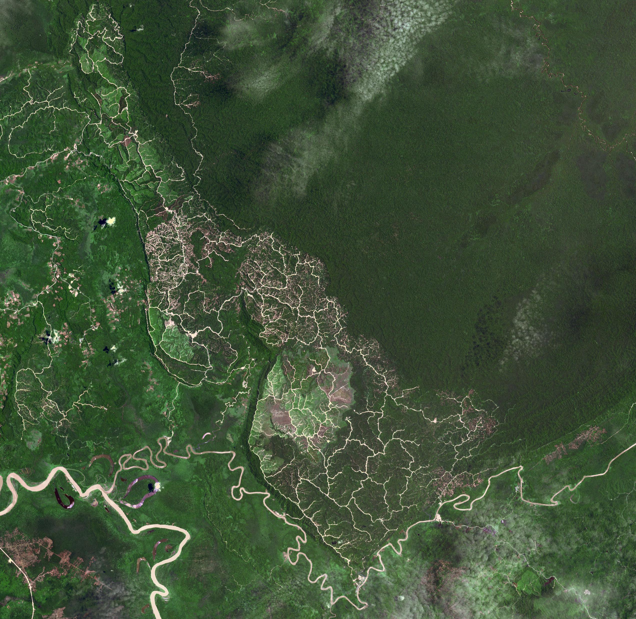
2017-10-31 |
Earth
|
Terra
|
ASTER
|
2302x2601x3 |
|
-
PIA22019:
-
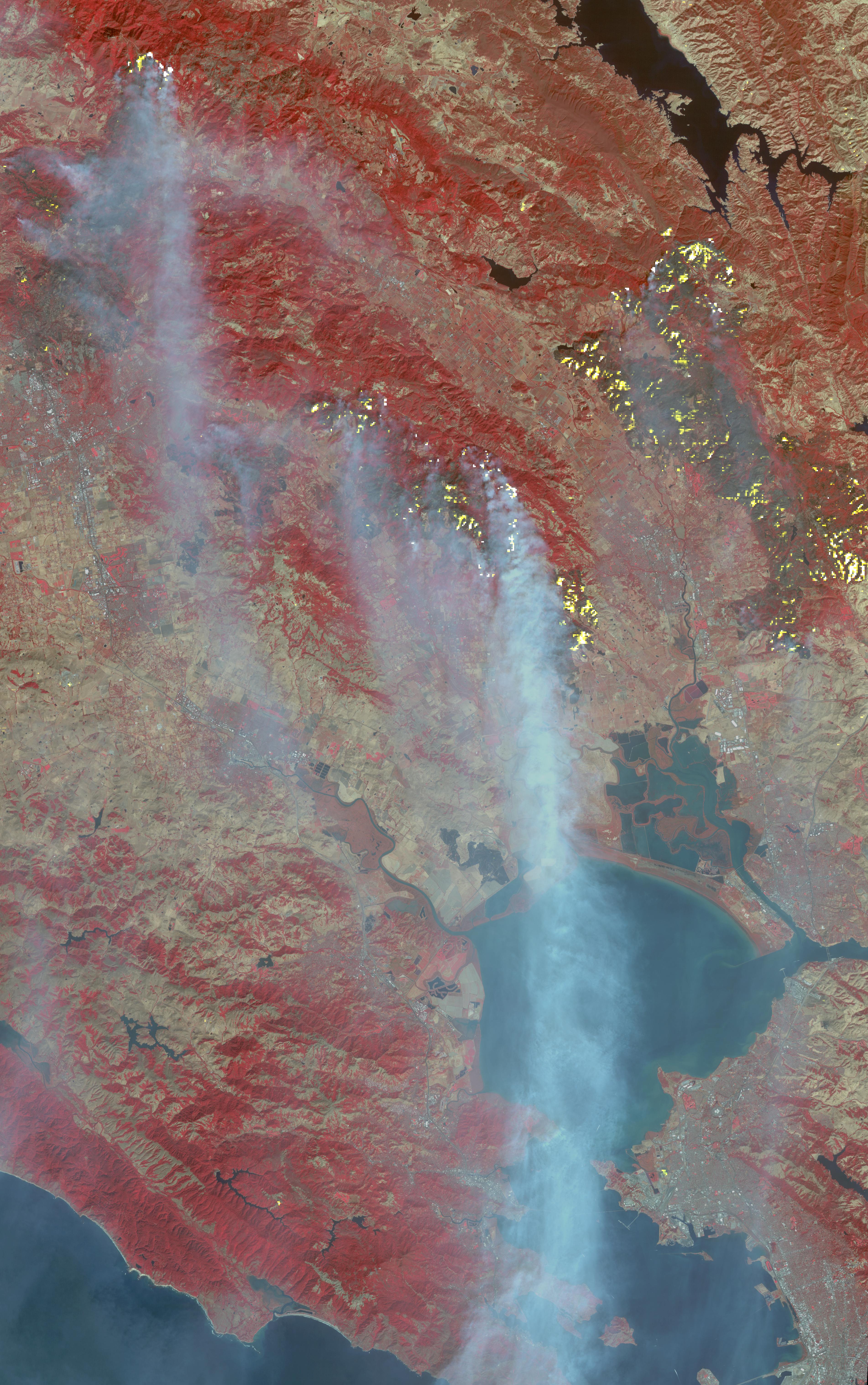
Northern California Fires
Full Resolution:
TIFF
(17.97 MB)
JPEG
(1.463 MB)
|
|
|
2017-10-31 |
Earth
|
Terra
|
ASTER
|
2543x2473x3 |
|
-
PIA22034:
-
Brunei-Sarawak Border
Full Resolution:
TIFF
(18.87 MB)
JPEG
(1.178 MB)
|
|
|
2017-10-31 |
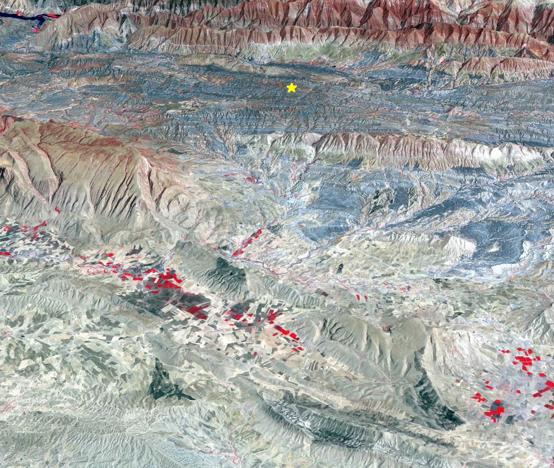
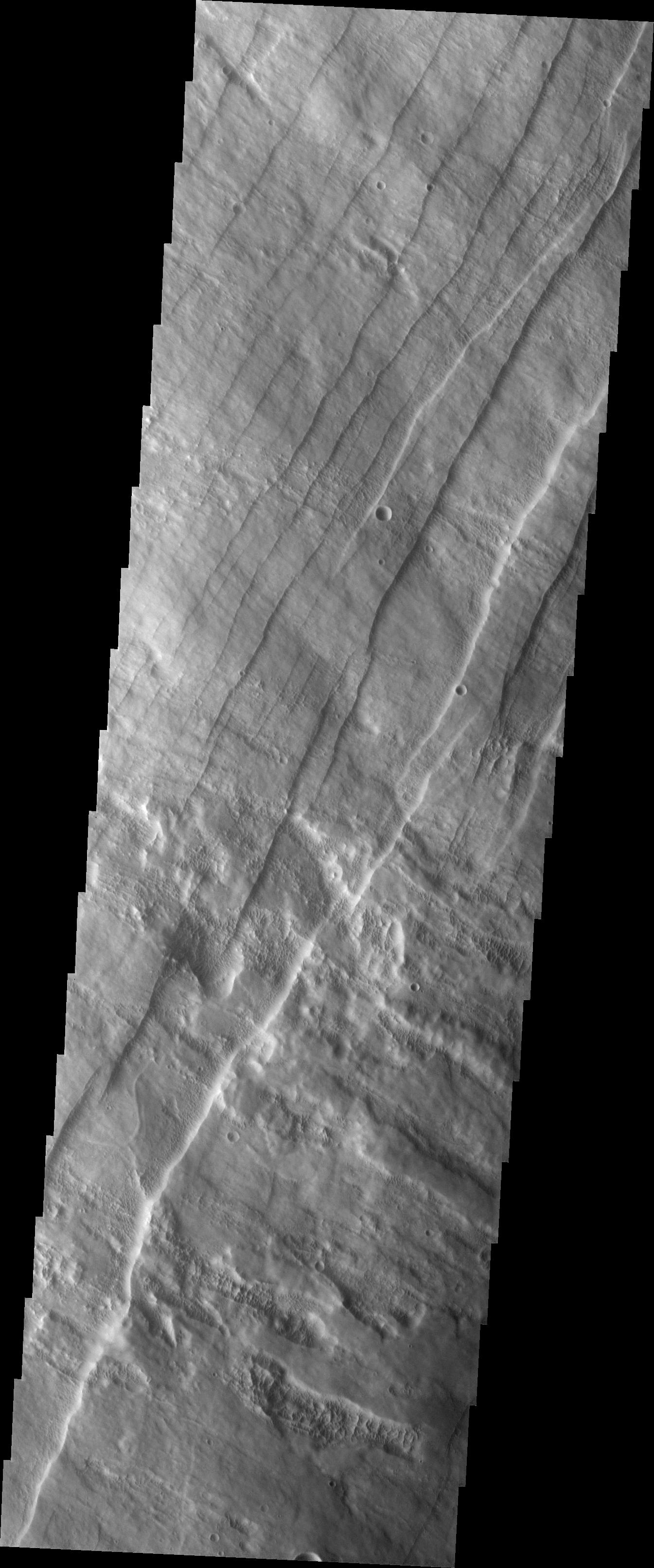
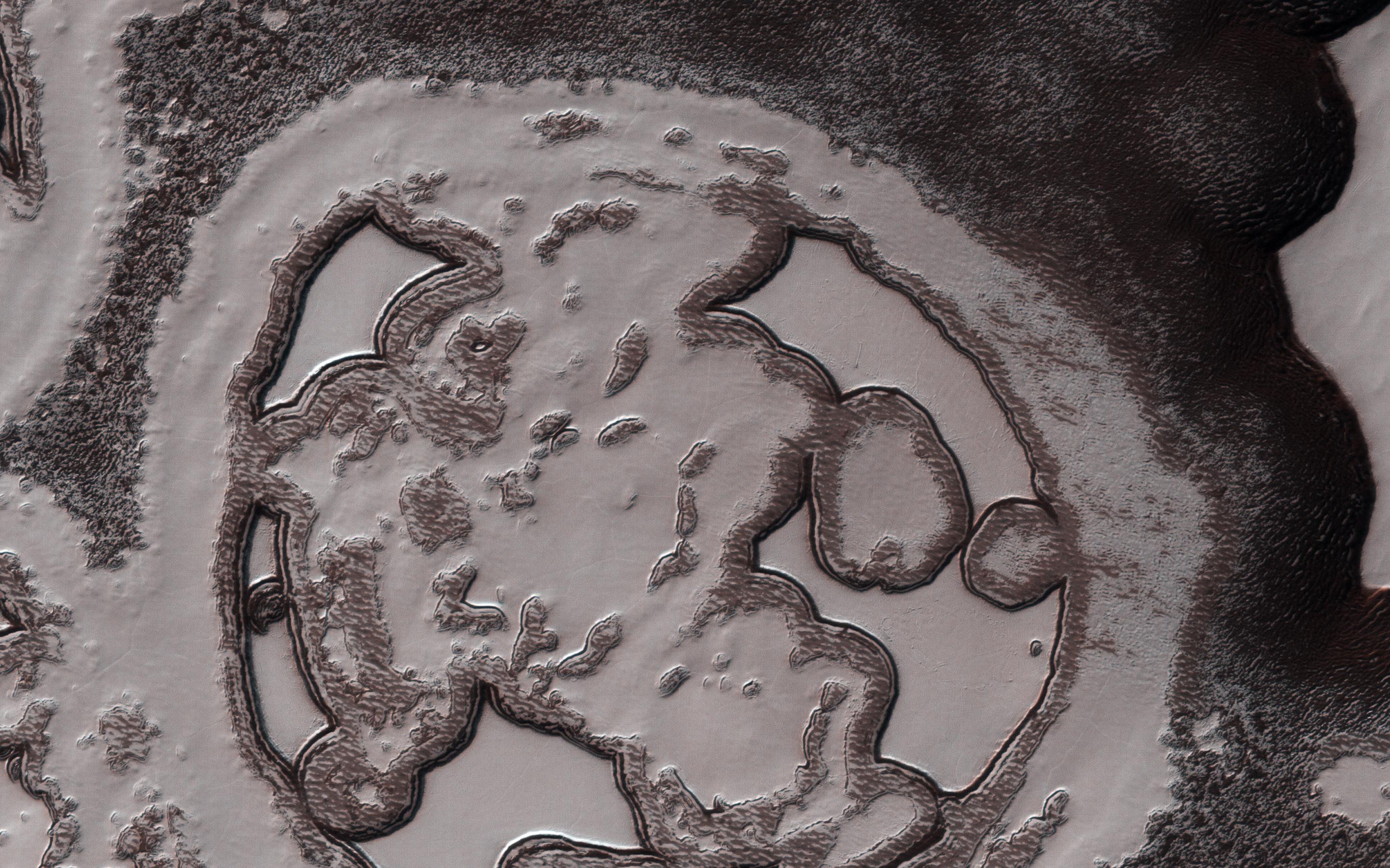
Mars
|
2001 Mars Odyssey
|
THEMIS
|
1345x3222x1 |
|
-
PIA22017:
-
Investigating Mars: Pavonis Mons
Full Resolution:
TIFF
(3.249 MB)
JPEG
(380.1 kB)
|
|
|
2017-10-23 |
Earth
|
Terra
|
ASTER
|
4098x4175x3 |
|
-
PIA22049:
-
Impact of Northern California Fires Seen in New NASA Satellite Image
Full Resolution:
TIFF
(51.36 MB)
JPEG
(3.573 MB)
|
|
|
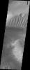
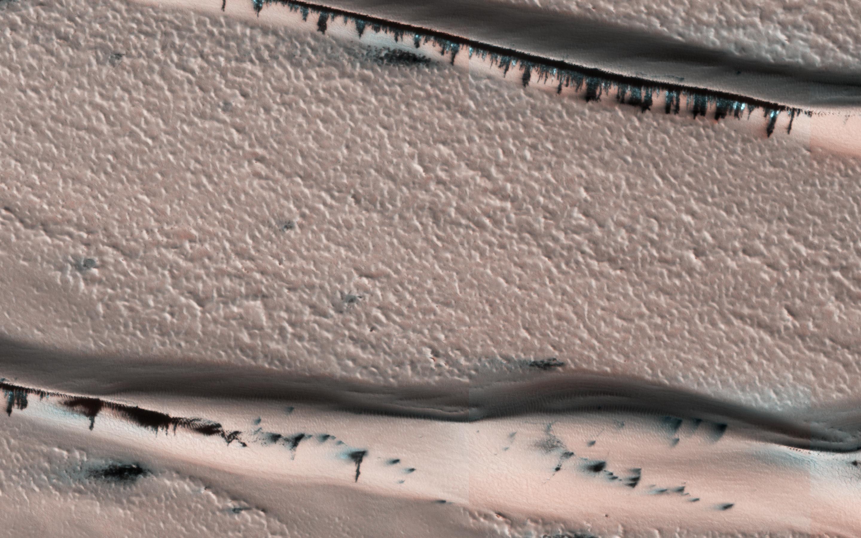
2017-10-23 |
Mars
|
Mars Reconnaissance Orbiter (MRO)
|
HiRISE
|
2880x1800x3 |
|
-
PIA22053:
-
Defrosting Dunes within Chasma Boreale
Full Resolution:
TIFF
(14.4 MB)
JPEG
(610.2 kB)
|
|
|
2017-10-18 |
Earth
|
ARIA
|
|
2041x2471x3 |
|
-
PIA22048:
-
NASA Damage Map Aids Northern California Wildfire Response
Full Resolution:
TIFF
(11.3 MB)
JPEG
(920.9 kB)
|
|
|
2017-10-16 |
S Rings
|
Cassini-Huygens
|
UVIS
|
450x450x3 |
|
-
PIA21899:
-
Polar Lights at Saturn Bid Cassini Farewell
Full Resolution:
TIFF
(412.9 kB)
JPEG
(27.56 kB)
|
|
|
2017-10-13 |
Earth
|
Terra
|
ASTER
|
3804x6066x3 |

|
-
PIA22046:
-
Destructive Northern California Fires Seen in New NASA Satellite Image
Full Resolution:
TIFF
(58.82 MB)
JPEG
(2.965 MB)
|
|
|
2017-10-09 |
Earth
|
Terra
|
ASTER
|
1368x897x3 |
|
-
PIA22044:
-
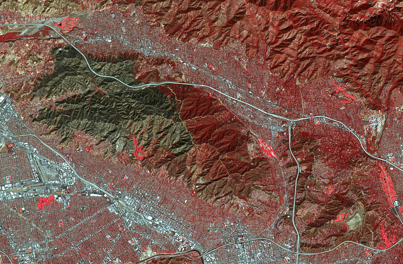
Scar from One of Los Angeles' Biggest Wildfires Imaged by NASA Satellite
Full Resolution:
TIFF
(3.683 MB)
JPEG
(414.8 kB)
|
|
|
2017-10-09 |
Sol (our sun)
|
SDO
|
Atmosphere Imaging Assembly
|
1650x1650x3 |
|
-
PIA22039:
-
Dynamic Duo
Full Resolution:
TIFF
(7.304 MB)
JPEG
(242.3 kB)
|
|
|
2017-10-06 |
Earth
|
Terra
|
ASTER
|
471x301x1 |
|
-
PIA22045:
-
Simmering Vanuatu Volcano Imaged by NASA Satellite
Full Resolution:
TIFF
(99.99 kB)
JPEG
(22.78 kB)
|
|
|
2017-10-02 |
Earth
|
Terra
|
ASTER
|
2670x3669x3 |

|
-
PIA21997:
-
Northwest Angle, Minnesota
Full Resolution:
TIFF
(25.31 MB)
JPEG
(989.1 kB)
|
|
|
2017-09-29 |
Earth
|
ARIA
|
|
2206x2112x3 |

|
-
PIA22037:
-
Dominica Hurricane Damage Mapped by NASA's ARIA Team
Full Resolution:
TIFF
(9.583 MB)
JPEG
(474.4 kB)
|
|
|
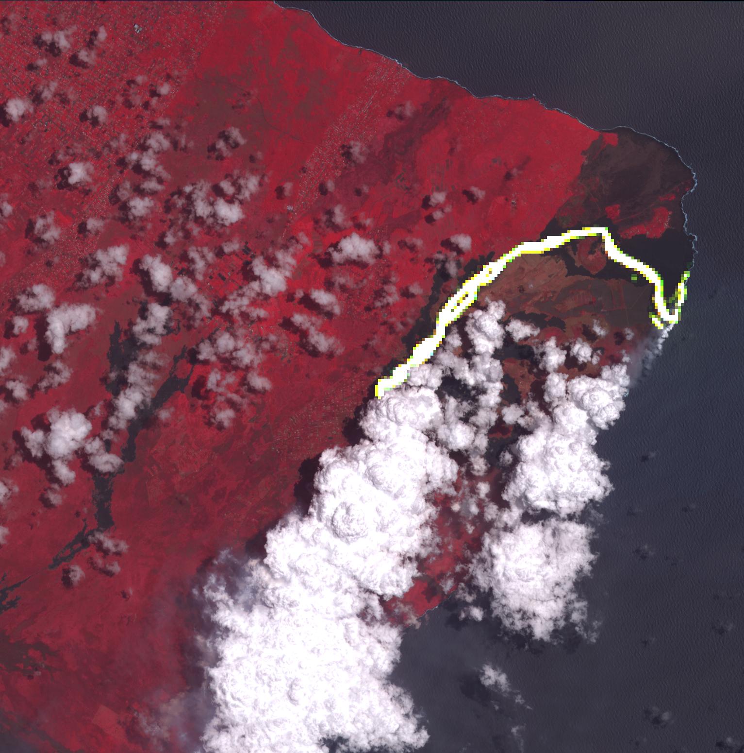
2017-09-28 |
Jupiter
|
Juno
|
JunoCam
|
16000x2952x3 |
|
-
PIA21967:
95 Minutes Over Jupiter
Full Resolution:
TIFF
(80.97 MB)
JPEG
(3.129 MB)
|
|
|
2017-09-26 |
Earth
|
ARIA
|
|
1600x900x3 |

|
-
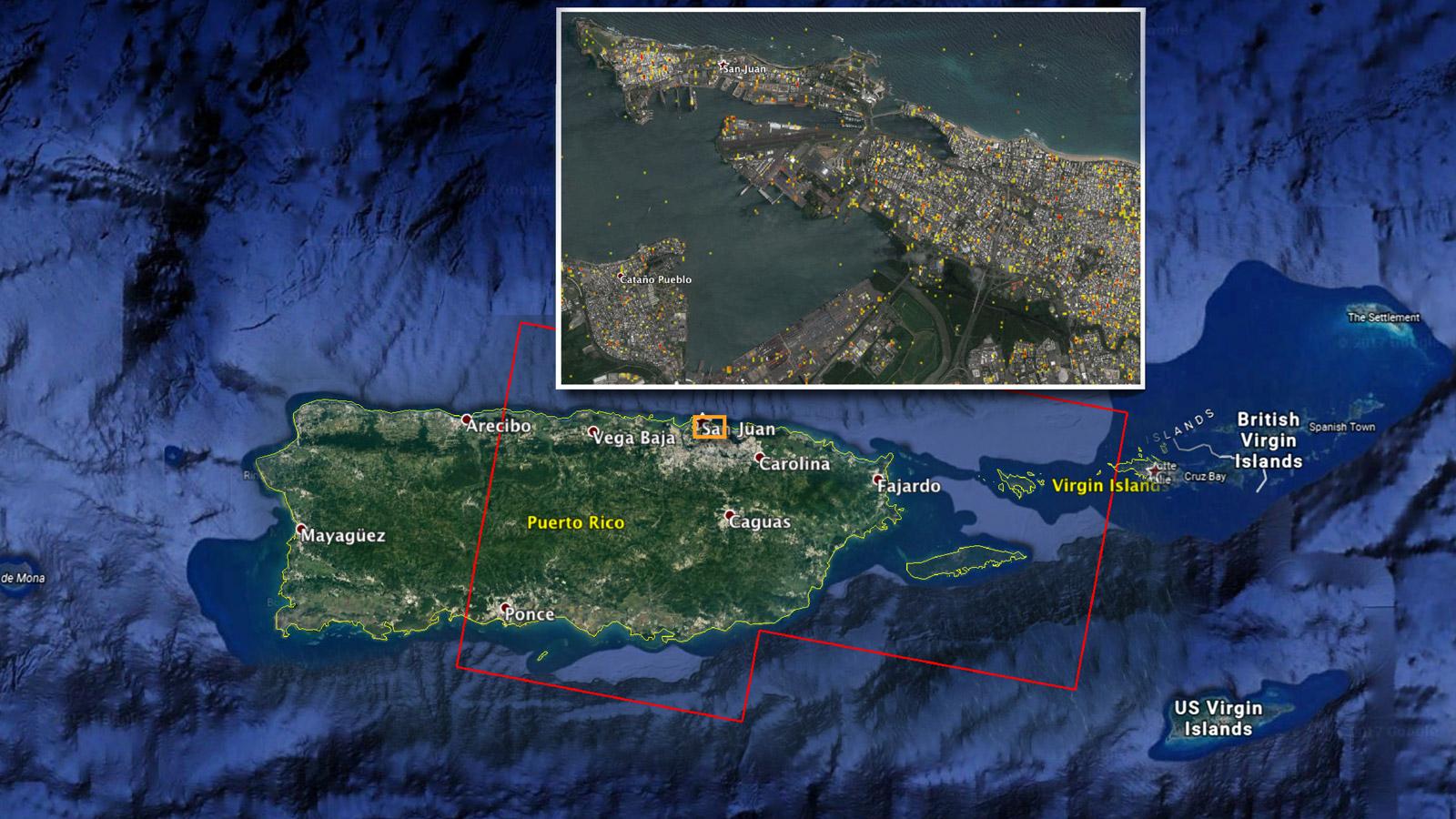
PIA21964:
-
NASA Damage Map Aids FEMA's Hurricane Maria Rescue Operation in Puerto Rico
Full Resolution:
TIFF
(4.322 MB)
JPEG
(223.4 kB)
|
|
|
2017-09-20 |
Earth
|
ARIA
|
|
2512x2290x3 |
|
-
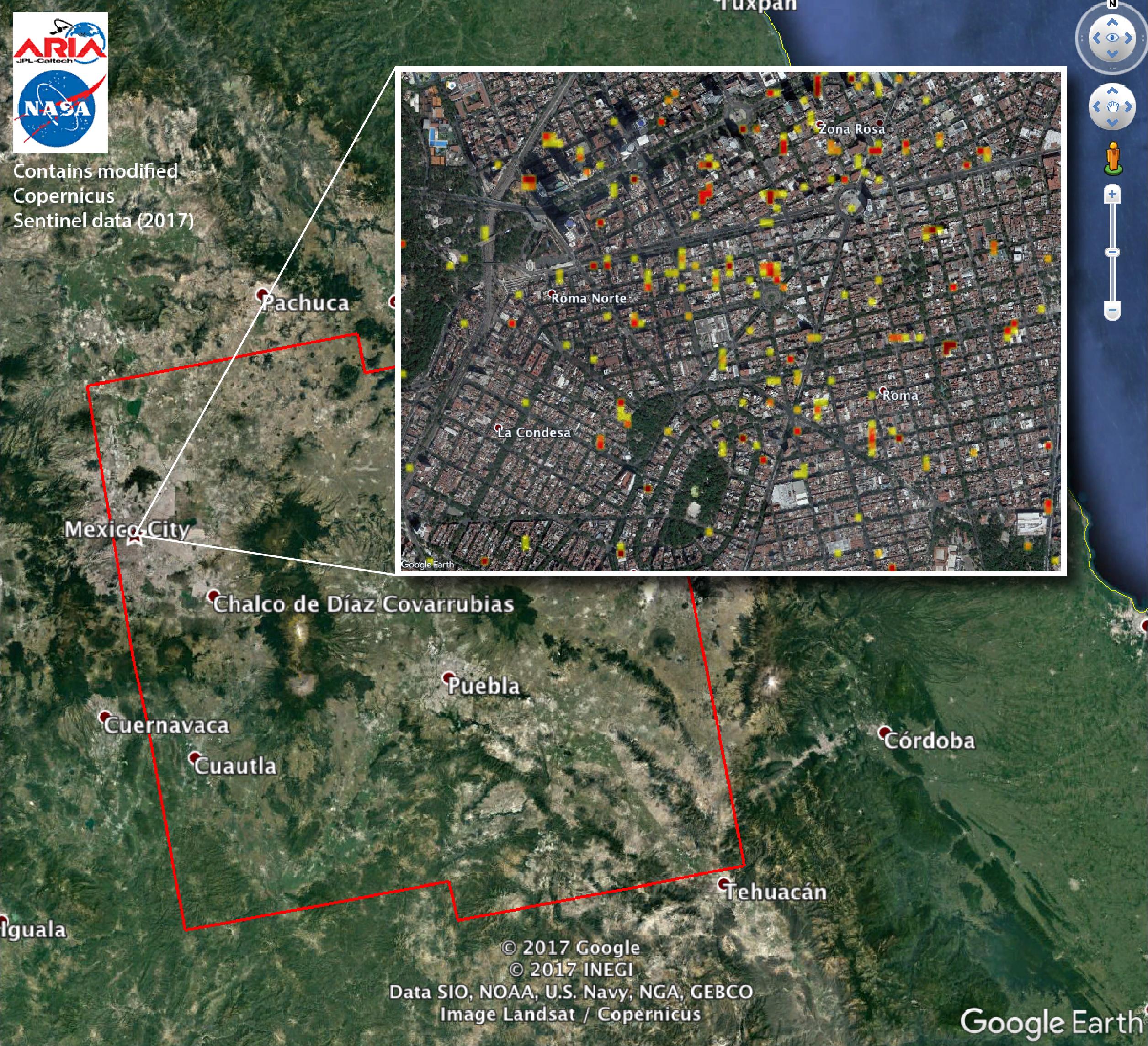
PIA21963:
-
Satellite Radar Detects Damage from Sept. 19, 2017 Raboso, Mexico, Quake
Full Resolution:
TIFF
(16.67 MB)
JPEG
(1.194 MB)
|
|
|
2017-09-20 |
Earth
|
ARIA
|
|
1860x1896x3 |
|
-
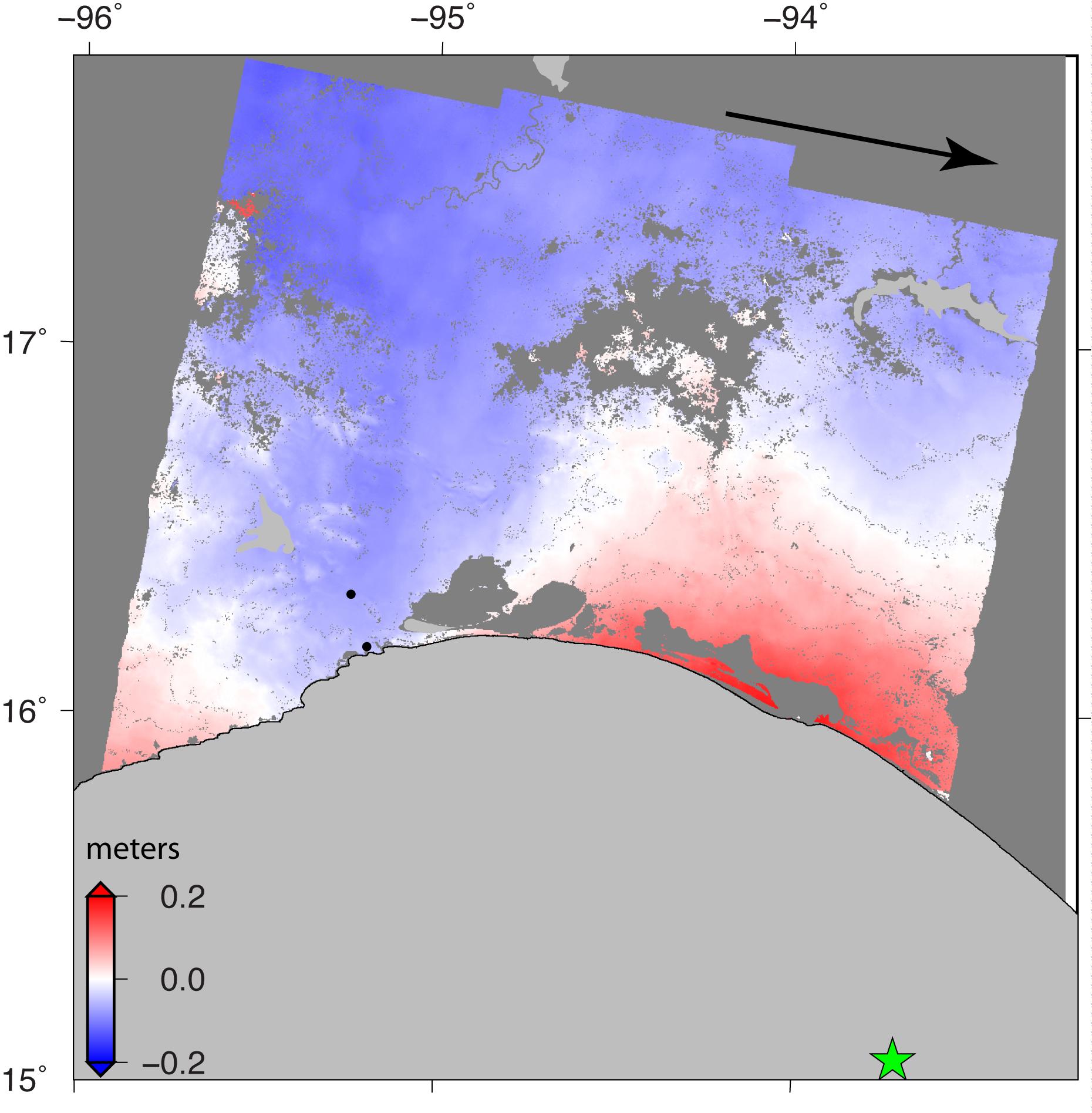
PIA21962:
-
Sentinel-1 Radar Shows Ground Motion From Sept. 2017 Oaxaca-Chiapas, Mexico Quake
Full Resolution:
TIFF
(2.292 MB)
JPEG
(259.6 kB)
|
|
|
2017-09-19 |
Earth
|
ARIA
|
|
3174x2707x3 |

|
-
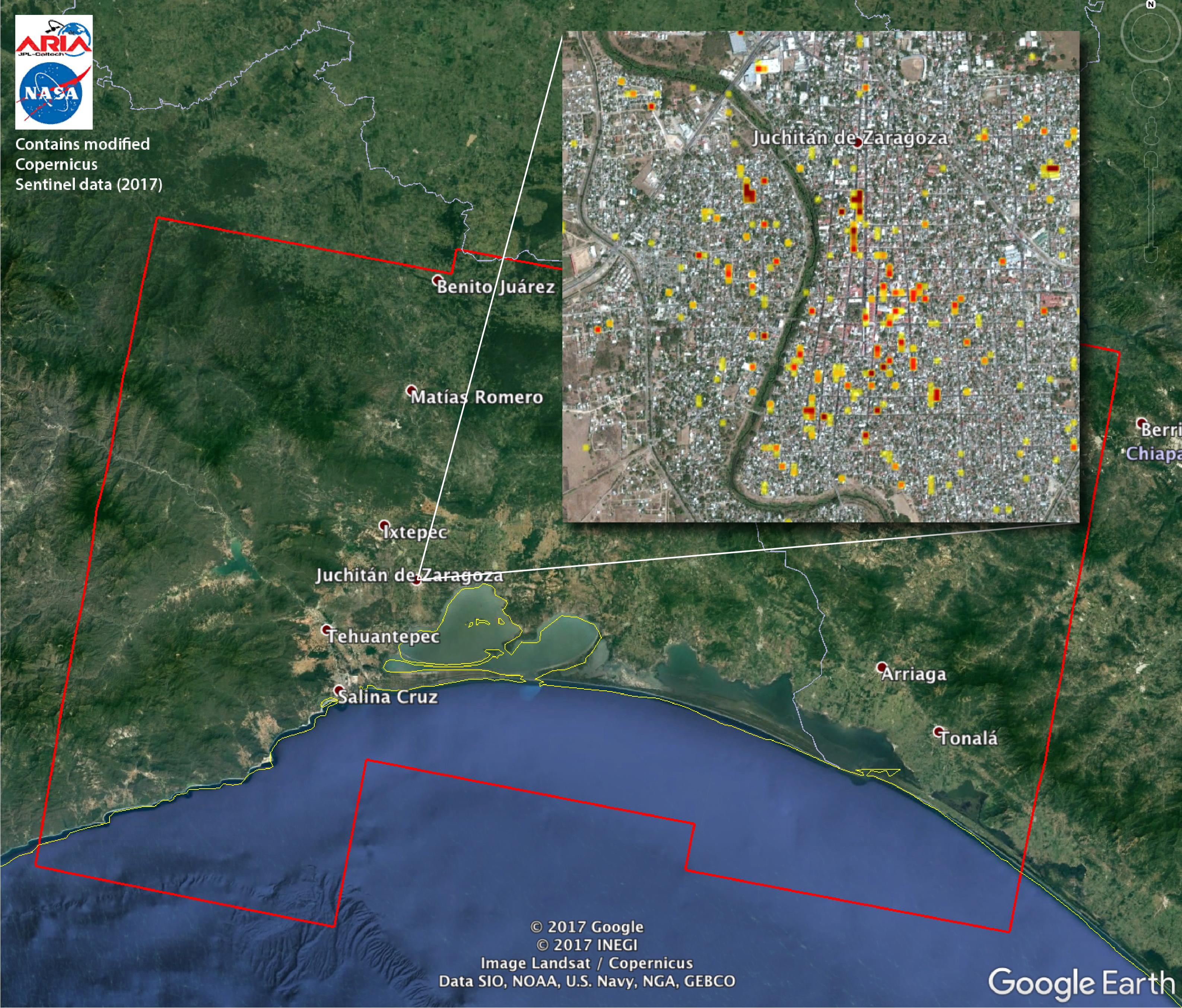
PIA21956:
-
Satellite Radar Detects Damage from Sept. 2017 Chiapas, Mexico Quake
Full Resolution:
TIFF
(22.41 MB)
JPEG
(1.302 MB)
|
|
|
2017-09-18 |
Earth
|
Terra
|
ASTER
|
1228x894x3 |
|
-
PIA21986:
-
Westland, The Netherlands
Full Resolution:
TIFF
(3.295 MB)
JPEG
(232 kB)
|
|
|
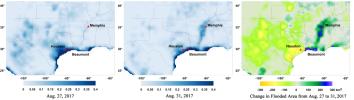
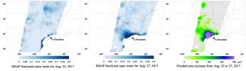
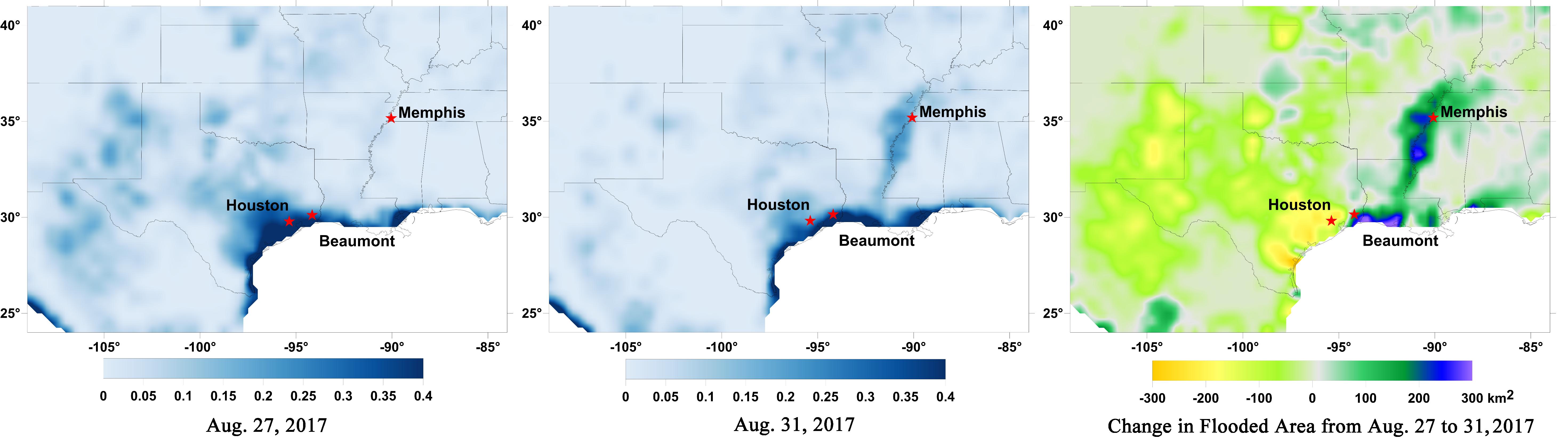
2017-09-13 |
Earth
|
SMAP
|
|
5882x1662x3 |
|
-
PIA21951:
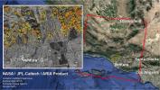
New NASA Maps Show Flooding Changes In Aftermath of Hurricane Harvey
Full Resolution:
TIFF
(9.019 MB)
JPEG
(552 kB)
|
|
|
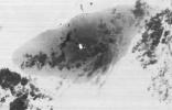
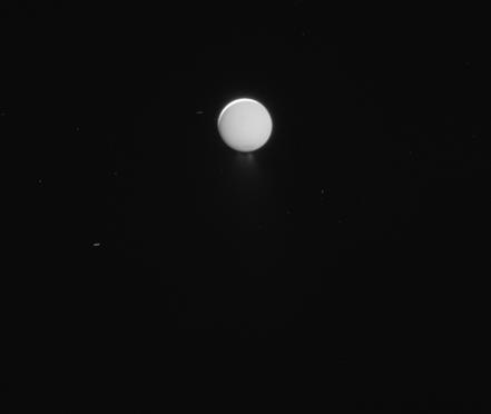
2017-09-08 |
Enceladus
|
Cassini-Huygens
|
ISS - Narrow Angle
|
441x372x1 |
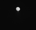
|
-
PIA21887:
-
Last Enceladus Plume Observation
Full Resolution:
TIFF
(59.67 kB)
JPEG
(2.996 kB)
|
|
|
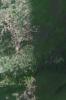
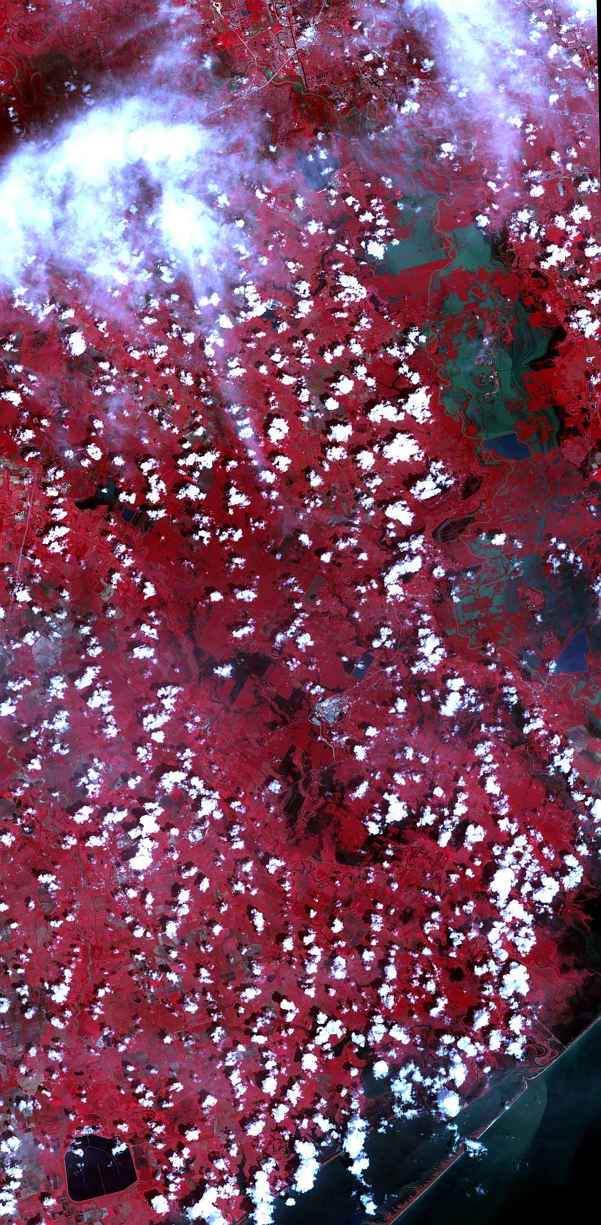
2017-09-05 |
Earth
|
Terra
|
ASTER
|
876x1786x3 |

|
-
PIA21940:
-
Hurricane Harvey Flooding Seen in New NASA Satellite Image
Full Resolution:
TIFF
(4.695 MB)
JPEG
(441 kB)
|
|
|
2017-09-04 |
Mars
|
Mars Reconnaissance Orbiter (MRO)
|
HiRISE
|
2880x1800x3 |
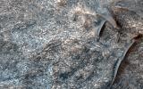
|
-
PIA21935:
-
Mixtures of Sulfates in Melas Chasma
Full Resolution:
TIFF
(15.56 MB)
JPEG
(1.154 MB)
|
|
|
2017-08-30 |
Earth
|
SMAP
|
|
11811x3410x3 |
|
-
PIA21930:
-
Surface Flooding from Hurricane Harvey Shown in New SMAP Imagery
Full Resolution:
TIFF
(13.21 MB)
JPEG
(1.489 MB)
|
|
|
2017-08-29 |
Earth
|
Terra
|
ASTER
|
1809x2754x3 |
|
-
PIA21826:
-
Belize-Guatemala Border
Full Resolution:
TIFF
(14.95 MB)
JPEG
(826.9 kB)
|
|
|
2017-08-24 |
Earth
|
Terra
|
ASTER
|
2118x2659x3 |
|
-
PIA21879:
-
Oregon Wildfire Captured in NASA Satellite Image
Full Resolution:
TIFF
(11.97 MB)
JPEG
(676.7 kB)
|
|
|
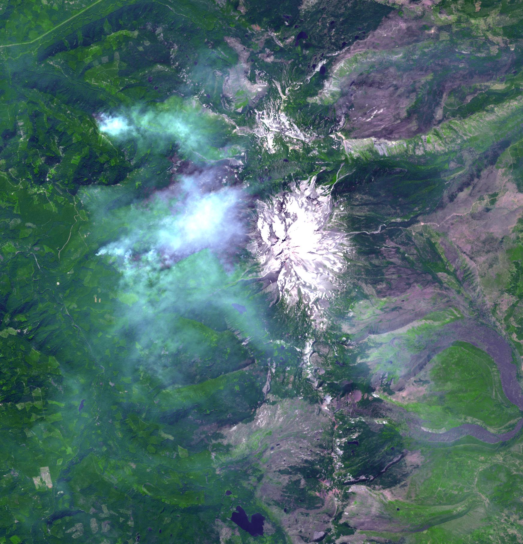
2017-08-22 |
Earth
|
Terra
|
ASTER
|
1577x1294x3 |
|
-
PIA21878:
-
NASA Satellite Images Erupting Russian Volcano
Full Resolution:
TIFF
(2.775 MB)
JPEG
(164.4 kB)
|
|
|
2017-08-21 |
Mars
|
Mars Reconnaissance Orbiter (MRO)
|
HiRISE
|
2880x1800x3 |
|
-
PIA21880:
-
Patterns Unique, Yet Familiar
Full Resolution:
TIFF
(15 MB)
JPEG
(835.4 kB)
|
|
|
2017-08-21 |
Earth
|
Terra
|
ASTER
|
1745x1813x3 |
|
-
PIA21877:
-
Oregon Wildfire in Eclipse Zone Imaged by NASA Satellite
Full Resolution:
TIFF
(9.495 MB)
JPEG
(490.3 kB)
|
 Planetary Data System


