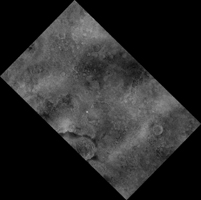
Map Projected Browse Image
Click on image for larger versionIt's spring in the Northern Hemisphere of Mars (when this image was taken), and this area was recently completely covered by the seasonal frost cap. Here, we see polygonal patterns that are highlighted by carbon dioxide frost that has not entirely sublimed away.
These organized patterns are likely caused by differences in the soil (regolith) characteristics such as grain size, density, even grain-shape and orientation in the underlying landforms and geologic materials. Variations in these characteristics strongly influence the strength of the ice-rich permafrost. This gives a preferred orientation to the stress field that produces the polygonal patterns.
In this case, there appears to have been a meander in a fluvial channel in which sediments that differ from the native soil were deposited. The physical properties of these sediments probably change near the channel banks where flow rate drops off. Additionally, a high ice content might have resulted from a sediment-rich slurry flow that froze in place. Higher ice content will produce a weaker stress field and larger polygons, more so than just changes in grain size or orientation.
The map is projected here at a scale of 50 centimeters (19.7 inches) per pixel. (The original image scale is 62.8 centimeters [24.7 inches] per pixel [with 2 x 2 binning]; objects on the order of 188 centimeters [74.0 inches] across are resolved.) North is up.
The University of Arizona, in Tucson, operates HiRISE, which was built by Ball Aerospace & Technologies Corp., in Boulder, Colorado. NASA's Jet Propulsion Laboratory, a division of Caltech in Pasadena, California, manages the Mars Reconnaissance Orbiter Project for NASA's Science Mission Directorate, Washington.

