My
List |
Addition Date
|
Target
|
Mission
|
Instrument
|
Size
|

|
2022-06-22 |
Mars
|
2001 Mars Odyssey
|
THEMIS
|
703x1435x3 |
|
-
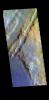
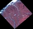
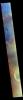
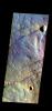
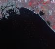
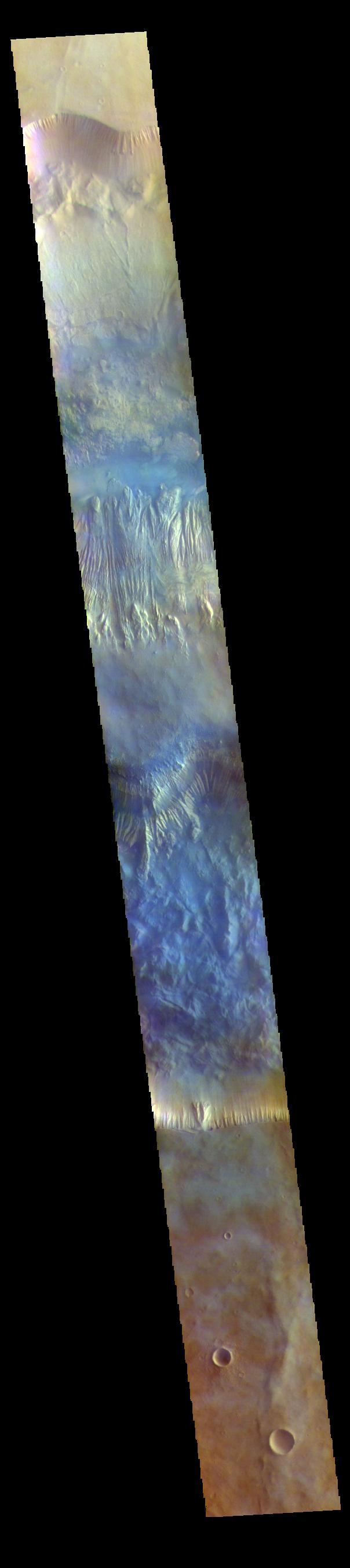
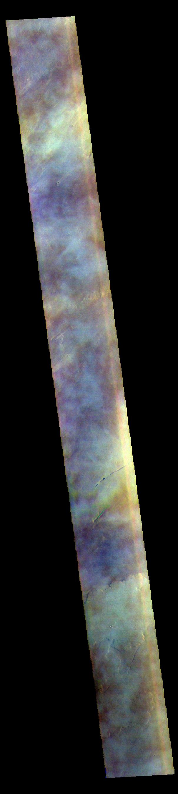
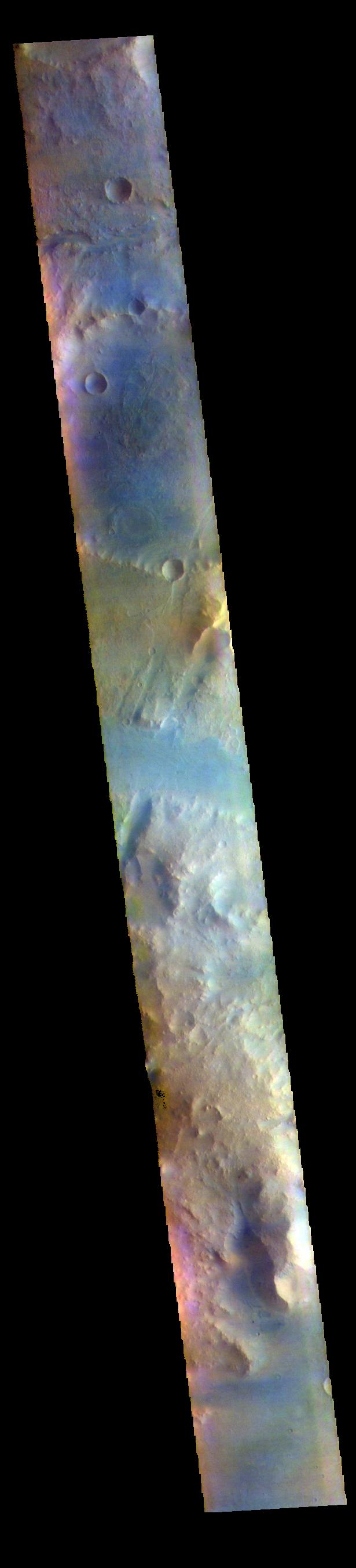
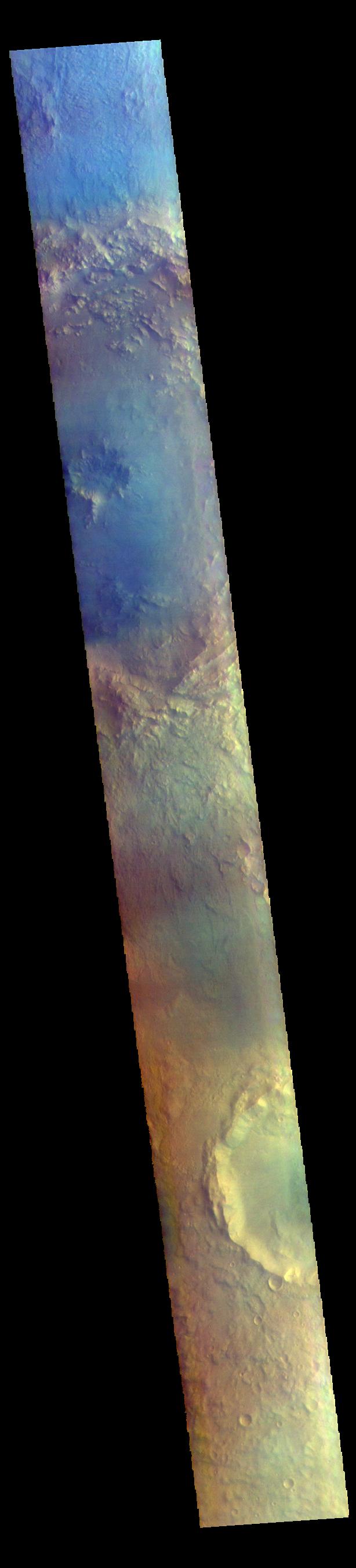
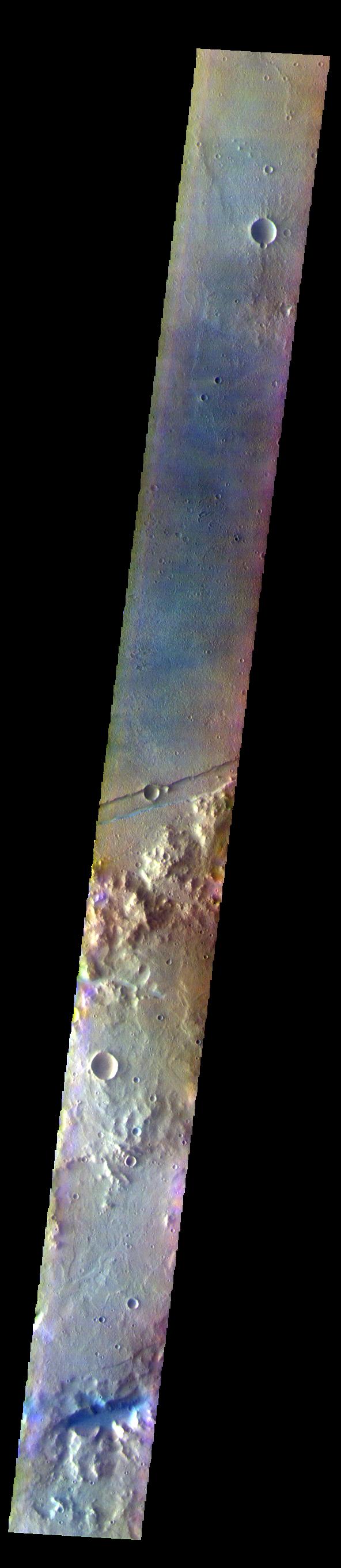
PIA25388:
-
Nili Fossae - False Color
Full Resolution:
TIFF
(2.044 MB)
JPEG
(96.53 kB)
|
|
|
2022-06-21 |
Mars
|
2001 Mars Odyssey
|
THEMIS
|
704x1432x3 |
|
-
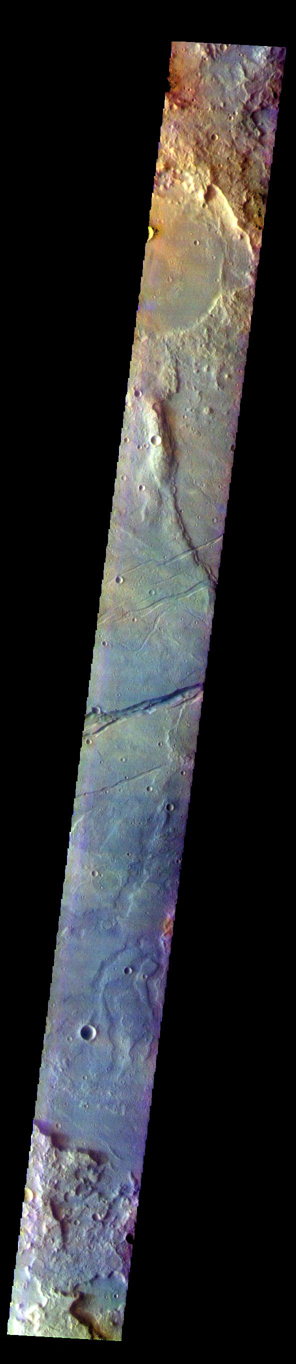
PIA25387:
-
Terra Sabaea - False Color
Full Resolution:
TIFF
(2.07 MB)
JPEG
(104.3 kB)
|
|
|
2022-06-20 |
Mars
|
2001 Mars Odyssey
|
THEMIS
|
719x1458x3 |
|
-
PIA25386:
-
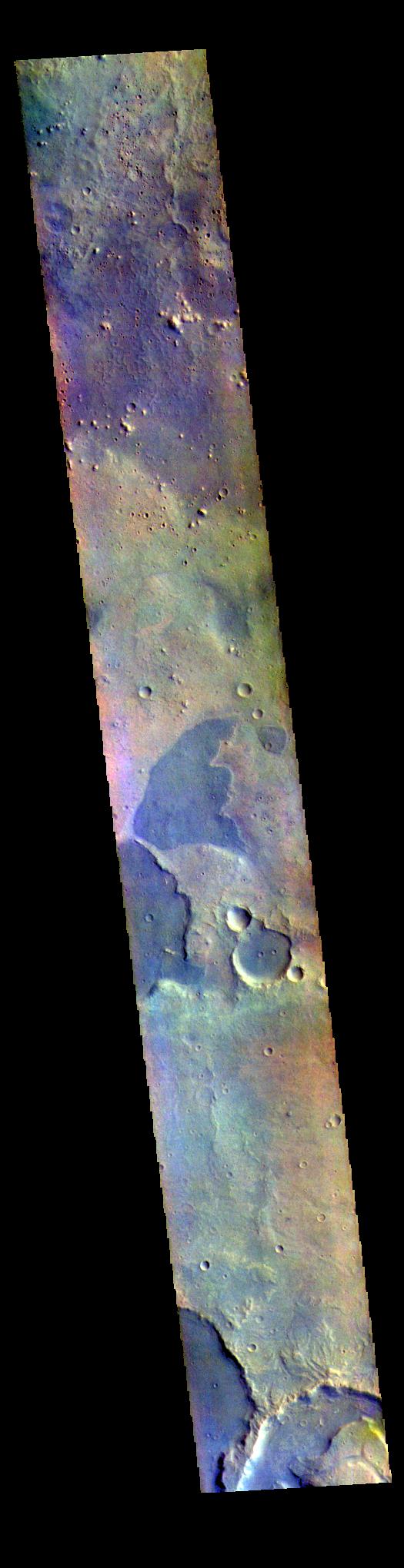
Cydonia Colles - False Color
Full Resolution:
TIFF
(2.1 MB)
JPEG
(105.3 kB)
|
|
|
2022-06-17 |
Mars
|
2001 Mars Odyssey
|
THEMIS
|
607x2711x3 |
|
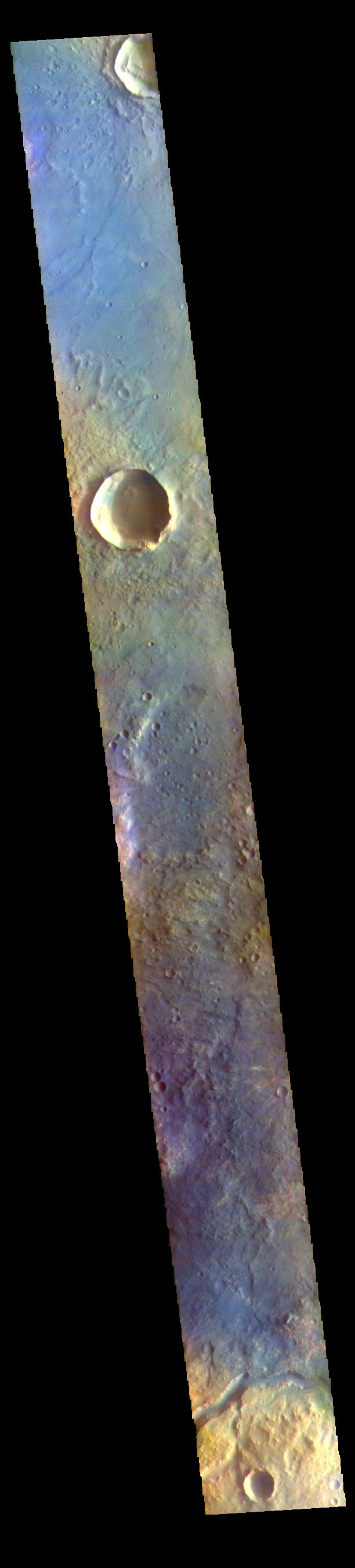
-
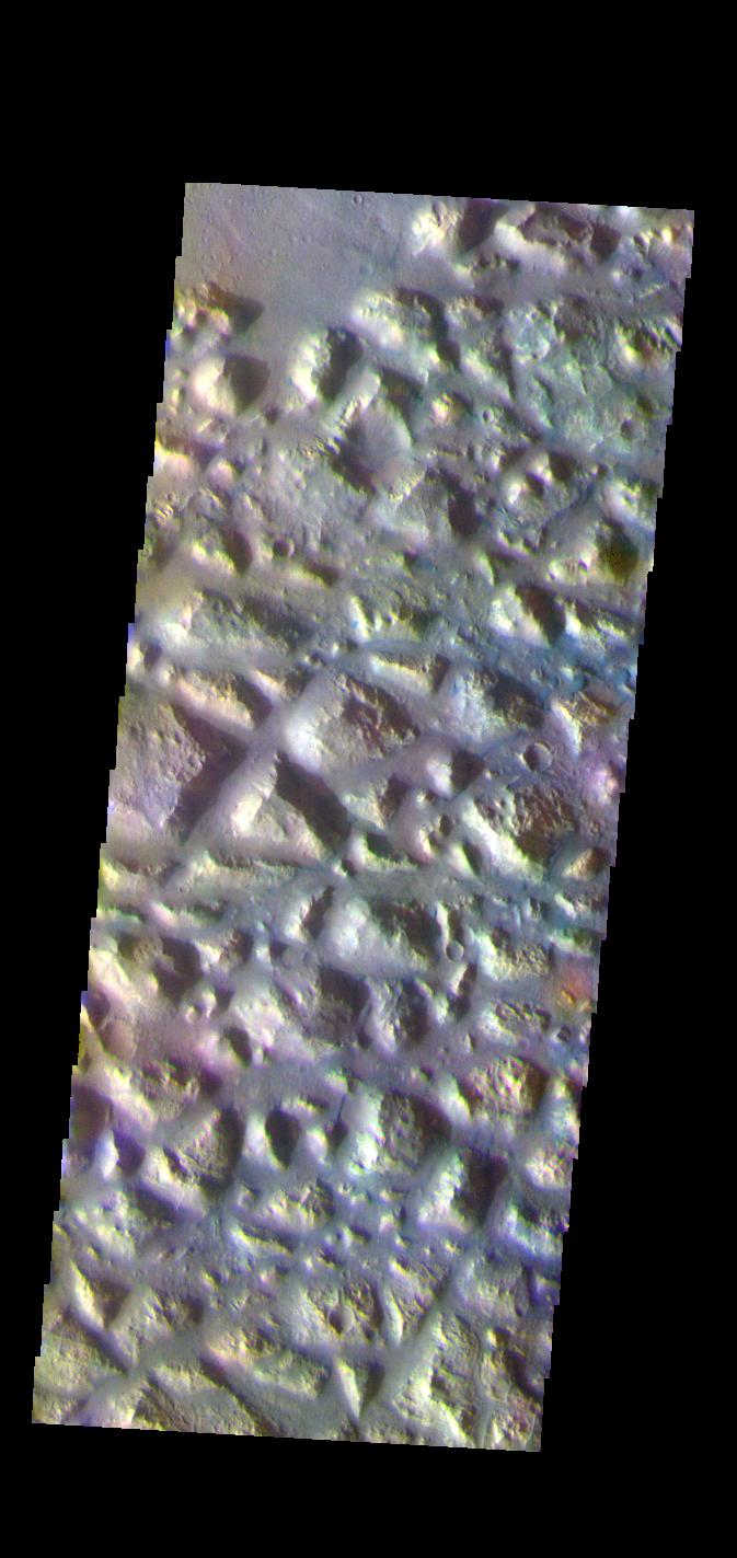
PIA25385:
-
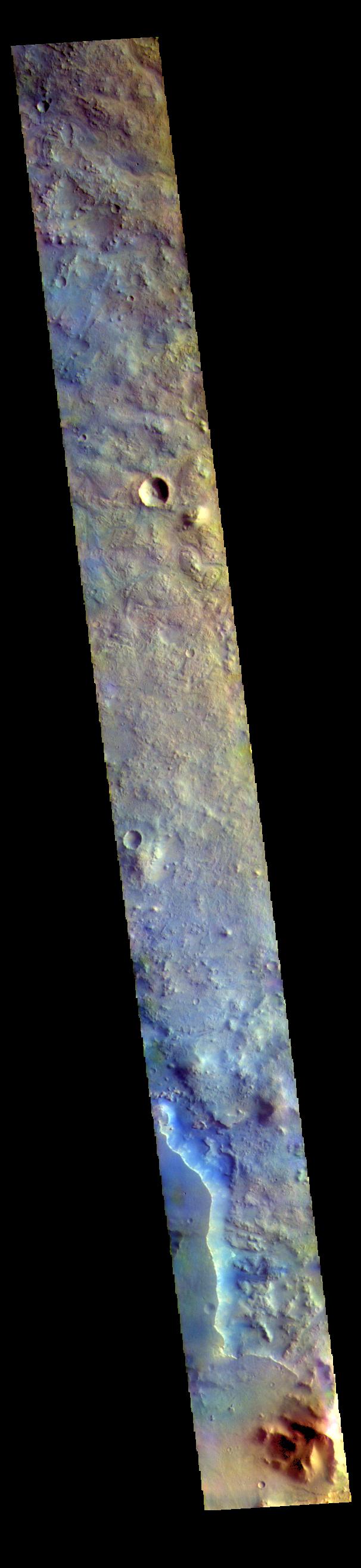
Arabia Terra Crater - False Color
Full Resolution:
TIFF
(2.22 MB)
JPEG
(109.6 kB)
|
|
|
2022-06-16 |
Mars
|
2001 Mars Odyssey
|
THEMIS
|
608x2708x3 |
|
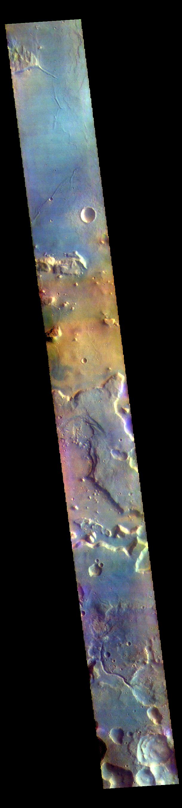
-
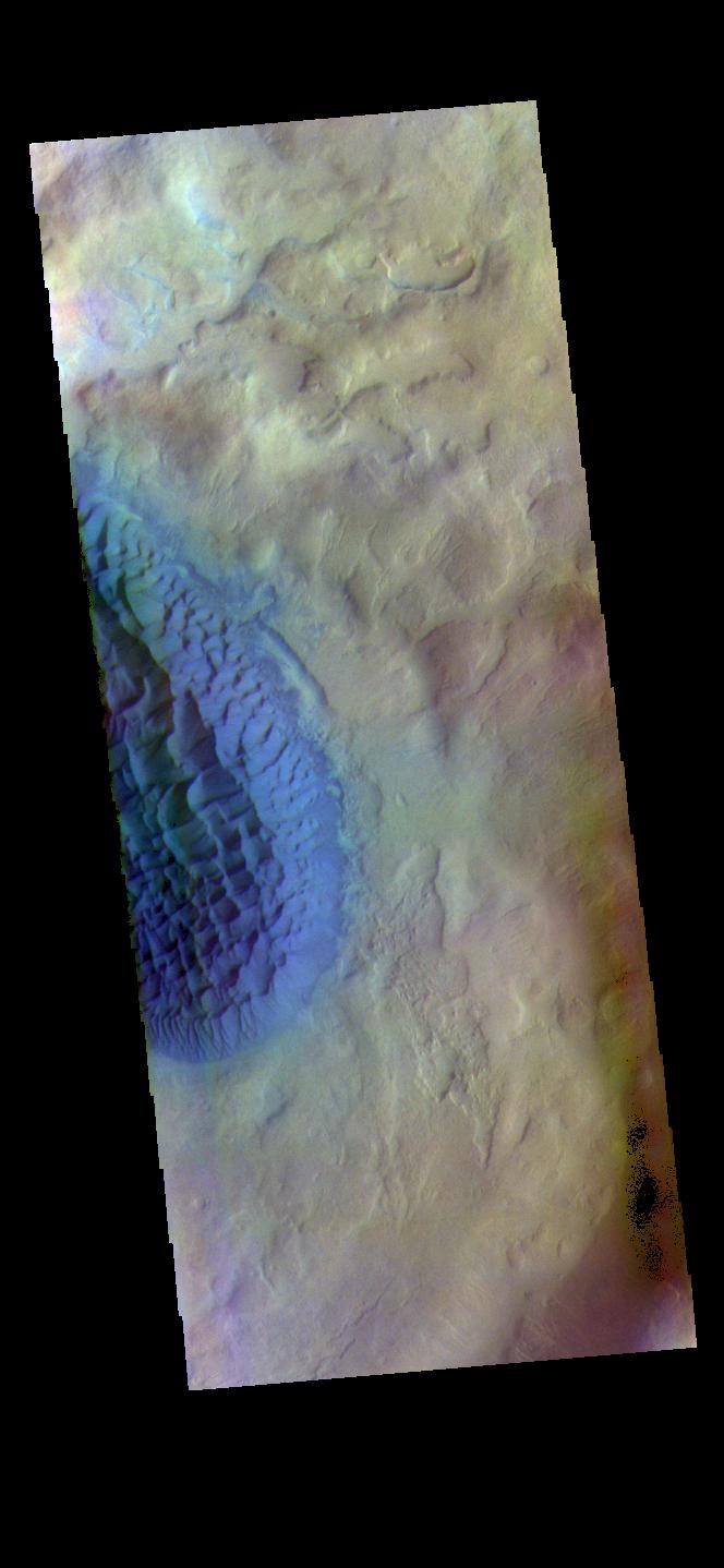
PIA25384:
-
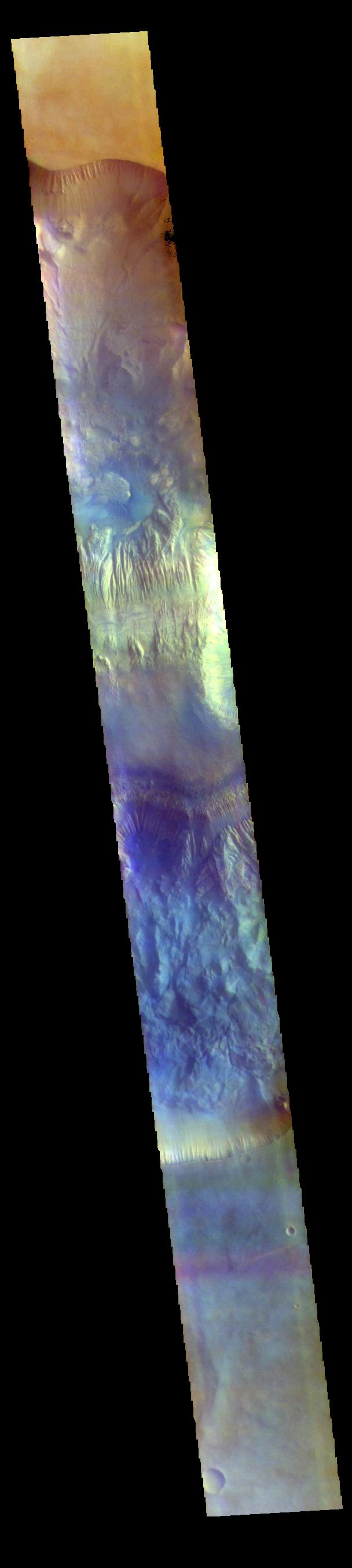
Hebes Chasma - False Color
Full Resolution:
TIFF
(2.204 MB)
JPEG
(99.25 kB)
|
|
|
2022-06-15 |
Mars
|
2001 Mars Odyssey
|
THEMIS
|
606x2710x3 |
|
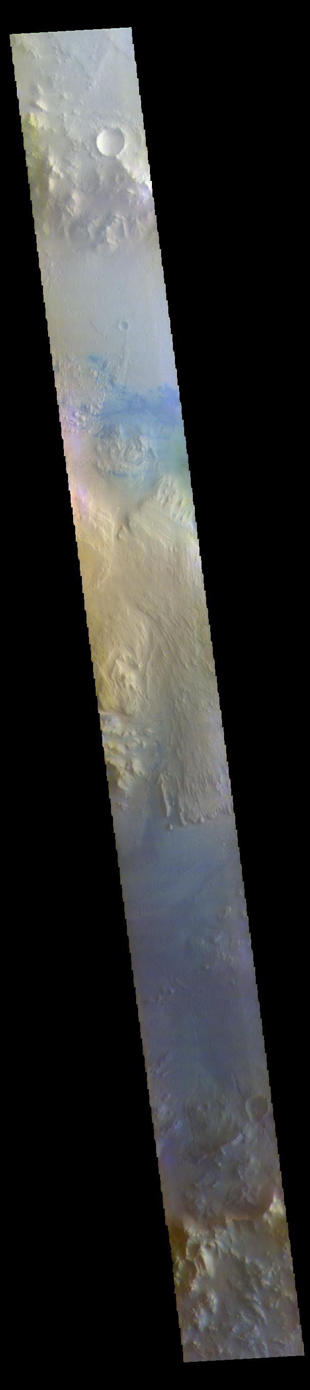
-
PIA25383:
-
Gale Crater - False Color
Full Resolution:
TIFF
(2.131 MB)
JPEG
(93.1 kB)
|
|
|
2022-06-14 |
Mars
|
2001 Mars Odyssey
|
THEMIS
|
693x1428x3 |
|
-
PIA25382:
-
Meridiani Planum - False Color
Full Resolution:
TIFF
(2.012 MB)
JPEG
(114.3 kB)
|
|
|
2022-06-13 |
Mars
|
2001 Mars Odyssey
|
THEMIS
|
525x2040x3 |
|
-
PIA25381:
-
Arabia Terra - False Color
Full Resolution:
TIFF
(1.739 MB)
JPEG
(111.9 kB)
|
|
|
2022-06-10 |
Mars
|
2001 Mars Odyssey
|
THEMIS
|
606x2633x3 |
|
-
PIA25380:
-
Terra Sabaea - False Color
Full Resolution:
TIFF
(2.263 MB)
JPEG
(132.4 kB)
|
|
|
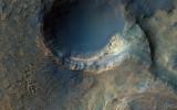
2022-05-26 |
Mars
|
Mars Reconnaissance Orbiter (MRO)
|
HiRISE
|
2880x1800x3 |
|
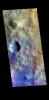
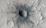
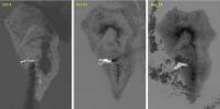
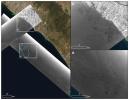
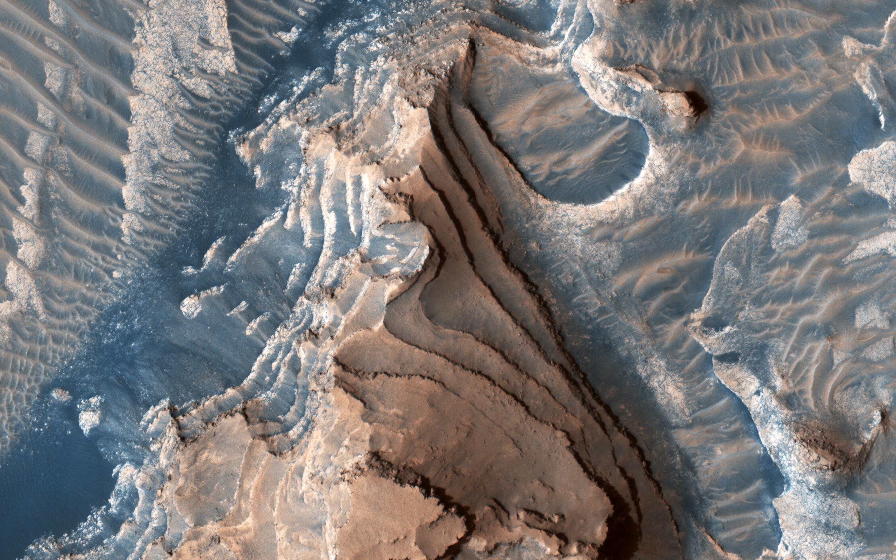
-
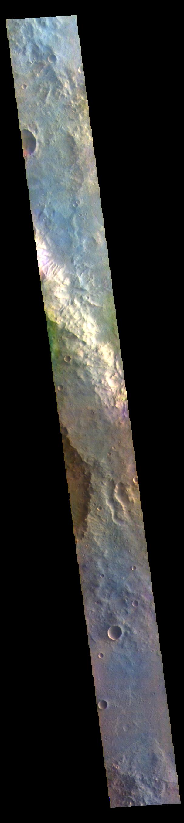
PIA25354:
-
Sedimentary Rocks inside Terby Crater
Full Resolution:
TIFF
(15.56 MB)
JPEG
(900.4 kB)
|
|
|
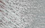
2022-05-26 |
Mars
|
Mars Reconnaissance Orbiter (MRO)
|
HiRISE
|
2880x1800x3 |
|
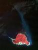
-
PIA25353:
-
Rapid Changes on the North Polar Cap
Full Resolution:
TIFF
(15.56 MB)
JPEG
(1.285 MB)
|
|
|
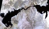
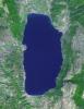
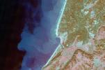
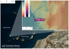
2022-05-26 |
Earth
|
Terra
|
ASTER
|
2326x1369x3 |
|
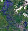
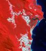
-
PIA25279:
-
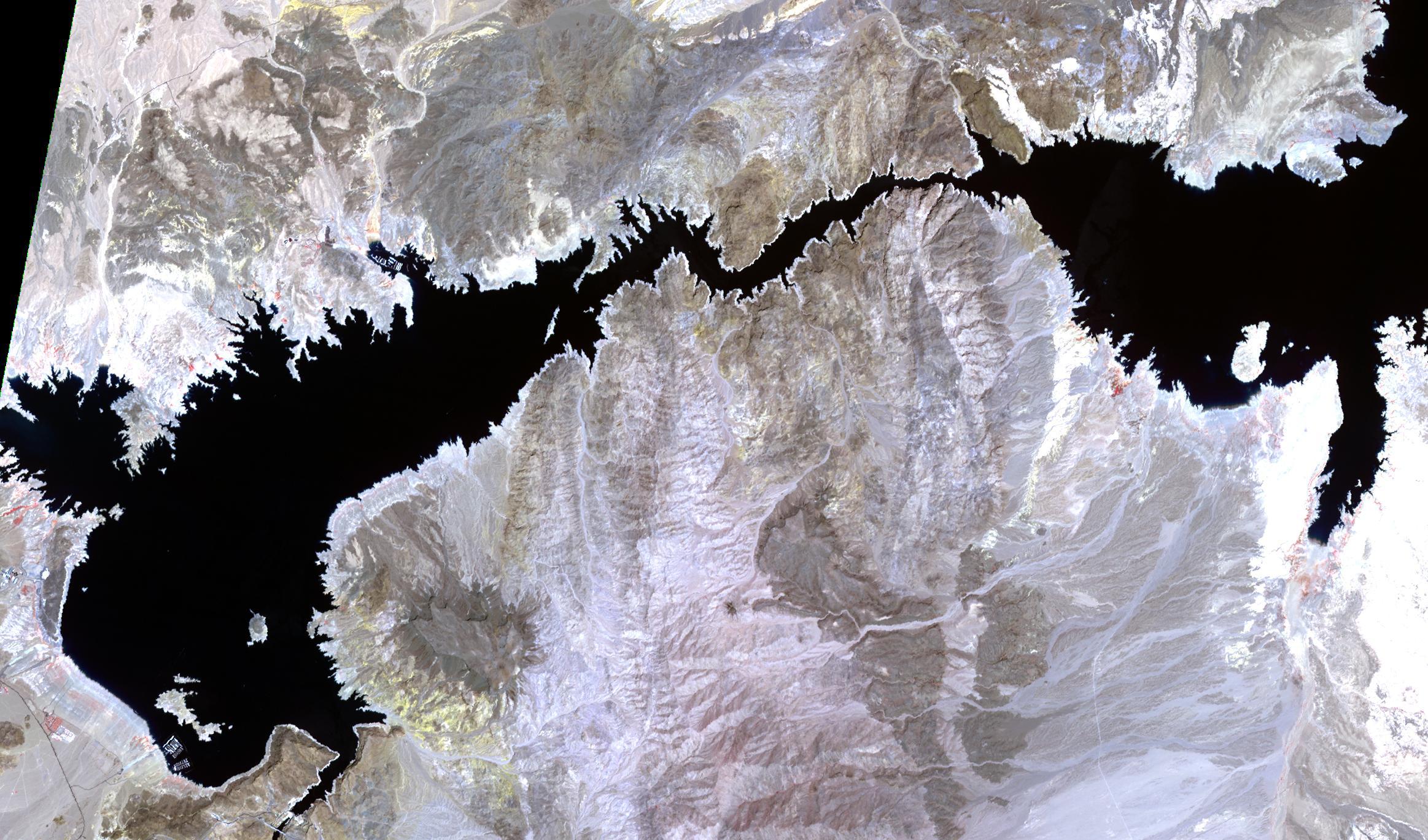
Lake Mead-2022
Full Resolution:
TIFF
(8.796 MB)
JPEG
(538 kB)
|
|
|
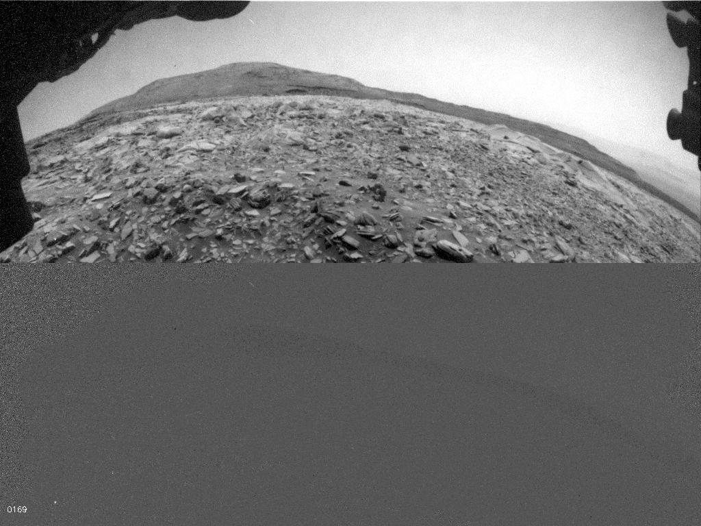
2022-05-18 |
Mars
|
Mars Science Laboratory (MSL)
|
Mastcam
|
7630x2295x3 |
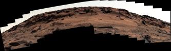
|
-
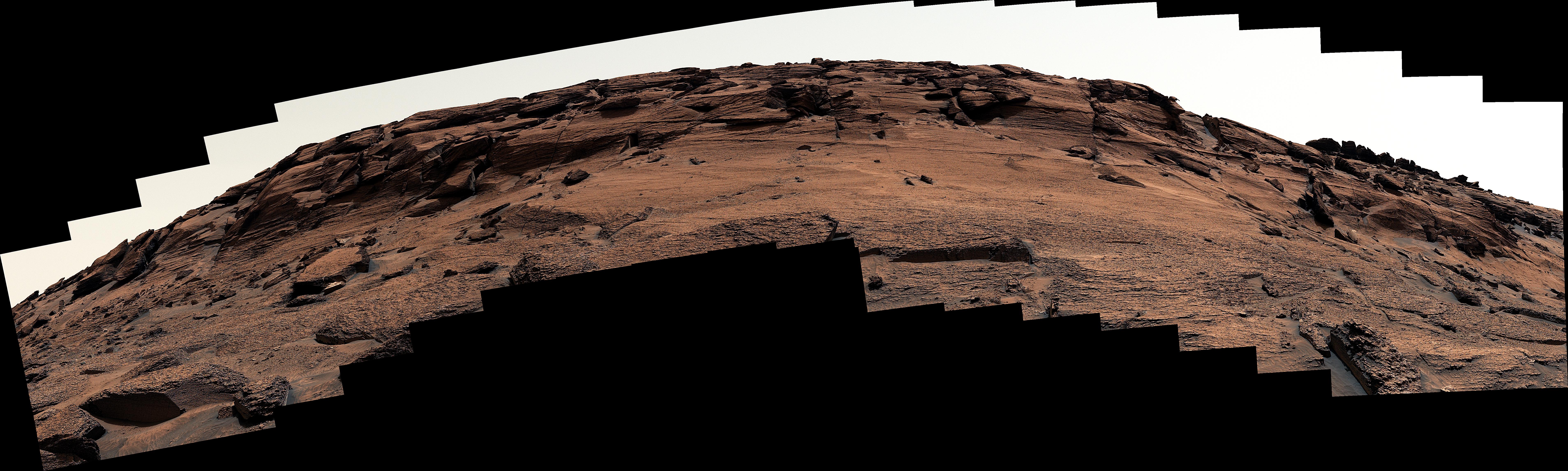
PIA25288:
-
Door-Shaped Fracture Spotted by Curiosity at East Cliffs
Full Resolution:
TIFF
(30.19 MB)
JPEG
(2.872 MB)
|
|
|
2022-05-17 |
Mars
|
InSight
|
|
4801x2700x3 |
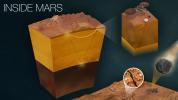
|
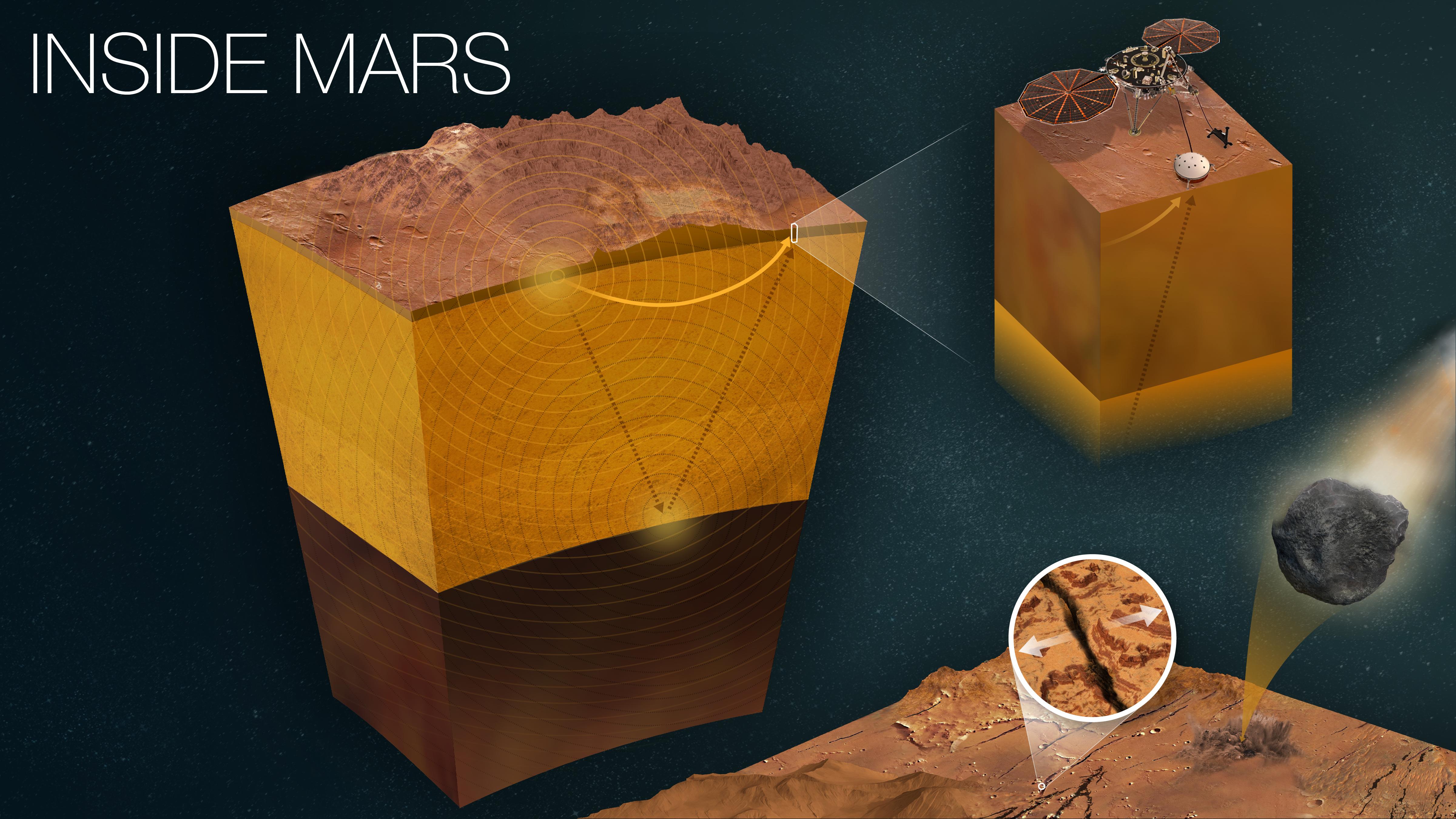
-
PIA25282:
-
How InSight Studies Mars' Inner Layers
Full Resolution:
TIFF
(27.36 MB)
JPEG
(1.18 MB)
|
|
|
2022-05-17 |
Earth
|
Terra
|
ASTER
|
2051x2656x3 |
|
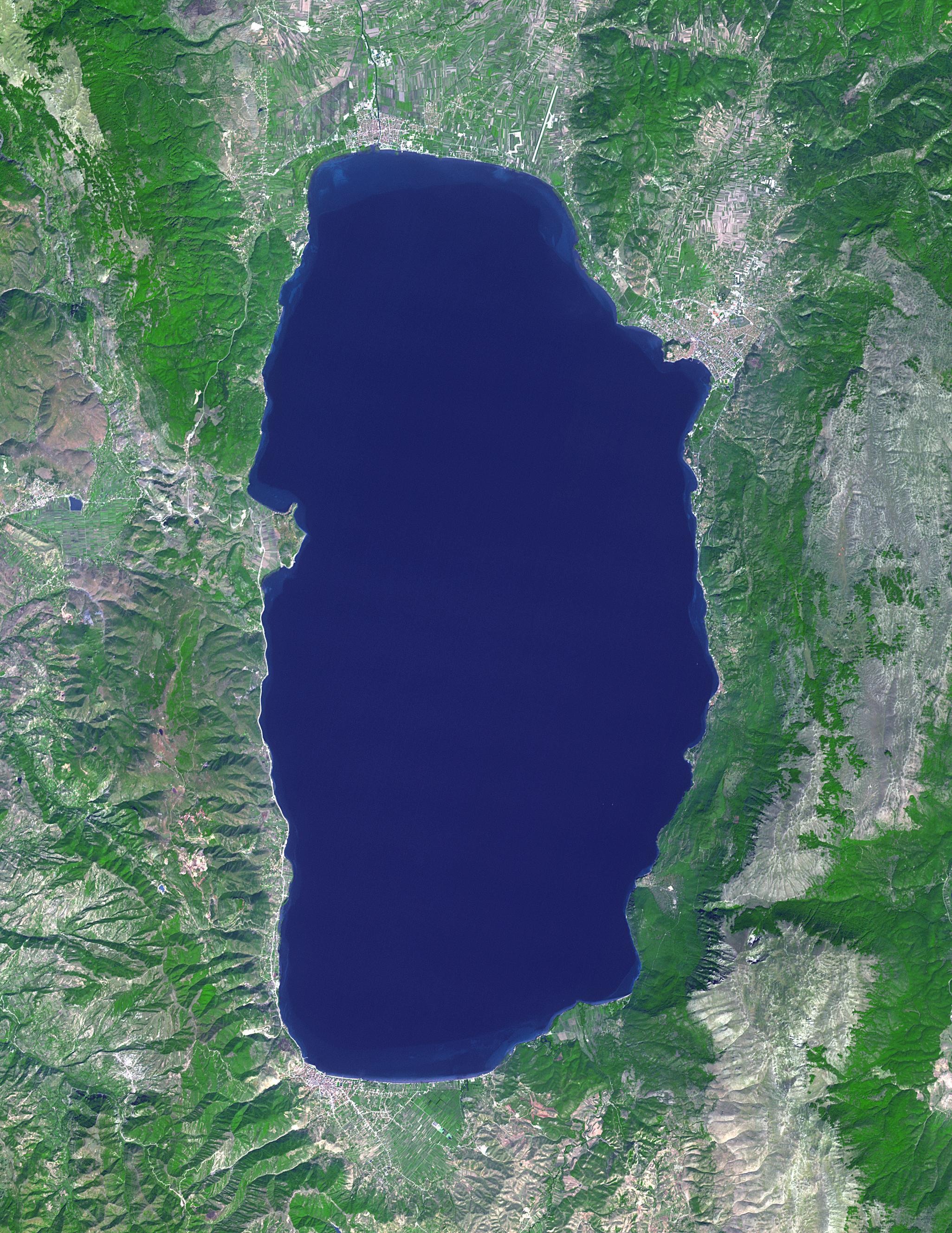
-
PIA25306:
-
Lake Ohrid, Macedonia-Albania
Full Resolution:
TIFF
(16.35 MB)
JPEG
(1.048 MB)
|
|
|
2022-05-12 |
Mars
|
2001 Mars Odyssey
|
THEMIS
|
1385x2632x1 |

|
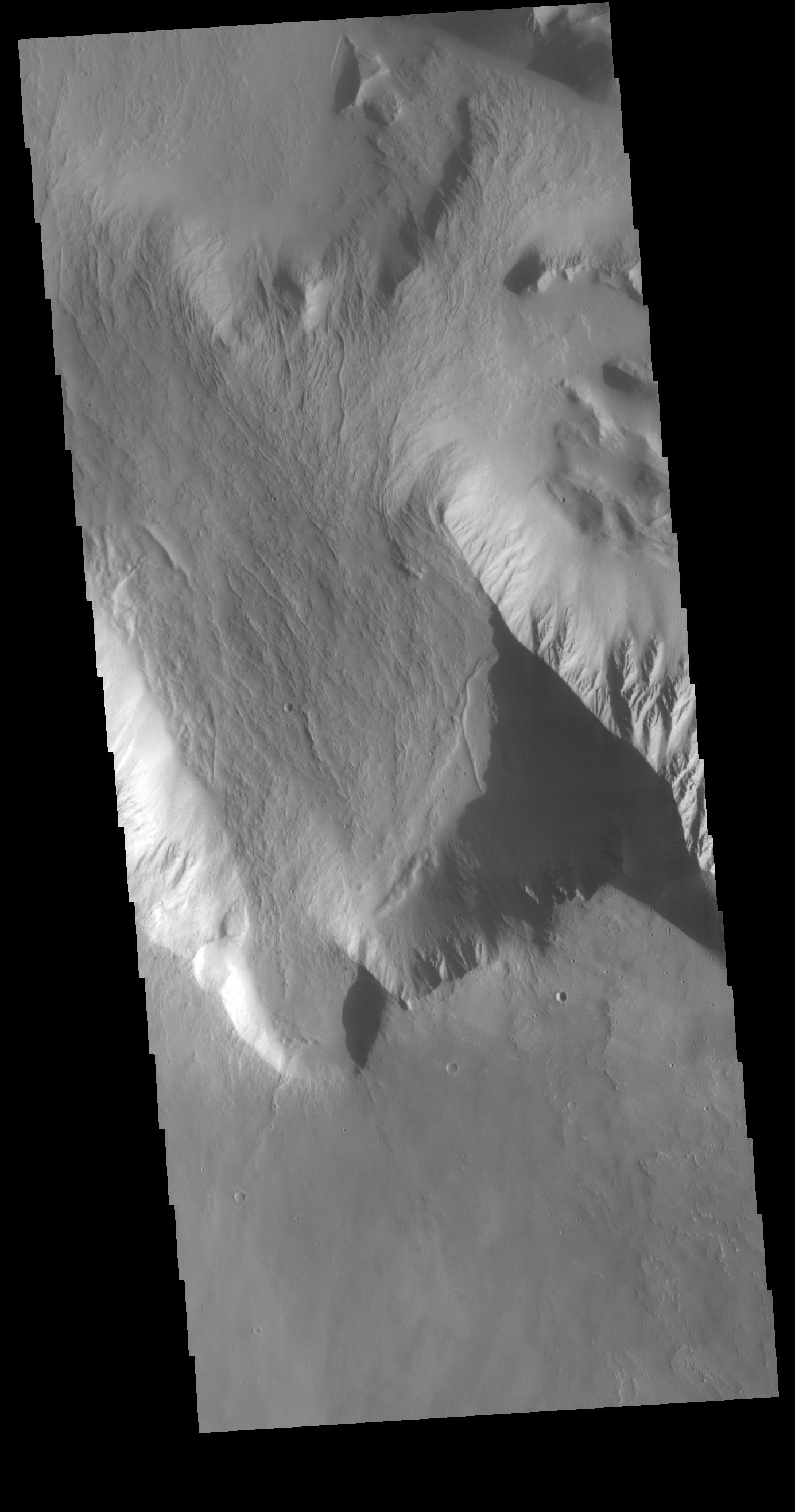
-
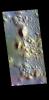
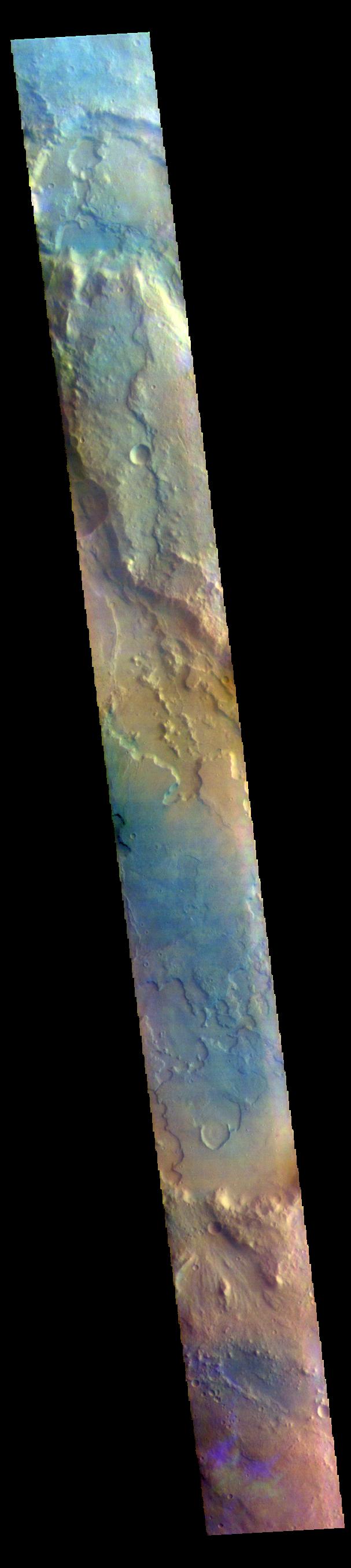
PIA25304:
-
Olympus Rupes
Full Resolution:
TIFF
(2.308 MB)
JPEG
(213.5 kB)
|
|
|
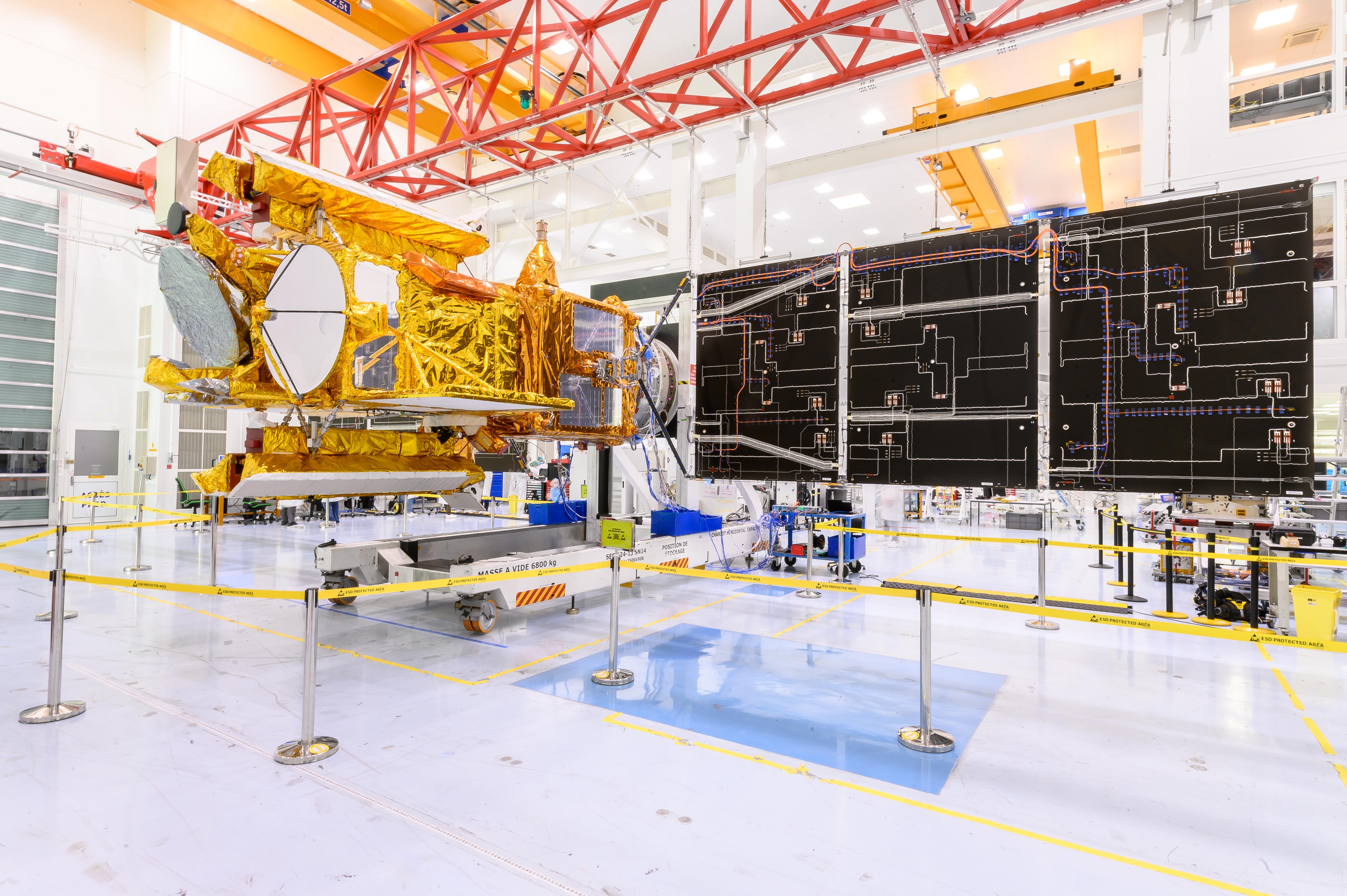
2022-05-11 |
|
Surface Water and Ocean Topography (SWOT)
|
|
6048x4024x3 |
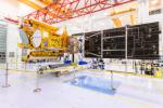
|
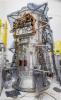
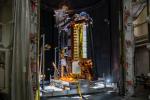
-
PIA25147:
-
SWOT Solar Panels Deploy at Thales Alenia Space Facility in France
Full Resolution:
TIFF
(55.8 MB)
JPEG
(2.346 MB)
|
|
|
2022-05-09 |
Mars
|
InSight
|
|
1920x1440x1 |
|
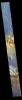
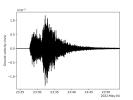
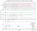
-
PIA25180:
-
InSight's Seismogram of Big Martian Quake
Full Resolution:
TIFF
(194.8 kB)
JPEG
(101.5 kB)
|
|
|
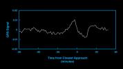
2022-05-09 |
Mars
|
InSight
|
|
1711x1007x3 |
|
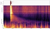
-
PIA25044:
-
InSight's Spectrogram of Big Martian Quake
Full Resolution:
TIFF
(4.615 MB)
JPEG
(237.2 kB)
|
|
|
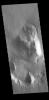
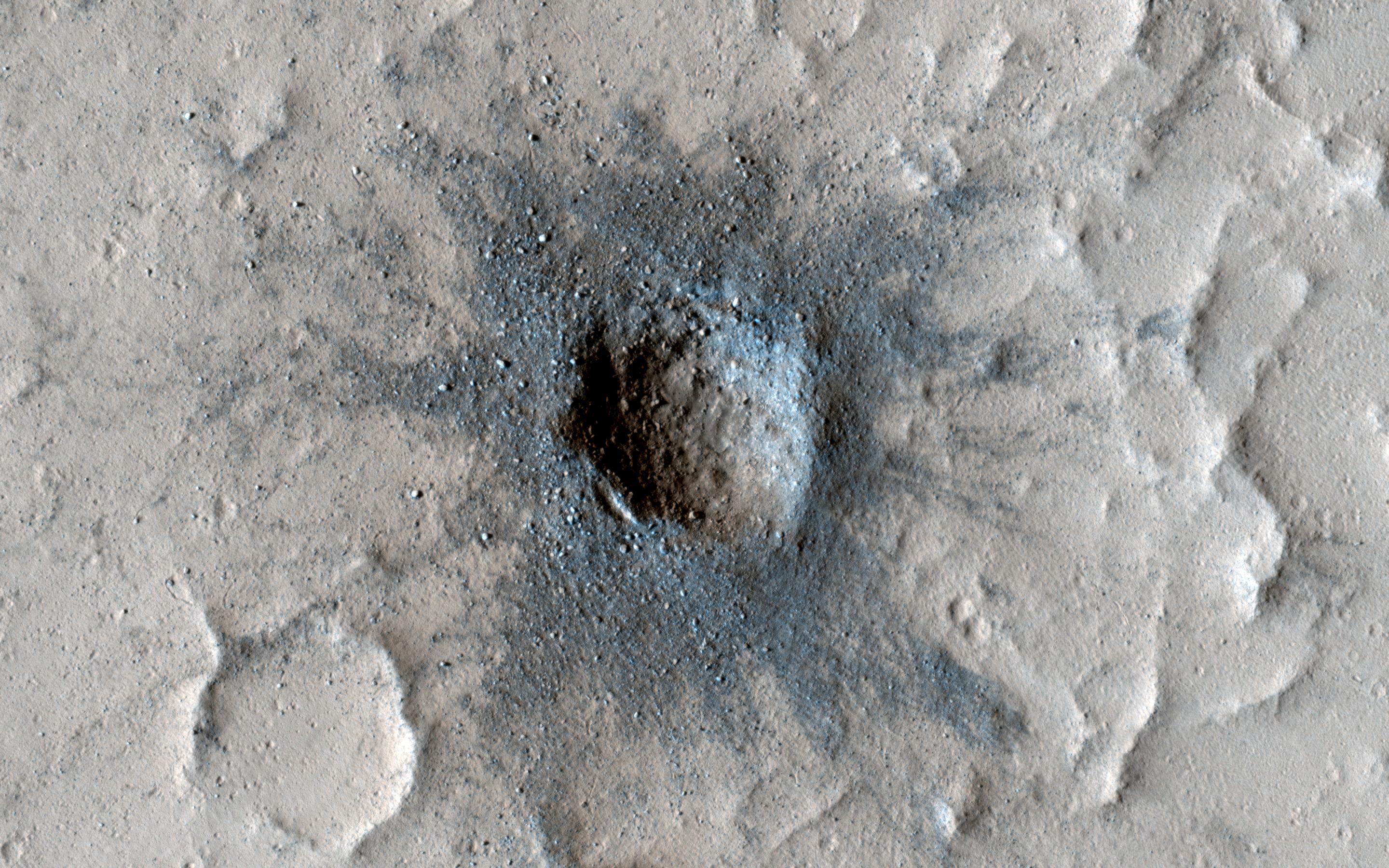
2022-04-29 |
Mars
|
Mars Reconnaissance Orbiter (MRO)
|
HiRISE
|
2880x1800x3 |
|
-
PIA25310:
-
Slow Changes at an Old Impact Crater
Full Resolution:
TIFF
(15.56 MB)
JPEG
(954.6 kB)
|
|
|
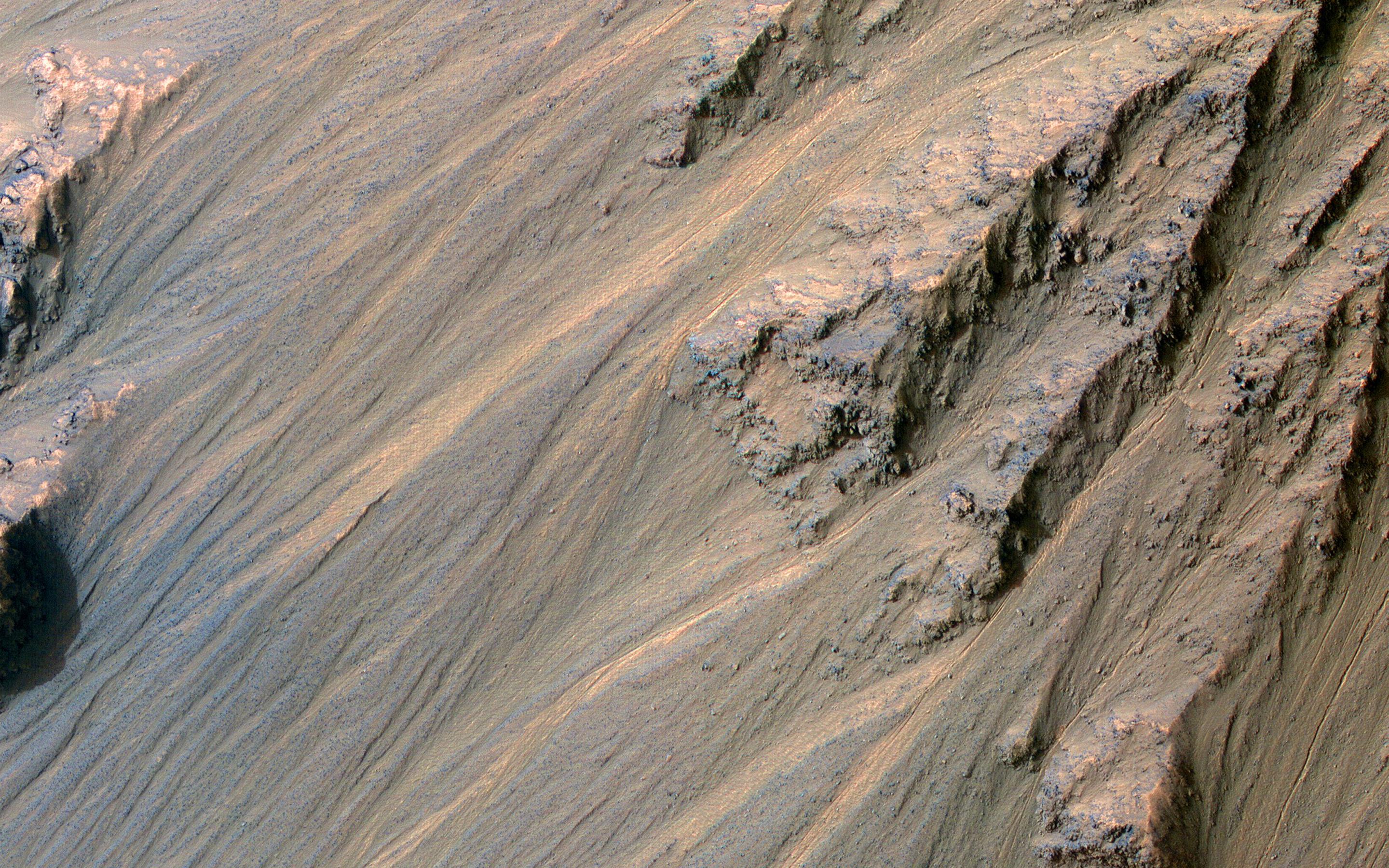
2022-04-29 |
Mars
|
Mars Reconnaissance Orbiter (MRO)
|
HiRISE
|
2880x1800x3 |
|
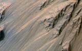
-
PIA25309:
-
Recent Gullies in Equatorial Valles Marineris
Full Resolution:
TIFF
(15.56 MB)
JPEG
(1.108 MB)
|
|
|
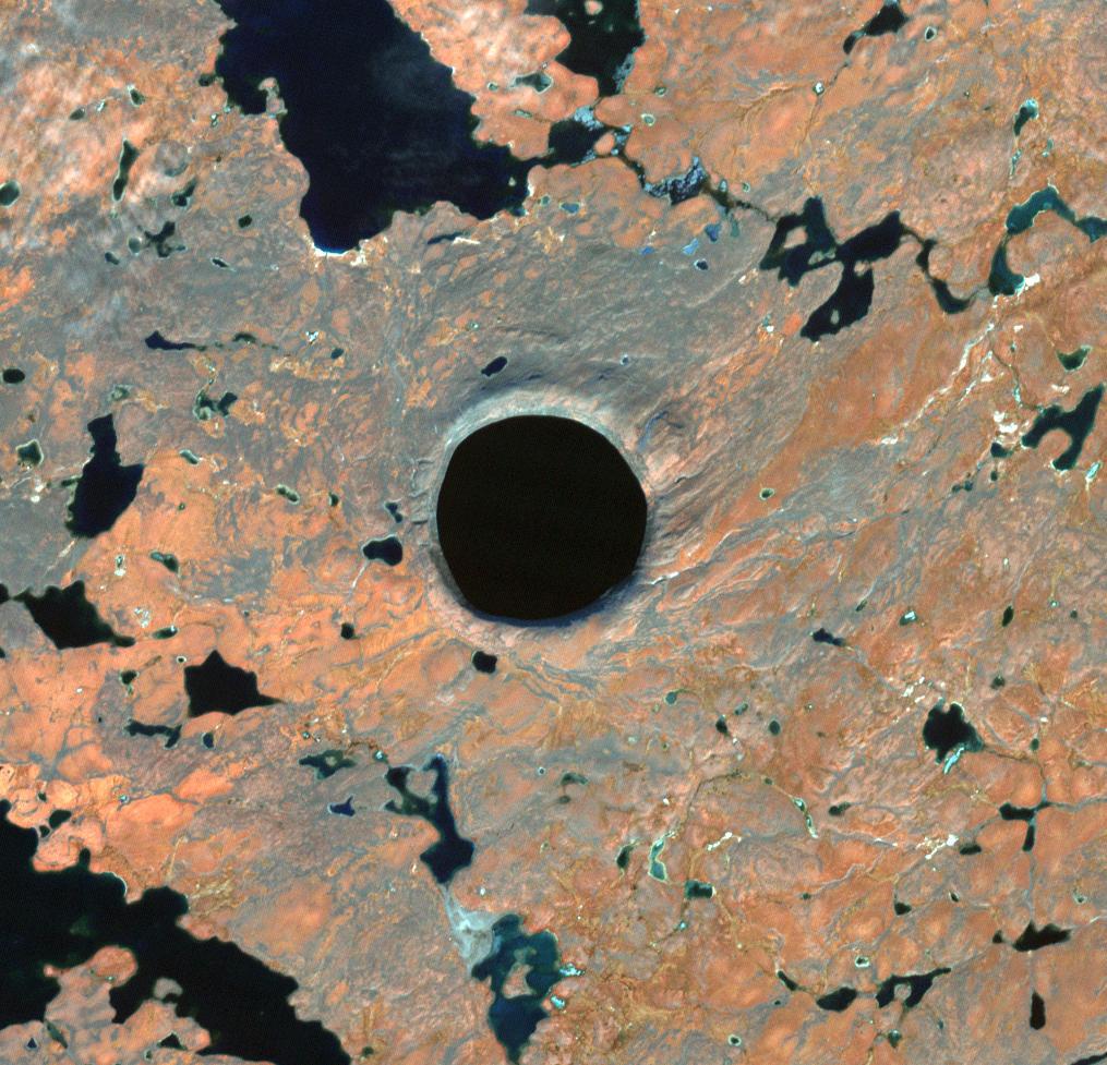
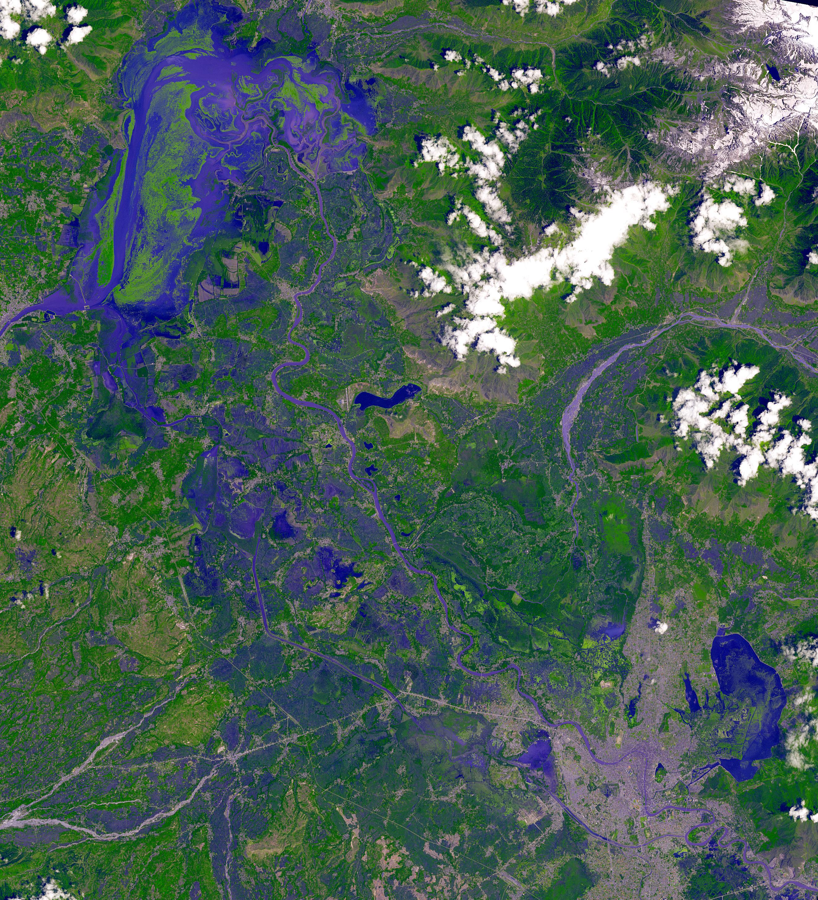
2022-04-19 |
Earth
|
Terra
|
ASTER
|
1015x977x3 |

|
-
PIA25276:
-
Pingualuit Crater, Nunavik Province, Canada
Full Resolution:
TIFF
(2.976 MB)
JPEG
(191.8 kB)
|
|
|
2022-04-06 |
Mars
|
Mars Science Laboratory (MSL)
|
Hazcam (MSL)
|
1024x768x1 |
|
-
PIA25177:
-
Curiosity's Hazcam Catches a Dusty Wind Gust
Full Resolution:
TIFF
(770.5 kB)
JPEG
(123.6 kB)
|
|
|
2022-04-05 |
|
Mars Helicopter
|
|
586x269x3 |
|
-
PIA25211:
-
Mars Atmosphere Density Model
Full Resolution:
TIFF
(204.9 kB)
JPEG
(32.11 kB)
|
|
|
2022-04-05 |
Earth
|
Terra
|
ASTER
|
2500x1700x3 |
|
-
PIA25186:
-
Abuja, Nigeria, 2021
Full Resolution:
TIFF
(12.75 MB)
JPEG
(883.2 kB)
|
|
|
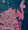
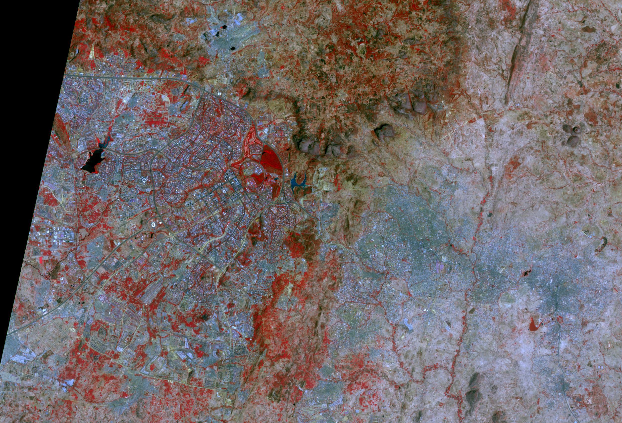
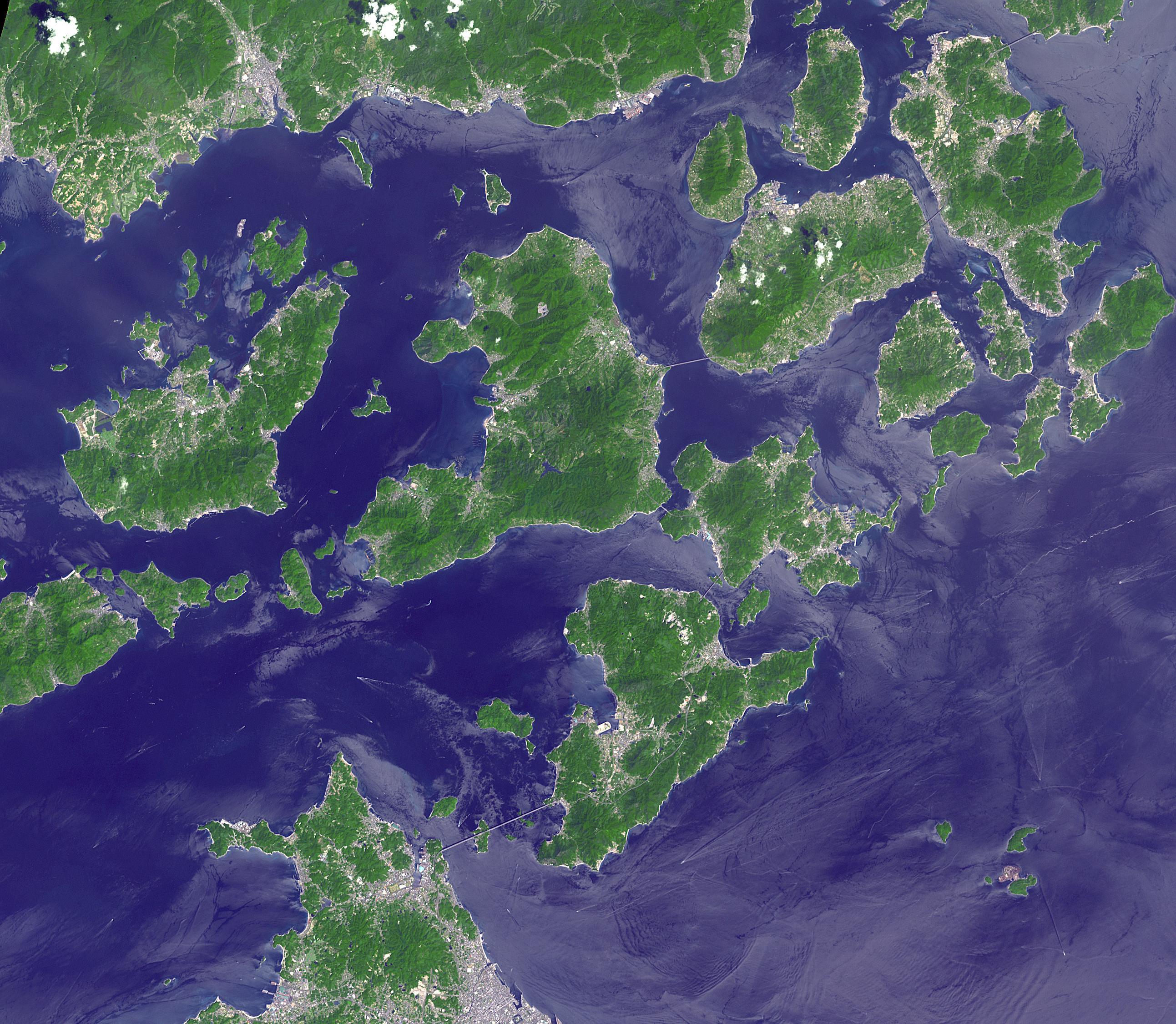
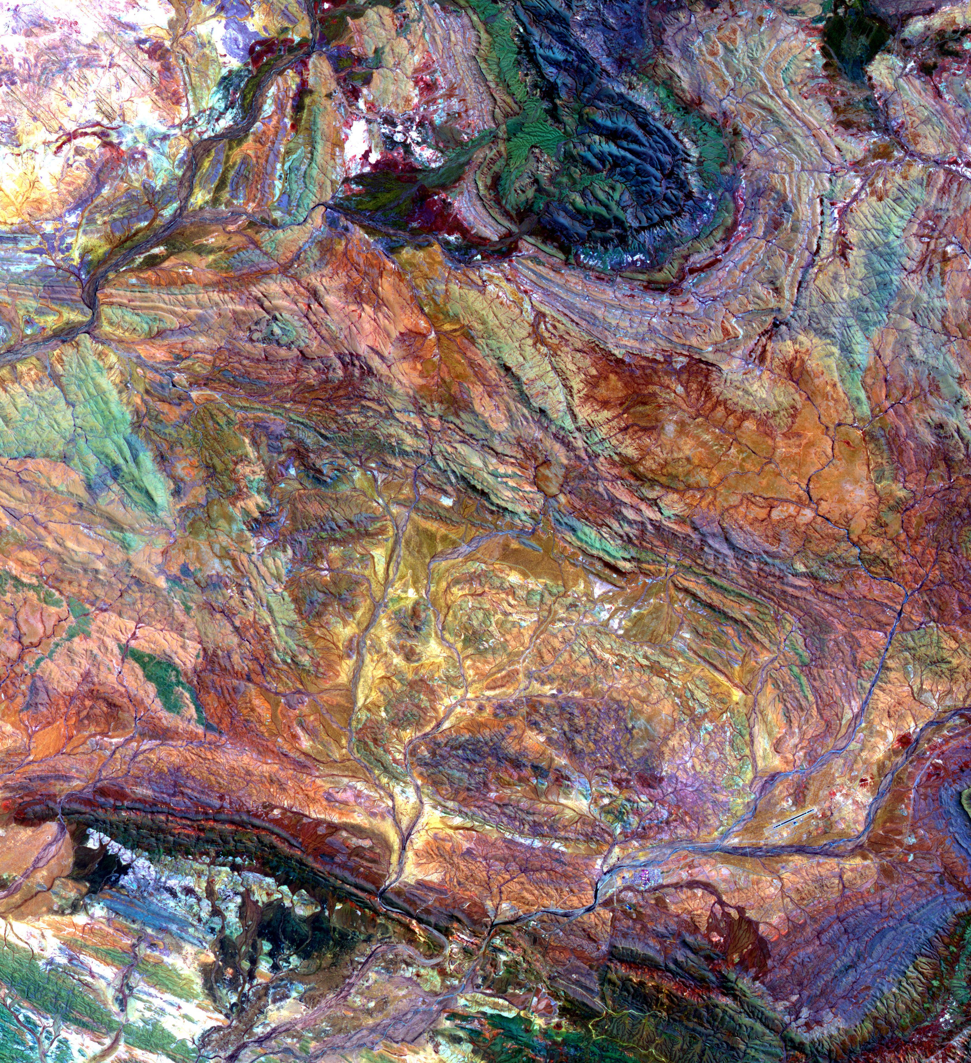
2022-03-23 |
Earth
|
Terra
|
ASTER
|
2585x2251x3 |
|
-
PIA25185:
-
Geiyo Archipelago, Japan
Full Resolution:
TIFF
(17.05 MB)
JPEG
(1.001 MB)
|
|
|
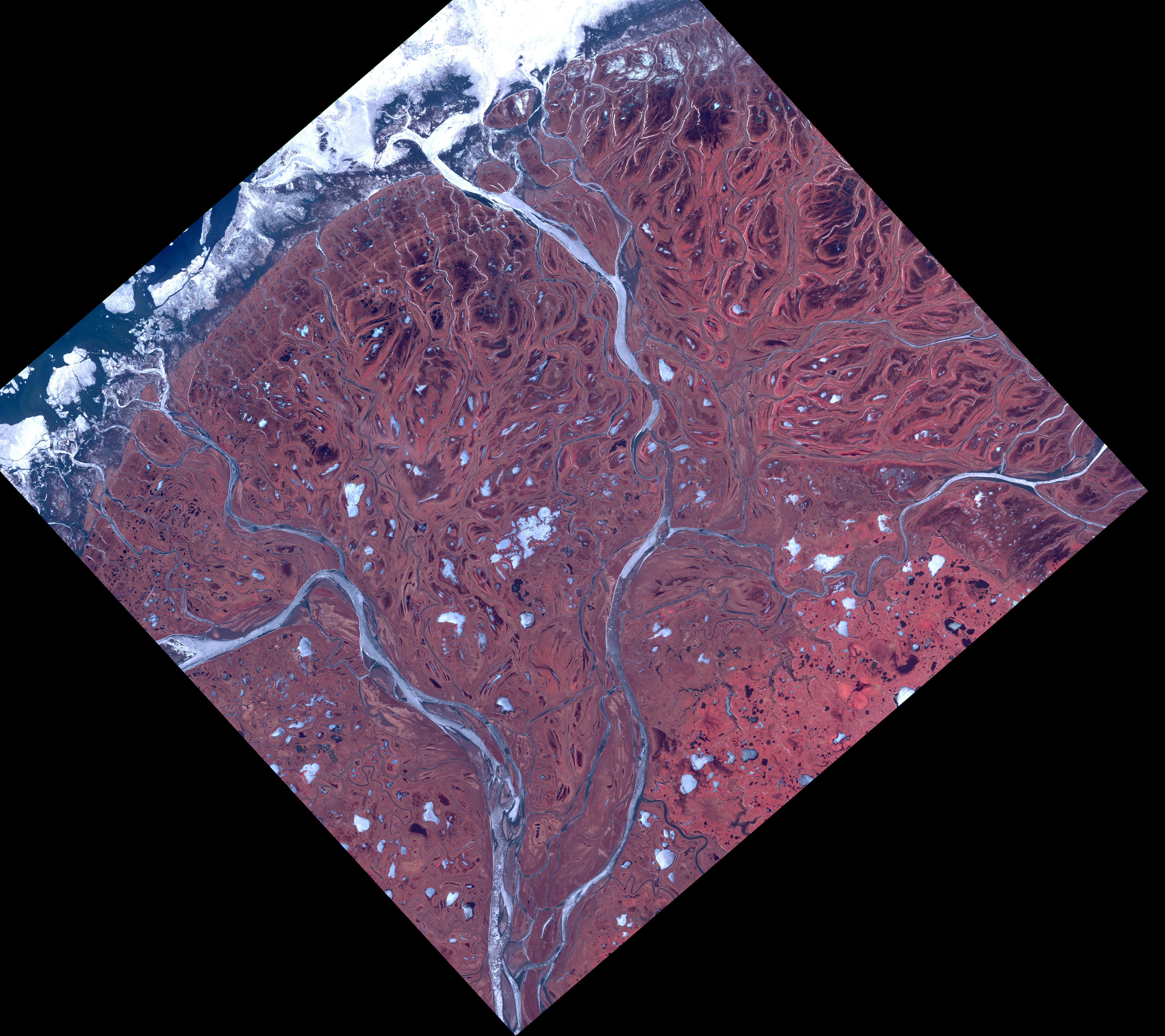
2022-03-08 |
Earth
|
Terra
|
ASTER
|
5856x5207x3 |
|
-
PIA25124:
-
Yukon Delta, Alaska
Full Resolution:
TIFF
(56.46 MB)
JPEG
(3.158 MB)
|
|
|
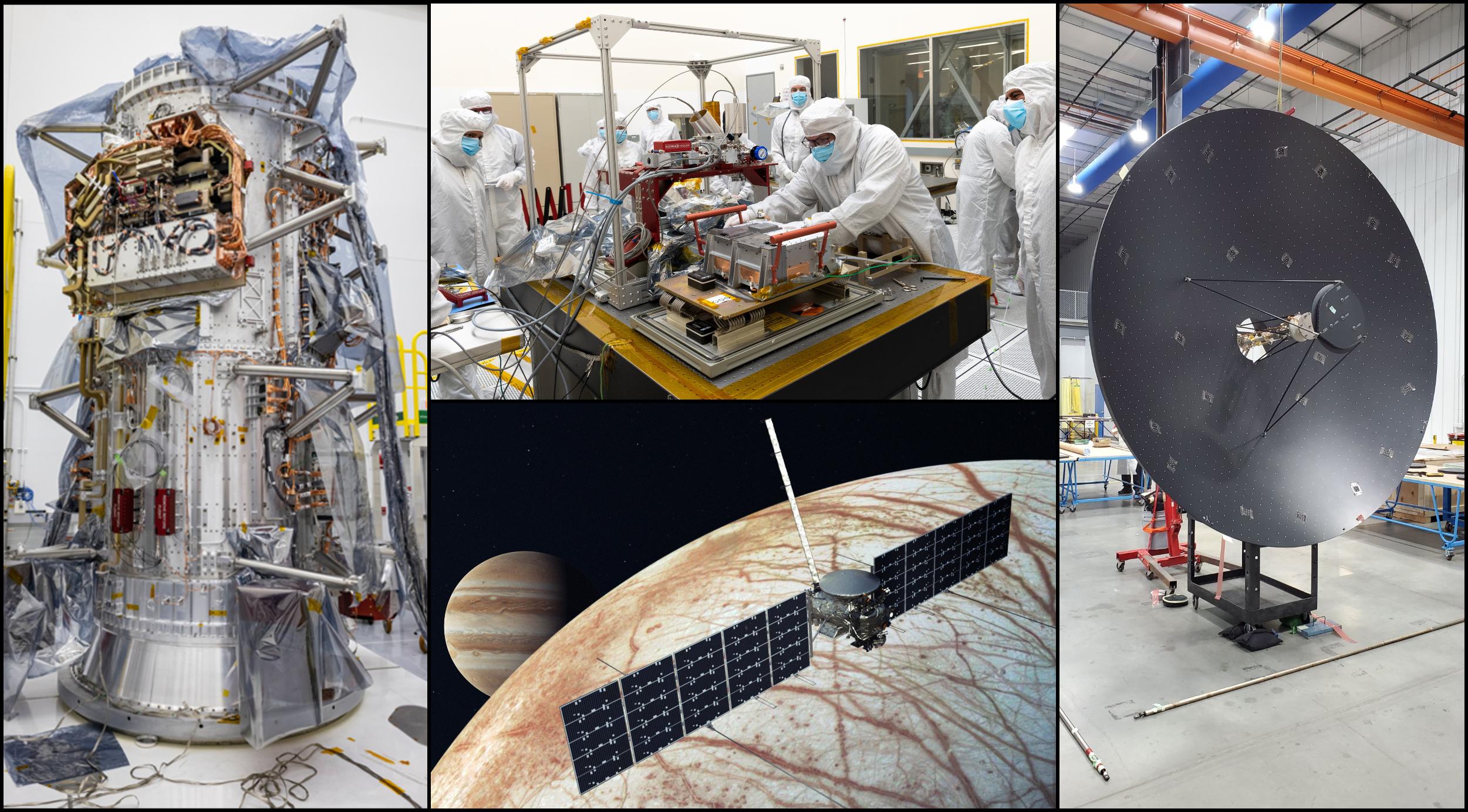
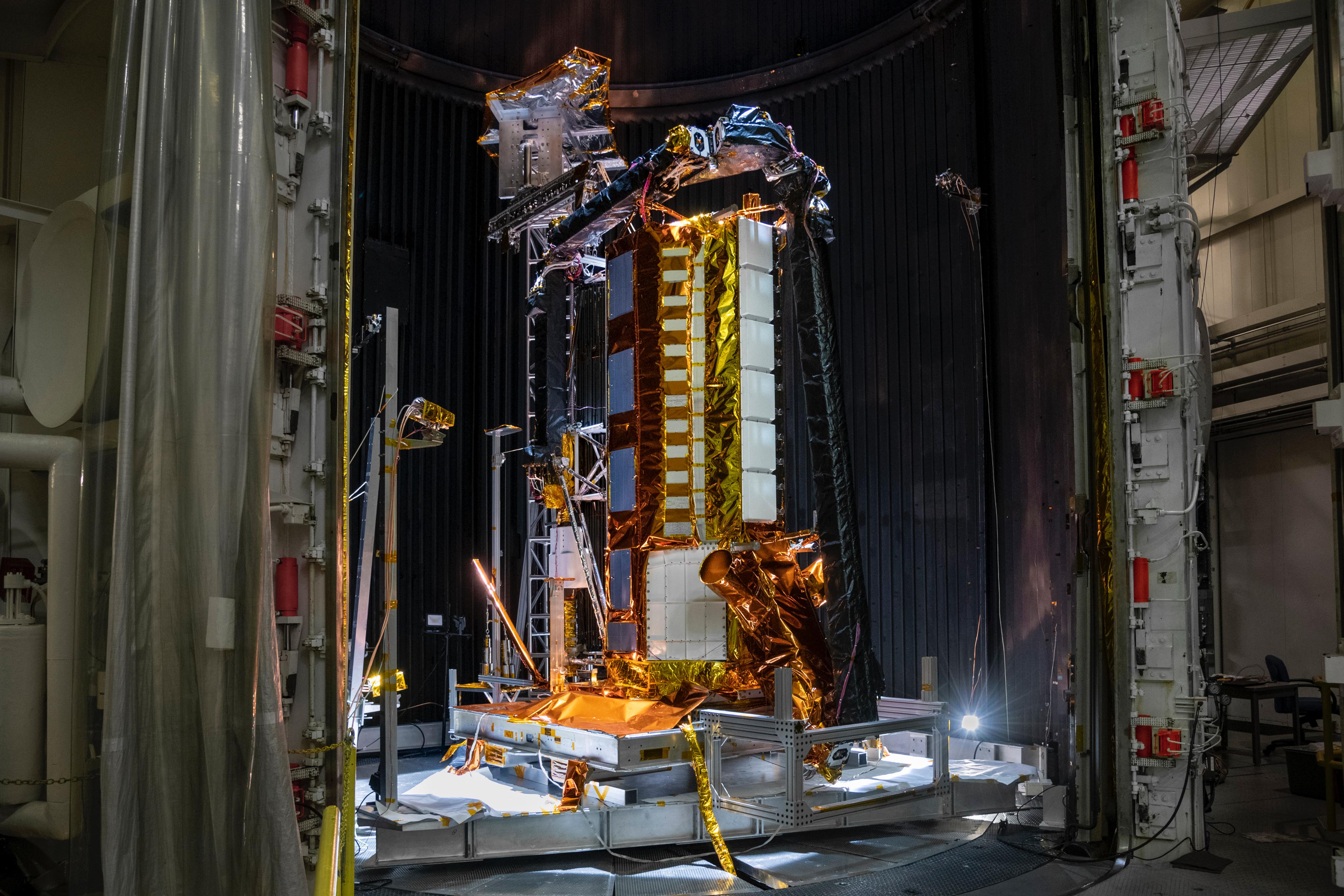
2022-03-03 |
|
Europa Clipper
|
|
2501x1384x3 |

|
-
PIA25125:
-
NASA Begins Assembly of Europa Clipper Spacecraft
Full Resolution:
TIFF
(9.944 MB)
JPEG
(537 kB)
|
|
|
2022-03-03 |
|
Europa Clipper
|
|
920x1495x3 |
|
-
PIA24900:
-
Europa Clipper's Propulsion Module
Full Resolution:
TIFF
(3.873 MB)
JPEG
(183 kB)
|
|
|
2022-02-22 |
Earth
|
Terra
|
ASTER
|
2646x2910x3 |
|
-
PIA25123:
-
Dal Lake, India
Full Resolution:
TIFF
(23.11 MB)
JPEG
(1.882 MB)
|
|
|
2022-02-04 |
Earth
|
Terra
|
ASTER
|
3365x3681x3 |

|
-
PIA25122:
-
Pilbara, NW Australia
Full Resolution:
TIFF
(37.17 MB)
JPEG
(2.913 MB)
|
|
|
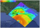
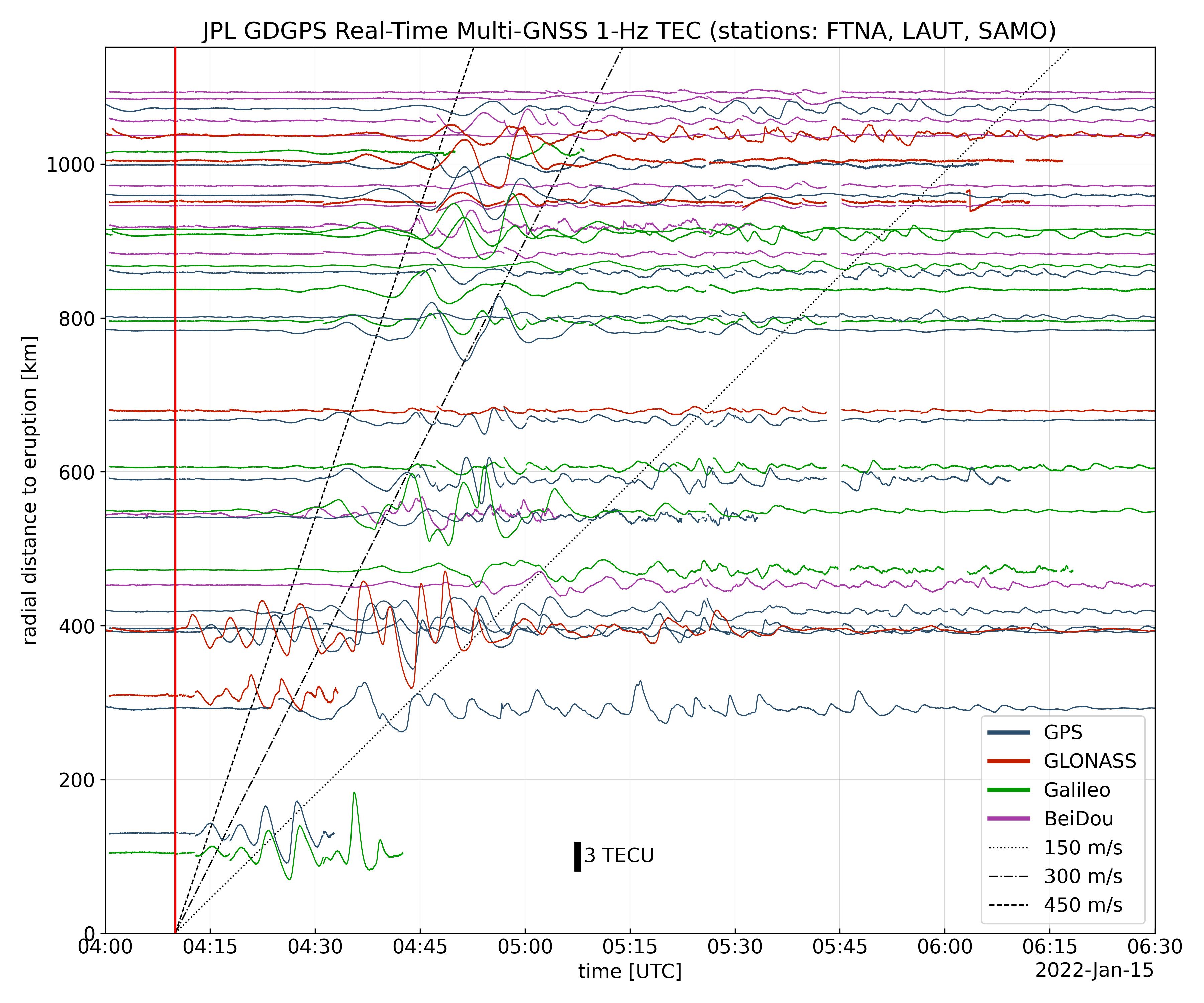
2022-01-27 |
Earth
|
Global Differential Global Positioning System (GDGPS)
|
|
3600x3000x3 |
|
-
PIA24905:
-
Tonga Eruption Atmospheric Wave
Full Resolution:
TIFF
(3.165 MB)
JPEG
(1.025 MB)
|
|
|
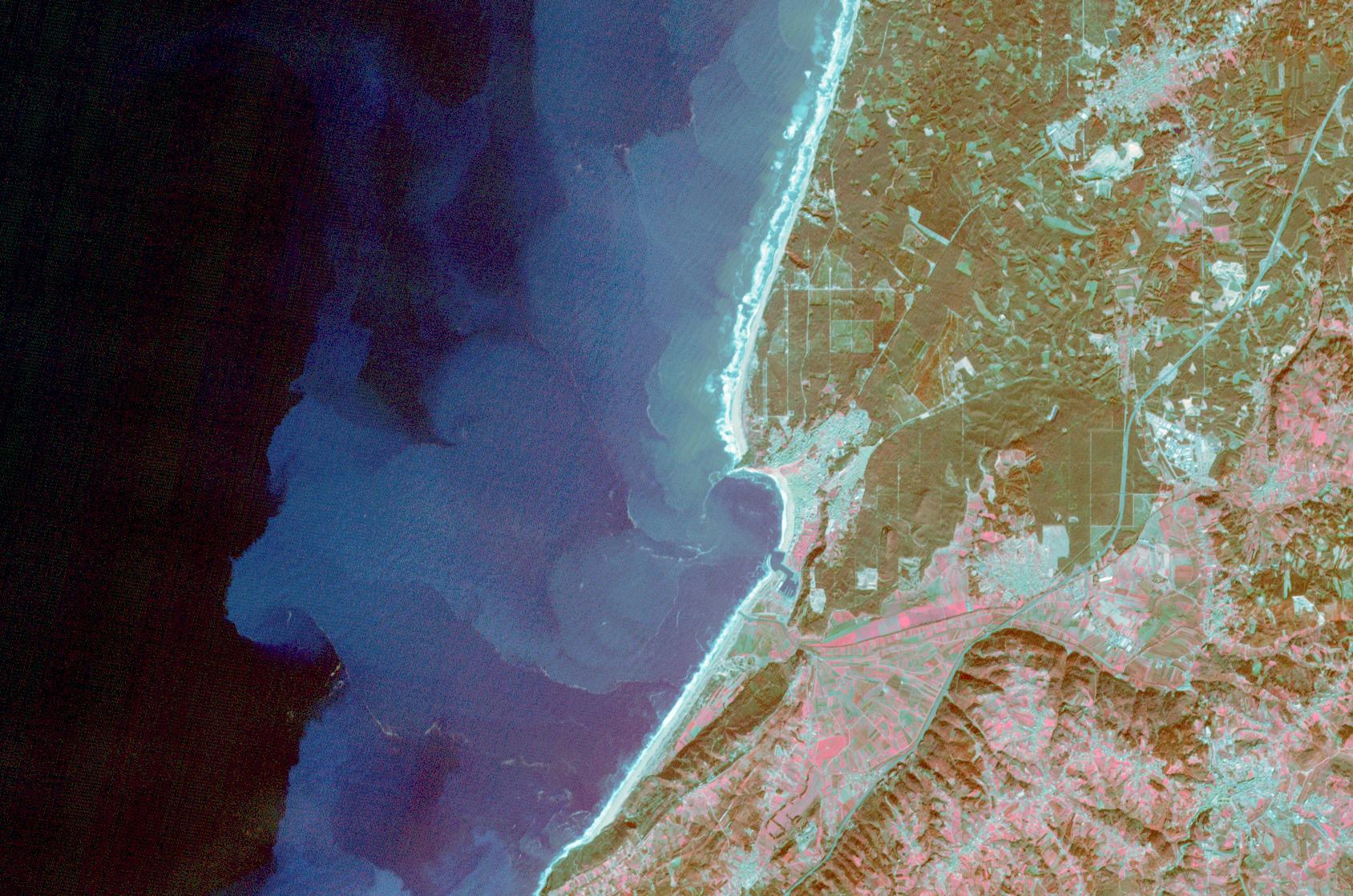
2022-01-21 |
Earth
|
Terra
|
ASTER
|
1688x1119x3 |
|
-
PIA25121:
-
Nazare, Portugal
Full Resolution:
TIFF
(5.669 MB)
JPEG
(393.9 kB)
|
|
|
2022-01-18 |
Mars
|
2001 Mars Odyssey
|
THEMIS
|
700x1433x1 |

|
-
PIA25107:
-
Olympus Rupes
Full Resolution:
TIFF
(665.5 kB)
JPEG
(65.76 kB)
|
|
|
2022-01-11 |
Mars
|
2001 Mars Odyssey
|
THEMIS
|
609x2705x3 |

|
-
PIA25102:
-
Chia Crater - False Color
Full Resolution:
TIFF
(2.203 MB)
JPEG
(105 kB)
|
|
|
2022-01-10 |
Mars
|
2001 Mars Odyssey
|
THEMIS
|
604x2714x3 |
|
-
PIA25101:
-
Huygens Crater - False Color
Full Resolution:
TIFF
(2.071 MB)
JPEG
(97.76 kB)
|
|
|
2022-01-07 |
Mars
|
2001 Mars Odyssey
|
THEMIS
|
604x2704x3 |
|
-
PIA25100:
-
Hebes Chasma - False Color
Full Resolution:
TIFF
(2.16 MB)
JPEG
(96.85 kB)
|
|
|
2022-01-06 |
Mars
|
2001 Mars Odyssey
|
THEMIS
|
606x2711x3 |
|
-
PIA25099:
-
Oenotria Scopuli - False Color
Full Resolution:
TIFF
(2.193 MB)
JPEG
(112.8 kB)
|
|
|
2022-01-05 |
Earth
|
Terra
|
ASTER
|
1278x635x3 |
|
-
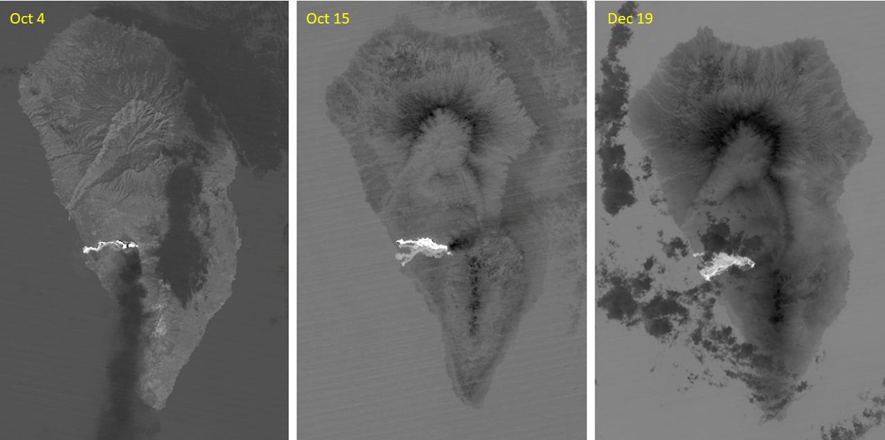
PIA25085:
-
Cumbre Vieja volcano, La Palma
Full Resolution:
TIFF
(924.2 kB)
JPEG
(68.57 kB)
|
|
|
2022-01-05 |
Mars
|
2001 Mars Odyssey
|
THEMIS
|
608x2712x3 |
|
-
PIA25098:
-
Terra Sabaea Craters - False Color
Full Resolution:
TIFF
(2.2 MB)
JPEG
(99.91 kB)
|
|
|
2022-01-04 |
Earth
|
Terra
|
ASTER
|
710x928x3 |
|
-
PIA24950:
-
TurtleIsland, Taiwan
Full Resolution:
TIFF
(1.978 MB)
JPEG
(118.7 kB)
|
|
|
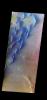
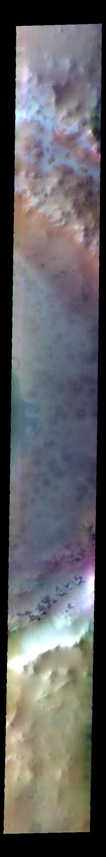
2022-01-04 |
Mars
|
2001 Mars Odyssey
|
THEMIS
|
607x2713x3 |
|
-
PIA25097:
-
Clouds - False Color
Full Resolution:
TIFF
(2.328 MB)
JPEG
(114.1 kB)
|
|
|
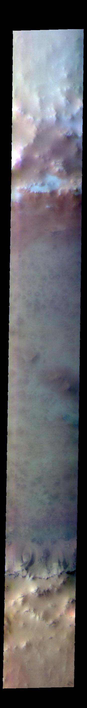
2022-01-03 |
Mars
|
2001 Mars Odyssey
|
THEMIS
|
605x2686x3 |
|
-
PIA25096:
-
Tharsis Clouds - False Color
Full Resolution:
TIFF
(2.253 MB)
JPEG
(115.1 kB)
|
|
|
2021-12-31 |
Mars
|
2001 Mars Odyssey
|
THEMIS
|
612x2701x3 |

|
-
PIA25095:
-
Syrtis Major Planum - False Color
Full Resolution:
TIFF
(2.249 MB)
JPEG
(113.3 kB)
|
|
|
2021-12-30 |
Mars
|
2001 Mars Odyssey
|
THEMIS
|
610x2702x3 |
|
-
PIA25094:
-
Arabia Terra - False Color
Full Resolution:
TIFF
(2.425 MB)
JPEG
(133.2 kB)
|
|
|
2021-12-29 |
Mars
|
2001 Mars Odyssey
|
THEMIS
|
611x2693x3 |
|
-
PIA25093:
-
Nili Fossae - False Color
Full Resolution:
TIFF
(2.312 MB)
JPEG
(126.8 kB)
|
|
|
2021-12-28 |
Mars
|
2001 Mars Odyssey
|
THEMIS
|
606x2712x3 |
|
-
PIA25092:
-
Gale Crater - False Color
Full Resolution:
TIFF
(2.057 MB)
JPEG
(80.03 kB)
|
|
|
2021-12-27 |
Mars
|
2001 Mars Odyssey
|
THEMIS
|
348x2818x3 |

|
-
PIA25091:
-
Lomonosov Crater - False Color
Full Resolution:
TIFF
(2.449 MB)
JPEG
(67.02 kB)
|
|
|
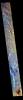
2021-12-24 |
Mars
|
2001 Mars Odyssey
|
THEMIS
|
350x2826x3 |
|
-
PIA25060:
-
Lomonosov Crater - False Color
Full Resolution:
TIFF
(2.551 MB)
JPEG
(71.79 kB)
|
|
|
2021-12-23 |
Mars
|
2001 Mars Odyssey
|
THEMIS
|
611x2705x3 |
|
-
PIA25059:
-
Crommelin Crater - False Color
Full Resolution:
TIFF
(2.25 MB)
JPEG
(107.6 kB)
|
|
|
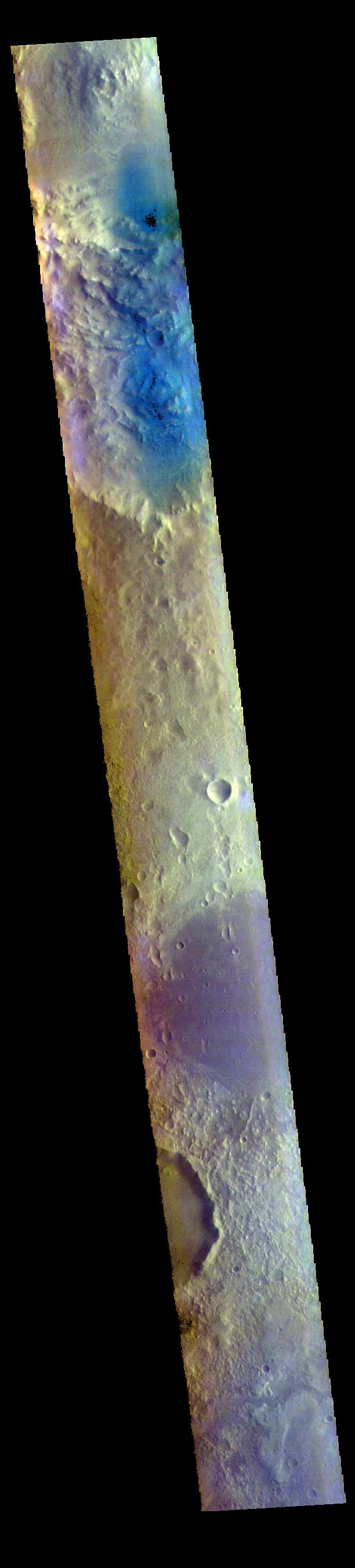
2021-12-22 |
Mars
|
2001 Mars Odyssey
|
THEMIS
|
614x2701x3 |
|
-
PIA25058:
-
Syrtis Major Planum - False Color
Full Resolution:
TIFF
(2.372 MB)
JPEG
(134.6 kB)
|
|
|
2021-12-21 |
Mars
|
2001 Mars Odyssey
|
THEMIS
|
612x2700x3 |
|
-
PIA25057:
-
Arabia Terra - False Color
Full Resolution:
TIFF
(2.384 MB)
JPEG
(122.2 kB)
|
|
|
2021-12-20 |
Mars
|
2001 Mars Odyssey
|
THEMIS
|
615x2702x3 |

|
-
PIA25056:
-
Terra Sabaea - False Color
Full Resolution:
TIFF
(2.304 MB)
JPEG
(104.9 kB)
|
|
|
2021-12-17 |
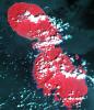
Jupiter
|
Juno
|
|
4500x3500x3 |
|
-
PIA25036:
-
Mapping the Great Blue Spot
Full Resolution:
TIFF
(4.513 MB)
JPEG
(587.8 kB)
|
|
|
2021-12-17 |
Jupiter
|
Juno
|
Waves
|
781x443x3 |
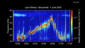
|
-
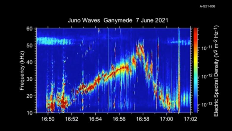
PIA25030:
-
Audio of Juno's Ganymede Flyby
Full Resolution:
TIFF
(524.7 kB)
JPEG
(41.85 kB)
|
|
|
2021-12-17 |
Mars
|
2001 Mars Odyssey
|
THEMIS
|
611x2703x3 |
|
-
PIA25055:
-
Arabia Terra - False Color
Full Resolution:
TIFF
(2.348 MB)
JPEG
(118.9 kB)
|
|
|
2021-12-16 |
Mars
|
2001 Mars Odyssey
|
THEMIS
|
613x2697x3 |
|
-
PIA25054:
-
Terra Sabaea - False Color
Full Resolution:
TIFF
(2.392 MB)
JPEG
(121.9 kB)
|
|
|
2021-12-15 |
Mars
|
2001 Mars Odyssey
|
THEMIS
|
614x2700x3 |
|
-
PIA25053:
-
Bamberg Crater - False Color
Full Resolution:
TIFF
(2.443 MB)
JPEG
(108.9 kB)
|
|
|
2021-12-14 |
Mars
|
2001 Mars Odyssey
|
THEMIS
|
612x2706x3 |
|
-
PIA25052:
-
Arabia Terra - False Color
Full Resolution:
TIFF
(2.384 MB)
JPEG
(133.1 kB)
|
|
|
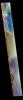
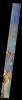
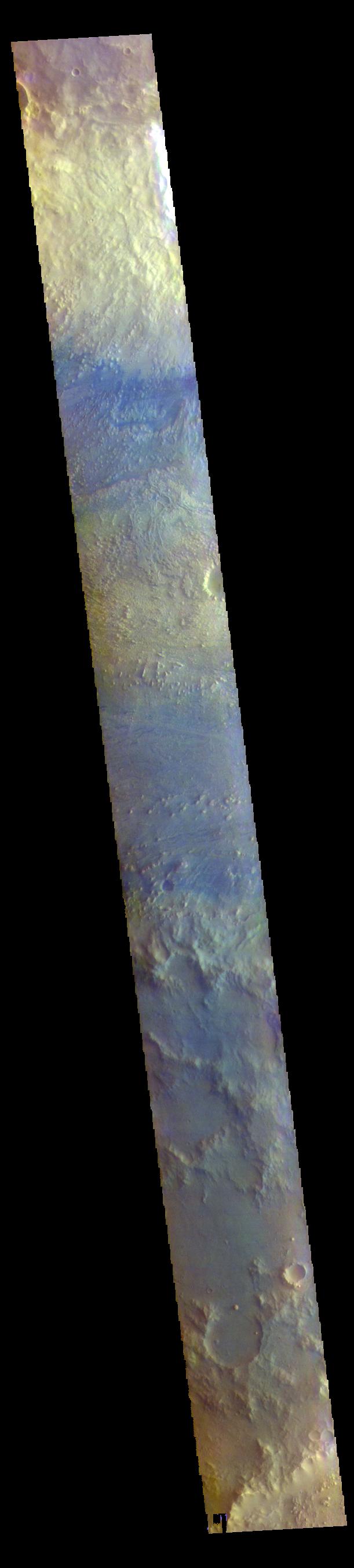
2021-12-13 |
Mars
|
2001 Mars Odyssey
|
THEMIS
|
258x2745x3 |

|
-
PIA25051:
-
Argentea Planum - False Color
Full Resolution:
TIFF
(1.993 MB)
JPEG
(59.1 kB)
|
|
|
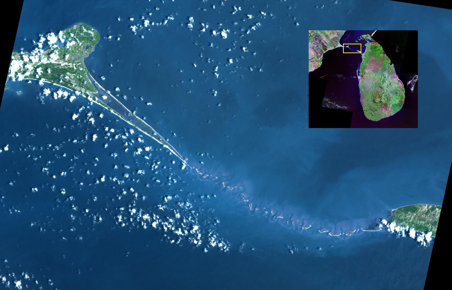
2021-12-10 |
Earth
|
Terra
|
ASTER
|
1895x1216x3 |

|
-
PIA24949:
-
Adam's Bridge, India-Sri Lanka
Full Resolution:
TIFF
(4.54 MB)
JPEG
(208.9 kB)
|
|
|
2021-12-10 |
Mars
|
2001 Mars Odyssey
|
THEMIS
|
260x2752x3 |

|
-
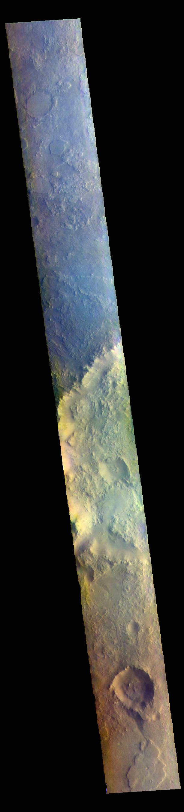
PIA25010:
-
Angustus Labyrinthus - False Color
Full Resolution:
TIFF
(2.147 MB)
JPEG
(89 kB)
|
|
|
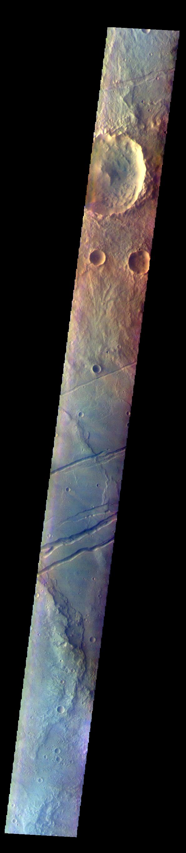
2021-12-09 |
Mars
|
2001 Mars Odyssey
|
THEMIS
|
260x2750x3 |

|
-
PIA25009:
-
Angustus Labyrinthus - False Color
Full Resolution:
TIFF
(2.133 MB)
JPEG
(83.5 kB)
|
|
|
2021-12-08 |
Mars
|
2001 Mars Odyssey
|
THEMIS
|
260x2746x3 |

|
-
PIA25008:
-
Australe Montes - False Color
Full Resolution:
TIFF
(2.143 MB)
JPEG
(84.76 kB)
|
|
|
2021-12-07 |
Mars
|
2001 Mars Odyssey
|
THEMIS
|
596x2722x3 |
|
-
PIA25007:
-
Sirenum Fossae - False Color
Full Resolution:
TIFF
(2.237 MB)
JPEG
(119.1 kB)
|
|
|
2021-12-06 |
Mars
|
2001 Mars Odyssey
|
THEMIS
|
669x1426x3 |
|
-
PIA25006:
-
Kaiser Crater Dunes - False Color
Full Resolution:
TIFF
(1.942 MB)
JPEG
(78.69 kB)
|
|
|
2021-12-03 |
Mars
|
2001 Mars Odyssey
|
THEMIS
|
592x2726x3 |
|
-
PIA25005:
-
Sirenum Fossae - False Color
Full Resolution:
TIFF
(2.219 MB)
JPEG
(132.8 kB)
|
|
|
2021-12-02 |
Mars
|
2001 Mars Odyssey
|
THEMIS
|
592x2725x3 |

|
-
PIA25004:
-
Sirenum Fossae - False Color
Full Resolution:
TIFF
(2.248 MB)
JPEG
(143.1 kB)
|
|
|
2021-12-01 |
Mars
|
2001 Mars Odyssey
|
THEMIS
|
673x1423x3 |
|
-
PIA25003:
-
Atlantis Chaos - False Color
Full Resolution:
TIFF
(1.975 MB)
JPEG
(106.2 kB)
|
|
|
2021-11-30 |
Mars
|
2001 Mars Odyssey
|
THEMIS
|
664x1438x3 |
|
-
PIA25002:
-
Matara Crater Dunes - False Color
Full Resolution:
TIFF
(1.932 MB)
JPEG
(76.34 kB)
|
|
|
2021-11-29 |
Mars
|
Mars Reconnaissance Orbiter (MRO)
|
HiRISE
|
2880x1800x3 |

|
-
PIA24946:
-
Layered Bedrock
Full Resolution:
TIFF
(15.56 MB)
JPEG
(757.3 kB)
|
|
|
2021-11-29 |
Mars
|
2001 Mars Odyssey
|
THEMIS
|
669x1419x3 |
|
-
PIA25001:
-
Sirenum Fossae - False Color
Full Resolution:
TIFF
(1.995 MB)
JPEG
(147.2 kB)
|
|
|
2021-11-26 |
Mars
|
2001 Mars Odyssey
|
THEMIS
|
669x1421x3 |
|
-
PIA25000:
-
Sirenum Fossae - False Color
Full Resolution:
TIFF
(1.979 MB)
JPEG
(113.4 kB)
|
|
|
2021-11-25 |
Mars
|
2001 Mars Odyssey
|
THEMIS
|
594x2725x3 |
|
-
PIA24999:
-
Terra Cimmeria - False Color
Full Resolution:
TIFF
(2.232 MB)
JPEG
(149.2 kB)
|
|
|
2021-11-23 |
Earth
|
Terra
|
ASTER
|
2083x1542x3 |

|
-
PIA24943:
-
Cotahuasi Canyon, Peru
Full Resolution:
TIFF
(9.539 MB)
JPEG
(512.9 kB)
|
|
|
2021-11-23 |
Mars
|
Mars Science Laboratory (MSL)
|
Navcam (MSL)
|
1932x1087x3 |

|
-
PIA24937:
-
A Picture Postcard From Curiosity's Navcams
Full Resolution:
TIFF
(5.197 MB)
JPEG
(198.6 kB)
|
|
|
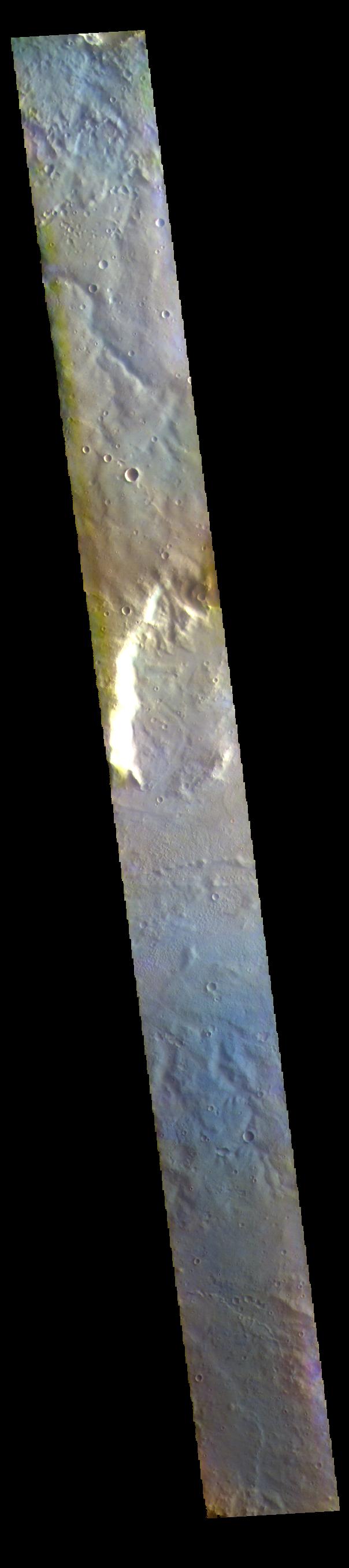
2021-11-19 |
Mars
|
2001 Mars Odyssey
|
THEMIS
|
704x1445x1 |

|
-
PIA24995:
-
Hephaestus Fossae
Full Resolution:
TIFF
(686.9 kB)
JPEG
(82.89 kB)
|
|
|
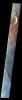
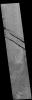
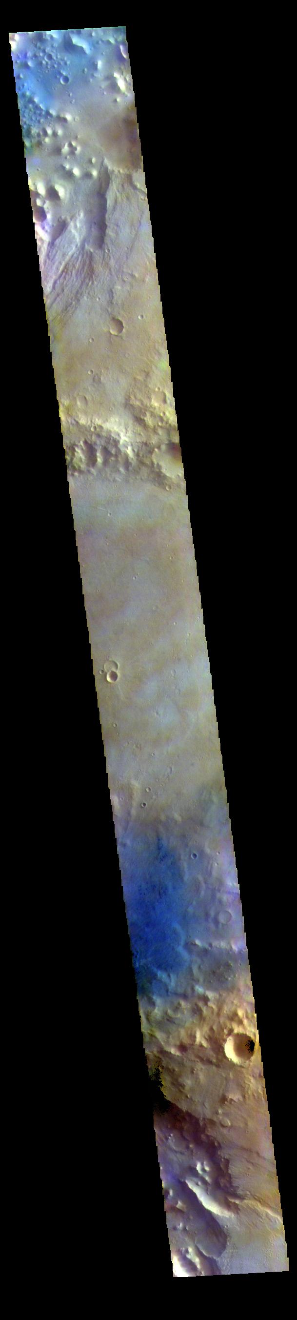
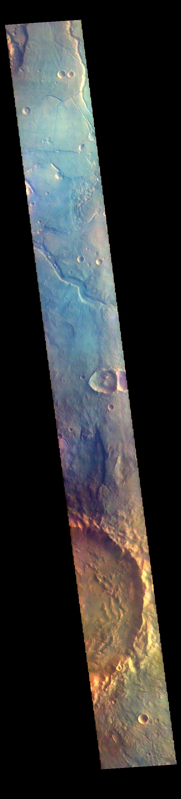
2021-11-18 |
Mars
|
2001 Mars Odyssey
|
THEMIS
|
868x2720x1 |
|
-
PIA24994:
-
Cerberus Fossae - Athabasca Valles
Full Resolution:
TIFF
(1.452 MB)
JPEG
(206.5 kB)
|
|
|
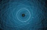
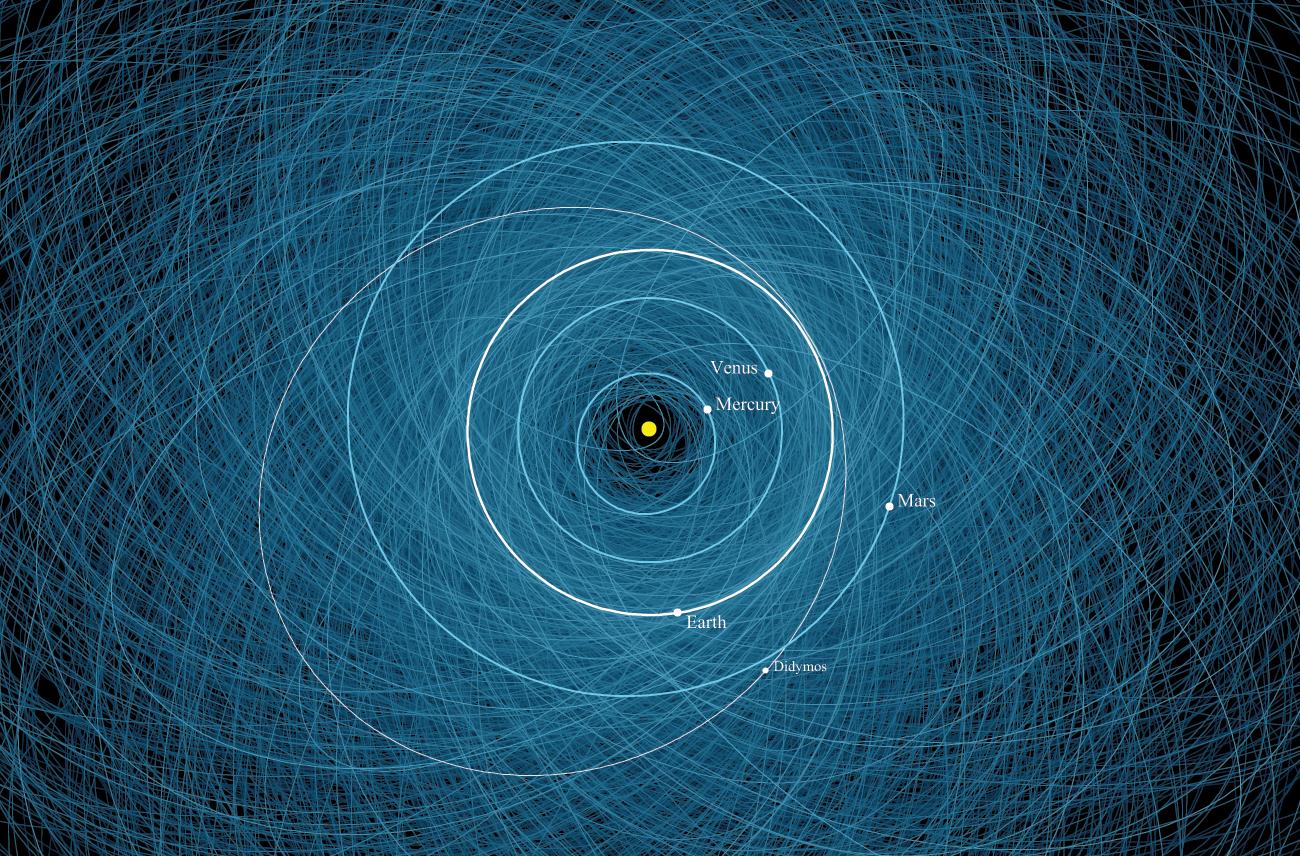
2021-11-17 |
Asteroid
|
Double Asteroid Redirect Test (DART)
|
|
1300x856x3 |
|
-
PIA24565:
-
The Orbit of Asteroid Didymos
Full Resolution:
TIFF
(3.34 MB)
JPEG
(328.4 kB)
|
|
|
2021-11-17 |
Mars
|
2001 Mars Odyssey
|
THEMIS
|
1191x5286x1 |
|
-
PIA24993:
-
Karzok Crater - Olympus Mons
Full Resolution:
TIFF
(3.043 MB)
JPEG
(525.8 kB)
|
|
|
2021-11-15 |
Mars
|
2001 Mars Odyssey
|
THEMIS
|
1180x2599x1 |
|
-
PIA24991:
-
Olympia Undae
Full Resolution:
TIFF
(3.071 MB)
JPEG
(475.6 kB)
|
|
|
2021-11-08 |
Earth
|
Terra
|
ASTER
|
2420x2809x3 |
|
-
PIA24942:
-
Sangihe Island, Indonesia
Full Resolution:
TIFF
(19.48 MB)
JPEG
(957.8 kB)
|
|
|
2021-10-28 |
Jupiter
|
Deep Space Network (DSN)
|
Deep Space Network
|
960x540x3 |
|
-
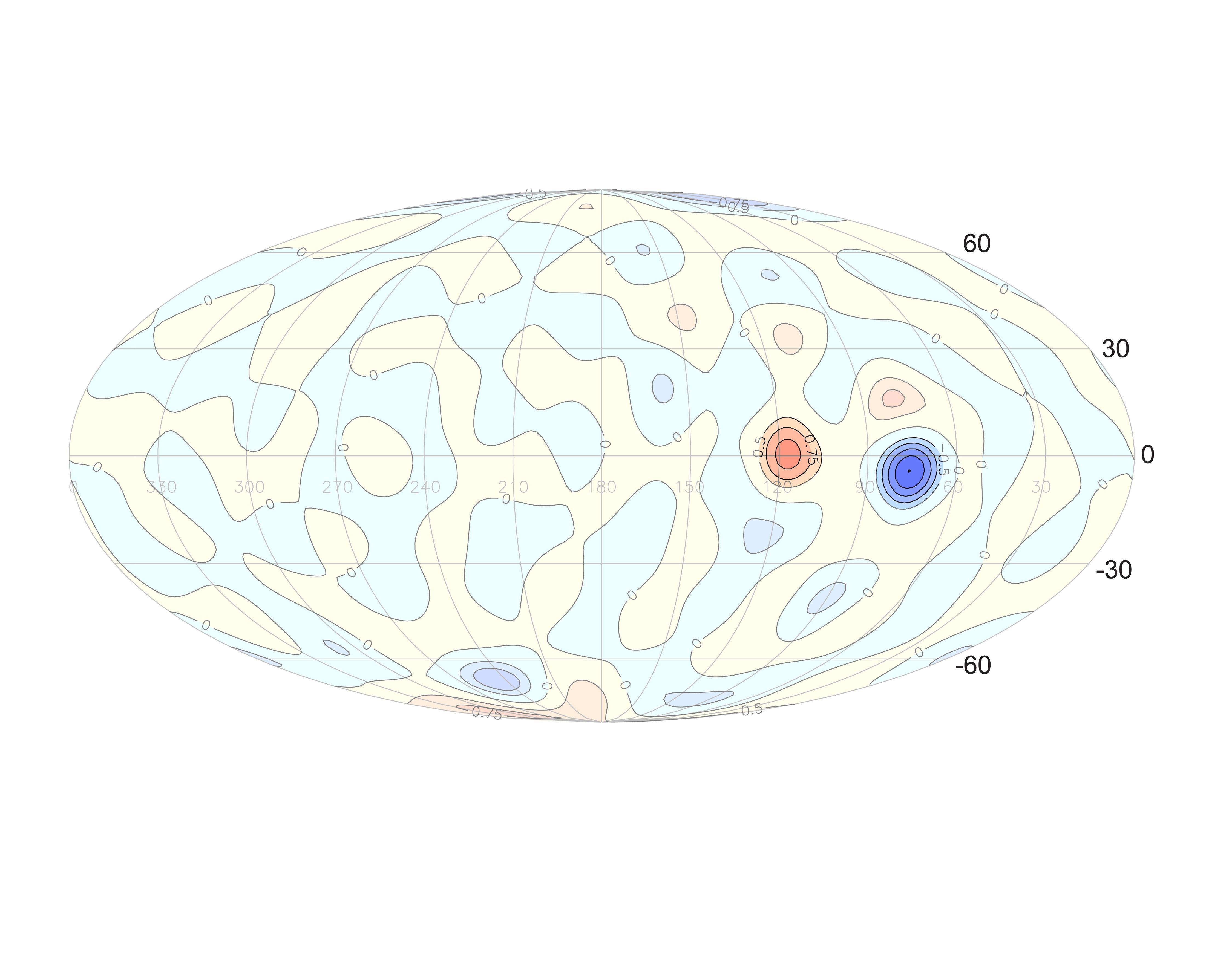
PIA24963:
-
Great Red Spot Gravity
Full Resolution:
TIFF
(130.6 kB)
JPEG
(30.86 kB)
|
|
|
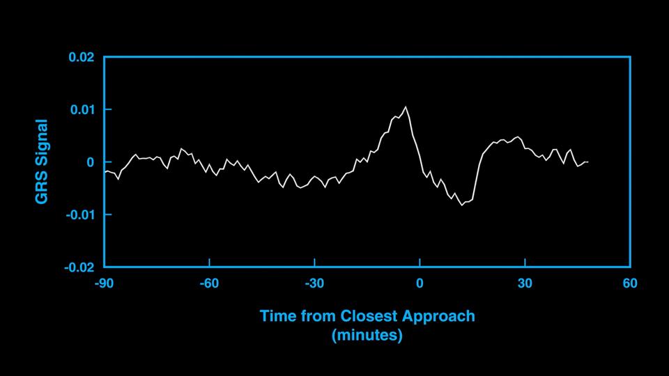
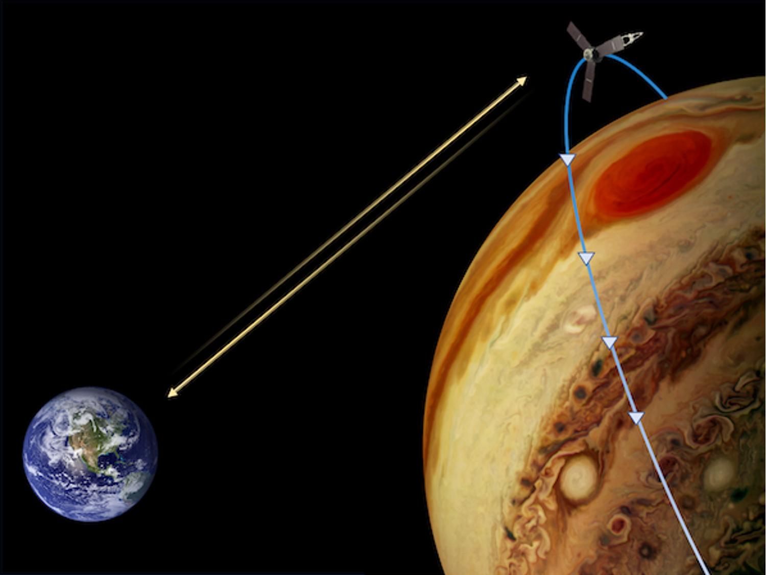
2021-10-28 |
Jupiter
|
Juno
|
|
1500x1125x3 |
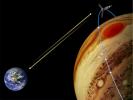
|
-
PIA24820:
-
Measuring the Gravity of Jupiter's Great Red Spot
Full Resolution:
TIFF
(2.366 MB)
JPEG
(98.7 kB)
|
|
|
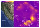
2021-10-27 |
Earth
|
ECOSTRESS
|
|
3507x2480x3 |
|
-
PIA24916:
-
La Palma Volcano
Full Resolution:
TIFF
(16.12 MB)
JPEG
(719.5 kB)
|
|
|
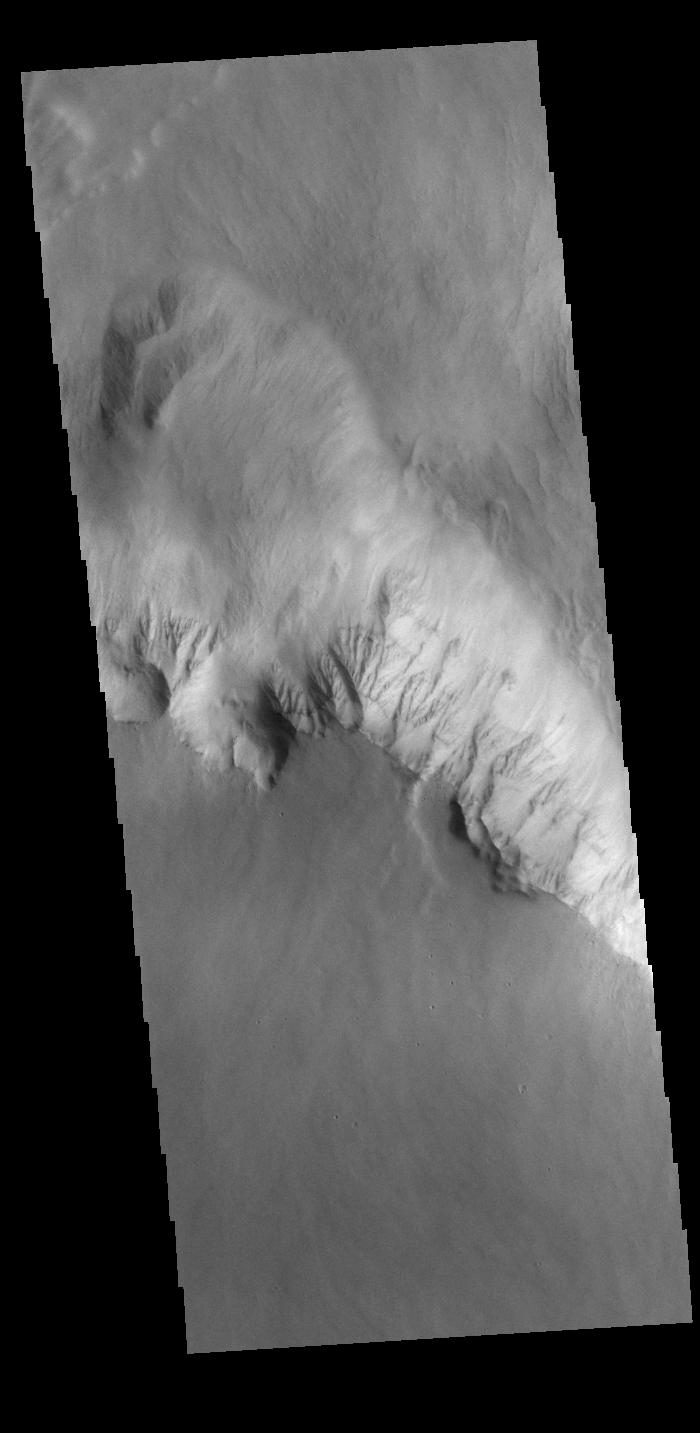
2021-10-27 |
Mars
|
2001 Mars Odyssey
|
THEMIS
|
700x1433x1 |
|
-
PIA24228:
-
Olympus Rupes
Full Resolution:
TIFF
(697.1 kB)
JPEG
(77.16 kB)
|
|
|
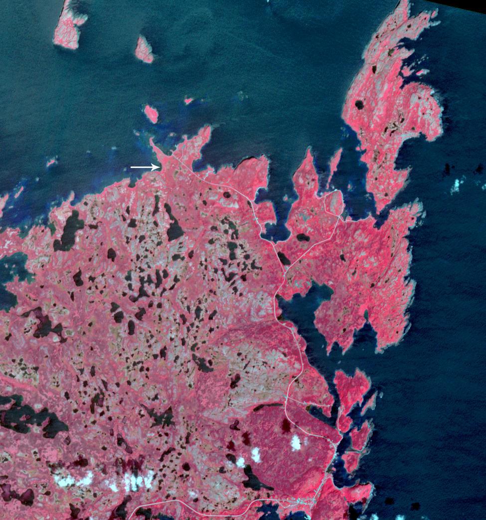
2021-10-21 |
Earth
|
Terra
|
ASTER
|
975x1043x3 |
|
-
PIA24941:
-
L'Anse aux Meadows, Newfoundland
Full Resolution:
TIFF
(3.052 MB)
JPEG
(194.8 kB)
|
|
|
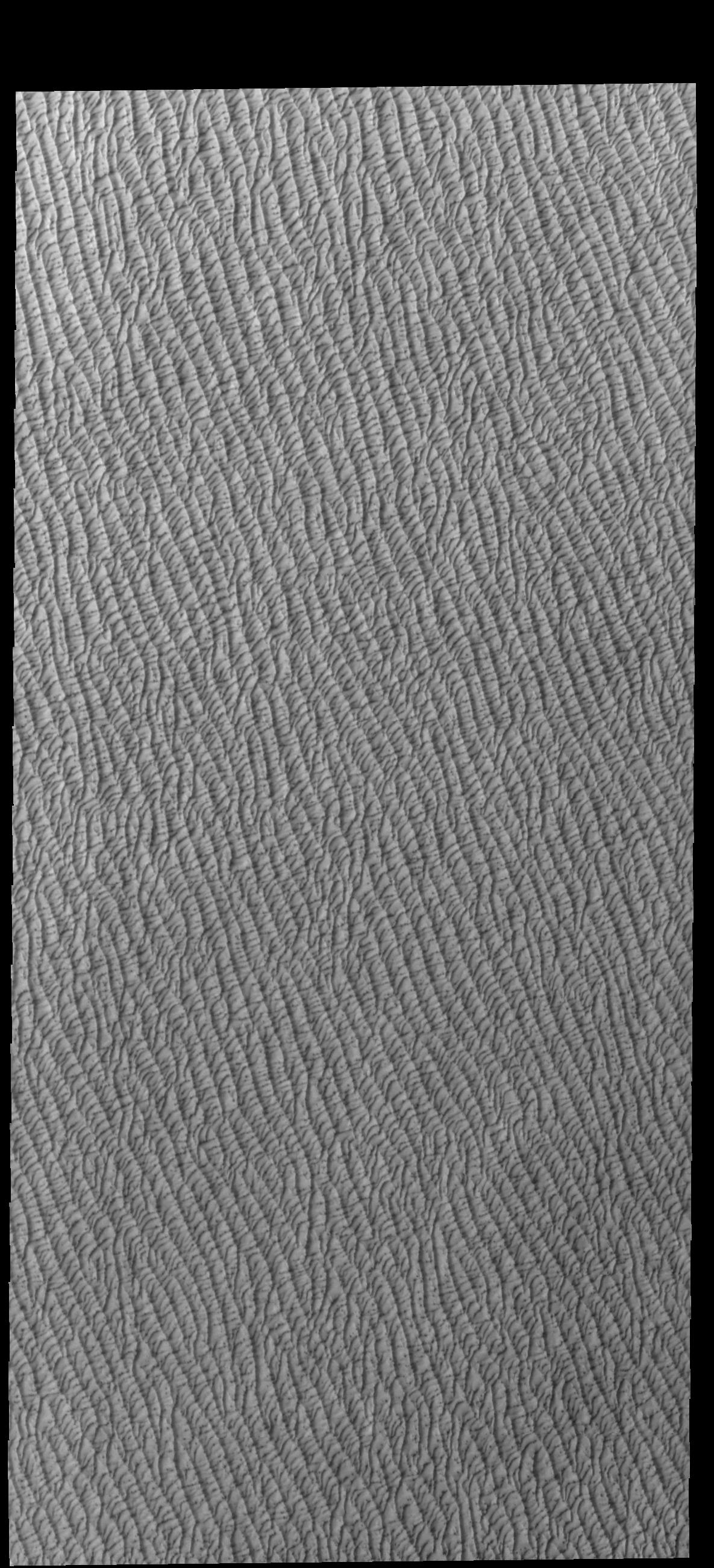
2021-10-18 |
Mars
|
2001 Mars Odyssey
|
THEMIS
|
1185x2604x1 |

|
-
PIA24221:
-
Olympia Undae
Full Resolution:
TIFF
(3.089 MB)
JPEG
(467.9 kB)
|
|
|
2021-10-14 |
Earth
|
Terra
|
ASTER
|
1702x1525x3 |
|
-
PIA24902:
-
Backup at Ports of LA and Long Beach
Full Resolution:
TIFF
(6.549 MB)
JPEG
(360.2 kB)
|
|
|
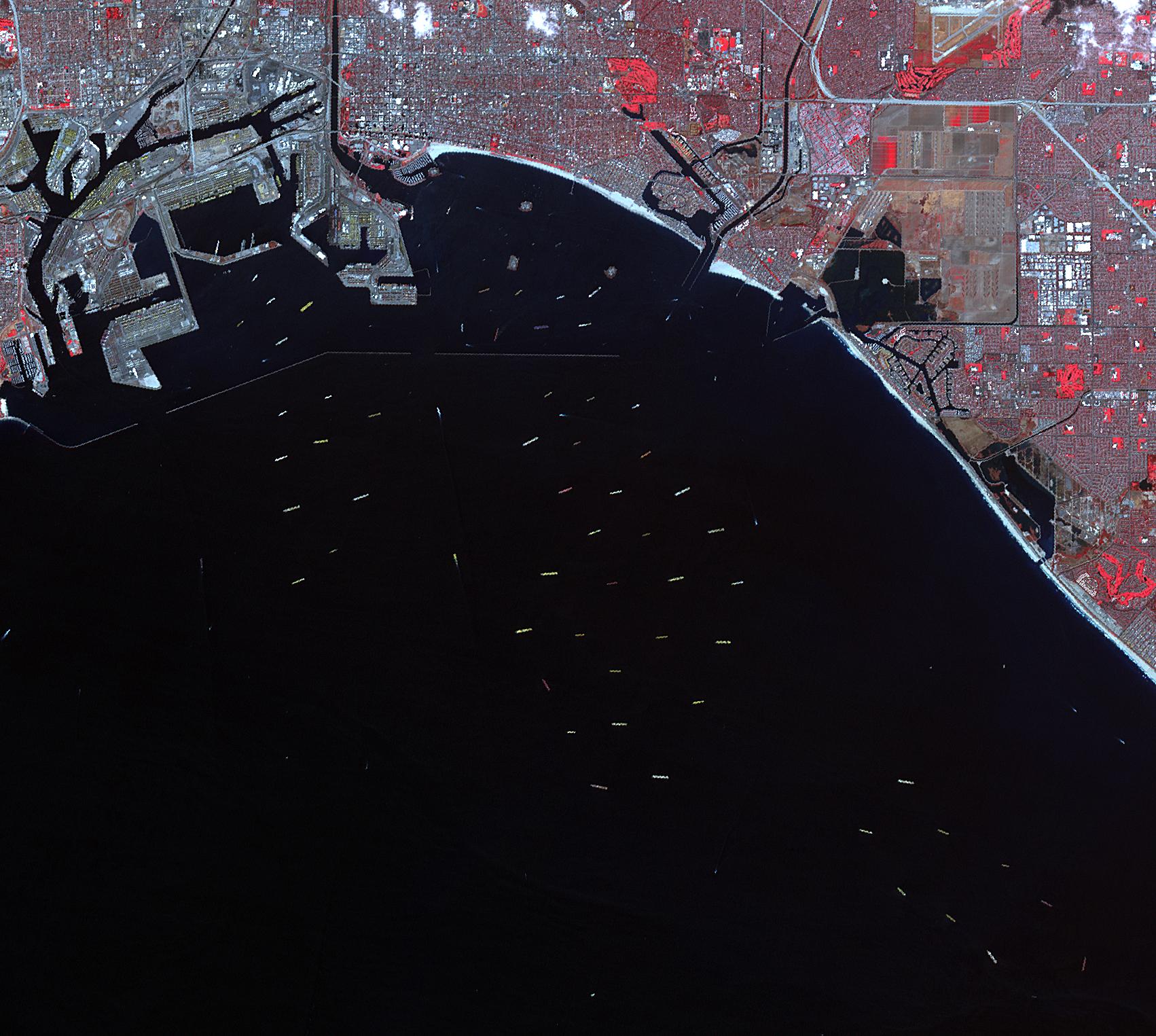
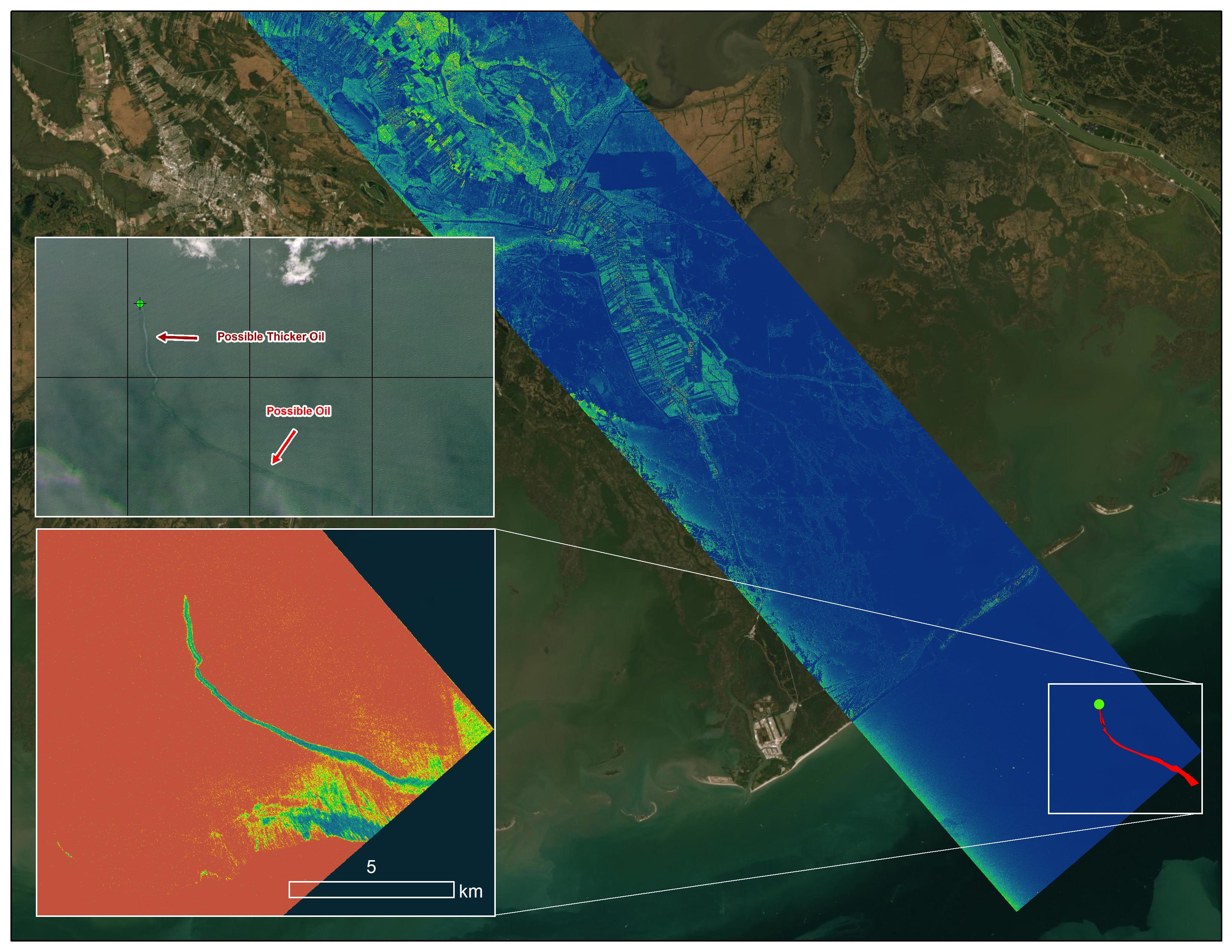
2021-10-13 |
Earth
|
|
UAVSAR
|
3300x2550x3 |
|
-
PIA23782:
-
UAVSAR Oil Slicks
Full Resolution:
TIFF
(13.21 MB)
JPEG
(2.027 MB)
|
|
|
2021-10-13 |
|
NISAR
|
L-Band Synthetic Aperture Radar
S-Band Synthetic Aperture Radar
|
4128x2752x3 |
|
-
PIA24539:
-
NISAR Testing
Full Resolution:
TIFF
(30.04 MB)
JPEG
(1.467 MB)
|
|
|
2021-10-11 |
Earth
|
Terra
|
ASTER
|
1843x2016x3 |
|
-
PIA24869:
-
Daintree National Park, Australia
Full Resolution:
TIFF
(11.15 MB)
JPEG
(617.5 kB)
|
|
|
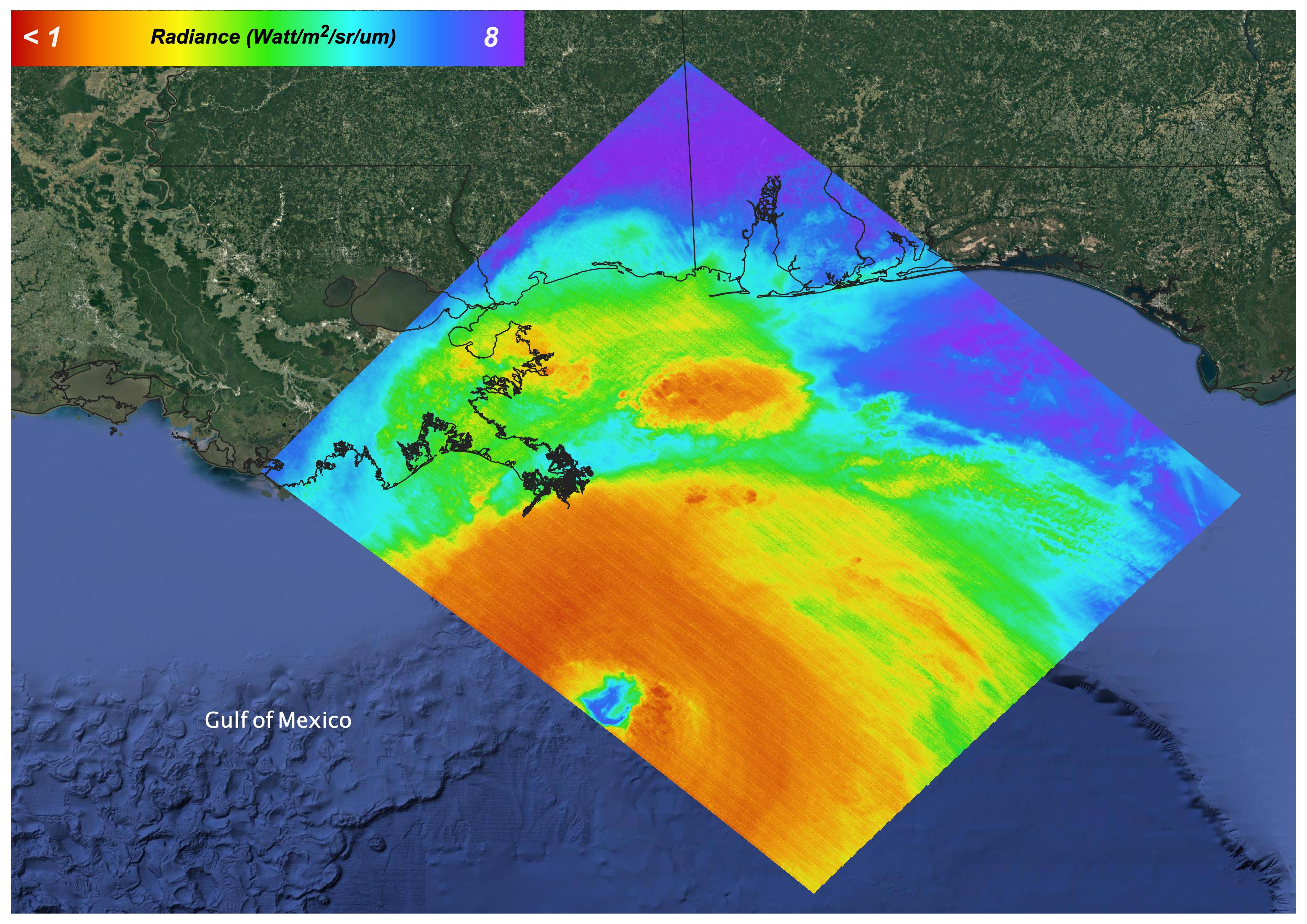
2021-10-07 |
Earth
|
ECOSTRESS
|
|
3507x2480x3 |
|
-
PIA24210:
-
Hurricane Ida, August 27, 2021
Full Resolution:
TIFF
(21.59 MB)
JPEG
(1.144 MB)
|
|
|
2021-10-07 |
Earth
|
ECOSTRESS
|
|
3507x2480x3 |
|
-
PIA24209:
-
Glass Fire, September 27, 2020
Full Resolution:
TIFF
(14.05 MB)
JPEG
(854.1 kB)
|
|
|
2021-09-29 |
Mars
|
Mars Reconnaissance Orbiter (MRO)
|
HiRISE
|
2880x1800x3 |
|
-
PIA24912:
-
Bright and Dark Slope Streaks
Full Resolution:
TIFF
(15.56 MB)
JPEG
(981.5 kB)
|
|
|
2021-09-23 |
Earth
|
Terra
|
ASTER
|
1120x866x3 |
|
-
PIA24868:
-
Pamukkale, Turkey
Full Resolution:
TIFF
(2.911 MB)
JPEG
(192.7 kB)
|
|
|
2021-09-21 |
Mars
|
2001 Mars Odyssey
|
THEMIS
|
587x1435x1 |
|
-
PIA24882:
-
Olympia Undae
Full Resolution:
TIFF
(832.4 kB)
JPEG
(151.5 kB)
|
|
|
2021-09-20 |
Earth
|
Delta-X
|
UAVSAR
|
3300x2550x3 |
|
-
PIA24540:
-
Delta-X Oil Slick Radar Signal in Gulf of Mexico
Full Resolution:
TIFF
(16.81 MB)
JPEG
(966.2 kB)
|
|
|
2021-09-15 |
Mars
|
2001 Mars Odyssey
|
THEMIS
|
600x2719x1 |

|
-
PIA24878:
-
Olympia Undae
Full Resolution:
TIFF
(1.633 MB)
JPEG
(314.8 kB)
|
|
|
2021-09-13 |
Mars
|
2001 Mars Odyssey
|
THEMIS
|
691x1429x1 |

|
-
PIA24876:
-
Olympus Rupes
Full Resolution:
TIFF
(627.5 kB)
JPEG
(60.95 kB)
|
 Planetary Data System


