My
List |
Addition Date
|
Target
|
Mission
|
Instrument
|
Size
|

|
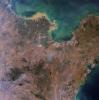
2025-01-06 |
Earth
|
Terra
|
ASTER
|
2805x3876x3 |

|
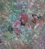
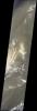
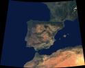
-
PIA26503:
-
French Overseas Terrritory of Mayotte, Indian Ocean
Full Resolution:
TIFF
(20.02 MB)
JPEG
(840.2 kB)
|
|
|
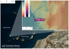
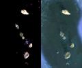
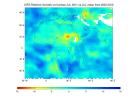
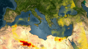
2024-10-10 |
Earth
|
Carbon Mapper Coalition
|
Carbon Mapper Imaging Spectrometer
|
7680x7680x3 |
|
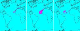
-
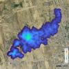
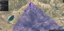
PIA26416:
-
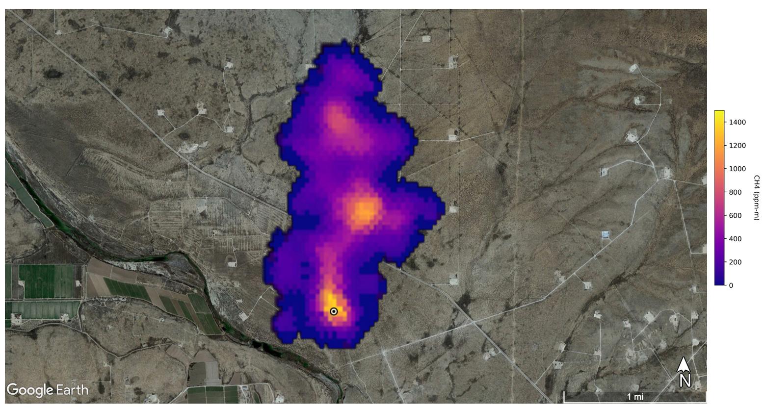
Tanager-1 First Methane and Carbon Dioxide Plume Detections
Full Resolution:
TIFF
(161.9 MB)
JPEG
(7.602 MB)
|
|
|
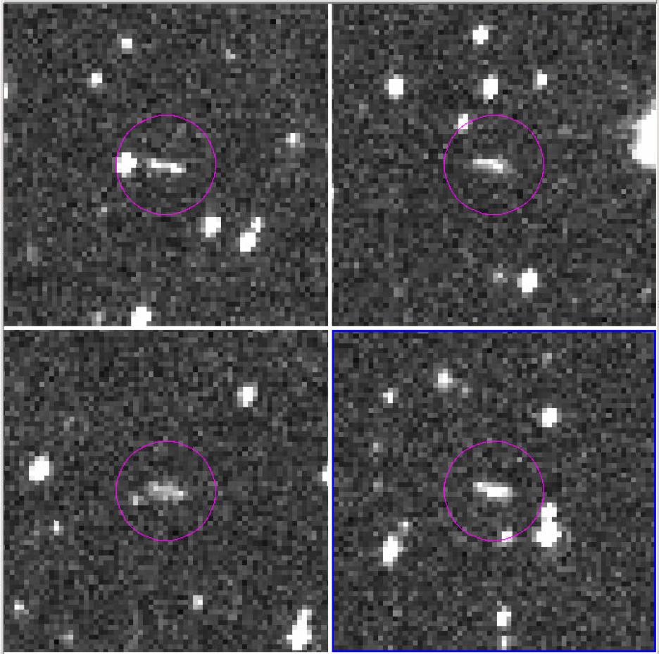
2024-10-02 |
Asteroid
|
|
ATLAS
|
1367x970x3 |
|
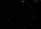
-
PIA26452:
-
Asteroid 2024 PT5's Orbit Around the Sun (Animation)
Full Resolution:
TIFF
(195.3 kB)
JPEG
(38.41 kB)
|
|
|
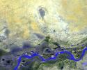
2024-04-26 |
Earth
|
|
|
1440x810x3 |
|
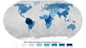
-
PIA26119:
-
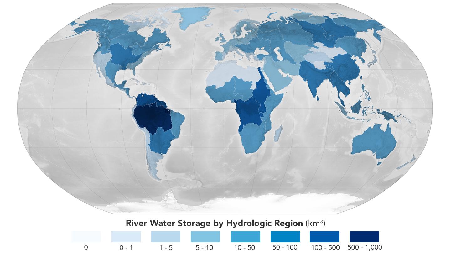
Global Accounting of Earth's River Storage and Flow
Full Resolution:
TIFF
(1.377 MB)
JPEG
(104.8 kB)
|
|
|
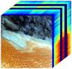
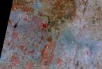
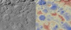
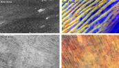
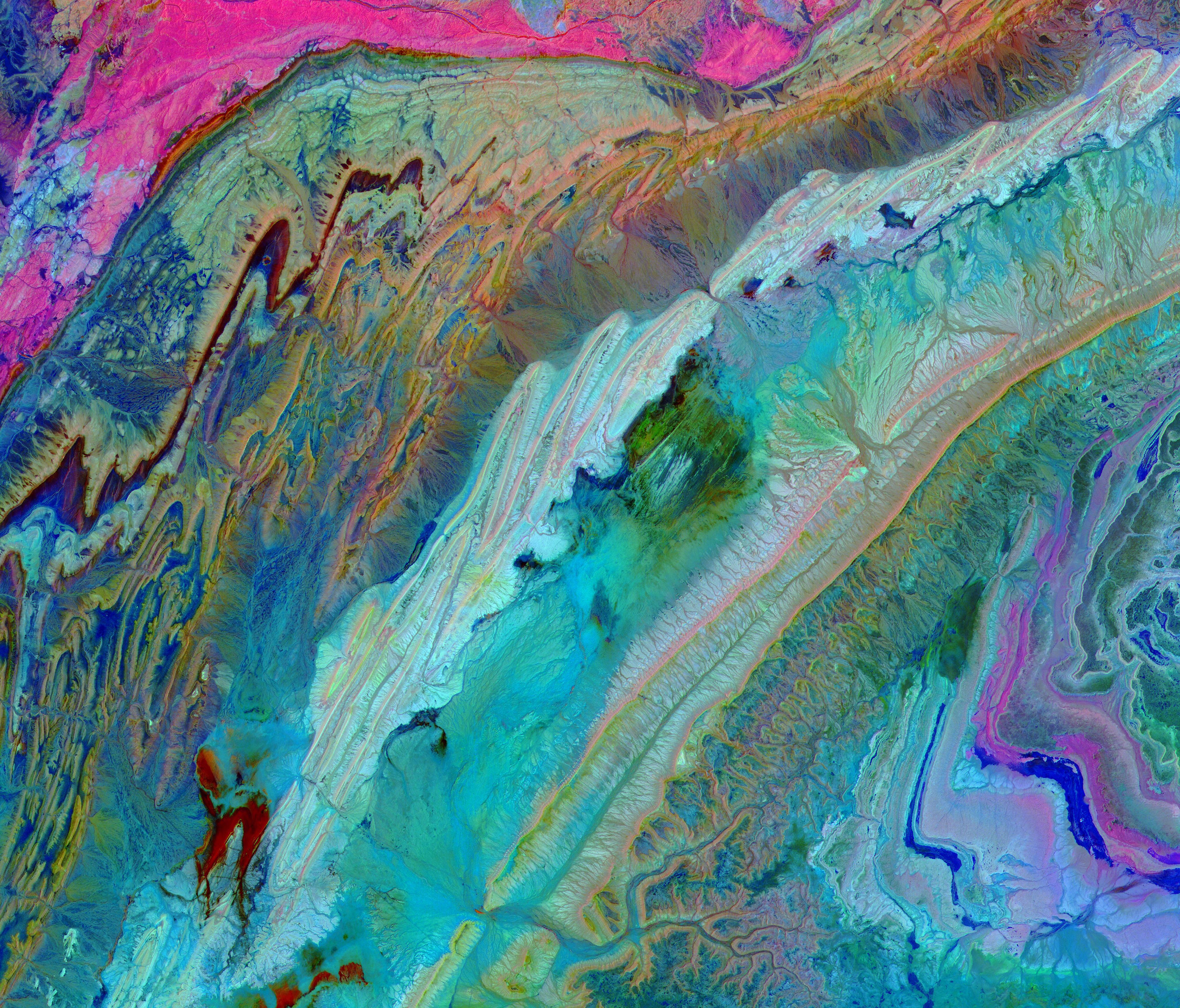
2023-12-11 |
Earth
|
Earth Surface Mineral Dust Source Investigation (EMIT)
|
EMIT
|
5836x2174x3 |
|
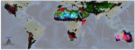
-
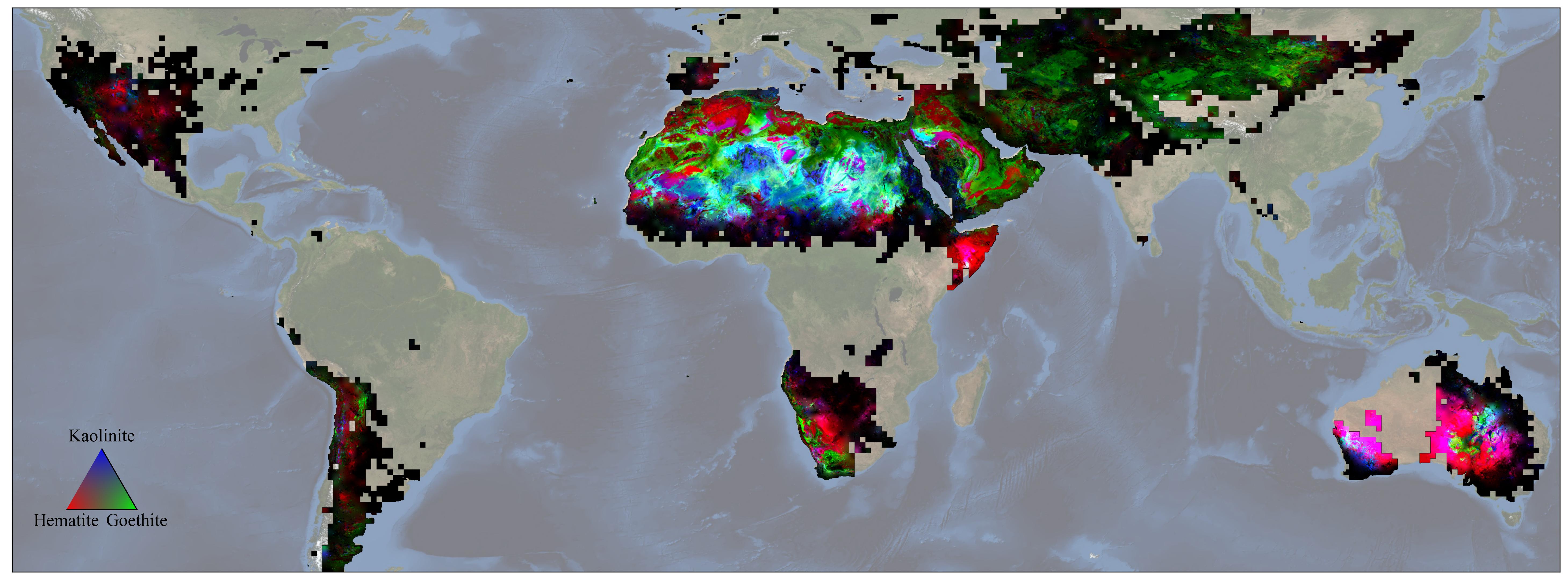
PIA26116:
-
NASA's EMIT Mission Produces Maps of Arid Region Surface Minerals
Full Resolution:
TIFF
(21.27 MB)
JPEG
(819.1 kB)
|
|
|
2023-11-17 |
Earth
|
Earth Surface Mineral Dust Source Investigation (EMIT)
|
EMIT
|
3499x1700x3 |
|
-
PIA26113:
-
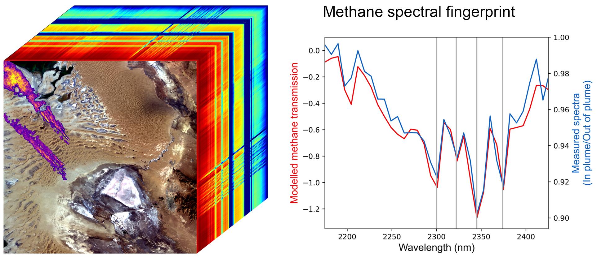
EMIT Identifying Methane Plumes Around the Globe
Full Resolution:
TIFF
(17.85 MB)
JPEG
(1.131 MB)
|
|
|
2023-07-18 |
Earth
|
Terra
|
ASTER
|
4000x3303x3 |
|
-
PIA25981:
-
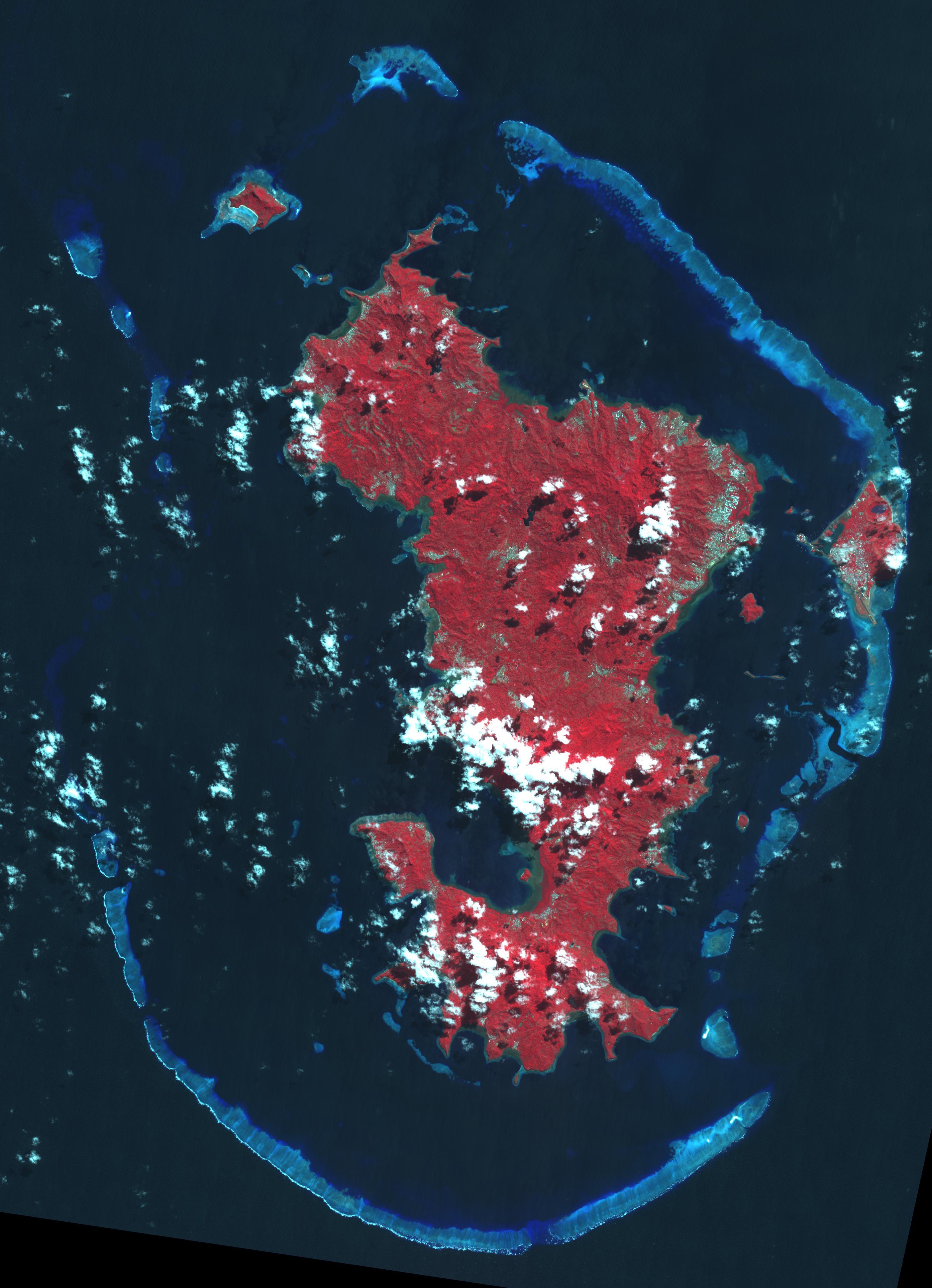
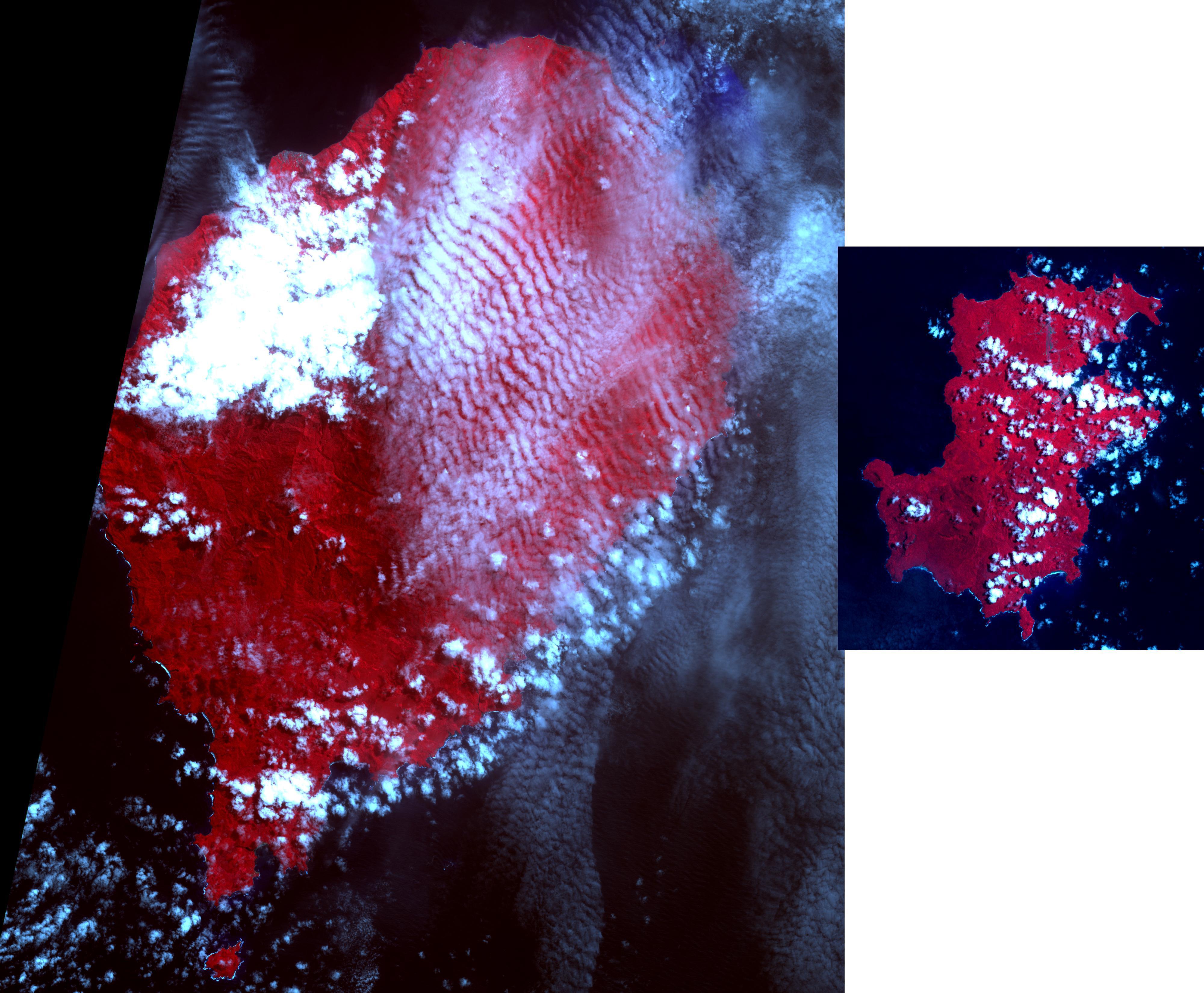
Democratic Republic of Sao Tome and Principe
Full Resolution:
TIFF
(27.66 MB)
JPEG
(1.153 MB)
|
|
|
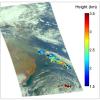
2022-10-25 |
Earth
|
Earth Surface Mineral Dust Source Investigation (EMIT)
|
EMIT
|
1925x834x3 |
|
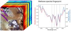
-
PIA25593:
-
EMIT Methane Spectral Fingerprint
Full Resolution:
TIFF
(2.575 MB)
JPEG
(246.3 kB)
|
|
|
2022-10-25 |
Earth
|
Earth Surface Mineral Dust Source Investigation (EMIT)
|
EMIT
|
1557x834x3 |
|
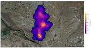
-
PIA25592:
-
EMIT Spots Methane Hotspots
Full Resolution:
TIFF
(3.464 MB)
JPEG
(204.9 kB)
|
|
|
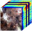
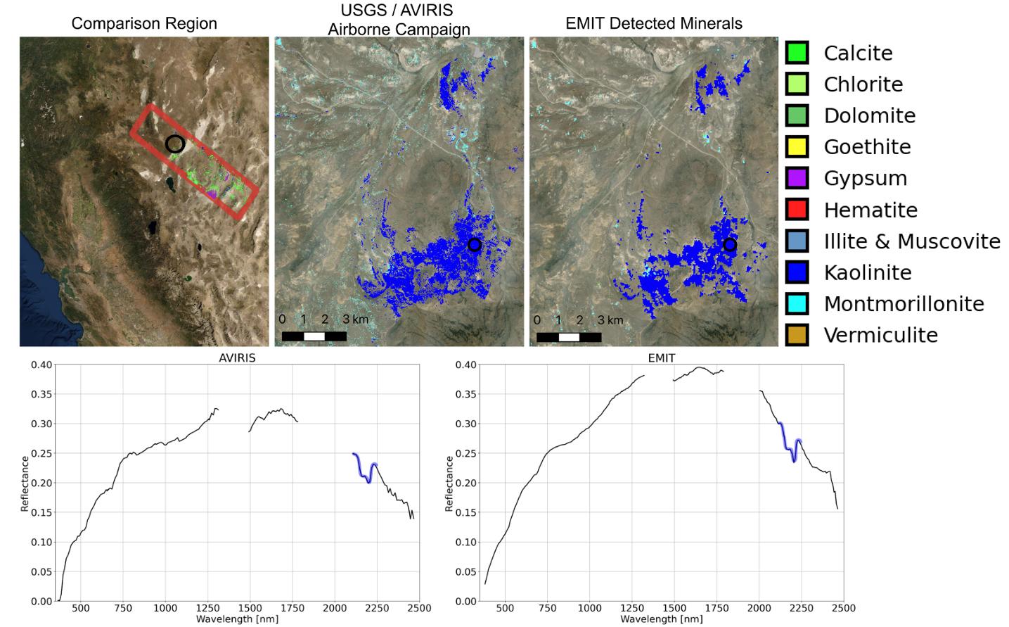
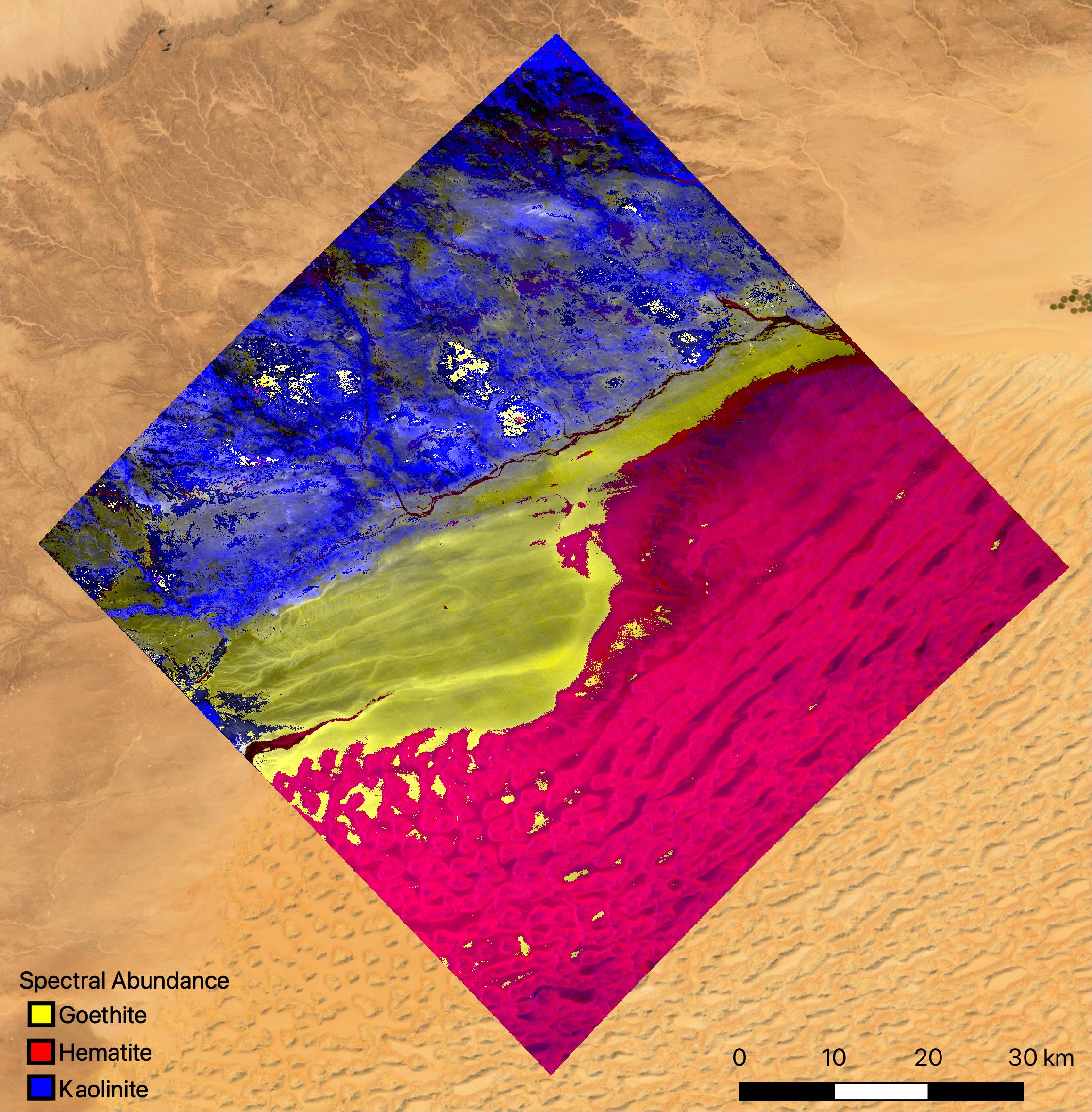
2022-10-12 |
Earth
|
Earth Surface Mineral Dust Source Investigation (EMIT)
|
EMIT
|
2457x2370x3 |
|
-
PIA25430:
-
NASA's EMIT Mission Generates Image Cube of Surface Minerals in Southwestern Libya
Full Resolution:
TIFF
(15.61 MB)
JPEG
(788.9 kB)
|
|
|
2022-10-12 |
Earth
|
Earth Surface Mineral Dust Source Investigation (EMIT)
|
EMIT
|
1489x1039x3 |

|
-
PIA25429:
-
NASA's EMIT Measures Surface Dust in North Africa, Europe, the Middle East, Central Asia
Full Resolution:
TIFF
(4.643 MB)
JPEG
(393.1 kB)
|
|
|
2022-10-12 |
Earth
|
Earth Surface Mineral Dust Source Investigation (EMIT)
|
EMIT
|
1435x891x3 |

|
-
PIA25428:
-
NASA's EMIT Collects Mineral Maps, Spectral Fingerprints From Nevada
Full Resolution:
TIFF
(1.876 MB)
JPEG
(184.9 kB)
|
|
|
2022-10-12 |
Earth
|
Earth Surface Mineral Dust Source Investigation (EMIT)
|
EMIT
|
774x750x3 |
|
-
PIA25427:
-
NASA's EMIT Generates Image Cube of Surface Minerals in Northwest Nevada
Full Resolution:
TIFF
(1.689 MB)
JPEG
(146.8 kB)
|
|
|
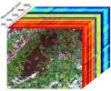
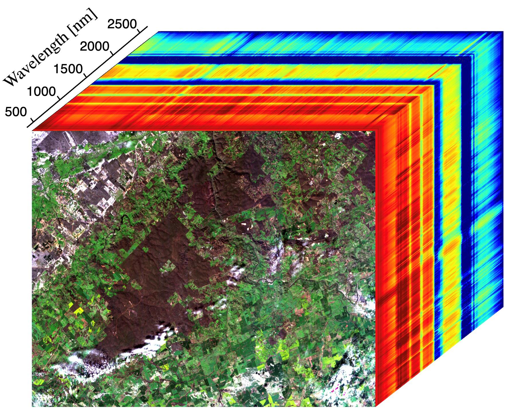
2022-10-12 |
Earth
|
Earth Surface Mineral Dust Source Investigation (EMIT)
|
EMIT
|
2249x2289x3 |

|
-
PIA25424:
-
EMIT Instrument's First Light
Full Resolution:
TIFF
(14.73 MB)
JPEG
(813.9 kB)
|
|
|
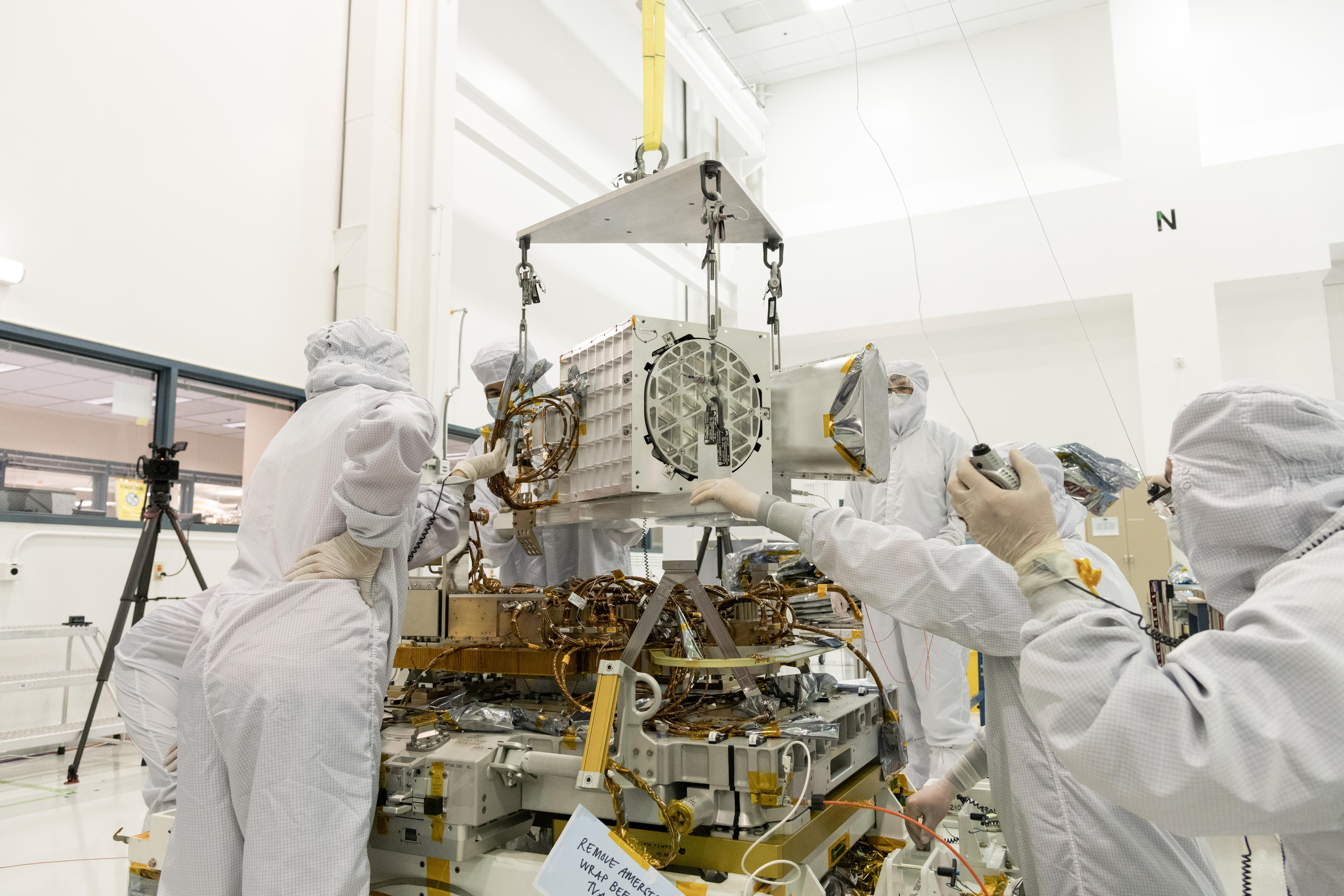
2022-07-29 |
Earth
|
Earth Surface Mineral Dust Source Investigation (EMIT)
|
EMIT
|
1774x1458x3 |
|
-
PIA24529:
-
EMIT Instrument's First Light
Full Resolution:
TIFF
(7.334 MB)
JPEG
(508.6 kB)
|
|
|
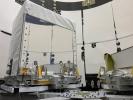
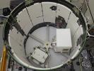
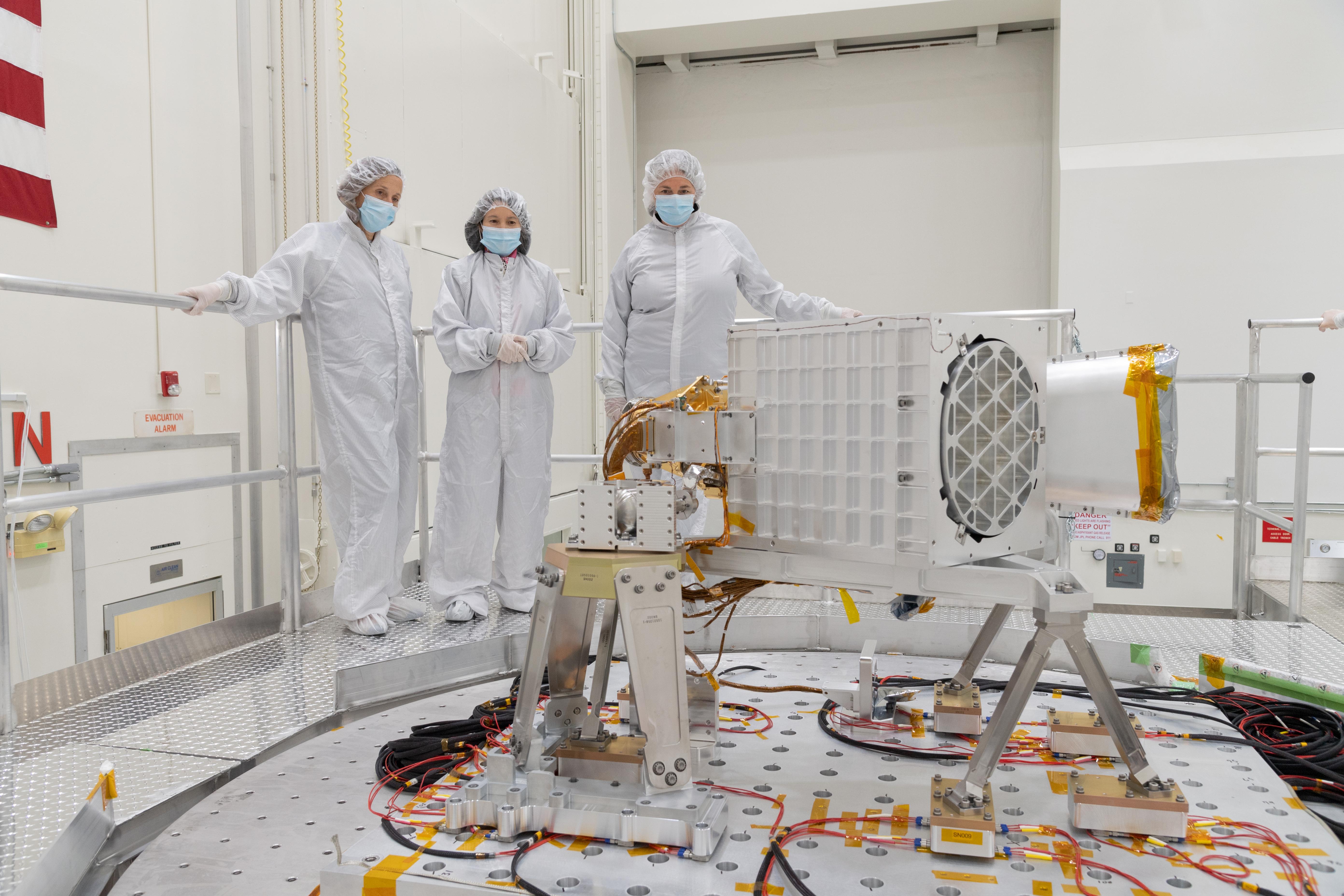
2022-06-01 |
Earth
|
Earth Surface Mineral Dust Source Investigation (EMIT)
|
EMIT
|
5568x3712x3 |

|
-
PIA25150:
-
EMIT Put to the Test at JPL
Full Resolution:
TIFF
(43.37 MB)
JPEG
(1.852 MB)
|
|
|
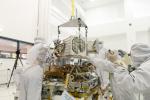
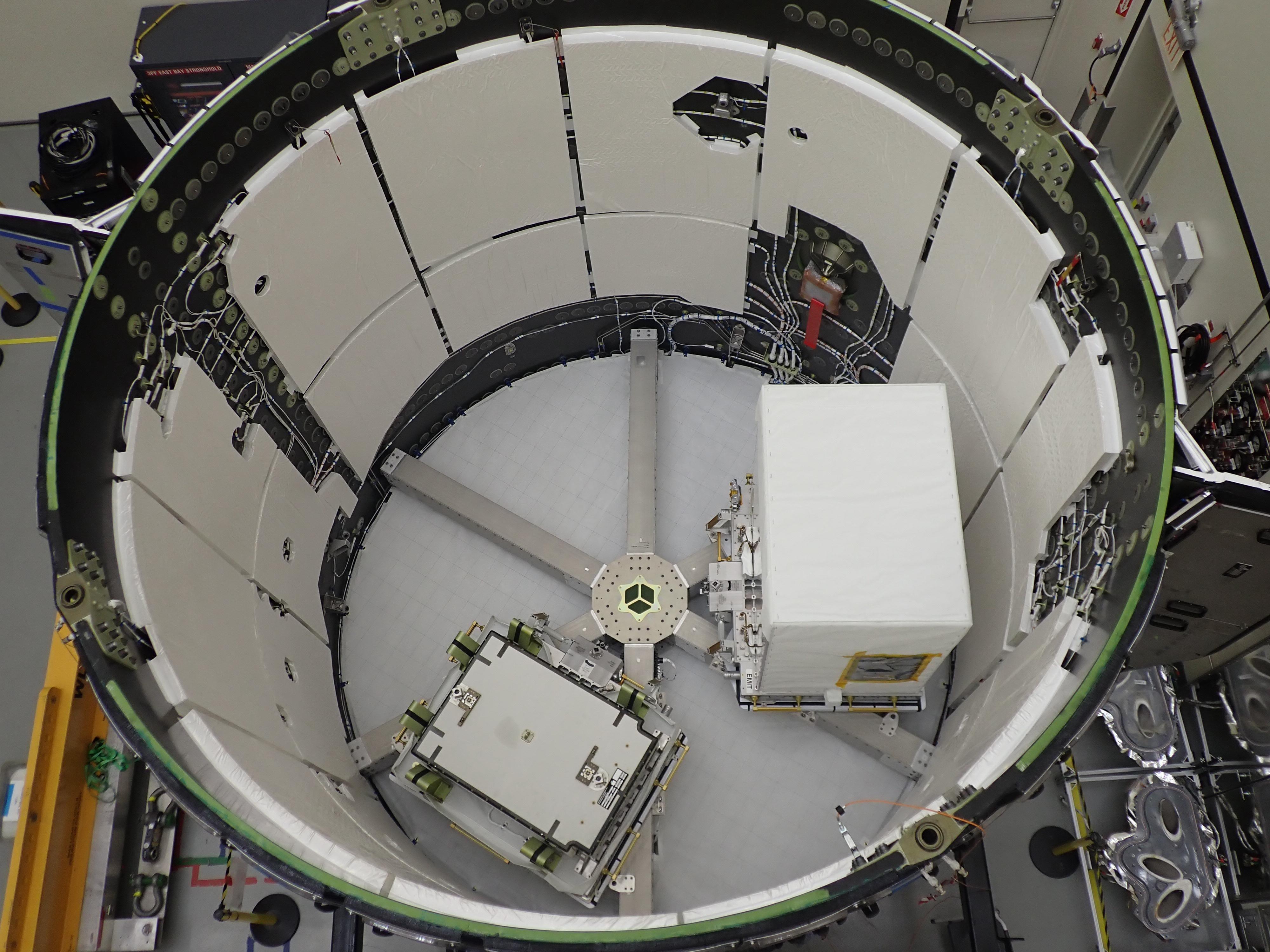
2022-05-12 |
Earth
|
Earth Surface Mineral Dust Source Investigation (EMIT)
|
EMIT
|
1230x922x3 |
|
-
PIA25149:
-
EMIT Inside SpaceX Falcon 9 Trunk Ahead of Transport
Full Resolution:
TIFF
(2.82 MB)
JPEG
(178.1 kB)
|
|
|
2022-05-12 |
Earth
|
Earth Surface Mineral Dust Source Investigation (EMIT)
|
EMIT
|
4000x3000x3 |
|
-
PIA25148:
-
EMIT Loaded Into SpaceX Falcon 9 Trunk Before Transport
Full Resolution:
TIFF
(28.26 MB)
JPEG
(1.117 MB)
|
|
|
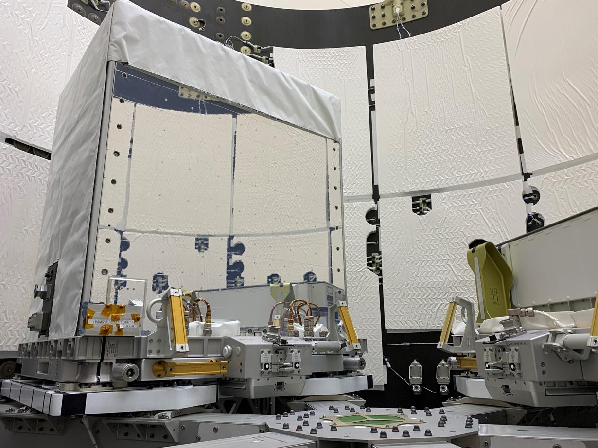
2022-05-02 |
Earth
|
Earth Surface Mineral Dust Source Investigation (EMIT)
|
EMIT
|
7955x5303x3 |
|
-
PIA25146:
-
EMIT's Components Come Together at JPL
Full Resolution:
TIFF
(89.44 MB)
JPEG
(5.066 MB)
|
|
|
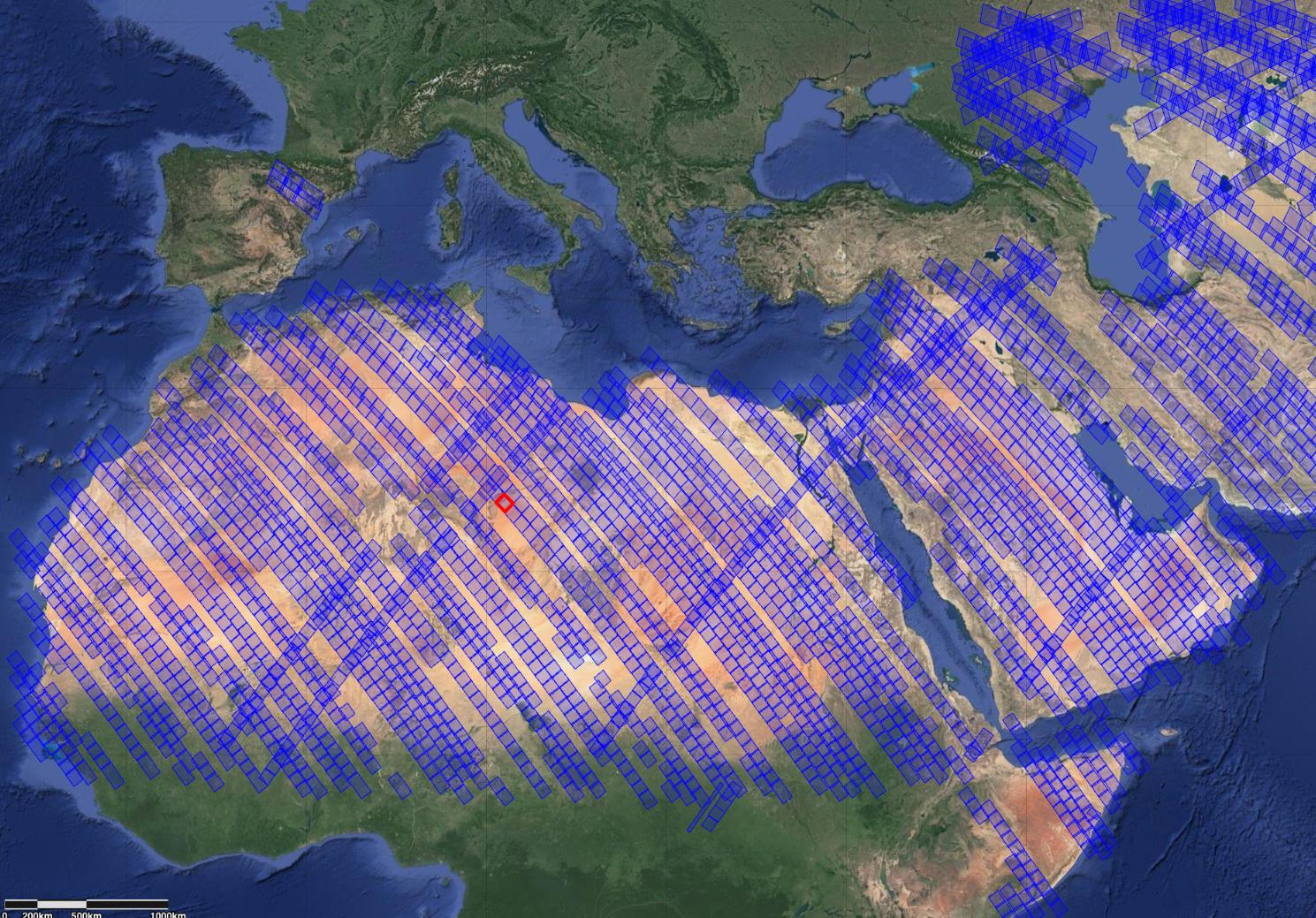
2022-05-02 |
Earth
|
Earth Surface Mineral Dust Source Investigation (EMIT)
|
EMIT
|
2522x1199x3 |

|
-
PIA25145:
-
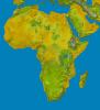
Global Mineral Dust Source Regions to Be Measured by EMIT
Full Resolution:
TIFF
(1.717 MB)
JPEG
(167.4 kB)
|
|
|
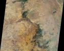
2022-04-05 |
Earth
|
Terra
|
ASTER
|
2500x1700x3 |
|
-
PIA25186:
-
Abuja, Nigeria, 2021
Full Resolution:
TIFF
(12.75 MB)
JPEG
(883.2 kB)
|
|
|
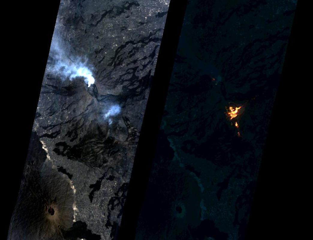
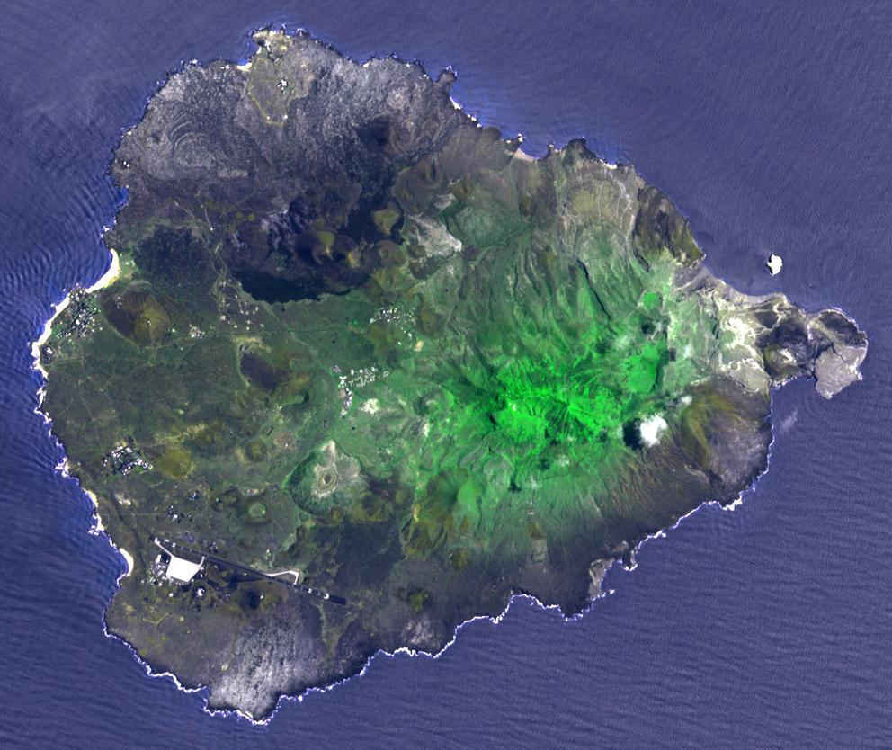
2021-10-27 |
Earth
|
ECOSTRESS
|
|
3507x2480x3 |
|
-
PIA24916:
-
La Palma Volcano
Full Resolution:
TIFF
(16.12 MB)
JPEG
(719.5 kB)
|
|
|
2021-05-18 |
Jupiter
|
Juno
|
JunoCam
|
1568x2382x3 |
|
-
PIA23609:
-
Juno Returns to Clyde's Spot on Jupiter
Full Resolution:
TIFF
(8.979 MB)
JPEG
(305.5 kB)
|
|
|
2021-02-09 |
Earth
|
Terra
|
ASTER
|
2727x1656x3 |

|
-
PIA24416:
-
Banjul, The Gambia
Full Resolution:
TIFF
(13.55 MB)
JPEG
(917.4 kB)
|
|
|
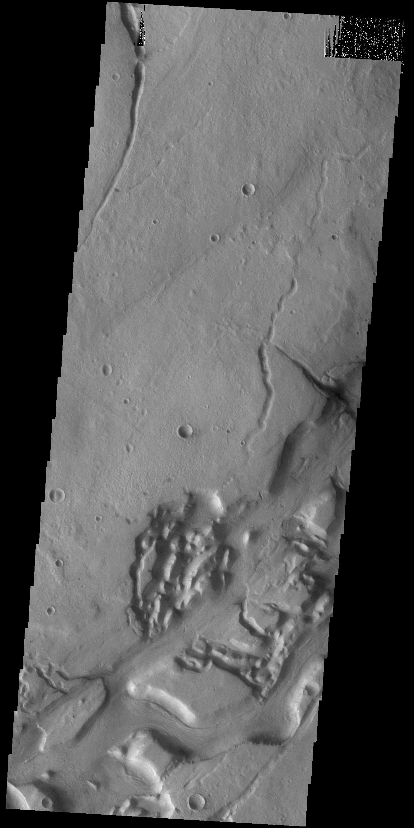
2021-01-15 |
Mars
|
2001 Mars Odyssey
|
THEMIS
|
1337x2665x1 |
|
-
PIA24365:
-
Niger Vallis
Full Resolution:
TIFF
(2.575 MB)
JPEG
(302.6 kB)
|
|
|
2020-12-17 |
Mars
|
2001 Mars Odyssey
|
THEMIS
|
1331x2662x1 |

|
-
PIA24279:
-
Niger Vallis
Full Resolution:
TIFF
(2.531 MB)
JPEG
(310.6 kB)
|
|
|
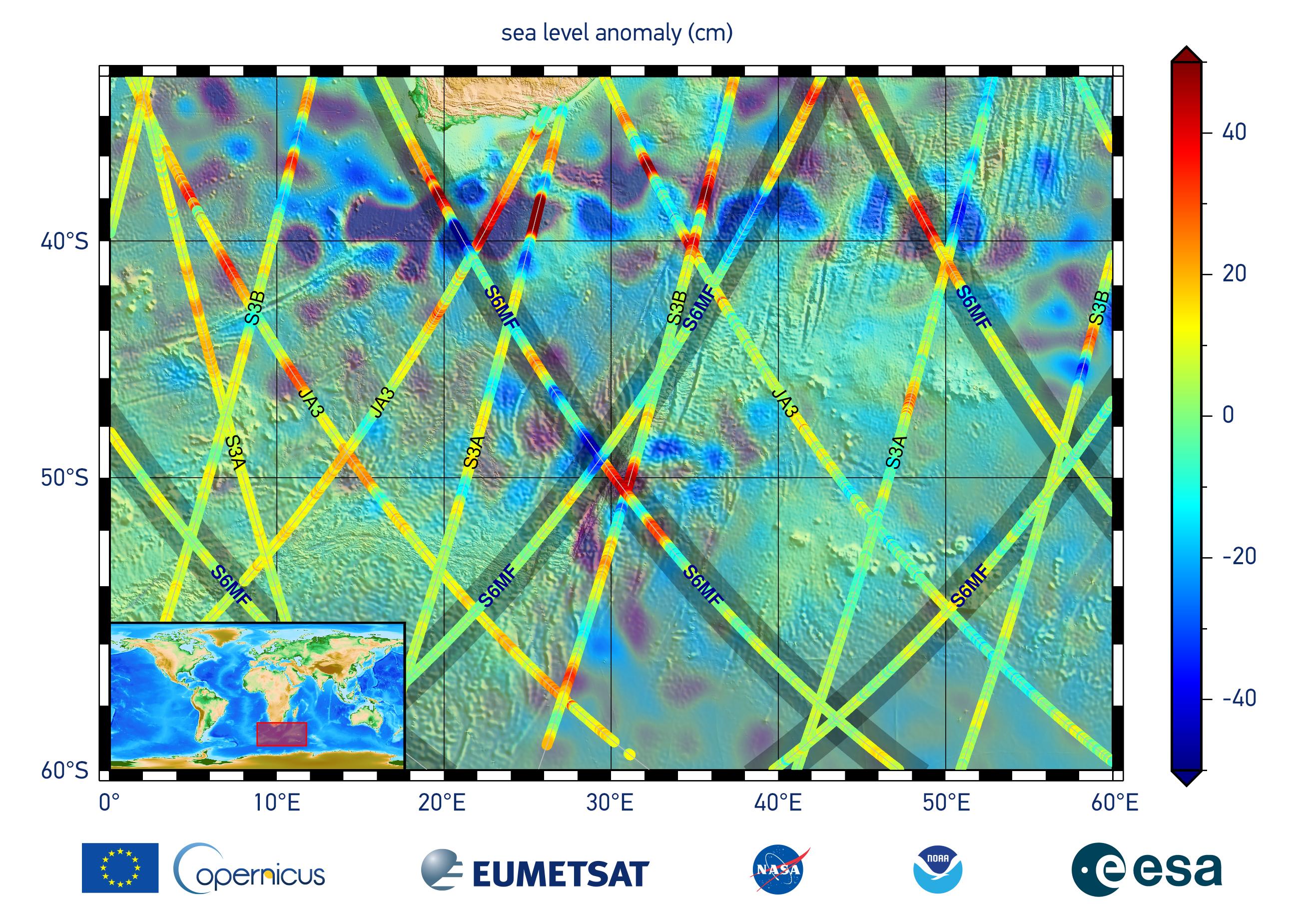
2020-12-10 |
Earth
|
Sentinel-6/Jason-CS
|
|
2600x1849x3 |
|
-
PIA24135:
-
Sentinel-6 Michael Freilich First Light Sea Level
Full Resolution:
TIFF
(10.71 MB)
JPEG
(704.9 kB)
|
|
|
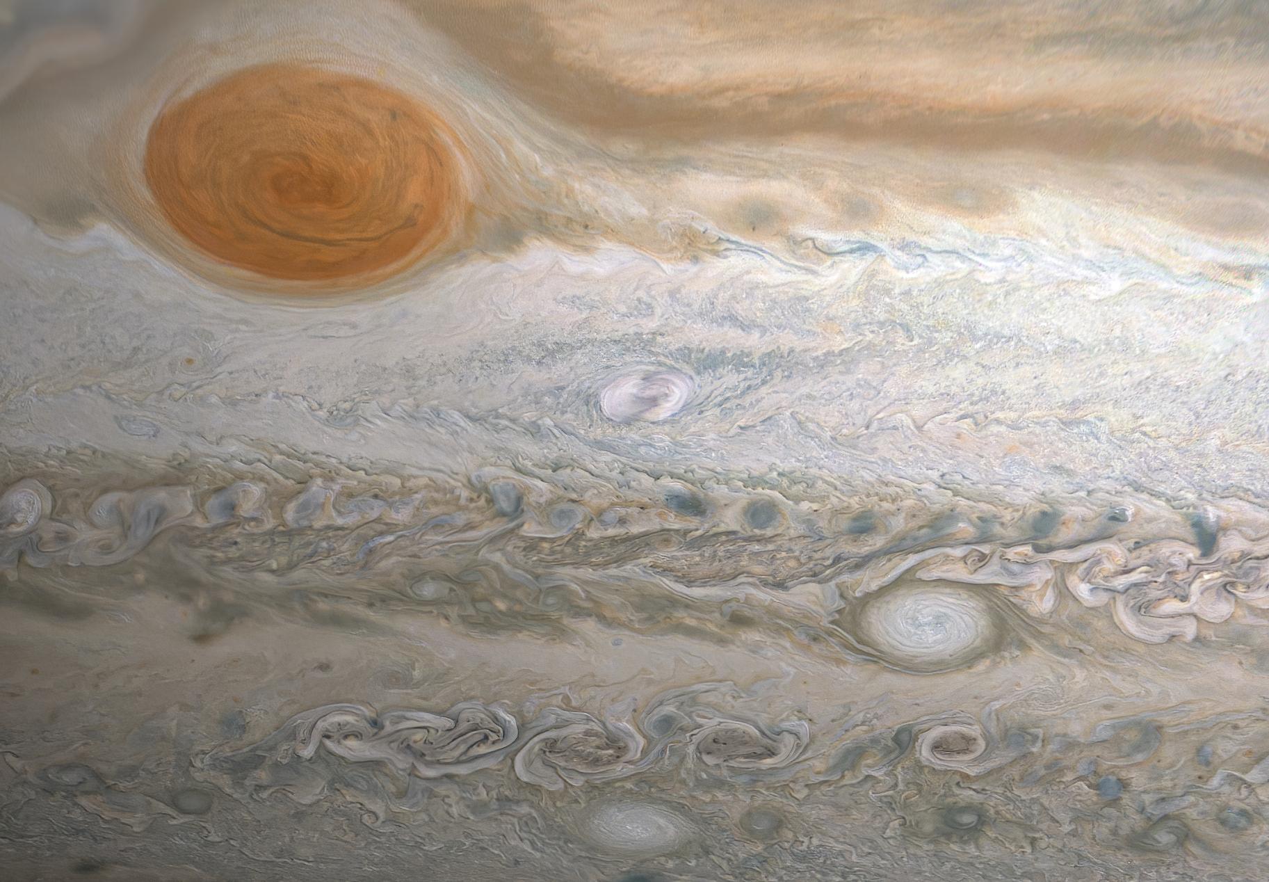
2020-07-01 |
Jupiter
|
Juno
|
JunoCam
|
1825x1268x3 |

|
-
PIA23806:
-
Clyde's Spot on Jupiter
Full Resolution:
TIFF
(6.495 MB)
JPEG
(301 kB)
|
|
|
2019-11-26 |
Earth
|
Terra
|
ASTER
|
4053x3461x3 |

|
-
PIA23533:
-
Anti-Atlas Mtns., Morocco
Full Resolution:
TIFF
(42.1 MB)
JPEG
(2.67 MB)
|
|
|
2018-06-03 |
Asteroid
|
Catalina Sky Survey (CSS)
|
|
936x928x3 |
|
-
PIA22468:
-
Asteroid 2018 LA
Full Resolution:
TIFF
(1.317 MB)
JPEG
(146 kB)
|
|
|
2018-03-19 |
Earth
|
Aqua
|
AIRS
|
2400x1800x3 |
|
-
PIA22344:
-
The Other Side of the Vortex
Full Resolution:
TIFF
(496.1 kB)
JPEG
(1.489 MB)
|
|
|
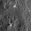
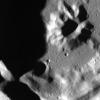
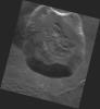
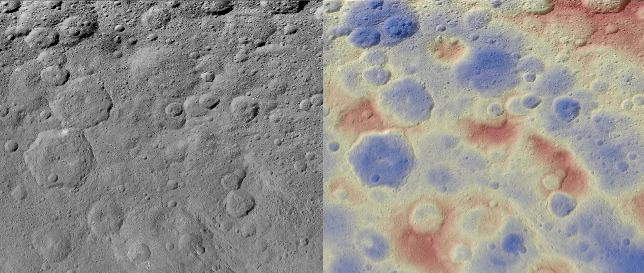
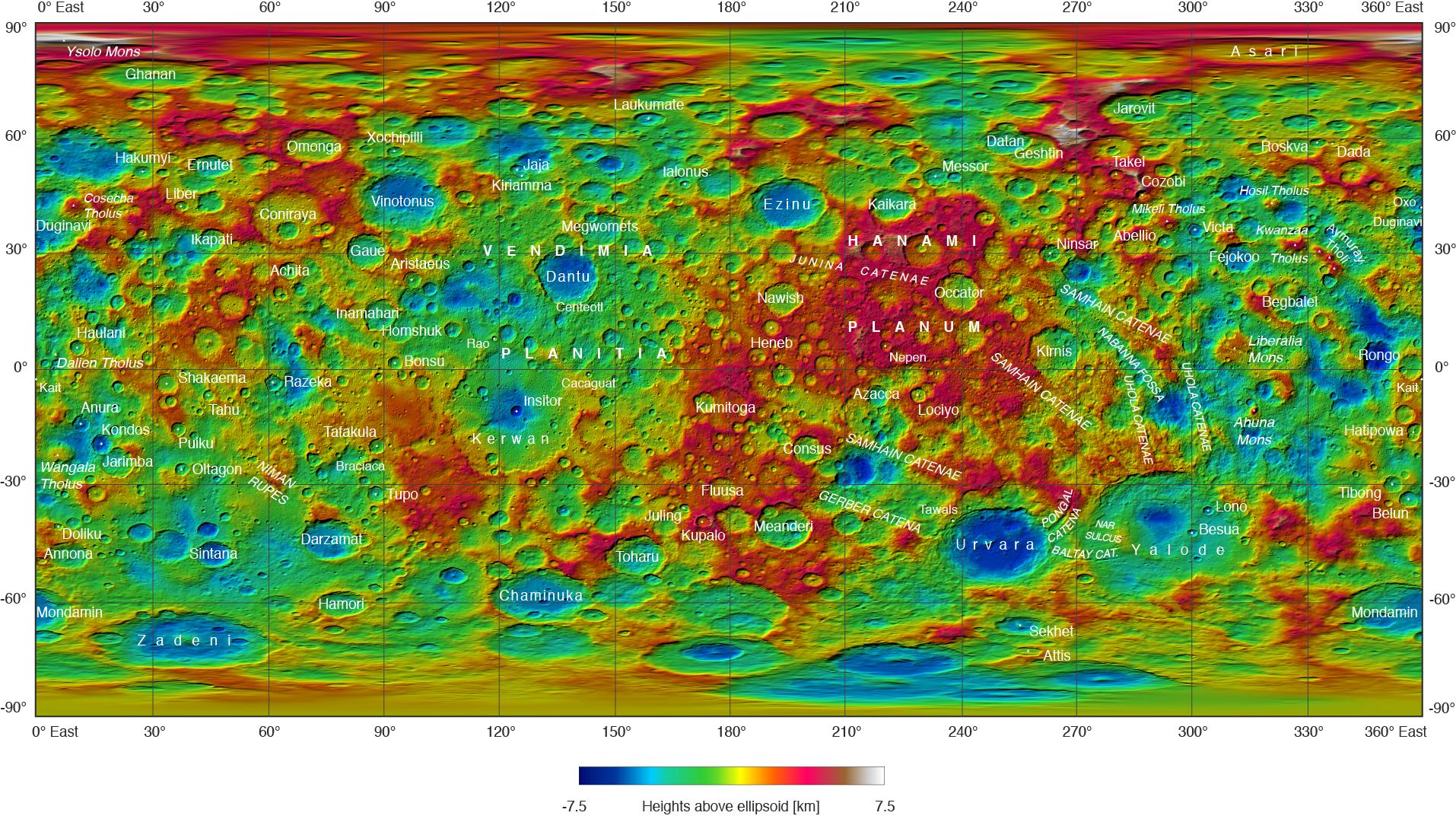
2017-12-21 |
Ceres
|
Dawn
|
Framing Camera
|
2051x869x3 |
|
-
PIA21916:
-
Kwanzaa Tholus
Full Resolution:
TIFF
(4.313 MB)
JPEG
(314.8 kB)
|
|
|
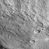
2017-09-26 |
Ceres
|
Dawn
|
Framing Camera
|
1024x1024x1 |
|
-
PIA21907:
-
Xevioso Crater on Ceres
Full Resolution:
TIFF
(1.05 MB)
JPEG
(201.7 kB)
|
|
|
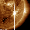
2017-09-11 |
Sol (our sun)
|
SDO
|
Atmosphere Imaging Assembly
|
1800x1800x3 |
|
-
PIA21949:
-
Major Solar Flare

Full Resolution:
TIFF
(6.065 MB)
JPEG
(233.6 kB)
|
|
|
2017-06-28 |
Ceres
|
Dawn
|
Framing Camera
|
1024x1024x1 |
|
-
PIA21410:
-
Yalode Crater on Ceres
Full Resolution:
TIFF
(1.05 MB)
JPEG
(250.8 kB)
|
|
|
2017-02-23 |
Earth
|
Earth Observing-1 (EO-1)
|
Hyperion Hyperspectral Imager
|
1044x801x3 |
|
-
PIA11239:
-
NASA Spacecraft Watches as Eruption Reshapes African Volcano
Full Resolution:
TIFF
(1.52 MB)
JPEG
(67.8 kB)
|
|
|
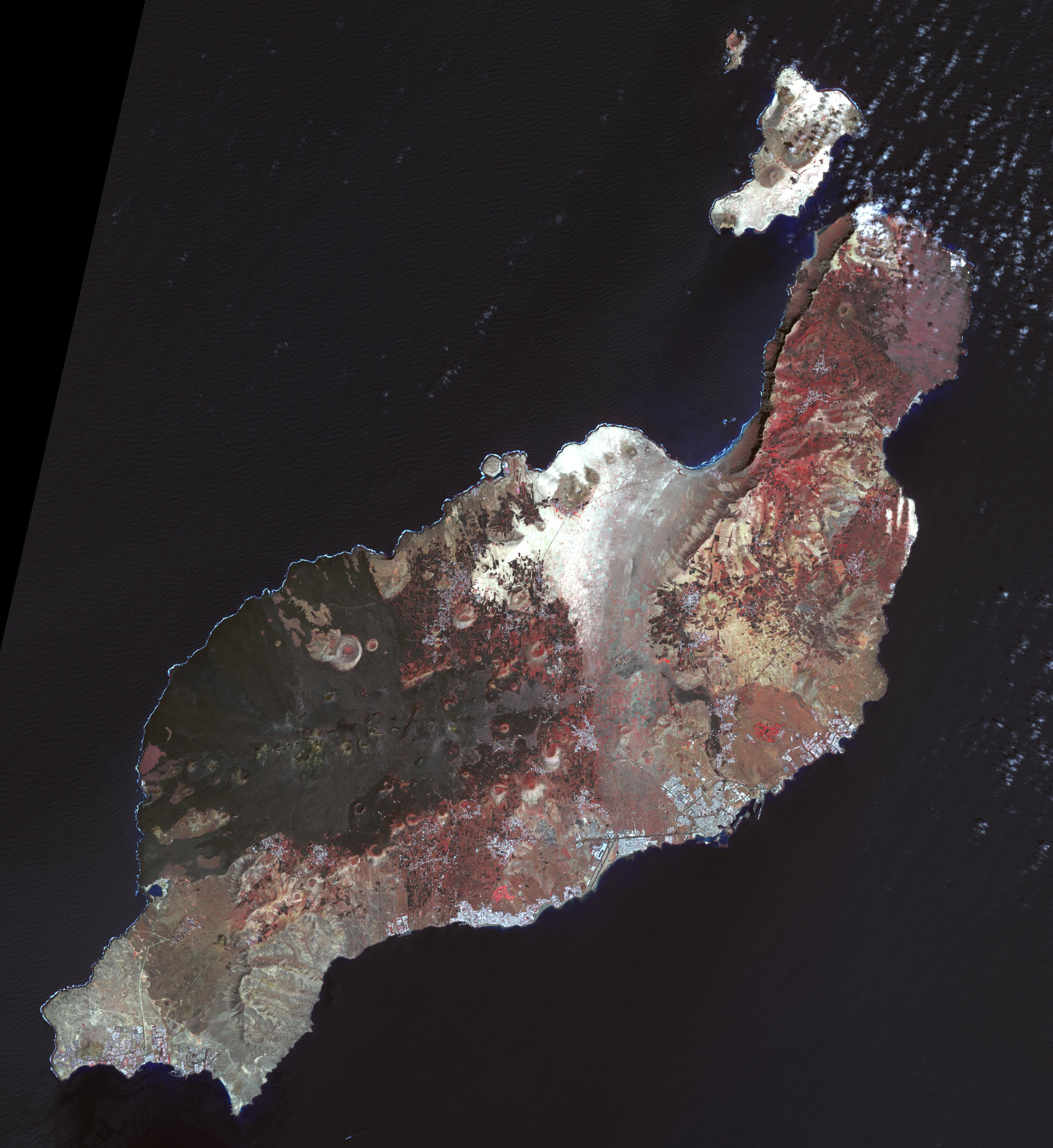
2017-01-06 |
Earth
|
Terra
|
ASTER
|
3367x3672x3 |

|
-
PIA21284:
-
Lanzarote, Canary Islands
Full Resolution:
TIFF
(21.83 MB)
JPEG
(1.084 MB)
|
|
|
2016-10-13 |
Earth
|
Terra
|
ASTER
|
2763x1493x3 |
|
-
PIA21014:
-
Cape Agulhas, South Africa
Full Resolution:
TIFF
(11.42 MB)
JPEG
(573.9 kB)
|
|
|
2016-09-26 |
Ceres
|
Dawn
|
Framing Camera
|
1914x1076x3 |
|
-
PIA20918:
-
Ceres Feature Names: September 2016
Full Resolution:
TIFF
(6.031 MB)
JPEG
(522.8 kB)
|
|
|
2016-08-10 |
Earth
|
Terra
|
ASTER
|
1440x1584x3 |
|
-
PIA20804:
-
Lilongwe, Malawi
Full Resolution:
TIFF
(6.846 MB)
JPEG
(835.5 kB)
|
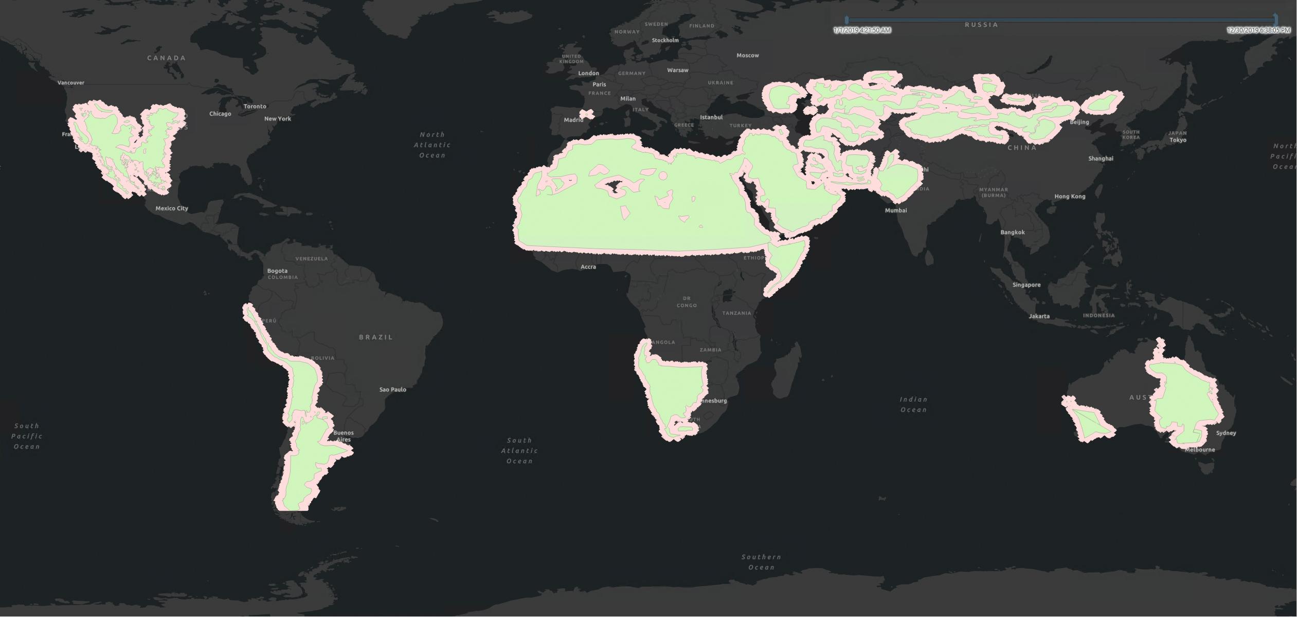
|
|
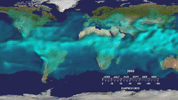
2015-12-08 |
Earth
|
GRACE
|
K-Band Ranging System
|
4900x2500x3 |
|
-
PIA20207:
-
Cumulative Total Middle East/North Africa Freshwater Losses as Seen by NASA's GRACE, 2002-15
Full Resolution:
TIFF
(7.868 MB)
JPEG
(961.7 kB)
|
|
|
2015-07-27 |
Earth
|
Terra
|
ASTER
|
992x834x3 |
|
-
PIA19738:
-
Ascension Island
Full Resolution:
TIFF
(2.366 MB)
JPEG
(138.3 kB)
|
|
|
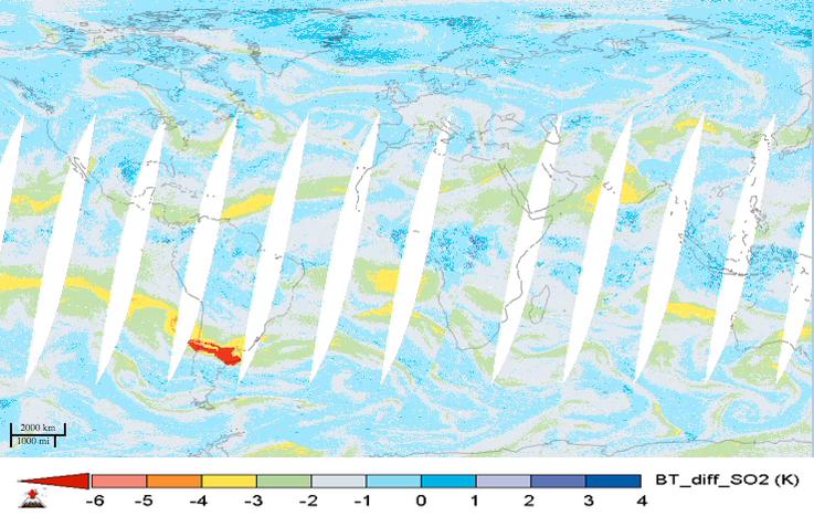
2015-05-07 |
Earth
|
Aqua
|
AIRS
|
737x467x3 |
|
-
PIA19385:
-
NASA's AIRS Instrument Tracks Transport of Sulfur Dioxide from Chilean Volcanic Eruption (Animation)
Full Resolution:
TIFF
(1.033 MB)
JPEG
(69.56 kB)
|
|
|
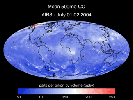
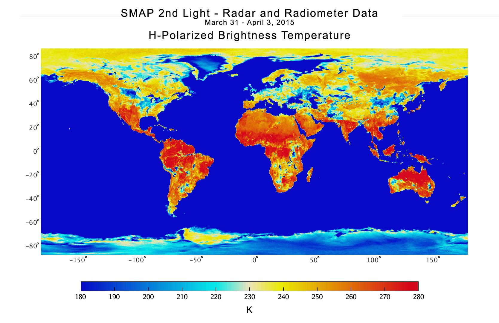
2015-04-21 |
Earth
|
SMAP
|
|
1669x1080x3 |
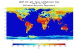
|
-
PIA18057:
-
NASA Soil Moisture Mission Produces First Global Radiometer Map
Full Resolution:
TIFF
(5.41 MB)
JPEG
(226.5 kB)
|
|
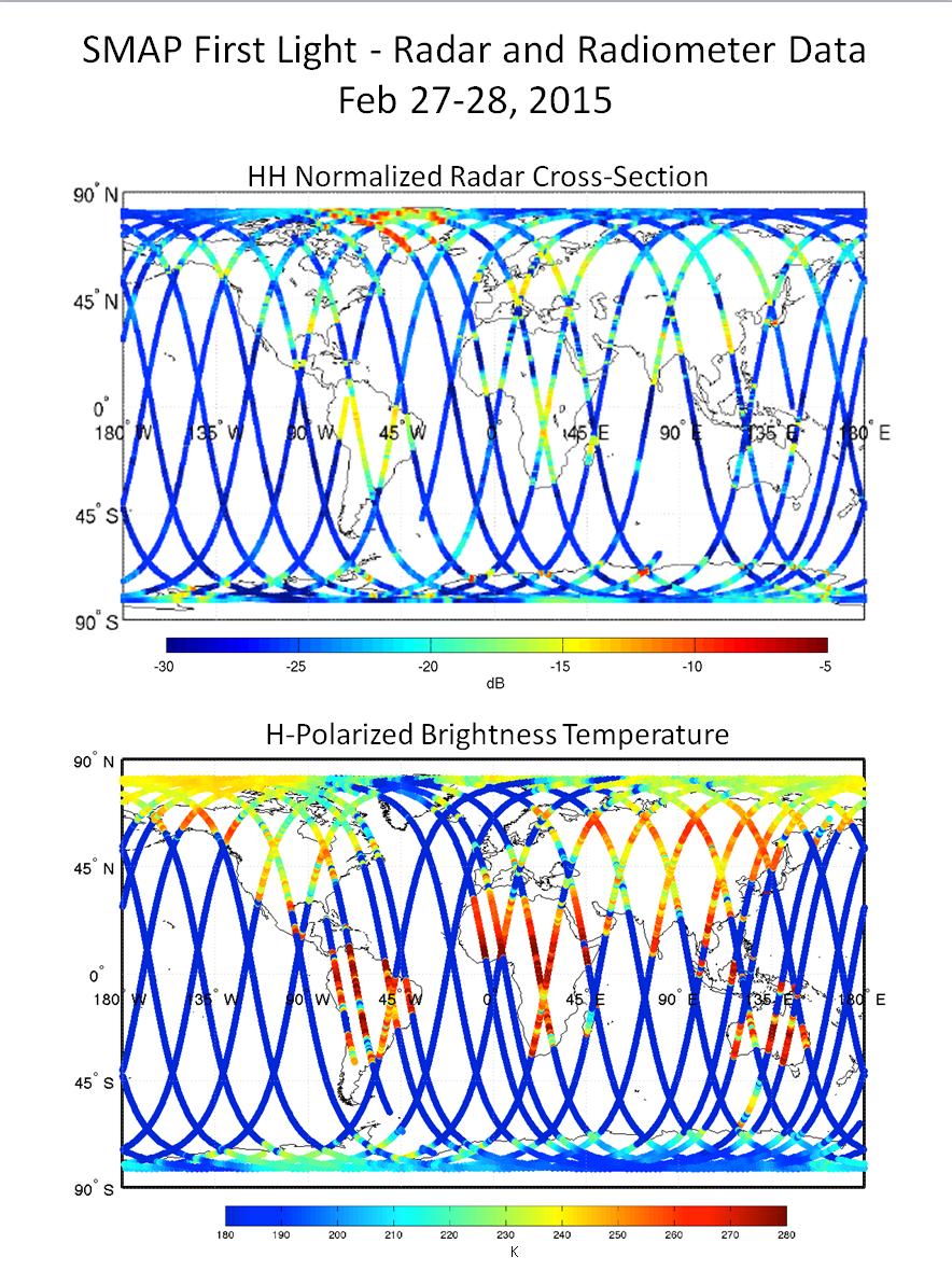
|
2015-03-09 |
Earth
|
SMAP
|
|
884x1180x3 |
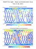
|
-
PIA19236:
-
NASA's Soil Moisture Mapper Takes First 'SMAPshots'
Full Resolution:
TIFF
(3.131 MB)
JPEG
(231.1 kB)
|
|
|
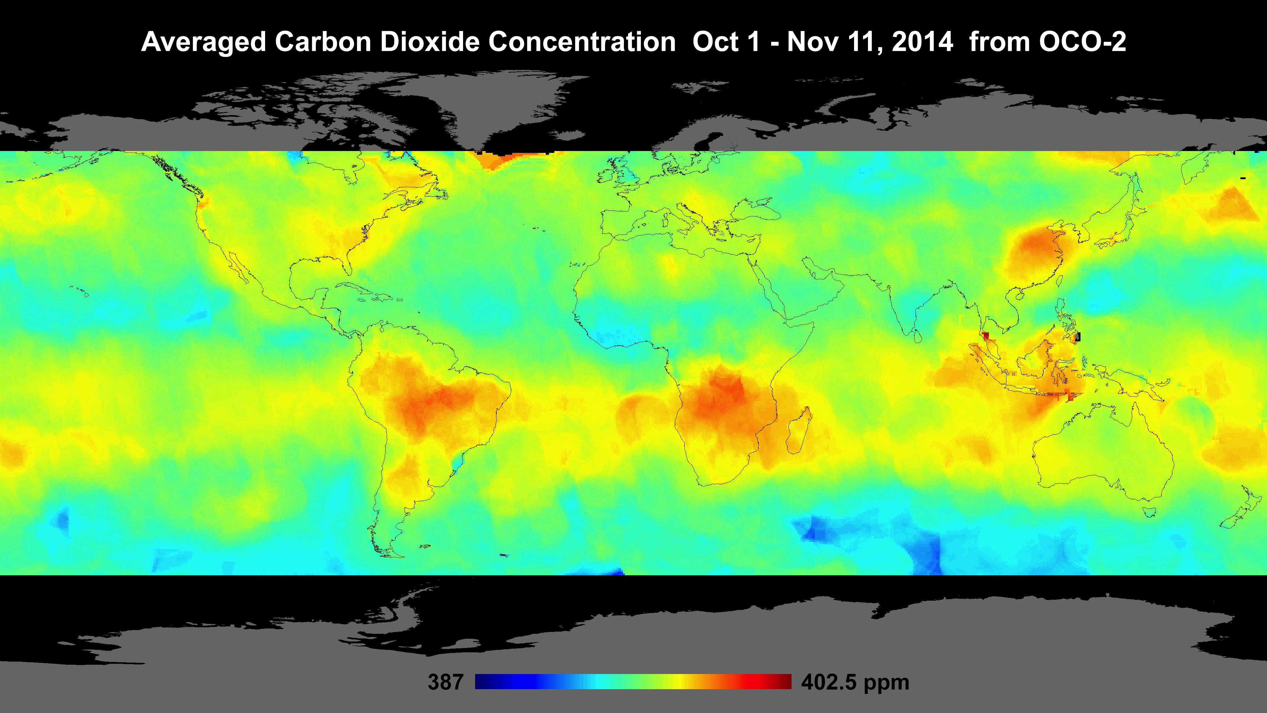
2014-12-18 |
Earth
|
OCO-2
|
OCO-2
|
4096x2304x3 |
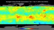
|
-
PIA18934:
-
Global Atmospheric Carbon Dioxide
Full Resolution:
TIFF
(28.32 MB)
JPEG
(639.9 kB)
|
|
|
2014-10-09 |
Earth
|
Terra
|
ASTER
|
1772x2208x3 |
|
-
PIA18825:
-
Mount Cameroon
Full Resolution:
TIFF
(11.74 MB)
JPEG
(466.7 kB)
|
|
|
2014-09-24 |
Earth
|
Shuttle Radar Topography Mission (SRTM)
|
C-Band Radar
X-Band Radar
|
1074x651x1 |

|
-
PIA18813:
-
Tanzania Images Highlight Improvements in Full-Resolution SRTM Africa Data
Full Resolution:
TIFF
(700.1 kB)
JPEG
(64.26 kB)
|
|
|
2014-07-07 |
Mercury
|
MESSENGER
|
MDIS - Narrow Angle
|
1020x1024x1 |
|
-
PIA18533:
-
A Flower in Egonu
Full Resolution:
TIFF
(1.046 MB)
JPEG
(117 kB)
|
|
|
2014-02-05 |
Earth
|
Terra
|
ASTER
|
2974x2147x3 |
|
-
PIA17977:
-
Sierra Leone Estuary
Full Resolution:
TIFF
(19.16 MB)
JPEG
(856.5 kB)
|
|
|
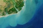
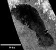
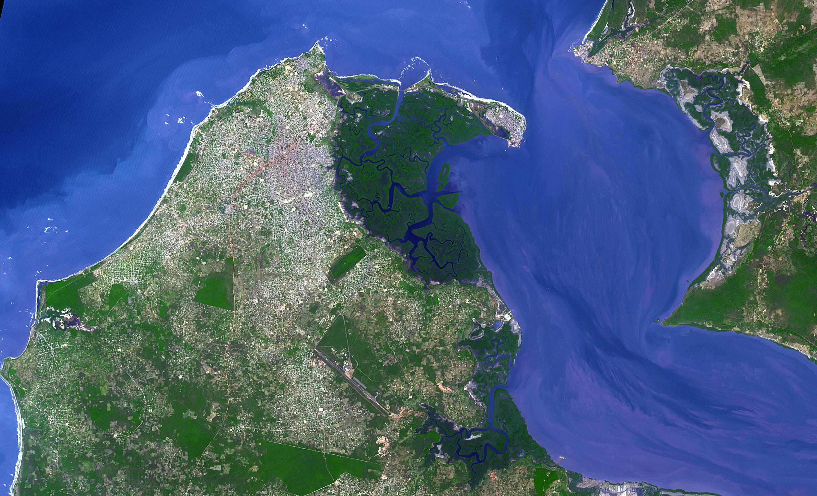
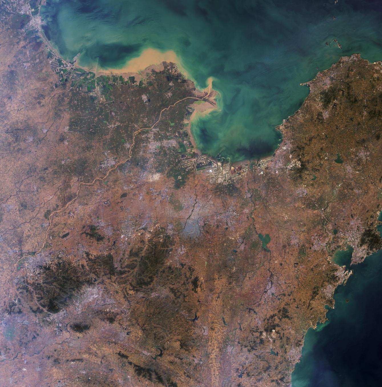
2013-11-05 |
Earth
|
Terra
|
ASTER
|
3684x3780x3 |
|
-
PIA17632:
-
Namib Desert, Namibia
Full Resolution:
TIFF
(41.79 MB)
JPEG
(2.037 MB)
|
|
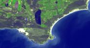
|
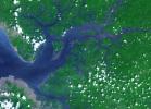
2013-08-29 |
Earth
|
Landsat
|
|
2180x1453x3 |
|
-
PIA18155:
-
Zambezi River Delta
Full Resolution:
TIFF
(9.507 MB)
JPEG
(347.9 kB)
|
|
|
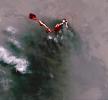
2013-08-27 |
Earth
|
Aqua
|
AIRS
|
879x600x3 |
|
-
PIA17427:
-
NASA's Aqua Spacecraft Images Pollution from California's Rim Fire
Full Resolution:
TIFF
(1.583 MB)
JPEG
(101.7 kB)
|
|
|
2013-07-22 |
Earth
|
MESSENGER
|
MDIS - Wide Angle
|
1024x1380x3 |
|
-
PIA17388:
-
Looking Back at Us
Full Resolution:
TIFF
(4.241 MB)
JPEG
(77.1 kB)
|
|
|
2013-02-11 |
Mercury
|
MESSENGER
|
MDIS - Wide Angle
|
711x711x1 |
|
-
PIA16822:
-
Ancient Heritage
Full Resolution:
TIFF
(506.3 kB)
JPEG
(67.18 kB)
|
|
|
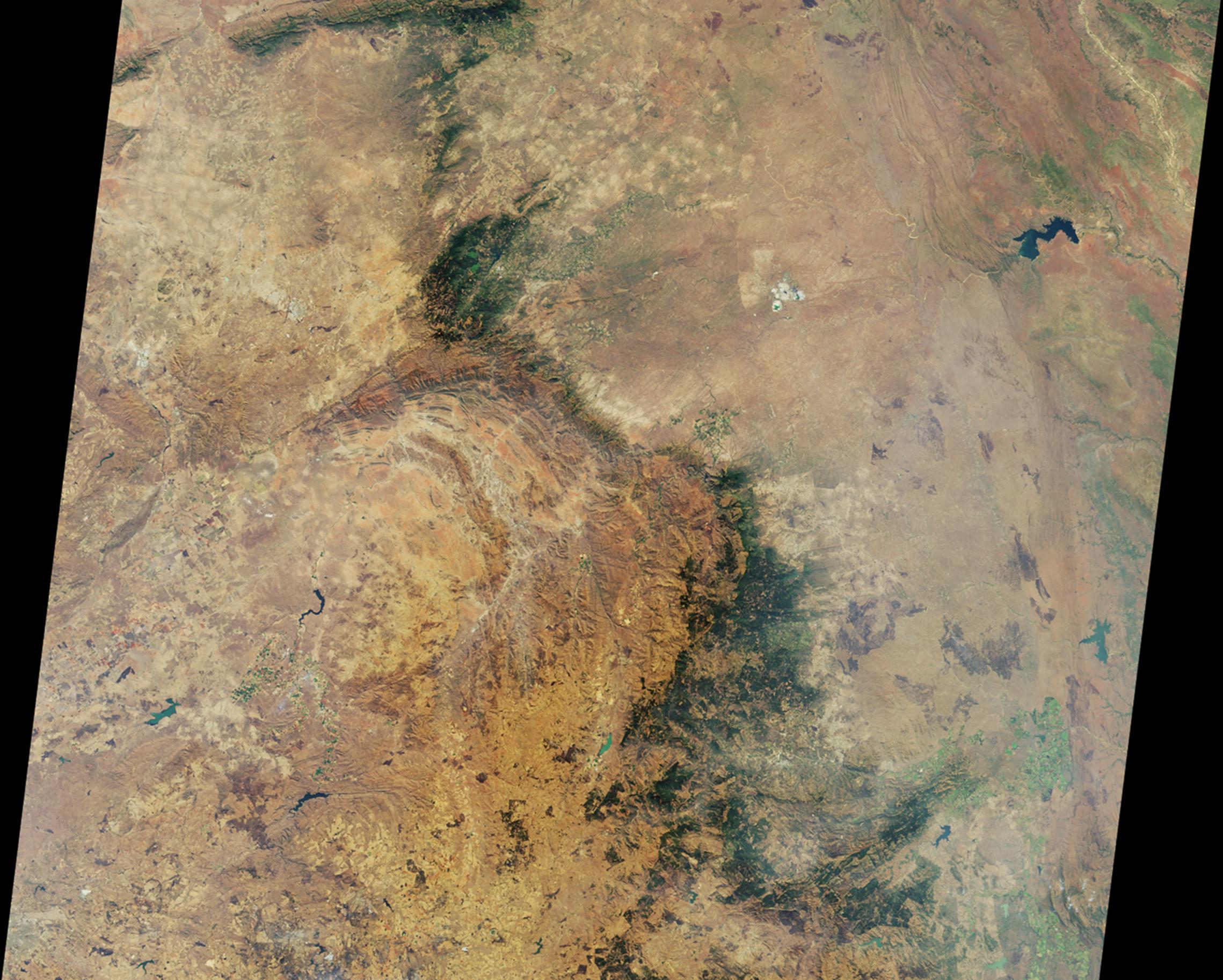
2013-02-08 |
Earth
|
Terra
|
ASTER
|
3414x2546x3 |

|
-
PIA16788:
-
Bushveld Igneous Complex, South Africa
Full Resolution:
TIFF
(26.09 MB)
JPEG
(1.736 MB)
|
|
|
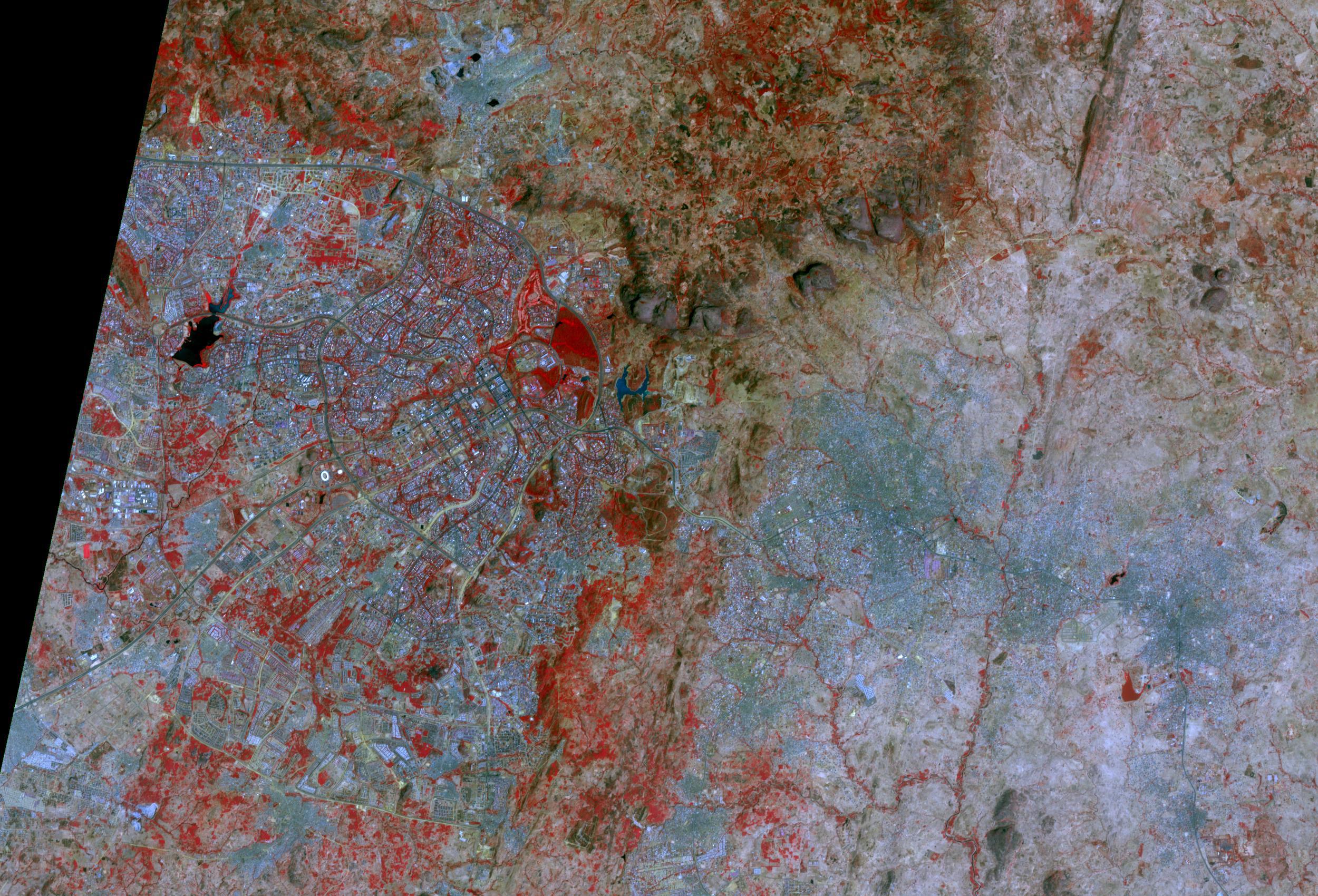
2013-01-29 |
Earth
|
Terra
|
ASTER
|
4284x8520x3 |
|
-
PIA16772:
-
NASA Satellite Images Severe Flooding in Mozambique
Full Resolution:
TIFF
(109.6 MB)
JPEG
(7.229 MB)
|
|
|
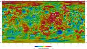
2012-05-02 |
Mercury
|
MESSENGER
|
MDIS - Narrow Angle
|
1284x1388x1 |
|
-
PIA15642:
-
Revelations on Mercury
Full Resolution:
TIFF
(1.784 MB)
JPEG
(90.67 kB)
|
|
|
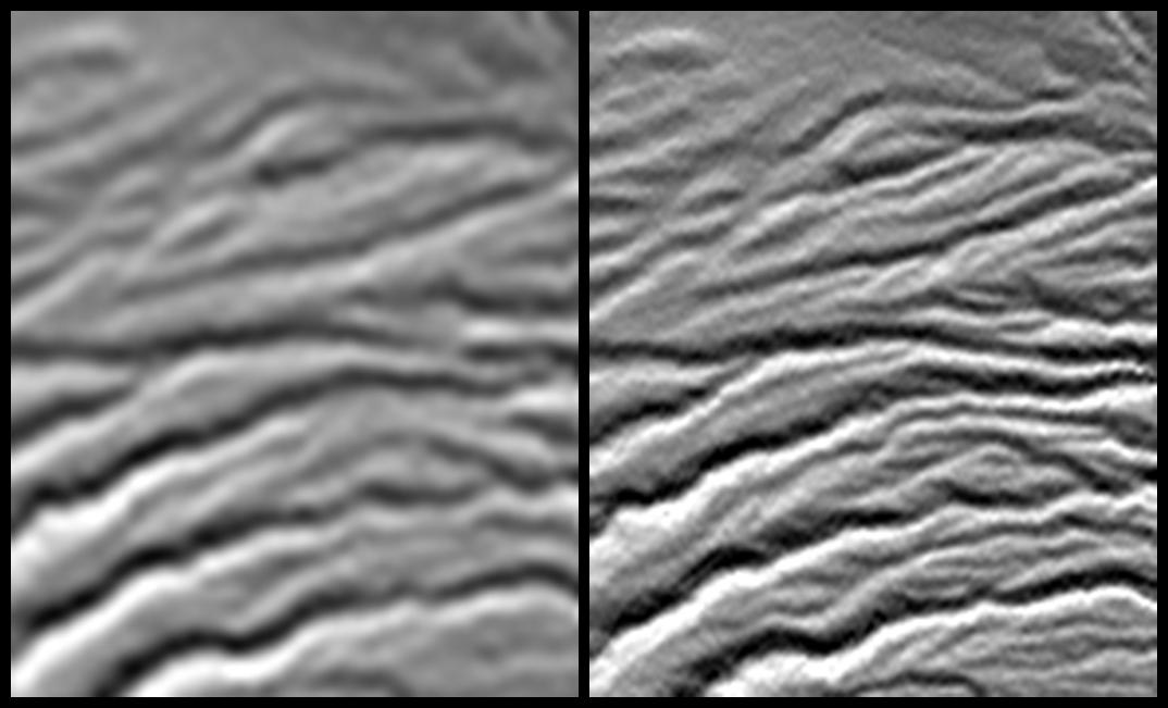
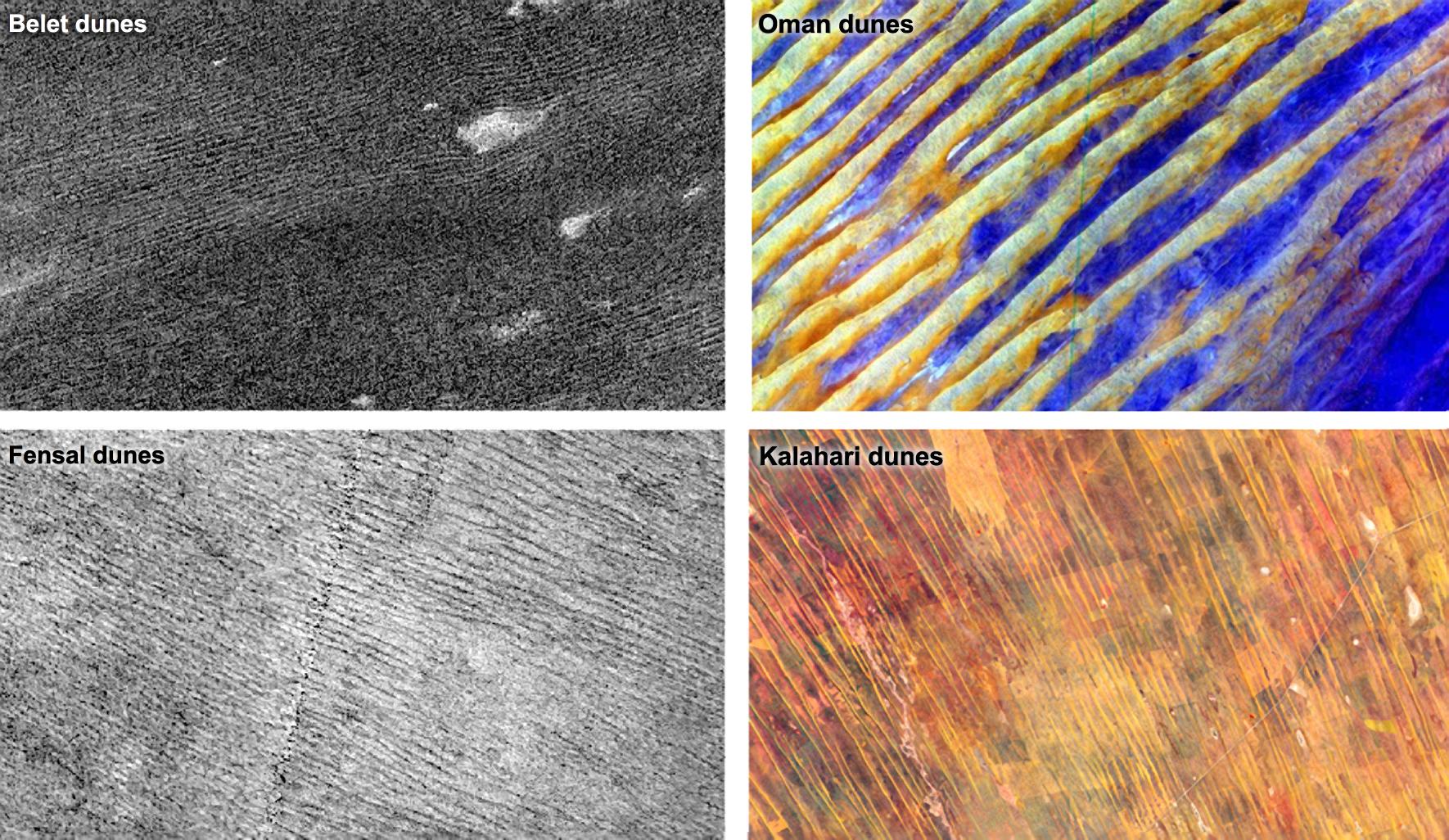
2012-01-23 |
Titan
|
Cassini-Huygens
Terra
|
ASTER
Radar Mapper
|
1770x1026x3 |
|
-
PIA15225:
-
Dune Patterns
Full Resolution:
TIFF
(5.457 MB)
JPEG
(421.9 kB)
|
|
|
2012-01-20 |
Earth
|
Terra
|
ASTER
|
746x620x3 |
|
-
PIA13954:
-
NASA Spacecraft Images Some of Earth's Newest "Real Estate"
Full Resolution:
TIFF
(1.389 MB)
JPEG
(41.59 kB)
|
|
|
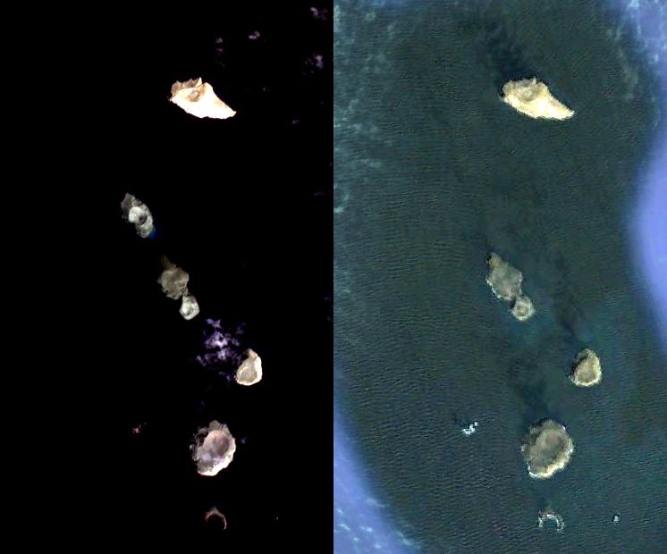
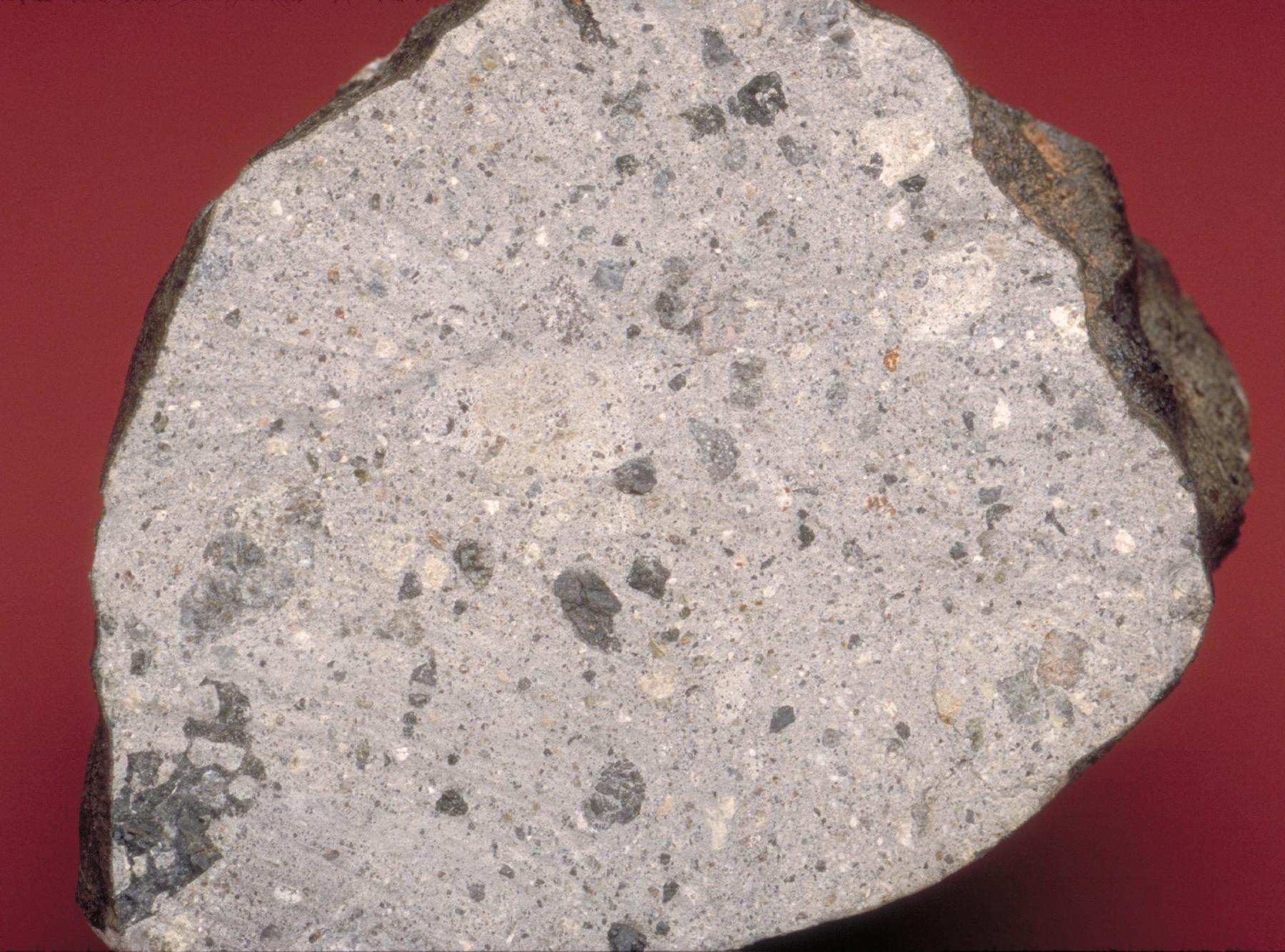
2011-12-03 |
Vesta
|
Dawn
|
|
1800x1333x3 |

|
-
PIA15137:
-
Rocks from Vesta -- Part 2: Howardites
Full Resolution:
TIFF
(7.209 MB)
JPEG
(343.9 kB)
|
|
|
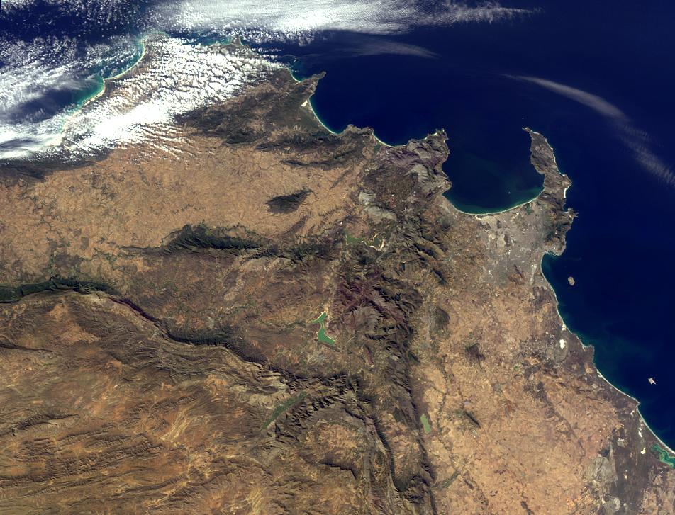
2011-08-03 |
Earth
|
Terra
|
MISR
|
952x727x3 |
|
-
PIA14489:
-
Where on Earth...? MISR Mystery Image Quiz #25: Western Cape, South Africa
Full Resolution:
TIFF
(2.079 MB)
JPEG
(146.7 kB)
|
|
|
2011-07-28 |
Earth
|
Aqua
|
AIRS
|
1200x900x3 |
|
-
PIA14488:
-
NASA Satellite Tracks Severity of African Drought
Full Resolution:
TIFF
(3.244 MB)
JPEG
(119.7 kB)
|
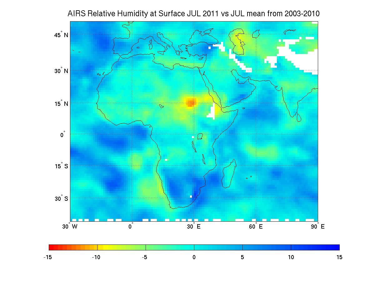
|
|
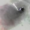
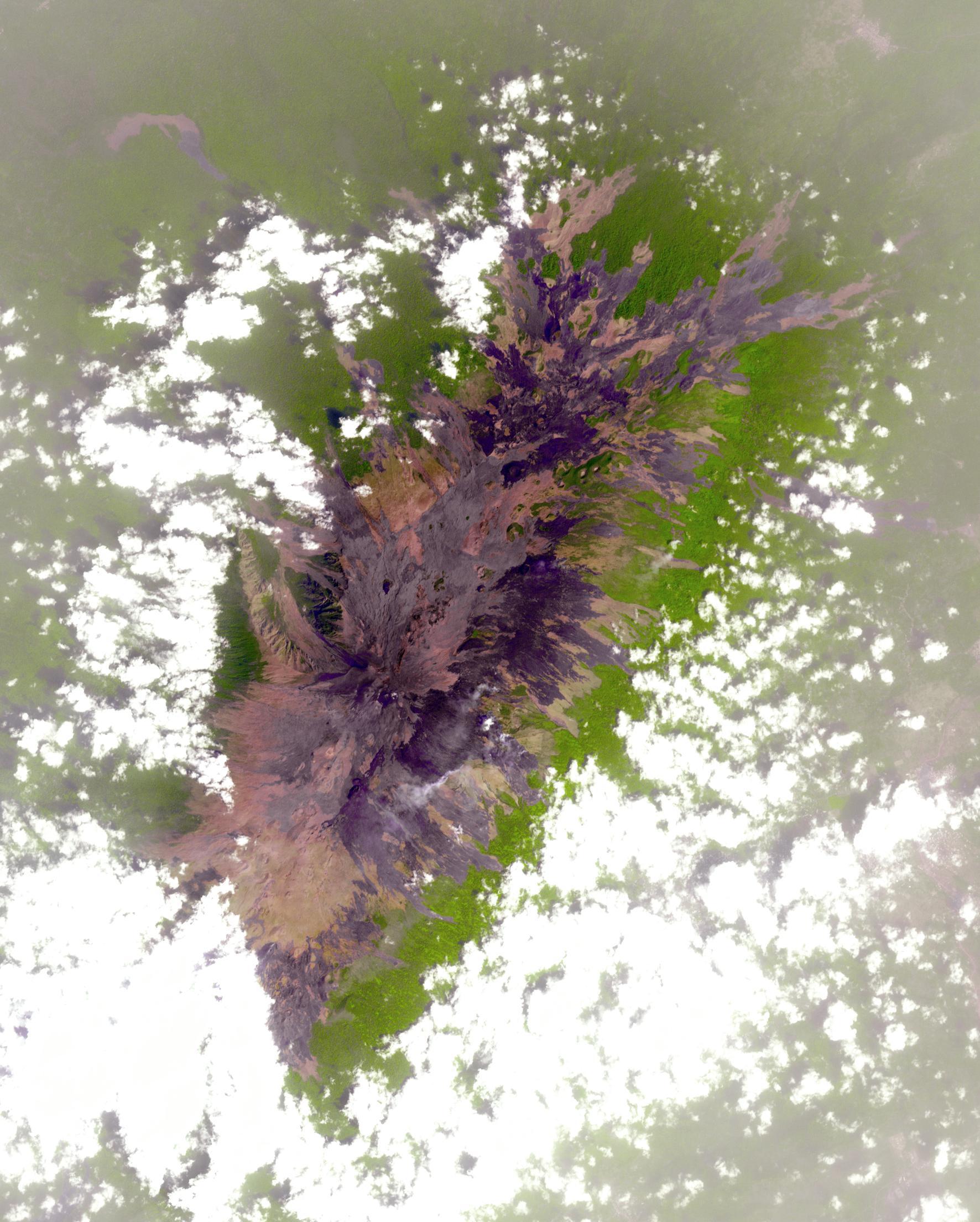
2011-07-07 |
Earth
|
Terra
|
ASTER
|
2682x2481x3 |
|
-
PIA14390:
-
Africa's Nabro Volcano Spews a Fiery Brew in NASA Spacecraft Image
Full Resolution:
TIFF
(19.98 MB)
JPEG
(511.6 kB)
|
|
|
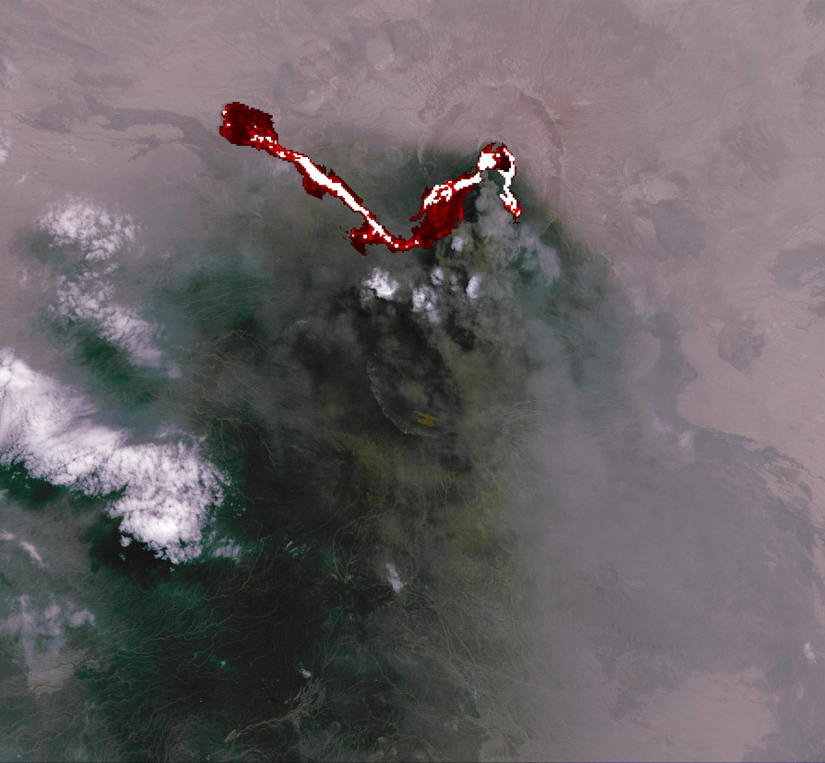
2011-07-06 |
Earth
|
Terra
|
ASTER
|
1606x1263x3 |

|
-
PIA14382:
-
NASA Spacecraft Capture's Nabro Volcano's Continuing Eruption
Full Resolution:
TIFF
(6.095 MB)
JPEG
(409.8 kB)
|
|
|
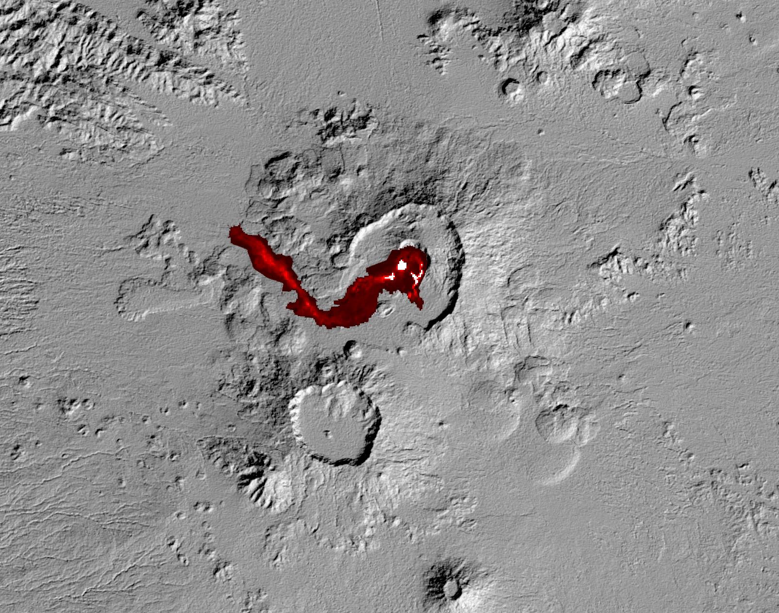
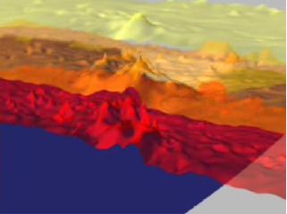
2011-06-28 |
Earth
|
Terra
|
ASTER
|
3624x4475x3 |
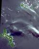
|
-
PIA14289:
-
Republic of Seychelles
Full Resolution:
TIFF
(48.65 MB)
JPEG
(2.095 MB)
|
|
|
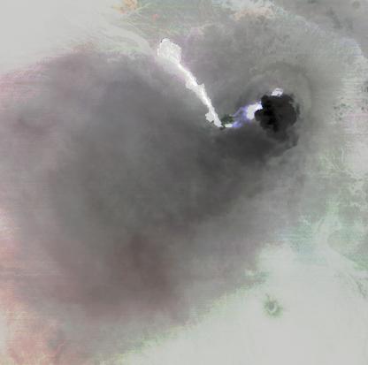
2011-06-20 |
Earth
|
Terra
|
ASTER
|
416x413x3 |
|
-
PIA14280:
-
NASA Spacecraft Captures First Recorded Eruption of Volcano in Africa's Horn
Full Resolution:
TIFF
(516.2 kB)
JPEG
(13.51 kB)
|
|
|
2010-11-03 |
Earth
|
Terra
|
MISR
|
1339x1356x3 |
|
-
PIA13565:
-
Where on Earth...? MISR Mystery Image Quiz #24: Shandong Province, China
Full Resolution:
TIFF
(5.453 MB)
JPEG
(311.5 kB)
|
|
|
2010-10-06 |
Earth
|
Terra
|
MISR
|
2278x1826x3 |
|
-
PIA13460:
-
NASA's MISR Views Kruger National Park
Full Resolution:
TIFF
(12.49 MB)
JPEG
(578.8 kB)
|
|
|
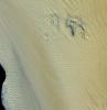
2010-07-15 |
Titan
|
Cassini-Huygens
|
Radar Mapper
|
1411x1276x1 |
|
-
PIA13172:
-
Footprint of Ontario Lacus
Full Resolution:
TIFF
(1.803 MB)
JPEG
(337.1 kB)
|
|
|
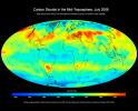
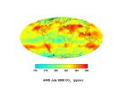
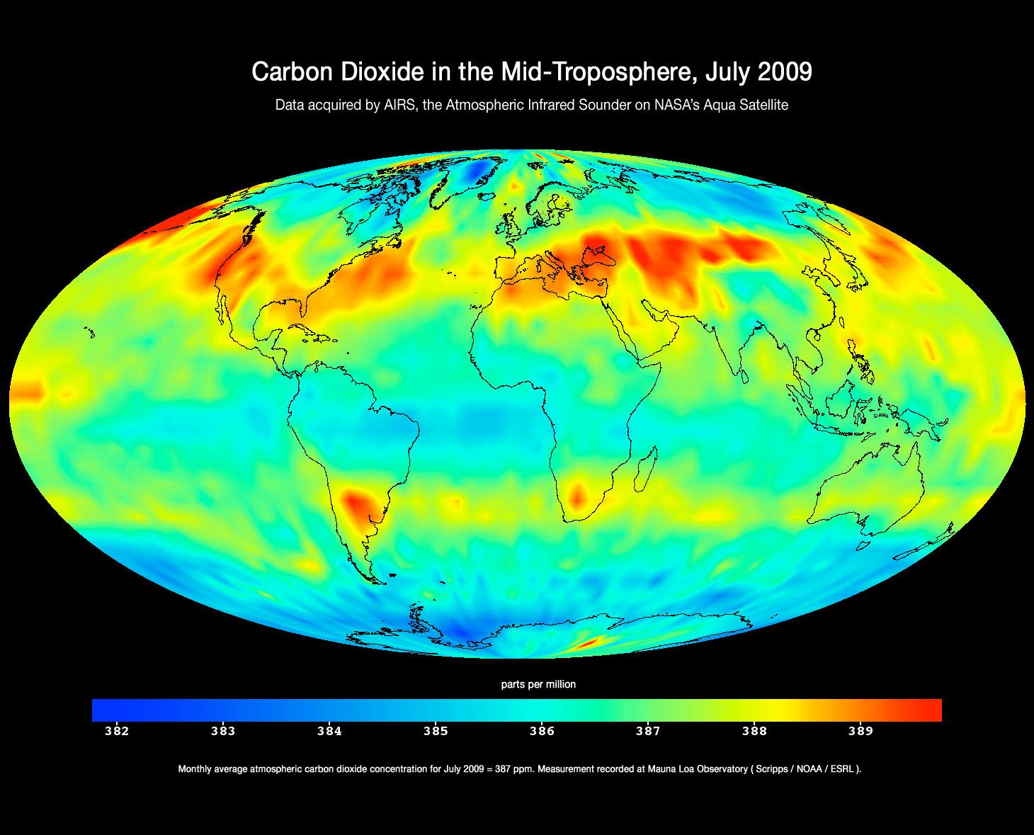
2009-11-09 |
Earth
|
Aqua
|
AIRS
|
1460x1179x3 |
|
-
PIA12339:
-
Global Carbon Dioxide Transport from AIRS Data, July 2009
Full Resolution:
TIFF
(5.174 MB)
JPEG
(184.8 kB)
|
|
|
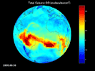
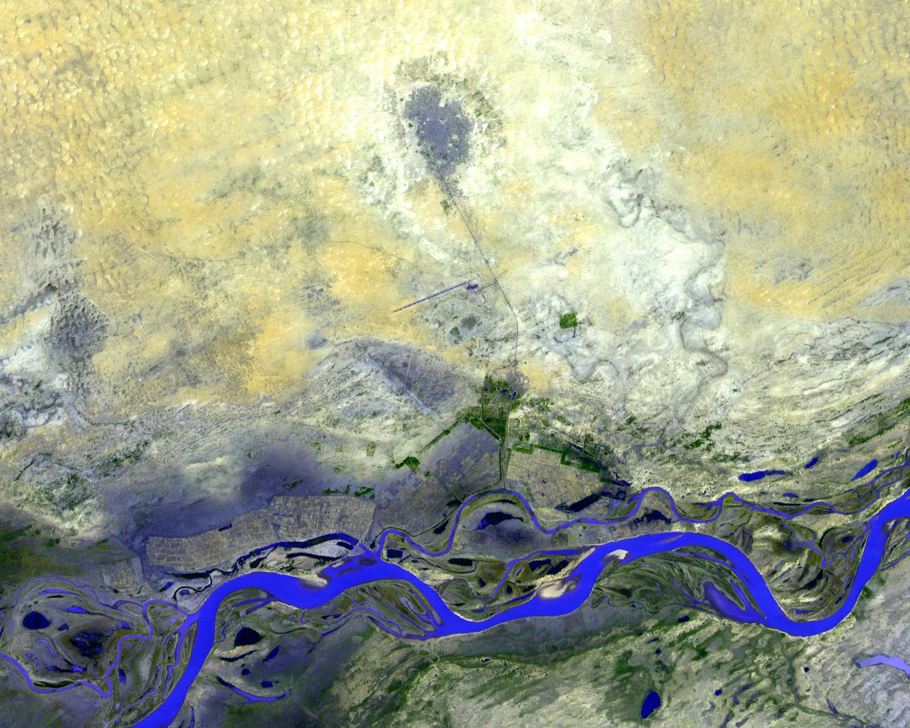
2009-10-05 |
Earth
|
Terra
|
ASTER
|
1789x1431x3 |
|
-
PIA12305:
-
Timbuktu, Mali
Full Resolution:
TIFF
(7.692 MB)
JPEG
(462.1 kB)
|
|
|
2009-09-24 |
Earth
|
Aqua
|
AIRS
|
1000x1000x3 |
|
-
PIA12239:
-
Australia's Red Dawn
Full Resolution:
TIFF
(3.004 MB)
JPEG
(138.4 kB)
|
|
|
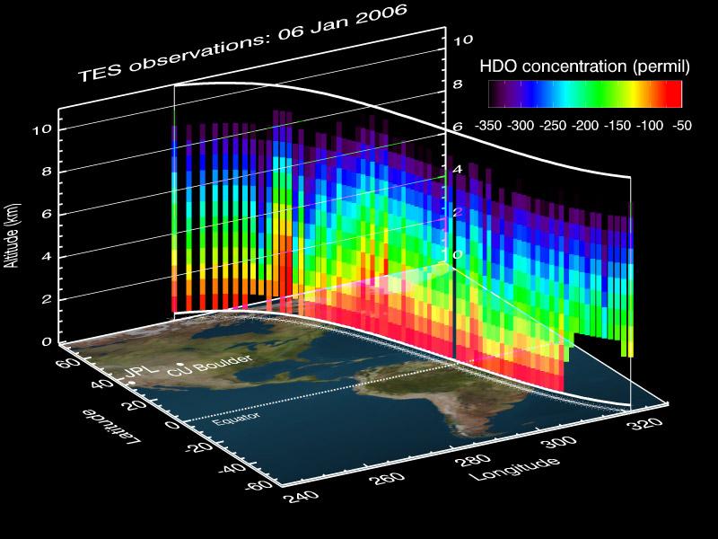
2009-08-13 |
Earth
|
Aura
|
TES
|
800x600x3 |

|
-
PIA12170:
-
A NASA Space Sleuth Hunts the Trail of Earth's Water
Full Resolution:
TIFF
(1.442 MB)
JPEG
(75.35 kB)
|
|
|
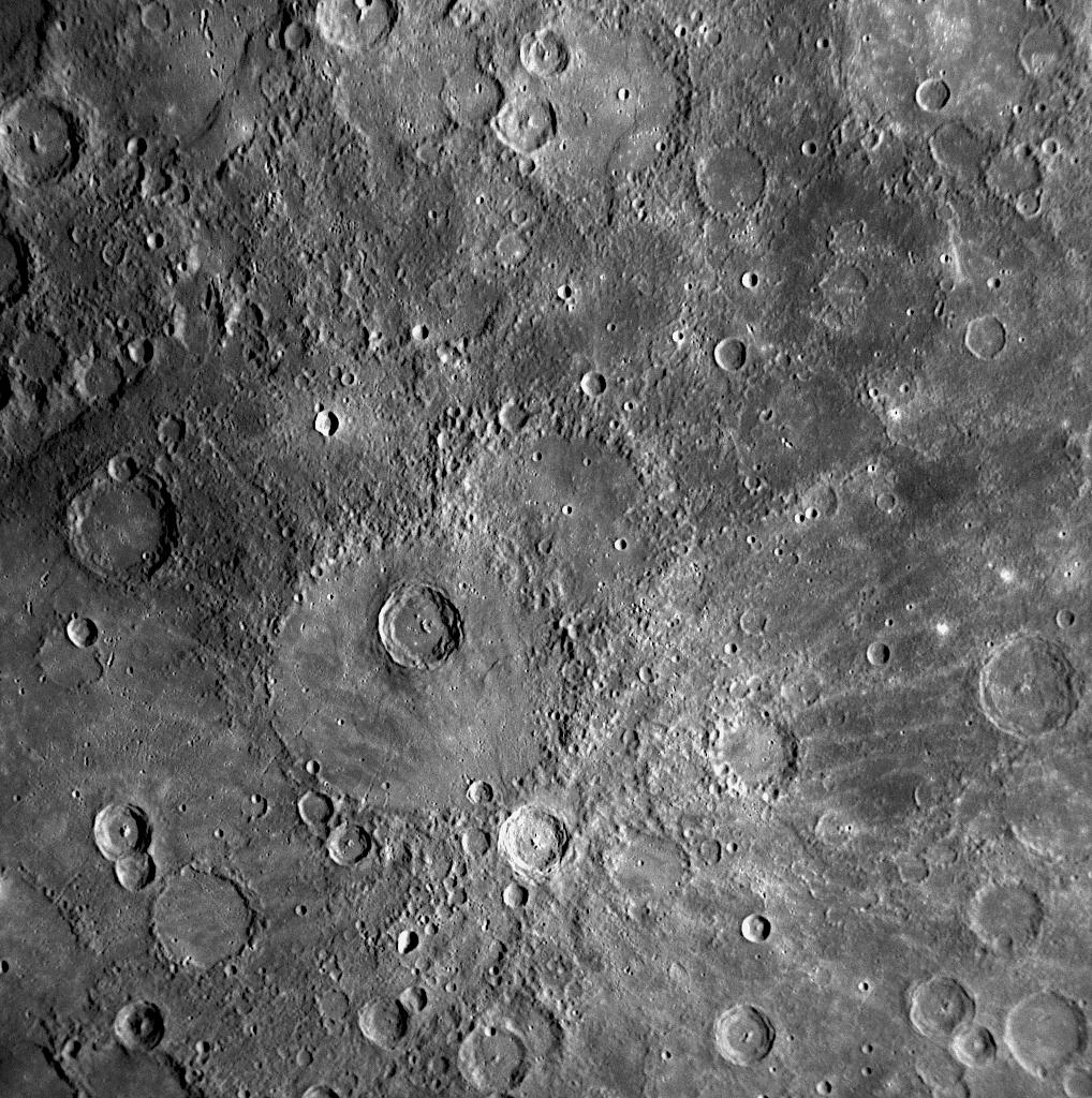
2009-02-03 |
Mercury
|
MESSENGER
|
MDIS - Narrow Angle
|
1018x1024x1 |

|
-
PIA11784:
-
Enwonwu: A Young Crater on Mercury Named for an African Modernist Artist
Full Resolution:
TIFF
(1.044 MB)
JPEG
(257.6 kB)
|
|
|
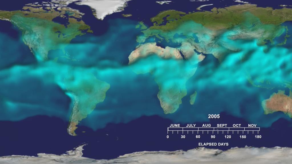
2008-11-18 |
Earth
|
Aqua
|
AIRS
|
1024x576x3 |
|
-
PIA11424:
-
Water Vapor Transport, June through November 2005 (Movie)
Full Resolution:
TIFF
(1.772 MB)
JPEG
(54.12 kB)
|
|
|
2008-09-30 |
Earth
|
Phoenix
|
|
1228x910x1 |
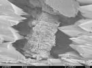
|
-
PIA11207:
-
Terrestrial Clay under Microscope
Full Resolution:
TIFF
(1.119 MB)
JPEG
(140.7 kB)
|
|
|
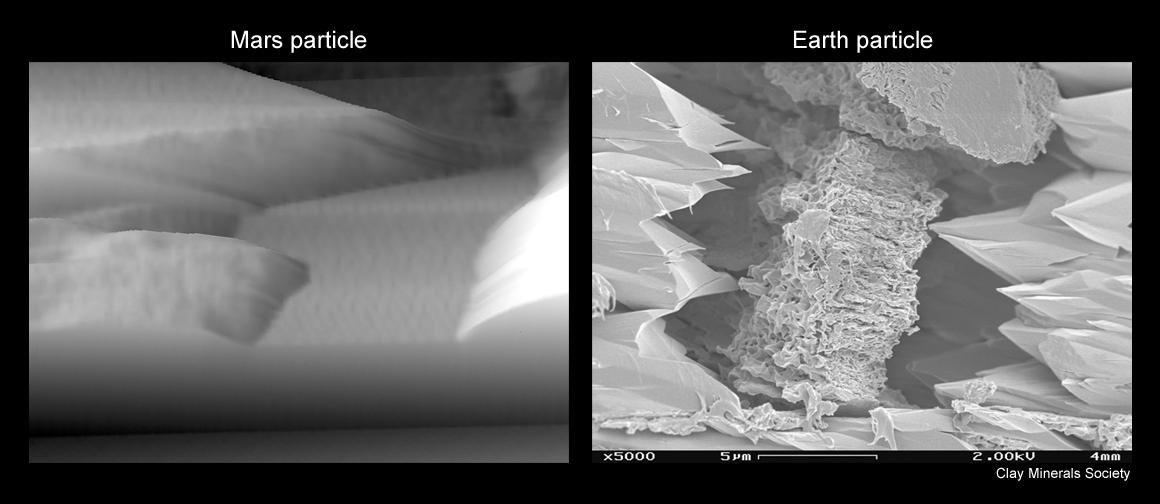
2008-09-30 |
Mars
|
Phoenix
|
MECA
|
1160x504x1 |

|
-
PIA11206:
-
Mars Particle and Terrestrial Soil, Compared Microscopically
Full Resolution:
TIFF
(585.4 kB)
JPEG
(55.27 kB)
|
|
|
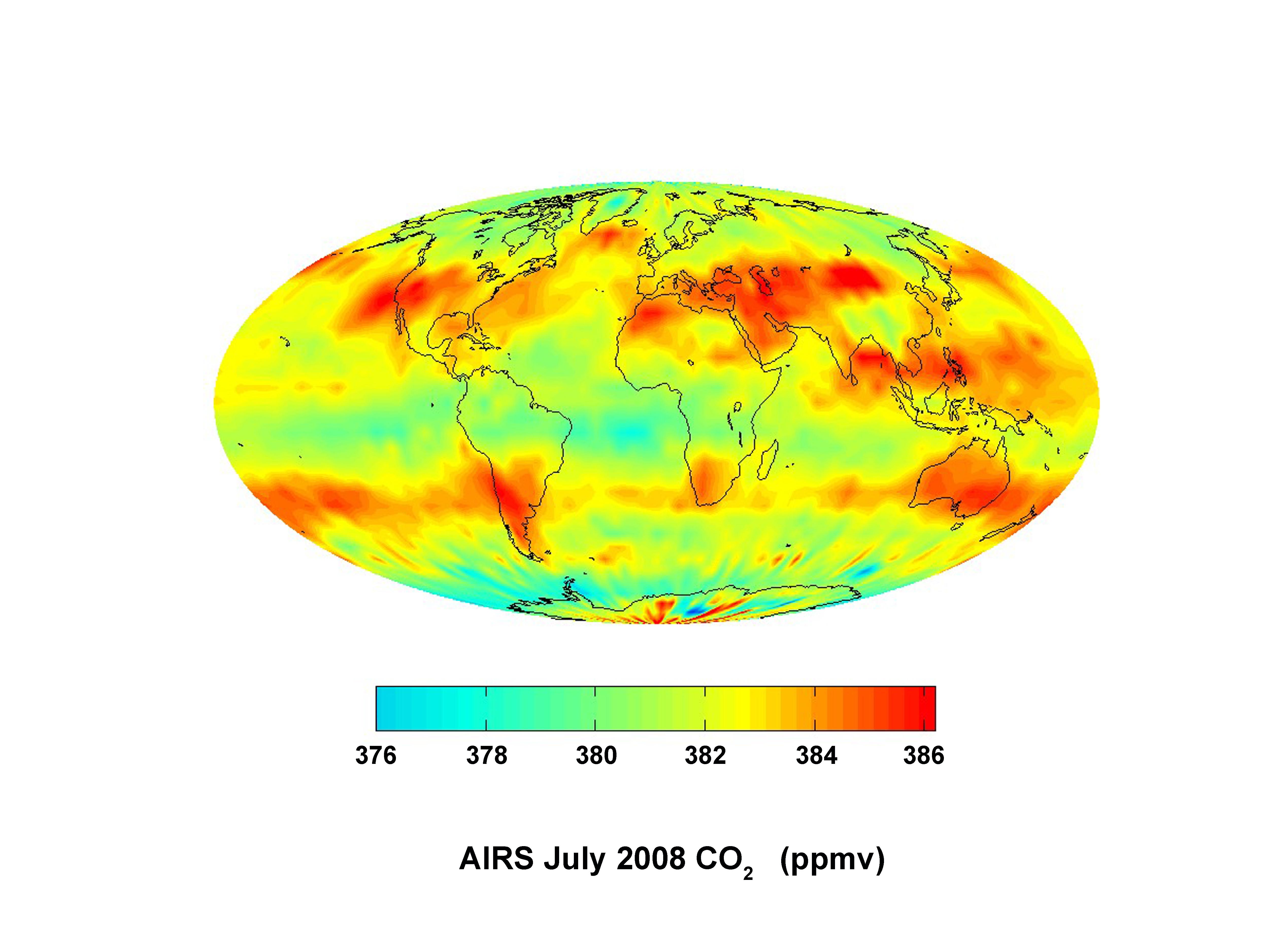
2008-09-24 |
Earth
|
Aqua
|
AIRS
|
5000x3750x3 |
|
-
PIA11194:
-
Global Carbon Dioxide Transport from AIRS Data, July 2008
Full Resolution:
TIFF
(56.25 MB)
JPEG
(715.3 kB)
|
|
|
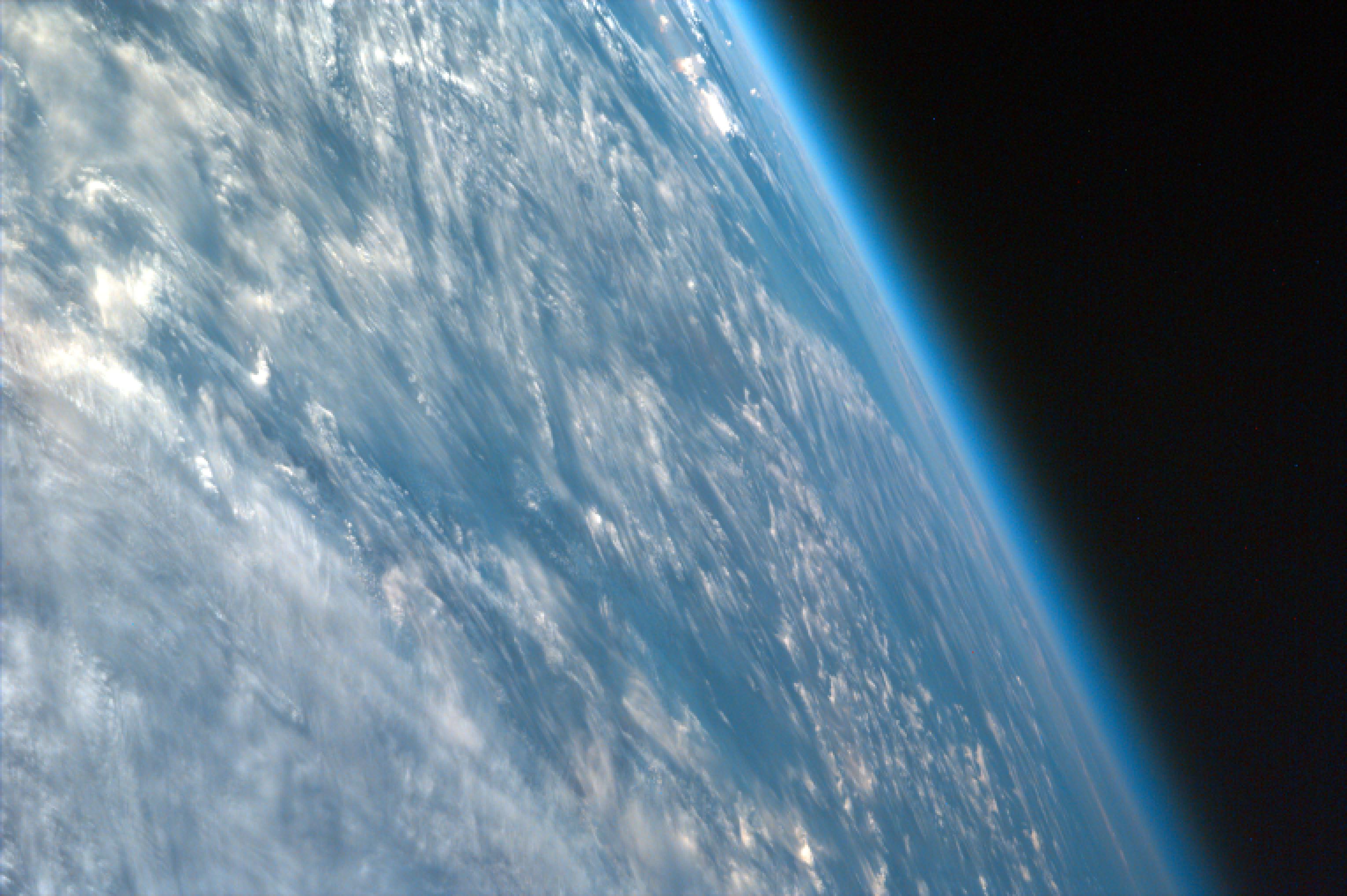
2008-09-05 |
Earth
|
ISS EarthKam
|
Electronic Still Camera
|
3060x2036x3 |
|
-
PIA11066:
-
Oblique Shot of Earth
Full Resolution:
TIFF
(18.69 MB)
JPEG
(460.9 kB)
|
|
|
2008-08-14 |
Earth
|
Aqua
|
AIRS
|
640x480x3 |
|
-
PIA11034:
-
Transport of Carbon Monoxide Generated by Alaska Fires, July 2004
Full Resolution:
TIFF
(922.8 kB)
JPEG
(44.52 kB)
|
|
|
2008-08-13 |
Earth
|
Aqua
|
AIRS
|
321x239x3 |
|
-
PIA11032:
-
Hurricane Isabel Isotherms
Full Resolution:
TIFF
(230.6 kB)
JPEG
(8.968 kB)
|
|
|
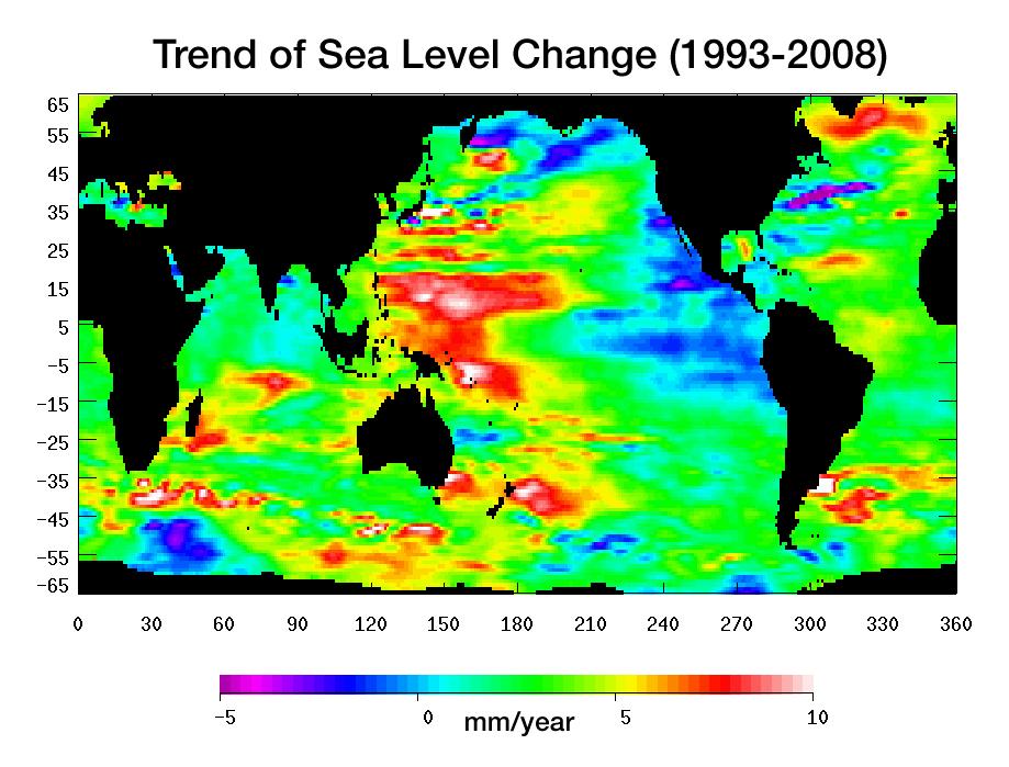
2008-07-31 |
Earth
|
Jason-1
|
Altimeter
|
919x699x3 |
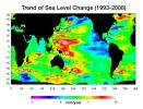
|
-
PIA11002:
-
Portrait of a Warming Ocean and Rising Sea Levels:
Trend of Sea Level Change 1993-2008
Full Resolution:
TIFF
(644.9 kB)
JPEG
(104.2 kB)
|
|
|
2008-07-01 |
|
Hubble Space Telescope
|
Advanced Camera for Surveys
WFPC2
|
1280x1188x3 |
|
-
PIA10926:
-
Hubble Sees Stars and a Stripe in Celestial Fireworks
Full Resolution:
TIFF
(4.567 MB)
JPEG
(158.8 kB)
|
|
|
2008-06-18 |
Earth
|
Terra
|
ASTER
|
2706x2134x3 |
|
-
PIA11082:
-
East African Rift
Full Resolution:
TIFF
(17.34 MB)
JPEG
(1.272 MB)
|
|
|
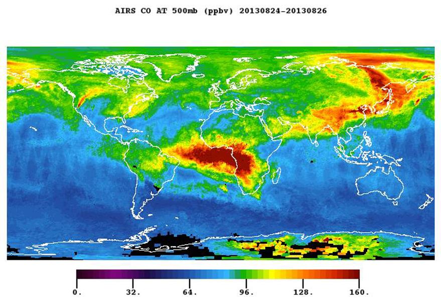
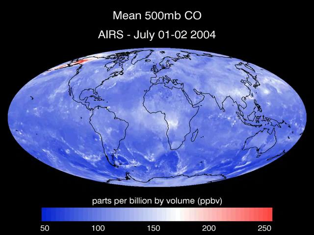
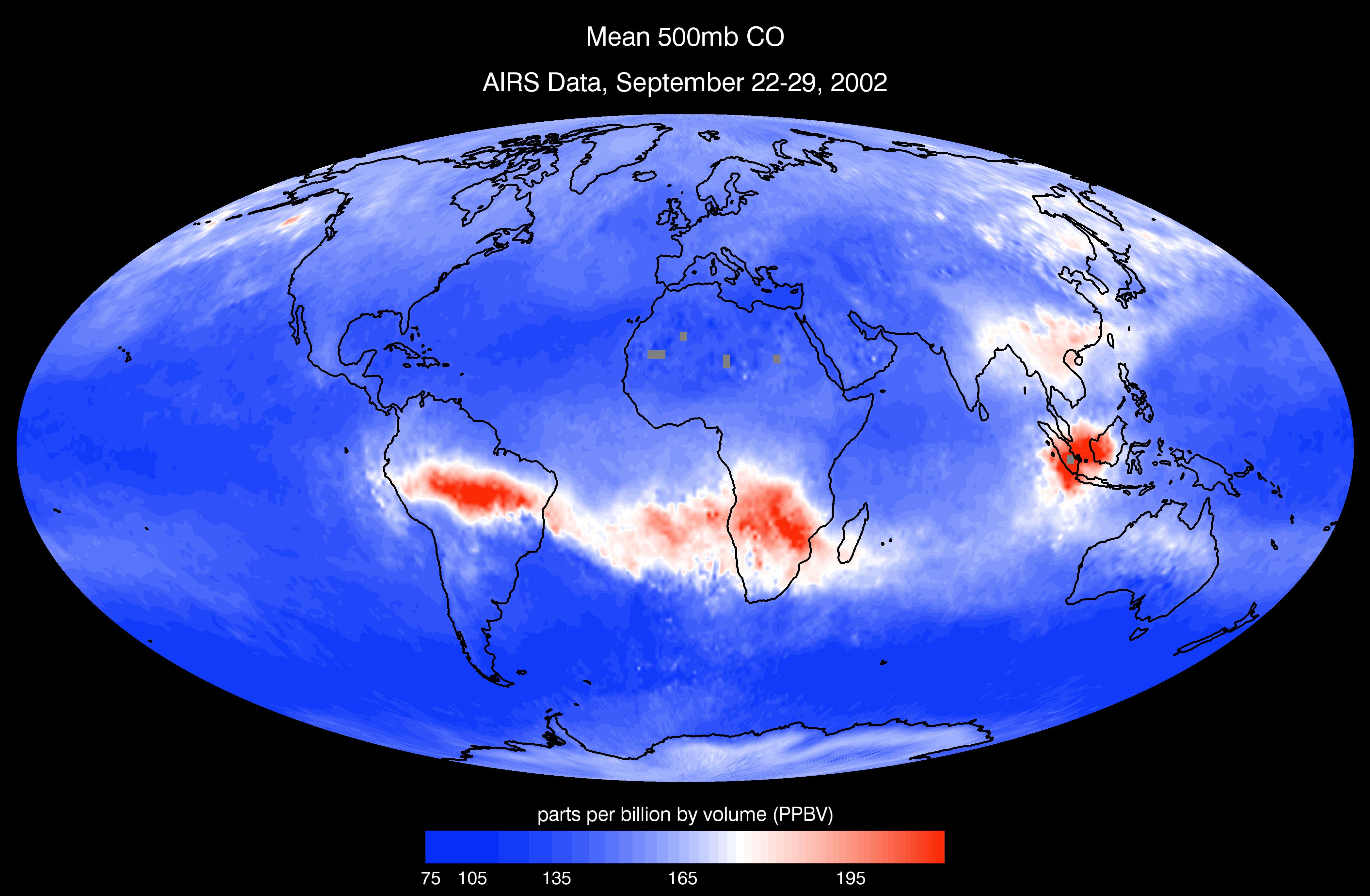
2008-03-12 |
Earth
|
Aqua
|
AIRS
|
4196x2747x3 |
|
-
PIA10241:
-
AIRS Mean Carbon Monoxide at 500 Millibar, September 22-29, 2002
Full Resolution:
TIFF
(34.58 MB)
JPEG
(798.8 kB)
|
|
|
2007-12-11 |
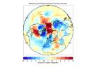
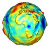
Earth
|
GRACE
|
K-Band Ranging System
|
1200x1200x3 |
|
-
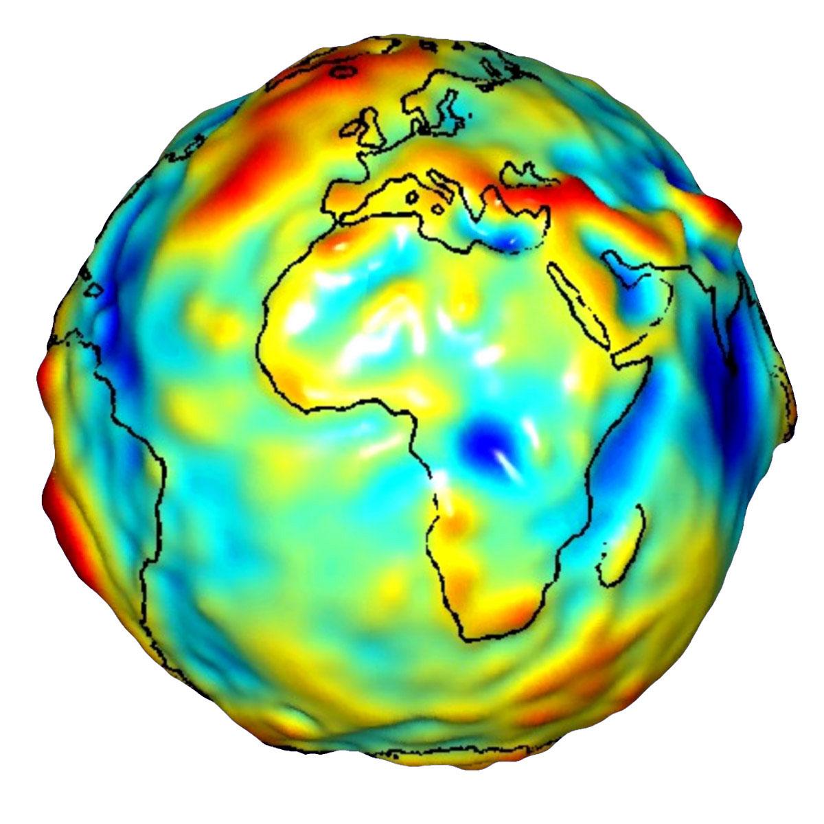
PIA12104:
-
Global Gravity: Africa and Europe
Full Resolution:
TIFF
(4.325 MB)
JPEG
(127.7 kB)
|
|
|
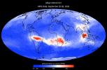
2007-09-11 |
Earth
|
Aqua
|
AIRS
|
1280x720x3 |
|
-
PIA09923:
-
Visualization of Fires in Greece as seen by the Atmospheric Infrared Sounder
Full Resolution:
TIFF
(2.768 MB)
JPEG
(115.7 kB)
|
|
|
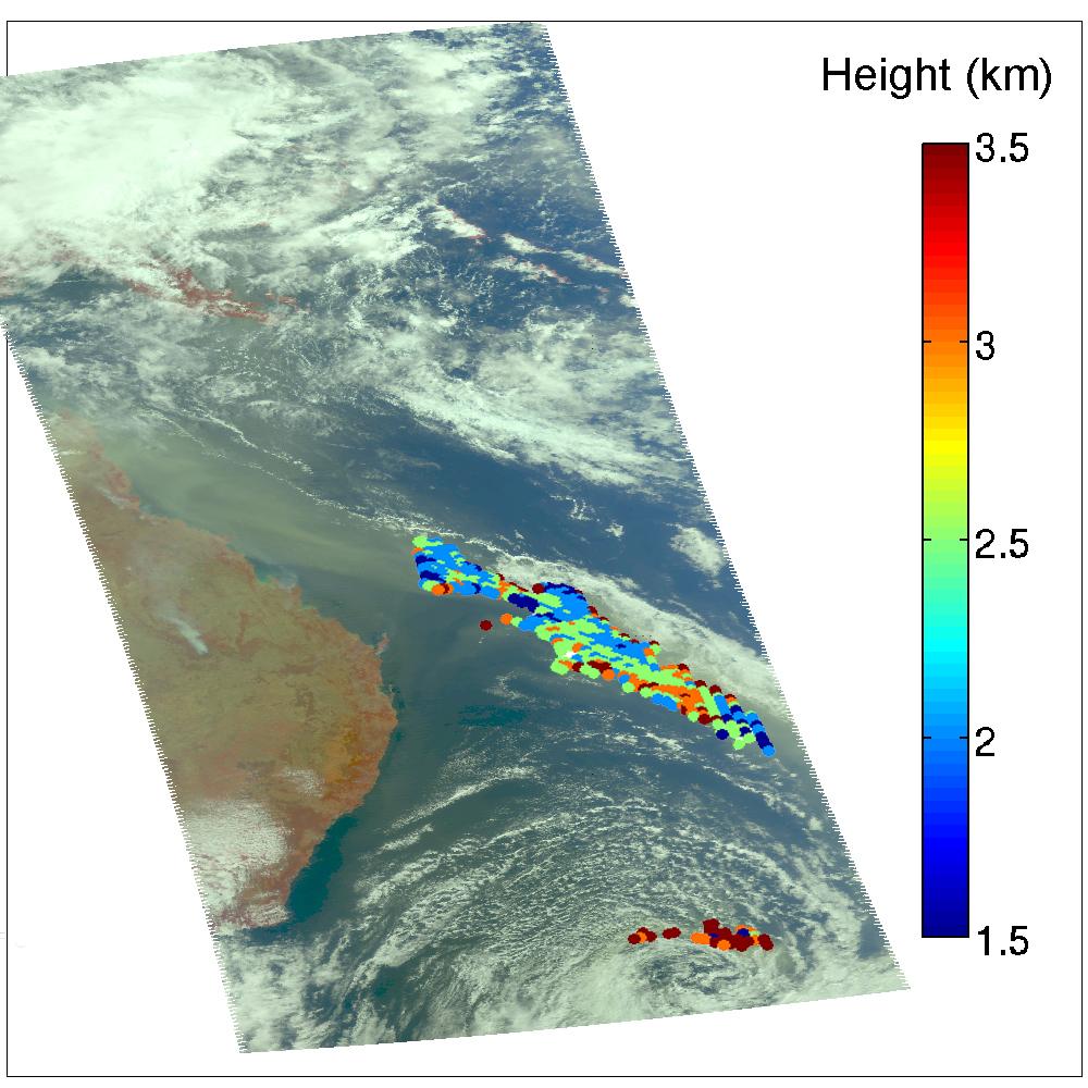
2007-07-24 |
Earth
|
Aqua
|
AIRS
|
2500x1875x3 |
|
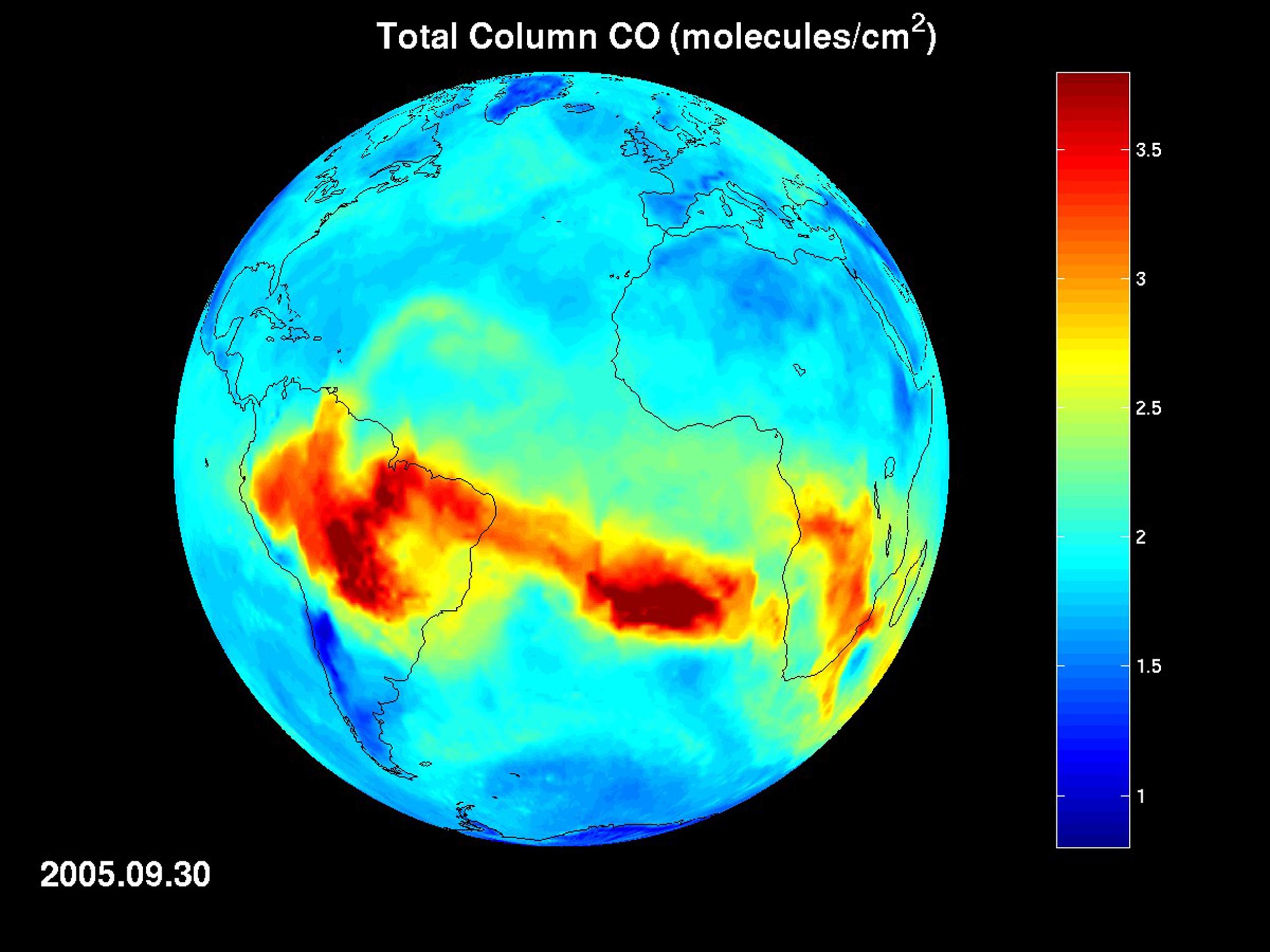
-
PIA09936:
-
AIRS Map of Carbon Monoxide Draped on Globe: Time Series from 8/1/2005 to
9/30/2005
Full Resolution:
TIFF
(14.08 MB)
JPEG
(289.4 kB)
|
|
|
2006-09-19 |
Saturn
|
Cassini-Huygens
|
ISS - Wide Angle
|
502x430x3 |
|
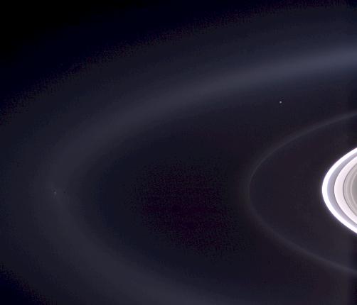
-
PIA08324:
-
Pale Blue Orb
Full Resolution:
TIFF
(648.5 kB)
JPEG
(11.57 kB)
|
|
|
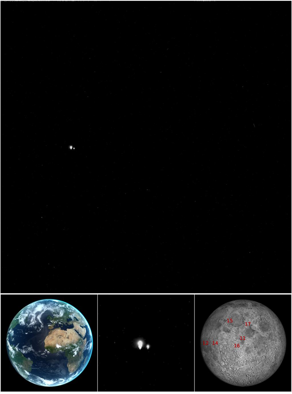
2006-09-19 |
Earth
|
Cassini-Huygens
|
ISS - Wide Angle
|
243x226x1 |
|
-
PIA08323:
-
Pale Blue Orb
Full Resolution:
TIFF
(55.2 kB)
JPEG
(2.363 kB)
|
|
|
2006-08-02 |
Earth
|
Terra
|
ASTER
|
1230x3209x3 |
|
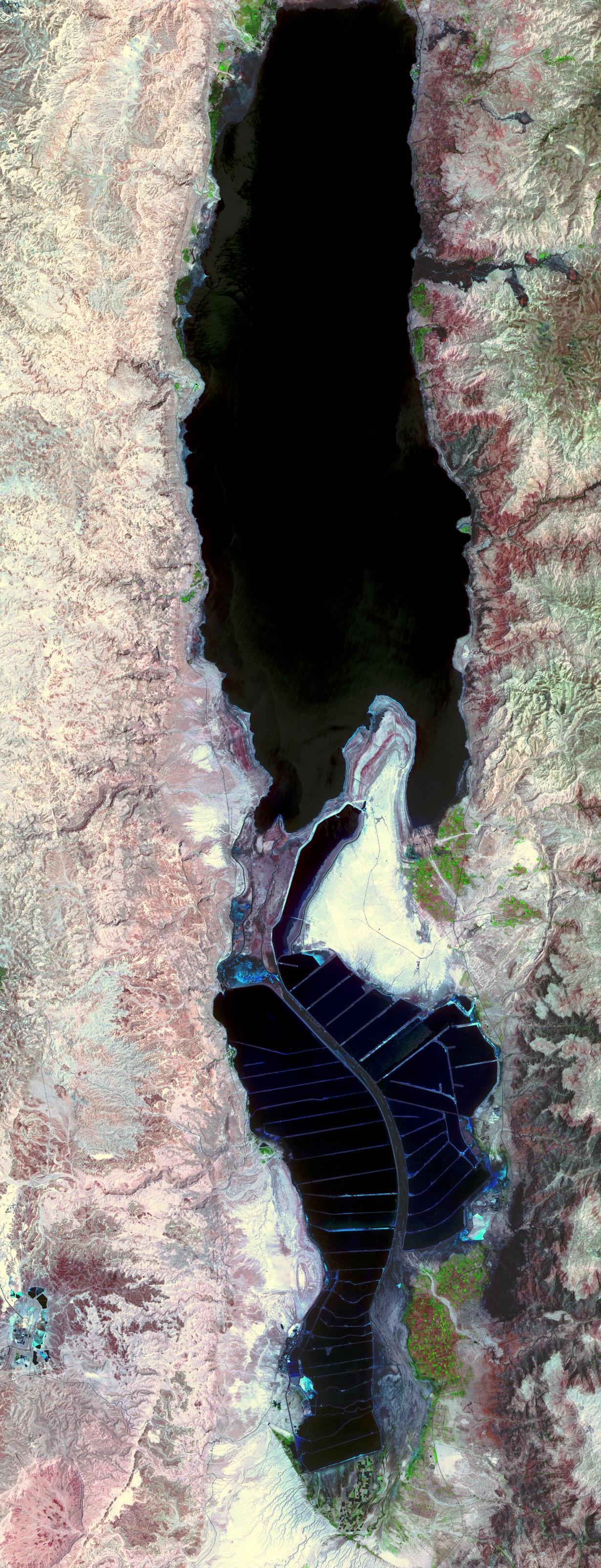
-
PIA01916:
-
The Dead Sea
Full Resolution:
TIFF
(11.85 MB)
JPEG
(859.1 kB)
|
|
|
2006-06-06 |
Earth
|
CloudSat
|
Cloud Profiling Radar (CPR)
|
1194x211x3 |
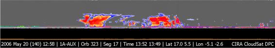
|
-
PIA08519:
CloudSat Image of Tropical Thunderstorms Over Africa
Full Resolution:
TIFF
(756.9 kB)
JPEG
(39.7 kB)
|
|
|
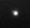
2006-01-25 |
Earth
|
Shuttle Radar Topography Mission (SRTM)
|
C-Band Imaging Radar
X-Band Radar
|
1586x1965x3 |
|
-
PIA06669:
-
Crater Highlands, Tanzania
Full Resolution:
TIFF
(9.365 MB)
JPEG
(540.6 kB)
|
|
|
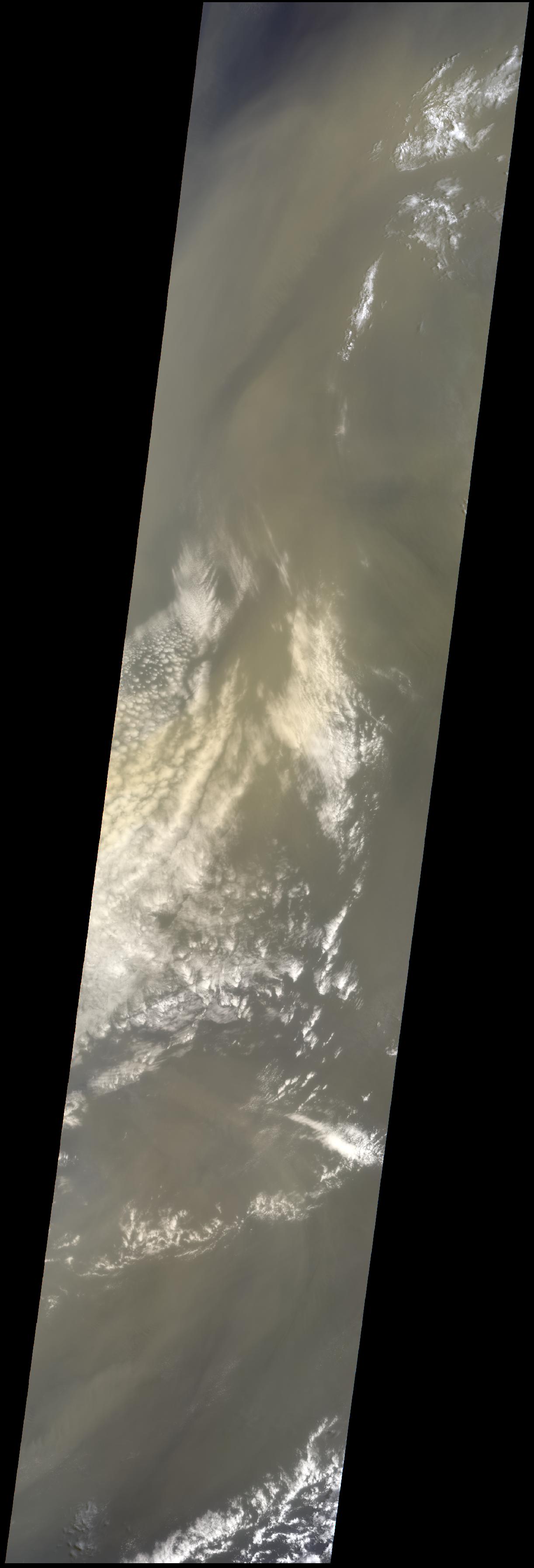
2005-07-28 |
Earth
|
Terra
|
MISR
|
1222x3591x3 |
|
-
PIA03539:
-
Saharan Dust Cloud Sails Toward U.S.
Full Resolution:
TIFF
(13.18 MB)
JPEG
(208.9 kB)
|
|
|
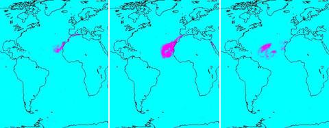
2005-07-15 |
Earth
|
Aqua
|
AIRS
|
480x187x3 |
|
-
PIA00448:
-
Sahara Dust Cloud
Full Resolution:
TIFF
(269.8 kB)
JPEG
(18.24 kB)
|
|
|
2005-03-23 |
Earth
|
Terra
|
MISR
|
2076x1670x3 |
|
-
PIA04376:
-
Where Europe meets Africa
Full Resolution:
TIFF
(5.048 MB)
JPEG
(286.9 kB)
|
|
|
2005-02-23 |
Earth
|
Terra
|
MISR
|
1548x1224x3 |
|
-
PIA04374:
-
Five Years of MISR Global Aerosol Observations
Full Resolution:
TIFF
(2.641 MB)
JPEG
(369.7 kB)
|
|
|
2004-11-10 |
Earth
|
Terra
|
MISR
|
1723x1838x3 |
|
-
PIA04371:
-
Floodwaters Renew Zambia's Kafue Wetland
Full Resolution:
TIFF
(8.518 MB)
JPEG
(716.8 kB)
|
|
|
2004-06-17 |
Earth
|
Shuttle Radar Topography Mission (SRTM)
|
C-Band Interferometric Radar
X-Band Radar
|
9600x10500x3 |
|
-
PIA04965:
-
SRTM Data Release for Africa, Colored Height
Full Resolution:
TIFF
(146.2 MB)
JPEG
(19.74 MB)
|
 Planetary Data System


