My
List |
Addition Date
|
Target
|
Mission
|
Instrument
|
Size
|

|
2004-06-17 |
Earth
|
Shuttle Radar Topography Mission (SRTM)
|
C-Band Interferometric Radar
X-Band Radar
|
9600x10500x3 |
|
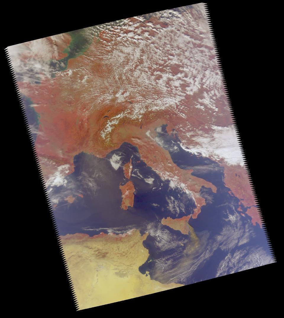
-
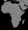
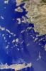
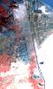
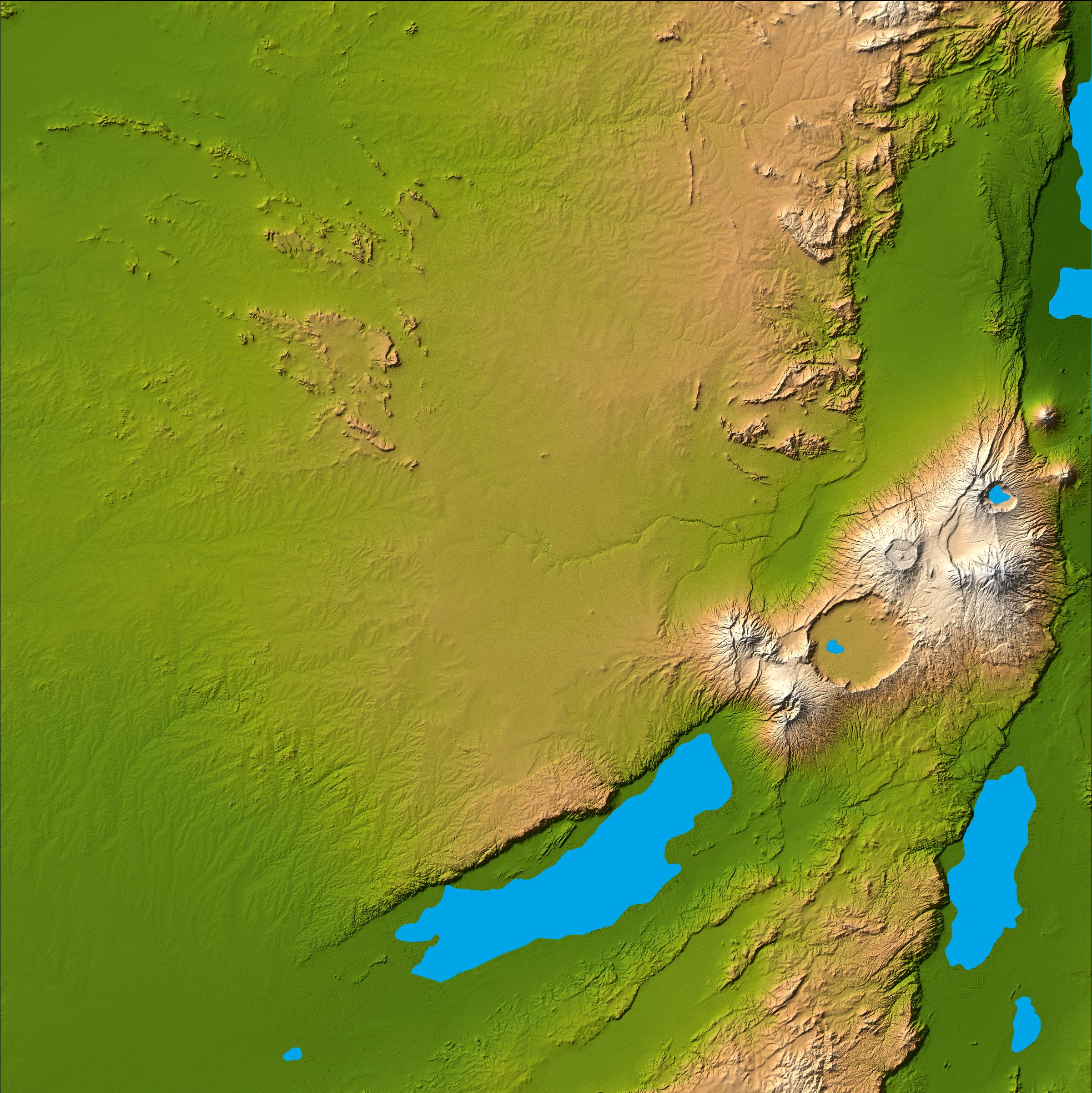
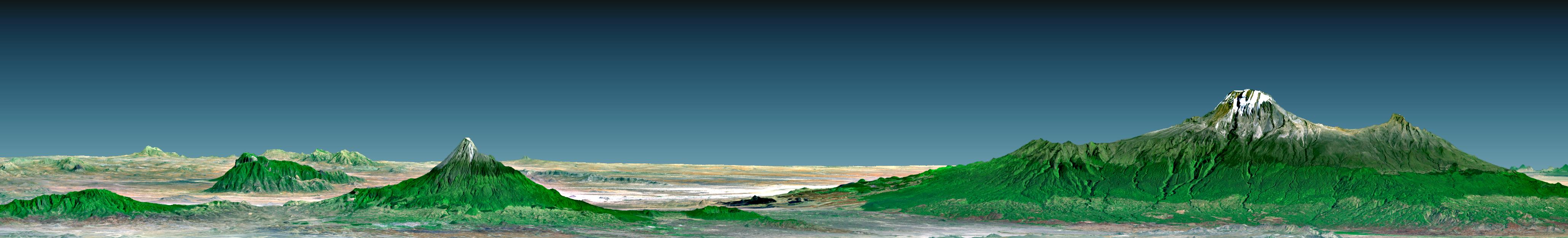
PIA04964:
-
Africa in SRTM 3-D, Anaglyph of Shaded Relief
Full Resolution:
TIFF
(123.1 MB)
JPEG
(13.79 MB)
|
|
|
2004-06-17 |
Earth
|
Landsat
Shuttle Radar Topography Mission (SRTM)
|
C-Band Interferometric Radar
X-Band Radar
|
2184x1377x3 |
|
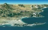
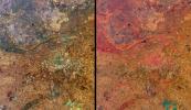
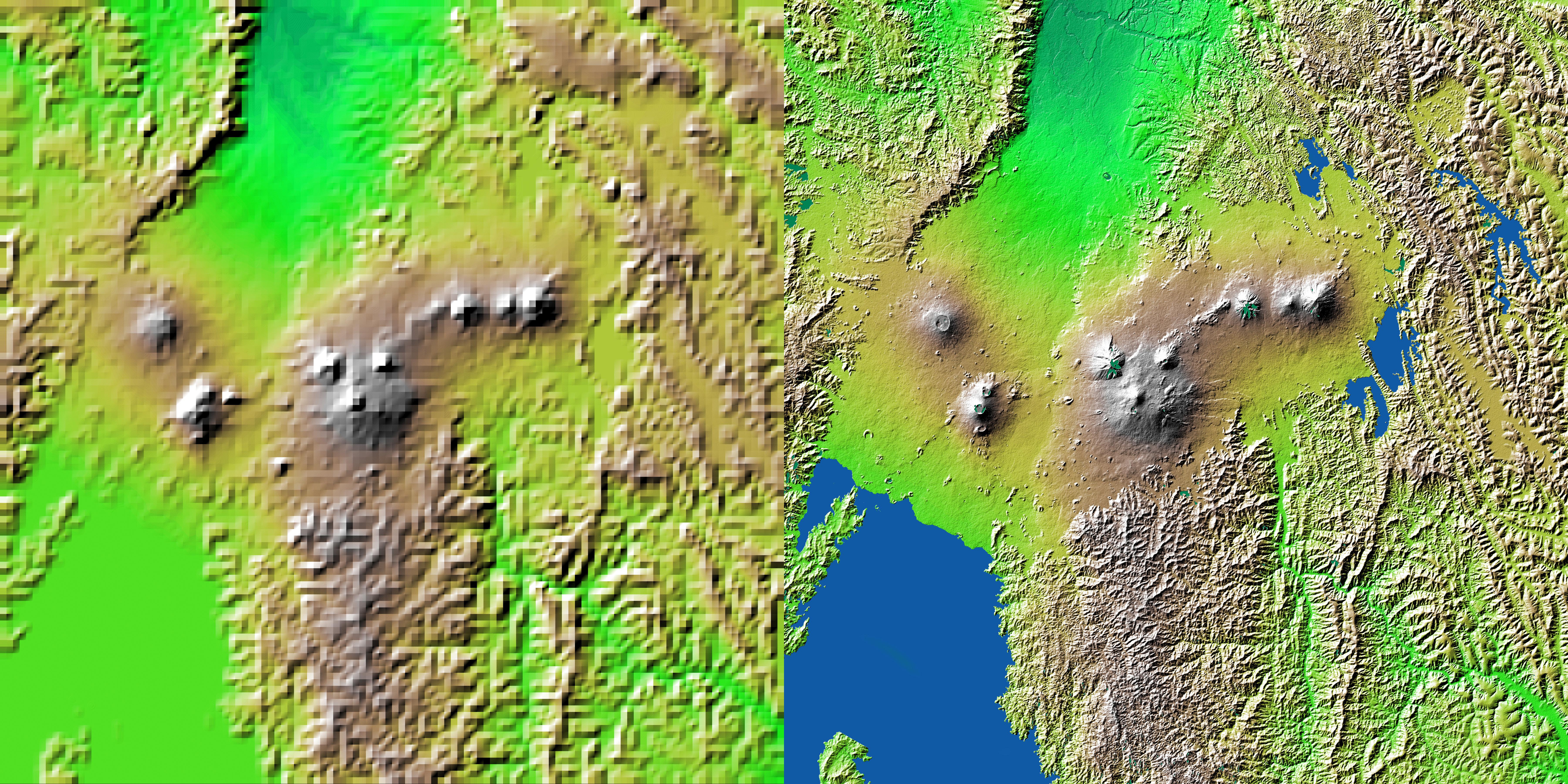
-
PIA04961:
-
Cape Town, South Africa, Perspective View, Landsat Image over SRTM
Elevation
Full Resolution:
TIFF
(8.727 MB)
JPEG
(581.8 kB)
|
|
|
2004-06-17 |
Earth
|
Landsat
Shuttle Radar Topography Mission (SRTM)
|
C-Band Interferometric Radar
X-Band Radar
|
4463x3000x3 |
|
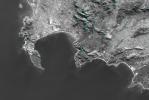
-
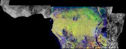
PIA04960:
-
Cape Town, South Africa, Anaglyph, Landsat Image over SRTM Elevation
Full Resolution:
TIFF
(26.41 MB)
JPEG
(2.219 MB)
|
|
|
2004-06-17 |
Earth
|
Shuttle Radar Topography Mission (SRTM)
|
C-Band Interferometric Radar
X-Band Radar
|
2401x2403x3 |

|
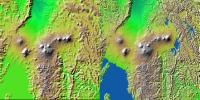
-
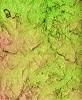
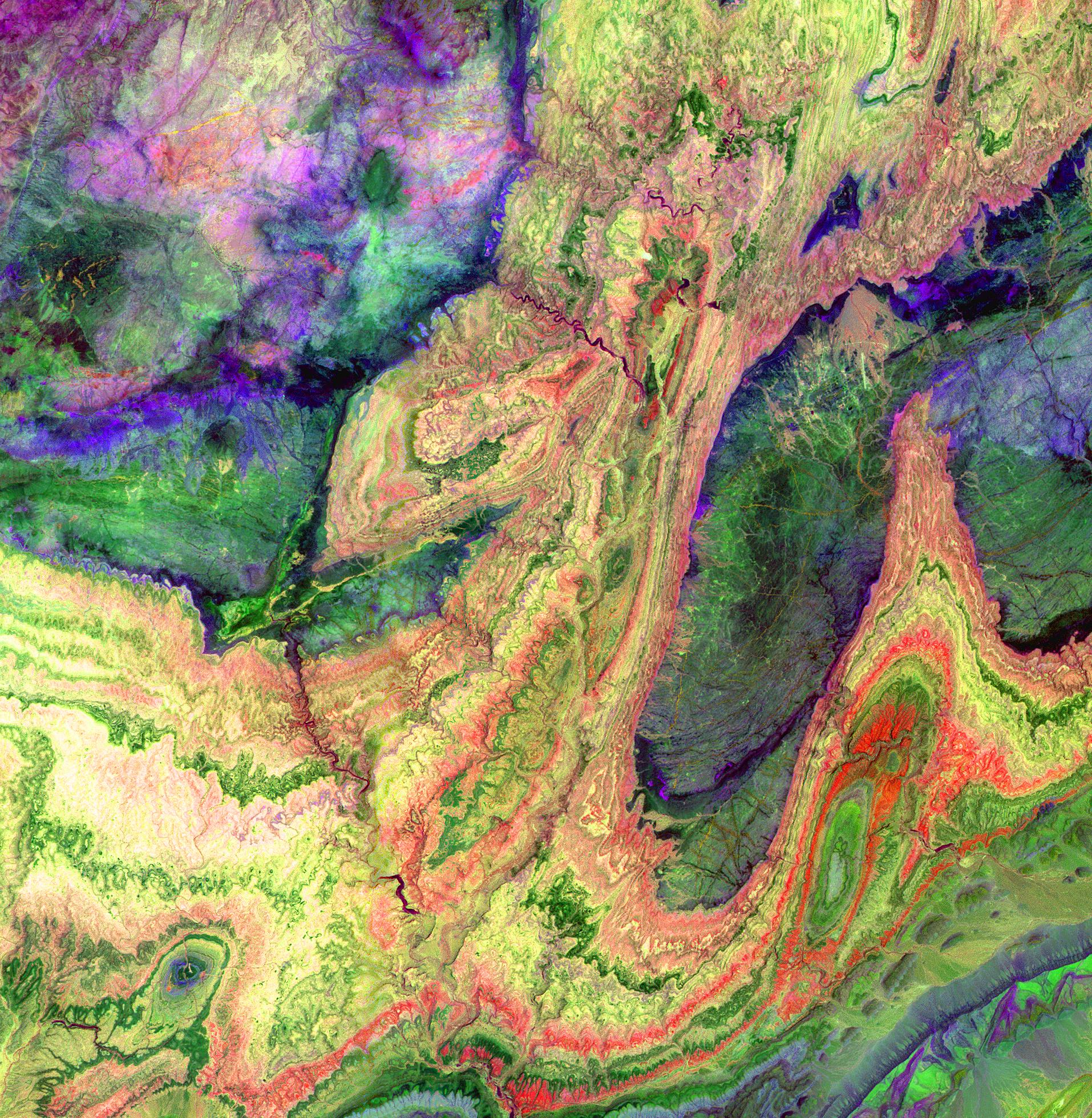
PIA04959:
-
Olduvai Gorge, Shaded Relief and Colored Height
Full Resolution:
TIFF
(17.33 MB)
JPEG
(1.018 MB)
|
|
|
2004-06-17 |
Earth
|
Shuttle Radar Topography Mission (SRTM)
|
C-Band Interferometric Radar
X-Band Radar
|
2401x2401x3 |

|
-
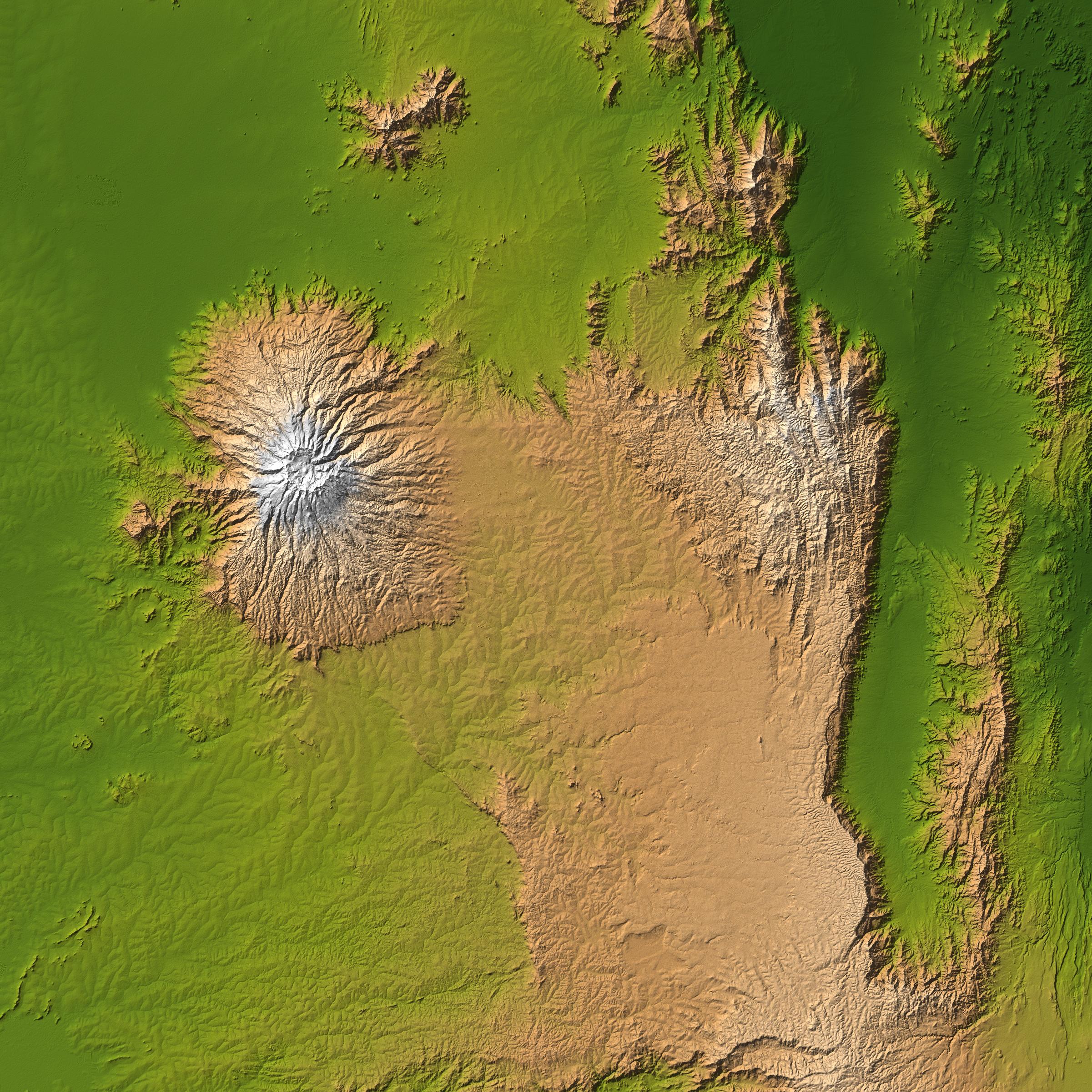
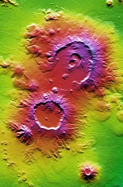
PIA04958:
-
Mt. Elgon, Africa, Shaded Relief and Colored Height
Full Resolution:
TIFF
(17.31 MB)
JPEG
(1.24 MB)
|
|
|
2004-06-17 |
Earth
|
Shuttle Radar Topography Mission (SRTM)
|
C-Band Interferometric Radar
X-Band Radar
|
3601x6897x3 |
|
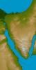
-
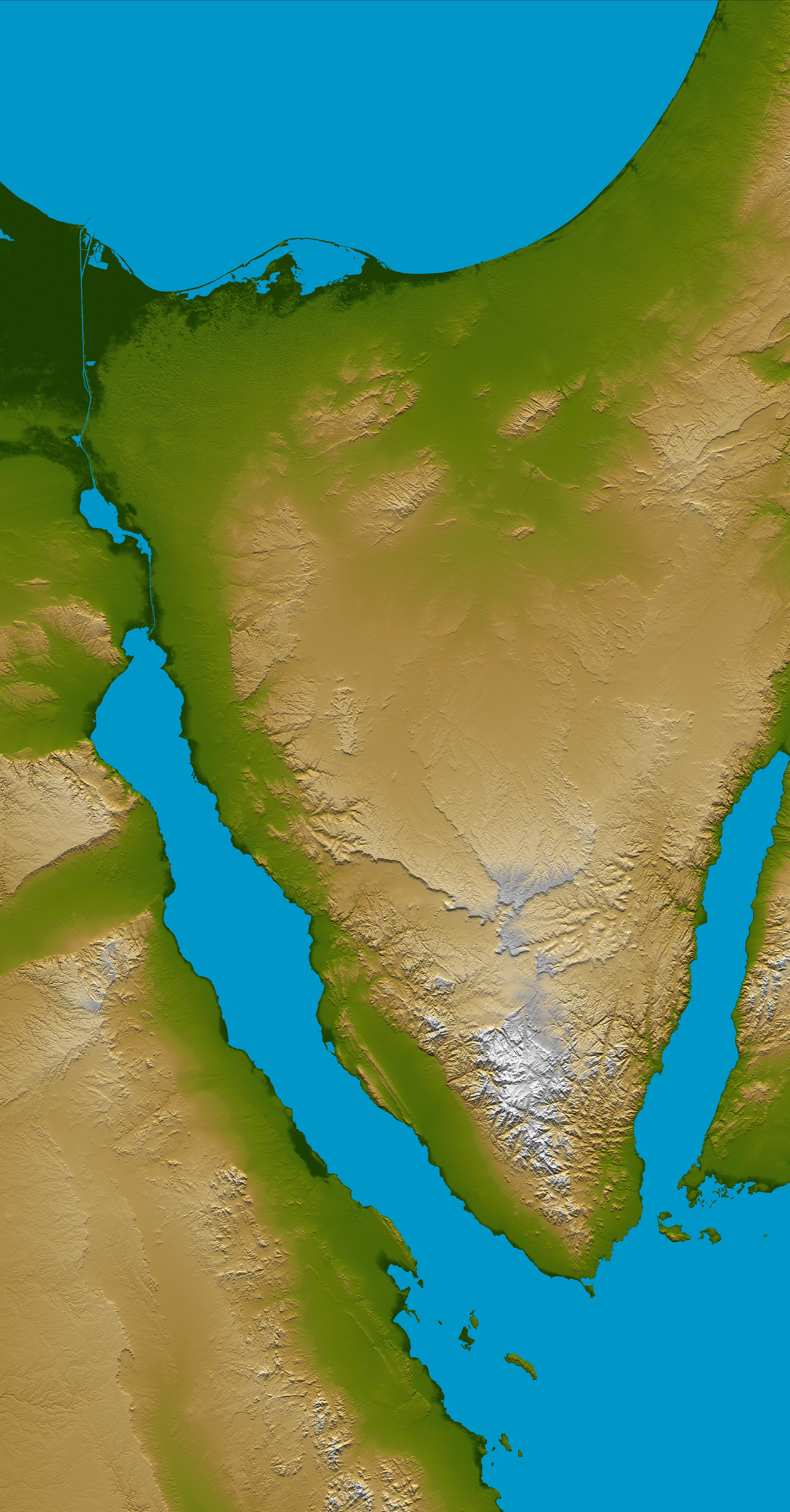
PIA04957:
-
Sinai Peninsula, Shaded Relief and Colored Height
Full Resolution:
TIFF
(56.53 MB)
JPEG
(3.751 MB)
|
|
|
2004-03-08 |
|
Spitzer Space Telescope
|
IRAC
Multiband Imaging Photometer (MIPS)
|
2262x1899x3 |

|
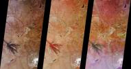
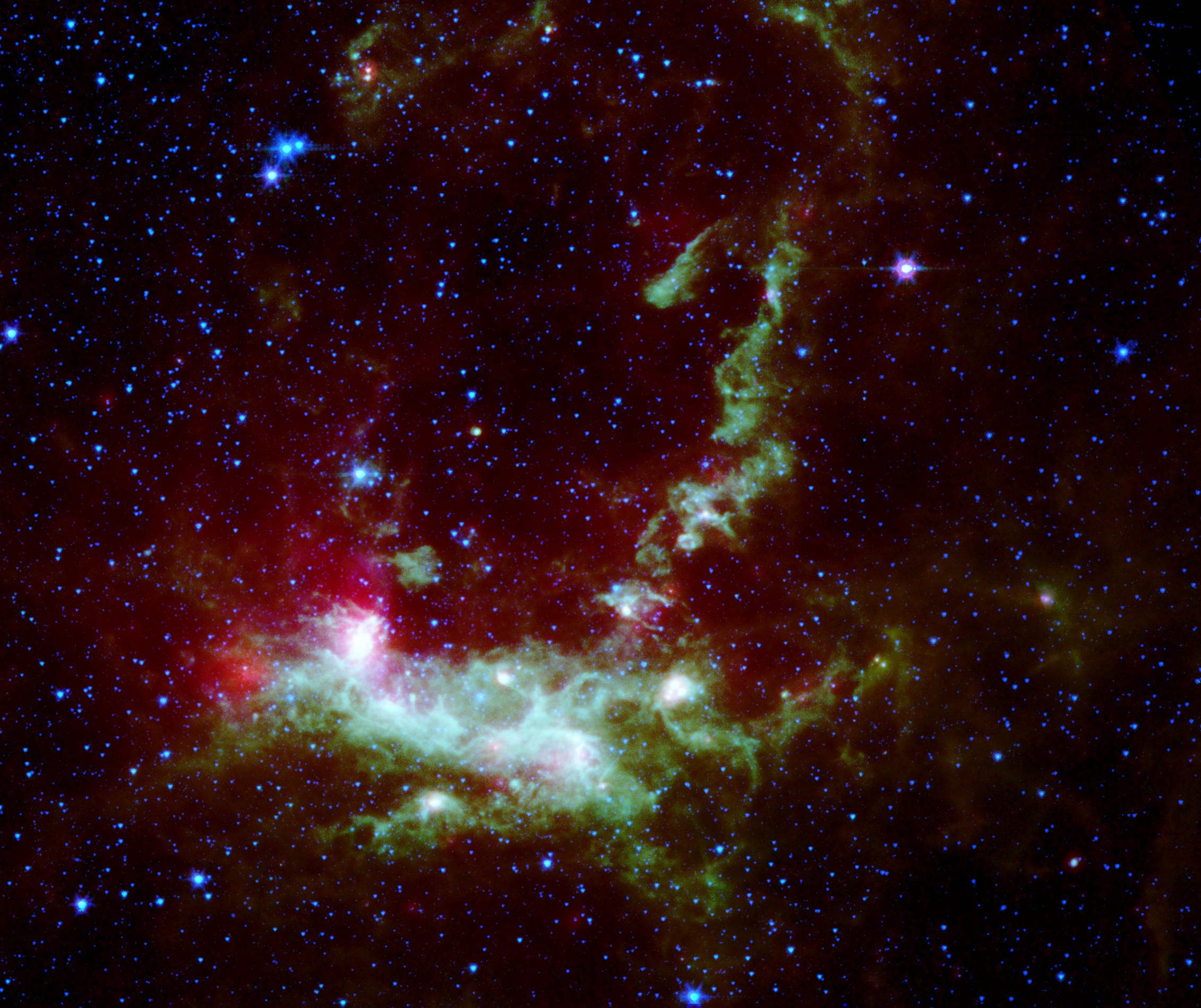
-
PIA05517:
-
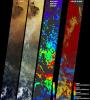
Star Formation in Henize 206
Full Resolution:
TIFF
(8.739 MB)
JPEG
(428.1 kB)
|
|
|
2004-03-04 |
Earth
|
Shuttle Radar Topography Mission (SRTM)
|
C-Band Radar
X-Band Radar
|
250x380x3 |

|
-
PIA04953:
-
Nabro and Mallahle Volcanoes, Eritrea and Ethiopia, SRTM Colored Height and Shaded Relief
Full Resolution:
TIFF
(285.5 kB)
JPEG
(23.34 kB)
|
|
|
2004-01-22 |
Earth
|
Shuttle Radar Topography Mission (SRTM)
|
C-Band Radar
X-Band Radar
|
3020x1700x3 |
|
-
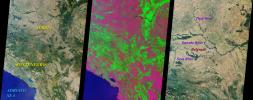
PIA03398:
-
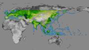
SRTM Data Release for Eurasia, Index Map and Colored Height
Full Resolution:
TIFF
(4.646 MB)
JPEG
(509.4 kB)
|
|
|
2004-01-21 |
Earth
|
Terra
|
MISR
|
2574x2766x3 |
|
-
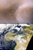
PIA04350:
-
Hazy and Dusty Skies over Western Africa
Full Resolution:
TIFF
(13.18 MB)
JPEG
(658.8 kB)
|
|
|
2003-10-24 |
Earth
|
Shuttle Radar Topography Mission (SRTM)
|
C-Band Interferometric Radar
X-Band Radar
|
1528x917x3 |

|
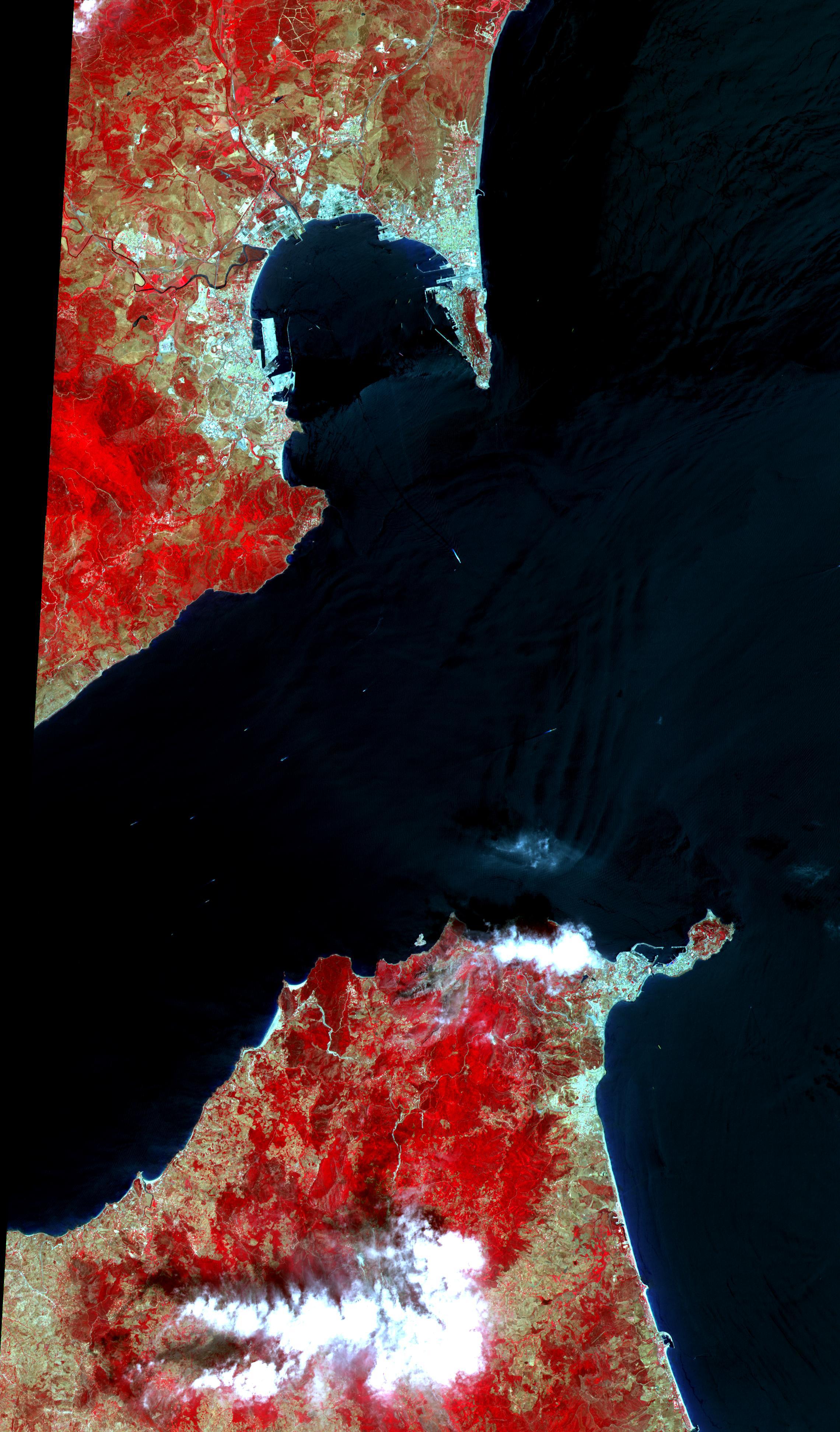
-
PIA03397:
-
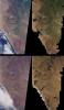
Strait of Gibraltar, Perspective with Landsat Image Overlay
Full Resolution:
TIFF
(3.227 MB)
JPEG
(185.6 kB)
|
|
|
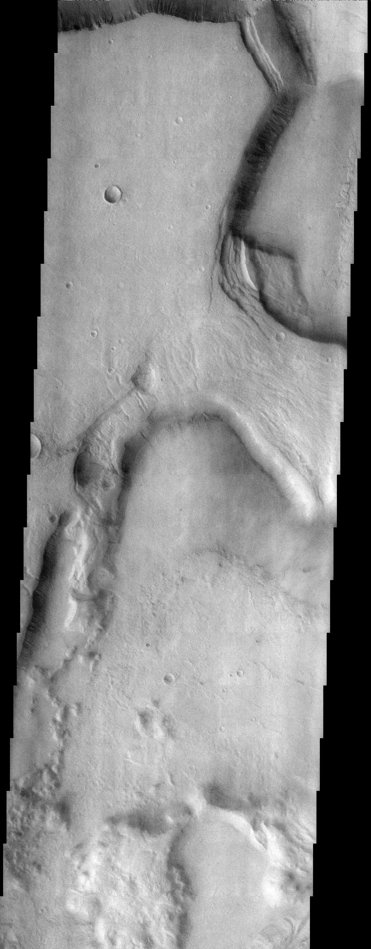
2003-09-29 |
Mars
|
2001 Mars Odyssey
|
THEMIS
|
1197x3061x1 |

|
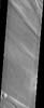
-
PIA04764:
-
Niger Vallis
Full Resolution:
TIFF
(3.665 MB)
JPEG
(897.8 kB)
|
|
|
2003-08-21 |
Earth
|
Shuttle Radar Topography Mission (SRTM)
|
C-Band Interferometric Radar
|
14850x8000x3 |
|
-
PIA03394:
-
World Globes, Shaded Relief and Colored Height
Full Resolution:
TIFF
(109.4 MB)
JPEG
(35.2 MB)
|
|
|
2003-06-19 |
Earth
|
Shuttle Radar Topography Mission (SRTM)
|
C-Band Interferometric Radar
|
7200x10886x3 |
|
-
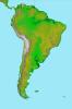
PIA03389:
-
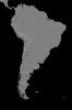
Anaglyph, South America
Full Resolution:
TIFF
(50.13 MB)
JPEG
(6.633 MB)
|
|
|
2003-06-19 |
Earth
|
Shuttle Radar Topography Mission (SRTM)
|
C-Band Interferometric Radar
|
7200x10886x3 |
|
-
PIA03388:
-
South America, Shaded Relief and Colored Height
Full Resolution:
TIFF
(69.52 MB)
JPEG
(8.202 MB)
|
|
|
2003-06-04 |
Earth
|
Terra
|
MISR
|
1466x896x3 |
|
-
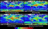
PIA04333:
-
Global and Seasonal Aerosol Distributions from MISR
Full Resolution:
TIFF
(3.079 MB)
JPEG
(530.4 kB)
|
|
|
2003-06-02 |
Earth
|
Aqua
|
AIRS
|
1437x921x3 |
|
-
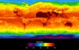
PIA00427:
-
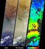
Global Average Brightness Temperature for April 2003
Full Resolution:
TIFF
(2.867 MB)
JPEG
(158.1 kB)
|
|
|
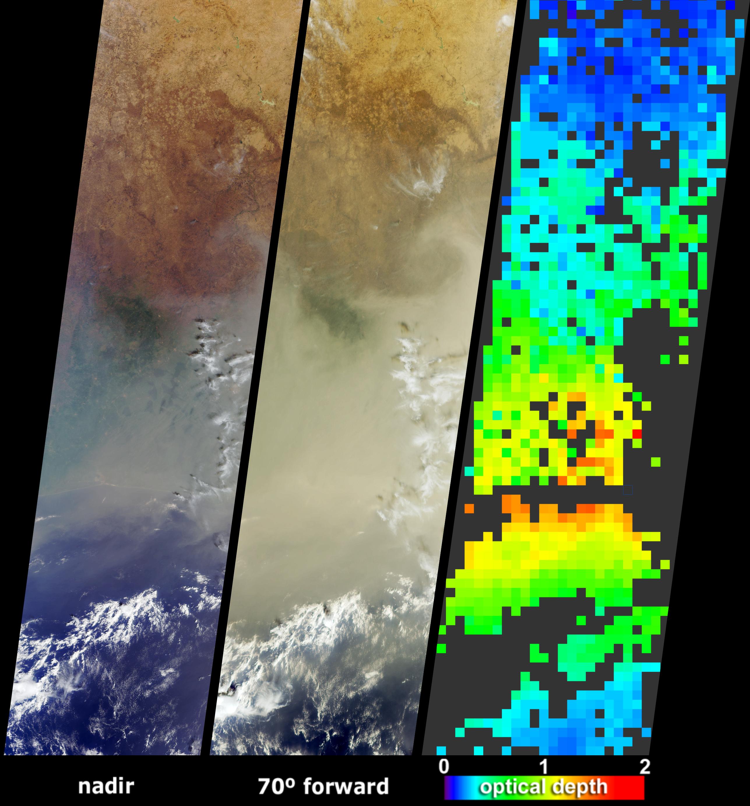
2003-03-12 |
Earth
|
Terra
|
MISR
|
1134x1885x3 |
|
-
PIA04322:
-
Casting Light and Shadows on a Saharan Dust Storm
Full Resolution:
TIFF
(3.043 MB)
JPEG
(250.3 kB)
|
|
|
2003-02-26 |
Earth
|
Terra
|
MISR
|
691x1200x3 |
|
-
PIA04320:
-
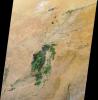
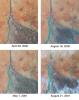
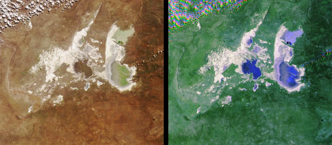
Seasonal Surface Changes in Namibia and Central Angola
Full Resolution:
TIFF
(2.107 MB)
JPEG
(111.5 kB)
|
|
|
2003-02-12 |
Earth
|
Terra
|
MISR
|
2070x2288x3 |
|
-
PIA03897:
-
Smoke over Nigeria and the Gulf of Guinea
Full Resolution:
TIFF
(5.98 MB)
JPEG
(681.2 kB)
|
|
|
2003-01-08 |
Earth
|
Terra
|
ASTER
|
1914x1960x3 |
|
-
PIA03893:
-
Anti-Atlas Mountains, Morocco
Full Resolution:
TIFF
(11.27 MB)
JPEG
(1.133 MB)
|
|
|
2002-11-13 |
Earth
|
Aqua
|
AIRS
|
960x1076x3 |
|
-
PIA00355:
-
Mt. Etna Eruption
Full Resolution:
TIFF
(2.131 MB)
JPEG
(120 kB)
|
|
|
2002-09-18 |
Earth
|
Terra
|
MISR
|
1341x2060x3 |
|
-
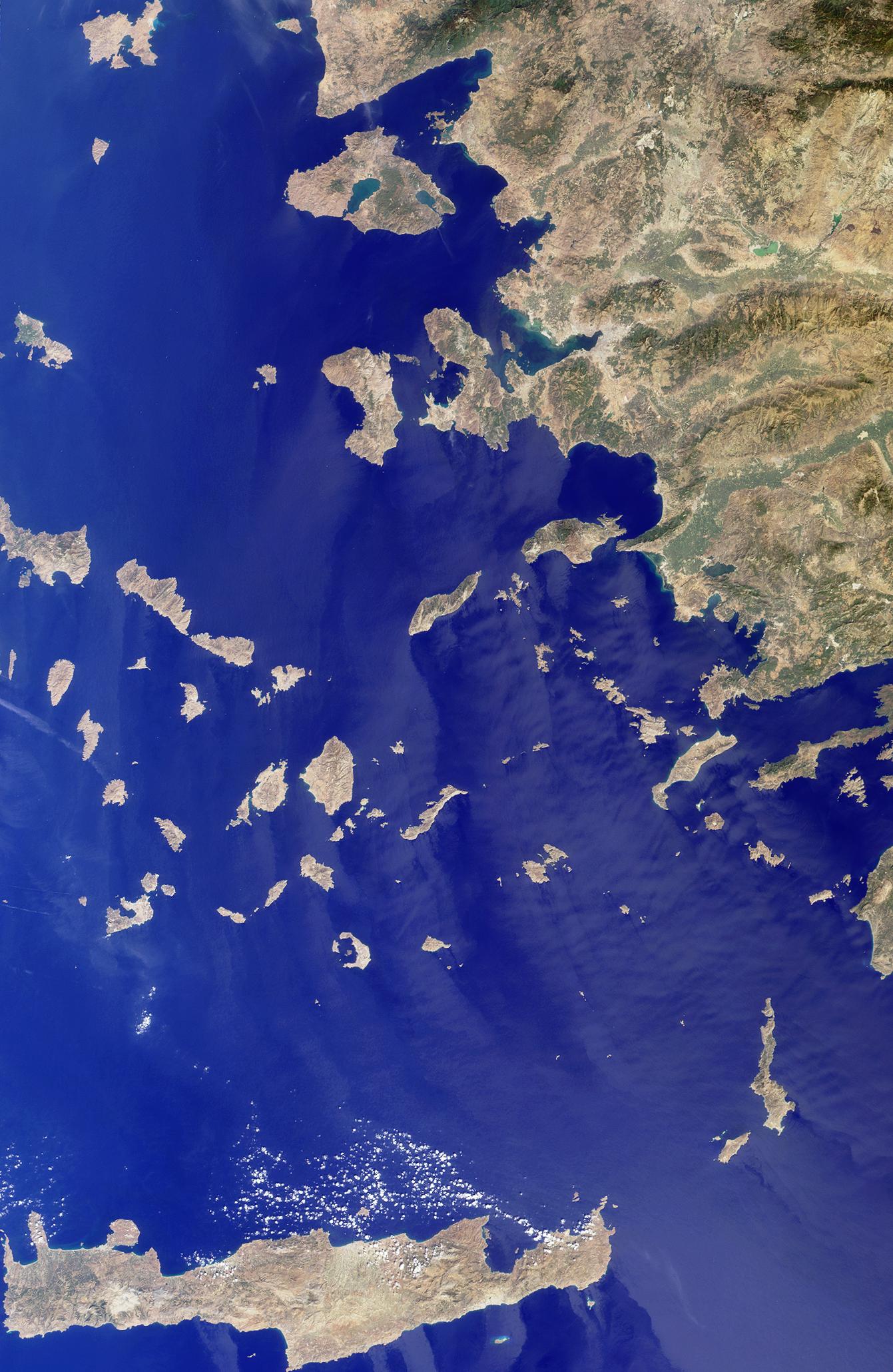
PIA03725:
-
Islands in the Midst of the World
Full Resolution:
TIFF
(8.296 MB)
JPEG
(411.5 kB)
|
|
|
2002-08-28 |
Earth
|
Terra
|
MISR
|
1392x805x3 |
|
-
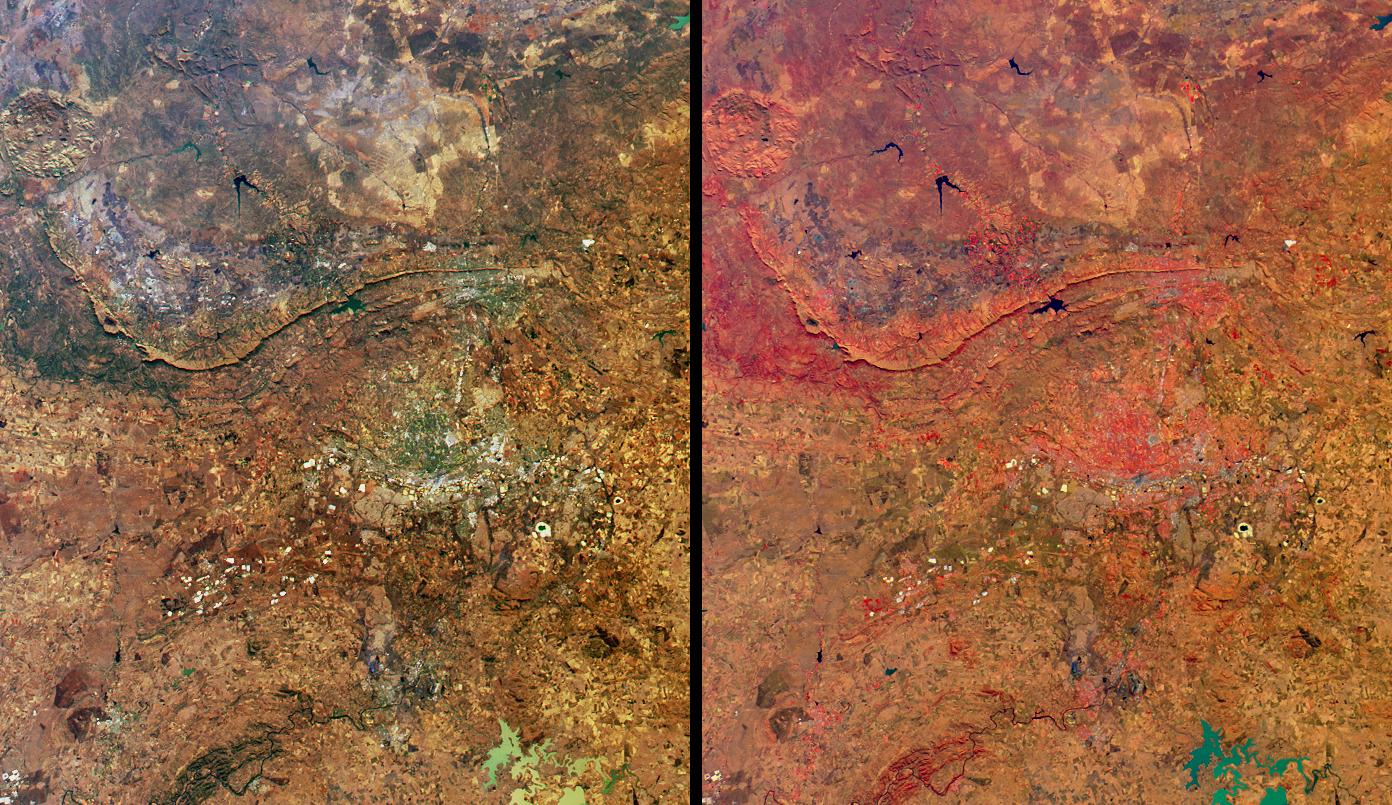
PIA03722:
-
Highlights from Johannesburg, Gauteng Province, South Africa
Full Resolution:
TIFF
(3.862 MB)
JPEG
(313 kB)
|
|
|
2002-08-22 |
Earth
|
Landsat
Shuttle Radar Topography Mission (SRTM)
|
C-Band Interferometric Radar
Thematic Mapper
|
1373x209x3 |

|
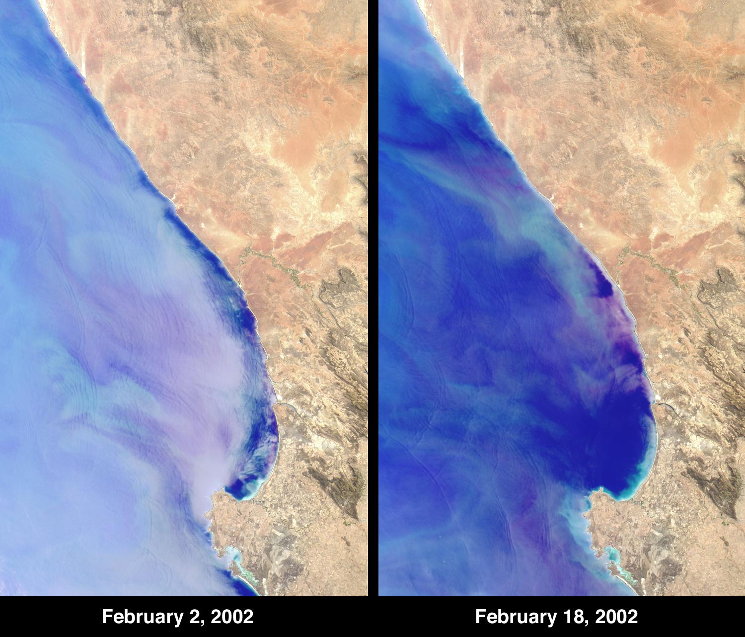
-
PIA03355:
Perspective with Landsat Overlay, Mount Kilimanjaro, Tanzania
Full Resolution:
TIFF
(2.589 MB)
JPEG
(275.5 kB)
|
|
|
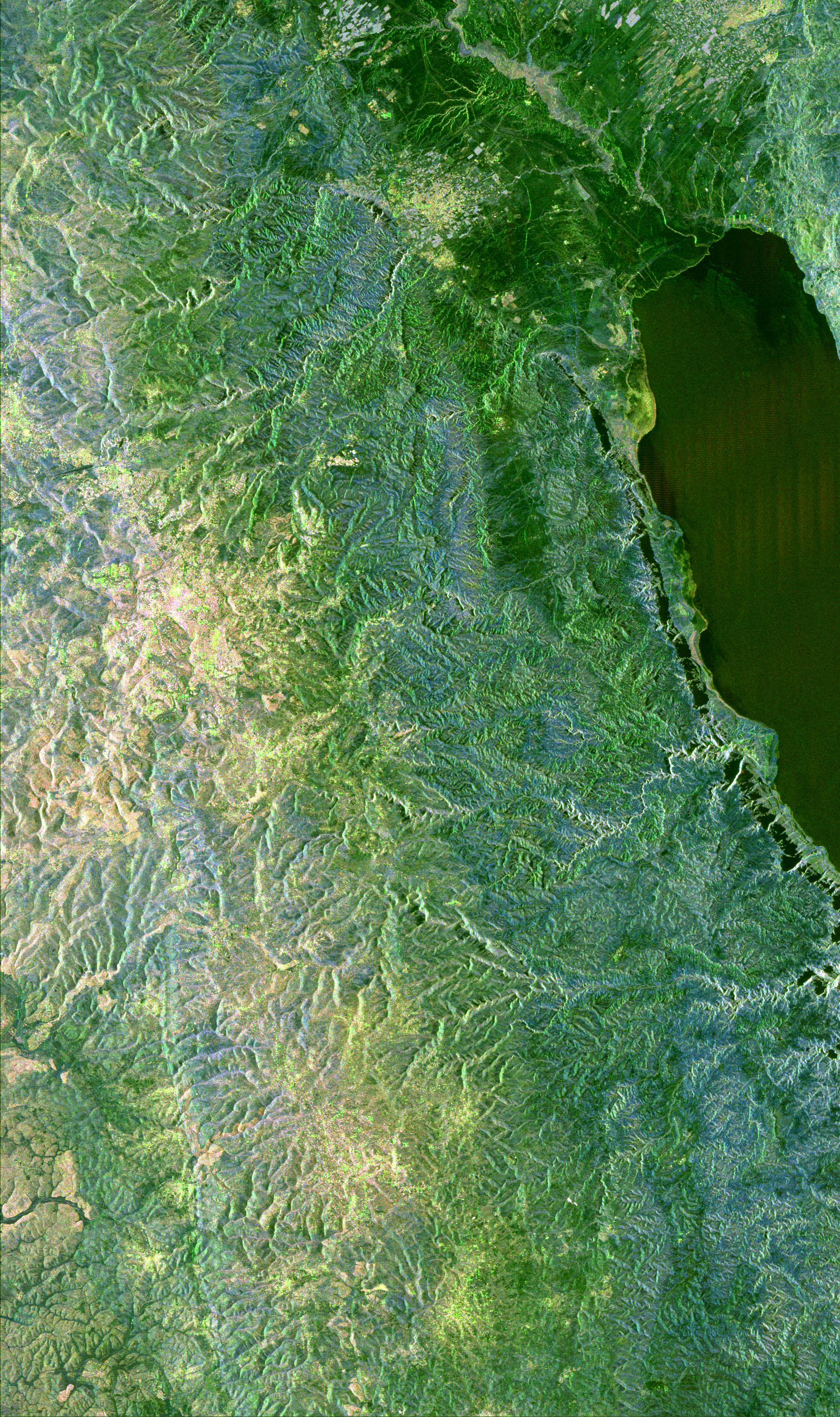
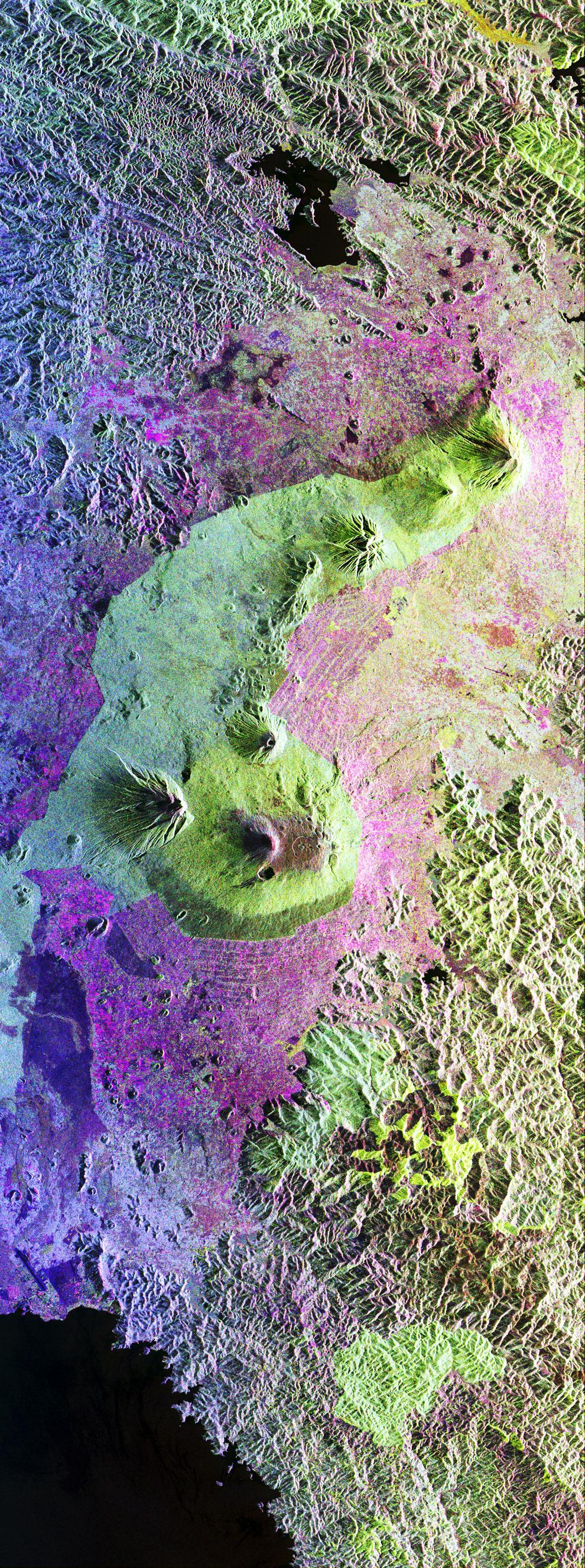
2002-07-11 |
Earth
|
Shuttle Radar Topography Mission (SRTM)
|
C-Band Interferometric Radar
|
7200x3601x3 |
|
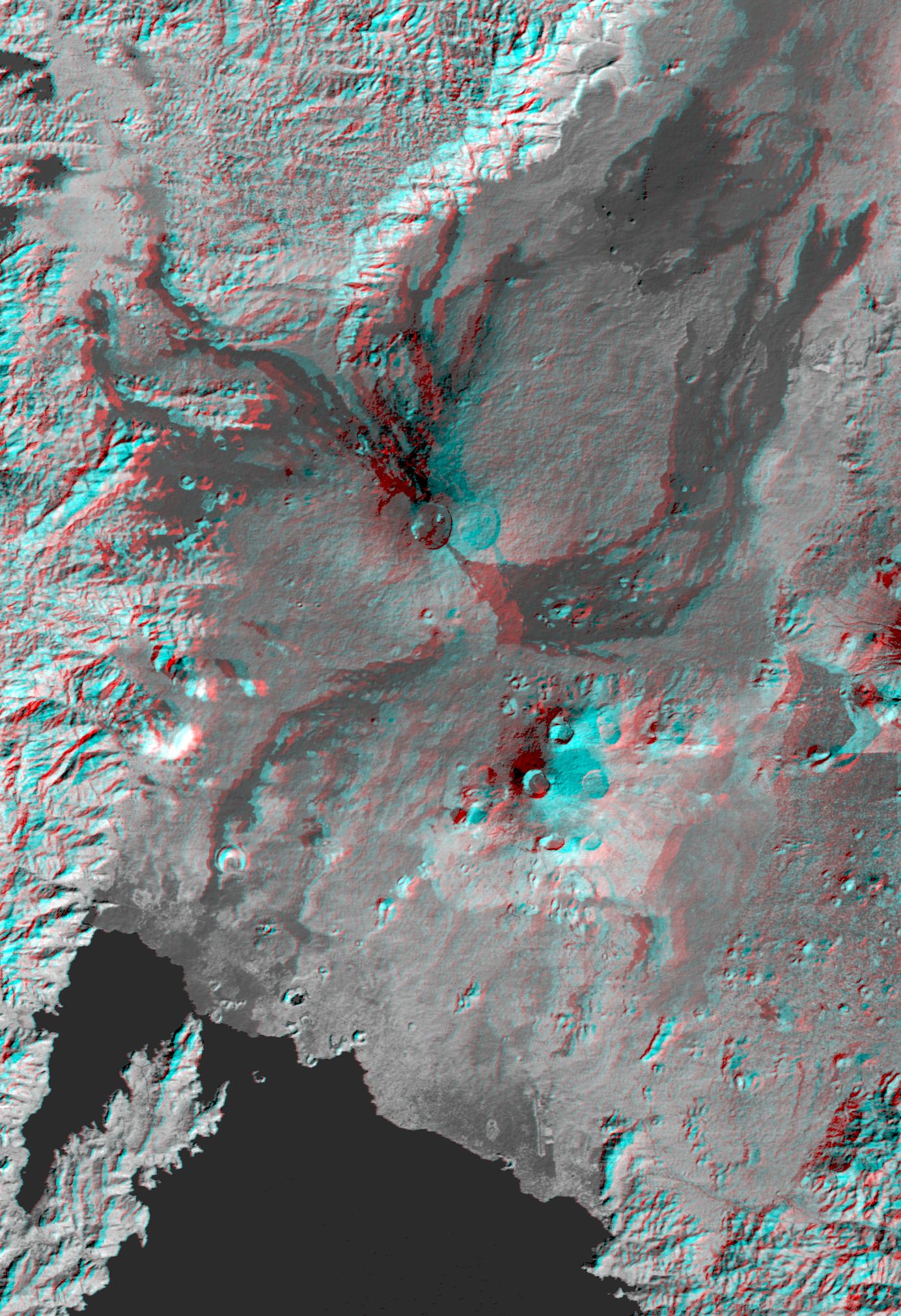
-
PIA03351:
-
Shaded Relief with Height as Color, Virunga and Nyiragongo Volcanoes and the East African Rift Valley
Full Resolution:
TIFF
(78.98 MB)
JPEG
(5.492 MB)
|
|
|
2002-06-17 |
Mars
|
2001 Mars Odyssey
|
THEMIS
|
1234x3025x1 |
|
-
PIA03810:
-
Tharsis Rise Graben
Full Resolution:
TIFF
(1.57 MB)
JPEG
(409.1 kB)
|
|
|
2002-03-06 |
Earth
|
Terra
|
MISR
|
1500x1282x3 |
|
-
PIA03447:
-
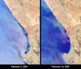
Red Tide Strands South African Rock Lobsters
Full Resolution:
TIFF
(5.909 MB)
JPEG
(242.3 kB)
|
|
|
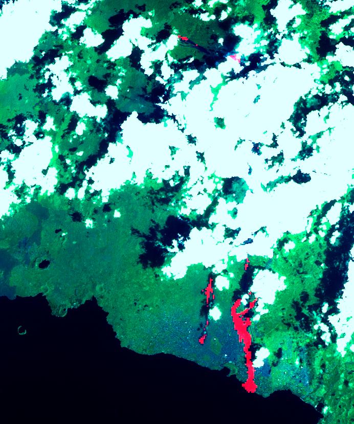
2002-02-01 |
Earth
|
Landsat
Shuttle Radar Topography Mission (SRTM)
|
C-Band Interferometric Radar
Thematic Mapper
|
1384x2022x3 |
|
-
PIA03340:
-
Nyiragongo volcano, Congo, Anaglyph, SRTM / Landsat
Full Resolution:
TIFF
(7.001 MB)
JPEG
(499 kB)
|
|
|
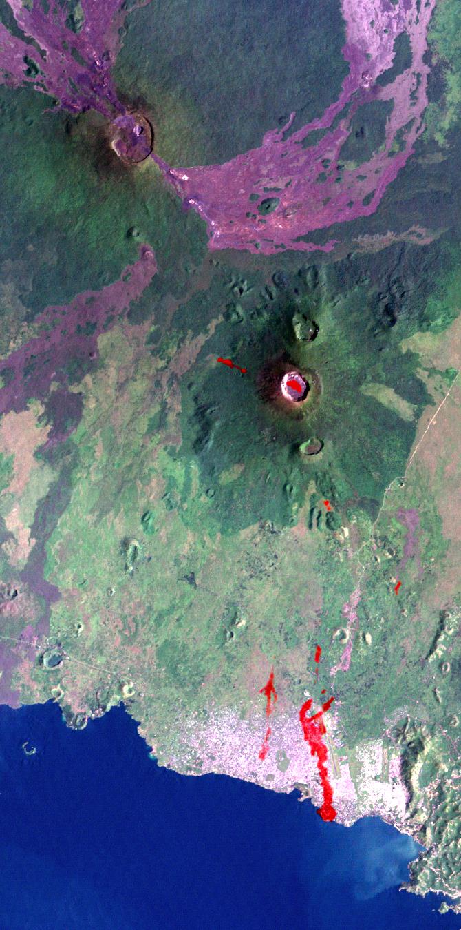
2002-02-01 |
Earth
|
Landsat
Shuttle Radar Topography Mission (SRTM)
|
C-Band Interferometric Radar
Thematic Mapper
|
670x1350x3 |
|
-
PIA03339:
-
Nyiragongo Volcano, Congo, Map View with Lava, Landsat / ASTER / SRTM
Full Resolution:
TIFF
(2.983 MB)
JPEG
(168.3 kB)
|
|
|
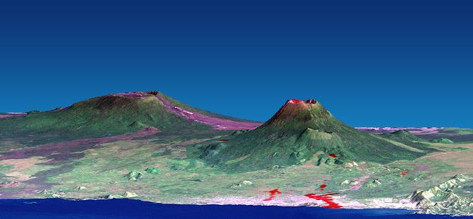
2002-02-01 |
Earth
|
Landsat
Shuttle Radar Topography Mission (SRTM)
|
C-Band Interferometric Radar
Thematic Mapper
|
670x311x3 |

|
-
PIA03338:
-
Nyiragongo volcano, Congo, Perspective View with Lava SRTM / ASTER / Landsat
Full Resolution:
TIFF
(368.7 kB)
JPEG
(29.26 kB)
|
|
|
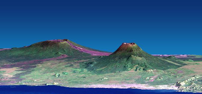
2002-02-01 |
Earth
|
Landsat
Shuttle Radar Topography Mission (SRTM)
|
C-Band Interferometric Radar
Thematic Mapper
|
670x311x3 |

|
-
PIA03337:
-
Nyiragongo volcano, Congo, Pre-eruption Perspective View, SRTM / Landsat
Full Resolution:
TIFF
(368 kB)
JPEG
(28.97 kB)
|
|
|
2002-02-01 |
Earth
|
Terra
|
ASTER
|
692x829x3 |
|
-
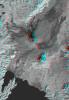
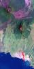
PIA03462:
-
Nyiragonga Volcano
Full Resolution:
TIFF
(997.9 kB)
JPEG
(119.6 kB)
|
|
|
2001-10-31 |
Earth
|
Terra
|
MISR
|
1605x1650x3 |
|
-
PIA03429:
-
Where on Earth...? MISR Mystery Image Quiz #4:
Mali, Africa
Full Resolution:
TIFF
(7.02 MB)
JPEG
(305.6 kB)
|
|
|
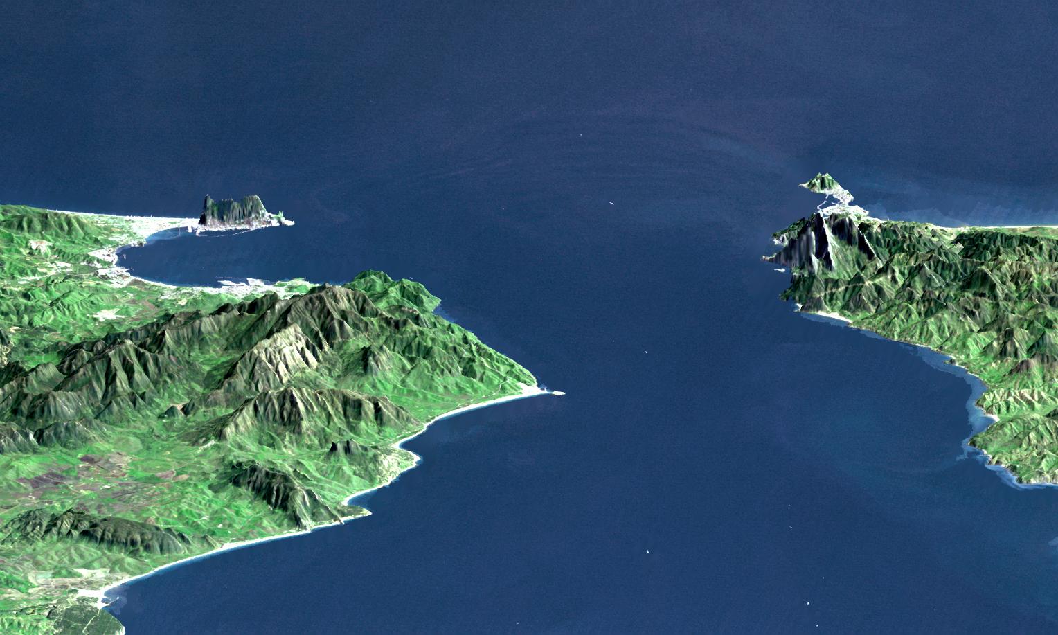
2001-10-22 |
Earth
|
Terra
|
ASTER
|
2280x3887x3 |
|
-
PIA11167:
-
Strait of Gibraltar
Full Resolution:
TIFF
(26.62 MB)
JPEG
(1.024 MB)
|
|
|
2001-08-29 |
Earth
|
Terra
|
MISR
|
983x1250x3 |
|
-
PIA03420:
-
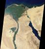
Nile River Fluctuations Near Khartoum, Sudan
Full Resolution:
TIFF
(3.15 MB)
JPEG
(165.1 kB)
|
|
|
2001-03-07 |
Earth
|
Terra
|
MISR
|
1604x1745x3 |
|
-
PIA02647:
-
The Nile
Full Resolution:
TIFF
(7.185 MB)
JPEG
(409.7 kB)
|
|
|
2001-01-10 |
Earth
|
Terra
|
MISR
|
1149x1046x3 |

|
-
PIA02640:
-
Airborne Particulates over Southern Africa
Full Resolution:
TIFF
(3.089 MB)
JPEG
(182.1 kB)
|
|
|
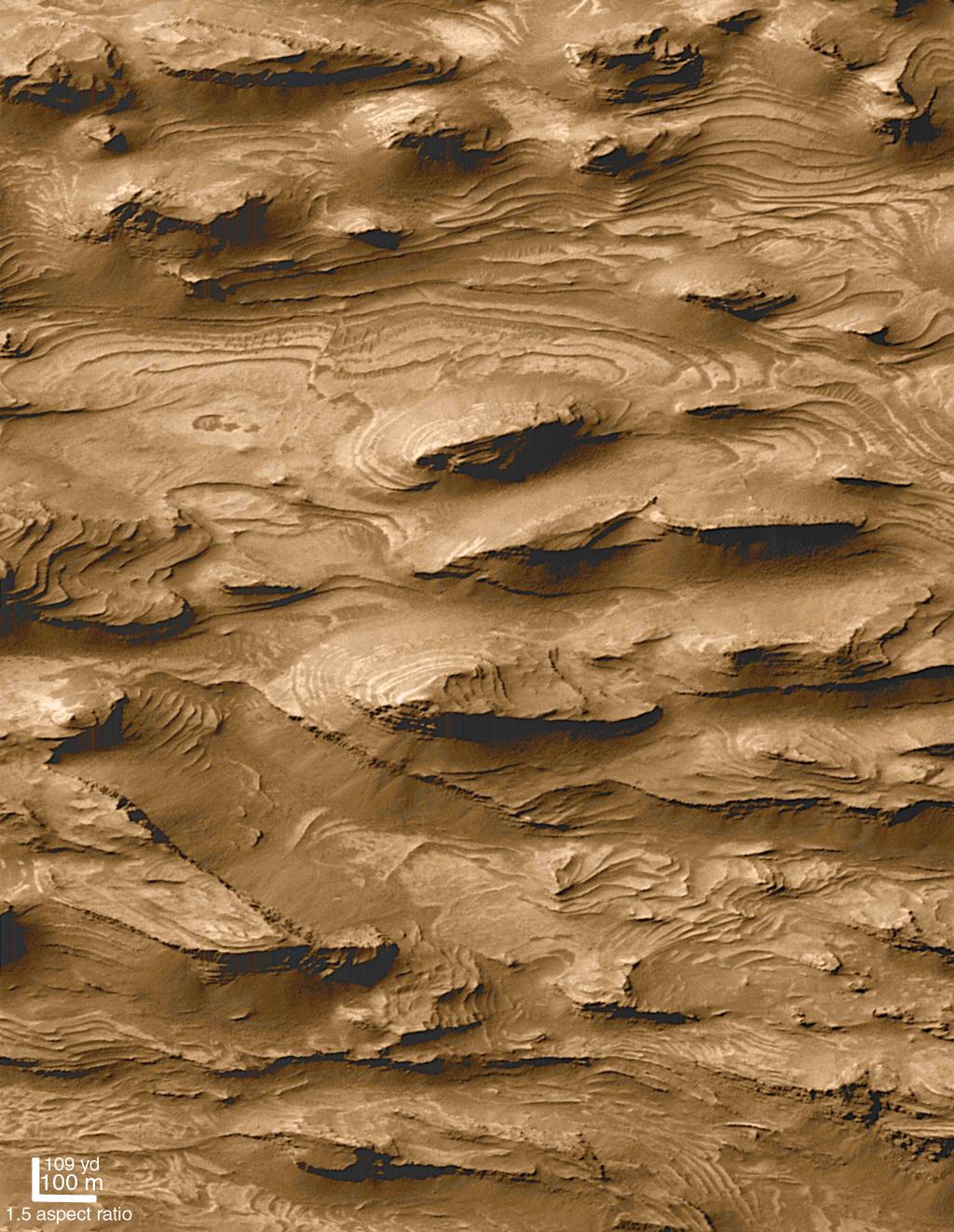
2000-12-04 |
Mars
|
Mars Global Surveyor (MGS)
|
Mars Orbiter Camera (MOC)
|
1024x1322x3 |
|
-
PIA02839:
-
Layered Outcrops of Far West Candor Chasma
Full Resolution:
TIFF
(4.395 MB)
JPEG
(241.8 kB)
|
|
|
2000-11-22 |
Mars
|
Mariner Mars 1971 (Mariner 9)
|
|
5925x4847x1 |
|
-
PIA02997:
-
Mariner 9 View of Arsia Silva
Full Resolution:
TIFF
(29.36 MB)
JPEG
(4.353 MB)
|
|
|
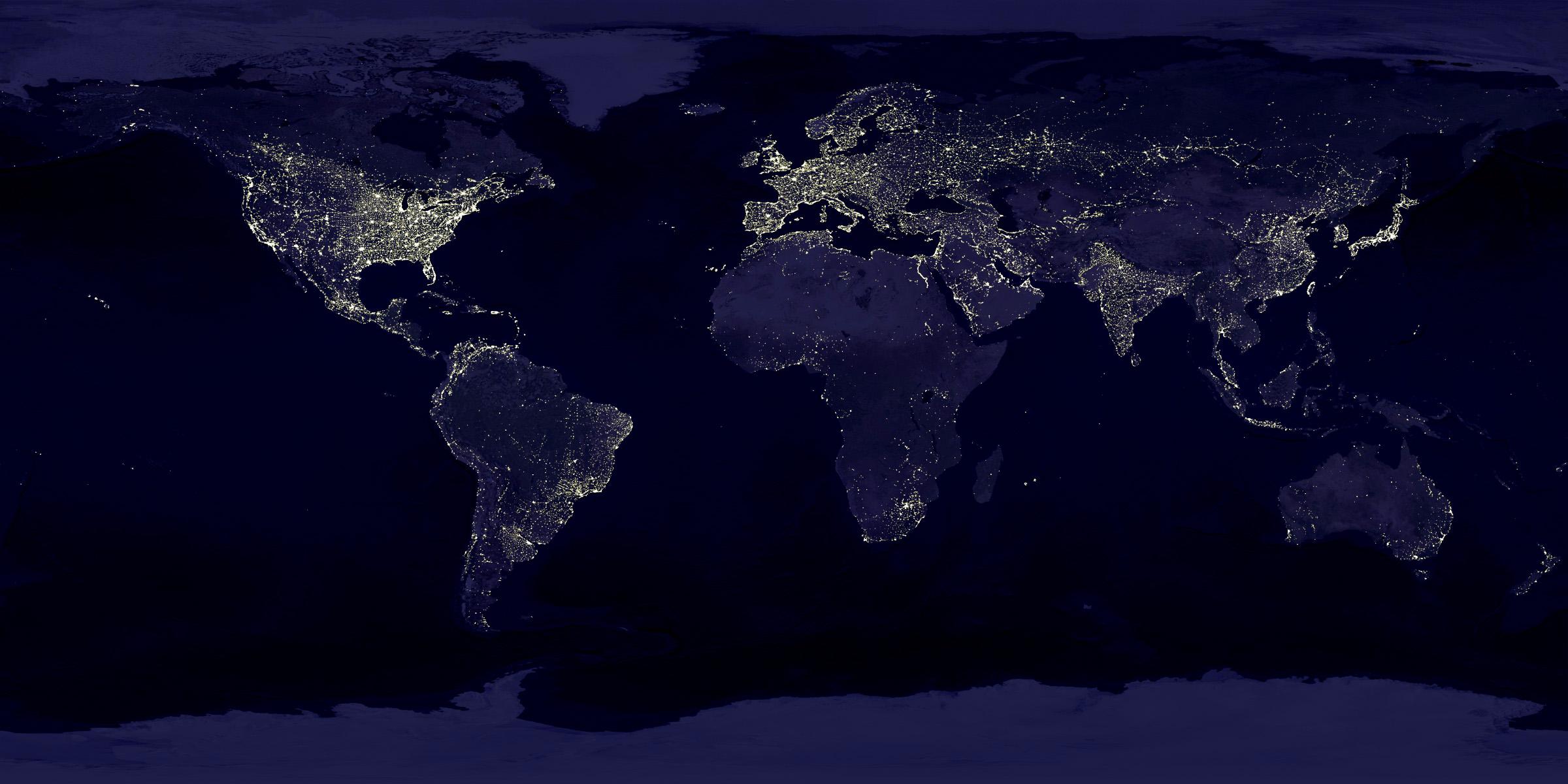
2000-11-09 |
Earth
|
Defense Meteorological Satellite Program (DMSP)
|
|
2400x1200x3 |
|
-
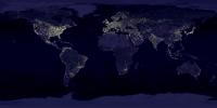
PIA02991:
-
Global City Lights
Full Resolution:
TIFF
(3.269 MB)
JPEG
(250.4 kB)
|
|
|
2000-10-11 |
Earth
|
Terra
|
MISR
|
2259x894x3 |
|
-
PIA02627:
-
MISR Looks at Yugoslavia
Full Resolution:
TIFF
(6.538 MB)
JPEG
(488.8 kB)
|
|
|
2000-10-06 |
Earth
|
Terra
|
ASTER
|
2412x4065x3 |
|
-
PIA02661:
-
ASTER Suez Canal
Full Resolution:
TIFF
(19.92 MB)
JPEG
(1.805 MB)
|
|
|
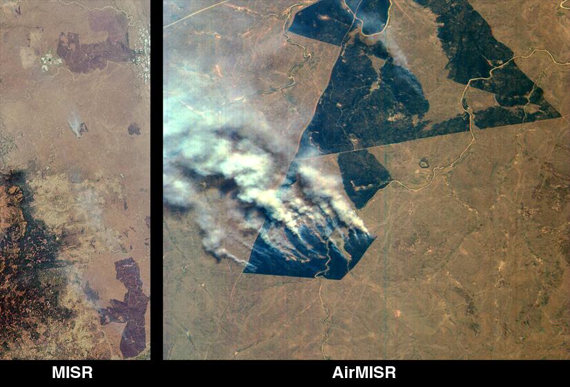
2000-09-20 |
Earth
|
Terra
|
MISR
|
826x560x3 |

|
-
PIA02624:
-
MISR and AirMISR Simultaneously Observe African Grassland Fires
Full Resolution:
TIFF
(1.505 MB)
JPEG
(86.42 kB)
|
|
|
2000-09-12 |
Mars
|
Mars Global Surveyor (MGS)
|
Mars Orbiter Camera (MOC)
|
885x1369x3 |
|
-
PIA02807:
-
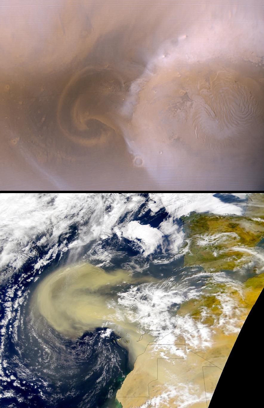
Recent Mars and Earth Dust Storms Compared
Full Resolution:
TIFF
(3.507 MB)
JPEG
(164.4 kB)
|
|
|
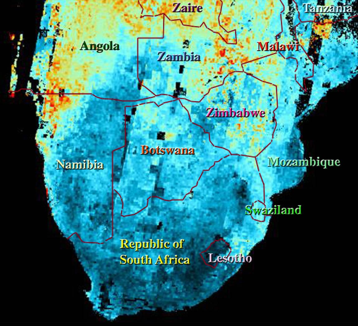
2000-08-30 |
Earth
|
Terra
|
MISR
|
1440x753x3 |
|
-
PIA02621:
-
MISR Images Zambia and Botswana
Full Resolution:
TIFF
(3.403 MB)
JPEG
(179.5 kB)
|
|
|
2000-08-23 |
Earth
|
Terra
|
MISR
|
1152x505x3 |

|
-
PIA02620:
-
MISR Images Northeastern Botswana
Full Resolution:
TIFF
(1.985 MB)
JPEG
(102.8 kB)
|
|
|
2000-04-27 |
Earth
|
Spaceborne Imaging Radar-C/X-Band Synthetic Aperture Radar
|
|
6577x4337x3 |
|
-
PIA01856:
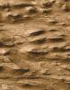
-
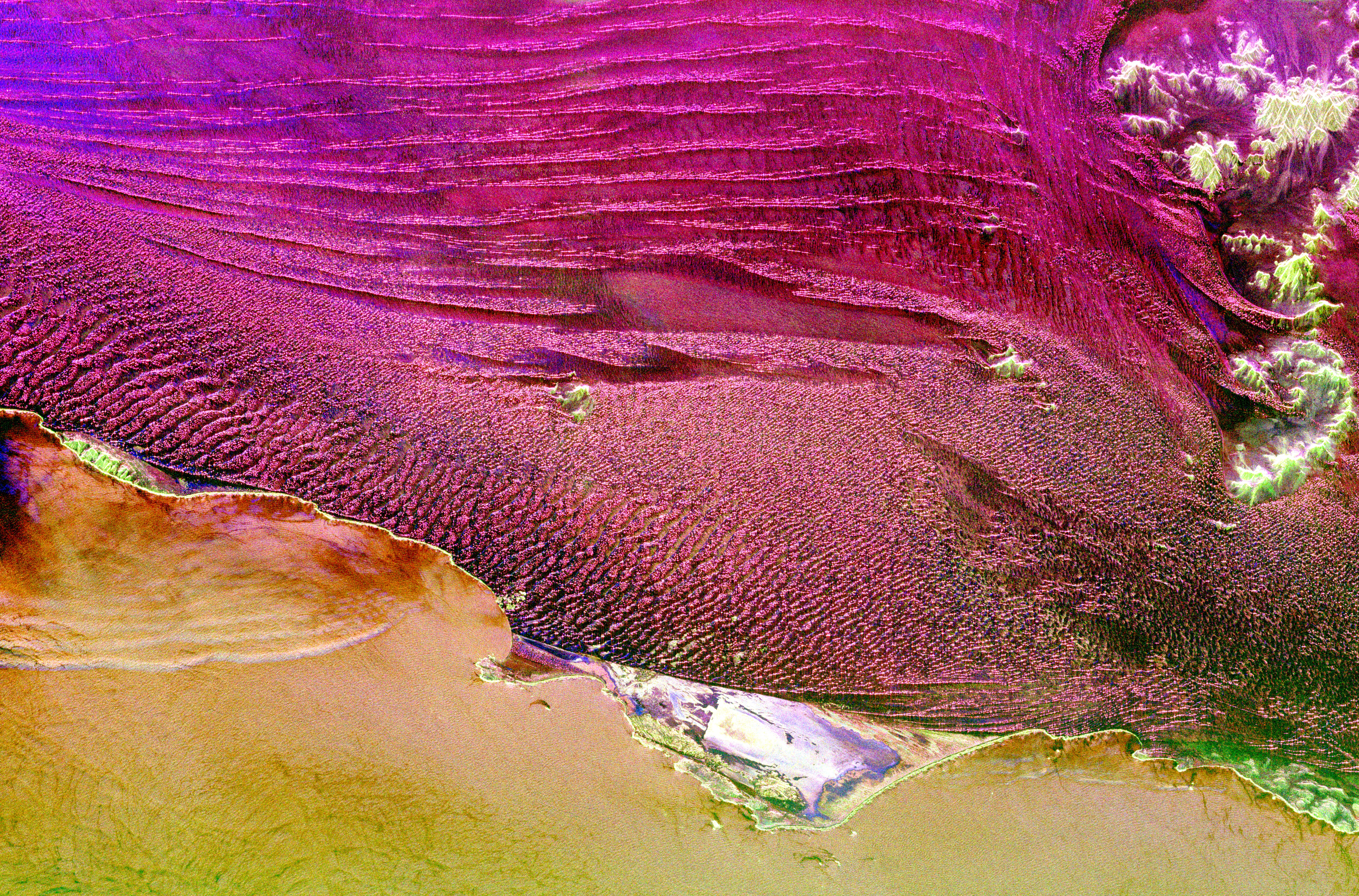
Space Radar Image of Namibia Sand Dunes
Full Resolution:
TIFF
(86.77 MB)
JPEG
(8.973 MB)
|
|
|
2000-02-15 |
Earth
|
Shuttle Radar Topography Mission (SRTM)
|
C-Band Interferometric Radar
|
2400x2938x3 |
|
-
PIA02706:
-
Shaded Relief of South Africa, Northern Cape Province
Full Resolution:
TIFF
(24.95 MB)
JPEG
(2.451 MB)
|
|
|
1999-09-23 |
Earth
|
Global Rain Forest Mapping Project (GRFM)
|
JERS-1 SAR
|
2552x997x3 |
|
-
PIA01348:
-
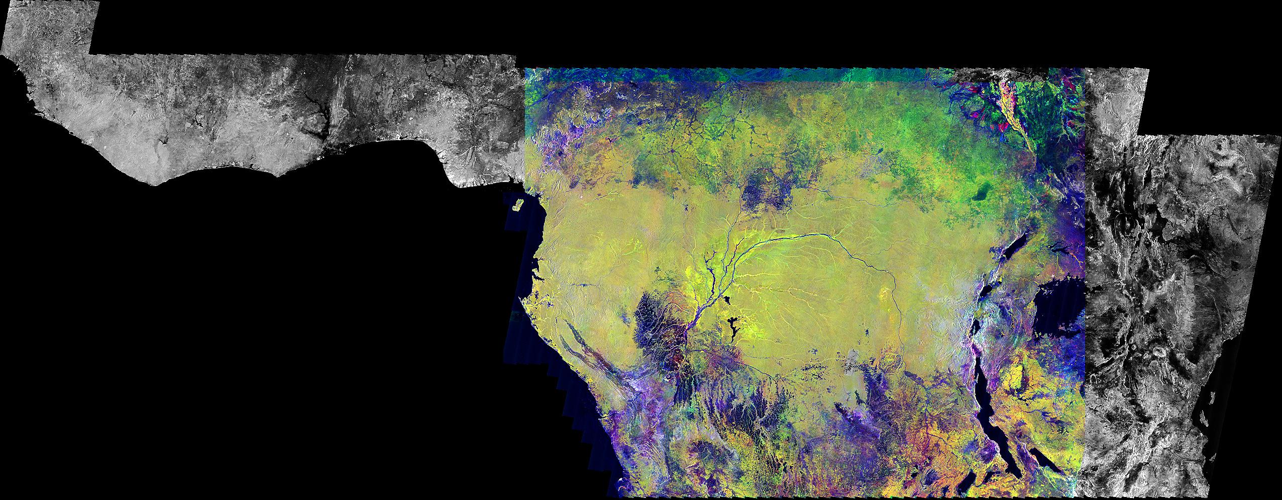
Radar Mosaic of Africa
Full Resolution:
TIFF
(4.785 MB)
JPEG
(616.3 kB)
|
|
|
1999-06-12 |
Earth
|
DSPSE
|
Ultraviolet/Visible Camera
|
969x1385x3 |
|
-
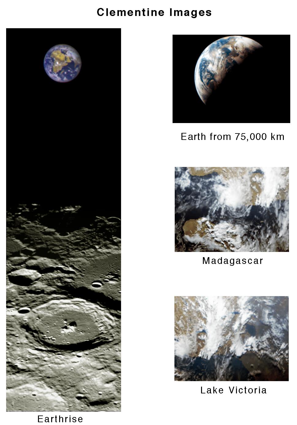
PIA00432:
-
Clementine Images of Earth and Moon
Full Resolution:
TIFF
(1.272 MB)
JPEG
(132.8 kB)
|
|
|
1999-05-01 |
Earth
|
Spaceborne Imaging Radar-C/X-Band Synthetic Aperture Radar
|
|
916x807x3 |
|
-
PIA01736:
-
Space Radar Image of Karisoke & Virunga Volcanoes
Full Resolution:
TIFF
(2.857 MB)
JPEG
(375 kB)
|
|
|
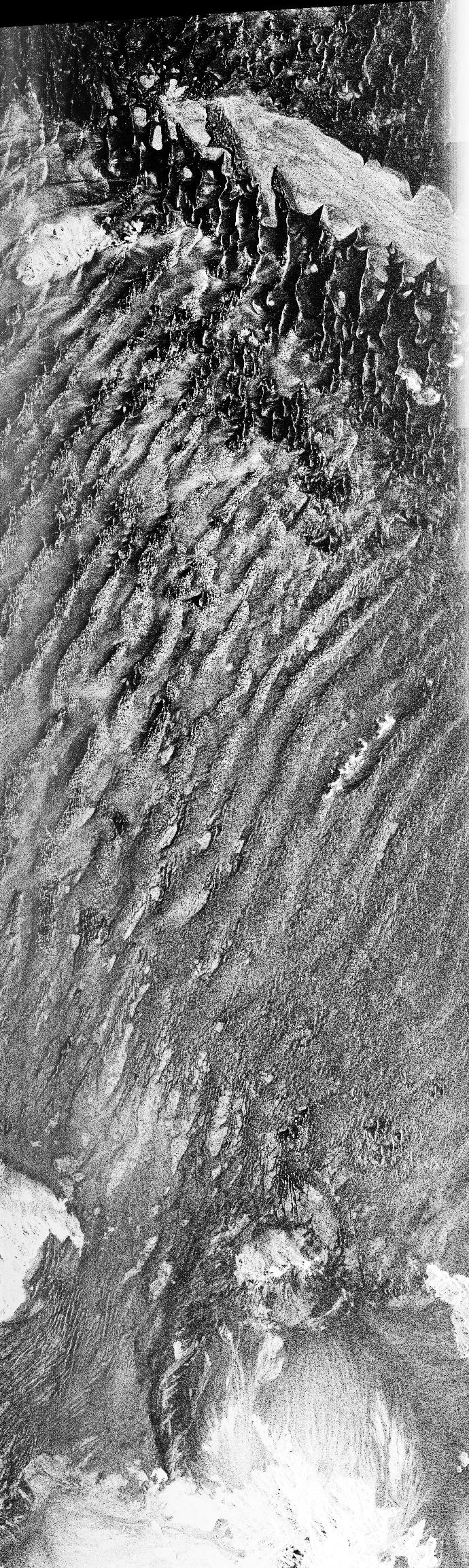
1999-04-15 |
Earth
|
Spaceborne Imaging Radar-C/X-Band Synthetic Aperture Radar
|
|
3537x2708x3 |

|
-
PIA01863:
-
Space Radar Image of Eastern Morocco
Full Resolution:
TIFF
(35.28 MB)
JPEG
(3.031 MB)
|
|
|
1999-04-15 |
Earth
|
Spaceborne Imaging Radar-C/X-Band Synthetic Aperture Radar
|
|
1750x2950x3 |
|
-
PIA01814:
-
Space Radar Image of Jerusalem and the Dead Sea
Full Resolution:
TIFF
(19.16 MB)
JPEG
(1.522 MB)
|
|
|
1999-01-27 |
Earth
|
Spaceborne Imaging Radar-C/X-Band Synthetic Aperture Radar
|
|
990x2655x3 |
|
-
PIA01724:
-
Space Radar Image of Central African Gorilla Habitat
Full Resolution:
TIFF
(10.21 MB)
JPEG
(1.071 MB)
|
|
|
1999-01-27 |
Earth
|
Spaceborne Imaging Radar-C/X-Band Synthetic Aperture Radar
|
|
690x2309x1 |
|
-
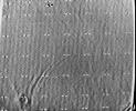
PIA01720:
-
Space Radar Image of Namib Desert in Southern Namib
Full Resolution:
TIFF
(1.742 MB)
JPEG
(721.2 kB)
|
|
|
1999-01-27 |
Earth
|
Spaceborne Imaging Radar-C/X-Band Synthetic Aperture Radar
|
|
736x994x3 |
|
-
PIA01711:
-
Space Radar Image of Safsaf, North Africa
Full Resolution:
TIFF
(2.76 MB)
JPEG
(328.7 kB)
|
|
|
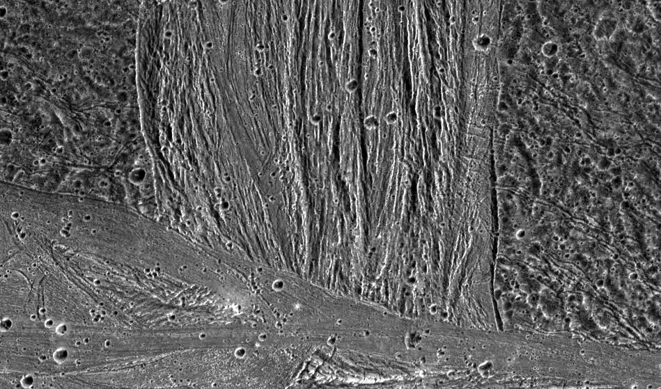
1998-07-15 |
Ganymede
|
Galileo
|
Solid-State Imaging
|
949x559x1 |
|
-
PIA01615:
-
Swaths of Grooved Terrain on Ganymede
Full Resolution:
TIFF
(499.9 kB)
JPEG
(160.6 kB)
|
|
|
1998-07-03 |
Mars
|
Mars Global Surveyor (MGS)
|
Mars Orbiter Camera (MOC)
|
1600x500x1 |
|
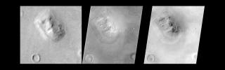
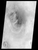
-
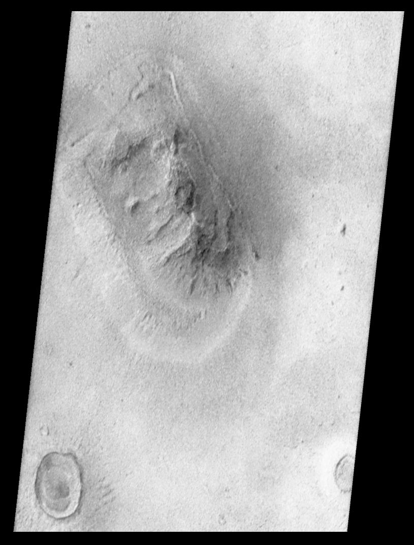
PIA01442:
-
Mars Orbiter Camera Views the "Face on Mars" - Comparison with Viking
Full Resolution:
TIFF
(423.4 kB)
JPEG
(62.18 kB)
|
|
|
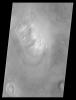
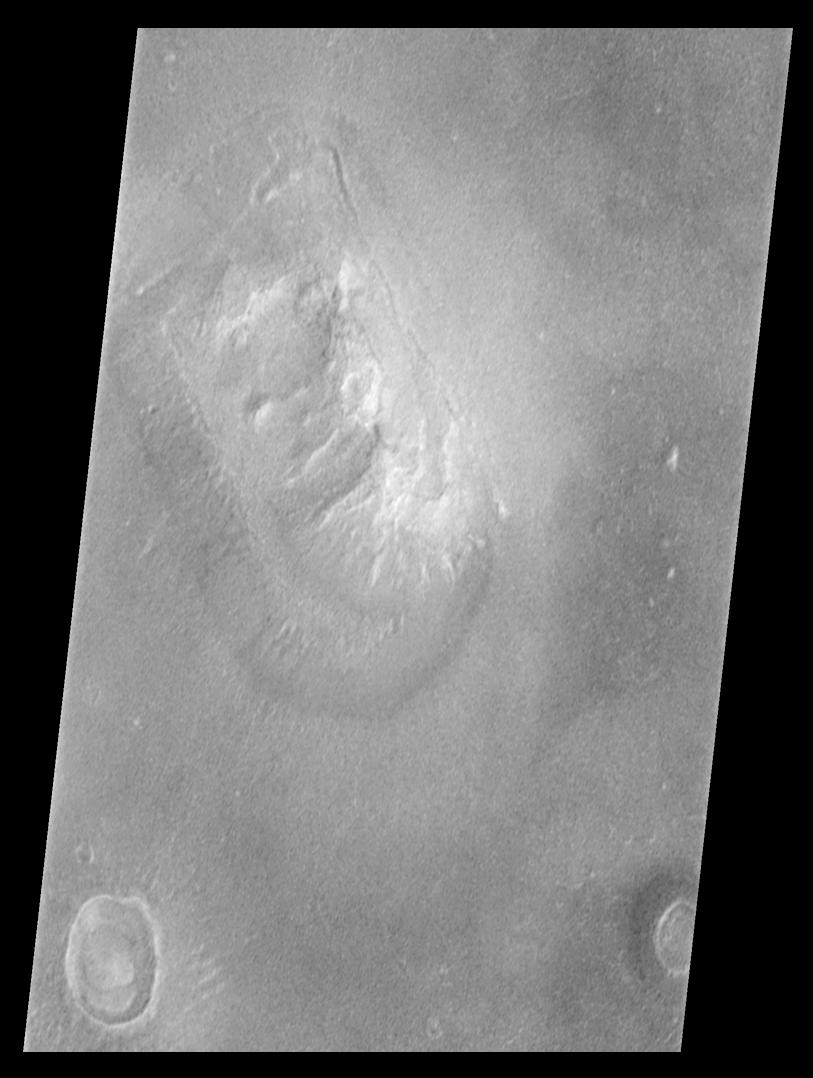
1998-07-03 |
Mars
|
Mars Global Surveyor (MGS)
|
Mars Orbiter Camera (MOC)
|
815x1072x1 |
|
-
PIA01441:
-
Mars Orbiter Camera Views the "Face on Mars" - calibrated, contrast enhanced, filtered, brightness-inverted
Full Resolution:
TIFF
(570.9 kB)
JPEG
(93.52 kB)
|
|
|
1998-07-03 |
Mars
|
Mars Global Surveyor (MGS)
|
Mars Orbiter Camera (MOC)
|
813x1078x1 |
|
-
PIA01440:
-
Mars Orbiter Camera Views the "Face on Mars" - calibrated, contrast enhanced, filtered
Full Resolution:
TIFF
(540.3 kB)
JPEG
(78.83 kB)
|
|
|
1998-04-14 |
Earth
|
Spaceborne Imaging Radar-C/X-Band Synthetic Aperture Radar
|
Imaging Radar
|
3112x4817x3 |
|
-
PIA01310:
-
Space Radar Image of Wadi Kufra, Libya
Full Resolution:
TIFF
(54.46 MB)
JPEG
(4.357 MB)
|
|
|
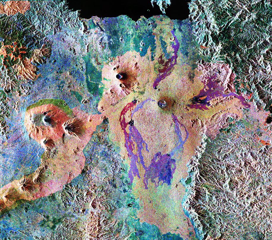
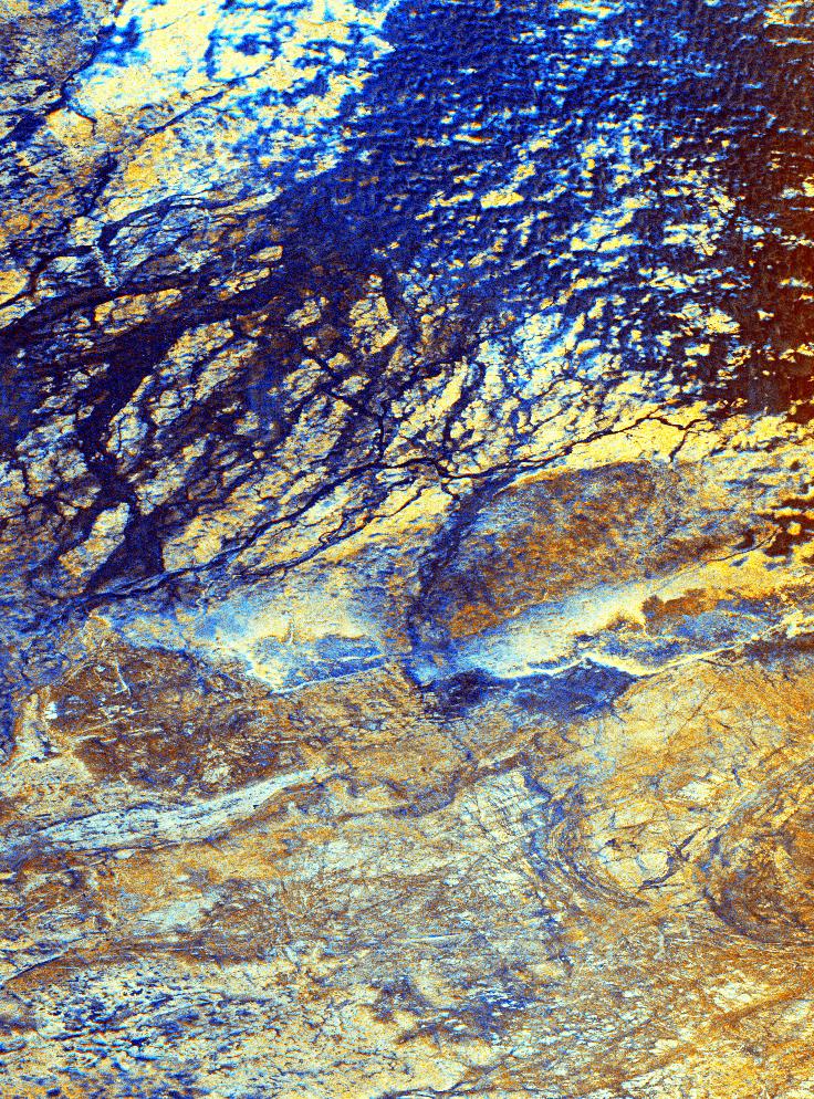
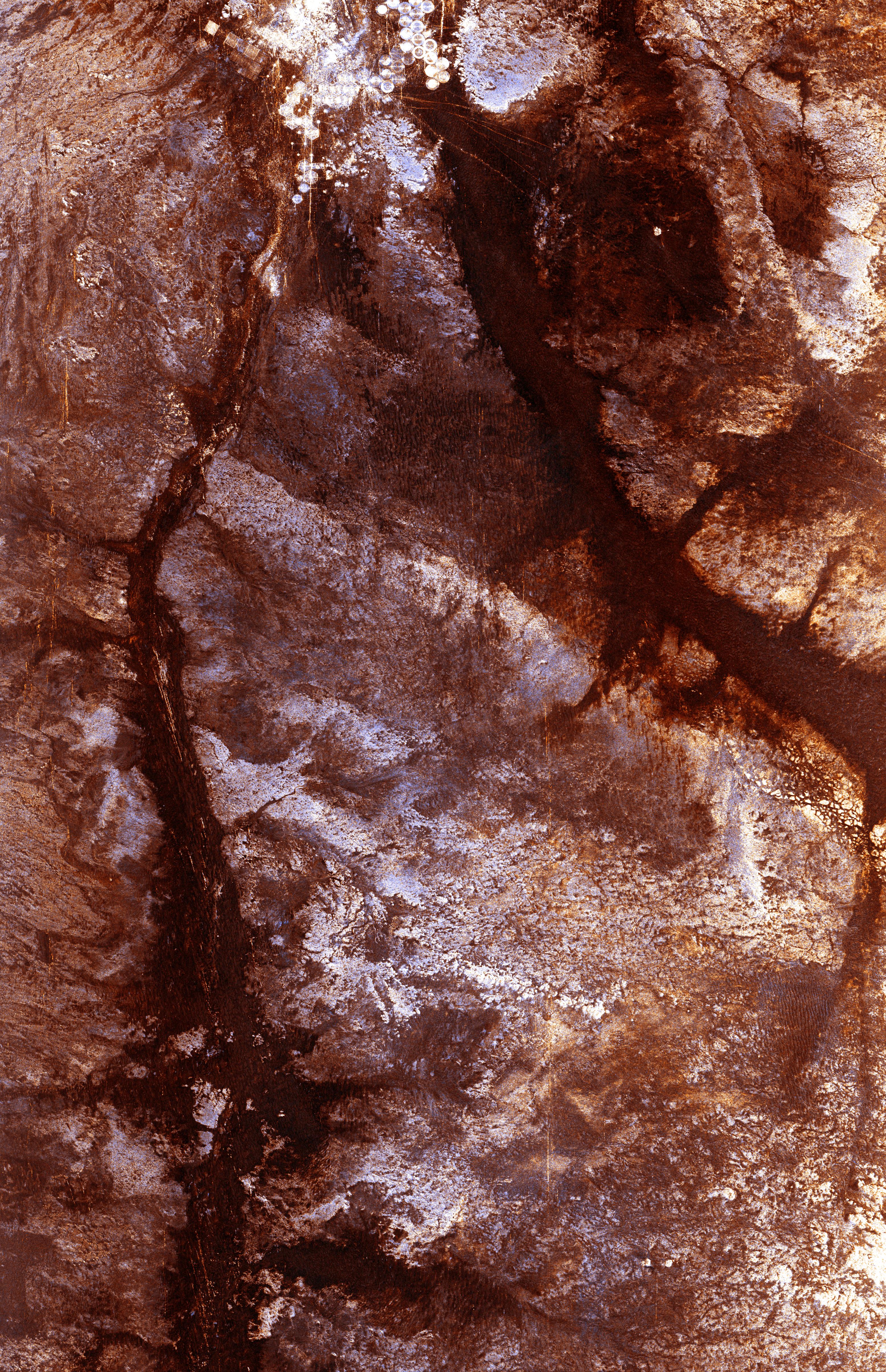
1998-03-16 |
Earth
|
Spaceborne Imaging Radar-C/X-Band Synthetic Aperture Radar
|
L-Band Imaging Radar
|
1571x1135x3 |
|
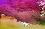
-
PIA00822:
-
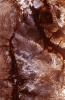
South Africa, Namibia Diamond Deposits (Close-up)
Full Resolution:
TIFF
(6.439 MB)
JPEG
(581.7 kB)
|
|
|
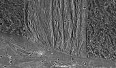
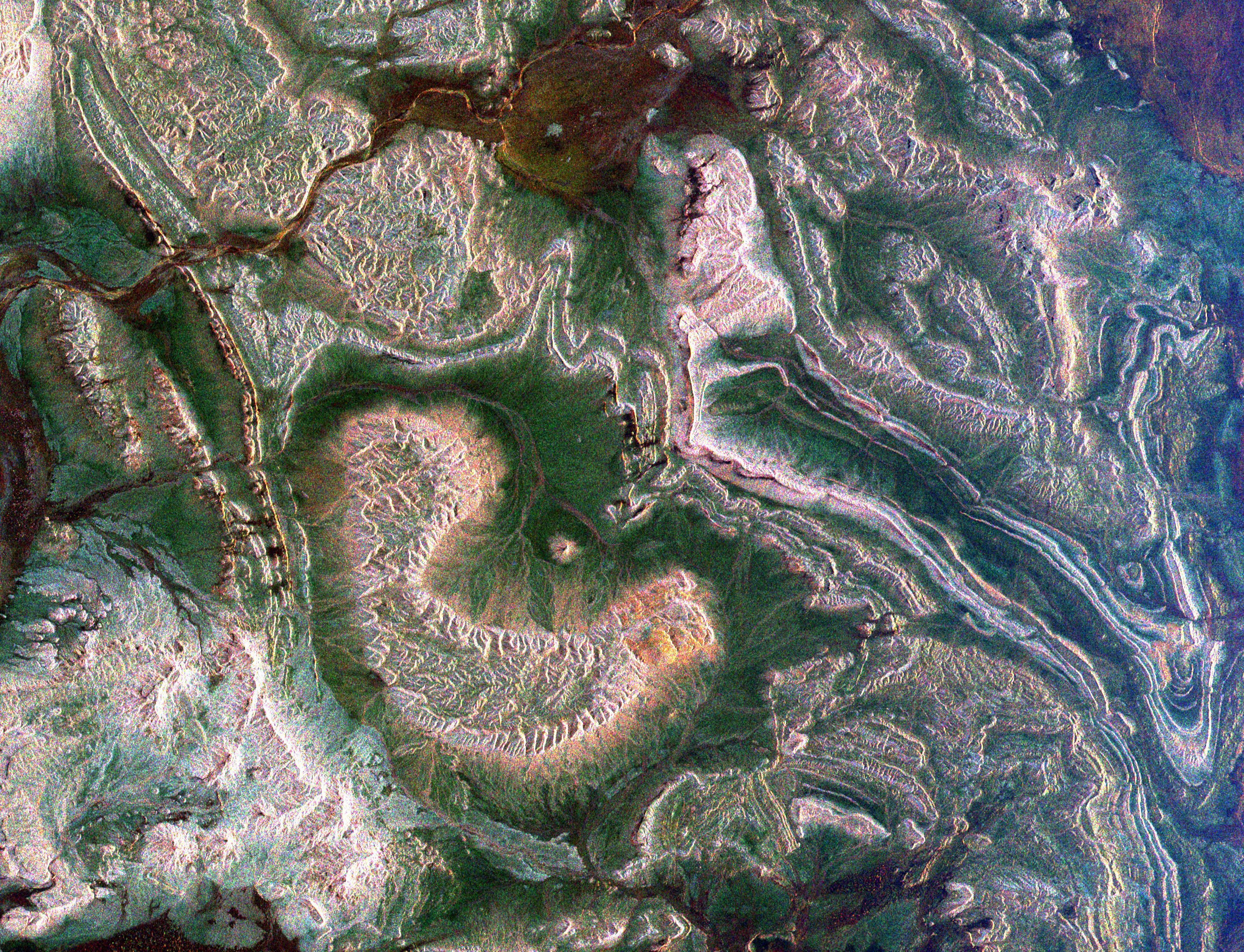
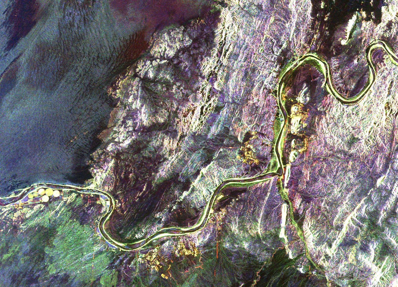
1998-03-16 |
Earth
|
Spaceborne Imaging Radar-C/X-Band Synthetic Aperture Radar
|
L-Band Imaging Radar
|
2282x2375x3 |
|
-
PIA00821:
-
South Africa, Namibia Diamond Deposits
Full Resolution:
TIFF
(18.25 MB)
JPEG
(1.739 MB)
|
|
|
1997-09-10 |
Earth
|
Galileo
|
Solid-State Imaging
|
452x439x3 |

|
-
PIA00729:
-
South Polar Projection of Earth
Full Resolution:
TIFF
(169.4 kB)
JPEG
(29.01 kB)
|
|
|
1997-09-10 |
Earth
|
Galileo
|
Solid-State Imaging
|
1020x1128x3 |
|
-
PIA00728:
-
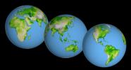
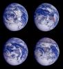
Global Images of Earth
Full Resolution:
TIFF
(2.169 MB)
JPEG
(117.6 kB)
|
|
|
1996-11-13 |
Earth
|
Spaceborne Imaging Radar-C/X-Band Synthetic Aperture Radar
|
Imaging Radar
|
2910x2040x3 |
|
-
PIA00503:
-
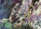
Roter Kamm Impact Crater in Namibia
Full Resolution:
TIFF
(20.03 MB)
JPEG
(1.839 MB)
|
|
|
1996-09-26 |
Venus
|
Magellan
|
Imaging Radar
|
8180x7150x1 |
|
-
PIA00464:
-
Venus - Magellan Data Superimposed on Pioneer Venus Data - Devana Chasma and Phoebe Regio
Full Resolution:
TIFF
(10.45 MB)
JPEG
(2.287 MB)
|
|
|
1996-02-08 |
Earth
|
Galileo
|
Solid-State Imaging
|
650x650x1 |
|
-
PIA00226:
-
Global View of Earth in the Near-Infrared
Full Resolution:
TIFF
(223.3 kB)
JPEG
(44.25 kB)
|
|
|
1996-01-29 |
Earth
|
Galileo
|
Solid-State Imaging
|
987x987x3 |
|
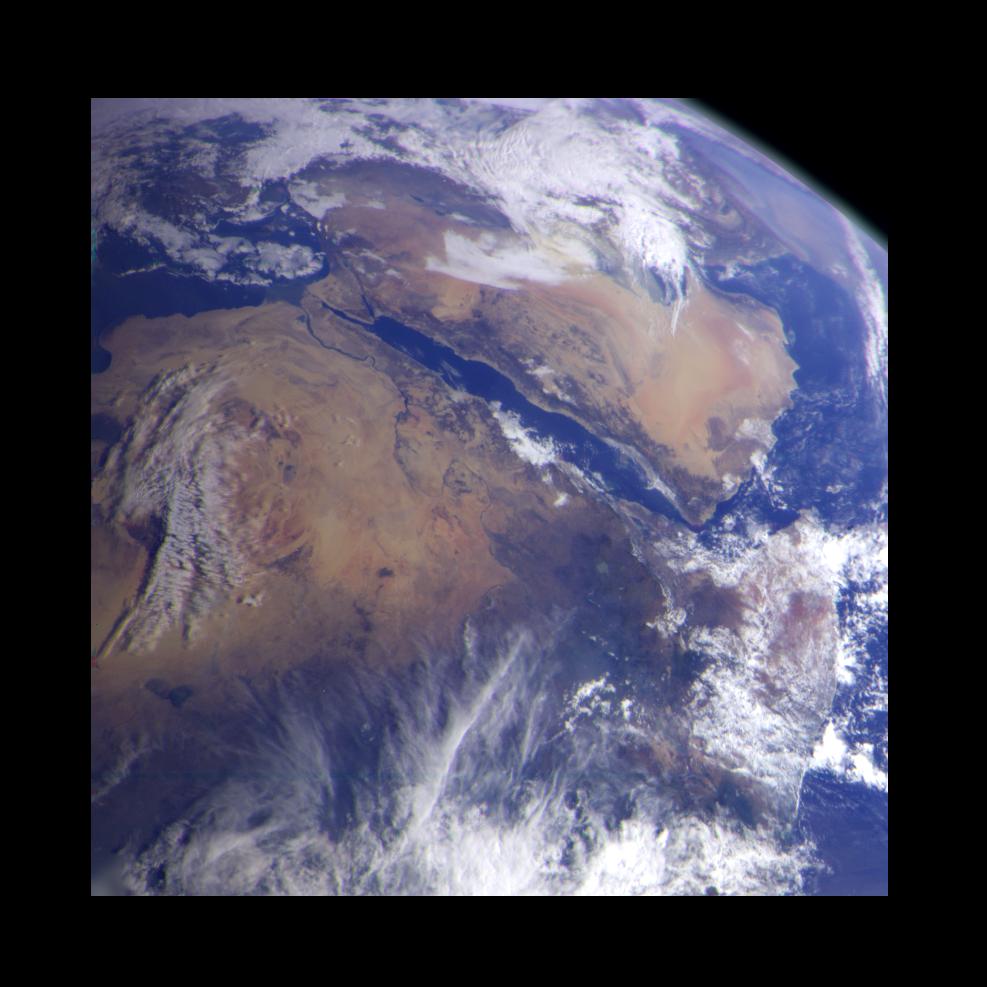
-
PIA00127:
-
Earth - Northeast Africa and the Arabian Peninsula
Full Resolution:
TIFF
(1.878 MB)
JPEG
(94.22 kB)
|
|
|
1996-01-29 |
Earth
|
Galileo
|
Solid-State Imaging
|
800x800x3 |
|
-
PIA00076:
-
Earth - Full Disk View of Africa
Full Resolution:
TIFF
(506.5 kB)
JPEG
(34.9 kB)
|
 Planetary Data System


