Your search criteria found 2612 images
Target is Earth (and available satellites)
Go to PIAxxxxx:
Refine this list of images by:
Target:
Mission:
Spacecraft:
Instrument:
Click on an image for detailed information
Click on a column heading to sort in ascending or descending order
My
List
Addition Date Target MissionSort Ascending Instrument Size
Add Image to Favorite List 2018-06-26 Earth Terra
ASTER
2300x1800x3
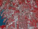
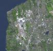
Frisco, Texas, a city along the Shawnee Trail in the Dallas-Fort Worth metroplex has become a bedroom community for workers in Dallas-Fort Worth. NASA's Terra spacecraft acquired this image on April 15, 2018.
PIA22552:
Frisco, Texas
Full Resolution:     TIFF (12.43 MB)     JPEG (1.123 MB)
Add Image to Favorite List 2018-06-28 Earth Terra
ASTER
1689x1434x3
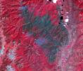
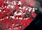
On June 26, 2018, NASA's Terra spacecraft acquired this image of 416 Fire which started June 1, 2018, about 13 miles north of Durango, Colorado. Vegetation in shown red, clouds in white, cities and bare rocky areas in gray, and burned area in dark gray.
PIA22554:
Colorado Wildfire Imaged in Infrared by NASA Satellite
Full Resolution:     TIFF (7.269 MB)     JPEG (482.1 kB)
Add Image to Favorite List 2018-07-26 Earth Terra
ASTER
1238x1022x3
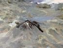
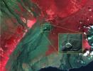
NASA's Terra spacecraft shows Hawaii's Kilauea volcano continues to create new land as flows from fissure 8, one of the most active to break ground since the eruption began in early May, reach the ocean.
PIA22489:
Satellite Imagery Shows Hawaii Volcano Lava Flow
Full Resolution:     TIFF (3.646 MB)     JPEG (132 kB)
Add Image to Favorite List 2018-07-17 Earth Terra
ASTER
3768x2469x3
NASA's Terra spacecraft shows footprints of clear-cut logging activities in northern California, east of Mt. Shasta.
PIA22613:
Logging in Northern California
Full Resolution:     TIFF (27.92 MB)     JPEG (2.401 MB)
Add Image to Favorite List 2018-07-28 Earth Terra
ASTER
1280x720x3
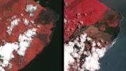
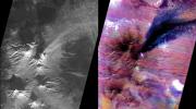
NASA's Terra spacecraft obtained near-infrared data of the ongoing Kilauea volcano eruption and its impact on the Leilani Estates area on May 15, 2018 (left) and June 23, 2018 (right). New dark areas show where the ground has been covered with lava flows.
PIA22593:
Dramatic Changes from Kilauea Leilani Estates Lava Flows Seen by NASA Spacecraft
Full Resolution:     TIFF (2.739 MB)     JPEG (114.3 kB)
Add Image to Favorite List 2018-07-31 Earth Terra
MISR
1629x1019x3
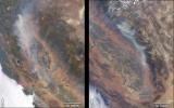
NASA's Terra satellite took these images of the Carr Fire (left) and the Ferguson Fire (right) on July 27 and July 29, respectively.
PIA22488:
California Wildfires Captured by NASA Satellite
Full Resolution:     TIFF (4.982 MB)     JPEG (290.4 kB)
Add Image to Favorite List 2018-08-01 Earth Terra
MISR
4200x3300x3
Image of unknown location for the latest mystery quiz from NASA's MISR (Multi-angle Imaging SpectroRadiometer) instrument onboard the Terra satellite.
PIA22591:
MISR Where on Earth ...? MISR Mystery Image Quiz #30
Full Resolution:     TIFF (41.61 MB)     JPEG (1.578 MB)
Add Image to Favorite List 2018-08-22 Earth Terra
ASTER
2429x1856x3
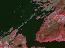
NASA's Terra spacecraft shows significant evidence of mining in northestern Siberia, along the Chukchi Sea, and 100 kilometers west of Mys Shmidta.
PIA22672:
Gold Mining, Siberia
Full Resolution:     TIFF (13.53 MB)     JPEG (738.8 kB)
Add Image to Favorite List 2018-08-25 Earth Terra
MISR
1963x2502x1
Hurricane Lane as viewed by the MISR instrument onboard NASA's Terra satellite on Aug. 24, 2018. The length of the arrows is proportional to the wind speed, while their color shows the altitude of the cloud tops in kilometers.
PIA22494:
MISR Hurricane Lane
Full Resolution:     TIFF (2.337 MB)     JPEG (213.7 kB)
Add Image to Favorite List 2018-09-05 Earth Terra
ASTER
1241x1407x3
NASA's Terra spacecraft shows Ushuaia, the capital of Tierra Del Fuego, Argentina, which is regarded as the southernmost city in the world.
PIA22685:
Ushuaia, Argentina
Full Resolution:     TIFF (4.45 MB)     JPEG (201.4 kB)
Add Image to Favorite List 2018-09-14 Earth Terra
MISR
2493x4095x3
NASA's Terra spacecraft passed over Hurricane Florence as it approached the eastern coast of the United States on Thursday, Sept. 13, 2018. At the time the image was acquired, Florence was a large Category 2 storm.
PIA22700:
Hurricane Florence as Viewed by NASA's MISR Instrument
Full Resolution:     TIFF (11.96 MB)     JPEG (506.9 kB)
Add Image to Favorite List 2018-09-14 Earth Terra
MISR
3966x1349x3
NASA's Terra spacecraft passed over Hurricane Florence as it approached the eastern coast of the United States on Thursday, Sept. 13, 2018. At the time the image was acquired, Florence was a large Category 2 storm.
PIA22701:
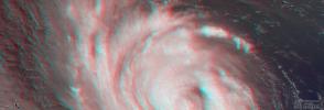
NASA's MISR captures Hurricane Florence in 3D
Full Resolution:     TIFF (14.61 MB)     JPEG (386.3 kB)
Add Image to Favorite List 2018-09-14 Earth Terra
ASTER
MODIS
804x1627x3
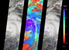
On Thursday, Sept. 13, 2018, NASA's Terra spacecraft acquired this image swath over Hurricane Florence as the storm headed for the Eastern seaboard and the Carolinas.
PIA22651:
Hurricane Florence Swath seen by NASA Spacecraft
Full Resolution:     TIFF (2.219 MB)     JPEG (125.9 kB)
Add Image to Favorite List 2018-09-19 Earth Terra
ASTER
1917x1468x3
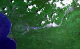
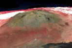
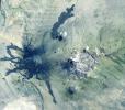
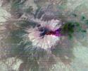
NASA's Terra spacecraft shows Llullaillaco, a stratovolcano at the border of Argentina and Chile.
PIA22721:
Llullaillaco Volcano, Chile/Argentina
Full Resolution:     TIFF (7.77 MB)     JPEG (333.2 kB)
Add Image to Favorite List 2018-10-04 Earth Terra
ASTER
1368x1440x3
NASA's Terra spacecraft shows the largest city wall in the world, located in Nanjing, China. It was built between 1366 and 1386 by the Ming Dynasty Emperor Zhu Yuangzhang to enclose and fortify his capital city.
PIA22735:
Nanjing, China City Walls
Full Resolution:     TIFF (5.912 MB)     JPEG (576.4 kB)
Add Image to Favorite List 2018-10-05 Earth Terra
ASTER
3426x4083x3
NASA's Terra spacecraft obtained this ASTER image of Dagupan and the Lingayen Gulf, showing flooded and water-saturated areas on September 22, 2018. Sediment-laden waters from swollen rivers enter the ocean and appear as blue-green plumes.
PIA22705:
NASA's ASTER Instrument Sees Aftermath of Typhoon Mangkhut
Full Resolution:     TIFF (31.83 MB)     JPEG (2.201 MB)
Add Image to Favorite List 2018-10-10 Earth Terra
MISR
6500x4726x3
NASA's Terra spacecraft viewed Hurricane Michael over the course of approximately seven minutes when it was just off Florida's west coast on Tuesday, October 9, 2018.
PIA22750:
MISR Captures Hurricane Michael Near Florida Panhandle
Full Resolution:     TIFF (50.27 MB)     JPEG (2.681 MB)
Add Image to Favorite List 2018-10-10 Earth Terra
MISR
3957x1343x3
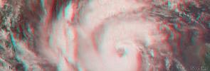
NASA's Terra spacecraft shows a three-dimensional view of Hurricane Michael and combines two of MISR's nine camera angles.
PIA22748:
MISR Captures Hurricane Michael's Eye in 3D
Full Resolution:     TIFF (15.95 MB)     JPEG (502.6 kB)
Add Image to Favorite List 2018-10-16 Earth Terra
MISR
4200x5400x3
NASA's Terra spacecraft became one of a handful of NASA satellite ever to complete 100,000 orbits on October 6, 2018.
PIA22836:
MISR Records the View as NASA's Terra Satellite Passes Its 100,000th Orbit
Full Resolution:     TIFF (41.59 MB)     JPEG (1.508 MB)
Add Image to Favorite List 2018-10-17 Earth Terra
ASTER
4000x3069x3
NASA's Terra spacecraft shows the Air Mountains, located in northern Niger and extending over 84,000 square kilometers within the Sahara Desert.
PIA22795:
Air Mountains, Niger
Full Resolution:     TIFF (32.05 MB)     JPEG (2.448 MB)
Add Image to Favorite List 2018-10-31 Earth Terra
ASTER
2274x1917x3
NASA's Terra spacecraft shows Ventura, California has a coastal site, set against hills and flanked by two rivers.
PIA22841:
Ventura, CA
Full Resolution:     TIFF (13.08 MB)     JPEG (1.297 MB)
Add Image to Favorite List 2018-11-02 Earth Terra
ASTER
1929x2283x3
NASA's Terra spacecraft obtained this ASTER image of an eruption from Piton de la Fournaise volcano on Reunion Island in the Indian Ocean. The background image was acquired July 16, 2018, and the thermal image on November 1, 2018.
PIA22755:
NASA's ASTER Captures Piton de la Fournaise Eruption
Full Resolution:     TIFF (10.21 MB)     JPEG (703.5 kB)
Add Image to Favorite List 2018-11-12 Earth Terra
MISR
4499x1423x3
NASA's Terra spacecraft shows a three-dimensional view of the Woolsey Fire in southern California on Nov. 11, 2018.
PIA22817:
NASA's MISR Captures 3D Image of Smoke from California's Woolsey Fire
Full Resolution:     TIFF (17.19 MB)     JPEG (574.8 kB)
Add Image to Favorite List 2018-11-12 Earth Terra
MISR
2624x5022x3
NASA's Terra spacecraft shows the Woolsey Fire in southern California on Nov. 11, 2018. The Woolsey Fire had charred more than 90,000 acres as of Nov. 12, 2018, and was 20-percent contained at that time.
PIA22818:
NASA's MISR Sees California's Woolsey Fire From Space
Full Resolution:     TIFF (19.09 MB)     JPEG (766.6 kB)
Add Image to Favorite List 2018-11-13 Earth Terra
ASTER
1800x1200x3
NASA's Terra spacecraft shows the Carajas Mine, the largest open-pit iron ore mine in the world. It is located in the state of Para, northern Brazil.
PIA22861:
Carajas Mine, Brazil
Full Resolution:     TIFF (6.362 MB)     JPEG (326.4 kB)
Add Image to Favorite List 2018-12-03 Earth Terra
ASTER
3800x2800x3
NASA's Terra spacecraft obtained this ASTER image of Guatemala's Fuego volcano on Nov. 24, 2018, following a recent eruption.
PIA22820:
NASA's ASTER Captures Lava Flow, Ash from Guatemala Volcano
Full Resolution:     TIFF (29.07 MB)     JPEG (1.594 MB)
Add Image to Favorite List 2018-12-04 Earth Terra
ASTER
2408x1247x3
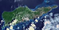
NASA's Terra spacecraft shows Saint Croix, a district of the U.S. Virgin Islands, in the Caribbean Sea.
PIA22894:
St. Croix, US Virgin Islands
Full Resolution:     TIFF (8.784 MB)     JPEG (453.6 kB)
Add Image to Favorite List 2018-12-13 Earth Terra
ASTER
1700x1200x3
NASA's Terra spacecraft shows the 2018 Kilauea, Hawaii eruption that began in May on Kilauea's East Rift Zone.
PIA22899:
2018 Kilauea East Rift Zone Eruption
Full Resolution:     TIFF (6.123 MB)     JPEG (272.4 kB)
Add Image to Favorite List 2018-12-21 Earth Terra
ASTER
2772x1252x3
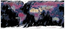
This mosaic was created from thumbnail browse images of data from NASA's Terra spacecraft.
PIA22979:
ASTER Global Mosaic
Full Resolution:     TIFF (7.881 MB)     JPEG (746.2 kB)
Add Image to Favorite List 2019-01-08 Earth Terra
ASTER
752x722x3
NASA's Terra spacecraft shows the largest building in the world located at the Boeing factory in Everett, Washington.
PIA23000:
Boeing Plant, Everett WA
Full Resolution:     TIFF (1.63 MB)     JPEG (147.1 kB)
Add Image to Favorite List 2019-01-17 Earth Terra
ASTER
904x815x3
NASA's Terra spacecraft obtained this ASTER image on Dec. 22, 2018, of Indonesia's Anak Krakatau volcano which erupted and partially collapsed.
PIA22821:
ASTER Images Post-eruption Anak Krakatau Volcano
Full Resolution:     TIFF (1.844 MB)     JPEG (64.95 kB)
Add Image to Favorite List 2019-01-23 Earth Terra
ASTER
3198x3258x3
NASA's Terra spacecraft shows Severnaya Zemlya, an archipelago in the Russian high Arctic. It was first charted in 1930.
PIA23018:
October Revolution Island, Russia
Full Resolution:     TIFF (28.69 MB)     JPEG (1.255 MB)
Add Image to Favorite List 2019-02-06 Earth Terra
ASTER
1152x864x3
NASA's Terra spacecraft shows the after image, acquired Feb. 1, 2019, of a dam burst at a Brazilian iron ore mine.
PIA22824:
NASA's ASTER Shows Brazilian City After Dam Disaster
Full Resolution:     TIFF (2.987 MB)     JPEG (176.7 kB)
Add Image to Favorite List 2019-02-07 Earth Terra
ASTER
1284x1056x3
NASA's Terra spacecraft shows Luxor, a city in Upper Egypt, along the Nile. It is the site of the ancient Egyptian city of Waset, known to the Greeks as Thebes.
PIA23060:
Luxor, Egypt
Full Resolution:     TIFF (4.069 MB)     JPEG (308.9 kB)
Add Image to Favorite List 2019-02-21 Earth Terra
ASTER
2427x2400x3
NASA's Terra spacecraft shows the Potrillo volcanic field, located on the Rio Grande Rift in southern New Mexico.
PIA23065:
Potrillo Volcanic Field, New Mexico
Full Resolution:     TIFF (17.48 MB)     JPEG (997.1 kB)
Add Image to Favorite List 2019-03-14 Earth Terra
ASTER
789x590x3
NASA's Terra spacecraft shows the Atlantic Ocean Road, an 8.3 kilometer road that runs through an archipelago in Eide and Averoy in More of Romsdal, Norway.
PIA23096:
Atlantic Ocean Road, Norway
Full Resolution:     TIFF (1.36 MB)     JPEG (110.5 kB)
Add Image to Favorite List 2019-03-21 Earth Terra
MISR
1830x1830x3
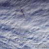
This image sequence shows views from five of nine cameras on the MISR instrument, onboard NASA's Terra satellite, a few minutes after a bright meteor exploded over the Bering Sea on Dec. 18, 2018.
PIA22825:
MISR Images Fireball Over Bering Sea
Full Resolution:     TIFF (10.05 MB)     JPEG (369 kB)
Add Image to Favorite List 2019-03-21 Earth Terra
MISR
1429x1354x3
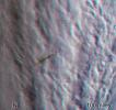
This stereo anaglyph combines two views from the MISR instrument, aboard NASA's Terra satellite, which captured a bright meteor explosion over the Bering Sea on December 18, 2018.
PIA23050:
MISR Images Fireball Over Bering Sea (Anaglyph)
Full Resolution:     TIFF (5.807 MB)     JPEG (178.9 kB)
Add Image to Favorite List 2019-03-21 Earth Terra
MODIS
3289x2252x3
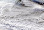
NASA's MODIS instrument, aboard the Terra satellite, captured this true-color image showing the remnants of a meteor's passage, seen as a dark shadow cast on thick, white clouds on Dec. 18, 2018.
PIA23141:
MODIS Images Fireball over Bering Sea
Full Resolution:     TIFF (16.58 MB)     JPEG (853.1 kB)
Add Image to Favorite List 2019-03-28 Earth Terra
ASTER
3202x3673x3
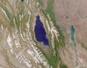
NASA's Terra spacecraft shows Lake Karakul in northeast Tajikistan, a hypersaline lake with no external drainage, receiving less than 3 cm precipitation per year.
PIA23102:
Lake Karakul, Tajikistan
Full Resolution:     TIFF (26.71 MB)     JPEG (1.209 MB)
Add Image to Favorite List 2019-04-12 Earth Terra
ASTER
2600x1151x3
NASA's Terra spacecraft obtained this ASTER image on April 10, 2019, of Peru's Sabancaya stratovolcano.
PIA23143:
NASA's ASTER Images Sabancaya Volcano
Full Resolution:     TIFF (8.687 MB)     JPEG (443.8 kB)
Add Image to Favorite List 2019-04-15 Earth Terra
ASTER
2397x1885x3
NASA's Terra spacecraft shows Cape Horn, the southernmost point of the Tierra Del Fuego archipelago of Southern Chile.
PIA23118:
Cape Horn, Chile
Full Resolution:     TIFF (12.19 MB)     JPEG (534.4 kB)
Add Image to Favorite List 2019-04-29 Earth Terra
ASTER
1849x2418x3
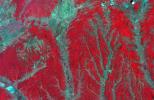
NASA's Terra spacecraft shows on the border between Mongolia and China, southward draining ephemeral streams have carved a series of parallel channels.
PIA23196:
Alluvial Fan, China and Mongolia
Full Resolution:     TIFF (12.95 MB)     JPEG (734.2 kB)
Add Image to Favorite List 2019-05-23 Earth Terra
ASTER
3426x3501x3
NASA's Terra spacecraft shows Lake St. Clair connects Lake Huron, via the St. Clair River, to Lake Erie, via the Detroit River.
PIA23234:
Lake St. Clair, US and Canada
Full Resolution:     TIFF (33.91 MB)     JPEG (1.468 MB)
Add Image to Favorite List 2019-07-01 Earth Terra
ASTER
4200x1919x3
NASA's Terra spacecraft shows Raikoke volcanic island, near the center of the Kuril Islands in the Sea of Okhotsk in the northwest Pacific Ocean.
PIA23326:
Raikoke Island, Kuril Islands
Full Resolution:     TIFF (19.62 MB)     JPEG (623.5 kB)
Add Image to Favorite List 2019-07-10 Earth Terra
MISR
4200x3444x3
Image of unknown location for the latest mystery quiz from NASA's MISR (Multi-angle Imaging SpectroRadiometer) instrument onboard the Terra satellite.
PIA23332:
MISR Where on Earth ...? MISR Mystery Image Quiz #31
Full Resolution:     TIFF (33.45 MB)     JPEG (962.9 kB)
Add Image to Favorite List 2019-07-17 Earth Terra
ASTER
2603x1600x3
NASA's Terra spacecraft shows the Panguna copper ore deposit, discovered in 1969 in the Autonomous Region of Bougainville, Papua New Guinea.
PIA23338:
Panguna Copper Deposit, Papua New Guinea
Full Resolution:     TIFF (12.5 MB)     JPEG (678 kB)
Add Image to Favorite List 2019-08-07 Earth Terra
ASTER
2134x1447x3
NASA's Terra spacecraft shows the top of Mauna Kea Volcano, Big Island of Hawaii, where the Mauna Kea Observatories, with thirteen telescopes, are located.
PIA23339:
Mauna Kea volcano, Hawaii
Full Resolution:     TIFF (8.003 MB)     JPEG (372.9 kB)
Add Image to Favorite List 2019-08-20 Earth Terra
ASTER
3400x2800x3
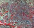
NASA's Terra spacecraft shows Phoenix, the capital and most populous city in Arizona.
PIA23411:
Phoenix, AZ
Full Resolution:     TIFF (28.57 MB)     JPEG (2.744 MB)
Add Image to Favorite List 2019-09-05 Earth Terra
ASTER
1508x1856x3
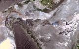
NASA's Terra spacecraft shows Salar de Atacama (Atacama salt flats) in Chile's Atacama Desert. It receives 2 mm rain per year.
PIA23420:
Salar de Atacama, Chile
Full Resolution:     TIFF (5.488 MB)     JPEG (250 kB)
Add Image to Favorite List 2019-09-10 Earth Terra
MISR
2550x3150x3
NASA's MISR instrument captured this imagery over the eye of Hurricane Dorian on Sept. 5, 2019.
PIA23423:
NASA's MISR Observes Hurricane Dorian off the South Carolina Coast
Full Resolution:     TIFF (12.86 MB)     JPEG (1.031 MB)
Add Image to Favorite List 2019-09-19 Earth Terra
ASTER
1280x720x3
NASA's Terra spacecraft shows the Mozu Tombs, a group of megalithic tombs in Sakai, Japan, in the Osaka Plain.
PIA23460:
Mozu Tombs, Japan
Full Resolution:     TIFF (2.766 MB)     JPEG (315.1 kB)
Add Image to Favorite List 2019-10-09 Earth Terra
ASTER
2314x2930x3
NASA's Terra spacecraft shows the Wajid Aquifer in Saudi Arabia.
PIA23490:
Wadi Al Dawasir, Saudi Arabia
Full Resolution:     TIFF (20.35 MB)     JPEG (1.282 MB)
Add Image to Favorite List 2019-10-21 Earth Terra
ASTER
2847x3903x3
NASA's Terra spacecraft shows Los Volcanes Natural Park on Lanzarote in the Spanish Canary Islands. It is serving as a training ground to prepare for the next mission to the Moon and Mars.
PIA23526:
Lanzarote, Spanish Canary Islands
Full Resolution:     TIFF (22.01 MB)     JPEG (1.189 MB)
Add Image to Favorite List 2019-10-31 Earth Terra
ASTER
1165x1520x3
NASA's Terra spacecraft shows Okata, a small village of about 3,000 residents in northwest Japan.
PIA23531:
Okata, Japan
Full Resolution:     TIFF (5.314 MB)     JPEG (352.6 kB)
Add Image to Favorite List 2019-11-04 Earth Terra
ASTER
2590x2185x3
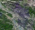
A large burn scar can be seen from space where the Kincade Fire has burned through Sonoma County, California. The image was taken on Nov. 3, 2019, by the ASTER instrument aboard NASA's Terra satellite.
PIA23426:
ASTER Sees Kincade Fire Damage From Space
Full Resolution:     TIFF (16.98 MB)     JPEG (1.333 MB)
Add Image to Favorite List 2019-11-05 Earth Terra
720x480x3
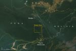
This satellite image, taken by NASA's Earth-observing Terra satellite on Aug. 18, 2019, shows the ECOSTRESS study area in the Amazon Basin and smoke from active fires in the rainforest.
PIA23546:
NASA Terra Satellite Sees Amazon Fires in Peru
Full Resolution:     TIFF (855.7 kB)     JPEG (51.57 kB)
Add Image to Favorite List 2019-11-14 Earth Terra
ASTER
2445x2487x3
NASA's Terra spacecraft shows the Sichuan Basin, in the northeast Sichuan province of China, surrounded by mountains on all sides and drained by the Yangtzee River.
PIA23532:
Sichuan Basin, China
Full Resolution:     TIFF (18.25 MB)     JPEG (1.613 MB)
Add Image to Favorite List 2019-11-26 Earth Terra
ASTER
4053x3461x3
NASA's Terra spacecraft shows the Anti-Atlas Mountains of Morocco, formed as a result of the collision of the African and Eurasian tectonic plates about 80 million years ago.
PIA23533:
Anti-Atlas Mtns., Morocco
Full Resolution:     TIFF (42.1 MB)     JPEG (2.67 MB)
Add Image to Favorite List 2019-12-16 Earth Terra
ASTER
2616x3751x3
NASA's Terra spacecraft shows that the Mississippi River continually evolves and changes course over time.
PIA23534:
Mississippi River
Full Resolution:     TIFF (29.45 MB)     JPEG (1.536 MB)
Add Image to Favorite List 2020-01-08 Earth Terra
ASTER
1587x990x3
NASA's Terra spacecraft shows the Cuatro Cienegas Basin, in the northern Mexican state of Cohuilla.
PIA23535:
Cuatro Cienegas Basin, Mexico
Full Resolution:     TIFF (4.715 MB)     JPEG (283.2 kB)
Add Image to Favorite List 2020-01-29 Earth Terra
ASTER
3537x3114x3
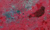
NASA's Terra spacecraft shows Payun Matru, a large shield volcano capped by a caldera, located in the Andean Volcanic Belt in Argentina.
PIA23670:
Payun Volcanoes, Argentina
Full Resolution:     TIFF (33.06 MB)     JPEG (1.679 MB)
Add Image to Favorite List 2020-02-03 Earth Terra
ASTER
3318x2151x3
NASA's Terra spacecraft shows southwest Romania where the rivers draining the Transylvanian Alps have incised the rough topography of the foothills.
PIA23677:
Gorj Province, Romania
Full Resolution:     TIFF (21.42 MB)     JPEG (1.513 MB)
Add Image to Favorite List 2020-02-13 Earth Terra
ASTER
3237x1970x3
NASA's Terra spacecraft shows the Niepolmice Forest in Poland, consisting of six nature reserves.
PIA23678:
Niepolmice Forest, Poland
Full Resolution:     TIFF (19.14 MB)     JPEG (1.537 MB)
Add Image to Favorite List 2020-02-24 Earth Terra
ASTER
1980x1560x3
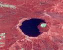
NASA's Terra spacecraft shows Japan's Lake Mashu on Hokkaido Island, one of the clearest lakes in the world.
PIA23679:
Lake Mashu, Japan
Full Resolution:     TIFF (9.27 MB)     JPEG (574.7 kB)
Add Image to Favorite List 2020-03-02 Earth Terra
ASTER
1500x1200x3
NASA's Terra spacecraft shows Popocatepetl, Mexico's most active volcano, erupted on February 23, sending blocks and bombs down the volcano's flanks, and emitting an ash column 1 km above the summit.
PIA23680:
Popocatepetl Volcano, Mexico
Full Resolution:     TIFF (5.402 MB)     JPEG (275.4 kB)
Add Image to Favorite List 2020-03-10 Earth Terra
ASTER
1542x1825x3
NASA's Terra spacecraft shows that in northern Argentina's Salta province, the chaco forests, made up of shrubs and hardwood trees, once thrived in the region.
PIA23756:
Salta Province, Argentina
Full Resolution:     TIFF (8.446 MB)     JPEG (428 kB)
Add Image to Favorite List 2020-03-30 Earth Terra
ASTER
842x811x3
NASA's Terra spacecraft shows Nishinoshima Volcano, a small volcanic island located about 1000 km south of Tokyo.
PIA23846:
Nishinoshima Volcano, Japan
Full Resolution:     TIFF (1.722 MB)     JPEG (75.4 kB)
Add Image to Favorite List 2020-04-10 Earth Terra
ASTER
600x600x3
NASA's Terra spacecraft shows the town of Nordlingen in southern Germany with its circular 14th century walls.
PIA23851:
Nordlingen, Germany
Full Resolution:     TIFF (1.081 MB)     JPEG (92.63 kB)
Add Image to Favorite List 2020-05-01 Earth Terra
ASTER
3948x4092x3
NASA's Terra spacecraft shows fires near the Chernobyl Nuclear Power Plant in Ukraine April 4, 2020.
PIA23911:
Ukraine Fires
Full Resolution:     TIFF (48.48 MB)     JPEG (2.098 MB)
Add Image to Favorite List 2020-05-06 Earth Terra
ASTER
2140x1239x3
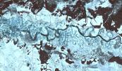
NASA's Terra spacecraft shows the many meanders and abandoned paleochannels of the Dneiper River in the Ukraine.
PIA23912:
Dneiper River, Ukraine
Full Resolution:     TIFF (7.958 MB)     JPEG (616.7 kB)
Add Image to Favorite List 2020-05-18 Earth Terra
ASTER
2000x2000x3
NASA's Terra spacecraft shows Mount St. Helens, Washington, just after its eruption on May 18, 1980, 40 years ago.
PIA23913:
Mount St. Helens, Washington
Full Resolution:     TIFF (12 MB)     JPEG (538.4 kB)
Add Image to Favorite List 2020-06-16 Earth Terra
ASTER
530x272x3
NASA's Terra spacecraft shows Sangay Volcano, Ecuador, which erupted in early June, sending lava flows and pyroclastic flows down its southeastern flank.
PIA23914:
Sangay Volcano, Ecuador
Full Resolution:     TIFF (432.9 kB)     JPEG (24.97 kB)
Add Image to Favorite List 2020-06-22 Earth Terra
ASTER
1996x1722x3
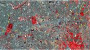
NASA's Terra spacecraft shows Berlin's old Tegel airport, soon to be replaced in by a new airport, Berlin-Brandenburg, located 19 km southeast of the city in Schönefeld.
PIA23915:
Berlin-Brandenburg Airport, Germany
Full Resolution:     TIFF (10.32 MB)     JPEG (1.047 MB)
Add Image to Favorite List 2020-06-30 Earth Terra
ASTER
1600x2289x3
NASA's ASTER instrument imaged areas burned by the Bighorn Fire north of Tucson, Arizona, on June 29. Vegetation is shown in red and burned areas are shown in dark gray.
PIA23691:
Arizona Bighorn Fire 2020
Full Resolution:     TIFF (10.99 MB)     JPEG (997.1 kB)
Add Image to Favorite List 2020-07-06 Earth Terra
ASTER
2880x3240x3
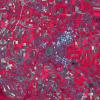
NASA's Terra spacecraft shows the Al Jowf Province in northwestern Saudi Arabia, 30 years after the area has grown from 22 center-pivot irrigated fields to thousands.
PIA23955:
Al Jowf, Saudi Arabia
Full Resolution:     TIFF (28.01 MB)     JPEG (1.219 MB)
Add Image to Favorite List 2020-07-16 Earth Terra
ASTER
1136x958x3
NASA's Terra spacecraft shows the Mount Whaleback open pit iron ore mine, located 6 km west of the town of Newman in the Pilbara region of Western Australia.
PIA24016:
Mount Whaleback Iron Ore Mine, Australia
Full Resolution:     TIFF (3.266 MB)     JPEG (235.6 kB)
Add Image to Favorite List 2020-07-30 Earth Terra
ASTER
1400x1000x3
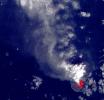
NASA's Terra spacecraft shows an ash and steam plume emanating from the central crater of Nishinoshima, a small volcanic island located about 1000 km south of Tokyo, Japan.
PIA24017:
Nishinoshima Volcano, Japan
Full Resolution:     TIFF (3.482 MB)     JPEG (179.3 kB)
Add Image to Favorite List 2020-08-17 Earth Terra
ASTER
3262x3292x3
NASA's Terra spacecraft shows Lake Fitri, located in the center of Chad. It is fed by seasonal rainfall, so its area can triple in wet years. In extreme drought years, the lake may dry out completely.
PIA24018:
Lake Fitri, Chad
Full Resolution:     TIFF (32.23 MB)     JPEG (1.673 MB)
Add Image to Favorite List 2020-09-01 Earth Terra
ASTER
2500x1725x3
Captured by the ASTER instrument aboard NASA's Terra satellite, this false-color map shows the burn area of the River and Carmel fires in Monterey County, California.
PIA23800:
ASTER Gets a Birdseye View of the Carmel and River Fire Burn Areas
Full Resolution:     TIFF (12.94 MB)     JPEG (977.4 kB)
Add Image to Favorite List 2020-09-15 Earth Terra
ASTER
958x561x3
NASA's Terra spacecraft shows the Kuril Islands, a volcanic archipelago, stretching 1300 km from Hokkaido, Japan to Kamchatka, Russia.
PIA24020:
Tao-Rusyr Volcano, Kuril Islands
Full Resolution:     TIFF (1.259 MB)     JPEG (68.11 kB)
Add Image to Favorite List 2020-09-24 Earth Terra
ASTER
2053x3531x3
NASA's Terra spacecraft shows Aldan, the administrative center of the Aldansky District in Siberia, Russia. It was founded in 1923 after discovery of rich gold and uranium deposits.
PIA24126:
Aldan, Siberia, Russia
Full Resolution:     TIFF (21.76 MB)     JPEG (1.276 MB)
Add Image to Favorite List 2020-10-19 Earth Terra
ASTER
1200x400x3
NASA's Terra spacecraft shows three super-sensitive gravitational wave-detection systems in America and Europe. The two American LIGO systems are located near Livingston, LA and near Hanford, WA. The European VIRGO system is located near Pisa, Italy.
PIA24129:
Gravity Wave Detectors
Full Resolution:     TIFF (1.441 MB)     JPEG (103.2 kB)
Add Image to Favorite List 2020-10-28 Earth Terra
ASTER
1063x712x3
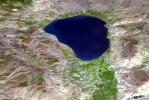
NASA's Terra spacecraft shows the Sea of Galilee (or Sea of Kinneret) in northern Israel, the lowest freshwater lake on Earth.
PIA24130:
Sea of Galilee, Israel
Full Resolution:     TIFF (2.272 MB)     JPEG (184.7 kB)
Add Image to Favorite List 2020-11-10 Earth Terra
ASTER
2134x2863x3
NASA's Terra spacecraft shows filling of the Grand Ethiopian Renaissance Dam (GERD) along the Blue Nile River is well under way near the Ethiopia-Sudan border.
PIA24150:
Grand Ethiopian Renaissance Dam
Full Resolution:     TIFF (18.34 MB)     JPEG (892 kB)
Add Image to Favorite List 2020-12-07 Earth Terra
ASTER
1159x1936x3
NASA's Terra spacecraft shows Providencia Island, located in the Caribbean Sea. It is part of Colombia even though located 800 km northwest of mainland Colombia.
PIA24281:
Providencia Island, Colombia
Full Resolution:     TIFF (5.529 MB)     JPEG (307.7 kB)
Add Image to Favorite List 2020-12-07 Earth Terra
ASTER
3600x2000x3
NASA's Terra spacecraft shows Kliuchevskoi stratovolcano, erupting almost constantly, and the tallest volcano in Kamchatka.
PIA24282:
Kliuchevskoi Volcano, Kamchatka, Russia
Full Resolution:     TIFF (17.97 MB)     JPEG (1.719 MB)
Add Image to Favorite List 2020-12-16 Earth Terra
ASTER
803x905x3
NASA's Terra spacecraft shows a strong eruptive episode began, starting December 13, 2020, at Mt. Etna's New SE summit crater.
PIA24283:
Mt. Etna, Italy
Full Resolution:     TIFF (2.181 MB)     JPEG (123.4 kB)
Add Image to Favorite List 2021-01-04 Earth Terra
ASTER
1580x1209x3
NASA's Terra spacecraft shows Kilauea volcano, Hawaii, which began erupting on December 20, 2020.
PIA24284:
Kilauea Volcano, Hawaii
Full Resolution:     TIFF (5.733 MB)     JPEG (298.6 kB)
Add Image to Favorite List 2021-01-22 Earth Terra
ASTER
756x611x3
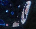
NASA's Terra spacecraft shows the Maldives nation, in the Indian Ocean. It faces an environmental threat from sea level rise. To counter this threat, the country is creating a new artificial island, Hulhumale.
PIA24381:
Hulhumale, Maldives
Full Resolution:     TIFF (1.386 MB)     JPEG (103 kB)
Add Image to Favorite List 2021-01-26 Earth Terra
ASTER
1240x1076x3
NASA's Terra spacecraft shows Serabit el-Khadim in the Sinai Peninsula, Egypt.
PIA24386:
Serabit el-Khadim, Egypt
Full Resolution:     TIFF (4.004 MB)     JPEG (289.4 kB)
Add Image to Favorite List 2021-02-09 Earth Terra
ASTER
2727x1656x3
NASA's Terra spacecraft shows Banjul, the capital of The Gambia; it is located on St. Mary's Island, where the Gambia River enters the Atlantic Ocean in western Africa.
PIA24416:
Banjul, The Gambia
Full Resolution:     TIFF (13.55 MB)     JPEG (917.4 kB)
Add Image to Favorite List 2021-02-23 Earth Terra
ASTER
781x732x3
NASA's Terra spacecraft shows Mt. Etna, Italy, sending rivers of lava down the southeast flank of the volcano, and spewing ashes and volcanic stones over nearby villages.
PIA24417:
Mt. Etna February 2021
Full Resolution:     TIFF (1.716 MB)     JPEG (93.03 kB)
Add Image to Favorite List 2021-02-26 Earth Terra
ASTER
1867x1672x3
NASA's Terra spacecraft shows Mt. Etna, Italy, sending rivers of lava down the southeast flank of the volcano. The ASTER visible image shows the extent of the active lava flows (derived from the thermal infrared data).
PIA24418:
Mt. Etna--February 26, 2021
Full Resolution:     TIFF (9.368 MB)     JPEG (448.3 kB)
Add Image to Favorite List 2021-03-05 Earth Terra
ASTER
438x332x1
NASA's Terra spacecraft shows two of Guatemala's active volcanoes, Fuego and Pacaya erupting when the ASTER nighttime thermal infrared image was acquired on March 5, 2021.
PIA24419:
Pacaya and Fuego Volcanoes, Guatemala
Full Resolution:     TIFF (125.2 kB)     JPEG (11.76 kB)
Add Image to Favorite List 2021-03-25 Earth Terra
ASTER
3369x2879x3
NASA's Terra spacecraft shows long straight dunes along the western edge of the Kalahari Desert, in central Namibia.
PIA24551:
Namibia Dunes
Full Resolution:     TIFF (29.11 MB)     JPEG (2.551 MB)
Add Image to Favorite List 2021-04-06 Earth Terra
ASTER
1421x1734x3
NASA's Terra spacecraft shows the southern entrance to the Suez Canal, where over 100 freighters wait their turn to enter and proceed to the Mediterranean Sea.
PIA24553:
Suez Canal Crisis
Full Resolution:     TIFF (4.89 MB)     JPEG (217.6 kB)
Add Image to Favorite List 2021-04-20 Earth Terra
ASTER
1703x3039x3
NASA's Terra spacecraft shows the Territorial Collectivity of Saint-Pierre and Miquelon, a self-governing overseas collectivity of France, off the southern coast of Newfoundland.
PIA24554:
St. Pierre, France
Full Resolution:     TIFF (10.29 MB)     JPEG (562.3 kB)
Add Image to Favorite List 2021-05-10 Earth Terra
ASTER
1561x1507x3
NASA's Terra spacecraft shows Oroville Dam in Northern California. Lake Oroville is the second largest man-made lake in the state of California.
PIA24555:
Lake Oroville, CA, 2014
Full Resolution:     TIFF (7.06 MB)     JPEG (422.8 kB)
Add Image to Favorite List 2021-05-24 Earth Terra
ASTER
3155x2224x3
NASA's Terra spacecraft shows the Nubian Sandstone Aquifer System, the world's largest fossil water aquifer system.
PIA24616:
Nubian Sandstone Aquifer, Egypt
Full Resolution:     TIFF (18.52 MB)     JPEG (749.5 kB)
Retrieve Previous Set  Jump to a Previous Set   Jump to a Previous Set   Jump to a Previous Set   Jump to a Previous Set   Jump to a Previous Set   Jump to a Previous Set   Jump to a Previous Set   Jump to a Previous Set   Jump to a Previous Set   Current Set   Retrieve Next Set 
 1-100   101-200   201-300   301-400   401-500   501-600   601-700   701-800   801-900   901-1000 
Currently displaying images: 901 - 1000 of 2612