
Figure 1, November 19, 2019
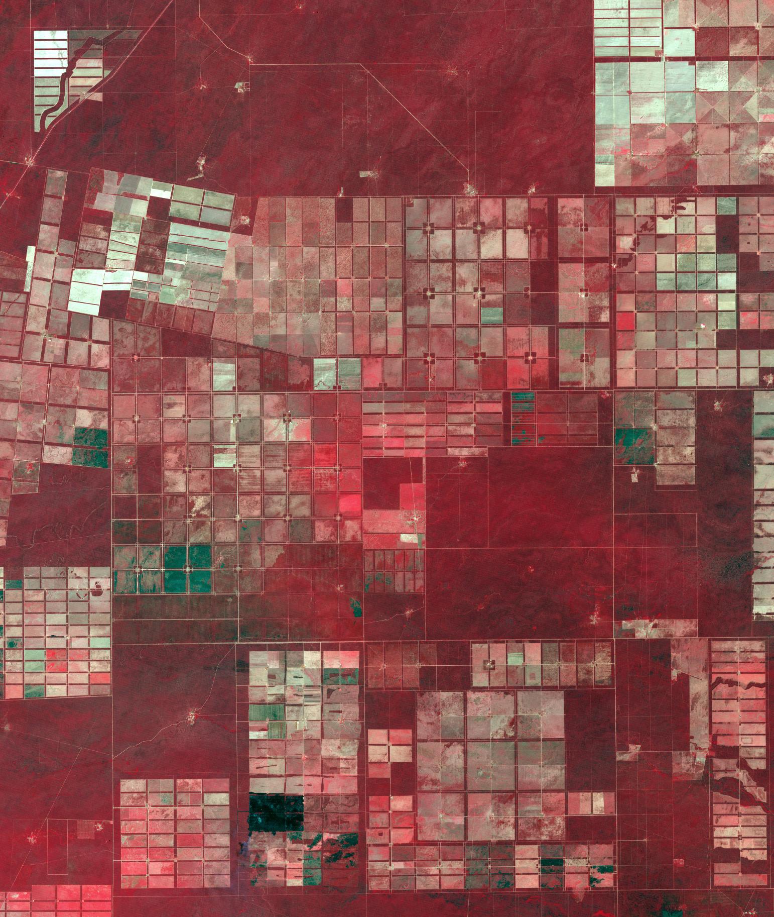
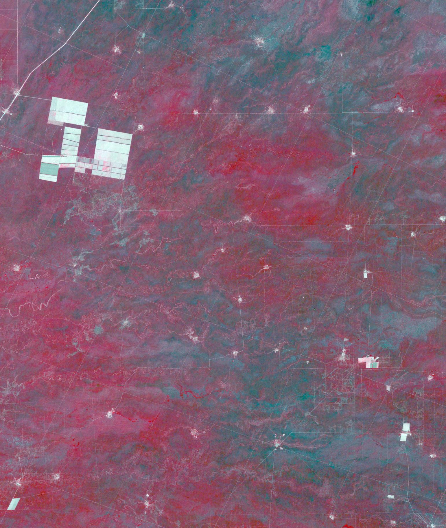
Click on the image for larger versionIn northern Argentina's Salta province, the chaco forests, made up of shrubs and hardwood trees, once thrived in the region. In the past 30 years, large-scale farming and ranch operators have cleared broad areas of the chaco, and replaced with industrial-scale raising of crops and livestock. The December 1, 1989 Landsat TM image is dominiated by traditional puestos, settlements consisting of a few dwellings and small-scale crops located near a well. The November 19, 2019 ASTER image shows large fields arranged in a grid pattern. The chaco forest has almost disappeared. The images cover an area of 22.2 by 27.8 km, and are located at 24.9 degrees south, 63.5 degrees west.
With its 14 spectral bands from the visible to the thermal infrared wavelength region and its high spatial resolution of about 50 to 300 feet (15 to 90 meters), ASTER images Earth to map and monitor the changing surface of our planet. ASTER is one of five Earth-observing instruments launched Dec. 18, 1999, on Terra. The instrument was built by Japan's Ministry of Economy, Trade and Industry. A joint U.S./Japan science team is responsible for validation and calibration of the instrument and data products.
The broad spectral coverage and high spectral resolution of ASTER provides scientists in numerous disciplines with critical information for surface mapping and monitoring of dynamic conditions and temporal change. Example applications are monitoring glacial advances and retreats; monitoring potentially active volcanoes; identifying crop stress; determining cloud morphology and physical properties; wetlands evaluation; thermal pollution monitoring; coral reef degradation; surface temperature mapping of soils and geology; and measuring surface heat balance.
The U.S. science team is located at NASA's Jet Propulsion Laboratory in Pasadena, Calif. The Terra mission is part of NASA's Science Mission Directorate, Washington.
More information about ASTER is available at http://asterweb.jpl.nasa.gov/.
