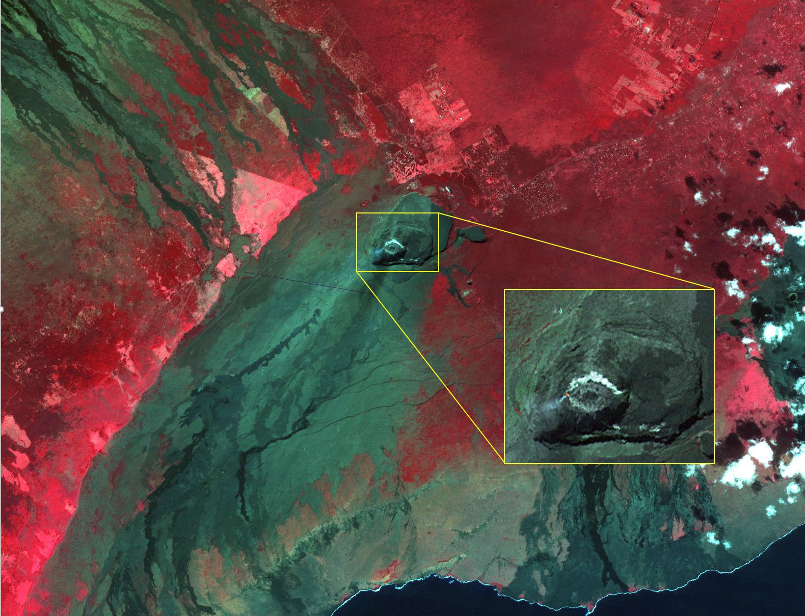
Kilauea volcano, Hawaii, began erupting on December 20, 2020, when a lava flow within Halema'uma'u crater interacted with a pool of water, triggering a vigorous eruption, emitting steam, ash, and sulfur dioxide gas. Since then, lava continues to enter the crater, and the lava lake appears to be stable. In the image, the lava feeder is bright red within the crater, gas is coming from the lava; the lava lake is a lighter gray donut, with a cooler lava island in the middle. The image was acquired December 28, 2020, covers an area of 29.7 by 37.2 km, and is located at 19.4 degrees north, 155.3 degrees west.
With its 14 spectral bands from the visible to the thermal infrared wavelength region and its high spatial resolution of about 50 to 300 feet (15 to 90 meters), ASTER images Earth to map and monitor the changing surface of our planet. ASTER is one of five Earth-observing instruments launched Dec. 18, 1999, on Terra. The instrument was built by Japan's Ministry of Economy, Trade and Industry. A joint U.S./Japan science team is responsible for validation and calibration of the instrument and data products.
The broad spectral coverage and high spectral resolution of ASTER provides scientists in numerous disciplines with critical information for surface mapping and monitoring of dynamic conditions and temporal change. Example applications are monitoring glacial advances and retreats; monitoring potentially active volcanoes; identifying crop stress; determining cloud morphology and physical properties; wetlands evaluation; thermal pollution monitoring; coral reef degradation; surface temperature mapping of soils and geology; and measuring surface heat balance.
The U.S. science team is located at NASA's Jet Propulsion Laboratory in Pasadena, Calif. The Terra mission is part of NASA's Science Mission Directorate, Washington.
More information about ASTER is available at http://asterweb.jpl.nasa.gov/.
