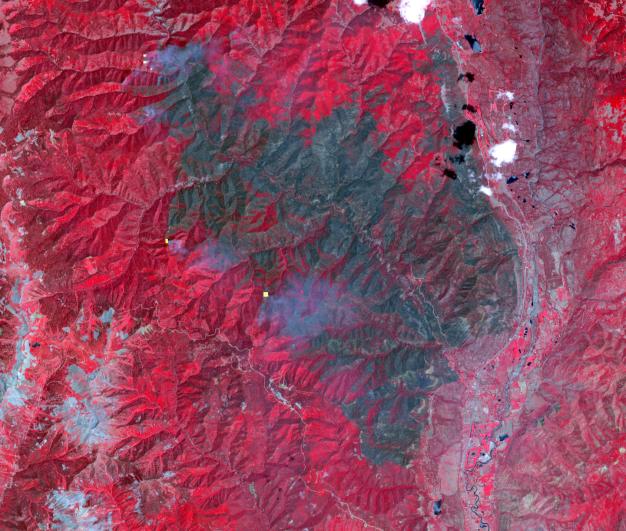
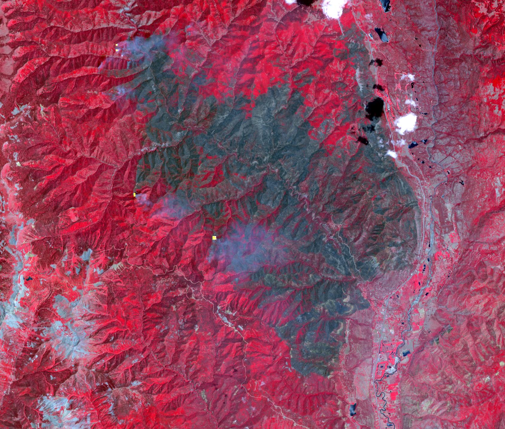
The 416 Fire started June 1, 2018, about 13 miles (18 kilometers) north of Durango, Colorado. Four weeks later, the fire was mostly contained, after consuming 35,000 acres of timber and brush. The cause of the fire is presently unknown. This image, acquired June 26, 2018 by the Advanced Spaceborne Thermal Emission and Reflection (ASTER) radiometer instrument aboard NASA's Terra satellite, shows vegetation in red, clouds in white, cities and bare rocky areas in gray, and the burned area in dark gray. A few small hot spots, detected on ASTER's thermal channels, are overlain in yellow. Smoke can be seen drifting eastward from these hotspots. The data cover an area of 15.2 by 12.9 miles (25.3 by 21.5 kilometers) located at 7.5 degrees north, 107.9 degrees east.
With its 14 spectral bands from the visible to the thermal infrared wavelength region and its high spatial resolution of 15 to 90 meters (about 50 to 300 feet), ASTER images Earth to map and monitor the changing surface of our planet. ASTER is one of five Earth-observing instruments launched Dec. 18, 1999, on Terra. The instrument was built by Japan's Ministry of Economy, Trade and Industry. A joint U.S./Japan science team is responsible for validation and calibration of the instrument and data products.
The broad spectral coverage and high spectral resolution of ASTER provides scientists in numerous disciplines with critical information for surface mapping and monitoring of dynamic conditions and temporal change. Example applications are: monitoring glacial advances and retreats; monitoring potentially active volcanoes; identifying crop stress; determining cloud morphology and physical properties; wetlands evaluation; thermal pollution monitoring; coral reef degradation; surface temperature mapping of soils and geology; and measuring surface heat balance.
The U.S. science team is located at NASA's Jet Propulsion Laboratory, Pasadena, Calif. The Terra mission is part of NASA's Science Mission Directorate, Washington, D.C.
More information about ASTER is available at http://asterweb.jpl.nasa.gov/.