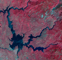
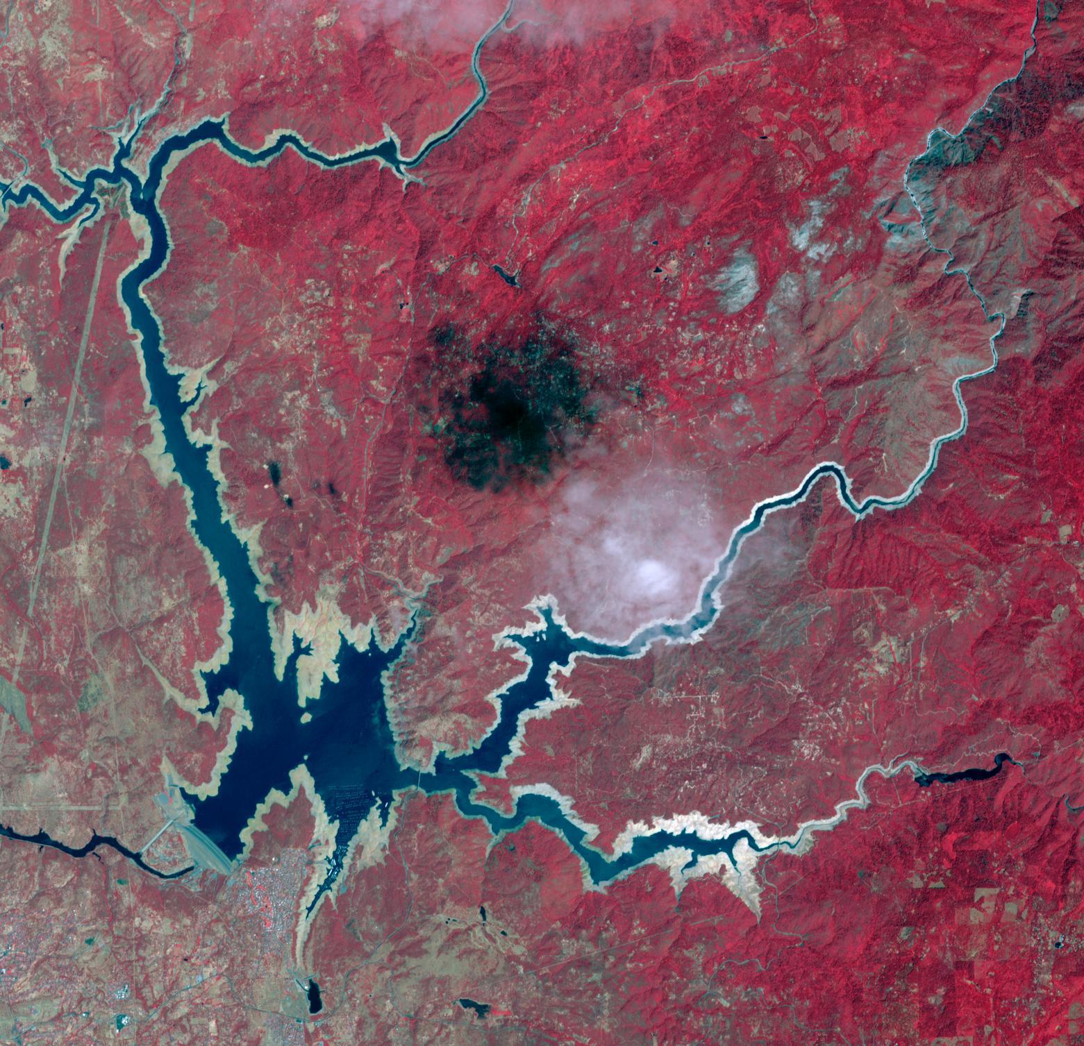
Lake Oroville, 2012
Click on the image for larger versionOroville Dam in Northern California is an earth fill embankment dam, and is the tallest dam in the U.S. Lake Oroville is the second largest man-made lake in the state of California. The lake's capacity reflects the large swings in California's annual rainfall accumulation. With the reality of a very dry 2020-21 rain year, the 2014 data may anticipate this year's water shortage. On May 7, 2012, the lake held 3.5 million acre-feet of water, and was at maximum capacity. Two years later, on August 1, 2014, the lake held 1.2 million acre-feet of water, threatening the water supply to users of its water. The images cover an area of 22.5 by 23.4 km, and are located at 39.6 degrees north, 121.5 degrees west.
With its 14 spectral bands from the visible to the thermal infrared wavelength region and its high spatial resolution of about 50 to 300 feet (15 to 90 meters), ASTER images Earth to map and monitor the changing surface of our planet. ASTER is one of five Earth-observing instruments launched Dec. 18, 1999, on Terra. The instrument was built by Japan's Ministry of Economy, Trade and Industry. A joint U.S./Japan science team is responsible for validation and calibration of the instrument and data products.
The broad spectral coverage and high spectral resolution of ASTER provides scientists in numerous disciplines with critical information for surface mapping and monitoring of dynamic conditions and temporal change. Example applications are monitoring glacial advances and retreats; monitoring potentially active volcanoes; identifying crop stress; determining cloud morphology and physical properties; wetlands evaluation; thermal pollution monitoring; coral reef degradation; surface temperature mapping of soils and geology; and measuring surface heat balance.
The U.S. science team is located at NASA's Jet Propulsion Laboratory in Pasadena, Calif. The Terra mission is part of NASA's Science Mission Directorate, Washington.
More information about ASTER is available at http://asterweb.jpl.nasa.gov/.
 Planetary Data System


