Figure 1, July 28, 2019
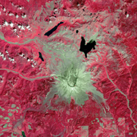
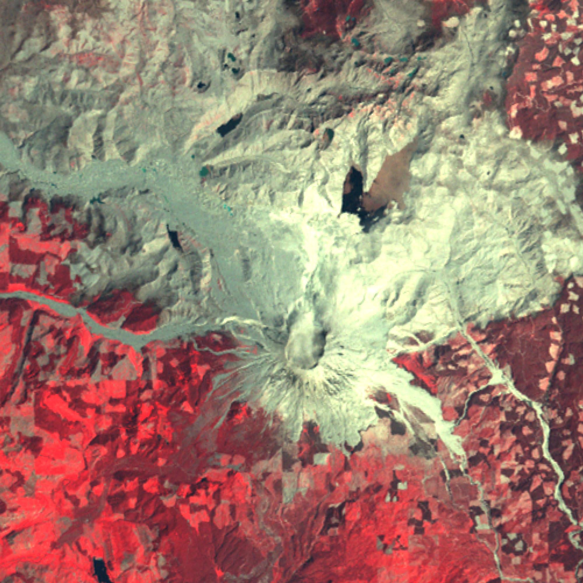
Click on the image for larger versionMount St. Helens, Washington, erupted 40 years ago, on May 18, 1980. A massive debris avalanche, triggered by an earthquake of magnitude 5.1, caused a lateral eruption that reduced the elevation of the mountain's summit from 2,950 m to 2,549 m, leaving a 1.6 km wide horseshoe-shaped crater. The collapse of the northern flank resulted in massive volcanic mudflows. Since 1980, new lava built a dome in the crater, and occasional steam and ash plumes have been emitted. The Landsat MSS image was acquired July 31, 1980, and the ASTER image (Figure 1) on July 28, 2019. The images cover an area of 30 by 30 km, and are located at 46.2 degrees north, 122.2 degrees west.
With its 14 spectral bands from the visible to the thermal infrared wavelength region and its high spatial resolution of about 50 to 300 feet (15 to 90 meters), ASTER images Earth to map and monitor the changing surface of our planet. ASTER is one of five Earth-observing instruments launched Dec. 18, 1999, on Terra. The instrument was built by Japan's Ministry of Economy, Trade and Industry. A joint U.S./Japan science team is responsible for validation and calibration of the instrument and data products.
The broad spectral coverage and high spectral resolution of ASTER provides scientists in numerous disciplines with critical information for surface mapping and monitoring of dynamic conditions and temporal change. Example applications are monitoring glacial advances and retreats; monitoring potentially active volcanoes; identifying crop stress; determining cloud morphology and physical properties; wetlands evaluation; thermal pollution monitoring; coral reef degradation; surface temperature mapping of soils and geology; and measuring surface heat balance.
The U.S. science team is located at NASA's Jet Propulsion Laboratory in Pasadena, Calif. The Terra mission is part of NASA's Science Mission Directorate, Washington.
More information about ASTER is available at http://asterweb.jpl.nasa.gov/.
 Planetary Data System


