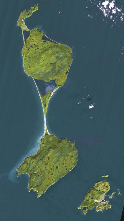
The Territorial Collectivity of Saint-Pierre and Miquelon is a self-governing overseas collectivity of France, off the southern coast of Newfoundland. It is the last remaining part of New France in North America to retain French sovereignty; its 6000 residents are French citizens. During the early part of its 500 year history, the island changed ownership numerous times between France and Britain. Only in 1816 were the islands permanently claimed by France, and French settlers came from Brittany, Normandy, and the Basque areas. The image was acquired September 27, 2011, covers an area of 25.5 by 45.6 km, and is located at 46.9 degrees north, 56.4 degrees west.
With its 14 spectral bands from the visible to the thermal infrared wavelength region and its high spatial resolution of about 50 to 300 feet (15 to 90 meters), ASTER images Earth to map and monitor the changing surface of our planet. ASTER is one of five Earth-observing instruments launched Dec. 18, 1999, on Terra. The instrument was built by Japan's Ministry of Economy, Trade and Industry. A joint U.S./Japan science team is responsible for validation and calibration of the instrument and data products.
The broad spectral coverage and high spectral resolution of ASTER provides scientists in numerous disciplines with critical information for surface mapping and monitoring of dynamic conditions and temporal change. Example applications are monitoring glacial advances and retreats; monitoring potentially active volcanoes; identifying crop stress; determining cloud morphology and physical properties; wetlands evaluation; thermal pollution monitoring; coral reef degradation; surface temperature mapping of soils and geology; and measuring surface heat balance.
The U.S. science team is located at NASA's Jet Propulsion Laboratory in Pasadena, Calif. The Terra mission is part of NASA's Science Mission Directorate, Washington.
More information about ASTER is available at http://asterweb.jpl.nasa.gov/.