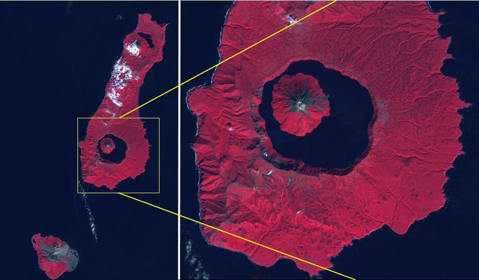
The Kuril Islands are a volcanic archipelago, stretching 1300 km from Hokkaido, Japan to Kamchatka, Russia. They are part of the Pacific Ring of Fire, the result of subduction of the Pacific Plate under the Okhotsk Plate along the Kuril Trench. At the southern end of Onekotan Island is the Tao-Rusyr Caldera stratovolcano, with its 7500 year old caldera lake. The most recent eruption was in 1952. The smaller Kharimkotan Island to the southwest last erupted in 1933. Collapse of this volcano created a horseshoe-shaped crater, and caused a tsunami that killed two people on a near-by island. The image was acquired June 4, 2012; the enlargement covers an area of 17 by 18.5 km, and is located at 49.3 degrees north, 154.7 degrees east.
With its 14 spectral bands from the visible to the thermal infrared wavelength region and its high spatial resolution of about 50 to 300 feet (15 to 90 meters), ASTER images Earth to map and monitor the changing surface of our planet. ASTER is one of five Earth-observing instruments launched Dec. 18, 1999, on Terra. The instrument was built by Japan's Ministry of Economy, Trade and Industry. A joint U.S./Japan science team is responsible for validation and calibration of the instrument and data products.
The broad spectral coverage and high spectral resolution of ASTER provides scientists in numerous disciplines with critical information for surface mapping and monitoring of dynamic conditions and temporal change. Example applications are monitoring glacial advances and retreats; monitoring potentially active volcanoes; identifying crop stress; determining cloud morphology and physical properties; wetlands evaluation; thermal pollution monitoring; coral reef degradation; surface temperature mapping of soils and geology; and measuring surface heat balance.
The U.S. science team is located at NASA's Jet Propulsion Laboratory in Pasadena, Calif. The Terra mission is part of NASA's Science Mission Directorate, Washington.
More information about ASTER is available at http://asterweb.jpl.nasa.gov/.
