PDS logoPlanetary Data System
PDS Information
Find a Node - Use these links to navigate to any of the 8 publicly accessible PDS Nodes.

This bar indicates that you are within the PDS enterprise which includes 6 science discipline nodes and 2 support nodes which are overseen by the Project Management Office at NASA's Goddard Space Flight Center (GSFC). Each node is led by an expert in the subject discipline, supported by an advisory group of other practitioners of that discipline, and subject to selection and approval under a regular NASA Research Announcement.
Click here to return to the Photojournal Home Page Click here to view a list of Photojournal Image Galleries Photojournal_inner_header
Latest Images  |  Spacecraft & Technology  |  Animations  |  Space Images App  |  Feedback  |  Photojournal Search  
My Favorite Images from the Planetary Photojoural
I have 7 images in my list


The first time you select an image to My List, a separate browser window will open. This page will list the set of images you have selected as favorites from the Photojournal. This list is kept for a short period of time, approximately 60 days. The way we associate you with your list is through a persistent cookie left on your computer. This cookie is nothing more than a unique key that allows the Photojournal to make this association. Once created, this list is only modifiable from the same computer. Information stored in the cookie on your computer is used by the Photojournal server only during your session. If you configure your Web browser not to use cookies, you will not be able to create and refer back to a personal list of favorite images. To view your current list, click on a marked entry for your list from the catalog page, or add another favorite. For more information, see JPL's Privacy Policy.
My
List
Catalog # Target Mission Instrument Addition Date Size
Remove Image from Favorite List PIA24206 Mars 2020 Rover
Radar Imager for Mars' Subsurface Experiment (RIMFAX)
2021-01-20 4608x3456x3
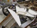
The bowtie-shaped antenna for the Radar Imager for Mars' Subsurface Experiment (RIMFAX) instrument has been mounted on the underside of the Perseverance rover.
Title:
Put a Bowtie on It!
Remove Image from Favorite List PIA00901 Mars Mars Pathfinder (MPF)
Rover Cameras
1997-08-19 540x343x1
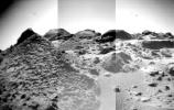
The front cameras aboard NASA's rover Sojourner imaged several prominent rocks on Sol 44. The highly-textured rock at left is Wedge, and in the background from left to right are 'Shark,' 'Half-Dome,' and 'Moe.' Sol 1 began on July 4, 1997.
Title:
Mosaic of "Wedge," "Shark," "Half-Dome," "Moe" and "Flat Top"
Remove Image from Favorite List PIA01996 Neptune Voyager
VG ISS - Narrow Angle
1999-07-25 512x480x1
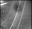
This image of Neptune's south polar region was obtained by NASA's Voyager on Aug. 23, 1989. The image shows the discovery of shadows in Neptune's atmosphere, shadows cast onto a deep cloud bank by small elevated clouds.
Title:
Neptune - Closest Approach
Remove Image from Favorite List PIA01639 Jupiter Galileo
Solid-State Imaging
1998-10-13 592x537x3
This false-color picture of a convective thunderstorm 10,000 kilometers (6,218 miles) northwest of Jupiter's Great Red Spot was obtained by NASA's Galileo spacecraft on June 26, 1996.
Title:
Water Cloud Thunderstorm Northwest of Great Red Spot
Remove Image from Favorite List PIA12043 Mercury MESSENGER
MDIS - Narrow Angle
2009-04-07 1018x1025x1
This view in the southern constellation Carina was acquired on December 13, 2007 as part of the characterization tests of the Framing Camera. The false-color view is a composite of images at 430 nm (violet), 650 nm (red), and 980 nm (infrared).
Title:
A View of Oskison in Mercury's North
Remove Image from Favorite List PIA14461 Mars Mars Reconnaissance Orbiter (MRO)
HiRISE
2011-07-15 2560x1920x3
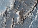
NASA's Mars Reconnaissance Orbiter captured this image of the Claritas Fossae region, characterized by systems of 'graben.' A graben forms when a block of the planet's crust drops down between two faults, due to extension, or pulling, of the crust.
Title:
Faults in Claritas Fossae
Remove Image from Favorite List PIA20716 Earth Earth Observing System (EOS)
AVIRIS
Hyperion Hyperspectral Imager
2016-06-14 1600x900x3
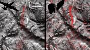
Comparison of detected methane plumes over Aliso Canyon, California, acquired 11 days apart in Jan. 2016 by NASA's AVIRIS and Hyperion instruments on NASA satellites in low-Earth orbit.
Title:
A First: NASA Spots Single Methane Leak from Space