Map Projected Browse Image
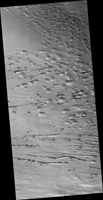
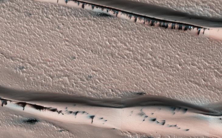
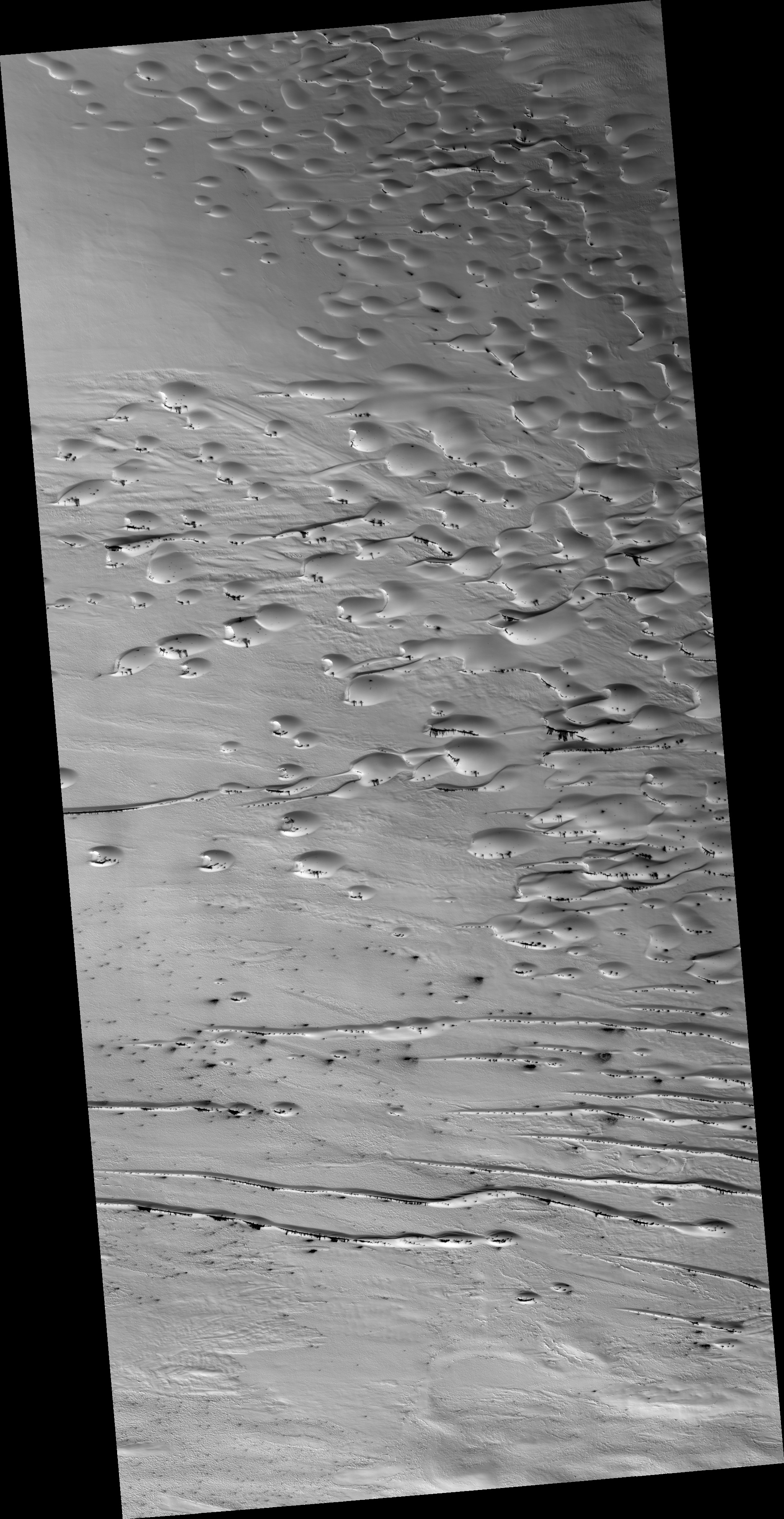
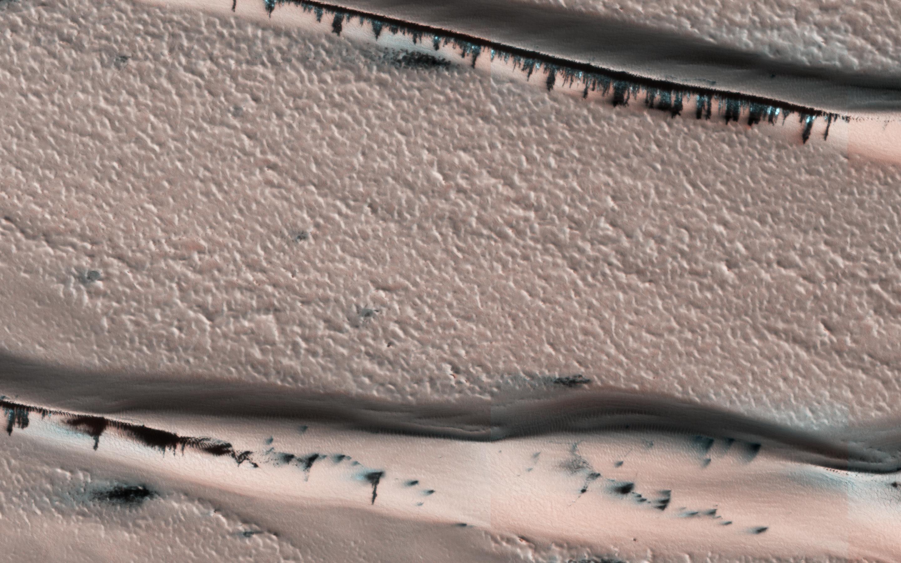
Click on the image for larger versionThis image from NASA's Mars Reconnaisance Orbiter (MRO) shows a dune field in Chasma Boreale, which is a large trough that cuts into the North Polar ice cap. Some of the dunes in this image are quite long and sinuous with a slight bulge at one end like a "head," giving it the appearance of a snake.However, most of the dunes visible here are of the type referred to as "barchan," which are characterized by their crescent shape. For these types of dunes, the "mouth" of the crescent points in the downwind direction, indicating that the winds are traveling east-west. The diverse dune morphologies here suggest that the wind-direction changes over a very small area.
Because Mars has a similar axial tilt to Earth, it also experiences seasons. When we took this image, Mars was in late spring. At this time of year, the dunes in this image are almost completely covered by frost. But this will soon change! Small portions of the underlying dark basaltic sands of these dunes are becoming increasingly visible with the active removal of their seasonal coating of ice. A look at a series of images demonstrates the transition from early to late spring, marked by defrosting and the gradual growth of dark spots. By summer, the dunes will be defrosted, and will appear completely black.
The map is projected here at a scale of 25 centimeters (9.8 inches) per pixel. [The original image scale is 31.9 centimeters (12.6 inches) per pixel (with 1 x 1 binning); objects on the order of 96 centimeters (37.8 inches) across are resolved.] North is up.
The University of Arizona, Tucson, operates HiRISE, which was built by Ball Aerospace & Technologies Corp., Boulder, Colo. NASA's Jet Propulsion Laboratory, a division of Caltech in Pasadena, California, manages the Mars Reconnaissance Orbiter Project for NASA's Science Mission Directorate, Washington.