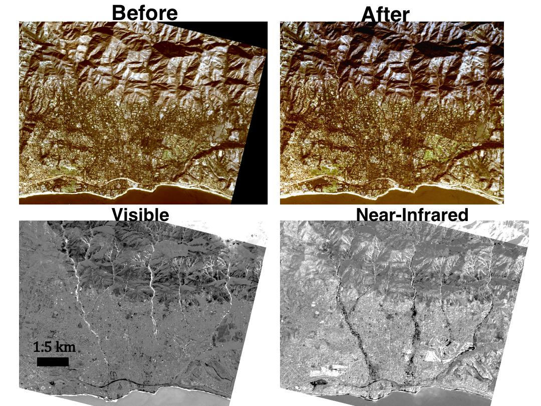
To map the spatial extent of the Montecito mudflows that occurred on Jan. 9, 2018, east of Santa Barbara, California, a group of JPL investigators used 10-foot (3-meter) resolution optical images acquired by Planet Labs' dove satellite constellation. To quantify changes between the before (top left) and after (top right) images, which were acquired 11 days before and one day after the mudflow event, the researchers compared the satellite's visible and near-infrared (NIR) bands. The bottom left image was acquired by subtracting the average of the red-green-blue bands of the pre-event image from the post-event image, while the bottom right image represents the differencing result between the near-infrared (780-860 nanometers) band. Areas of mudflow in the visible band appear as bright, positive regions due to changes from vegetation to mud and soil, as do smaller landslides upstream in drainage basins. The near-infrared result better resolves the spatial extent of the toe of the landslide near the coast, likely due to damage and loss of vegetation.
References: Planet Team: Planet Application Program Interface: In Space for Life on Earth. San Francisco, CA, https://api.planet.com (last accessed: 2nd March 2018), 2018.
