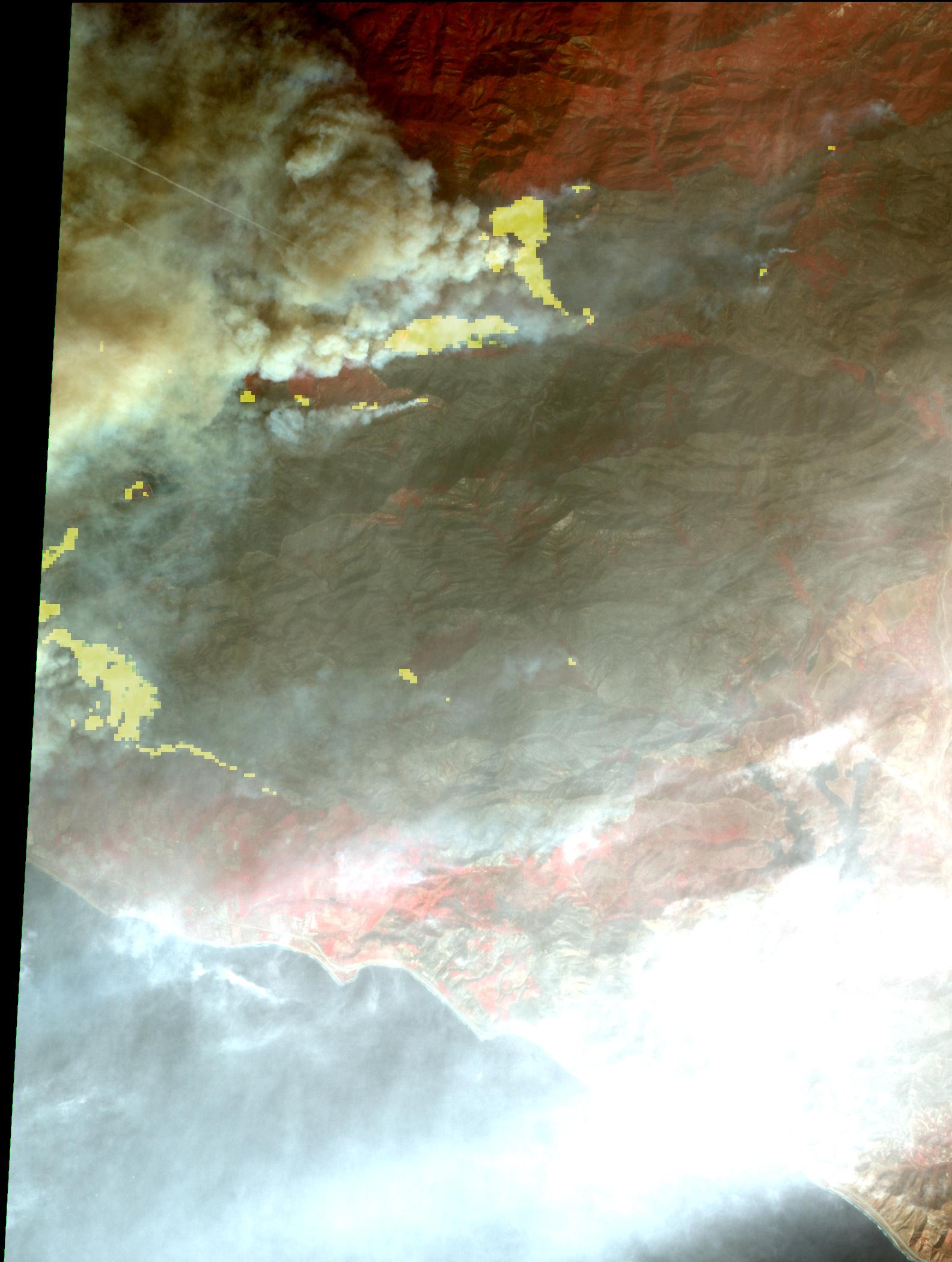
The Thomas fire, west of Los Angeles, continues to advance to the west and north and is threatening a number of coastal communities, including Santa Barbara. It is now the fifth largest wildfire in modern California history. According to CAL FIRE, as of midday Dec. 11, the fire had consumed more than 230,000 acres and was 15 percent contained. The Advanced Spaceborne Thermal Emission and Reflection Radiometer (ASTER) instrument on NASA's Terra satellite captured this image on Dec. 10. The image depicts vegetation in red, smoke in light brown, burned areas in dark grey, and active fires in yellow, as detected by the thermal infrared bands. The image covers an area of 14.3 by 19.6 miles (23 by 31.5 kilometers), and is located at 34.5 degrees north, 119.4 degrees west.
With its 14 spectral bands from the visible to the thermal infrared wavelength region and its high spatial resolution of 15 to 90 meters (about 50 to 300 feet), ASTER images Earth to map and monitor the changing surface of our planet. ASTER is one of five Earth-observing instruments launched Dec. 18, 1999, on Terra. The instrument was built by Japan's Ministry of Economy, Trade and Industry. A joint U.S./Japan science team is responsible for validation and calibration of the instrument and data products.
The broad spectral coverage and high spectral resolution of ASTER provides scientists in numerous disciplines with critical information for surface mapping and monitoring of dynamic conditions and temporal change. Example applications are: monitoring glacial advances and retreats; monitoring potentially active volcanoes; identifying crop stress; determining cloud morphology and physical properties; wetlands evaluation; thermal pollution monitoring; coral reef degradation; surface temperature mapping of soils and geology; and measuring surface heat balance.
The U.S. science team is located at NASA's Jet Propulsion Laboratory, Pasadena, Calif. The Terra mission is part of NASA's Science Mission Directorate, Washington, D.C.
More information about ASTER is available at http://asterweb.jpl.nasa.gov/.
