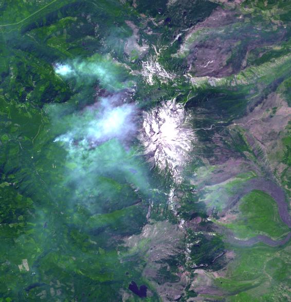
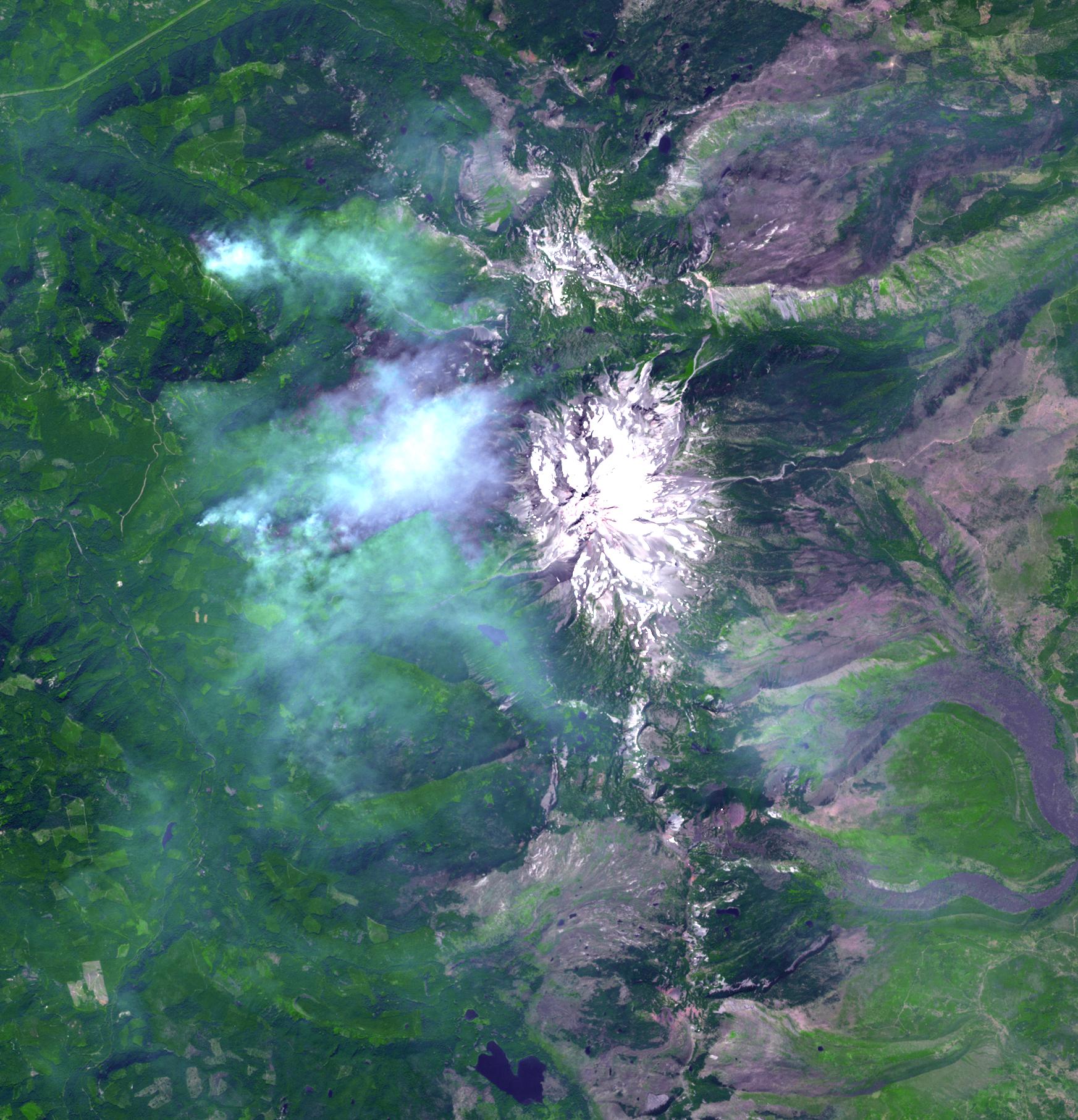
The Whitewater Fire in the Mount Jefferson Wilderness in Oregon was started by a lightning strike. As of Aug. 18, 2017, more than 117,000 acres and 30 miles (48 kilometers) of the Pacific Crest Trail are closed to the public in an area that had been expected to be popular with people there to view the August 21 solar eclipse. The smoke clouds sit over the burned area, just west-northwest of Mount Jefferson. The image was acquired Aug. 18, 2017, covers an area of 16 by 17 miles (26.1 by 27.2 kilometers), and is located at 44.7 degrees north, 121.8 degrees west.
With its 14 spectral bands from the visible to the thermal infrared wavelength region and its high spatial resolution of 15 to 90 meters (about 50 to 300 feet), ASTER images Earth to map and monitor the changing surface of our planet. ASTER is one of five Earth-observing instruments launched Dec. 18, 1999, on Terra. The instrument was built by Japan's Ministry of Economy, Trade and Industry. A joint U.S./Japan science team is responsible for validation and calibration of the instrument and data products.
The broad spectral coverage and high spectral resolution of ASTER provides scientists in numerous disciplines with critical information for surface mapping and monitoring of dynamic conditions and temporal change. Example applications are: monitoring glacial advances and retreats; monitoring potentially active volcanoes; identifying crop stress; determining cloud morphology and physical properties; wetlands evaluation; thermal pollution monitoring; coral reef degradation; surface temperature mapping of soils and geology; and measuring surface heat balance.
The U.S. science team is located at NASA's Jet Propulsion Laboratory, Pasadena, Calif. The Terra mission is part of NASA's Science Mission Directorate, Washington, D.C.
More information about ASTER is available at http://asterweb.jpl.nasa.gov/.