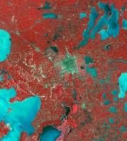
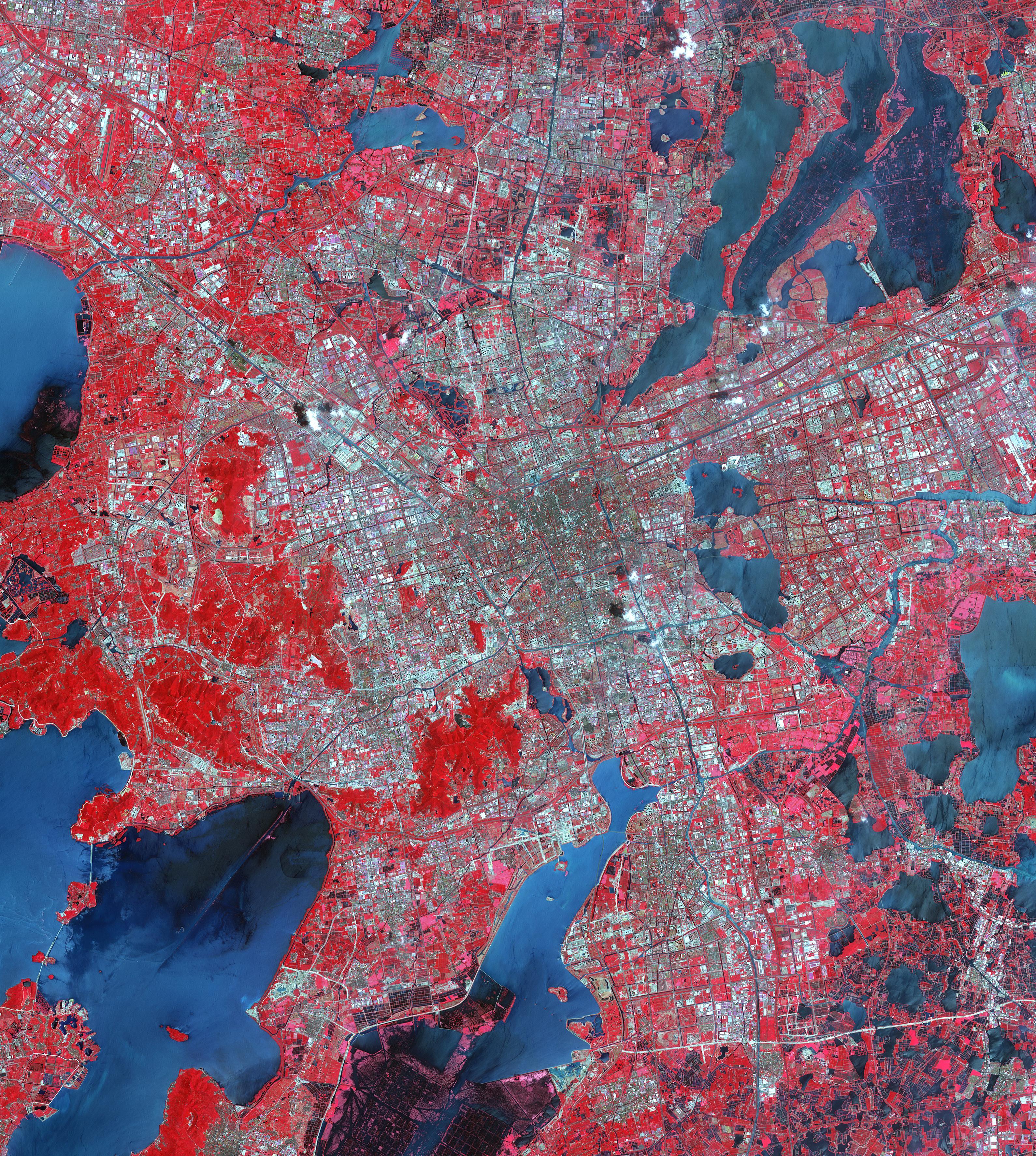
1984 SuzhouSuzhou is a major city located in southeastern Jiangsu Province of East China, about 100 km northwest of Shanghai. It is a major economic center and focal point of trade and commerce. The city is situated on the lower reaches of the Yangtze River and the shores of Lake Tai. Founded in 514 BCE, Suzhou has over 2,500 years of history, with an abundant display of relics and sites of historical interest. Since major economic reforms began in 1978, Suzhou has become one of the fastest growing major cities in the world. The population has grown from 0.9 million in 1990, 2.2 million in 2000, 4.1 million in 2010, to 5.3 million in 2017. The Landsat TM image was acquired August 4, 1984, and the Aster image was acquired August 2, 2015. The images cover an area of 48 by 53 km, and are located at 31.2 degrees north, 120.4 degrees east.
With its 14 spectral bands from the visible to the thermal infrared wavelength region and its high spatial resolution of 15 to 90 meters (about 50 to 300 feet), ASTER images Earth to map and monitor the changing surface of our planet. ASTER is one of five Earth-observing instruments launched Dec. 18, 1999, on Terra. The instrument was built by Japan's Ministry of Economy, Trade and Industry. A joint U.S./Japan science team is responsible for validation and calibration of the instrument and data products.
The broad spectral coverage and high spectral resolution of ASTER provides scientists in numerous disciplines with critical information for surface mapping and monitoring of dynamic conditions and temporal change. Example applications are: monitoring glacial advances and retreats; monitoring potentially active volcanoes; identifying crop stress; determining cloud morphology and physical properties; wetlands evaluation; thermal pollution monitoring; coral reef degradation; surface temperature mapping of soils and geology; and measuring surface heat balance.
The U.S. science team is located at NASA's Jet Propulsion Laboratory, Pasadena, Calif. The Terra mission is part of NASA's Science Mission Directorate, Washington, D.C.
More information about ASTER is available at http://asterweb.jpl.nasa.gov/.
 Planetary Data System


