Your search criteria found 2612 images
Target is Earth (and available satellites)
Go to PIAxxxxx:
Refine this list of images by:
Target:
Mission:
Spacecraft:
Instrument:
Click on an image for detailed information
Click on a column heading to sort in ascending or descending order
My
List
Addition Date Target Mission Instrument SizeSort Descending
Add Image to Favorite List 2000-02-17 Earth Shuttle Radar Topography Mission (SRTM)
C-Band Interferometric Radar
1228x1093x3
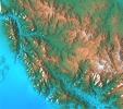
This topographic acquired by NASA's Shuttle Radar Topography Mission from data collected on February 16, 2000 shows the relationship of the urban area of Pasadena, California to the natural contours of the land.
PIA02716:
San Gabriel Mountains, California, Shaded relief, Color as Height
Full Resolution:     TIFF (4.009 MB)     JPEG (232.8 kB)
Add Image to Favorite List 2000-02-17 Earth Shuttle Radar Topography Mission (SRTM)
C-Band Interferometric Radar
1059x722x3
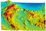
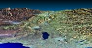
This perspective view acquired by NASA's Shuttle Radar Topography Mission from data collected on February 16, 2000 shows an area of Ventura County, California, including Simi Valley in the center of the image.
PIA02711:
Simi Valley, California, Perspective View of Shaded Relief, Color as Height
Full Resolution:     TIFF (2.166 MB)     JPEG (207.8 kB)
Add Image to Favorite List 2000-02-18 Earth Landsat
Shuttle Radar Topography Mission (SRTM)
C-Band Interferometric Radar
Thematic Mapper
1363x2200x3
This three-dimensional perspective view, looking up the Tigil River, acquired by NASA's Shuttle Radar Topography Mission from data collected on February 16, 2000, shows the western side of the volcanically active Kamchatka Peninsula, Russia.
PIA02717:
Kamchatka Peninsula, Russia 3-D Perspective with Landsat Overlay
Full Resolution:     TIFF (8.536 MB)     JPEG (860.9 kB)
Add Image to Favorite List 2000-02-18 Earth Landsat
Shuttle Radar Topography Mission (SRTM)
C-Band Interferometric Radar
Thematic Mapper
1939x1999x3
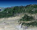
This perspective view, acquired by NASA's Shuttle Radar Topography Mission in Feb. 2000, shows the western part of the city of Pasadena, California, looking north towards the San Gabriel Mountains.
PIA02718:
Pasadena, California Perspective View with Aerial Photo and Landsat Overlay
Full Resolution:     TIFF (10.26 MB)     JPEG (872.3 kB)
Add Image to Favorite List 2000-02-18 Earth Shuttle Radar Topography Mission (SRTM)
C-Band Interferometric Radar
1856x1852x3
This topographic radar image acquired by NASA's Shuttle Radar Topography Mission in Feb. 2000 shows the city of Honolulu, Hawaii and adjacent areas on the island of Oahu. Honolulu lies on the south shore of the island.
PIA02720:
Honolulu, Hawaii Radar Image, Wrapped Color as Height
Full Resolution:     TIFF (2.443 MB)     JPEG (1.319 MB)
Add Image to Favorite List 2000-02-18 Earth Shuttle Radar Topography Mission (SRTM)
C-Band Interferometric Radar
737x797x3
This anaglyph shows NASA's Jet Propulsion Laboratory (JPL) in Pasadena, California as seen by the instrument onboard NASA's Shuttle Radar Topography Mission. 3D glasses are necessary to view this image.
PIA02721:
Pasadena, California Anaglyph with Aerial Photo Overlay
Full Resolution:     TIFF (1.749 MB)     JPEG (218.8 kB)
Add Image to Favorite List 2000-02-19 Earth Shuttle Radar Topography Mission (SRTM)
C-Band Interferometric Radar
2273x1515x3
This topographic radar image acquired by NASA's Shuttle Radar Topography Mission in Feb. 2000 shows the Lanai (left) and western Maui (right) islands of Hawaii.
PIA02723:
Radar Image, Wrapped Color as Height, Lanai and West Maui, Hawaii
Full Resolution:     TIFF (1.881 MB)     JPEG (676.5 kB)
Add Image to Favorite List 2000-02-19 Earth Shuttle Radar Topography Mission (SRTM)
C-Band Interferometric Radar
1319x1062x3
This perspective view acquired by NASA's Shuttle Radar Topography Mission from data collected on February 18, 2000 shows three Hawaiian islands: Molokai (lower left), Lanai (right), and the northwest tip of Maui (upper left).
PIA02724:
Perspective View, Radar Image, Color as Height, Molokai, Lanai and Maui, Hawaii
Full Resolution:     TIFF (1.541 MB)     JPEG (141.2 kB)
Add Image to Favorite List 2000-02-19 Earth Shuttle Radar Topography Mission (SRTM)
C-Band Interferometric Radar
1877x1676x3
This radar image acquired by NASA's Shuttle Radar Topography Mission from data collected on February 15, 2000 includes the city of Salalah, the second largest city in Oman.
PIA02725:
Radar Image, Color as Height , Salalah, Oman
Full Resolution:     TIFF (6.929 MB)     JPEG (809.5 kB)
Add Image to Favorite List 2000-02-19 Earth Shuttle Radar Topography Mission (SRTM)
C-Band Interferometric Radar
1793x1314x1
This radar image acquired by NASA's Shuttle Radar Topography Mission from data collected on February 18, 2000 shows the Dallas-Fort Worth metropolitan area in Texas.
PIA02722:
C-Band Radar Imagery, Dallas-Fort Worth, Texas
Full Resolution:     TIFF (2.885 MB)     JPEG (804.4 kB)
Add Image to Favorite List 2000-02-20 Earth Shuttle Radar Topography Mission (SRTM)
C-Band Interferometric Radar
1965x1347x3
This topographic image acquired by NASA's Shuttle Radar Topography Mission from data collected on February 15, 2000, of Patagonia, Argentina shows a spectacular landscape formed by volcanoes, rivers, and wind.
PIA02726:
Shaded relief, color as height Patagonia, Argentina
Full Resolution:     TIFF (9.036 MB)     JPEG (857.3 kB)
Add Image to Favorite List 2000-02-20 Earth Landsat
Shuttle Radar Topography Mission (SRTM)
C-Band Interferometric Radar
Thematic Mapper
1430x1152x3
This perspective view, acquired by NASA's Shuttle Radar Topography Mission in Feb. 2000, shows Honolulu, on the island of Oahu.
PIA02727:
Perspective view, Landsat Overlay Oahu, Hawaii
Full Resolution:     TIFF (2.192 MB)     JPEG (217.2 kB)
Add Image to Favorite List 2000-02-20 Earth Landsat
Shuttle Radar Topography Mission (SRTM)
C-Band Interferometric Radar
Thematic Mapper
940x658x3
This anaglyph, from NASA's Shuttle Radar Topography Mission, is of Honolulu, on the island of Oahu .3D glasses are necessary to view this image.
PIA02728:
Anaglyph, Landsat overlay Honolulu, Hawaii
Full Resolution:     TIFF (1.436 MB)     JPEG (112.3 kB)
Add Image to Favorite List 2000-02-20 Earth Shuttle Radar Topography Mission (SRTM)
C-Band Interferometric Radar
1634x1072x3
This perspective view acquired by NASA's Shuttle Radar Topography Mission from data collected in the year 2000 shows Patagonia, Argentina, a spectacular landscape formed by volcanoes, rivers, and wind.
PIA02729:
Perspective view of shaded relief, color as height, Patagonia, Argentina
Full Resolution:     TIFF (5.989 MB)     JPEG (459.9 kB)
Add Image to Favorite List 2000-02-21 Earth Shuttle Radar Topography Mission (SRTM)
C-Band Interferometric Radar
1252x2352x1
This radar image acquired by NASA's Shuttle Radar Topography Mission from data collected on February 16, 2000 shows the San Francisco Bay Area in California. Bay, lakes, roads and airport runways appear dark; buildings and trees appear bright.
PIA02730:
Radar image San Francisco Bay Area, California
Full Resolution:     TIFF (3.475 MB)     JPEG (874.5 kB)
Add Image to Favorite List 2000-02-21 Earth Shuttle Radar Topography Mission (SRTM)
C-Band Interferometric Radar
1929x1800x3
This anaglyph, from NASA's Shuttle Radar Topography Mission, is of Pasadena, California, looking north toward the San Gabriel Mountains. 3D glasses are necessary to view this image.
PIA02731:
Anaglyph of Perspective View with Aerial Photo Overlay Pasadena, California
Full Resolution:     TIFF (6.552 MB)     JPEG (663.3 kB)
Add Image to Favorite List 2000-02-21 Earth Shuttle Radar Topography Mission (SRTM)
C-Band Interferometric Radar
1603x1181x3
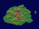
This image from NASA's Shuttle Radar Topography Mission shows Viti Levu, in the Sovereign Democratic Republic of the Fiji Islands, an independent nation consisting of some 332 islands surrounding the Koro Sea in the South Pacific Ocean.
PIA02732:
Shaded relief, color as height, Fiji
Full Resolution:     TIFF (1.396 MB)     JPEG (328.6 kB)
Add Image to Favorite List 2000-02-21 Earth Landsat
Shuttle Radar Topography Mission (SRTM)
C-Band Interferometric Radar
Thematic Mapper
4000x3000x3
The prominent linear feature straight down the center of this perspective view from NASA's Shuttle Radar Topography Mission is the San Andreas Fault. This segment of the fault lies near the city of Palmdale, CA, about 60 kilometers north of Los Angeles.
PIA02733:
Perspective view, Landsat overlay San Andreas Fault, Palmdale, California
Full Resolution:     TIFF (24.12 MB)     JPEG (879.1 kB)
Add Image to Favorite List 2000-02-21 Earth Landsat
Shuttle Radar Topography Mission (SRTM)
C-Band Interferometric Radar
Thematic Mapper
4000x3000x3
This image from NASA's Shuttle Radar Topography Mission shows of the area around Pasadena, California, just north of Los Angeles. The cluster of hills surrounded by freeways is the Verdugo Hills, which lie between the San Gabriel and San Fernando Valley.
PIA02734:
Perspective View, Landsat Overlay Pasadena, California
Full Resolution:     TIFF (27.95 MB)     JPEG (930 kB)
Add Image to Favorite List 2000-03-10 Earth Shuttle Radar Topography Mission (SRTM)
C-Band Interferometric Radar
2482x661x3
This elevation map shows a part of the southern coast of the Arabian Peninsula including parts of the countries of Oman and Yemen as seen by NASA's Shuttle Radar Topography Mission.
PIA02735:
Shaded Relief, Color as Height, Salalah, Oman
Full Resolution:     TIFF (2.65 MB)     JPEG (458.7 kB)
Add Image to Favorite List 2000-03-10 Earth Landsat
Shuttle Radar Topography Mission (SRTM)
C-Band Interferometric Radar
Thematic Mapper
1218x1366x3
This anaglyph, from NASA's Shuttle Radar Topography Mission, is of the coastal area in southernmost Oman; the Arabian Sea is on the right. 3D glasses are necessary to view this image.
PIA02736:
Anaglyph, Landsat overlay, Southernmost Coastal Oman
Full Resolution:     TIFF (4.27 MB)     JPEG (312.1 kB)
Add Image to Favorite List 2000-03-10 Earth Landsat
Shuttle Radar Topography Mission (SRTM)
C-Band Interferometric Radar
Thematic Mapper
2340x2069x3
This image from NASA's Shuttle Radar Topography Mission shows the western part of the city of Pasadena, California, looking north toward the San Gabriel Mountains. Portions of the cities of Altadena and La Canada Flintridge are also shown.
PIA02737:
Stereo Pair, Pasadena, California
Full Resolution:     TIFF (8.309 MB)     JPEG (704.7 kB)
Add Image to Favorite List 2000-03-10 Earth Landsat
Shuttle Radar Topography Mission (SRTM)
C-Band Interferometric Radar
Thematic Mapper
1591x2005x3
Honolulu, on the island of Oahu, is a large and growing urban area. This stereoscopic image pair, combining a Landsat image with topography measured by NASA's Shuttle Radar Topography Mission, shows how topography controls the urban pattern.
PIA02738:
Stereo Pair, Honolulu, Oahu
Full Resolution:     TIFF (6.849 MB)     JPEG (439.6 kB)
Add Image to Favorite List 2000-03-11 Earth Terra
MISR
1383x512x3
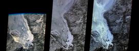
The first images taken by NASA's Multi-angle Imaging SpectroRadiometer (MISR) on February 24, 2000, show the winter landscape of James Bay, Ontario, Canada from three of the instrument's nine cameras.
PIA02450:
MISR's First Views of James Bay, Canada
Full Resolution:     TIFF (1.916 MB)     JPEG (146.1 kB)
Add Image to Favorite List 2000-03-11 Earth Terra
ASTER
2263x2027x1
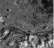
This image of the San Francisco River channel, and its surrounding flood zone, in Brazil was acquired by band 3N of ASTER's Visible/Near Infrared sensor onboard NASA's Terra spacecraft.
PIA02451:
ASTER's First Views of San Francisco River, Brazil - Visible/near Infrared (VNIR) Image (monochrome)
Full Resolution:     TIFF (3.321 MB)     JPEG (256.2 kB)
Add Image to Favorite List 2000-03-11 Earth Terra
ASTER
2160x2251x1
This scene scene covers the Red Sea coastline to an inland area of Ethiopia. This image is from NASA's Terra spacecraft.
PIA02452:
ASTER's First Views of Red Sea, Ethiopia - Thermal-Infrared (TIR) Image (monochrome)
Full Resolution:     TIFF (2.76 MB)     JPEG (185.8 kB)
Add Image to Favorite List 2000-03-11 Earth Terra
ASTER
2288x2288x3
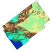
This image from NASA's Terra spacecraft is a color composite covering the Rift Valley inland area of Ethiopia.
PIA02453:
ASTER's First Views of Rift Valley, Ethiopia - Thermal-Infrared (TIR) Image (color)
Full Resolution:     TIFF (13.48 MB)     JPEG (231.5 kB)
Add Image to Favorite List 2000-03-13 Earth Shuttle Radar Topography Mission (SRTM)
C-Band Interferometric Radar
2496x2447x3
'From the desert to the mountains to the sea,' this image acquired by NASA's Shuttle Radar Topography Mission in Feb. 2000, shows in striking detail the varied topography of Southern California.
PIA02719:
Southern California Shaded Relief, Color as Height
Full Resolution:     TIFF (8.636 MB)     JPEG (654 kB)
Add Image to Favorite List 2000-03-16 Earth Landsat
Shuttle Radar Topography Mission (SRTM)
C-Band Interferometric Radar
Thematic Mapper
4000x3000x3
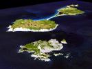
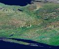
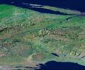
This image from NASA's Shuttle Radar Topography Mission shows Miquelon and Saint Pierre Islands, located south of Newfoundland, Canada. These islands, along with five smaller islands, are a self-governing territory of France.
PIA02739:
3-D Perspective View, Miquelon and Saint Pierre Islands
Full Resolution:     TIFF (34.1 MB)     JPEG (1.338 MB)
Add Image to Favorite List 2000-03-23 Earth Landsat
Shuttle Radar Topography Mission (SRTM)
C-Band Interferometric Radar
Thematic Mapper
2220x994x3
This perspective view shows the western side of the volcanically active Kamchatka Peninsula in eastern Russia. The image was generated using the first data collected during NASA's Shuttle Radar Topography Mission.
PIA02740:
3-D Perspective View, Kamchatka Peninsula, Russia
Full Resolution:     TIFF (4.091 MB)     JPEG (304.8 kB)
Add Image to Favorite List 2000-03-28 Earth Shuttle Radar Topography Mission (SRTM)
C-Band Interferometric Radar
1176x710x3
These two images of the eastern part of the island of Oahu, Hawaii provide information on regional topography and show the relationship between urban development and sensitive ecosystems as seen by NASA's Shuttle Radar Topography Mission.
PIA02741:
SRTM Radar Image, Wrapped Color as Height/EarthKam Optical Honolulu, Hawaii
Full Resolution:     TIFF (2.756 MB)     JPEG (178.6 kB)
Add Image to Favorite List 2000-04-06 Earth Shuttle Radar Topography Mission (SRTM)
C-Band Interferometric Radar
2197x2400x3
The topography of New Zealand's North Island is rich in seismic features: the sharp line cutting through the city of Wellington is the active Wellington Fault as seen by NASA's Shuttle Radar Topography Mission.
PIA02742:
Shaded relief with Color as Height, Wellington, New Zealand
Full Resolution:     TIFF (11.9 MB)     JPEG (1.063 MB)
Add Image to Favorite List 2000-04-13 Earth Landsat
Shuttle Radar Topography Mission (SRTM)
C-Band Interferometric Radar
Thematic Mapper
1428x2200x3
The Lake Palanskoye in northern Kamchatka was formed when a large landslide disrupted the drainage pattern, forming a natural dam as seen in this image from NASA's Shuttle Radar Topography Mission.
PIA02743:
Stereo Pair, Lake Palanskoye Landslide, Kamchatka Peninsula, Russia
Full Resolution:     TIFF (7.223 MB)     JPEG (689.6 kB)
Add Image to Favorite List 2000-04-13 Earth Landsat
Shuttle Radar Topography Mission (SRTM)
C-Band Interferometric Radar
Thematic Mapper
839x651x3
This anaglyph, from NASA's Shuttle Radar Topography Mission, is of Lake Palanskoye in northern Kamchatka. 3D glasses are necessary to view this image.
PIA02744:
Anaglyph, Lake Palanskoye Landslide, Kamchatka Peninsula, Russia
Full Resolution:     TIFF (1.501 MB)     JPEG (180.1 kB)
Add Image to Favorite List 2000-04-19 Earth Terra
MISR
1906x981x3
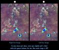
The stereo image at right is a downward-looking (nadir) view of the area around the San Cristobal volcano in Nicaragua taken by NASA's Terra satellite. 3D glasses are necessary to view this image.
PIA02600:
Nicaraguan Volcanoes, 26 February 2000
Full Resolution:     TIFF (4.239 MB)     JPEG (194.3 kB)
Add Image to Favorite List 2000-04-19 Earth Terra
MISR
1920x1079x3
These images from NASA's Terra spacecraft show the (nadir) view of the eastern United States, stretching from Lake Ontario to northern Georgia, and spanning the Appalachian Mountains.
PIA02601:
Multi-Angle Views of the Appalachian Mountains, 6 March 2000
Full Resolution:     TIFF (5.067 MB)     JPEG (244.4 kB)
Add Image to Favorite List 2000-04-19 Earth Terra
MISR
2536x800x3
A multi-angle view of the Canary Islands in a dust storm, 29 February 2000. At left is a true-color image taken by the Multi-angle Imaging SpectroRadiometer (MISR) instrument on NASA's Terra satellite.
PIA02602:
Multi-Angle View of the Canary Islands
Full Resolution:     TIFF (3.681 MB)     JPEG (169 kB)
Add Image to Favorite List 2000-04-19 Earth Terra
MISR
1520x1264x3
These multi-angle images of Hudson Bay and James Bay, Canada, taken 24 February 2000 from NASA's Terra spacecraft, come from the downward-looking (nadir) camera on the MISR instrument onboard NASA's Terra satellite.
PIA02603:
Multi-angle Images of Hudson Bay and James Bay, Canada, 24 February 2000
Full Resolution:     TIFF (4.927 MB)     JPEG (370.2 kB)
Add Image to Favorite List 2000-04-20 Earth Landsat
Shuttle Radar Topography Mission (SRTM)
C-Band Interferometric Radar
Thematic Mapper
4000x3000x3
The prominent linear feature straight down the center of this perspective view is the San Andreas Fault in California. This mage was created with data from NASA's shuttle Radar Topography Mission.
PIA02746:
Perspective View, San Andreas Fault
Full Resolution:     TIFF (6.834 MB)     JPEG (666.4 kB)
Add Image to Favorite List 2000-04-20 Earth Landsat
Shuttle Radar Topography Mission (SRTM)
C-Band Interferometric Radar
Thematic Mapper
4000x3000x3
California's Garlock Fault, marking the northwestern boundary of the Mojave Desert, lies at the foot of the mountains, running from the lower right to the top center of this image, which was created with data from NASA's shuttle Radar Topography Mission.
PIA02747:
Perspective View, Garlock Fault
Full Resolution:     TIFF (8.213 MB)     JPEG (756.2 kB)
Add Image to Favorite List 2000-04-20 Earth Landsat
Shuttle Radar Topography Mission (SRTM)
C-Band Interferometric Radar
Thematic Mapper
4000x3000x3
The prominent linear feature straight down the center of this perspective view is California's famous San Andreas Fault. The image was created with data from NASA's Shuttle Radar Topography Mission.
PIA02745:
Perspective View, San Andreas Fault
Full Resolution:     TIFF (7.318 MB)     JPEG (703.5 kB)
Add Image to Favorite List 2000-04-26 Earth Terra
ASTER
2100x1445x3
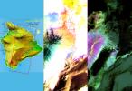
These images of the Island of Hawaii were acquired on March 19, 2000 by the Advanced Spaceborne Thermal Emission and Reflection Radiometer (ASTER) on NASA's Terra satellite.
PIA02604:
ASTER Images the Island of Hawaii
Full Resolution:     TIFF (7.393 MB)     JPEG (430.3 kB)
Add Image to Favorite List 2000-04-26 Earth Terra
ASTER
4100x4980x3
These images of the San Francisco Bay region were acquired on March 3, 2000 by the Advanced Spaceborne Thermal Emission and Reflection Radiometer (ASTER) on NASA's Terra satellite.
PIA02605:
ASTER Images San Francisco Bay Area
Full Resolution:     TIFF (36.23 MB)     JPEG (3.773 MB)
Add Image to Favorite List 2000-04-26 Earth Terra
ASTER
4100x5400x3
This image of the San Francisco Bay region was acquired on March 3, 2000 by the Advanced Spaceborne Thermal Emission and Reflection Radiometer (ASTER) on NASA's Terra satellite.
PIA02606:
ASTER Images San Francisco Bay Area
Full Resolution:     TIFF (54.36 MB)     JPEG (4.828 MB)
Add Image to Favorite List 2000-04-26 Earth Terra
ASTER
4100x6177x3
This image of the city of Tokyo was acquired on March 22, 2000 by the Advanced Spaceborne Thermal Emission and Reflection Radiometer (ASTER) on NASA's Terra satellite.
PIA02607:
ASTER Images Tokyo
Full Resolution:     TIFF (75.98 MB)     JPEG (12.25 MB)
Add Image to Favorite List 2000-04-26 Earth Terra
ASTER
1174x1447x3
On April 3, 2000, the Advanced Spaceborne Thermal Emission and Reflection Radiometer (ASTER) on NASA's Terra Satellite captured this image of the erupting Mt. Usu volcano in Hokkaido, Japan.
PIA02608:
ASTER Images Mt. Usu Volcano
Full Resolution:     TIFF (3.631 MB)     JPEG (681 kB)
Add Image to Favorite List 2000-04-27 Earth Spaceborne Imaging Radar-C/X-Band Synthetic Aperture Radar
6577x4337x3
This spaceborne radar image from NASA's Spaceborne Imaging Radar C/X-Band Synthetic Aperture Radar shows part of the vast Namib Sand Sea on the west coast of southern Africa, just northeast of the city of Luderitz, Namibia.
PIA01856:
Space Radar Image of Namibia Sand Dunes
Full Resolution:     TIFF (86.77 MB)     JPEG (8.973 MB)
Add Image to Favorite List 2000-04-27 Earth Landsat
Shuttle Radar Topography Mission (SRTM)
C-Band Interferometric Radar
Thematic Mapper
1362x900x3
This 3-D perspective view from NASA's Shuttle Radar Topography Mission looks south along the southeast coast of the North Island of New Zealand. The capital city of Wellington is off the right side of the image.
PIA02748:
Perspective View with Landsat Overlaid Owahanga, New Zealand
Full Resolution:     TIFF (2.168 MB)     JPEG (177.3 kB)
Add Image to Favorite List 2000-05-07 Earth QuikScat
SeaWinds Scatterometer
3296x4267x3
The distribution of ocean surface winds over the Atlantic Ocean, based on September 1999 data from NASA's SeaWinds instrument on the QuikScat satellite, shows wind direction, superimposed on the color image indicating wind speed.
PIA02455:
SeaWinds Global Coverage with Detail of Hurricane Floyd
Full Resolution:     TIFF (1.921 MB)     JPEG (1.595 MB)
Add Image to Favorite List 2000-05-07 Earth QuikScat
SeaWinds Scatterometer
3296x4267x3
This image demonstrates the capability of the SeaWinds instrument on NASA's QuikScat satellite in monitoring both sea ice and ocean surface wind, thus helping to further our knowledge in wind-ice interaction and its effect on climate change.
PIA02456:
SeaWinds Wind-Ice Interaction
Full Resolution:     TIFF (1.974 MB)     JPEG (1.274 MB)
Add Image to Favorite List 2000-05-07 Earth QuikScat
SeaWinds Scatterometer
2638x2201x3
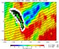
NASA's SeaWinds instrument on the QuikScat satellite shows winds are blocked by an island mountain barrier on South Georgia Island, in the South Atlantic Ocean in the year 2000.
PIA02457:
SeaWinds - South Georgia Island
Full Resolution:     TIFF (1.029 MB)     JPEG (1.018 MB)
Add Image to Favorite List 2000-05-07 Earth TOPEX/Poseidon
Altimeter
900x900x3
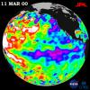
NASA's TOPEX/Poseidon data, collected over a 10-day sampling cycle from March 1 to 11, 2000, showed a La Niņa condition with sea surface heights reflecting unusual patterns of heat storage in the ocean.
PIA02460:
TOPEX/El Niņo Watch - La Niņa Still a "cool" Problem Child, March 23, 2000
Full Resolution:     TIFF (1.031 MB)     JPEG (123.2 kB)
Add Image to Favorite List 2000-05-08 Earth QuikScat
SeaWinds Scatterometer
2048x2048x3
The SeaWinds scatterometer on NASA's QuikScat satellite makes global radar measurements day and night, in clear sky and through clouds. Greenland and the polar ice cap are shown here on September 20, 1999.
PIA02458:
SeaWinds - Oceans, Land, Polar Regions
Full Resolution:     TIFF (934.2 kB)     JPEG (679.2 kB)
Add Image to Favorite List 2000-05-08 Earth QuikScat
SeaWinds Scatterometer
1452x1280x3
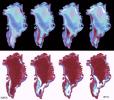
The frequent coverage provided by NASA's SeaWinds instrument on the QuikScat satellite in 1999 provided unprecedented capability to monitor daily and seasonal changes in the key melt zones of Greenland.
PIA02459:
SeaWinds - Greenland
Full Resolution:     TIFF (765.6 kB)     JPEG (205.7 kB)
Add Image to Favorite List 2000-05-11 Earth Landsat
Shuttle Radar Topography Mission (SRTM)
C-Band Interferometric Radar
Thematic Mapper
1840x2320x3
This image from NASA's Shuttle Radar Topography Mission shows Wellington, the capital city of New Zealand, located on the shores of Port Nicholson, a natural harbor at the south end of North Island.
PIA02749:
Stereo Pair: Wellington, New Zealand
Full Resolution:     TIFF (9.859 MB)     JPEG (619.5 kB)
Add Image to Favorite List 2000-05-11 Earth Landsat
Shuttle Radar Topography Mission (SRTM)
C-Band Interferometric Radar
Thematic Mapper
2158x1540x3
This anaglyph, from NASA's Shuttle Radar Topography Mission, is of Wellington, the capital city of New Zealand, located on the shores of Port Nicholson, a natural harbor. 3D glasses are necessary to view this image.
PIA02750:
Anaglyph, Landsat Overlay: Wellington, New Zealand
Full Resolution:     TIFF (7.542 MB)     JPEG (613.9 kB)
Add Image to Favorite List 2000-05-18 Earth Shuttle Radar Topography Mission (SRTM)
C-Band Interferometric Radar
1416x2113x3
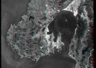
The southeast part of the island of Hokkaido, Japan, is an area dominated by volcanoes and volcanic caldera. The active Usu Volcano is at the lower right edge of the circular Lake Toya-Ko as seen by NASA's Shuttle Radar Topography Mission.
PIA02751:
Radar Image, Hokkaido, Japan
Full Resolution:     TIFF (7.544 MB)     JPEG (1.125 MB)
Add Image to Favorite List 2000-06-01 Earth Shuttle Radar Topography Mission (SRTM)
C-Band Interferometric Radar
1353x2000x3
From Lake Ontario and the St. Lawrence River extending to Long Island this image from NASA's Shuttle Radar Topography Mission shows the varied topography of eastern New York State and parts of Massachusetts, Connecticut, Pennsylvania and New Jersey.
PIA02752:
Stereo Pair of Height as Color & Shaded Relief, New York State, Lake Ontario to Long Island
Full Resolution:     TIFF (5.123 MB)     JPEG (546.7 kB)
Add Image to Favorite List 2000-06-01 Earth Shuttle Radar Topography Mission (SRTM)
C-Band Interferometric Radar
669x1427x3
This anaglyph, from NASA's Shuttle Radar Topography Mission, shows the varied topography of eastern New York State and parts of Massachusetts, Connecticut, Pennsylvania and New Jersey. 3D glasses are necessary.
PIA02753:
Anaglyph of Shaded Relief New York State, Lake Ontario to Long Island
Full Resolution:     TIFF (1.849 MB)     JPEG (193.7 kB)
Add Image to Favorite List 2000-06-15 Earth Shuttle Radar Topography Mission (SRTM)
C-Band Interferometric Radar
2336x3229x3
This image shows the northern part of central New York State, a landscape sculpted by the ice sheets of the last ice age. Lake Ontario runs across the top of the image as seen by NASA's Shuttle Radar Topography Mission.
PIA02754:
Radar with Color-wrapped Height Fringes, Syracuse and vicinity, New York State
Full Resolution:     TIFF (19.24 MB)     JPEG (3.371 MB)
Add Image to Favorite List 2000-06-15 Earth Landsat
Shuttle Radar Topography Mission (SRTM)
C-Band Interferometric Radar
Thematic Mapper
1828x1513x3
From Lake Ontario to the St. Lawrence River, extending to Long Island, this perspective view from NASA's Shuttle Radar Topography Mission shows topography of eastern New York State and Massachusetts, Connecticut, Pennsylvania, New Jersey and Rhode Island.
PIA02757:
Perspective View, New York State, Long Island to Lake Ontario
Full Resolution:     TIFF (8.777 MB)     JPEG (640.5 kB)
Add Image to Favorite List 2000-06-15 Earth Landsat
Shuttle Radar Topography Mission (SRTM)
C-Band Interferometric Radar
Thematic Mapper
1828x1515x3
From Lake Ontario to the St. Lawrence River, extending to Long Island, this perspective view from NASA's Shuttle Radar Topography Mission shows topography of eastern New York State and Massachusetts, Connecticut, Pennsylvania, New Jersey and Rhode Island.
PIA02758:
Perspective View, New York State, Lake Ontario to Long Island
Full Resolution:     TIFF (8.574 MB)     JPEG (617 kB)
Add Image to Favorite List 2000-06-15 Earth Landsat
Shuttle Radar Topography Mission (SRTM)
C-Band Interferometric Radar
Thematic Mapper
3717x1969x3
This perspective view from NASA's Shuttle Radar Topography Mission of upstate New York shows Lake Ontario in the lower left, the Adirondack Mountains in the upper left, and the Catskill Mountains on the right.
PIA02759:
Perspective View, Syracuse, Oneida Lake, Utica, Upstate New York
Full Resolution:     TIFF (21.13 MB)     JPEG (2.424 MB)
Add Image to Favorite List 2000-06-20 Earth Terra
MISR
2220x2048x3
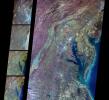
These multi-angle images of Delaware Bay, Chesapeake Bay, and the Appalachian Mountains, acquired 24 March 2000 from NASA's Terra spacecraft, come from the downward-looking (nadir) camera on the MISR instrument onboard NASA's Terra satellite.
PIA02609:
MISR Views Delaware Bay, Chesapeake Bay, and the Appalachian Mountains
Full Resolution:     TIFF (12.73 MB)     JPEG (862.5 kB)
Add Image to Favorite List 2000-06-20 Earth Terra
MISR
2548x3800x3
A plume from a large brush fire that burned about 15,000 acres in 2000 is visible at the western edge of the Big Cypress Swamp in southern Florida. NASA's Terra satellite captured acquired this image on April 9, 2000. 3D glasses are necessary.
PIA02610:
MISR Views Florida
Full Resolution:     TIFF (19.67 MB)     JPEG (1.364 MB)
Add Image to Favorite List 2000-06-22 Earth Landsat
Shuttle Radar Topography Mission (SRTM)
C-Band Interferometric Radar
Thematic Mapper
2920x4236x3
This anaglyph, from NASA's Shuttle Radar Topography Mission, shows elatively young volcanoes in northern Patagonia, at Los Menucos, Argentina. 3D glasses are necessary to view this image.
PIA02755:
Anaglyph, Patagonia, Argentina
Full Resolution:     TIFF (19.93 MB)     JPEG (2.452 MB)
Add Image to Favorite List 2000-06-22 Earth Landsat
Shuttle Radar Topography Mission (SRTM)
C-Band Interferometric Radar
Thematic Mapper
2995x3129x3
This view from NASA's Shuttle Radar Topography Mission of northern Patagonia, at Los Menucos, Argentina shows remnants of relatively young volcanoes built upon an eroded plain of much older and contorted volcanic, granitic, and sedimentary rocks.
PIA02756:
Stereo Pair, Patagonia, Argentina
Full Resolution:     TIFF (24.23 MB)     JPEG (1.777 MB)
Add Image to Favorite List 2000-06-29 Earth Landsat
Shuttle Radar Topography Mission (SRTM)
C-Band Interferometric Radar
Thematic Mapper
1102x1105x3
This view from NASA's Shuttle Radar Topography Mission of northern Patagonia, near El Cain, Argentina shows complexly eroded volcanic terrain, with basalt mesas, sinkholes, landslide debris, playas, and relatively few integrated drainage channels.
PIA02760:
Stereo Pair: Patagonia, Argentina
Full Resolution:     TIFF (2.054 MB)     JPEG (214.7 kB)
Add Image to Favorite List 2000-06-29 Earth Landsat
Shuttle Radar Topography Mission (SRTM)
C-Band Interferometric Radar
Thematic Mapper
506x798x3
This anaglyph, from NASA's Shuttle Radar Topography Mission, shows complexly eroded volcanic terrain in northern Patagonia, near El Cain, Argentina. 3D glasses are necessary to view this image.
PIA02761:
Anaglyph: Patagonia, Argentina
Full Resolution:     TIFF (1.101 MB)     JPEG (79.37 kB)
Add Image to Favorite List 2000-07-06 Earth TOPEX/Poseidon
Altimeter
900x900x3
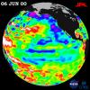
After dominating the tropical Pacific Ocean for more than two years, the 1998-2000 La Niņa 'cool pool' is continuing its slow fade and seems to be retiring from the climate stage, according to satellite data from NASA's U.S.-French TOPEX/Poseidon mission.
PIA02935:
TOPEX/El Niņo Watch - Strong, Long-lasting La Niņa Just Fading Away, June 19, 2000
Full Resolution:     TIFF (997.1 kB)     JPEG (119.1 kB)
Add Image to Favorite List 2000-07-08 Earth Terra
MISR
584x900x3
This anaglyph from NASA's Terra satellite's vertical (nadir) camera, shows Hurricane Carlotta's location in the eastern Pacific Ocean, about 500 km south of Puerto Vallarta, Mexico in 2000. 3D glasses are necessary to view this image.
PIA02611:
MISR Views Hurricane Carlotta
Full Resolution:     TIFF (1.25 MB)     JPEG (76.02 kB)
Add Image to Favorite List 2000-07-13 Earth Landsat
Shuttle Radar Topography Mission (SRTM)
C-Band Interferometric Radar
Thematic Mapper
1631x956x3
This anaglyph, from NASA's Shuttle Radar Topography Mission, shows basalt cliffs along the northwest edge of the Meseta de Somuncura plateau near Sierra Colorada, Argentina. 3D glasses are necessary to view this image.
PIA02762:
Anaglyph: Basalt Cliffs, Patagonia, Argentina
Full Resolution:     TIFF (2.516 MB)     JPEG (296.4 kB)
Add Image to Favorite List 2000-07-13 Earth Landsat
Shuttle Radar Topography Mission (SRTM)
C-Band Interferometric Radar
Thematic Mapper
2437x1466x3
Basalt cliffs along the northwest edge of the Meseta de Somuncura plateau near Sierra Colorada, Argentina show an unusual and striking pattern of erosion in this image from NASA's Shuttle Radar Topography Mission.
PIA02763:
Stereo Pair: Basalt Cliffs, Patagonia, Argentina
Full Resolution:     TIFF (5.358 MB)     JPEG (505.6 kB)
Add Image to Favorite List 2000-07-19 Earth Terra
MISR
1149x668x3
These images from NASA's Terra satellite are of tropical northern Australia acquired on June 1, 2000 (Terra orbit 2413) during the long dry season.
PIA02614:
MISR Views Northern Australia
Full Resolution:     TIFF (2.837 MB)     JPEG (182.9 kB)
Add Image to Favorite List 2000-07-20 Earth Landsat
Shuttle Radar Topography Mission (SRTM)
C-Band Interferometric Radar
Thematic Mapper
718x907x3
This anaglyph, from NASA's Shuttle Radar Topography Mission, shows Meseta de Somuncura, a broad plateau capped by basalt. Near its western edge is evidence of multiple volcanic events. 3D glasses are necessary to view this image.
PIA02764:
SRTM Anaglyph: Inverted Topography, Patagonia, Argentina
Full Resolution:     TIFF (1.025 MB)     JPEG (149.5 kB)
Add Image to Favorite List 2000-07-20 Earth Landsat
Shuttle Radar Topography Mission (SRTM)
C-Band Interferometric Radar
Thematic Mapper
1526x1243x3
The Meseta de Somuncura is a broad plateau capped by basalt. Near its western edge is evidence of multiple volcanic events and a complex erosion history in this image from NASA's Shuttle Radar Topography Mission.
PIA02765:
Stereo Pair: Inverted Topography, Patagonia, Argentina
Full Resolution:     TIFF (3.087 MB)     JPEG (286.3 kB)
Add Image to Favorite List 2000-07-26 Earth Terra
MISR
950x801x3
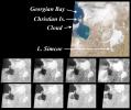
These images from NASA's Terra satellite are of the southeast portion of Georgian Bay in Ontario, Canada, acquired on March 6, 2000, during Terra orbit 1155.
PIA02615:
MISR View of Georgian Bay, Ontario, Canada
Full Resolution:     TIFF (1.027 MB)     JPEG (108.6 kB)
Add Image to Favorite List 2000-07-27 Earth Landsat
Shuttle Radar Topography Mission (SRTM)
C-Band Interferometric Radar
Thematic Mapper
999x1335x3
This anaglyph, from NASA's Shuttle Radar Topography Mission, shows Meseta de Somuncura, a semi-arid basalt plateau in northern Patagonia. 3D glasses are necessary to view this image.
PIA02766:
SRTM Anaglyph: Meseta de Somuncura, Patagonia, Argentina (Near Los Menucos)
Full Resolution:     TIFF (3.633 MB)     JPEG (273.4 kB)
Add Image to Favorite List 2000-07-27 Earth Landsat
Shuttle Radar Topography Mission (SRTM)
C-Band Interferometric Radar
Thematic Mapper
2088x1795x3
The Meseta de Somuncura is a semi-arid basalt plateau in northern Patagonia. This view from NASA's Shuttle Radar Topography Mission of the northwestern part of the plateau, near Los Menucos, Argentina, shows numerous depressions.
PIA02767:
SRTM Stereo Pair: Meseta de Somuncura, Patagonia, Argentina
Full Resolution:     TIFF (5.983 MB)     JPEG (516.6 kB)
Add Image to Favorite List 2000-08-02 Earth Terra
MISR
959x861x3
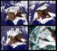
This stereo image from NASA's Terra satellite show the Mauna Kea and Mauna Loa volcanoes in Hawaii; a southern face of a line of cumulus clouds off the north coast of Hawaii is also visible. 3D glasses are necessary to view this image.
PIA02616:
MISR Views the Big Island of Hawaii
Full Resolution:     TIFF (2.201 MB)     JPEG (145.4 kB)
Add Image to Favorite List 2000-08-03 Earth Landsat
Shuttle Radar Topography Mission (SRTM)
C-Band Interferometric Radar
Thematic Mapper
576x800x3
This perspective view from NASA's Shuttle Radar Topography Mission includes the city of Salalah, the second largest city in Oman. The city is located on the broad, generally bright coastal plain and includes areas of green irrigated crops.
PIA02768:
Perspective View, Landsat Overlay, Salalah, Oman, Southern Arabian Peninsula
Full Resolution:     TIFF (932.8 kB)     JPEG (98.28 kB)
Add Image to Favorite List 2000-08-09 Earth Terra
MISR
1152x550x3
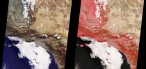
These images from NASA'sTerra satellite are of Southern California acquired on March 14, 2000 during Terra orbit 1273. North is at the top.
PIA02617:
MISR Views Southern California
Full Resolution:     TIFF (1.832 MB)     JPEG (106.9 kB)
Add Image to Favorite List 2000-08-10 Earth Shuttle Radar Topography Mission (SRTM)
C-Band Interferometric Radar
1431x911x3
This 3D perspective view shows the Japanese island called Miyake-Jima viewed from the northeast as seen by NASA's Shuttle Radar Topography Mission.
PIA02769:
Perspective View of Shaded Relief with Color as Height, Miyake-Jima, Japan
Full Resolution:     TIFF (3.176 MB)     JPEG (185.8 kB)
Add Image to Favorite List 2000-08-10 Earth Shuttle Radar Topography Mission (SRTM)
Terra
ASTER
C-Band Interferometric Radar
1866x605x3
This image from NASA's Terra spacecraft shows Mount Oyama, an 820-meter-high (2,700 feet) volcano on the island of Miyake-Jima, Japan.
PIA02771:
ASTER-SRTM Perspective of Mount Oyama Volcano, Miyake-Jima Island, Japan
Full Resolution:     TIFF (1.26 MB)     JPEG (101 kB)
Add Image to Favorite List 2000-08-16 Earth Terra
MISR
938x790x3
These images from NASA's Terra satellite are of smoke plumes from devastating wildfires in the northwestern U.S. This view of the Clearwater and Salmon River Mountains in Idaho was acquired on August 5, 2000 (Terra orbit 3370).
PIA02618:
MISR Images Wildfires in Northwestern US
Full Resolution:     TIFF (2.435 MB)     JPEG (127.1 kB)
Add Image to Favorite List 2000-08-17 Earth European Remote Sensing Satellite Mission (ERS)
2135x2386x3
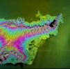
This image of California's Hayward fault is an interferogram created using a pair of images taken by ESA's ERS-1 and ERS-2 in June 1992 and September 1997 over the central San Francisco Bay in California.
PIA02651:
Hayward Fault, California Interferogram
Full Resolution:     TIFF (11.07 MB)     JPEG (1.827 MB)
Add Image to Favorite List 2000-08-17 Earth Landsat
Shuttle Radar Topography Mission (SRTM)
C-Band Interferometric Radar
Thematic Mapper
2148x1755x1
In addition to an elevation model of most of Earth's landmass, NASA's Shuttle Radar Topography Mission shows lava flows in northern Patagonia, Argentina.
PIA02770:
SRTM Radar - Landsat Image Comparison, Patagonia, Argentina
Full Resolution:     TIFF (4.223 MB)     JPEG (913 kB)
Add Image to Favorite List 2000-08-18 Earth Terra
MISR
1436x1311x3
These images from NASA's Terra satellite captured on August 14, 2000 show forest fires raging in Montana and Hurricane Hector swirling in the Pacific.
PIA02619:
MISR Images Forest Fires and Hurricane
Full Resolution:     TIFF (5.22 MB)     JPEG (263.7 kB)
Add Image to Favorite List 2000-08-23 Earth Terra
MISR
1152x505x3
These images from NASA's Terra satellite images of the Ntwetwe and Sua Pans in northeastern Botswana were acquired on August 18, 2000 (Terra orbit 3553).
PIA02620:
MISR Images Northeastern Botswana
Full Resolution:     TIFF (1.985 MB)     JPEG (102.8 kB)
Add Image to Favorite List 2000-08-23 Earth QuikScat
SeaWinds Scatterometer
640x565x3
As super Typhoon Bilis, equal in strength to a category 5 hurricane, bore down on Taiwan, these images from August 21, 2000, show the massive storm's most devastating components: rain and wind.
PIA01047:
Typhoon Bilis
Full Resolution:     TIFF (229 kB)     JPEG (123.4 kB)
Add Image to Favorite List 2000-08-30 Earth Terra
MISR
1440x753x3
These images from NASA's Terra satellite images of Zambia and Botswana, Africa were acquired on August 25, 2000 during Terra orbit 3655.
PIA02621:
MISR Images Zambia and Botswana
Full Resolution:     TIFF (3.403 MB)     JPEG (179.5 kB)
Add Image to Favorite List 2000-08-30 Earth TOPEX/Poseidon
Altimeter
900x900x3
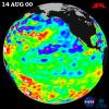
After three years of El Niņo and La Niņa, the Pacific finally calmed down in the tropics but still showed signs of being abnormal elsewhere, according to the satellite data from NASA's U.S.-French TOPEX/Poseidon mission in 2000.
PIA02969:
TOPEX/El Niņo Watch - Los Niņos may be Gone, But Pacific Pattern Remains August 14, 2000
Full Resolution:     TIFF (983.8 kB)     JPEG (113.8 kB)
Add Image to Favorite List 2000-08-31 Earth Landsat
Shuttle Radar Topography Mission (SRTM)
C-Band Interferometric Radar
Thematic Mapper
499x801x3
This anaglyph, from NASA's Shuttle Radar Topography Mission, shows Wheeler Ridge and vicinity, California, a site of major tectonic activity. 3D glasses are necessary to view this image.
PIA02772:
SRTM Anaglyph: Wheeler Ridge, California
Full Resolution:     TIFF (1.069 MB)     JPEG (109.4 kB)
Add Image to Favorite List 2000-08-31 Earth Landsat
Shuttle Radar Topography Mission (SRTM)
C-Band Interferometric Radar
Thematic Mapper
984x1125x3
Wheeler Ridge and vicinity, is a site of major tectonic activity, both historically and over recent geologic time, as seen in this image from NASA's Shuttle Radar Topography Mission. Both sets of images show lava flows in northern Patagonia, Argentina.
PIA02773:
SRTM Stereo Pair: Wheeler Ridge, California
Full Resolution:     TIFF (2.866 MB)     JPEG (281.4 kB)
Add Image to Favorite List 2000-09-06 Earth Terra
MISR
1256x705x3
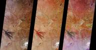
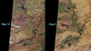
This image pair from NASA's Terra satellite shows 'before and after' views of a dry sagerush fire in the area around the Hanford Nuclear Reservation near Richland, Washington, in June, 2000.
PIA02622:
MISR Views a Fire-Scarred Landscape
Full Resolution:     TIFF (1.473 MB)     JPEG (163.8 kB)
Add Image to Favorite List 2000-09-07 Earth Landsat
Shuttle Radar Topography Mission (SRTM)
C-Band Interferometric Radar
Thematic Mapperr
1443x1175x3
Southern California's dramatic topography plays a critical role in its climate, hydrology, ecology, agriculture, and habitability in this image from NASA's Shuttle Radar Topography Mission.
PIA02774:
Perspective with Landsat Overlay: Mojave to Ventura, California
Full Resolution:     TIFF (4.508 MB)     JPEG (341 kB)
Add Image to Favorite List 2000-09-13 Earth Terra
MISR
500x549x3
This image from NASA's Terra satellite was acquired on July 11, 2000 (Terra orbit 3009) and shows a 200-kilometer section of the eastern Australian coast, centered around the Sydney metropolitan area.
PIA02623:
MISR Looks at Sydney and the Southeastern Australia Coast
Full Resolution:     TIFF (857.6 kB)     JPEG (62.85 kB)
Add Image to Favorite List 2000-09-14 Earth Landsat
Shuttle Radar Topography Mission (SRTM)
C-Band Interferometric Radar
Thematic Mapper
3069x785x3
Antelope Valley is bounded by two of the most active faults in California: the Garlock fault, which fronts the distant mountains in this view from NASA's Shuttle Radar Topography Mission, as well as the San Andreas fault.
PIA02775:
Perspective with Landsat Overlay: Antelope Valley, California
Full Resolution:     TIFF (6.207 MB)     JPEG (500.9 kB)
Add Image to Favorite List 2000-09-20 Earth Terra
MISR
826x560x3
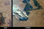
These images from NASA's Terra satellite images are of northeastern South Africa, near Kruger National Park, were acquired on September 7, 2000.
PIA02624:
MISR and AirMISR Simultaneously Observe African Grassland Fires
Full Resolution:     TIFF (1.505 MB)     JPEG (86.42 kB)
Add Image to Favorite List 2000-09-20 Earth RadarSat
Imaging Radar
720x520x3
NASA researchers have insights into the mysteries of Arctic sea ice, thanks to the unique abilities of Canada's Radarsat satellite in this view of the global arctic.
PIA02970:
Global View of the Arctic Ocean
Full Resolution:     TIFF (624.4 kB)     JPEG (35.77 kB)
Retrieve Previous Set  Jump to a Previous Set   Jump to a Previous Set   Jump to a Previous Set   Current Set   Jump to a Following Set   Jump to a Following Set   Jump to a Following Set   Jump to a Following Set   Jump to a Following Set   Jump to a Following Set   Retrieve Next Set 
 1-100   101-200   201-300   301-400   401-500   501-600   601-700   701-800   801-900   901-1000 
Currently displaying images: 301 - 400 of 2612