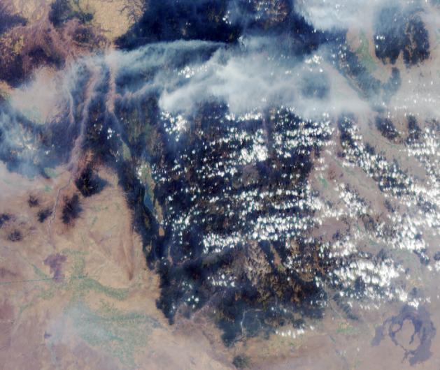
MISR image of smoke plumes from devastating wildfires in the northwestern US. This view of the Clearwater and Salmon River Mountains in Idaho was acquired on August 5, 2000 (Terra orbit 3370). The body of water to the left of image center is the Cascade Reservoir, located about 100 km north of Boise and 80 km east of the Snake River. North is at the top, and the image is approximately 380 km across.
In addition to the huge plumes traversing the mountains in the northern part of the image, smoke accumulating in the lower elevation canyons and plains is visible. This image was generated using data from the MISR camera that looks forward at a steep angle (70.5 degrees). The smoke is far more visible when viewed at this highly oblique angle than it would be in a conventional, straight-downward view. In creating this color composite, data from the blue and green MISR bands, acquired at 1.1-km spatial resolution, were digitally "sharpened" using 275-m resolution data acquired in the red band.
MISR was built and is managed by NASA's Jet Propulsion Laboratory, Pasadena, CA, for NASA's Office of Earth Science, Washington, DC. The Terra satellite is managed by NASA's Goddard Space Flight Center, Greenbelt, MD. JPL is a division of the California Institute of Technology.
For more information: http://www-misr.jpl.nasa.gov