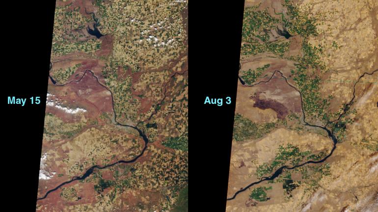
This MISR image pair shows "before and after" views of the area around the Hanford Nuclear Reservation near Richland, Washington. On June 27, 2000, a fire in the dry sagebrush was sparked by an automobile crash. The flames were fanned by hot summer winds. By the day after the accident, about 100,000 acres had burned, and the fire's spread forced the closure of highways and loss of homes.
These images, from Terra orbits 2176 and 3341, were obtained by MISR's vertical-viewing (nadir) camera. Compare the area just above and to the right of the line of cumulus clouds in the May 15 image with the same area imaged on August 3. The darkened burn scar measures approximately 35 kilometers across. The Columbia River is seen wending its way around the area, and the Snake River branches off to the right.
According to Idaho's National Interagency Fire Center, the US has been experiencing the worst fire season since 1996.
MISR was built and is managed by NASA's Jet Propulsion Laboratory, Pasadena, CA, for NASA's Office of Earth Science, Washington, DC. The Terra satellite is managed by NASA's Goddard Space Flight Center, Greenbelt, MD. JPL is a division of the California Institute of Technology.