Your search criteria found 2624 images
Target is Earth (and available satellites)
Go to PIAxxxxx:
Refine this list of images by:
Target:
Mission:
Spacecraft:
Instrument:
Click on an image for detailed information
Click on a column heading to sort in ascending or descending order
My
List
Addition Date Target MissionSort Descending Instrument Size
Add Image to Favorite List 2022-09-08 Earth Aqua
AIRS
900x695x3
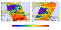
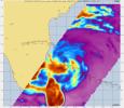
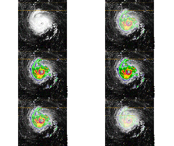
NASA's AIRS instrument imaged Typhoon Hinnamnor on the afternoon of September 5, 2022, shortly before the storm made landfall in South Korea on September 6.
PIA25521:
AIRS Images Typhoon Hinnamnor Ahead of Landfall
Full Resolution:     TIFF (825.3 kB)     JPEG (112.9 kB)
Add Image to Favorite List 2022-09-28 Earth Aqua
AIRS
900x695x3
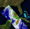
The AIRS instrument aboard NASA's Aqua satellite captured imagery of Hurricane Ian over the Gulf of Mexico between Cuba and Florida just before 2 a.m. local time September 28, 2022.
PIA24908:
Hurricane Ian Captured in Infrared by AIRS
Full Resolution:     TIFF (808.6 kB)     JPEG (116 kB)
Add Image to Favorite List 2022-12-05 Earth Aqua
AIRS
2702x3011x3
The Atmospheric Infrared Sounder (AIRS) instrument aboard NASA's Aqua satellite detected volcanic sulfur dioxide (SO₂) plumes emanating from Hawaii's Mauna Loa volcano, which started erupting Nov. 27, 2022.
PIA25562:
NASA's AIRS Instrument Tracks Volcanic Sulfur Dioxide Plume from Mauna Loa Eruption
Full Resolution:     TIFF (7.935 MB)     JPEG (1.295 MB)
Add Image to Favorite List 2023-01-10 Earth Aqua
AIRS
1195x611x3
The AIRS instrument aboard NASA's Aqua satellite captured a series of storms as they dumped record amounts of rain in some parts of California, causing flooding, and damaging infrastructure.
PIA25597:
California Atmospheric River Storms Captured by NASA's AIRS
Full Resolution:     TIFF (1.868 MB)     JPEG (175.8 kB)
Add Image to Favorite List 2023-08-18 Earth Aqua
AIRS
900x695x3
NASA's Atmospheric Infrared Sounder (AIRS) captured Hurricane Hilary on the morning of Aug. 18, 2023, when it was a Category 4 storm roughly 470 miles (760 kilometers) south of Baja California.
PIA25779:
Hurricane Hilary Captured by NASA's AIRS
Full Resolution:     TIFF (817.3 kB)     JPEG (107.8 kB)
Add Image to Favorite List 2024-09-27 Earth Aqua
AIRS
900x695x3
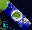
NASA's Atmospheric Infrared Sounder (AIRS) captured an infrared image of Hurricane Helene on Friday, Sept. 27, 2024, at 3:47 a.m. local time, nearly five hours after it made landfall on the Florida coast.
PIA26413:
NASA's AIRS Instrument Captures Hurricane Helene
Full Resolution:     TIFF (805.8 kB)     JPEG (118 kB)
Add Image to Favorite List 2015-09-12 Earth Aqua
Aquarius
SMAP
1299x1078x3
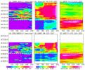
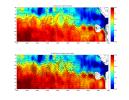
This figure shows the longitude-time variations, averaged between 21 and 22 degrees North, across the middle of the India subcontinent from mid-April to mid-June in a deadly heat wave in India that killed more than 2,300 people.
PIA19938:
Pre-Monsoon Drought and Heat Waves in India
Full Resolution:     TIFF (2.614 MB)     JPEG (231.1 kB)
Add Image to Favorite List 2013-05-13 Earth Aqua
OSCAT
MODIS
OSCAT Scatterometer
1034x1692x3
Extensive and persistent rains between Jan. 24 and Jan. 27, 2013, significantly increased soil moisture and enhanced vegetation growth in Southern California based on data from NASA's Aqua spacecraft and ISRO's Oceansat-2 satellite.
PIA17052:
Satellites See Double Jeopardy for Socal Fire Season
Full Resolution:     TIFF (5.251 MB)     JPEG (212.1 kB)
Add Image to Favorite List 2013-11-08 Earth Aqua
OSCAT
AIRS
OSCAT
1200x600x3
Satellite images obtained from NASA's Atmospheric Infrared Sounder (AIRS) instrument aboard NASA's Aqua spacecraft provide a glimpse into one of the most powerful storms ever recorded on Earth, Typhoon Haiyan.
PIA17680:
Super Typhoon Haiyan
Full Resolution:     TIFF (2.161 MB)     JPEG (140.6 kB)
Add Image to Favorite List 2013-06-13 Earth Aqua
Terra
MODIS
MODIS
1659x1452x3
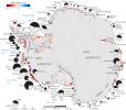
Rates of basal melt of Antarctic ice shelves (melting of the shelves from underneath) overlaid on a 2009 mosaic of Antarctica created from data from NASA's Terra and Aqua spacecraft.
PIA17284:
Rates of Basal Melt of Antarctic Ice Shelves
Full Resolution:     TIFF (7.23 MB)     JPEG (358.1 kB)
Add Image to Favorite List 2011-09-22 Earth Aquarius
Aquarius
2340x1024x3
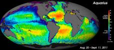
NASA's Aquarius instrument has produced its first global map of the salinity, or saltiness, of Earth's ocean surface, providing an early glimpse of the mission's anticipated discoveries.
PIA14786:
NASA's "Salt of the Earth" Aquarius Reveals First Map
Full Resolution:     TIFF (7.197 MB)     JPEG (439.4 kB)
Add Image to Favorite List 2011-12-07 Earth Aquarius
Aquarius
980x1558x3
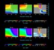
Tropical Storm Lee made landfall over New Orleans on Sept. 2-3, 2011, with predicted rainfall of 15 to 20 inches (38 to 51 centimeters) over southern Louisiana. These charts are from NASA's Aquarius spacecraft.
PIA15185:
NASA's Aquarius Detects Possible Effects of Tropical Storm Lee in Gulf
Full Resolution:     TIFF (4.587 MB)     JPEG (186.8 kB)
Add Image to Favorite List 2012-06-12 Earth Aquarius
Aquarius
3300x2550x3
NASA's Aquarius instrument on the Aquarius/SAC-D observatory gives an unprecedented look at a key factor involved in the formation of an oceanic wave feature in the tropical Pacific and Atlantic Oceans that influences global climate patterns.
PIA15799:
NASA's Aquarius Maps Ocean Salinity Structure
Full Resolution:     TIFF (8.427 MB)     JPEG (1.08 MB)
Add Image to Favorite List 2015-10-30 Earth Aquarius
AIRS
2400x1800x3
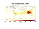
Data taken over three days by NASA's Aqua Satellite from October 14 through 16, and October 26 through 28, shows the high concentration and large extent of the fires over Indonesia are quite apparent.
PIA20042:
Carbon Monoxide in Mid-Troposphere over Indonesia Fires, October 2015
Full Resolution:     TIFF (1.047 MB)     JPEG (259.9 kB)
Add Image to Favorite List 2016-10-07 Earth Aquarius
AIRS
1041x800x3
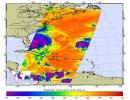
At 11:29 p.m. PDT on Oct. 6 (2:29 a.m. EDT on Oct. 7), NASA's Atmospheric Infrared Sounder (AIRS) instrument on NASA's Aqua satellite produced this false-color infrared image of Matthew as the storm moved up Florida's central coast.
PIA21097:
NASA's AIRS Examines Hurricane Matthew's Cloud Top Temperatures
Full Resolution:     TIFF (1.728 MB)     JPEG (159.9 kB)
Add Image to Favorite List 2005-06-02 Earth Aura
MLS
1013x939x3
This image from the Microwave Limb Sounder instrument on NASA's Aura spacecraft depicts the relationship between nitrous oxide levels and ozone loss, 2004-2005 Arctic winter.
PIA07994:
Microwave Limb Sounder Measurements Depicting the Relationship Between Nitrous Oxide Levels and Ozone Loss, 2004-2005 Arctic Winter
Full Resolution:     TIFF (2.858 MB)     JPEG (93.72 kB)
Add Image to Favorite List 2005-06-02 Earth Aura
MLS
642x335x3
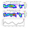
These data maps from the Microwave Limb Sounder on NASA's Aura spacecraft depict levels of hydrogen chloride, chlorine monoxide, and ozone at an altitude of approximately 19 km (490,000 ft) on selected days during the 2004-05 Arctic winter.
PIA07252:
Aura's Microwave Limb Sounder Estimates of Ozone Loss, 2004/2005 Arctic Winter
Full Resolution:     TIFF (646.1 kB)     JPEG (65.28 kB)
Add Image to Favorite List 2005-06-02 Earth Aura
Ozone Monitoring Instrument
2215x6554x3
Images from the Ozone Monitoring Instrument onboard NASA's Aura spacecraft shows the average total column ozone during the months of January and March, and the total column ozone on the single day of 11 March, 2005.
PIA07254:
Selected Measurements of Total Arctic Column Ozone Amounts from Aura's Ozone Monitoring Instrument, 2004-2005 Arctic Winter
Full Resolution:     TIFF (43.6 MB)     JPEG (1.489 MB)
Add Image to Favorite List 2005-06-02 Earth Aura
MLS
720x540x3
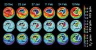
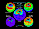
This still from an animation created from data from the Microwave Limb Sounder instrument on NASA's Aura spacecraft depicts the complex interaction of chemicals involved in the destruction of ozone during the 2005 Arctic winter.
PIA07255:
Aura Microwave Limb Sounder Animation Illustrating the Interaction Between Temperatures and Chemicals Involved in Ozone Destruction, 2004-2005 Arctic Winter Animation Icon
Full Resolution:     TIFF (1.168 MB)     JPEG (60.91 kB)
Add Image to Favorite List 2009-08-13 Earth Aura
TES
800x600x3
This vertical profile view from the Tropospheric Emission Spectrometer (TES) instrument on NASA's Aura satellite depicts the distribution of water vapor molecules over Earth's tropics across one transect of the satellite's orbit on January 6, 2006.
PIA12170:
A NASA Space Sleuth Hunts the Trail of Earth's Water
Full Resolution:     TIFF (1.442 MB)     JPEG (75.35 kB)
Add Image to Favorite List 2010-03-16 Earth Aura
MLS
760x760x3
NASA's Aura spacecraft sees El Niño's effects on the atmosphere. An El Niño is characterized by an abnormal warming of sea surface temperatures in the equatorial central and eastern Pacific Ocean.
PIA12961:
NASA's Aura Sees El Niño's Effects on the Atmosphere
Full Resolution:     TIFF (1.735 MB)     JPEG (91.76 kB)
Add Image to Favorite List 2011-10-02 Earth Aura
MLS
708x312x3
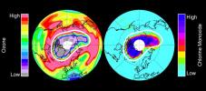
In mid-March 2011, NASA's Aura spacecraft observed ozone in Earth's stratosphere -- low ozone amounts are shown in purple and grey colors, large amounts of chlorine monoxide are shown in dark blue colors.
PIA14824:
Unprecedented Arctic Ozone Loss in 2011
Full Resolution:     TIFF (663.8 kB)     JPEG (44.02 kB)
Add Image to Favorite List 2012-02-06 Earth Aura
TES
1115x560x3
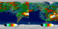
This frame from a time series, from one year of Tropospheric Emission Spectrometer (TES) measurements, shows how powerful the TES data are for understanding emissions, chemistry, and transport in the troposphere.
PIA15005:
Annual Variation in Global CO and O3 Animation Icon
Full Resolution:     TIFF (1.876 MB)     JPEG (70.63 kB)
Add Image to Favorite List 2012-02-06 Earth Aura
TES
1021x575x3
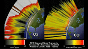
This frame from an animation depicts the distribution of O3 and CO in the atmosphere over North America. This visualization is based on data acquired by NASA's Tropospheric Emission Spectrometer (TES).
PIA15006:
O3 and CO Transects over North America Animation Icon
Full Resolution:     TIFF (1.764 MB)     JPEG (110.1 kB)
Add Image to Favorite List 2004-04-01 Earth Aura
TES
1041x761x3
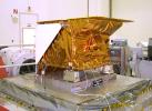
Technicians install NASA's Tropospheric Emission Spectrometer (TES) instrument on NASA's Aura spacecraft prior to launch in July 2004.
PIA15608:
NASA's Tropospheric Emission Spectrometer (TES) Instrument Onboard Aura
Full Resolution:     TIFF (2.378 MB)     JPEG (128.1 kB)
Add Image to Favorite List 2024-09-25 Earth Carbon Mapper Coalition
Carbon Mapper Imaging Spectrometer
1133x1326x3
An imaging spectrometer designed by NASA's Jet Propulsion Laboratory captured its first data over Karachi, Pakistan, on Sept. 19, 2024.
PIA26412:
Tanager-1 First Light
Full Resolution:     TIFF (2.663 MB)     JPEG (215.2 kB)
Add Image to Favorite List 2024-10-10 Earth Carbon Mapper Coalition
Carbon Mapper Imaging Spectrometer
7680x7680x3
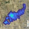
On Sept. 19, 2024, the imaging spectrometer on the Carbon Mapper Coalition's Tanager-1 satellite detected this methane plume in Karachi, Pakistan, extending nearly 2½ miles (4 kilometers) from a landfill.
PIA26416:
Tanager-1 First Methane and Carbon Dioxide Plume Detections
Full Resolution:     TIFF (161.9 MB)     JPEG (7.602 MB)
Add Image to Favorite List 1997-10-23 Earth Cassini-Huygens
1520x2280x3
This image from 1997 is of the Titan IVB/Centaur carrying NASA's Cassini spacecraft at Launch Complex 40 on Cape Canaveral Air Station, the Mobile Service Tower has been retracted away.
PIA00747:
Cassini Orbiter and Huygens Probe aboard the Titan IV
Full Resolution:     TIFF (8.635 MB)     JPEG (493.9 kB)
Add Image to Favorite List 1997-10-23 Earth Cassini-Huygens
1536x2304x3
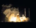
A seven-year journey to the ringed planet Saturn began on Oct. 15, 1997 with the liftoff of a Titan IVB/Centaur carrying NASA's Cassini orbiter and its attached Huygens probe.
PIA00748:
Launch of Cassini Orbiter and Huygens Probe on Titan IV
Full Resolution:     TIFF (7.255 MB)     JPEG (285.3 kB)
Add Image to Favorite List 1997-10-23 Earth Cassini-Huygens
2280x1800x3
A seven-year journey to the ringed planet Saturn began on Oct. 15, 1997 with the liftoff of a Titan IVB/Centaur carrying NASA's Cassini orbiter and its attached Huygens probe
PIA00749:
Launch of Cassini Orbiter and Huygens Probe on Titan IV
Full Resolution:     TIFF (9.054 MB)     JPEG (483.3 kB)
Add Image to Favorite List 1997-10-23 Earth Cassini-Huygens
1901x2850x3
A seven-year journey to the ringed planet Saturn begins with the liftoff of a Titan IVB/Centaur carrying NASA's Cassini orbiter and its attached Huygens probe.
PIA01050:
Launch of Cassini Orbiter and Huygens Probe on Titan IV
Full Resolution:     TIFF (10.63 MB)     JPEG (504.5 kB)
Add Image to Favorite List 1997-10-23 Earth Cassini-Huygens
1800x2280x3
A seven-year journey to the ringed planet Saturn begins with the liftoff of a Titan IVB/Centaur carrying NASA's Cassini orbiter and its attached Huygens probe.
PIA01051:
Launch of Cassini Orbiter and Huygens Probe on Titan IV
Full Resolution:     TIFF (6.213 MB)     JPEG (300.9 kB)
Add Image to Favorite List 1999-09-10 Moon Cassini-Huygens
ISS - Narrow Angle
1084x1025x1
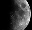
This narrow angle image taken NASA's Cassini's camera system of the Moon is one of the best of a sequence of narrow angle frames taken as the spacecraft passed by the Moon on the way to its closest approach with Earth on August 17, 1999.
PIA02321:
Single Still Image
Full Resolution:     TIFF (655.5 kB)     JPEG (96.1 kB)
Add Image to Favorite List 1999-09-10 Moon Cassini-Huygens
ISS - Narrow Angle
1424x1024x1
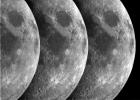
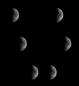
This composite image was made from NASA's Cassini which captured a significant portion of the Moon during a Moon flyby imaging sequence.All three images have been scaled so that the brightness of Crisium basin, the dark circular region in the upper right.
PIA02322:
Triptych of the Moon
Full Resolution:     TIFF (1.407 MB)     JPEG (189.1 kB)
Add Image to Favorite List 1999-09-01 Moon Cassini-Huygens
ISS - Narrow Angle
712x512x1
This frame from a movie of the Moon was made from NASA's Cassini narrow-angle camera as the spacecraft passed by the Moon on the way to its closest approach with Earth on August 17, 1999
.
PIA02323:
Narrow Angle Movie Animation Icon
Full Resolution:
Add Image to Favorite List 1999-09-01 Moon Cassini-Huygens
ISS - Wide Angle
413x300x1
This frame from a movie of the Moon was made from NASA's Cassini wide-angle camera as the spacecraft passed by the Moon on the way to its closest approach with Earth on August 17, 1999
.
PIA02324:
Wide Angle Movie Animation Icon
Full Resolution:
Add Image to Favorite List 2006-09-19 Earth Cassini-Huygens
ISS - Wide Angle
243x226x1
NASA's Cassini casts powerful eyes on our home planet, and captures Earth, a pale blue orb, and a faint suggestion of our moon, among the glories of the Saturn system in this image taken Sept. 15, 2006.
PIA08323:
Pale Blue Orb
Full Resolution:     TIFF (55.2 kB)     JPEG (2.363 kB)
Add Image to Favorite List 2009-09-24 Moon Cassini-Huygens
VIMS
ISS
1024x880x3
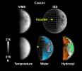
NASA's Cassini spacecraft observations of Earth's moon on Aug. 19, 1999 show water and hydroxyl at all latitudes on the surface, even areas exposed to direct sunlight.
PIA12228:
Cassini's Look at Water on the Moon
Full Resolution:     TIFF (2.707 MB)     JPEG (73.38 kB)
Add Image to Favorite List 2013-07-22 Earth Cassini-Huygens
Imaging Science Subsystem
984x984x3
The cameras on NASA's Cassini spacecraft captured this rare look at Earth and its moon from Saturn orbit on July 19, 2013.
PIA14949:
One Special Day in the Life of Planet Earth
Full Resolution:     TIFF (2.906 MB)     JPEG (16.8 kB)
Add Image to Favorite List 2013-07-22 Earth Cassini-Huygens
ISS - Wide Angle
941x826x3
The cameras on NASA's Cassini spacecraft captured this rare look at Earth and its moon from Saturn orbit on July 19, 2013. The image has been magnified five times.
PIA17170:
One Special Day in the Life of Planet Earth -- Close-Up
Full Resolution:     TIFF (2.333 MB)     JPEG (16.07 kB)
Add Image to Favorite List 2017-04-20 Earth Cassini-Huygens
Imaging Science Subsystem
1020x1020x1
This view from NASA's Cassini spacecraft shows planet Earth as a point of light between the icy rings of Saturn. Cassini was 870 million miles (1.4 billion kilometers) away from Earth when the image was taken.
PIA21445:
Earth Between the Rings of Saturn
Full Resolution:     TIFF (529.2 kB)     JPEG (28.99 kB)
Add Image to Favorite List 2009-09-24 Moon Cassini-Huygens
Chandrayaan-1
Moon Mineralogy Mapper
VIMS
1410x1120x3
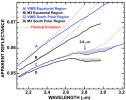
This graph compares detailed measurements of light from the moon, called spectra, taken by NASA's Cassini spacecraft and NASA's Moon Mineralogy Mapper instrument on the Indian Space Research Organization's Chandrayaan-1 spacecraft.
PIA12227:
Cassini and Chandrayaan-1 Agree
Full Resolution:     TIFF (4.747 MB)     JPEG (159.6 kB)
Add Image to Favorite List 2008-12-17 Moon Chandrayaan-1
Moon Mineralogy Mapper
631x635x3
Different wavelengths of light provide new information about the Orientale Basin region of the moon in a composite image taken by NASA's Moon Mineralogy Mapper, a guest instrument aboard the Indian Space Research Organization's Chandrayaan-1 spacecraft.
PIA11727:
NASA's Moon Mineralogy Mapper
Full Resolution:     TIFF (1.204 MB)     JPEG (65.59 kB)
Add Image to Favorite List 2009-08-03 Moon Chandrayaan-1
Moon Mineralogy Mapper
1709x669x3
NASA's Moon Minerology Mapper, a guest instrument onboard the Indian Space Research Organization's Chandrayaan-1 mission to the moon, looks homeward. Australia is visible in the lower center of the image.
PIA12158:
Moon Mapper Looks Homeward
Full Resolution:     TIFF (3.436 MB)     JPEG (43.77 kB)
Add Image to Favorite List 2009-09-24 Moon Chandrayaan-1
Moon Mineralogy Mapper
1260x780x3
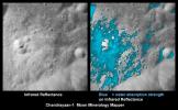
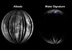
Rays of Water and Hydroxyl
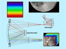
PIA12225:
Rays of Water and Hydroxyl
Full Resolution:     TIFF (2.952 MB)     JPEG (133.4 kB)
Add Image to Favorite List 2009-09-24 Moon Chandrayaan-1
Moon Mineralogy Mapper
630x390x3
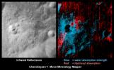
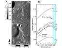
Water Around a Fresh Crater
PIA12226:
Water Around a Fresh Crater
Full Resolution:     TIFF (738.1 kB)     JPEG (47.87 kB)
Add Image to Favorite List 2009-09-24 Moon Chandrayaan-1
Moon Mineralogy Mapper
800x601x3
Mineral Mapping the Moon
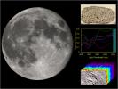
PIA12229:
Mineral Mapping the Moon
Full Resolution:     TIFF (1.444 MB)     JPEG (59.63 kB)
Add Image to Favorite List 2009-09-24 Moon Chandrayaan-1
Moon Mineralogy Mapper
800x627x3
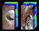
Colorful Cubes of Light
PIA12230:
Colorful Cubes of Light
Full Resolution:     TIFF (1.507 MB)     JPEG (101.1 kB)
Add Image to Favorite List 2009-09-24 Moon Chandrayaan-1
Moon Mineralogy Mapper
800x600x3
Dispersing Light through the Moon Mineralogy Mapper
PIA12232:
Dispersing Light through the Moon Mineralogy Mapper
Full Resolution:     TIFF (1.442 MB)     JPEG (77.51 kB)
Add Image to Favorite List 2009-09-24 Moon Chandrayaan-1
Moon Mineralogy Mapper
800x600x3
Mapping the Moon, Point by Point
PIA12233:
Mapping the Moon, Point by Point
Full Resolution:     TIFF (1.442 MB)     JPEG (72.78 kB)
Add Image to Favorite List 2009-09-24 Moon Chandrayaan-1
Moon Mineralogy Mapper
2048x1600x3
Craters and the Tell-Tale Signatures
PIA12234:
Craters and the Tell-Tale Signatures
Full Resolution:     TIFF (9.843 MB)     JPEG (252.4 kB)
Add Image to Favorite List 2009-09-24 Moon Chandrayaan-1
Moon Mineralogy Mapper
2000x1400x3
Nearside of the Moon
PIA12235:
Nearside of the Moon
Full Resolution:     TIFF (8.411 MB)     JPEG (250.2 kB)
Add Image to Favorite List 2009-09-24 Moon Chandrayaan-1
Moon Mineralogy Mapper
1950x1950x3
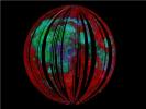
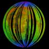
This image of the moon is from NASA's Moon Mineralogy Mapper on the Indian Space Research Organization's Chandrayaan-1 mission. It is a three-color composite of reflected near-infrared radiation from the sun.
PIA12237:
Water Detected at High Latitudes
Full Resolution:     TIFF (11.42 MB)     JPEG (559.2 kB)
Add Image to Favorite List 2009-09-24 Moon Chandrayaan-1
Moon Mineralogy Mapper
492x496x3
Data from NASA's Moon Mineralogy Mapper instrument on the Indian Space Research Organization's Chandrayaan-1 spacecraft reveal subtle and previously unknown lunar diversity and features. Animation available at the Photojournal.
PIA12238:
Invisible Colors of the Moon Animation Icon
Full Resolution:     TIFF (733.1 kB)     JPEG (19.21 kB)
Add Image to Favorite List 2006-06-06 Earth CloudSat
Cloud Profiling Radar (CPR)
1190x209x3
NASA's CloudSat satellite's first image, of a warm front storm over the Norwegian Sea, was obtained on May 20, 2006.
PIA08517:
CloudSat First Image of a Warm Front Storm Over the Norwegian Sea
Full Resolution:     TIFF (747.2 kB)     JPEG (30.16 kB)
Add Image to Favorite List 2006-06-06 Earth CloudSat
Cloud Profiling Radar (CPR)
1194x211x3
NASA's CloudSat satellite's image of a horizontal cross-section of tropical clouds and thunderstorms over east Africa.
PIA08519:
CloudSat Image of Tropical Thunderstorms Over Africa
Full Resolution:     TIFF (756.9 kB)     JPEG (39.7 kB)
Add Image to Favorite List 2006-06-06 Earth CloudSat
Cloud Profiling Radar (CPR)
1188x208x3
NASA's CloudSat satellite's image of a horizontal cross-section of a polar night storm near Antarctica.
PIA08518:
CloudSat Image of a Polar Night Storm Near Antarctica
Full Resolution:     TIFF (742.4 kB)     JPEG (30.42 kB)
Add Image to Favorite List 2006-06-12 Earth CloudSat
Cloud Profiling Radar (CPR)
600x105x3
NASA's CloudSat satellite captured its first tropical storm, Alberto, as it spun over the Gulf of Mexico the morning of June 12, 2006.
PIA08538:
Tropical Storm Alberto, Seen Through New "Eyes"
Full Resolution:     TIFF (64.85 kB)     JPEG (13.85 kB)
Add Image to Favorite List 2006-07-13 Earth CloudSat
Cloud Profiling Radar (CPR)
940x162x3
NASA's CloudSat satellite captured the highest, coldest clouds located near the center of Hurricane Bud on July 12, 2006.
PIA08599:
CloudSat Overflight of Hurricane Bud
Full Resolution:     TIFF (457.7 kB)     JPEG (23.5 kB)
Add Image to Favorite List 2006-07-25 Earth CloudSat
Cloud Profiling Radar (CPR)
960x498x3
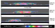
Hurricane Daniel intensified between July 18 and July 23rd. NASA's CloudSat satellite was able to capture and confirm this transformation in its side-view images of Hurricane Daniel.
PIA08642:
NASA's CloudSat Captures Hurricane Daniel's Transformation
Full Resolution:     TIFF (1.436 MB)     JPEG (67.35 kB)
Add Image to Favorite List 2006-08-09 Earth CloudSat
Cloud Profiling Radar (CPR)
733x541x3
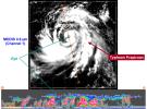
At approximately 0553 UTC (1:53 am EDT), on 2 Aug 2006, NASA's CloudSat satellite flew over the eye of Typhoon Prapiroon as it approached southern China.
PIA08651:
Typhoon Prapiroon viewed by CloudSat
Full Resolution:     TIFF (1.191 MB)     JPEG (78.42 kB)
Add Image to Favorite List 2007-05-10 Earth CloudSat
Cloud Profiling Radar (CPR)
Moderate Resolution Imaging Spectroradiometer (MODIS)
864x1108x3
NASA's CloudSat Cloud Profiling Radar captured a profile across Tropical Storm Andrea on Wednesday, May 9, 2007, near the South Carolina/Georgia/Florida Atlantic coast.
PIA09379:
CloudSat Profiles Tropical Storm Andrea
Full Resolution:     TIFF (2.875 MB)     JPEG (159.7 kB)
Add Image to Favorite List 2007-06-07 Earth CloudSat
Cloud Profiling Radar (CPR)
Moderate Resolution Imaging Spectroradiometer (MODIS)
1277x1539x3
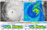
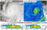
The image of Tropical Cyclone Gonu in the upper panel was taken by the Moderate Resolution Imaging Spectroradiometer (MODIS) instrument on NASA's Aqua satellite on June 5, 2007, at approximately 20:20 UTC.
PIA09601:
Tropical Cyclone Gonu Viewed by CloudSat
Full Resolution:     TIFF (5.902 MB)     JPEG (317.8 kB)
Add Image to Favorite List 2007-06-28 Earth CloudSat
Cloud Profiling Radar (CPR)
1095x542x3
This image was taken on June 26, 2007 by NASA's CloudSat satellite. In this image an obvious storm hangs over the middle of the United States.
PIA09697:
Rain Floods Central Texas
Full Resolution:     TIFF (1.783 MB)     JPEG (143.8 kB)
Add Image to Favorite List 2008-02-08 Earth CloudSat
Cloud Profiling Radar (CPR)
682x850x3
NASA's CloudSat satellite made a nighttime overpass of the thunderstorms responsible for the tornadic outbreak over Kentucky, Tennessee, and Mississippi on Tuesday, February 5, 2008.
PIA10236:
CloudSat Profiles Tornadic Outbreak
Full Resolution:     TIFF (1.741 MB)     JPEG (104.8 kB)
Add Image to Favorite List 2009-08-21 Earth CloudSat
AMSR-E
Cloud Profiling Radar (CPR)
MODIS
1728x1108x3
NASA's satellite CloudSat captured an extraordinary eye overpass of a category 4 Hurricane Bill on August 19, 2009 at 1720 UTC (1220 EDT). Bill's maximum sustained winds are 132 mph (115 knots) with a central pressure of 947 mb.
PIA12179:
Hurricane Bill Eye Overpass
Full Resolution:     TIFF (5.753 MB)     JPEG (381.1 kB)
Add Image to Favorite List 2009-09-15 Earth CloudSat
AMSR-E
Cloud Profiling Radar (CPR)
MODIS
960x616x3
NASA's CloudSat satellite captured an eye overpass of Super Typhoon Choi-Wan in the Western Pacific on September 15, 2009 at 0352Z.
PIA12198:
CloudSat Peers Into the Heart of a Super Typhoon
Full Resolution:     TIFF (1.777 MB)     JPEG (143.8 kB)
Add Image to Favorite List 2010-08-19 Earth CloudSat
Cloud Profiling Radar (CPR)
MODIS
1055x1419x3
In late July 2010, flooding caused by heavy monsoon rains began in several regions of Pakistan. This image from NASA's Aqua spacecraft reveals the bright white cloud tops from the cluster of thunderstorms.
PIA13340:
NASA's CloudSat Spots Beginning of Pakistan Floods
Full Resolution:     TIFF (4.497 MB)     JPEG (200.3 kB)
Add Image to Favorite List 2012-10-30 Earth CloudSat
Cloud Profiling Radar (CPR)
1201x206x3
NASA's CloudSat spacecraft overpassed Hurricane Sandy on Oct. 29, 2012 just as Sandy was approaching the Atlantic coastline. Sandy contained estimated maximum sustained winds of 90 miles per hour (78 knots).
PIA16201:
CloudSat's View of Hurricane Sandy Animation Icon
Full Resolution:     TIFF (742.7 kB)     JPEG (52.4 kB)
Add Image to Favorite List 2012-10-29 Earth CloudSat
Cloud Profiling Radar (CPR)
1196x206x3
NASA's CloudSat passed over Sandy at 10:32 a.m. EDT on Oct. 27, 2012. Light to moderate precipitation associated with parts of the outer bands of Hurricane Sandy were moving on shore into parts of North Carolina.
PIA16436:
NASA's CloudSat Views Hurricane Sandy
Full Resolution:     TIFF (739.6 kB)     JPEG (44.93 kB)
Add Image to Favorite List 2013-08-22 Earth CloudSat
Cloud Profiling Radar (CPR)
MODIS
1199x206x3
NASA's CloudSat satellite flew over Typhoon Utor in the West Pacific on Aug. 11, 2013 at 0518 UTC, passing within about 6.2 miles (10 kilometers) from the center of the storm, and revealing the structure of the storm's eye and eyewall.
PIA17413:
NASA's CloudSat Eyes Powerful Typhoon Utor
Full Resolution:     TIFF (741.5 kB)     JPEG (52.9 kB)
Add Image to Favorite List 2015-05-22 Earth CloudSat
MODIS
960x540x3
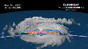
NASA's CloudSat satellite completed a stunning eye overpass of Typhoon Dolphin in the western Pacific Ocean on May 16, 2015, at 0407 UTC.
PIA19475:
NASA's CloudSat Peers Into the Eye of Powerful Typhoon Dolphin Animation Icon
Full Resolution:     TIFF (1.556 MB)     JPEG (61.88 kB)
Add Image to Favorite List 2016-10-07 Earth CloudSat
Cloudsat
1258x1395x3
NASA's CloudSat flew east of Hurricane Matthew's center on Oct. 6 at 11:30 a.m. PDT (2:30 p.m. EDT), intersecting parts of Matthew's outer rain bands and revealing Matthew's anvil clouds.
PIA21095:
CloudSat Takes a 3D Slice of Hurricane Matthew
Full Resolution:     TIFF (4.619 MB)     JPEG (337.9 kB)
Add Image to Favorite List 2017-08-29 Earth CloudSat
Cloud Profiling Radar (CPR)
960x540x3
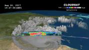
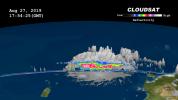
NASA's CloudSat satellite flew over then-Tropical Storm Harvey on Aug. 26, 2017, at 2:45 p.m. CDT (19:45 UTC) as the storm was nearly stationary over south Texas.
PIA17392:
NASA's CloudSat Sees Tropical Storm Harvey in 3D
Full Resolution:     TIFF (1.012 MB)     JPEG (68.11 kB)
Add Image to Favorite List 2017-09-08 Earth CloudSat
Cloud Profiling Radar (CPR)
1672x938x3
NASA's CloudSat satellite flew over Hurricane Irma on Sept. 6, 2017 at 1:45 p.m. EDT (17:45 UTC) as the storm was approaching Puerto Rico in the Atlantic Ocean.
PIA21947:
Powerful Hurricane Irma Seen in 3D by NASA's CloudSat
Full Resolution:     TIFF (1.206 MB)     JPEG (50.3 kB)
Add Image to Favorite List 2017-09-20 Earth CloudSat
Cloud Profiling Radar (CPR)
1672x938x3
NASA's CloudSat satellite flew over Hurricane Maria on Sept. 17, 2017, at 1:23 p.m. EDT (17:23 UTC) as the storm had just strengthened into a hurricane in the Atlantic Ocean.
PIA21961:
Taking a 3-D Slice of Hurricane Maria's Cloud Structure
Full Resolution:     TIFF (1.581 MB)     JPEG (63.81 kB)
Add Image to Favorite List 2018-10-11 Earth CloudSat
Cloud Profiling Radar (CPR)
953x533x3
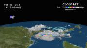
NASA's CloudSat satellite passed over Hurricane Michael on October 9, 2018, at 3:15 p.m. EDT (19:15 UTC) as the storm was intensifying and moving northwest toward the Florida panhandle in the Gulf of Mexico.
PIA22753:
NASA's CloudSat Passes Over Hurricane Michael
Full Resolution:     TIFF (720.4 kB)     JPEG (50.54 kB)
Add Image to Favorite List 2019-08-29 Earth CloudSat
Cloud Profiling Radar (CPR)
1632x918x3
Data from NASA's CloudSat satellite, acquired on Aug., 2019, at 2 p.m. EDT (11 a.m. PDT) was used to make this 3D animation of then-Tropical Storm Dorian. It shows cloud heights extending 9 miles (15 kilometers) into the atmosphere.
PIA23359:
NASA's CloudSat Images Dorian in 3D
Full Resolution:     TIFF (1.707 MB)     JPEG (97.89 kB)
Add Image to Favorite List 2022-02-08 Earth COWVR
Compact Ocean Wind Vector Radiometer (COWVR)
8817x3019x3
This map, made using COWVR's new observations, shows Earth's microwave emissions at a frequency that provides information on the strength of winds at the ocean surface, the amount of water in clouds, and the amount of water vapor in the atmosphere.
PIA24985:
COWVR's New Map
Full Resolution:     TIFF (78.07 MB)     JPEG (4.831 MB)
Add Image to Favorite List 2022-09-28 Earth COWVR
COWVR
TEMPEST
1564x1527x3
From aboard the International Space Station, NASA-built instruments COWVR and TEMPEST captured wind and water vapor data from Hurricane Ian as the storm neared Cuba.
PIA25425:
COWVR and TEMPEST Image Hurricane Ian
Full Resolution:     TIFF (5.736 MB)     JPEG (250.1 kB)
Add Image to Favorite List 2023-02-23 Earth COWVR
COWVR
TEMPEST
1752x1526x3
Data from the COWVR and TEMPEST instruments aboard the ISS was used to create this image of Tropical Cyclone Mandous, which forecasters used to understand the December 2022 storm's intensity and predict its path toward southern India.
PIA25565:
COWVR, TEMPEST Track Tropical Cyclone Mandous
Full Resolution:     TIFF (4.653 MB)     JPEG (210.3 kB)
Add Image to Favorite List 2023-08-29 Earth COWVR
COWVR
TEMPEST
1576x1527x3
A pair of weather instruments built at NASA's Jet Propulsion Laboratory in Southern California captured images of Hurricane Idalia as the storm approached the Gulf Coast of Florida on Aug. 29, 2023.
PIA25569:
COWVR, TEMPEST Capture Vital Data on Hurricane Idalia
Full Resolution:     TIFF (5.962 MB)     JPEG (250.3 kB)
Add Image to Favorite List 2023-08-29 Earth COWVR
COWVR
TEMPEST
1606x1527x3
A pair of weather instruments built at NASA's Jet Propulsion Laboratory in Southern California captured images of Hurricane Franklin as the Category 4 storm moved off the East Coast of the United States on Aug. 29, 2023.
PIA25870:
COWVR, TEMPEST Capture Vital Data on Hurricane Franklin
Full Resolution:     TIFF (3.924 MB)     JPEG (155.7 kB)
Add Image to Favorite List 2013-07-08 Earth CSIRO Parkes Observatory
Parks Telescope
3220x2225x3
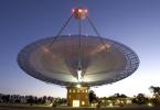
This image shows the Parkes telescope in Australia, part of the Commonwealth Scientific and Industrial Research Organization. Researchers used the telescope to detect the first population of radio bursts known to originate from beyond our galaxy.
PIA17248:
Parkes Telescope
Full Resolution:     TIFF (21.5 MB)     JPEG (882.5 kB)
Add Image to Favorite List 2018-09-20 Earth CubeSat
790x787x3
This image combines NASA's TEMPEST-D data with a visible image of the storm from NASA's GOES weather satellite revealing the eye of the storm surrounded by towering, intense rain bands.
PIA22652:
Hurricane Florence as Seen from a CubeSat Animation Icon
Full Resolution:     TIFF (1.357 MB)     JPEG (144.5 kB)
Add Image to Favorite List 2018-09-25 Earth CubeSat
478x318x3
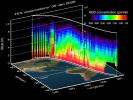
This image shows the size of NASA's tiny weather satellite, Raincube, in comparison to the International Space Station. RainCube was deployed into low-Earth orbit from the ISS in July, 2018.
PIA22653:
Mini Mission RainCube is Sent into Earth Orbit
Full Resolution:     TIFF (330.8 kB)     JPEG (210.5 kB)
Add Image to Favorite List 2018-09-25 Earth CubeSat
1280x434x3
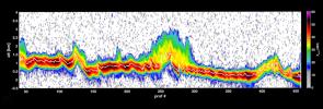
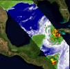
This graph shows the first data from NASA's RainCube satellite. The data shows a vertical snapshot of a storm over the mountains in Mexico in late August 2018, as measured by RainCube's radar.
PIA22654:
RainCube Collects First Storm Data
Full Resolution:     TIFF (759.9 kB)     JPEG (106.9 kB)
Add Image to Favorite List 2019-05-16 Earth CubeSat
2592x2192x1
This image of the greater Los Angeles area was taken on March 29, 2019 by ASTERIA, the Arcsecond Space Telescope Enabling Research in Astrophysics satellite. The Port of Long Beach is visible near the center of the image.
PIA23124:
ASTERIA Image of Los Angeles 1
Full Resolution:     TIFF (4.729 MB)     JPEG (440.4 kB)
Add Image to Favorite List 2019-05-16 Earth CubeSat
2592x2192x1
This image of the greater Los Angeles area was taken on March 29, 2019, by ASTERIA, the Arcsecond Space Telescope Enabling Research in Astrophysics satellite. It shows a region of about 43.5 square miles with a resolution of about 100 feet per pixel.
PIA23125:
ASTERIA Image of Los Angeles 2
Full Resolution:     TIFF (4.963 MB)     JPEG (831.4 kB)
Add Image to Favorite List 2019-08-29 Earth CubeSat
1400x778x3
Hurricane Dorian off the coast of Puerto Rico, as seen by the small satellite TEMPEST-D on Aug. 28, 2019 (local time). The colors in the image reveal the heavy rain and moisture inside the storm.
PIA23414:
Small Satellite TEMPEST-D Sees Hurricane Dorian off Coast
Full Resolution:     TIFF (1.738 MB)     JPEG (121.2 kB)
Add Image to Favorite List 2019-09-04 Earth CubeSat
1400x788x3
Hurricane Dorian off the coast of Florida, as seen by the small satellite TEMPEST-D at 2 a.m. EDT on Sep. 3, 2019 (11 p.m PDT on Sept. 2, 2019). The layers in the animation reveal slices of the hurricane from four depths.
PIA23431:
TEMPEST-D CubeSat Sees Hurricane Dorian in 3D
Full Resolution:     TIFF (1.581 MB)     JPEG (105.9 kB)
Add Image to Favorite List 2009-09-24 Moon Deep Impact
1000x750x3
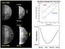
Observations from NASA's Deep Impact mission of the moon's north pole from June 2 to 9, 2009 reveal changes in the amounts of water and hydroxyl.
PIA12222:
Water Abundances Change with Time of Day
Full Resolution:     TIFF (2.253 MB)     JPEG (86.12 kB)
Add Image to Favorite List 2009-09-24 Moon Deep Impact
1000x750x3
This chart highlights observations from NASA's Deep Impact mission of the northern polar regions of the moon acquired on June 9, 2009. The water signature varies significantly across the lunar surface.
PIA12223:
Water Abundance Dependent on Temperature
Full Resolution:     TIFF (2.253 MB)     JPEG (61.51 kB)
Add Image to Favorite List 2009-09-24 Moon Deep Impact
1000x495x3
Since successfully carrying out its spectacular impact experiment at comet Tempel 1 on July 4, 2005, the Deep Impact spacecraft observed the moon for calibration purposes on several occasions. In June 2009, the northern polar regions were observed.
PIA12224:
Deep Impact Identifies Water on the Lunar Surface
Full Resolution:     TIFF (1.487 MB)     JPEG (60.06 kB)
Add Image to Favorite List 1996-06-03 Moon DSPSE
Ultraviolet/Visible Camera
7943x7943x1
This orthographic projection is centered on the south polar region of the moon as seen by NASA's Clementine spacecraft. The Schrodinger Basin is located in the lower right of the mosaic.
PIA00001:
South Pole Region of the Moon as Seen by Clementine
Full Resolution:     TIFF (32.98 MB)     JPEG (6.572 MB)     PNG (26.32 MB)
Add Image to Favorite List 1996-06-03 Moon DSPSE
Ultraviolet/Visible Camera
7738x7730x1
Lunar mosaic of ~1500 NASA Clementine images of the north polar region of the moon.
PIA00002:
North Pole Region of the Moon as Seen by Clementine
Full Resolution:     TIFF (37.43 MB)     JPEG (5.483 MB)
Add Image to Favorite List 1998-06-03 Moon DSPSE
Ultraviolet/Visible Camera
4316x4299x3
The Aristarchus region is one of the most diverse and interesting areas on the Moon. About 500 images from NASA's Clementine spacecraft were processed and combined into a multispectral mosaic of this region.
PIA00090:
Multispectral Mosaic of the Aristarchus Crater and Plateau
Full Resolution:     TIFF (45.47 MB)     JPEG (1.293 MB)
Add Image to Favorite List 1998-06-04 Moon DSPSE
Ultraviolet/Visible Camera
1719x1719x1
This image taken in 1994 by Clementine 1, Mare Moscoviense (dark albedo feature upper left of image center) and South Pole-Aitken Basin (dark feature at bottom) represent maria regions largely absent on the lunar farside.
PIA00302:
Nearside of Earth's Moon as Seen by the Clementine Spacecraft
Full Resolution:     TIFF (1.905 MB)     JPEG (265.4 kB)
Add Image to Favorite List 1998-06-04 Moon DSPSE
Ultraviolet/Visible Camera
1719x1719x1
The dark albedo features Mare Smythii (image center) and Mare Marginis (above Smythii) are visible in this image of the Moon from NASA's Clementine spacecraft.
PIA00303:
East Limb View of Earth's Moon as Seen by the Clementine Spacecraft
Full Resolution:     TIFF (2.029 MB)     JPEG (303.8 kB)
Add Image to Favorite List 1998-06-04 Moon DSPSE
Ultraviolet/Visible Camera
1719x1719x1
Mare Moscoviense (dark albedo feature upper left of image center) and South Pole-Aitken Basin (dark feature at bottom) represent maria regions largely absent on the lunar farside in this image from NASA's Clementine spacecraft.
PIA00304:
Farside View of Earth's Moon as Seen by the Clementine Spacecraft
Full Resolution:     TIFF (1.976 MB)     JPEG (318.8 kB)
Retrieve Previous Set  Jump to a Previous Set   Jump to a Previous Set   Jump to a Previous Set   Current Set   Jump to a Following Set   Jump to a Following Set   Jump to a Following Set   Jump to a Following Set   Jump to a Following Set   Jump to a Following Set   Retrieve Next Set 
 1-100   101-200   201-300   301-400   401-500   501-600   601-700   701-800   801-900   901-1000 
Currently displaying images: 301 - 400 of 2624