- Original Caption Released with Image:
-
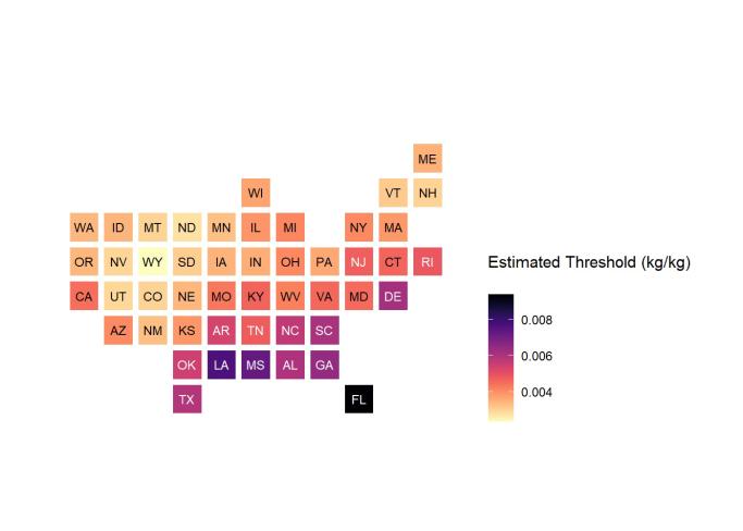
This chart shows low-humidity thresholds that signal flu outbreaks in 48 U.S. states, calculated using water vapor data from NASA's Atmospheric Infrared Sounder (AIRS) instrument on the Aqua satellite with data on U.S. flu cases from 2003 to 2015. The color range from lighter to darker indicates lower to higher humidity thresholds, with the driest state, Wyoming, having the lowest threshold and Florida the highest. Units are kilograms of water per kilogram of air. More information about AIRS can be found at https://airs.jpl.nasa.gov.
- Image Credit:
-
NASA/JPL-Caltech
Image Addition Date: -
2022-03-04
|