My
List |
Addition Date
|
Target
|
Mission
|
Instrument
|
Size
|

|
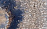
2013-08-16 |
Earth
|
Terra
|
ASTER
|
2523x2922x3 |

|
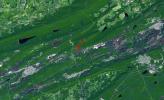
-
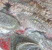
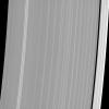
PIA17411:
-
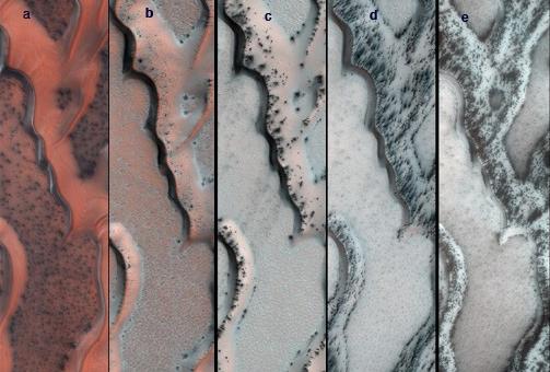
Star Dunes, Algeria
Full Resolution:
TIFF
(22.12 MB)
JPEG
(1.491 MB)
|
|
|
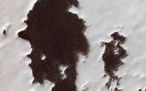
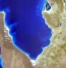
2013-08-08 |
Mars
|
Mars Reconnaissance Orbiter (MRO)
|
HiRISE
|
2880x1800x3 |
|
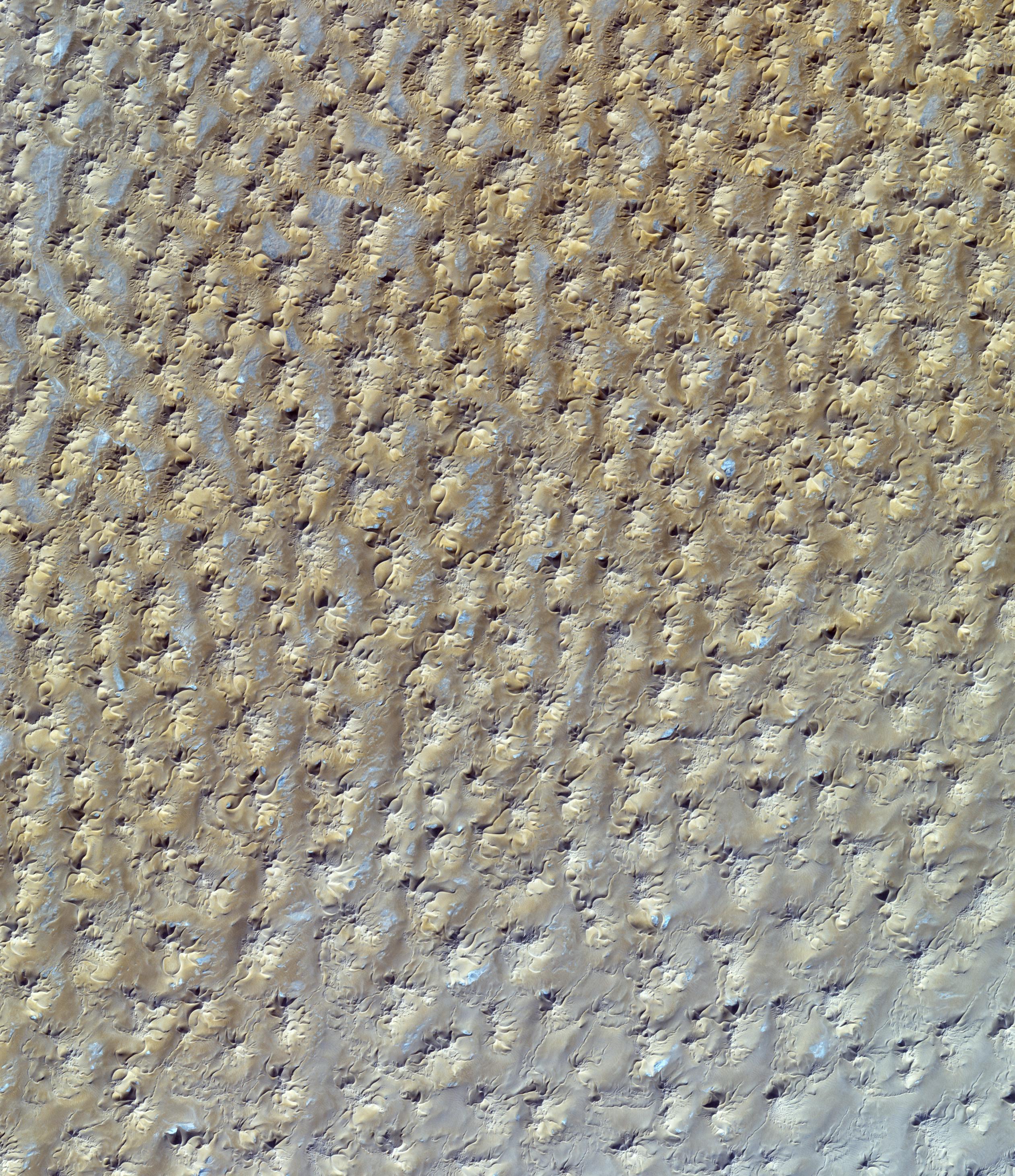
-
PIA17638:
-
Bright Dunes in Syria Planum
Full Resolution:
TIFF
(15.56 MB)
JPEG
(1.179 MB)
|
|
|
2013-08-08 |
Mars
|
Mars Reconnaissance Orbiter (MRO)
|
HiRISE
|
2880x1800x3 |
|
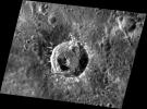
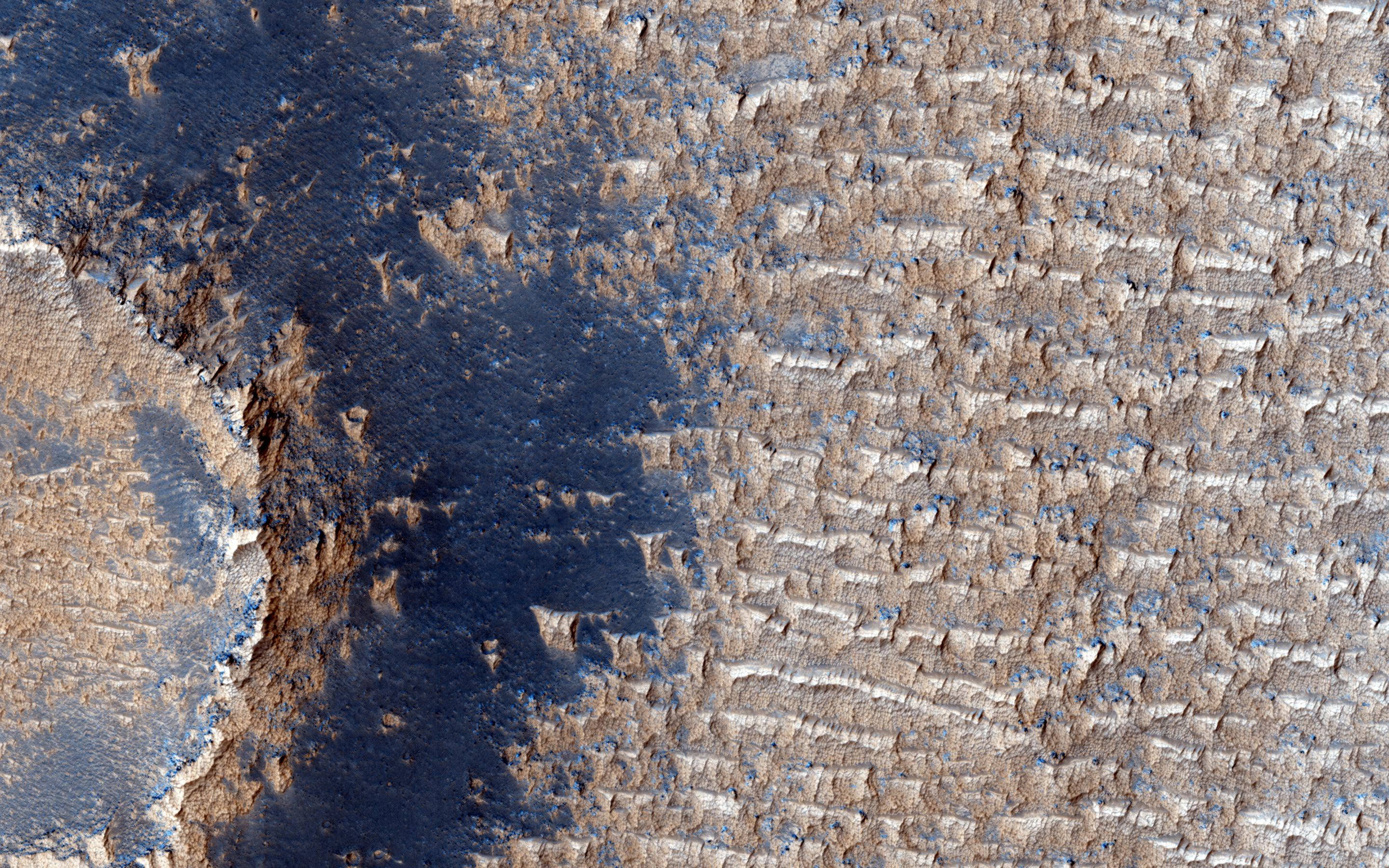
-
PIA17636:
-
Polygonal Surface Patterns at the South Pole
Full Resolution:
TIFF
(15.56 MB)
JPEG
(553.2 kB)
|
|
|
2013-08-08 |
Mars
|
Mars Reconnaissance Orbiter (MRO)
|
HiRISE
|
2880x1800x3 |

|
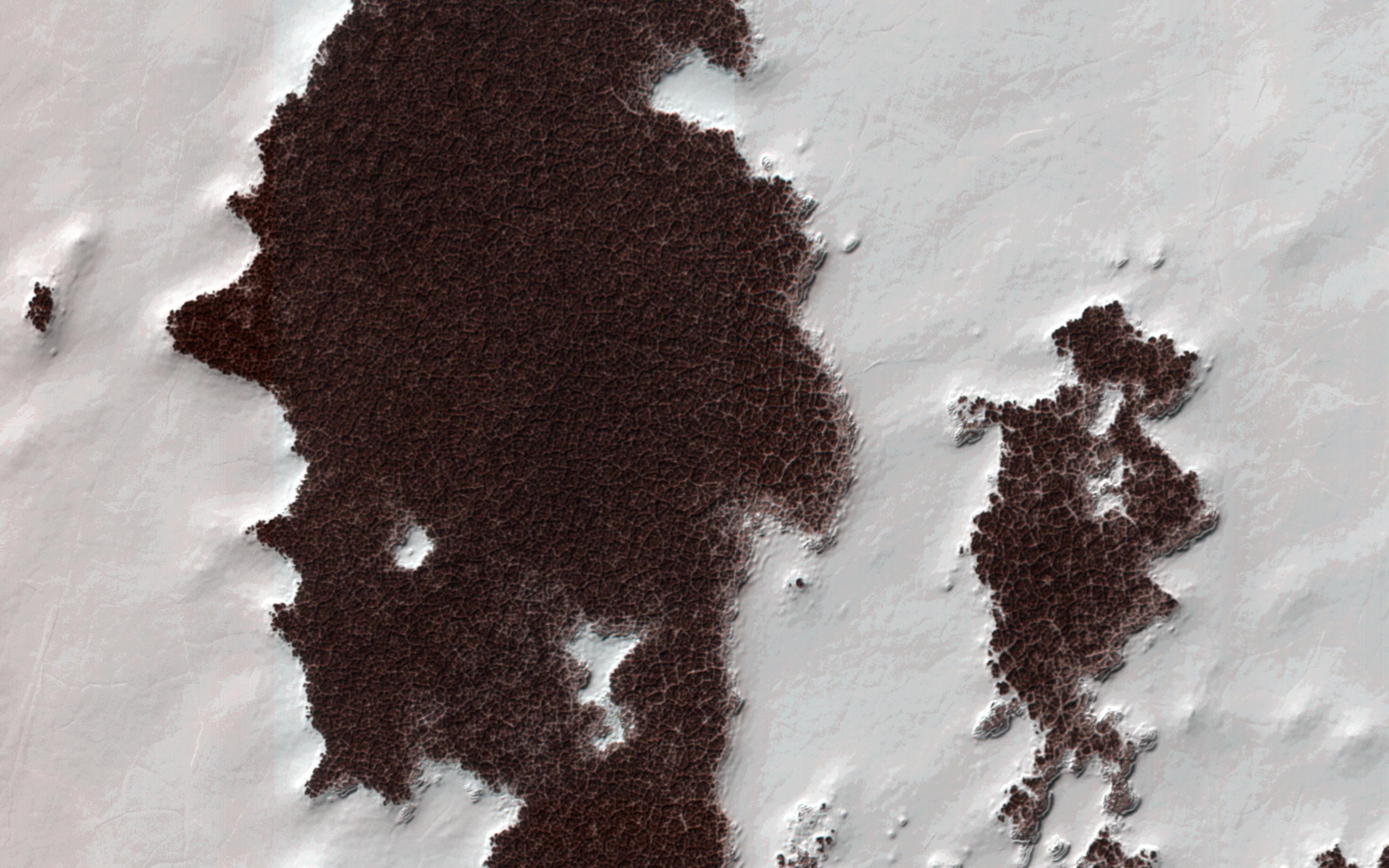
-
PIA17635:
-
Possible Cyclic Bedding within a Crater in Arabia Terra
Full Resolution:
TIFF
(15.56 MB)
JPEG
(749.6 kB)
|
|
|
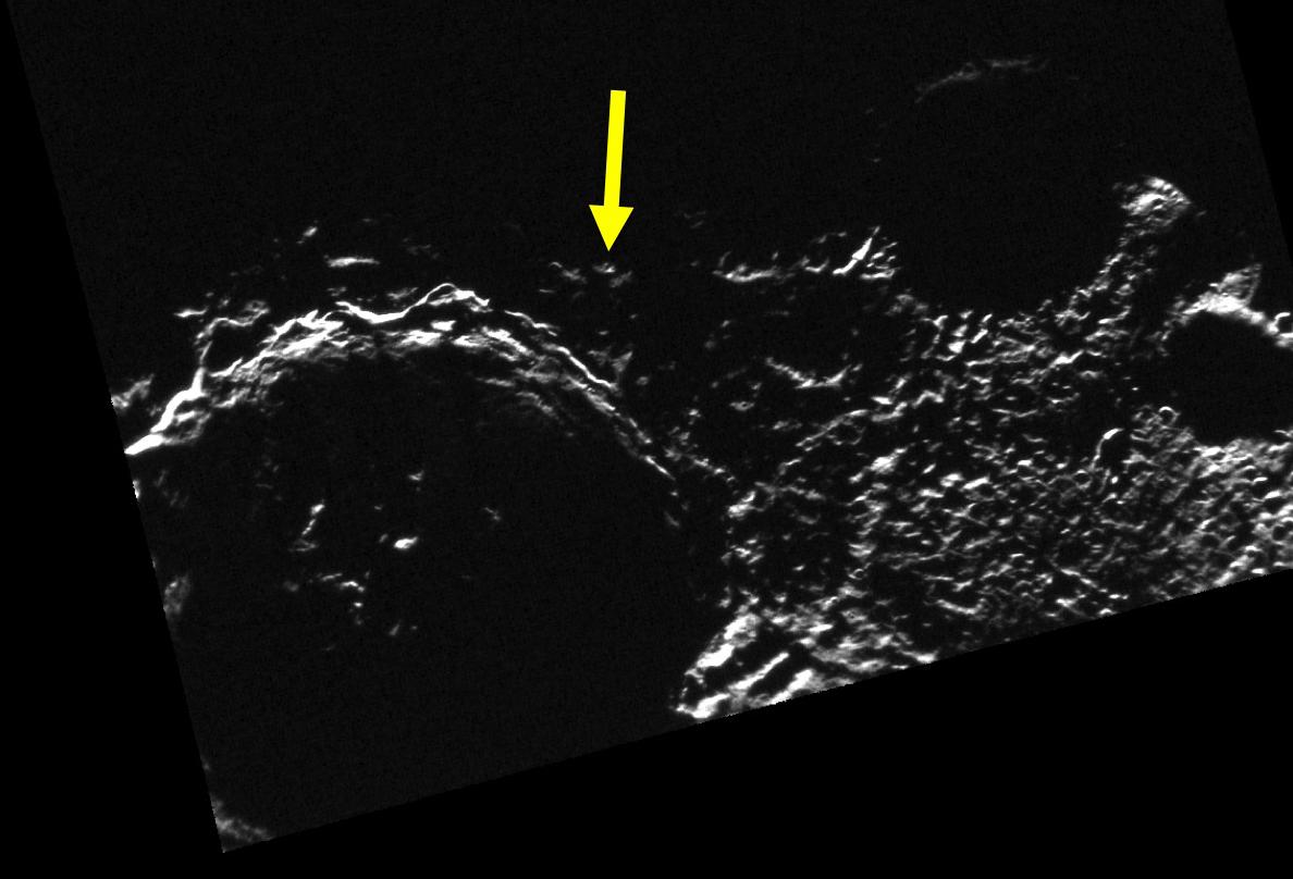
2013-07-31 |
Enceladus
|
Cassini-Huygens
|
Visual and Infrared Mapping Spectrometer
|
2184x999x3 |
|
-
PIA17040:
-
Squeezing and Releasing Enceladus
Full Resolution:
TIFF
(6.548 MB)
JPEG
(129.7 kB)
|
|
|
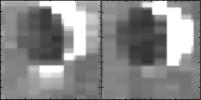
2013-07-31 |
Enceladus
|
Cassini-Huygens
|
Visual and Infrared Mapping Spectrometer
|
1613x801x1 |
|
-
PIA17039:
-
Enceladus "On" and "Off"
Full Resolution:
TIFF
(1.294 MB)
JPEG
(50.21 kB)
|
|
|
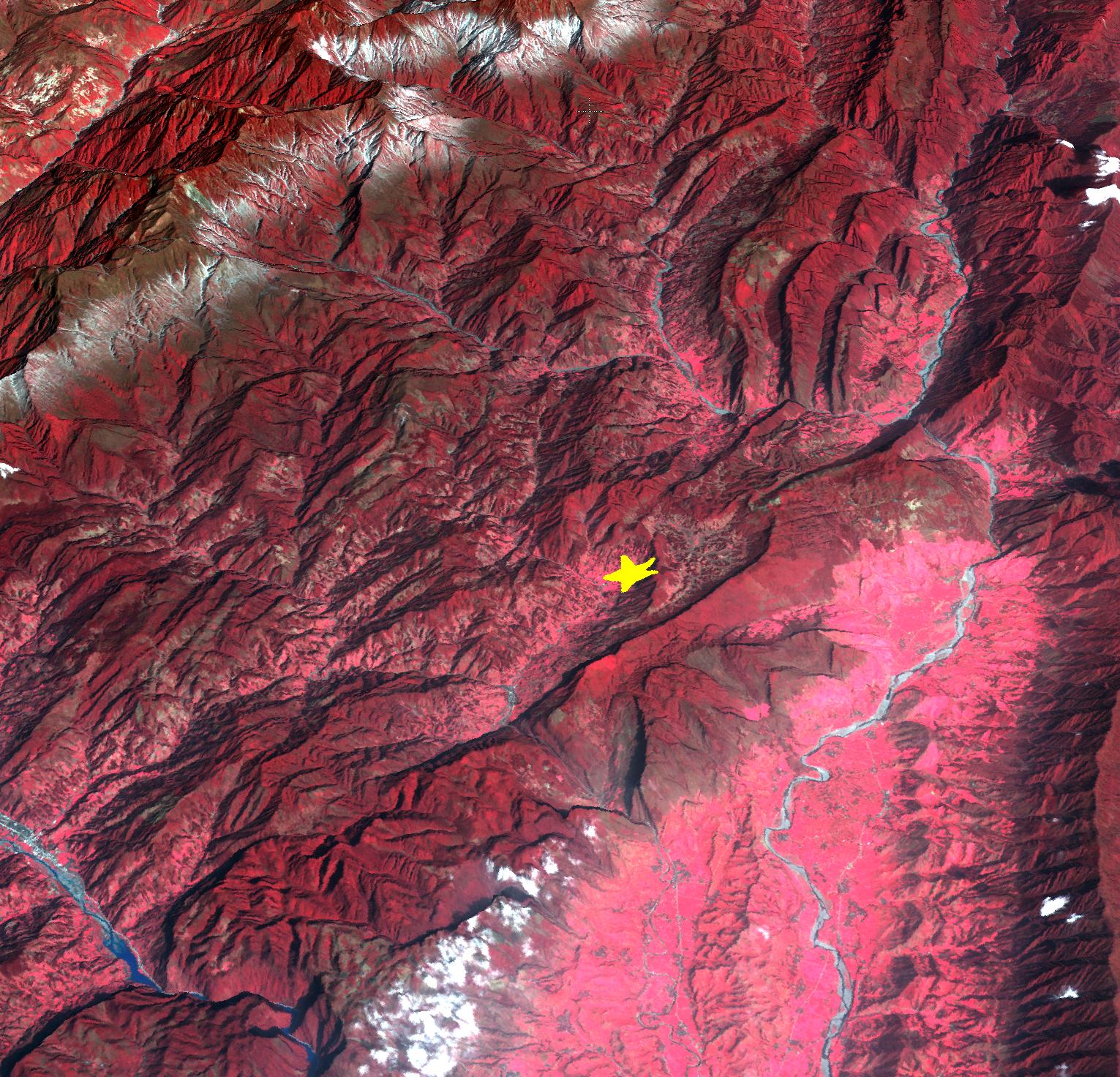
2013-07-15 |
Earth
|
Terra
|
ASTER
|
2626x3773x3 |
|
-
PIA17391:
-
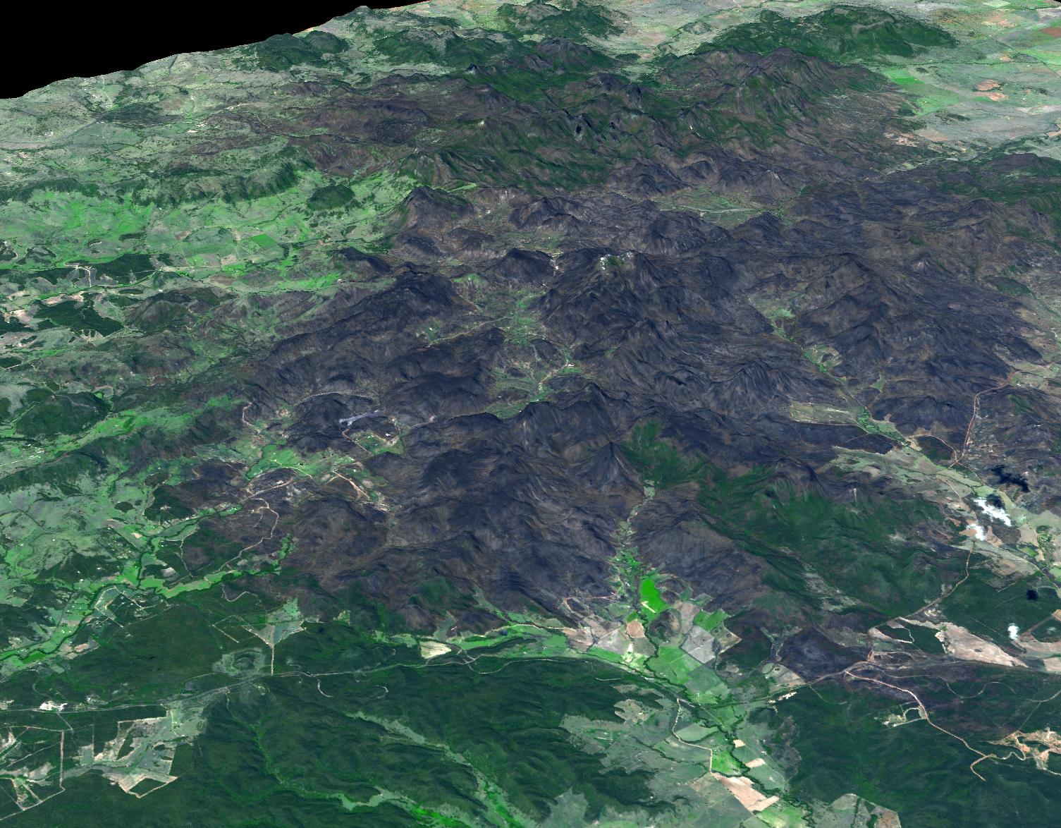
Sulaiman Fold Belt, Pakistan
Full Resolution:
TIFF
(29.73 MB)
JPEG
(1.861 MB)
|
|
|
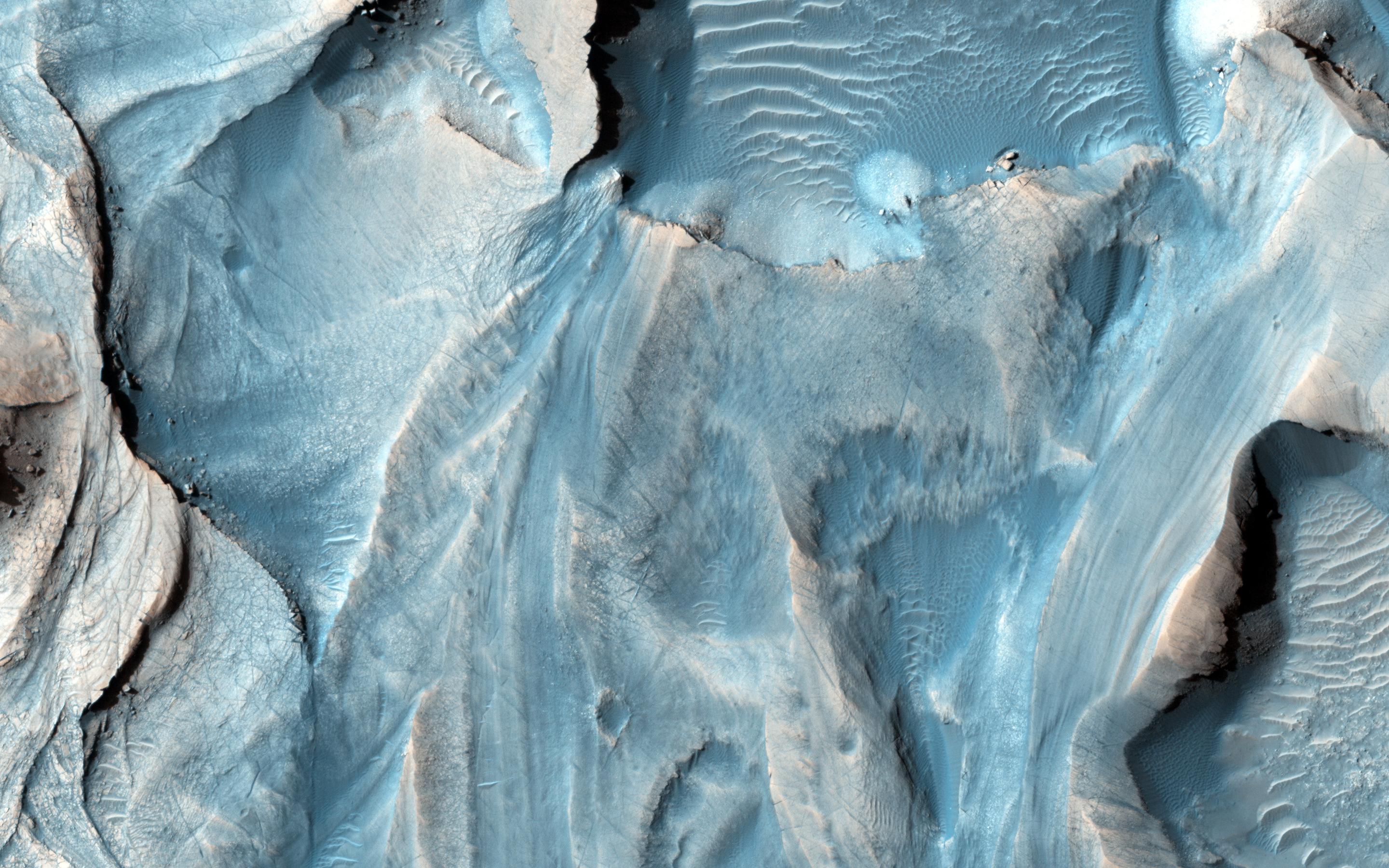
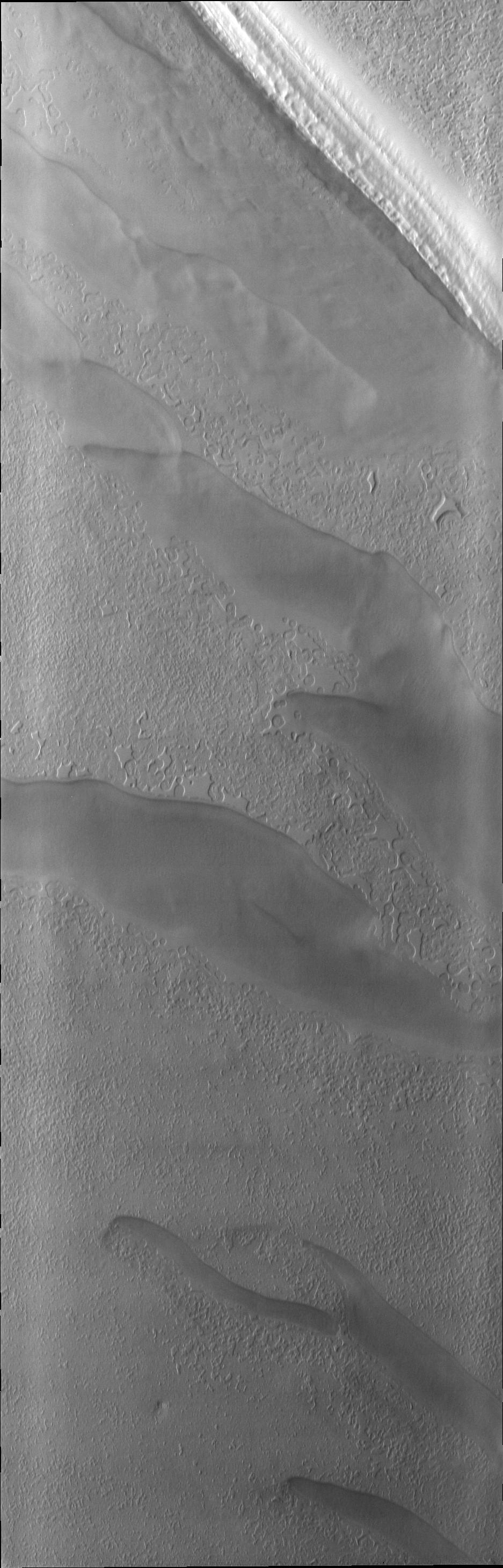
2013-07-10 |
Mars
|
Mars Reconnaissance Orbiter (MRO)
|
HiRISE
|
2880x1800x3 |
|
-
PIA17723:
-
Mawrth Vallis Geodiversity
Full Resolution:
TIFF
(15.56 MB)
JPEG
(815.4 kB)
|
|
|
2013-07-10 |
Mars
|
Mars Reconnaissance Orbiter (MRO)
|
HiRISE
|
2880x1800x3 |
|
-
PIA17722:
-
Knob in the South Polar Layered Deposits of Mars
Full Resolution:
TIFF
(15.56 MB)
JPEG
(1.072 MB)
|
|
|
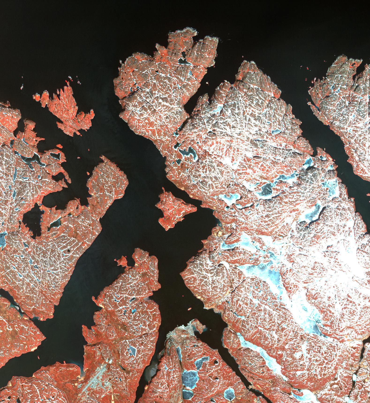
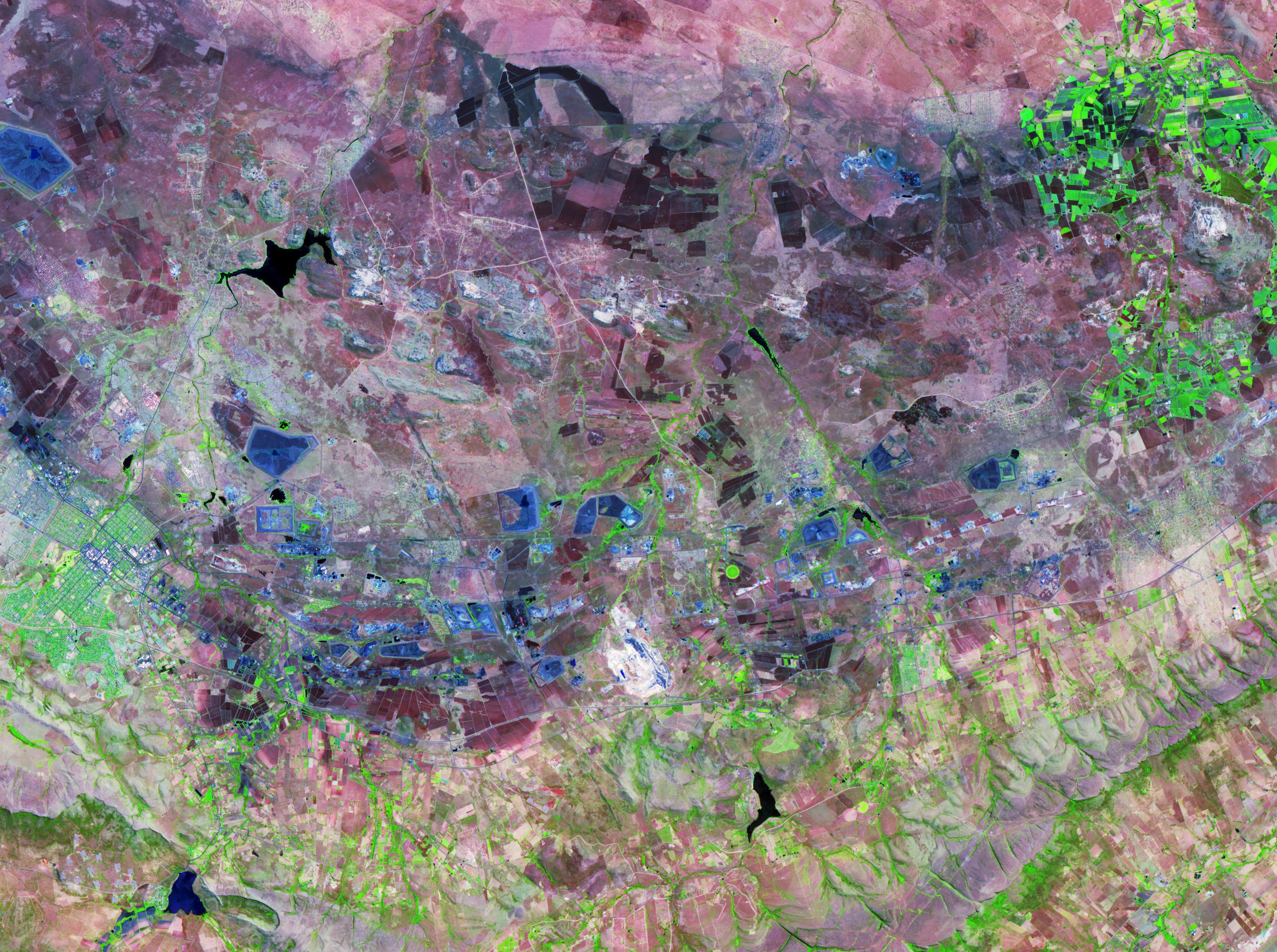
2013-07-09 |
Earth
|
Terra
|
ASTER
|
1578x1716x3 |
|
-
PIA17312:
-
Kirkenes, Norway
Full Resolution:
TIFF
(8.127 MB)
JPEG
(659.2 kB)
|
|
|
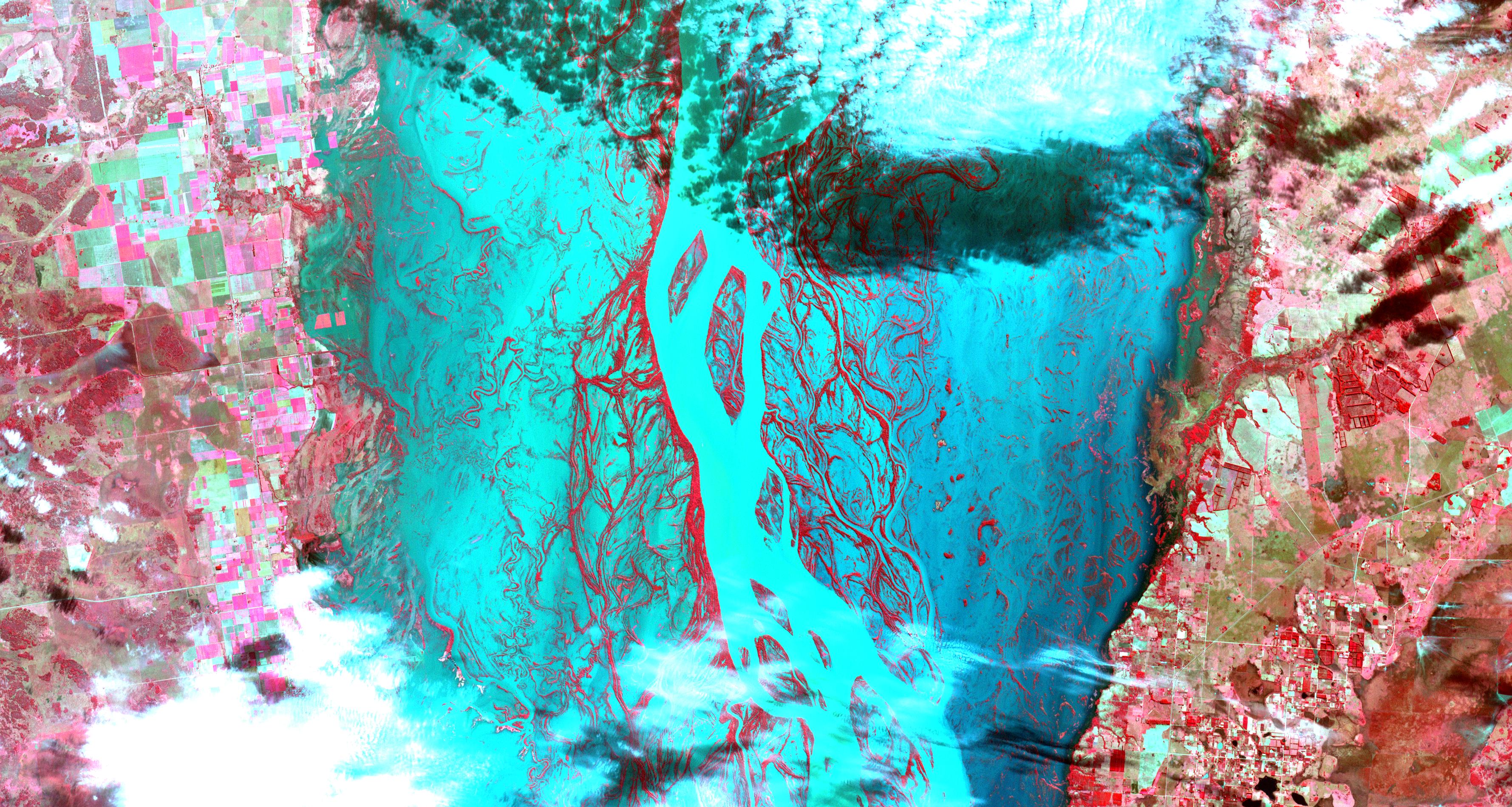
2013-07-08 |
Earth
|
Terra
|
ASTER
|
3558x1900x3 |
|
-
PIA17376:
-
Flooding Along Parana River
Full Resolution:
TIFF
(20.29 MB)
JPEG
(1.439 MB)
|
|
|
2013-07-08 |
Mars
|
Mars Science Laboratory (MSL)
|
Navcam (MSL)
|
1024x1024x1 |
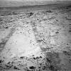
|
-
PIA17272:
-
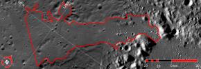
First Leg of Long Trek Toward Mount Sharp
Full Resolution:
TIFF
(1.05 MB)
JPEG
(298.1 kB)
|
|
|
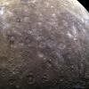
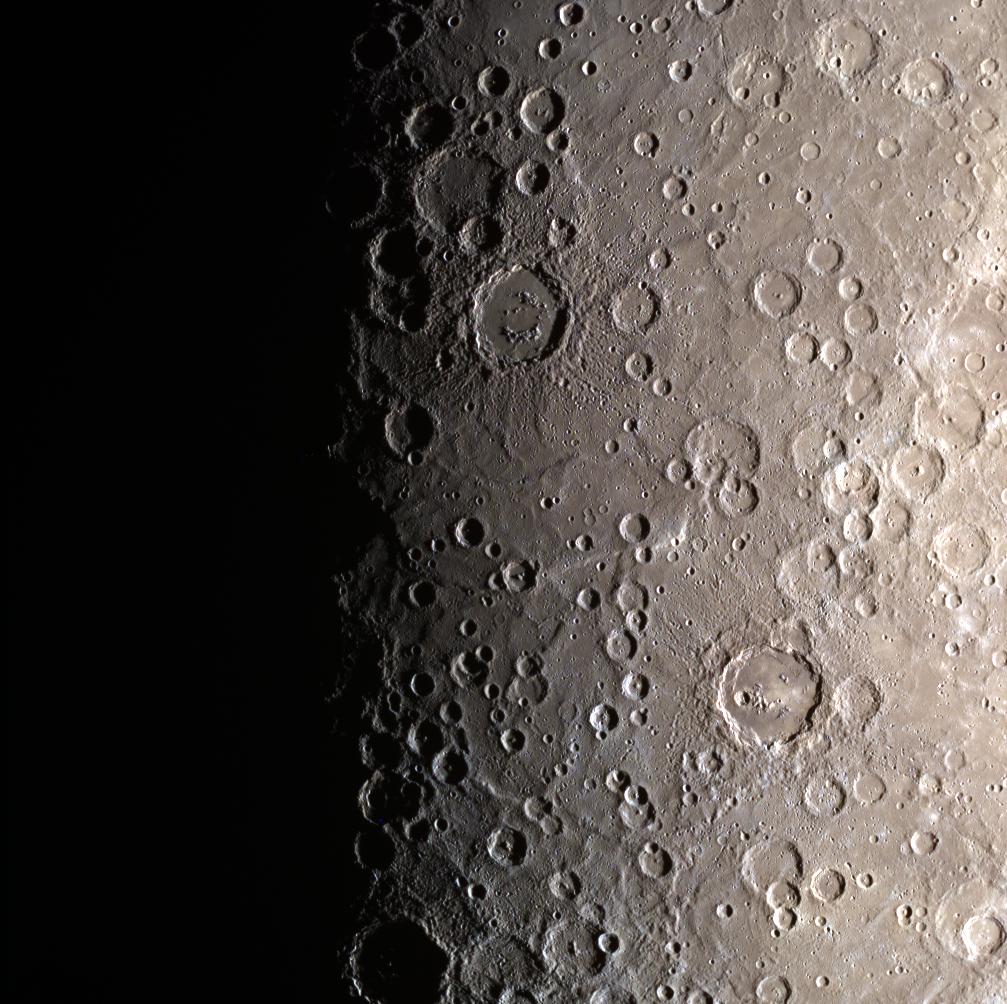
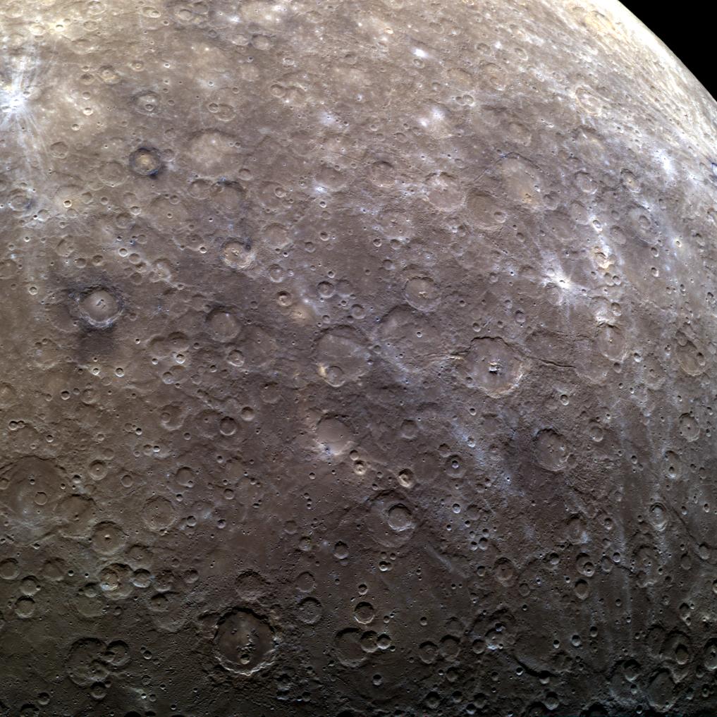
2013-06-25 |
Mercury
|
MESSENGER
|
MDIS - Wide Angle
|
1007x1004x3 |
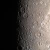
|
-
PIA17296:
-
I'll Be Back!
Full Resolution:
TIFF
(3.034 MB)
JPEG
(171.2 kB)
|
|
|
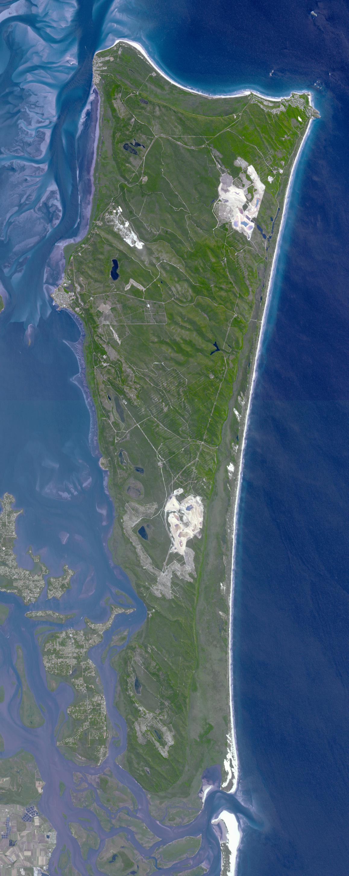
2013-06-25 |
Earth
|
Terra
|
ASTER
|
1158x2904x3 |
|
-
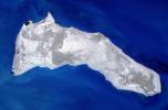
PIA17112:
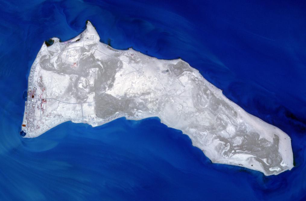
-
North Stradbroke Island, Australia
Full Resolution:
TIFF
(10.09 MB)
JPEG
(421.3 kB)
|
|
|
2013-06-21 |
Earth
|
Terra
|
ASTER
|
2616x1746x3 |
|
-
PIA17292:
-
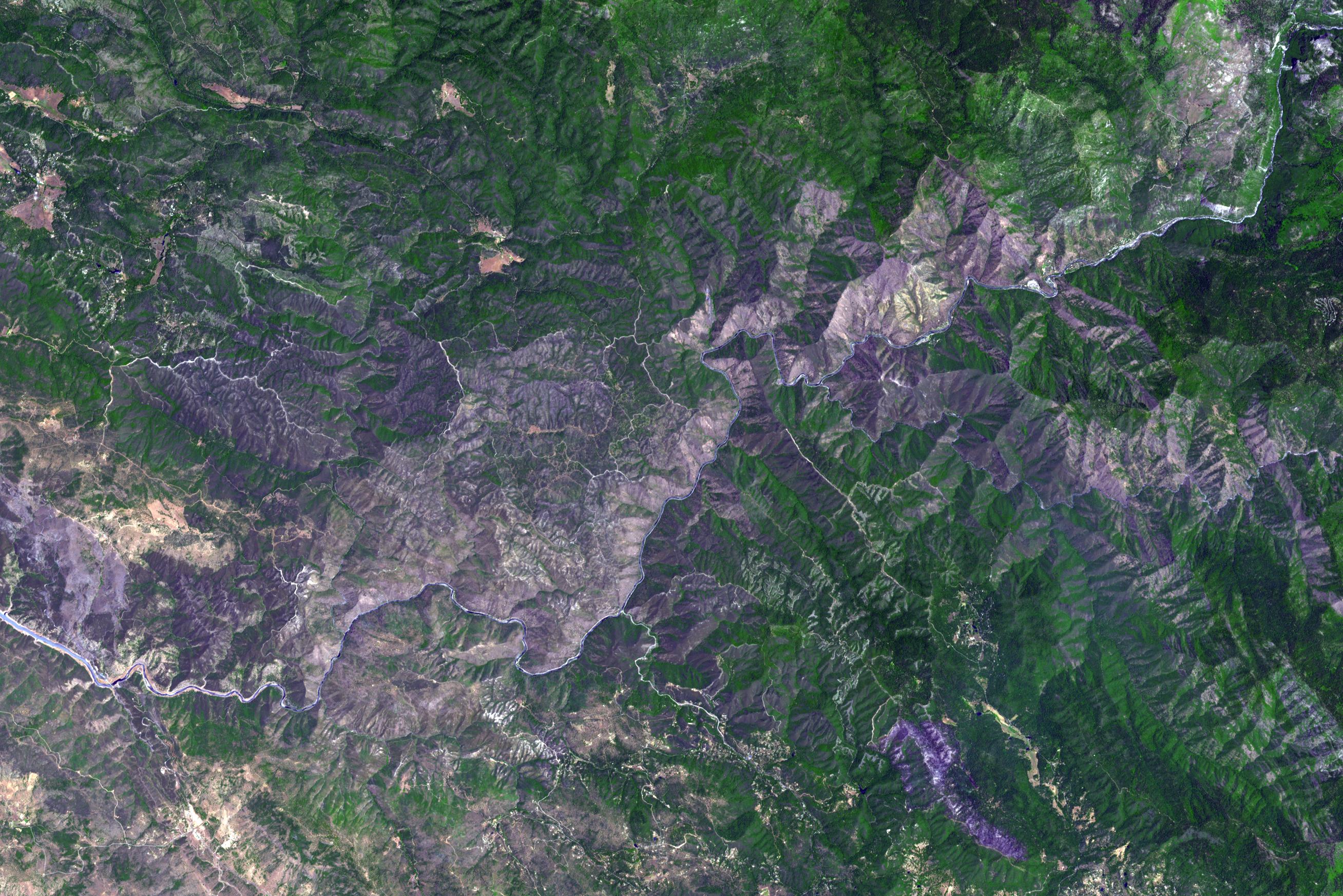
NASA Spacecraft Images Wildfire Near Yosemite National Park
Full Resolution:
TIFF
(13.71 MB)
JPEG
(958.7 kB)
|
|
|
2013-06-13 |
Earth
|
GRACE
|
K-Band Ranging System
|
2168x2430x3 |
|
-
PIA16840:
-
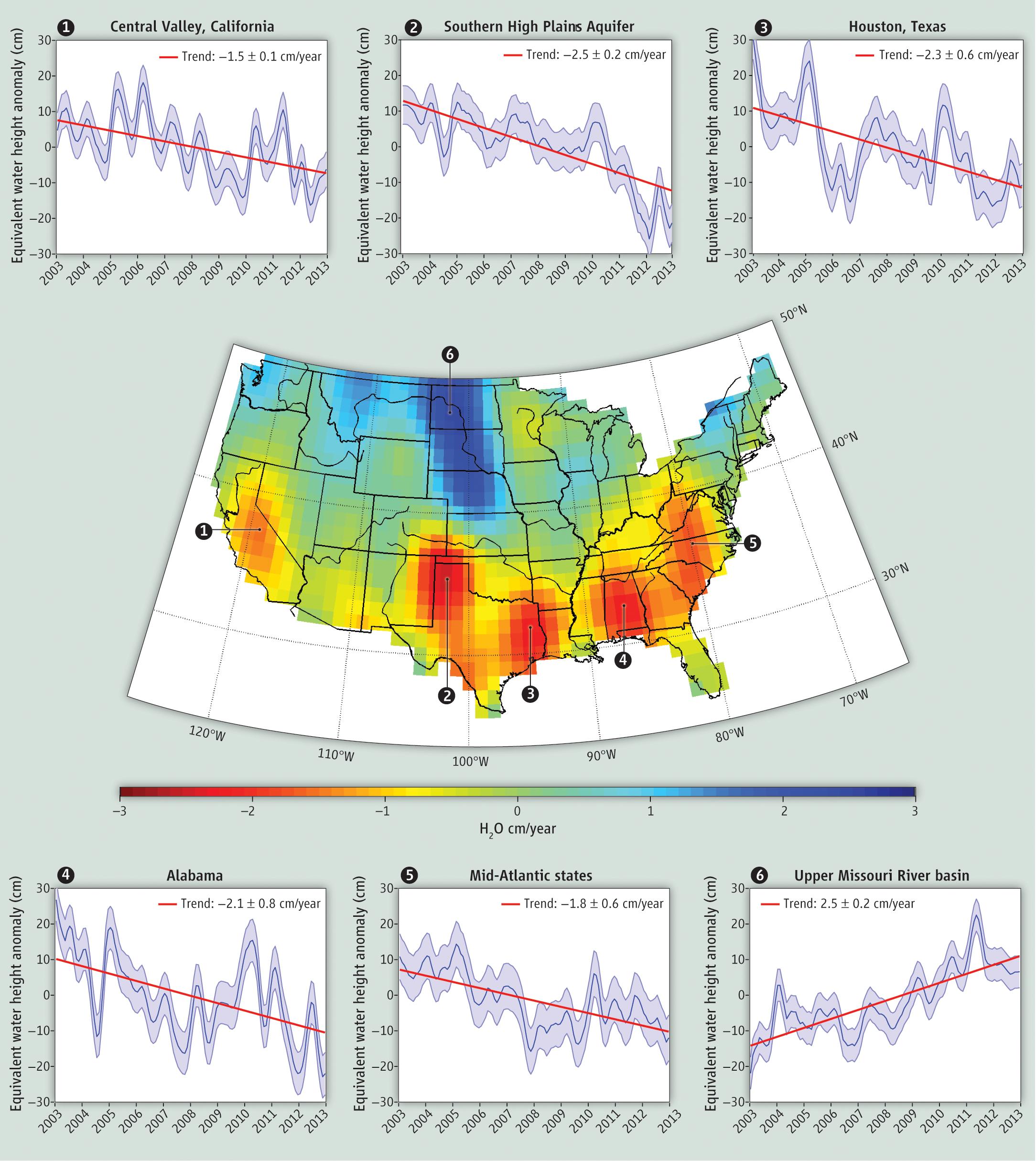
GRACE Measures Groundwater Changes Across the U.S.
Full Resolution:
TIFF
(15.81 MB)
JPEG
(518.9 kB)
|
|
|
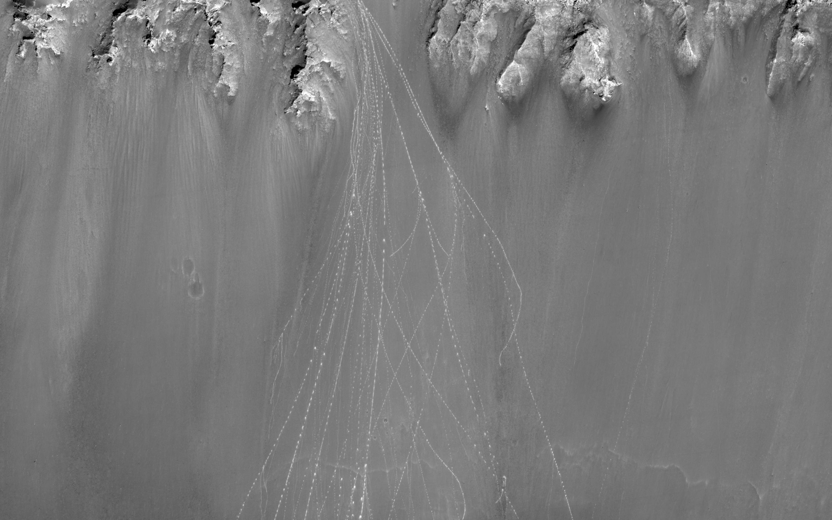
2013-06-11 |
Mars
|
Mars Reconnaissance Orbiter (MRO)
|
HiRISE
|
1439x1993x1 |
|
-
PIA17261:
-
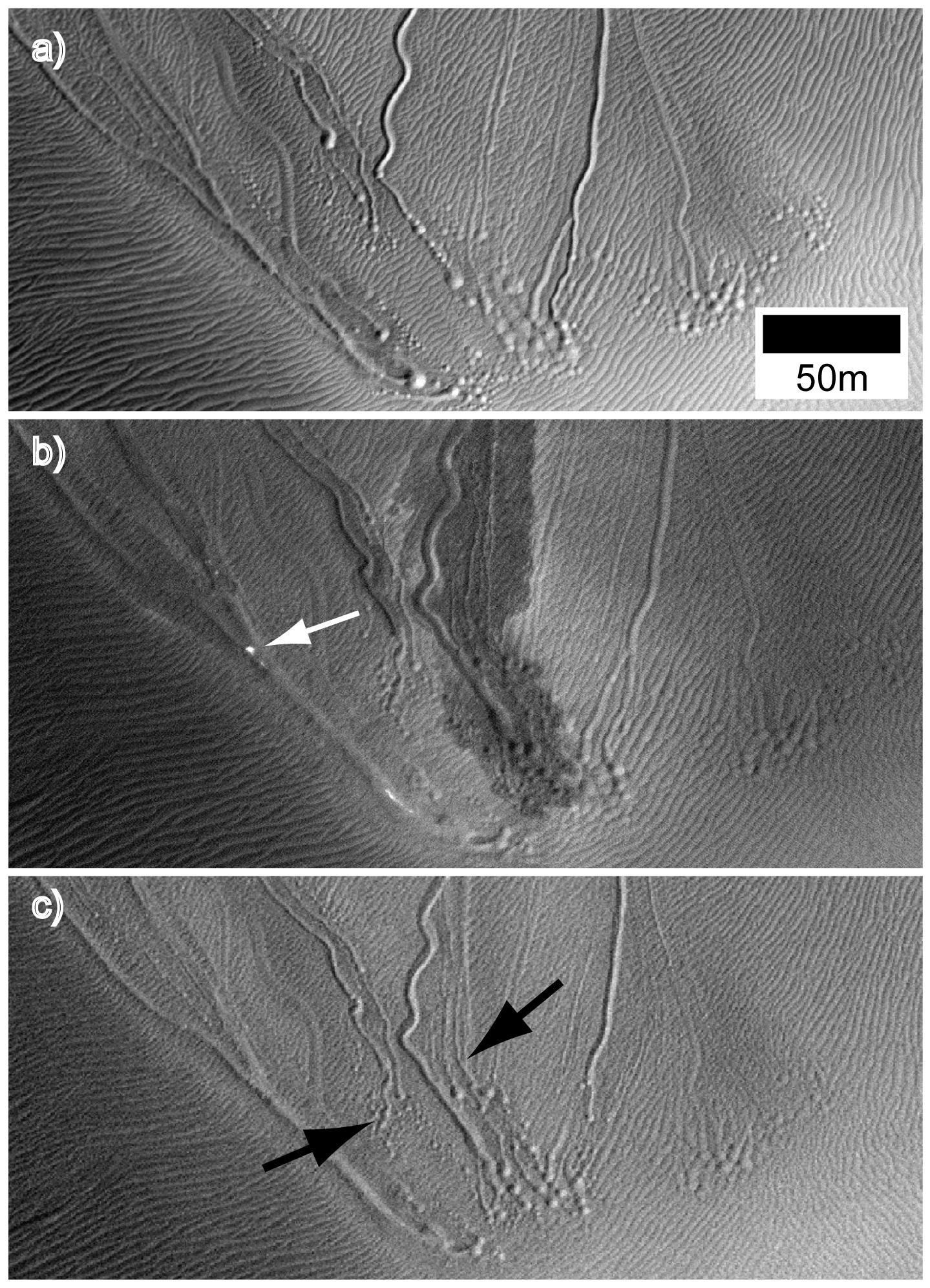
Some Gullies on Mars Could Be Tracks of Sliding Dry Ice
Full Resolution:
TIFF
(2.871 MB)
JPEG
(568.4 kB)
|
|
|
2013-06-11 |
Mars
|
2001 Mars Odyssey
Mars Reconnaissance Orbiter (MRO)
Mars Global Surveyor (MGS)
|
HiRISE
Mars Orbiter Camera (MOC)
THEMIS
|
960x608x3 |
|
-
PIA17079:
-
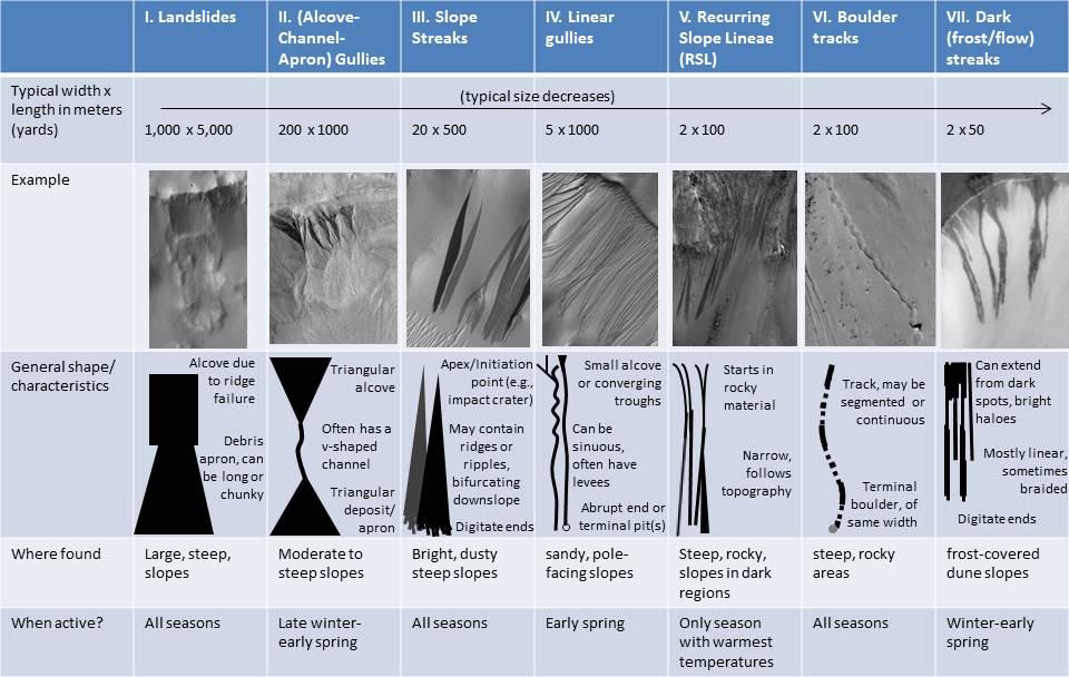
Martian Features Formed When Material Moves Downslope
Full Resolution:
TIFF
(1.752 MB)
JPEG
(100.9 kB)
|
|
|
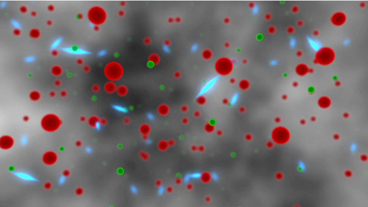
2013-06-11 |
|
NuSTAR
|
NuSTAR
|
6620x3724x3 |
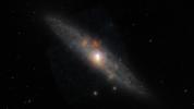
|
-
PIA17244:
-
Sculptor Galaxy Shines with X-rays
Full Resolution:
TIFF
(73.99 MB)
JPEG
(547.1 kB)
|
|
|
2013-06-05 |
Earth
|
Terra
|
ASTER
|
1402x883x3 |

|
-
PIA17099:
-
Kouru, French Guiana
Full Resolution:
TIFF
(3.716 MB)
JPEG
(179.8 kB)
|
|
|
2013-06-05 |
Earth
|
Terra
|
ASTER
|
922x637x3 |

|
-
PIA16488:
-
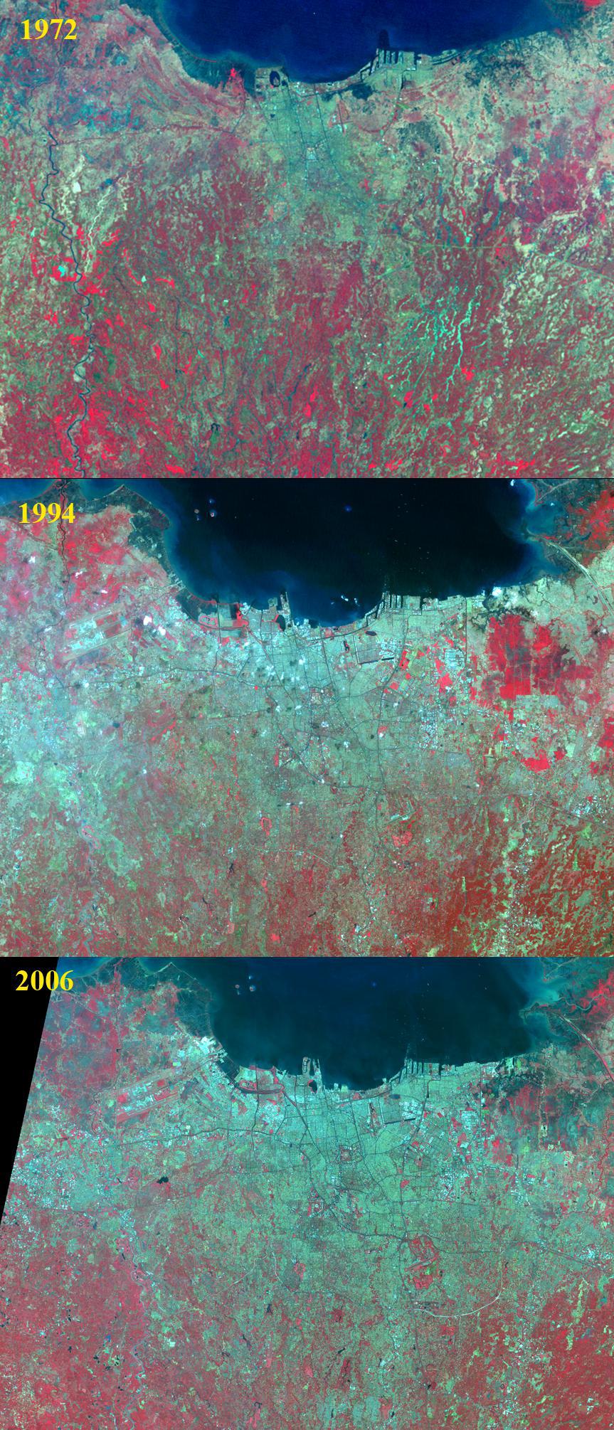
NASA Spacecraft Captures Swath of Destruction from Deadly Oklahoma Tornado
Full Resolution:
TIFF
(1.763 MB)
JPEG
(160.5 kB)
|
|
|
2013-05-23 |
Earth
|
Jason-3
|
|
8192x8192x3 |
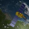
|
-
PIA14441:
-
Artist's Concept of U.S.-European Jason-3 Ocean Altimetry Satellite over the Amazon
Full Resolution:
TIFF
(201.4 MB)
JPEG
(3.898 MB)
|
|
|
2013-05-23 |
Earth
|
Jason-3
|
|
8192x8192x3 |
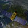
|
-
PIA14440:
-
Artist's Concept of U.S.-European Jason-3 Ocean Altimetry Satellite over France
Full Resolution:
TIFF
(201.4 MB)
JPEG
(4.08 MB)
|
|
|
2013-05-23 |
Earth
|
Jason-3
|
|
8192x8192x3 |
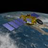
|
-
PIA14439:
-
Artist's Concept of U.S.-European Jason-3 Ocean Altimetry Satellite over California
Full Resolution:
TIFF
(201.4 MB)
JPEG
(4.259 MB)
|
|
|
2013-05-22 |
Earth
|
Aqua
|
AIRS
|
1960x1482x3 |

|
-
PIA14437:
-
Carbon Dioxide in Earth's Mid-Troposphere, April 2013 Monthly Average
Full Resolution:
TIFF
(2.909 MB)
JPEG
(260.8 kB)
|
|
|
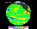
2013-05-22 |
Earth
|
Aqua
|
AIRS
|
1976x1900x3 |
|
-
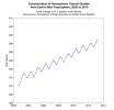
PIA14435:
-
Concentration of Atmospheric Carbon Dioxide from Earth's Mid-Troposphere, 2002 to 2013
Full Resolution:
TIFF
(11.27 MB)
JPEG
(185.8 kB)
|
|
|
2013-05-21 |
Earth
|
Terra
|
ASTER
|
2020x3315x3 |

|
-
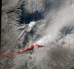
PIA16995:
-
Prolific Alaska Volcano Spews Ash in New Eruption
Full Resolution:
TIFF
(20.1 MB)
JPEG
(882.9 kB)
|
|
|
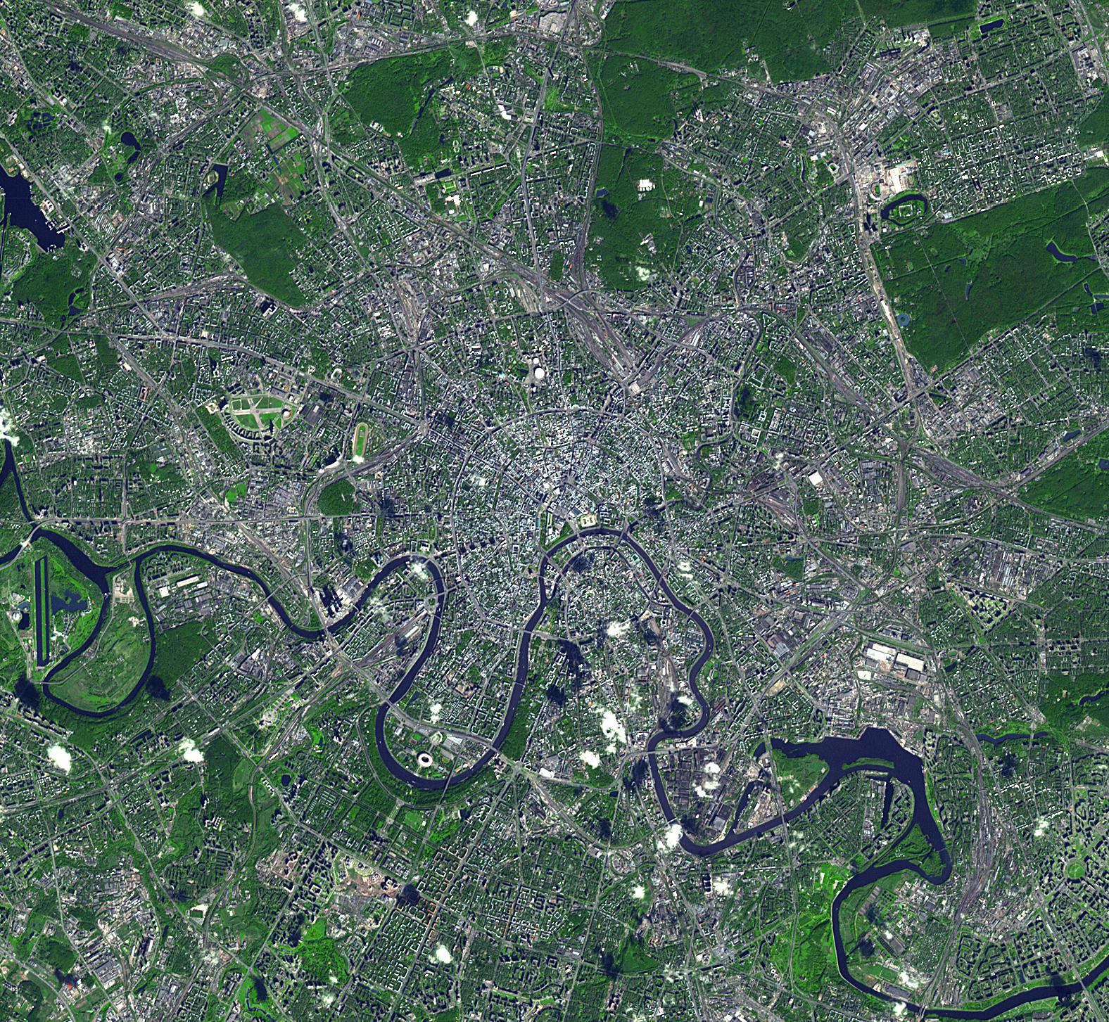
2013-05-21 |
Earth
|
Terra
|
ASTER
|
1576x1453x3 |
|
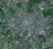
-
PIA16988:
-
Moscow, Russia
Full Resolution:
TIFF
(6.872 MB)
JPEG
(859.8 kB)
|
|
|
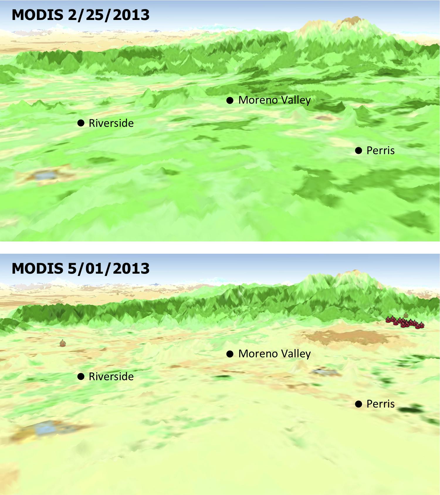
2013-05-13 |
Earth
|
Aqua
|
MODIS
|
1500x1686x3 |
|
-
PIA17053:
-
MODIS Satellite See Double Jeopardy for Socal Fire Season
Full Resolution:
TIFF
(7.59 MB)
JPEG
(220.7 kB)
|
|
|
2013-05-13 |
Earth
|
Aqua
OSCAT
|
MODIS
OSCAT Scatterometer
|
1034x1692x3 |
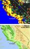
|
-
PIA17052:
-
Satellites See Double Jeopardy for Socal Fire Season
Full Resolution:
TIFF
(5.251 MB)
JPEG
(212.1 kB)
|
|
|
2013-05-10 |
Mercury
|
MESSENGER
|
MDIS - Wide Angle
|
1597x472x3 |

|
-
PIA17050:
-
In Focus: Timgad Vallis
Full Resolution:
TIFF
(2.262 MB)
JPEG
(121.3 kB)
|
|
|
2013-05-09 |
Mercury
|
MESSENGER
|
MDIS - Wide Angle
|
1370x472x3 |
|
-
PIA17029:
-
In Focus: Paestum Vallis
Full Resolution:
TIFF
(1.941 MB)
JPEG
(108.2 kB)
|
|
|
2013-05-08 |
Mercury
|
MESSENGER
|
MDIS - Wide Angle
|
1370x472x3 |
|
-
PIA17028:
-
In Focus: Caral Vallis
Full Resolution:
TIFF
(1.941 MB)
JPEG
(118.8 kB)
|
|
|
2013-05-07 |
Mercury
|
MESSENGER
|
MDIS - Wide Angle
|
1370x472x3 |
|
-
PIA17027:
-
In Focus: Cahokia Vallis
Full Resolution:
TIFF
(1.941 MB)
JPEG
(100.4 kB)
|
|
|
2013-05-06 |
Mercury
|
MESSENGER
|
MDIS - Wide Angle
|
1370x472x3 |
|
-
PIA17026:
-
In Focus: Angkor Vallis
Full Resolution:
TIFF
(1.941 MB)
JPEG
(143.8 kB)
|
|
|
2013-05-02 |
Earth
|
Terra
|
ASTER
|
718x2376x3 |

|
-
PIA16980:
-
Macquarie Island, Australia
Full Resolution:
TIFF
(5.12 MB)
JPEG
(158.9 kB)
|
|
|
2013-05-01 |
Mars
|
Mars Reconnaissance Orbiter (MRO)
|
HiRISE
|
2880x1800x1 |

|
-
PIA17870:
-
Watch for Falling Rocks!
Full Resolution:
TIFF
(5.191 MB)
JPEG
(428.7 kB)
|
|
|
2013-04-24 |
Mercury
|
MESSENGER
|
MDIS - Narrow Angle
|
1188x808x3 |
|
-
PIA16999:
-
There is a Light that Never Goes Out (Almost)
Full Resolution:
TIFF
(2.881 MB)
JPEG
(83.9 kB)
|
|
|
2013-04-22 |
Earth
|
Terra
|
ASTER
|
1531x1472x3 |
|
-
PIA16994:
-
NASA Spacecraft Shows Location of China Quake
Full Resolution:
TIFF
(6.763 MB)
JPEG
(518.8 kB)
|
|
|
2013-04-18 |
Mercury
|
MESSENGER
|
MDIS - Wide Angle
|
2533x2075x3 |
|
-
PIA16959:
-
It was a Dark and Stormy Night
Full Resolution:
TIFF
(15.77 MB)
JPEG
(496.3 kB)
|
|
|
2013-04-16 |
Earth
|
Terra
|
ASTER
|
2832x2982x3 |
|
-
PIA16991:
-
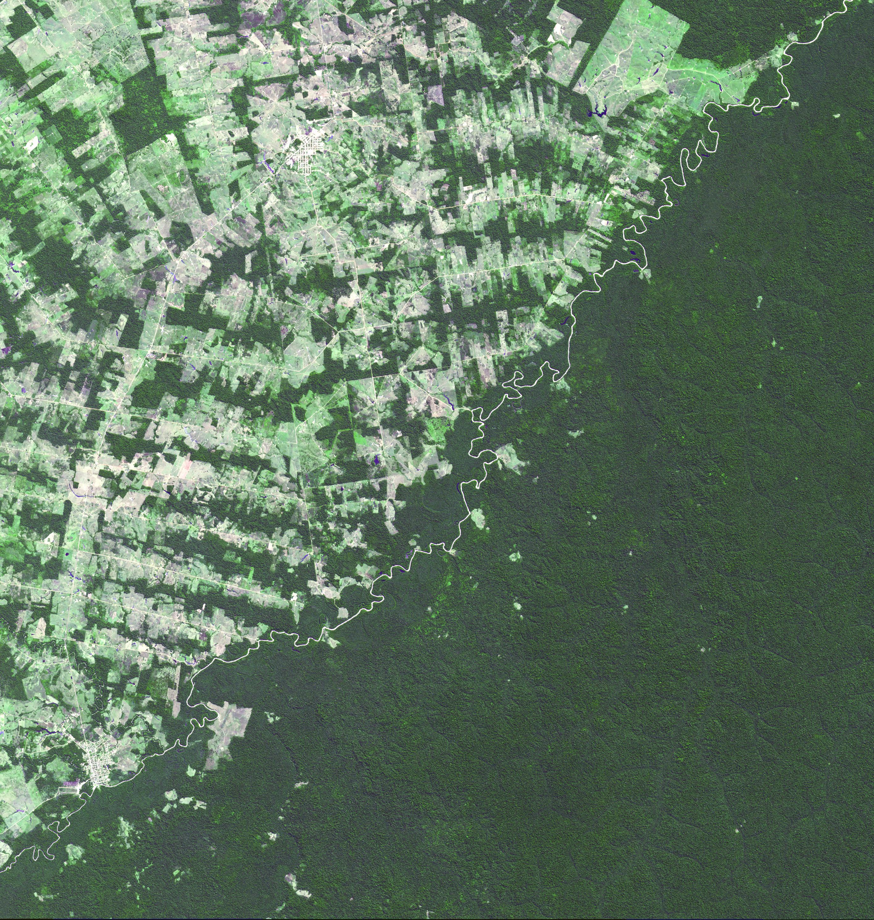
Brazil-Bolivia Border
Full Resolution:
TIFF
(25.35 MB)
JPEG
(2.142 MB)
|
|
|
2013-04-10 |
Earth
|
Terra
|
ASTER
|
1547x1483x3 |
|
-
PIA16946:
-
NASA Spacecraft Image Shows Location of Iranian Earthquake
Full Resolution:
TIFF
(6.885 MB)
JPEG
(853.7 kB)
|
|
|
2013-04-08 |
Mars
|
Mars Science Laboratory (MSL)
|
DAN
|
1312x902x3 |
|
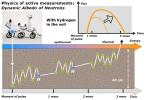
-
PIA16917:
-
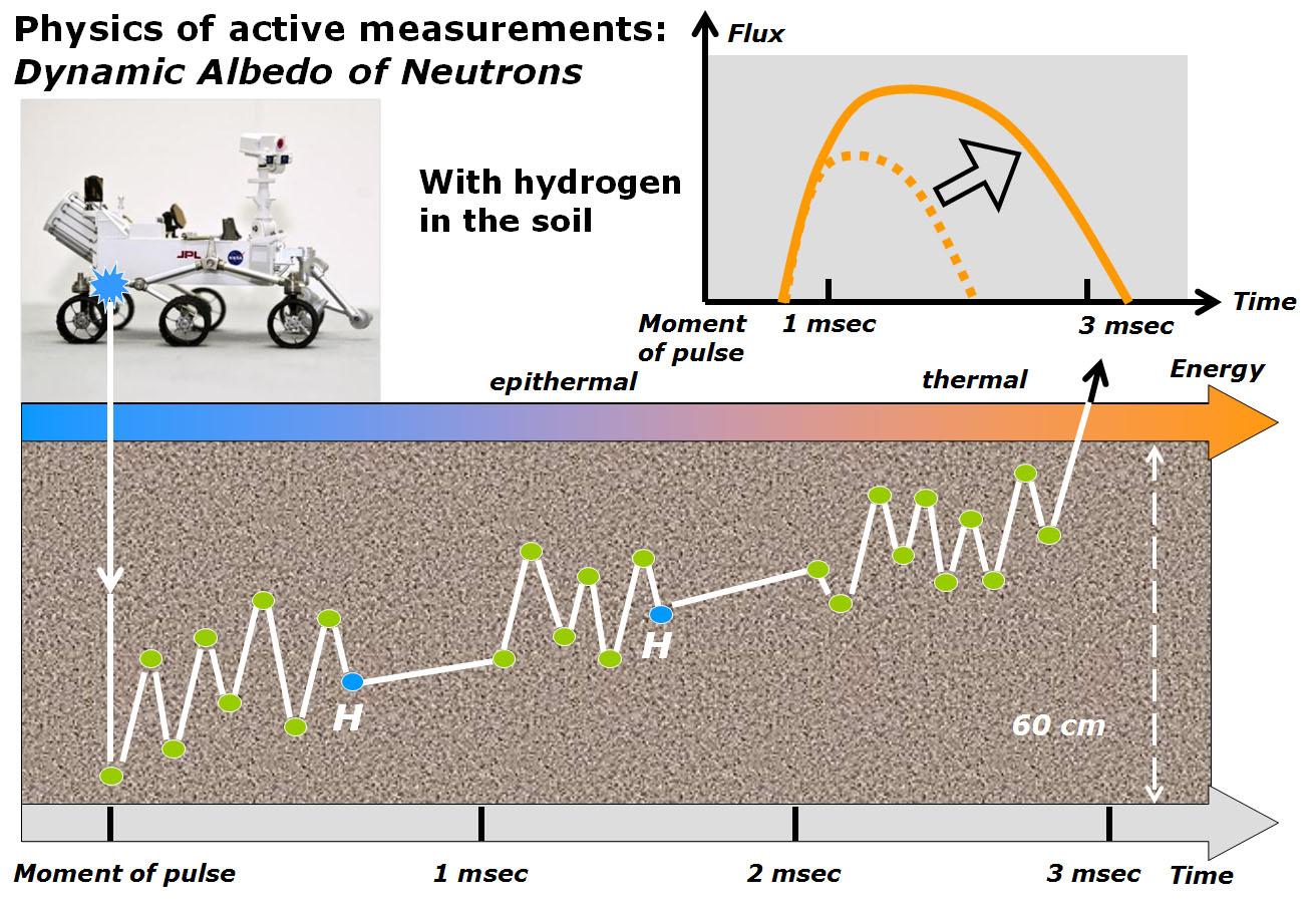
Physics of How DAN on Curiosity Checks for Water, Part 2
Full Resolution:
TIFF
(3.552 MB)
JPEG
(200.8 kB)
|
|
|
2013-04-08 |
Mars
|
Mars Science Laboratory (MSL)
|
REMS
|
700x534x3 |
|
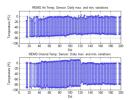
-
PIA16913:
-
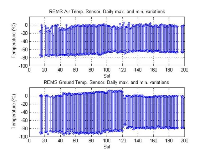
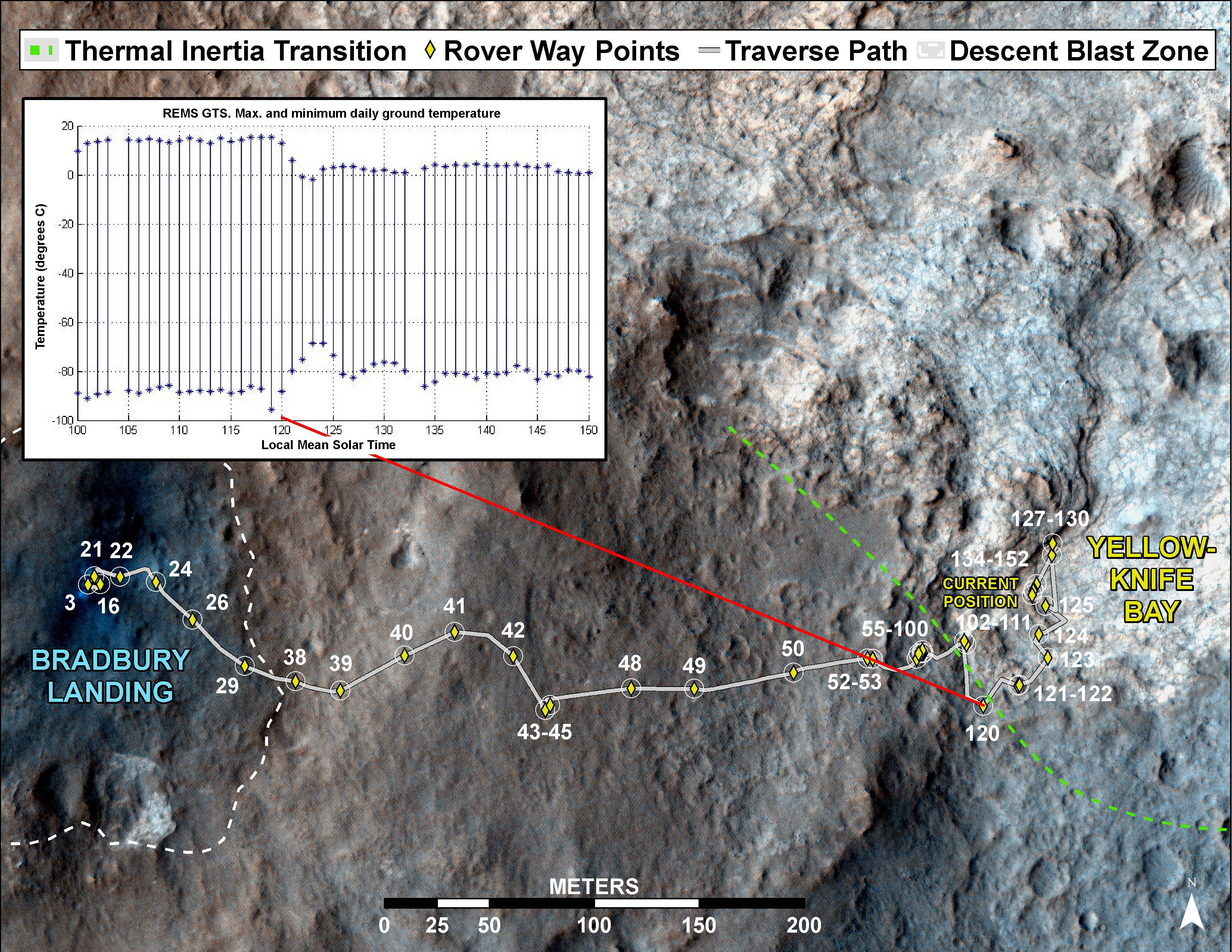
Steady Temperatures at Mars' Gale Crater
Full Resolution:
TIFF
(1.122 MB)
JPEG
(75.76 kB)
|
|
|
2013-04-05 |
Earth
|
Terra
|
ASTER
|
1706x1796x3 |

|
-
PIA16945:
-
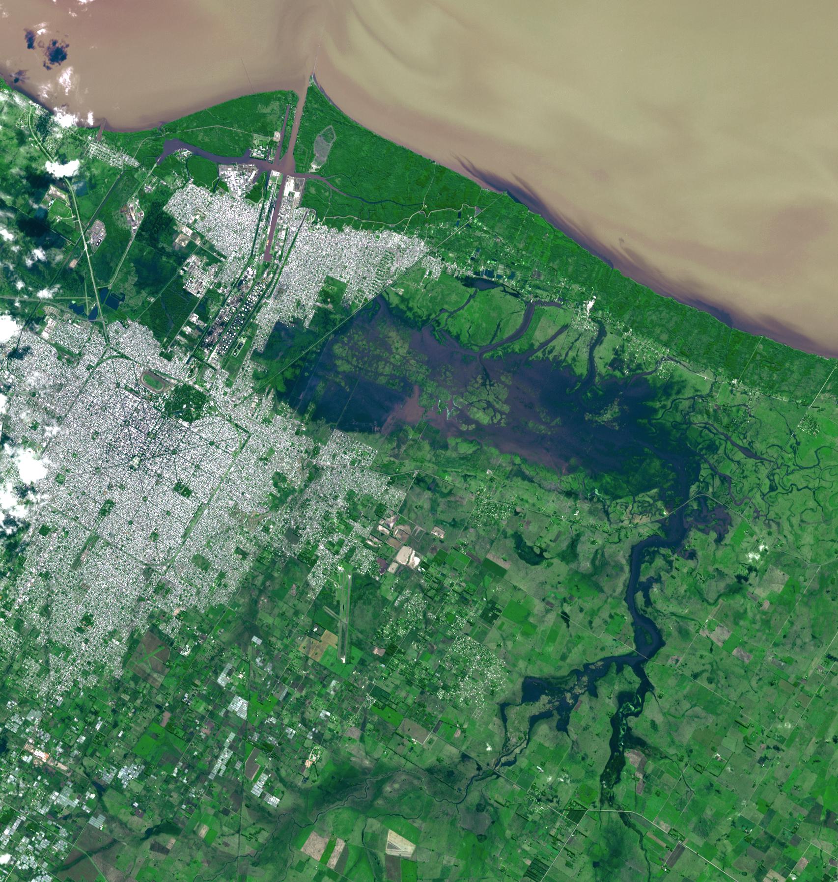
NASA Spacecraft Eyes Severe Flooding in Argentina
Full Resolution:
TIFF
(9.196 MB)
JPEG
(583.5 kB)
|
|
|
2013-04-04 |
Earth
|
Terra
|
ASTER
|
1015x667x3 |
|
-
PIA16944:
-
Failaka Island, Kuwait
Full Resolution:
TIFF
(2.032 MB)
JPEG
(58.53 kB)
|
|
|
2013-04-04 |
|
Kepler
|
|
3000x2400x3 |
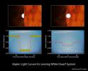
|
-
PIA16886:
-
White Dwarfs: Small and Strong
Full Resolution:
TIFF
(21.61 MB)
JPEG
(404.9 kB)
|
|
|
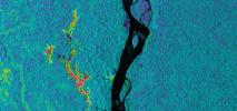
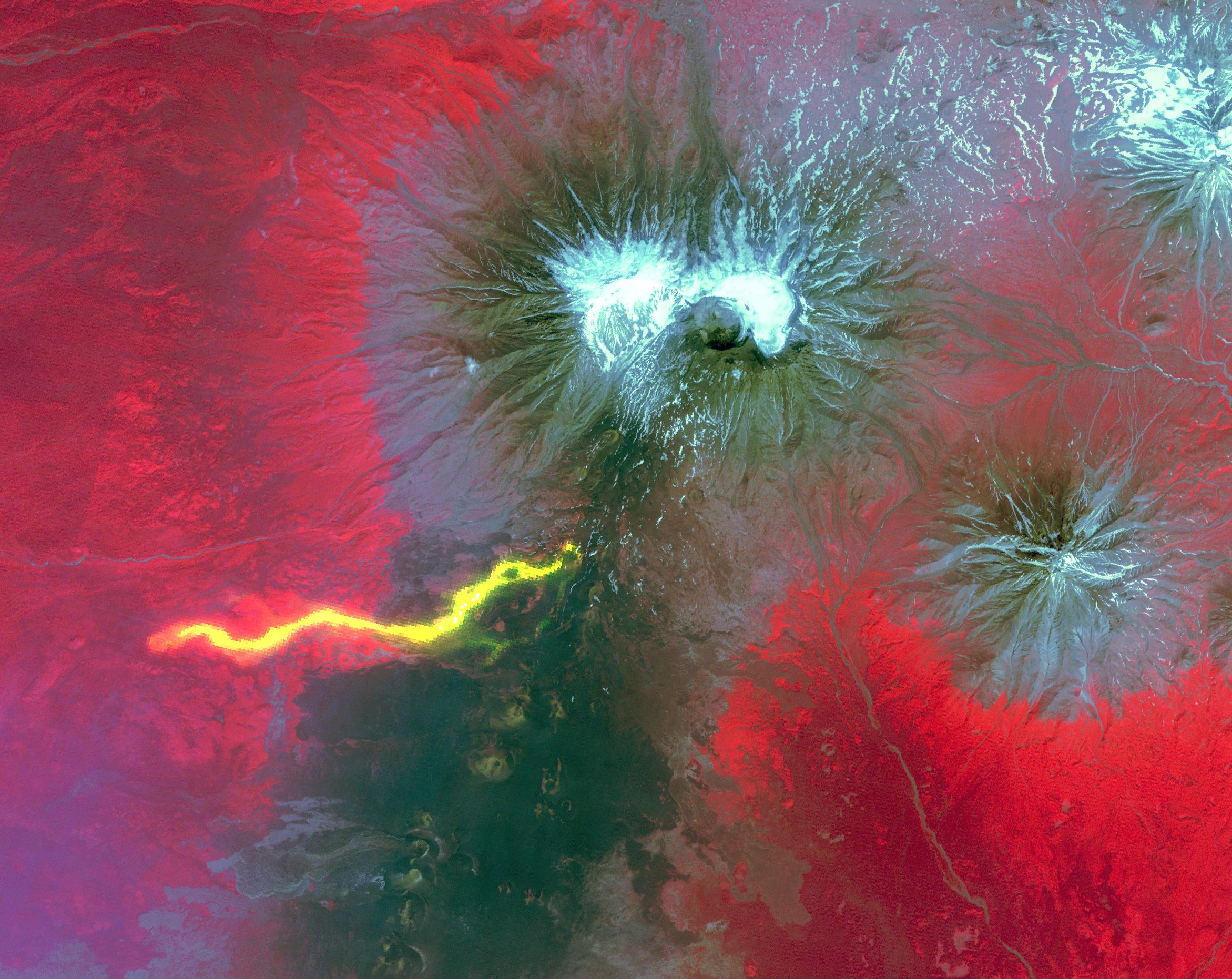
2013-04-03 |
Earth
|
UAVSAR
|
L-Band UAVSAR
|
1079x863x3 |
|
-
PIA16943:
-
UAVSAR Acquires False-Color Image of Galeras Volcano, Colombia
Full Resolution:
TIFF
(2.795 MB)
JPEG
(230.9 kB)
|
|
|
2013-04-03 |
Earth
|
UAVSAR
|
L-Band UAVSAR
|
2806x1314x3 |
|
-
PIA16942:
-
NASA Sends Unmanned Aircraft To Study Volcanoes and Wetlands
Full Resolution:
TIFF
(11.07 MB)
JPEG
(1.742 MB)
|
|
|
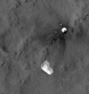
2013-04-03 |
Mars
|
Mars Reconnaissance Orbiter (MRO)
Mars Science Laboratory (MSL)
|
HiRISE
|
369x390x1 |
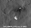
|
-
PIA16813:
-
MSL's Parachute Flapping in the Wind

Full Resolution:
TIFF
(144.3 kB)
JPEG
(15.5 kB)
|
|
|
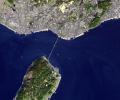
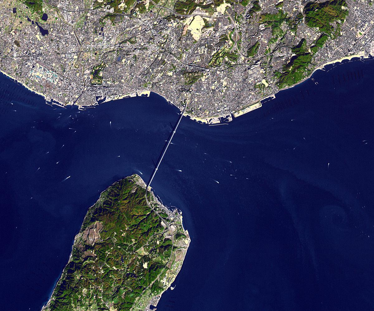
2013-03-25 |
Earth
|
Terra
|
ASTER
|
1200x1000x3 |
|
-
PIA16905:
-
Akashi Kaikyo Bridge, Japan
Full Resolution:
TIFF
(3.602 MB)
JPEG
(266.1 kB)
|
|
|
2013-03-21 |
|
Planck
|
|
1276x719x3 |

|
-
PIA16882:
-
A Journey of Light Through Space and Time
Full Resolution:
TIFF
(2.754 MB)
JPEG
(81.33 kB)
|
|
|
2013-03-15 |
Earth
|
Terra
|
ASTER
|
2931x3045x3 |
|
-
PIA16894:
-
Shark Bay, Australia
Full Resolution:
TIFF
(26.79 MB)
JPEG
(1.144 MB)
|
|
|
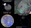
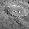
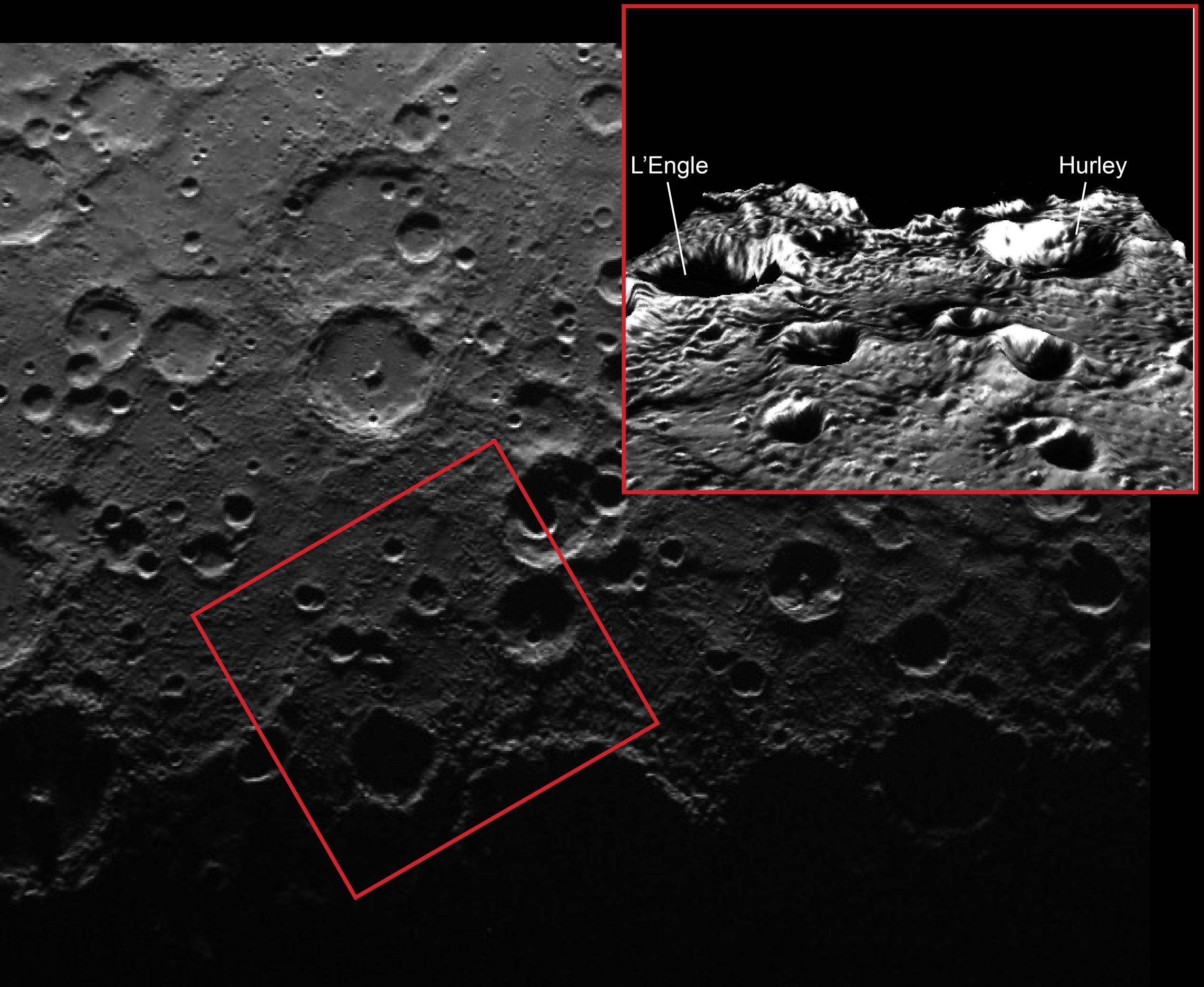
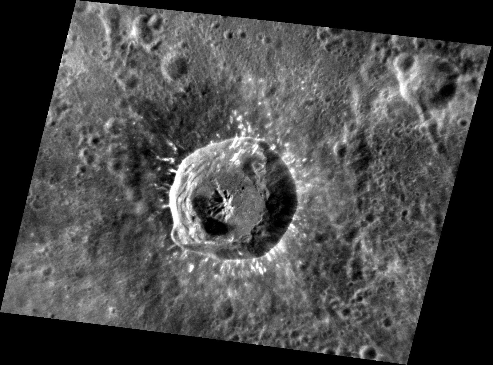
2013-03-14 |
Mercury
|
MESSENGER
|
Mercury Dual Imaging System (MDIS)
|
663x612x3 |
|
-
PIA16893:
-
A Tribute to MESSENGER: Video
Full Resolution:
TIFF
(1.218 MB)
JPEG
(65.88 kB)
|
|
|
2013-03-07 |
Mercury
|
MESSENGER
|
MDIS - Narrow Angle
|
1340x1334x1 |
|
-
PIA16867:
-
On the Other Side
Full Resolution:
TIFF
(1.79 MB)
JPEG
(147.5 kB)
|
|
|
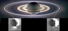
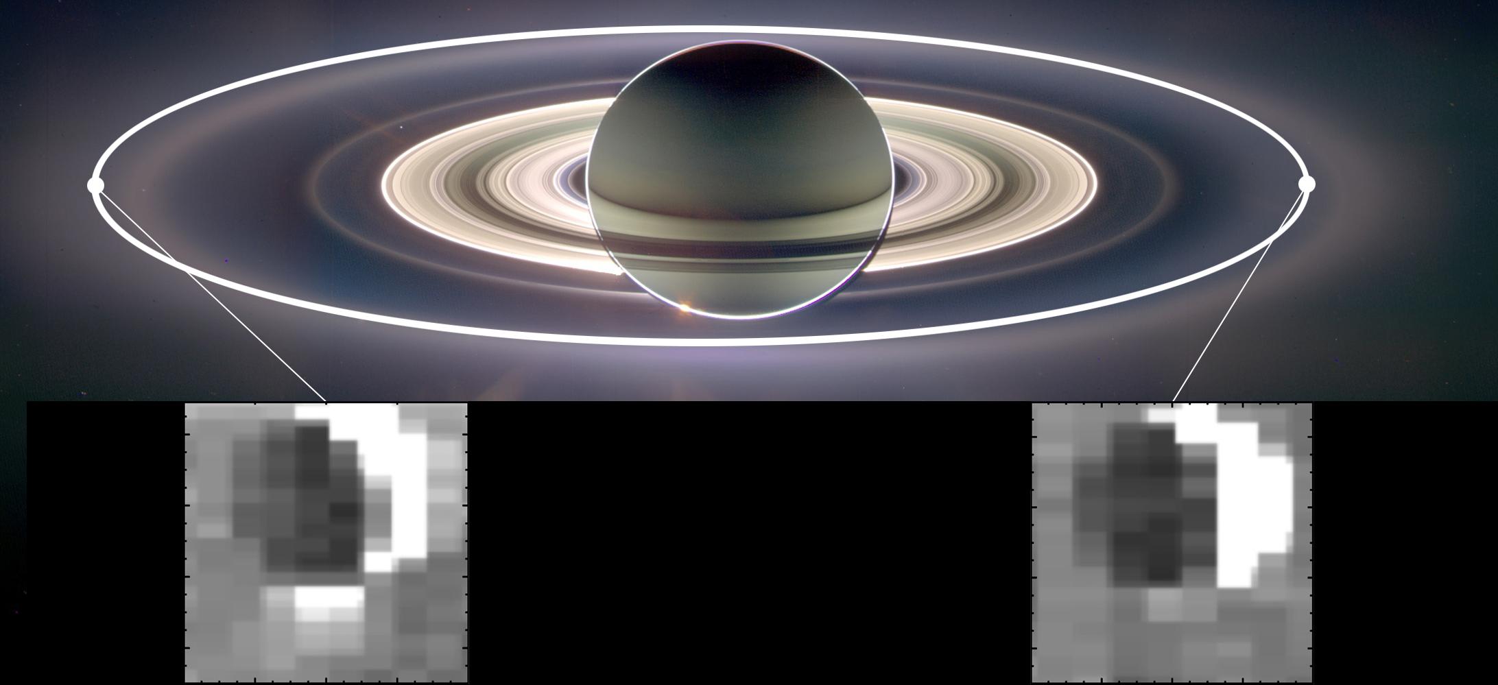
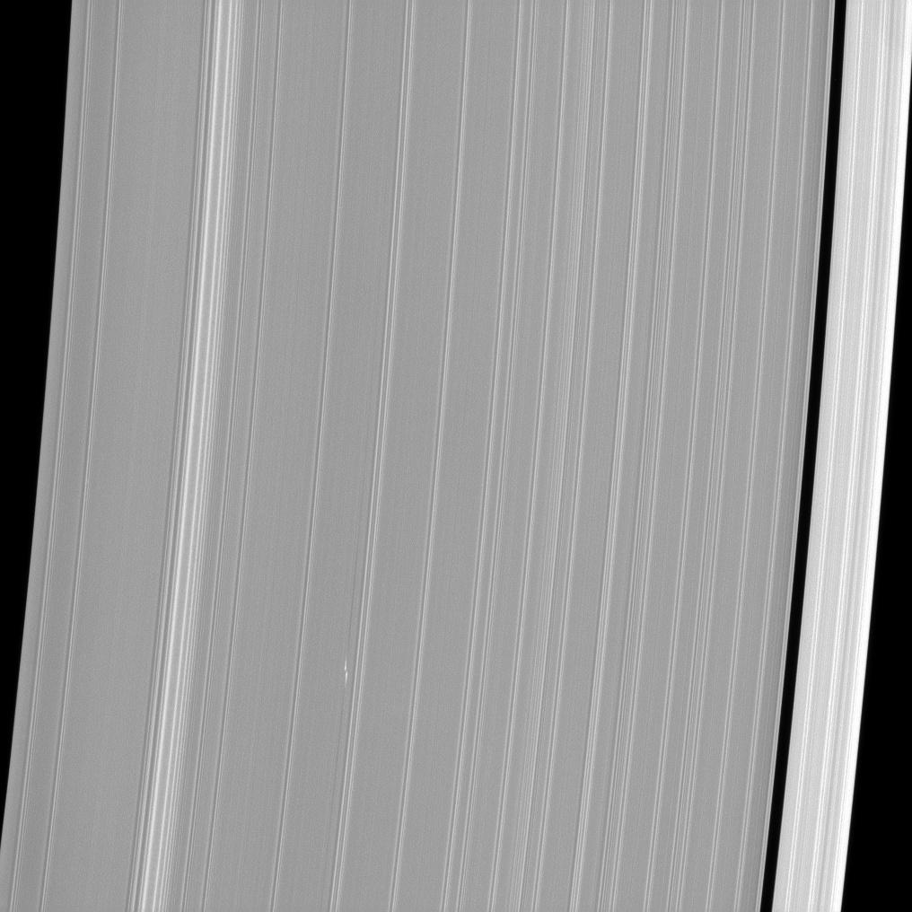
2013-02-25 |
S Rings
|
Cassini-Huygens
|
ISS - Narrow Angle
|
1016x1016x1 |
|
-
PIA14649:
-
Bleriot Recaptured
Full Resolution:
TIFF
(1.033 MB)
JPEG
(101.4 kB)
|
|
|
2013-02-20 |
Mercury
|
MESSENGER
|
MDIS - Narrow Angle
|
1603x1188x1 |
|
-
PIA16856:
-
The Return of Xiao Zhao
Full Resolution:
TIFF
(1.906 MB)
JPEG
(250.9 kB)
|
|
|
2013-02-19 |
Earth
|
Terra
|
ASTER
|
989x691x3 |
|
-
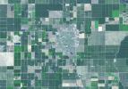
PIA16855:
-
Wasco, California
Full Resolution:
TIFF
(2.051 MB)
JPEG
(118.7 kB)
|
|
|
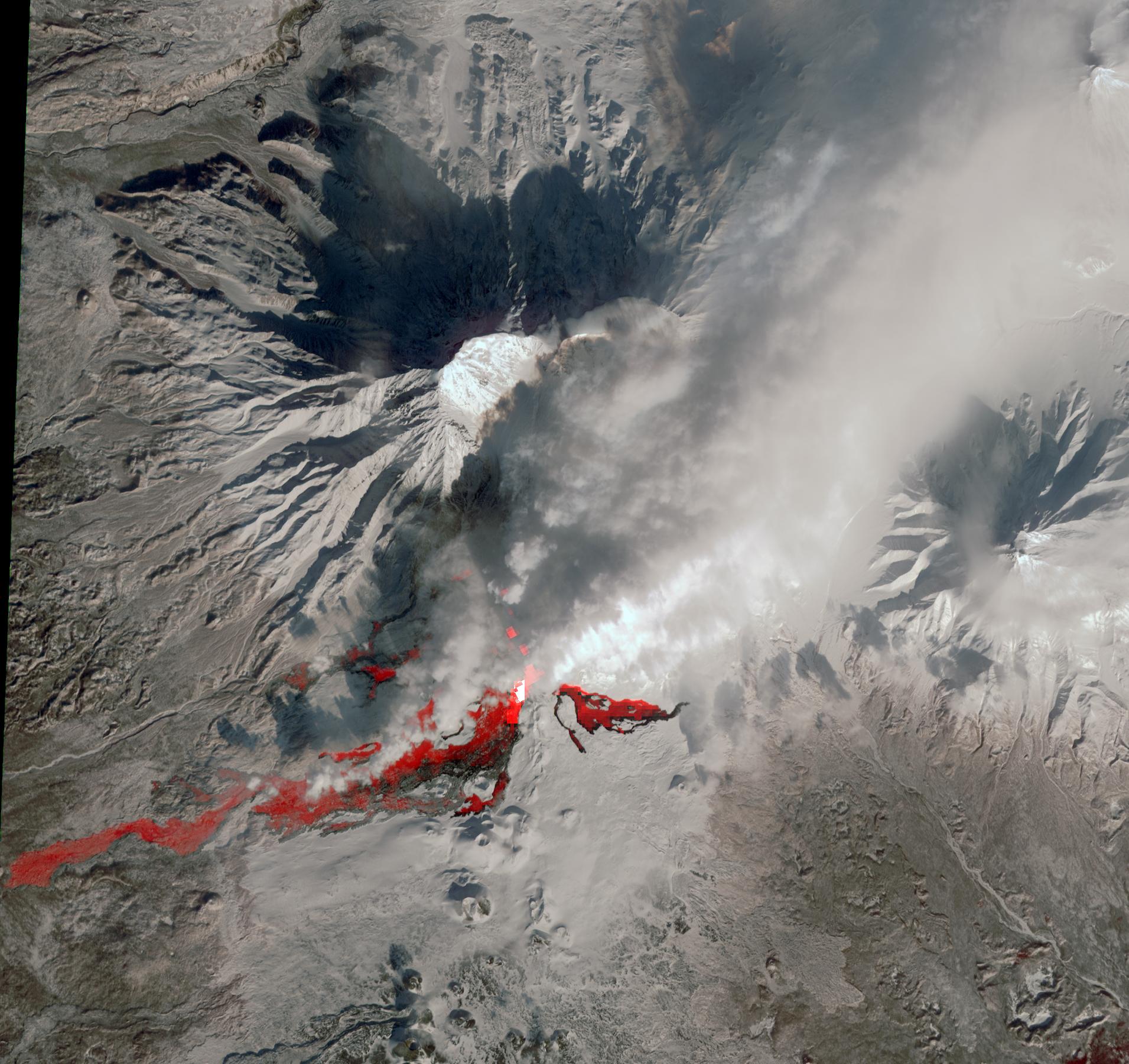
2013-02-15 |
Earth
|
Terra
|
ASTER
|
1911x1800x3 |
|
-
PIA16824:
-
NASA Satellite Captures New Russian Volcanic Eruption
Full Resolution:
TIFF
(10.32 MB)
JPEG
(442.7 kB)
|
|
|
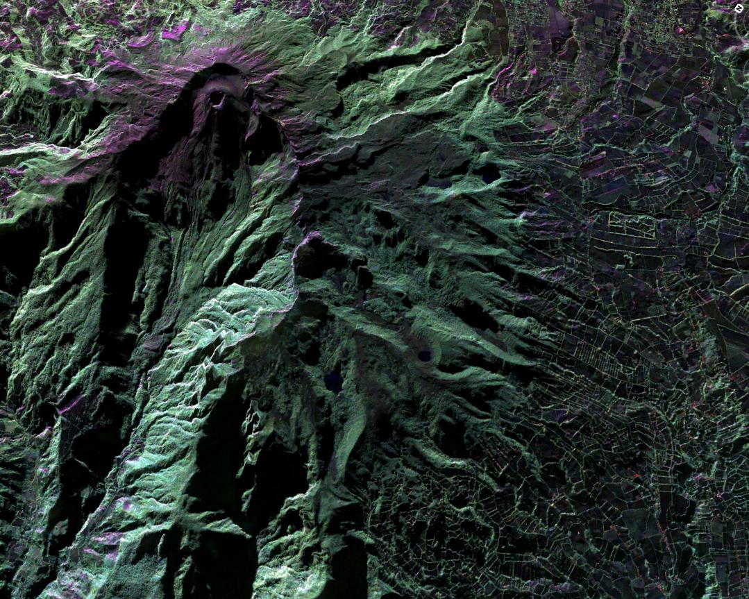
2013-02-08 |
Earth
|
Terra
|
ASTER
|
3414x2546x3 |

|
-
PIA16788:
-
Bushveld Igneous Complex, South Africa
Full Resolution:
TIFF
(26.09 MB)
JPEG
(1.736 MB)
|
|
|
2013-02-08 |
Mercury
|
MESSENGER
|
MDIS - Wide Angle
|
1017x1017x3 |
|
-
PIA16820:
-
The Beauty of Calibration
Full Resolution:
TIFF
(3.104 MB)
JPEG
(195.8 kB)
|
|
|
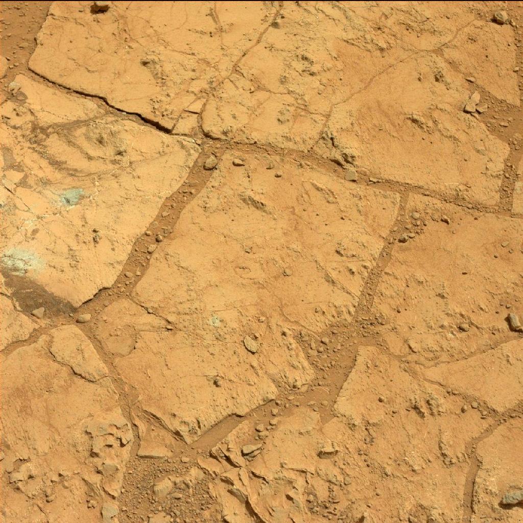
2013-02-07 |
Mars
|
Mars Science Laboratory (MSL)
|
Mastcam
|
1024x1024x3 |
|
-
PIA16762:
-
Before-and-After Blink of Curiosity 'Mini Drill' into Mars Rock
Full Resolution:
TIFF
(1.051 MB)
JPEG
(216.1 kB)
|
|
|
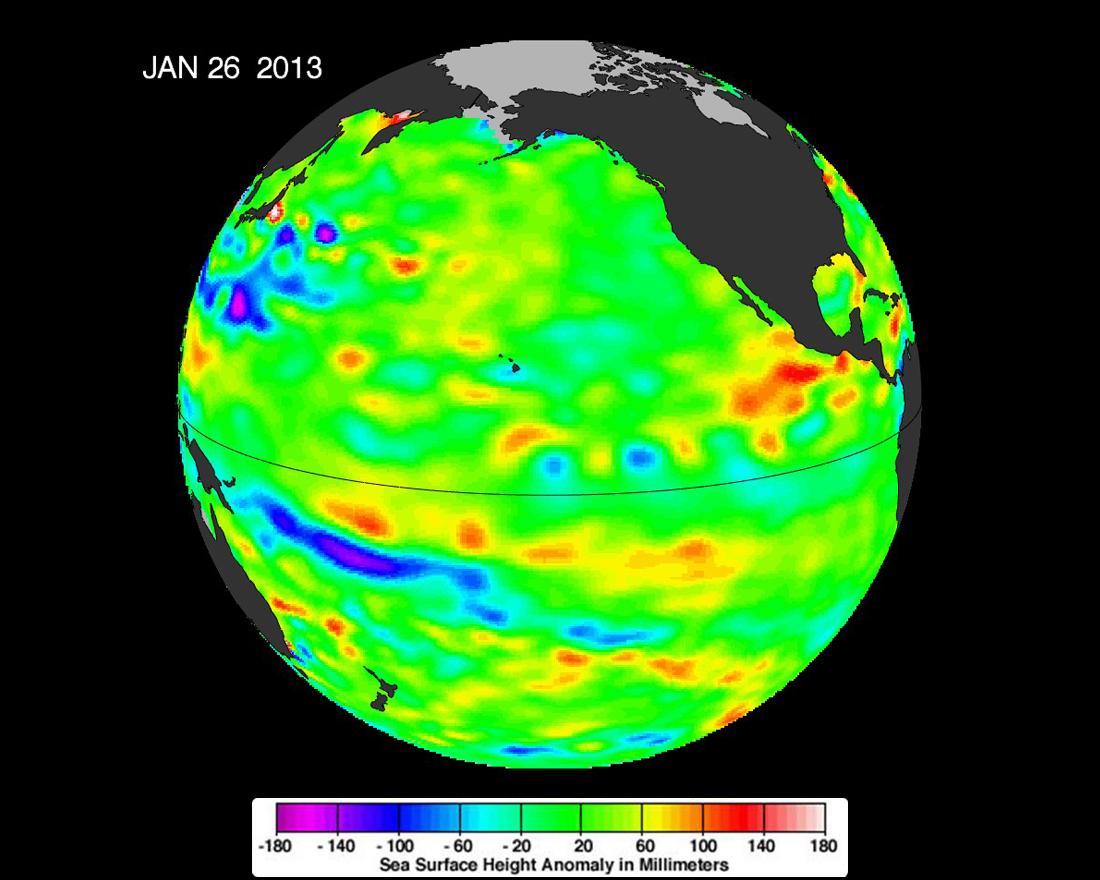
2013-02-07 |
Earth
|
OSTM/Jason-2
|
Altimeter
|
1100x880x3 |
|
-
PIA16787:
-
Pacific Locked in 'La Nada' Limbo
Full Resolution:
TIFF
(2.905 MB)
JPEG
(93.08 kB)
|
|
|
2013-02-05 |
Earth
|
Terra
|
ASTER
|
1505x1174x3 |

|
-
PIA16783:
-
NASA Spacecraft Captures 3-D View of Massive Australian Wildfire
Full Resolution:
TIFF
(5.303 MB)
JPEG
(356.6 kB)
|
|
|
2013-02-01 |
Mercury
|
MESSENGER
|
MDIS - Narrow Angle
|
1024x1024x1 |
|
-
PIA16778:
-
Ruining Rudyard
Full Resolution:
TIFF
(1.05 MB)
JPEG
(128.1 kB)
|
|
|
2013-01-30 |
Earth
|
Terra
|
ASTER
|
863x2010x3 |
|
-
PIA16776:
-
Jakarta, Indonesia
Full Resolution:
TIFF
(5.206 MB)
JPEG
(393.5 kB)
|
|
|
2013-01-29 |
Earth
|
Terra
|
ASTER
|
4284x8520x3 |
|
-
PIA16772:
-
NASA Satellite Images Severe Flooding in Mozambique
Full Resolution:
TIFF
(109.6 MB)
JPEG
(7.229 MB)
|
|
|
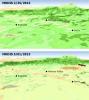
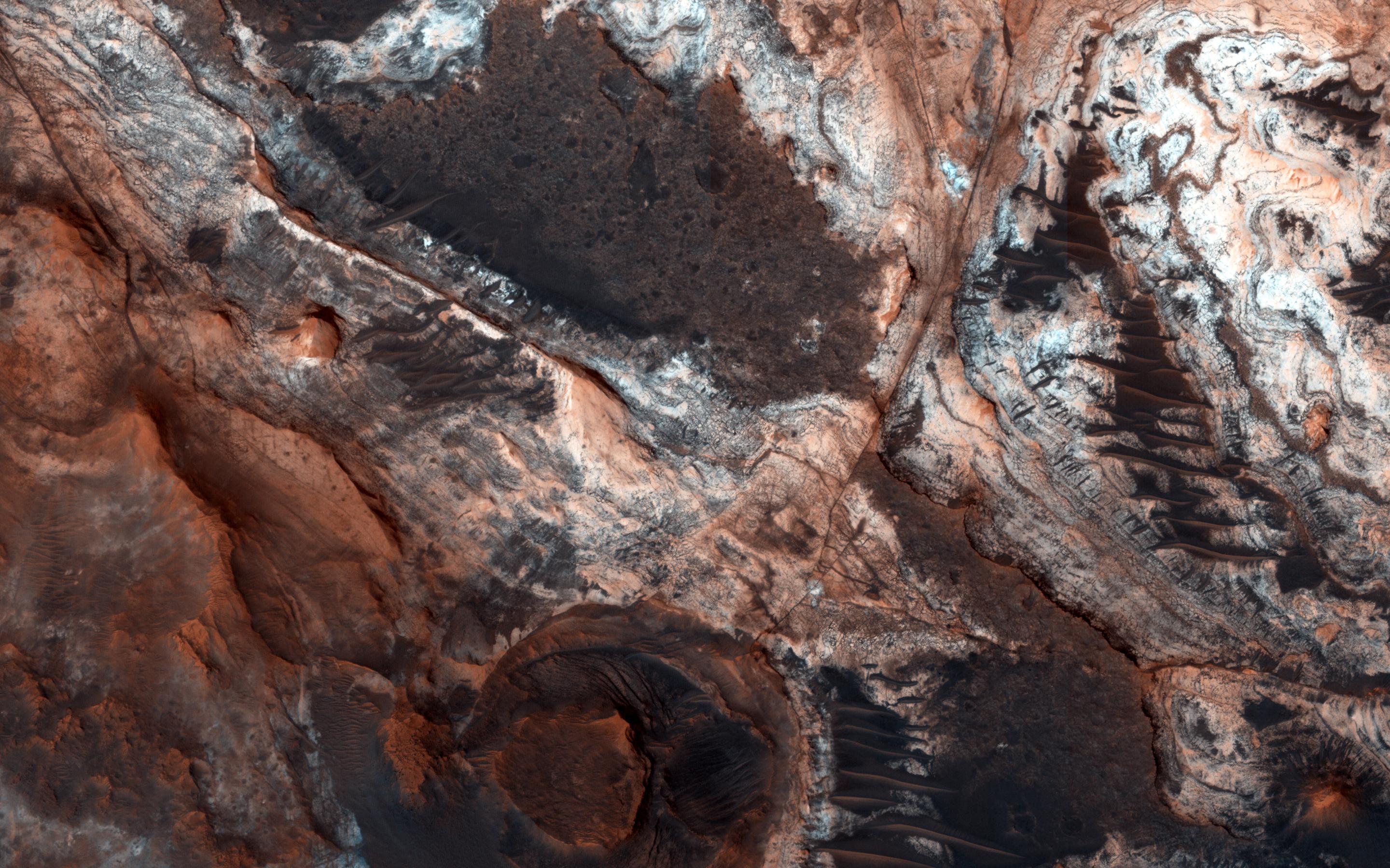
2013-01-24 |
Mars
|
Mars Reconnaissance Orbiter (MRO)
|
HiRISE
|
503x340x3 |
|
-
PIA16715:
-
Seasonal Changes on Far-Northern Mars
Full Resolution:
TIFF
(513.5 kB)
JPEG
(35.91 kB)
|
|
|
2013-01-16 |
Earth
|
Terra
|
ASTER
|
1563x2055x3 |
|
-
PIA16741:
-
NASA's Terra Spacecraft Images Russian Volcanic Eruption
Full Resolution:
TIFF
(9.639 MB)
JPEG
(455.7 kB)
|
|
|
2013-01-15 |
Mars
|
Mars Science Laboratory (MSL)
|
REMS
|
3300x2550x3 |
|
-
PIA16708:
-
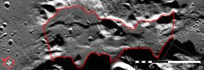
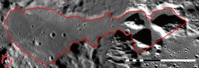
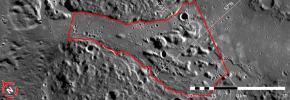
Curiosity's Traverse into Different Terrain
Full Resolution:
TIFF
(25.26 MB)
JPEG
(1.779 MB)
|
|
|
2013-01-15 |
Mars
|
Mars Science Laboratory (MSL)
|
Mastcam
|
12858x6312x3 |
|
-
PIA16568:
-
Diversity in Vicinity of Curiosity's First Drilling Target
Full Resolution:
TIFF
(243.5 MB)
JPEG
(12.8 MB)
|
|
|
2013-01-12 |
Earth
|
Terra
|
ASTER
|
2877x2736x3 |
|
-
PIA16679:
-
Jebel Uweinat
Full Resolution:
TIFF
(23.63 MB)
JPEG
(909.8 kB)
|
|
|
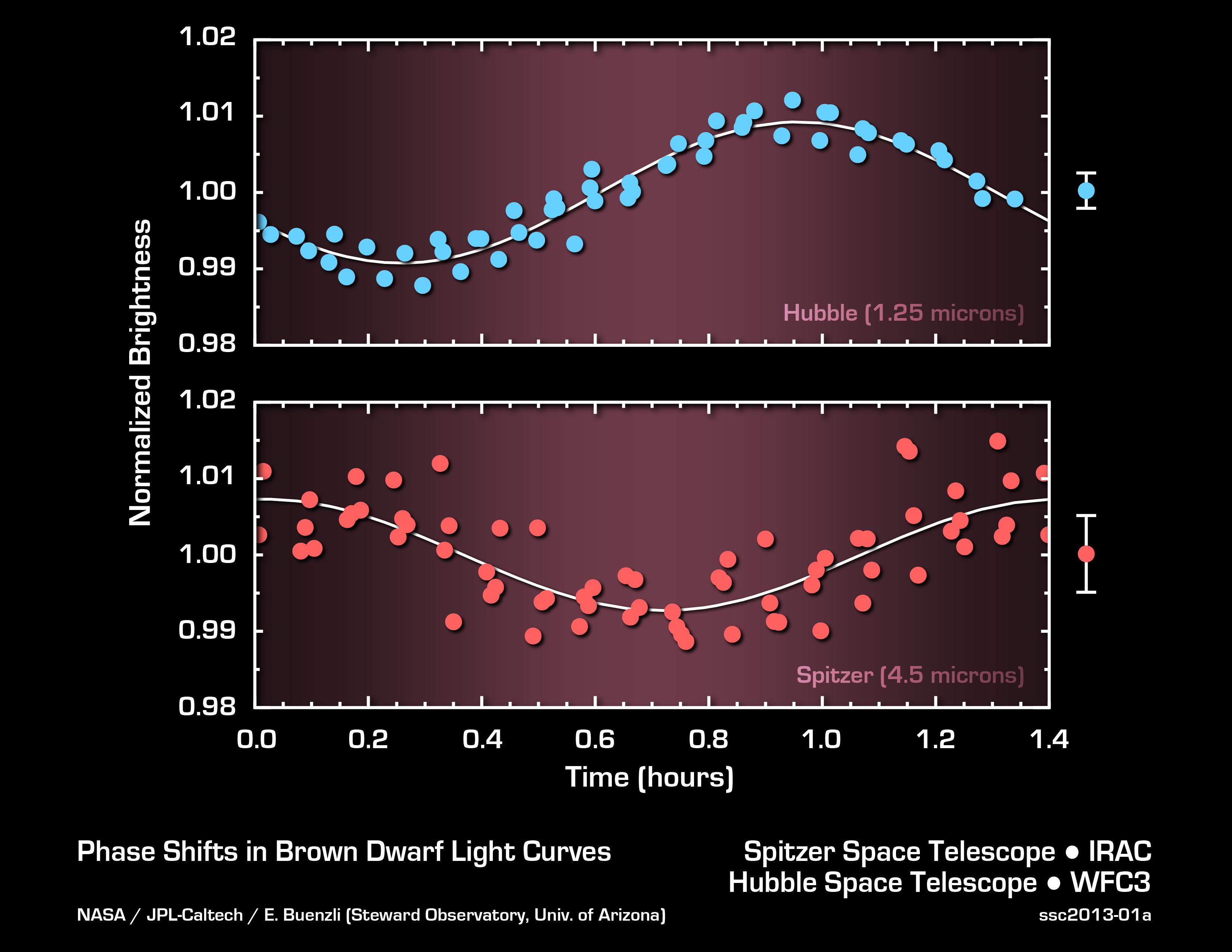
2013-01-08 |
|
Hubble Space Telescope
Spitzer Space Telescope
|
|
3300x2550x3 |
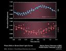
|
-
PIA16612:
-
Probing Brown Dwarf Layers
Full Resolution:
TIFF
(25.26 MB)
JPEG
(422.8 kB)
|
|
|
2013-01-08 |
|
Hubble Space Telescope
Spitzer Space Telescope
|
|
4268x2400x3 |
|
-
PIA16608:
-
Anatomy of Brown Dwarf's Atmosphere (Artist Concept)
Full Resolution:
TIFF
(30.75 MB)
JPEG
(469 kB)
|
|
|
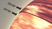
2012-12-14 |
Asteroid
|
Goldstone Deep Space Network (DSN)
|
Goldstone Solar System Radar
|
876x708x1 |
|
-
PIA16599:
-
Tumbling Asteroid Toutatis
Full Resolution:
TIFF
(621.1 kB)
JPEG
(124.8 kB)
|
|
|
2012-12-12 |
Earth
|
Space Shuttle
|
SIR-C/X-SAR
|
2128x1612x1 |
|
-
PIA16179:
-
Nile River in Black and White
Full Resolution:
TIFF
(3.435 MB)
JPEG
(707.9 kB)
|
|
|
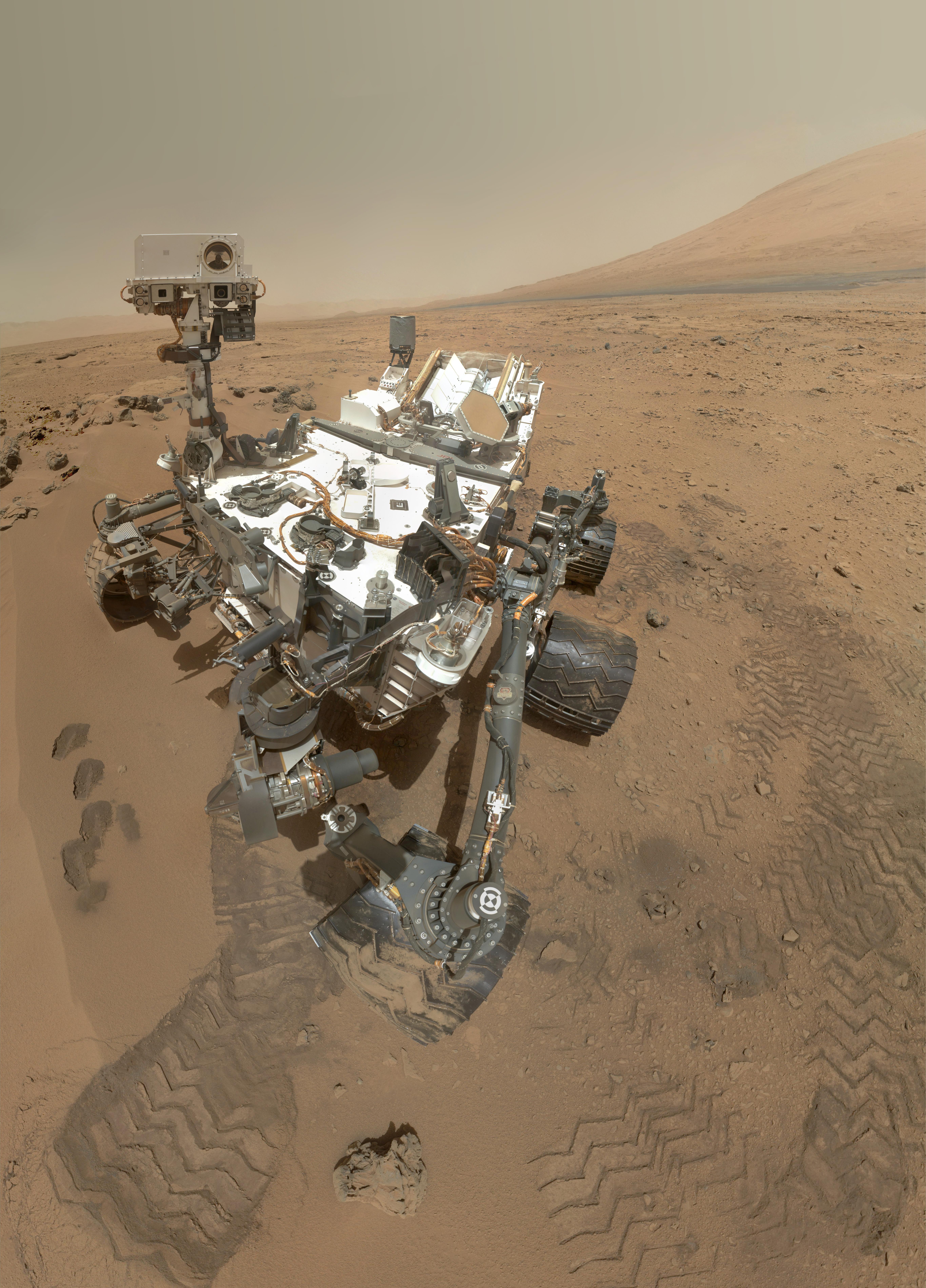
2012-12-11 |
Mars
|
Mars Science Laboratory (MSL)
|
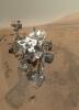
MAHLI
|
6710x4500x3 |
|
-
PIA16457:
-
Curiosity Self-Portrait, Wide View
Full Resolution:
TIFF
(90.62 MB)
JPEG
(2.278 MB)
|
|
|
2012-12-07 |
Earth
|
Terra
|
ASTER
|
1508x1288x3 |
|
-
PIA16596:
-
Heilongjiang Province, China
Full Resolution:
TIFF
(5.829 MB)
JPEG
(482.5 kB)
|
|
|
2012-12-03 |
Earth
|
Terra
|
ASTER
|
2343x1862x3 |
|
-
PIA16590:
-
NASA's Terra Spacecraft Captures Russian Volcano Eruption
Full Resolution:
TIFF
(13.09 MB)
JPEG
(690.7 kB)
|
|
|
2012-12-03 |
Mars
|
Mars Science Laboratory (MSL)
|
SAM
|
1600x1200x3 |
|
-
PIA16574:
-
Atmospheric Loss on Mars
Full Resolution:
TIFF
(5.762 MB)
JPEG
(216.4 kB)
|
|
|
2012-12-03 |
Mars
|
Mars Science Laboratory (MSL)
|
|
1809x1332x3 |
|
-
PIA16571:
-
A Sampling of Martian Soils
Full Resolution:
TIFF
(7.232 MB)
JPEG
(328.1 kB)
|
|
|
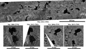
2012-11-30 |
Mercury
|
MESSENGER
|
Neutron Spectrometer
|
1980x4235x3 |
|
-
PIA16526:
-
Neutron Spectrometer Measurements
Full Resolution:
TIFF
(25.16 MB)
JPEG
(383.7 kB)
|
|
|
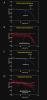
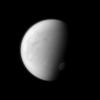
2012-11-28 |
Titan
|
Cassini-Huygens
|
|
4300x1722x3 |
|
-
PIA16481:
-
Titan's Changing Seasons (Artist's Concept)
Full Resolution:
TIFF
(22.23 MB)
JPEG
(244.3 kB)
|
|
|
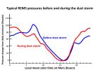
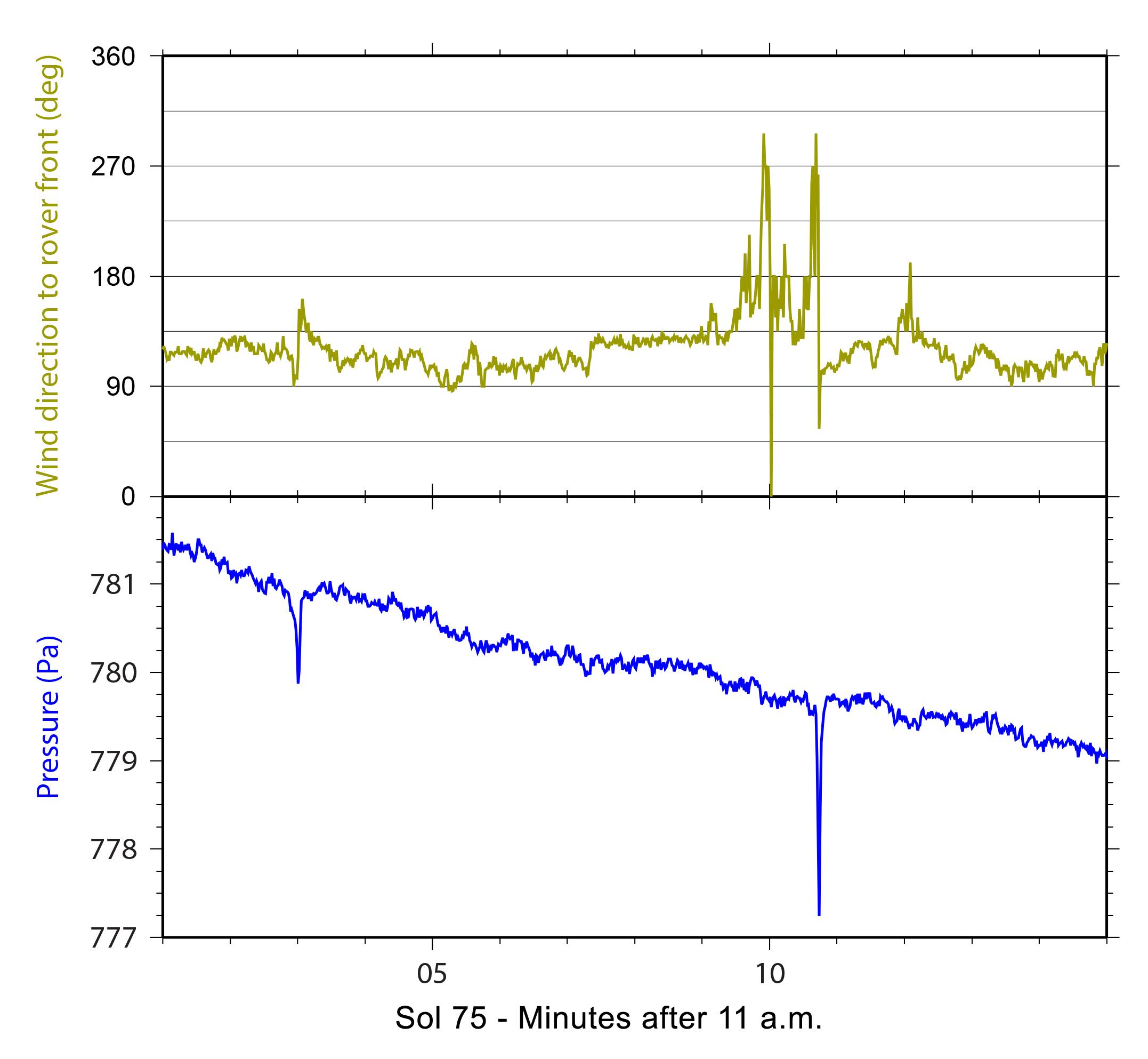
2012-11-27 |
Mars
|
Mars Science Laboratory (MSL)
|
REMS
|
2999x2249x3 |
|
-
PIA16455:
-
Atmospheric Pressure Patterns Before and During Dust Storm
Full Resolution:
TIFF
(20.24 MB)
JPEG
(324.8 kB)
|
|
|
2012-11-26 |
Earth
|
Terra
|
ASTER
|
925x775x3 |

|
-
PIA16542:
-
Amsterdam, Netherlands
Full Resolution:
TIFF
(2.152 MB)
JPEG
(221.1 kB)
|
|
|
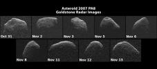
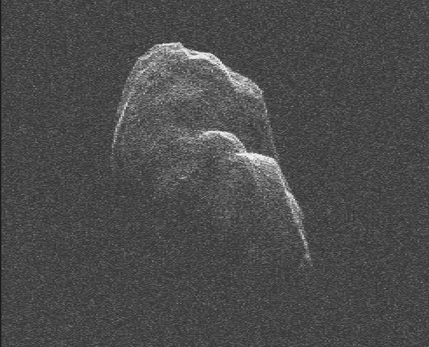
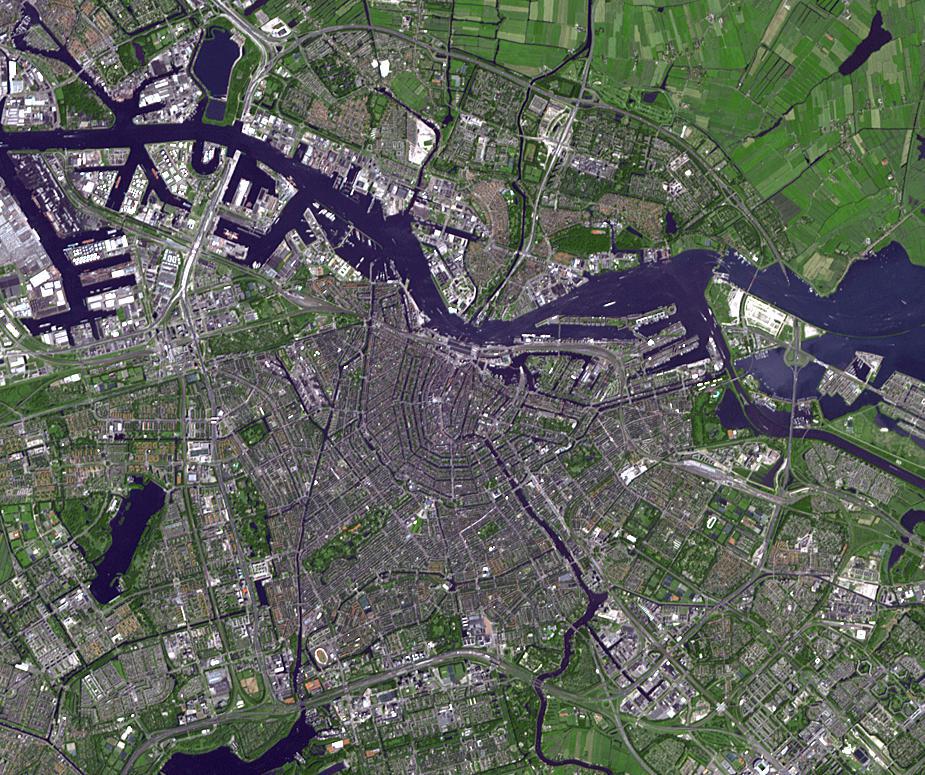
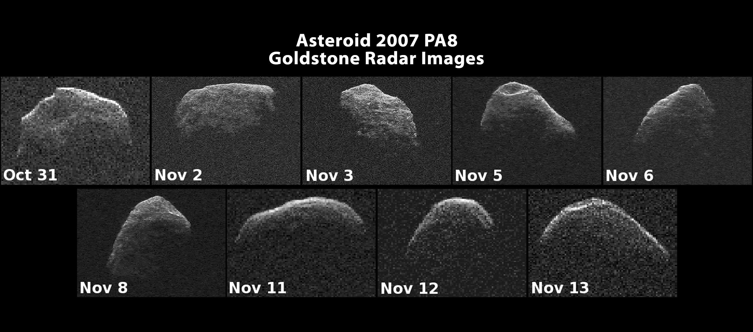
2012-11-26 |
Asteroid
|
Goldstone Deep Space Network (DSN)
|
Goldstone Solar System Radar
|
2448x1080x1 |
|
-
PIA16474:
-
Nine Radar Images of Asteroid PA8
Full Resolution:
TIFF
(2.647 MB)
JPEG
(271.5 kB)
|
|
|
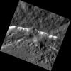
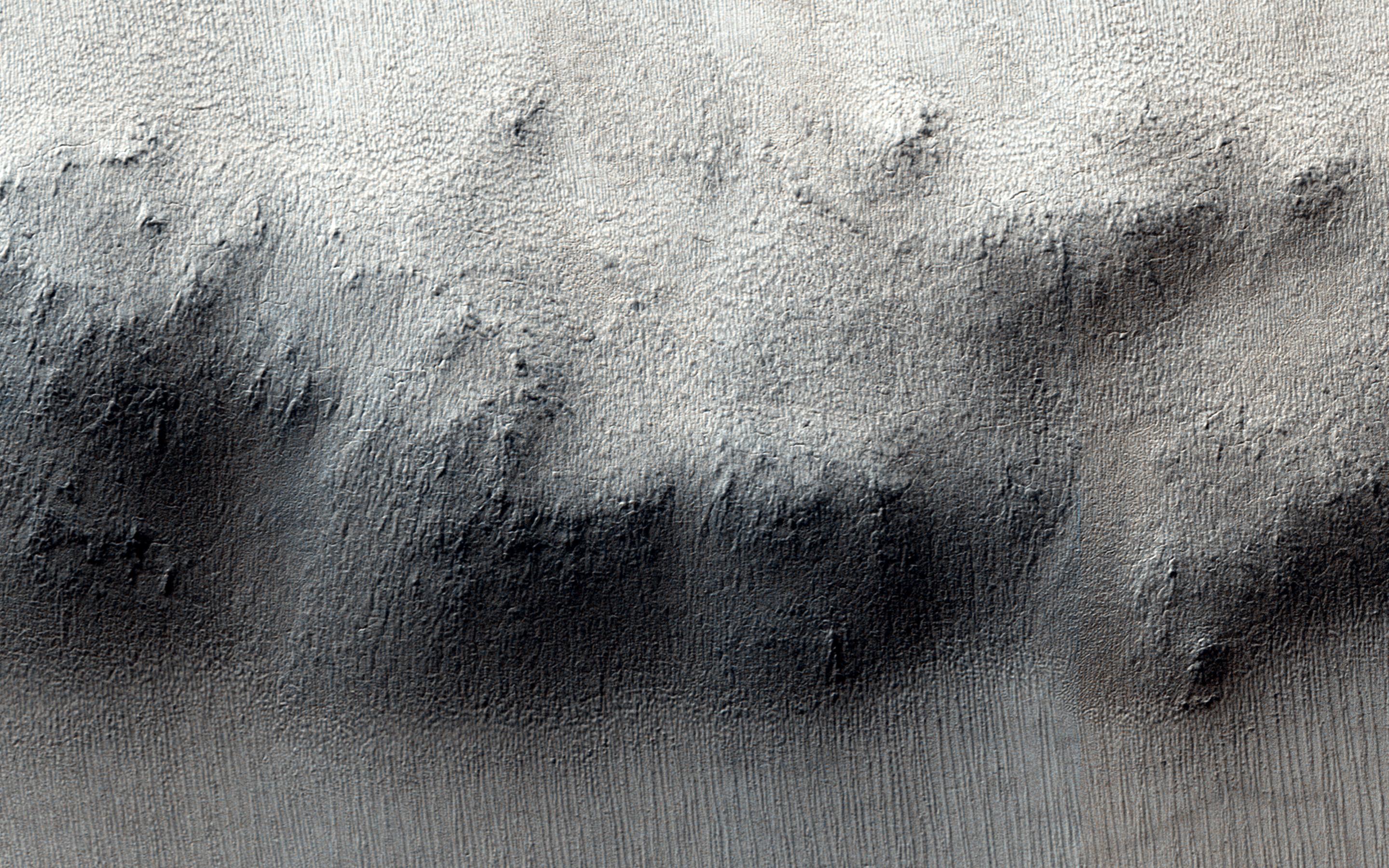
2012-11-15 |
Mars
|
Mars Science Laboratory (MSL)
|
REMS
|
2154x1986x3 |
|
-
PIA16476:
-
Signs of a Whirlwind in Gale Crater
Full Resolution:
TIFF
(12.84 MB)
JPEG
(224 kB)
|
|
|
2012-11-12 |
Earth
|
Terra
|
ASTER
|
1554x5122x3 |

|
-
PIA15950:
-
Ogasawara Islands, Japan
Full Resolution:
TIFF
(23.89 MB)
JPEG
(603.3 kB)
|
|
|
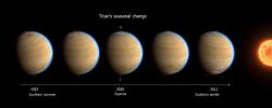
2012-11-12 |
Titan
|
Cassini-Huygens
|
ISS - Narrow Angle
|
1300x1300x1 |
|
-
PIA14634:
-
Seasonal Swirl
Full Resolution:
TIFF
(1.692 MB)
JPEG
(45.63 kB)
|
|
|
2012-11-02 |
|
Mars Science Laboratory (MSL)
|
SAM
|
922x627x3 |
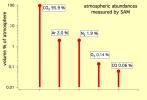
|
-
PIA16460:
-
The Five Most Abundant Gases in the Martian Atmosphere
Full Resolution:
TIFF
(1.735 MB)
JPEG
(43.96 kB)
|
|
|
2012-11-02 |
Mars
|
2001 Mars Odyssey
|
THEMIS
|
937x2920x1 |
|
-
PIA16338:
-
South Pole
Full Resolution:
TIFF
(2.739 MB)
JPEG
(313.1 kB)
|
|
|
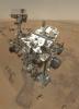
2012-11-01 |
Mars
|
Mars Science Laboratory (MSL)
|
MAHLI
|
5463x7595x3 |
|
-
PIA16239:
-
High-Resolution Self-Portrait by Curiosity Rover Arm Camera
Full Resolution:
TIFF
(124.5 MB)
JPEG
(3.831 MB)
|
|
|
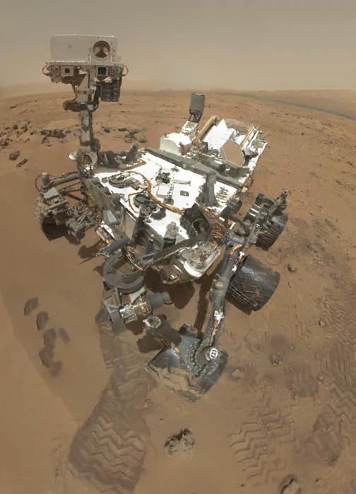
2012-11-01 |
Mars
|
Mars Science Laboratory (MSL)
|
MAHLI
|
504x699x3 |
|
-
PIA16238:
-
Preliminary Self-Portrait of Curiosity by Rover's Arm Camera
Full Resolution:
TIFF
(1.057 MB)
JPEG
(45.02 kB)
|
|
|
2012-10-22 |
Earth
|
Terra
|
ASTER
|
800x600x3 |
|
-
PIA16295:
-
Baytown Refinery, Texas
Full Resolution:
TIFF
(1.441 MB)
JPEG
(103.8 kB)
|
|
|
2012-10-17 |
Earth
|
Jason-1 (Topex/Poseidon)
OSTM/Jason-2
|
Altimeter
|
1384x858x3 |
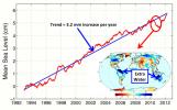
|
-
PIA16294:
-
After Brief Dip, Global Mean Sea Level Resumes Climb
Full Resolution:
TIFF
(3.564 MB)
JPEG
(143.3 kB)
|
|
|
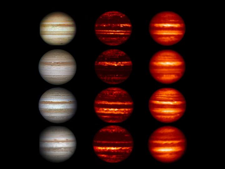
2012-10-17 |
Jupiter
|
IRTF
|
Infrared Telescope
|
720x541x3 |
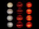
|
-
PIA16168:
-
Global Upheaval at Jupiter
Full Resolution:
TIFF
(1.169 MB)
JPEG
(27.58 kB)
|
|
|
2012-10-16 |
Titan
|
Cassini-Huygens
|
Radar Mapper
|
1911x1086x1 |
|
-
PIA16167:
-
Titan's Lake District, One Season Later
Full Resolution:
TIFF
(2.078 MB)
JPEG
(732.9 kB)
|
|
|
2012-10-05 |
Earth
|
Terra
|
ASTER
|
3015x2742x3 |
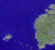
|
-
PIA15007:
-
Brittany, France
Full Resolution:
TIFF
(24.81 MB)
JPEG
(1.091 MB)
|
|
|
2012-09-28 |
Earth
|
Terra
|
ASTER
|
988x1146x3 |
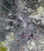
|
-
PIA16292:
-
Baikonur Cosmodrome, Kazakhstan
Full Resolution:
TIFF
(3.398 MB)
JPEG
(329.6 kB)
|
|
|
2012-09-28 |
Earth
|
Terra
|
ASTER
|
1447x879x3 |
|
-
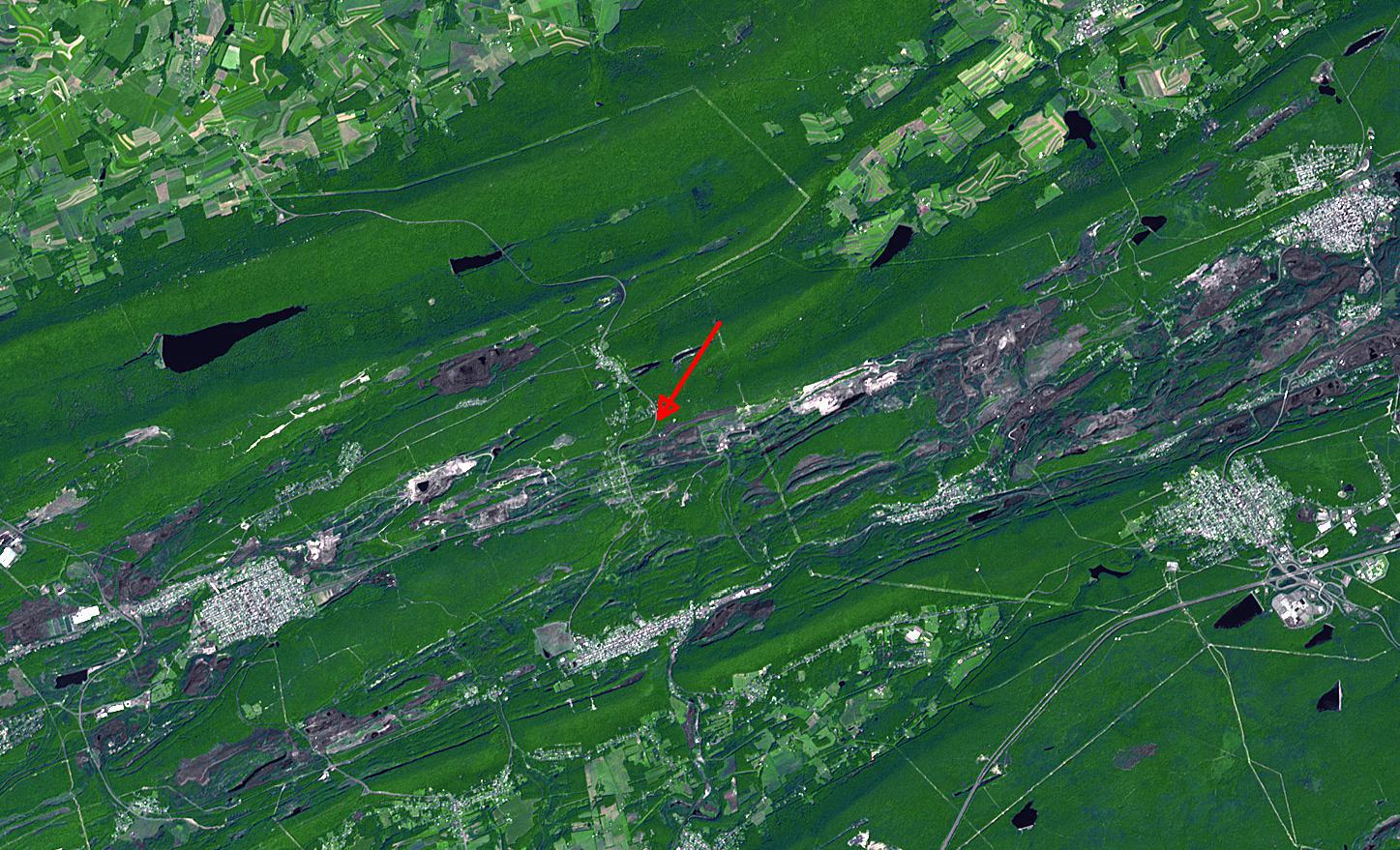
PIA16291:
-
Centralia, Pennsylvania
Full Resolution:
TIFF
(3.817 MB)
JPEG
(321.8 kB)
|
 Planetary Data System


