My
List |
Addition Date
|
Target
|
Mission
|
Instrument
|
Size
|

|
1999-04-15 |
Earth
|
Spaceborne Imaging Radar-C/X-Band Synthetic Aperture Radar
|
|
2325x1521x3 |
|
-
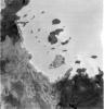
PIA01837:
-
Space Radar Image of Mineral Resources, China
Full Resolution:
TIFF
(9.551 MB)
JPEG
(1.02 MB)
|
|
|
1999-04-15 |
Earth
|
Spaceborne Imaging Radar-C/X-Band Synthetic Aperture Radar
|
|
2050x3120x3 |
|
-
PIA01838:
-
Space Radar Image of Great Wall of China
Full Resolution:
TIFF
(16.51 MB)
JPEG
(1.113 MB)
|
|
|
1999-04-15 |
Earth
|
Spaceborne Imaging Radar-C/X-Band Synthetic Aperture Radar
|
|
2805x2472x3 |
|
-
PIA01839:
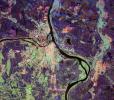
-
Space Radar Image of Belgrade, Serbia
Full Resolution:
TIFF
(26.23 MB)
JPEG
(2.34 MB)
|
|
|
1999-04-15 |
Earth
|
Spaceborne Imaging Radar-C/X-Band Synthetic Aperture Radar
|
|
1920x1080x3 |
|
-
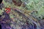
PIA01840:
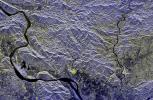
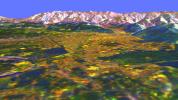
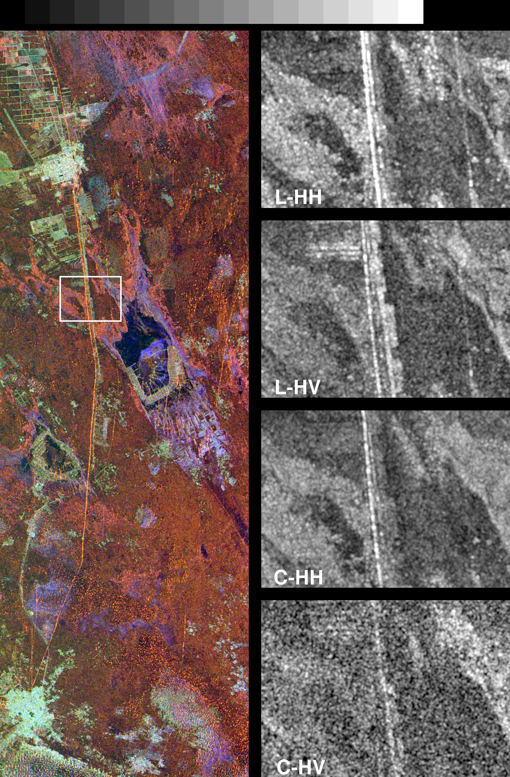
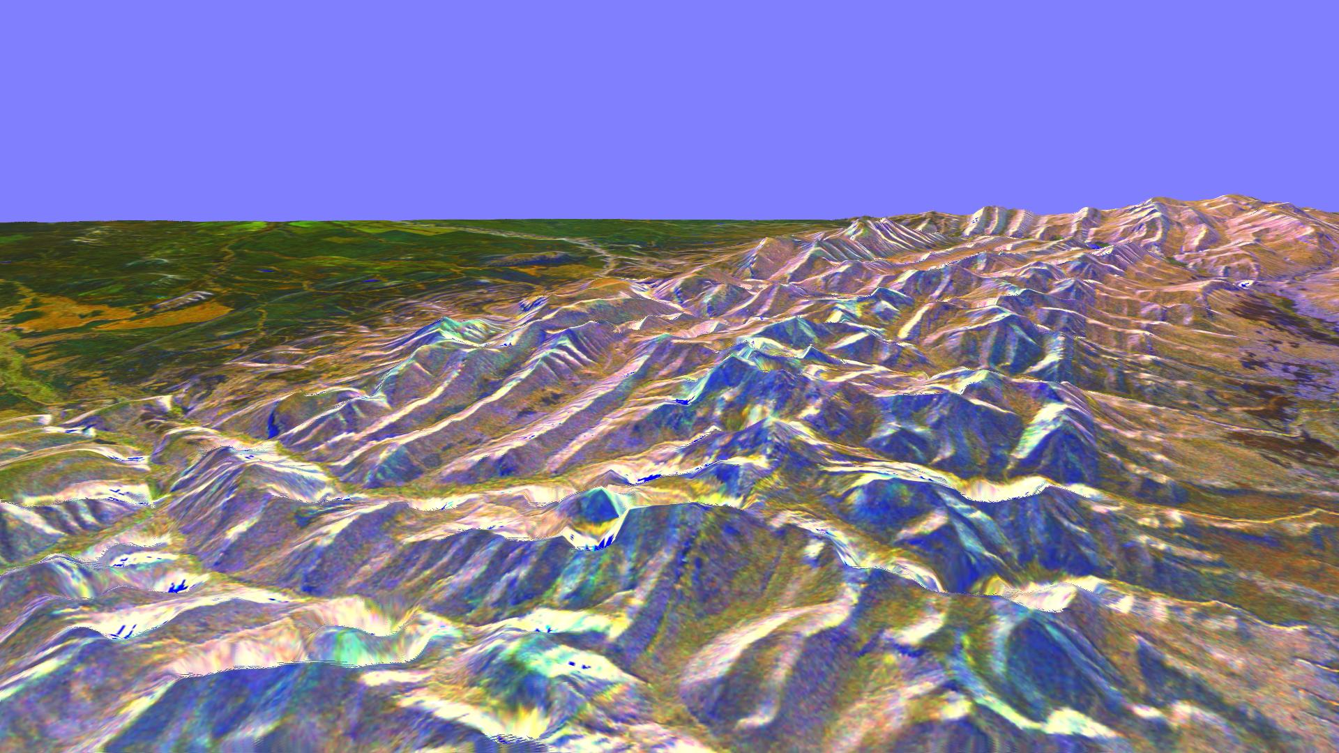
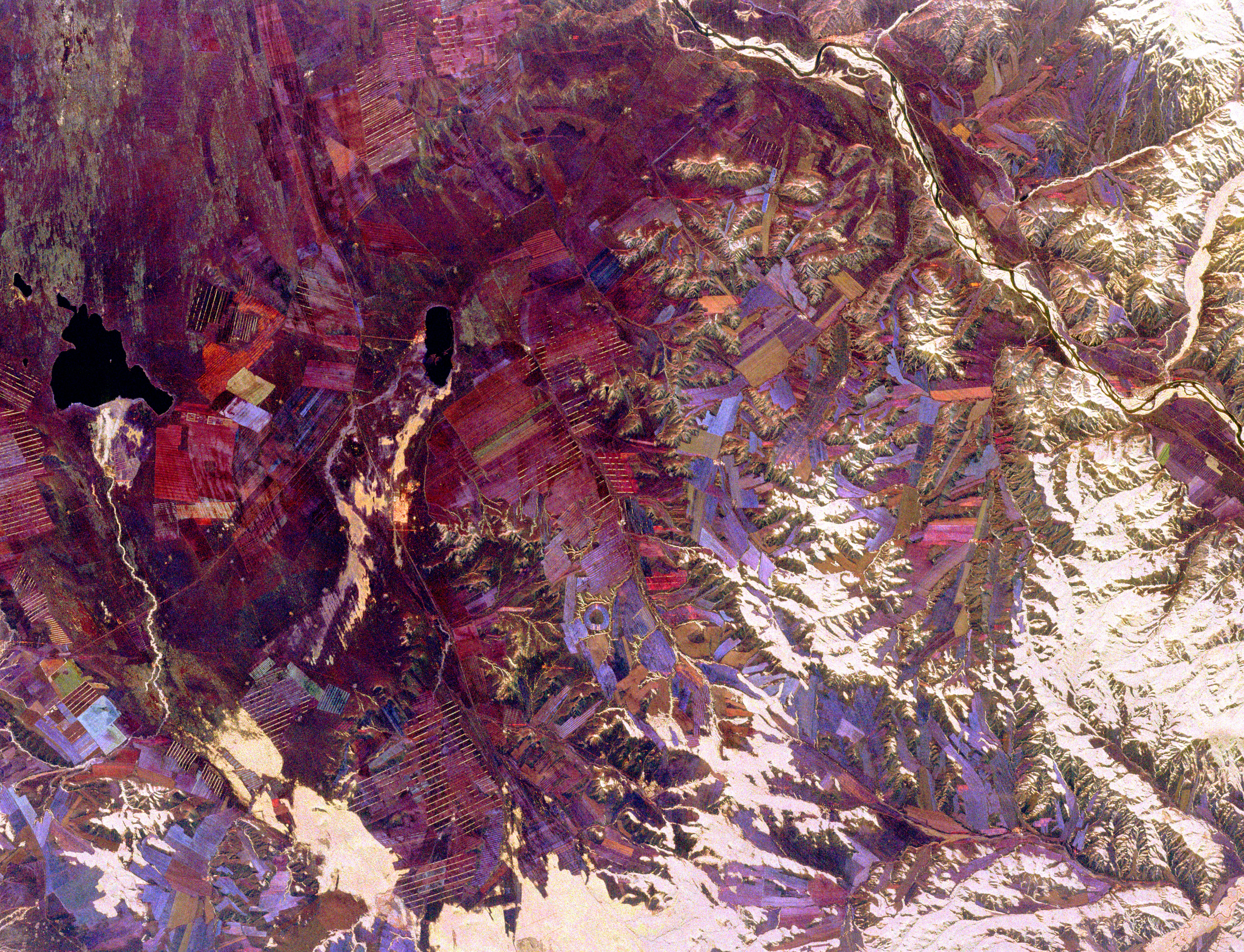
-
Space Radar Image of Rocky Mountains, Montana
Full Resolution:
TIFF
(5.591 MB)
JPEG
(319.5 kB)
|
|
|
1999-04-15 |
Earth
|
Spaceborne Imaging Radar-C/X-Band Synthetic Aperture Radar
|
|
1920x1080x3 |
|
-
PIA01841:
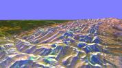
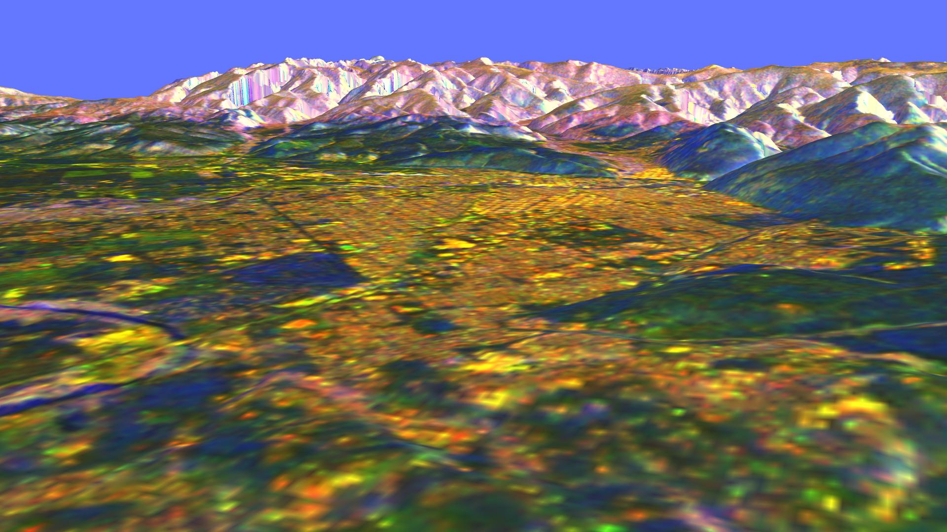
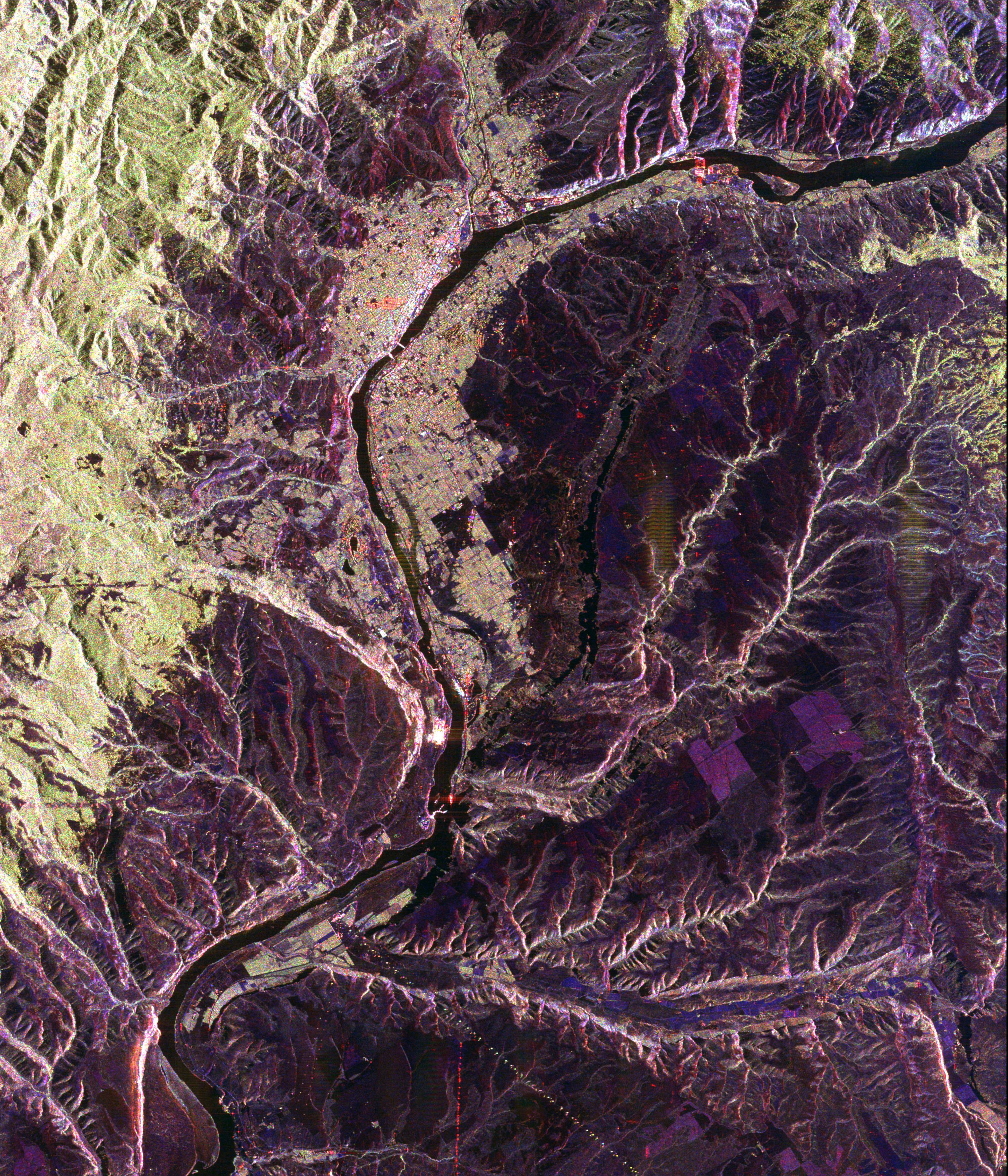
-
Space Radar Image of Missoula, Montana in 3-D
Full Resolution:
TIFF
(6.282 MB)
JPEG
(267.3 kB)
|
|
|
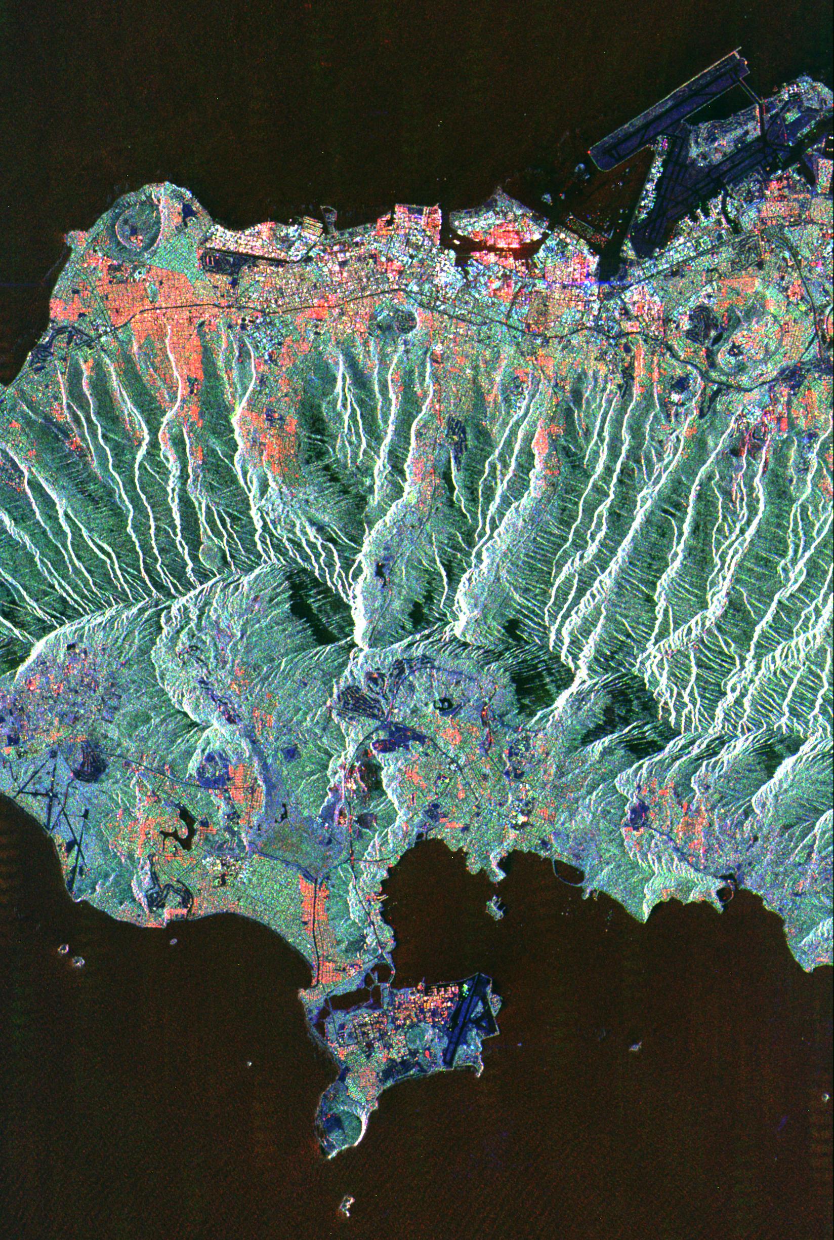
2002-10-29 |
Earth
|
Terra
|
ASTER
|
1400x1100x3 |
|
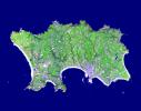
-
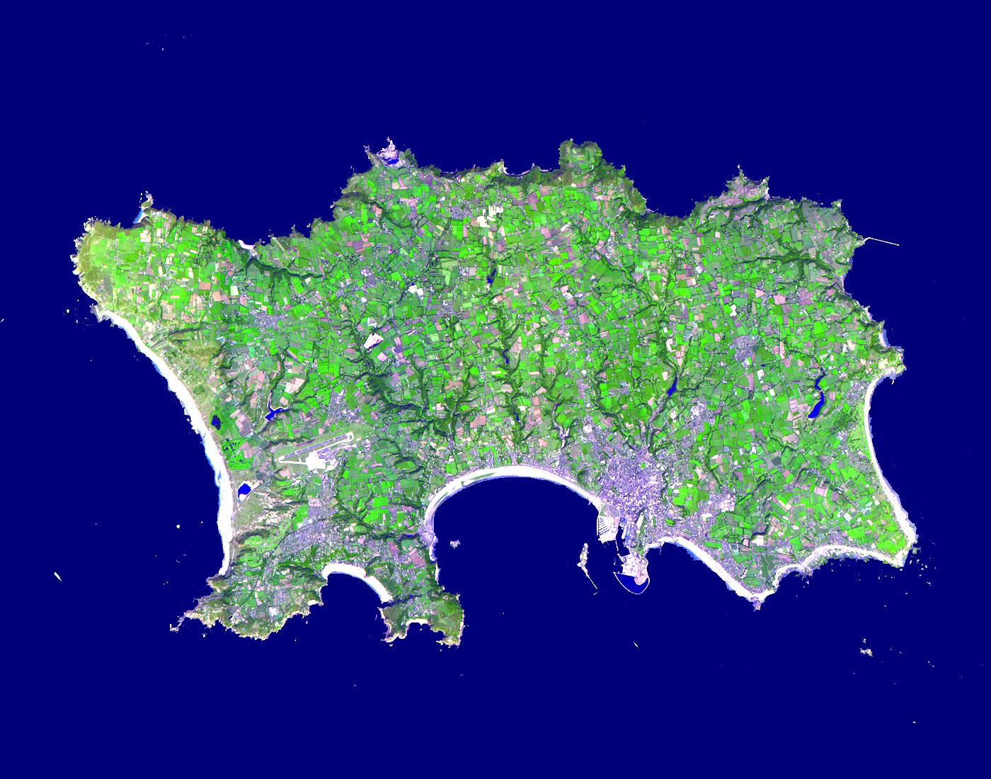
PIA03879:
-
Isle of Jersey
Full Resolution:
TIFF
(2.241 MB)
JPEG
(236.9 kB)
|
|
|
1999-04-15 |
Earth
|
Spaceborne Imaging Radar-C/X-Band Synthetic Aperture Radar
|
|
1648x2449x3 |
|
-
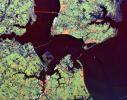
PIA01842:
-
Space Radar Image of Honolulu, Oahu, Hawaii
Full Resolution:
TIFF
(12.13 MB)
JPEG
(961.7 kB)
|
|
|
1999-04-15 |
Earth
|
Spaceborne Imaging Radar-C/X-Band Synthetic Aperture Radar
|
|
1792x2496x3 |
|
-
PIA01843:
-
Space Radar Image of Hong Kong
Full Resolution:
TIFF
(13.68 MB)
JPEG
(1.002 MB)
|
|
|
1999-04-15 |
Earth
|
Spaceborne Imaging Radar-C/X-Band Synthetic Aperture Radar
|
|
1196x627x3 |
|
-
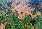
PIA01844:
-
Space Radar Image of Calcutta, West Bengal, India
Full Resolution:
TIFF
(2.759 MB)
JPEG
(203.7 kB)
|
|
|
1999-04-15 |
Earth
|
Spaceborne Imaging Radar-C/X-Band Synthetic Aperture Radar
|
|
2466x2881x3 |
|
-
PIA01845:
-
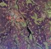
Space Radar Image of Munich, Germany
Full Resolution:
TIFF
(26.31 MB)
JPEG
(2.135 MB)
|
|
|
1999-04-15 |
Earth
|
Spaceborne Imaging Radar-C/X-Band Synthetic Aperture Radar
|
|
5881x4501x3 |

|
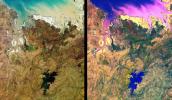
-
PIA01846:
-
Space Radar Image of Tuva, Central Asia
Full Resolution:
TIFF
(80.21 MB)
JPEG
(6.547 MB)
|
|
|
1999-04-15 |
Earth
|
Spaceborne Imaging Radar-C/X-Band Synthetic Aperture Radar
|
|
2177x2057x3 |
|
-
PIA01847:
-
Space Radar Image of Phnom Phen, Cambodia
Full Resolution:
TIFF
(16.8 MB)
JPEG
(1.418 MB)
|
|
|
1999-04-15 |
Earth
|
Spaceborne Imaging Radar-C/X-Band Synthetic Aperture Radar
|
|
3295x1662x3 |
|
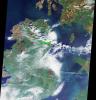
-
PIA01848:
-
Space Radar Image of County Kerry, Ireland
Full Resolution:
TIFF
(18.29 MB)
JPEG
(1.841 MB)
|
|
|
1999-04-15 |
Earth
|
Spaceborne Imaging Radar-C/X-Band Synthetic Aperture Radar
|
|
3000x3500x3 |
|
-
PIA01849:
-
Space Radar Image of Wenatchee, Washington
Full Resolution:
TIFF
(37.48 MB)
JPEG
(2.441 MB)
|
|
|
1999-04-15 |
Earth
|
Spaceborne Imaging Radar-C/X-Band Synthetic Aperture Radar
|
|
2808x3500x3 |
|
-
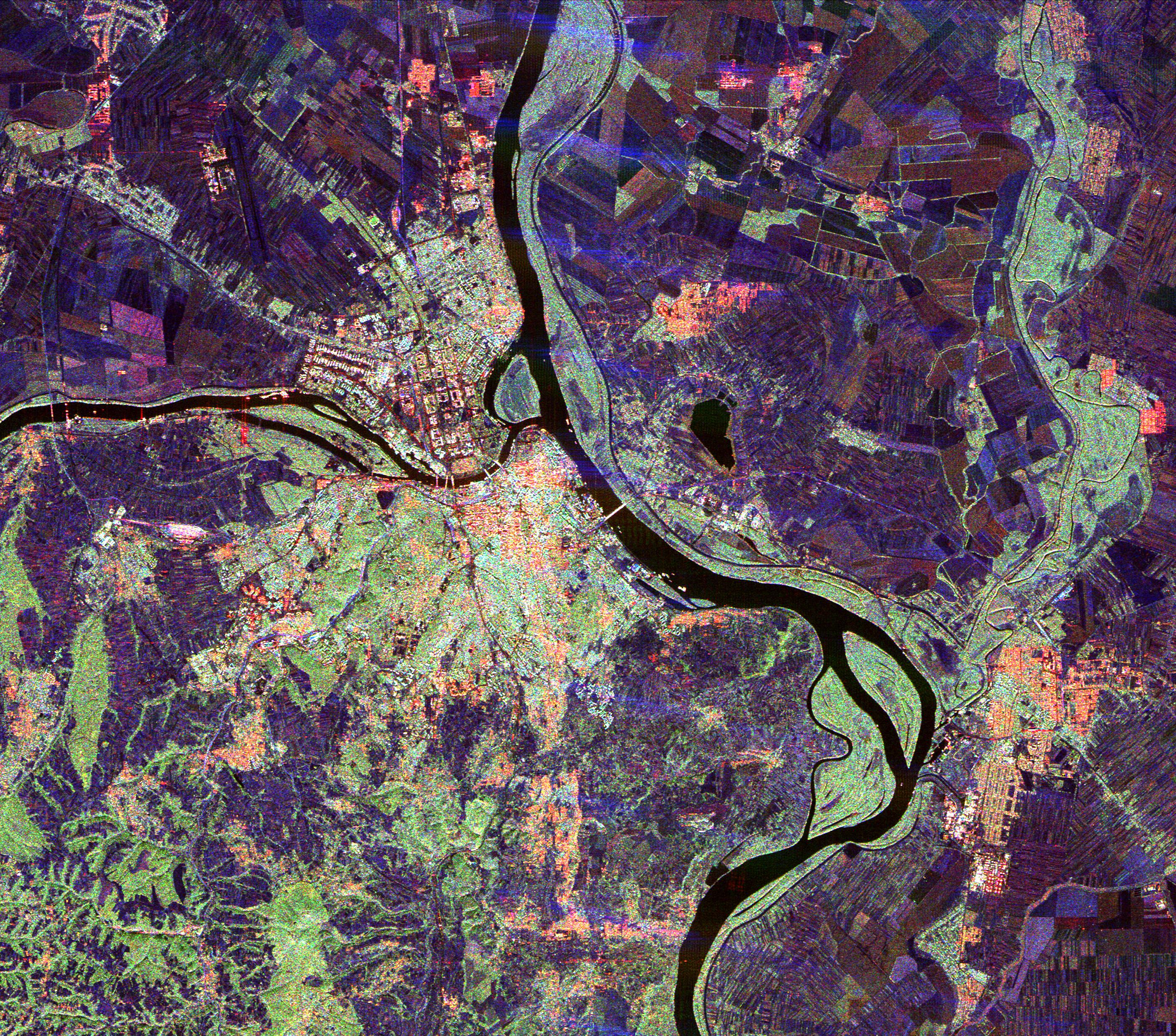
PIA01850:
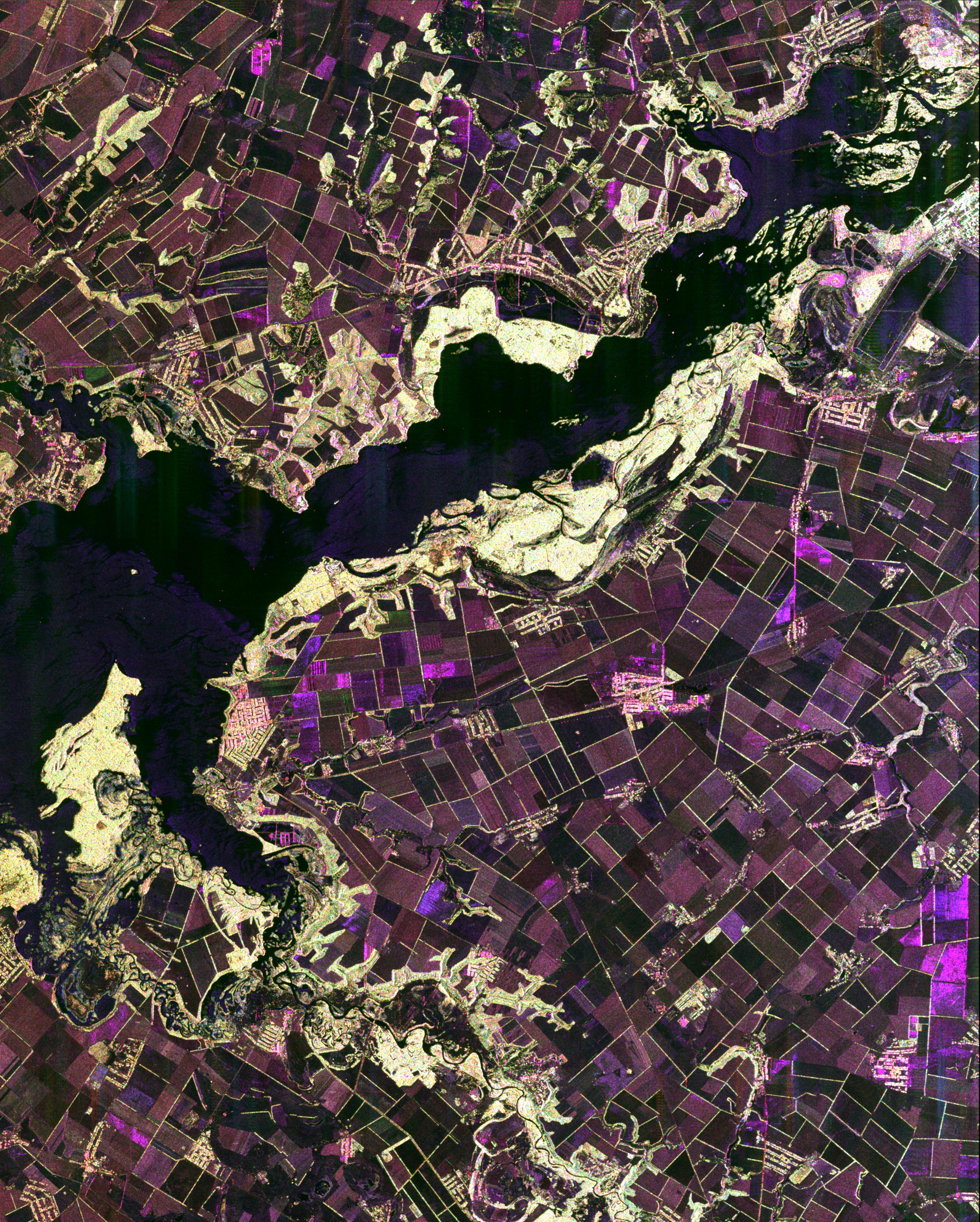
-
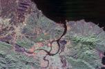
Space Radar Image of Dnieper River, Ukraine
Full Resolution:
TIFF
(32.99 MB)
JPEG
(2.203 MB)
|
|
|
1999-04-15 |
Earth
|
Spaceborne Imaging Radar-C/X-Band Synthetic Aperture Radar
|
|
6000x3852x3 |
|
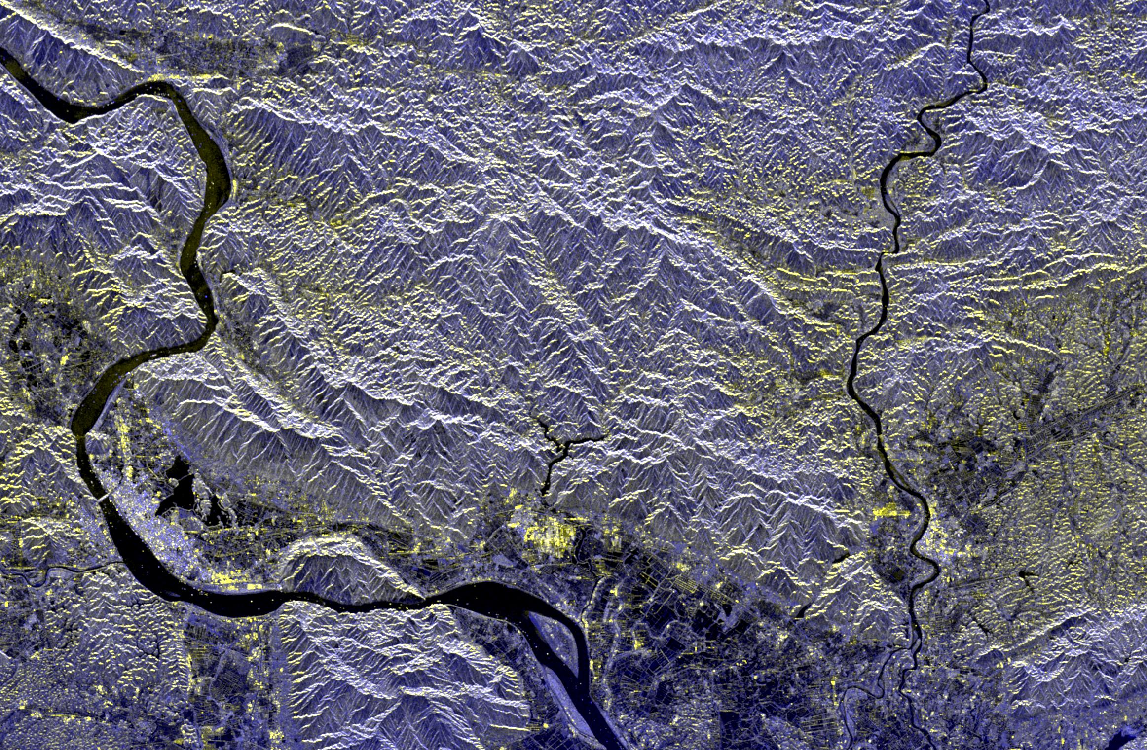
-
PIA01851:
-
Space Radar Image of Barstow, California
Full Resolution:
TIFF
(79.47 MB)
JPEG
(9.271 MB)
|
|
|
1999-04-15 |
Earth
|
Spaceborne Imaging Radar-C/X-Band Synthetic Aperture Radar
|
|
3841x4593x3 |
|
-
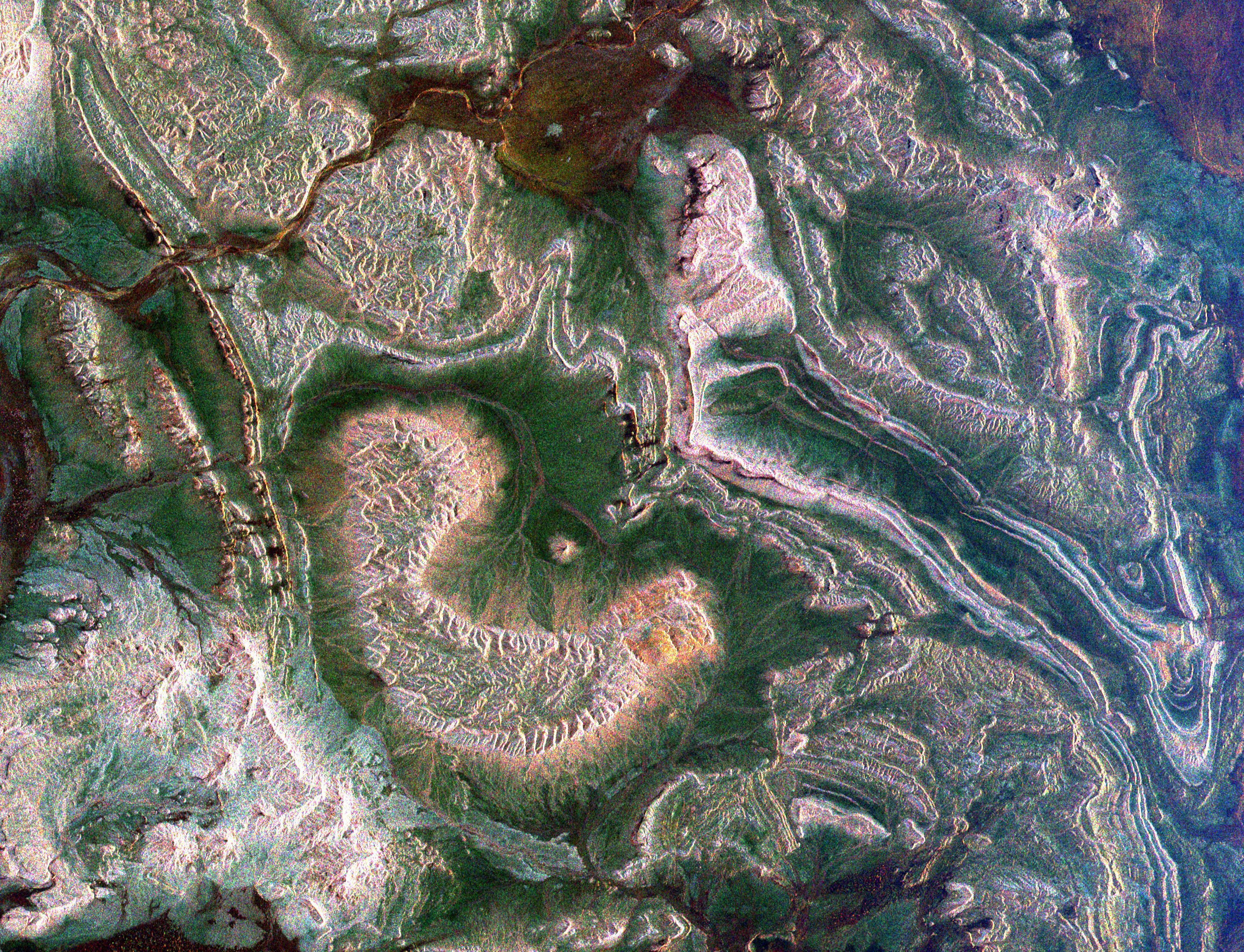
PIA01852:
-
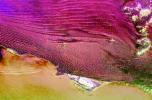
Space Radar Image of Pinacate Volcanic Field, Mexico
Full Resolution:
TIFF
(64.12 MB)
JPEG
(5.228 MB)
|
|
|
1999-04-15 |
Earth
|
Spaceborne Imaging Radar-C/X-Band Synthetic Aperture Radar
|
|
4001x2640x3 |
|
-
PIA01853:
-
Space Radar Image of Taipei, Taiwan
Full Resolution:
TIFF
(34.76 MB)
JPEG
(2.419 MB)
|
|
|
2000-04-27 |
Earth
|
Spaceborne Imaging Radar-C/X-Band Synthetic Aperture Radar
|
|
6577x4337x3 |
|
-
PIA01856:
-
Space Radar Image of Namibia Sand Dunes
Full Resolution:
TIFF
(86.77 MB)
JPEG
(8.973 MB)
|
|
|
1999-04-15 |
Earth
|
Spaceborne Imaging Radar-C/X-Band Synthetic Aperture Radar
|
|
6539x3444x3 |

|
-
PIA01857:
-
Space Radar Image of Cape Cod, Massachusetts
Full Resolution:
TIFF
(25.1 MB)
JPEG
(3.779 MB)
|
|
|
1999-04-15 |
Earth
|
Spaceborne Imaging Radar-C/X-Band Synthetic Aperture Radar
|
|
2949x1949x3 |
|
-
PIA01858:
-
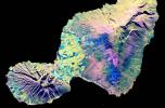
Space Radar Image of Maui, Hawaii
Full Resolution:
TIFF
(11.52 MB)
JPEG
(1.26 MB)
|
|
|
1999-04-15 |
Earth
|
Spaceborne Imaging Radar-C/X-Band Synthetic Aperture Radar
|
|
2733x2656x3 |
|
-
PIA01859:
-
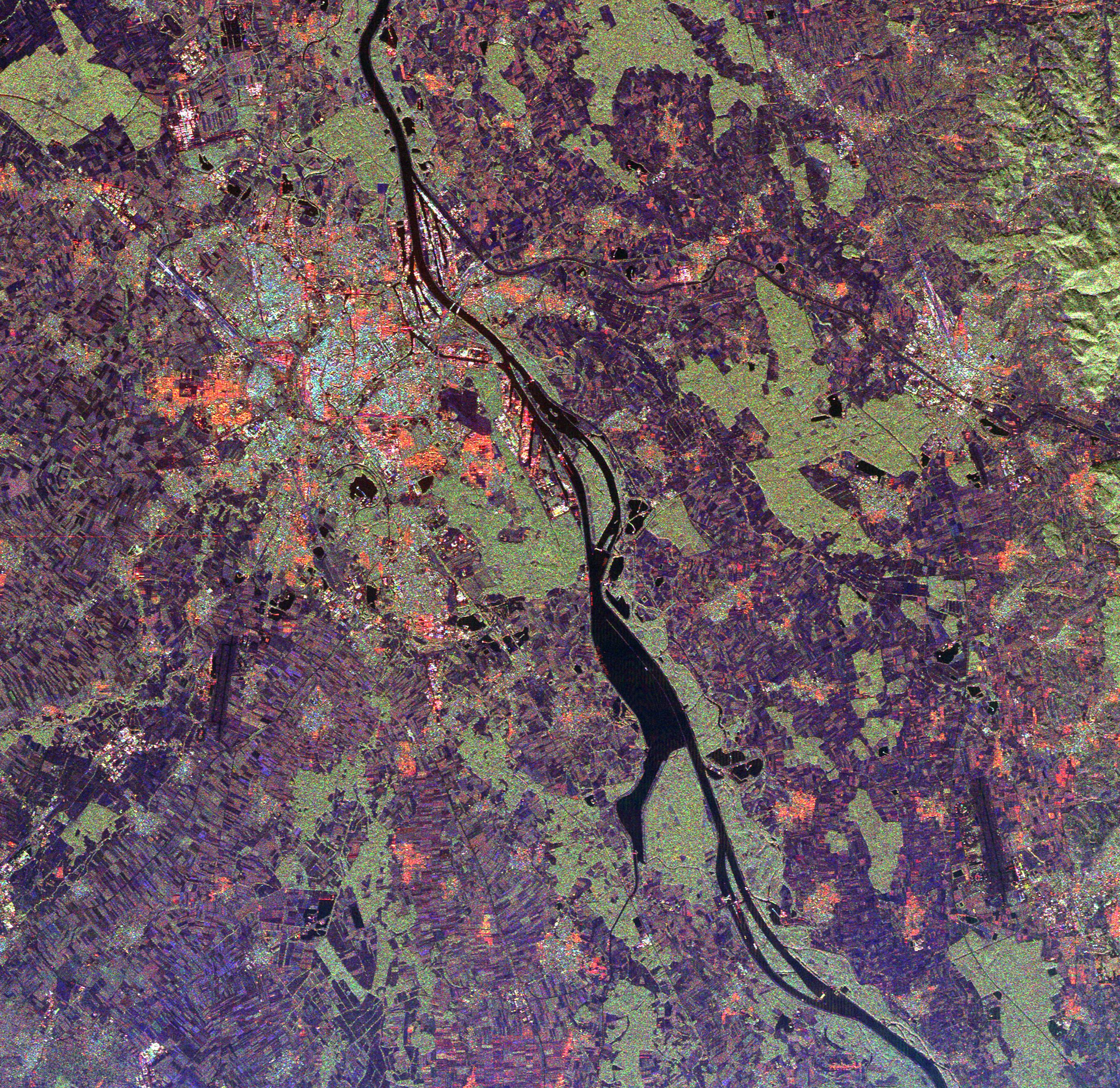
Space Radar Image of Rhine River, France and Germany
Full Resolution:
TIFF
(27.7 MB)
JPEG
(2.372 MB)
|
|
|
1999-04-15 |
Earth
|
Spaceborne Imaging Radar-C/X-Band Synthetic Aperture Radar
|
|
4236x2788x3 |
|
-
PIA01860:
-
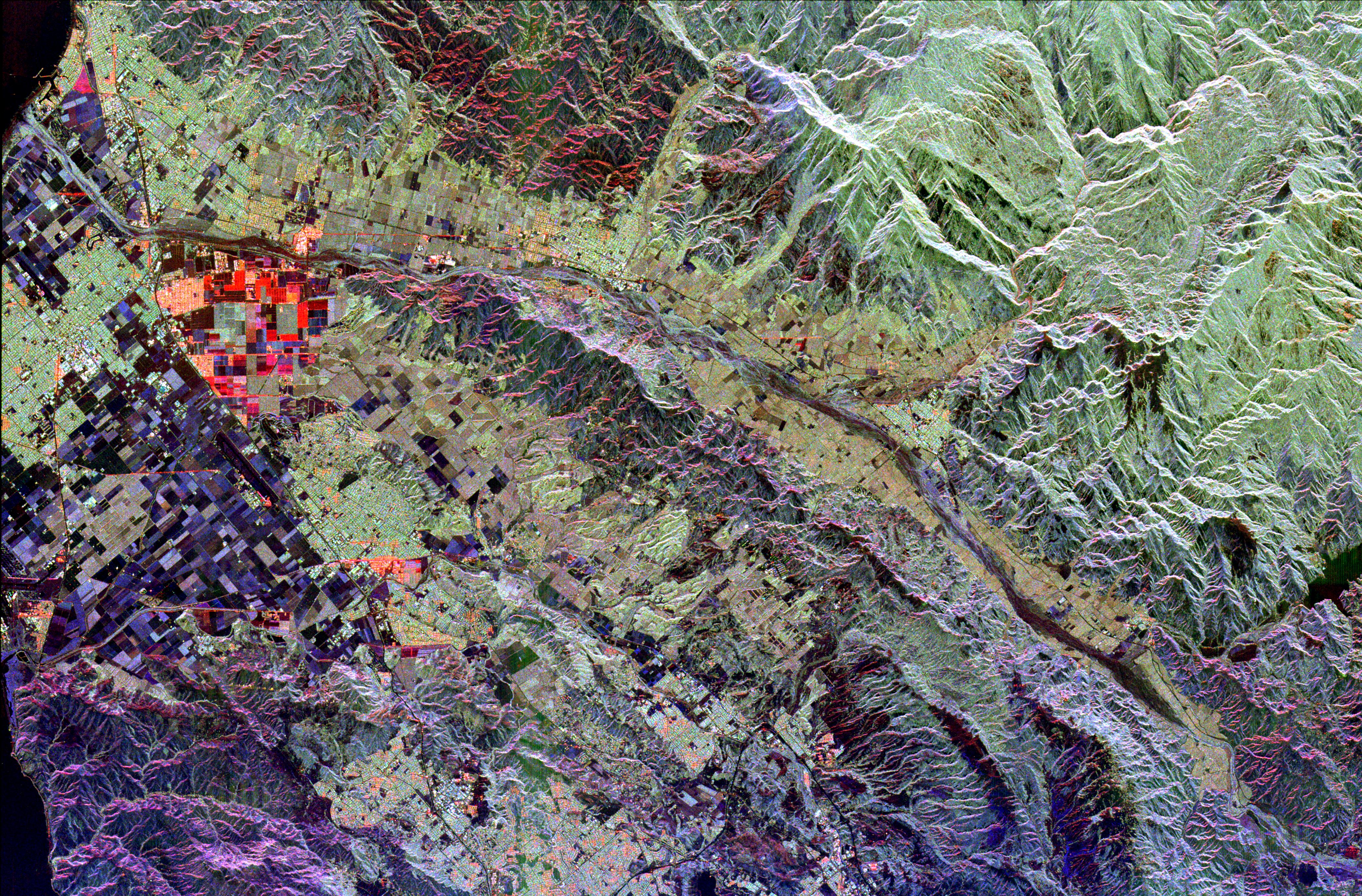
Space Radar Image of Ventura County, California
Full Resolution:
TIFF
(42.27 MB)
JPEG
(3.482 MB)
|
|
|
1999-04-15 |
Earth
|
Spaceborne Imaging Radar-C/X-Band Synthetic Aperture Radar
|
|
1537x1081x3 |
|
-
PIA01861:
-
Space Radar Image of Sacramento, California
Full Resolution:
TIFF
(5.841 MB)
JPEG
(770.2 kB)
|
|
|
1999-04-15 |
Earth
|
Spaceborne Imaging Radar-C/X-Band Synthetic Aperture Radar
|
|
2985x2361x3 |
|
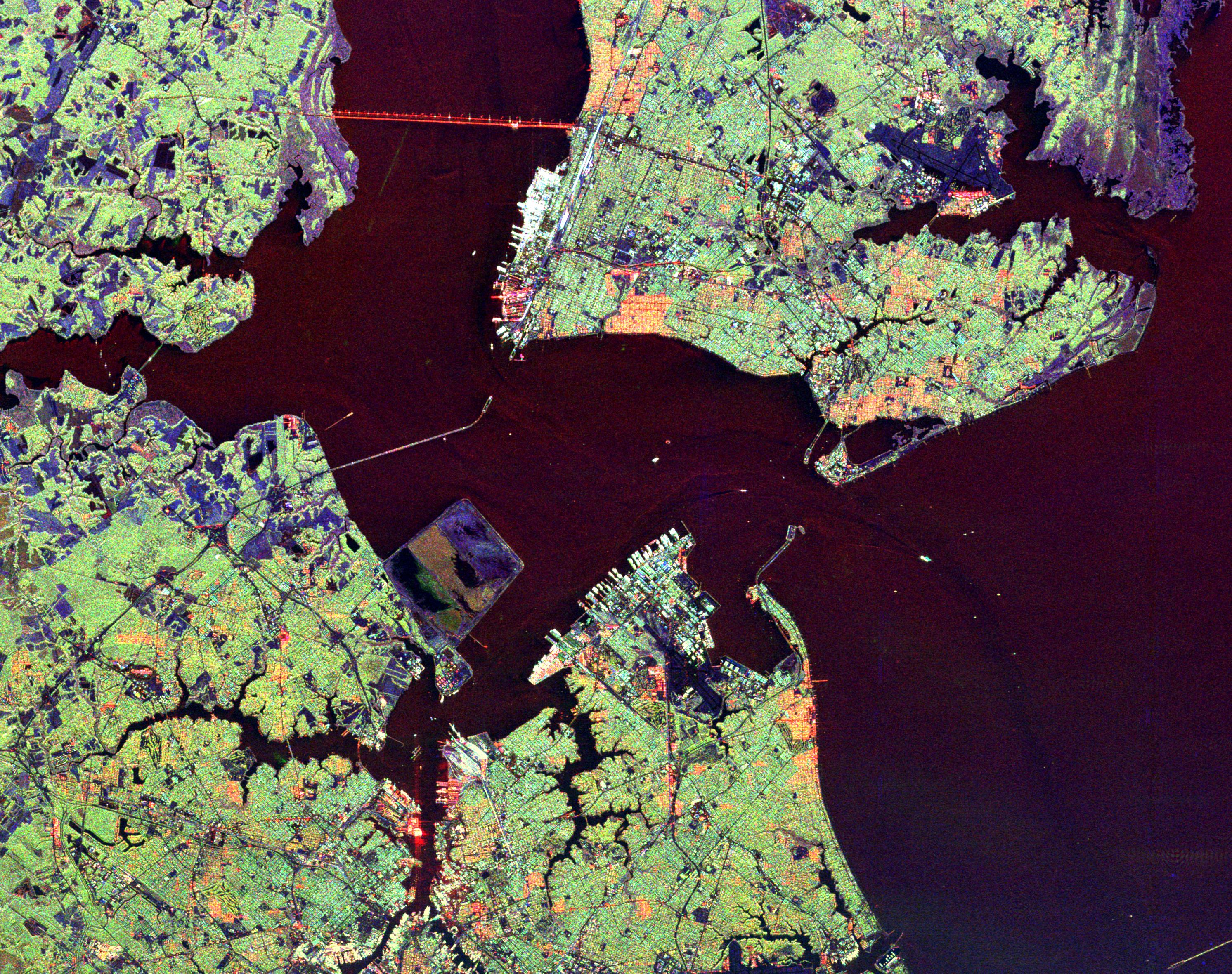
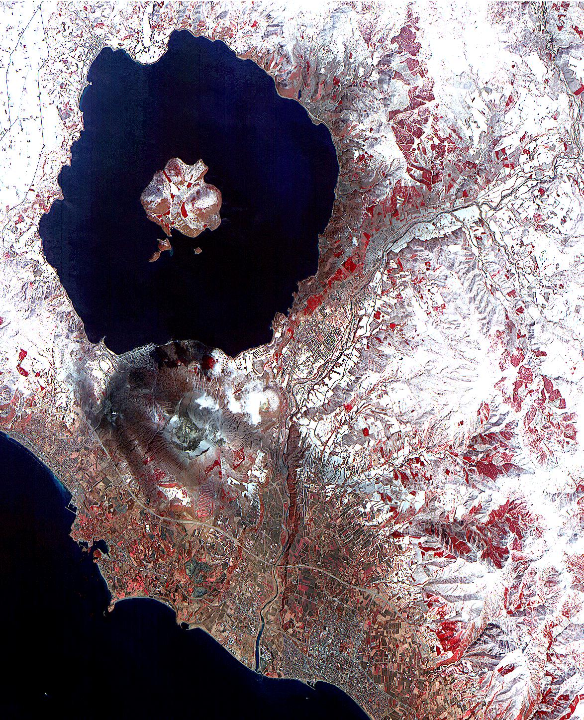
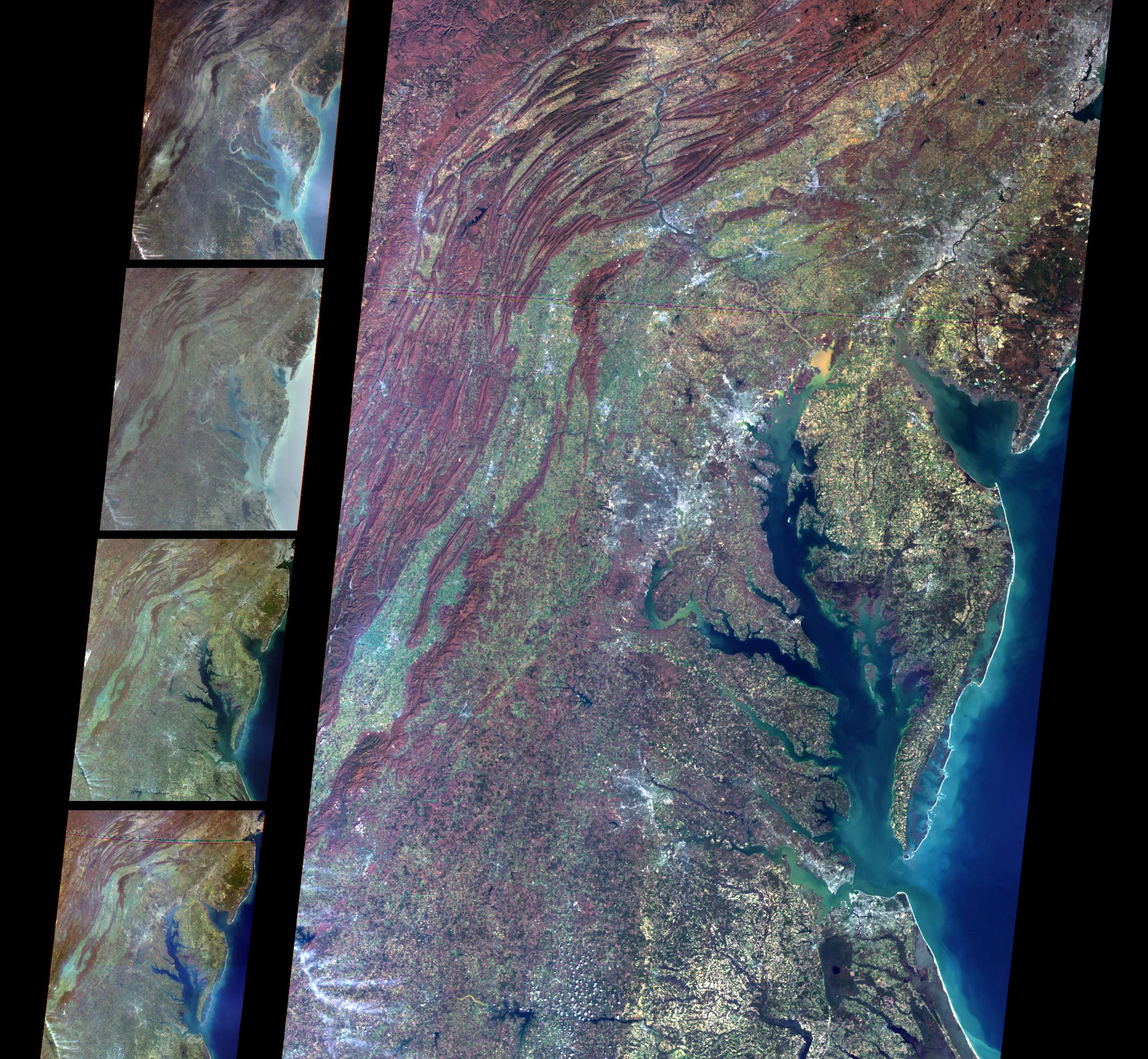
-
PIA01862:
-
Space Radar Image of Hampton Roads, Virginia
Full Resolution:
TIFF
(24.39 MB)
JPEG
(1.869 MB)
|
|
|
1999-04-15 |
Earth
|
Spaceborne Imaging Radar-C/X-Band Synthetic Aperture Radar
|
|
3537x2708x3 |

|
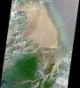
-
PIA01863:
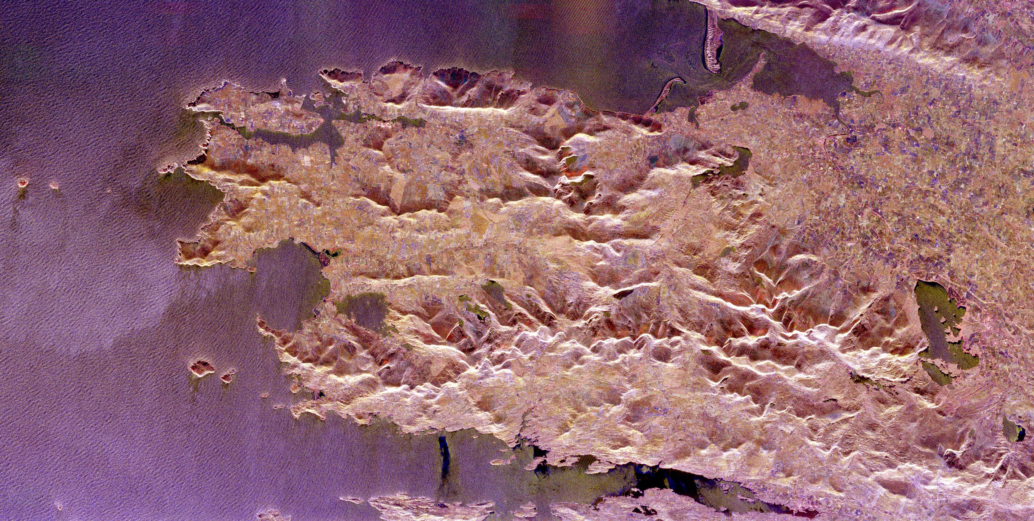
-
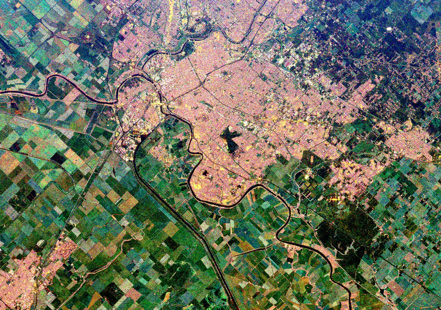
Space Radar Image of Eastern Morocco
Full Resolution:
TIFF
(35.28 MB)
JPEG
(3.031 MB)
|
|
|
1999-05-15 |
Earth
|
Voyager
|
VG ISS - Narrow Angle
|
565x790x3 |

|
-
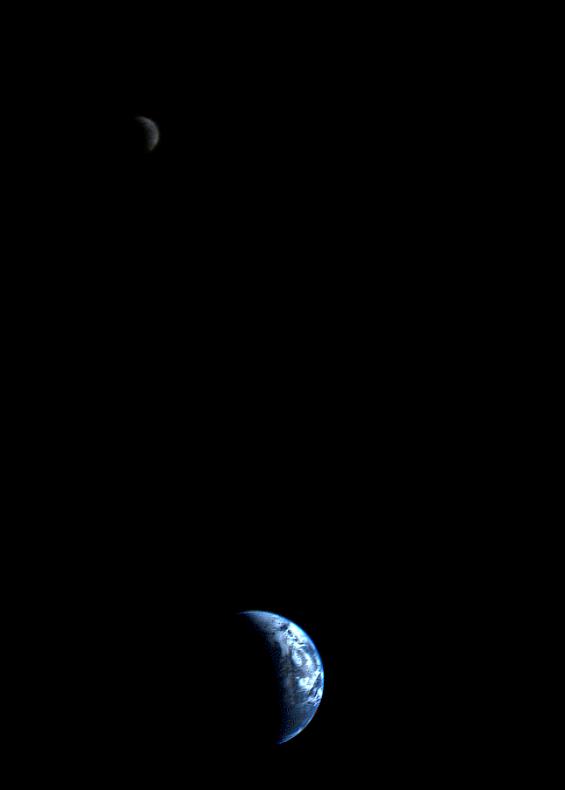
PIA01967:
-
Crescent-shaped Earth and Moon
Full Resolution:
TIFF
(48.38 kB)
JPEG
(9.77 kB)
|
|
|
1999-12-10 |
Earth
|
Voyager
|
VG ISS - Narrow Angle
|
200x200x3 |
|
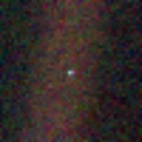
-
PIA02228:
-
Solar System Portrait - Earth
Full Resolution:
TIFF
(117.8 kB)
JPEG
(4.977 kB)
|
|
|
1999-09-08 |
Earth
|
QuikScat
|
SeaWinds Scatterometer
|
900x900x1 |
|
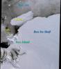
-
PIA02329:
-
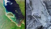
SeaWinds Watches for Breakup of Giant Iceberg
Full Resolution:
TIFF
(132.8 kB)
JPEG
(49.24 kB)
|
|
|
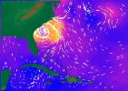
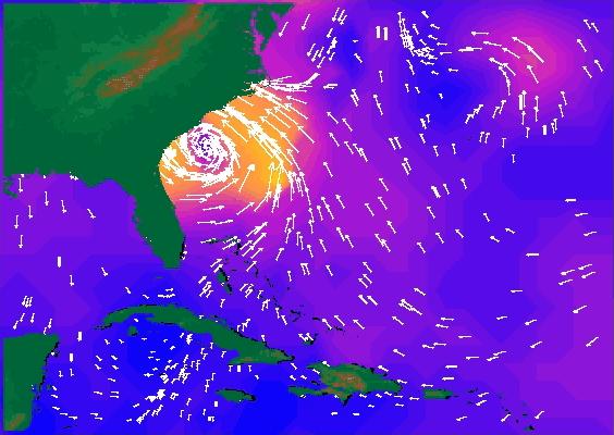
1999-09-16 |
Earth
|
QuikScat
|
SeaWinds Scatterometer
|
564x400x3 |
|
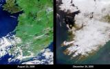
-
PIA02334:
-
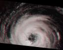
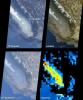
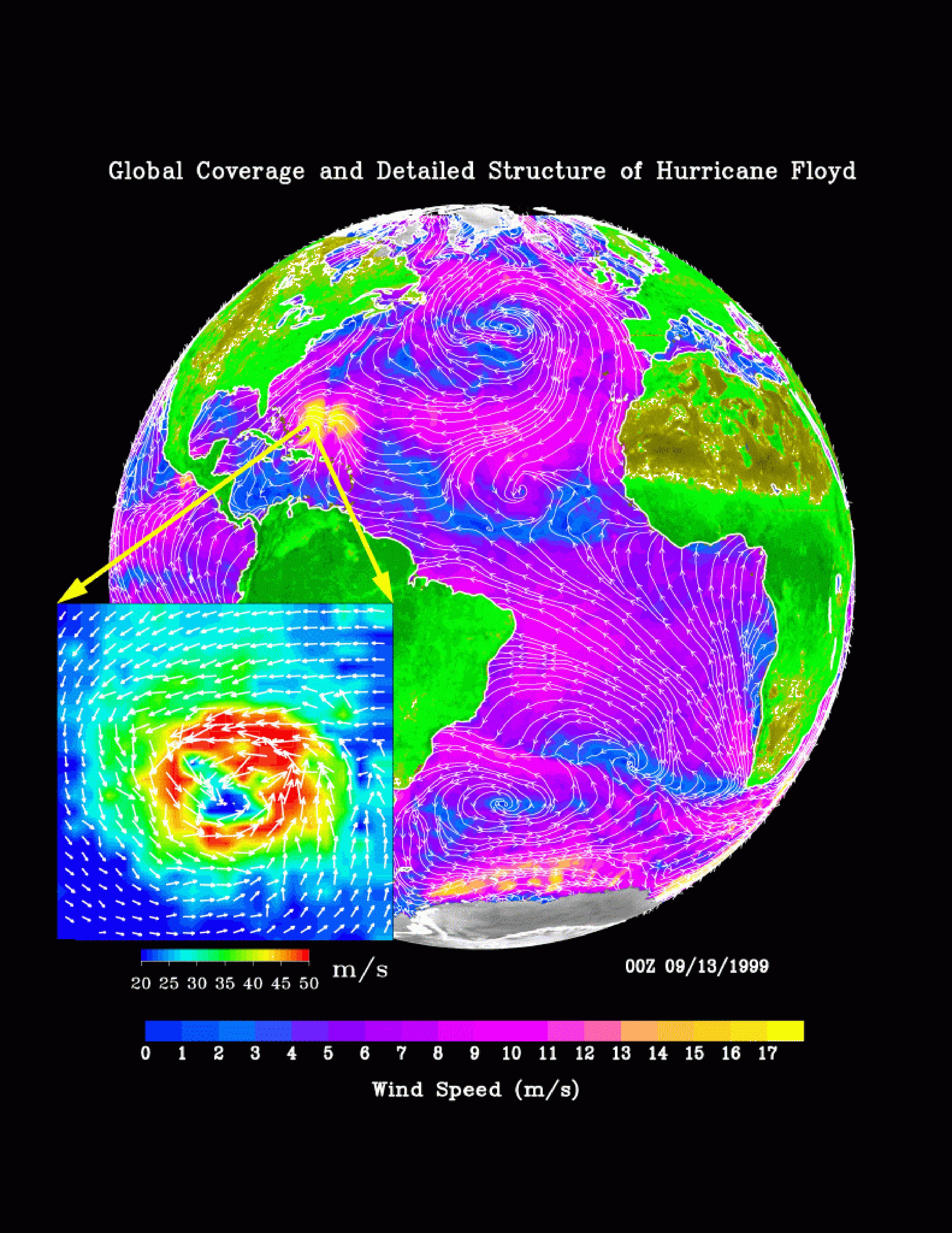
SeaWinds Radar Stares Into The Eye Of Angry Hurricane Floyd
Full Resolution:
TIFF
(192.6 kB)
JPEG
(44.92 kB)
|
|
|
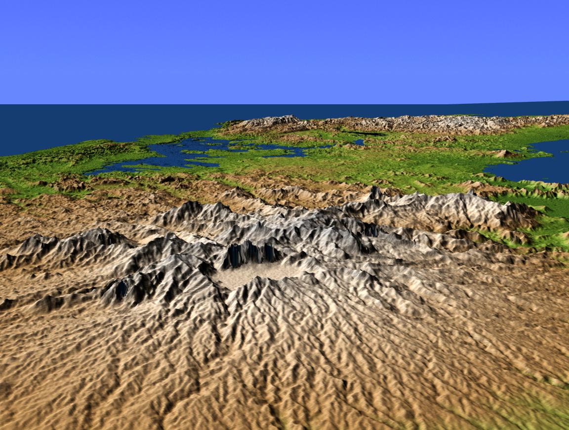
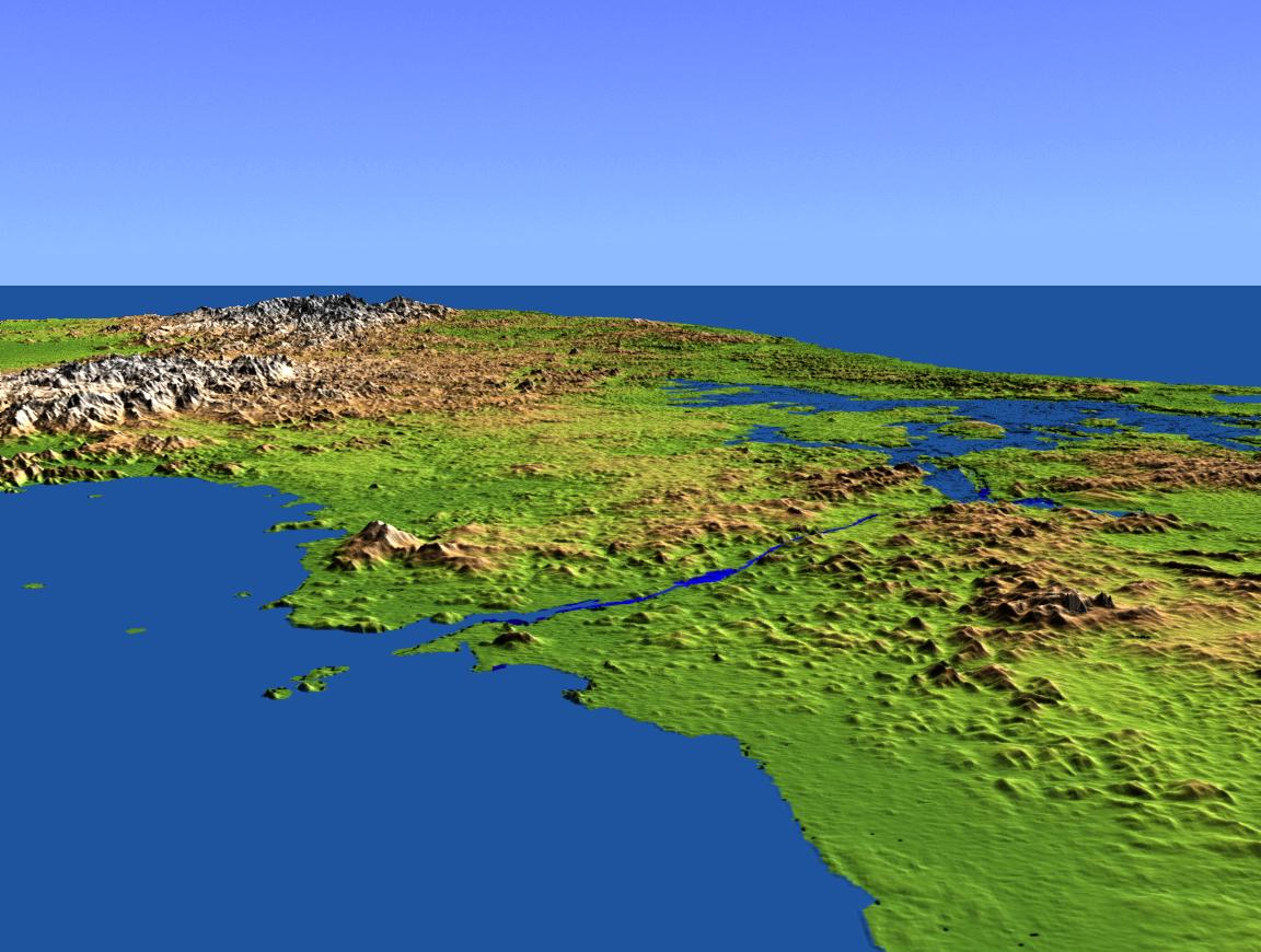
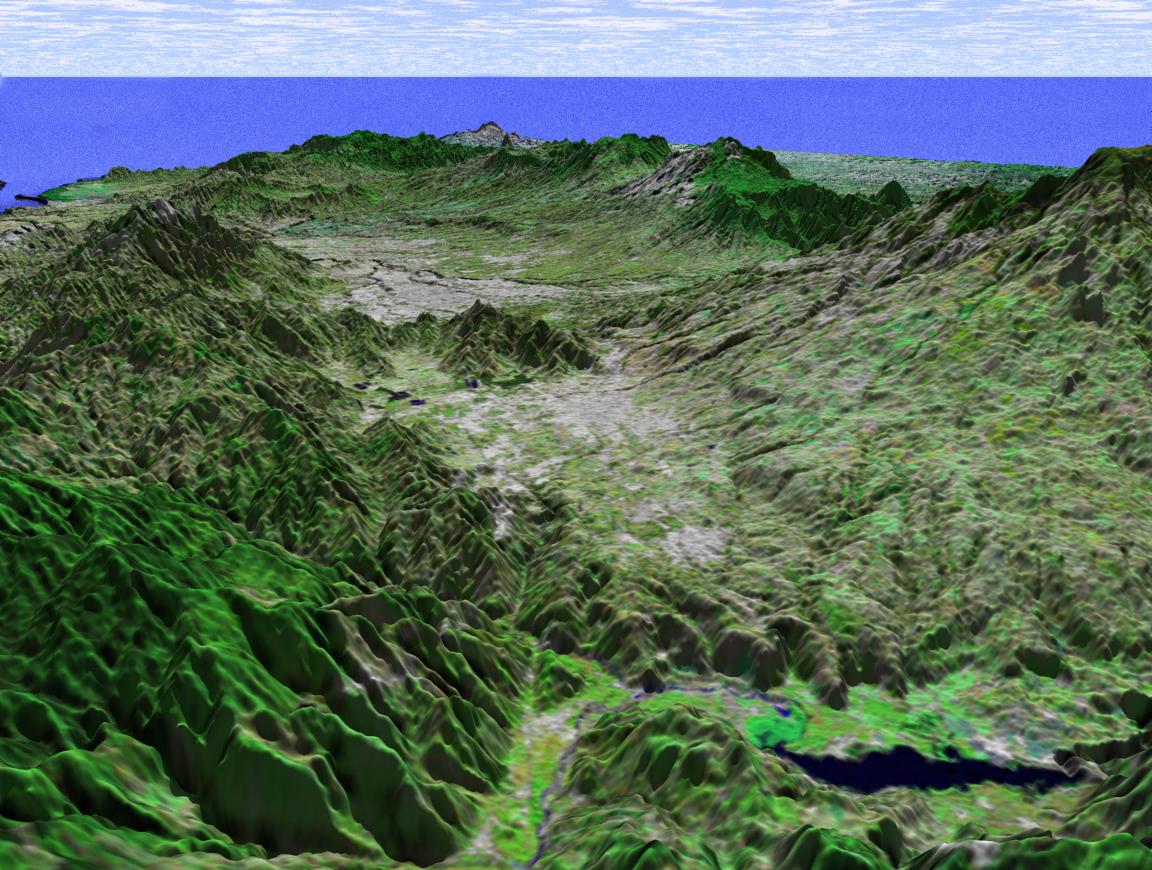
2002-10-25 |
Earth
|
Shuttle Radar Topography Mission (SRTM)
|
C-Band Interferometric Radar
|
1152x870x3 |

|
-
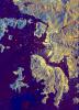
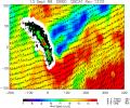
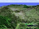
PIA03369:
-
Perspective View with Color-Coded Shaded Relief, Central Panama
Full Resolution:
TIFF
(2.588 MB)
JPEG
(192.8 kB)
|
|
|
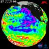
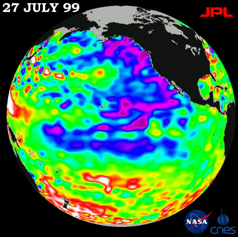
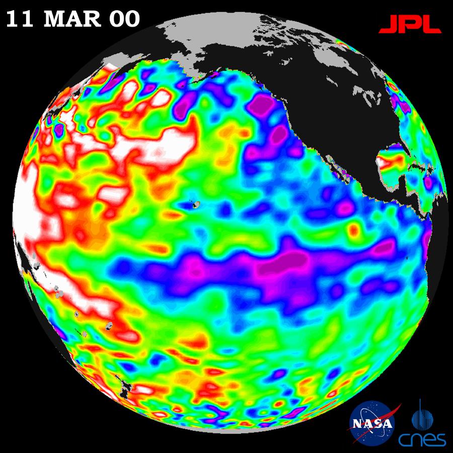
1999-08-23 |
Earth
|
TOPEX/Poseidon
|
Altimeter
|
902x900x3 |
|
-
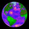
PIA02403:
-
TOPEX/El Niño Watch - Pacific Ocean Conditions are Split: Cold in East, Hot in West, July 27, 1999
Full Resolution:
TIFF
(872 kB)
JPEG
(116.8 kB)
|
|
|
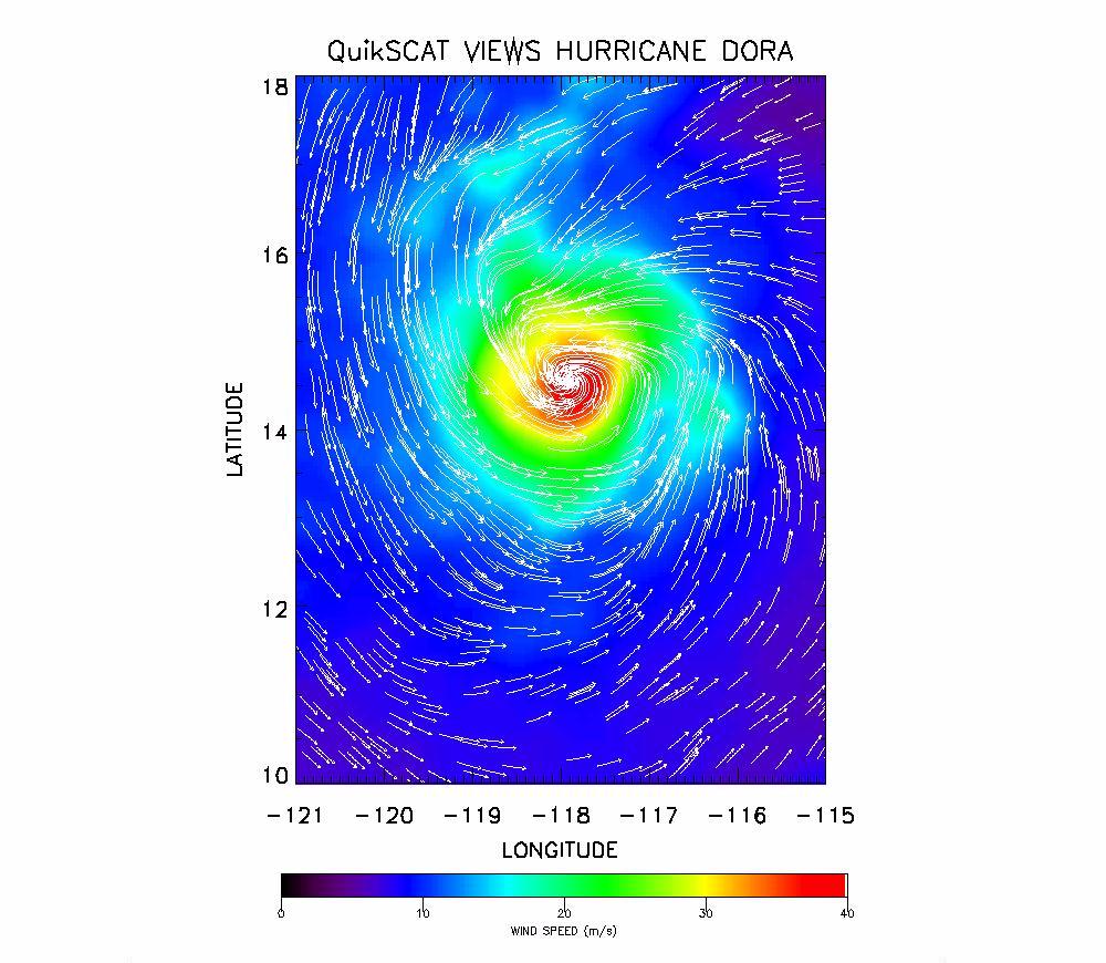
1999-08-25 |
Earth
|
QuikScat
|
SeaWinds Scatterometer
|
1000x870x3 |

|
-
PIA02404:
-
SeaWinds Radar Clocks Hurricane Dora's Wind Speeds
Full Resolution:
TIFF
(1.118 MB)
JPEG
(142.8 kB)
|
|
|
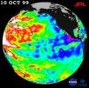
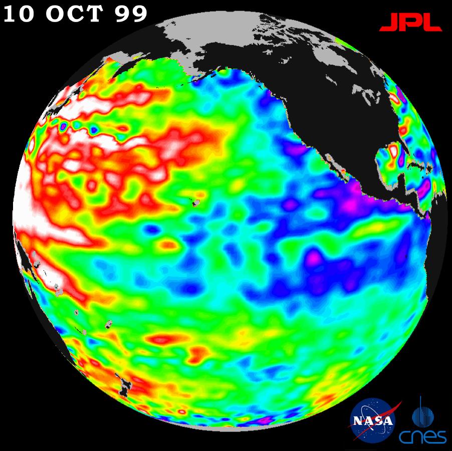
1999-11-18 |
Earth
|
TOPEX/Poseidon
|
Altimeter
|
902x900x3 |
|
-
PIA02436:
-
TOPEX/El Niño Watch - La Niña Conditions Likely to Prevail, October 10, 1999
Full Resolution:
TIFF
(765.6 kB)
JPEG
(113.1 kB)
|
|
|
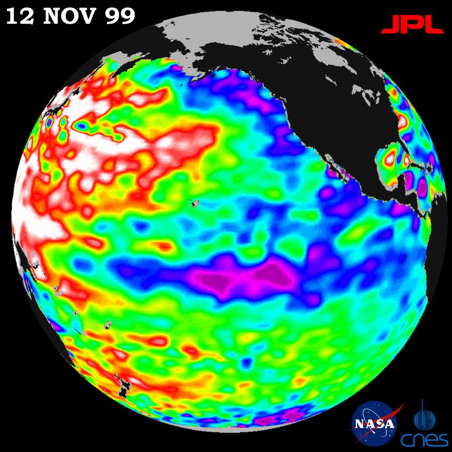
1999-12-01 |
Earth
|
TOPEX/Poseidon
|
Altimeter
|
900x900x3 |
|
-
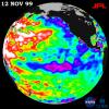
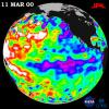
PIA02437:
-
TOPEX/El Niño Watch - Mild La Niña Conditions Developing, November 12, 1999
Full Resolution:
TIFF
(745.9 kB)
JPEG
(117 kB)
|
|
|
2002-10-25 |
Earth
|
Shuttle Radar Topography Mission (SRTM)
|
C-Band Interferometric Radar
|
1152x870x3 |

|
-
PIA03368:
-
Perspective View with Color-Coded Shaded Relief, Panama Canal
Full Resolution:
TIFF
(1.584 MB)
JPEG
(141.6 kB)
|
|
|
1999-12-21 |
Earth
|
Mariner Venus Mercury (Mariner 10)
|
|
922x749x3 |

|
-
PIA02441:
-
Earth and Moon as Viewed by Mariner 10
Full Resolution:
TIFF
(388.4 kB)
JPEG
(32.07 kB)
|
|
|
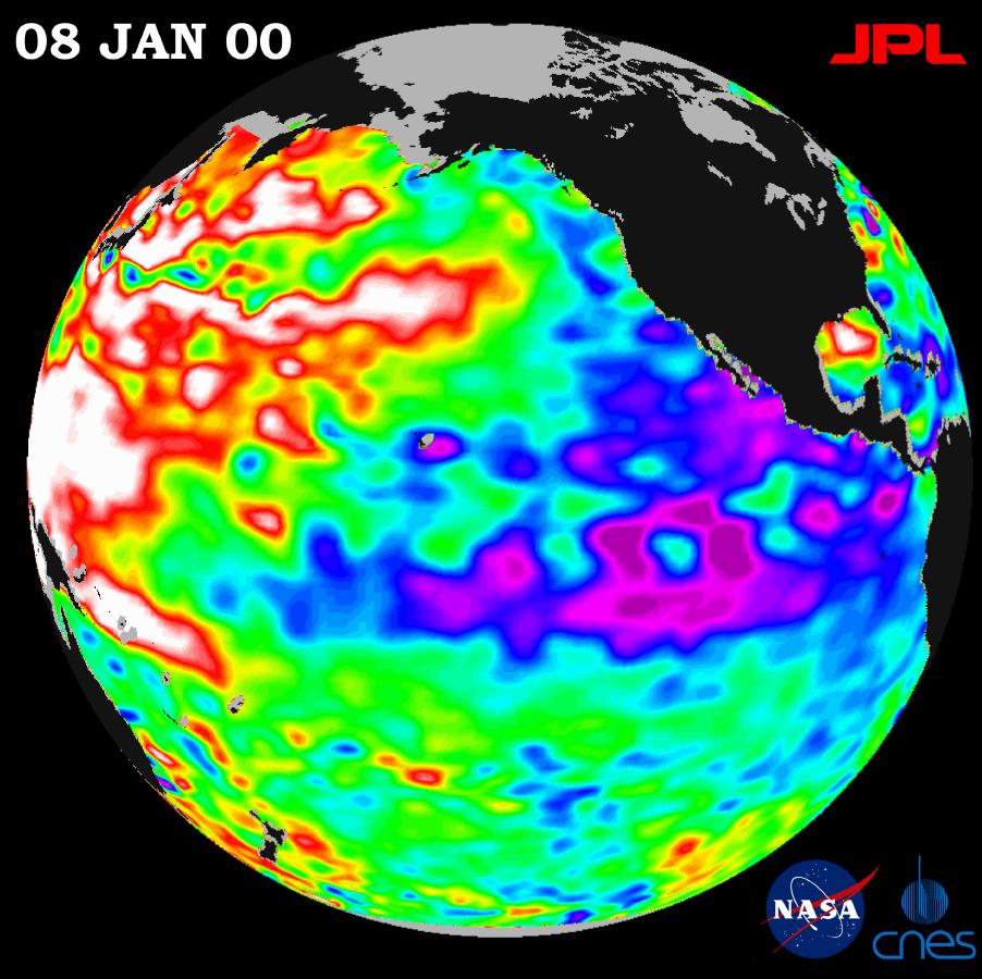
2000-01-21 |
Earth
|
TOPEX/Poseidon
|
Altimeter
|
902x900x3 |
|
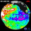
-
PIA02448:
-
TOPEX/El Niño Watch - La Niña Persistence May be Part of Larger Climate Pattern, January 8, 2000
Full Resolution:
TIFF
(744.7 kB)
JPEG
(115.1 kB)
|
|
|
2000-03-11 |
Earth
|
Terra
|
MISR
|
1383x512x3 |
|
-
PIA02450:
-
MISR's First Views of James Bay, Canada
Full Resolution:
TIFF
(1.916 MB)
JPEG
(146.1 kB)
|
|
|
2000-03-11 |
Earth
|
Terra
|
ASTER
|
2263x2027x1 |
|
-
PIA02451:
-
ASTER's First Views of San Francisco River, Brazil - Visible/near Infrared (VNIR) Image (monochrome)
Full Resolution:
TIFF
(3.321 MB)
JPEG
(256.2 kB)
|
|
|
2000-03-11 |
Earth
|
Terra
|
ASTER
|
2160x2251x1 |
|
-
PIA02452:
-
ASTER's First Views of Red Sea, Ethiopia - Thermal-Infrared (TIR) Image (monochrome)
Full Resolution:
TIFF
(2.76 MB)
JPEG
(185.8 kB)
|
|
|
2000-03-11 |
Earth
|
Terra
|
ASTER
|
2288x2288x3 |
|
-
PIA02453:
-
ASTER's First Views of Rift Valley, Ethiopia - Thermal-Infrared (TIR) Image (color)
Full Resolution:
TIFF
(13.48 MB)
JPEG
(231.5 kB)
|
|
|
2000-05-07 |
Earth
|
QuikScat
|
SeaWinds Scatterometer
|
3296x4267x3 |

|
-
PIA02455:
-
SeaWinds Global Coverage with Detail of Hurricane Floyd
Full Resolution:
TIFF
(1.921 MB)
JPEG
(1.595 MB)
|
|
|
2000-05-07 |
Earth
|
QuikScat
|
SeaWinds Scatterometer
|
3296x4267x3 |
|
-
PIA02456:
-
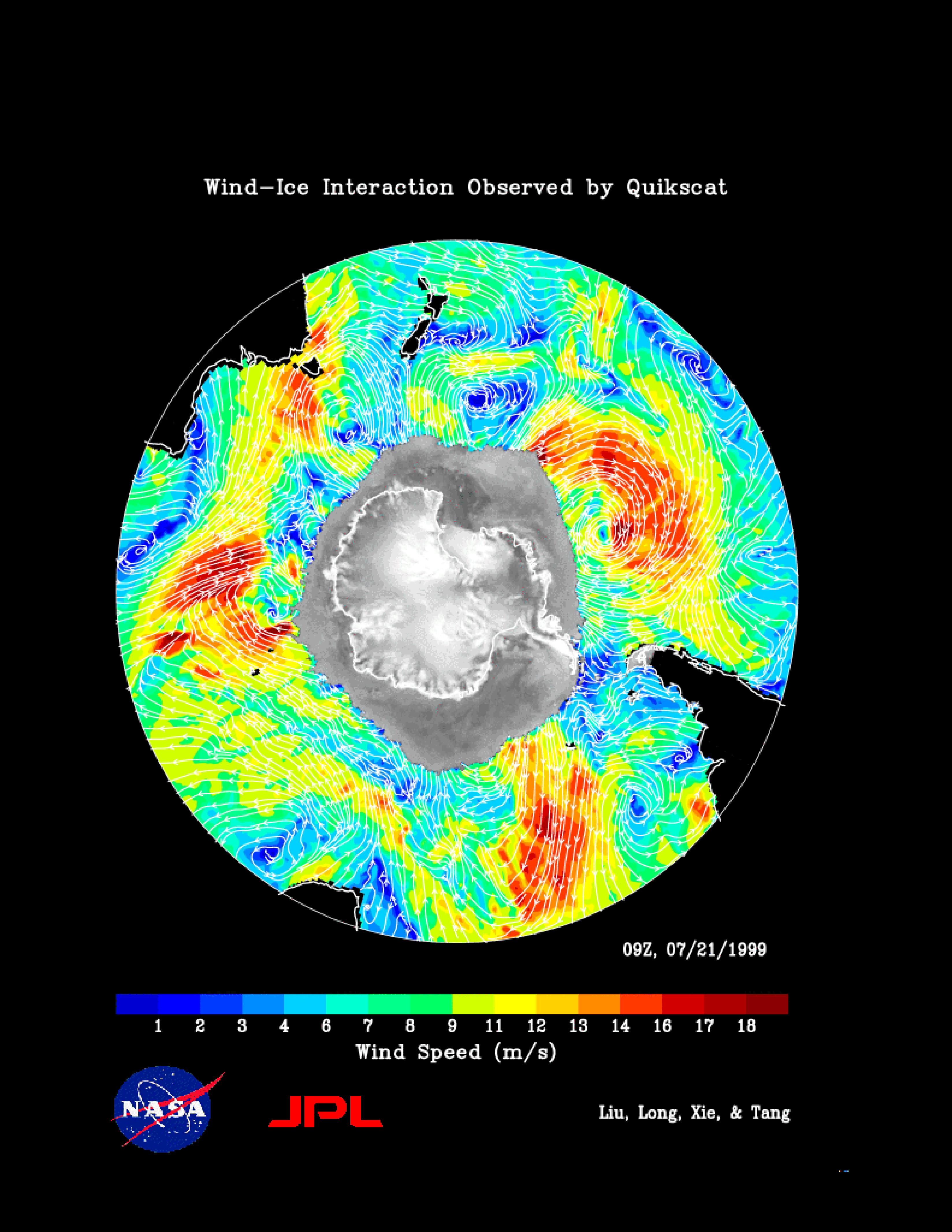
SeaWinds Wind-Ice Interaction
Full Resolution:
TIFF
(1.974 MB)
JPEG
(1.274 MB)
|
|
|
2000-05-07 |
Earth
|
QuikScat
|
SeaWinds Scatterometer
|
2638x2201x3 |
|
-
PIA02457:
-
SeaWinds - South Georgia Island
Full Resolution:
TIFF
(1.029 MB)
JPEG
(1.018 MB)
|
|
|
2000-05-08 |
Earth
|
QuikScat
|
SeaWinds Scatterometer
|
2048x2048x3 |
|
-
PIA02458:
-
SeaWinds - Oceans, Land, Polar Regions
Full Resolution:
TIFF
(934.2 kB)
JPEG
(679.2 kB)
|
|
|
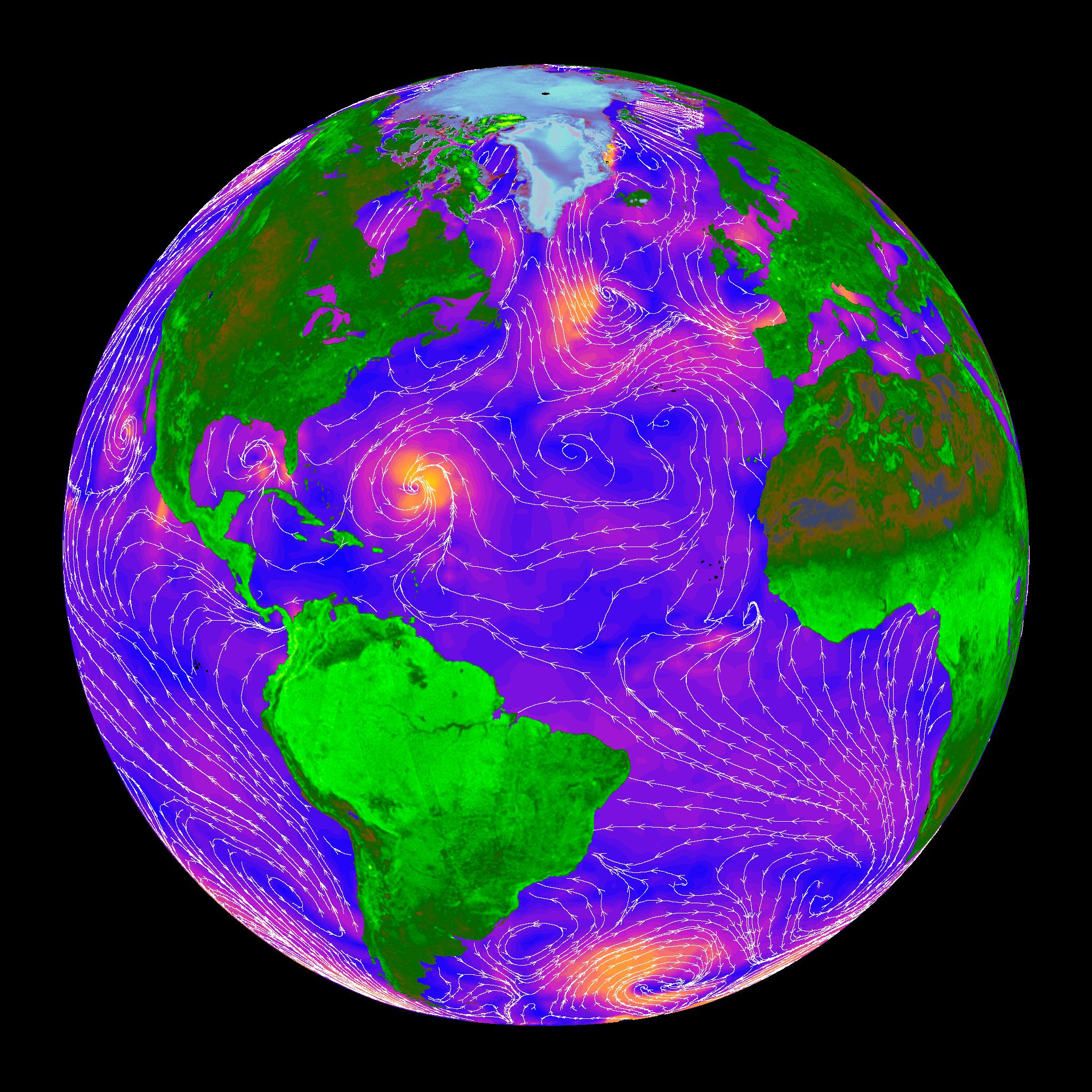
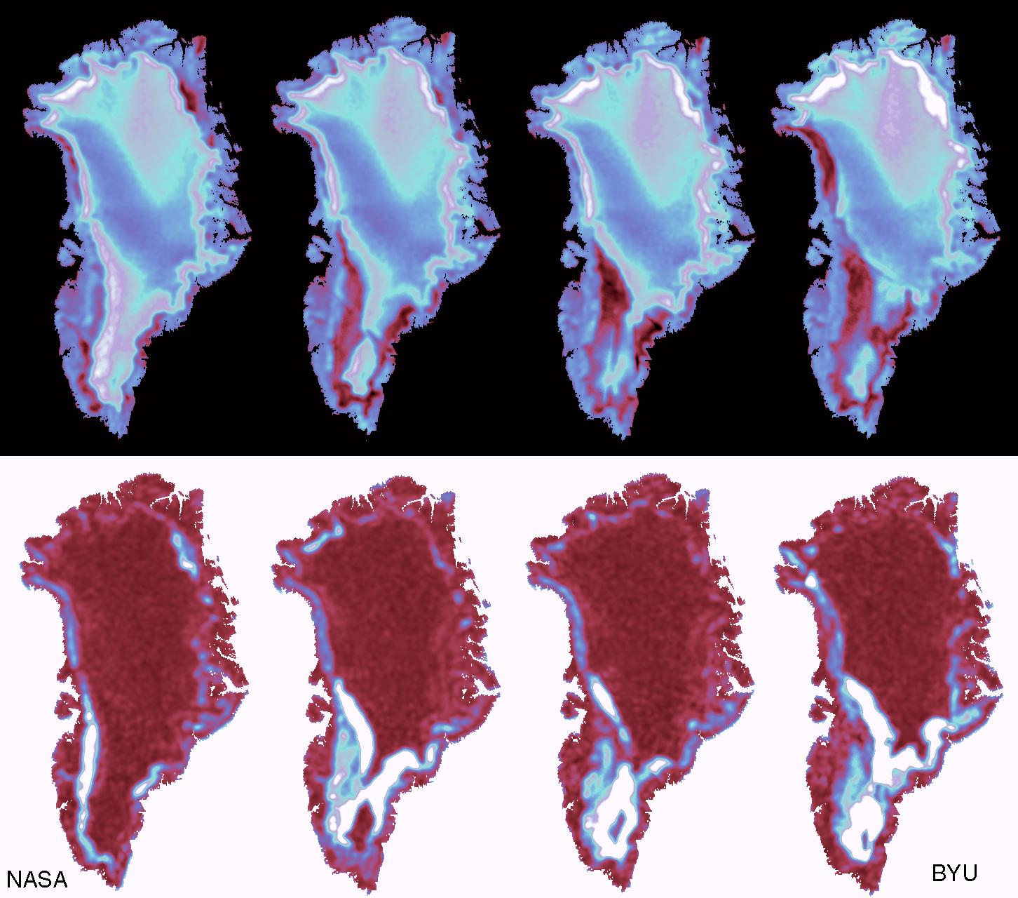
2000-05-08 |
Earth
|
QuikScat
|
SeaWinds Scatterometer
|
1452x1280x3 |
|
-
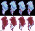
PIA02459:
-
SeaWinds - Greenland
Full Resolution:
TIFF
(765.6 kB)
JPEG
(205.7 kB)
|
|
|
2000-05-07 |
Earth
|
TOPEX/Poseidon
|
Altimeter
|
900x900x3 |
|
-
PIA02460:
-
TOPEX/El Niño Watch - La Niña Still a "cool" Problem Child, March 23, 2000
Full Resolution:
TIFF
(1.031 MB)
JPEG
(123.2 kB)
|
|
|
2002-10-25 |
Earth
|
Landsat
Shuttle Radar Topography Mission (SRTM)
|
C-Band Interferometric Radar
Thematic Mapper
|
1152x870x3 |
|
-
PIA03367:
-
Perspective View with Landsat Overlay, San Jose, Costa Rica
Full Resolution:
TIFF
(3.01 MB)
JPEG
(210.8 kB)
|
|
|
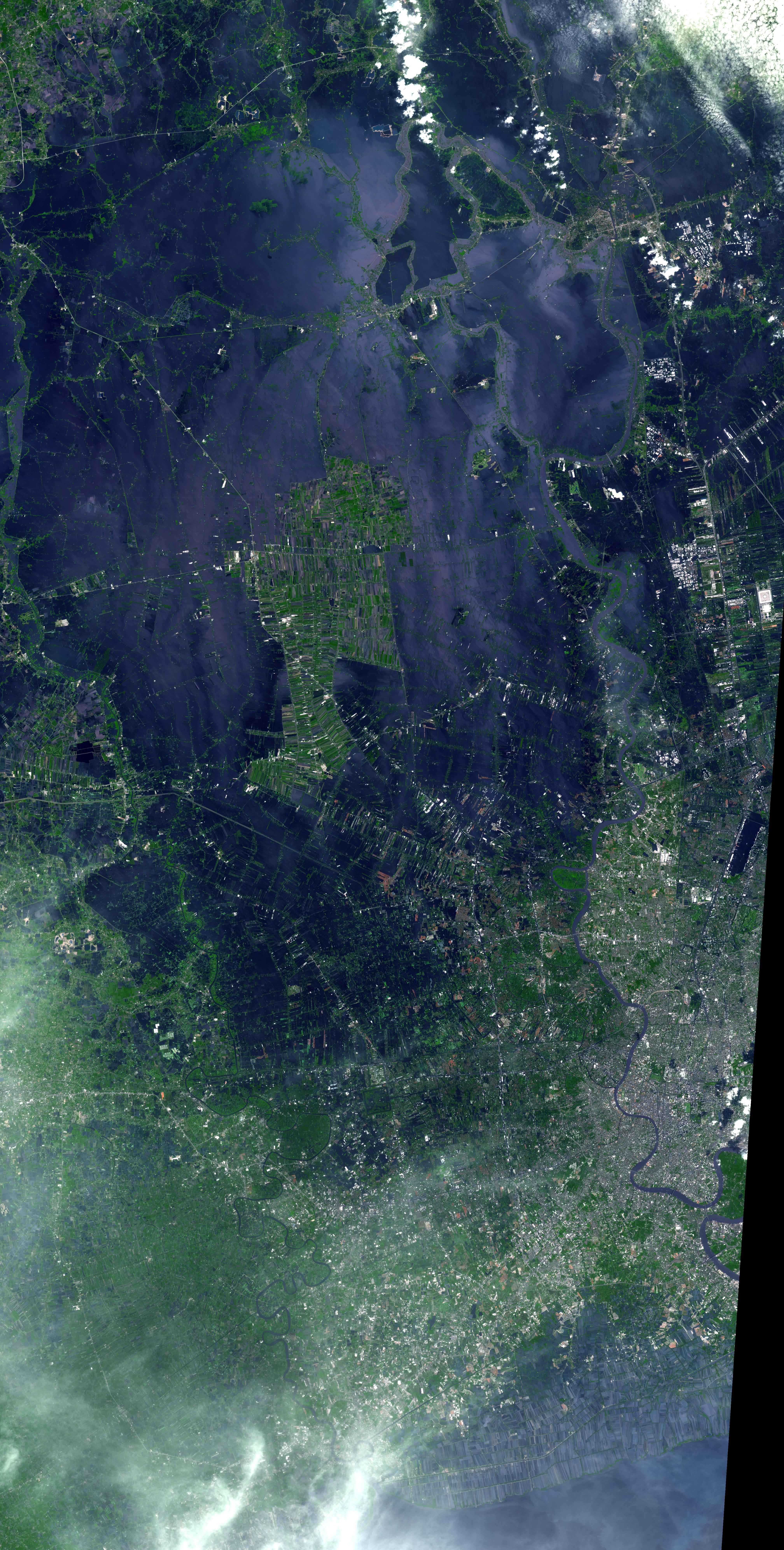
2011-11-10 |
Earth
|
Terra
|
ASTER
|
4032x7962x3 |
|
-
PIA15072:
-
NASA Spacecraft Depicts More Flooding in Thailand
Full Resolution:
TIFF
(96.31 MB)
JPEG
(4.98 MB)
|
|
|
2002-10-25 |
Earth
|
Landsat
Shuttle Radar Topography Mission (SRTM)
|
C-Band Interferometric Radar
Thematic Mapper
|
1152x870x3 |
|
-
PIA03366:
-
Perspective View with Landsat Overlay, Costa Rica
Full Resolution:
TIFF
(3.01 MB)
JPEG
(220.9 kB)
|
|
|
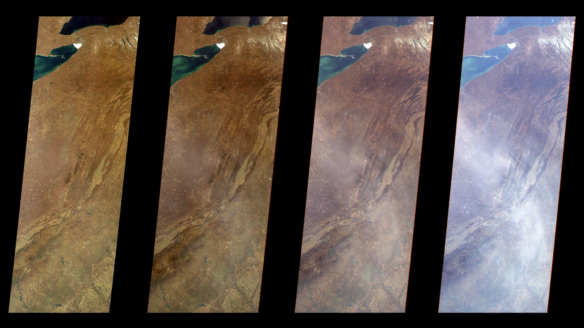
2000-04-19 |
Earth
|
Terra
|
MISR
|
1906x981x3 |
|
-
PIA02600:
-
Nicaraguan Volcanoes, 26 February 2000
Full Resolution:
TIFF
(4.239 MB)
JPEG
(194.3 kB)
|
|
|
2000-04-19 |
Earth
|
Terra
|
MISR
|
1920x1079x3 |
|
-
PIA02601:
-
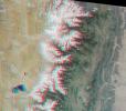
Multi-Angle Views of the Appalachian Mountains, 6 March 2000
Full Resolution:
TIFF
(5.067 MB)
JPEG
(244.4 kB)
|
|
|
2000-04-19 |
Earth
|
Terra
|
MISR
|
2536x800x3 |
|
-
PIA02602:
-
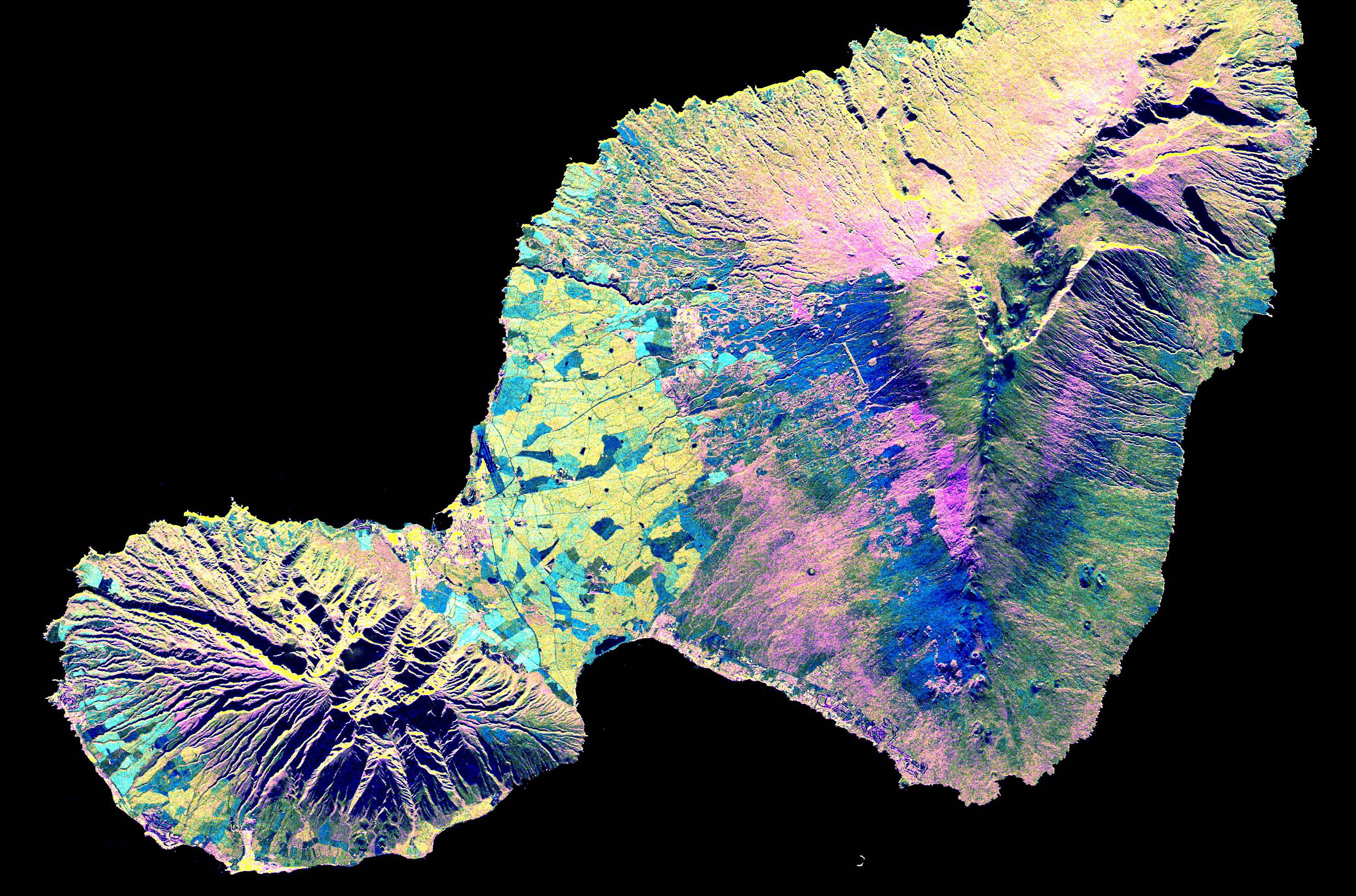
Multi-Angle View of the Canary Islands
Full Resolution:
TIFF
(3.681 MB)
JPEG
(169 kB)
|
|
|
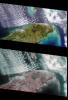
2000-04-19 |
Earth
|
Terra
|
MISR
|
1520x1264x3 |
|
-
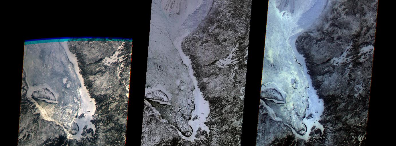
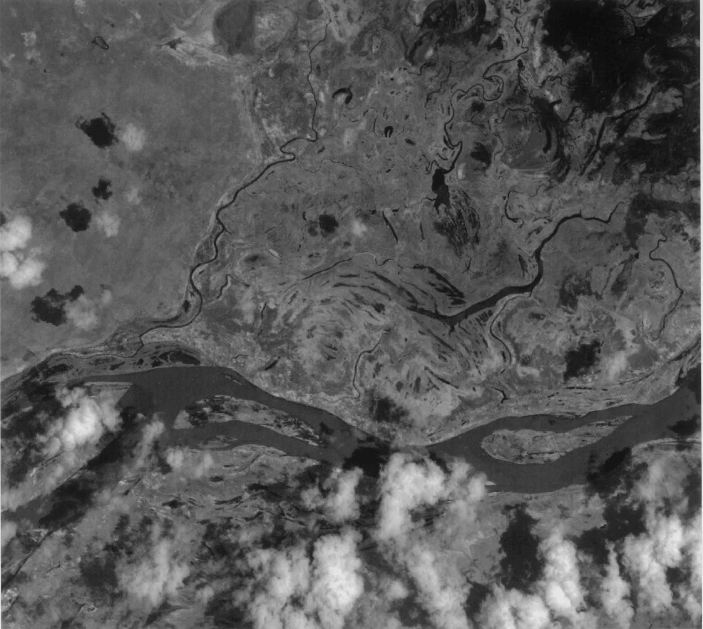
PIA02603:
-
Multi-angle Images of Hudson Bay and James Bay, Canada, 24 February 2000
Full Resolution:
TIFF
(4.927 MB)
JPEG
(370.2 kB)
|
|
|
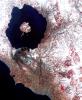
2000-04-26 |
Earth
|
Terra
|
ASTER
|
2100x1445x3 |
|
-
PIA02604:
-
ASTER Images the Island of Hawaii
Full Resolution:
TIFF
(7.393 MB)
JPEG
(430.3 kB)
|
|
|
2000-04-26 |
Earth
|
Terra
|
ASTER
|
4100x4980x3 |
|
-
PIA02605:
-
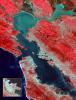
ASTER Images San Francisco Bay Area
Full Resolution:
TIFF
(36.23 MB)
JPEG
(3.773 MB)
|
|
|
2000-04-26 |
Earth
|
Terra
|
ASTER
|
4100x5400x3 |
|
-
PIA02606:
-
ASTER Images San Francisco Bay Area
Full Resolution:
TIFF
(54.36 MB)
JPEG
(4.828 MB)
|
|
|
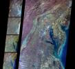
2000-04-26 |
Earth
|
Terra
|
ASTER
|
4100x6177x3 |
|
-
PIA02607:
-
ASTER Images Tokyo
Full Resolution:
TIFF
(75.98 MB)
JPEG
(12.25 MB)
|
|
|
2000-04-26 |
Earth
|
Terra
|
ASTER
|
1174x1447x3 |
|
-
PIA02608:
-
ASTER Images Mt. Usu Volcano
Full Resolution:
TIFF
(3.631 MB)
JPEG
(681 kB)
|
|
|
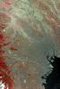
2000-06-20 |
Earth
|
Terra
|
MISR
|
2220x2048x3 |
|
-
PIA02609:
-
MISR Views Delaware Bay, Chesapeake Bay, and the Appalachian Mountains
Full Resolution:
TIFF
(12.73 MB)
JPEG
(862.5 kB)
|
|
|
2000-06-20 |
Earth
|
Terra
|
MISR
|
2548x3800x3 |
|
-
PIA02610:
-
MISR Views Florida
Full Resolution:
TIFF
(19.67 MB)
JPEG
(1.364 MB)
|
|
|
2000-07-08 |
Earth
|
Terra
|
MISR
|
584x900x3 |
|
-
PIA02611:
-
MISR Views Hurricane Carlotta
Full Resolution:
TIFF
(1.25 MB)
JPEG
(76.02 kB)
|
|
|
2000-07-19 |
Earth
|
Terra
|
MISR
|
1149x668x3 |
|
-
PIA02614:
-
MISR Views Northern Australia
Full Resolution:
TIFF
(2.837 MB)
JPEG
(182.9 kB)
|
|
|
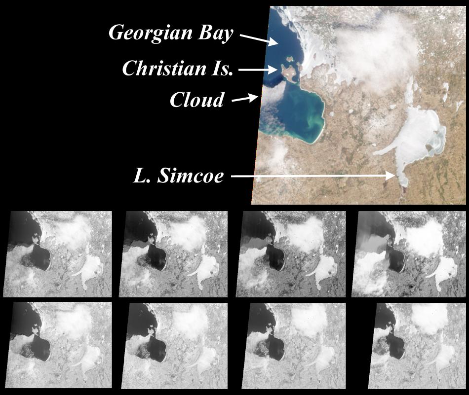
2000-07-26 |
Earth
|
Terra
|
MISR
|
950x801x3 |
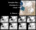
|
-
PIA02615:
-
MISR View of Georgian Bay, Ontario, Canada
Full Resolution:
TIFF
(1.027 MB)
JPEG
(108.6 kB)
|
|
|
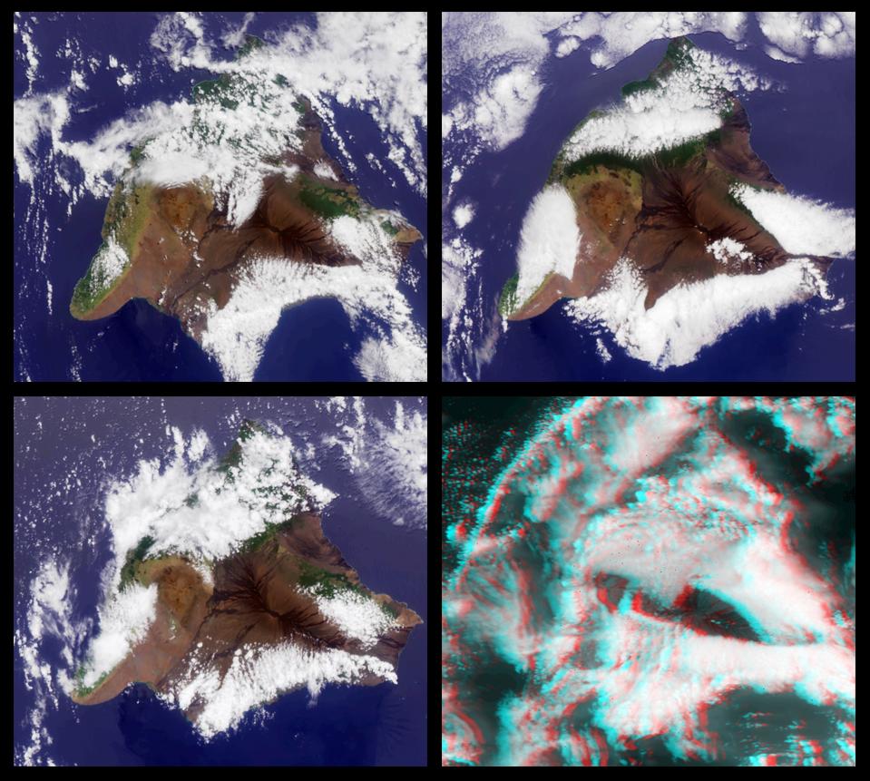
2000-08-02 |
Earth
|
Terra
|
MISR
|
959x861x3 |
|
-
PIA02616:
-
MISR Views the Big Island of Hawaii
Full Resolution:
TIFF
(2.201 MB)
JPEG
(145.4 kB)
|
|
|
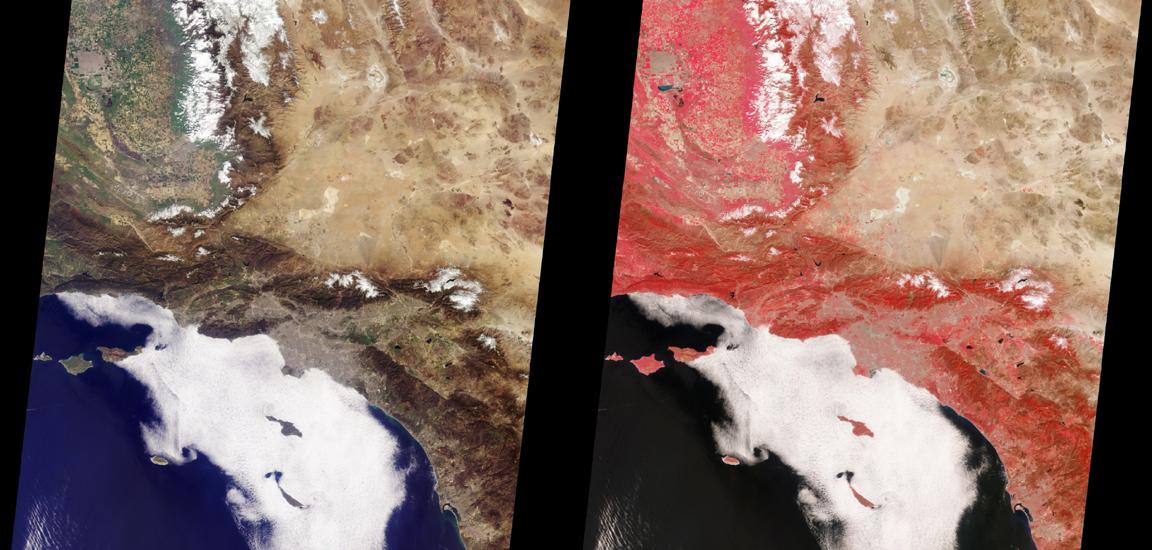
2000-08-09 |
Earth
|
Terra
|
MISR
|
1152x550x3 |
|
-
PIA02617:
-
MISR Views Southern California
Full Resolution:
TIFF
(1.832 MB)
JPEG
(106.9 kB)
|
|
|
2000-08-16 |
Earth
|
Terra
|
MISR
|
938x790x3 |
|
-
PIA02618:
-
MISR Images Wildfires in Northwestern US
Full Resolution:
TIFF
(2.435 MB)
JPEG
(127.1 kB)
|
|
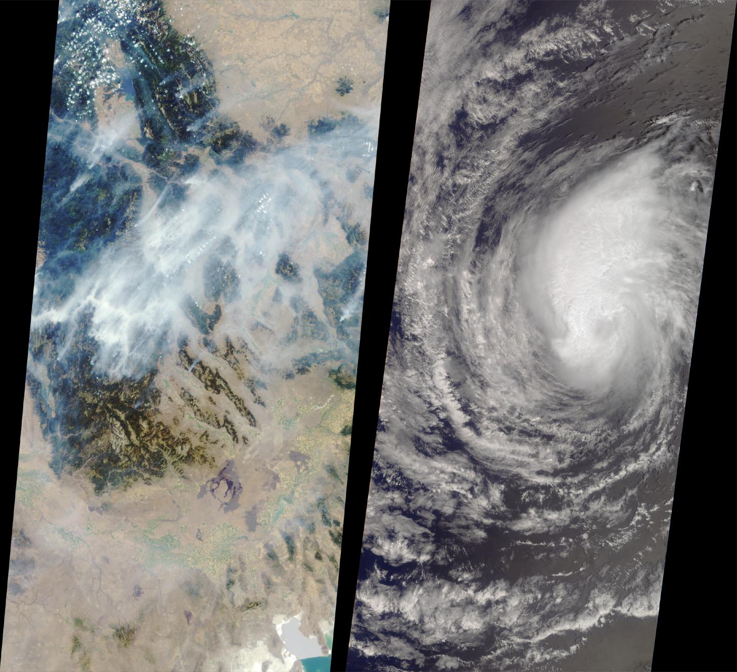
|
2000-08-18 |
Earth
|
Terra
|
MISR
|
1436x1311x3 |
|
-
PIA02619:
-
MISR Images Forest Fires and Hurricane
Full Resolution:
TIFF
(5.22 MB)
JPEG
(263.7 kB)
|
|
|
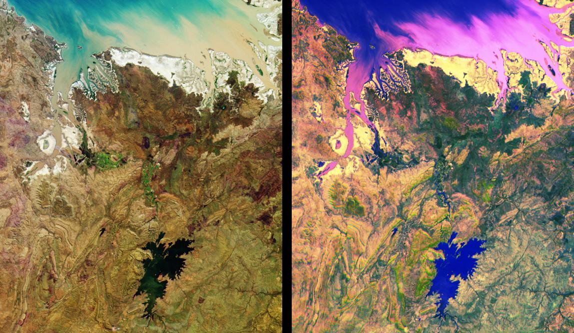
2000-08-23 |
Earth
|
Terra
|
MISR
|
1152x505x3 |

|
-
PIA02620:
-
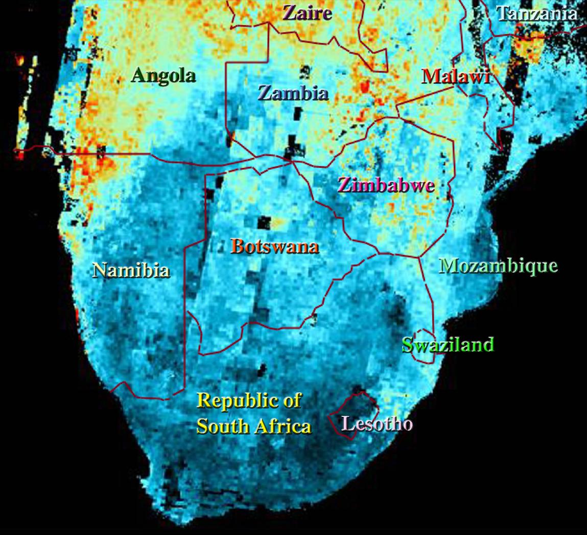
MISR Images Northeastern Botswana
Full Resolution:
TIFF
(1.985 MB)
JPEG
(102.8 kB)
|
|
|
2000-08-30 |
Earth
|
Terra
|
MISR
|
1440x753x3 |
|
-
PIA02621:
-
MISR Images Zambia and Botswana
Full Resolution:
TIFF
(3.403 MB)
JPEG
(179.5 kB)
|
|
|
2000-09-06 |
Earth
|
Terra
|
MISR
|
1256x705x3 |
|
-
PIA02622:
-
MISR Views a Fire-Scarred Landscape
Full Resolution:
TIFF
(1.473 MB)
JPEG
(163.8 kB)
|
|
|
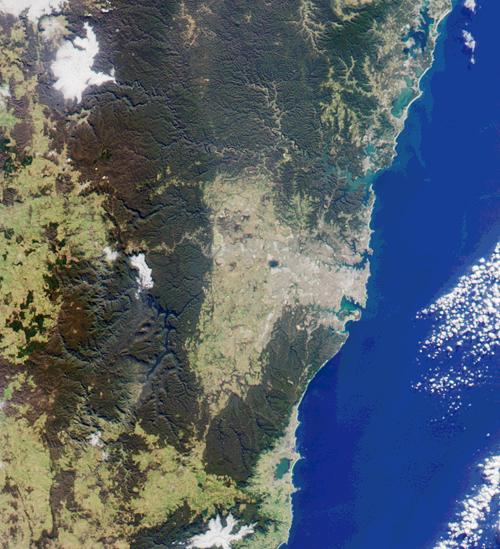
2000-09-13 |
Earth
|
Terra
|
MISR
|
500x549x3 |
|
-
PIA02623:
-
MISR Looks at Sydney and the Southeastern Australia Coast
Full Resolution:
TIFF
(857.6 kB)
JPEG
(62.85 kB)
|
|
|
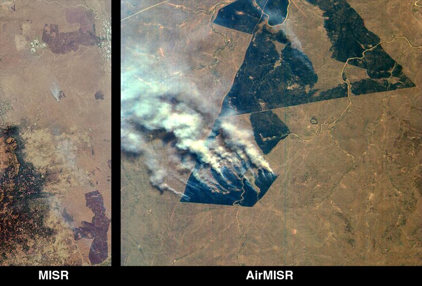
2000-09-20 |
Earth
|
Terra
|
MISR
|
826x560x3 |

|
-
PIA02624:
-
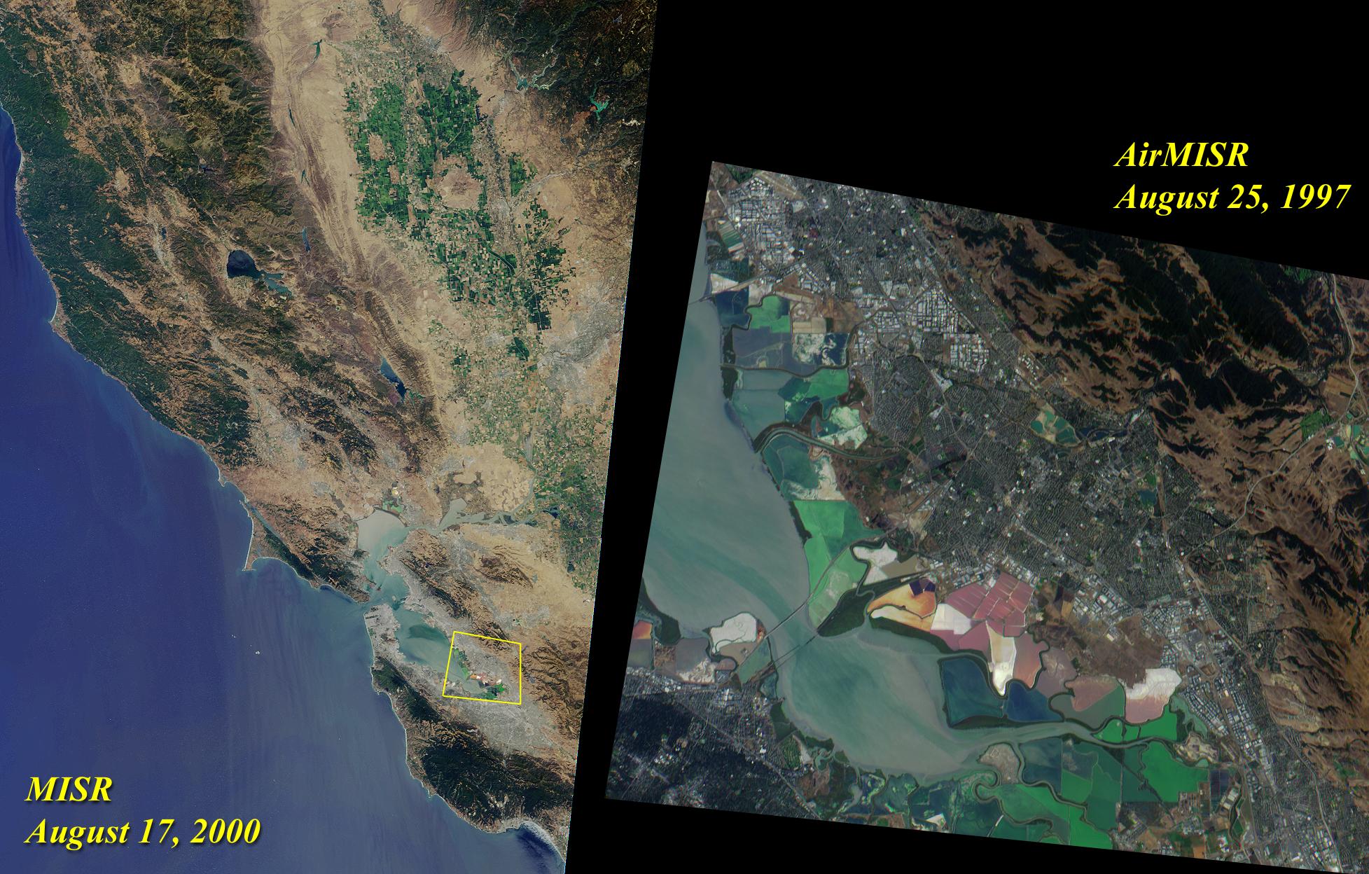
MISR and AirMISR Simultaneously Observe African Grassland Fires
Full Resolution:
TIFF
(1.505 MB)
JPEG
(86.42 kB)
|
|
|
2000-09-27 |
Earth
|
Terra
|
MISR
|
1148x819x3 |
|
-
PIA02625:
-
MISR Stereo Imaging Distinguishes Smoke from Cloud
Full Resolution:
TIFF
(2.36 MB)
JPEG
(142.6 kB)
|
|
|
2000-10-04 |
Earth
|
Terra
|
MISR
|
1149x750x3 |
|
-
PIA02626:
-
MISR Views the Middle East
Full Resolution:
TIFF
(2.67 MB)
JPEG
(145.1 kB)
|
|
|
2000-10-11 |
Earth
|
Terra
|
MISR
|
2259x894x3 |
|
-
PIA02627:
-
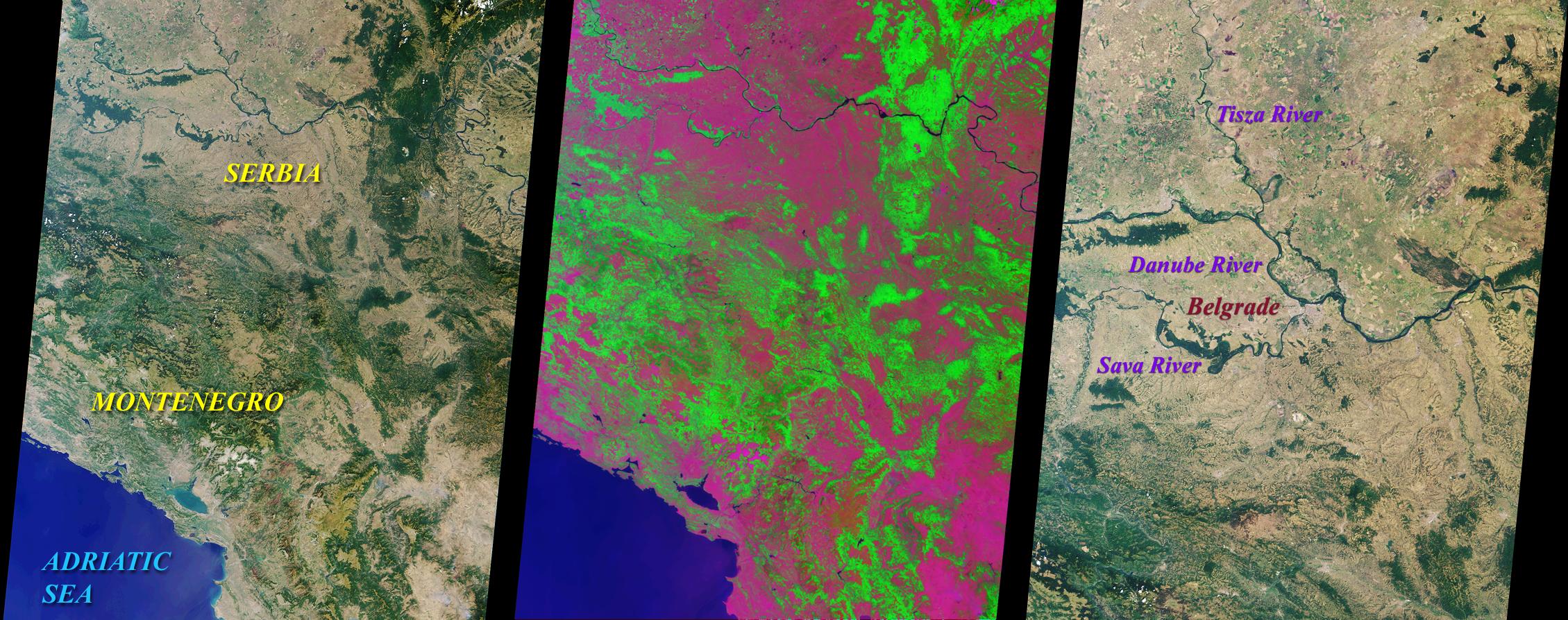
MISR Looks at Yugoslavia
Full Resolution:
TIFF
(6.538 MB)
JPEG
(488.8 kB)
|
|
|
2000-10-18 |
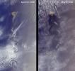
Earth
|
Terra
|
MISR
|
1728x1043x3 |
|
-
PIA02628:
-
MISR Sees the Sierra Nevadas in Stereo
Full Resolution:
TIFF
(5.638 MB)
JPEG
(299.3 kB)
|
|
|
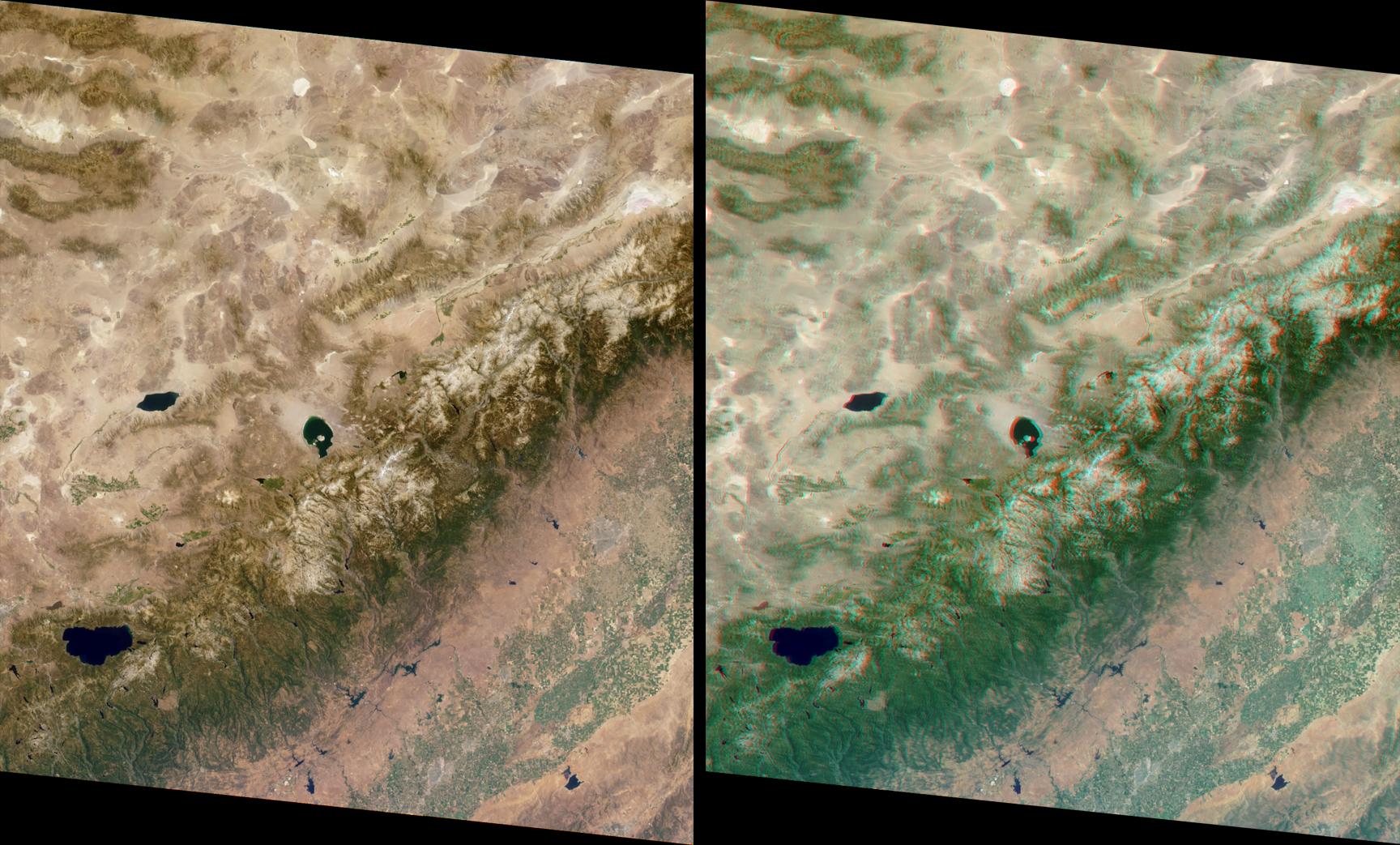
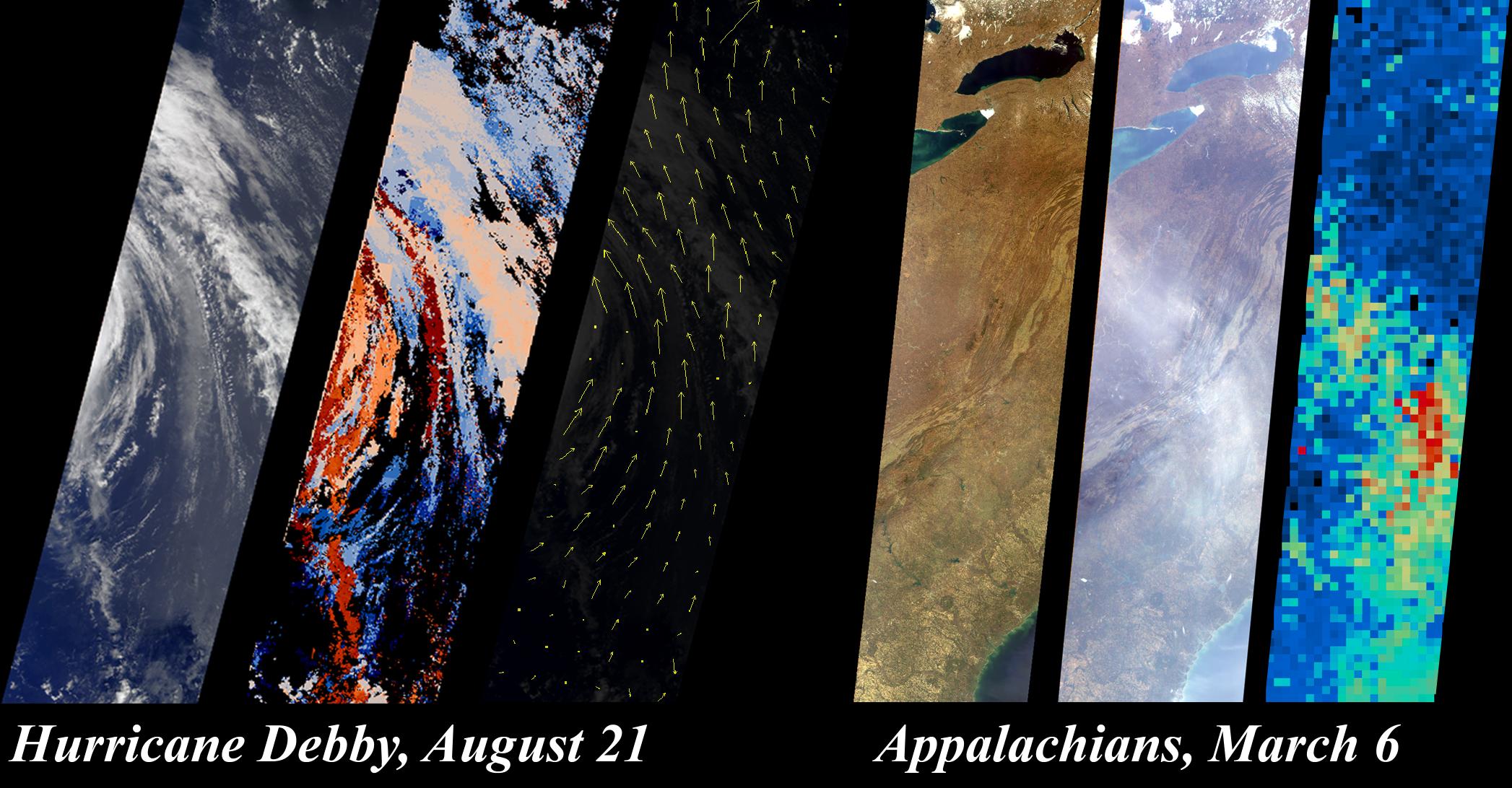
2000-10-25 |
Earth
|
Terra
|
MISR
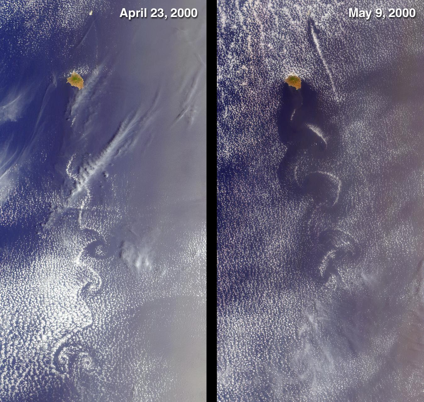
|
2094x1092x3 |
|
-
PIA02629:
-
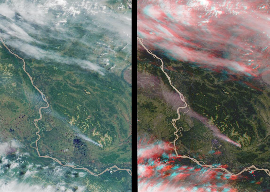
Hurricane Debby and the Appalachians Highlight New MISR Data Products
Full Resolution:
TIFF
(4.867 MB)
JPEG
(327.6 kB)
|
|
|
2000-11-03 |
Earth
|
Terra
|
MISR
|
1256x1097x3 |
|
-
PIA02630:
-
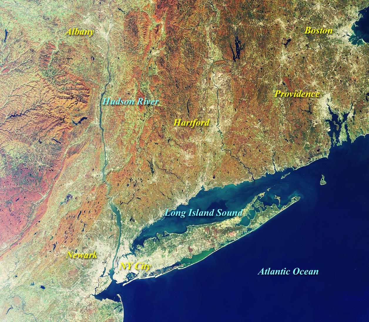
MISR Views New York and Southern New England
Full Resolution:
TIFF
(4.524 MB)
JPEG
(430.3 kB)
|
|
|
2000-11-08 |
Earth
|
Terra
|
MISR
|
1606x1293x3 |
|
-
PIA02631:
-
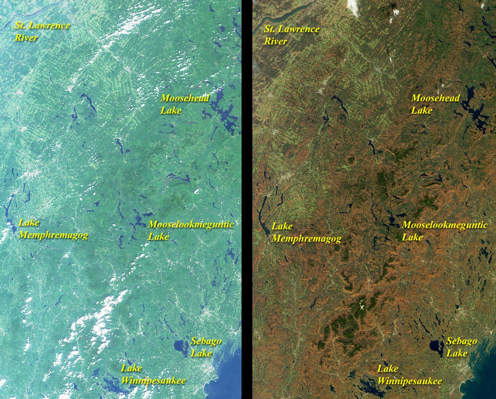
Summer Turns to Autumn in New England
Full Resolution:
TIFF
(7.373 MB)
JPEG
(580.9 kB)
|
|
|
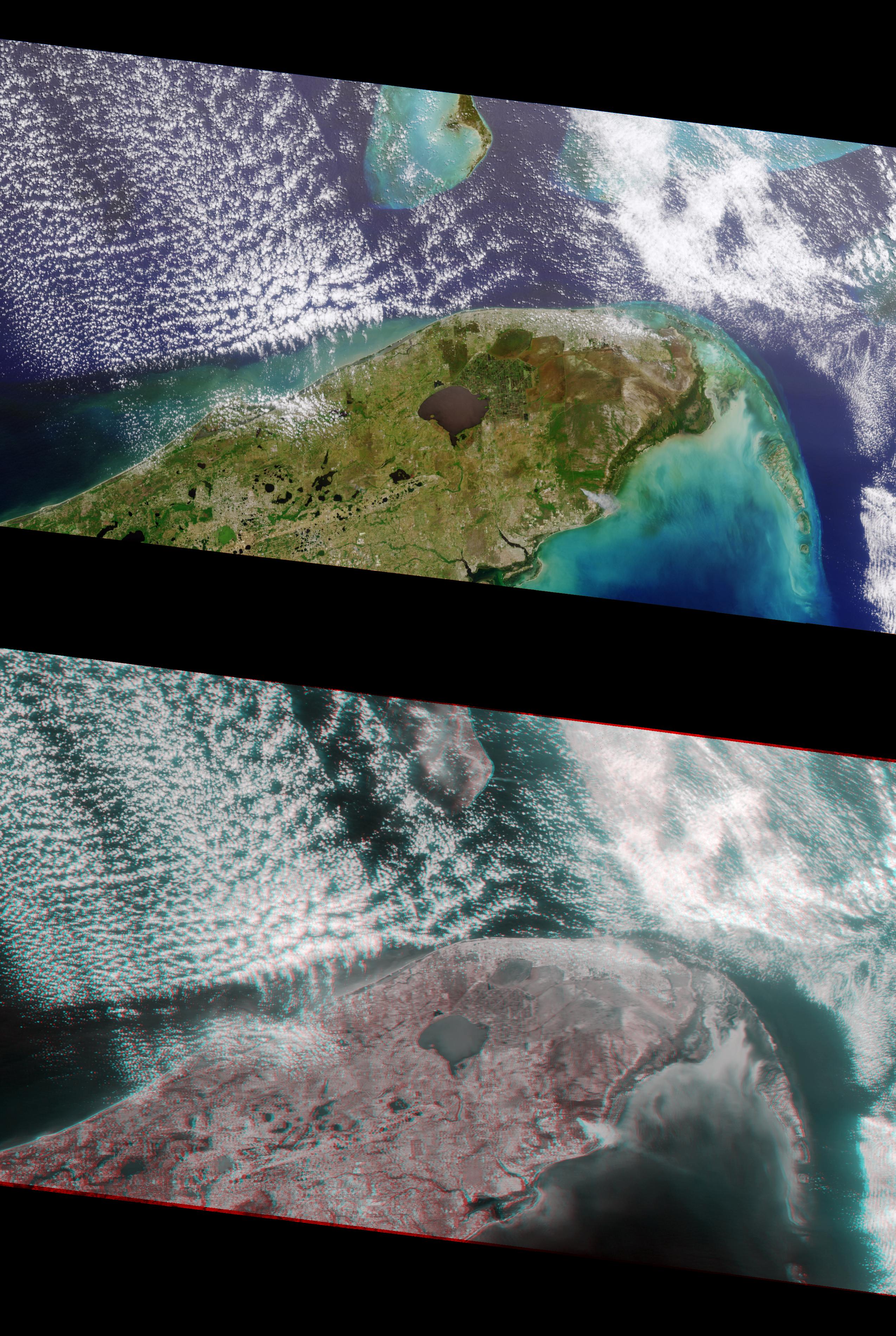
2000-11-15 |
Earth
|
Terra
|
MISR
|
1918x1424x3 |
|
-
PIA02632:
-
MISR Views Southern Florida
Full Resolution:
TIFF
(8.522 MB)
JPEG
(433.6 kB)
|
|
|
2000-11-22 |
Earth
|
Terra
|
MISR
|
670x1005x3 |
|
-
PIA02633:
-
MISR Looks at Cape Cod
Full Resolution:
TIFF
(2.138 MB)
JPEG
(125.3 kB)
|
|
|
2000-11-29 |
Earth
|
Terra
|
MISR
|
1591x1382x3 |

|
-
PIA02634:
-
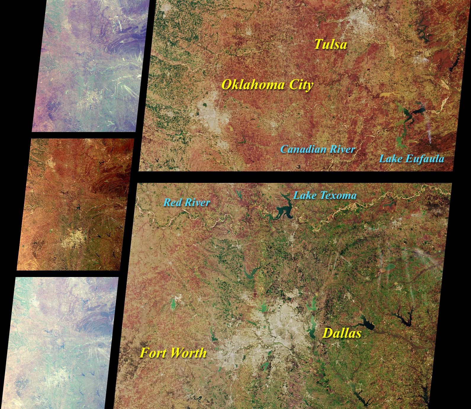
MISR Scans the Texas-Oklahoma Border
Full Resolution:
TIFF
(6.837 MB)
JPEG
(568.3 kB)
|
|
|
2000-12-06 |
Earth
|
Terra
|
MISR
|
1011x1422x3 |
|
-
PIA02635:
-
Atmospheric Vortices near Guadalupe Island
Full Resolution:
TIFF
(4.254 MB)
JPEG
(272.2 kB)
|
|
|
2000-12-13 |
Earth
|
Terra
|
MISR
|
1600x1261x3 |
|
-
PIA02636:
-
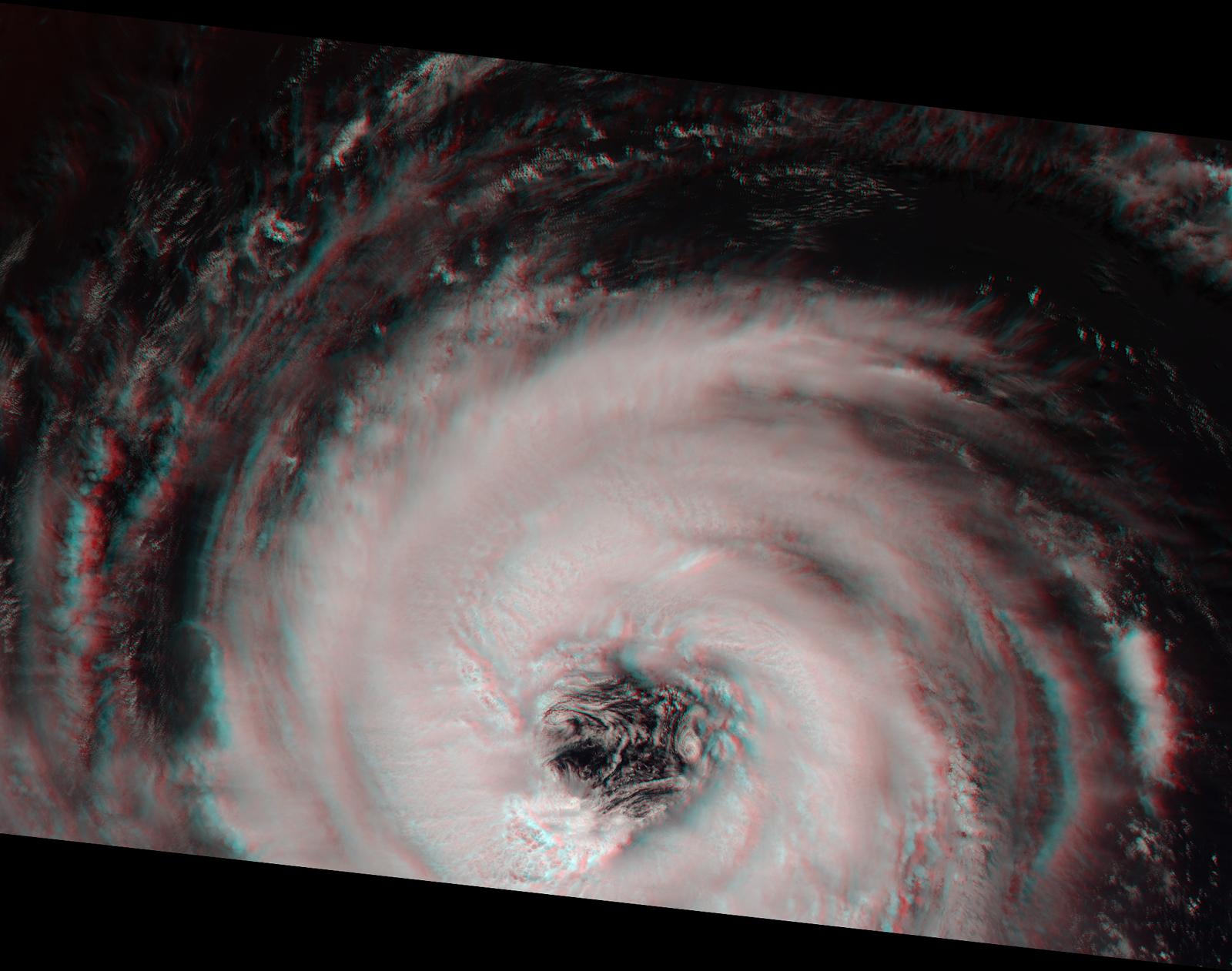
Into the Eye of the Storm
Full Resolution:
TIFF
(5.091 MB)
JPEG
(173.1 kB)
|
|
|
2000-12-20 |
Earth
|
Terra
|
MISR
|
1955x1248x3 |
|
-
PIA02637:
-
Northern California and San Francisco Bay
Full Resolution:
TIFF
(6.924 MB)
JPEG
(437.3 kB)
|
|
|
2000-12-27 |
Earth
|
Terra
|
MISR
|
1488x1564x3 |
|
-
PIA02638:
-
MISR Sights the Bering Strait
Full Resolution:
TIFF
(7.383 MB)
JPEG
(295.8 kB)
|
|
|
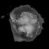
2001-01-03 |
Earth
|
Terra
|
MISR
|
1476x1681x3 |
|
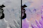
-
PIA02639:
-
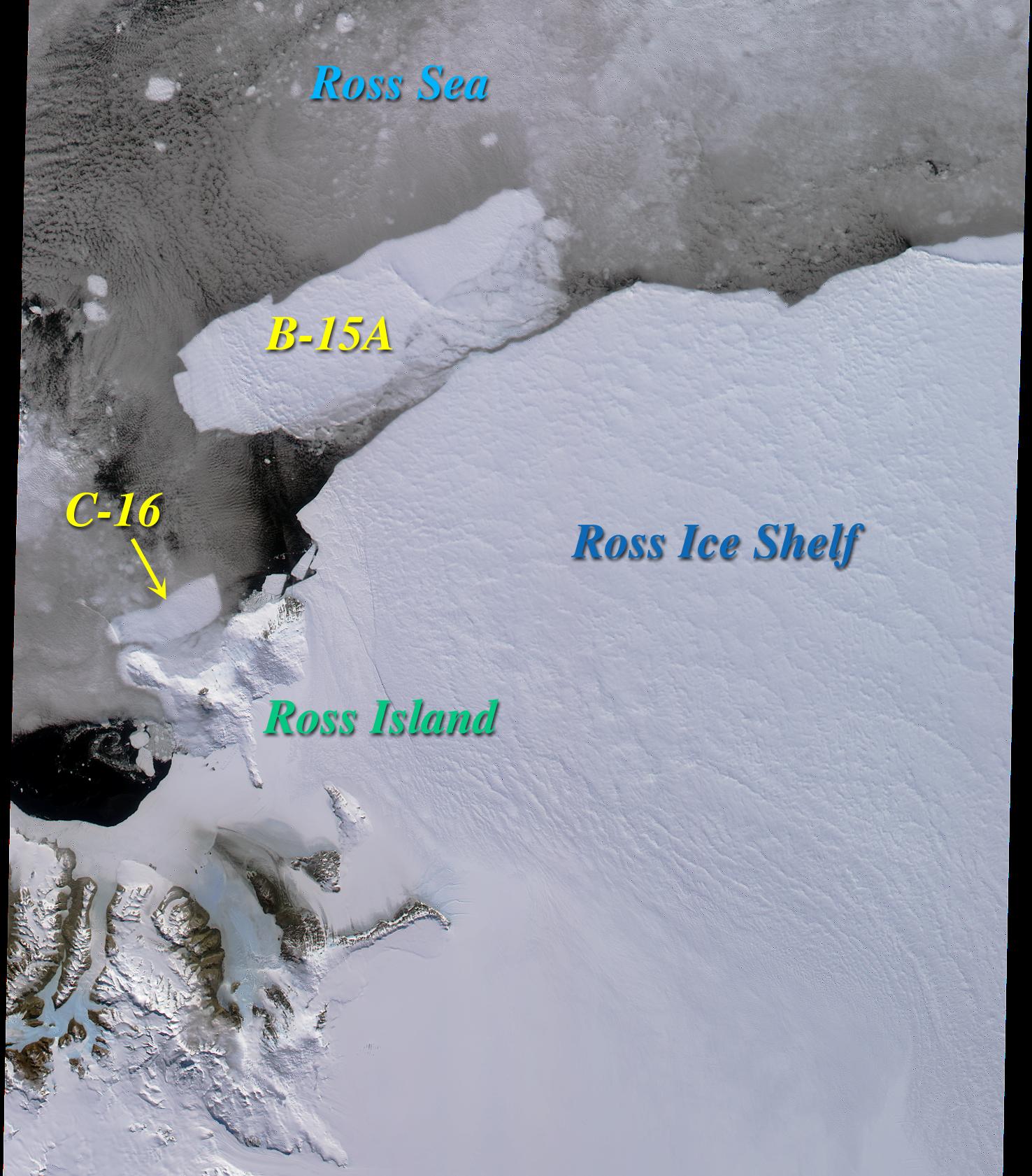
Icebergs in the Ross Sea, Antarctica
Full Resolution:
TIFF
(5.694 MB)
JPEG
(303.6 kB)
|
|
|
2001-01-10 |
Earth
|
Terra
|
MISR
|
1149x1046x3 |

|
-
PIA02640:
-
Airborne Particulates over Southern Africa
Full Resolution:
TIFF
(3.089 MB)
JPEG
(182.1 kB)
|
|
|
2001-01-17 |
Earth
|
Terra
|
MISR
|
1595x1000x3 |
|
-
PIA02641:
-
Winter Snowfall Turns an Emerald White
Full Resolution:
TIFF
(4.808 MB)
JPEG
(359.7 kB)
|
|
|
2001-01-24 |
Earth
|
Terra
|
MISR
|
1567x1354x3 |
|
-
PIA02642:
-
A Merging of Pale and Dark
Full Resolution:
TIFF
(6.731 MB)
JPEG
(556.3 kB)
|
|
|
2001-02-07 |
Earth
|
Terra
|
MISR
|
1639x1810x3 |
|
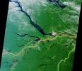
-
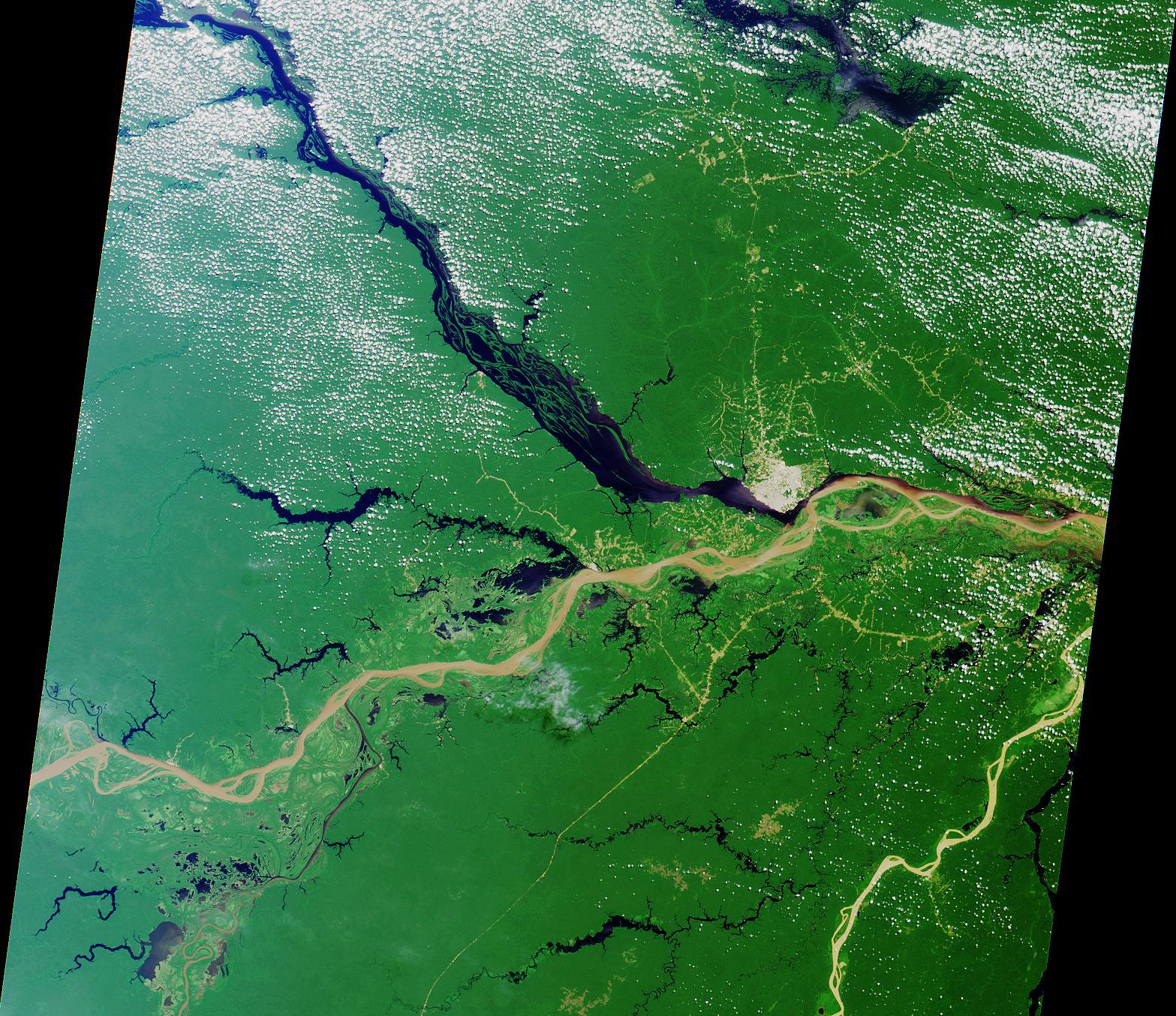
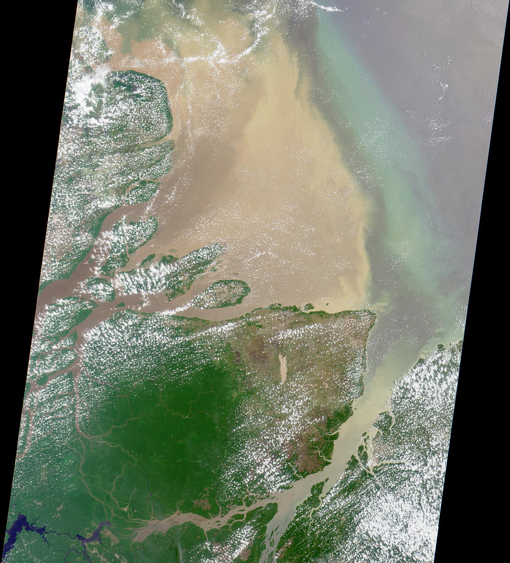
PIA02643:
-
Mouth of the Amazon
Full Resolution:
TIFF
(8.415 MB)
JPEG
(629 kB)
|
|
|
2001-02-14 |
Earth
|
Terra
|
MISR
|
876x1056x3 |
|
-
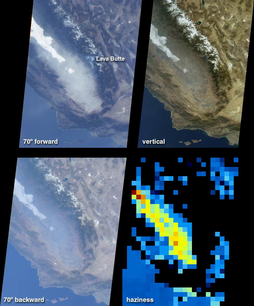
PIA02644:
-
Fog and Haze in California's San Joaquin Valley
Full Resolution:
TIFF
(1.68 MB)
JPEG
(107.4 kB)
|
|
|
2001-02-21 |
Earth
|
Terra
|
MISR
|
1500x867x3 |
|
-
PIA02645:
-
Green Summer and Icy Winter in James Bay
Full Resolution:
TIFF
(4.594 MB)
JPEG
(315.5 kB)
|
|
|
2001-02-28 |
Earth
|
Terra
|
MISR
|
954x839x3 |
|
-
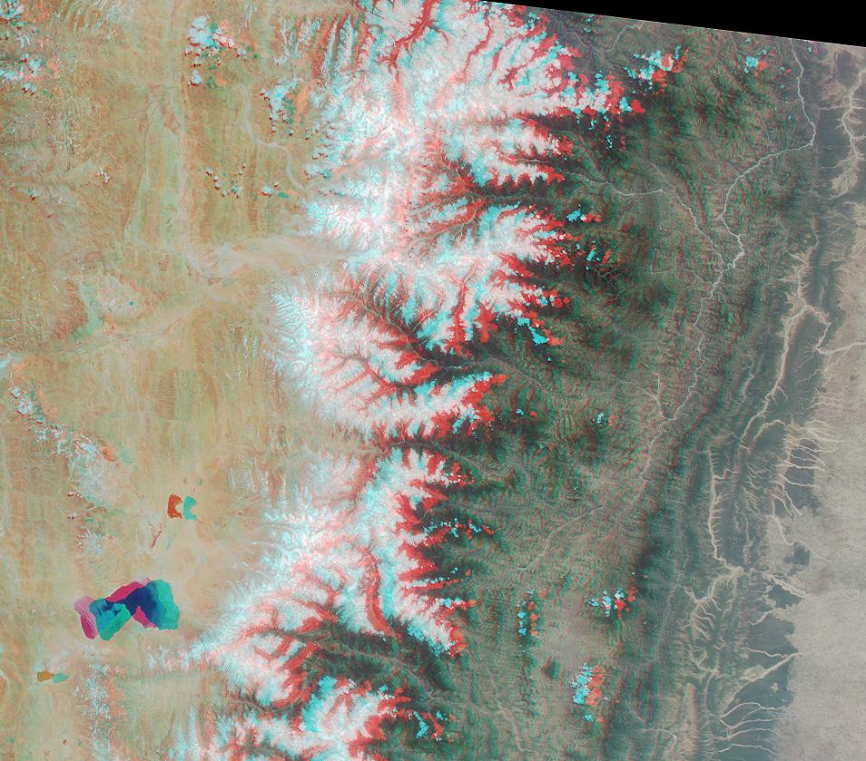
PIA02646:
-
Roof of the World and the Abode of Snow
Full Resolution:
TIFF
(2.774 MB)
JPEG
(169.3 kB)
|
|
|
2001-03-07 |
Earth
|
Terra
|
MISR
|
1604x1745x3 |
|
-
PIA02647:
-
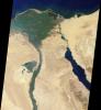
The Nile
Full Resolution:
TIFF
(7.185 MB)
JPEG
(409.7 kB)
|
|
|
2001-03-14 |
Earth
|
Terra
|
MISR
|
1349x1277x3 |
|
-
PIA02648:
-
Swirls of Lace
Full Resolution:
TIFF
(5.691 MB)
JPEG
(379.8 kB)
|
|
|
2001-03-21 |
Earth
|
Terra
|
MISR
|
1513x1590x3 |
|
-
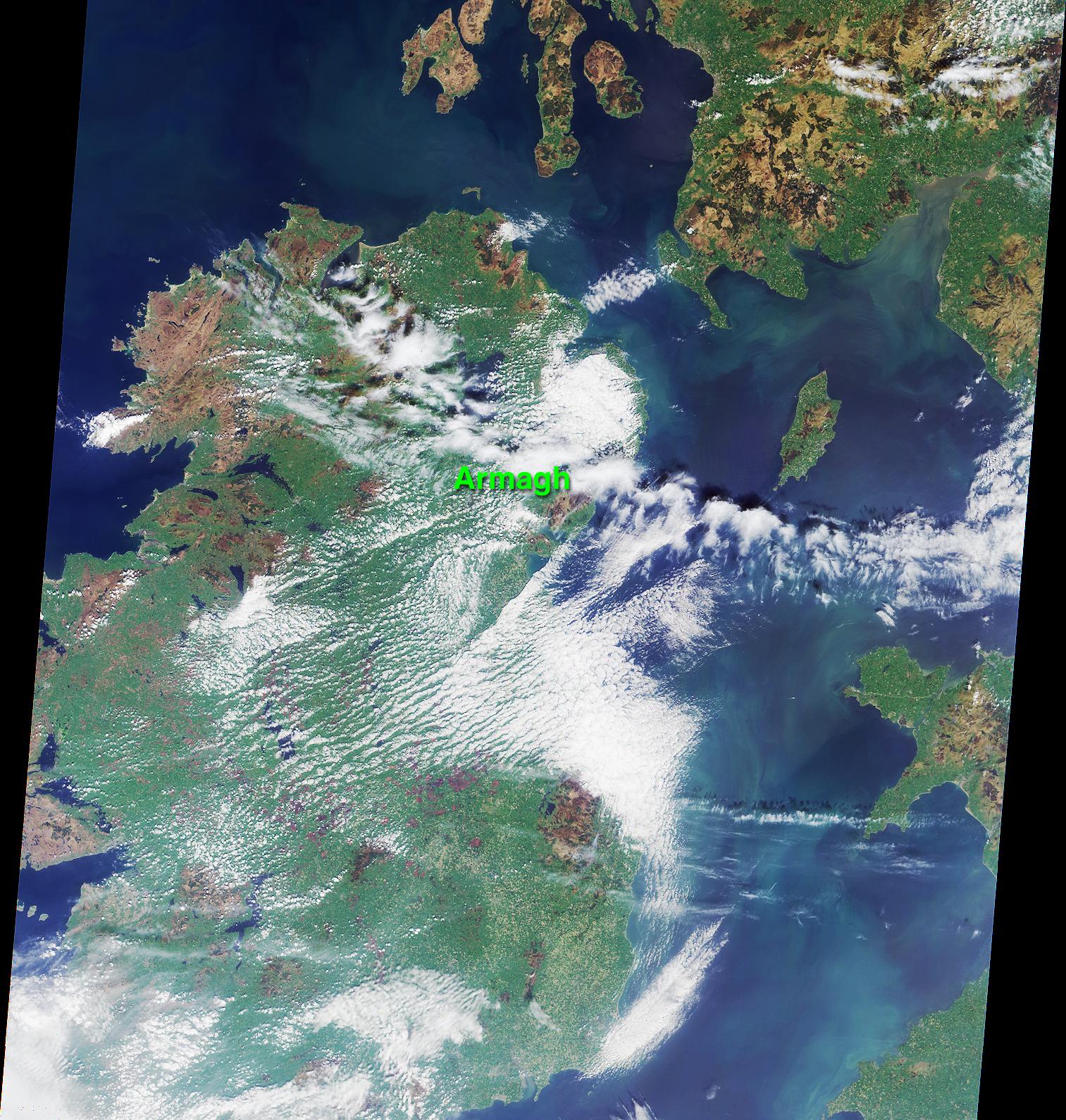
PIA02649:
-
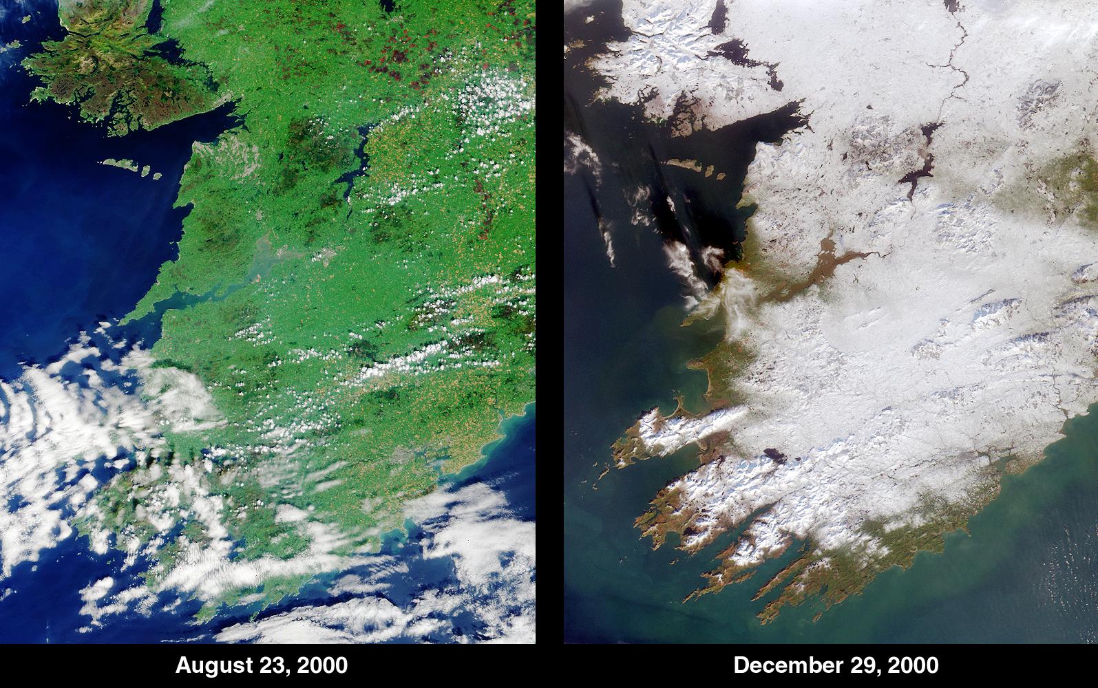
An Irish Tale: One City, Two Asteroids
Full Resolution:
TIFF
(7.175 MB)
JPEG
(541.2 kB)
|
|
|
2001-03-28 |
Earth
|
Terra
|
MISR
|
2000x1315x3 |
|
-
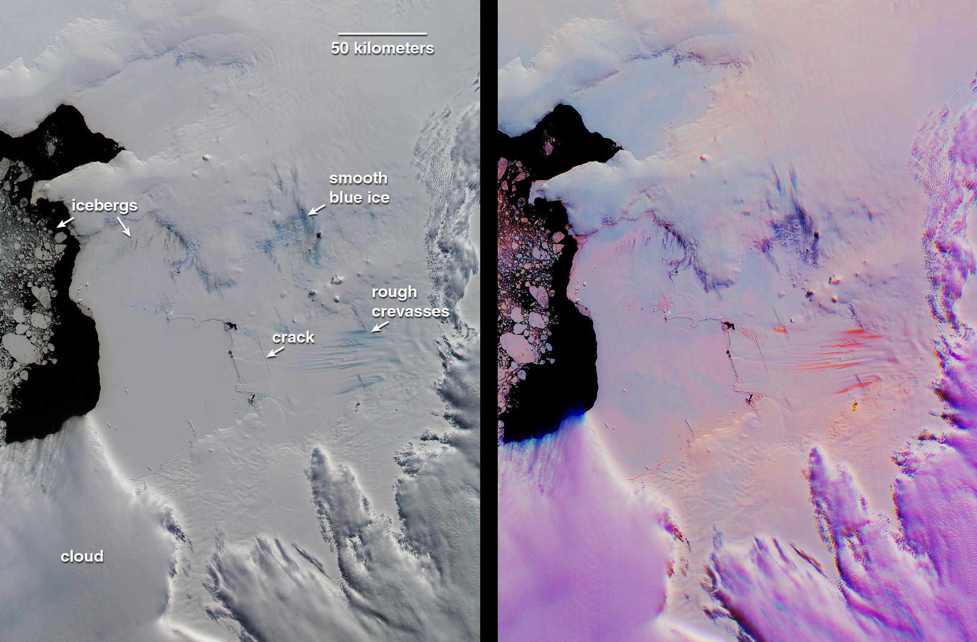
PIA02650:
-
Pine Island Glacier, Antarctica
Full Resolution:
TIFF
(6.189 MB)
JPEG
(308.3 kB)
|
 Planetary Data System


