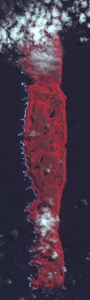
Macquarie Island lies halfway between New Zealand and Antarctica, and is part of Tasmania. Accidentally discovered in 1810, the island was used by sealers and as a base for Antarctic expeditions. In 1933 the island was declared a wildlife sanctuary, and in 1997 listed as a World Heritage Site. Birdlife International identified Macquarie as an Important Bird Area because it supports 3.5 million breeding seabirds of 13 species, including 5 breeds of penguins. The image is located at 54.6 degrees south latitude, 159 degrees east longitude, covers an area of 10 by 36 km, and was acquired January 9, 2011.
With its 14 spectral bands from the visible to the thermal infrared wavelength region and its high spatial resolution of 15 to 90 meters (about 50 to 300 feet), ASTER images Earth to map and monitor the changing surface of our planet. ASTER is one of five Earth-observing instruments launched Dec. 18, 1999, on Terra. The instrument was built by Japan's Ministry of Economy, Trade and Industry. A joint U.S./Japan science team is responsible for validation and calibration of the instrument and data products.
The broad spectral coverage and high spectral resolution of ASTER provides scientists in numerous disciplines with critical information for surface mapping and monitoring of dynamic conditions and temporal change. Example applications are: monitoring glacial advances and retreats; monitoring potentially active volcanoes; identifying crop stress; determining cloud morphology and physical properties; wetlands evaluation; thermal pollution monitoring; coral reef degradation; surface temperature mapping of soils and geology; and measuring surface heat balance.
The U.S. science team is located at NASA's Jet Propulsion Laboratory, Pasadena, Calif. The Terra mission is part of NASA's Science Mission Directorate, Washington, D.C.
More information about ASTER is available at http://asterweb.jpl.nasa.gov/.
 Planetary Data System


