Your search criteria found 561 images
Feature Name
Go to PIAxxxxx:
Refine this list of images by:
Target:
Mission:
Spacecraft:
Instrument:
Click on an image for detailed information
Click on a column heading to sort in ascending or descending order
My
List
Addition DateSort Ascending Target Mission Instrument Size
Add Image to Favorite List 2004-02-13 Mars Mars Exploration Rover (MER)
Microscopic Imager
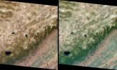
974x974x3
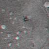
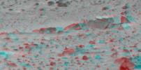
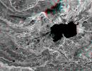
This 3-D anaglyph, from NASA's Mars Exploration Rover Spirit, shows an extreme close-up of round, blueberry-shaped grains on the crater floor near the rock outcrop at Meridiani Planum called Stone Mountain. 3D glasses are necessary.
PIA05286:
Even More Eye-popping 'Berries'
Full Resolution:     TIFF (2.674 MB)     JPEG (204.2 kB)
Add Image to Favorite List 2004-02-13 Mars Mars Exploration Rover (MER)
Microscopic Imager
974x974x3
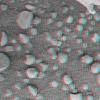
This 3-D anaglyph, from NASA's Mars Exploration Rover Spirit, shows an extreme close-up of round, blueberry-shaped grains on the crater floor near the rock outcrop at Meridiani Planum called Stone Mountain. 3D glasses are necessary.
PIA05285:
More Eye-popping 'Berries'
Full Resolution:     TIFF (2.385 MB)     JPEG (130.6 kB)
Add Image to Favorite List 2004-02-13 Mars Mars Exploration Rover (MER)
Microscopic Imager
974x974x3
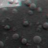
This is 3-D anaglyph, from NASA's Mars Exploration Rover Spirit, shows an extreme close-up of round, blueberry-shaped grains on the crater floor near the rock outcrop at Meridiani Planum called Stone Mountain. 3D glasses are necessary.
PIA05284:
Eye-popping 'Berries'
Full Resolution:     TIFF (2.339 MB)     JPEG (117.8 kB)
Add Image to Favorite List 2004-02-13 Mars Mars Exploration Rover (MER)
Microscopic Imager
Rock Abrasion Tool (RAT)
974x974x3
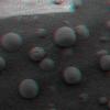
This 3D anaglyph, from NASA's Mars Exploration Rover Spirit, shows a microscopic image taken of the rock called Adirondack. 3D glasses are necessary to view this image.
PIA05278:
Adirondack Post-Drill (3-D)
Full Resolution:     TIFF (2.161 MB)     JPEG (105.7 kB)
Add Image to Favorite List 2004-02-13 Mars Mars Exploration Rover (MER)
Microscopic Imager
Rock Abrasion Tool (RAT)
974x974x3
This 3D anaglyph, from NASA's Mars Exploration Rover Spirit, shows a microscopic image taken of the rock called Adirondack. 3D glasses are necessary to view this image.
PIA05277:
A Clean Adirondack (3-D)
Full Resolution:     TIFF (2.642 MB)     JPEG (162.6 kB)
Add Image to Favorite List 2004-02-12 Mars Mars Exploration Rover (MER)
Moessbauer Spectrometer
974x974x3
This 3-D anaglyph, from NASA's Mars Exploration Rover Spirit, shows a microscopic image taken of soil featuring round, blueberry-shaped rock formations on the crater floor at Meridiani Planum, Mars. 3D glasses are necessary to view this image.
PIA05275:
"Berries" on the Ground 2 (3-D)
Full Resolution:     TIFF (2.621 MB)     JPEG (190.1 kB)
Add Image to Favorite List 2004-02-12 Mars Mars Exploration Rover (MER)
Moessbauer Spectrometer
974x974x3
This 3-D anaglyph, from NASA's Mars Exploration Rover Spirit, shows a microscopic image taken of soil featuring round, blueberry-shaped rock formations on the crater floor at Meridiani Planum, Mars. 3D glasses are necessary to view this image.
PIA05274:
"Berries" on the Ground 2 (3-D)
Full Resolution:     TIFF (2.211 MB)     JPEG (107.9 kB)
Add Image to Favorite List 2004-02-10 Mars Mars Exploration Rover (MER)
Navigation Camera
968x1008x3
This is a three-dimensional stereo anaglyph of an image taken by the front navigation camera onboard NASA's Mars Exploration Rover Spirit, showing an interesting patch of rippled soil. 3D glasses are necessary to view this image.
PIA05249:
Ripples in The Soil
Full Resolution:     TIFF (2.735 MB)     JPEG (202.4 kB)
Add Image to Favorite List 2004-02-06 Mars Mars Exploration Rover (MER)
Hazcam
1024x865x3
This 3-D view from behind NASA's Mars Exploration Rover Opportunity shows the path the rover has traveled since rolling 1 meter (3 feet) away from its empty lander on the seventh martian day, or sol, of its mission. 3D glasses are necessary.
PIA05212:
Traversing Martian Terrain
Full Resolution:     TIFF (1.379 MB)     JPEG (71.74 kB)
Add Image to Favorite List 2004-02-02 Mars Mars Exploration Rover (MER)
Hazcam
954x1024x3
This is a three-dimensional stereo anaglyph of an image taken by the front hazard-identification camera onboard NASA's Mars Exploration Rover Opportunity, showing the rover's arm in its extended position. 3D glasses are necessary to view this image.
PIA05198:
Opportunity Stretches Out (3-D)
Full Resolution:     TIFF (1.857 MB)     JPEG (74.63 kB)
Add Image to Favorite List 2004-01-31 Mars Mars Exploration Rover (MER)
Hazcam
1024x1024x3
This 3-D image captured by NASA's Mars Exploration Rover Opportunity's rear hazard-identification camera shows the now-empty lander that carried the rover 283 million miles to Meridiani Planum, Mars. 3D glasses are necessary to view this image.
PIA05183:
Vacant Lander in 3-D
Full Resolution:     TIFF (2.145 MB)     JPEG (89.33 kB)
Add Image to Favorite List 2004-01-27 Mars Mars Exploration Rover (MER)
Panoramic Camera
7450x1122x1
This sweeping look at the unusual rock outcropping near NASA's Mars Exploration Rover Opportunity. 3D glasses are necessary to view this image.
PIA05158:
Not of this Earth
Full Resolution:     TIFF (5.902 MB)     JPEG (781.4 kB)
Add Image to Favorite List 2004-01-23 Mars Mars Exploration Rover (MER)
Panoramic Camera
995x761x3
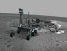
This 3-D image combines computer-generated models of NASA's Mars Exploration Rover Spirit and its lander with real surface data from the rover's panoramic camera. 3D glasses are necessary to view this image.
PIA05137:
On Its Own
Full Resolution:     TIFF (1.462 MB)     JPEG (84.76 kB)
Add Image to Favorite List 2004-01-19 Mars Mars Exploration Rover (MER)
Hazcam
1024x1024x3
This 3-D stereo anaglyph image was taken by NASA's Mars Exploration Rover Spirit. 3D glasses are necessary to view this image.
PIA05107:
Approaching Rock Target No. 1
Full Resolution:     TIFF (2.215 MB)     JPEG (74.85 kB)
Add Image to Favorite List 2004-01-16 Mars Mars Exploration Rover (MER)
Microscopic Imager
970x843x3
This image taken by the microscopic imager on NASA's Mars Exploration Rover Spirit shows the powdery soil of Mars in 3-D. 3D glasses are necessary to view this image.
PIA05095:
Martian Soil in 3-D
Full Resolution:     TIFF (2.08 MB)     JPEG (208.1 kB)
Add Image to Favorite List 2004-01-10 Mars Mars Exploration Rover (MER)
Navigation Camera
7695x3320x3
This anaglyph from NASA's Mars Exploration Rover, Spirit, shows the rover's lander and, in the background, the surrounding martian terrain. 3D glasses are necessary to view this image.
PIA05038:
Martian Landscape in 3-D
Full Resolution:     TIFF (31.46 MB)     JPEG (1.443 MB)
Add Image to Favorite List 2004-01-07 Mars Mars Exploration Rover (MER)
Panoramic Camera
3322x2934x3
Dust-covered rocks can be seen in this portion of the 3D image taken by the panoramic camera on NASA's Mars Exploration Rover Spirit. 3D glasses are necessary to view this image.
PIA05005:
Shrouded in Dust
Full Resolution:     TIFF (949.9 kB)     JPEG (50.61 kB)
Add Image to Favorite List 2004-01-07 Mars Mars Exploration Rover (MER)
Panoramic Camera
863x428x3
Martian terrain is seen in this 3-D image taken by the panoramic camera on NASA's Mars Exploration Rover Spirit. 3D glasses are necessary to view this image.
PIA05008:
Mars in Stereo
Full Resolution:     TIFF (20.25 MB)     JPEG (1.061 MB)
Add Image to Favorite List 2004-01-05 Mars Mars Exploration Rover (MER)
Navigation Camera
1892x384x3
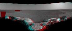
This sprawling look at the martian landscape surrounding the Mars Exploration Rover Spirit is the first 3-D stereo image from the rover's navigation camera. 'Sleepy Hollow' can be seen to center left of the image. 3D glasses are necessary.
PIA04993:
First 3-D Panorama of Spirit's Landing Site
Full Resolution:     TIFF (1.206 MB)     JPEG (67.76 kB)
Add Image to Favorite List 2003-12-10 Earth Terra
MISR
1062x860x3
This anaglyph from the MISR instrument aboard NASA's Terra spacecraft shows Santa Ana winds swept large amounts of dust and ash across the skies of San Diego and over the Pacific Ocean. 3D glasses are necessary to view this image.
PIA04348:
Airborne Dust and Ash over Southern California
Full Resolution:     TIFF (2.744 MB)     JPEG (148.8 kB)
Add Image to Favorite List 2003-10-28 Mars 2001 Mars Odyssey
4000x4000x3
NASA's Mars Odyssey spacecraft passes above a portion of the planet that is rotating into the sunlight in this artist's concept illustration. 3D glasses are necessary to view this image.
PIA04819:
Odyssey over Martian Sunrise, 3-D (Artist Concept)
Full Resolution:     TIFF (7.902 MB)     JPEG (398 kB)
Add Image to Favorite List 2003-10-28 Mars 2001 Mars Odyssey
6000x5000x3
NASA's Mars Odyssey spacecraft passes above Mars' south pole in this artist's concept illustration. 3D glasses are necessary to view this image.
PIA04817:
Odyssey over Mars' South Pole in 3-D (Artist Concept)
Full Resolution:     TIFF (45.22 MB)     JPEG (1.589 MB)
Add Image to Favorite List 2003-10-22 Mars Mars Express (MEX)
6200x5500x3
The European Space Agency's Mars Express spacecraft is depicted in orbit around Mars in this artist's concept stereo illustration. 3D glasses are necessary to view this image.
PIA04803:
Mars Express, 3-D Artist's Concept
Full Resolution:     TIFF (56.9 MB)     JPEG (1.616 MB)
Add Image to Favorite List 2003-07-03 Earth Landsat
Shuttle Radar Topography Mission (SRTM)
C-Band Interferometric Radar
2805x1705x3
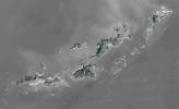
St. Thomas, St. John, Tortola, and Virgin Gorda are the four main islands (lower left to upper right) of this map-view anaglyph of the U.S. Virgin Islands and British Virgin Islands from NASA's Shuttle Radar Topography Mission. 3D glasses are necessary.
PIA03392:
Anaglyph with Landsat Virgin Islands, Caribbean
Full Resolution:     TIFF (7.529 MB)     JPEG (737 kB)
Add Image to Favorite List 2003-06-19 Earth Shuttle Radar Topography Mission (SRTM)
C-Band Interferometric Radar
7200x10886x3
This anaglyph, from NASA's Shuttle Radar Topography Mission, in South America is dominated by the Andes Mountains, which extend all along the Pacific Coast. 3D glasses are necessary to view this image.
PIA03389:
Anaglyph, South America
Full Resolution:     TIFF (50.13 MB)     JPEG (6.633 MB)
Add Image to Favorite List 2003-05-01 Earth Landsat
Shuttle Radar Topography Mission (SRTM)
C-Band Interferometric Radar
Thematic Mapper
3262x3162x3
This anaglyph, from NASA's Shuttle Radar Topography Mission, is of Malaspina Glacier in southeastern Alaska. 3D glasses are necessary to view this image.
PIA03387:
Malaspina Glacier, Alaska, Anaglyph with Landsat Overlay
Full Resolution:     TIFF (26.8 MB)     JPEG (2.079 MB)
Add Image to Favorite List 2003-04-25 Mars Mars Global Surveyor (MGS)
Mars Orbiter Camera (MOC)
540x810x3
The light-toned materials at the bottom end of this anaglyph fomr NASA's Mars Global Surveyor are considered to be thick exposures of sedimentary rock. 3D glasses are necessary to view this image.
PIA04481:
Northern Sinus Meridiani Stereo
Full Resolution:     TIFF (1.234 MB)     JPEG (41.56 kB)
Add Image to Favorite List 2003-04-09 Earth Terra
MISR
1362x1824x3
Dark smoke from oil fires extend for about 60 kilometers south of Iraq's capital city of Baghdad in this anaglyph acquired by the MISR instrument aboard NASA's Terra spacecraft on April 2, 2003. 3D glasses are necessary to view this image.
PIA04326:
Oil Fire Plumes Over Baghdad
Full Resolution:     TIFF (7.24 MB)     JPEG (331.6 kB)
Add Image to Favorite List 2003-03-27 Earth Shuttle Radar Topography Mission (SRTM)
C-Band Interferometric Radar
1573x2401x3
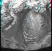
Manicouagan Crater is one of the world's largest and oldest known impact craters and perhaps the one most readily apparent to astronauts in orbit. This anaglyph is from the instrument onboard NASA's Shuttle Radar Topography Mission. 3D glasses needed.
PIA03385:
Anaglyph, Manicouagan Crater, Quebec, Canada
Full Resolution:     TIFF (9.691 MB)     JPEG (826 kB)
Add Image to Favorite List 2003-03-26 Earth Terra
MISR
1344x2219x3
This anaglyph from the MISR instrument aboard NASA's Terra spacecraft portrays the Little Aral and the eastern Large Aral at the onset of winter. 3D glasses are necessary to view this image.
PIA04324:
Windswept Shores of the Aral Sea
Full Resolution:     TIFF (8.956 MB)     JPEG (470.1 kB)
Add Image to Favorite List 2003-03-13 Earth Shuttle Radar Topography Mission (SRTM)
C-Band Interferometric Radar
1587x1536x3
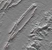
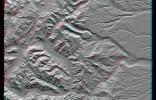
This anaglyph, from NASA's Shuttle Radar Topography Mission, is of Massanutten Mountain in the Shenandoah Valley of northern Virginia. 3D glasses are necessary to view this image.
PIA03382:
Massanutten Mountain, Virginia, USA (Anaglyph)
Full Resolution:     TIFF (6.914 MB)     JPEG (527.2 kB)
Add Image to Favorite List 2003-03-06 Earth Shuttle Radar Topography Mission (SRTM)
C-Band Interferometric Radar
1600x1080x3
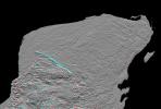
This anaglyph of Mexico's Yucatan Peninsula was generated from NASA's Shuttle Radar Topography Mission data, and shows a subtle but distinctive indication of the Chicxulub impact crater. 3D glasses are necessary to view this image.
PIA03380:
Anaglyph, Yucatan Peninsula, Mexico
Full Resolution:     TIFF (2.651 MB)     JPEG (362 kB)
Add Image to Favorite List 2003-03-06 Earth Shuttle Radar Topography Mission (SRTM)
C-Band Interferometric Radar
9600x7240x3
This anaglyph, from NASA's Shuttle Radar Topography Mission, is of the Iturralde Structure, Bolivia, a possible impact crater. 3D glasses are necessary to view this image.
PIA03378:
Anaglyph, North America
Full Resolution:     TIFF (94.73 MB)     JPEG (9.055 MB)
Add Image to Favorite List 2003-01-02 Earth Terra
MISR
1522x1789x3
Stratus clouds are common in the Arctic during the summer months, and are important modulators of the arctic climate as seen in this anaglyph from the MISR instrument aboard NASA's Terra spacecraft. 3D glasses are necessary to view this image.
PIA03748:
Stratified Arctic Clouds
Full Resolution:     TIFF (8.183 MB)     JPEG (436.8 kB)
Add Image to Favorite List 2002-11-13 Earth Terra
MISR
1079x984x3
This anaglyph from the MISR instrument aboard NASA's Terra spacecraft captured the energetic eruption of Sicily's Mount Etna volcano on October 29, 2002. 3D glasses are necessary to view this image.
PIA03733:
Multi-angle Portrayals of Mt. Etna's Plume
Full Resolution:     TIFF (2.551 MB)     JPEG (138.7 kB)
Add Image to Favorite List 2002-10-09 Earth Terra
MISR
3584x3252x3
This anaglyph from the MISR instrument aboard NASA's Terra spacecraft shows Hurricane Lili headed for Louisiana on October 2, 2002. 3D glasses are necessary to view this image.
PIA03728:
Hurricane Lili Heads for Louisiana Landfall
Full Resolution:     TIFF (24.35 MB)     JPEG (921.7 kB)
Add Image to Favorite List 2002-09-26 Earth Shuttle Radar Topography Mission (SRTM)
C-Band Interferometric Radar
1200x1200x3
This anaglyph, from NASA's Shuttle Radar Topography Mission, is of the Iturralde Structure, Bolivia, a possible impact crater. 3D glasses are necessary to view this image.
PIA03362:
Anaglyph: Shaded Relief and Height as Brightness, Iturralde Structure, Bolivia
Full Resolution:     TIFF (3.729 MB)     JPEG (366.1 kB)
Add Image to Favorite List 2002-09-19 Earth Landsat
Shuttle Radar Topography Mission (SRTM)
C-Band Interferometric Radar
Thematic Mapper
1009x1600x3
This anaglyph, from NASA's Shuttle Radar Topography Mission, is of Mount St Helens, Washington. 3D glasses are necessary to view this image.
PIA03360:
Anaglyph, Mount St Helens, Washington State
Full Resolution:     TIFF (4.217 MB)     JPEG (309 kB)
Add Image to Favorite List 2002-09-12 Earth Landsat
Shuttle Radar Topography Mission (SRTM)
C-Band Interferometric Radar
Thematic Mapper
339x620x3
This anaglyph, from NASA's Shuttle Radar Topography Mission, is of Mount Meru, an active volcano located just 70 kilometers (44 miles) west of Mount Kilimanjaro. 3D glasses are necessary to view this image.
PIA03358:
Anaglyph with Landsat Overlay, Mount Meru, Tanzania
Full Resolution:     TIFF (602.1 kB)     JPEG (56.43 kB)
Add Image to Favorite List 2002-08-07 Mars Mars Global Surveyor (MGS)
Mars Orbiter Camera (MOC)
1490x422x3
This anaglyph from NASA's Mars Global Surveyor shows a circular feature in northern Terra Meridiani. The circular feature was once an impact crater. 3D glasses are necessary to view this image.
PIA03915:
Partially-Exhumed Crater in Northern Terra Meridiani: Stereo Anaglyph of overlapping coverage in M04-01289 and E17-01676
Full Resolution:     TIFF (1.919 MB)     JPEG (114.7 kB)
Add Image to Favorite List 2002-08-07 Mars Mars Global Surveyor (MGS)
Mars Orbiter Camera (MOC)
1825x1876x1
This image from NASA's Mars Global Surveyor shows a circular feature in northern Terra Meridiani on Mars.
PIA03914:
Partially-Exhumed Crater in Northern Terra Meridiani: Mosaic of M04-01289, E17-01676, and M21-01646
Full Resolution:     TIFF (3.286 MB)     JPEG (557.6 kB)
Add Image to Favorite List 2002-06-12 Earth Terra
MISR
1660x933x3
The mountains and desert plateaus of northwest Colorado are shown in this anaglyph from the MISR instrument aboard NASA's Terra spacecraft. 3D glasses are necessary to view this image.
PIA03711:
Spectacular Mountain Views of Northwest Colorado
Full Resolution:     TIFF (5.47 MB)     JPEG (442.1 kB)
Add Image to Favorite List 2002-05-22 Earth Terra
MISR
1063x1565x3
Large smoke plumes were produced by the Blackjack complex fire in southeastern Georgia's Okefenokee Swamp as seen by the MISR instrument aboard NASA's Terra spacecraft May 8, 2002. 3D glasses are necessary to view this image.
PIA03709:
Okefenokee Swamp Fire, Georgia
Full Resolution:     TIFF (4.625 MB)     JPEG (247.1 kB)
Add Image to Favorite List 2002-03-13 Earth Terra
MISR
1328x1229x3
Marine stratocumulus clouds frequently form parallel rows, or 'cloud streets,' along the direction of wind flow. NASA's Terra spacecraft captured this stereo image of Jan Mayen island's Beerenberg volcano. 3D glasses are necessary to view this image.
PIA03448:
A Vortex Street in the Arctic
Full Resolution:     TIFF (4.249 MB)     JPEG (272 kB)
Add Image to Favorite List 2002-02-28 Earth Landsat
Shuttle Radar Topography Mission (SRTM)
C-Band Interferometric Radar
Thematic Mapper
1958x799x3
Mount San Antonio (more commonly known as Mount Baldy) crowns the San Gabriel Mountains northeast of Los Angeles, Calif., in this anaglyph from NASA's Shuttle Radar Topography Mission. 3D glasses are necessary to view this image.
PIA03345:
Anaglyph, Metro Los Angeles, Calif.: Malibu to Mount Baldy
Full Resolution:     TIFF (3.198 MB)     JPEG (298.8 kB)
Add Image to Favorite List 2002-02-16 Mars Mars Global Surveyor (MGS)
Mars Orbiter Camera (MOC)
4377x480x3
This anaglyph from NASA's Mars Global Surveyor shows eroded, pitted, light-toned layer outcrops in Iani Chaos. 3D glasses are necessary to view this image.
PIA03472:
Stereo View of Layer Outcrops in Iani Chaos
Full Resolution:     TIFF (6.625 MB)     JPEG (428.8 kB)
Add Image to Favorite List 2002-02-06 Earth Landsat
Shuttle Radar Topography Mission (SRTM)
C-Band Interferometric Radar
Thematic Mapper
925x2385x3
This anaglyph, from NASA's Shuttle Radar Topography Mission, is of Salt Lake City, Utah. 3D glasses are necessary to view this image.
PIA03343:
Anaglyph, Salt Lake City, Utah
Full Resolution:     TIFF (6.158 MB)     JPEG (683.6 kB)
Add Image to Favorite List 2002-02-01 Earth Landsat
Shuttle Radar Topography Mission (SRTM)
C-Band Interferometric Radar
Thematic Mapper
1384x2022x3
This anaglyph, from NASA's Shuttle Radar Topography Mission, is of the Nyiragongo volcano in the Congo. 3D glasses are necessary to view this image.
PIA03340:
Nyiragongo volcano, Congo, Anaglyph, SRTM / Landsat
Full Resolution:     TIFF (7.001 MB)     JPEG (499 kB)
Add Image to Favorite List 2002-01-16 Earth Terra
MISR
1728x1974x3
This anaglyph from the MISR instrument aboard NASA's Terra spacecraft shows the peaks of the Wasatch and Uinta Ranges in Utah. 3D glasses are necessary to view this image.
PIA03439:
Snow-Covered Peaks of the Wasatch and Uinta Mountains
Full Resolution:     TIFF (10.85 MB)     JPEG (649.6 kB)
Add Image to Favorite List 2001-11-28 Earth Terra
MISR
1698x2372x3
These images, taken by the MISR instrument aboard NASA's Terra spacecraft, are centered over the Pacific Ocean, about 1600 kilometers west of San Francisco. 3D glasses are necessary to view this image.
PIA03433:
Ship Tracks in a Stratiform Cloud Layer
Full Resolution:     TIFF (10.73 MB)     JPEG (839.9 kB)
Add Image to Favorite List 2001-10-22 Earth Terra
ASTER
1200x1354x3
NASA's Terra spacecraft captured this anaglyph image of Mt. St. Helens volcano in the Cascade Range of southwestern Washington; it erupted on 18 May 1980. 3D glasses are necessary to view this image.
PIA11160:
Mt. St. Helens Animation Icon
Full Resolution:     TIFF (4.88 MB)     JPEG (460.2 kB)
Add Image to Favorite List 2001-10-10 Earth Terra
MISR
730x900x3
Two of Iceland's larger icecaps, Langjökull (located just below image center) and Hofsjökull (just above center) can be clearly seen in this anaglyph from the MISR instrument aboard NASA's Terra spacecraft. 3D glasses are necessary to view this image.
PIA03426:
The Land of Ice and Fire
Full Resolution:     TIFF (2.148 MB)     JPEG (141.7 kB)
Add Image to Favorite List 2001-09-19 Earth Terra
MISR
1737x981x3
Spectacular canyons of the central Andes, in the Peruvian department of Arequipa, are seen in this anaglyph from the MISR instrument aboard NASA's Terra spacecraft. 3D glasses are necessary to view this image.
PIA03423:
Deepest Canyons of the Andes
Full Resolution:     TIFF (6.045 MB)     JPEG (413.2 kB)
Add Image to Favorite List 2001-09-01 Earth Shuttle Radar Topography Mission (SRTM)
C-Band Interferometric Radar
1910x1215x3
This anaglyph, from NASA's Shuttle Radar Topography Mission, is of the Andes Mountains, southeast of San Carlos de Bariloche, Argentina. 3D glasses are necessary to view this image.
PIA03326:
SRTM Anaglyph: Las Bayas, Argentina
Full Resolution:     TIFF (5.28 MB)     JPEG (429.3 kB)
Add Image to Favorite List 2001-08-24 Earth Shuttle Radar Topography Mission (SRTM)
C-Band Interferometric Radar
1630x1200x3
This anaglyph, from NASA's Shuttle Radar Topography Mission, is of an area southwest of Zapala, Argentina, showing a wide diversity of geologic features. 3D glasses are necessary to view this image.
PIA03325:
SRTM Anaglyph: Near Zapala, Argentina
Full Resolution:     TIFF (4.867 MB)     JPEG (318.9 kB)
Add Image to Favorite List 2001-08-16 Earth Shuttle Radar Topography Mission (SRTM)
C-Band Interferometric Radar
1090x1480x3
This anaglyph, from NASA's Shuttle Radar Topography Mission, is of Patagonia, near La Esperanza, Argentina. 3D glasses are necessary to view this image.
PIA03323:
SRTM Anaglyph: Lava plateaus, Argentina
Full Resolution:     TIFF (3.841 MB)     JPEG (284.2 kB)
Add Image to Favorite List 2001-08-03 Earth Shuttle Radar Topography Mission (SRTM)
C-Band Interferometric Radar
2501x1201x3
This anaglyph, from NASA's Shuttle Radar Topography Mission, shows the city of Bhuj, India. 3D glasses are necessary to view this image.
PIA03320:
SRTM Anaglyph: Piñon Canyon region, Colorado
Full Resolution:     TIFF (5.238 MB)     JPEG (349.1 kB)
Add Image to Favorite List 2001-08-01 Earth Terra
MISR
1736x1328x3
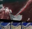
This anaglyph from the MISR instrument aboard NASA's Terra spacecraft shows the area around Jackson Hole, Wyoming, where the Green Knoll forest fire raged for many days in July, 2001. 3D glasses are necessary to view this image.
PIA03416:
Smoke over Jackson Hole, Wyoming
Full Resolution:     TIFF (7.261 MB)     JPEG (467.3 kB)
Add Image to Favorite List 2001-07-26 Earth Shuttle Radar Topography Mission (SRTM)
C-Band Interferometric Radar
2020x1350x3
This anaglyph, from NASA's Shuttle Radar Topography Mission, shows the eastern flank of the Andes Mountains, southeast of San Martin de Los Andes, Argentina. 3D glasses are necessary to view this image.
PIA03317:
SRTM Anaglyph: Corral de Piedra, Argentina
Full Resolution:     TIFF (6.425 MB)     JPEG (486.8 kB)
Add Image to Favorite List 2001-07-25 Earth Terra
MISR
1594x1444x3
This anaglyph from the MISR instrument aboard NASA's Terra spacecraft shows the eruption of Mt. Etna volcano located near the eastern coast of Sicily on July 22, 2001. 3D glasses are necessary to view this image.
PIA03415:
Eruption of Mt. Etna
Full Resolution:     TIFF (5.094 MB)     JPEG (282.1 kB)
Add Image to Favorite List 2001-07-05 Earth Shuttle Radar Topography Mission (SRTM)
C-Band Interferometric Radar
1600x1763x3
This anaglyph, from NASA's Shuttle Radar Topography Mission, shows the Kamchatka Peninsula in eastern Russia. Sredinnyy Khrebet, the mountain range that makes up the spine of the peninsula. 3D glasses are necessary to view this image.
PIA03313:
SRTM Anaglyph: Sredinnyy Khrebet, Kamchatka Peninsula, Russia
Full Resolution:     TIFF (7.882 MB)     JPEG (667.8 kB)
Add Image to Favorite List 2001-06-20 Earth Terra
MISR
1356x1932x3
This anaglyph from the MISR instrument aboard NASA's Terra spacecraft shows the rugged Southern Alps extending some 650 kilometers along the western side of New Zealand's South Island. 3D glasses are necessary to view this image.
PIA03410:
New Zealand's Southern Alps
Full Resolution:     TIFF (7.269 MB)     JPEG (518.5 kB)
Add Image to Favorite List 2001-06-14 Earth Shuttle Radar Topography Mission (SRTM)
C-Band Interferometric Radar
1935x1240x3
This anaglyph, from the instrument onboard NASA's Shuttle Radar Topography Mission, shows an area south of San Martin de Los Andes, Argentina. 3D glasses are necessary to view this image.
PIA03311:
SRTM Anaglyph: Laguna Mellquina, Andes Mountains, Argentina
Full Resolution:     TIFF (6.146 MB)     JPEG (457 kB)
Add Image to Favorite List 2001-05-31 Earth Landsat
Shuttle Radar Topography Mission (SRTM)
C-Band Interferometric Radar
Thematic Mapper
398x710x3
This anaglyph NASA's Shuttle Radar Topography Mission, shows the city of Bhuj, India. 3D glasses are necessary to view this image.
PIA03309:
SRTM Anaglyph: Northwest of Bhuj, India
Full Resolution:     TIFF (802.2 kB)     JPEG (84.41 kB)
Add Image to Favorite List 2001-05-24 Mars Mars Global Surveyor (MGS)
Mars Orbiter Camera (MOC)
907x2547x3
This stereo image mosaic from NASA's Mars Global Surveyor is of a field of dunes located in Nili Patera, a volcanic depression in central Syrtis Major. 3D glasses are necessary to view this image.
PIA03224:
Sand Dunes of Nili Patera in 3-D
Full Resolution:     TIFF (7.497 MB)     JPEG (540.1 kB)
Add Image to Favorite List 2001-05-24 Earth Landsat
Shuttle Radar Topography Mission (SRTM)
C-Band Interferometric Radar
Thematic Mapper
941x1304x3
This anaglyph NASA's Shuttle Radar Topography Mission, shows the city of Bhuj, India. 3D glasses are necessary to view this image.
PIA03307:
SRTM Anaglyph: Roads versus Dikes near Bhuj, India
Full Resolution:     TIFF (2.534 MB)     JPEG (344.1 kB)
Add Image to Favorite List 2001-05-23 Earth Terra
MISR
1300x1550x3
Several mountain ranges and a portion of the Amur River are visible in this set of stereo images of Russia's far east Khabarovsk region taken by the MISR instrument aboard NASA's Terra spacecraft. 3D glasses are necessary to view this image.
PIA03407:
Smoke and Clouds over Russia
Full Resolution:     TIFF (5.313 MB)     JPEG (386.1 kB)
Add Image to Favorite List 2001-05-16 Earth Terra
MISR
1536x1579x3
This anaglyph from the MISR instrument aboard NASA's Terra spacecraft include portions of southern Wyoming, central Colorado, and western Nebraska. 3D glasses are necessary to view this image.
PIA03406:
Front Range of the Rockies
Full Resolution:     TIFF (8.452 MB)     JPEG (541 kB)
Add Image to Favorite List 2001-05-02 Earth Landsat
Shuttle Radar Topography Mission (SRTM)
C-Band Interferometric Radar
Thematic Mapper
477x745x3
This anaglyph NASA's Shuttle Radar Topography Mission, shows the Haro and Kas Hills of the Kachchh region in western India. 3D glasses are necessary to view this image.
PIA03303:
SRTM Anaglyph: Haro and Kas Hills
Full Resolution:     TIFF (989 kB)     JPEG (108.1 kB)
Add Image to Favorite List 2001-04-05 Earth Landsat
Shuttle Radar Topography Mission (SRTM)
C-Band Interferometric Radar
Thematic Mapper
451x691x3
This anaglyph, from NASA's Shuttle Radar Topography Mission, shows the city of Bhuj, India. 3D glasses are necessary to view this image.
PIA02797:
SRTM Anaglyph: Bhuj, India, Two Weeks After Earthquake
Full Resolution:     TIFF (870.6 kB)     JPEG (98.48 kB)
Add Image to Favorite List 2001-02-17 Eros NEAR Shoemaker
Multi-Spectral Imager
1093x1119x3
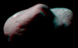
62 miles above Eros, NASA's NEAR Shoemaker took several frames which were combined to create this anaglyph of the saddle region, 3D glasses are necessary to view this image.
PIA03127:
The Saddle in 3-D
Full Resolution:     TIFF (2.391 MB)     JPEG (136.2 kB)
Add Image to Favorite List 2000-12-13 Earth Terra
MISR
1600x1261x3
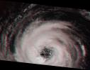
This stereoimage of Hurricane Alberto on August 19, 2000 was acquired by NASA's Terra satellite. At this time, the storm was located in the North Atlantic Ocean, west of the Azores. 3D glasses are necessary to view this image.
PIA02636:
Into the Eye of the Storm
Full Resolution:     TIFF (5.091 MB)     JPEG (173.1 kB)
Add Image to Favorite List 2000-11-11 Mars Mars Global Surveyor (MGS)
Mars Orbiter Camera (MOC)
1340x510x3
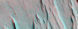
Layers of bedrock etched by wind to form sharp, elongated ridges known to geomorphologists as yardangs are commonplace in the southern Elysium Planitia/southern Amazonis region of Mars as seen by NASA's Mars Global Surveyor.
PIA02827:
A 3-D Look at Wind-Sculpted Ridges in Aeolis
Full Resolution:     TIFF (2.174 MB)     JPEG (118.7 kB)
Add Image to Favorite List 2000-11-02 Earth Shuttle Radar Topography Mission (SRTM)
C-Band Interferometric Radar
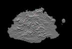
1703x1181x3
This anaglyph, from NASA's Shuttle Radar Topography Mission, shows Viti Levu, the largest island in the group some 332 islands commonly known as Fiji. 3D glasses are necessary to view this image.
PIA02784:
SRTM Anaglyph: Fiji Islands
Full Resolution:     TIFF (1.719 MB)     JPEG (232.7 kB)
Add Image to Favorite List 2000-10-20 Earth Landsat
Shuttle Radar Topography Mission (SRTM)
C-Band Interferometric Radar
Thematic Mapper
1212x1518x3
This anaglyph, from NASA's Shuttle Radar Topography Mission, shows Miquelon and Saint Pierre Islands, located south of Newfoundland, Canada. 3D glasses are necessary to view this image.
PIA02781:
SRTM Anaglyph with Landsat Overlay: Miquelon and Saint Pierre Islands
Full Resolution:     TIFF (3.237 MB)     JPEG (324.2 kB)
Add Image to Favorite List 2000-10-18 Earth Terra
MISR
1728x1043x3
This stereo view of the Sierra Nevada mountains near the California-Nevada border was acquired on August 12, 2000 by NASA's Terra satellite. 3D glasses are necessary to view this image.
PIA02628:
MISR Sees the Sierra Nevadas in Stereo
Full Resolution:     TIFF (5.638 MB)     JPEG (299.3 kB)
Add Image to Favorite List 2000-10-16 Mars Mars Global Surveyor (MGS)
Mars Orbiter Camera (MOC)
1010x1010x3
This stereo image mosaic from NASA's Mars Global Surveyor is of Mars' south polar terrain. 3D glasses are necessary to view this image.
PIA02815:
South Polar Terrain in 3-D
Full Resolution:     TIFF (3.018 MB)     JPEG (209.5 kB)
Add Image to Favorite List 2000-09-27 Earth Terra
MISR
1148x819x3
This stereo view of western Alaska was acquired by NASA's Terra satellite on June 25, 2000. 3D glasses are necessary to view this image.
PIA02625:
MISR Stereo Imaging Distinguishes Smoke from Cloud
Full Resolution:     TIFF (2.36 MB)     JPEG (142.6 kB)
Add Image to Favorite List 2000-09-21 Earth Landsat
Shuttle Radar Topography Mission (SRTM)
C-Band Interferometric Radar
Thematic Mapper
1786x2356x3
This anaglyph, from NASA's Shuttle Radar Topography Mission, shows rugged terrain between Los Angeles and California's central valley. 3D glasses are necessary to view this image.
PIA02777:
SRTM Anaglyph with Landsat Overlay: Los Angeles to San Joaquin Valley, California
Full Resolution:     TIFF (12.92 MB)     JPEG (1.054 MB)
Add Image to Favorite List 2000-08-31 Earth Landsat
Shuttle Radar Topography Mission (SRTM)
C-Band Interferometric Radar
Thematic Mapper
499x801x3
This anaglyph, from NASA's Shuttle Radar Topography Mission, shows Wheeler Ridge and vicinity, California, a site of major tectonic activity. 3D glasses are necessary to view this image.
PIA02772:
SRTM Anaglyph: Wheeler Ridge, California
Full Resolution:     TIFF (1.069 MB)     JPEG (109.4 kB)
Add Image to Favorite List 2000-08-02 Earth Terra
MISR
959x861x3
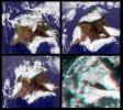
This stereo image from NASA's Terra satellite show the Mauna Kea and Mauna Loa volcanoes in Hawaii; a southern face of a line of cumulus clouds off the north coast of Hawaii is also visible. 3D glasses are necessary to view this image.
PIA02616:
MISR Views the Big Island of Hawaii
Full Resolution:     TIFF (2.201 MB)     JPEG (145.4 kB)
Add Image to Favorite List 2000-07-27 Earth Landsat
Shuttle Radar Topography Mission (SRTM)
C-Band Interferometric Radar
Thematic Mapper
999x1335x3
This anaglyph, from NASA's Shuttle Radar Topography Mission, shows Meseta de Somuncura, a semi-arid basalt plateau in northern Patagonia. 3D glasses are necessary to view this image.
PIA02766:
SRTM Anaglyph: Meseta de Somuncura, Patagonia, Argentina (Near Los Menucos)
Full Resolution:     TIFF (3.633 MB)     JPEG (273.4 kB)
Add Image to Favorite List 2000-07-20 Earth Landsat
Shuttle Radar Topography Mission (SRTM)
C-Band Interferometric Radar
Thematic Mapper
718x907x3
This anaglyph, from NASA's Shuttle Radar Topography Mission, shows Meseta de Somuncura, a broad plateau capped by basalt. Near its western edge is evidence of multiple volcanic events. 3D glasses are necessary to view this image.
PIA02764:
SRTM Anaglyph: Inverted Topography, Patagonia, Argentina
Full Resolution:     TIFF (1.025 MB)     JPEG (149.5 kB)
Add Image to Favorite List 2000-07-13 Earth Landsat
Shuttle Radar Topography Mission (SRTM)
C-Band Interferometric Radar
Thematic Mapper
1631x956x3
This anaglyph, from NASA's Shuttle Radar Topography Mission, shows basalt cliffs along the northwest edge of the Meseta de Somuncura plateau near Sierra Colorada, Argentina. 3D glasses are necessary to view this image.
PIA02762:
Anaglyph: Basalt Cliffs, Patagonia, Argentina
Full Resolution:     TIFF (2.516 MB)     JPEG (296.4 kB)
Add Image to Favorite List 2000-07-08 Earth Terra
MISR
584x900x3
This anaglyph from NASA's Terra satellite's vertical (nadir) camera, shows Hurricane Carlotta's location in the eastern Pacific Ocean, about 500 km south of Puerto Vallarta, Mexico in 2000. 3D glasses are necessary to view this image.
PIA02611:
MISR Views Hurricane Carlotta
Full Resolution:     TIFF (1.25 MB)     JPEG (76.02 kB)
Add Image to Favorite List 2000-06-29 Earth Landsat
Shuttle Radar Topography Mission (SRTM)
C-Band Interferometric Radar
Thematic Mapper
506x798x3
This anaglyph, from NASA's Shuttle Radar Topography Mission, shows complexly eroded volcanic terrain in northern Patagonia, near El Cain, Argentina. 3D glasses are necessary to view this image.
PIA02761:
Anaglyph: Patagonia, Argentina
Full Resolution:     TIFF (1.101 MB)     JPEG (79.37 kB)
Add Image to Favorite List 2000-06-22 Mars Mars Global Surveyor (MGS)
Mars Orbiter Camera (MOC)
1613x1210x1
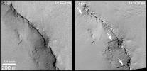
The first clue that there might be places on Mars where liquid groundwater seeps out onto the surface came from a picture taken by NASA's Mars Global Surveyor. 3D glasses are necessary to identify surface detail.
PIA01036:
Evidence for Recent Liquid Water on Mars: Seepage Sites in "Aerobraking Crater" Revisited
Full Resolution:     TIFF (1.626 MB)     JPEG (301.9 kB)
Add Image to Favorite List 2000-06-22 Earth Landsat
Shuttle Radar Topography Mission (SRTM)
C-Band Interferometric Radar
Thematic Mapper
2920x4236x3
This anaglyph, from NASA's Shuttle Radar Topography Mission, shows elatively young volcanoes in northern Patagonia, at Los Menucos, Argentina. 3D glasses are necessary to view this image.
PIA02755:
Anaglyph, Patagonia, Argentina
Full Resolution:     TIFF (19.93 MB)     JPEG (2.452 MB)
Add Image to Favorite List 2000-06-20 Earth Terra
MISR
2548x3800x3
A plume from a large brush fire that burned about 15,000 acres in 2000 is visible at the western edge of the Big Cypress Swamp in southern Florida. NASA's Terra satellite captured acquired this image on April 9, 2000. 3D glasses are necessary.
PIA02610:
MISR Views Florida
Full Resolution:     TIFF (19.67 MB)     JPEG (1.364 MB)
Add Image to Favorite List 2000-06-01 Earth Shuttle Radar Topography Mission (SRTM)
C-Band Interferometric Radar
669x1427x3
This anaglyph, from NASA's Shuttle Radar Topography Mission, shows the varied topography of eastern New York State and parts of Massachusetts, Connecticut, Pennsylvania and New Jersey. 3D glasses are necessary.
PIA02753:
Anaglyph of Shaded Relief New York State, Lake Ontario to Long Island
Full Resolution:     TIFF (1.849 MB)     JPEG (193.7 kB)
Add Image to Favorite List 2000-05-11 Earth Landsat
Shuttle Radar Topography Mission (SRTM)
C-Band Interferometric Radar
Thematic Mapper
2158x1540x3
This anaglyph, from NASA's Shuttle Radar Topography Mission, is of Wellington, the capital city of New Zealand, located on the shores of Port Nicholson, a natural harbor. 3D glasses are necessary to view this image.
PIA02750:
Anaglyph, Landsat Overlay: Wellington, New Zealand
Full Resolution:     TIFF (7.542 MB)     JPEG (613.9 kB)
Add Image to Favorite List 2000-05-07 Eros NEAR Shoemaker
Multi-Spectral Imager
500x531x3
This image from NASA's NEAR Shoemaker is of processed data showing Eros from slightly different perspectives is combined as anaglyphs or stereo pairs. 3D glasses are necessary to view this image.
PIA02473:
Eros' Global Morphology
Full Resolution:     TIFF (207.5 kB)     JPEG (38.08 kB)
Add Image to Favorite List 2000-05-07 Eros NEAR Shoemaker
Multi-Spectral Imager
670x416x3
Stereo imaging, an important tool on NASA's NEAR Shoemaker for geologic analysis of Eros, provides three-dimensional information on the asteroid's landforms and structures. 3D glasses are necessary to view this image.
PIA02471:
Eros in Stereo
Full Resolution:     TIFF (247.8 kB)     JPEG (21.91 kB)
Add Image to Favorite List 2000-04-24 Mars Mars Global Surveyor (MGS)
Mars Orbiter Camera (MOC)
437x572x3
The anaglyph is helpful to see that the dark streaks really do occur on a slope in this image taken by NASA's Mars Global Surveyor 1999. 3D glasses are necessary to view this image.
PIA02380:
Recent Movements: New Landslides in Less than 1 Martian Year
Full Resolution:     TIFF (681.5 kB)     JPEG (49.69 kB)
Add Image to Favorite List 2000-04-24 Mars Mars Global Surveyor (MGS)
Mars Orbiter Camera (MOC)
1105x535x1
The anaglyph is helpful to see that the dark streaks really do occur on a slope in this image taken by NASA's Mars Global Surveyor 1999. 3D glasses are necessary to view this image.
PIA02379:
Recent Movements: New Landslides in Less than 1 Martian Year
Full Resolution:     TIFF (431.2 kB)     JPEG (136.4 kB)
Add Image to Favorite List 2000-04-24 Mars Mars Global Surveyor (MGS)
Mars Orbiter Camera (MOC)
662x824x1
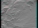
This anaglyph from NASA's Mars Global Surveyor shows dark, blanketed or mantled surfaces in the Sinus Sabaeus region of Mars. 3D glasses are necessary to view this image.
PIA02362:
The Dark Surfaces of Mars: Mantles and Sand Sheets
Full Resolution:     TIFF (383.2 kB)     JPEG (49.09 kB)
Add Image to Favorite List 2000-04-19 Earth Terra
MISR
1906x981x3
The stereo image at right is a downward-looking (nadir) view of the area around the San Cristobal volcano in Nicaragua taken by NASA's Terra satellite. 3D glasses are necessary to view this image.
PIA02600:
Nicaraguan Volcanoes, 26 February 2000
Full Resolution:     TIFF (4.239 MB)     JPEG (194.3 kB)
Add Image to Favorite List 2000-04-13 Earth Landsat
Shuttle Radar Topography Mission (SRTM)
C-Band Interferometric Radar
Thematic Mapper
839x651x3
This anaglyph, from NASA's Shuttle Radar Topography Mission, is of Lake Palanskoye in northern Kamchatka. 3D glasses are necessary to view this image.
PIA02744:
Anaglyph, Lake Palanskoye Landslide, Kamchatka Peninsula, Russia
Full Resolution:     TIFF (1.501 MB)     JPEG (180.1 kB)
Add Image to Favorite List 2000-04-07 Mars Mars Global Surveyor (MGS)
Mars Orbiter Camera (MOC)
1336x1168x3
This image was taken by NASA's Mars Global Surveyor Cydonia region on Mars. 3D glasses are necessary to view this image.
PIA02381:
Cydonia: Wide Angle Color Image
Full Resolution:     TIFF (4.201 MB)     JPEG (196.6 kB)
Add Image to Favorite List 2000-03-10 Earth Landsat
Shuttle Radar Topography Mission (SRTM)
C-Band Interferometric Radar
Thematic Mapper
1218x1366x3
This anaglyph, from NASA's Shuttle Radar Topography Mission, is of the coastal area in southernmost Oman; the Arabian Sea is on the right. 3D glasses are necessary to view this image.
PIA02736:
Anaglyph, Landsat overlay, Southernmost Coastal Oman
Full Resolution:     TIFF (4.27 MB)     JPEG (312.1 kB)
Retrieve Previous Set  Jump to a Previous Set   Jump to a Previous Set   Jump to a Previous Set   Jump to a Previous Set   Current Set   Jump to a Following Set   Retrieve Next Set 
 1-100   101-200   201-300   301-400   401-500   501-600 
Currently displaying images: 401 - 500 of 561