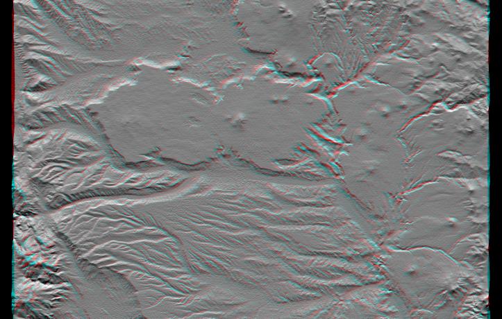
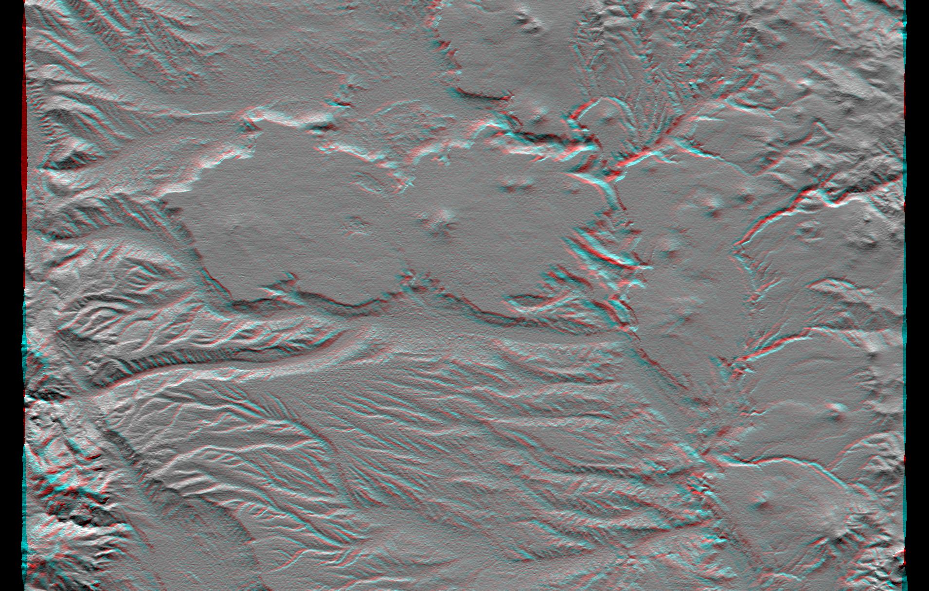
The interplay of volcanism, stream erosion and landslides is evident in this Shuttle Radar Topography Mission view of the eastern flank of the Andes Mountains, southeast of San Carlos de Bariloche, Argentina. Older lava flows emanating from the Andes once covered much of this area. Younger, local volcanoes (seen here as small peaks) then covered parts of the area with fresh, erosion resistant flows (seen here as very smooth surfaces). Subsequent erosion has created fine patterns on the older surfaces (bottom of the image) and bolder, irregular patterns through and around the younger surfaces (upper center and right center). Meanwhile, where a large stream immediately borders the resistant plateau (center of the image), lateral erosion has undercut the resistant plateau causing slivers of it to fall into the stream channel. This scene well illustrate show topographic data alone can reveal some aspects of recent geologic history.
This anaglyph was produced by first shading a preliminary elevation model from data acquired by the Shuttle Radar Topography Mission. The stereoscopic effect was then created by generating two differing perspectives, one for each eye. When viewed through special glasses, the result is a vertically exaggerated view of the Earth's surface in its full three dimensions. Anaglyph glasses cover the left eye with a red filter and cover the right eye with a blue filter.
Elevation data used in this image were acquired by the Shuttle Radar Topography Mission aboard the Space Shuttle Endeavour, launched on February 11, 2000. The mission used the same radar instrument that comprised the Spaceborne Imaging Radar-C/X-Band Synthetic Aperture Radar that flew twice on the Space Shuttle Endeavour in 1994. The Shuttle Radar Topography Mission was designed to collect three-dimensional measurements of the Earth's surface. To collect the 3-D data, engineers added a 60-meter-long (200-foot) mast, installed additional C-band and X-band antennas, and improved tracking and navigation devices. The mission is a cooperative project between NASA, the National Imagery and Mapping Agency of the U.S. Department of Defense, and the German and Italian space agencies. It is managed by NASA's Jet Propulsion Laboratory, Pasadena, CA, for NASA's Earth Science Enterprise, Washington, DC.
Size: 54.3 x 36.4 kilometers ( 33.7 x 22.6 miles)
Location: 41.4 deg. South lat., 70.8 deg. West lon.
Orientation: North toward the top
Image Data: Shaded SRTM elevation model
Date Acquired: February 2000
 Planetary Data System


