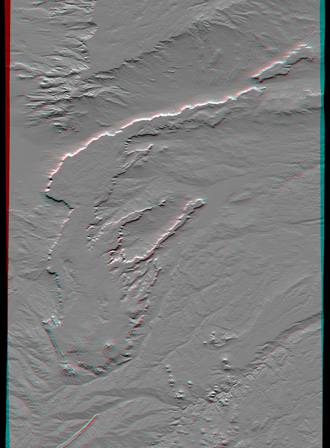
All of the major landforms relate to volcanism and/or erosion in this Shuttle Radar Topography Mission scene of Patagonia, near La Esperanza, Argentina. The two prominent plateaus once formed a continuous surface that extended over much of this region. Younger volcanoes have grown through and atop the plateau, and one just south of this scene has sent a long, narrow flow down a stream channel (lower left). The topographic pattern shows that streams dominate the erosion processes in this arid environment even though wind is known to move substantial amounts of sediment here.
This anaglyph was produced by first shading a preliminary SRTM elevation model. The stereoscopic effect was then created by generating two differing perspectives, one for each eye. When viewed through special glasses, the result is a vertically exaggerated view of the Earth's surface in its full three dimensions. Anaglyph glasses cover the left eye with a red filter and cover the right eye with a blue filter.
Elevation data used in this image was acquired by the Shuttle Radar Topography Mission aboard the Space Shuttle Endeavour, launched on February 11, 2000. SRTM used the same radar instrument that comprised the Spaceborne Imaging Radar-C/X-Band Synthetic Aperture Radar (SIR-C/X-SAR) that flew twice on the Space Shuttle Endeavour in 1994. SRTM was designed to collect three-dimensional measurements of the Earth's surface. To collect the 3-D data, engineers added a 60-meter-long (200-foot) mast, installed additional C-band and X-band antennas, and improved tracking and navigation devices. The mission is a cooperative project between NASA, the National Imagery and Mapping Agency (NIMA) of the U.S. Department of Defense, and the German and Italian space agencies. It is managed by NASA's Jet Propulsion Laboratory, Pasadena, CA, for NASA's Earth Science Enterprise, Washington, DC.
Size: 62.4 by 88.8 kilometers (38.7 by 55.1 miles)
Location: 40.0 deg. South lat., 68.6 deg. West lon.
Orientation: North toward the top
Image Data: Shaded and colored SRTM elevation model
Date Acquired: February 2000
 Planetary Data System


