My
List |
Addition Date
|
Target
|
Mission
|
Instrument
|
Size
|

|
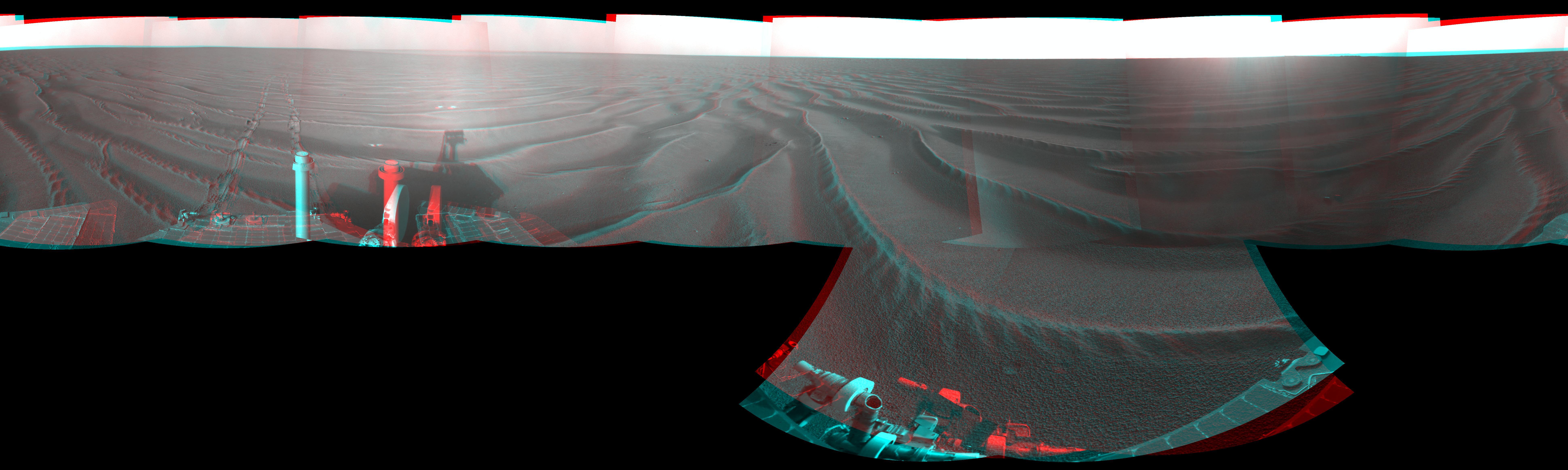
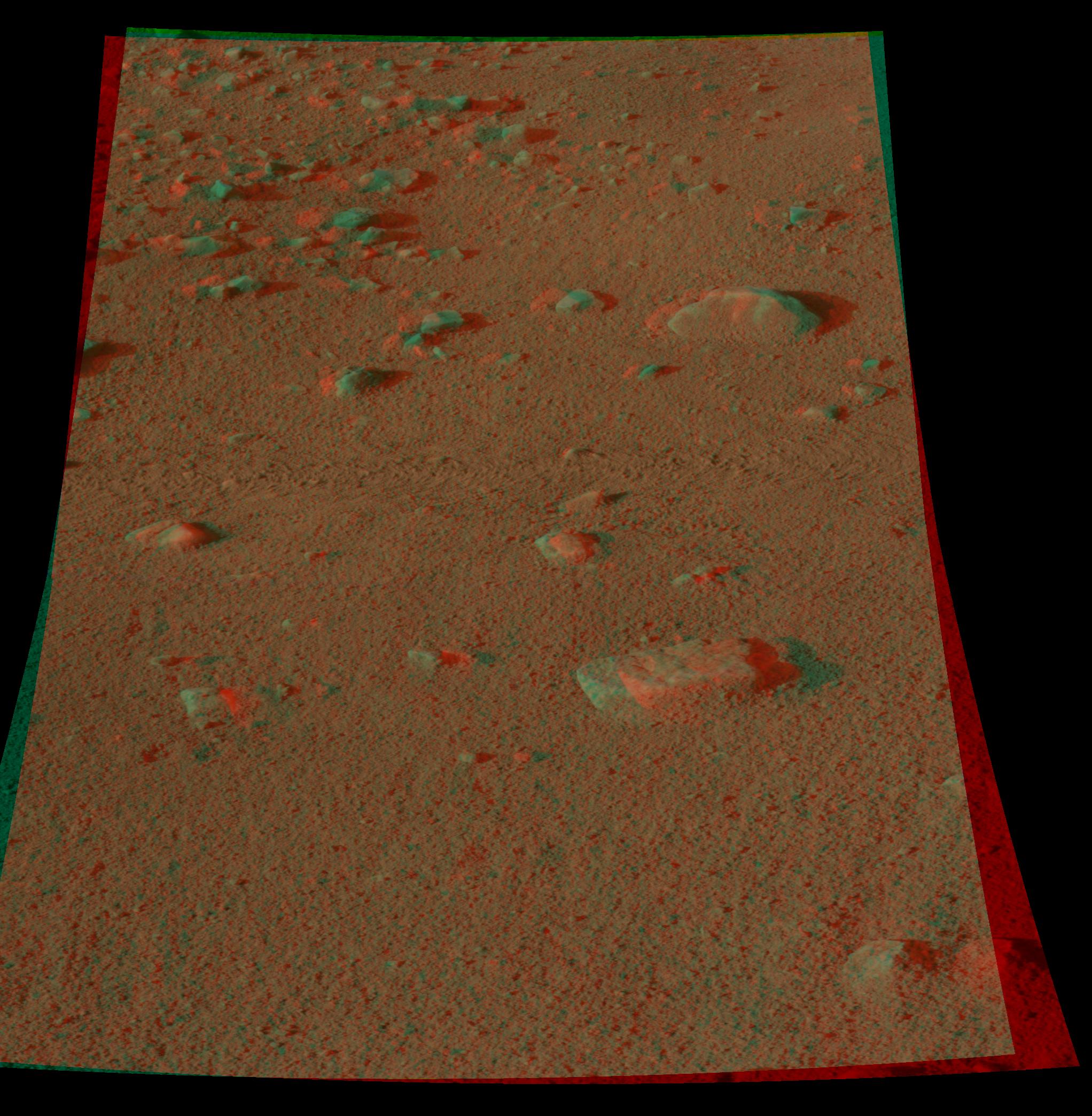
2010-09-07 |
Mars
|
Mars Exploration Rover (MER)
|
Navigation Camera
|
4278x1143x3 |
|
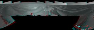
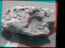
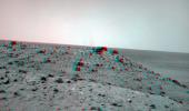
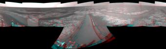
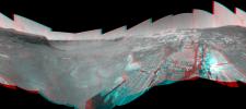
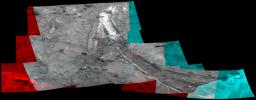
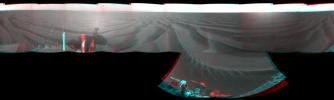
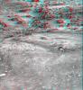
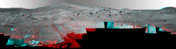
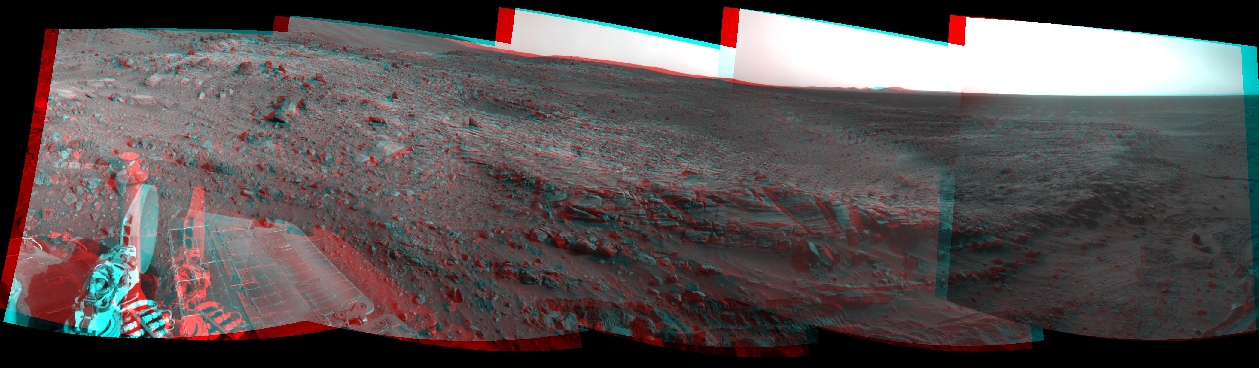
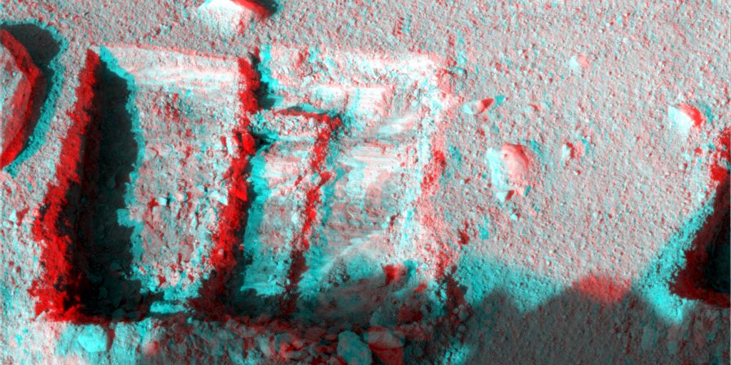
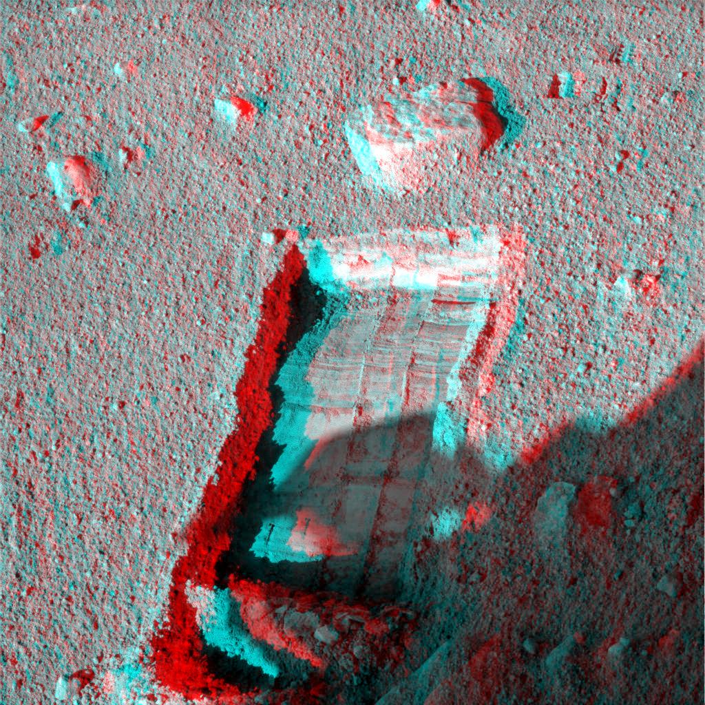
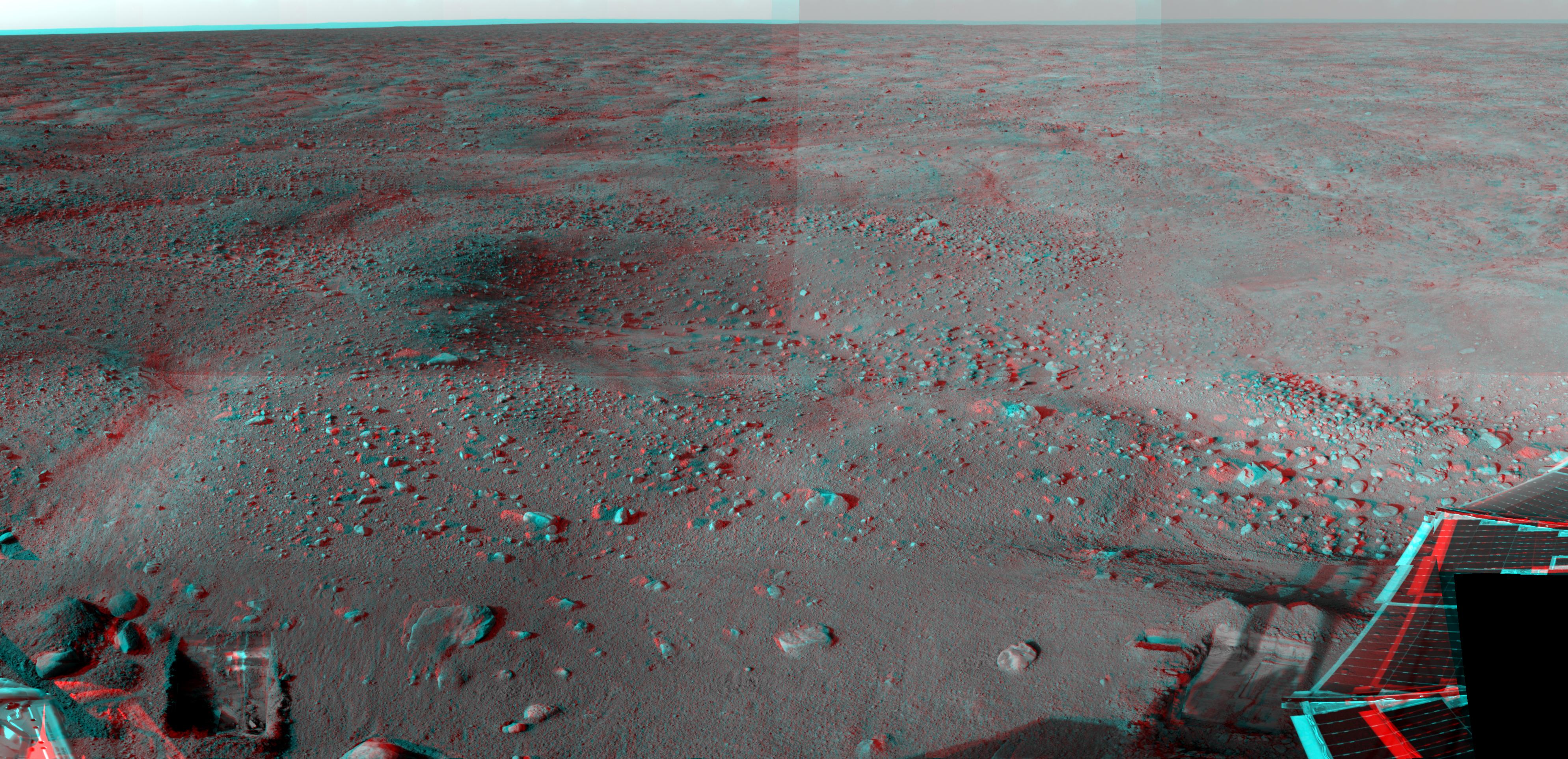
-
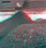
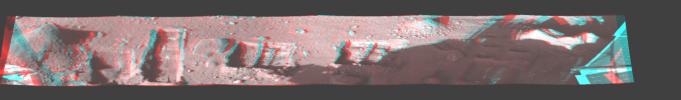
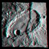
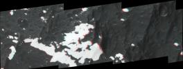
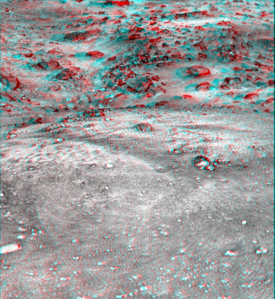
PIA13371:
-
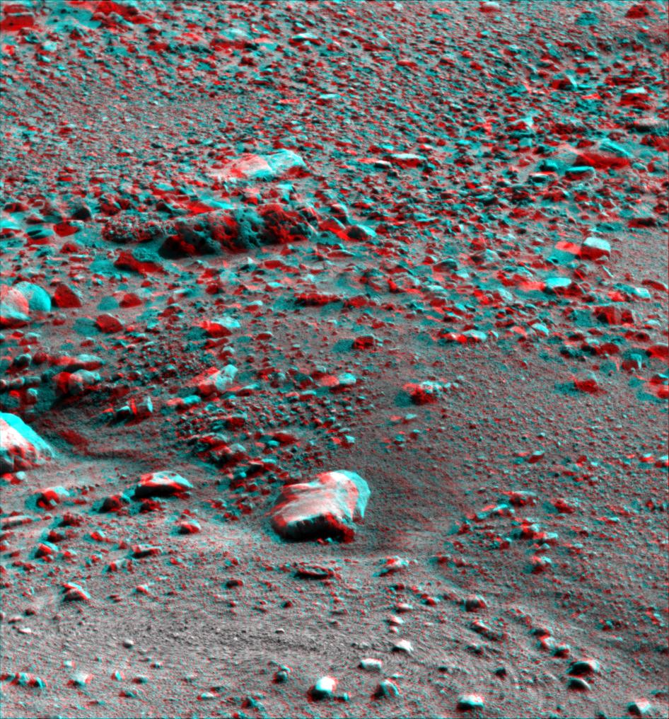
'Cambridge Bay' Outcrop Examined by Opportunity (Stereo)
Full Resolution:
TIFF
(14.67 MB)
JPEG
(549.4 kB)
|
|
|
2010-07-07 |
Earth
|
Terra
|
MISR
|
1656x1182x3 |
|
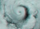
-
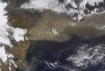
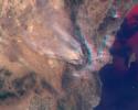
PIA13242:
-
Hurricane Alex Disrupts Gulf Cleanup
Full Resolution:
TIFF
(5.882 MB)
JPEG
(120.5 kB)
|
|
|
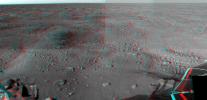
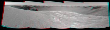
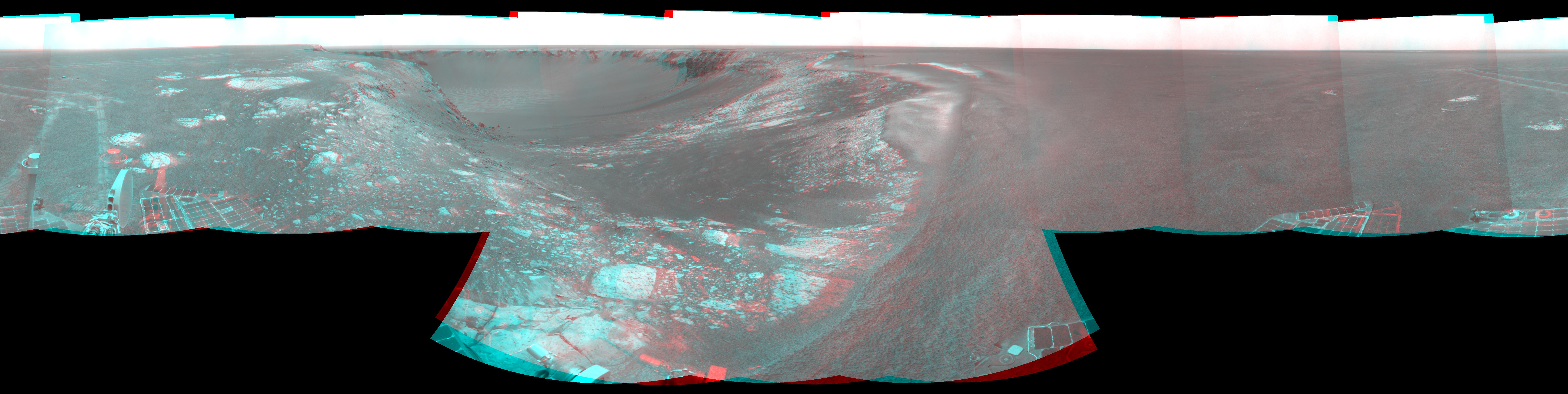
2010-06-25 |
Mars
|
Mars Exploration Rover (MER)
|
Navigation Camera
|
7753x2513x3 |
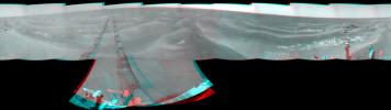
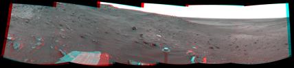
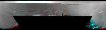
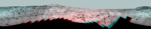
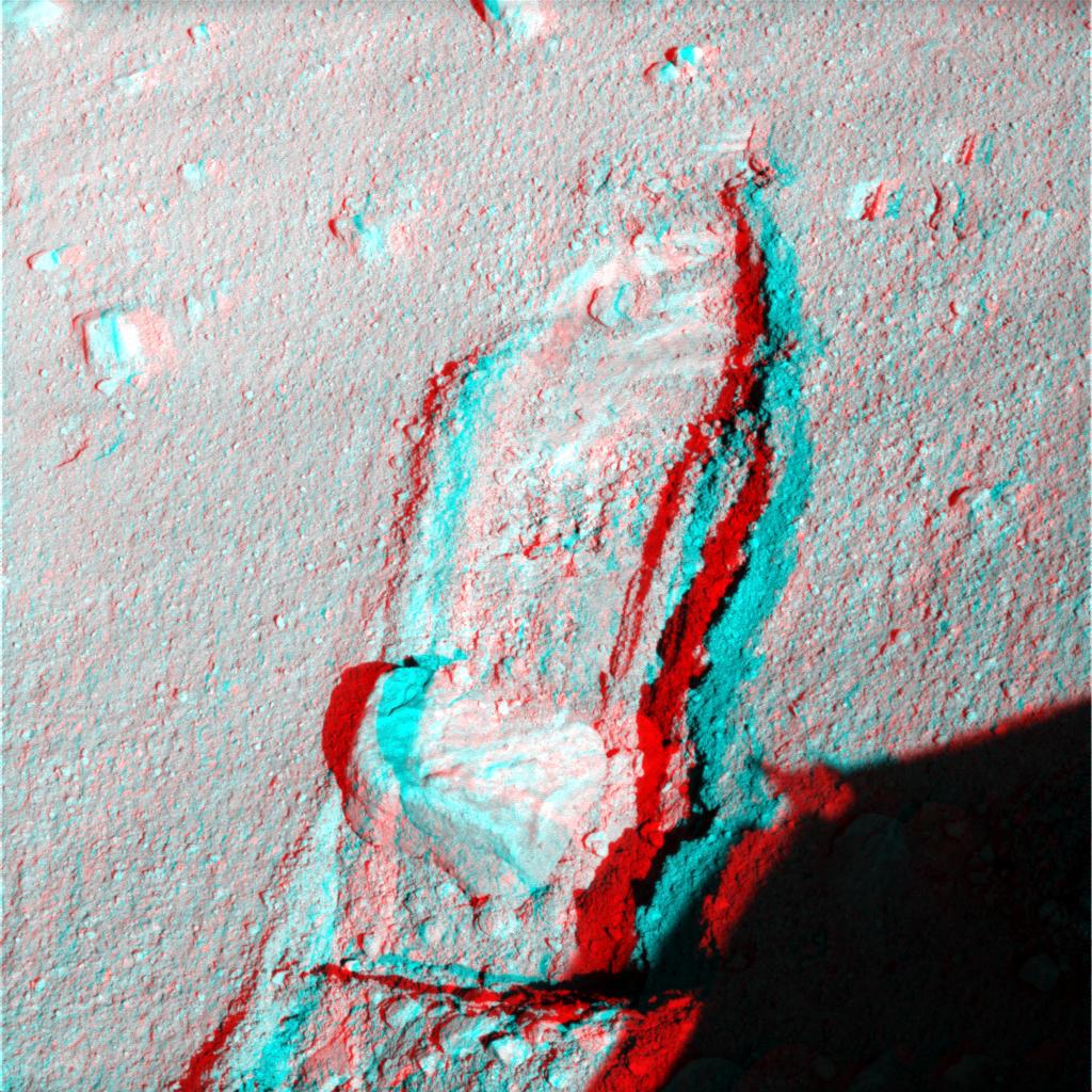
|
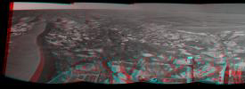
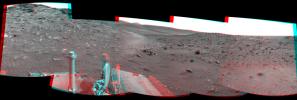
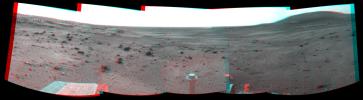
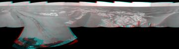
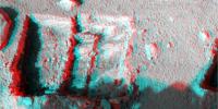
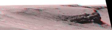
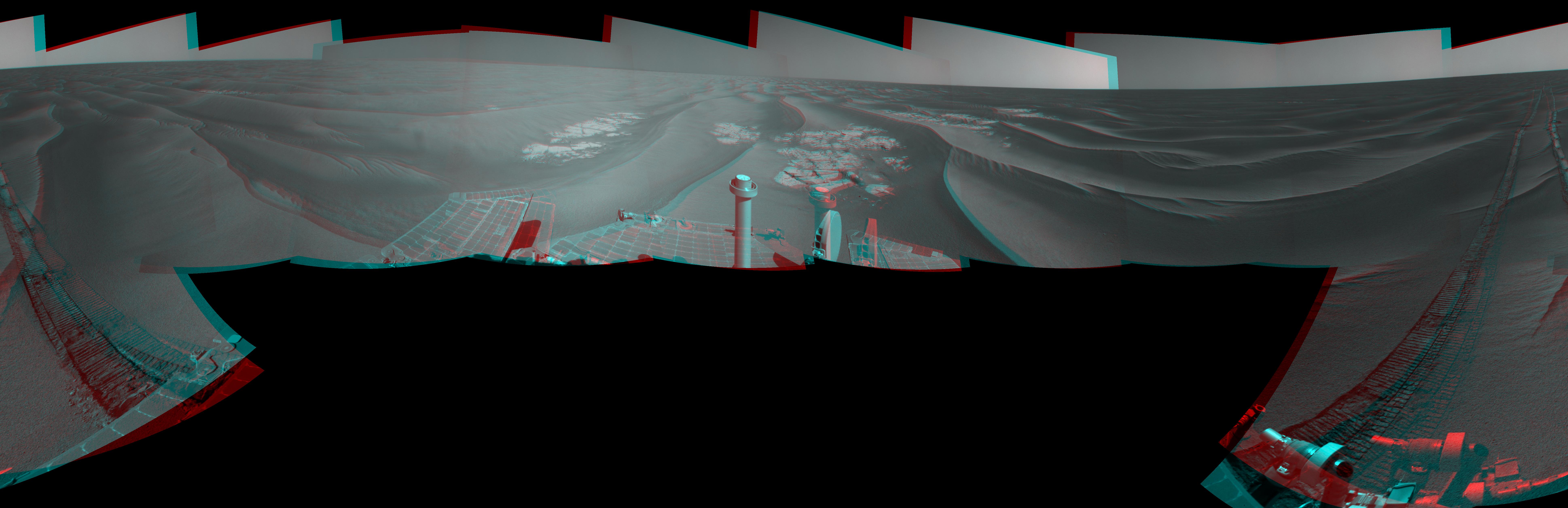
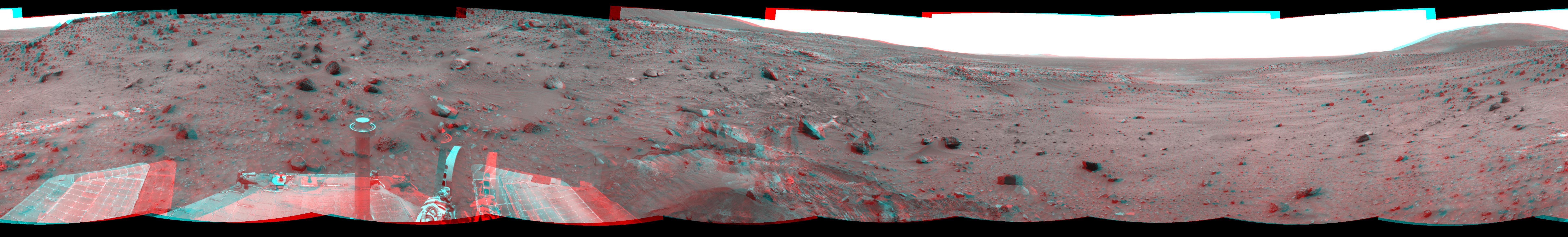
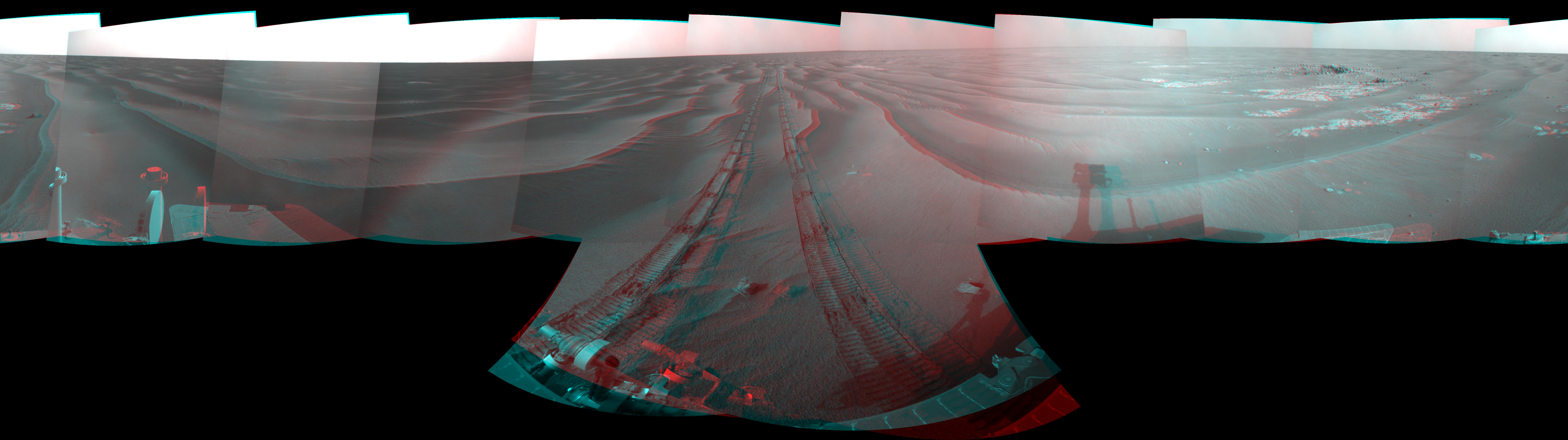
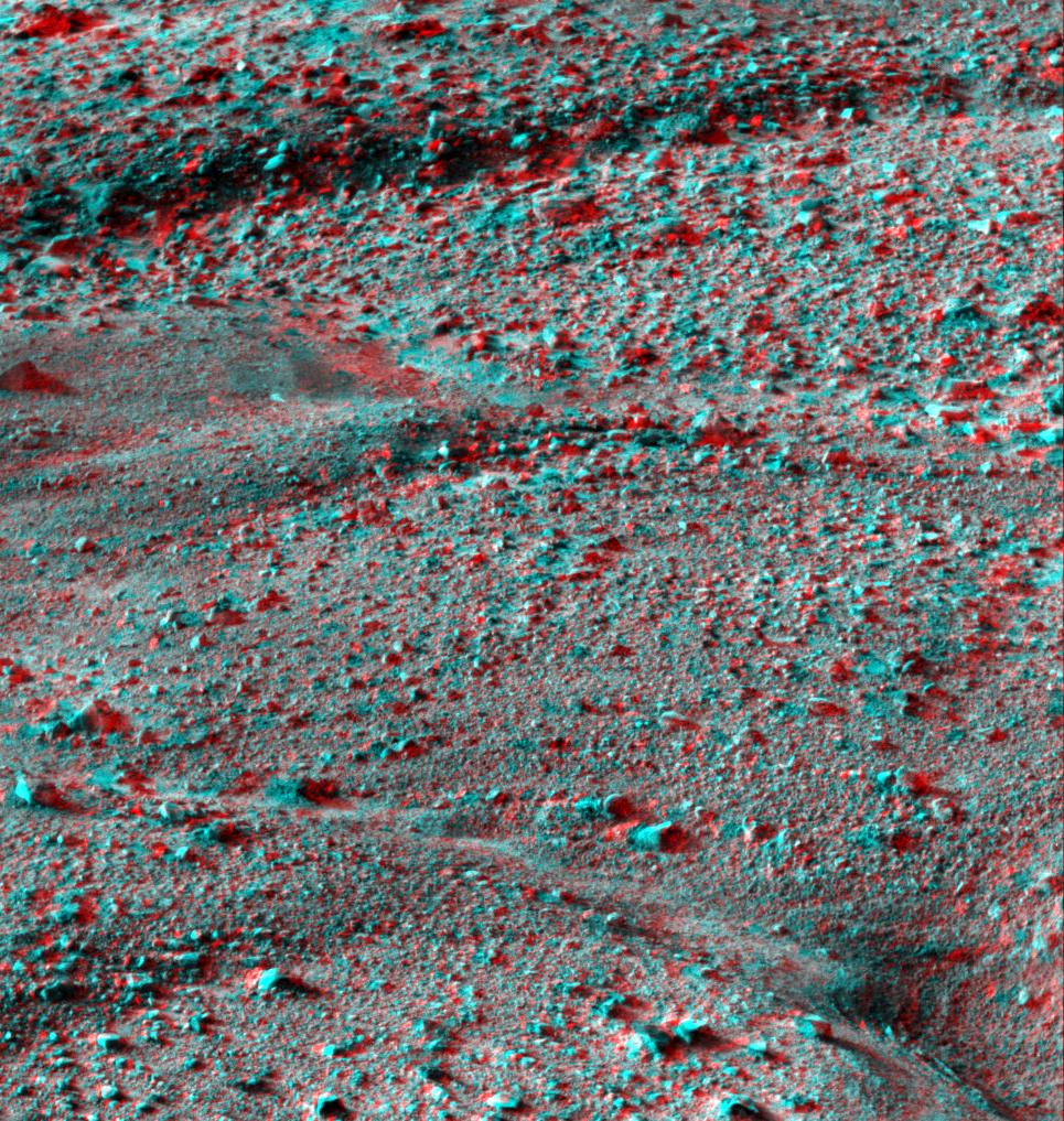
-
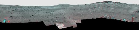
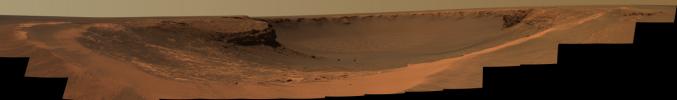
PIA13221:
-
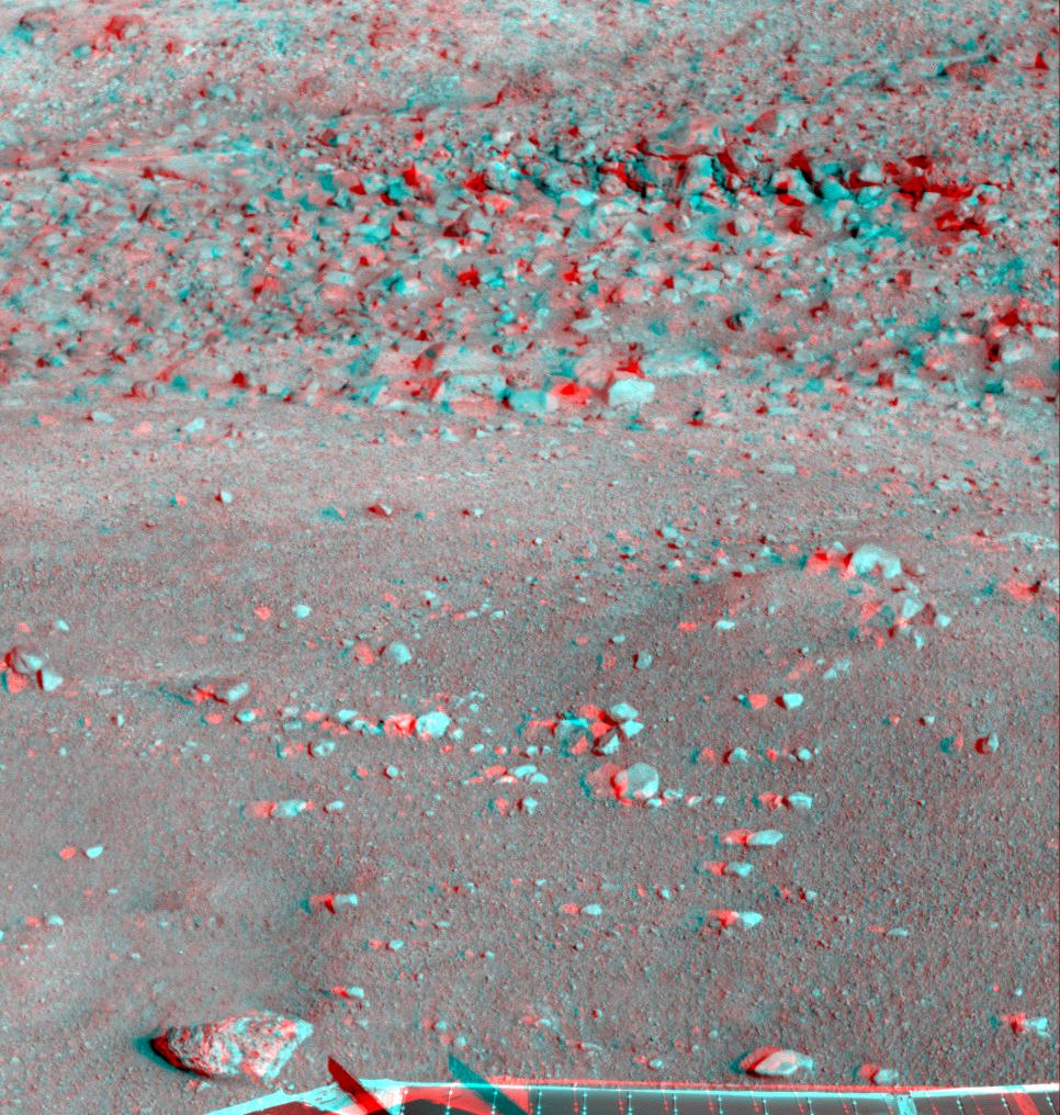
Opportunity's Surroundings After Sol 2220 Drive (Stereo)
Full Resolution:
TIFF
(58.45 MB)
JPEG
(1.074 MB)
|
|
|
2010-05-05 |
Moon
|
Lunar Reconnaissance Orbiter (LRO)
|
Lunar Reconnaissance Orbiter Camera (NAC)
|
1000x1000x3 |
|
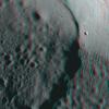
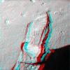
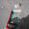
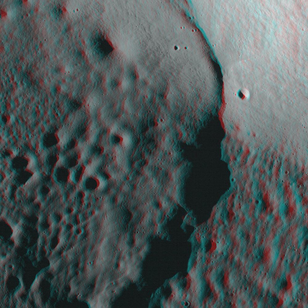
-
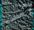
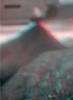
PIA13094:
-
Central Peak of Copernicus Crater (Anaglyph)
Full Resolution:
TIFF
(3.004 MB)
JPEG
(107.4 kB)
|
|
|
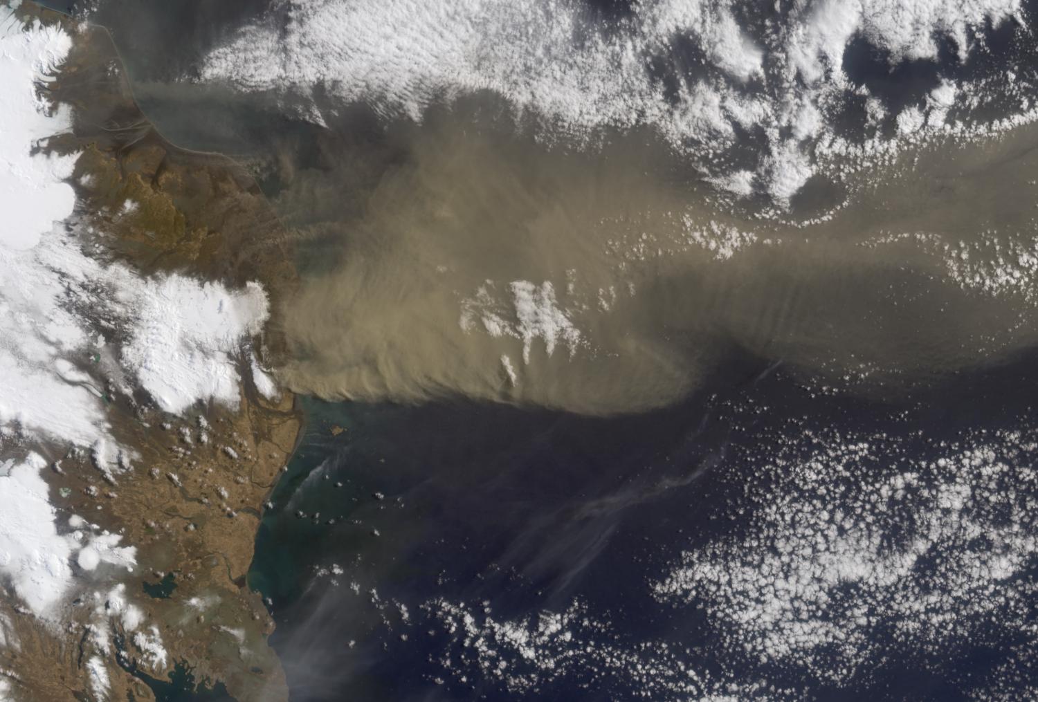
2010-04-20 |
Earth
|
Terra
|
MISR
|
1500x1015x3 |
|
-
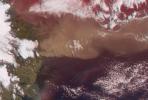
PIA13052:
-
Heights of the Eyjafjallajökull Eruption Plume - April 19, 2010
Full Resolution:
TIFF
(4.576 MB)
JPEG
(192.9 kB)
|
|
|
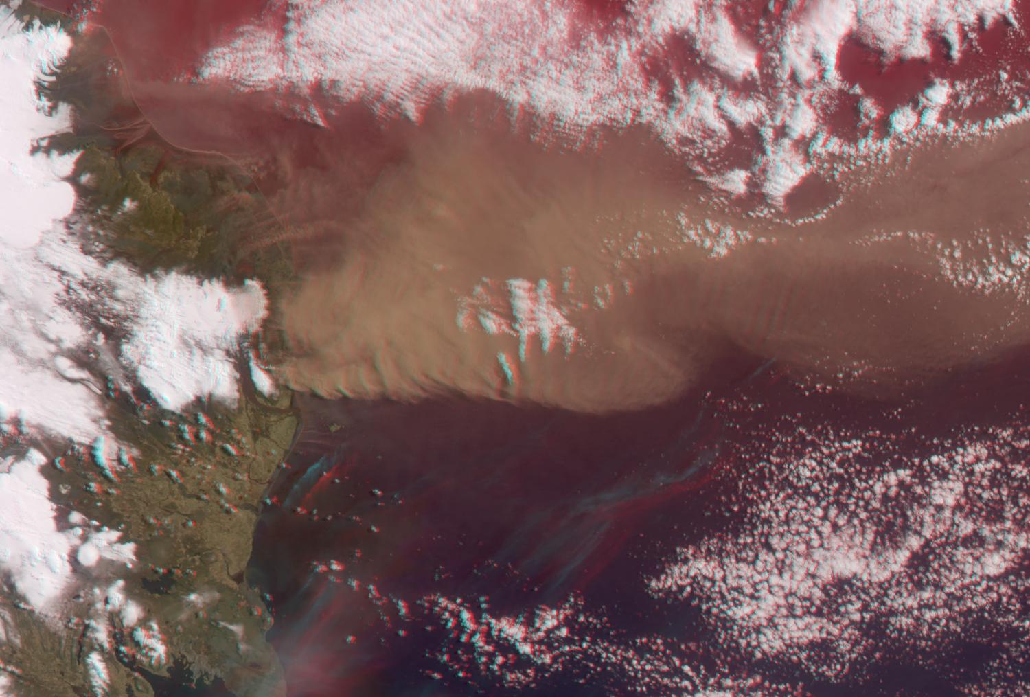
2010-04-20 |
Earth
|
Terra
|
MISR
|
1500x1015x3 |
|
-
PIA13051:
-
Heights of the Eyjafjallajökull Eruption Plume - April 19, 2010 (Anaglyph)
Full Resolution:
TIFF
(4.576 MB)
JPEG
(188.7 kB)
|
|
|
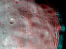
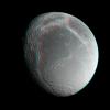
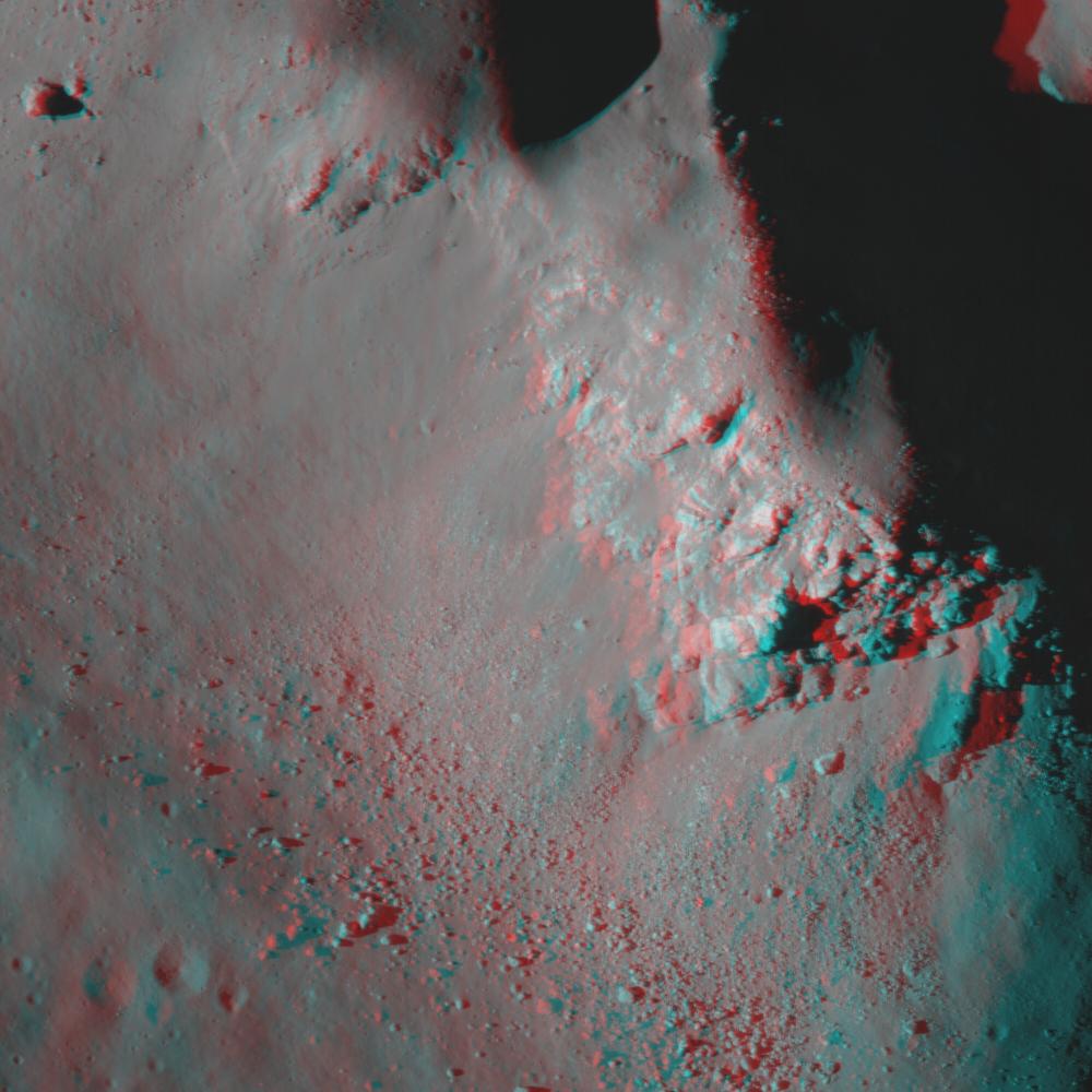
2010-03-29 |
Mimas
|
Cassini-Huygens
|
ISS - Narrow Angle
|
3891x4179x3 |

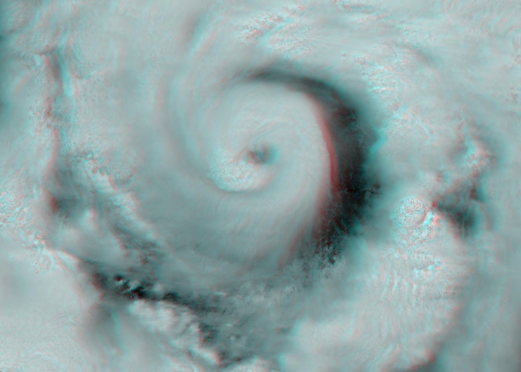
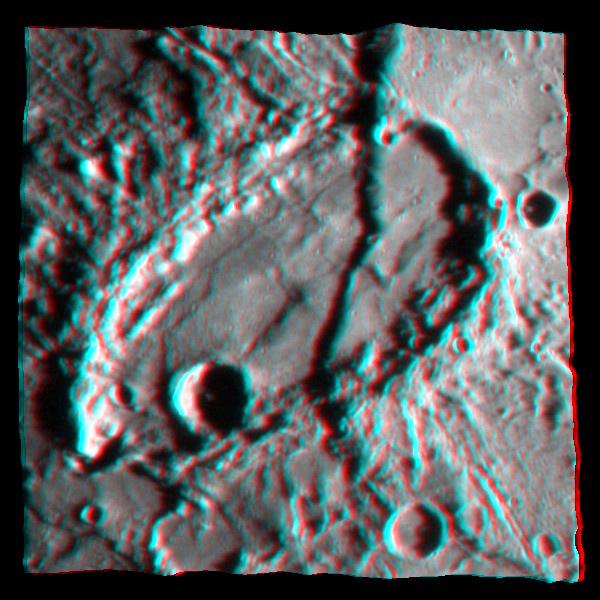
|
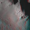
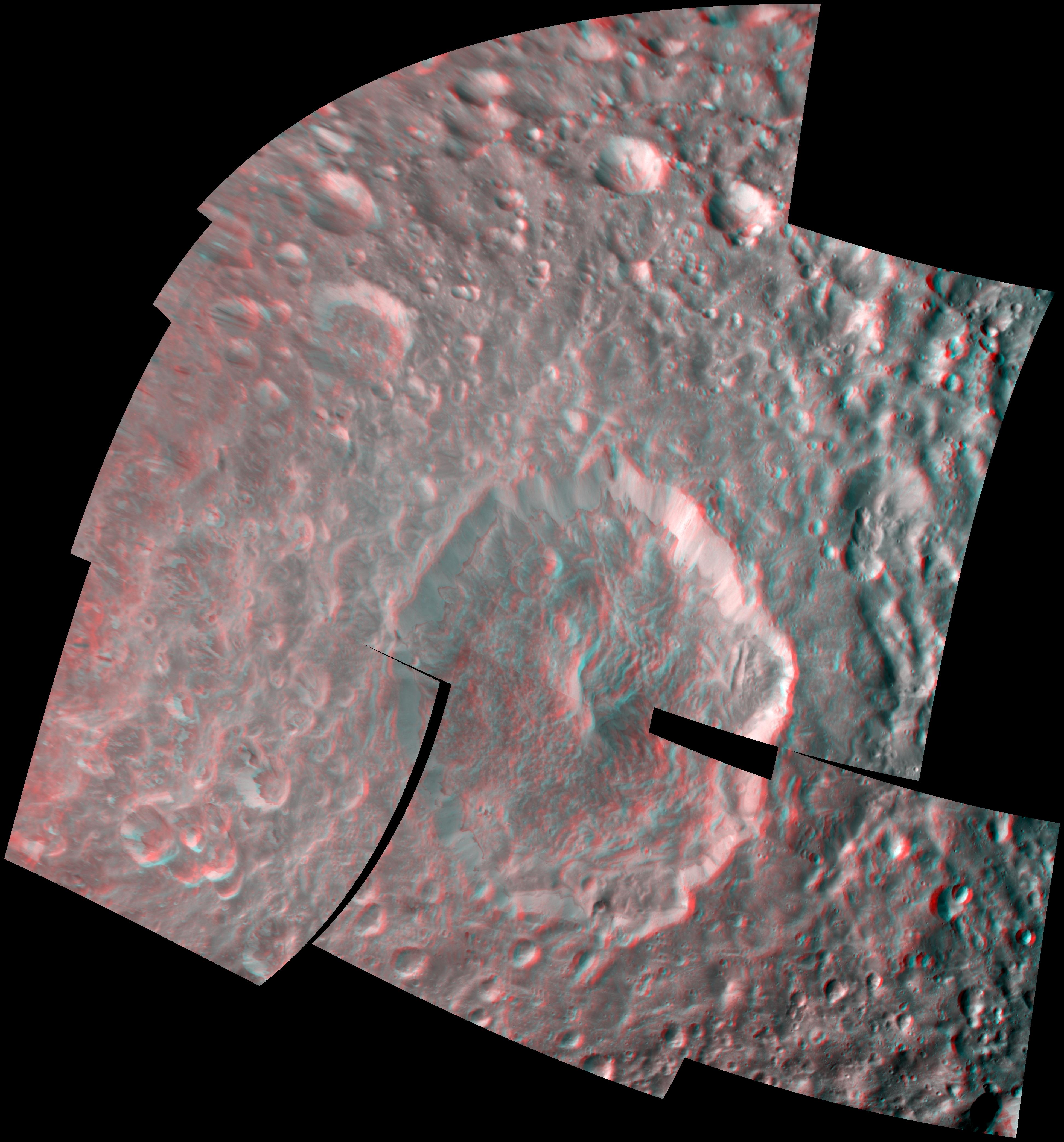
-
PIA12573:
-
Herschel Crater in 3-D
Full Resolution:
TIFF
(48.78 MB)
JPEG
(1.081 MB)
|
|
|
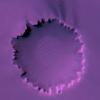
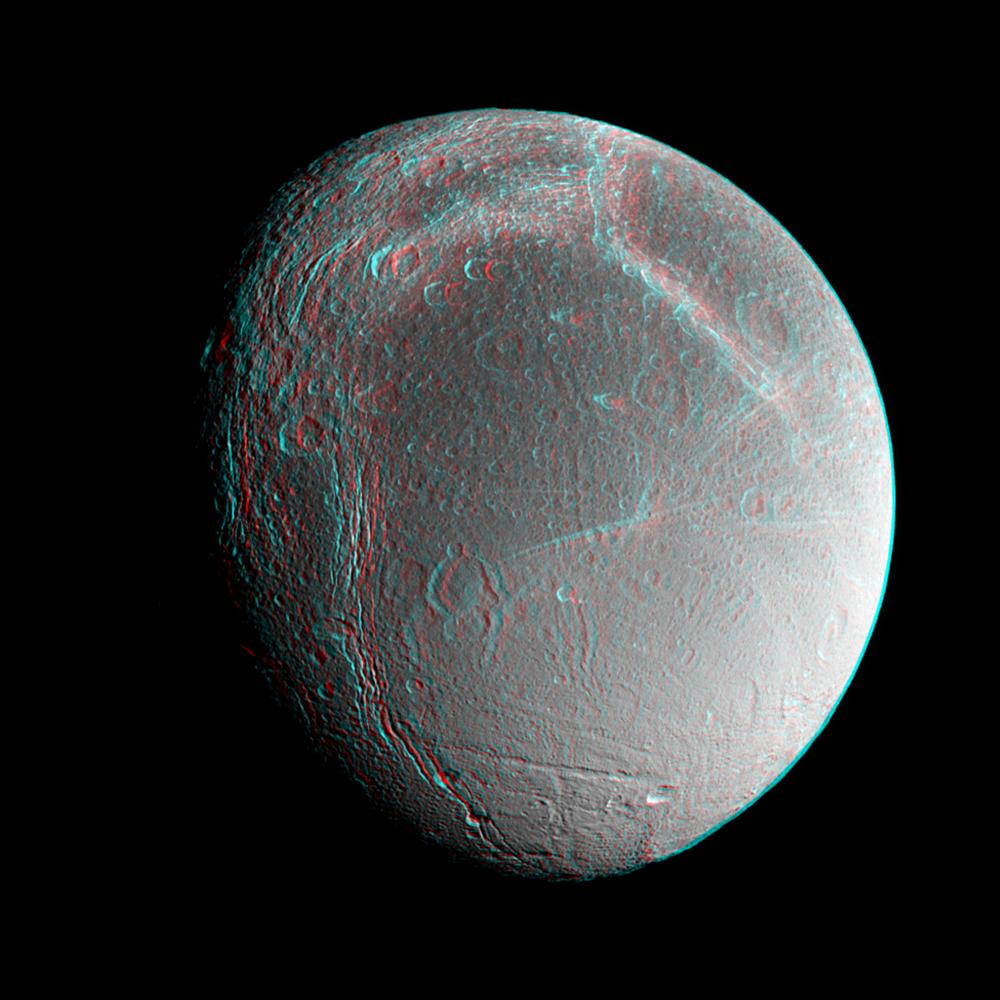
2010-02-23 |
Enceladus
|
Cassini-Huygens
|
Imaging Science Subsystem
|
1145x1001x3 |
|
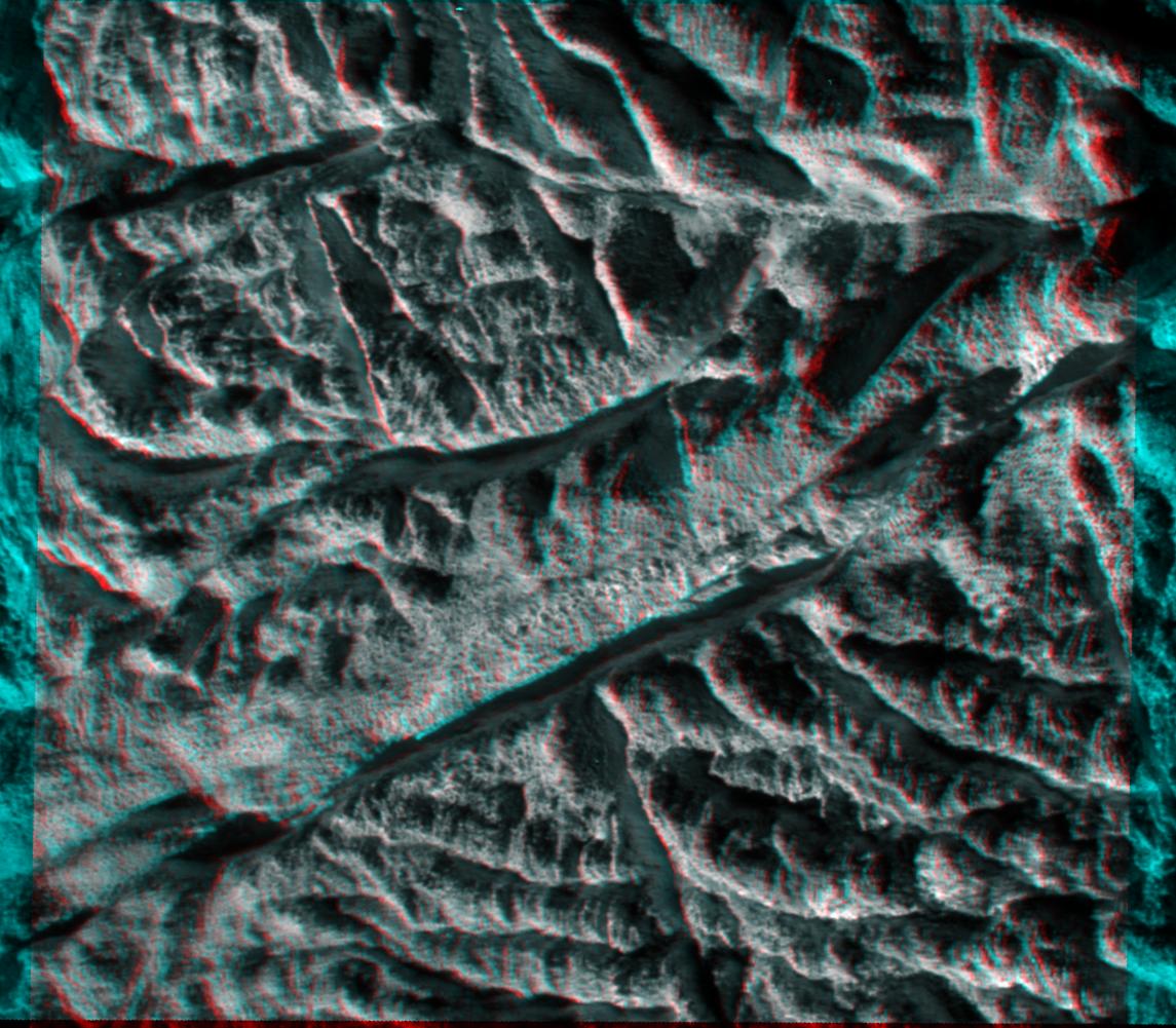
-
PIA11687:
-
Baghdad Sulcus in 3-D
Full Resolution:
TIFF
(3.443 MB)
JPEG
(200.3 kB)
|
|
|
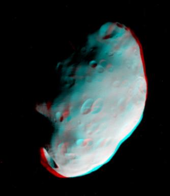
2010-02-19 |
Prometheus
|
Cassini-Huygens
|
ISS - Narrow Angle
|
470x364x3 |

|
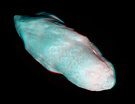
-
PIA12548:
-
Prometheus Popping in 3-D
Full Resolution:
TIFF
(514.1 kB)
JPEG
(12.37 kB)
|
|
|
2010-01-14 |
Earth
|
Shuttle Radar Topography Mission (SRTM)
|
C-Band Radar
X-Band Radar
|
6001x1201x3 |
|
-
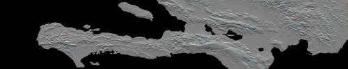
PIA12493:
Southern Haiti Anaglyph
Full Resolution:
TIFF
(21.62 MB)
JPEG
(900.4 kB)
|
|
|
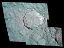
2009-10-06 |
Mercury
|
MESSENGER
|
MDIS - Narrow Angle
|
1561x525x3 |

|
-
PIA12282:
-
Rembrandt in 3-D!
Full Resolution:
TIFF
(2.463 MB)
JPEG
(156.6 kB)
|
|
|
2009-09-04 |
Earth
|
Terra
|
MISR
|
1014x810x3 |
|
-
PIA12196:
-
Smoke from Station Fire Blankets Southern California (Anaglyph)
Full Resolution:
TIFF
(2.467 MB)
JPEG
(90.65 kB)
|
|
|
2009-08-26 |
Mars
|
Mars Exploration Rover (MER)
|
Panoramic Camera
|
23123x5093x3 |
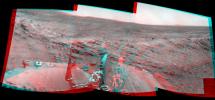
|
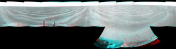
-
PIA12202:
'Calypso' Panorama of Spirit's View from 'Troy' (Stereo)
Full Resolution:
TIFF
(353.3 MB)
JPEG
(9.053 MB)
|
|
|
2009-08-21 |
Mars
|
Mars Exploration Rover (MER)
|
Microscopic Imager
|
947x1000x3 |
|
-
PIA12181:
-
Spirit's View of Own Underbelly, (Stereo from Two Sols)
Full Resolution:
TIFF
(2.845 MB)
JPEG
(69.71 kB)
|
|
|
2009-08-21 |
Mars
|
Mars Exploration Rover (MER)
|
Microscopic Imager
|
735x1014x3 |
|
-
PIA12180:
-
Spirit's View of Own Underbelly, (Sol 1925 Stereo)
Full Resolution:
TIFF
(2.239 MB)
JPEG
(74.14 kB)
|
|
|
2009-08-06 |
Mars
|
Mars Exploration Rover (MER)
|
Panoramic Camera
|
1024x766x3 |
|
-
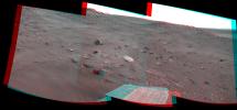
PIA12165:
-
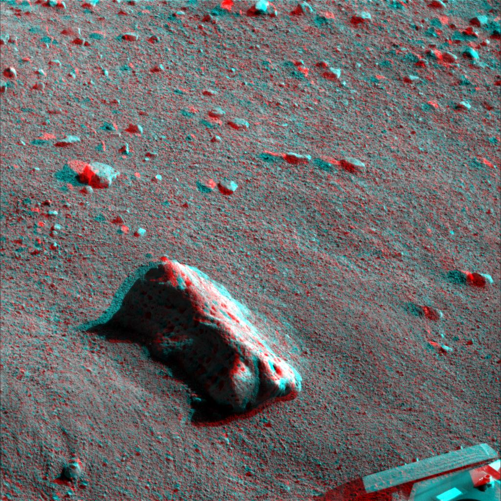
'Block Island' Meteorite on Mars, Sol 1961 (Stereo)
Full Resolution:
TIFF
(2.356 MB)
JPEG
(102.9 kB)
|
|
|
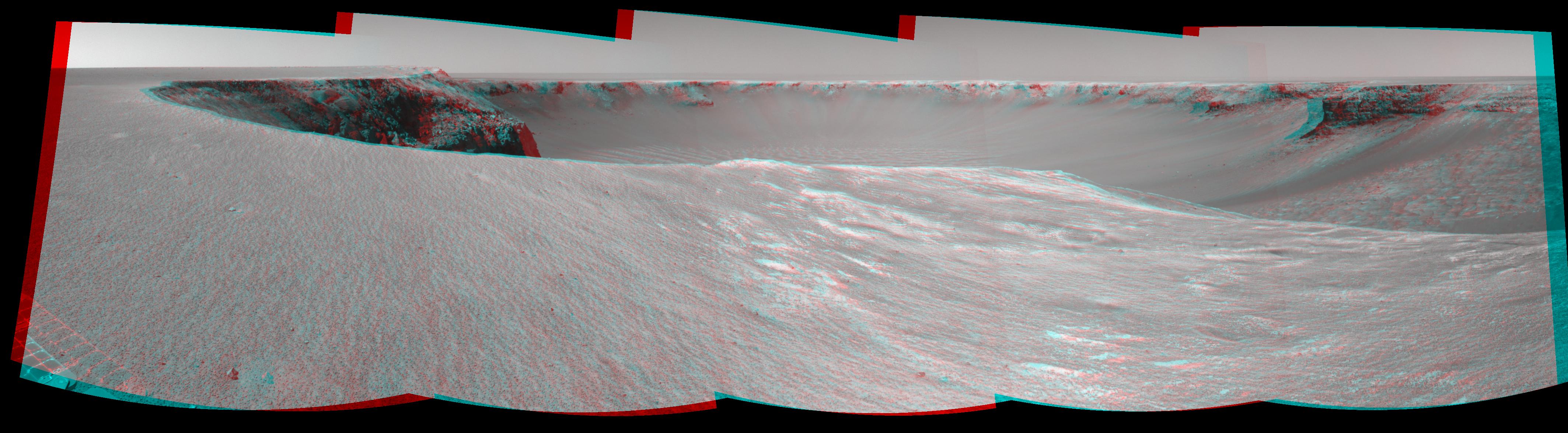
2009-07-23 |
Mars
|
Mars Exploration Rover (MER)
|
Navigation Camera
|
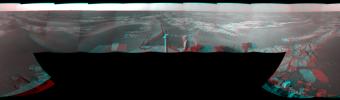
7753x2178x3 |
|
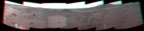
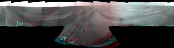
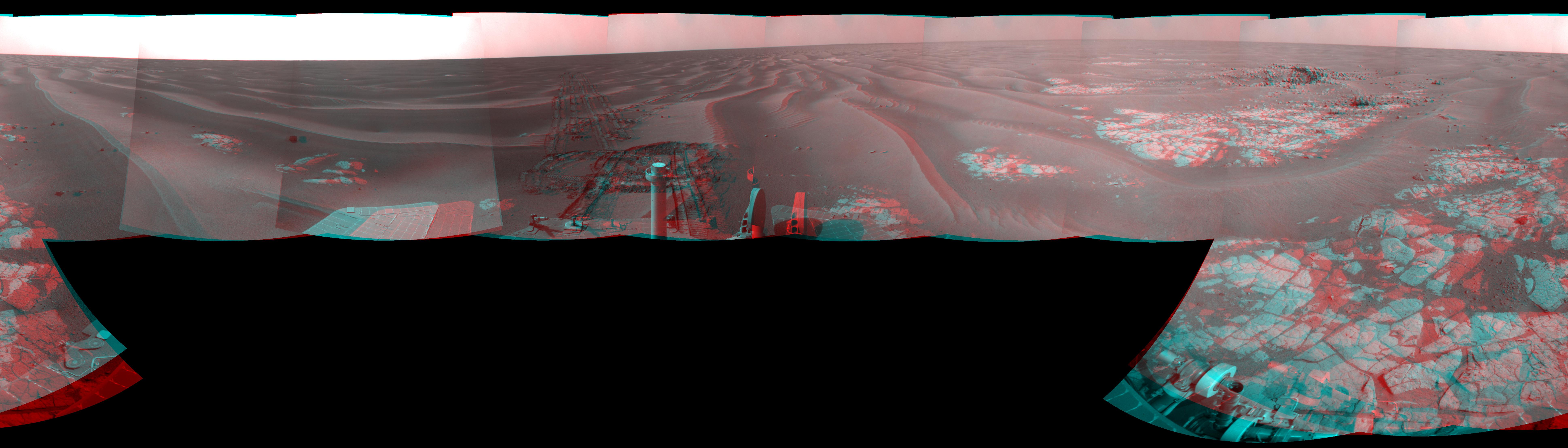
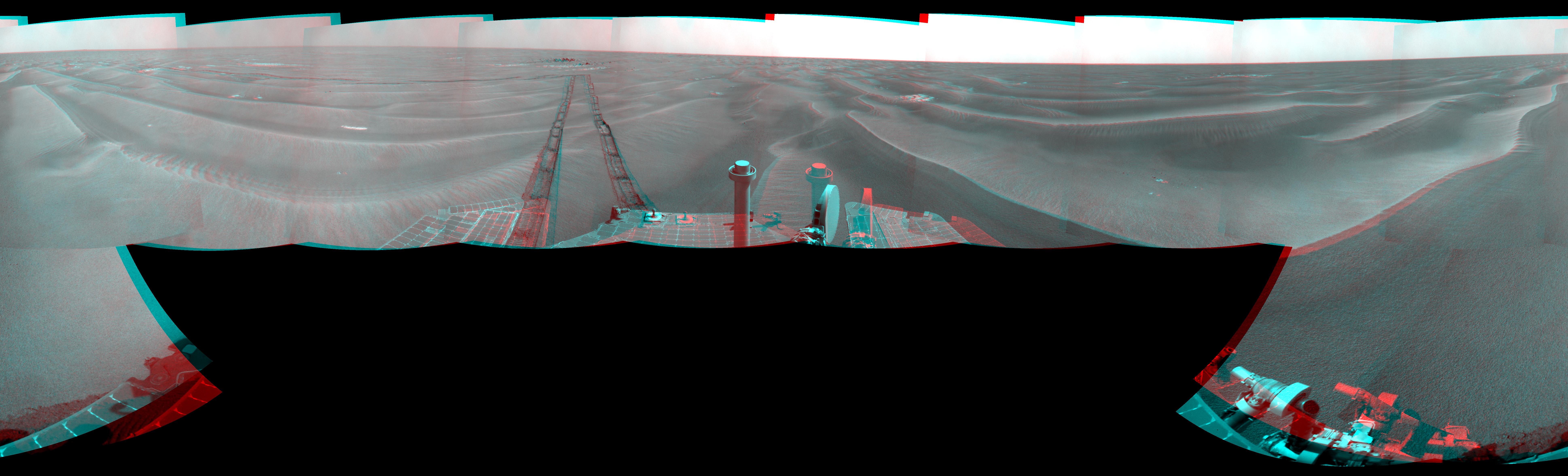
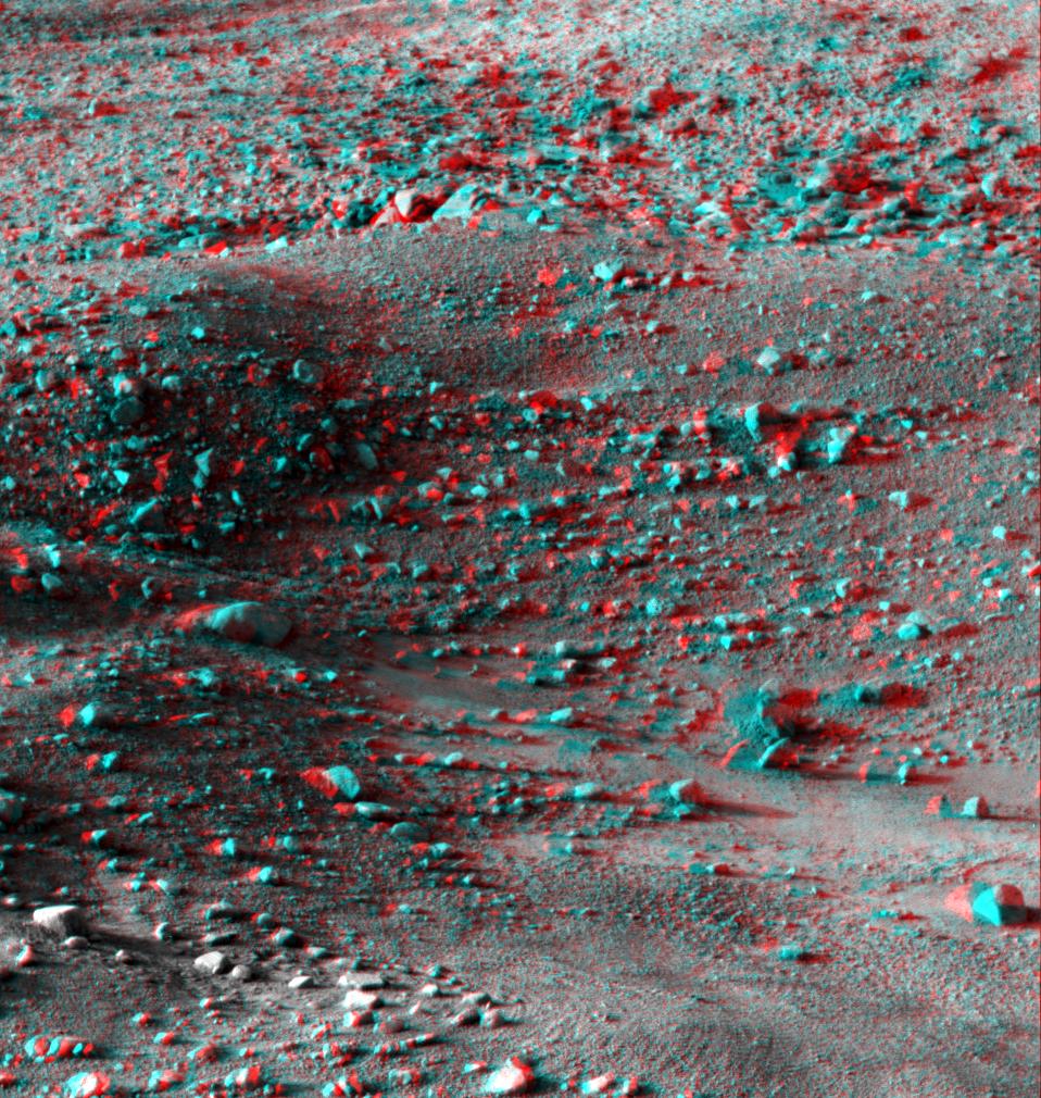
-
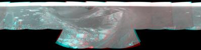
PIA12154:
Opportunity's Surroundings on Sol 1950 (Stereo)
Full Resolution:
TIFF
(50.66 MB)
JPEG
(1.35 MB)
|
|
|
2009-07-21 |
Moon
|
Lunar Reconnaissance Orbiter (LRO)
|
Lunar Reconnaissance Orbiter Camera (NAC)
|
1000x1000x3 |
|
-
PIA12890:
-
The Moon in 3-D
Full Resolution:
TIFF
(3.004 MB)
JPEG
(145.4 kB)
|
|
|
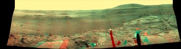
2009-07-16 |
Mars
|
Mars Exploration Rover (MER)
|
Navigation Camera
|
5894x1270x3 |
|
-
PIA12143:
Spirit's View from "Troy" (Stereo)
Full Resolution:
TIFF
(22.46 MB)
JPEG
(822.4 kB)
|
|
|
2009-07-16 |
Mars
|
Mars Exploration Rover (MER)
|
Navigation Camera
|
4115x1385x3 |
|
-
PIA12141:
-
Spirit Close to "Troy," Sol 1871 (Stereo)
Full Resolution:
TIFF
(17.1 MB)
JPEG
(692.3 kB)
|
|
|
2009-07-16 |
Mars
|
Mars Exploration Rover (MER)
|
Navigation Camera
|
2715x1249x3 |

|
-
PIA12139:
-
Spirit's Look Ahead on Sol 1869 (Stereo)
Full Resolution:
TIFF
(10.18 MB)
JPEG
(436.8 kB)
|
|
|
2009-07-16 |
Mars
|
Mars Exploration Rover (MER)
|
Navigation Camera
|
2722x1265x3 |
|
-
PIA12137:
-
Spirit's Look Ahead After Sol 1866 Drive (Stereo)
Full Resolution:
TIFF
(10.34 MB)
JPEG
(366.5 kB)
|
|
|
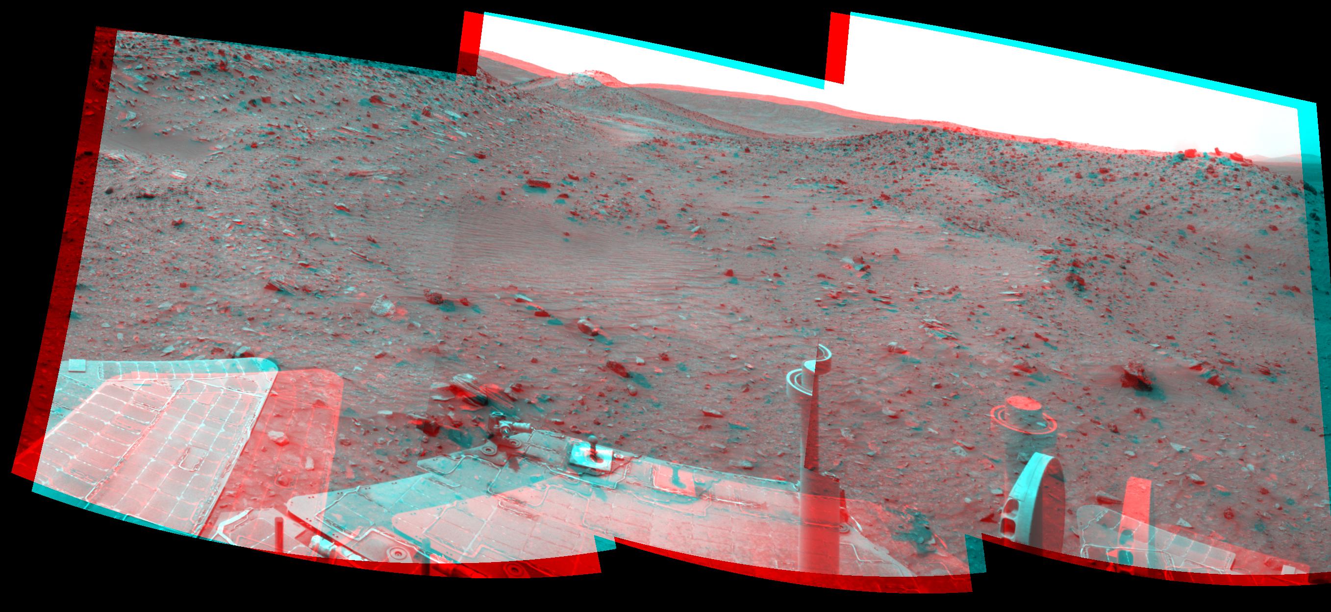
2009-07-15 |
Mars
|
Mars Exploration Rover (MER)
|
Navigation Camera
|
7753x2187x3 |
|
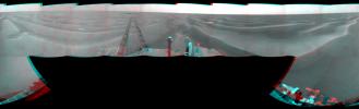
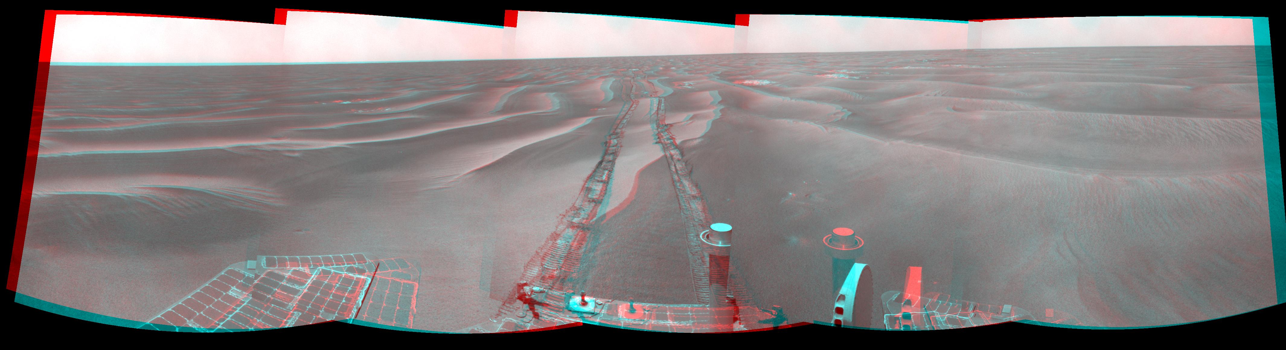
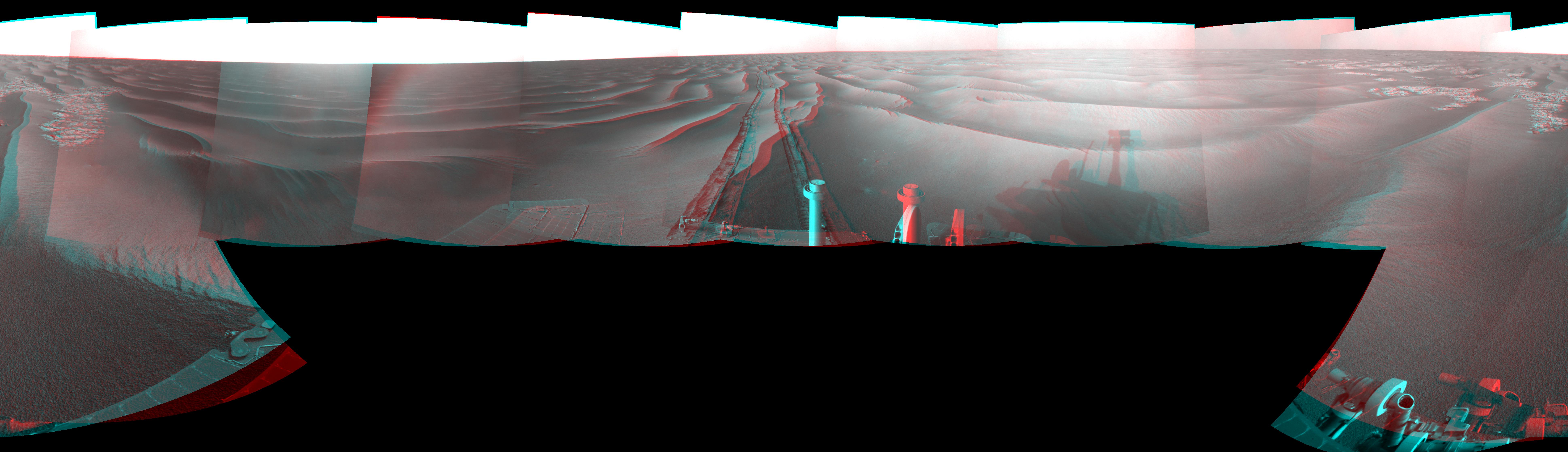
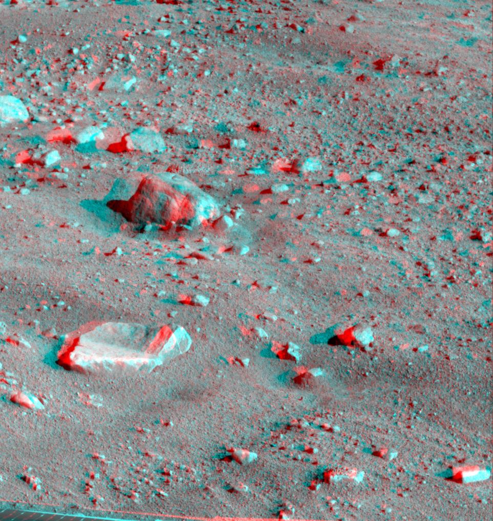
-
PIA12129:
Opportunity's View After 72-Meter Drive, Sol 1912 (Stereo)
Full Resolution:
TIFF
(50.87 MB)
JPEG
(1.249 MB)
|
|
|
2009-07-15 |
Mars
|
Mars Exploration Rover (MER)
|
Navigation Camera
|
7753x2186x3 |
|
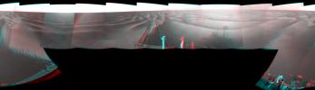
-
PIA12125:
Opportunity's Surroundings After Backwards Drive, Sol 1850 (Stereo)
Full Resolution:
TIFF
(50.84 MB)
JPEG
(1.08 MB)
|
|
|
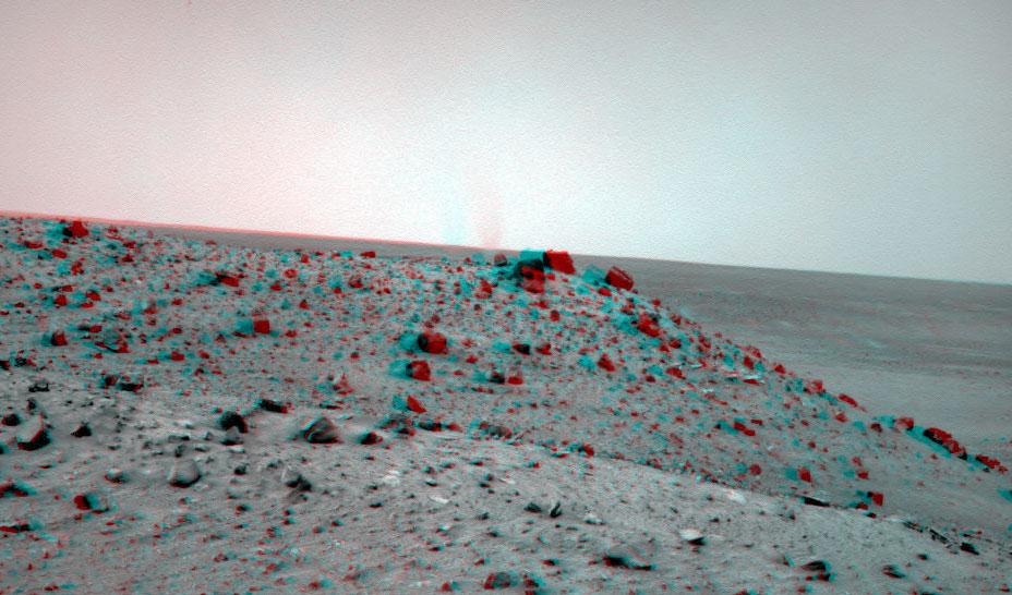
2009-07-14 |
Mars
|
Mars Exploration Rover (MER)
|
Navigation Camera
|
928x546x3 |
|
-
PIA12122:
-
Dust Devil West of Spirit, Sol 1913 (Stereo)
Full Resolution:
TIFF
(1.522 MB)
JPEG
(87.66 kB)
|
|
|
2009-04-05 |
Mars
|
Mars Exploration Rover (MER)
|
Navigation Camera
|
5073x1188x3 |
|
-
PIA11977:
View Ahead After Spirit's Sol 1861 Drive (Stereo)
Full Resolution:
TIFF
(18.08 MB)
JPEG
(625.3 kB)
|
|
|
2009-04-05 |
Mars
|
Mars Exploration Rover (MER)
|
Navigation Camera
|
7704x1167x3 |

|
-
PIA11973:
Time for a Change; Spirit's View on Sol 1843 (Stereo)
Full Resolution:
TIFF
(26.97 MB)
JPEG
(1.08 MB)
|
|
|
2009-04-05 |
Mars
|
Mars Exploration Rover (MER)
|
Navigation Camera
|
4190x1225x3 |
|
-
PIA11971:
-
Spirit's View Beside 'Home Plate' on Sol 1823 (Stereo)
Full Resolution:
TIFF
(15.4 MB)
JPEG
(586.2 kB)
|
|
|
2009-03-26 |
Mars
|
Mars Exploration Rover (MER)
|
Navigation Camera
|
4326x1201x3 |
|
-
PIA11962:
New Record Five-Wheel Drive, Spirit's Sol 1856 (Stereo)
Full Resolution:
TIFF
(15.59 MB)
JPEG
(639.9 kB)
|
|
|
2009-03-26 |
Mars
|
Mars Exploration Rover (MER)
|
Navigation Camera
|
4325x1191x3 |
|
-
PIA11960:
Dust Devil in Spirit's View Ahead on Sol 1854 (Stereo)
Full Resolution:
TIFF
(15.45 MB)
JPEG
(563 kB)
|
|
|
2009-03-23 |
Mars
|
Mars Exploration Rover (MER)
|
Navigation Camera
|
7753x2218x3 |

|
-
PIA11854:
-
Opportunity at 'Cook Islands' (Stereo)
Full Resolution:
TIFF
(51.59 MB)
JPEG
(1.162 MB)
|
|
|
2009-03-23 |
Mars
|
Mars Exploration Rover (MER)
|
Navigation Camera
|
4260x1161x3 |

|
-
PIA11850:
Opportunity's Surroundings on Sol 1798 (Stereo)
Full Resolution:
TIFF
(14.84 MB)
JPEG
(449.3 kB)
|
|
|
2009-03-23 |
Mars
|
Mars Exploration Rover (MER)
|
Navigation Camera
|
7753x2177x3 |
|
-
PIA11846:
Opportunity's Surroundings on Sol 1818 (Stereo)
Full Resolution:
TIFF
(50.64 MB)
JPEG
(970 kB)
|
|
|
2009-03-23 |
Mars
|
Mars Exploration Rover (MER)
|
Navigation Camera
|
7753x2357x3 |
|
-
PIA11842:
-
Opportunity's Surroundings After Sol 1820 Drive (Stereo)
Full Resolution:
TIFF
(54.82 MB)
JPEG
(1.314 MB)
|
|
|
2009-03-03 |
Mars
|
Mars Exploration Rover (MER)
|
Navigation Camera
|
7753x2235x3 |
|
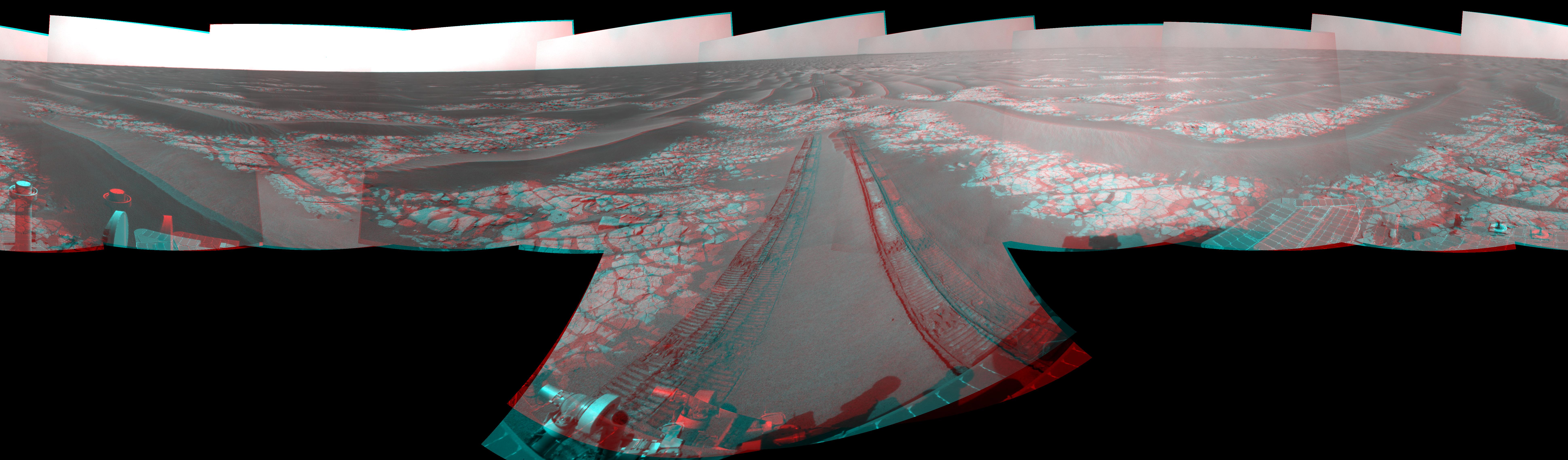
-
PIA11820:
-
Wind-Sculpted Vicinity After Opportunity's Sol 1797 Drive (Stereo)
Full Resolution:
TIFF
(51.98 MB)
JPEG
(1.099 MB)
|
|
|
2009-03-03 |
Mars
|
Mars Exploration Rover (MER)
|
Navigation Camera
|
7753x2275x3 |
|
-
PIA11816:
-
Opportunity's View After Drive on Sol 1806 (Stereo)
Full Resolution:
TIFF
(52.91 MB)
JPEG
(1.29 MB)
|
|
|
2009-03-03 |
Mars
|
Mars Exploration Rover (MER)
|
Navigation Camera
|
7753x2149x3 |
|
-
PIA11812:
Opportunity's View on Sols 1803 and 1804 (Stereo)
Full Resolution:
TIFF
(49.98 MB)
JPEG
(1.162 MB)
|
|
|
2009-02-17 |
Mars
|
Mars Exploration Rover (MER)
|
Navigation Camera
|
2684x1247x3 |
|
-
PIA11803:
-
Spirit Beside 'Home Plate,' Sol 1809 (Stereo)
Full Resolution:
TIFF
(10.05 MB)
JPEG
(431.9 kB)
|
|
|
2009-02-04 |
Mars
|
Mars Exploration Rover (MER)
|
Navigation Camera
|
7753x2286x3 |
|
-
PIA11791:
-
Opportunity's View After Long Drive on Sol 1770 (Stereo)
Full Resolution:
TIFF
(53.17 MB)
JPEG
(1.193 MB)
|
|
|
2009-02-03 |
Mars
|
Mars Exploration Rover (MER)
|
Navigation Camera
|
7753x3446x3 |
|
-
PIA11787:
-
Opportunity View During Exploration in 'Duck Bay,' Sols 1506-1510 (Stereo)
Full Resolution:
TIFF
(80.15 MB)
JPEG
(2.041 MB)
|
|
|
2009-02-02 |
Mars
|
Mars Exploration Rover (MER)
|
Navigation Camera
|
7704x1198x3 |

|
-
PIA11781:
Spirit Near "Stapledon" on Sol 1802 (Stereo)
Full Resolution:
TIFF
(27.69 MB)
JPEG
(1.212 MB)
|
|
|
2009-01-22 |
Mars
|
Mars Exploration Rover (MER)
|
Navigation Camera
|
7753x2191x3 |
|
-
PIA11385:
View from West of Victoria Crater, Sol 1664 (Stereo)
Full Resolution:
TIFF
(50.96 MB)
JPEG
(1.302 MB)
|
|
|
2009-01-12 |
Mars
|
Mars Exploration Rover (MER)
|
Panoramic Camera
|
7214x2818x3 |
|
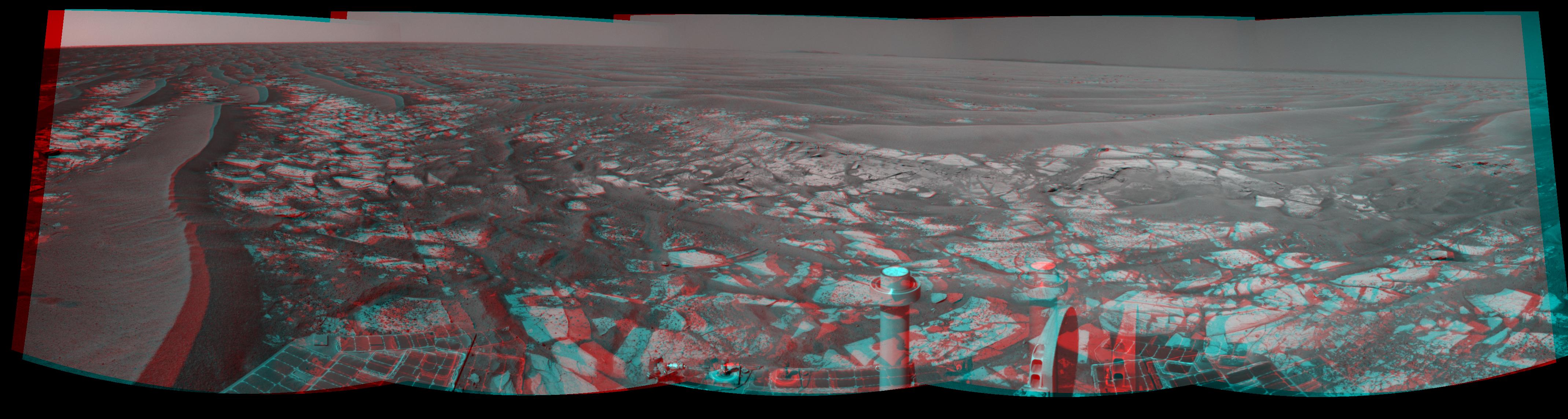
-
PIA11755:
-
Rover's Wheel Churns Up Bright Martian Soil (Stereo)
Full Resolution:
TIFF
(60.99 MB)
JPEG
(1.725 MB)
|
|
|
2009-01-05 |
Mars
|
Mars Exploration Rover (MER)
|
Panoramic Camera
|
23123x4477x3 |
|
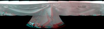
-
PIA11744:
Full-Circle 'Bonestell' Panorama from Spirit (Stereo)
Full Resolution:
TIFF
(310.6 MB)
JPEG
(11.21 MB)
|
|
|
2009-01-05 |
Mars
|
Mars Exploration Rover (MER)
|
Navigation Camera
|
7753x2324x3 |
|
-
PIA11739:
-
Opportunity's Surroundings on Sol 1687 (Stereo)
Full Resolution:
TIFF
(54.05 MB)
JPEG
(1.201 MB)
|
|
|
2008-12-08 |
Mars
|
Mars Reconnaissance Orbiter (MRO)
|
HiRISE
|
1129x949x3 |
|
-
PIA11446:
-
Elysium Planitia, Mars - Fractured Mounds in Stereo
Full Resolution:
TIFF
(3.218 MB)
JPEG
(227.3 kB)
|
|
|
2008-10-29 |
Mars
|
Phoenix
|
Surface Stereo Imager (SSI)
|
1024x1024x3 |
|
-
PIA11381:
-
Phoenix Deepens Trenches on Mars (3-D)
Full Resolution:
TIFF
(3.15 MB)
JPEG
(203.9 kB)
|
|
|
2008-10-29 |
Mars
|
Phoenix
|
Surface Stereo Imager (SSI)
|
1024x1024x3 |
|
-
PIA11380:
-
Phoenix Deepens Trenches on Mars (3-D)
Full Resolution:
TIFF
(3.15 MB)
JPEG
(215 kB)
|
|
|
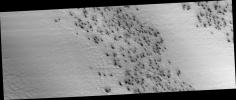
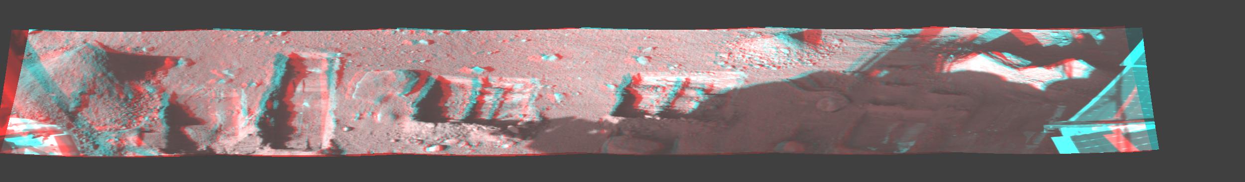
2008-10-13 |
Mars
|
Phoenix
|
Surface Stereo Imager (SSI)
|
2500x367x3 |
|
-
PIA11229:
Phoenix Trenches
Full Resolution:
TIFF
(2.756 MB)
JPEG
(102.7 kB)
|
|
|
2008-10-09 |
Mars
|
Phoenix
|
Surface Stereo Imager (SSI)
|
1024x512x3 |
|
-
PIA11130:
-
Phoenix's La Mancha Trench in 3-D
Full Resolution:
TIFF
(1.575 MB)
JPEG
(122.6 kB)
|
|
|
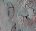
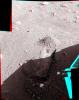
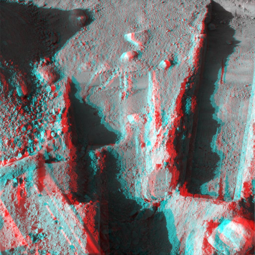
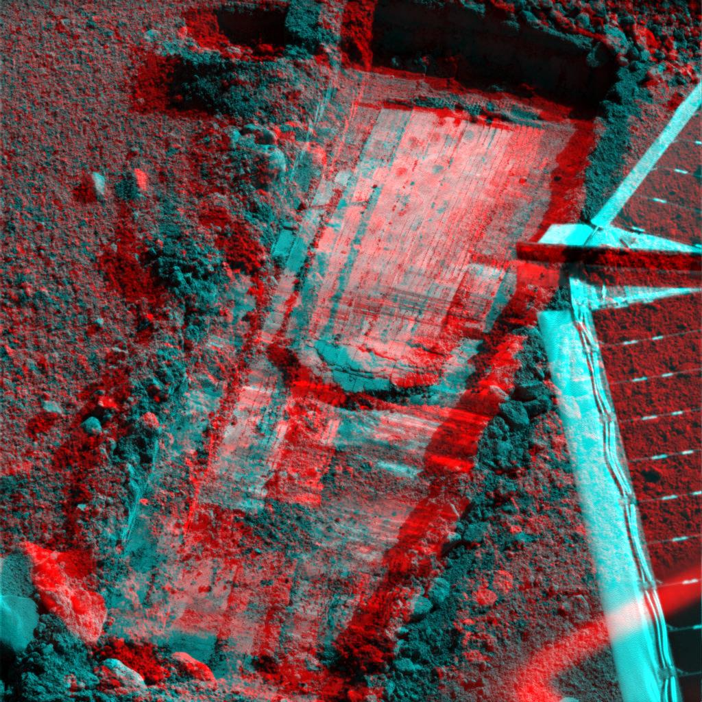
2008-09-23 |
Mars
|
Phoenix
|
Robotic Arm
Surface Stereo Imager (SSI)
|
1024x1024x3 |
|
-
PIA11192:
-
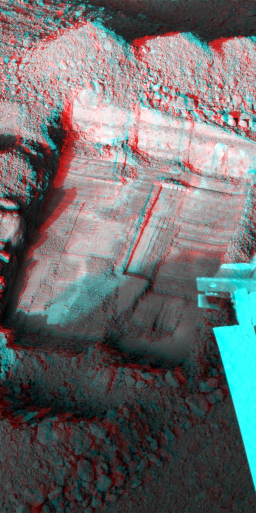
Rock Moved by Mars Lander Arm, Stereo View
Full Resolution:
TIFF
(3.15 MB)
JPEG
(244 kB)
|
|
|
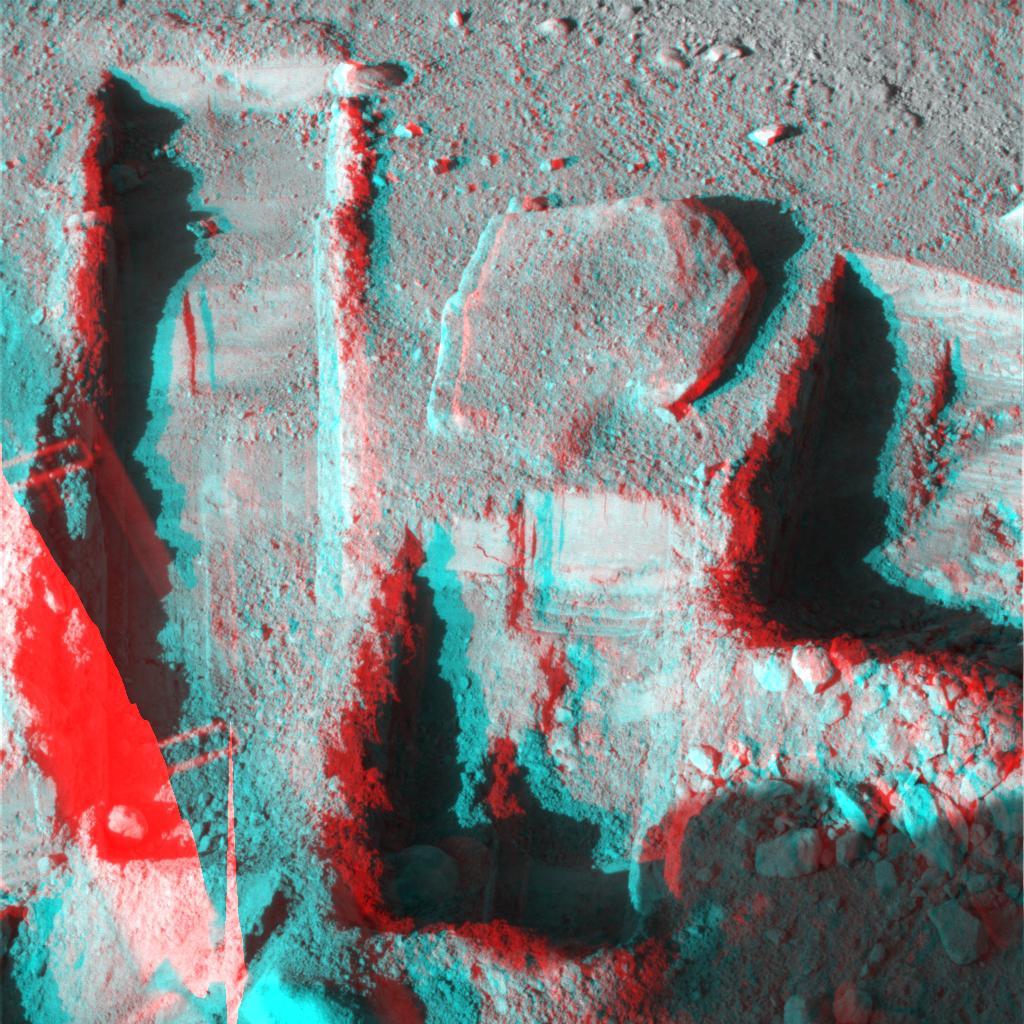
2008-09-23 |
Mars
|
Phoenix
|
Robotic Arm
Surface Stereo Imager (SSI)
|
1024x1024x3 |
|
-
PIA11190:
-
Preparation for Moving a Rock on Mars, Stereo View
Full Resolution:
TIFF
(3.15 MB)
JPEG
(310.8 kB)
|
|
|
2008-09-09 |
Mercury
|
MESSENGER
|
MDIS - Narrow Angle
MDIS - Wide Angle
|
600x600x3 |
|
-
PIA11078:
-
Mercury - in 3-D!
Full Resolution:
TIFF
(1.081 MB)
JPEG
(60.73 kB)
|
|
|
2008-09-01 |
Mars
|
Phoenix
|
Surface Stereo Imager (SSI)
|
512x512x3 |
|
-
PIA11057:
-
Picking up Clues from the Discard Pile (Stereo)
Full Resolution:
TIFF
(787.5 kB)
JPEG
(86.78 kB)
|
|
|
2008-08-26 |
Mars
|
Phoenix
|
Surface Stereo Imager (SSI)
|
1024x1024x3 |
|
-
PIA11052:
-
Deep 'Stone Soup' Trenching by Phoenix (Stereo)
Full Resolution:
TIFF
(3.15 MB)
JPEG
(198 kB)
|
|
|
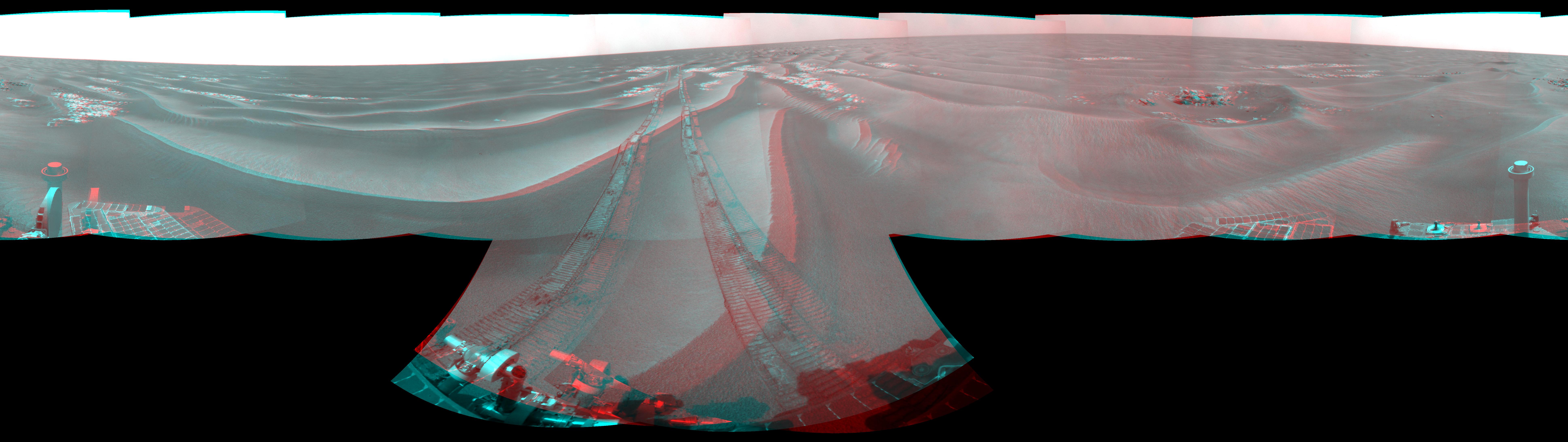
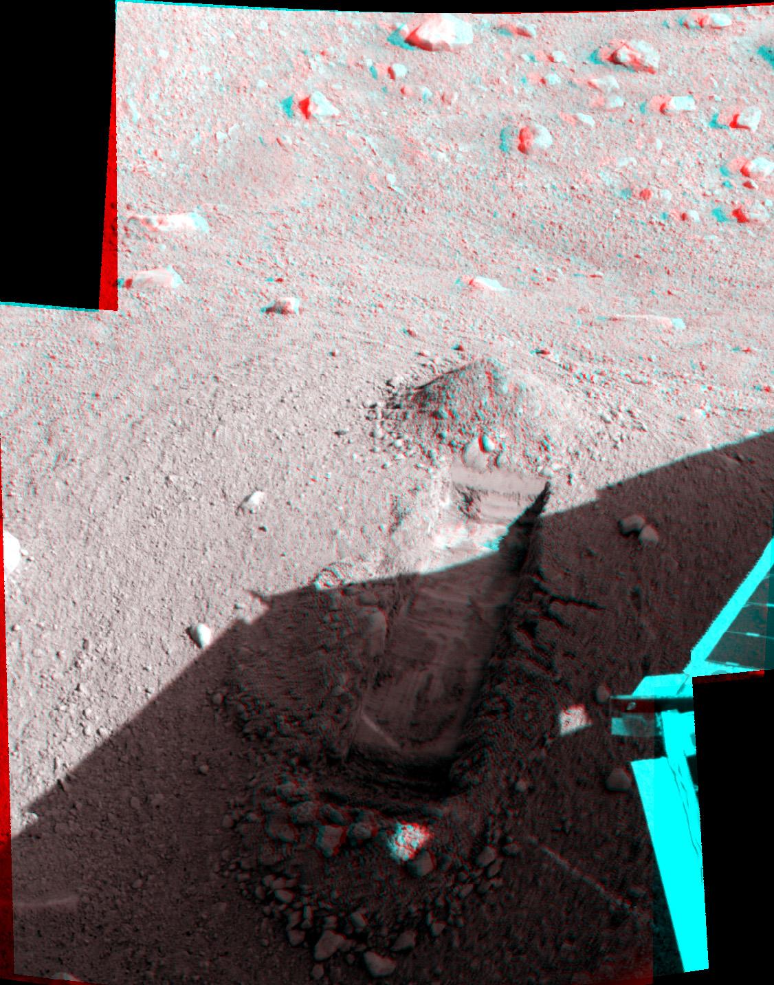
2008-08-26 |
Mars
|
Mars Exploration Rover (MER)
|
Panoramic Camera
|
12221x3471x3 |
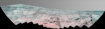
|
-
PIA11050:
Southern Half of Spirit's 'Bonestell' Panorama (Anaglyph)
Full Resolution:
TIFF
(127.3 MB)
JPEG
(4.401 MB)
|
|
|
2008-07-28 |
Mars
|
Phoenix
|
Surface Stereo Imager (SSI)
|
3978x1926x3 |
|
-
PIA10998:
-
Martian Surface as Seen by Phoenix
Full Resolution:
TIFF
(22.99 MB)
JPEG
(1.304 MB)
|
|
|
2008-07-28 |
Mars
|
Phoenix
|
Surface Stereo Imager (SSI)
|
1126x1432x3 |
|
-
PIA10997:
-
Martian Surface as Seen by Phoenix
Full Resolution:
TIFF
(4.843 MB)
JPEG
(275.1 kB)
|
|
|
2008-07-28 |
Mars
|
Phoenix
|
Surface Stereo Imager (SSI)
|
448x512x3 |
|
-
PIA10996:
-
Martian Surface as Seen by Phoenix
Full Resolution:
TIFF
(689.1 kB)
JPEG
(62.14 kB)
|
|
|
2008-07-28 |
Mars
|
Phoenix
|
Surface Stereo Imager (SSI)
|
944x1015x3 |
|
-
PIA10995:
-
Martian Surface as Seen by Phoenix
Full Resolution:
TIFF
(2.879 MB)
JPEG
(242.7 kB)
|
|
|
2008-07-28 |
Mars
|
Phoenix
|
Surface Stereo Imager (SSI)
|
937x1018x3 |
|
-
PIA10994:
-
Martian Surface as Seen by Phoenix
Full Resolution:
TIFF
(2.866 MB)
JPEG
(260.8 kB)
|
|
|
2008-07-28 |
Mars
|
Phoenix
|
Surface Stereo Imager (SSI)
|
965x1017x3 |
|
-
PIA10993:
-
Martian Surface as Seen by Phoenix
Full Resolution:
TIFF
(2.949 MB)
JPEG
(306.5 kB)
|
|
|
2008-07-28 |
Mars
|
Phoenix
|
Surface Stereo Imager (SSI)
|
958x1010x3 |
|
-
PIA10992:
-
Martian Surface as Seen by Phoenix
Full Resolution:
TIFF
(2.907 MB)
JPEG
(251.1 kB)
|
|
|
2008-07-28 |
Mars
|
Phoenix
|
Surface Stereo Imager (SSI)
|
963x1017x3 |
|
-
PIA10991:
-
Martian Surface as Seen by Phoenix
Full Resolution:
TIFF
(2.942 MB)
JPEG
(231.4 kB)
|
|
|
2008-07-28 |
Mars
|
Phoenix
|
Surface Stereo Imager (SSI)
|
1024x1024x3 |
|
-
PIA10990:
-
Martian Surface as Seen by Phoenix
Full Resolution:
TIFF
(3.15 MB)
JPEG
(297 kB)
|
|
|
2008-07-28 |
Mars
|
Phoenix
|
Surface Stereo Imager (SSI)
|
966x1016x3 |
|
-
PIA10989:
-
Martian Surface as Seen by Phoenix
Full Resolution:
TIFF
(2.949 MB)
JPEG
(218.5 kB)
|
|
|
2008-07-28 |
Mars
|
Phoenix
|
Surface Stereo Imager (SSI)
|
946x1016x3 |
|
-
PIA10988:
-
Martian Surface as Seen by Phoenix
Full Resolution:
TIFF
(2.888 MB)
JPEG
(265.4 kB)
|
|
|
2008-07-28 |
Mars
|
Phoenix
|
Surface Stereo Imager (SSI)
|
512x1024x3 |
|
-
PIA10987:
-
Martian Surface as Seen by Phoenix
Full Resolution:
TIFF
(1.575 MB)
JPEG
(116.2 kB)
|
|
|
2008-07-28 |
Mars
|
Phoenix
|
Surface Stereo Imager (SSI)
|
1020x1014x3 |
|
-
PIA10986:
-
Martian Surface as Seen by Phoenix
Full Resolution:
TIFF
(3.107 MB)
JPEG
(215.9 kB)
|
|
|
2008-07-28 |
Mars
|
Phoenix
|
Surface Stereo Imager (SSI)
|
2044x2089x3 |
|
-
PIA10985:
-
Martian Surface as Seen by Phoenix
Full Resolution:
TIFF
(12.83 MB)
JPEG
(485 kB)
|
|
|
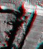
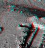
2008-07-24 |
Mars
|
Phoenix
|
Robotic Arm
Surface Stereo Imager (SSI)
|
1024x1024x3 |

|
-
PIA10977:
-
'Snow White' Trench After Scraping (Stereo View)
Full Resolution:
TIFF
(3.15 MB)
JPEG
(257.3 kB)
|
|
|
2008-07-22 |
Mars
|
Phoenix
|
Surface Stereo Imager (SSI)
|
916x939x3 |
|
-
PIA10972:
-
Two Holes from Using Rasp in 'Snow White' (Stereo)
Full Resolution:
TIFF
(2.584 MB)
JPEG
(116.9 kB)
|
|
|
2008-06-02 |
Mars
|
Phoenix
|
Surface Stereo Imager (SSI)
|
512x512x3 |
|
-
PIA10744:
-
Stereo View of Phoenix Test Sample Site
Full Resolution:
TIFF
(787.5 kB)
JPEG
(85.33 kB)
|
|
|
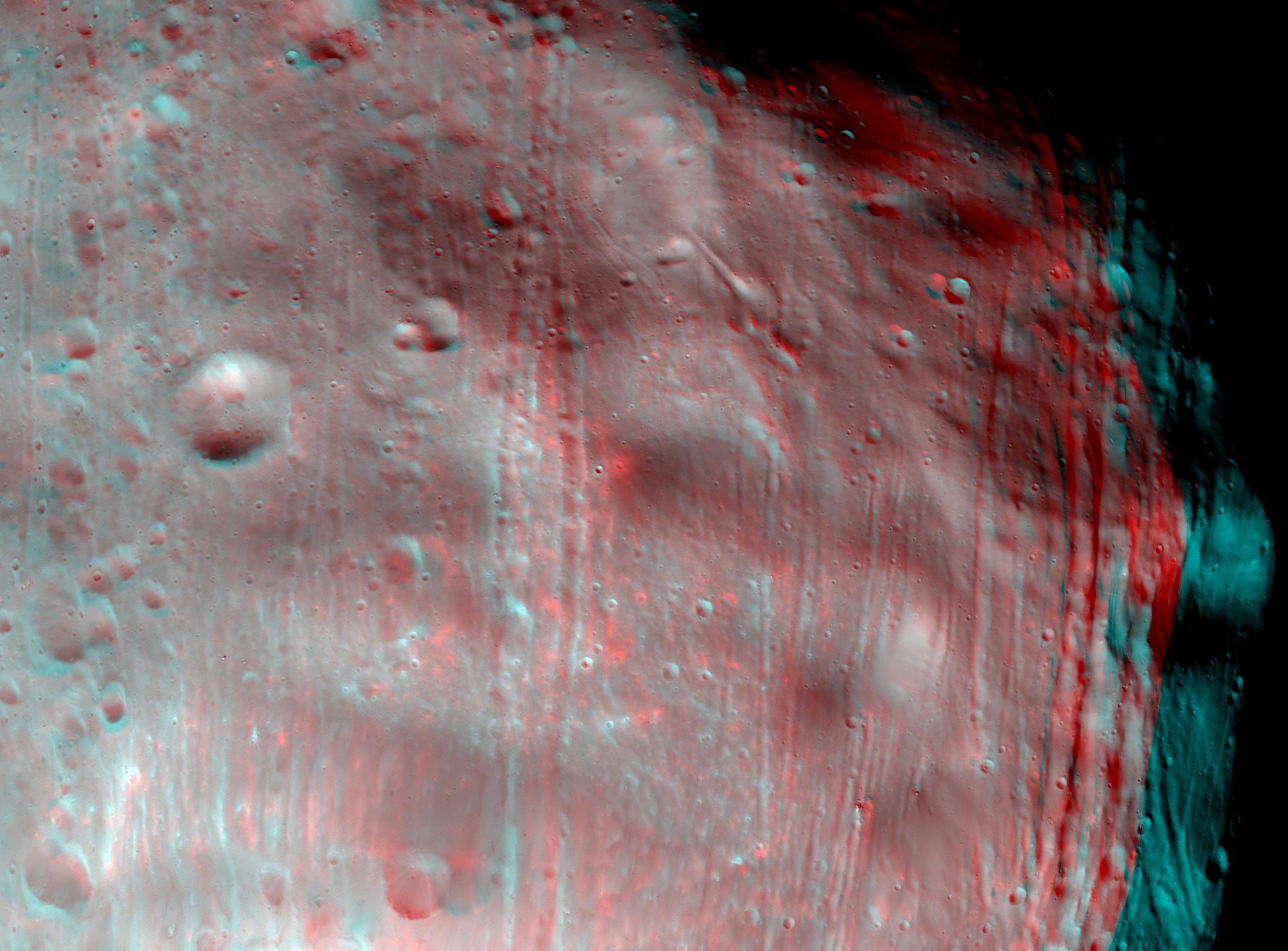
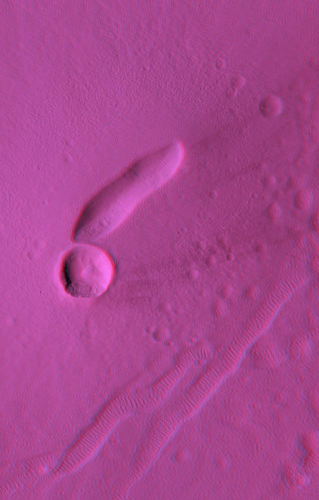
2008-04-09 |
Phobos
|
Mars Reconnaissance Orbiter (MRO)
|
HiRISE
|
1952x1442x3 |
|
-
PIA10371:
-
Phobos in Stereo
Full Resolution:
TIFF
(8.456 MB)
JPEG
(302.3 kB)
|
|
|
2008-01-24 |
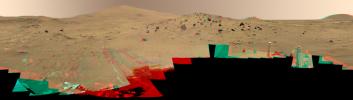
Mars
|
Mars Exploration Rover (MER)
|
Panoramic Camera
|
23123x7034x3 |

|
-
PIA10228:
-
'Lyell' Panorama inside Victoria Crater (Stereo)
Full Resolution:
TIFF
(487.9 MB)
JPEG
(13.65 MB)
|
|
|
2008-01-03 |
Mars
|
Mars Exploration Rover (MER)
|
Panoramic Camera
|
12756x3487x3 |
|
-
PIA10215:
Spirit's West Valley Panorama (Anaglyph)
Full Resolution:
TIFF
(133.4 MB)
JPEG
(5.836 MB)
|
|
|
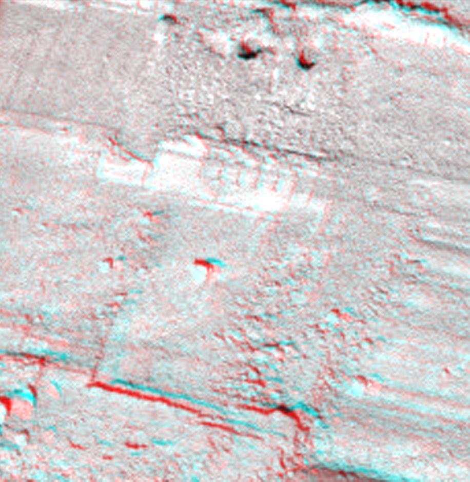
2007-12-11 |
Mars
|
Mars Reconnaissance Orbiter (MRO)
|
HiRISE
|
2048x866x1 |
|
-
PIA10139:
-
Field of Fans
Full Resolution:
TIFF
(1.776 MB)
JPEG
(236.9 kB)
|
|
|
2007-10-15 |
Rhea
|
Cassini-Huygens
|
ISS - Narrow Angle
|
3524x2680x3 |
|
-
PIA08402:
-
Rhea's Pop-up Crater
Full Resolution:
TIFF
(28.33 MB)
JPEG
(907.4 kB)
|
|
|
2007-10-09 |
Iapetus
|
Cassini-Huygens
|
ISS - Narrow Angle
|
4082x1546x3 |
|
-
PIA08379:
-
Towering Peaks of Iapetus
Full Resolution:
TIFF
(18.93 MB)
JPEG
(346.2 kB)
|
|
|
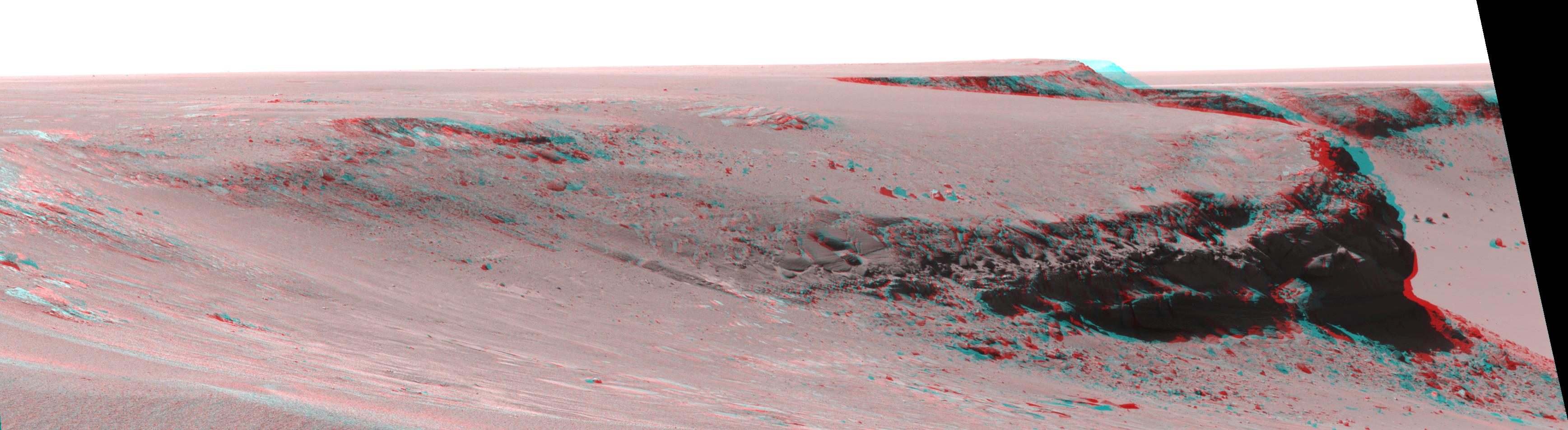
2007-09-27 |
Mars
|
Mars Exploration Rover (MER)
|
Panoramic Camera
|
15049x2217x3 |
|
-
PIA10007:
Duck Bay, Victoria Crater
Full Resolution:
TIFF
(100.1 MB)
JPEG
(2.92 MB)
|
|
|
2007-09-07 |
Mars
|
Mars Exploration Rover (MER)
|
Navigation Camera
|
7753x1949x3 |
|
-
PIA09972:
Forty Meters from Entry to Victoria Crater (Stereo)
Full Resolution:
TIFF
(45.33 MB)
JPEG
(1.248 MB)
|
|
|
2007-05-10 |
|
Phoenix
|
|
8000x5000x3 |
|
-
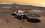
PIA09345:
-
Phoenix Lander on Mars (Stereo)
Full Resolution:
TIFF
(120 MB)
JPEG
(3.08 MB)
|
|
|
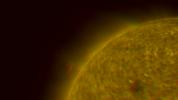
2007-04-27 |
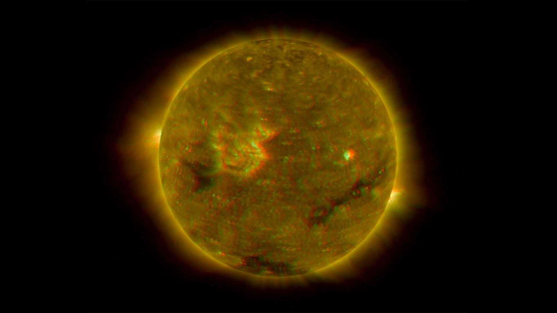
Sol (our sun)
|
Solar TErrestrial RElations Observatory (STEREO)
|
SECCHI/Extreme Ultraviolet Imaging Telescope
|
1920x1080x3 |
|
-
PIA09333:
-
Left Limb of North Pole of the Sun, March 20, 2007 (Anaglyph)
Full Resolution:
TIFF
(6.23 MB)
JPEG
(89.44 kB)
|
|
|
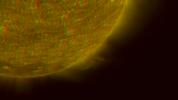
2007-04-27 |
Sol (our sun)
|
Solar TErrestrial RElations Observatory (STEREO)
|
SECCHI/Extreme Ultraviolet Imaging Telescope
|
1920x1080x3 |

|
-
PIA09331:
-
South Pole of the Sun, March 20, 2007 (Anaglyph)
Full Resolution:
TIFF
(6.23 MB)
JPEG
(114.9 kB)
|
|
|
2007-04-27 |
Sol (our sun)
|
Solar TErrestrial RElations Observatory (STEREO)
|
SECCHI/Extreme Ultraviolet Imaging Telescope
|
1920x1080x3 |

|
-
PIA09329:
-
North Pole of the Sun, March 20, 2007 (Anaglyph)
Full Resolution:
TIFF
(6.23 MB)
JPEG
(126.2 kB)
|
|
|
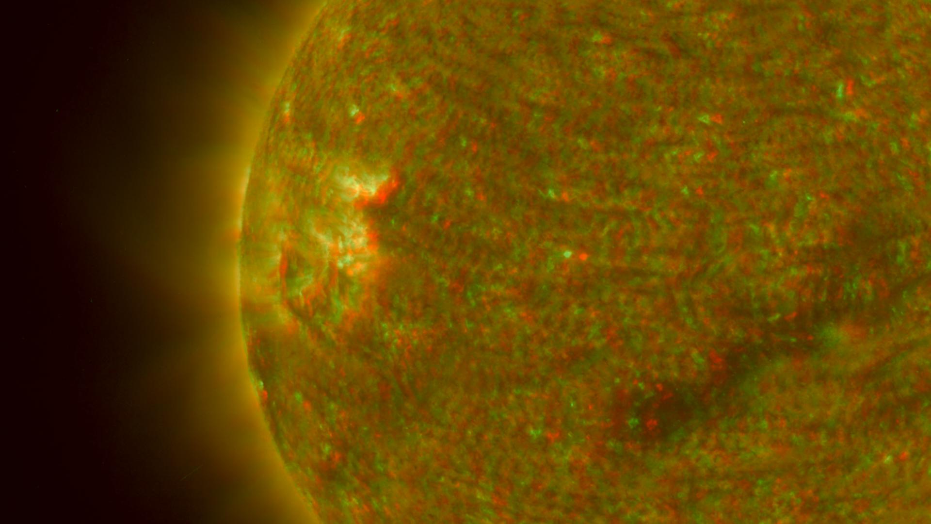
2007-04-27 |
Sol (our sun)
|
Solar TErrestrial RElations Observatory (STEREO)
|
SECCHI/Extreme Ultraviolet Imaging Telescope
|
1920x1080x3 |
|
-
PIA09327:
-
Right Limb of the South Pole of the Sun, March 18, 2007 (Anaglyph)
Full Resolution:
TIFF
(6.23 MB)
JPEG
(99.1 kB)
|
|
|
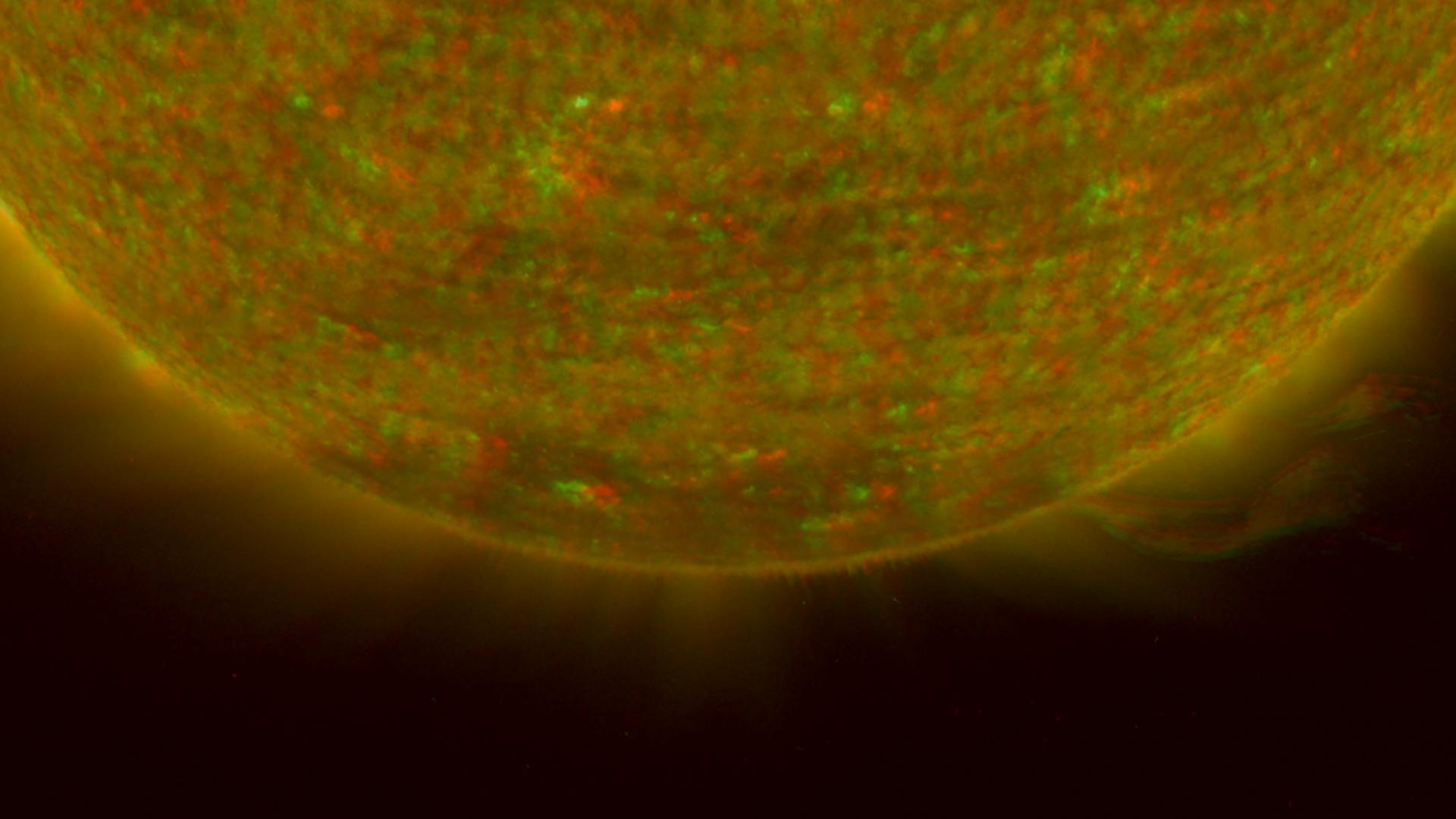
2007-04-27 |
Sol (our sun)
|
Solar TErrestrial RElations Observatory (STEREO)
|
SECCHI/Extreme Ultraviolet Imaging Telescope
|
1920x1080x3 |
|
-
PIA09325:
-
Closer View of the Equatorial Region of the Sun, March 24, 2007 (Anaglyph)
Full Resolution:
TIFF
(6.23 MB)
JPEG
(169.6 kB)
|
|
|
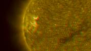
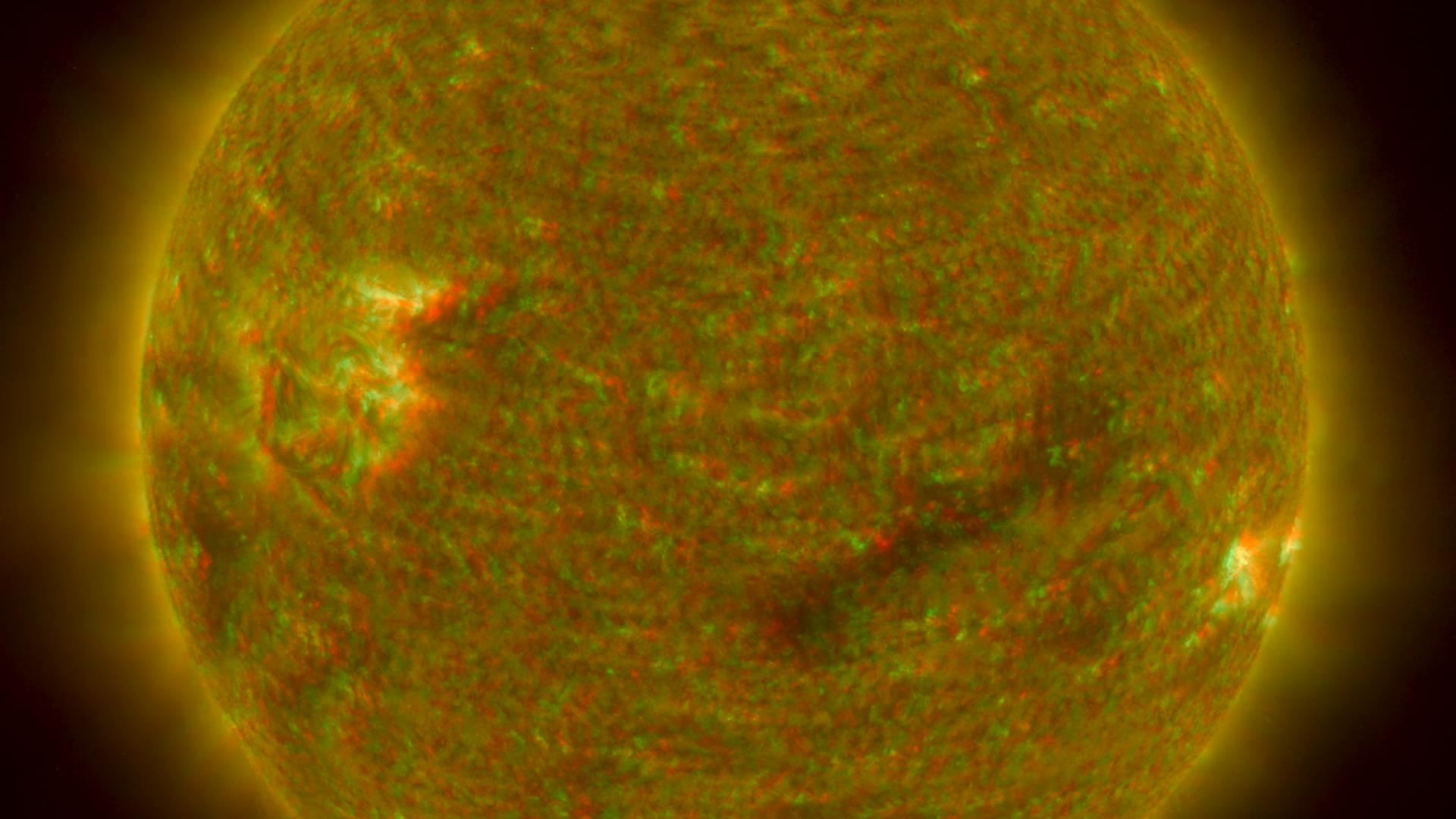
2007-04-27 |
Sol (our sun)
|
Solar TErrestrial RElations Observatory (STEREO)
|
SECCHI/Extreme Ultraviolet Imaging Telescope
|
1920x1080x3 |
|
-
PIA09323:
-
Close-up View of an Active Region of the Sun, March 23, 2007 (Anaglyph)
Full Resolution:
TIFF
(6.23 MB)
JPEG
(145.6 kB)
|
|
|
2007-04-27 |
Sol (our sun)
|
Solar TErrestrial RElations Observatory (STEREO)
|
SECCHI/Extreme Ultraviolet Imaging Telescope
|
1920x1080x3 |

|
-
PIA09321:
-
Full Disk Image of the Sun, March 26, 2007 (Anaglyph)
Full Resolution:
TIFF
(6.23 MB)
JPEG
(91.3 kB)
|
|
|
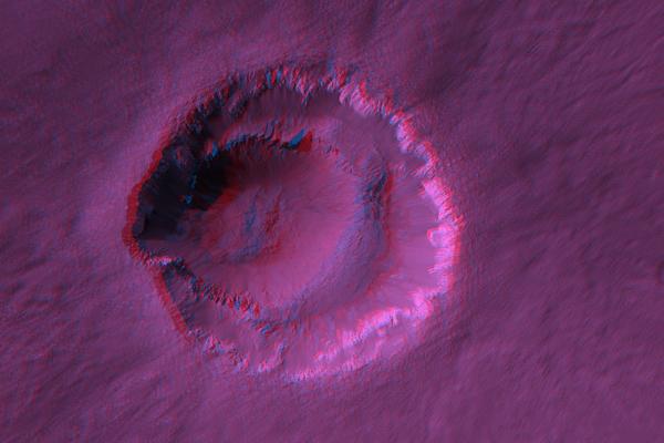
2007-01-17 |
Mars
|
Mars Reconnaissance Orbiter (MRO)
|
HiRISE
|
619x800x3 |
|
-
PIA09569:
-
Anaglyph of the Basal Scarp of Olympus Mons Volcano
Full Resolution:
TIFF
(1.487 MB)
JPEG
(61.58 kB)
|
|
|
2007-01-17 |
Mars
|
Mars Reconnaissance Orbiter (MRO)
|
HiRISE
|
638x1000x3 |
|
-
PIA09567:
-
Anaglyph of East Mareotis Tholus
Full Resolution:
TIFF
(1.916 MB)
JPEG
(71.69 kB)
|
|
|
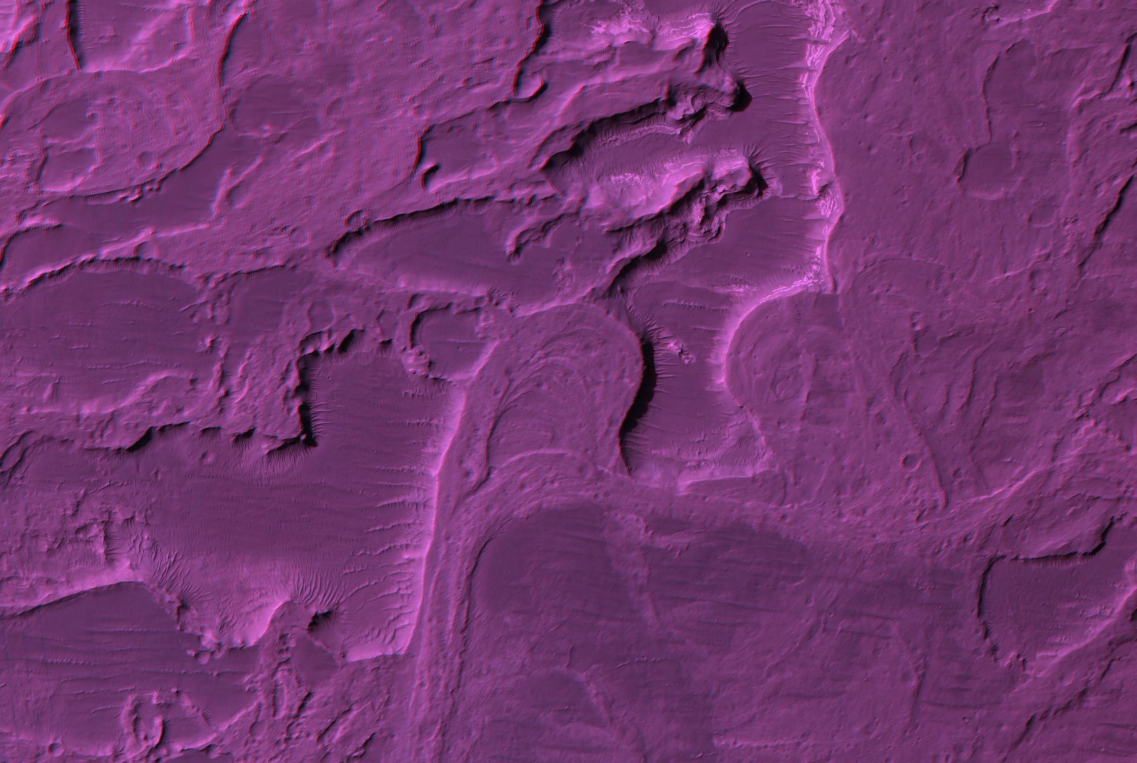
2007-01-10 |
Mars
|
Mars Reconnaissance Orbiter (MRO)
|
HiRISE
|
2235x1500x3 |
|
-
PIA09558:
-
Stereo Anaglyphs of River Meanders in Eberswalde Delta
Full Resolution:
TIFF
(10.07 MB)
JPEG
(433.4 kB)
|
|
|
2007-01-10 |
Mars
|
Mars Reconnaissance Orbiter (MRO)
|
HiRISE
|
600x400x3 |
|
-
PIA09557:
-
Stereo Anaglyphs of Ada Crater
Full Resolution:
TIFF
(721 kB)
JPEG
(26.64 kB)
|
|
|
2006-12-29 |
Pandora
|
Cassini-Huygens
|
ISS - Narrow Angle
|
334x384x3 |

|
-
PIA08339:
-
Pandora Anaglyph
Full Resolution:
TIFF
(385.4 kB)
JPEG
(8.982 kB)
|
|
|
2006-12-29 |
Dione
|
Cassini-Huygens
|
ISS - Narrow Angle
|
1000x1000x3 |
|
-
PIA08338:
-
Dione Anaglyph
Full Resolution:
TIFF
(3.004 MB)
JPEG
(101 kB)
|
|
|
2006-12-05 |
Mars
|
Mars Reconnaissance Orbiter (MRO)
|
HiRISE
|
4088x4103x3 |
|
-
PIA01883:
-
Stereo View of Victoria Crater
Full Resolution:
TIFF
(50.32 MB)
JPEG
(978.9 kB)
|
|
|
2006-11-14 |
Mars
|
Mars Exploration Rover (MER)
|
Navigation Camera
|
4255x1175x3 |
|
-
PIA01897:
Opportunity's View, Sol 958 (Stereo)
Full Resolution:
TIFF
(15 MB)
JPEG
(593.3 kB)
|
|
|
2006-10-25 |
Mars
|
Mars Exploration Rover (MER)
|
Panoramic Camera
|
27814x7879x3 |
|
-
PIA01905:
'McMurdo' Panorama from Spirit's 'Winter Haven' (Color Stereo)
Full Resolution:
TIFF
(657.4 MB)
JPEG
(90.15 MB)
|
|
|
2006-10-25 |
Mars
|
Mars Exploration Rover (MER)
|
Panoramic Camera
|
27814x7879x3 |
|
-
PIA01904:
'McMurdo' Panorama from Spirit's 'Winter Haven' (Stereo)
Full Resolution:
TIFF
(657.4 MB)
JPEG
(45.11 MB)
|
|
|
2006-10-06 |
Mars
|
Mars Exploration Rover (MER)
|
Panoramic Camera
|
3473x953x3 |
|
-
PIA08805:
Layers of 'Cape Verde' in 'Victoria Crater' (Stereo)
Full Resolution:
TIFF
(9.93 MB)
JPEG
(417.4 kB)
|
 Planetary Data System


