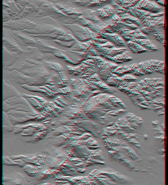
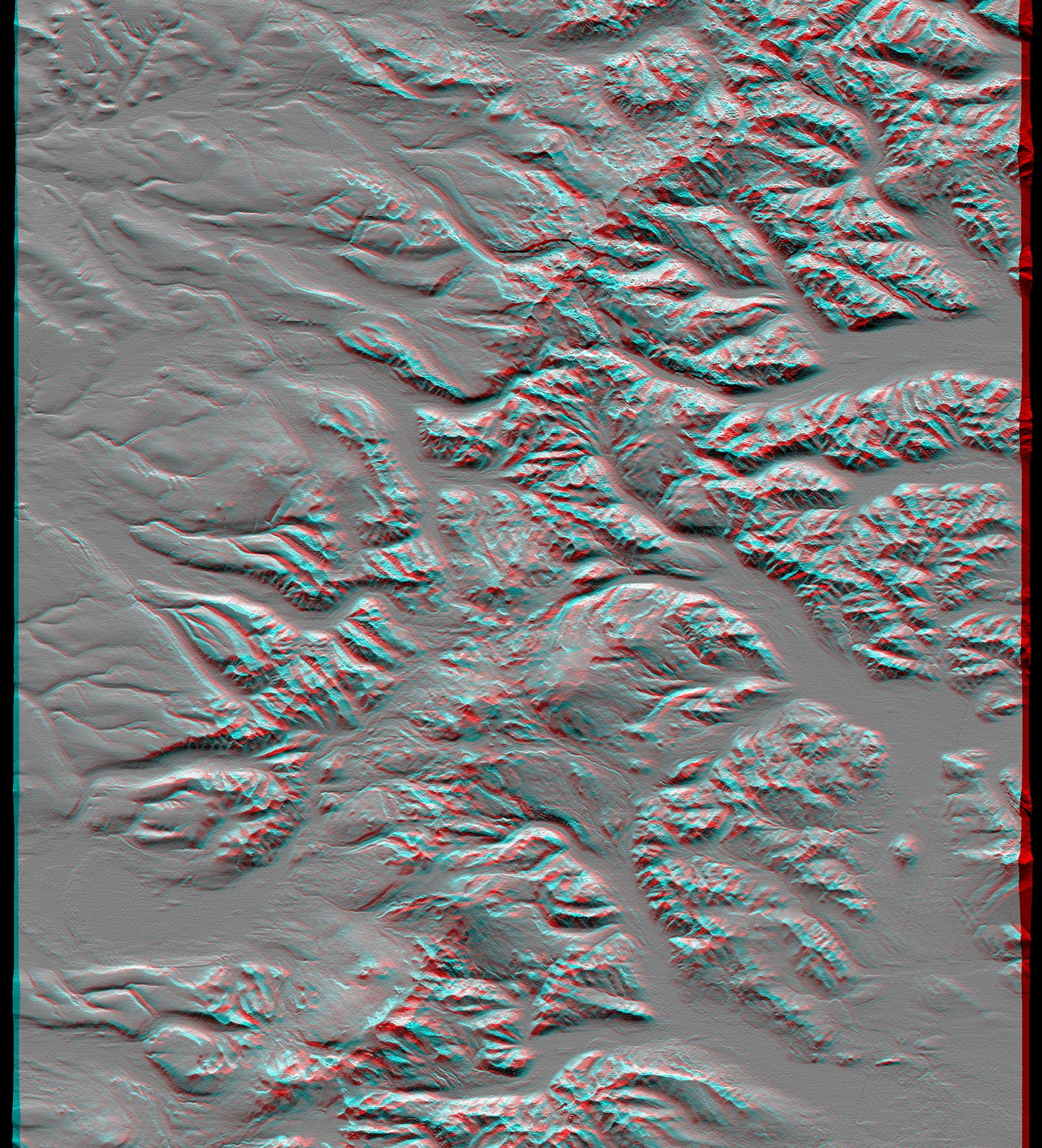
The Kamchatka Peninsula in eastern Russia is shown in this scene created from a preliminary elevation model derived from the first data collected during the Shuttle Radar Topography Mission (SRTM) on February 12, 2000. Sredinnyy Khrebet, the mountain range that makes up the spine of the peninsula, is a chain of active volcanic peaks. Pleistocene and recent glaciers have carved the broad valleys and jagged ridges that are common here. The relative youth of the volcanism is revealed by the topography as infilling and smoothing of the otherwise rugged terrain by lava, ash, and pyroclastic flows, particularly surrounding the high peaks in the south central part of the image. Elevations here range from near sea level up to 2,618 meters (8,590 feet).
This anaglyph was produced by first shading a preliminary SRTM elevation model. The stereoscopic effect was then created by generating two differing perspectives, one for each eye. When viewed through special glasses, the result is a vertically exaggerated view of Earth's surface in its full three dimensions. Anaglyph glasses cover the left eye with a red filter and cover the right eye with a blue filter.
Elevation data used in this image was acquired by the Shuttle Radar Topography Mission (SRTM) aboard Space Shuttle Endeavour, launched on February 11, 2000. SRTM used the same radar instrument that comprised the Spaceborne Imaging Radar-C/X-Band Synthetic Aperture Radar (SIR-C/X-SAR) that flew twice on Space Shuttle Endeavour in 1994. SRTM was designed to collect three-dimensional measurements of Earth's surface. To collect the 3-D data, engineers added a 60-meter-long (200-foot) mast, installed additional C-band and X-band antennas, and improved tracking and navigation devices. The mission is a cooperative project between the National Aeronautics and Space Administration (NASA), the National Imagery and Mapping Agency (NIMA) of the U.S. Department of Defense, and the German and Italian space agencies. It is managed by NASA's Jet Propulsion Laboratory, Pasadena, CA, for NASA's Earth Science Enterprise, Washington, DC.
Size: 93.0 x 105.7 kilometers ( 57.7 x 65.6 miles)
Location: 58.3 deg. North lat., 160.9 deg. East lon.
Orientation: North toward the top
Image Data: Shaded SRTM elevation model
Date Acquired: February 12, 2000
 Planetary Data System


