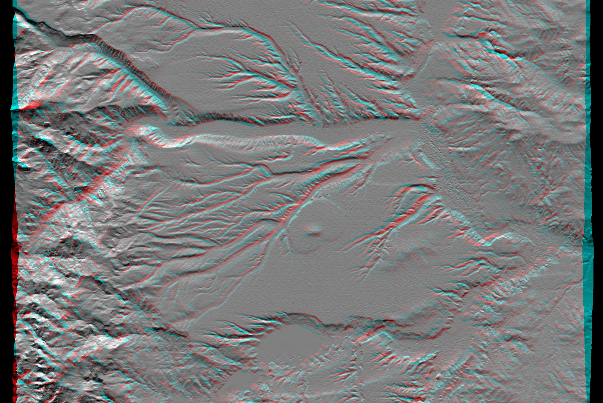
Volcanism and erosion are prominently seen in this view of the eastern flank of the Andes Mountains taken by Shuttle Radar Topography Mission (SRTM). The area is southeast of San Martin de Los Andes, Argentina. Eroded peaks up to 2,210-meter-high (7,260-foot) are seen on the west (left), but much of the scene consists of lava plateaus that slope gently eastward. These lava flows were most likely derived from volcanic sources in the high mountains. However, younger and more localized volcanic activity is evident in the topographic data as a cone surrounding oval-shaped flow near the center of the scene.
The plateaus are extensively eroded by the Rio Limay (bottom of the image) and the Rio Collon Cura and its tributaries (upper half). The larger stream channels have reached a stable level and are now cutting broad valleys. Few terraces between the levels of the high plateaus and lower valleys (bottom center and upper right of the volcanic cone) indicate that stream erosion had once temporarily reached a higher stable level before eroding down to its current level. In general, depositional surfaces like lava flows are progressively younger with increasing elevation, while erosional surfaces are progressively younger with decreasing elevation.
This anaglyph was produced by first shading a preliminary SRTM elevation model. The stereoscopic effect was then created by generating two differing perspectives, one for each eye. When viewed through special glasses, the result is a vertically exaggerated view of the Earth's surface in its full three dimensions. Anaglyph glasses cover the left eye with a red filter and cover the right eye with a blue filter.
Elevation data used in this image was acquired by the Shuttle Radar Topography Mission (SRTM) aboard the Space Shuttle Endeavour, launched on Feb. 11, 2000. SRTM used the same radar instrument that comprised the Spaceborne Imaging Radar-C/X-Band Synthetic Aperture Radar (SIR-C/X-SAR) that flew twice on the Space Shuttle Endeavour in 1994. SRTM was designed to collect three-dimensional measurements of the Earth's surface. To collect the 3-D data, engineers added a 60-meter-long (200-foot) mast, installed additional C-band and X-band antennas, and improved tracking and navigation devices. The mission is a cooperative project between the National Aeronautics and Space Administration (NASA), the National Imagery and Mapping Agency (NIMA) of the U.S. Department of Defense, and the German and Italian space agencies. It is managed by NASA's Jet Propulsion Laboratory, Pasadena, CA, for NASA's Earth Science Enterprise, Washington, DC.
Size: 57.6 x 40.5 kilometers (35.7 x 25.1 miles)
Location: 40.4 deg. South lat., 70.8 deg. West lon.
Orientation: North toward the top
Image Data: Shaded SRTM elevation model
Date Acquired: February 2000
 Planetary Data System


