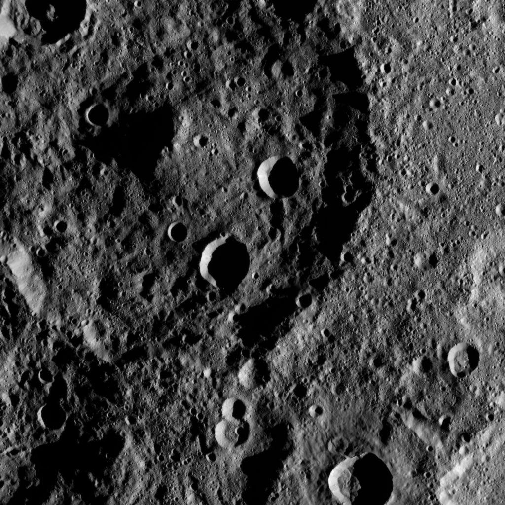
My
List |
Addition Date
|
Target
|
Mission
|
Instrument
|
Size
|

|
2015-11-11 |
Mars
|
Mars Science Laboratory (MSL)
|
MAHLI
|
573x438x3 |
|
-
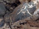
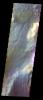
PIA19926:
-
Injection of Light Material into an Older Dark Vein
Full Resolution:
TIFF
(753.4 kB)
JPEG
(40.18 kB)
|
|
|
2015-11-11 |
Mars
|
Mars Science Laboratory (MSL)
|
MAHLI
|
628x446x3 |
|
-
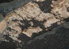
PIA19925:
-
Crystal Growth Texture in Light Vein at 'Garden City'
Full Resolution:
TIFF
(840.8 kB)
JPEG
(60.26 kB)
|
|
|
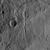
2015-11-11 |
Mars
|
Mars Science Laboratory (MSL)
|
ChemCam
|
847x388x1 |
|
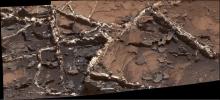
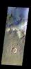
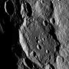
-
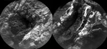
PIA19924:
-
Thick, Dark Veins at 'Garden City,' Mars
Full Resolution:
TIFF
(311.2 kB)
JPEG
(49.1 kB)
|
|
|
2015-11-11 |
Mars
|
Mars Science Laboratory (MSL)
|
ChemCam
|
949x396x3 |
|
-
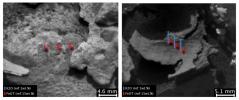
PIA19923:
-
Dark, Thin Fracture-Filling Material
Full Resolution:
TIFF
(554.9 kB)
JPEG
(50.57 kB)
|
|
|
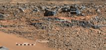
2015-11-11 |
Mars
|
Mars Science Laboratory (MSL)
|
Mastcam
|
1505x685x3 |
|
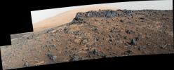
-
PIA19922:
-
'Garden City' Vein Complex on Lower Mount Sharp, Mars
Full Resolution:
TIFF
(3.093 MB)
JPEG
(179.7 kB)
|
|
|
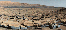
2015-11-11 |
Mars
|
Mars Science Laboratory (MSL)
|
Mastcam
|
5572x2246x3 |
|
-
PIA19921:
-
Veiny 'Garden City' Site and Surroundings on Mount Sharp, Mars
Full Resolution:
TIFF
(30.62 MB)
JPEG
(2.718 MB)
|
|
|
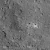
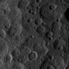
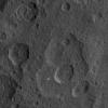
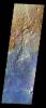
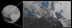
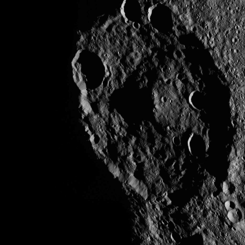
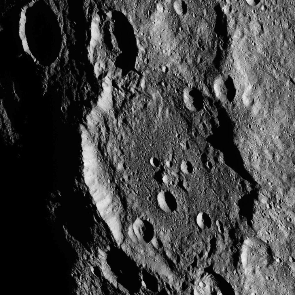
2015-11-11 |
Ceres
|
Dawn
|
Framing Camera
|
1024x1024x1 |
|
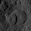
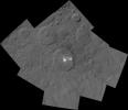
-
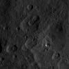
PIA20000:
-
Dawn HAMO Image 57
Full Resolution:
TIFF
(1.05 MB)
JPEG
(148.8 kB)
|
|
|
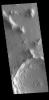
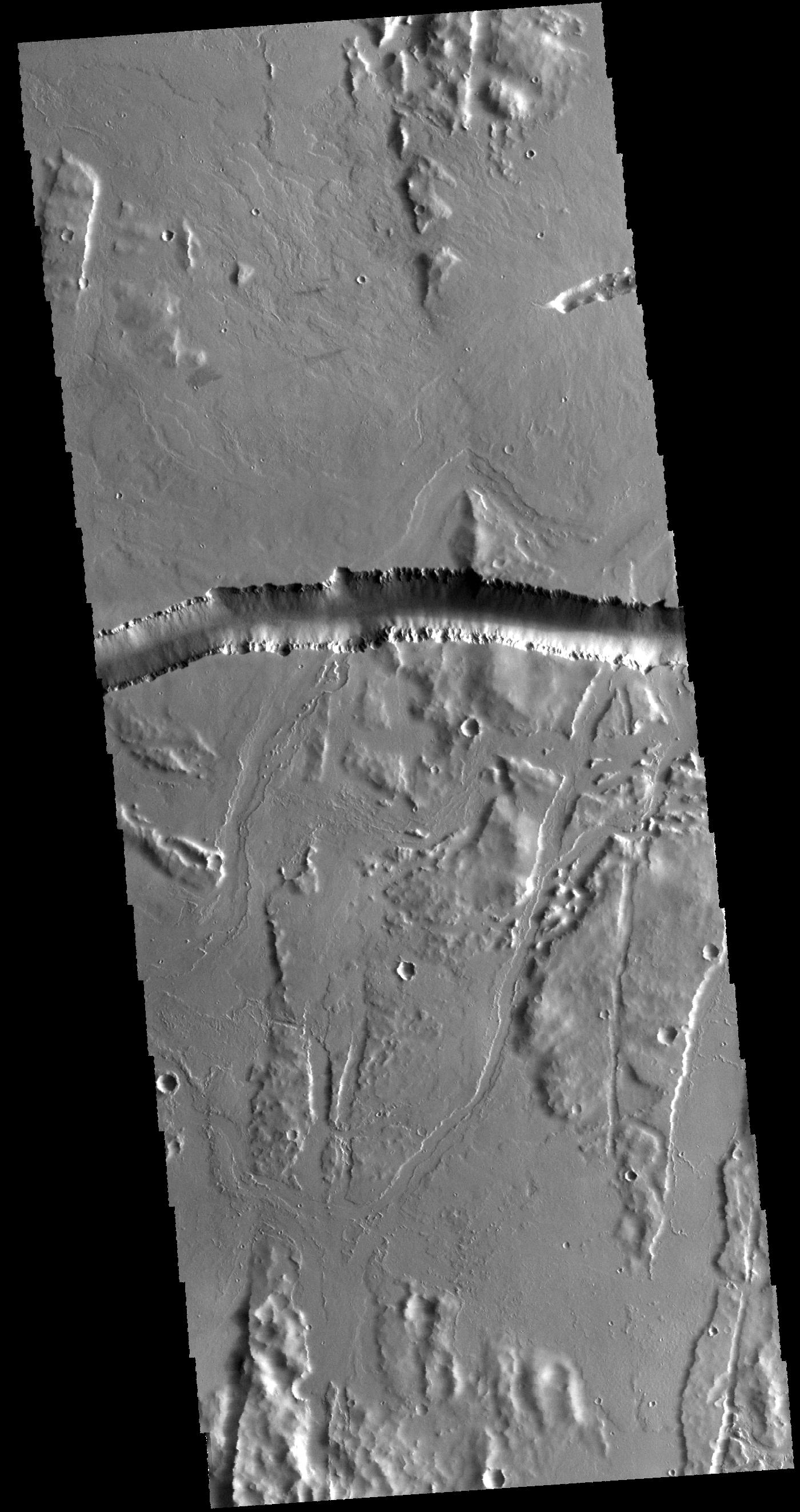
2015-11-11 |
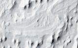
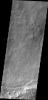
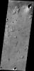
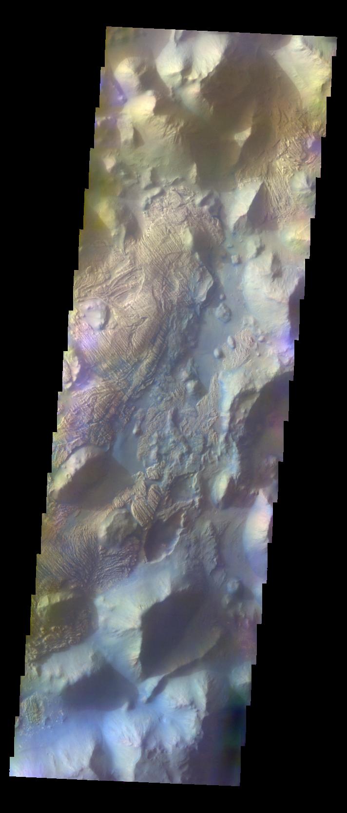
Mars
|
2001 Mars Odyssey
|
THEMIS
|
723x1459x1 |
|
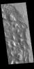
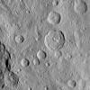
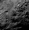
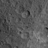
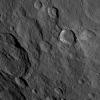
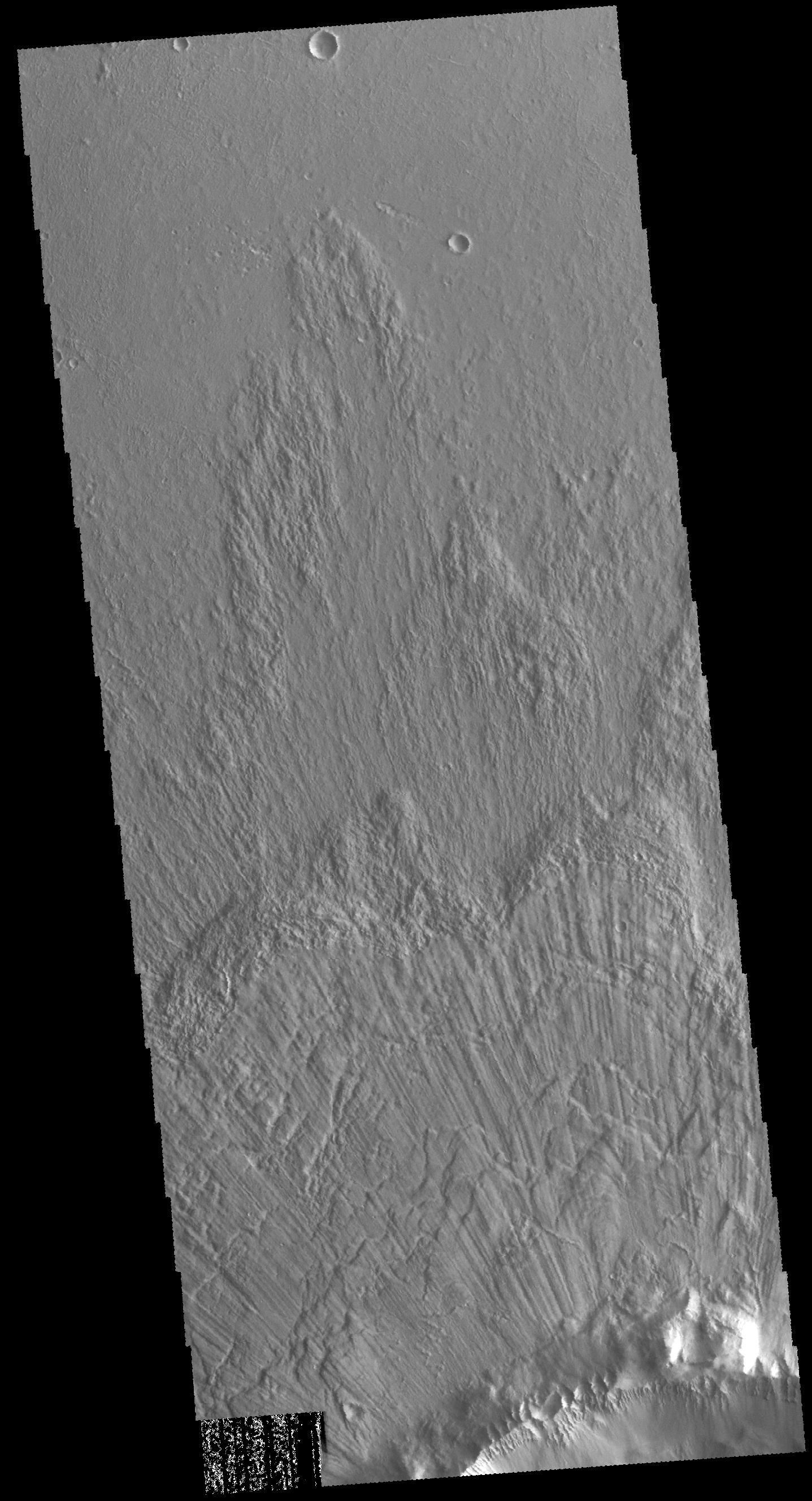
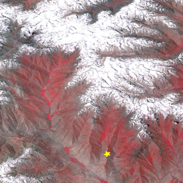
-
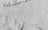
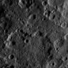
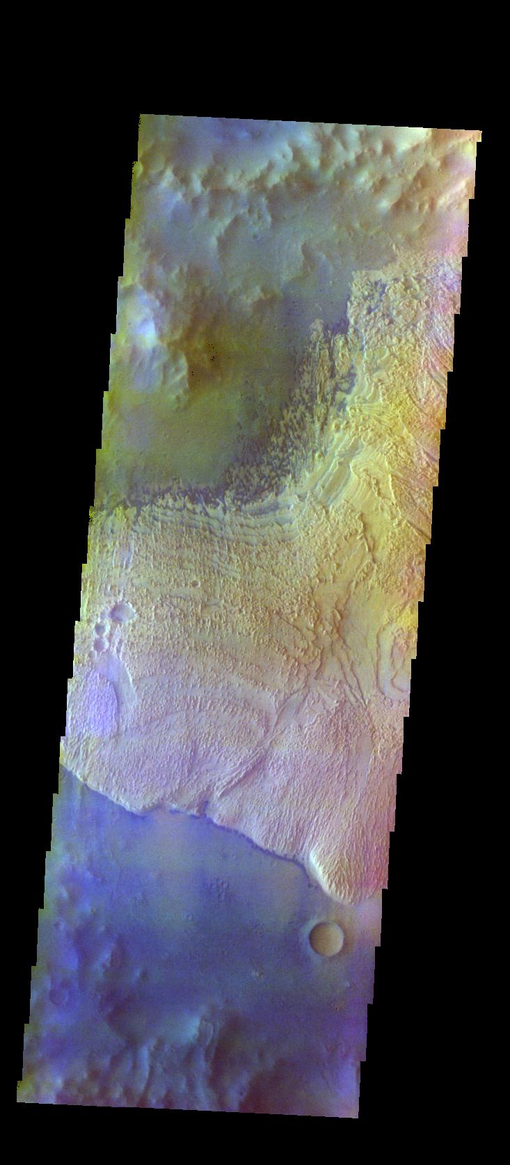
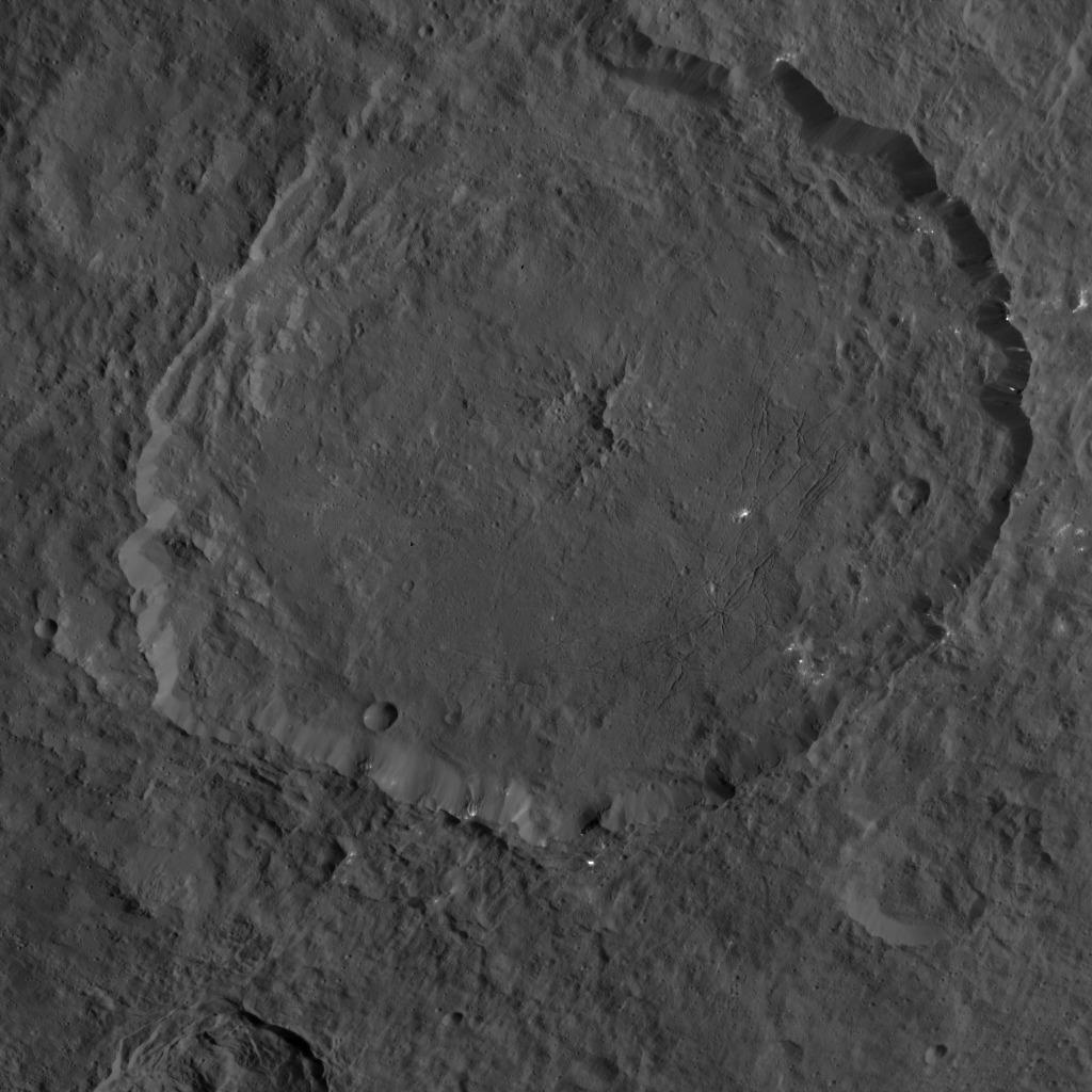
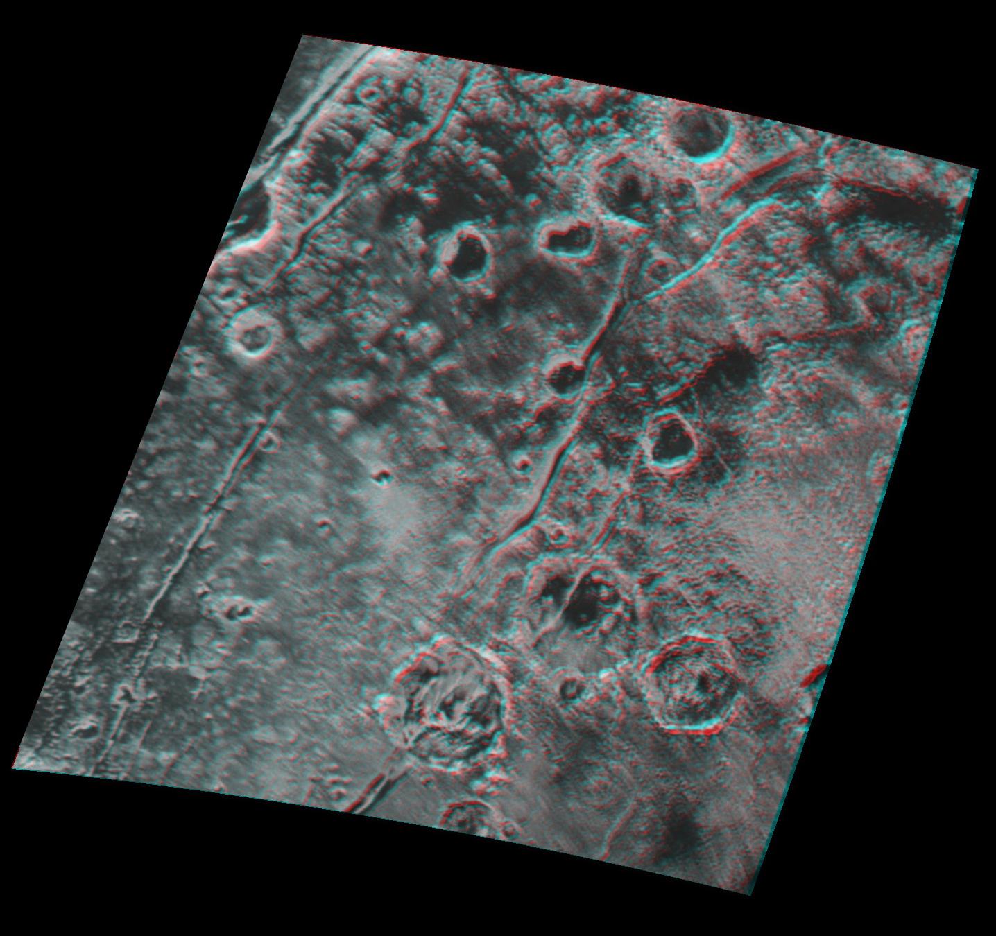
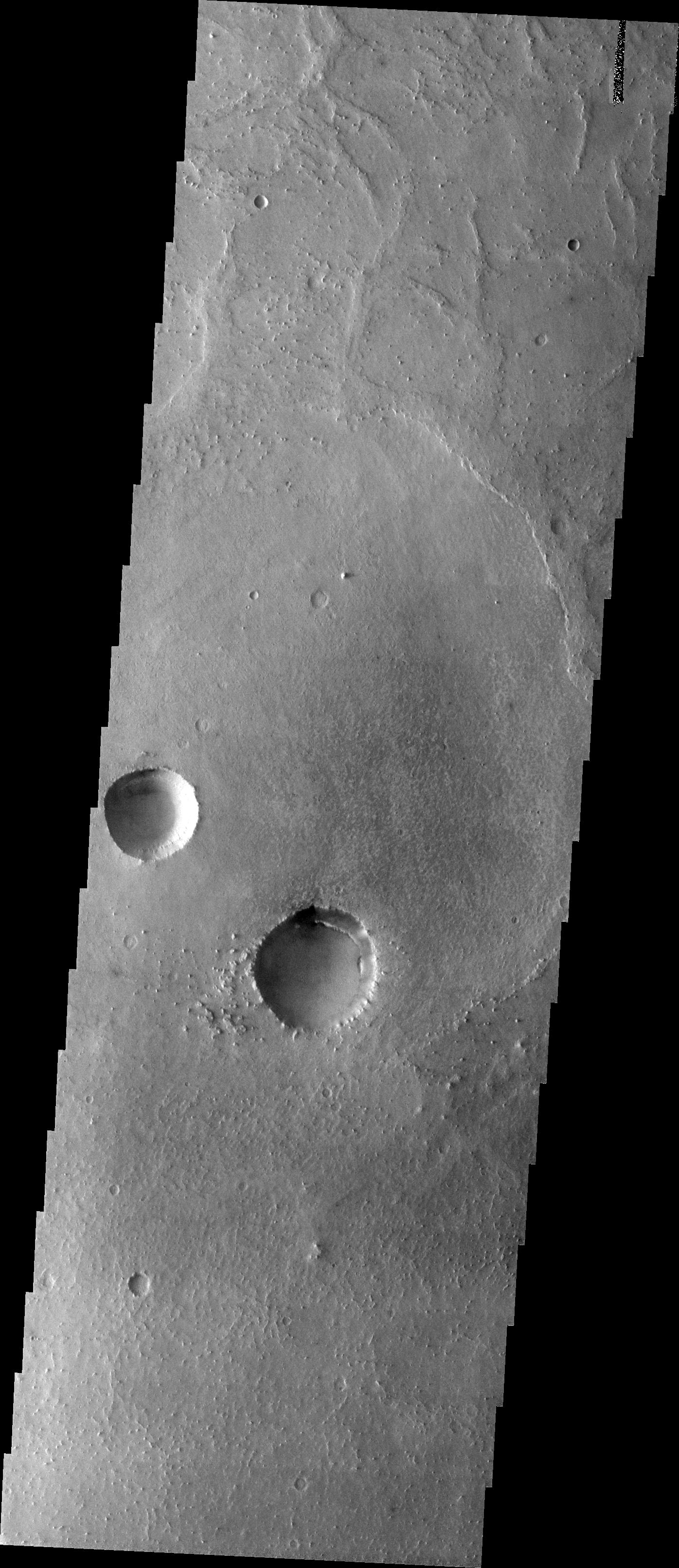
PIA20090:
-
Crater Chaos
Full Resolution:
TIFF
(775.6 kB)
JPEG
(96.58 kB)
|
|
|
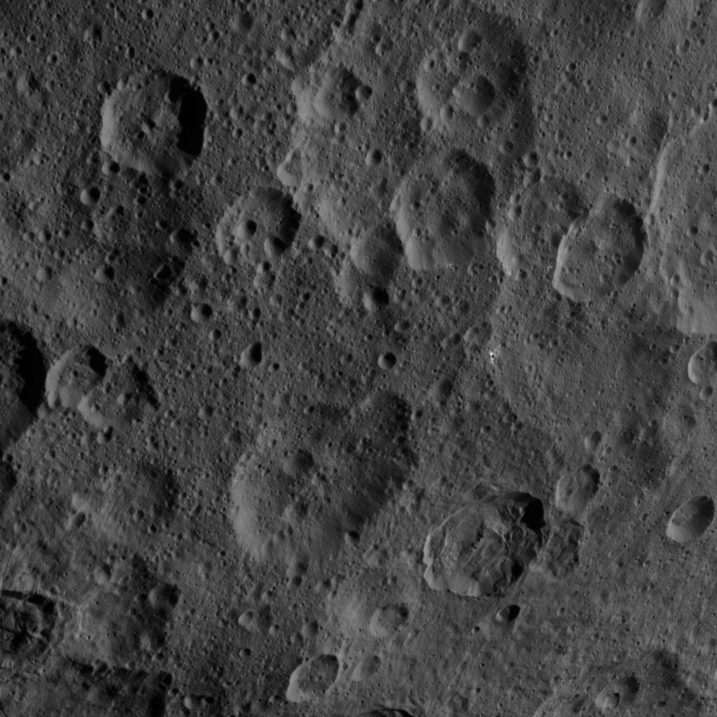
2015-11-10 |
Ceres
|
Dawn
|
Framing Camera
|
1024x1024x1 |
|
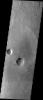
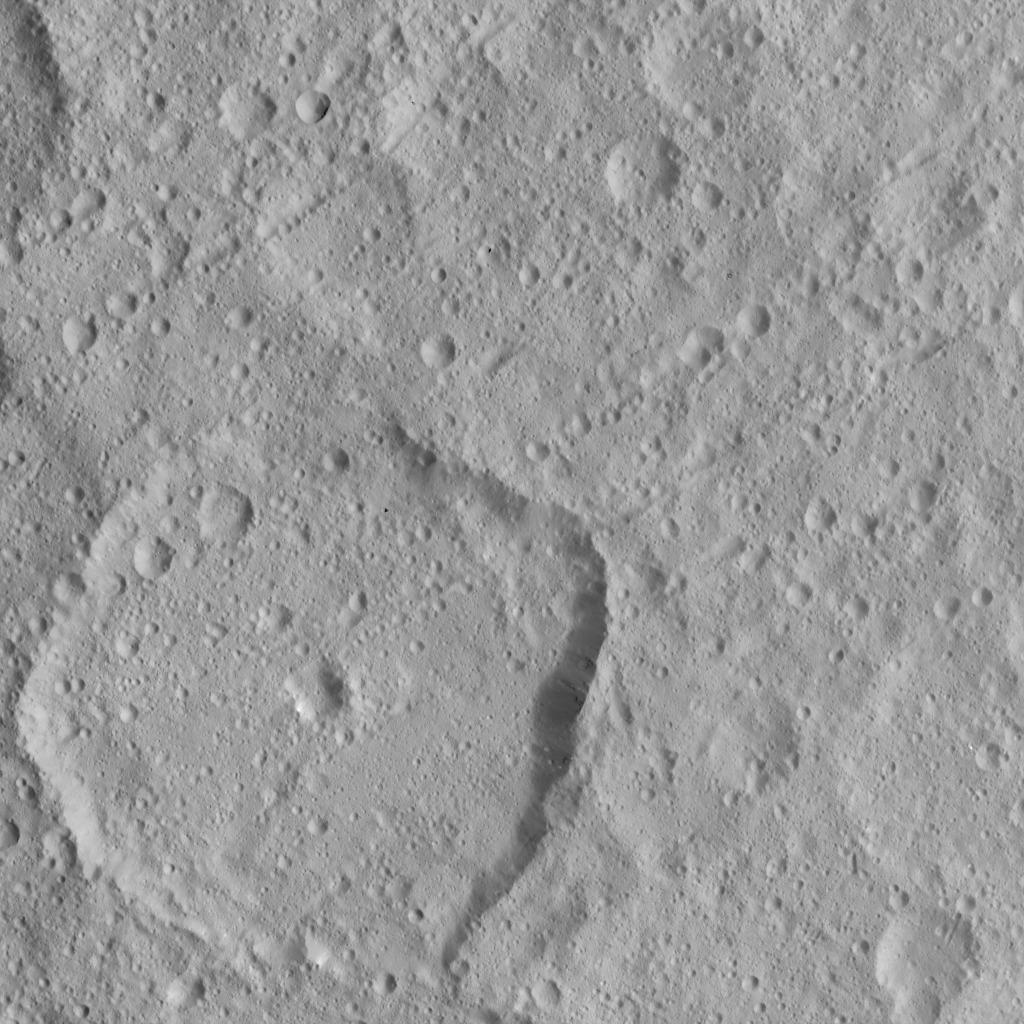
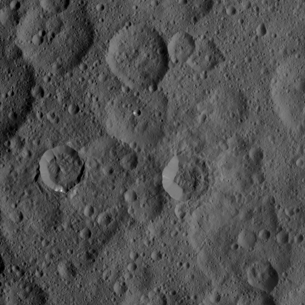
-
PIA19999:
-
Dawn HAMO Image 56
Full Resolution:
TIFF
(1.05 MB)
JPEG
(195.8 kB)
|
|
|
2015-11-10 |
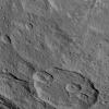
Mars
|
2001 Mars Odyssey
|
THEMIS
|
1423x2651x1 |
|
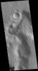
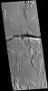
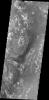
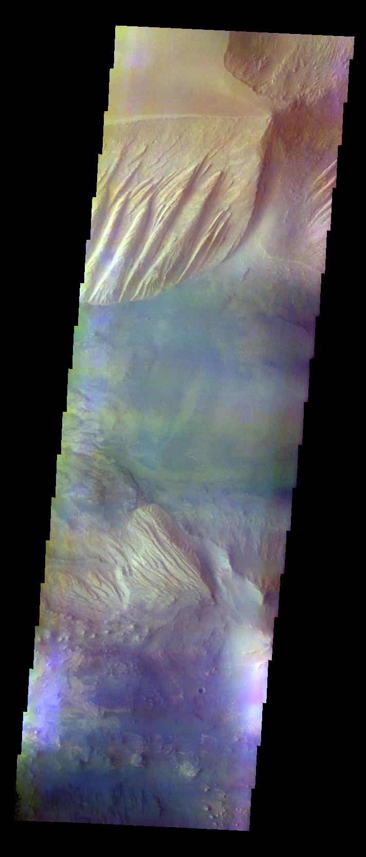
-
PIA20089:
-
Auqakuh Vallis
Full Resolution:
TIFF
(2.683 MB)
JPEG
(289.1 kB)
|
|
|
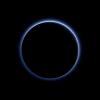
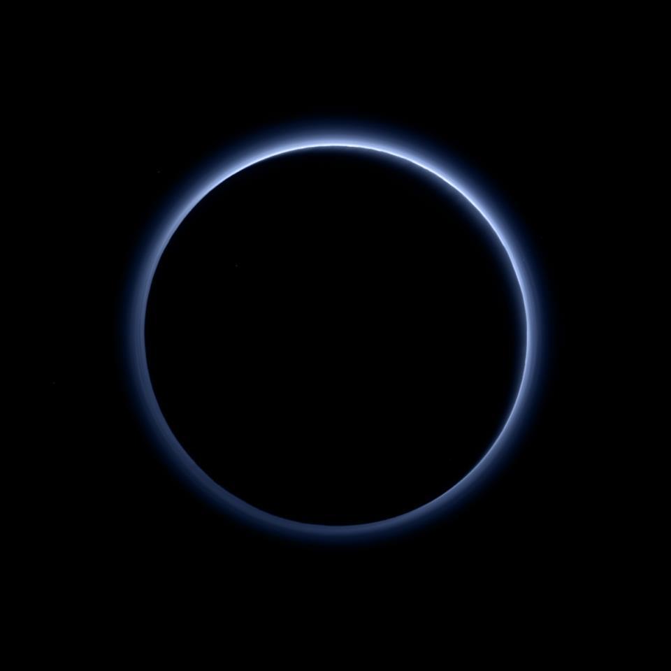
2015-11-10 |
Pluto
|
New Horizons
|
LORRI
|
879x906x1 |
|
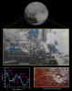
-
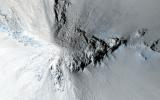
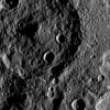
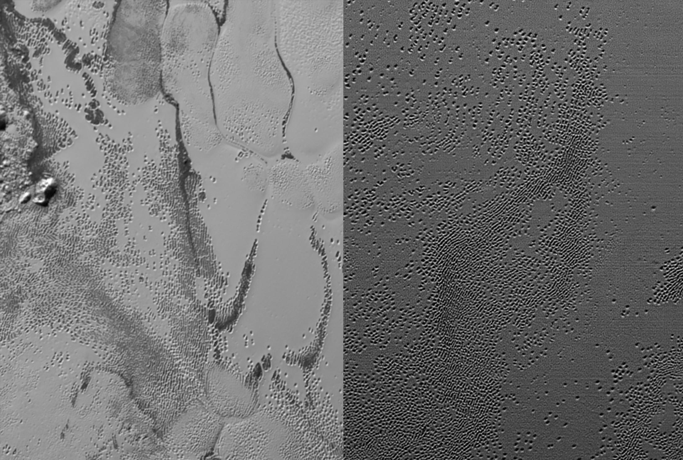
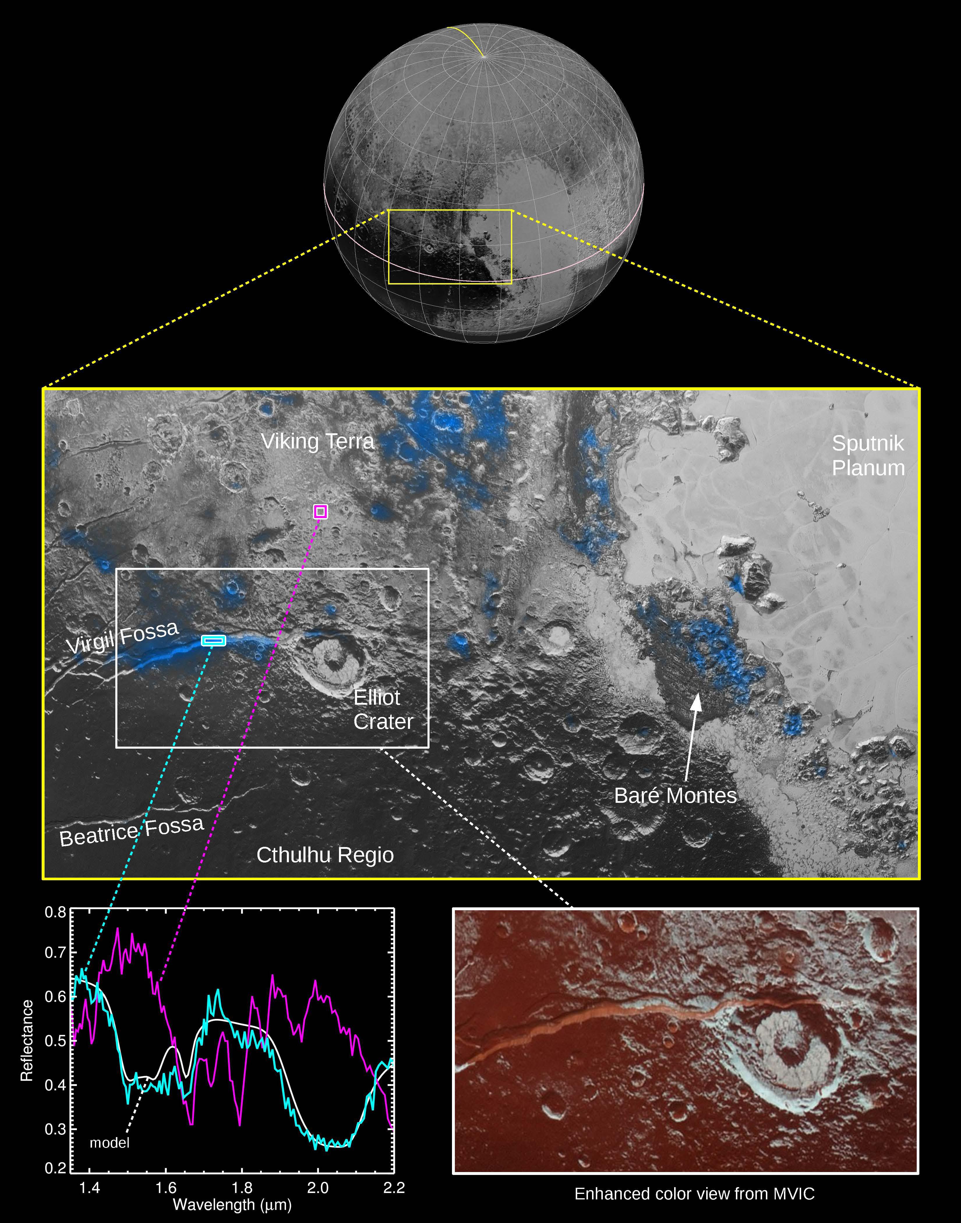
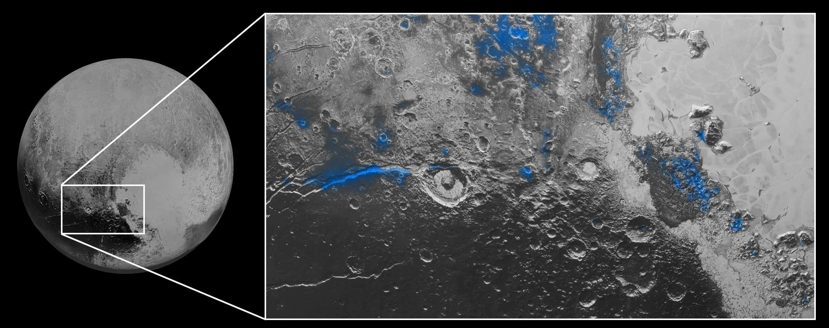
PIA20155:
-
Ice Volcanoes on Pluto?
Full Resolution:
TIFF
(797.4 kB)
JPEG
(207.4 kB)
|
|
|
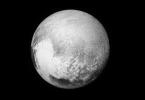
2015-11-10 |
Pluto
|
New Horizons
|
LORRI
|
903x471x3 |
|
-
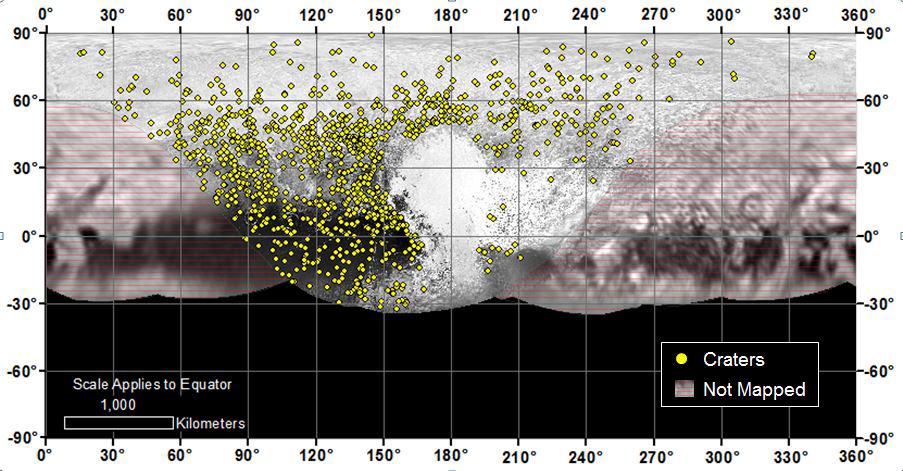
PIA20154:
-
Craters of All Ages and Sizes
Full Resolution:
TIFF
(780.5 kB)
JPEG
(101.6 kB)
|
|
|
2015-11-10 |
Pluto
|
New Horizons
|
LORRI
|
3000x1500x3 |
|
-
PIA20153:
-
Merged Bodies
Full Resolution:
TIFF
(1.766 MB)
JPEG
(167.7 kB)
|
|
|
2015-11-10 |
Pluto
|
New Horizons
|
|
1016x766x3 |
|
-
PIA20152:
-
Spinning Moons
Full Resolution:
TIFF
(155.4 kB)
JPEG
(30.31 kB)
|
|
|
2015-11-10 |
Pluto
|
New Horizons
|
LORRI
|
2200x1480x1 |
|
-
PIA20151:
-
Pluto's Pits
Full Resolution:
TIFF
(3.26 MB)
JPEG
(468 kB)
|
|
|
2015-11-10 |
Pluto
|
New Horizons
|
LORRI
|
974x1859x3 |
|
-
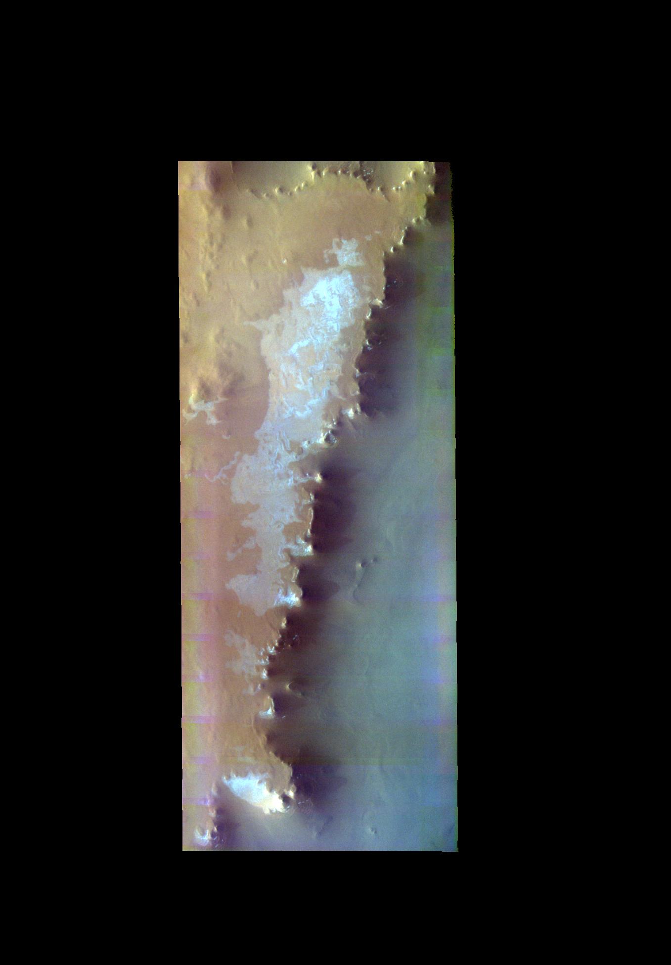
PIA20050:
-
Ice Volcanoes and Topography
Full Resolution:
TIFF
(5.434 MB)
JPEG
(408.8 kB)
|
|
|
2015-11-09 |
Ceres
|
Dawn
|
Framing Camera
|
1024x1024x1 |

|
-
PIA19998:
-
Dawn HAMO Image 55
Full Resolution:
TIFF
(1.05 MB)
JPEG
(163.6 kB)
|
|
|
2015-11-09 |
Mars
|
2001 Mars Odyssey
|
THEMIS
|
1437x2654x1 |

|
-
PIA20088:
-
Bacolor Crater Ejecta
Full Resolution:
TIFF
(2.789 MB)
JPEG
(408.4 kB)
|
|
|
2015-11-06 |
Earth
|
RapidScat
|
ISS-RapidScat
|
2816x2134x3 |
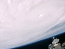
|
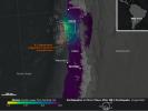
-
PIA20049:
-
RapidScat and Hurricane Patricia

Full Resolution:
TIFF
(8.031 MB)
JPEG
(159.9 kB)
|
|
|
2015-11-06 |
Ceres
|
Dawn
|
Framing Camera
|
1024x1024x1 |

|
-
PIA19997:
-
Dawn HAMO Image 54
Full Resolution:
TIFF
(1.05 MB)
JPEG
(152.7 kB)
|
|
|
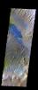
2015-11-06 |
Mars
|
2001 Mars Odyssey
|
THEMIS
|
712x1665x3 |
|
-
PIA20087:
-
Candor Chasma - False Color
Full Resolution:
TIFF
(2.59 MB)
JPEG
(108.4 kB)
|
|
|
2015-11-05 |
Ceres
|
Dawn
|
Framing Camera
|
1024x1024x1 |
|
-
PIA19995:
-
Dawn HAMO Image 53
Full Resolution:
TIFF
(1.05 MB)
JPEG
(202.8 kB)
|
|
|
2015-11-05 |
Mars
|
2001 Mars Odyssey
|
THEMIS
|
733x1674x3 |
|
-
PIA20085:
-
Becquerel Crater - False Color
Full Resolution:
TIFF
(2.544 MB)
JPEG
(123.7 kB)
|
|
|
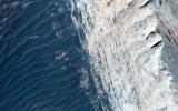
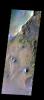
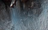
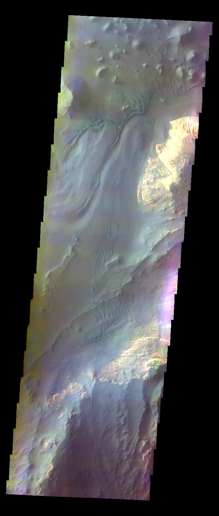
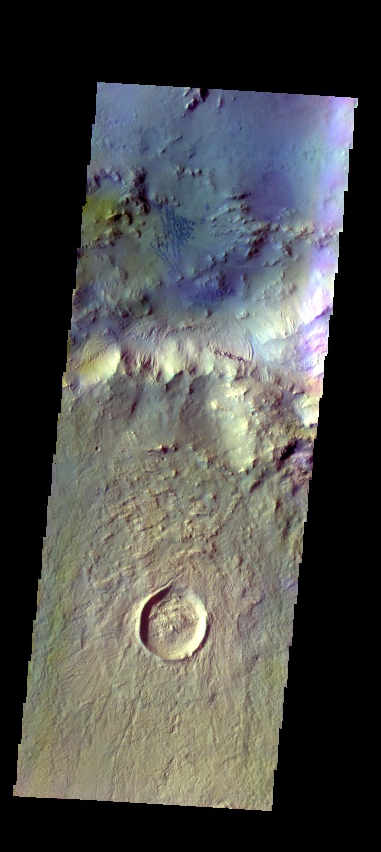
2015-11-05 |
Mars
|
Mars Reconnaissance Orbiter (MRO)
|
HiRISE
|
2880x1800x3 |
|
-
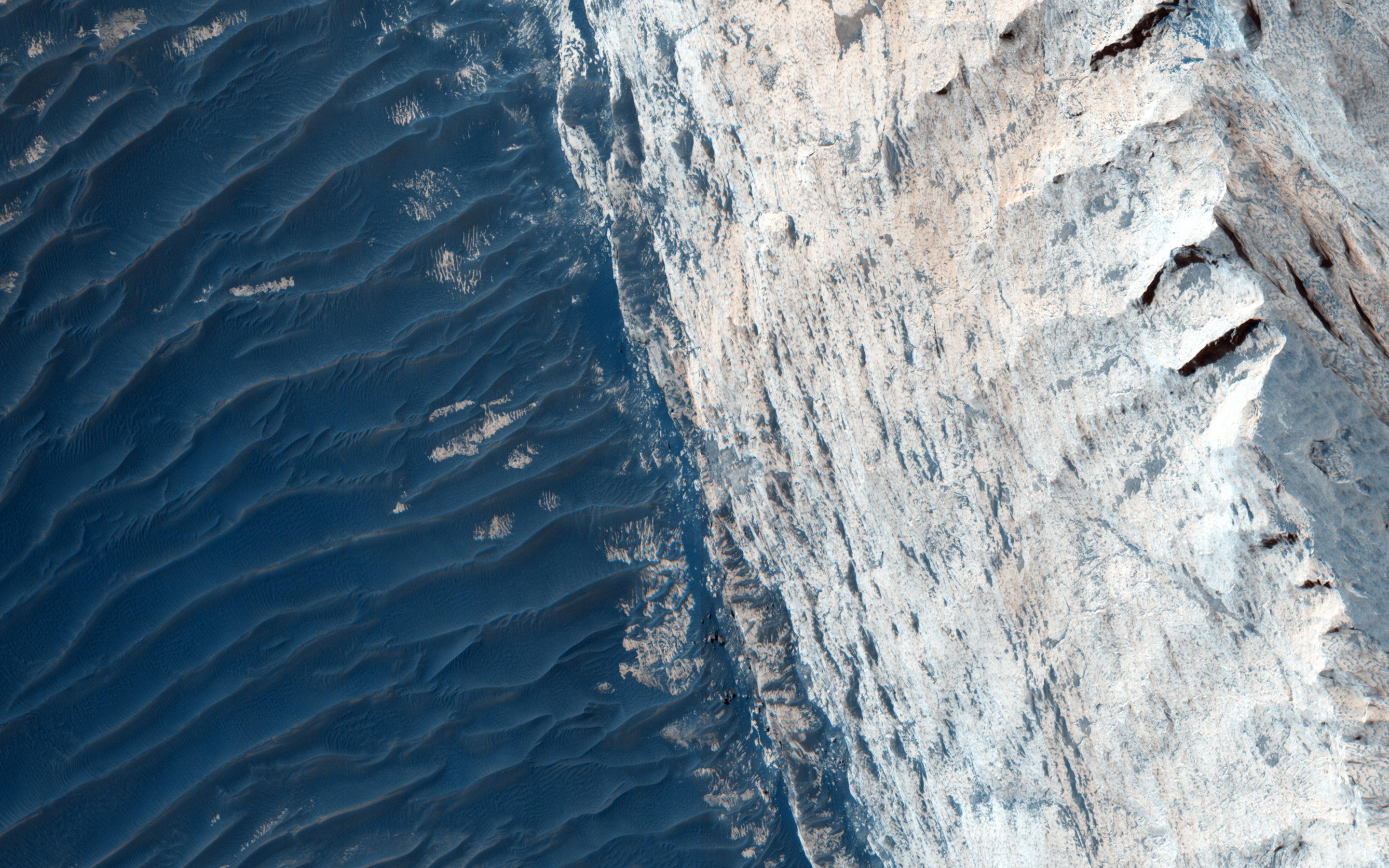
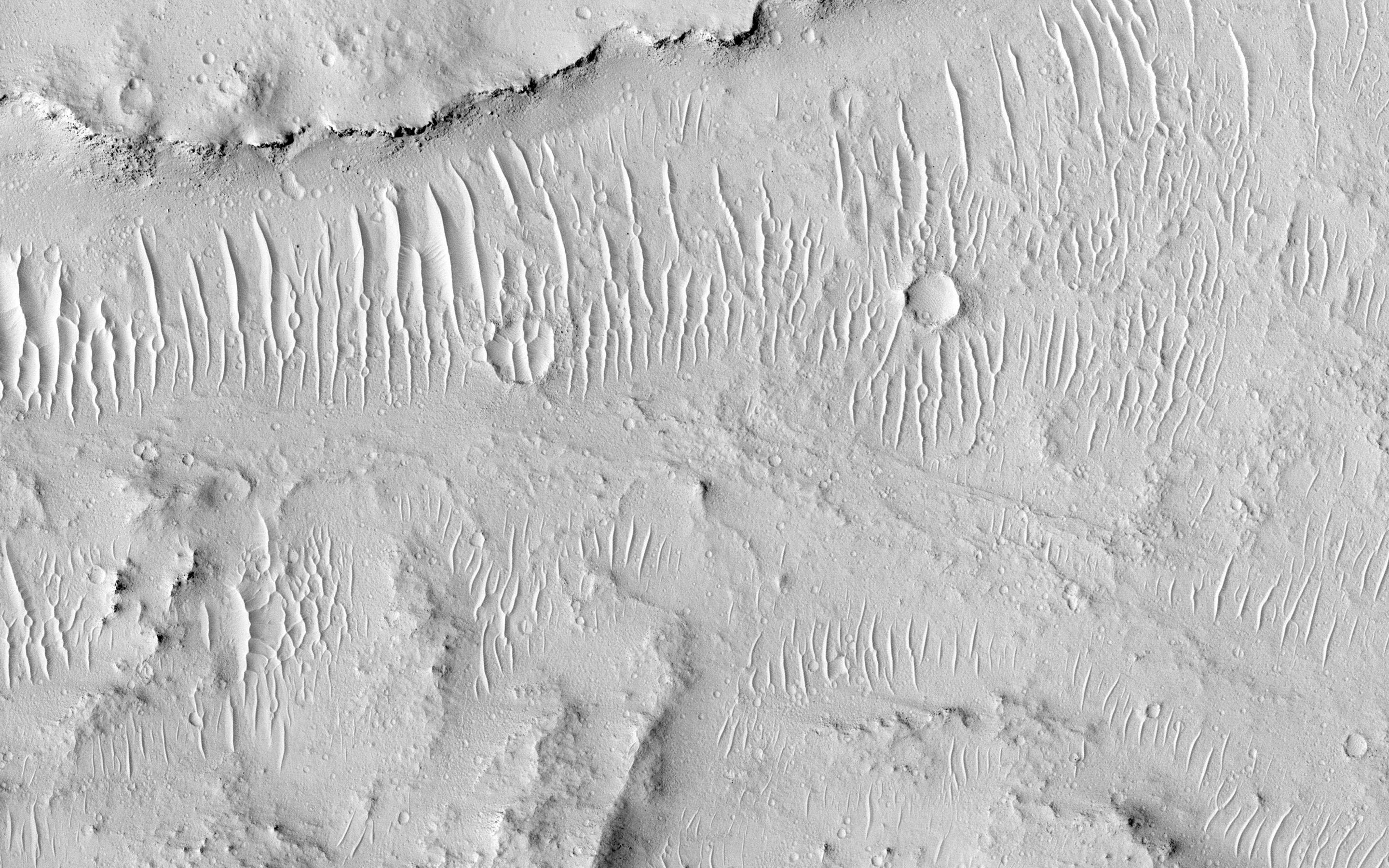
PIA20047:
-
Meanders in Ridge Form in the Zephyria Region
Full Resolution:
TIFF
(13.52 MB)
JPEG
(673.1 kB)
|
|
|
2015-11-05 |
Mars
|
Mars Reconnaissance Orbiter (MRO)
|
HiRISE
|
2880x1800x3 |

|
-
PIA20046:
-
Small Channels and a Rocky Patch in the Cydonia Region
Full Resolution:
TIFF
(15.56 MB)
JPEG
(1.167 MB)
|
|
|
2015-11-05 |
Mars
|
Mars Reconnaissance Orbiter (MRO)
|
HiRISE
|
2880x1800x1 |

|
-
PIA20045:
-
Marching Dust Devils
Full Resolution:
TIFF
(5.191 MB)
JPEG
(1.254 MB)
|
|
|
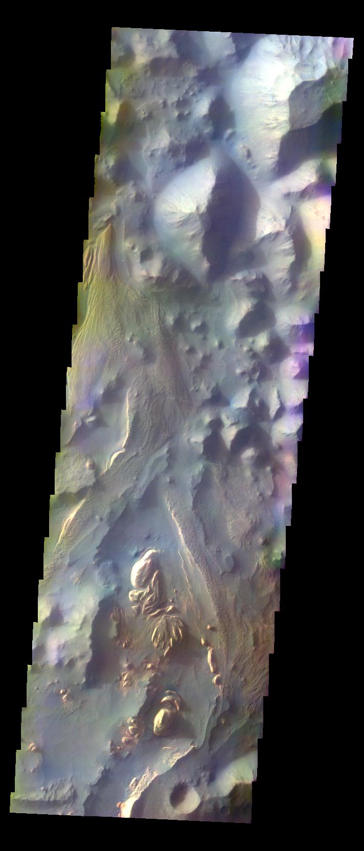
2015-11-05 |
Mars
|
Mars Reconnaissance Orbiter (MRO)
|
HiRISE
|
2880x1800x3 |
|
-
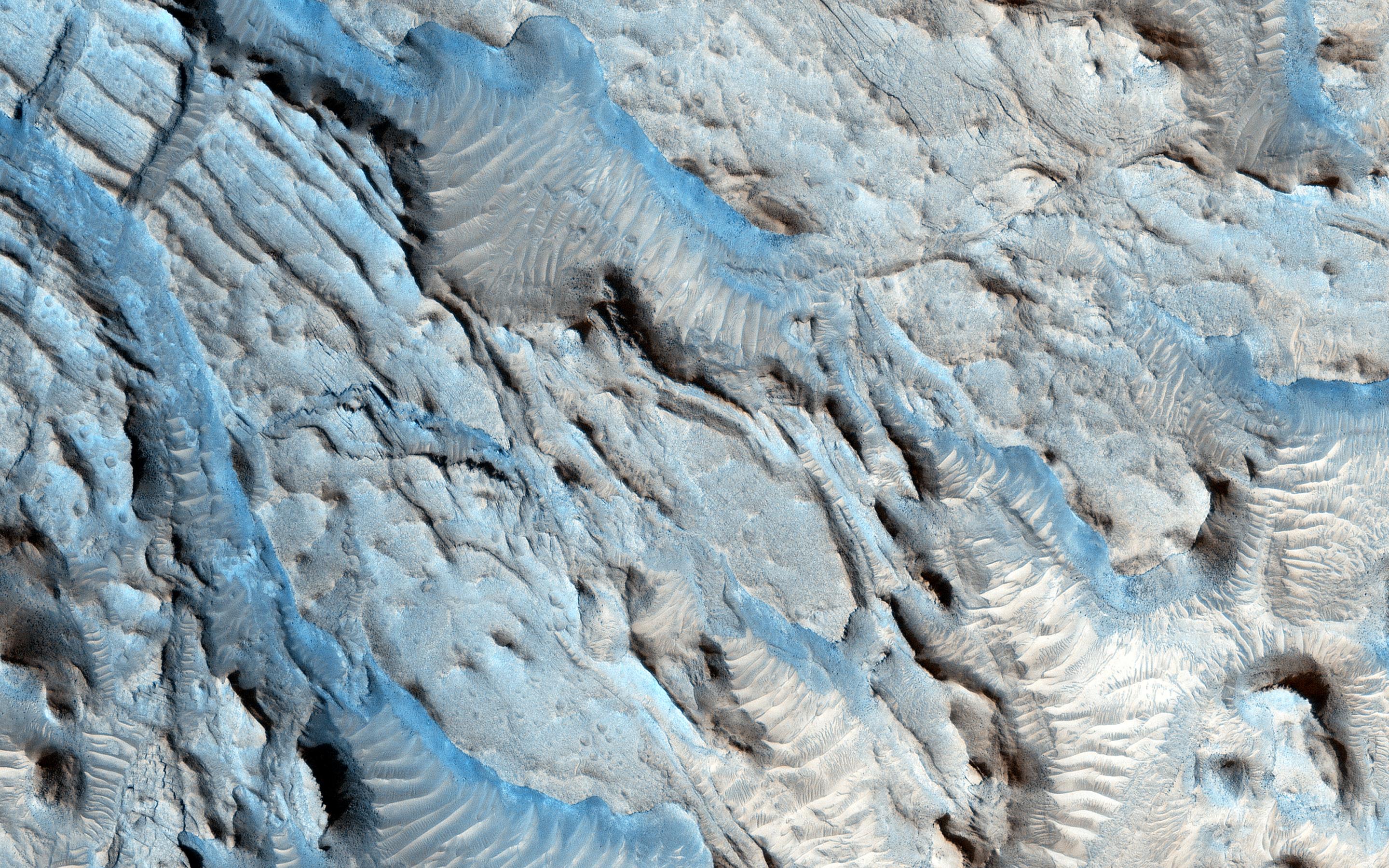
PIA20044:
-
Layers and Fractures in Ophir Chasma
Full Resolution:
TIFF
(15.56 MB)
JPEG
(815.3 kB)
|
|
|
2015-11-04 |
Ceres
|
Dawn
|
Framing Camera
|
1024x1024x1 |
|
-
PIA19994:
-
Dawn HAMO Image 52
Full Resolution:
TIFF
(1.05 MB)
JPEG
(165.9 kB)
|
|
|
2015-11-04 |
Mars
|
2001 Mars Odyssey
|
THEMIS
|
711x1665x3 |
|
-
PIA20084:
-
Hebes Chasma - False Color
Full Resolution:
TIFF
(2.418 MB)
JPEG
(99.01 kB)
|
|
|
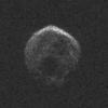
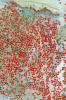
2015-11-03 |
Asteroid
|
Goldstone Deep Space Network (DSN)
|
Goldstone Solar System Radar
|
2172x1500x1 |
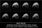
|
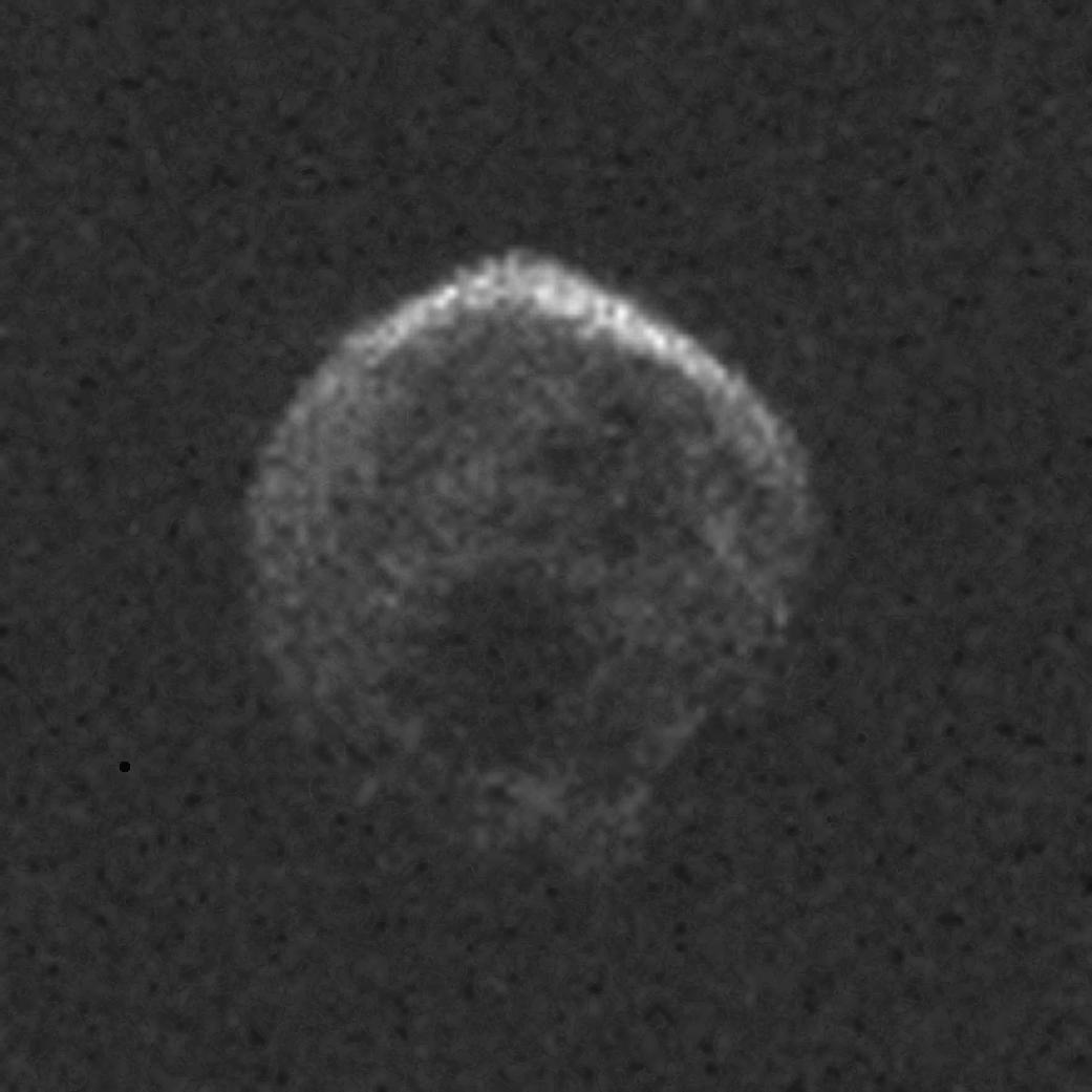
-
PIA20043:
-
Halloween Asteroid Rotation
Full Resolution:
TIFF
(629.7 kB)
JPEG
(408.6 kB)
|
|
|
2015-11-03 |
Ceres
|
Dawn
|
Framing Camera
|
1024x1024x1 |

|
-
PIA19993:
-
Dawn HAMO Image 51
Full Resolution:
TIFF
(982.2 kB)
JPEG
(126.2 kB)
|
|
|
2015-11-03 |
Mars
|
2001 Mars Odyssey
|
THEMIS
|
1357x1951x3 |

|
-
PIA20083:
-
Escorial Crater- False Color
Full Resolution:
TIFF
(2.952 MB)
JPEG
(121 kB)
|
|
|
2015-11-02 |
Earth
|
Terra
|
ASTER
|
1678x2134x3 |
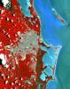
|
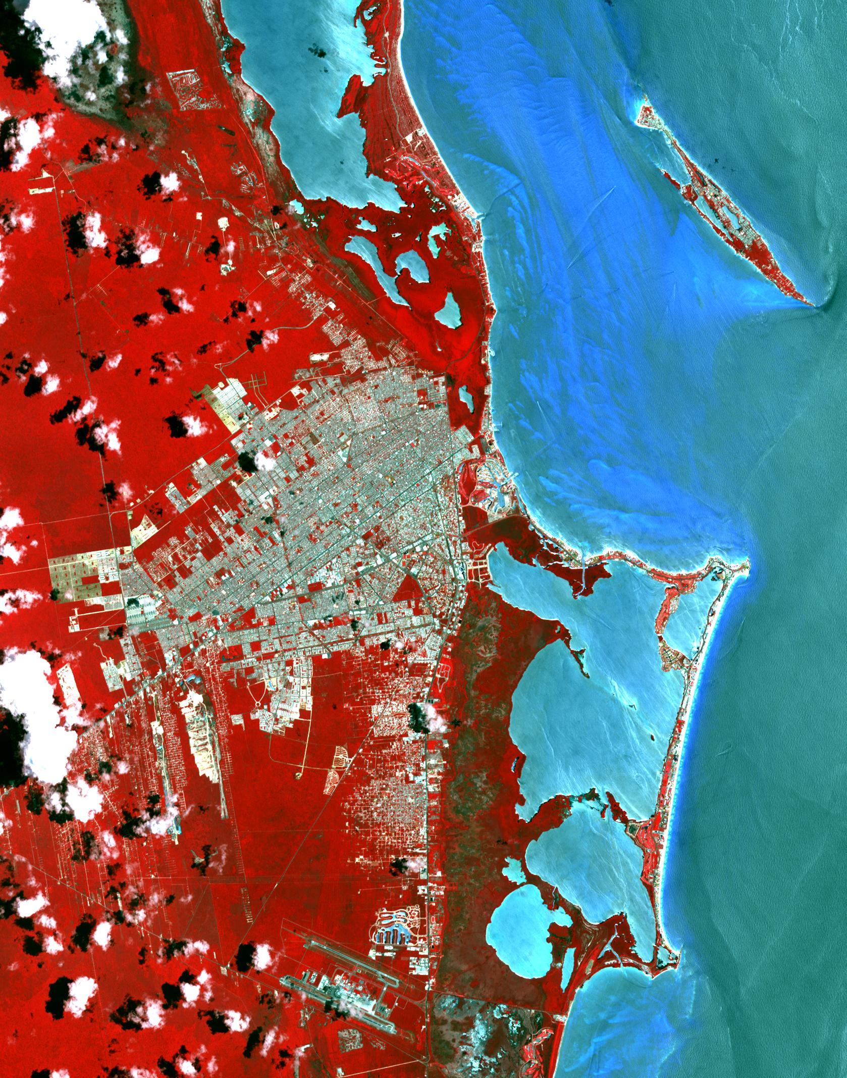
-
PIA20086:
-
Cancun, Mexico
Full Resolution:
TIFF
(10.75 MB)
JPEG
(711.6 kB)
|
|
|
2015-11-02 |
Ceres
|
Dawn
|
Framing Camera
|
1024x1024x1 |
|
-
PIA19992:
-
Dawn HAMO Image 50
Full Resolution:
TIFF
(1.05 MB)
JPEG
(154.5 kB)
|
|
|
2015-11-02 |
Mars
|
2001 Mars Odyssey
|
THEMIS
|
720x1668x3 |
|
-
PIA20082:
-
Danielson Crater Dunes - False Color
Full Resolution:
TIFF
(2.461 MB)
JPEG
(138.9 kB)
|
|
|
2015-10-30 |
Asteroid
|
|
Arecibo Observatory
|
1041x1041x1 |
|
-
PIA20041:
-
Halloween Asteroid Rotation
Full Resolution:
TIFF
(721.8 kB)
JPEG
(70.81 kB)
|
|
|
2015-10-30 |
Asteroid
|
|
Arecibo Observatory
|
1050x149x1 |
|
-
PIA20040:
First Radar Images of Halloween Asteroid
Full Resolution:
TIFF
(87.11 kB)
JPEG
(12.76 kB)
|
|
|
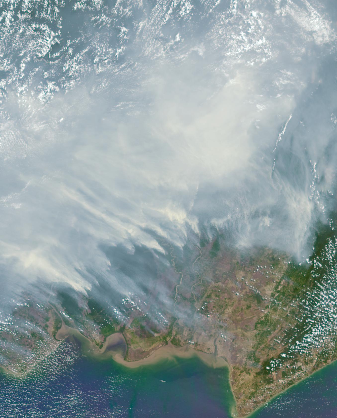
2015-10-30 |
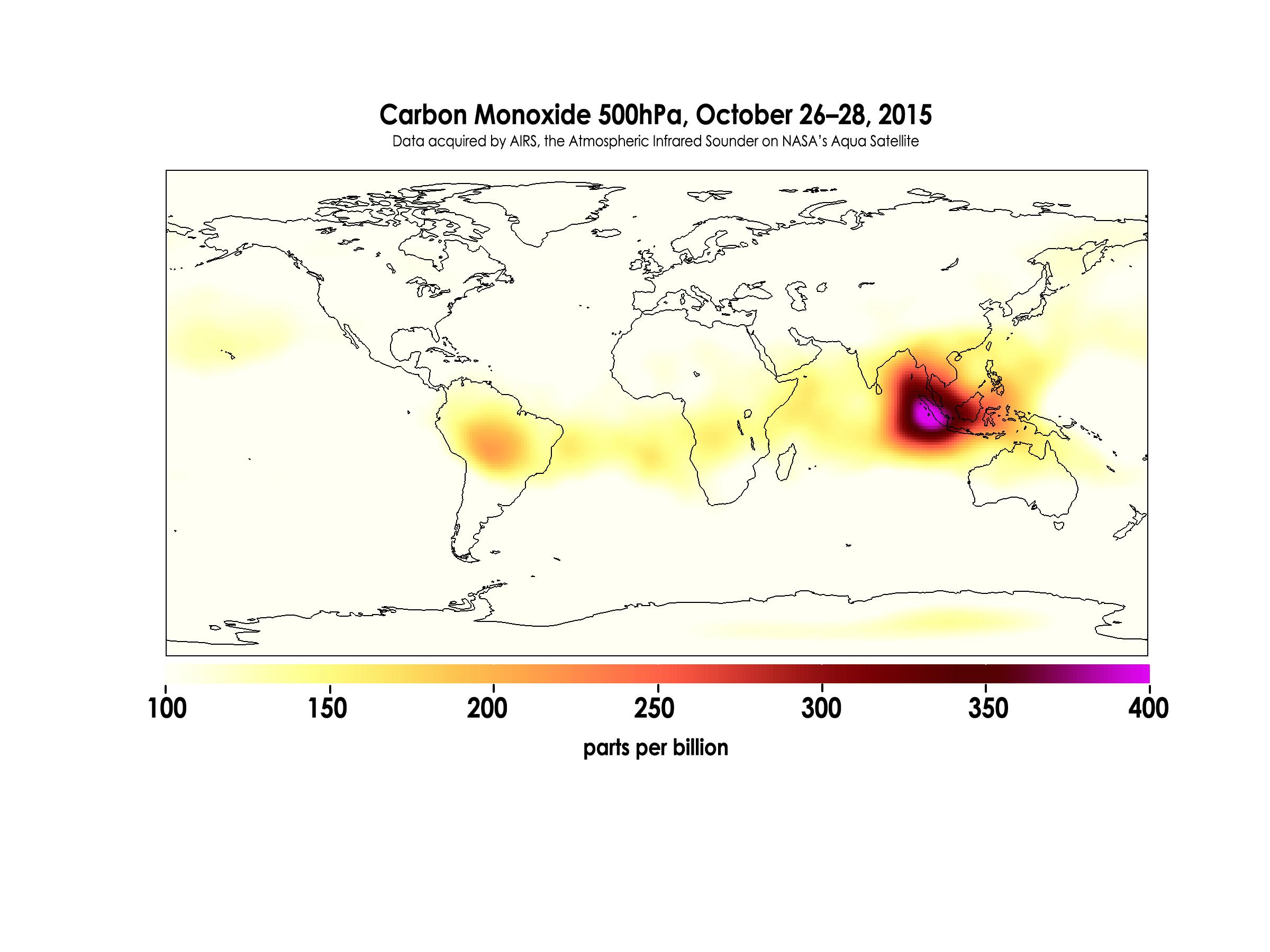
Earth
|
Aquarius
|
AIRS
|
2400x1800x3 |

|
-
PIA20042:
-
Carbon Monoxide in Mid-Troposphere over Indonesia Fires, October 2015
Full Resolution:
TIFF
(1.047 MB)
JPEG
(259.9 kB)
|
|
|
2015-10-30 |
Ceres
|
Dawn
|
Framing Camera
|
1024x1024x1 |
|
-
PIA19991:
-
Dawn HAMO Image 49
Full Resolution:
TIFF
(1.05 MB)
JPEG
(168.3 kB)
|
|
|
2015-10-30 |
Mars
|
2001 Mars Odyssey
|
THEMIS
|
743x1687x3 |
|
-
PIA20081:
-
Tyndall Crater - False Color
Full Resolution:
TIFF
(2.606 MB)
JPEG
(138.4 kB)
|
|
|
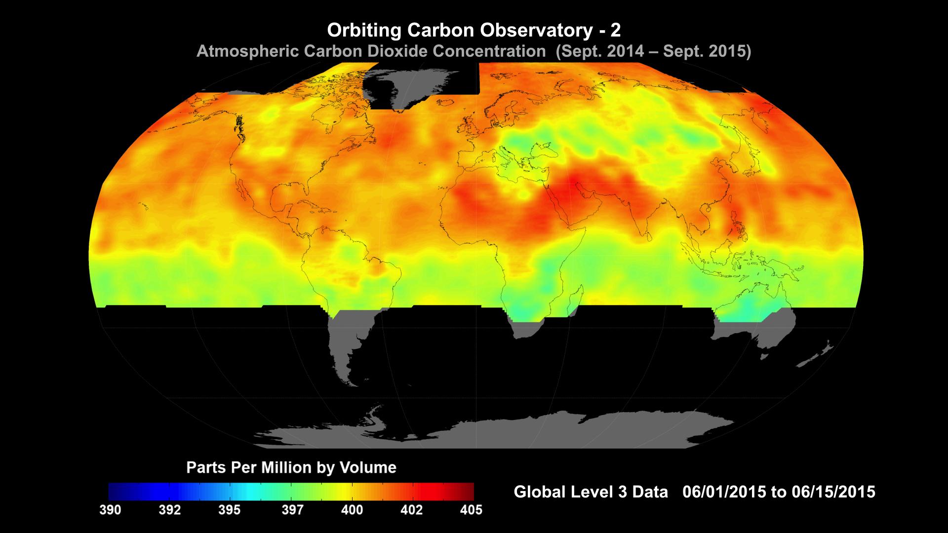
2015-10-29 |
Earth
|
OCO-2
|
OCO-2
|
1920x1080x3 |

|
-
PIA20039:
-
NASA Carbon Sleuth Begins Year Two
Full Resolution:
TIFF
(1.773 MB)
JPEG
(162.3 kB)
|
|
|
2015-10-29 |
Pluto
|
New Horizons
|
MVIC
|
2000x1125x1 |
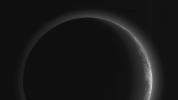
|
-
PIA20038:
-
A Full View of Pluto's Stunning Crescent
Full Resolution:
TIFF
(642.6 kB)
JPEG
(51.98 kB)
|
|
|
2015-10-29 |
Pluto
|
New Horizons
|
LORRI
|
1041x717x1 |
|
-
PIA20037:
-
Mapping Pluto's 'Broken Heart'
Full Resolution:
TIFF
(348.4 kB)
JPEG
(37.54 kB)
|
|
|
2015-10-29 |
Ceres
|
Dawn
|
Framing Camera
|
1024x1024x1 |
|
-
PIA19990:
-
Dawn HAMO Image 48
Full Resolution:
TIFF
(1.05 MB)
JPEG
(159.8 kB)
|
|
|
2015-10-29 |
Mars
|
2001 Mars Odyssey
|
THEMIS
|
712x1665x3 |

|
-
PIA20080:
-
Iani Chaos - False Color
Full Resolution:
TIFF
(2.564 MB)
JPEG
(98.89 kB)
|
|
|
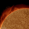
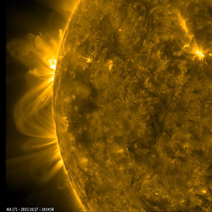
2015-10-28 |
Sol (our sun)
|
SDO
|
Atmosphere Imaging Assembly
|
720x720x3 |
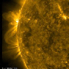
|
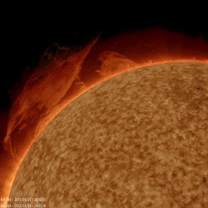
-
PIA20048:
-
Active Regions Blossoming
Full Resolution:
TIFF
(1.494 MB)
JPEG
(61.29 kB)
|
|
|
2015-10-28 |
Ceres
|
Dawn
|
Framing Camera
|
1024x1024x1 |

|
-
PIA19989:
-
Dawn HAMO Image 47
Full Resolution:
TIFF
(992.5 kB)
JPEG
(190.5 kB)
|
|
|
2015-10-28 |
Mars
|
2001 Mars Odyssey
|
THEMIS
|
709x1665x3 |
|
-
PIA20079:
-
Capri Mensa - False Color
Full Resolution:
TIFF
(2.451 MB)
JPEG
(90.88 kB)
|
|
|
2015-10-27 |
Earth
|
Terra
|
ASTER
|
732x734x3 |

|
-
PIA20035:
-
Earthquake in Hindu Kush Region, Afghanistan
Full Resolution:
TIFF
(1.479 MB)
JPEG
(143.1 kB)
|
|
|
2015-10-27 |
Ceres
|
Dawn
|
Framing Camera
|
1024x1024x1 |

|
-
PIA19988:
-
Dawn HAMO Image 46
Full Resolution:
TIFF
(611 kB)
JPEG
(122 kB)
|
|
|
2015-10-27 |
Mars
|
2001 Mars Odyssey
|
THEMIS
|
756x1690x3 |
|
-
PIA20078:
-
Bamberg Crater Dunes - False Color
Full Resolution:
TIFF
(2.601 MB)
JPEG
(127.3 kB)
|
|
|
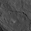
2015-10-26 |
Ceres
|
Dawn
|
Framing Camera
|
3558x3072x1 |
|
-
PIA19996:
-
Occator and Surrounding Terrain
Full Resolution:
TIFF
(5.459 MB)
JPEG
(797.7 kB)
|
|
|
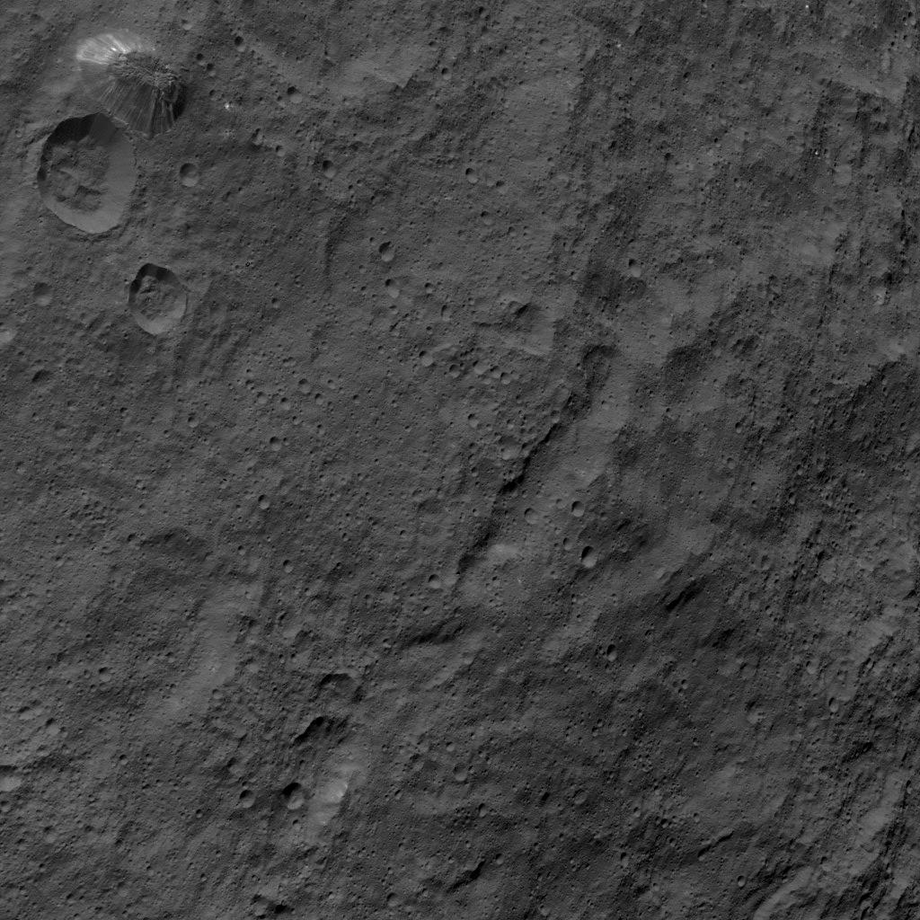
2015-10-26 |
Ceres
|
Dawn
|
Framing Camera
|
1024x1024x1 |
|
-
PIA19987:
-
Dawn HAMO Image 45
Full Resolution:
TIFF
(1.05 MB)
JPEG
(225.9 kB)
|
|
|
2015-10-26 |
Mars
|
2001 Mars Odyssey
|
THEMIS
|
712x1665x3 |
|
-
PIA20076:
-
Aureum Chaos - False Color
Full Resolution:
TIFF
(2.557 MB)
JPEG
(99.74 kB)
|
|
|
2015-10-23 |
Earth
|
RapidScat
|
ISS-RapidScat
|
584x593x3 |
|
-
PIA20031:
-
Hurricane Patricia Viewed by NASA's ISS-RapidScat
Full Resolution:
TIFF
(266.3 kB)
JPEG
(76.25 kB)
|
|
|
2015-10-23 |
Pluto
|
New Horizons
|
LORRI
|
1320x1277x1 |
|
-
PIA20034:
-
Kerberos Revealed
Full Resolution:
TIFF
(272.7 kB)
JPEG
(29.04 kB)
|
|
|
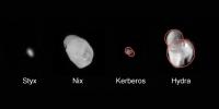
2015-10-23 |
Pluto
|
New Horizons
|
LORRI
|
1920x1080x1 |
|
-
PIA20033:
-
Family Portrait of Pluto's Moons
Full Resolution:
TIFF
(834.9 kB)
JPEG
(107.3 kB)
|
|
|
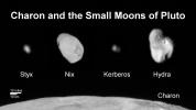
2015-10-23 |
Pluto
|
New Horizons
|
LORRI
|
1436x1350x3 |
|
-
PIA20032:
-
Pluto in 3-D
Full Resolution:
TIFF
(4.107 MB)
JPEG
(198.6 kB)
|
|
|
2015-10-23 |
Ceres
|
Dawn
|
Framing Camera
|
1024x1024x1 |
|
-
PIA19986:
-
Dawn HAMO Image 44
Full Resolution:
TIFF
(1.05 MB)
JPEG
(180.1 kB)
|
|
|
2015-10-23 |
Mars
|
2001 Mars Odyssey
|
THEMIS
|
606x2724x3 |
|
-
PIA20075:
-
Cloudy Day - False Color
Full Resolution:
TIFF
(2.215 MB)
JPEG
(94.62 kB)
|
|
|
2015-10-22 |
Ceres
|
Dawn
|
Framing Camera
|
1024x1024x1 |
|
-
PIA19985:
-
Dawn HAMO Image 43
Full Resolution:
TIFF
(997.1 kB)
JPEG
(139.7 kB)
|
|
|
2015-10-22 |
Mars
|
2001 Mars Odyssey
|
THEMIS
|
668x1435x3 |
|
-
PIA20074:
-
Proctor Crater Dunes - False Color
Full Resolution:
TIFF
(1.98 MB)
JPEG
(108 kB)
|
|
|
2015-10-21 |
Earth
|
Terra
|
MISR
|
1356x1682x3 |
|
-
PIA11218:
-
Borneo on Fire
Full Resolution:
TIFF
(6.253 MB)
JPEG
(246.6 kB)
|
|
|
2015-10-21 |
Ceres
|
Dawn
|
Framing Camera
|
1024x1024x1 |
|
-
PIA19984:
-
Dawn HAMO Image 42
Full Resolution:
TIFF
(1.05 MB)
JPEG
(220 kB)
|
|
|
2015-10-21 |
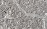
Mars
|
2001 Mars Odyssey
|
THEMIS
|
1444x2657x1 |
|
-
PIA20073:
-
Channels
Full Resolution:
TIFF
(2.701 MB)
JPEG
(280.7 kB)
|
|
|
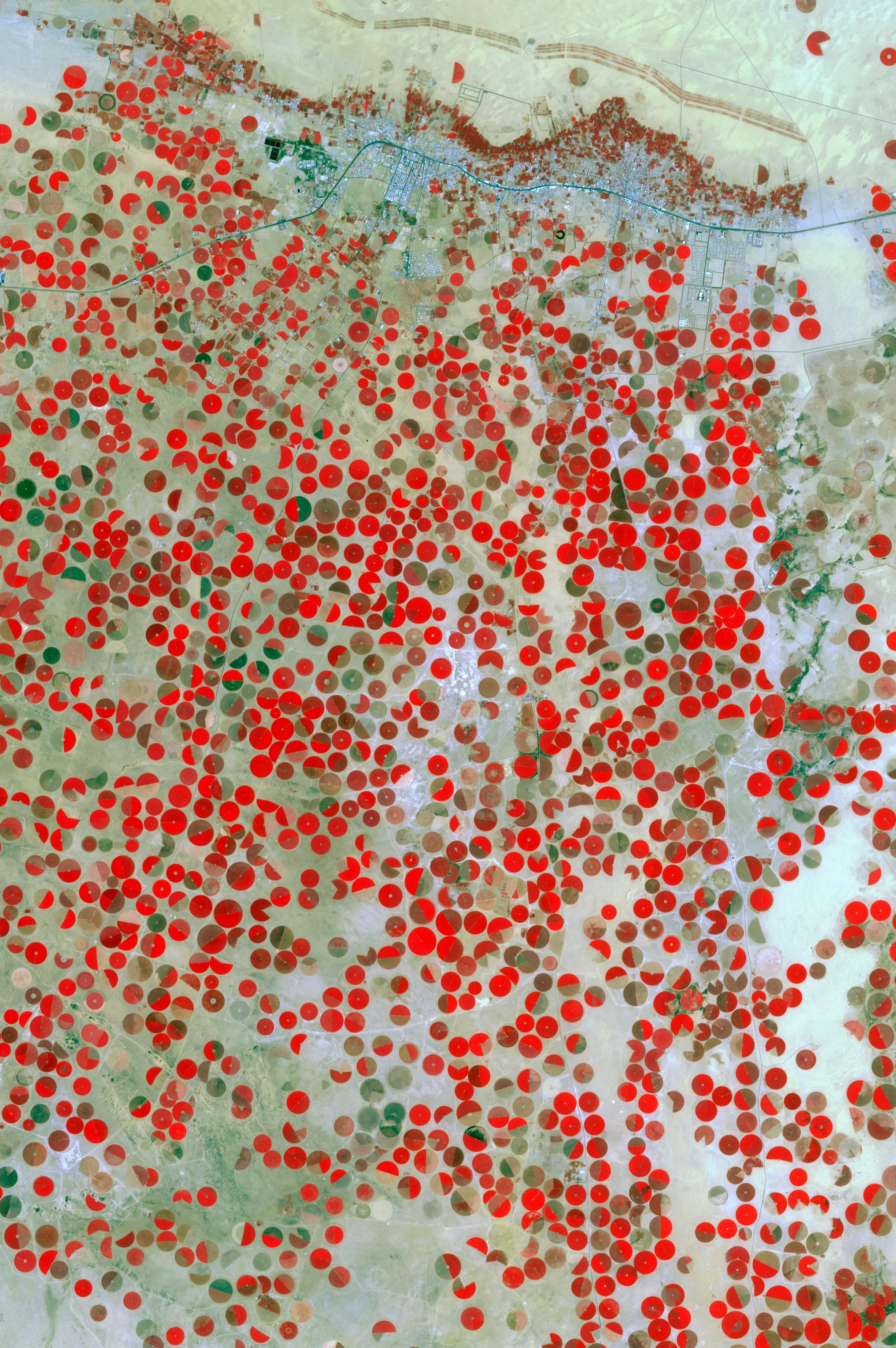
2015-10-20 |
Earth
|
Terra
|
ASTER
|
2034x3059x3 |
|
-
PIA20077:
-
Wadi Al Dawasir, Saudi Arabia
Full Resolution:
TIFF
(18.67 MB)
JPEG
(1.025 MB)
|
|
|
2015-10-20 |
Ceres
|
Dawn
|
Framing Camera
|
1024x1024x1 |
|
-
PIA19983:
-
Dawn HAMO Image 41
Full Resolution:
TIFF
(1.047 MB)
JPEG
(140.9 kB)
|
|
|
2015-10-20 |
Mars
|
2001 Mars Odyssey
|
THEMIS
|
711x1439x1 |
|
-
PIA20072:
-
Dark Slope Streaks
Full Resolution:
TIFF
(670.8 kB)
JPEG
(59.39 kB)
|
|
|
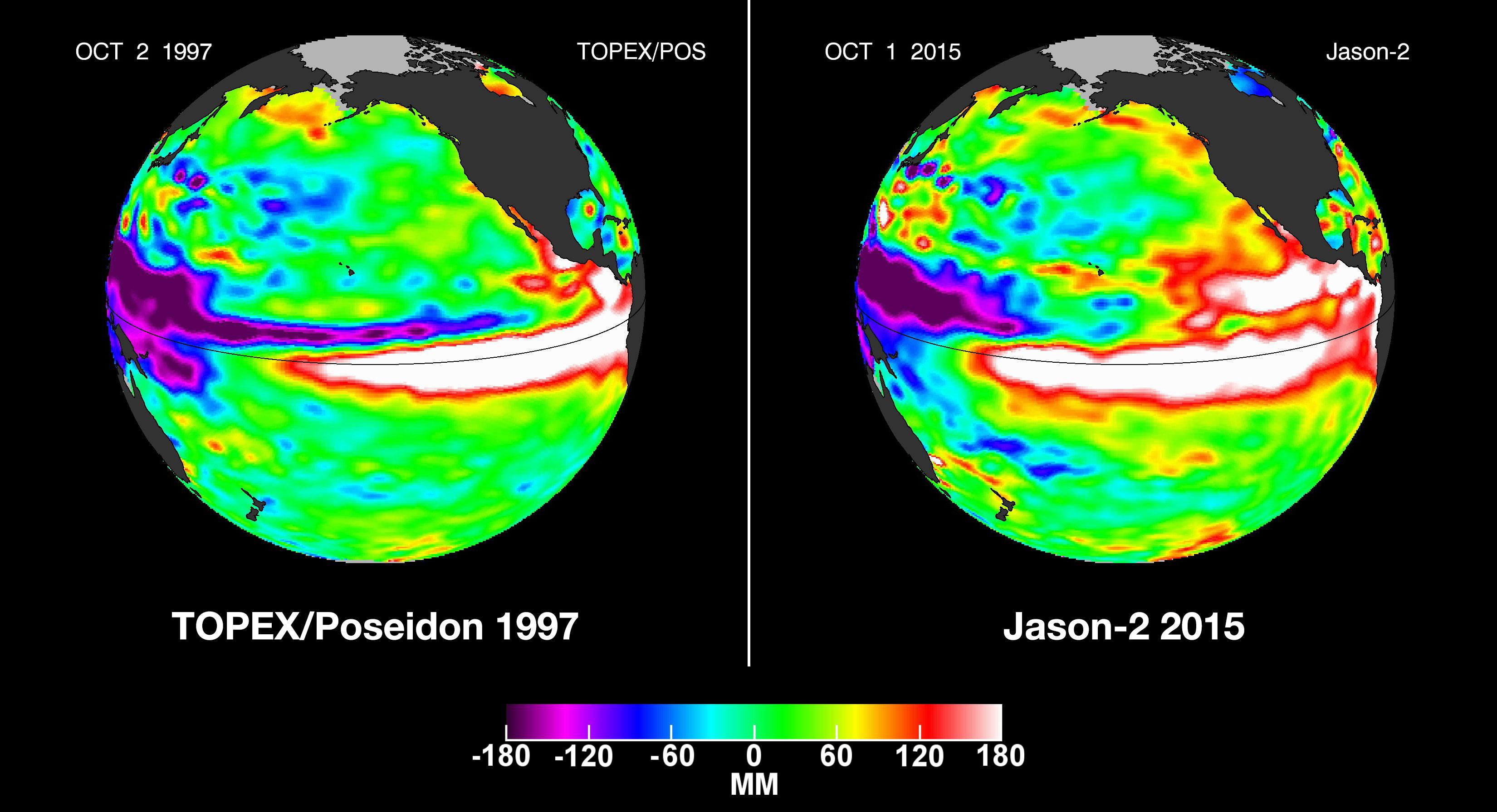
2015-10-19 |
Earth
|
OSTM/Jason-2
|
Altimeter
|
3300x1791x3 |
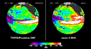
|
-
PIA20009:
-
NASA Studying 2015 El Niño Event as Never Before
Full Resolution:
TIFF
(6.183 MB)
JPEG
(459.8 kB)
|
|
|
2015-10-19 |
Ceres
|
Dawn
|
Framing Camera
|
1024x1024x1 |
|
-
PIA19982:
-
Dawn HAMO Image 40
Full Resolution:
TIFF
(958.1 kB)
JPEG
(204.1 kB)
|
|
|
2015-10-19 |
Mars
|
2001 Mars Odyssey
|
THEMIS
|
1400x2645x1 |
|
-
PIA20071:
-
Olympica Fossae
Full Resolution:
TIFF
(2.803 MB)
JPEG
(380.4 kB)
|
|
|
2015-10-16 |
Pluto
|
New Horizons
|
LEISA
MVIC
|
3300x4200x3 |
|
-
PIA20030:
-
Water Ice on Pluto
Full Resolution:
TIFF
(15.82 MB)
JPEG
(1.239 MB)
|
|
|
2015-10-16 |
Ceres
|
Dawn
|
Framing Camera
|
1024x1024x1 |
|
-
PIA19981:
-
Dawn HAMO Image 39
Full Resolution:
TIFF
(1.05 MB)
JPEG
(164.4 kB)
|
|
|
2015-10-16 |
Mars
|
2001 Mars Odyssey
|
THEMIS
|
1325x2774x1 |
|
-
PIA19800:
-
The Martian, Part 5: Schiaparelli Crater Floor
Full Resolution:
TIFF
(3.138 MB)
JPEG
(595.6 kB)
|
|
|
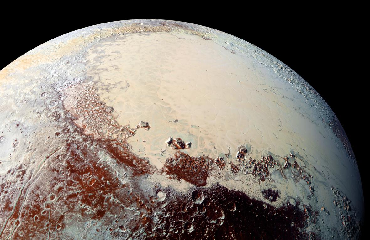
2015-10-15 |
Pluto
|
New Horizons
|
LORRI
MVIC
|
1180x766x3 |

|
-
PIA20007:
-
Sputnik Planum, in Color
Full Resolution:
TIFF
(2.433 MB)
JPEG
(152.9 kB)
|
|
|
2015-10-15 |
Ceres
|
Dawn
|
Framing Camera
|
1024x1024x1 |
|
-
PIA19980:
-
Dawn HAMO Image 38
Full Resolution:
TIFF
(1.05 MB)
JPEG
(170.7 kB)
|
|
|
2015-10-15 |
Mars
|
2001 Mars Odyssey
|
THEMIS
|
1388x3222x1 |

|
-
PIA19799:
-
The Martian, Part 4: Schiaparelli Crater Rim
Full Resolution:
TIFF
(3.232 MB)
JPEG
(328.6 kB)
|
|
|
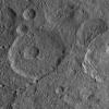
2015-10-14 |
Mars
|
Mars Reconnaissance Orbiter (MRO)
|
HiRISE
|
2880x1800x3 |
|
-
PIA20006:
-
Fine-Branched Ridges
Full Resolution:
TIFF
(15.56 MB)
JPEG
(1.099 MB)
|
|
|
2015-10-14 |
Mars
|
Mars Reconnaissance Orbiter (MRO)
|
HiRISE
|
2880x1800x3 |
|
-
PIA20005:
-
Gullies in a Central Pit Crater
Full Resolution:
TIFF
(15.56 MB)
JPEG
(885.4 kB)
|
|
|
2015-10-14 |
Mars
|
Mars Reconnaissance Orbiter (MRO)
|
HiRISE
|
2880x1800x3 |
|
-
PIA20004:
-
Kasei Valles
Full Resolution:
TIFF
(5.191 MB)
JPEG
(987.8 kB)
|
|
|
2015-10-14 |
Mars
|
Mars Reconnaissance Orbiter (MRO)
|
HiRISE
|
2880x1800x3 |
|
-
PIA20003:
-
A Cone Shaped Hill
Full Resolution:
TIFF
(14.25 MB)
JPEG
(766.5 kB)
|
|
|
2015-10-14 |
Ceres
|
Dawn
|
Framing Camera
|
1024x1024x1 |
|
-
PIA19979:
-
Dawn HAMO Image 37
Full Resolution:
TIFF
(1.05 MB)
JPEG
(147.2 kB)
|
|
|
2015-10-14 |
Mars
|
2001 Mars Odyssey
|
THEMIS
|
1396x3225x1 |
|
-
PIA19798:
-
The Martian, Part 3: Meridiani Planum
Full Resolution:
TIFF
(3.553 MB)
JPEG
(525.7 kB)
|
|
|
2015-10-13 |
Sol (our sun)
|
SDO
|
Atmosphere Imaging Assembly
|
720x720x3 |
|
-
PIA20008:
-
Hefty Prominence Eruption
Full Resolution:
TIFF
(1.164 MB)
JPEG
(53.28 kB)
|
|
|
2015-10-13 |
Jupiter
|
Hubble Space Telescope
|
WFPC3
|
1798x446x3 |

|
-
PIA19659:
Jupiter Wave
Full Resolution:
TIFF
(2.407 MB)
JPEG
(52.69 kB)
|
|
|
2015-10-13 |
Jupiter
|
Hubble Space Telescope
|
WFPC3
|
900x536x3 |
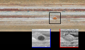
|
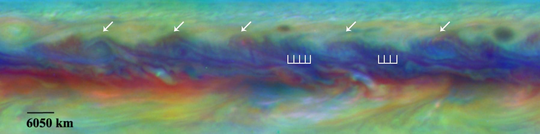
-
PIA19648:
-
New Changes in Jupiter's Great Red Spot
Full Resolution:
TIFF
(859.4 kB)
JPEG
(55.46 kB)
|
|
|
2015-10-13 |
Jupiter
|
Hubble Space Telescope
|
WFPC3
|
3600x1596x3 |
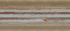
|
-
PIA19643:
-
Spinning Jupiter and Global Map
Full Resolution:
TIFF
(13.13 MB)
JPEG
(328.6 kB)
|
|
|
2015-10-13 |
Mars
|
Mars Science Laboratory (MSL)
|
MAHLI
|
7149x10036x3 |
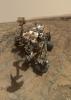
|
-
PIA19920:
-
Curiosity Self-Portrait at 'Big Sky' Drilling Site
Full Resolution:
TIFF
(165.6 MB)
JPEG
(5.999 MB)
|
|
|
2015-10-13 |
Ceres
|
Dawn
|
Framing Camera
|
1024x1024x1 |
|
-
PIA19978:
-
Dawn HAMO Image 36
Full Resolution:
TIFF
(1.05 MB)
JPEG
(215.6 kB)
|
|
|
2015-10-13 |
Mars
|
2001 Mars Odyssey
|
THEMIS
|
1356x2769x1 |
|
-
PIA19797:
-
The Martian, Part 2: Mawrth Valles
Full Resolution:
TIFF
(2.974 MB)
JPEG
(366.9 kB)
|
|
|
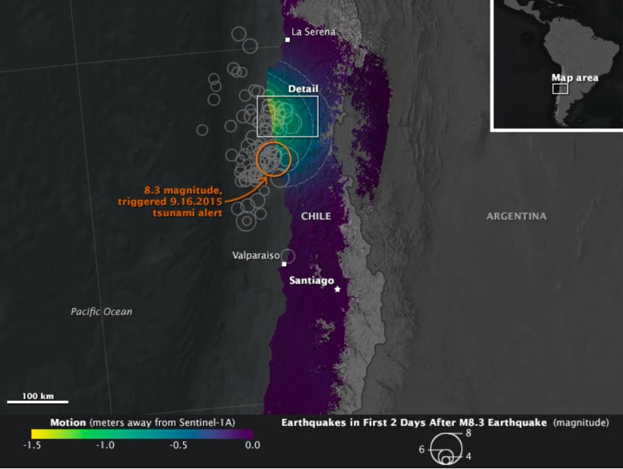
2015-10-12 |
Earth
|
Earth Observatory
|
C-Band SAR
|
898x676x3 |
|
-
PIA20002:
-
NASA Looks at Land Surface Changes Following Chilean Quake
Full Resolution:
TIFF
(888.9 kB)
JPEG
(51.91 kB)
|
|
|
2015-10-12 |
Ceres
|
Dawn
|
Framing Camera
|
1024x1024x1 |
|
-
PIA19973:
-
Dawn HAMO Image 35
Full Resolution:
TIFF
(1.05 MB)
JPEG
(234.9 kB)
|
|
|
2015-10-12 |
Mars
|
2001 Mars Odyssey
|
THEMIS
|
1406x2918x1 |
|
-
PIA19796:
-
The Martian, Part 1: Acidalia Planitia
Full Resolution:
TIFF
(3.302 MB)
JPEG
(560.8 kB)
|
|
|
2015-10-09 |
Ceres
|
Dawn
|
Framing Camera
|
1024x1024x1 |
|
-
PIA19972:
-
Dawn HAMO Image 34
Full Resolution:
TIFF
(1.05 MB)
JPEG
(195.1 kB)
|
|
|
2015-10-09 |
Mars
|
2001 Mars Odyssey
|
THEMIS
|
714x1666x3 |
|
-
PIA19794:
-
Arabia Terra - False Color
Full Resolution:
TIFF
(2.683 MB)
JPEG
(175 kB)
|
|
|
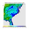
2015-10-08 |
Earth
|
SMAP
|
|
1093x1153x3 |
|
-
PIA20001:
-
Devastating Carolina Floods Viewed by NASA's SMAP
Full Resolution:
TIFF
(1.011 MB)
JPEG
(143.8 kB)
|
|
|
2015-10-08 |
Pluto
|
New Horizons
|
MVIC
|
960x960x3 |
|
-
PIA19964:
-
Pluto's Blue Sky
Full Resolution:
TIFF
(407.5 kB)
JPEG
(23.72 kB)
|
|
|
2015-10-08 |
Pluto
|
New Horizons
|
LEISA
MVIC
|
2707x1072x3 |
|
-
PIA19963:
-
Water Ice on Pluto
Full Resolution:
TIFF
(3.858 MB)
JPEG
(427.7 kB)
|
|
|
2015-10-08 |
Mars
|
Mars Science Laboratory (MSL)
|
Mastcam
|
2102x984x3 |
|
-
PIA19840:
-
Secrets of 'Hidden Valley' on Mars
Full Resolution:
TIFF
(6.208 MB)
JPEG
(485.1 kB)
|
|
|
2015-10-08 |
Mars
|
Mars Science Laboratory (MSL)
|
Mastcam
|
2472x1134x3 |
|
-
PIA19839:
-
Strata at Base of Mount Sharp
Full Resolution:
TIFF
(8.382 MB)
JPEG
(679.5 kB)
|
 Planetary Data System


