My
List |
Addition Date
|
Target
|
Mission
|
Instrument
|
Size
|

|
2008-03-10 |
Earth
|
Terra
|
ASTER
|
1596x1509x3 |

|
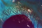
-
PIA10626:
-
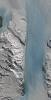
Longyearbyen, Svalbard, Norway
Full Resolution:
TIFF
(7.237 MB)
JPEG
(503.1 kB)
|
|
|
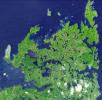
2008-03-21 |
Earth
|
Terra
|
ASTER
|
2505x2463x3 |
|
-
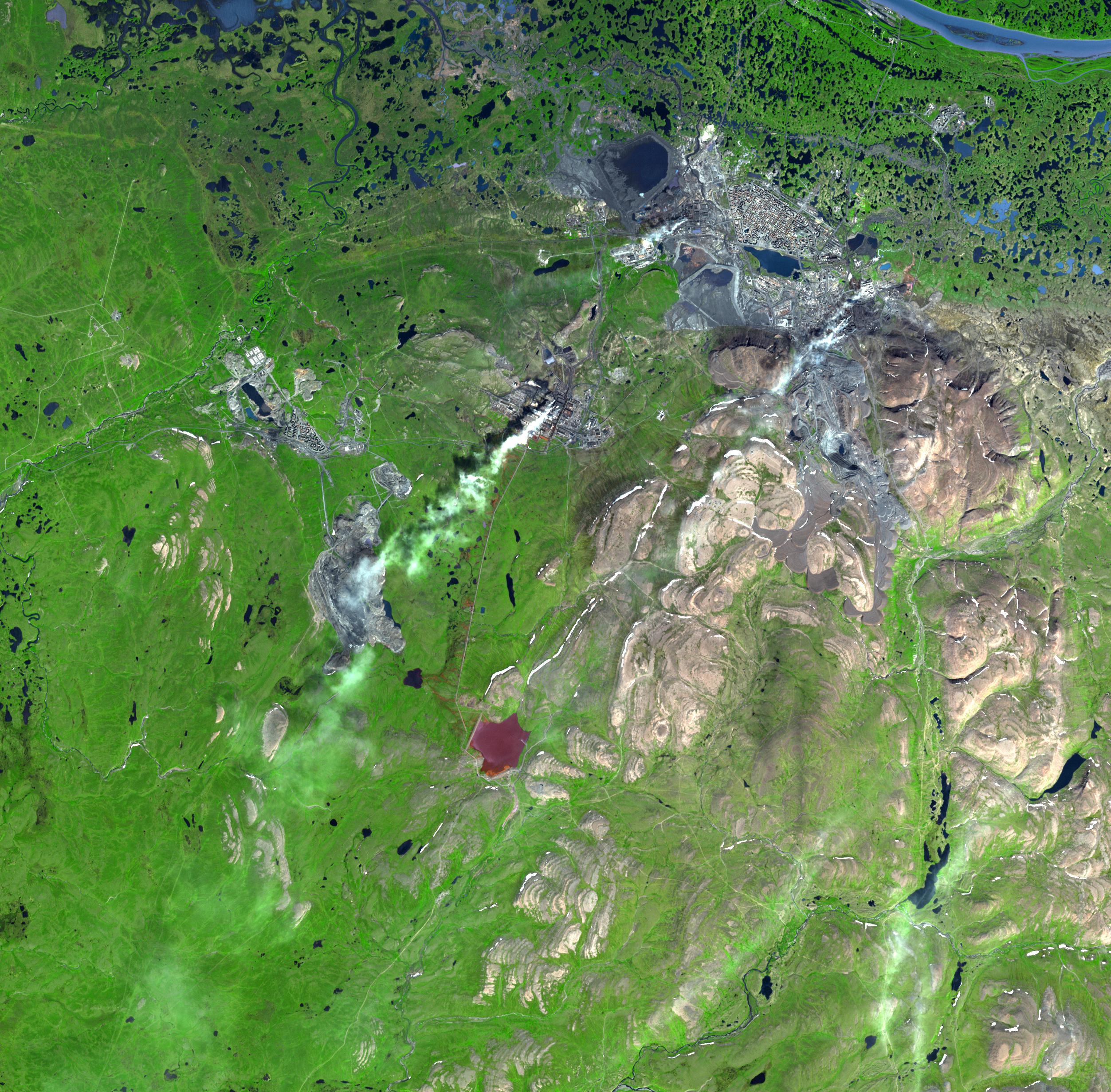
PIA10627:
-
Norilsk, Siberia
Full Resolution:
TIFF
(18.53 MB)
JPEG
(1.2 MB)
|
|
|
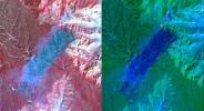
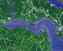
2008-04-01 |
Earth
|
Terra
|
ASTER
|
2536x2104x3 |
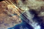
|
-
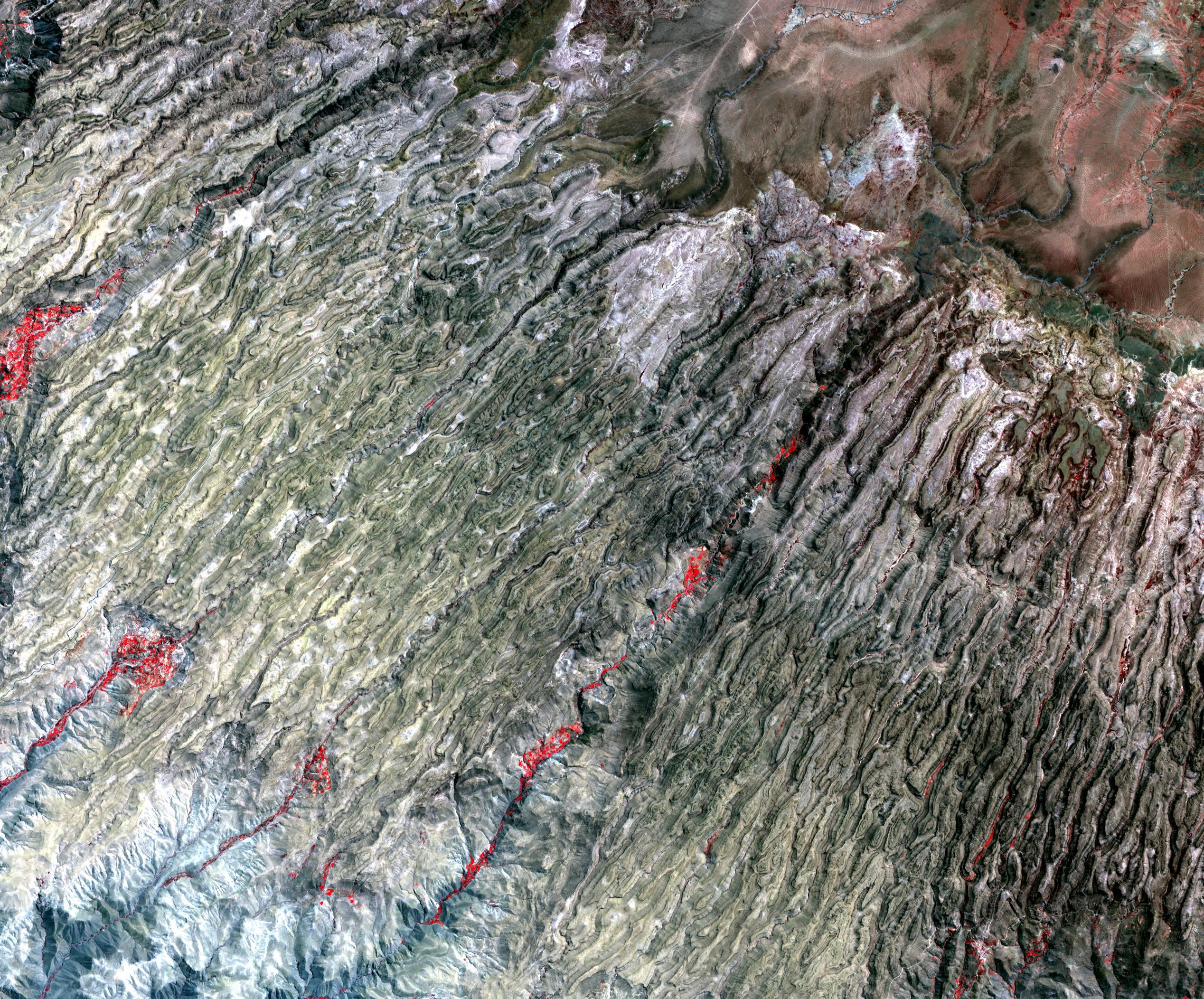
PIA10628:
-
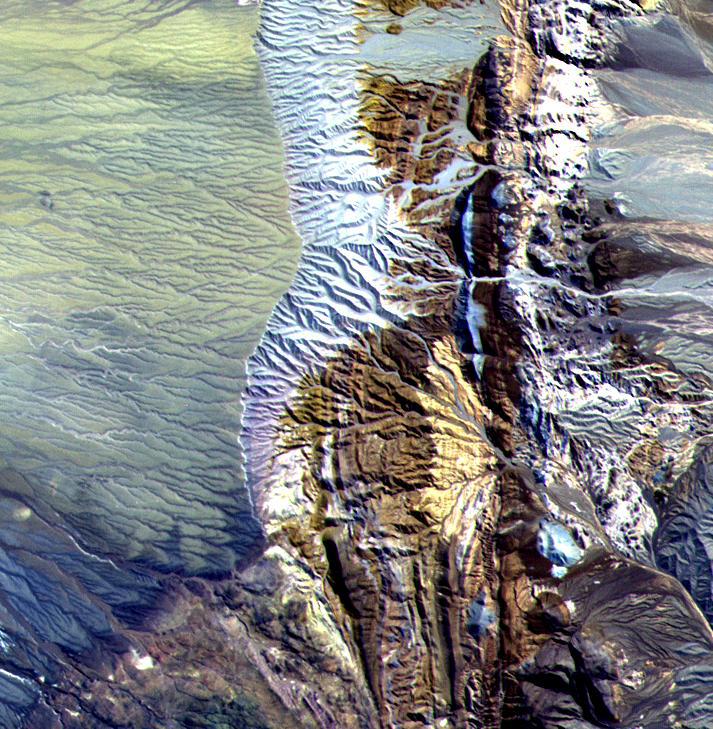
Western Slope of Andes, Peru
Full Resolution:
TIFF
(16.02 MB)
JPEG
(1.374 MB)
|
|
|
2008-04-08 |
Earth
|
Terra
|
ASTER
|
1250x1091x3 |
|
-
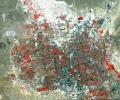
PIA10629:
-
Nardò Ring, Italy
Full Resolution:
TIFF
(4.096 MB)
JPEG
(336.8 kB)
|
|
|
2008-04-21 |
Earth
|
Terra
|
ASTER
|
1832x3276x3 |
|
-
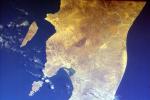
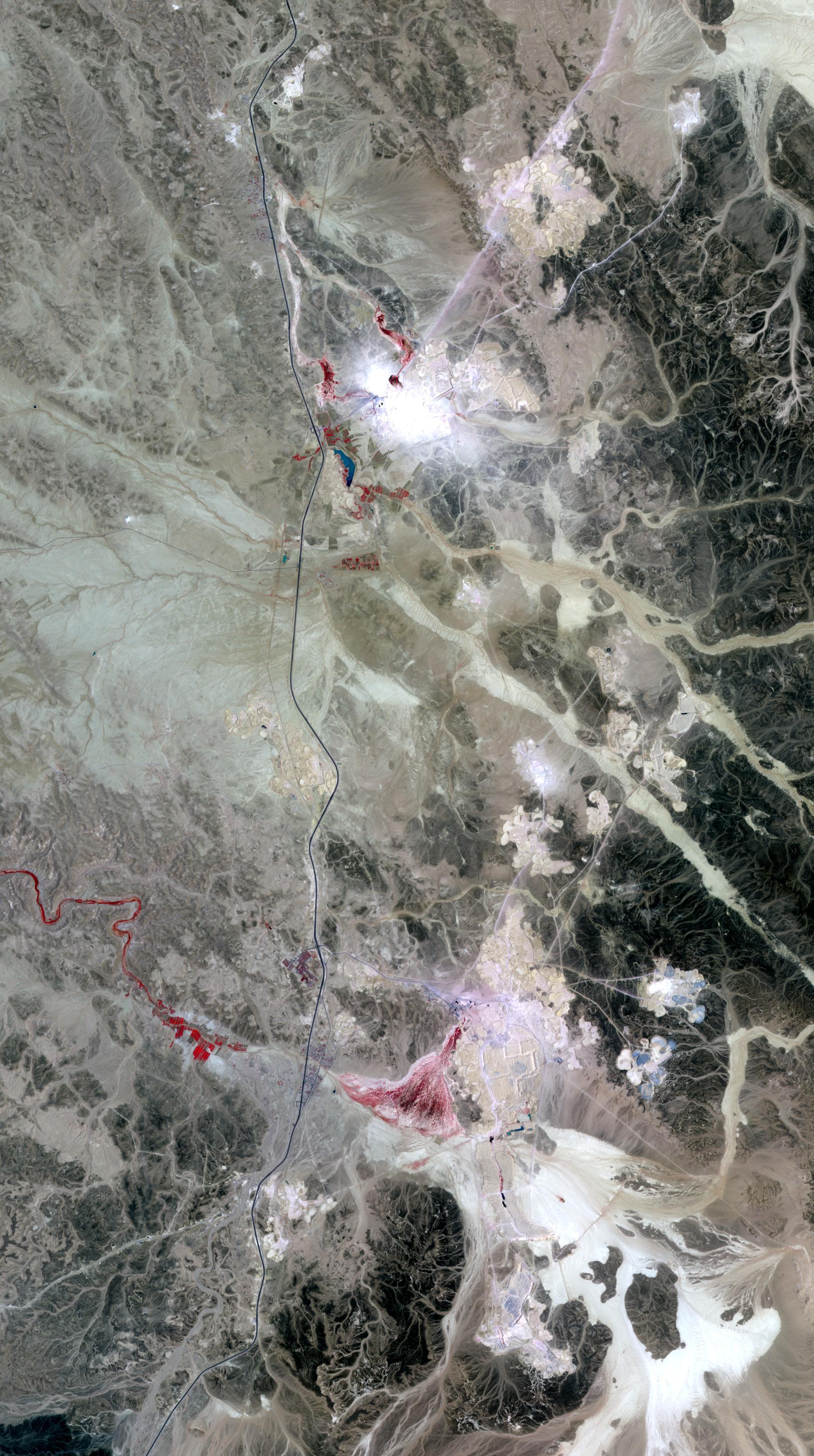
PIA10630:
-
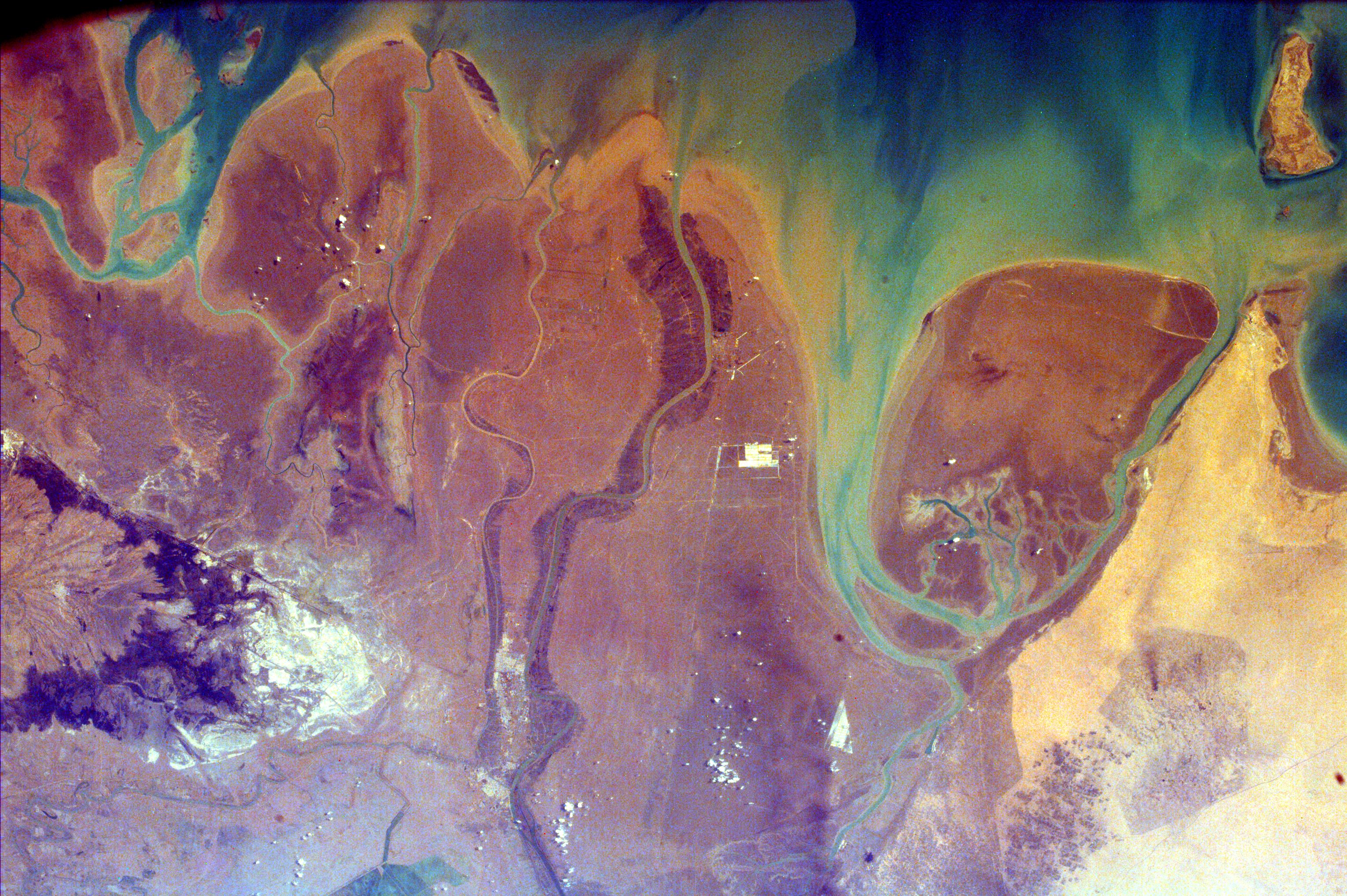
Phosphate Mines, Jordan
Full Resolution:
TIFF
(18.03 MB)
JPEG
(949.6 kB)
|
|
|
2008-04-30 |
Earth
|
Terra
|
ASTER
|
900x720x3 |
|
-
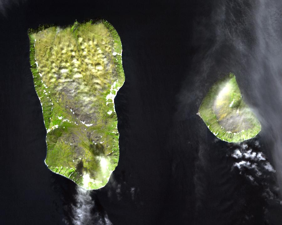
PIA10631:
-
Diomede Islands, Bering Straight
Full Resolution:
TIFF
(1.946 MB)
JPEG
(67.39 kB)
|
|
|
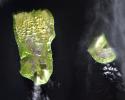
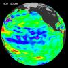
2007-05-16 |
Earth
|
Aqua
|
AIRS
|
720x486x3 |
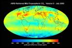
|
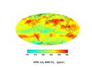
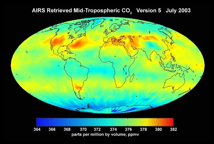
-
PIA10645:
-
AIRS Mid-Tropospheric CO2, Version 5, July 2003
Full Resolution:
TIFF
(1.051 MB)
JPEG
(53.1 kB)
|
|
|
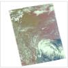
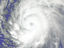
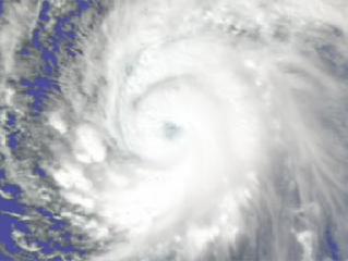
2007-08-15 |
Earth
|
Aqua
|
AIRS
|
1000x1000x3 |
|
-
PIA10646:
-
Hurricane Dean
Full Resolution:
TIFF
(3.004 MB)
JPEG
(130.4 kB)
|
|
|
2007-08-15 |
Earth
|
Aqua
|
AIRS
|
1000x1000x3 |
|
-
PIA10647:
-
Tropical Storm Erin
Full Resolution:
TIFF
(3.004 MB)
JPEG
(123.6 kB)
|
|
|
2007-08-18 |
Earth
|
Aqua
|
AIRS
|
1000x1000x3 |
|
-
PIA10648:
-
Typhoon Sepat
Full Resolution:
TIFF
(3.004 MB)
JPEG
(130.3 kB)
|
|
|
2007-09-03 |
Earth
|
Aqua
|
AIRS
|
900x695x3 |
|
-
PIA10649:
-
Hurricane Felix
Full Resolution:
TIFF
(1.879 MB)
JPEG
(124.9 kB)
|
|
|
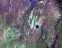
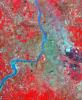
2008-06-06 |
Earth
|
Terra
|
ASTER
|
1761x1054x3 |
|
-
PIA10772:
-
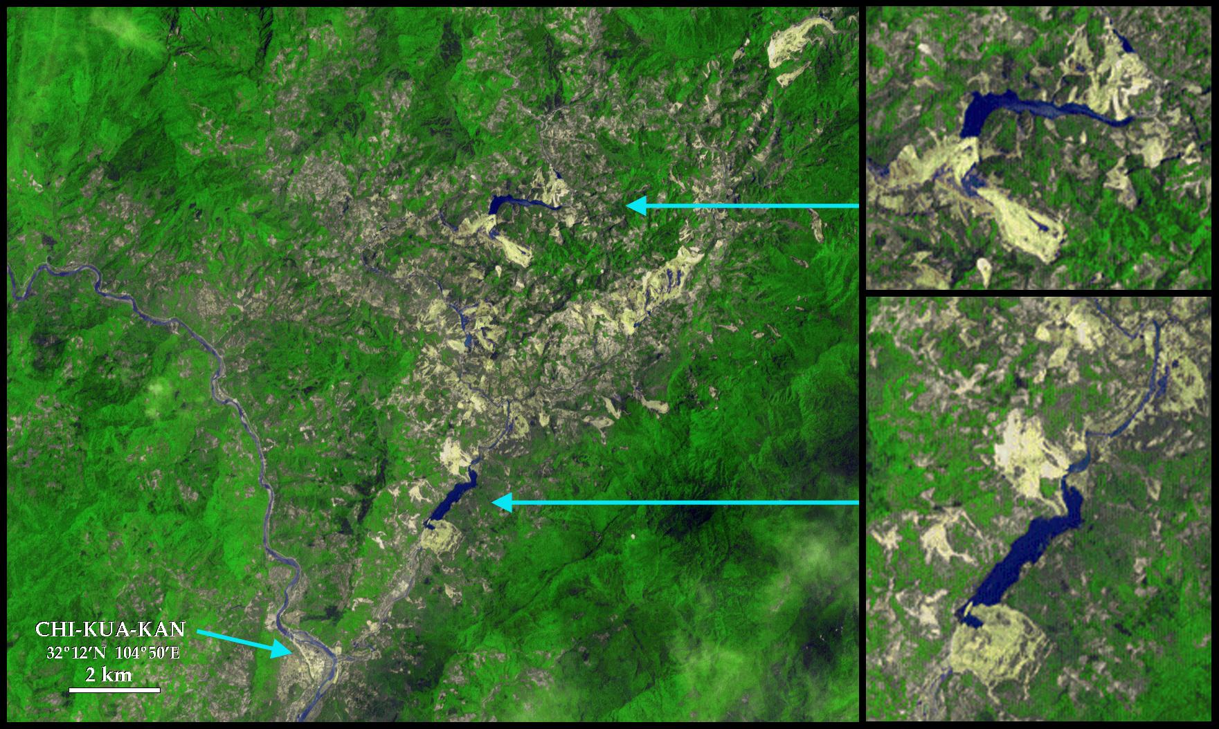
Sichuan Earthquake in China
Full Resolution:
TIFF
(5.577 MB)
JPEG
(375.9 kB)
|
|
|
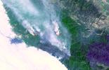
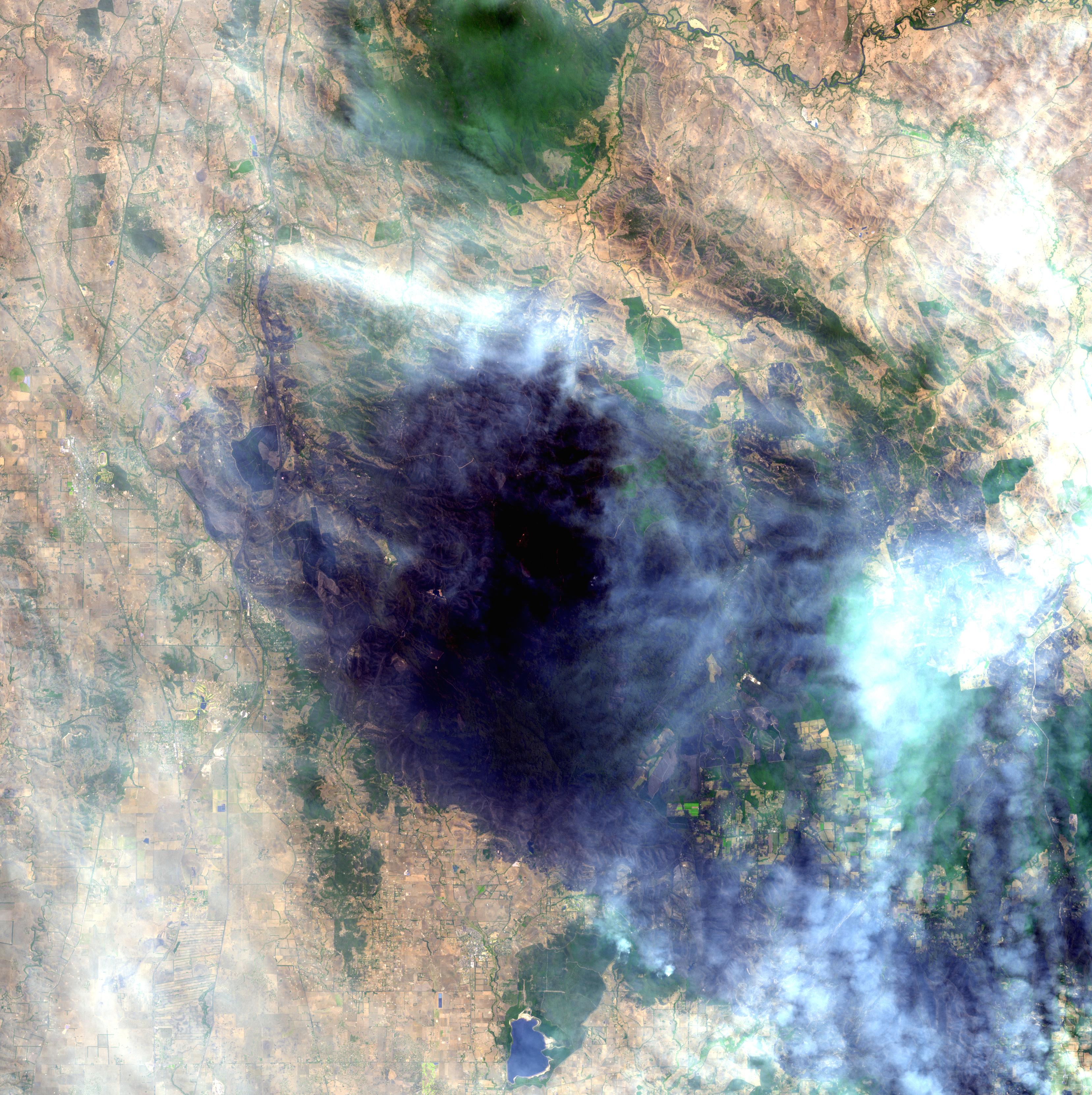
2008-06-30 |
Earth
|
Terra
|
ASTER
|
3858x2484x3 |
|
-
PIA10925:
-
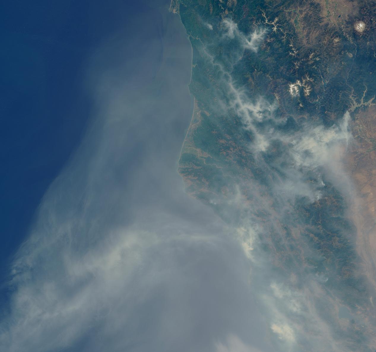
Fires Burning near Big Sur, California
Full Resolution:
TIFF
(28.75 MB)
JPEG
(1.261 MB)
|
|
|
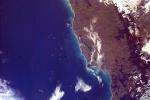
2008-07-02 |
Earth
|
Terra
|
MISR
|
1267x1187x3 |
|
-
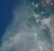
PIA10927:
-
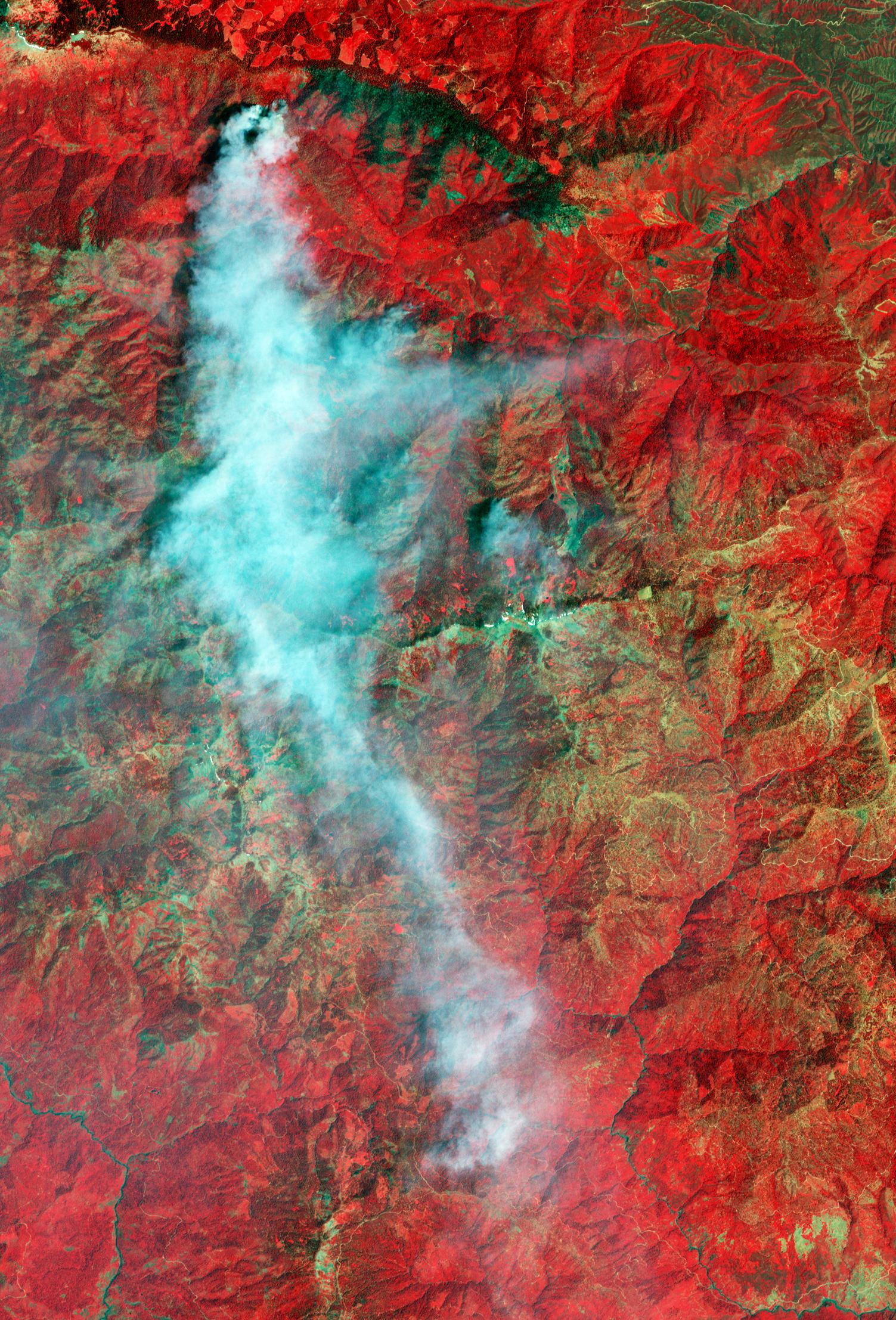
Smoke Blankets Northern California
Full Resolution:
TIFF
(4.517 MB)
JPEG
(100.6 kB)
|
|
|
2008-07-06 |
Earth
|
Goldstone Deep Space Network (DSN)
|
Deep Space Network Antenna
|
1148x1119x3 |
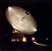
|
-
PIA10953:
-
70m Antenna at Goldstone, California
Full Resolution:
TIFF
(3.859 MB)
JPEG
(120 kB)
|
|
|
2008-07-15 |
Earth
|
OSTM/Jason-2
|
Advanced Microwave Radiometer (AMR)
|
2400x2772x3 |
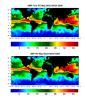
|
-
PIA10954:
-
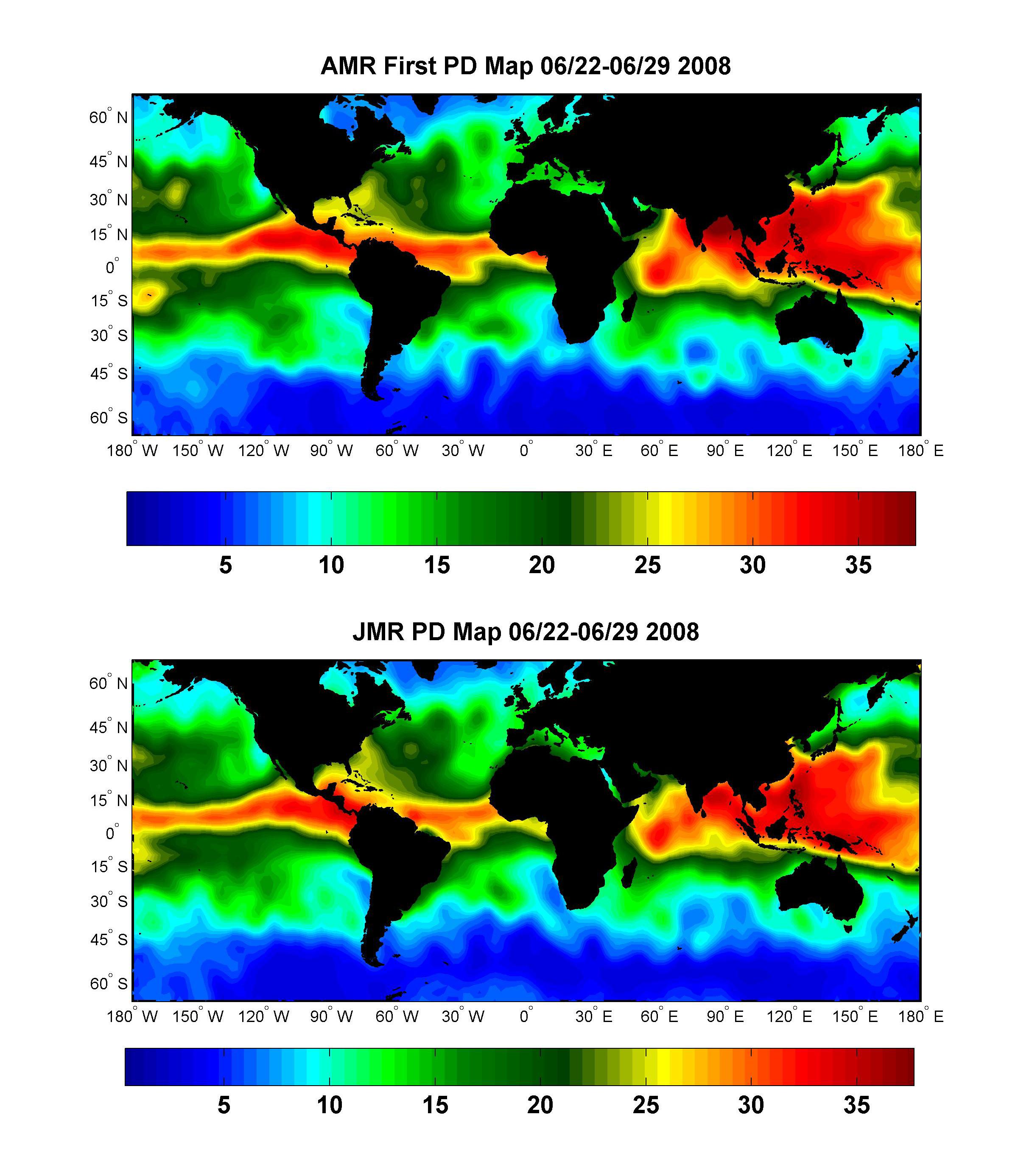
Global Views of Atmospheric Water Vapor:
First Data from OSTM/Jason-2's Advanced Microwave Radiometer
Full Resolution:
TIFF
(19.98 MB)
JPEG
(537.4 kB)
|
|
|
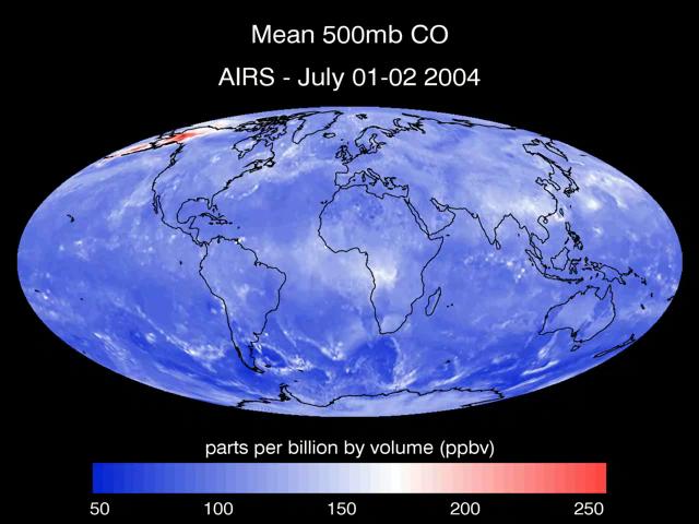
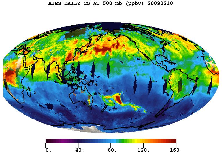
2008-07-22 |
Earth
|
Aqua
|
AIRS
|
1026x577x3 |
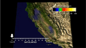
|
-
PIA10973:
-
Carbon Monoxide from California's Wildfire -
a Visualization Created Using Data from NASA's Atmospheric Infrared Sounder

Full Resolution:
TIFF
(1.779 MB)
JPEG
(61.13 kB)
|
|
|
2008-07-23 |
Earth
|
Terra
|
ASTER
|
1503x2214x3 |
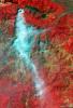
|
-
PIA10975:
-
Yolla Bolly Complex Wildland Fire
Full Resolution:
TIFF
(10 MB)
JPEG
(733.5 kB)
|
|
|
2008-07-31 |
Earth
|
Jason-1
|
Altimeter
|
919x699x3 |
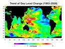
|
-
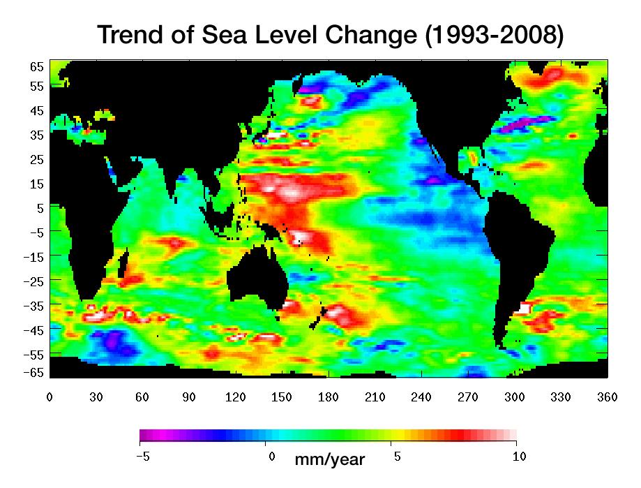
PIA11002:
-
Portrait of a Warming Ocean and Rising Sea Levels:
Trend of Sea Level Change 1993-2008
Full Resolution:
TIFF
(644.9 kB)
JPEG
(104.2 kB)
|
|
|
2008-08-06 |
Earth
|
Aqua
|
AIRS
|
727x329x3 |
|
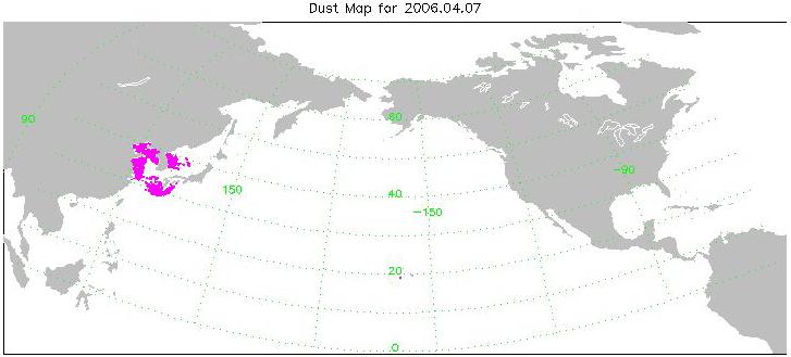
-
PIA11009:
-
Transport of Dust from China Dust Storm of April 2006
Full Resolution:
TIFF
(718.7 kB)
JPEG
(30.38 kB)
|
|
|
2008-08-13 |
Earth
|
Aqua
|
AIRS
|
321x239x3 |
|
-
PIA11032:
-
Hurricane Isabel Isotherms
Full Resolution:
TIFF
(230.6 kB)
JPEG
(8.968 kB)
|
|
|
2008-08-13 |
Earth
|
Aqua
|
AIRS
|
319x240x3 |
|
-
PIA11033:
-
Supertyphoon Pongsona Isotherms
Full Resolution:
TIFF
(230.2 kB)
JPEG
(9.715 kB)
|
|
|
2008-08-14 |
Earth
|
Aqua
|
AIRS
|
640x480x3 |
|
-
PIA11034:
-
Transport of Carbon Monoxide Generated by Alaska Fires, July 2004
Full Resolution:
TIFF
(922.8 kB)
JPEG
(44.52 kB)
|
|
|
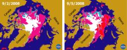
2008-09-05 |
Earth
|
ISS EarthKam
|
Electronic Still Camera
|
3060x2036x3 |
|
-
PIA11061:
-
Frozen Lake Quinghai Nanshan, Northern China
Full Resolution:
TIFF
(18.69 MB)
JPEG
(1.217 MB)
|
|
|
2008-09-04 |
Earth
|
ISS EarthKam
|
Electronic Still Camera
|
3060x2036x3 |
|
-
PIA11014:
-
North Island, New Zealand
Full Resolution:
TIFF
(18.69 MB)
JPEG
(1.303 MB)
|
|
|
2008-09-04 |
Earth
|
ISS EarthKam
|
Electronic Still Camera
|
3060x2036x3 |
|
-
PIA11015:
-
Algeria
Full Resolution:
TIFF
(18.69 MB)
JPEG
(1.659 MB)
|
|
|
2008-09-04 |
Earth
|
ISS EarthKam
|
Electronic Still Camera
|
3060x2036x3 |
|
-
PIA11016:
-
South Australia, Australia
Full Resolution:
TIFF
(18.69 MB)
JPEG
(1.711 MB)
|
|
|
2008-09-04 |
Earth
|
ISS EarthKam
|
Electronic Still Camera
|
3060x2036x3 |
|
-
PIA11017:
-
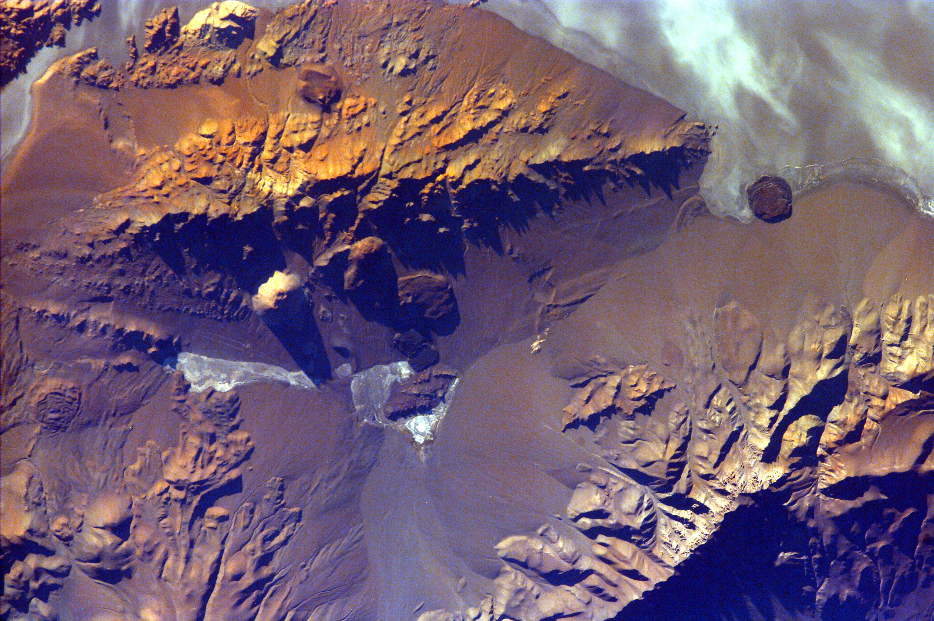
Aracar Volcano, Andes Mountains, Argentina near Chile Border
Full Resolution:
TIFF
(18.69 MB)
JPEG
(1.265 MB)
|
|
|
2008-09-04 |
Earth
|
ISS EarthKam
|
Electronic Still Camera
|
3060x2036x3 |
|
-
PIA11018:
-
Sakhalin Island, Russia
Full Resolution:
TIFF
(18.69 MB)
JPEG
(1.377 MB)
|
|
|
2008-09-04 |
Earth
|
ISS EarthKam
|
Electronic Still Camera
|
3060x2036x3 |
|
-
PIA11019:
-
Tongue of the Ocean and Grand Bahama Bank
Full Resolution:
TIFF
(18.69 MB)
JPEG
(1.05 MB)
|
|
|
2008-09-04 |
Earth
|
ISS EarthKam
|
Electronic Still Camera
|
3060x2036x3 |

|
-
PIA11020:
-
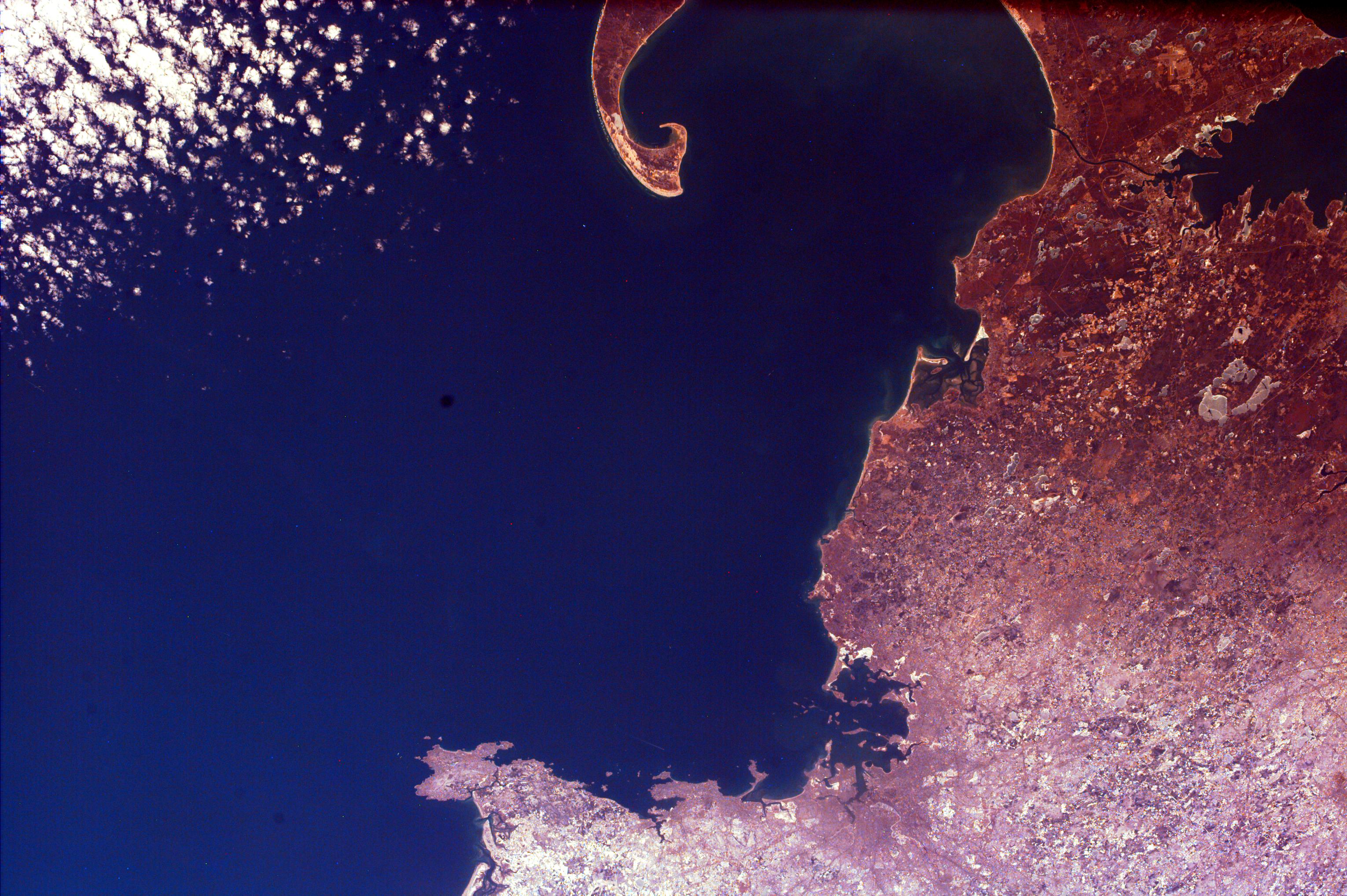
Isla Isabella, Galapagos Island
Full Resolution:
TIFF
(18.69 MB)
JPEG
(873.7 kB)
|
|
|
2008-09-04 |
Earth
|
ISS EarthKam
|
Electronic Still Camera
|
3060x2036x3 |

|
-
PIA11021:
-
The Persian Gulf and the Delta of the Tigris and Euphrates Rivers, Kuwait, Iraq, and Iran
Full Resolution:
TIFF
(18.69 MB)
JPEG
(1.299 MB)
|
|
|
2008-09-05 |
Earth
|
ISS EarthKam
|
Electronic Still Camera
|
3060x2036x3 |
|
-
PIA11062:
-
Contrails over Lisbon, Portugal
Full Resolution:
TIFF
(18.69 MB)
JPEG
(1.138 MB)
|
|
|
2008-09-05 |
Earth
|
ISS EarthKam
|
Electronic Still Camera
|
3060x2036x3 |
|
-
PIA11063:
-
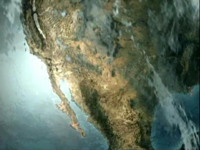
Southern Tip of Baja California, Mexico
Full Resolution:
TIFF
(18.69 MB)
JPEG
(1.229 MB)
|
|
|
2008-09-05 |
Earth
|
ISS EarthKam
|
Electronic Still Camera
|
3060x2036x3 |

|
-
PIA11064:
-
Cape Cod, Massachusetts
Full Resolution:
TIFF
(18.69 MB)
JPEG
(1.008 MB)
|
|
|
2008-09-05 |
Earth
|
ISS EarthKam
|
Electronic Still Camera
|
3060x2036x3 |
|
-
PIA11067:
-
Alluvial fan in China
Full Resolution:
TIFF
(18.69 MB)
JPEG
(854 kB)
|
|
|
2008-09-05 |
Earth
|
ISS EarthKam
|
Electronic Still Camera
|
3060x2036x3 |
|
-
PIA11065:
-
Delta of the Gurupi, Maracacume, and Tiriacu Rivers, Brazil
Full Resolution:
TIFF
(18.69 MB)
JPEG
(731 kB)
|
|
|
2008-09-05 |
Earth
|
ISS EarthKam
|
Electronic Still Camera
|
3060x2036x3 |
|
-
PIA11066:
-
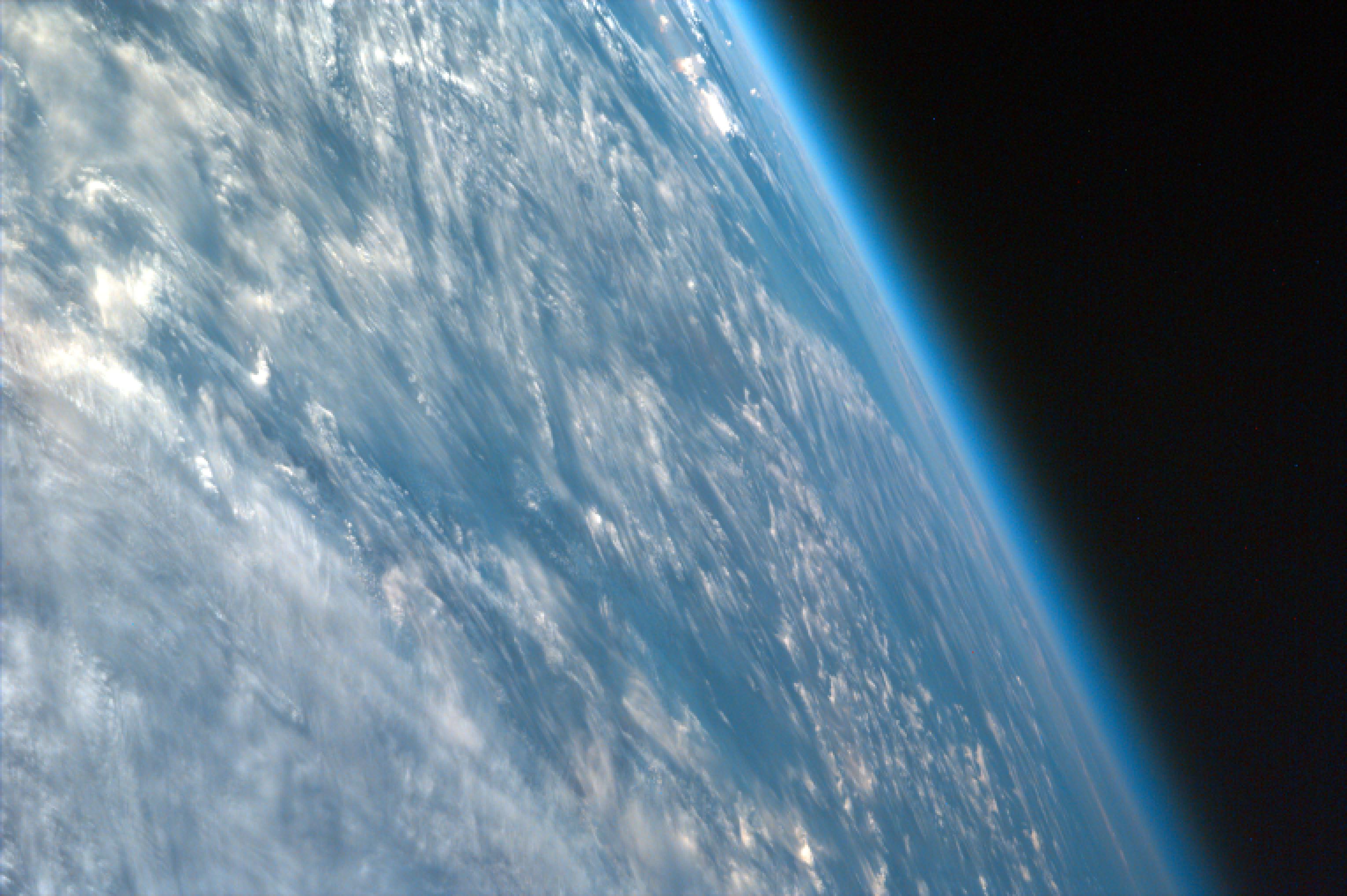
Oblique Shot of Earth
Full Resolution:
TIFF
(18.69 MB)
JPEG
(460.9 kB)
|
|
|
2008-09-05 |
Earth
|
ISS EarthKam
|
Electronic Still Camera
|
3060x2036x3 |
|
-
PIA11068:
-
Atlantic (maybe Caribbean Sea) Ocean and Islands
Full Resolution:
TIFF
(18.69 MB)
JPEG
(475.3 kB)
|
|
|
2008-09-05 |
Earth
|
ISS EarthKam
|
Electronic Still Camera
|
3060x2036x3 |

|
-
PIA11069:
-
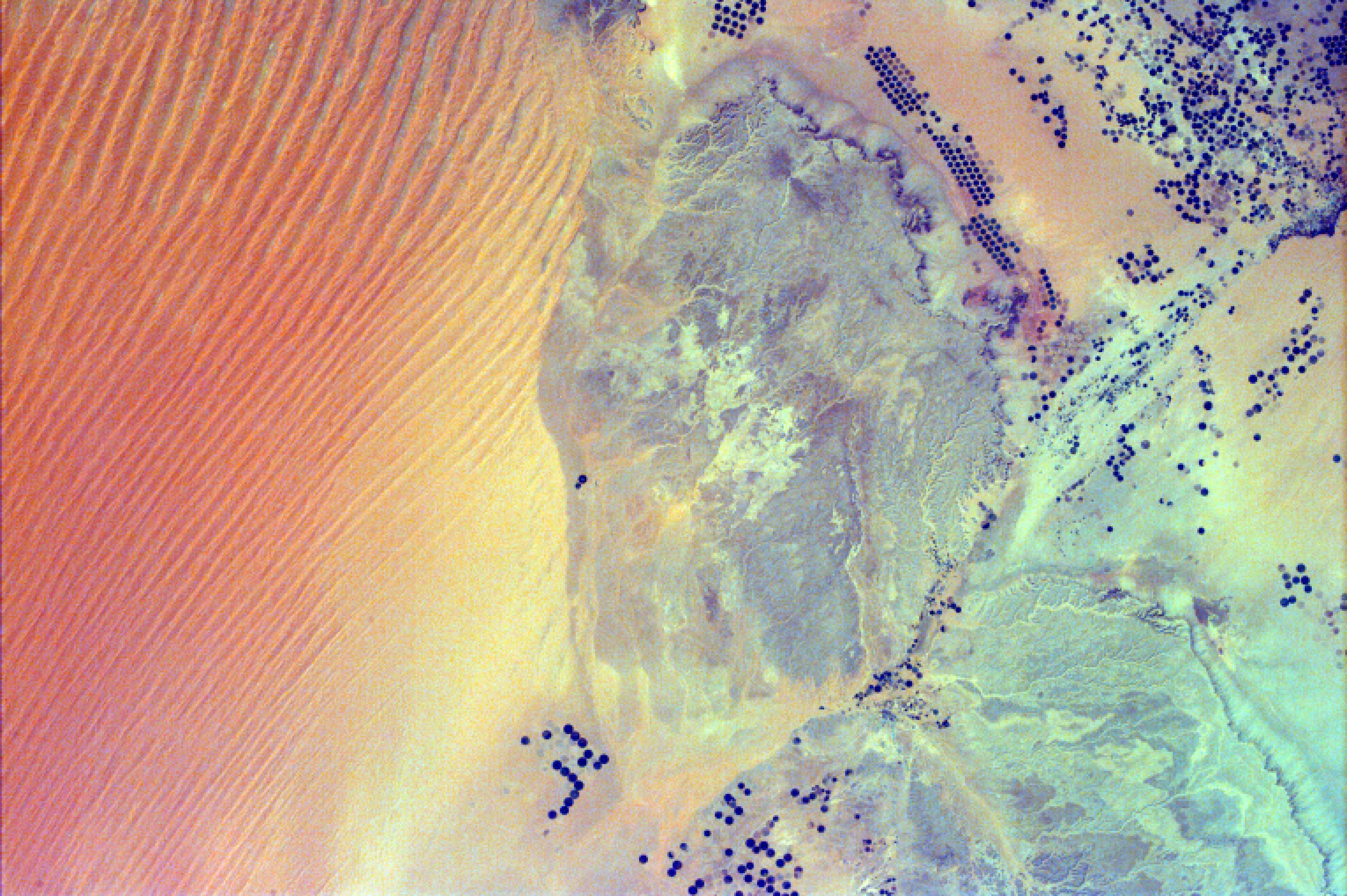
Sand Dunes and Center-Pivot Irrigation in Saudi Arabia
Full Resolution:
TIFF
(18.69 MB)
JPEG
(886.2 kB)
|
|
|
2008-09-05 |
Earth
|
ISS EarthKam
|
Electronic Still Camera
|
3060x2036x3 |

|
-
PIA11070:
-
Ganges River Delta
Full Resolution:
TIFF
(18.69 MB)
JPEG
(852 kB)
|
|
|
2008-05-09 |
Earth
|
Terra
|
ASTER
|
3732x2427x3 |

|
-
PIA11079:
-
Al Jazirah, Sudan
Full Resolution:
TIFF
(27.17 MB)
JPEG
(2.287 MB)
|
|
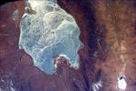
|
2008-05-23 |
Earth
|
Terra
|
ASTER
|
1735x1511x3 |

|
-
PIA11080:
-
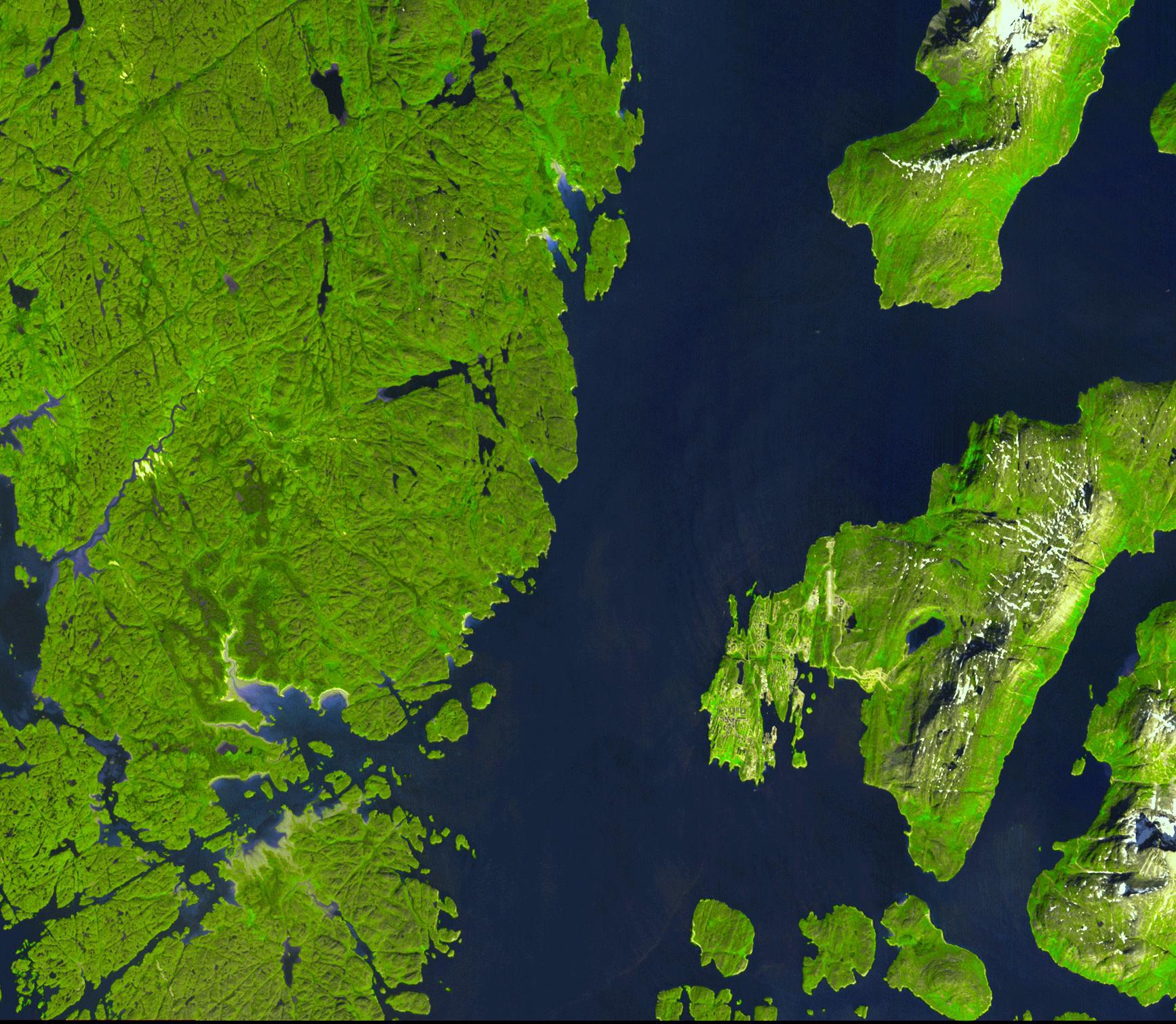
Nuuk, Greenland
Full Resolution:
TIFF
(7.877 MB)
JPEG
(433.8 kB)
|
|
|
2008-05-30 |
Earth
|
Terra
|
ASTER
|
800x295x3 |
|
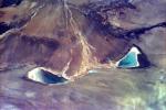
-
PIA11081:
-
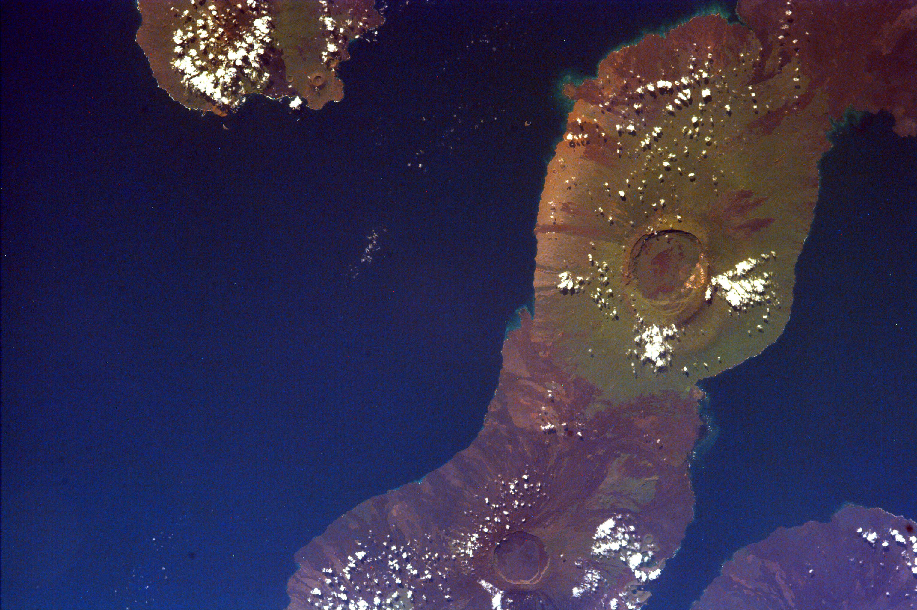
Chaiten Volcano, Chile
Full Resolution:
TIFF
(709 kB)
JPEG
(45.79 kB)
|
|
|
2008-06-18 |
Earth
|
Terra
|
ASTER
|
2706x2134x3 |
|
-
PIA11082:
-
East African Rift
Full Resolution:
TIFF
(17.34 MB)
JPEG
(1.272 MB)
|
|
|
2008-07-18 |
Earth
|
Terra
|
ASTER
|
1639x1611x3 |
|
-
PIA11083:
-
L'Anse Aux Meadows, Newfoundland
Full Resolution:
TIFF
(7.934 MB)
JPEG
(468.6 kB)
|
|
|
2008-08-08 |
Earth
|
Terra
|
ASTER
|
3656x4124x3 |
|
-
PIA11084:
-
Rub' al Khali, Arabia
Full Resolution:
TIFF
(45.23 MB)
JPEG
(3.202 MB)
|
|
|
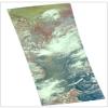
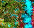
2008-08-28 |
Earth
|
Terra
|
ASTER
|
3832x2956x3 |
|
-
PIA11085:
-
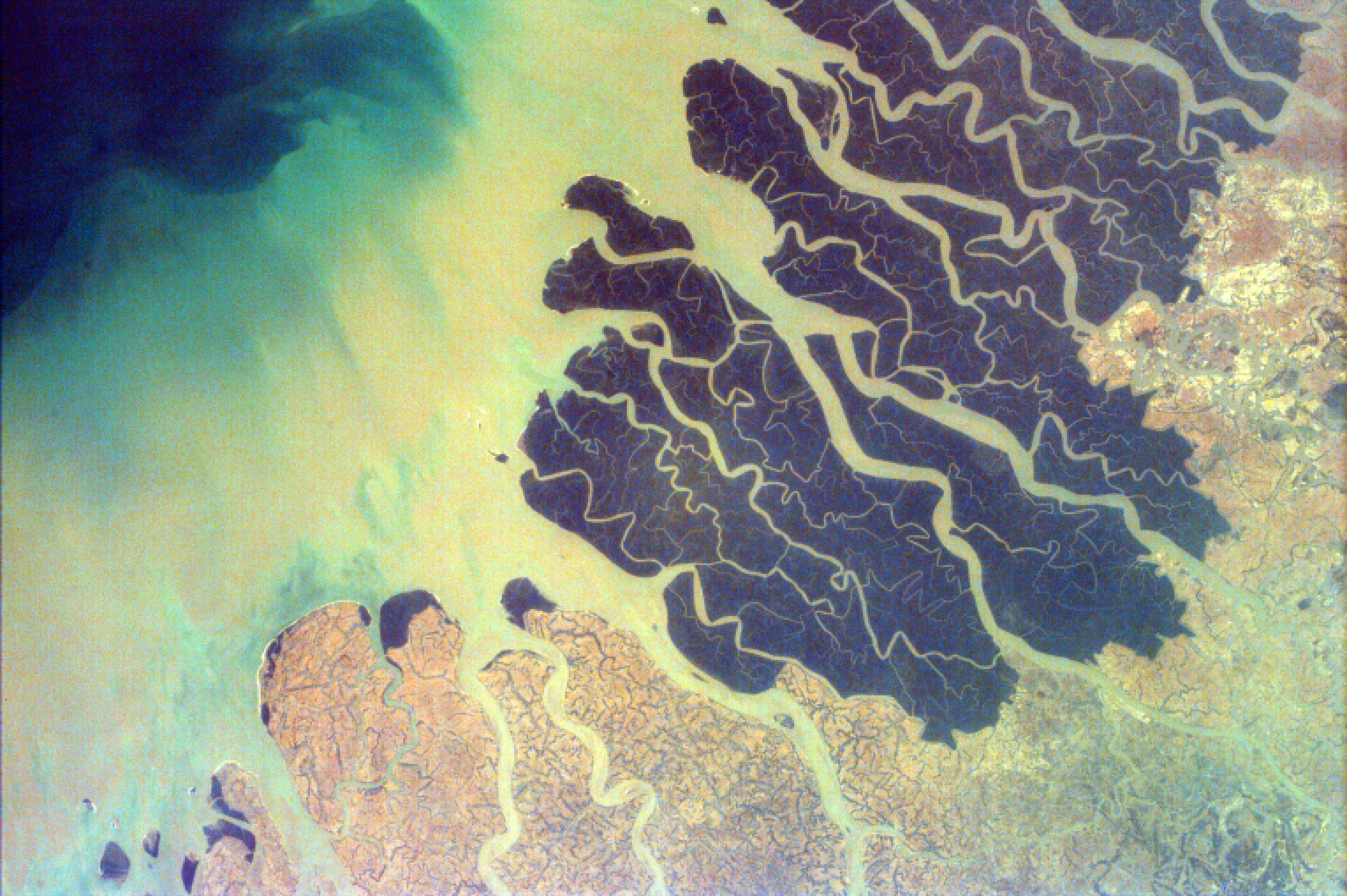
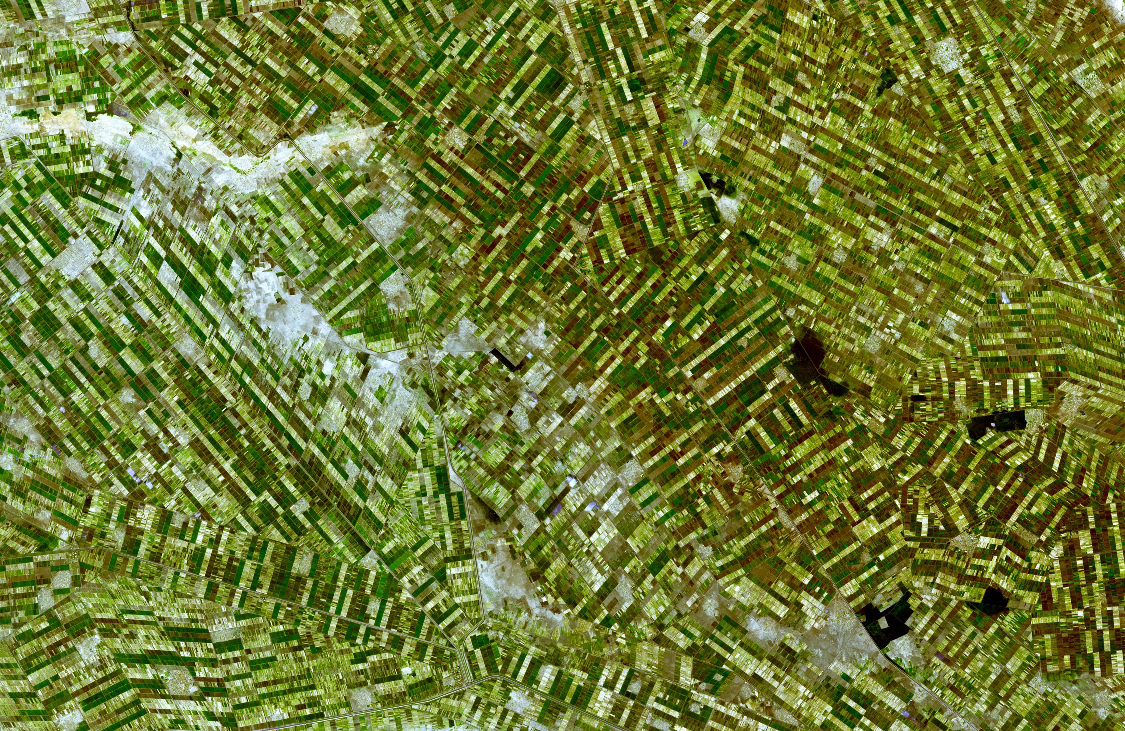
Colorado River Delta
Full Resolution:
TIFF
(33.98 MB)
JPEG
(1.911 MB)
|
|
|
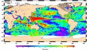
2008-09-11 |
Earth
|
QuikScat
|
SeaWinds Scatterometer
|
2344x926x3 |
|
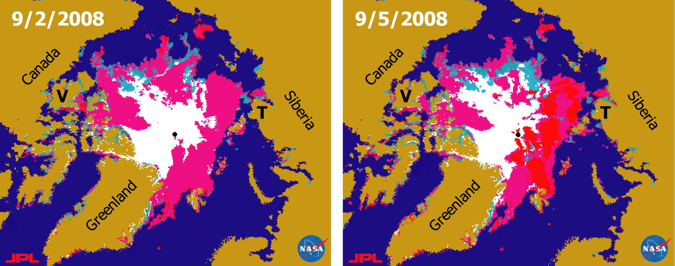
-
PIA11086:
-
Recent State of Arctic Sea Ice
Full Resolution:
TIFF
(6.519 MB)
JPEG
(290.8 kB)
|
|
|
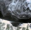
2001-10-22 |
Earth
|
Terra
|
ASTER
|
837x690x3 |

|
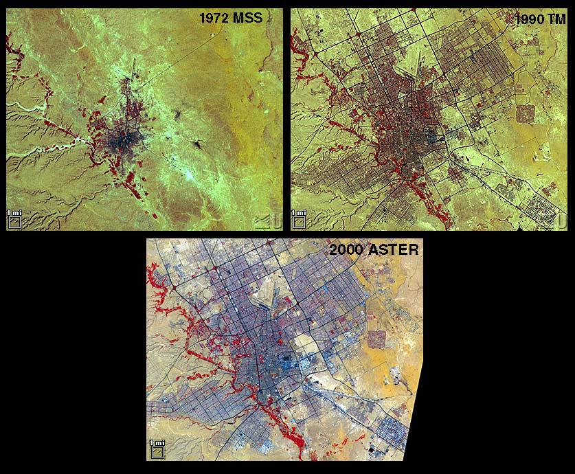
-
PIA11087:
-
Urbanization: Riyadh, Saudi Arabia
Full Resolution:
TIFF
(1.735 MB)
JPEG
(157.5 kB)
|
|
|
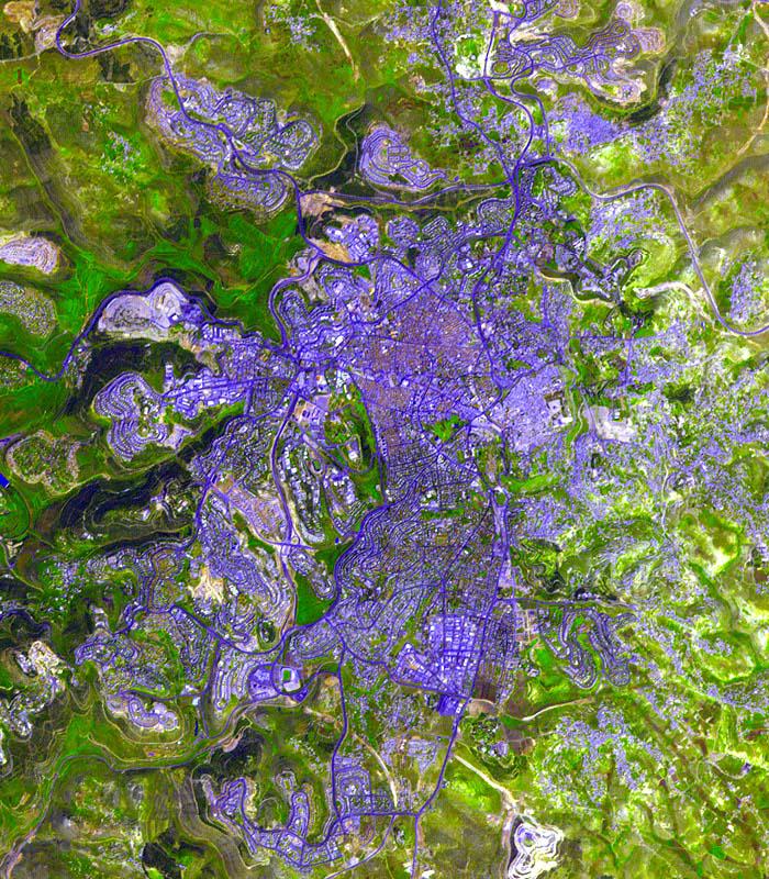
2001-10-22 |
Earth
|
Terra
|
ASTER
|
4100x4200x3 |
|
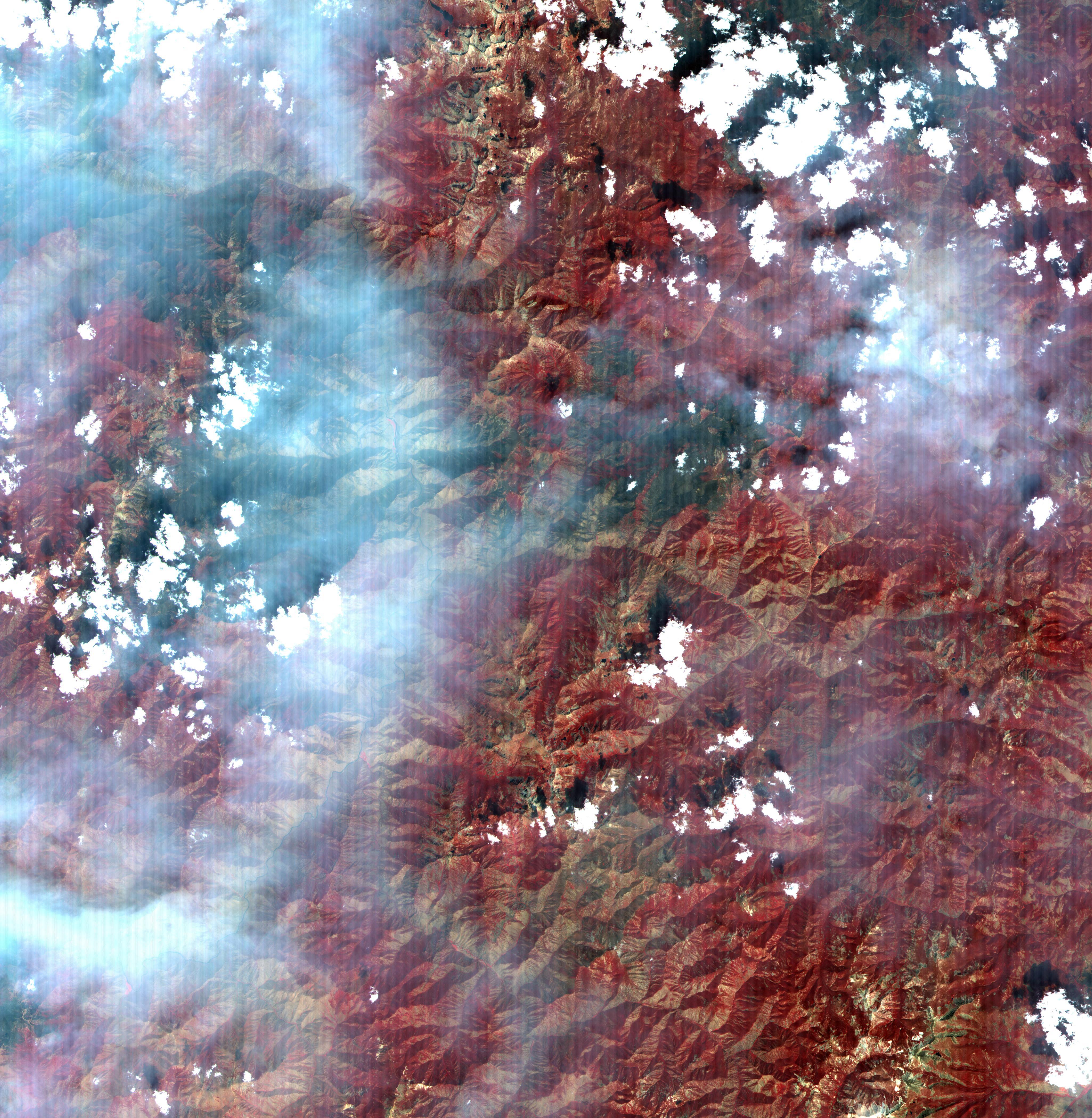
-
PIA11088:
-
Idaho Fires
Full Resolution:
TIFF
(51.66 MB)
JPEG
(2.704 MB)
|
|
|
2001-10-22 |
Earth
|
Terra
|
ASTER
|
2000x2500x3 |
|
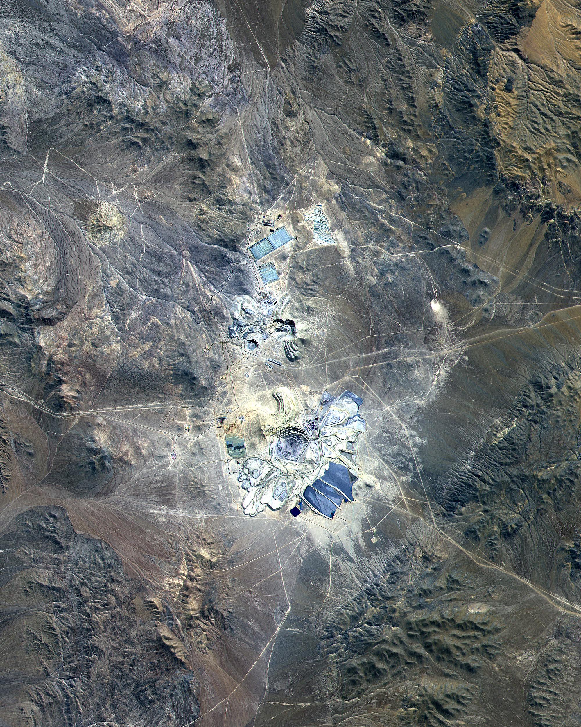
-
PIA11090:
-
Escondida Mine, Chile
Full Resolution:
TIFF
(15.02 MB)
JPEG
(1.402 MB)
|
|
|
2001-10-22 |
Earth
|
Terra
|
ASTER
|
1388x1167x3 |
|
-
PIA11089:
-
Baltimore, MD
Full Resolution:
TIFF
(4.869 MB)
JPEG
(565.4 kB)
|
|
|
2001-10-22 |
Earth
|
Terra
|
ASTER
|
3002x2477x3 |
|
-
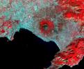
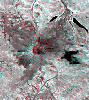
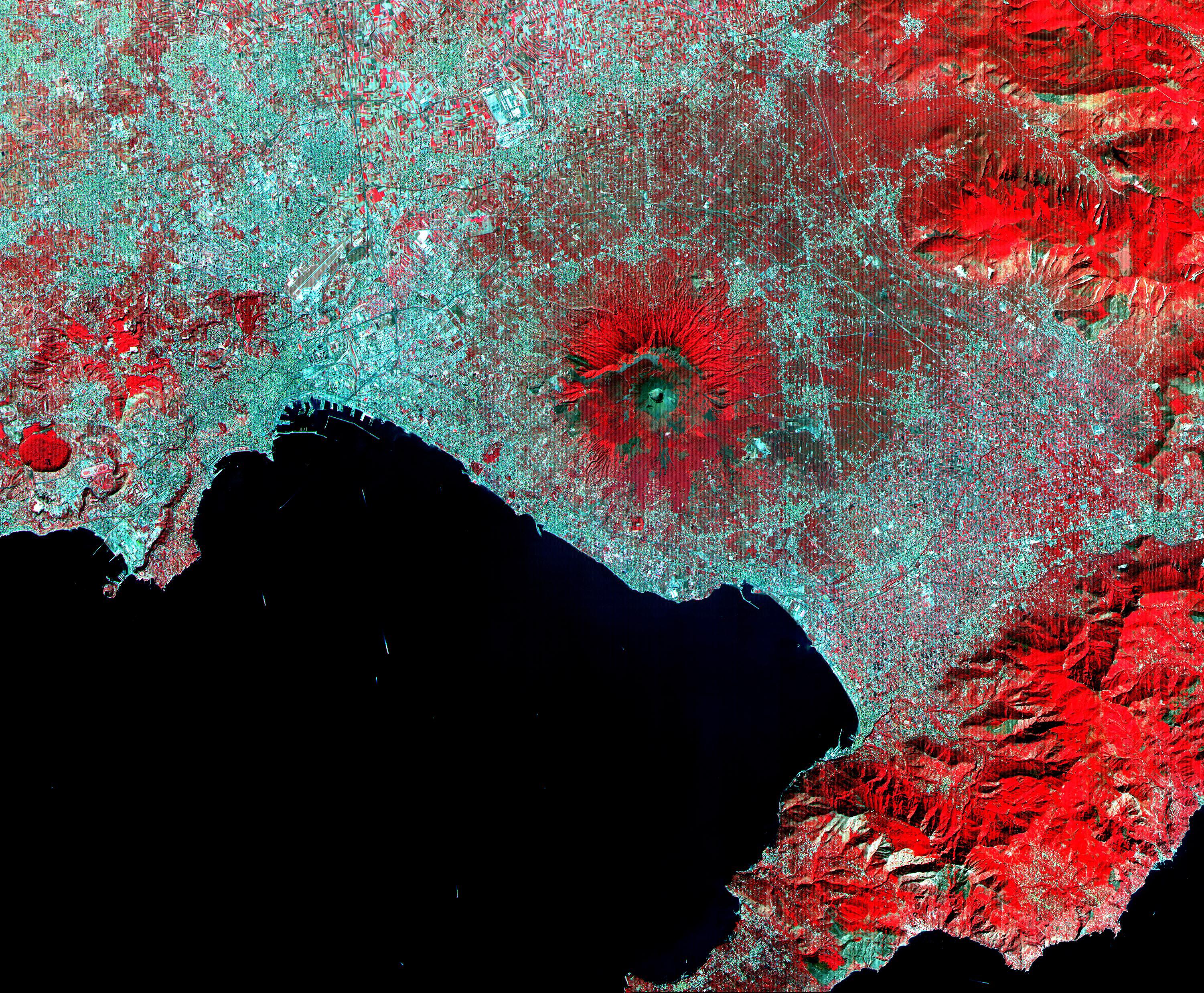
PIA11091:
-
Mt. Vesuvius, Italy
Full Resolution:
TIFF
(22.31 MB)
JPEG
(2.267 MB)
|
|
|
2001-10-22 |
Earth
|
Terra
|
ASTER
|
1694x921x3 |
|
-
PIA11092:
-
Arizona Forest Fire
Full Resolution:
TIFF
(4.688 MB)
JPEG
(343.9 kB)
|
|
|
2001-10-22 |
Earth
|
Terra
|
ASTER
|
600x540x3 |

|
-
PIA11093:
-
Hawaii Lava Flows
Full Resolution:
TIFF
(973.3 kB)
JPEG
(26.82 kB)
|
|
|
2001-10-22 |
Earth
|
Terra
|
ASTER
|
1300x1000x3 |
|
-
PIA11094:
-
Thar Desert
Full Resolution:
TIFF
(3.904 MB)
JPEG
(351.1 kB)
|
|
|
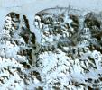
2001-10-22 |
Earth
|
Terra
|
ASTER
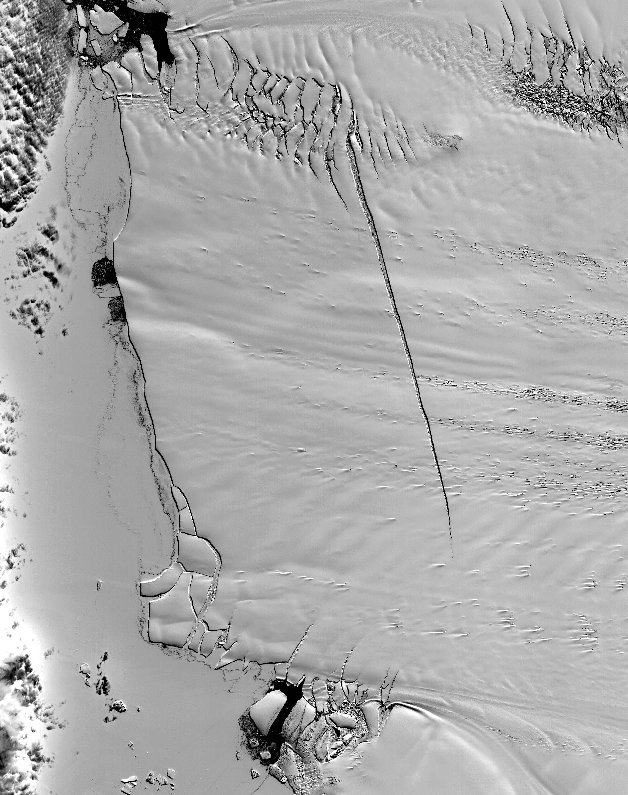
|
2547x3222x1 |
|
-
PIA11095:
-
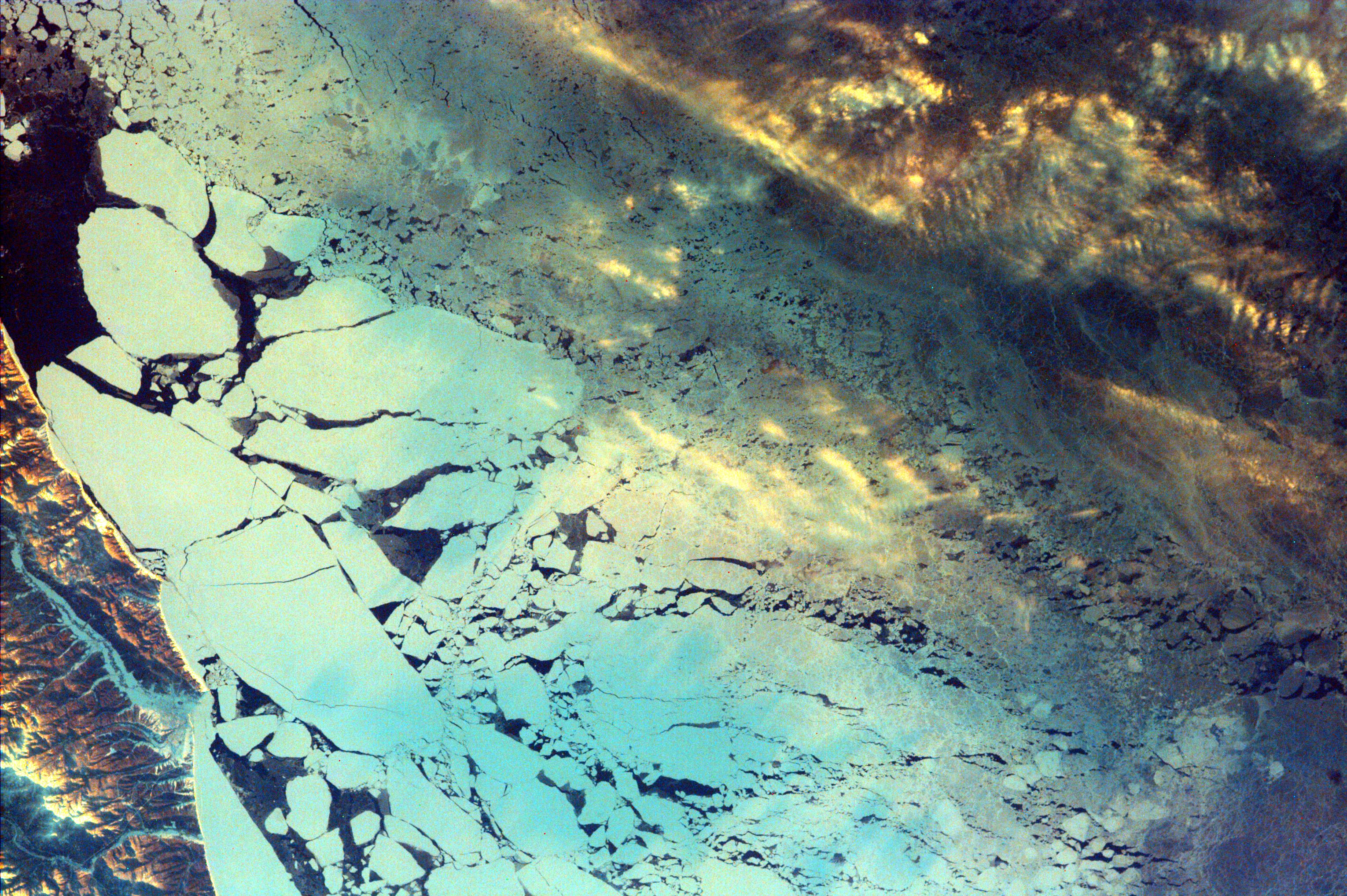
Pine Island Glacier, Antarctica
Full Resolution:
TIFF
(8.215 MB)
JPEG
(785.4 kB)
|
|
|
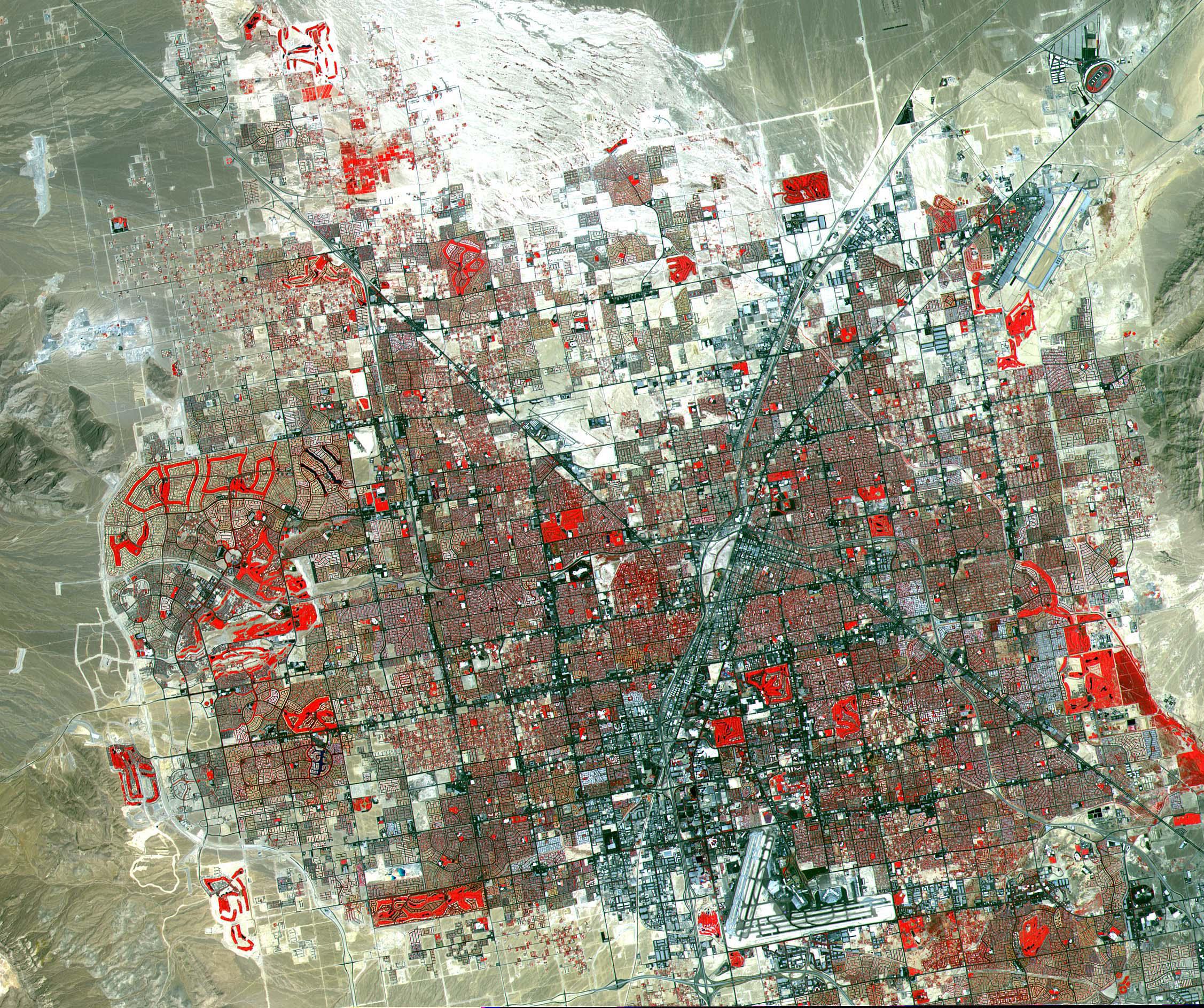
2001-10-22 |
Earth
|
Terra
|
ASTER
|
2254x1887x3 |
|
-
PIA11096:
-
Las Vegas
Full Resolution:
TIFF
(12.78 MB)
JPEG
(1.252 MB)
|
|
|
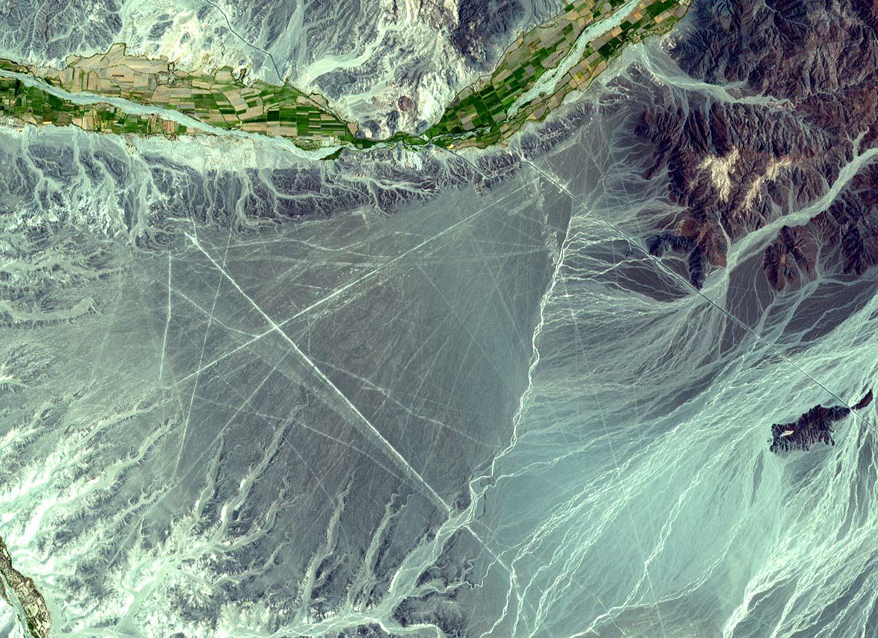
2001-10-22 |
Earth
|
Terra
|
ASTER
|
1273x925x3 |
|
-
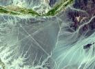
PIA11097:
-
Nasca Lines, Peru
Full Resolution:
TIFF
(3.537 MB)
JPEG
(301.1 kB)
|
|
|
2001-10-22 |
Earth
|
Terra
|
ASTER
|
700x800x3 |
|
-
PIA11098:
-
Jerusalem
Full Resolution:
TIFF
(1.682 MB)
JPEG
(193.9 kB)
|
|
|
2001-10-22 |
Earth
|
Terra
|
ASTER
|
1000x700x3 |
|
-
PIA11099:
-
Sand Dunes, Afghanistan
Full Resolution:
TIFF
(2.103 MB)
JPEG
(229.1 kB)
|
|
|
2001-10-22 |
Earth
|
Terra
|
ASTER
|
1800x2200x3 |
|
-
PIA11157:
-
Calcutta
Full Resolution:
TIFF
(11.9 MB)
JPEG
(1.91 MB)
|
|
|
2008-09-16 |
Earth
|
Terra
|
ASTER
|
3190x2810x3 |
|
-
PIA11169:
-
Northern Greenland
Full Resolution:
TIFF
(26.89 MB)
JPEG
(1.555 MB)
|
|
|
2001-10-22 |
Earth
|
Terra
|
ASTER
|
3636x4008x3 |
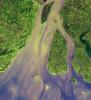
|
-
PIA11158:
-
Hugli River Delta, India
Full Resolution:
TIFF
(43.72 MB)
JPEG
(2.484 MB)
|
|
|
2001-10-22 |
Earth
|
Terra
|
ASTER
|
713x729x3 |
|
-
PIA11159:
-
Chile Altiplano Unconformity
Full Resolution:
TIFF
(1.562 MB)
JPEG
(147.2 kB)
|
|
|
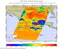
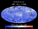
2008-09-17 |
Earth
|
Aqua
|
AIRS
|
638x478x3 |

|
-
PIA11171:
-
AIRS Collects Data and Creates a Temperature Profile
Full Resolution:
TIFF
(916.1 kB)
JPEG
(39.04 kB)
|
|
|
2001-10-22 |
Earth
|
Terra
|
ASTER
|
1200x1354x3 |
|
-
PIA11160:
-
Mt. St. Helens
Full Resolution:
TIFF
(4.88 MB)
JPEG
(460.2 kB)
|
|
|
2001-10-22 |
Earth
|
Terra
|
ASTER
|
1567x1811x3 |
|
-
PIA11161:
-
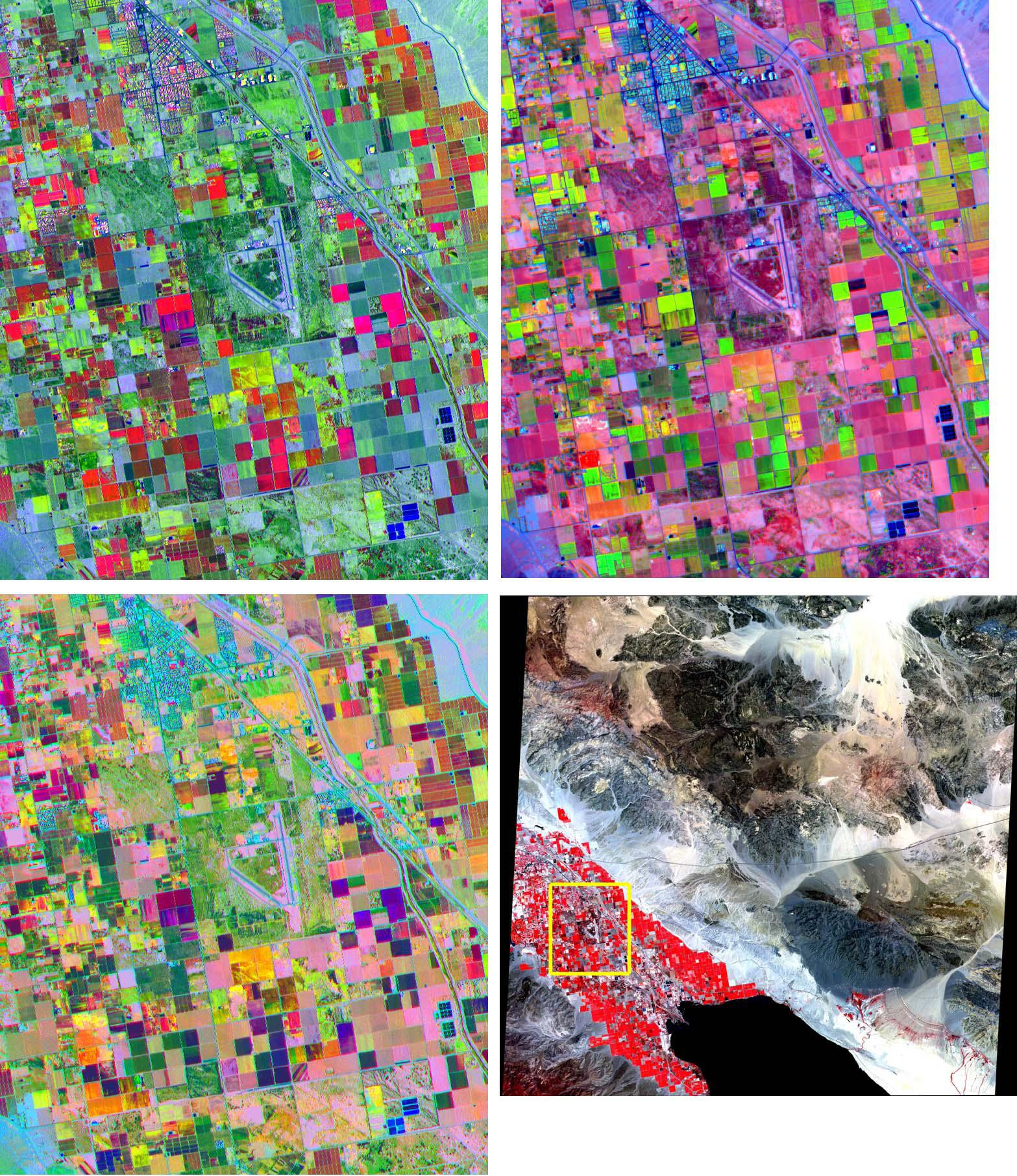
Coachella Valley, CA
Full Resolution:
TIFF
(8.528 MB)
JPEG
(676 kB)
|
|
|
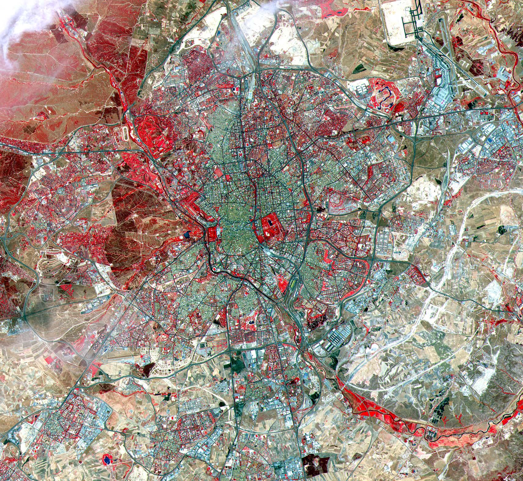
2001-10-22 |
Earth
|
Terra
|
ASTER
|
1711x1575x3 |
|
-
PIA11163:
-
Madrid
Full Resolution:
TIFF
(8.097 MB)
JPEG
(889.5 kB)
|
|
|
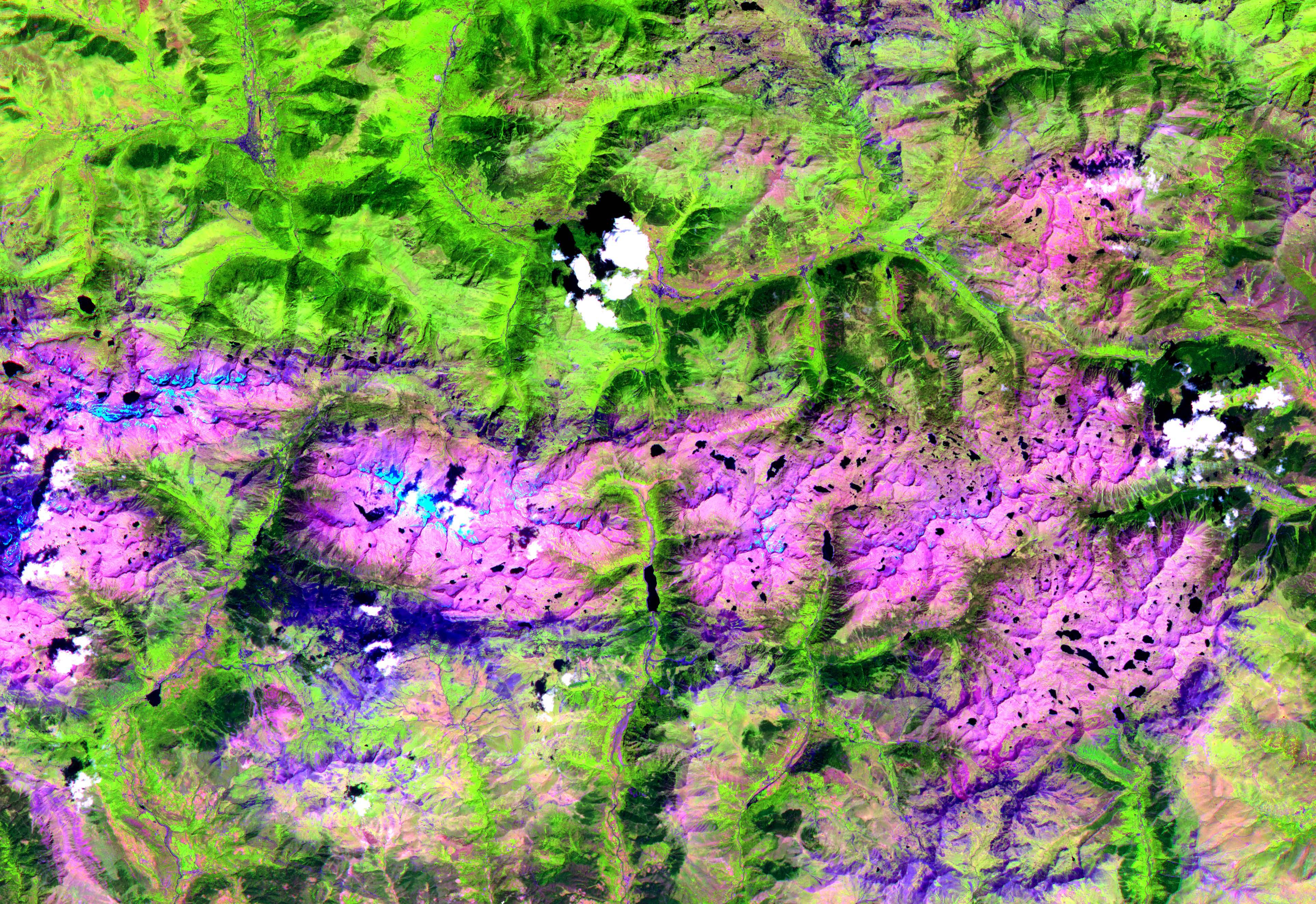
2001-10-22 |
Earth
|
Terra
|
ASTER
|
3851x2645x3 |

|
-
PIA11162:
-
Pyrenees Mtns., Spain
Full Resolution:
TIFF
(30.56 MB)
JPEG
(2.239 MB)
|
|
|
2001-10-22 |
Earth
|
Terra
|
ASTER
|
1960x2100x3 |
|
-
PIA11164:
-
Saline Valley
Full Resolution:
TIFF
(12.37 MB)
JPEG
(1.34 MB)
|
|
|
2001-10-22 |
Earth
|
Terra
|
ASTER
|
3138x2611x3 |
|
-
PIA11165:
-
Oregon Forests
Full Resolution:
TIFF
(24.58 MB)
JPEG
(2.054 MB)
|
|
|
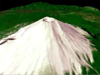
2001-10-22 |
Earth
|
Terra
|
ASTER
|
340x256x3 |

|
-
PIA11166:
-
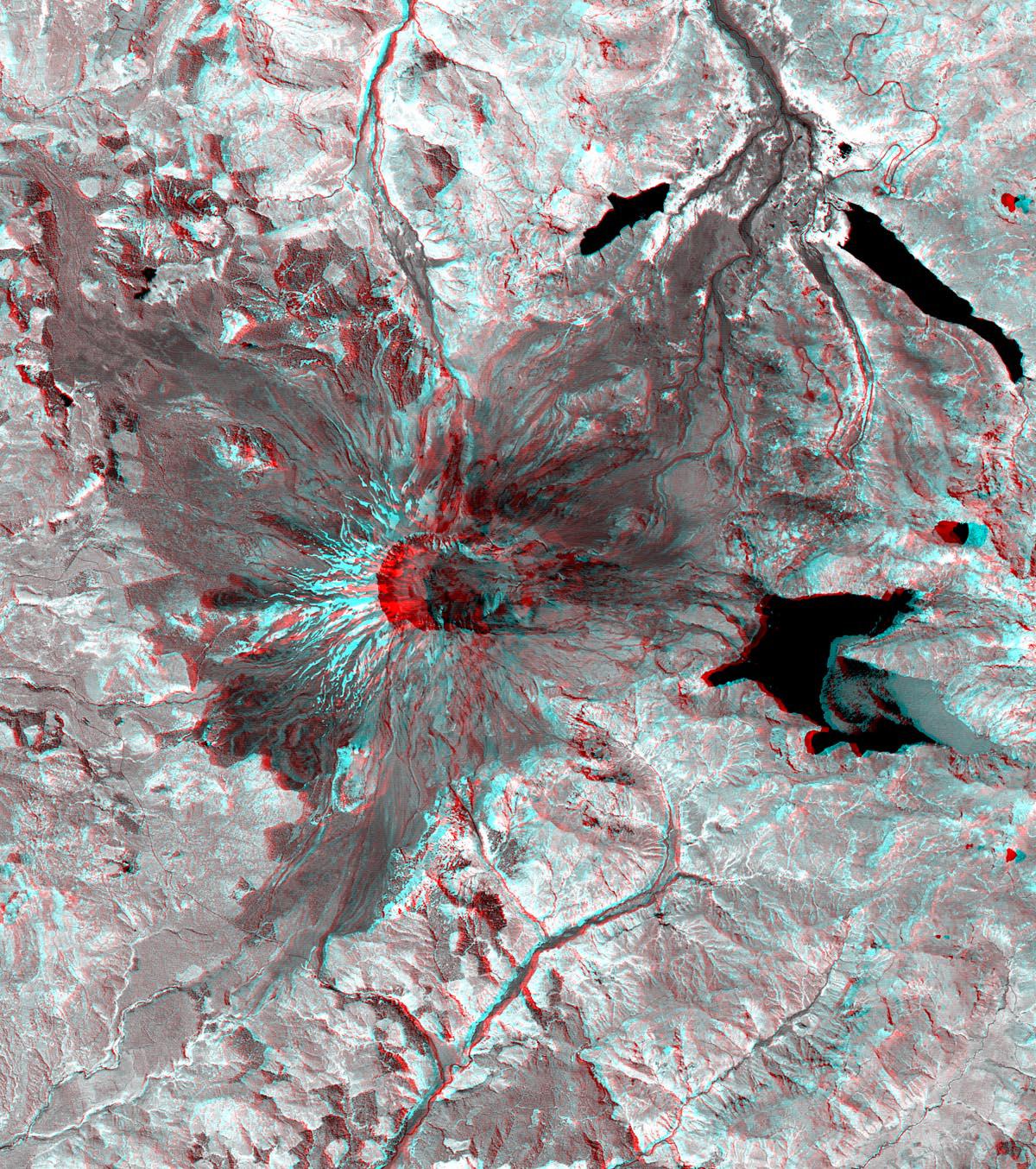
Mt. Fuji, Japan
Full Resolution:
TIFF
(261.6 kB)
JPEG
(12.14 kB)
|
|
|
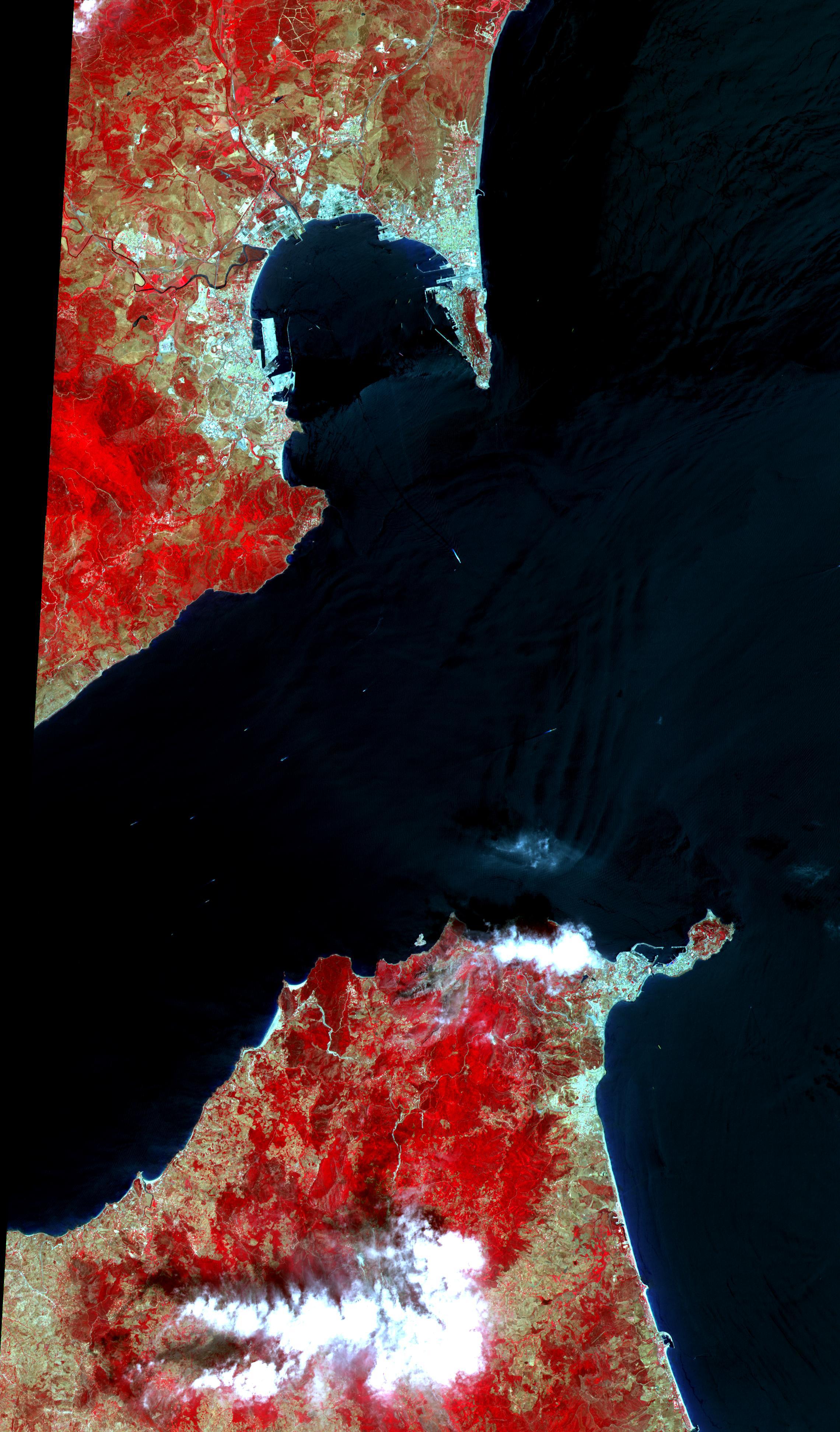
2001-10-22 |
Earth
|
Terra
|
ASTER
|
2280x3887x3 |
|
-
PIA11167:
-
Strait of Gibraltar
Full Resolution:
TIFF
(26.62 MB)
JPEG
(1.024 MB)
|
|
|
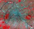
2001-10-22 |
Earth
|
Terra
|
ASTER
|
1528x1322x3 |
|
-
PIA11168:
-
Paris
Full Resolution:
TIFF
(6.071 MB)
JPEG
(1.008 MB)
|
|
|
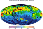
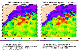
2008-09-22 |
Earth
|
Aqua
|
AIRS
|
1777x948x3 |
|
-
PIA11186:
-
AIRS Global Distribution of Mid-Tropospheric Carbon Dioxide at 8-13 km Altitudes
Full Resolution:
TIFF
(5.062 MB)
JPEG
(146.6 kB)
|
|
|
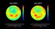
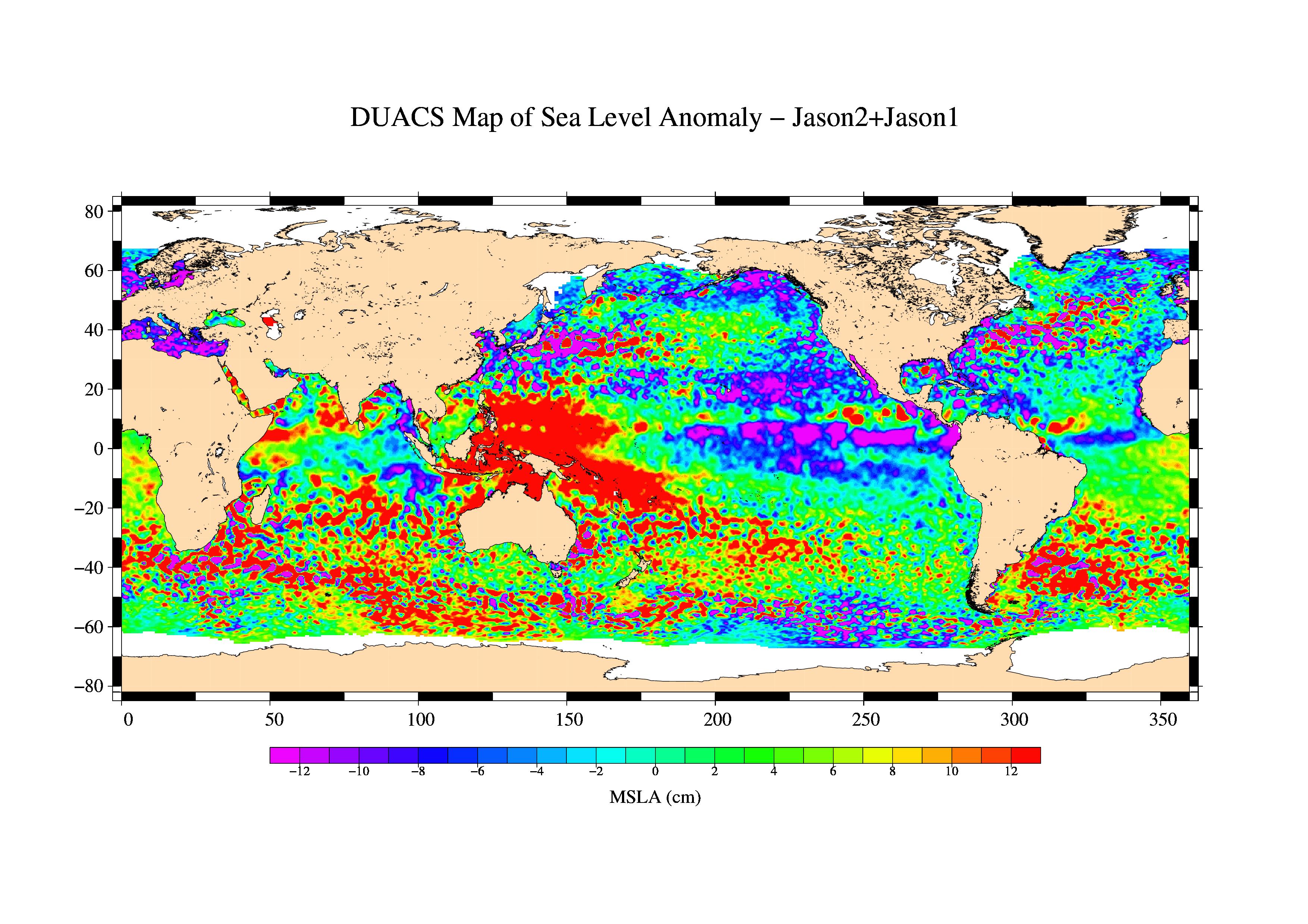
2008-09-24 |
Earth
|
Aqua
|
AIRS
|
5000x3750x3 |
|
-
PIA11194:
-
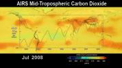
Global Carbon Dioxide Transport from AIRS Data, July 2008
Full Resolution:
TIFF
(56.25 MB)
JPEG
(715.3 kB)
|
|
|
2008-09-24 |
Earth
|
OSTM/Jason-2
|
Altimeter
|
1225x710x3 |
|
-
PIA11197:
-
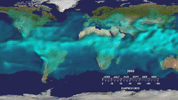
Newest Ocean-Observing Satellite Records Recent Sea Level Changes
Full Resolution:
TIFF
(872.5 kB)
JPEG
(211.1 kB)
|
|
|
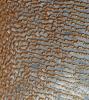
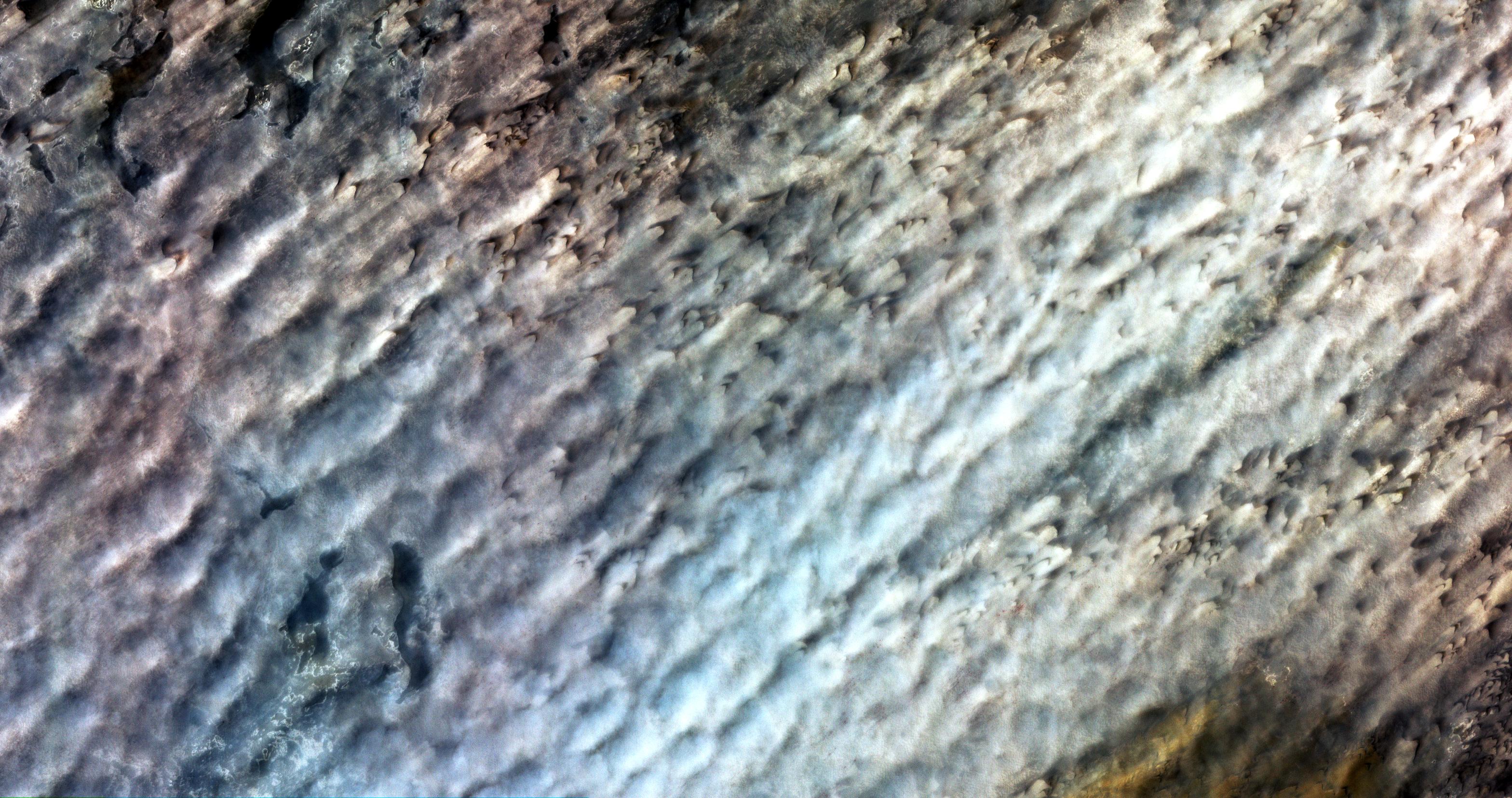
2008-09-30 |
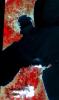
Earth
|
Phoenix
|
|
1228x910x1 |
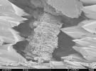
|
-
PIA11207:
-
Terrestrial Clay under Microscope
Full Resolution:
TIFF
(1.119 MB)
JPEG
(140.7 kB)
|
|
|
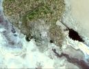
2008-11-03 |
Earth
|
Terra
|
ASTER
|
6630x5000x3 |
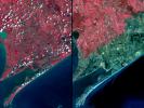
|
-
PIA11394:
-
Aftermath of Hurricane Ike along Texas Coast
Full Resolution:
TIFF
(99.45 MB)
JPEG
(4.42 MB)
|
|
|
2008-11-03 |
Earth
|
Aqua
|
AIRS
|
3840x2160x3 |
|
-
PIA11395:
-
AIRS Carbon Dioxide with Mauna Loa Carbon Dioxide Overlaid
Full Resolution:
TIFF
(24.88 MB)
JPEG
(534 kB)
|
|
|
2008-11-17 |
Earth
|
Terra
|
ASTER
|
4070x8024x3 |
|
-
PIA11419:
-
Byrd Glacier, Antarctica
Full Resolution:
TIFF
(97.97 MB)
JPEG
(7.07 MB)
|
|
|
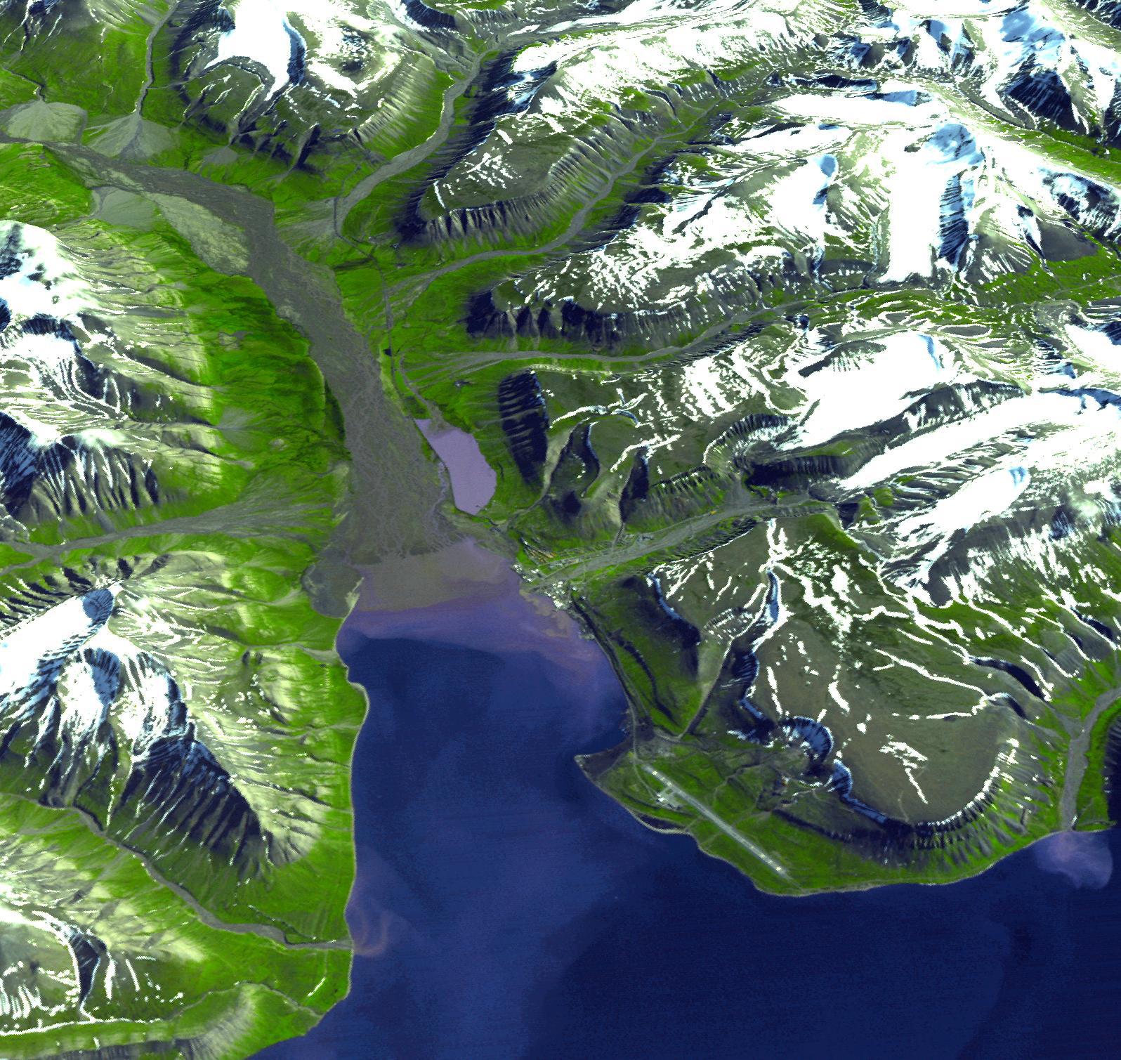
2008-10-16 |
Earth
|
Terra
|
ASTER
|
1922x2982x3 |
|
-
PIA11420:
-
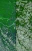
Mato Grosso, Brazil
Full Resolution:
TIFF
(17.22 MB)
JPEG
(1.446 MB)
|
|
|
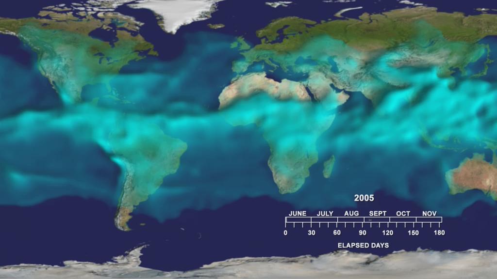
2008-11-18 |
Earth
|
Aqua
|
AIRS
|
1024x576x3 |
|
-
PIA11424:
-
Water Vapor Transport, June through November 2005 (Movie)
Full Resolution:
TIFF
(1.772 MB)
JPEG
(54.12 kB)
|
|
|
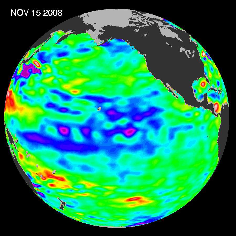
2008-12-13 |
Earth
|
Jason-1
|
Altimeter
|
900x900x3 |
|
-
PIA11710:
-
Oscillation Rules as the Pacific Cools
Full Resolution:
TIFF
(2.433 MB)
JPEG
(102.9 kB)
|
|
|
2009-01-09 |
Earth
|
Terra
|
ASTER
|
3136x1656x3 |
|
-
PIA11752:
-
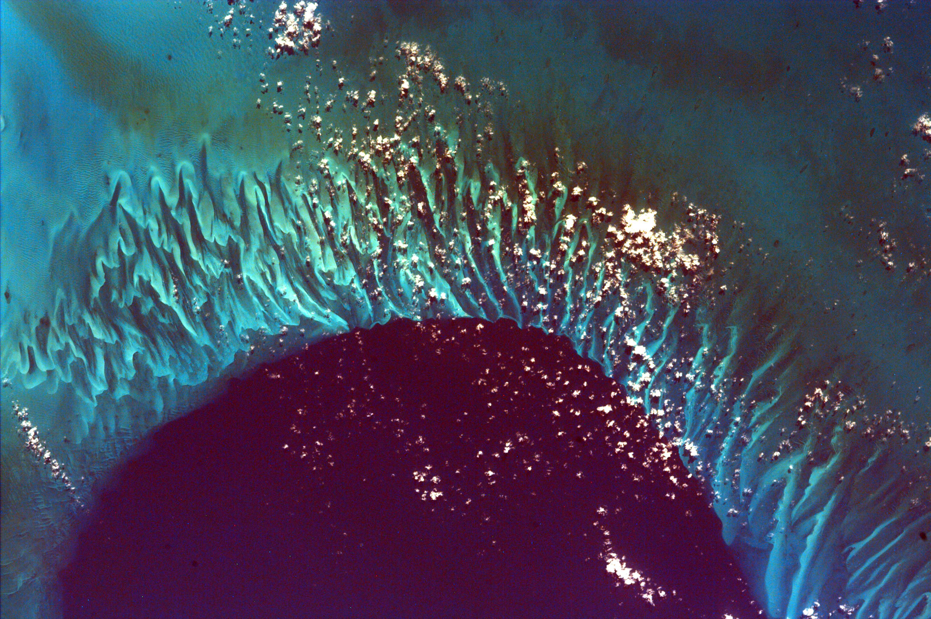
Bodele Sand Dunes, Chad
Full Resolution:
TIFF
(15.58 MB)
JPEG
(879.5 kB)
|
|
|
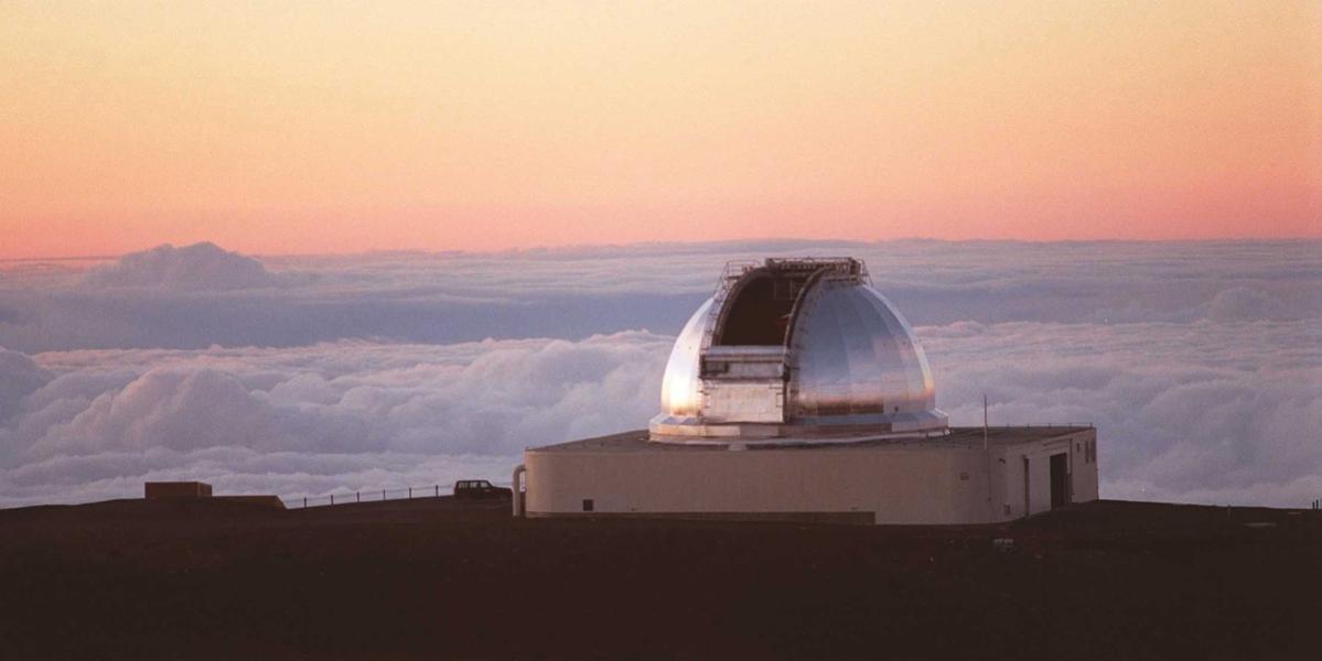
2010-02-03 |
Earth
|
IRTF
|
|
1199x600x3 |

|
-
PIA12504:
-
NASA's Infrared Telescope Facility atop Mauna Kea, Hawaii
Full Resolution:
TIFF
(2.161 MB)
JPEG
(46.23 kB)
|
|
|
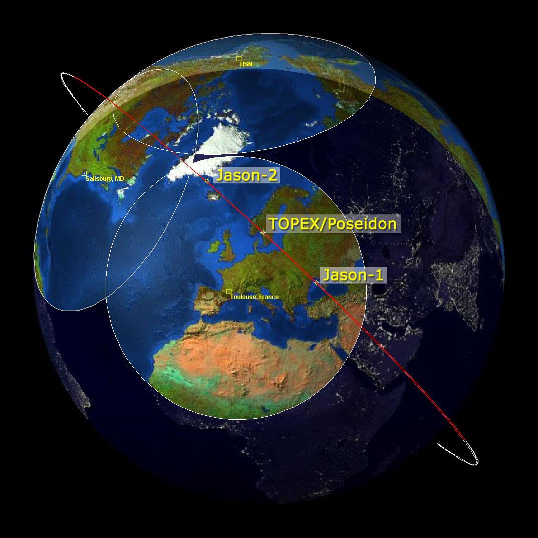
2009-02-06 |
Earth
|
Jason-1
OSTM/Jason-2
|
Altimeter
|
1074x1074x3 |

|
-
PIA11794:
-
Altimeter Family Portrait: Topex/Poseidon, Jason-1 and OSTM/Jason-2
Full Resolution:
TIFF
(3.465 MB)
JPEG
(131 kB)
|
|
|
2009-02-18 |
Earth
|
Terra
|
ASTER
|
3315x3324x3 |

|
-
PIA11806:
-
Australia Wildfires Extract a Heavy Toll in Lives, Land
Full Resolution:
TIFF
(33.06 MB)
JPEG
(1.678 MB)
|
|
|
2009-02-19 |
Earth
|
Aqua
|
AIRS
|
764x522x3 |
|
-
PIA11807:
-
Carbon Monoxide from the Australian Fires of Feb 2009 as seen by AIRS
Full Resolution:
TIFF
(1.198 MB)
JPEG
(92.37 kB)
|
|
|
2009-03-26 |
Earth
|
Jason-1
OSTM/Jason-2
|
Altimeter
|
3508x2479x3 |

|
-
PIA11859:
-
First Jason-1 and OSTM/Jason-2 Tandem Global View
Full Resolution:
TIFF
(26.09 MB)
JPEG
(1.128 MB)
|
|
|
2009-04-01 |
Earth
|
Shuttle Radar Topography Mission (SRTM)
|
C-Band Radar
|
1250x1440x1 |
|
-
PIA11964:
-
Fargo, North Dakota, USA
Full Resolution:
TIFF
(1.802 MB)
JPEG
(353.4 kB)
|
|
|
2009-04-19 |
Earth
|
Terra
|
ASTER
|
2508x5460x3 |
|
-
PIA11989:
-
North Dakota Floods
Full Resolution:
TIFF
(41.12 MB)
JPEG
(3.296 MB)
|
|
|
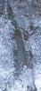
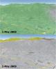
2009-04-20 |
Earth
|
Terra
|
ASTER
|
3235x2351x3 |
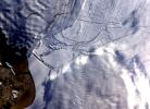
|
-
PIA11991:
-
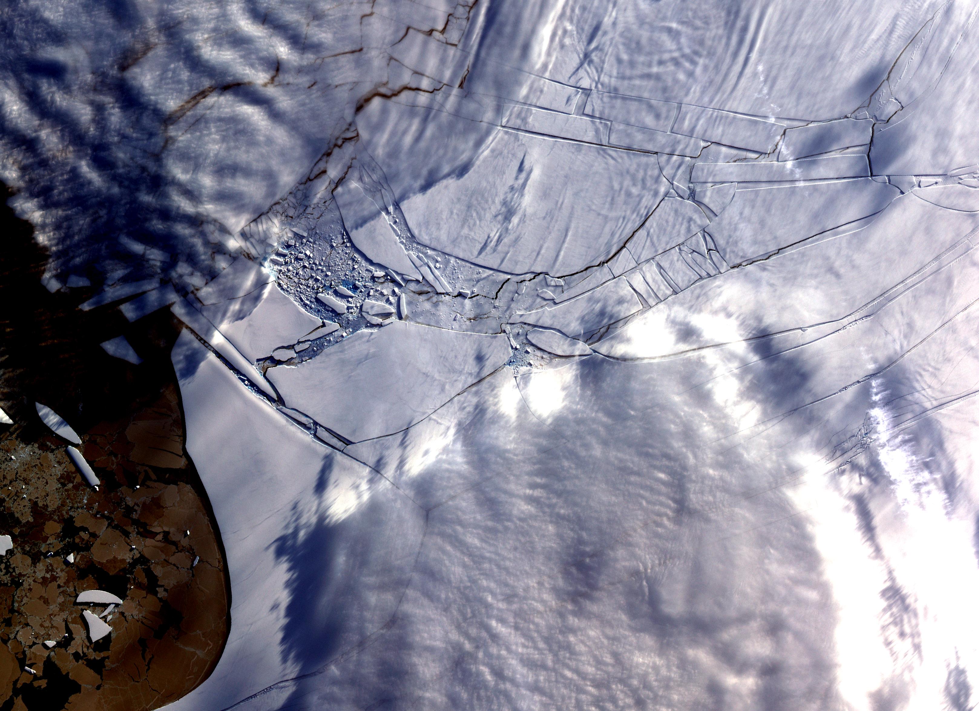
Wilkins Ice Shelf
Full Resolution:
TIFF
(22.82 MB)
JPEG
(984.9 kB)
|
|
|
2009-04-27 |
Earth
|
Jason-1
OSTM/Jason-2
|
Altimeter
|
1010x654x3 |
|
-
PIA11997:
-
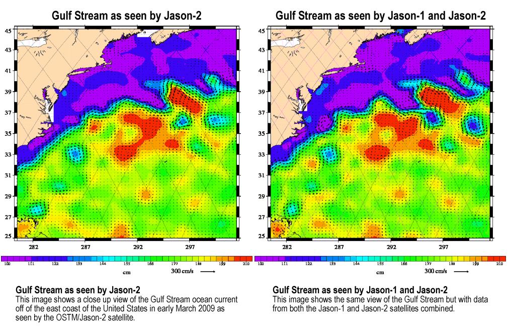
OSTM/Jason-2 and Jason-1 Tandem Mission View of the Gulf Stream
Full Resolution:
TIFF
(663 kB)
JPEG
(187.6 kB)
|
|
|
2009-05-08 |
Earth
|
QuikScat
|
SeaWinds Scatterometer
|
2367x2916x3 |
|
-
PIA12006:
-
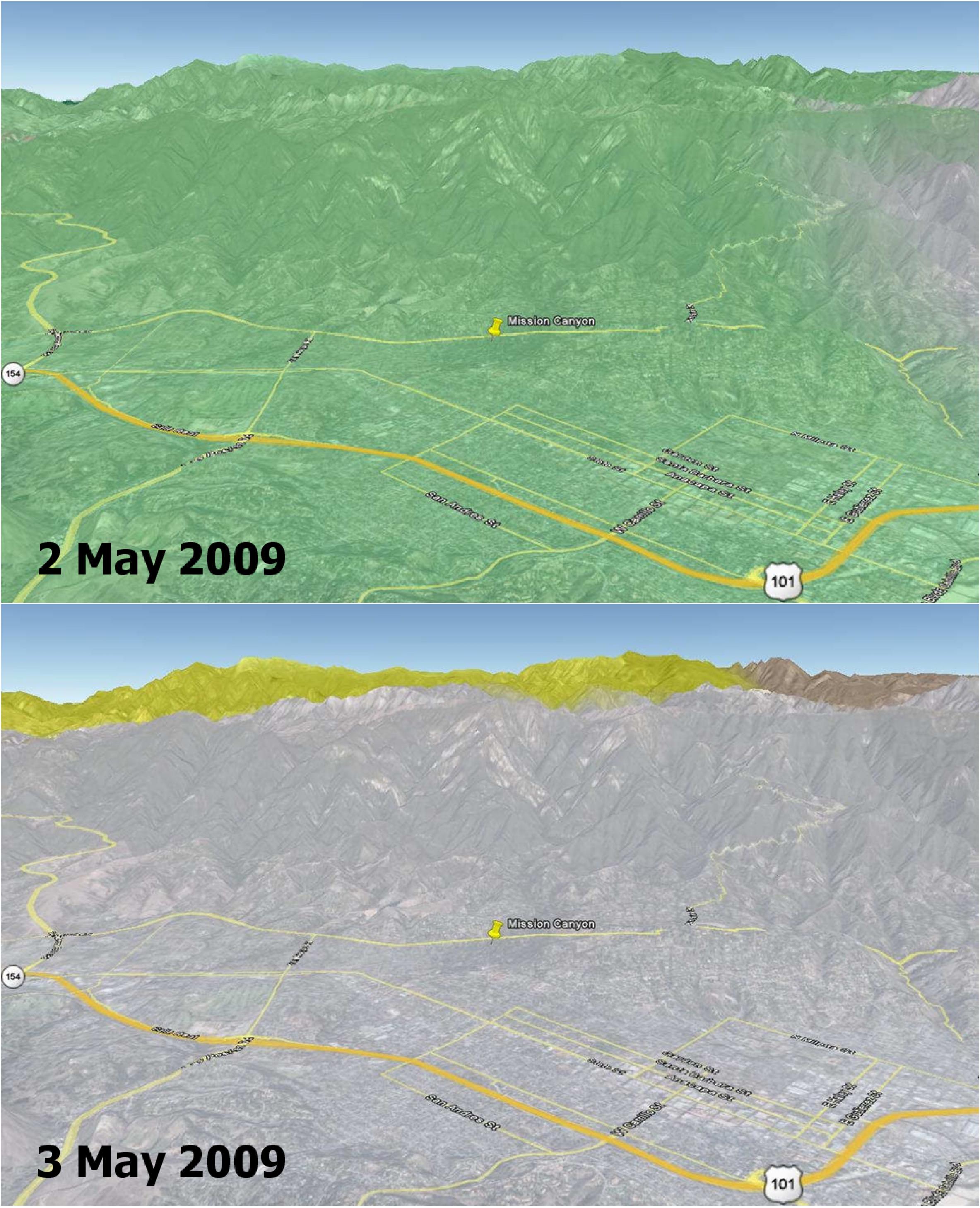
Disaster Management: Rapid Dry-Up of Rainwater on Land Surface Leading to the Santa Barbara Wildfire
Full Resolution:
TIFF
(20.73 MB)
JPEG
(727.8 kB)
|
|
|
2009-02-09 |
Earth
|
Terra
|
ASTER
|
2468x1992x3 |
|
-
PIA12055:
-
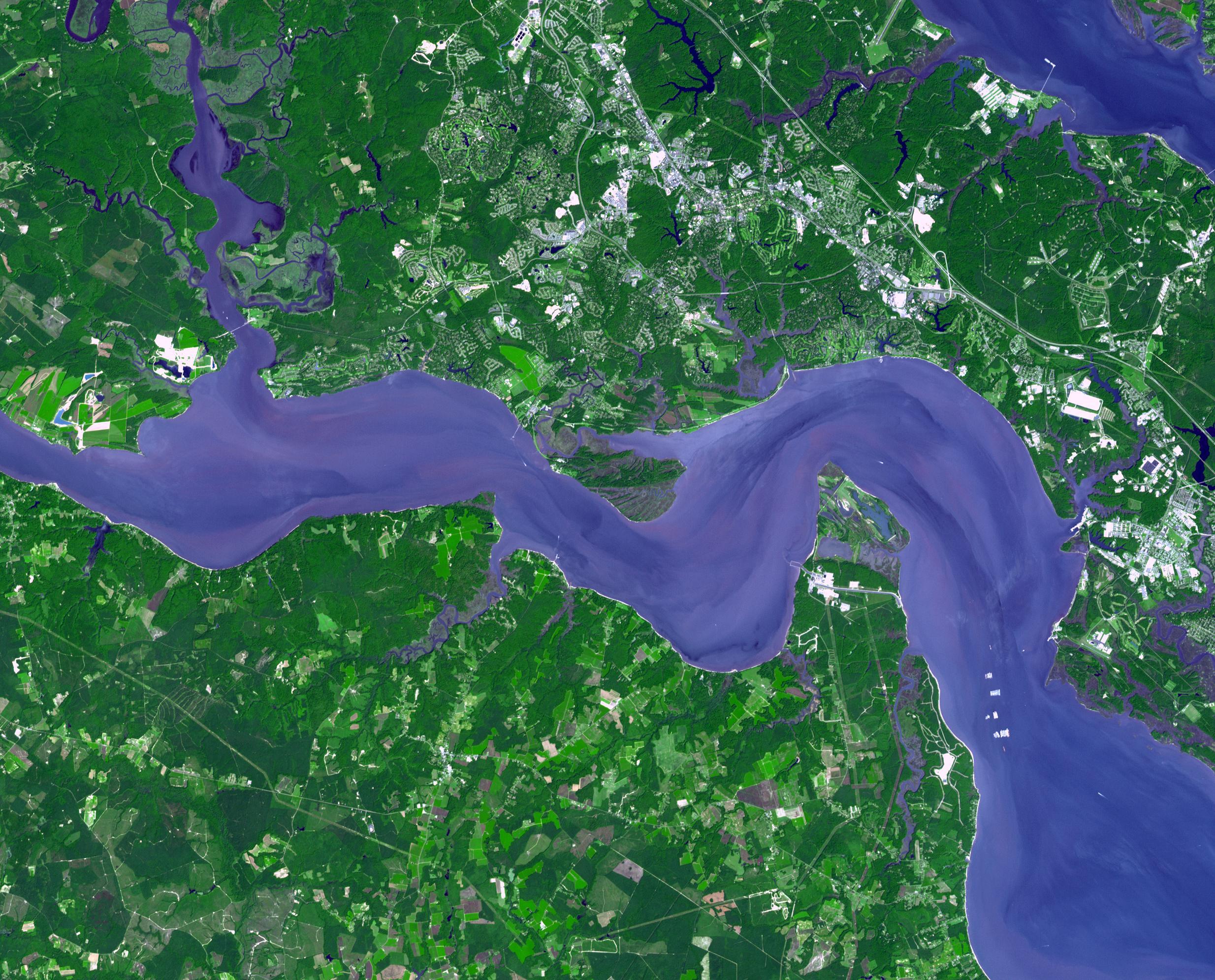
Jamestown, VA
Full Resolution:
TIFF
(14.76 MB)
JPEG
(918.7 kB)
|
|
|
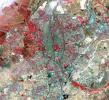
2009-02-20 |
Earth
|
Terra
|
ASTER
|
3900x3764x3 |
|
-
PIA12056:
-
Hokkaido, Japan
Full Resolution:
TIFF
(44.04 MB)
JPEG
(1.775 MB)
|
|
|
2009-03-02 |
Earth
|
Terra
|
ASTER
|
2368x3020x3 |
|
-
PIA12057:
-
Palm Islands, Dubai, UAE
Full Resolution:
TIFF
(21.48 MB)
JPEG
(700.7 kB)
|
 Planetary Data System


