My
List |
Addition Date
|
Target
|
Mission
|
Instrument
|
Size
|

|
2019-07-12 |
Earth
|
Orbiting Carbon Observatory (OCO-3)
|
OCO-3
|
1007x701x3 |

|
-
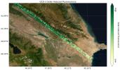
PIA23352:
-
OCO-3's First CO2 Measurements
Full Resolution:
TIFF
(1.255 MB)
JPEG
(99.61 kB)
|
|
|
2019-07-12 |
Earth
|
Orbiting Carbon Observatory (OCO-3)
|
OCO-3
|
1440x841x3 |
|
-
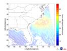
PIA23353:
-
OCO-3's First Solar-Induced Fluorescence Measurements
Full Resolution:
TIFF
(3.003 MB)
JPEG
(203.5 kB)
|
|
|
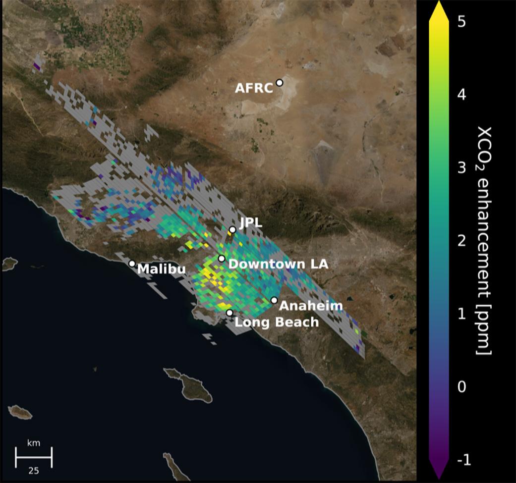
2021-06-07 |
Earth
|
Orbiting Carbon Observatory (OCO-3)
|
OCO-3
|
1041x975x3 |

|
-
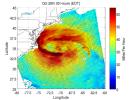
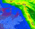
PIA24523:
-
Carbon Dioxide Over the L.A. Metropolitan Area
Full Resolution:
TIFF
(2.021 MB)
JPEG
(104.3 kB)
|
|
|
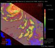
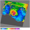
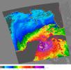
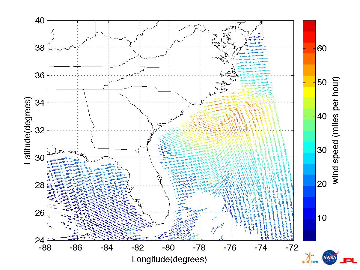
2011-08-27 |
Earth
|
OSCAT
|
OSCAT Scatterometer
|
1201x900x3 |
|
-
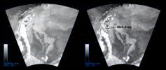
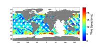
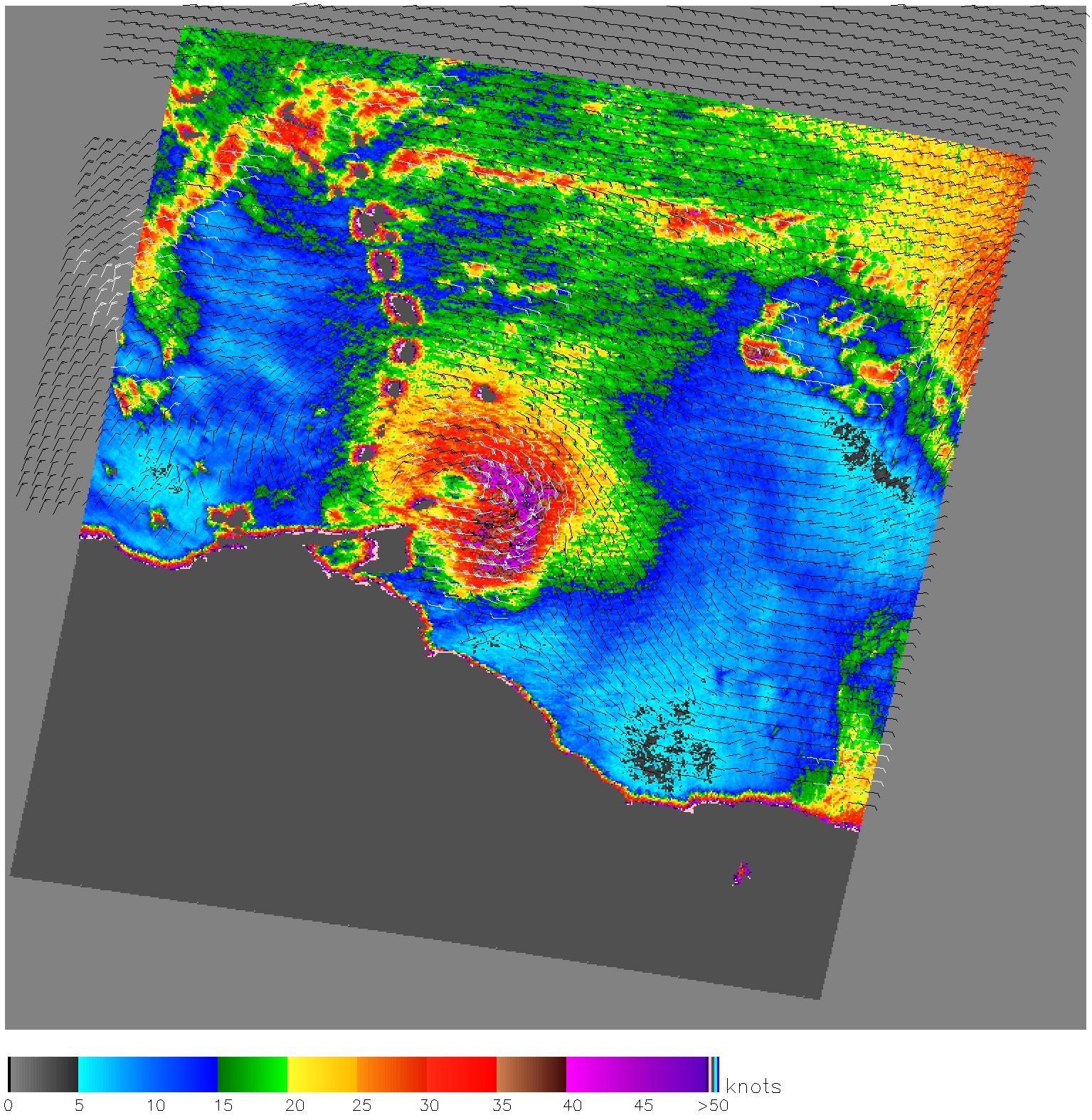
PIA14742:
-
NASA/ISRO Image Shows Irene's Winds Before Landfall
Full Resolution:
TIFF
(3.247 MB)
JPEG
(233.9 kB)
|
|
|
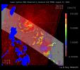
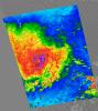
2012-10-30 |
Earth
|
OSCAT
|
OSCAT Scatterometer
|
447x337x3 |
|
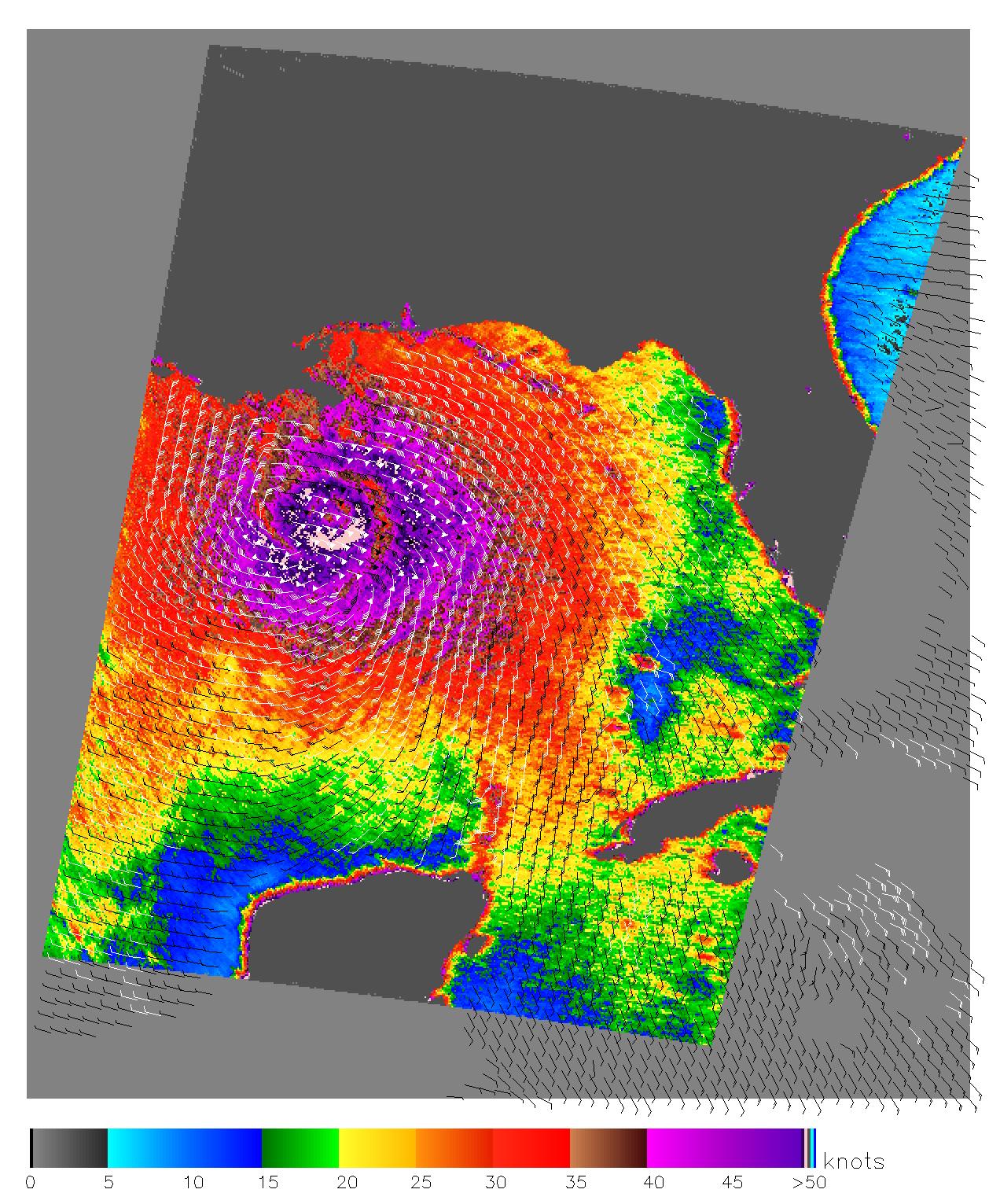
-
PIA16219:
-
OSCAT Eyes Hurricane Sandy
Full Resolution:
TIFF
(452.3 kB)
JPEG
(43.27 kB)
|
|
|
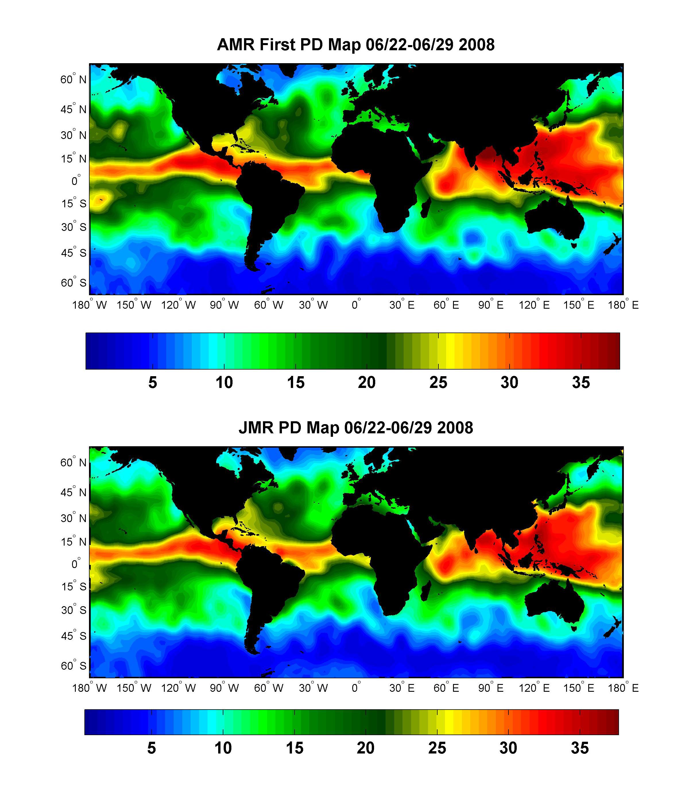
2008-07-15 |
Earth
|
OSTM/Jason-2
|
Advanced Microwave Radiometer (AMR)
|
2400x2772x3 |
|
-
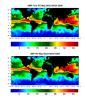
PIA10954:
-
Global Views of Atmospheric Water Vapor:
First Data from OSTM/Jason-2's Advanced Microwave Radiometer
Full Resolution:
TIFF
(19.98 MB)
JPEG
(537.4 kB)
|
|
|
2008-09-24 |
Earth
|
OSTM/Jason-2
|
Altimeter
|
1225x710x3 |
|
-
PIA11197:
-
Newest Ocean-Observing Satellite Records Recent Sea Level Changes
Full Resolution:
TIFF
(872.5 kB)
JPEG
(211.1 kB)
|
|
|
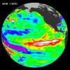
2009-10-29 |
Earth
|
OSTM/Jason-2
|
Altimeter
|
900x900x3 |
|
-
PIA12334:
-
Waves That Feed El Niños
Full Resolution:
TIFF
(2.433 MB)
JPEG
(104.4 kB)
|
|
|
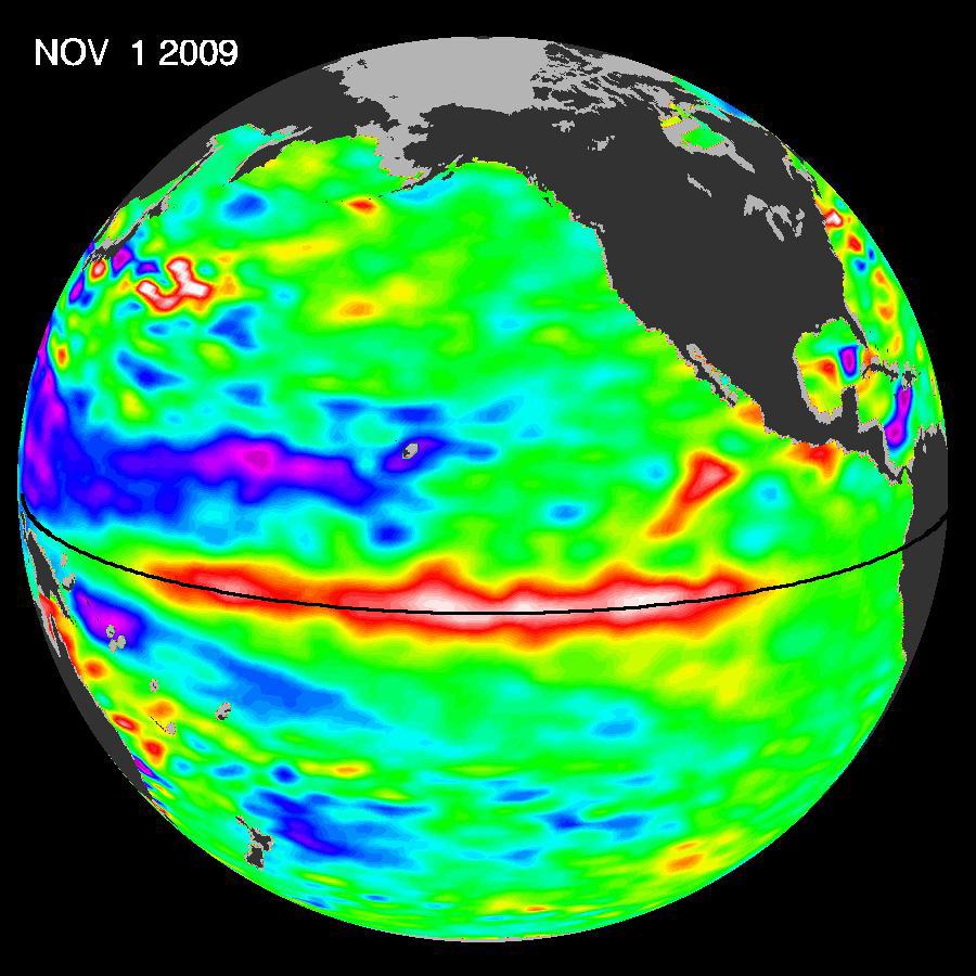
2009-11-12 |
Earth
|
OSTM/Jason-2
|
Altimeter
|
900x900x3 |
|
-
PIA12326:
-
El Niño Pumping Up, Warm Kelvin Wave Surges Toward South America
Full Resolution:
TIFF
(2.433 MB)
JPEG
(106 kB)
|
|
|
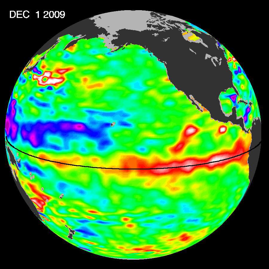
2009-12-17 |
Earth
|
OSTM/Jason-2
|
Altimeter
|
900x900x3 |
|
-
PIA12404:
-
El Niño Surges; Warm Kelvin Wave Headed for South America
Full Resolution:
TIFF
(2.433 MB)
JPEG
(109.1 kB)
|
|
|
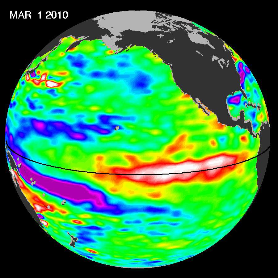
2010-03-16 |
Earth
|
OSTM/Jason-2
|
Altimeter
|
900x900x3 |
|
-
PIA12962:
-
El Niño's Last Stand?
Full Resolution:
TIFF
(2.433 MB)
JPEG
(108.4 kB)
|
|
|
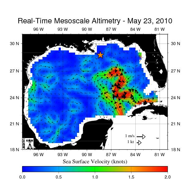
2010-05-24 |
Earth
|
OSTM/Jason-2
|
Altimeter
|
612x627x3 |

|
-
PIA13155:
-
Birth of a Loop Current Eddy
Full Resolution:
TIFF
(385.9 kB)
JPEG
(69.75 kB)
|
|
|
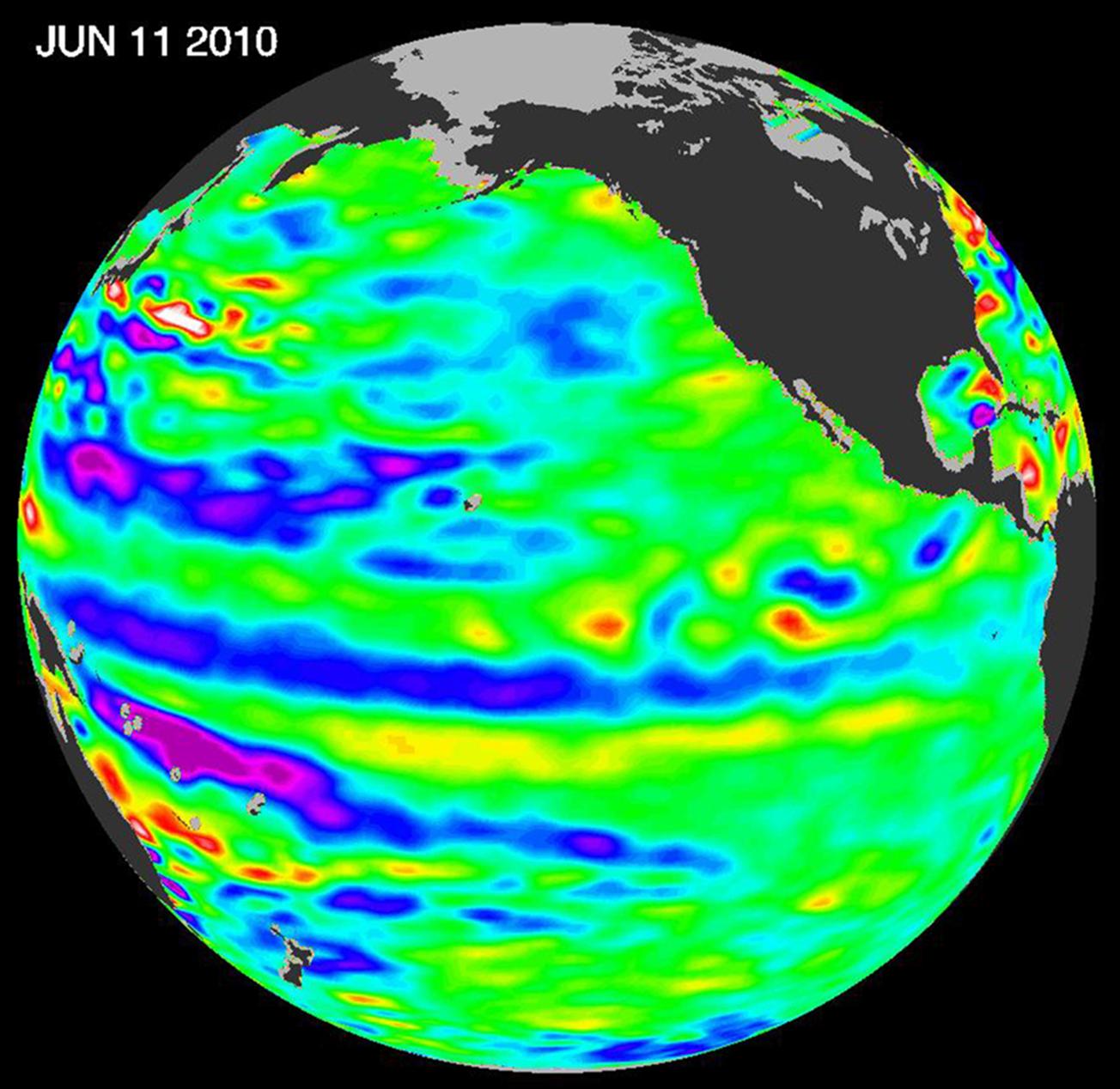
2010-06-22 |
Earth
|
OSTM/Jason-2
|
Altimeter
|
1304x1268x3 |
|
-
PIA13211:
-
Adios El Niño, Hello La Niña?
Full Resolution:
TIFF
(4.966 MB)
JPEG
(158.7 kB)
|
|
|
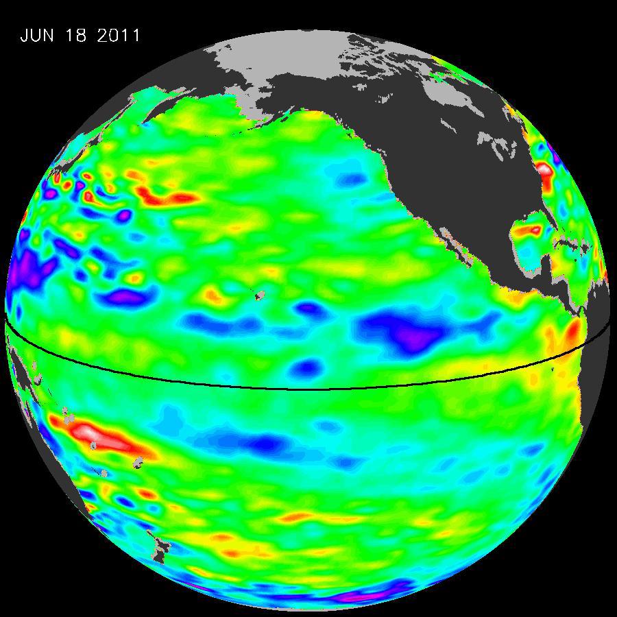
2011-07-06 |
Earth
|
OSTM/Jason-2
|
Altimeter
|
900x900x3 |
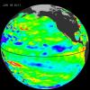
|
-
PIA14383:
-
La Niña's Exit Leaves Climate Forecasts in Limbo
Full Resolution:
TIFF
(2.433 MB)
JPEG
(104.9 kB)
|
|
|
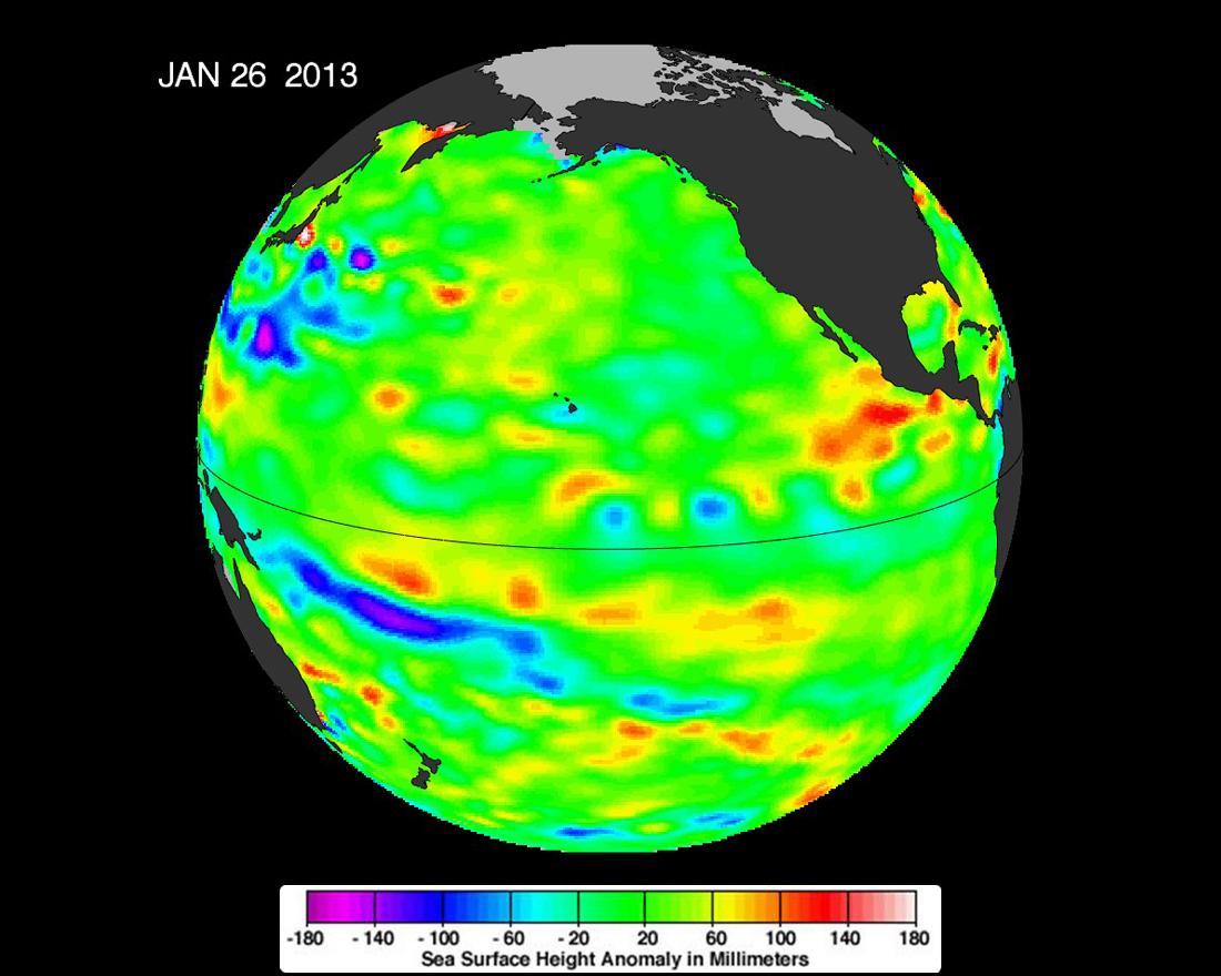
2013-02-07 |
Earth
|
OSTM/Jason-2
|
Altimeter
|
1100x880x3 |
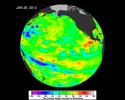
|
-
PIA16787:
-
Pacific Locked in 'La Nada' Limbo
Full Resolution:
TIFF
(2.905 MB)
JPEG
(93.08 kB)
|
|
|
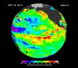
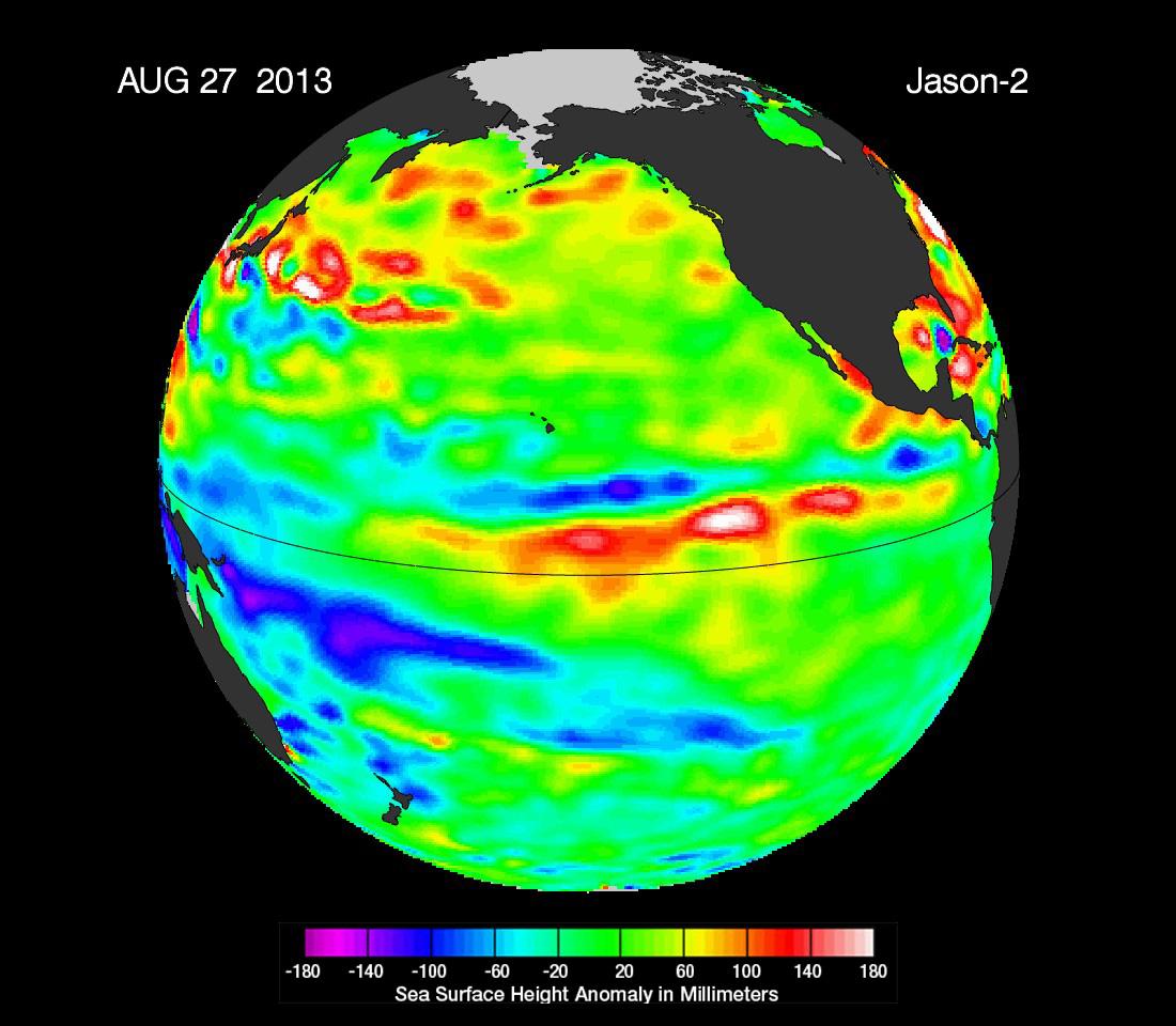
2013-09-09 |
Earth
|
OSTM/Jason-2
|
Altimeter
|
1100x960x3 |
|
-
PIA17454:
-
'La Nada' Climate Pattern Lingers in the Pacific
Full Resolution:
TIFF
(3.169 MB)
JPEG
(108.7 kB)
|
|
|
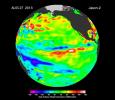
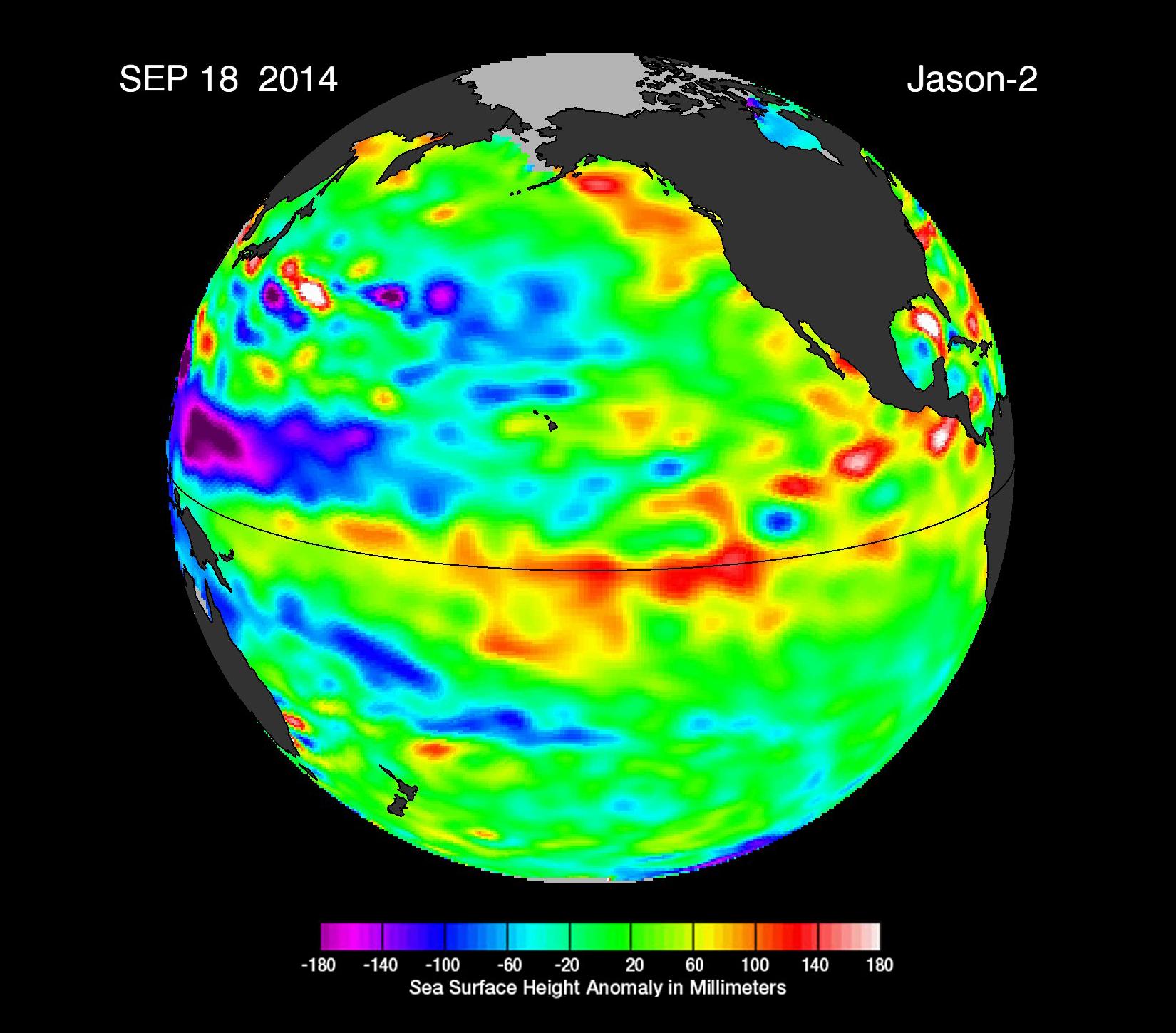
2014-09-22 |
Earth
|
OSTM/Jason-2
|
Altimeter
|
1650x1450x3 |
|
-
PIA17809:
-
The Fickle El Niño of 2014
Full Resolution:
TIFF
(7.181 MB)
JPEG
(203.9 kB)
|
|
|
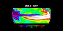
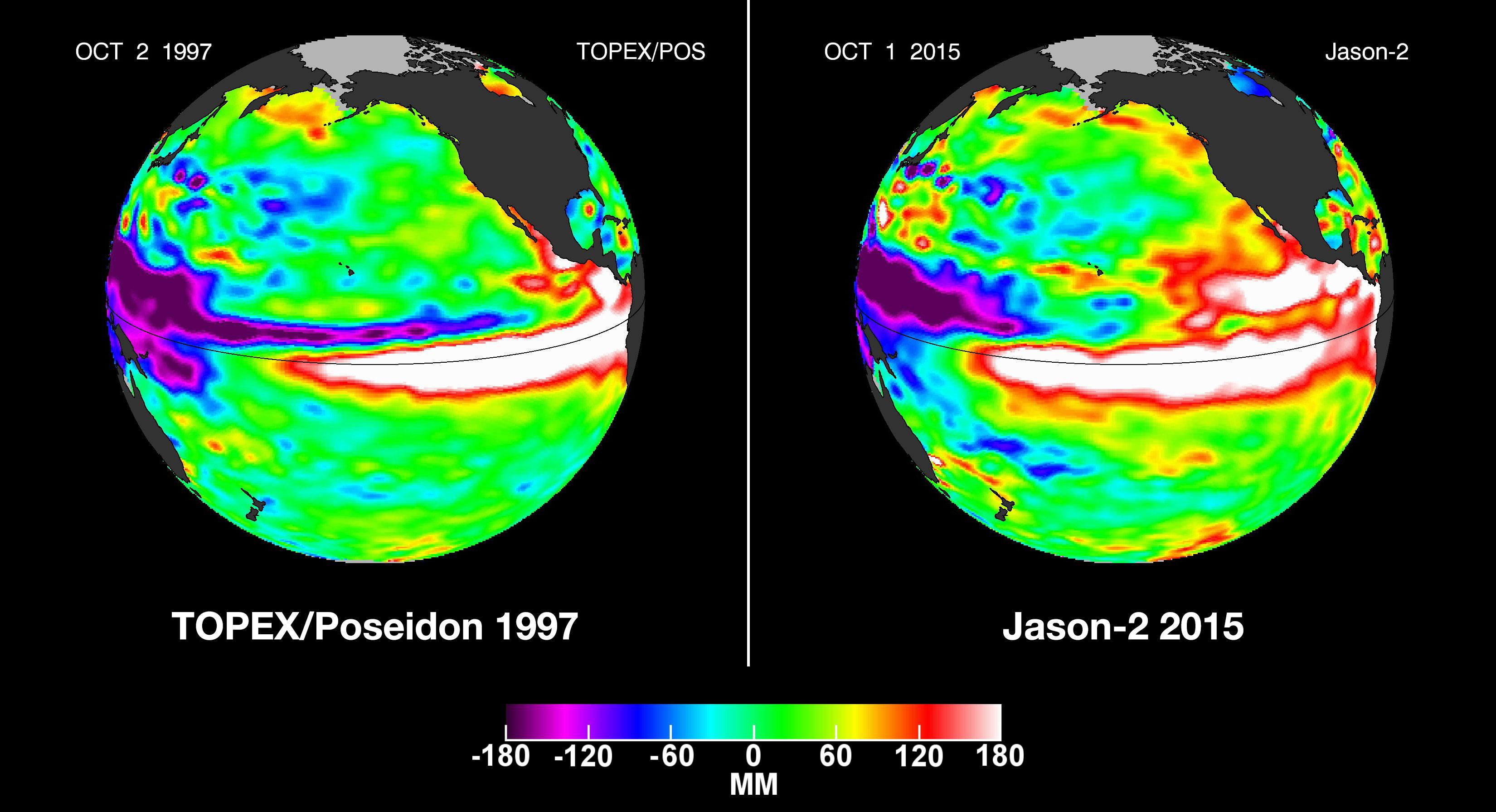
2015-10-19 |
Earth
|
OSTM/Jason-2
|
Altimeter
|
3300x1791x3 |
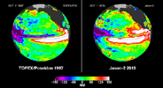
|
-
PIA20009:
-
NASA Studying 2015 El Niño Event as Never Before

Full Resolution:
TIFF
(6.183 MB)
JPEG
(459.8 kB)
|
|
|
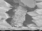
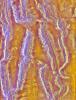
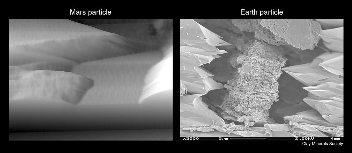
2008-09-30 |
Mars
|
Phoenix
|
MECA
|
1160x504x1 |

|
-
PIA11206:
-
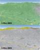
Mars Particle and Terrestrial Soil, Compared Microscopically
Full Resolution:
TIFF
(585.4 kB)
JPEG
(55.27 kB)
|
|
|
2008-09-30 |
Earth
|
Phoenix
|
|
1228x910x1 |
|
-
PIA11207:
-
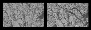
Terrestrial Clay under Microscope
Full Resolution:
TIFF
(1.119 MB)
JPEG
(140.7 kB)
|
|
|
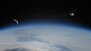
2023-08-14 |
Earth
|
Polar Radiant Energy in the Far-InfraRed Experiment (PREFIRE)
|
|
1920x1080x3 |
|
-
PIA25778:
-
PREFIRE Satellite Illustration
Full Resolution:
TIFF
(3.12 MB)
JPEG
(92.14 kB)
|
|
|
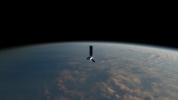
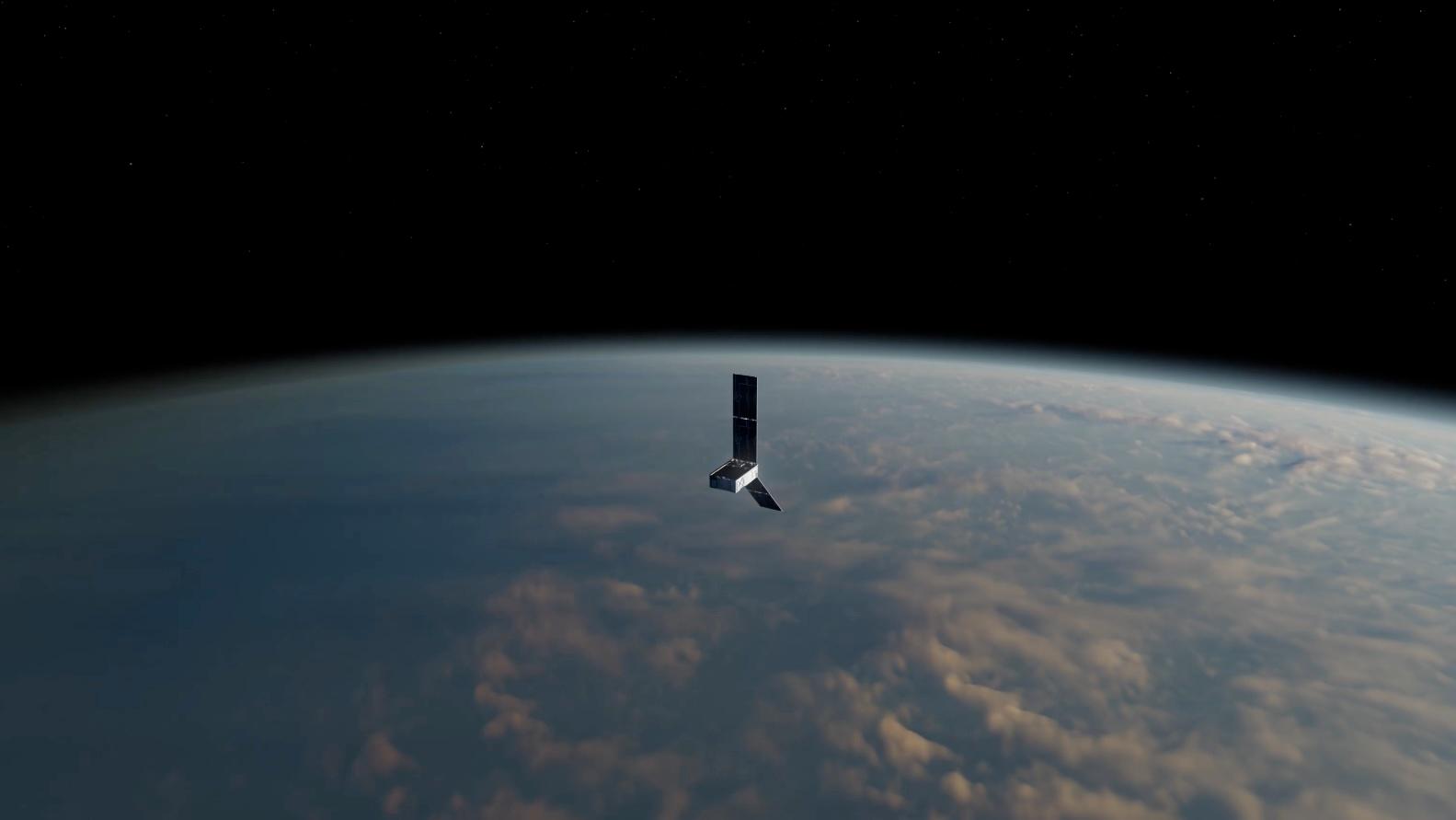
2024-05-15 |
Earth
|
Polar Radiant Energy in the Far-InfraRed Experiment (PREFIRE)
|
|
1583x891x3 |
|
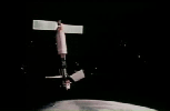
-
PIA26185:
-
PREFIRE CubeSat in Earth Orbit (Artist's Concept)
Full Resolution:
TIFF
(1.666 MB)
JPEG
(47.7 kB)
|
|
|
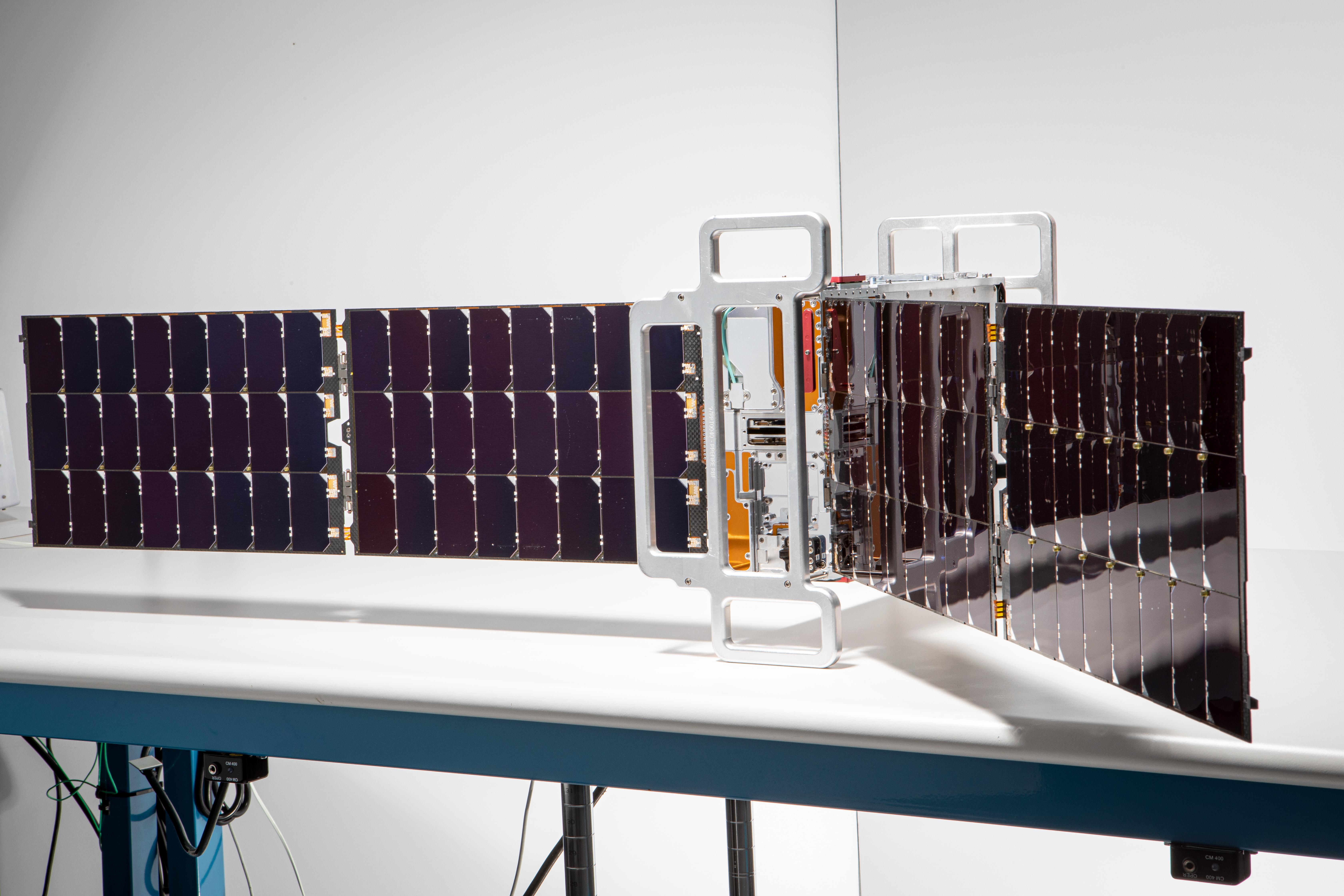
2024-05-21 |
Earth
|
Polar Radiant Energy in the Far-InfraRed Experiment (PREFIRE)
|
|
6720x4480x3 |

|
-
PIA26186:
-
PREFIRE CubeSat Image
Full Resolution:
TIFF
(56.6 MB)
JPEG
(2.543 MB)
|
|
|
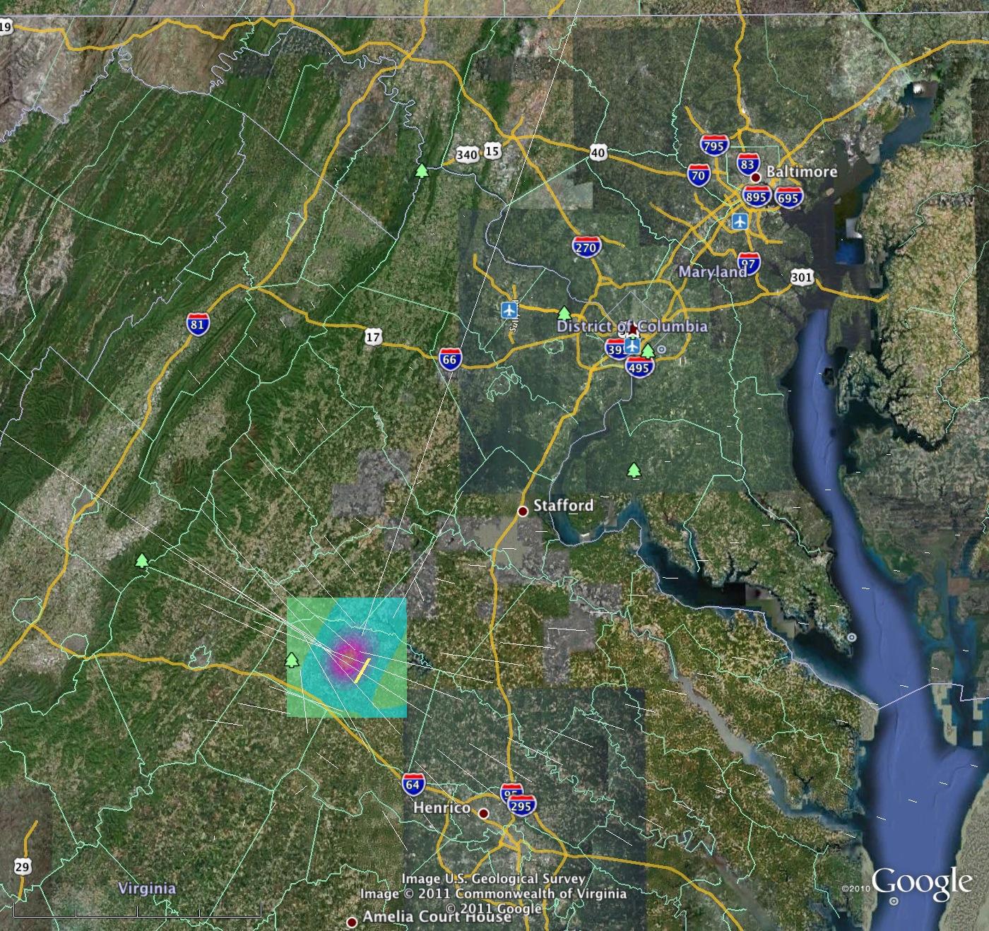
2011-08-24 |
Earth
|
QuakeSim
|
|
1400x1318x3 |

|
-
PIA13950:
-
Computer Model Estimates Permanent Ground Motions from the Aug. 23, 2011 Magnitude 5.8 Virginia Earthquake
Full Resolution:
TIFF
(5.546 MB)
JPEG
(490.4 kB)
|
|
|
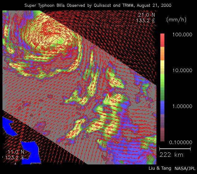
2000-08-23 |
Earth
|
QuikScat
|
SeaWinds Scatterometer
|
640x565x3 |
|
-
PIA01047:
-
Typhoon Bilis
Full Resolution:
TIFF
(229 kB)
JPEG
(123.4 kB)
|
|
|
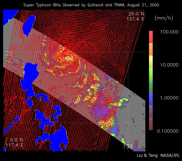
2002-07-05 |
Earth
|
QuikScat
|
SeaWinds Scatterometer
|
640x568x3 |
|
-
PIA01048:
-
Typhoon Bilis
Full Resolution:
TIFF
(166 kB)
JPEG
(122.5 kB)
|
|
|
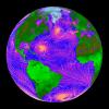
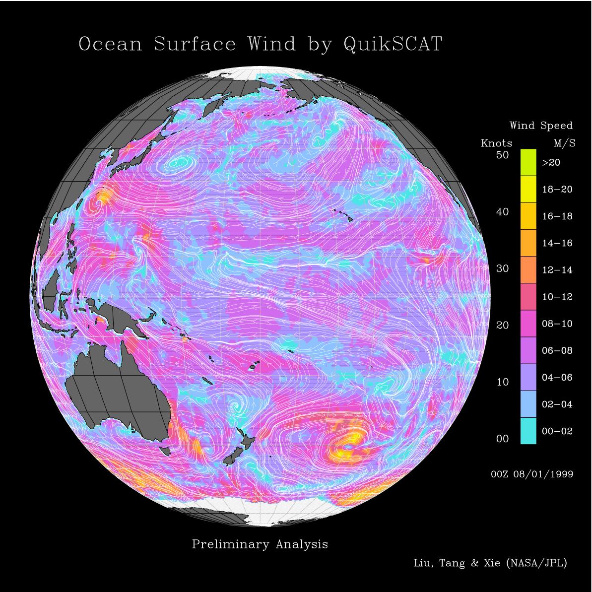
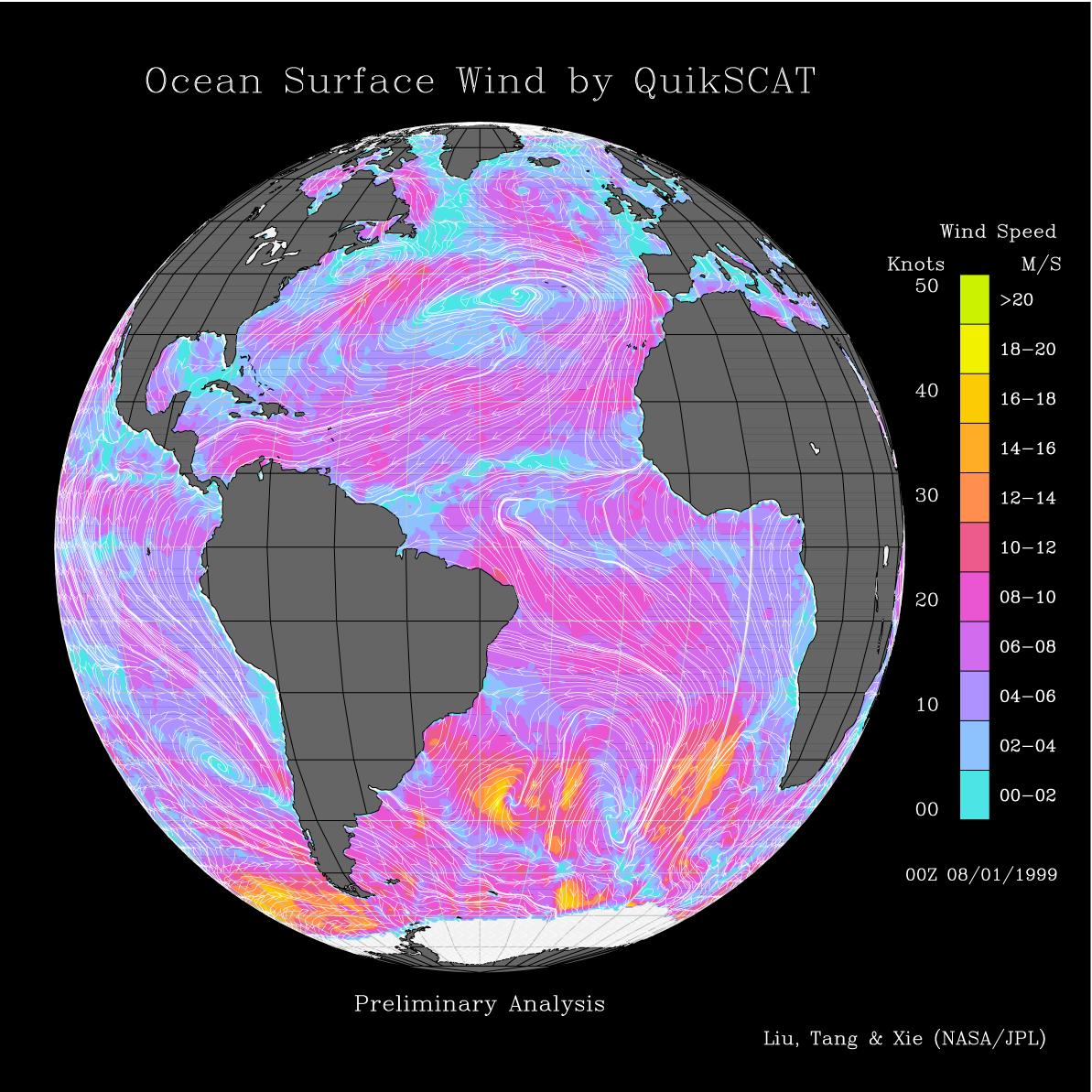
1999-08-09 |
Earth
|
QuikScat
|
SeaWinds Scatterometer
|
1193x1193x3 |
|
-
PIA01346:
-
Pacific Ocean Surface Winds from QuikScat
Full Resolution:
TIFF
(1.208 MB)
JPEG
(258.1 kB)
|
|
|
1999-08-09 |
Earth
|
QuikScat
|
SeaWinds Scatterometer
|
1193x1193x3 |
|
-
PIA01347:
-
Atlantic Ocean Surface Winds from QuikScat
Full Resolution:
TIFF
(1.065 MB)
JPEG
(237.9 kB)
|
|
|
1999-09-08 |
Earth
|
QuikScat
|
SeaWinds Scatterometer
|
900x900x1 |
|
-
PIA02329:
-
SeaWinds Watches for Breakup of Giant Iceberg
Full Resolution:
TIFF
(132.8 kB)
JPEG
(49.24 kB)
|
|
|
1999-09-16 |
Earth
|
QuikScat
|
SeaWinds Scatterometer
|
564x400x3 |
|
-
PIA02334:
-
SeaWinds Radar Stares Into The Eye Of Angry Hurricane Floyd
Full Resolution:
TIFF
(192.6 kB)
JPEG
(44.92 kB)
|
|
|
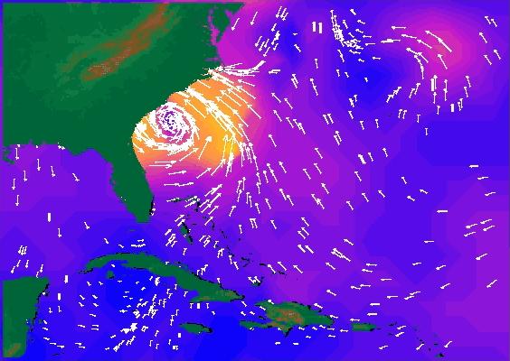
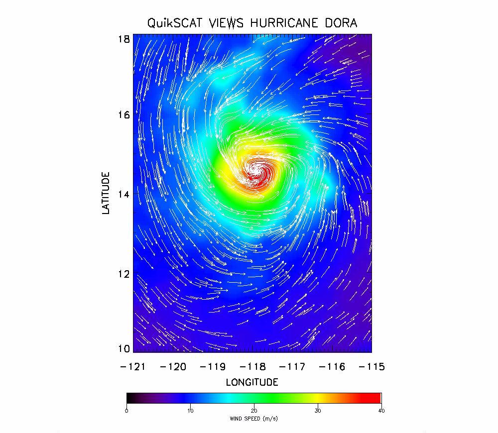
1999-08-25 |
Earth
|
QuikScat
|
SeaWinds Scatterometer
|
1000x870x3 |

|
-
PIA02404:
-
SeaWinds Radar Clocks Hurricane Dora's Wind Speeds
Full Resolution:
TIFF
(1.118 MB)
JPEG
(142.8 kB)
|
|
|
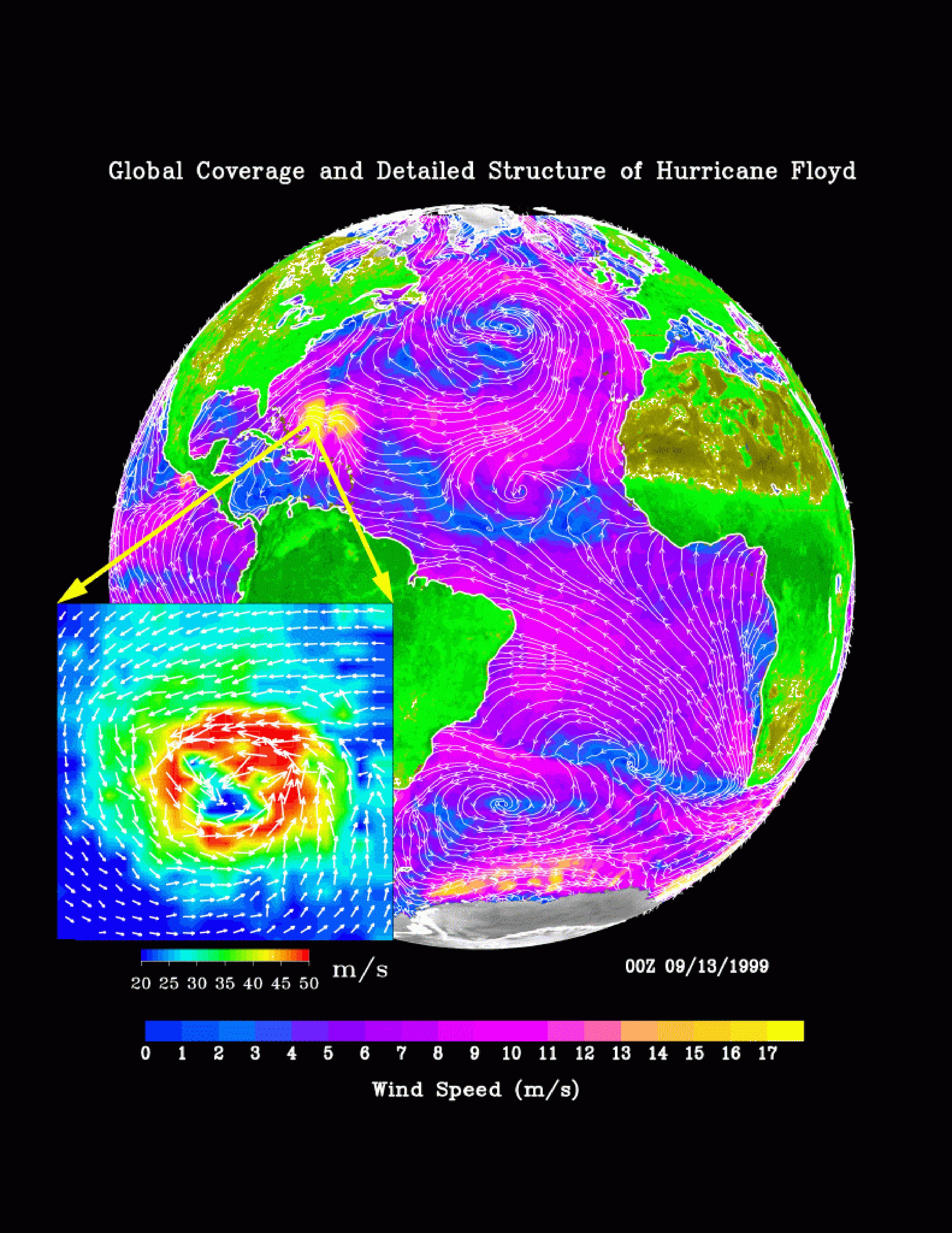
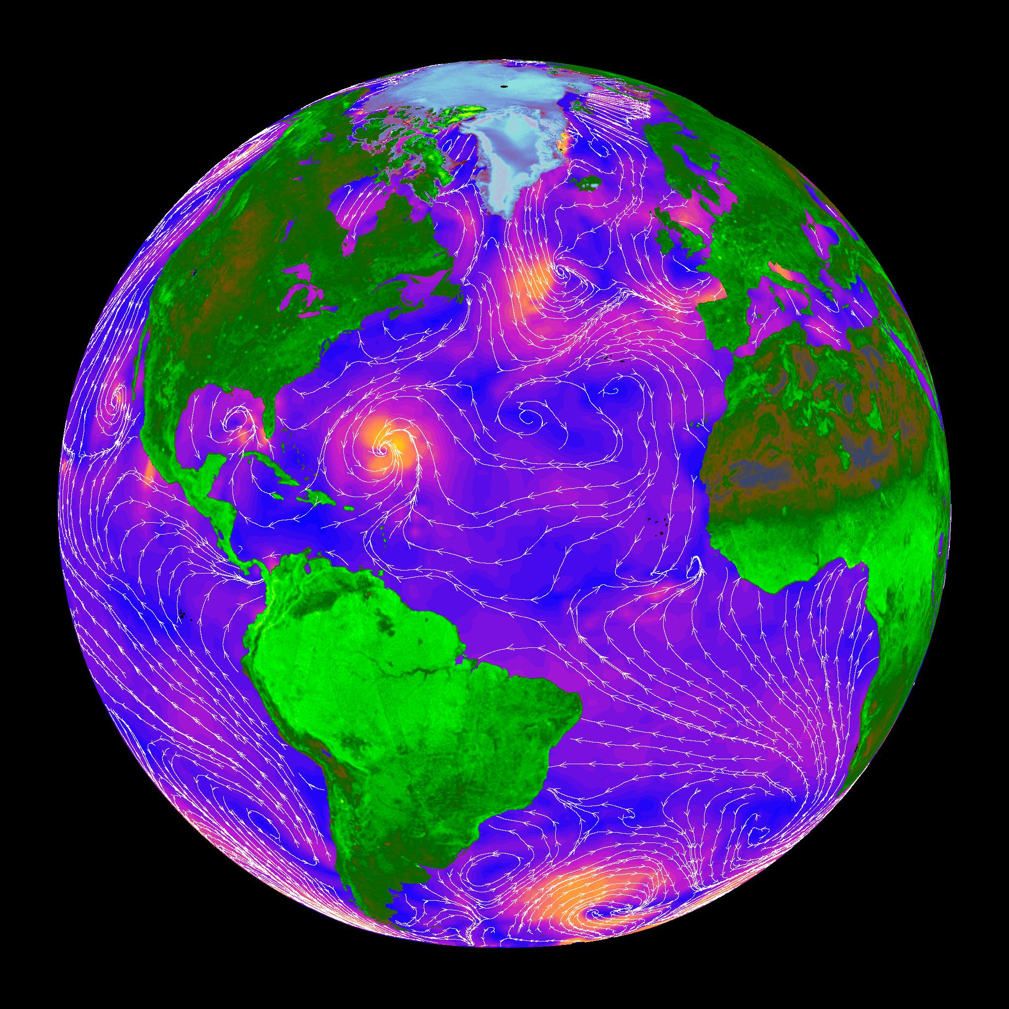
2000-05-07 |
Earth
|
QuikScat
|
SeaWinds Scatterometer
|
3296x4267x3 |

|
-
PIA02455:
-
SeaWinds Global Coverage with Detail of Hurricane Floyd
Full Resolution:
TIFF
(1.921 MB)
JPEG
(1.595 MB)
|
|
|
2000-05-07 |
Earth
|
QuikScat
|
SeaWinds Scatterometer
|
3296x4267x3 |
|
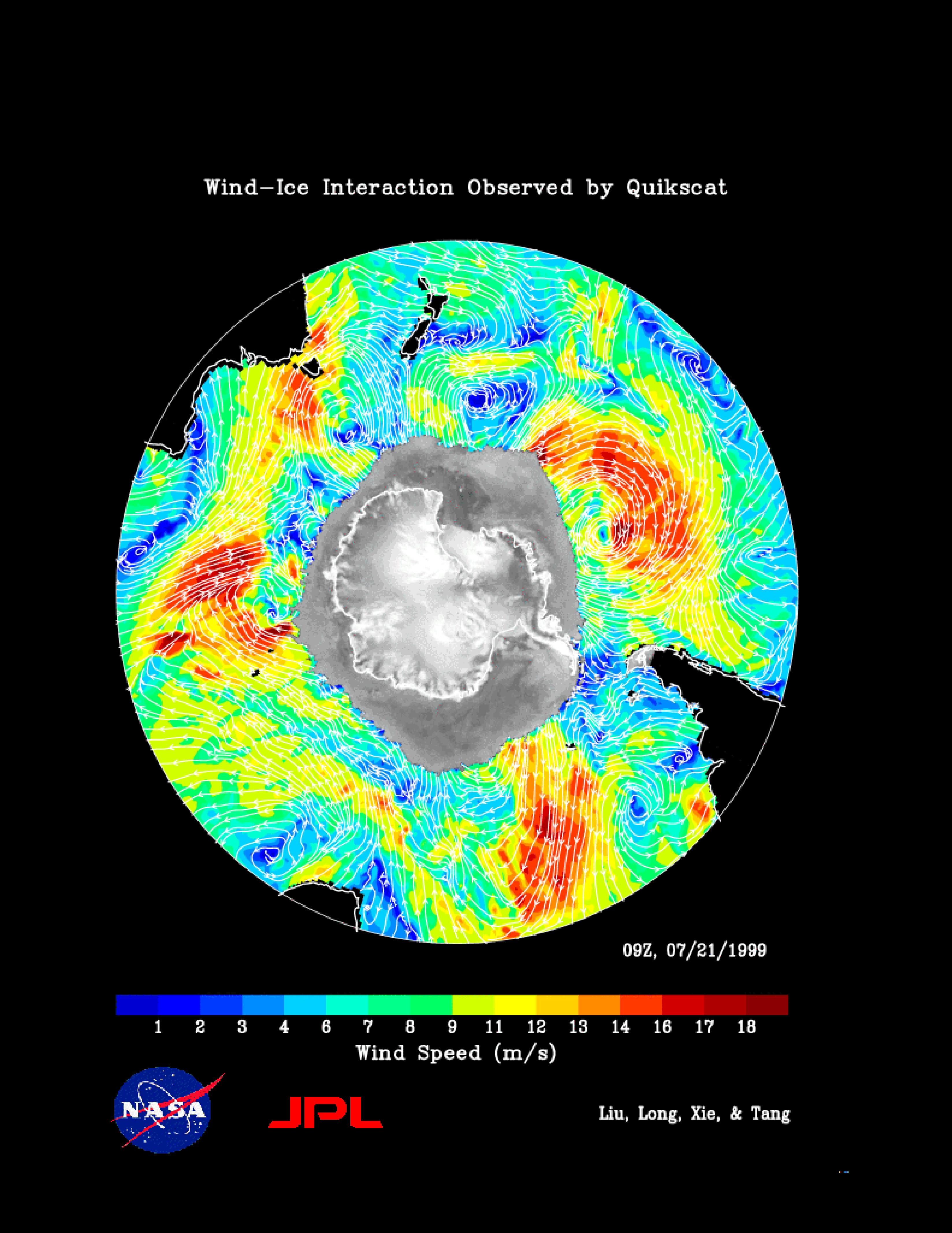
-
PIA02456:
-
SeaWinds Wind-Ice Interaction
Full Resolution:
TIFF
(1.974 MB)
JPEG
(1.274 MB)
|
|
|
2000-05-07 |
Earth
|
QuikScat
|
SeaWinds Scatterometer
|
2638x2201x3 |
|
-
PIA02457:
-
SeaWinds - South Georgia Island
Full Resolution:
TIFF
(1.029 MB)
JPEG
(1.018 MB)
|
|
|
2000-05-08 |
Earth
|
QuikScat
|
SeaWinds Scatterometer
|
2048x2048x3 |
|
-
PIA02458:
-
SeaWinds - Oceans, Land, Polar Regions
Full Resolution:
TIFF
(934.2 kB)
JPEG
(679.2 kB)
|
|
|
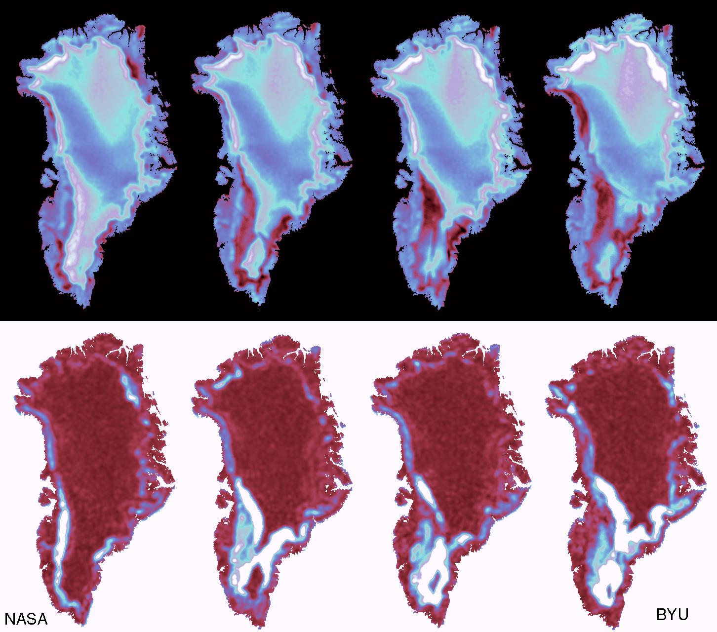
2000-05-08 |
Earth
|
QuikScat
|
SeaWinds Scatterometer
|
1452x1280x3 |
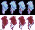
|
-
PIA02459:
-
SeaWinds - Greenland
Full Resolution:
TIFF
(765.6 kB)
JPEG
(205.7 kB)
|
|
|
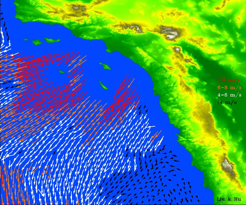
2003-01-08 |
Earth
|
QuikScat
|
SeaWinds Scatterometer
|
800x667x3 |
|
-
PIA03892:
-
Santa Ana Winds Over Los Angeles
Full Resolution:
TIFF
(1.608 MB)
JPEG
(154.9 kB)
|
|
|
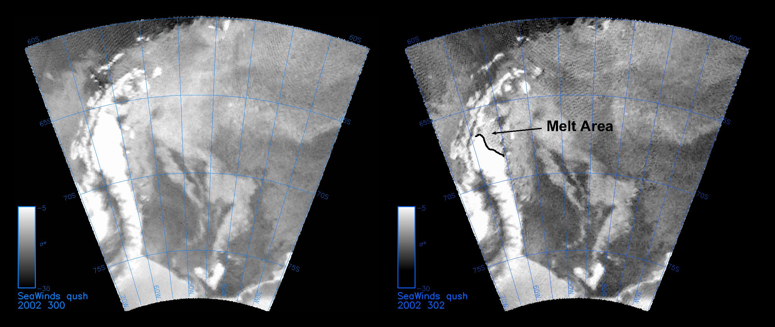
2003-01-13 |
Earth
|
QuikScat
|
SeaWinds Scatterometer
|
2490x1050x3 |
|
-
PIA03894:
-
QuikScat Captures an Early Melt
Full Resolution:
TIFF
(2.168 MB)
JPEG
(289.1 kB)
|
|
|
2004-12-09 |
Earth
|
QuikScat
|
SeaWinds Scatterometer
|
1414x1540x3 |
|
-
PIA07100:
-
Typhoon Nanmadol
Full Resolution:
TIFF
(6.539 MB)
JPEG
(1.741 MB)
|
|
|
2005-03-03 |
Earth
|
QuikScat
|
SeaWinds Scatterometer
|
1456x1548x3 |
|
-
PIA07415:
-
Cyclones in the Pacific
Full Resolution:
TIFF
(4.757 MB)
JPEG
(792.9 kB)
|
|
|
2005-07-18 |
Earth
|
QuikScat
|
SeaWinds Scatterometer
|
1280x1440x3 |
|
-
PIA07968:
-
Super Typhoon Haitang
Full Resolution:
TIFF
(5.536 MB)
JPEG
(636.7 kB)
|
|
|
2005-07-18 |
Earth
|
QuikScat
|
SeaWinds Scatterometer
|
1535x1575x3 |
|
-
PIA07969:
-
Hurricane Emily
Full Resolution:
TIFF
(7.266 MB)
JPEG
(561 kB)
|
|
|
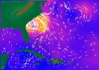
2005-08-25 |
Earth
|
QuikScat
|
SeaWinds Scatterometer
|
835x773x3 |
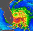
|
-
PIA07432:
-
Tropical Storm Katrina
Full Resolution:
TIFF
(1.939 MB)
JPEG
(229.8 kB)
|
|
|
2005-08-29 |
Earth
|
QuikScat
|
SeaWinds Scatterometer
|
1272x1531x3 |
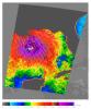
|
-
PIA04176:
-
Hurricane Katrina
Full Resolution:
TIFF
(5.849 MB)
JPEG
(446.3 kB)
|
|
|
2005-10-12 |
Earth
|
QuikScat
|
SeaWinds Scatterometer
|
3869x2421x3 |
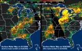
|
-
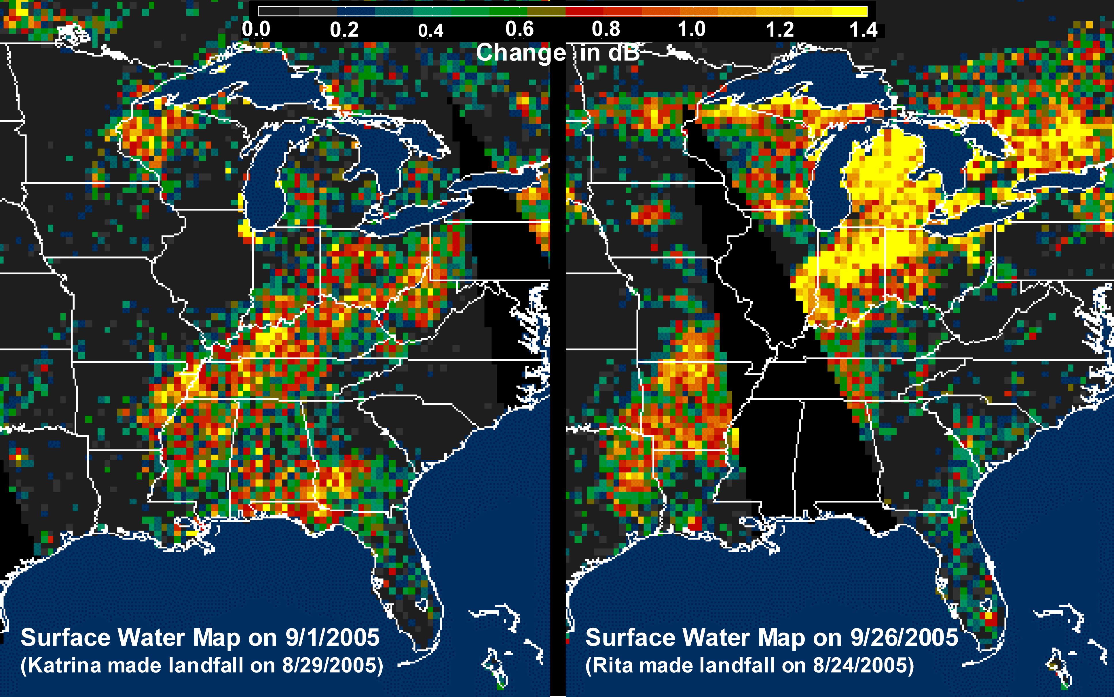
PIA03029:
-
Distribution Patterns of Land
Surface Water from Hurricanes Katrina and Rita
Full Resolution:
TIFF
(28.1 MB)
JPEG
(1.148 MB)
|
|
|
2005-10-21 |
Earth
|
QuikScat
|
SeaWinds Scatterometer
|
1599x1566x3 |
|
-
PIA03056:
-
Wilma's Winds Whip Mexico's Yucatan
Full Resolution:
TIFF
(2.508 MB)
JPEG
(579.9 kB)
|
|
|
2007-01-09 |
Earth
|
QuikScat
|
SeaWinds Scatterometer
|
1321x1623x3 |
|
-
PIA09110:
-
QuikScat Shows Rough Seas/Atmospheric Conditions at Time of Two Java Sea
Disasters
Full Resolution:
TIFF
(6.439 MB)
JPEG
(514.7 kB)
|
|
|
2007-06-06 |
Earth
|
QuikScat
|
SeaWinds Scatterometer
|
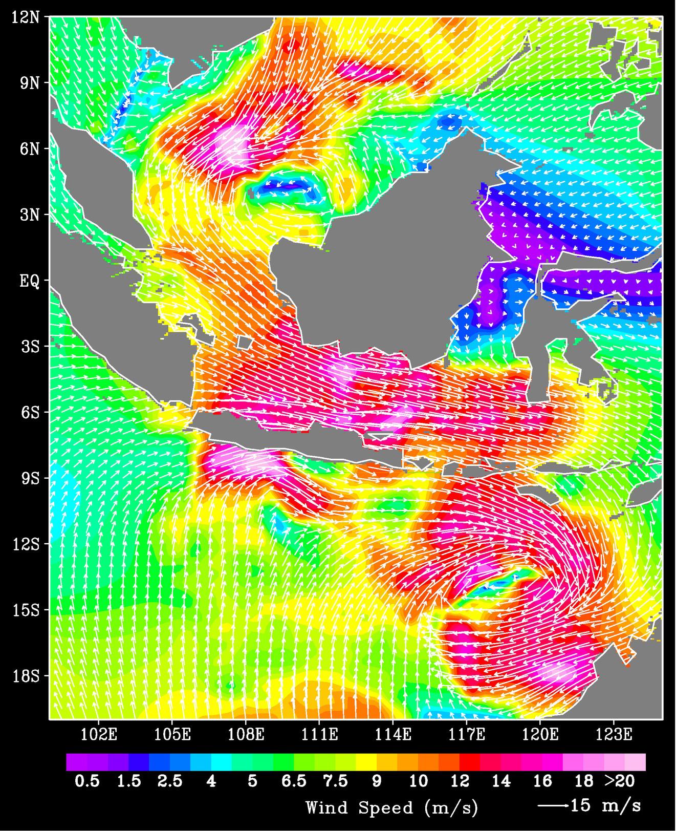
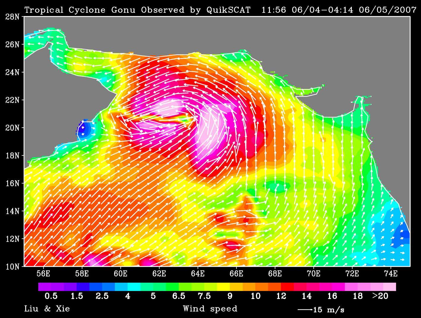
1418x1071x3 |
|
-
PIA09600:
-
Tropical Cyclone Gonu Observed by QuikSCAT
Full Resolution:
TIFF
(4.565 MB)
JPEG
(271 kB)
|
|
|
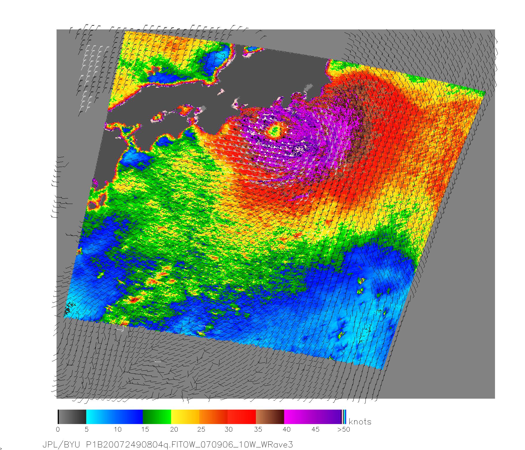
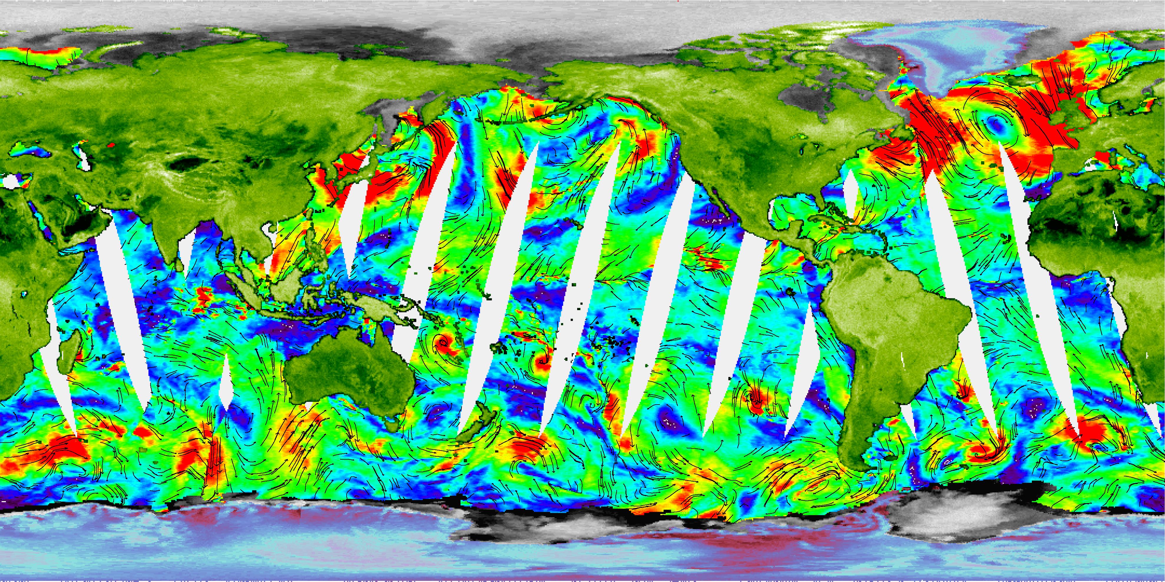
2007-09-07 |
Earth
|
QuikScat
|
SeaWinds Scatterometer
|
1820x1560x3 |
|
-
PIA09978:
-
NASA Measures Fitow's Winds by Satellite
Full Resolution:
TIFF
(8.53 MB)
JPEG
(711.1 kB)
|
|
|
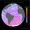
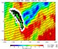
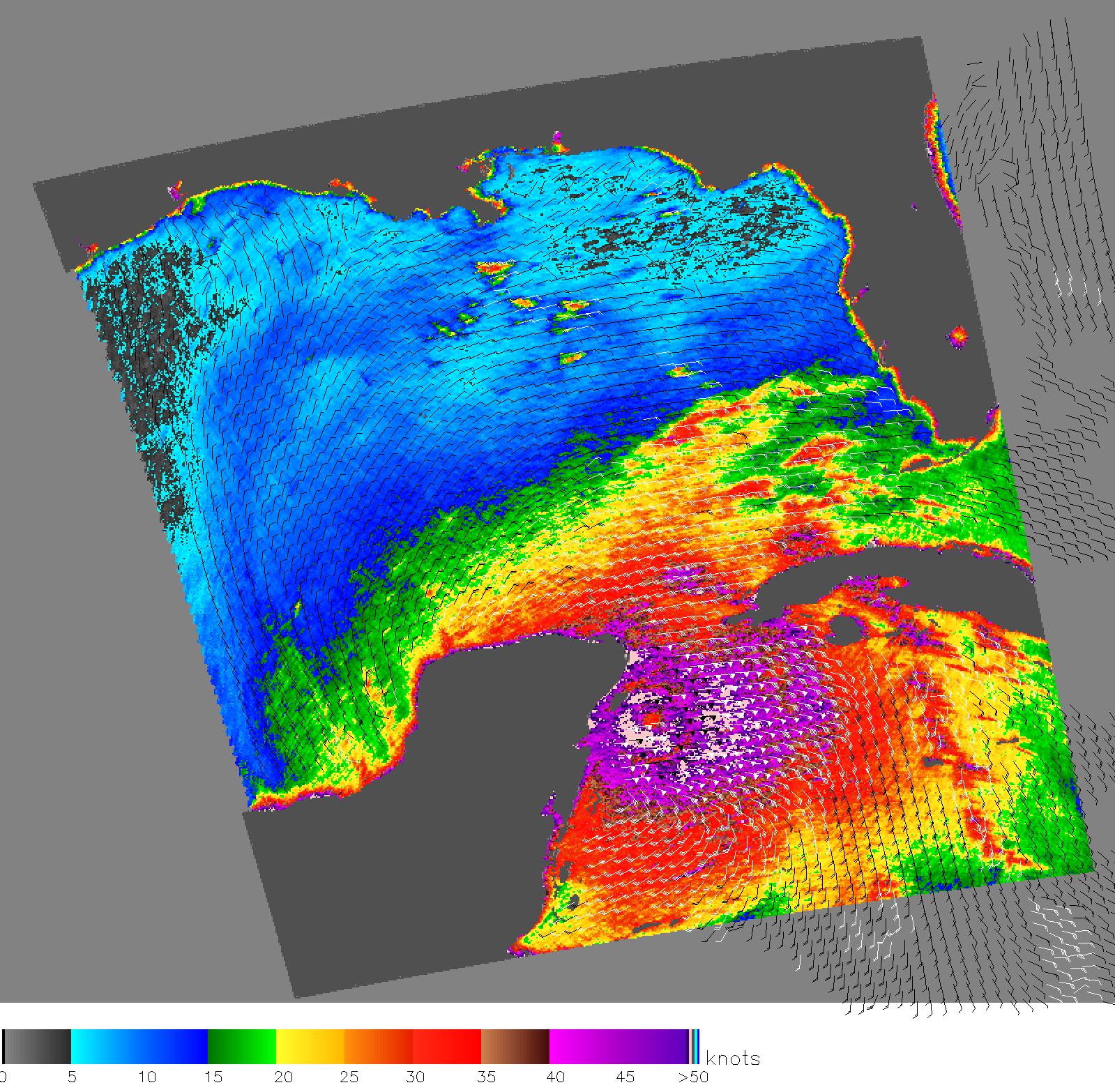
2007-10-23 |
Earth
|
QuikScat
|
SeaWinds Scatterometer
|
800x875x3 |

|
-
PIA10089:
-
NASA's QuikScat Maps Southern California's Destructive Santa Ana Winds
Full Resolution:
TIFF
(702.5 kB)
JPEG
(223.2 kB)
|
|
|
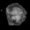
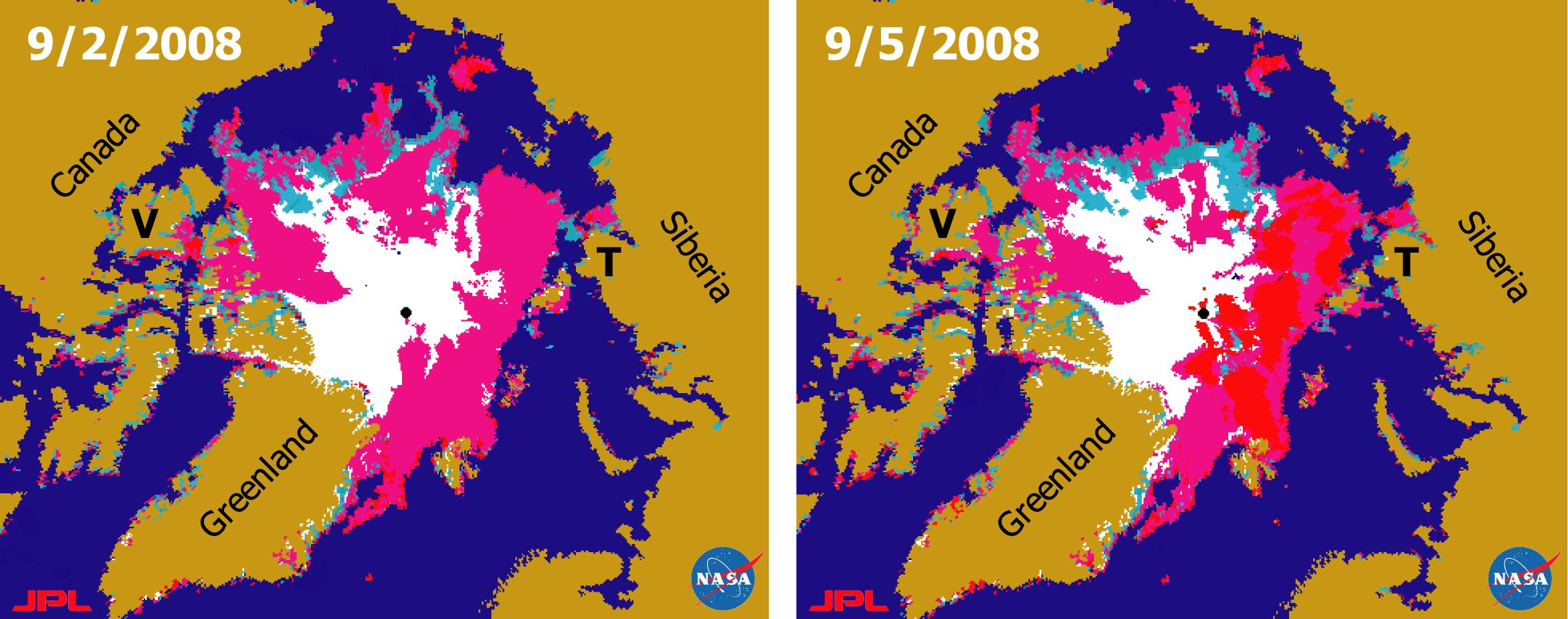
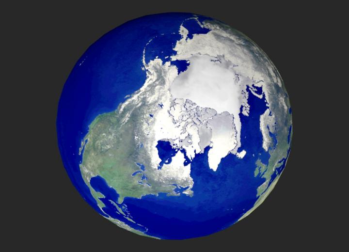
2008-09-11 |
Earth
|
QuikScat
|
SeaWinds Scatterometer
|
2344x926x3 |
|
-
PIA11086:
-
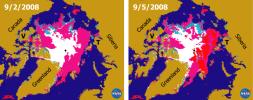
Recent State of Arctic Sea Ice
Full Resolution:
TIFF
(6.519 MB)
JPEG
(290.8 kB)
|
|
|
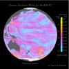
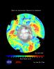
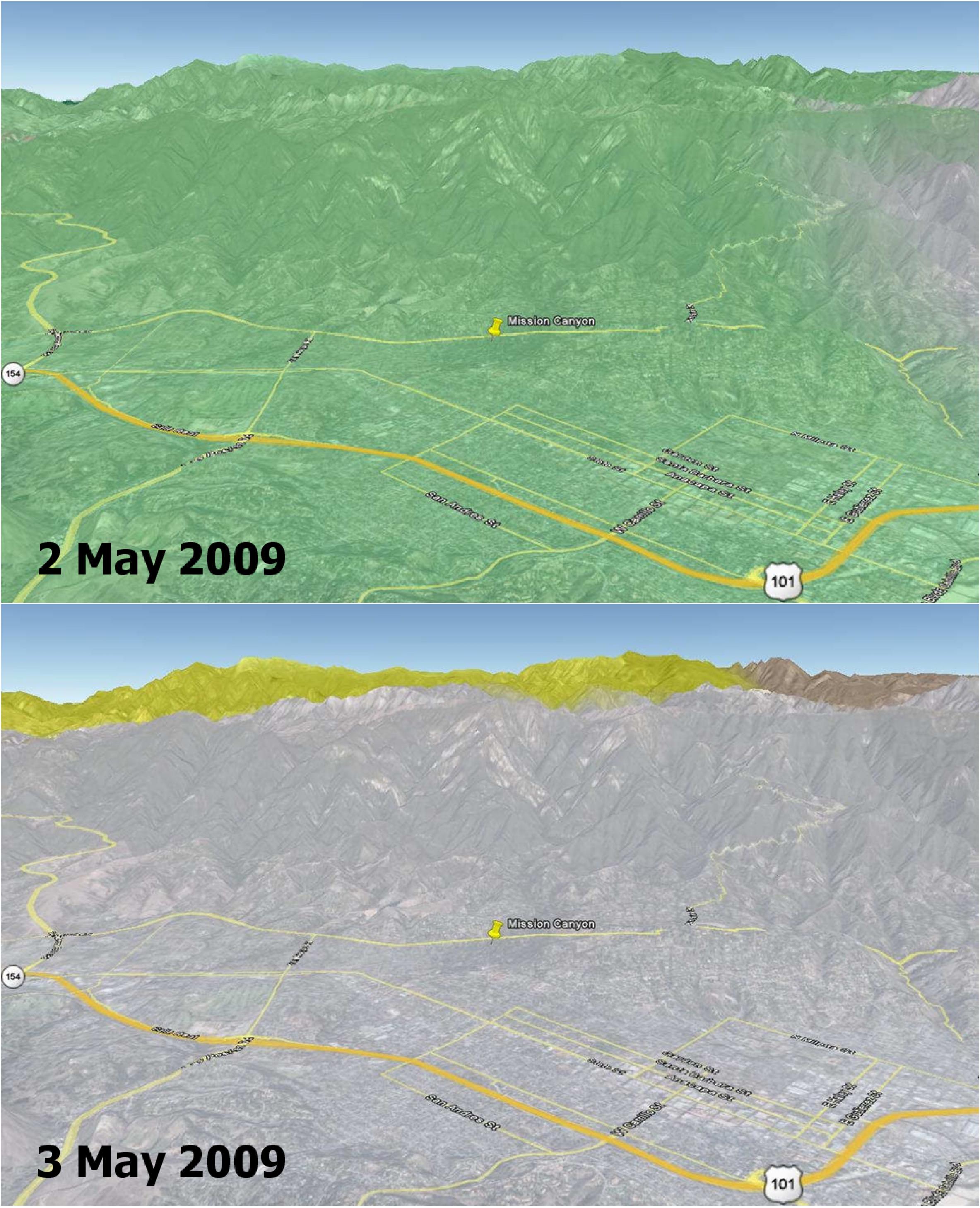
2009-05-08 |
Earth
|
QuikScat
|
SeaWinds Scatterometer
|
2367x2916x3 |
|
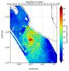
-
PIA12006:
-
Disaster Management: Rapid Dry-Up of Rainwater on Land Surface Leading to the Santa Barbara Wildfire
Full Resolution:
TIFF
(20.73 MB)
JPEG
(727.8 kB)
|
|
|
2000-09-20 |
Earth
|
RadarSat
|
Imaging Radar
|
720x520x3 |

|
-
PIA02970:
-
Global View of the Arctic Ocean
Full Resolution:
TIFF
(624.4 kB)
JPEG
(35.77 kB)
|
|
|
2000-09-20 |
Earth
|
RadarSat
|
Imaging Radar
|
1406x472x1 |
|
-
PIA02971:
-
Comparative Views of Arctic Sea Ice Growth
Full Resolution:
TIFF
(664.6 kB)
JPEG
(167.4 kB)
|
|
|
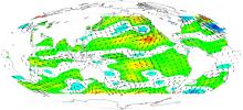
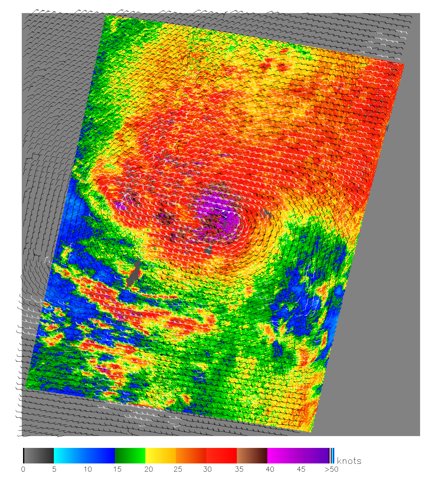
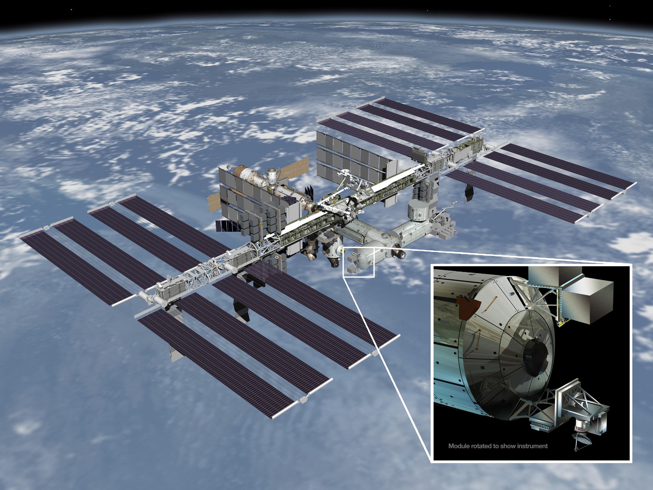
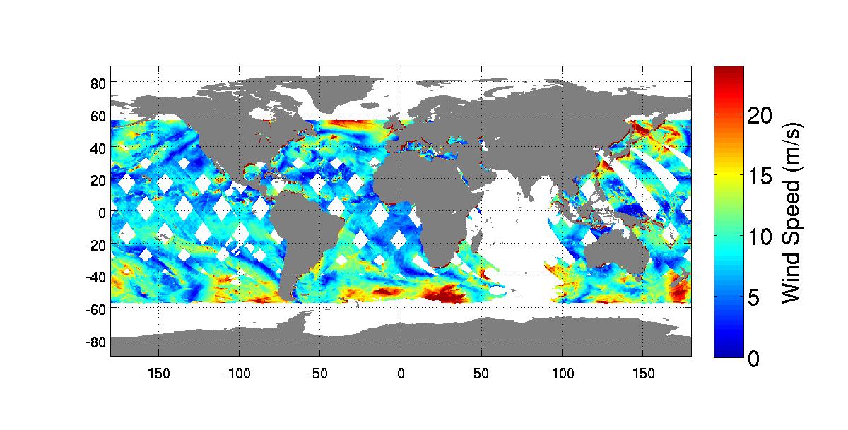
2014-01-22 |
Earth
|
RapidScat
|
ISS-RapidScat
|
2560x1920x3 |

|
-
PIA17897:
-
ISS-RapidScat
Full Resolution:
TIFF
(14.75 MB)
JPEG
(608.1 kB)
|
|
|
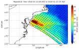
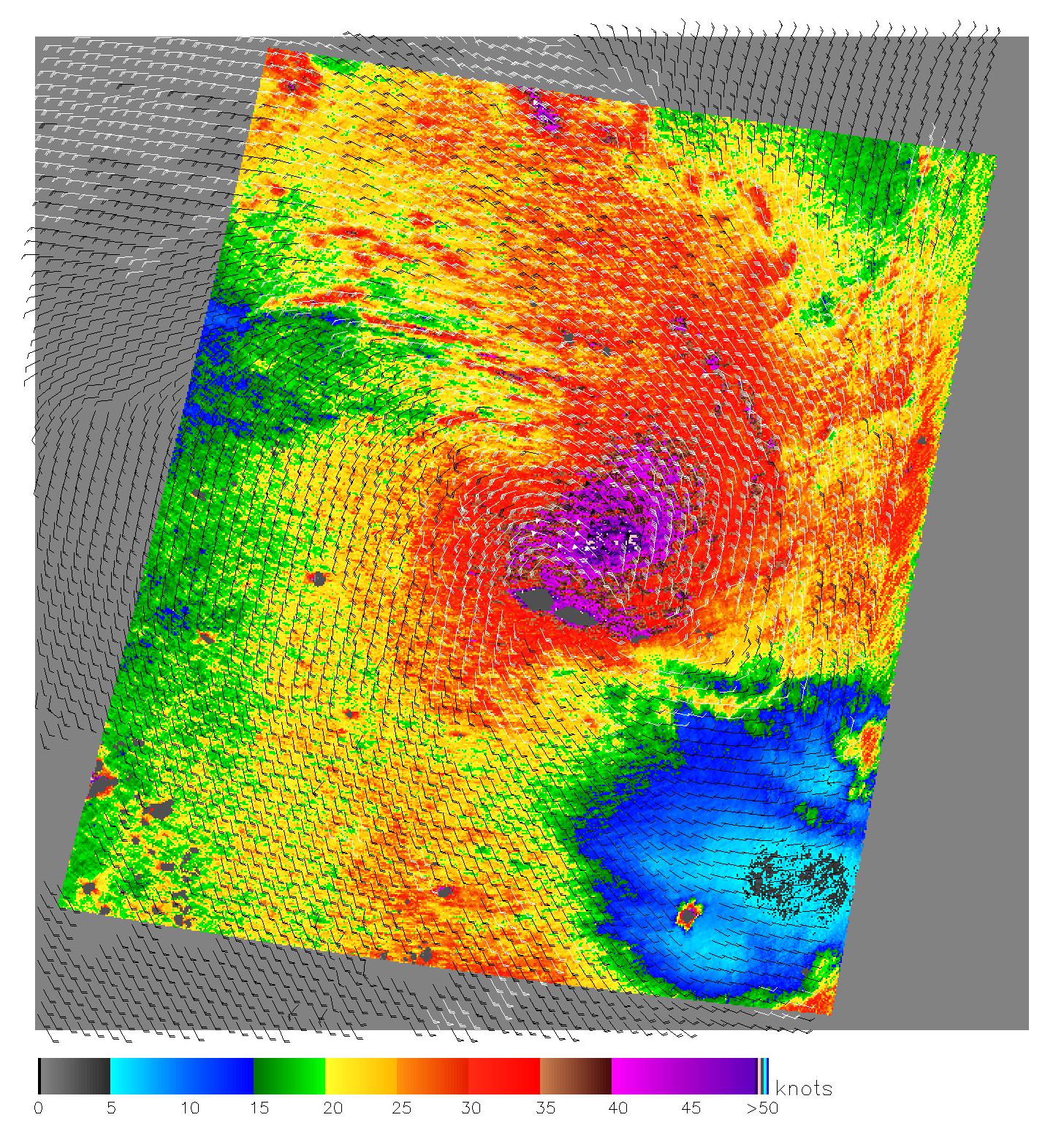
2014-10-06 |
Earth
|
RapidScat
|
ISS-RapidScat
|
1200x609x3 |
|
-
PIA18824:
-
NASA's New RapidScat Breezes Into Operation Aboard Space Station
Full Resolution:
TIFF
(2.193 MB)
JPEG
(126 kB)
|
|
|
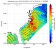
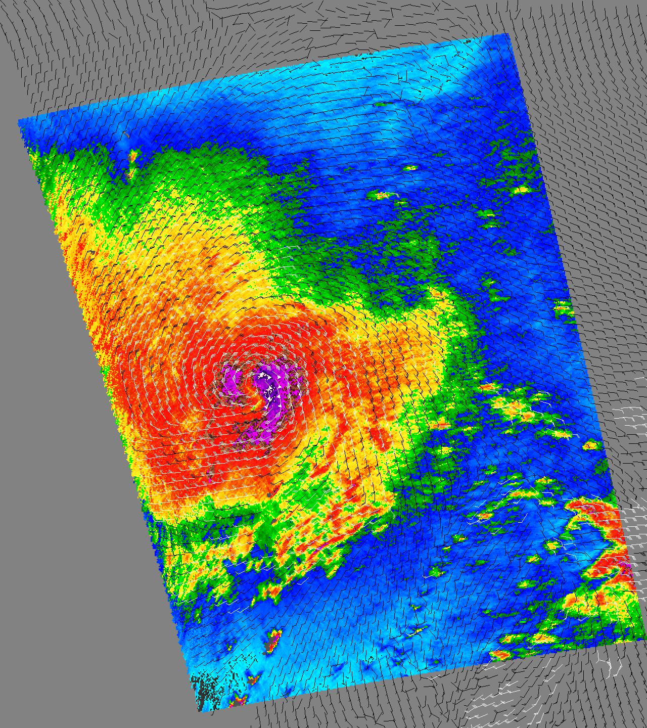
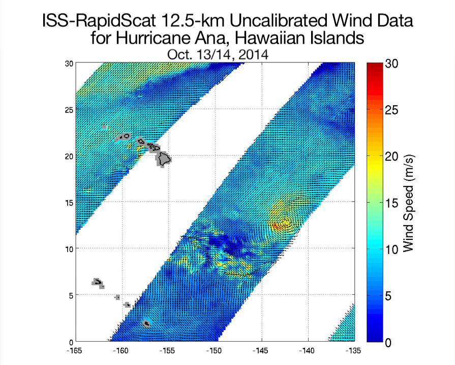
2014-10-21 |
Earth
|
RapidScat
|
ISS-RapidScat
|
895x718x3 |

|
-
PIA18834:
-
Hurricane Ana Viewed by NASA's ISS-RapidScat
Full Resolution:
TIFF
(1.929 MB)
JPEG
(136.3 kB)
|
|
|
2015-04-21 |
Earth
|
RapidScat
|
ISS-RapidScat
|
1064x706x3 |
|
-
PIA18059:
-
NASA RapidScat Proving Valuable for Tropical Cyclones
Full Resolution:
TIFF
(2.255 MB)
JPEG
(187.4 kB)
|
|
|
2015-10-23 |
Earth
|
RapidScat
|
ISS-RapidScat
|
584x593x3 |
|
-
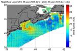
PIA20031:
-
Hurricane Patricia Viewed by NASA's ISS-RapidScat
Full Resolution:
TIFF
(266.3 kB)
JPEG
(76.25 kB)
|
|
|
2015-11-06 |
Earth
|
RapidScat
|
ISS-RapidScat
|
2816x2134x3 |
|
-
PIA20049:
-
RapidScat and Hurricane Patricia
Full Resolution:
TIFF
(8.031 MB)
JPEG
(159.9 kB)
|
|
|
2016-01-21 |
Earth
|
RapidScat
|
ISS-RapidScat
|
1532x696x3 |
|
-
PIA20365:
-
NASA's RapidScat Observes El Niño Blowing in the Winds
Full Resolution:
TIFF
(811.4 kB)
JPEG
(252.2 kB)
|
|
|
2016-01-25 |
Earth
|
RapidScat
|
ISS-RapidScat
|
751x479x3 |
|
-
PIA20366:
-
Winter Storm Winds in Southern New Jersey, as Viewed by ISS-RapidScat
Full Resolution:
TIFF
(247.3 kB)
JPEG
(74.27 kB)
|
|
|
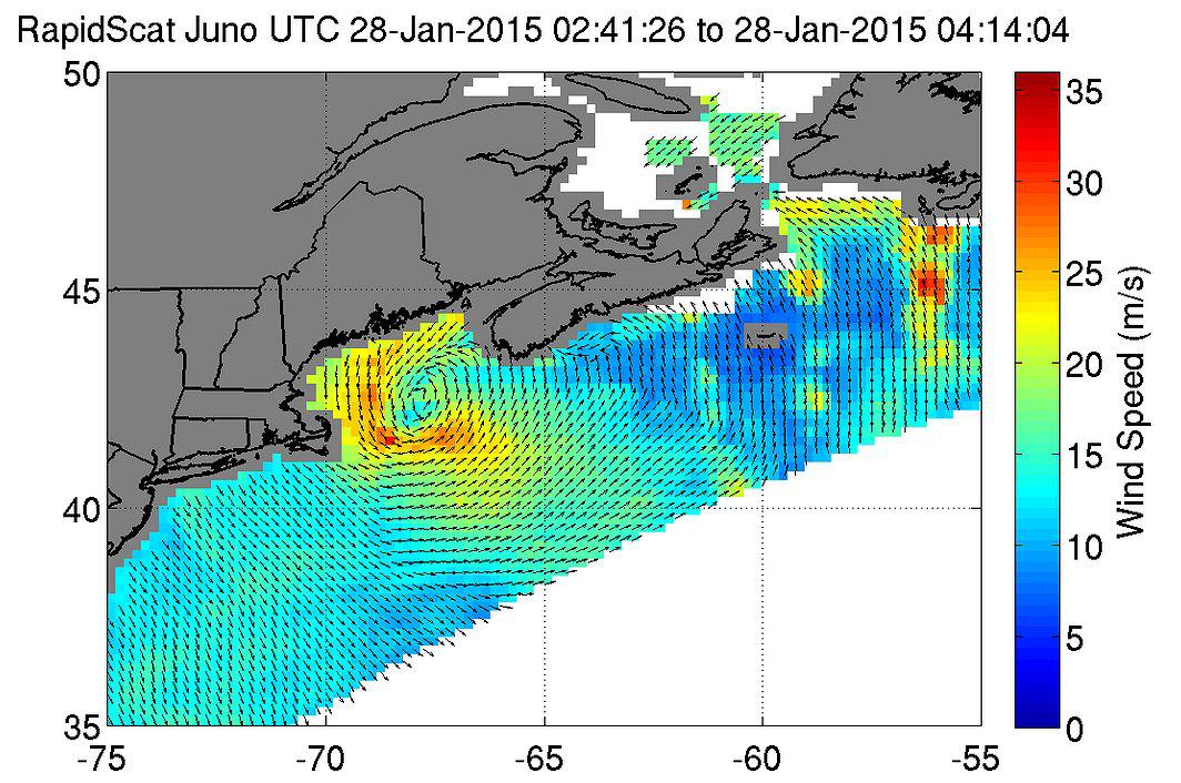
2016-01-28 |
Earth
|
RapidScat
|
ISS-RapidScat
|
682x593x3 |
|
-
PIA20372:
-
Winter Storm Winds on U.S. East Coast, as Viewed by ISS-RapidScat
Full Resolution:
TIFF
(287.4 kB)
JPEG
(85.58 kB)
|
|
|
2022-10-11 |
Earth
|
S-MODE
|
|
2844x1599x3 |

|
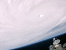
-
PIA25522:
-
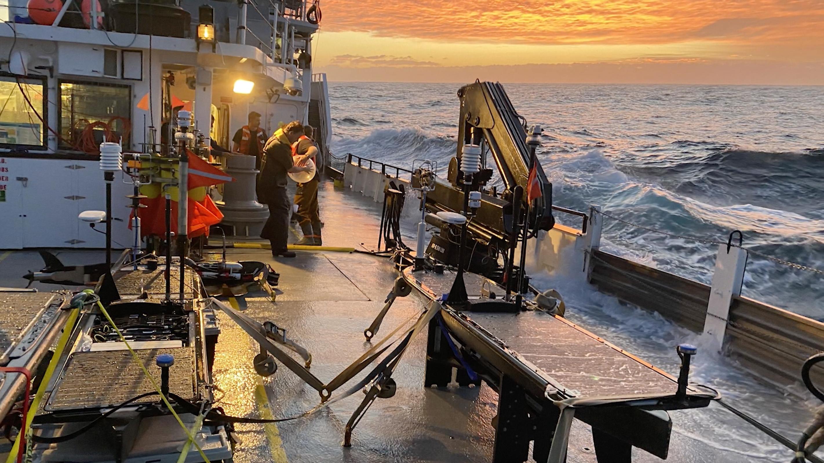
High Seas at Sunset During S-MODE Field Campaign
Full Resolution:
TIFF
(13.65 MB)
JPEG
(611.5 kB)
|
|
|
2022-10-11 |
Earth
|
S-MODE
|
|
2817x1582x3 |
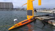
|
-
PIA25523:
-
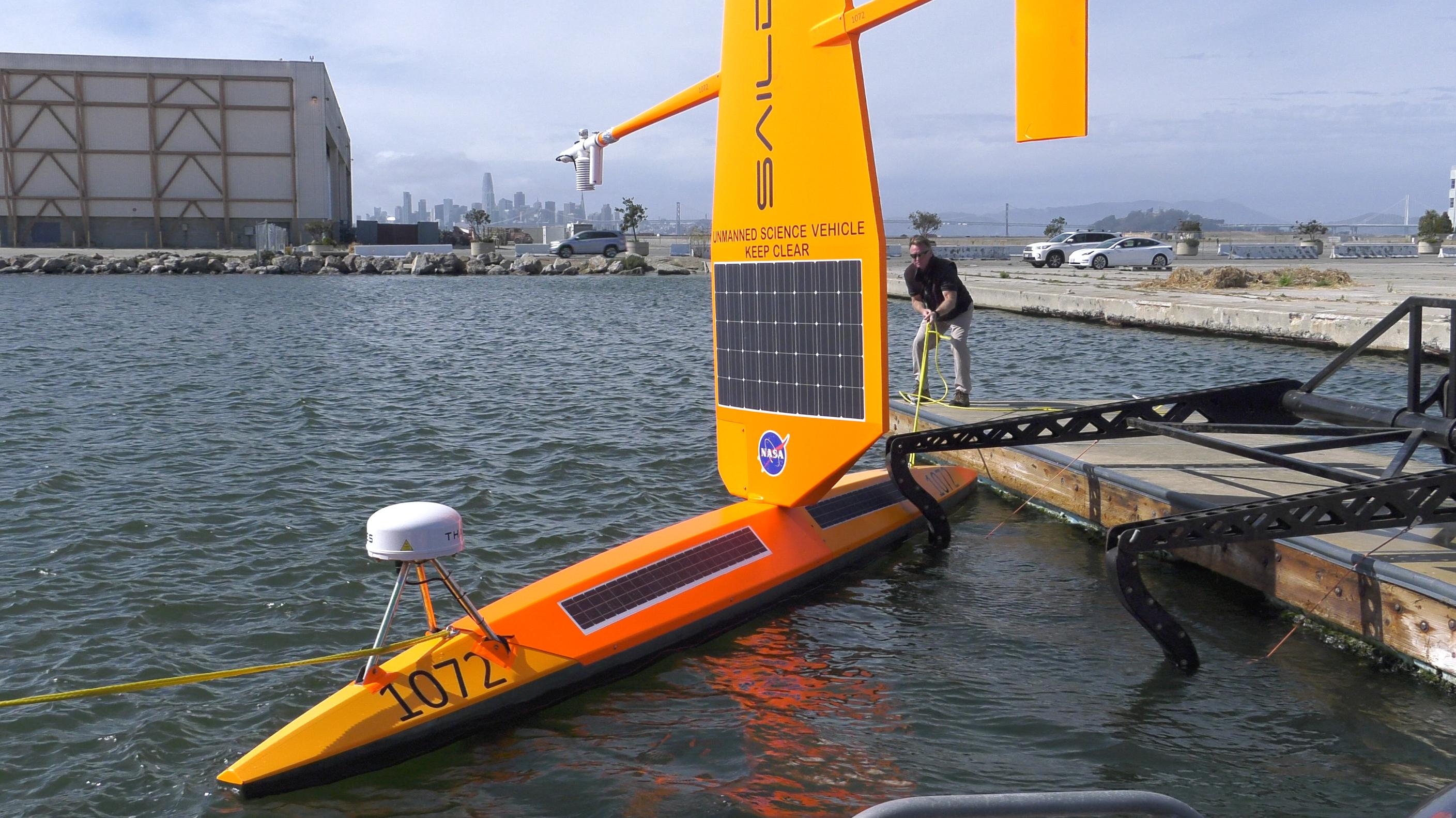
S-MODE Saildrone in San Francisco Waters
Full Resolution:
TIFF
(12.59 MB)
JPEG
(601.8 kB)
|
|
|
2022-10-11 |
Earth
|
S-MODE
|
|
4032x3024x3 |
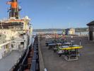
|
-
PIA25524:
-
S-MODE Research Vessel and Marine Robots Prepare for Sea
Full Resolution:
TIFF
(29.16 MB)
JPEG
(1.602 MB)
|
|
|
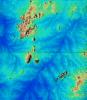
2013-06-27 |
Earth
|
Seasat
|
|
999x654x3 |
|
-
PIA15816:
-
Seasat Celebrates Landmark in Remote-Sensing History
Full Resolution:
TIFF
(1.961 MB)
JPEG
(21.08 kB)
|
|
|
2014-03-18 |
Earth
|
Seasat
|
Synthetic Aperture Radar (SAR)
|
3000x6407x3 |

|
-
PIA18137:
-
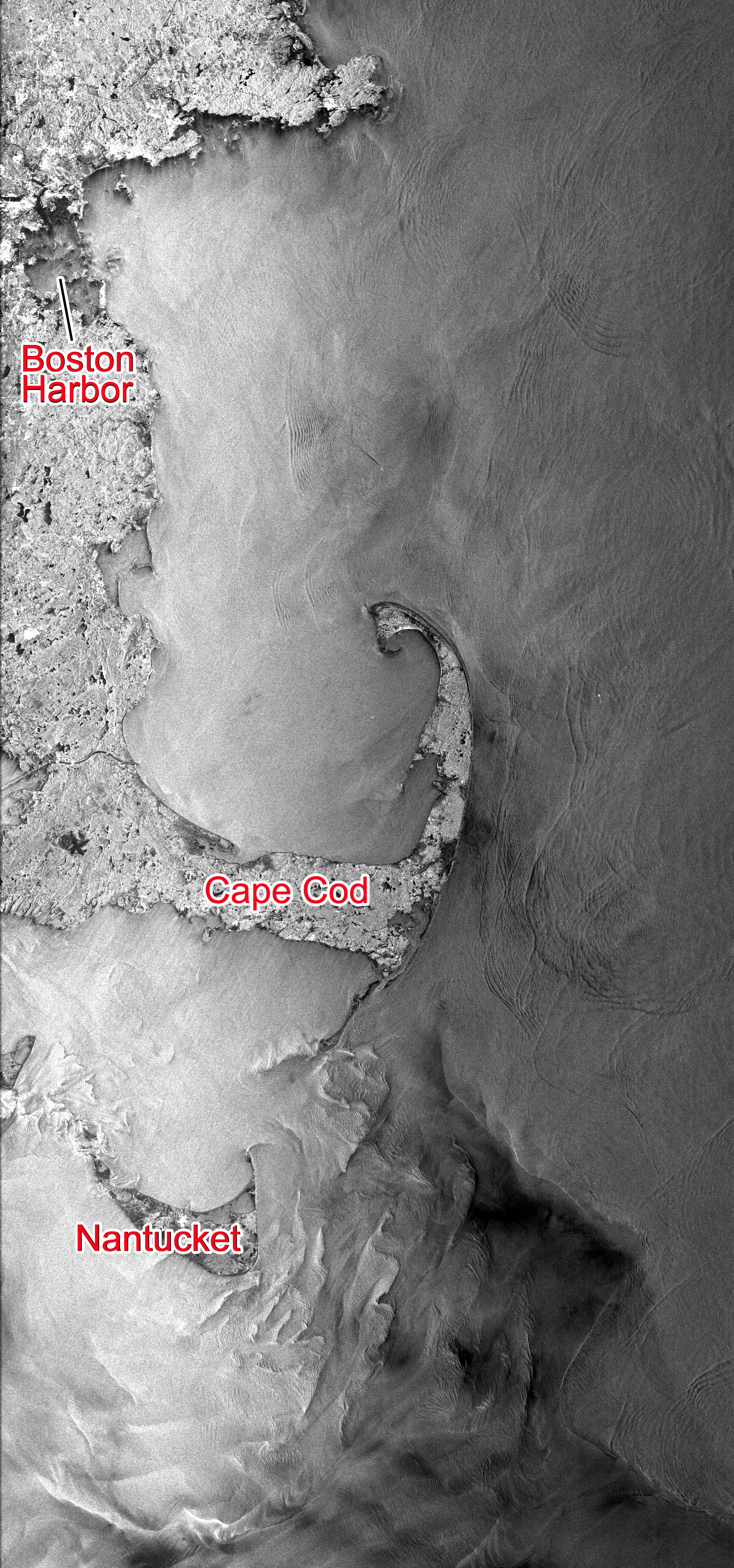
NASA's Seasat Satellite Shows Massachusetts Coast
Full Resolution:
TIFF
(57.69 MB)
JPEG
(3.845 MB)
|
|
|
2003-02-24 |
Earth
|
SeaWinds
|
SeaWinds Scatterometer
|
3956x1978x3 |
|
-
PIA03896:
-
NASA's Newest SeaWinds Instrument Breezes Into Operation
Full Resolution:
TIFF
(9.364 MB)
JPEG
(1.724 MB)
|
|
|
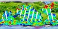
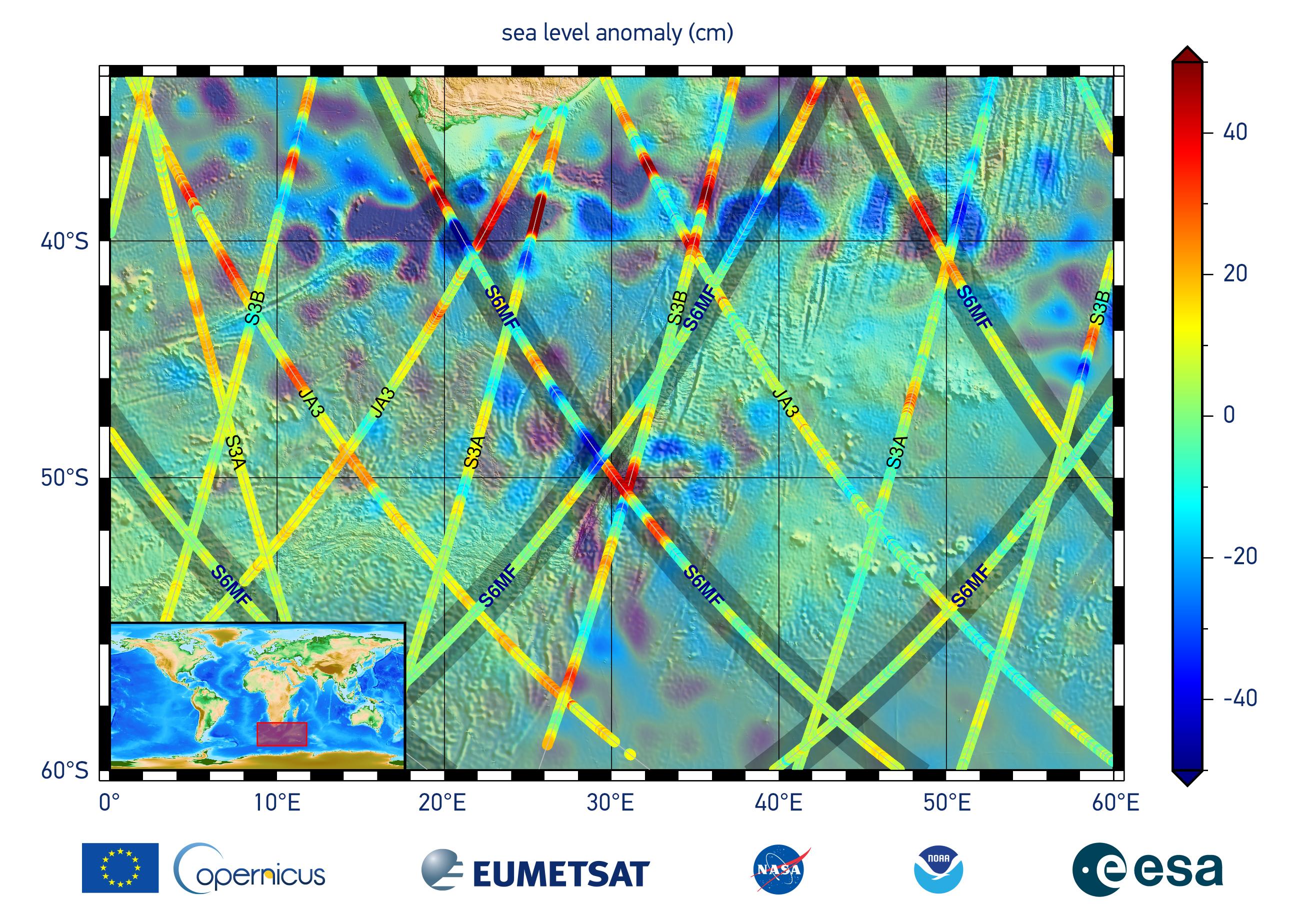
2020-12-10 |
Earth
|
Sentinel-6/Jason-CS
|
|
2600x1849x3 |
|
-
PIA24135:
-
Sentinel-6 Michael Freilich First Light Sea Level
Full Resolution:
TIFF
(10.71 MB)
JPEG
(704.9 kB)
|
|
|
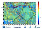
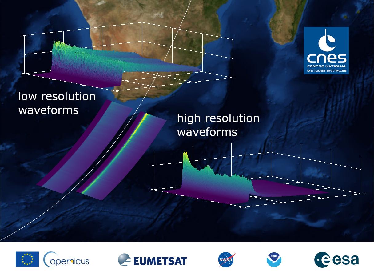
2020-12-10 |
Earth
|
Sentinel-6/Jason-CS
|
|
1216x900x3 |
|
-
PIA24136:
-
Sentinel-6 Michael Freilich First Light Waveform
Full Resolution:
TIFF
(2.221 MB)
JPEG
(121.2 kB)
|
|
|
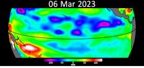
2021-06-21 |
Earth
|
Sentinel-6/Jason-CS
|
|
1536x1024x3 |
|
-
PIA24533:
-
Sentinel-6 Michael Freilich Sea Surface Height
Full Resolution:
TIFF
(1.492 MB)
JPEG
(78.4 kB)
|
|
|
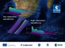
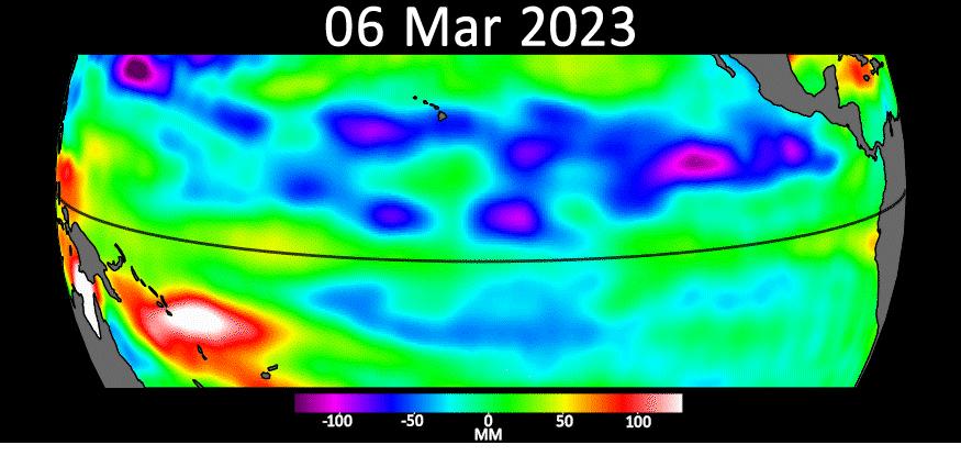
2023-05-12 |
Earth
|
Sentinel-6/Jason-CS
|
|
875x415x3 |
|
-
PIA25776:
-
Early El Niño Signs
Full Resolution:
TIFF
(598.3 kB)
JPEG
(51.43 kB)
|
|
|
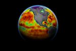
2023-10-18 |
Earth
|
Sentinel-6/Jason-CS
|
|
1586x783x3 |
|
-
PIA26099:
-
Comparing Sea Level During El Niño Events
Full Resolution:
TIFF
(303.4 kB)
JPEG
(200.3 kB)
|
|
|
2000-11-04 |
Earth
|
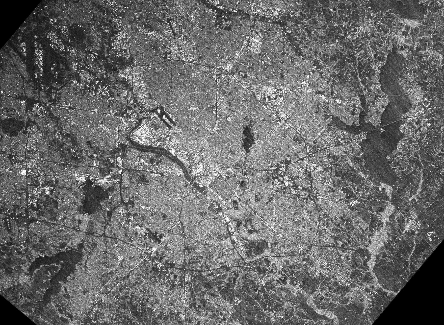
Shuttle Imaging Radar A (SIR-A)
|
|
2452x3228x3 |
|
-
PIA02986:
-
Radar view of China
Full Resolution:
TIFF
(29.88 MB)
JPEG
(3.194 MB)
|
|
|
2000-11-14 |
Earth
|
Shuttle Imaging Radar A (SIR-A)
|
|
1152x894x3 |
|
-
PIA02994:
-
Radar view of New Guinea
Full Resolution:
TIFF
(3.784 MB)
JPEG
(327.2 kB)
|
|
|
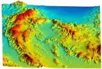
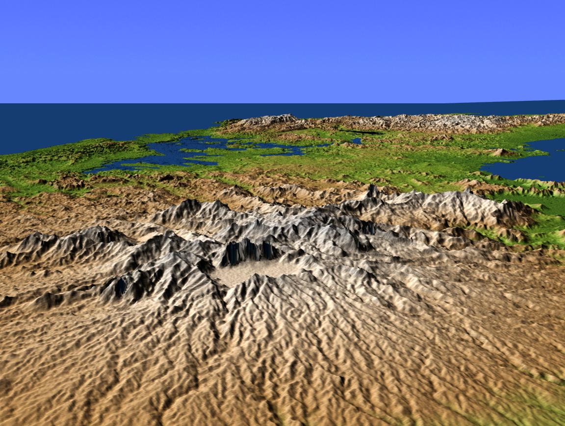
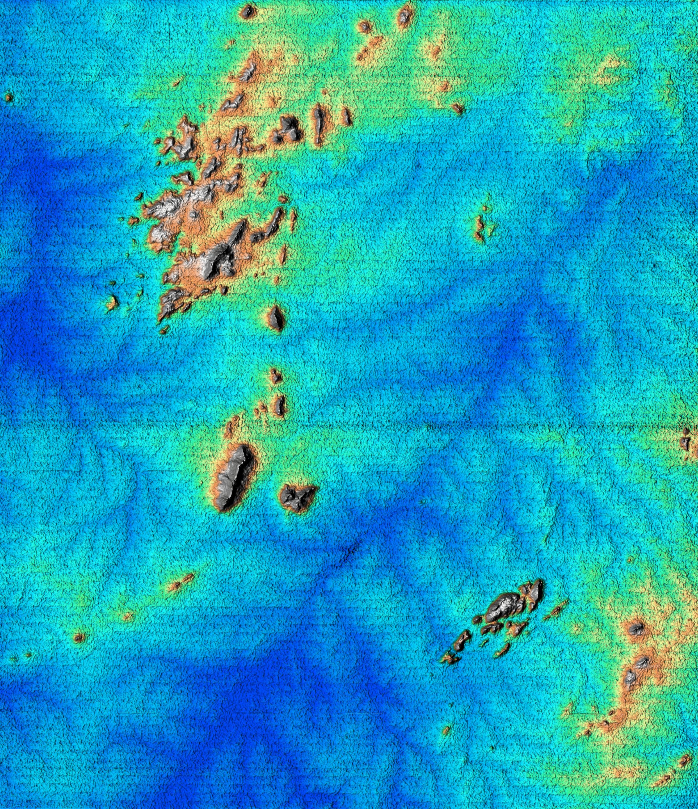
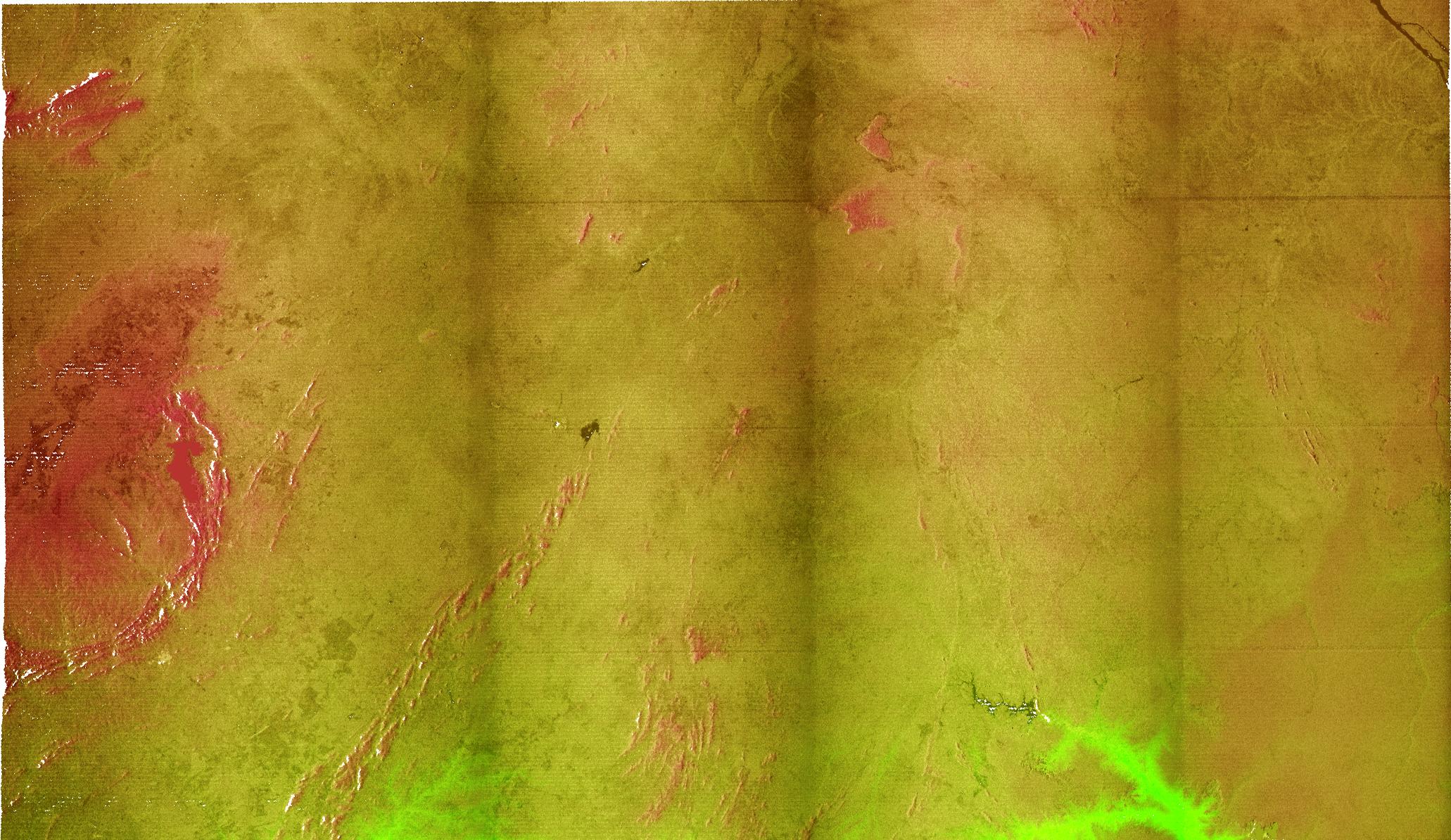
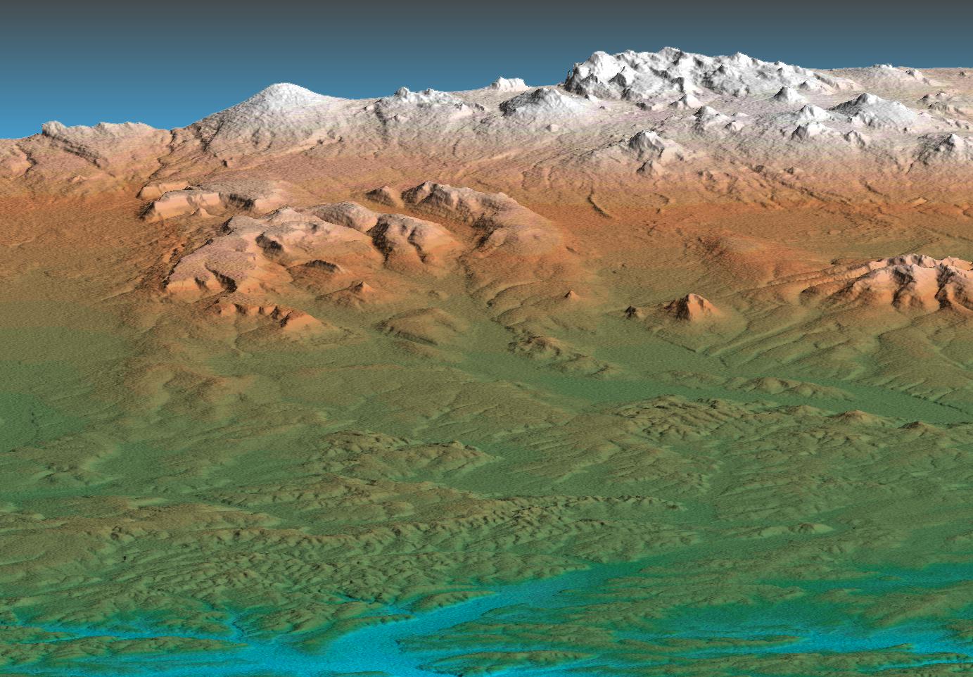
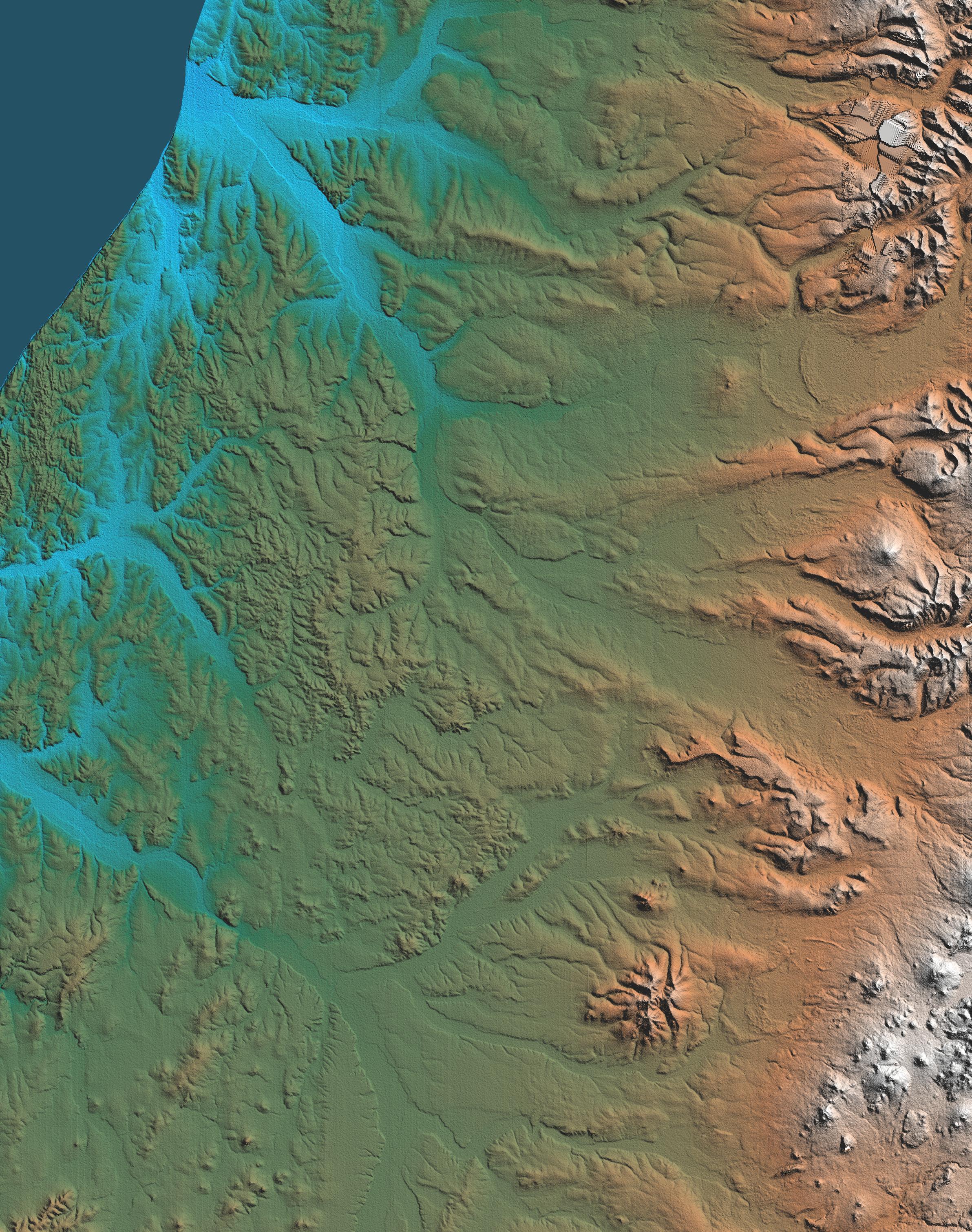
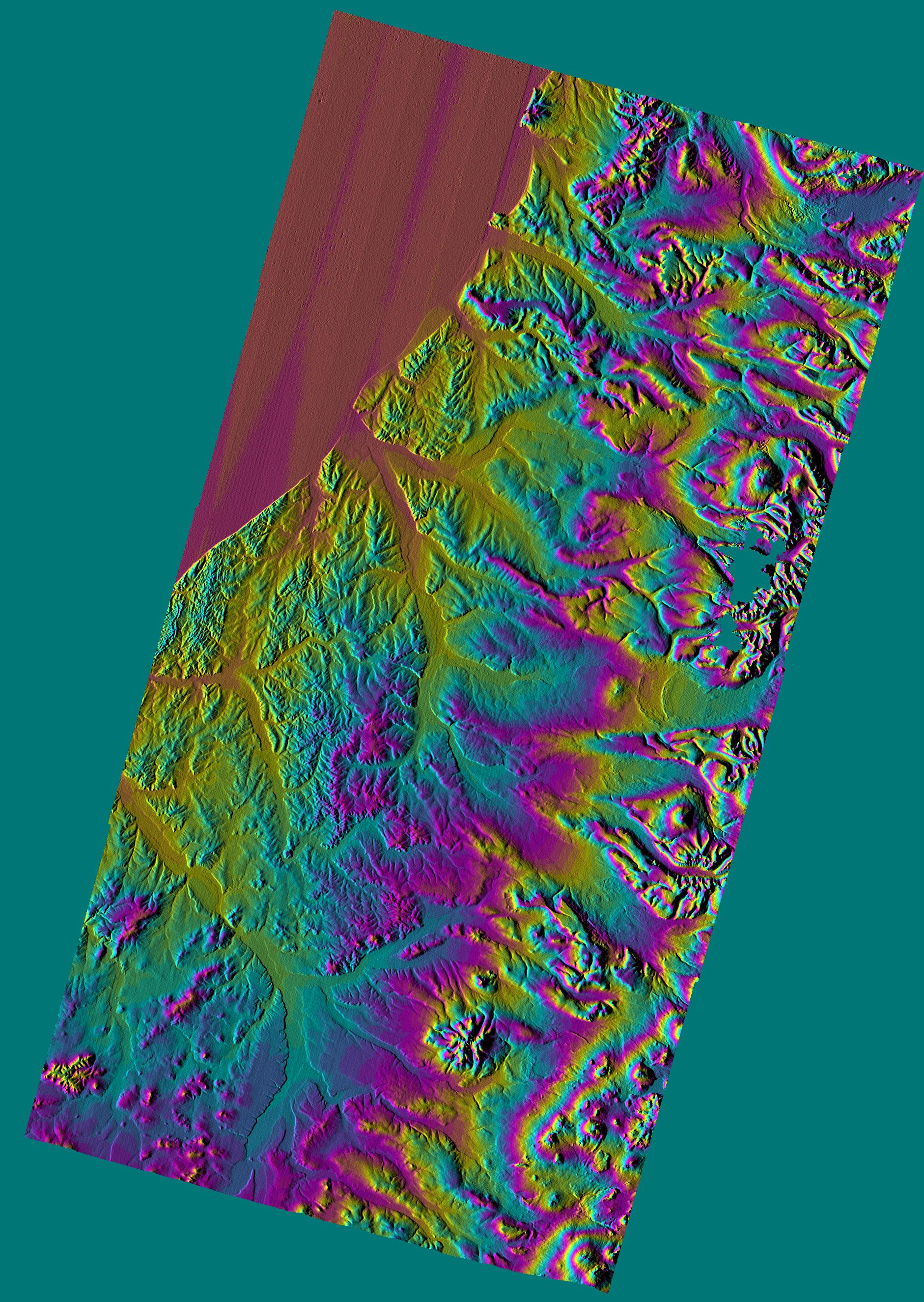
2002-10-25 |
Earth
|
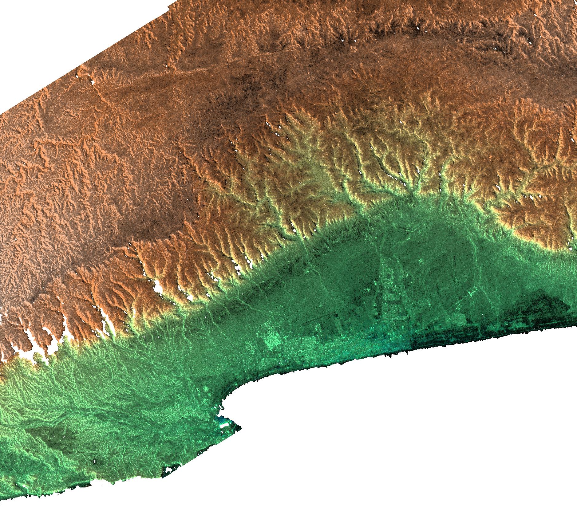
Shuttle Radar Topography Mission (SRTM)
|
C-Band Interferometric Radar
|
1152x870x3 |

|
-
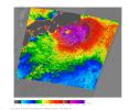
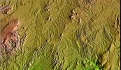
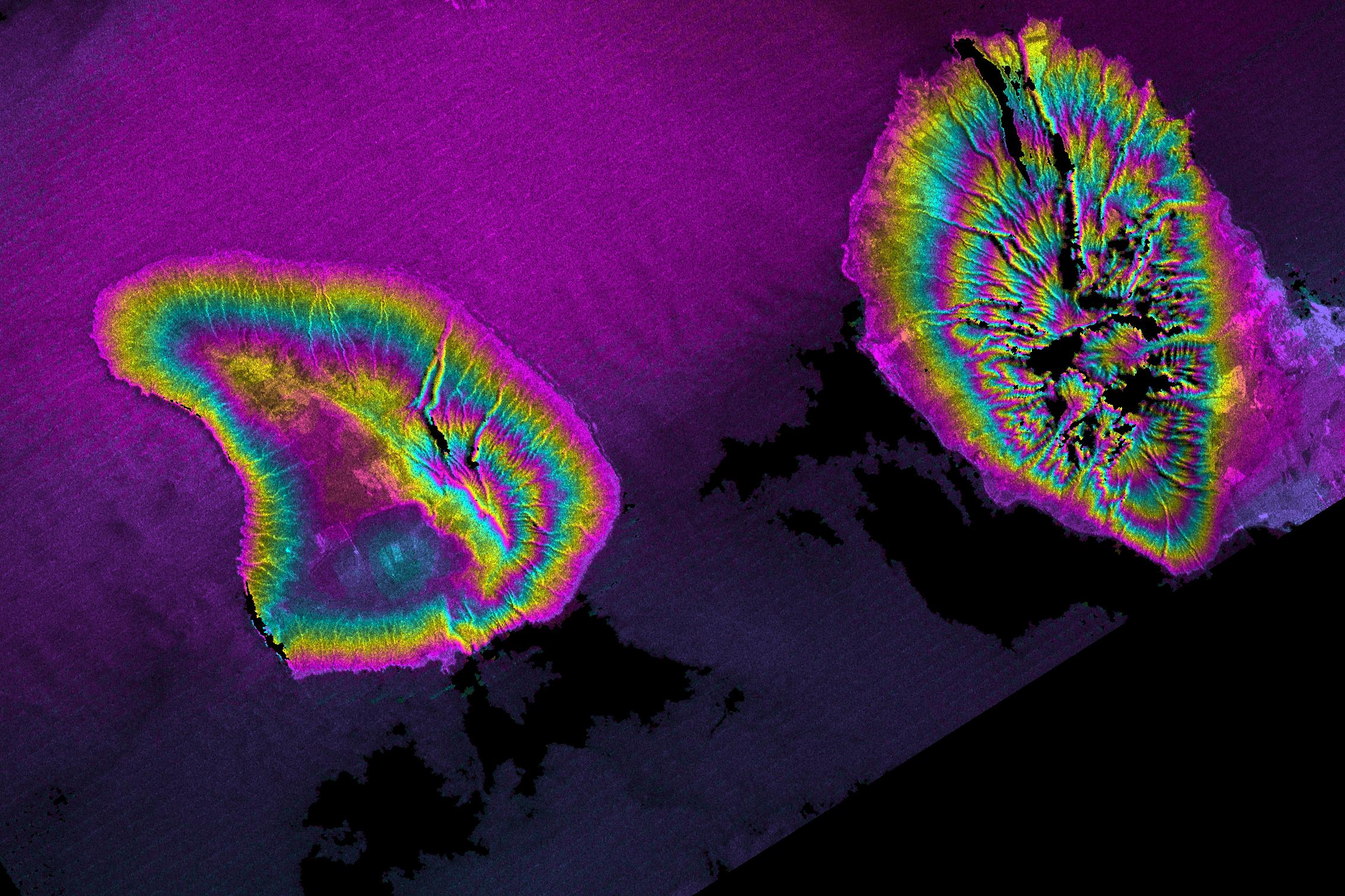
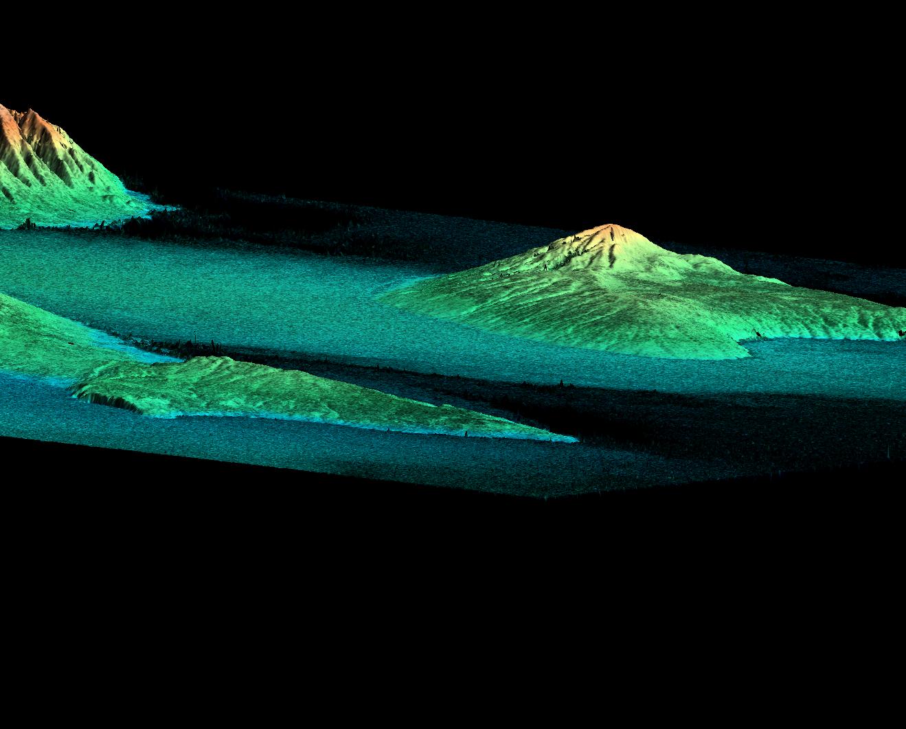
PIA03369:
-
Perspective View with Color-Coded Shaded Relief, Central Panama
Full Resolution:
TIFF
(2.588 MB)
JPEG
(192.8 kB)
|
|
|
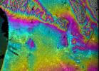
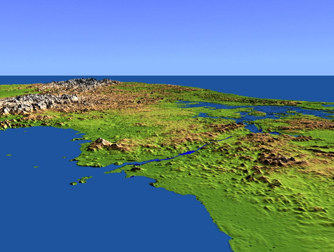
2002-10-25 |
Earth
|
Shuttle Radar Topography Mission (SRTM)
|
C-Band Interferometric Radar
|
1152x870x3 |

|
-
PIA03368:
-
Perspective View with Color-Coded Shaded Relief, Panama Canal
Full Resolution:
TIFF
(1.584 MB)
JPEG
(141.6 kB)
|
|
|
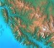
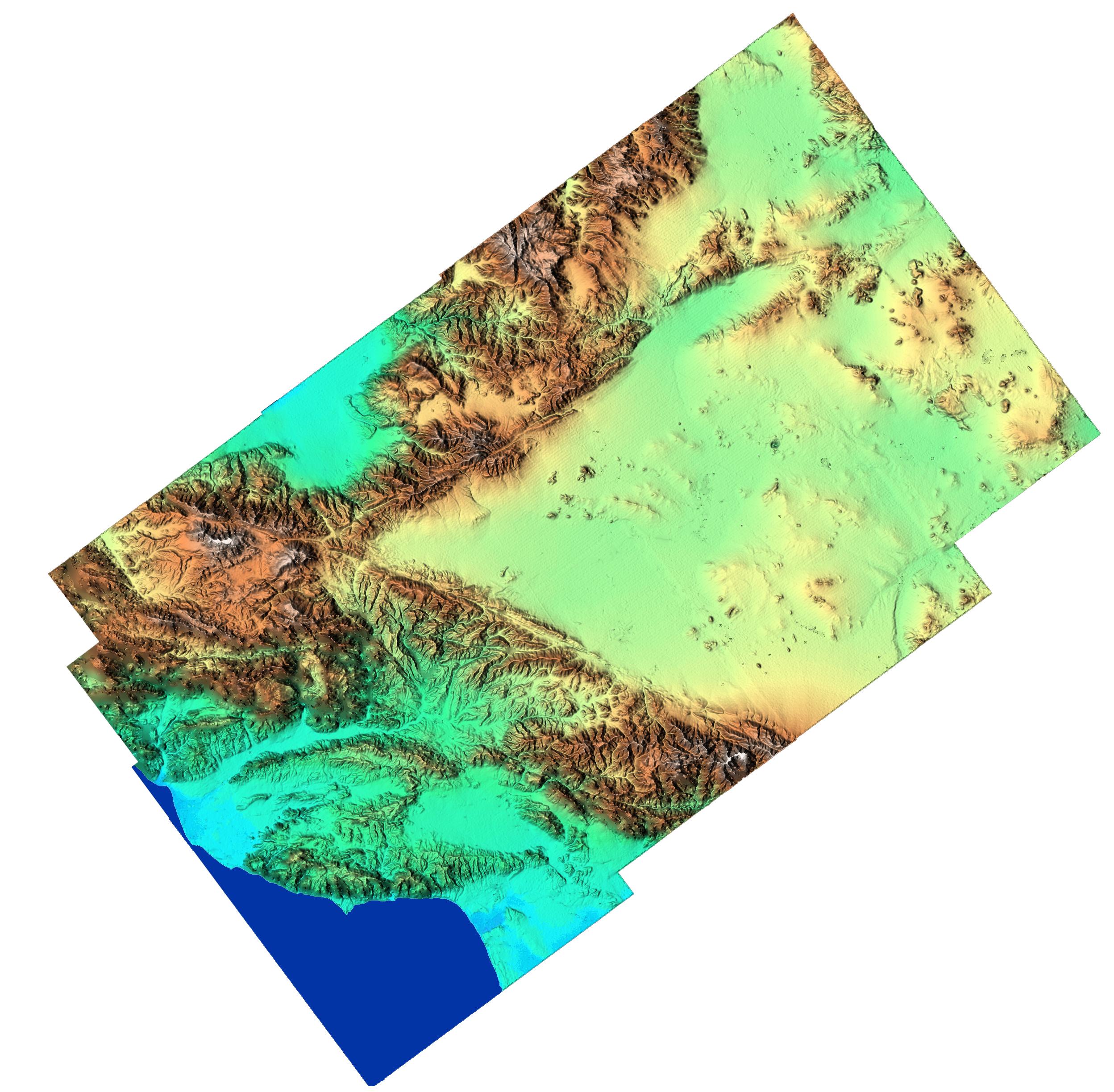
2000-02-14 |
Earth
|
Shuttle Radar Topography Mission (SRTM)
|
C-Band Interferometric Radar
|
2400x2781x3 |
|
-
PIA02700:
-
Shaded Relief of Rio Sao Francisco, Brazil
Full Resolution:
TIFF
(22.27 MB)
JPEG
(1.606 MB)
|
|
|
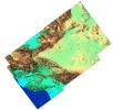
2000-02-14 |
Earth
|
Shuttle Radar Topography Mission (SRTM)
|
C-Band Interferometric Radar
|
1890x2270x1 |
|
-
PIA02701:
-
Radar Image of Rio Sao Francisco, Brazil
Full Resolution:
TIFF
(4.91 MB)
JPEG
(828.3 kB)
|
|
|
2000-02-14 |
Earth
|
Shuttle Radar Topography Mission (SRTM)
|
C-Band Interferometric Radar
|
2257x2887x1 |

|
-
PIA02703:
-
Shaded Relief Image of Saint Pierre and Miquelon
Full Resolution:
TIFF
(633 kB)
JPEG
(328.2 kB)
|
|
|
2000-02-15 |
Earth
|
Shuttle Radar Topography Mission (SRTM)
|
C-Band Interferometric Radar
|
2056x1194x3 |
|
-
PIA02704:
-
Shaded Relief of Bahia State, Brazil
Full Resolution:
TIFF
(8.391 MB)
JPEG
(1.179 MB)
|
|
|
2000-02-15 |
Earth
|
Shuttle Radar Topography Mission (SRTM)
|
C-Band Interferometric Radar
|
2062x1194x3 |

|
-
PIA02705:
-
Radar Image with Color as Height, Bahia State, Brazil
Full Resolution:
TIFF
(7.958 MB)
JPEG
(497.6 kB)
|
|
|
2000-02-15 |
Earth
|
Shuttle Radar Topography Mission (SRTM)
|
C-Band Interferometric Radar
|
2400x2938x3 |

|
-
PIA02706:
-
Shaded Relief of South Africa, Northern Cape Province
Full Resolution:
TIFF
(24.95 MB)
JPEG
(2.451 MB)
|
|
|
2000-02-16 |
Earth
|
Shuttle Radar Topography Mission (SRTM)
|
C-Band Interferometric Radar
|
1383x962x3 |
|
-
PIA02707:
-
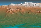
Perspective View, Kamchatka Peninsula, Russia
Full Resolution:
TIFF
(2.612 MB)
JPEG
(219.9 kB)
|
|
|
2000-02-16 |
Earth
|
Shuttle Radar Topography Mission (SRTM)
|
C-Band Interferometric Radar
|
2384x3021x3 |
|
-
PIA02708:
-
Shaded Relief, Kamchatka Peninsula, Russia
Full Resolution:
TIFF
(20.34 MB)
JPEG
(1.485 MB)
|
|
|
2000-02-16 |
Earth
|
Shuttle Radar Topography Mission (SRTM)
|
C-Band Interferometric Radar
|
1881x2650x3 |
|
-
PIA02710:
-
Shaded Relief Color Wrapped, Kamchatka Peninsula, Russia
Full Resolution:
TIFF
(2.271 MB)
JPEG
(868.8 kB)
|
|
|
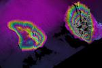
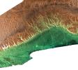
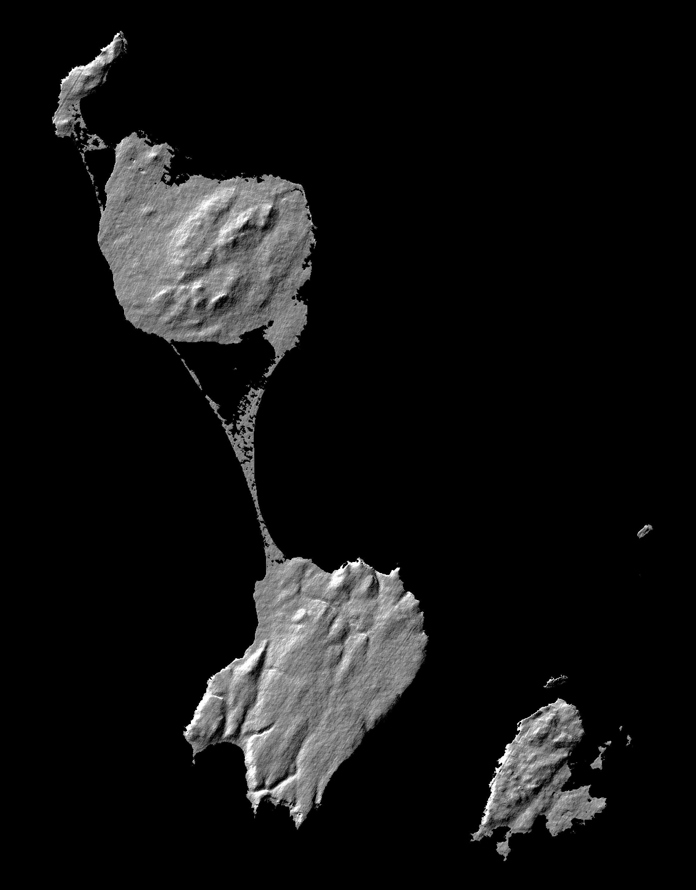
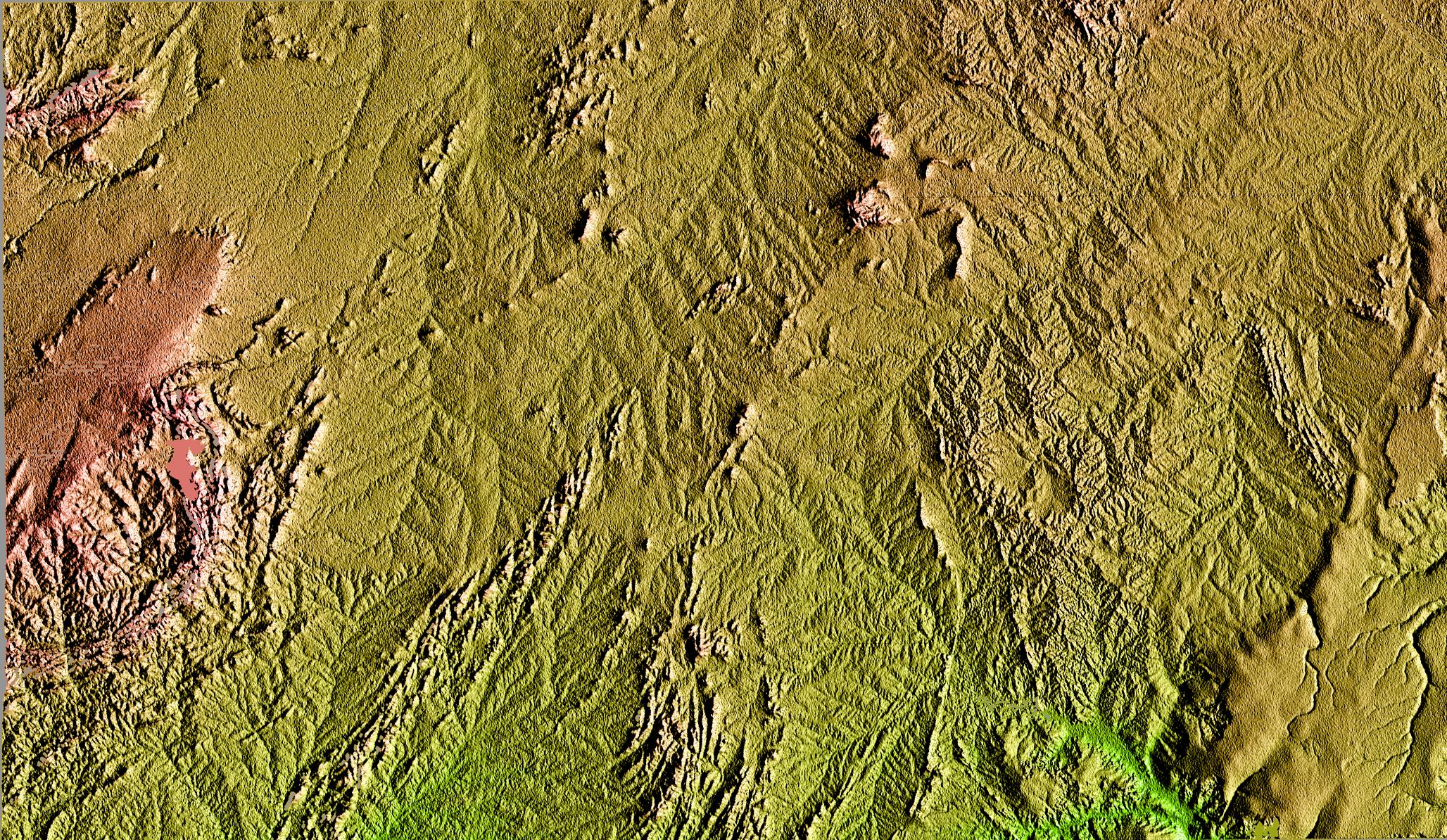
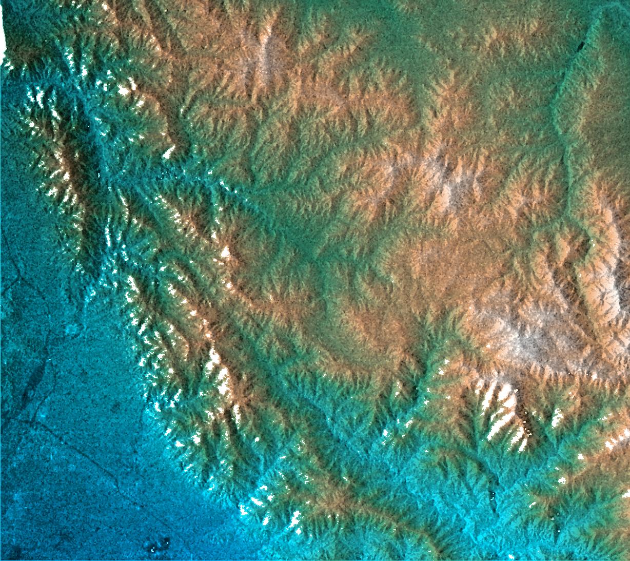
2000-02-17 |
Earth
|
Shuttle Radar Topography Mission (SRTM)
|
C-Band Interferometric Radar
|
1059x722x3 |
|
-
PIA02711:
-
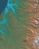
Simi Valley, California, Perspective View of Shaded Relief, Color as Height
Full Resolution:
TIFF
(2.166 MB)
JPEG
(207.8 kB)
|
|
|
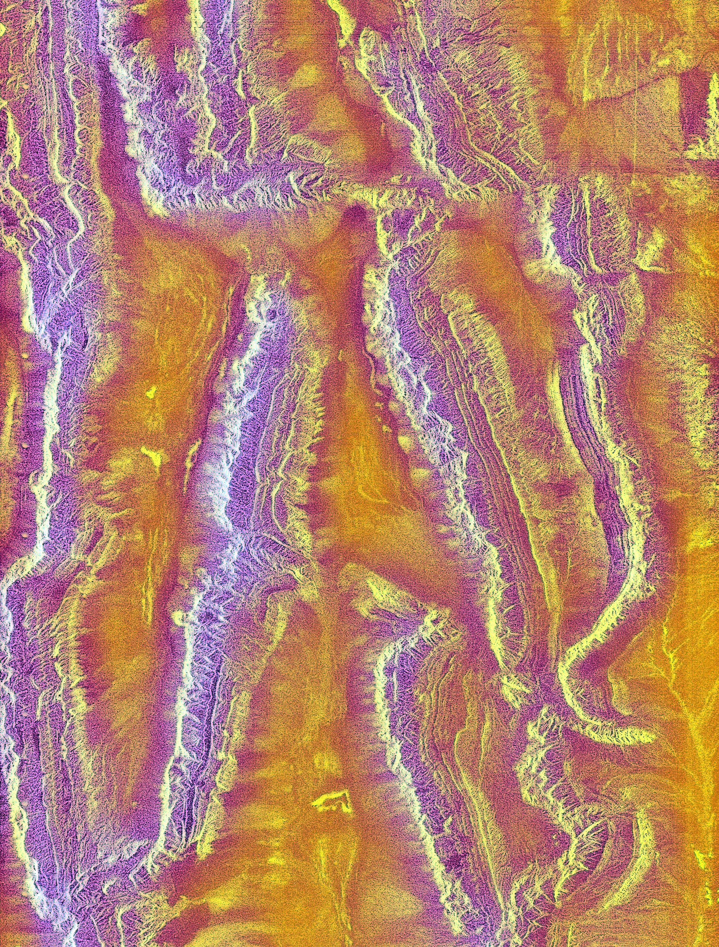
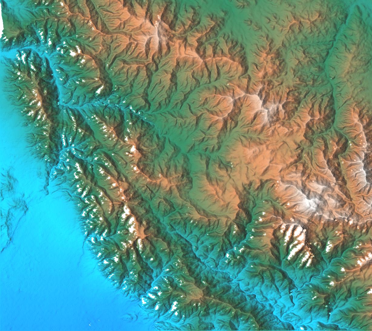
2000-02-17 |
Earth
|
Shuttle Radar Topography Mission (SRTM)
|
C-Band Interferometric Radar
|
1749x4787x3 |

|
-
PIA02712:
-
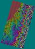
San Andreas Fault, Southern California, Shaded Relief, Wrapped Color as Height
Full Resolution:
TIFF
(6.467 MB)
JPEG
(2.572 MB)
|
|
|
2000-02-17 |
Earth
|
Shuttle Radar Topography Mission (SRTM)
|
C-Band Interferometric Radar
|
1357x982x3 |
|
-
PIA02713:
-
Los Angeles, California, Radar Image, Wrapped Color as Height
Full Resolution:
TIFF
(1.232 MB)
JPEG
(587.3 kB)
|
|
|
2000-02-17 |
Earth
|
Shuttle Radar Topography Mission (SRTM)
|
C-Band Interferometric Radar
|
1749x4787x3 |

|
-
PIA02714:
-
San Andreas Fault, Southern California , Radar Image, Wrapped Color as Height
Full Resolution:
TIFF
(7.228 MB)
JPEG
(3.292 MB)
|
|
|
2000-02-17 |
Earth
|
Shuttle Radar Topography Mission (SRTM)
|
C-Band Interferometric Radar
|
1228x1093x3 |

|
-
PIA02715:
-
San Gabriel Mountains, California, Radar Image, Color as Height
Full Resolution:
TIFF
(3.906 MB)
JPEG
(326.9 kB)
|
|
|
2000-02-17 |
Earth
|
Shuttle Radar Topography Mission (SRTM)
|
C-Band Interferometric Radar
|
1228x1093x3 |
|
-
PIA02716:
-
San Gabriel Mountains, California, Shaded relief, Color as Height
Full Resolution:
TIFF
(4.009 MB)
JPEG
(232.8 kB)
|
|
|
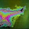
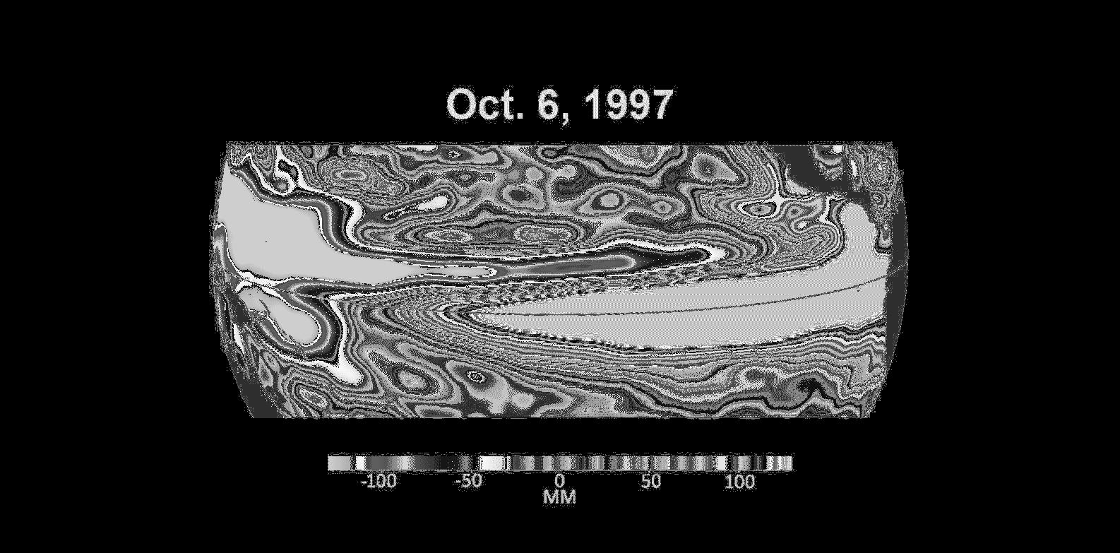
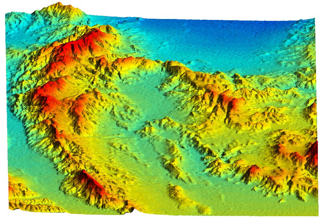
2000-03-13 |
Earth
|
Shuttle Radar Topography Mission (SRTM)
|
C-Band Interferometric Radar
|
2496x2447x3 |
|
-
PIA02719:
-
Southern California Shaded Relief, Color as Height
Full Resolution:
TIFF
(8.636 MB)
JPEG
(654 kB)
|
|
|
2000-02-18 |
Earth
|
Shuttle Radar Topography Mission (SRTM)
|
C-Band Interferometric Radar
|
1856x1852x3 |
|
-
PIA02720:
-
Honolulu, Hawaii Radar Image, Wrapped Color as Height
Full Resolution:
TIFF
(2.443 MB)
JPEG
(1.319 MB)
|
|
|
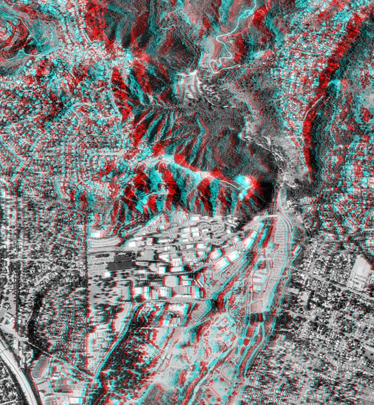
2000-02-18 |
Earth
|
Shuttle Radar Topography Mission (SRTM)
|
C-Band Interferometric Radar
|
737x797x3 |
|
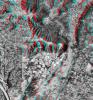
-
PIA02721:
-
Pasadena, California Anaglyph with Aerial Photo Overlay
Full Resolution:
TIFF
(1.749 MB)
JPEG
(218.8 kB)
|
|
|
2000-02-19 |
Earth
|
Shuttle Radar Topography Mission (SRTM)
|
C-Band Interferometric Radar
|
1793x1314x1 |
|
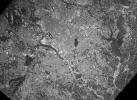
-
PIA02722:
-
C-Band Radar Imagery, Dallas-Fort Worth, Texas
Full Resolution:
TIFF
(2.885 MB)
JPEG
(804.4 kB)
|
|
|
2000-02-19 |
Earth
|
Shuttle Radar Topography Mission (SRTM)
|
C-Band Interferometric Radar
|
2273x1515x3 |
|
-
PIA02723:
-
Radar Image, Wrapped Color as Height, Lanai and West Maui, Hawaii
Full Resolution:
TIFF
(1.881 MB)
JPEG
(676.5 kB)
|
|
|
2000-02-19 |
Earth
|
Shuttle Radar Topography Mission (SRTM)
|
C-Band Interferometric Radar
|
1319x1062x3 |

|
-
PIA02724:
-
Perspective View, Radar Image, Color as Height, Molokai, Lanai and Maui, Hawaii
Full Resolution:
TIFF
(1.541 MB)
JPEG
(141.2 kB)
|
|
|
2000-02-19 |
Earth
|
Shuttle Radar Topography Mission (SRTM)
|
C-Band Interferometric Radar
|
1877x1676x3 |
|
-
PIA02725:
-
Radar Image, Color as Height , Salalah, Oman
Full Resolution:
TIFF
(6.929 MB)
JPEG
(809.5 kB)
|
 Planetary Data System


