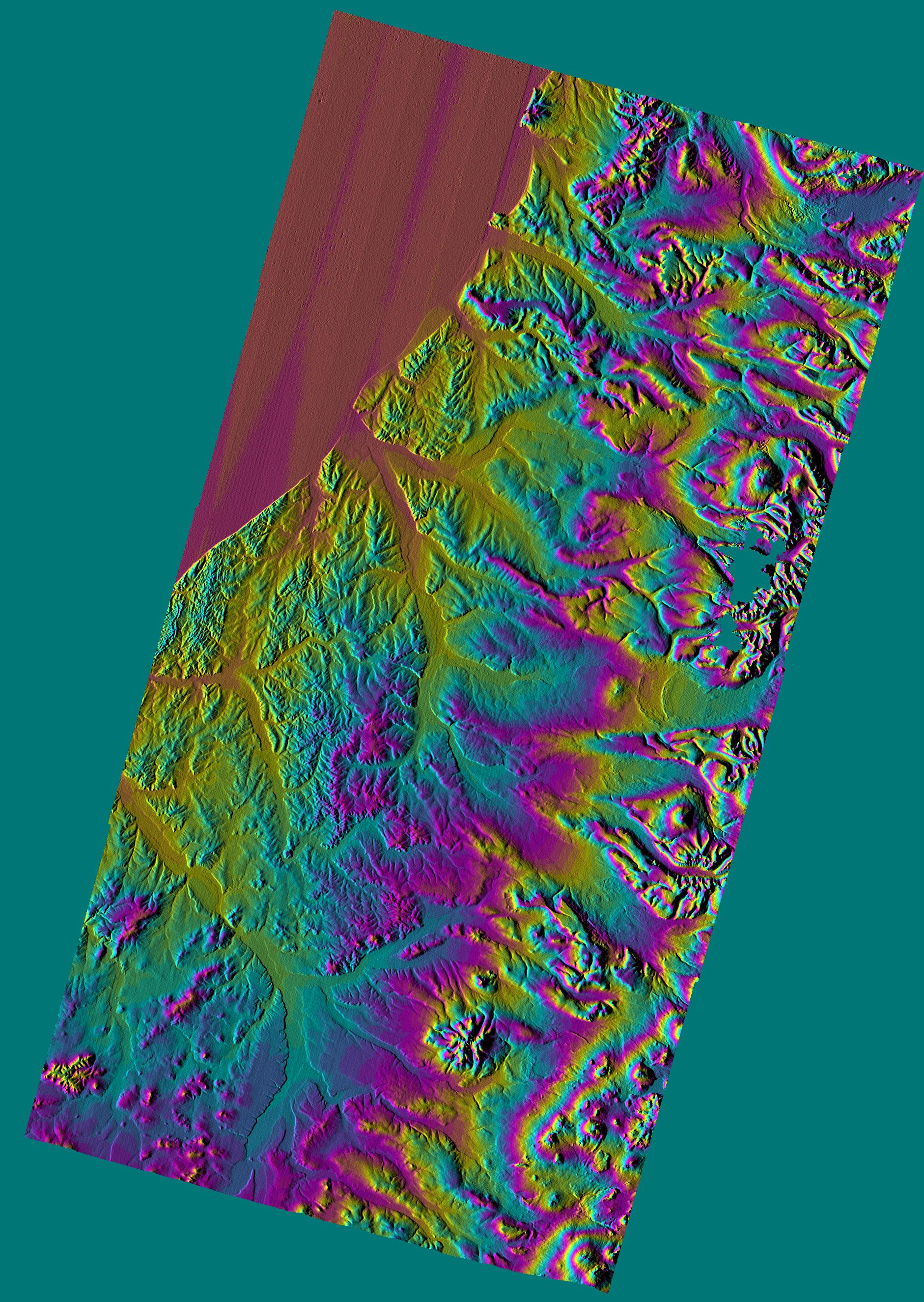
This shaded relief topographic image shows the western side of the volcanically active Kamchatka Peninsula, Russia. The data are from the first C-band mapping swath of the Shuttle Radar Topography Mission (SRTM). On the left side are five rivers, which flow northwest to the Sea of Okhotsk. These rivers are, from the south to north, Tigil, Amanina, Voyampolka, Zhilovaya, and Kakhtana. The broad, flat floodplains of the rivers are shown in yellow. These rivers are important spawning grounds for salmon. In the right side of the image is the Sredinnyy Khrebet, the volcanic mountain range that makes up the "spine" of the peninsula. The cluster of hills to the lower right is a field of small dormant volcanoes. High resolution SRTM topographic data will be used by geologists to study how volcanoes form and understand the hazards posed by future eruptions.
This image was generated using topographic data from the Shuttle Radar Topography Mission. Colors show the elevation as measured by SRTM. Each cycle of colors (from red through green back to red) represents an equal amount of elevation difference (400 meters, or 1300 feet) similar to contour lines on a standard topographic map. This image contains about 2300 meters (7500 feet) of total relief. For the shading, a computer-generated artificial light source illuminates the elevation data to produce a pattern of light and shadows. Slopes facing the light appear bright, while those facing away are shaded. Shaded relief maps are commonly used in applications such as geologic mapping and land use planning.
The Shuttle Radar Topography Mission (SRTM), launched on February 11, 2000, uses the same radar instrument that comprised the Spaceborne Imaging Radar-C/X-Band Synthetic Aperture Radar (SIR-C/X-SAR) that flew twice on the Space Shuttle Endeavour in 1994. The mission is designed to collect three-dimensional measurements of the Earth's surface. To collect the 3-D data, engineers added a 60-meter-long (200-foot) mast, an additional C-band imaging antenna and improved tracking and navigation devices. The mission is a cooperative project between the National Aeronautics and Space Administration (NASA), the National Imagery and Mapping Agency (NIMA) and the German (DLR) and Italian (ASI) space agencies. It is managed by NASA's Jet Propulsion Laboratory, Pasadena, CA, for NASA's Earth Science Enterprise, Washington, DC.
Size: 240 km (150 miles) x 122 km (77 miles)
Location: 57.5 deg. North lat., 158.8 deg. East lon.
Orientation: North at top
Original Data Resolution: 30 meters (99 feet)
Date Acquired: February 12, 2000
 Planetary Data System


