My
List |
Addition Date
|
Target
|
Mission
|
Instrument
|
Size
|

|
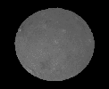
2015-09-09 |
Ceres
|
Dawn
|
Framing Camera
|
1024x1024x1 |
|
-
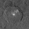
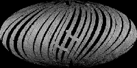
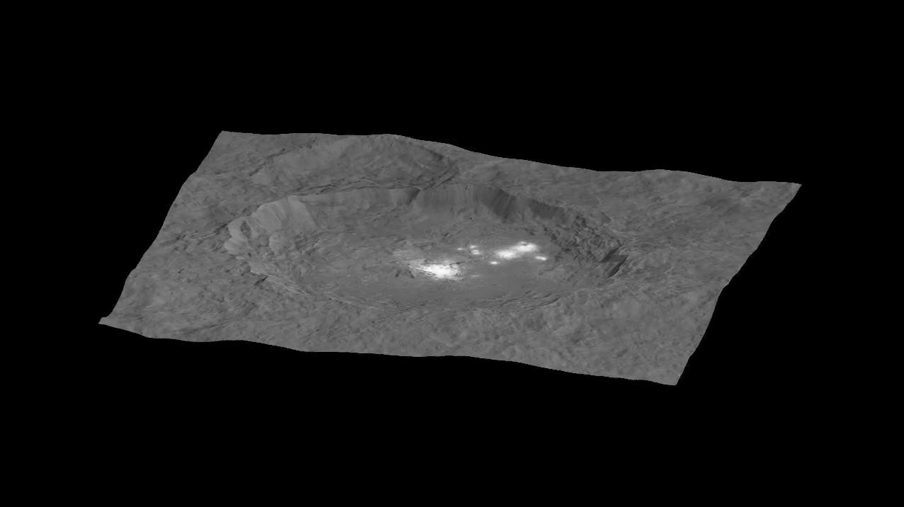
PIA19889:
-
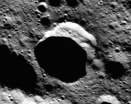
Dawn Takes a Closer Look at Occator
Full Resolution:
TIFF
(950.8 kB)
JPEG
(137.1 kB)
|
|
|
2015-09-09 |
Ceres
|
Dawn
|
Framing Camera
|
1277x716x1 |
|
-
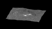
PIA19890:
-
Circling the Lights of Occator

Full Resolution:
TIFF
(238.4 kB)
JPEG
(38.01 kB)
|
|
|
2015-09-09 |
Ceres
|
Dawn
|
Framing Camera
|
1277x714x3 |
|
-
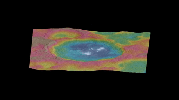
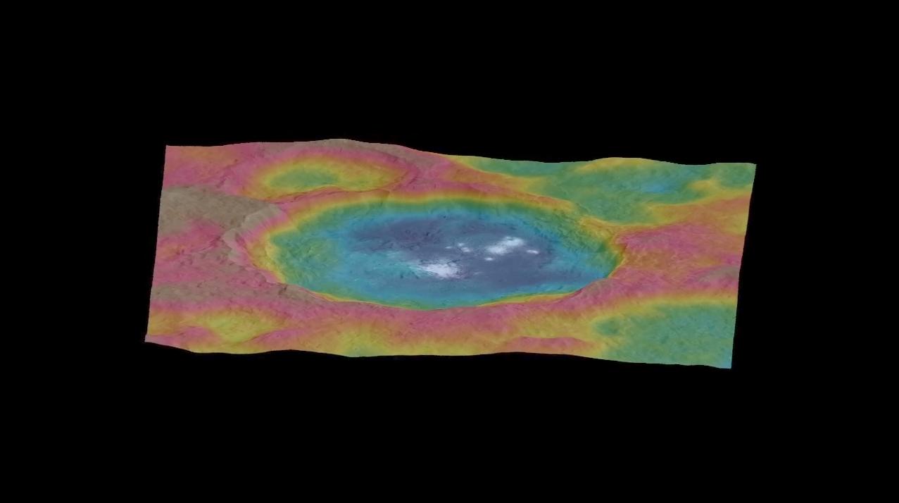
PIA19891:
-
Circling Occator -- Topographic Animation
Full Resolution:
TIFF
(813 kB)
JPEG
(39.37 kB)
|
|
|
2015-12-09 |
Ceres
|
Dawn
|
Framing Camera
|
1764x1112x3 |

|
-
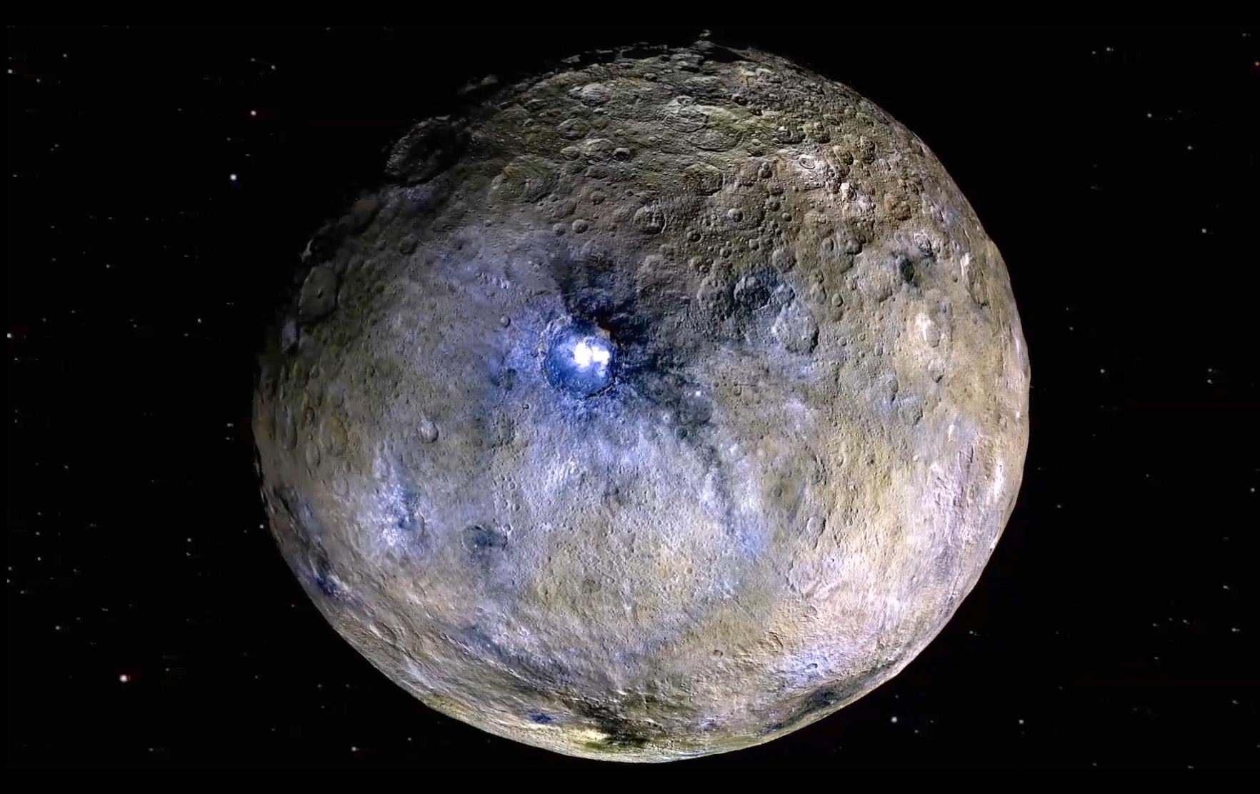
PIA20182:
-
Ceres Rotation and Occator Crater (Video)
Full Resolution:
TIFF
(3 MB)
JPEG
(221 kB)
|
|
|
2016-01-29 |
Ceres
|
Dawn
|
|
1280x720x3 |
|
-
PIA20019:
-
Flight Over Ceres
Full Resolution:
TIFF
(1.457 MB)
JPEG
(64.87 kB)
|
|
|
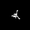
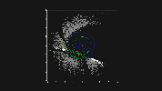
2016-03-22 |
Ceres
|
Dawn
|
Framing Camera
|
1264x632x1 |
|
-
PIA20356:
-
Ceres LAMO Coverage Map
Full Resolution:
TIFF
(648 kB)
JPEG
(186.5 kB)
|
|
|
2016-03-22 |
Ceres
|
Dawn
|
Framing Camera
|
640x360x3 |
|
-
PIA20537:
-
Unveiling Ceres (Animation)
Full Resolution:
TIFF
(178.3 kB)
JPEG
(18.84 kB)
|
|
|
2016-12-15 |
Ceres
|
Dawn
|
Framing Camera
|
1070x536x3 |
|
-
PIA21081:
-
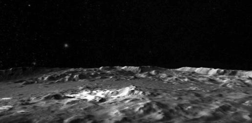
Water Ice Abundance on Ceres (Animation)
Full Resolution:
TIFF
(843.6 kB)
JPEG
(52.87 kB)
|
|
|
2016-12-15 |
Ceres
|
Dawn
|
Framing Camera
|
436x347x1 |

|
-
PIA21082:
-
Ceres Persistent Shadow (Animation)
Full Resolution:
TIFF
(142.1 kB)
JPEG
(32.21 kB)
|
|
|
2016-12-15 |
Ceres
|
Dawn
|
Framing Camera
|
516x253x1 |

|
-
PIA21080:
-
Flight Over Occator (Animation)
Full Resolution:
TIFF
(101.6 kB)
JPEG
(15.49 kB)
|
|
|
2017-03-22 |
Ceres
|
Dawn
|
Framing Camera
|
12500x9600x1 |
|
-
PIA21469:
-
Ceres' Shadowed Craters Over Time
Full Resolution:
TIFF
(30.83 MB)
JPEG
(5.459 MB)
|
|
|
2017-05-16 |
Ceres
|
Dawn
|
Framing Camera
|
690x566x1 |
|
-
PIA21405:
-
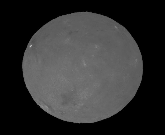
Ceres During 'Opposition Surge'
Full Resolution:
TIFF
(109.3 kB)
JPEG
(16.3 kB)
|
|
|
2017-10-26 |
Ceres
|
Dawn
|
Framing Camera
|
1400x788x3 |
|
-
PIA22083:
-
Clues to Ceres' Internal Structure
Full Resolution:
TIFF
(3.312 MB)
JPEG
(485.3 kB)
|
|
|
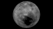
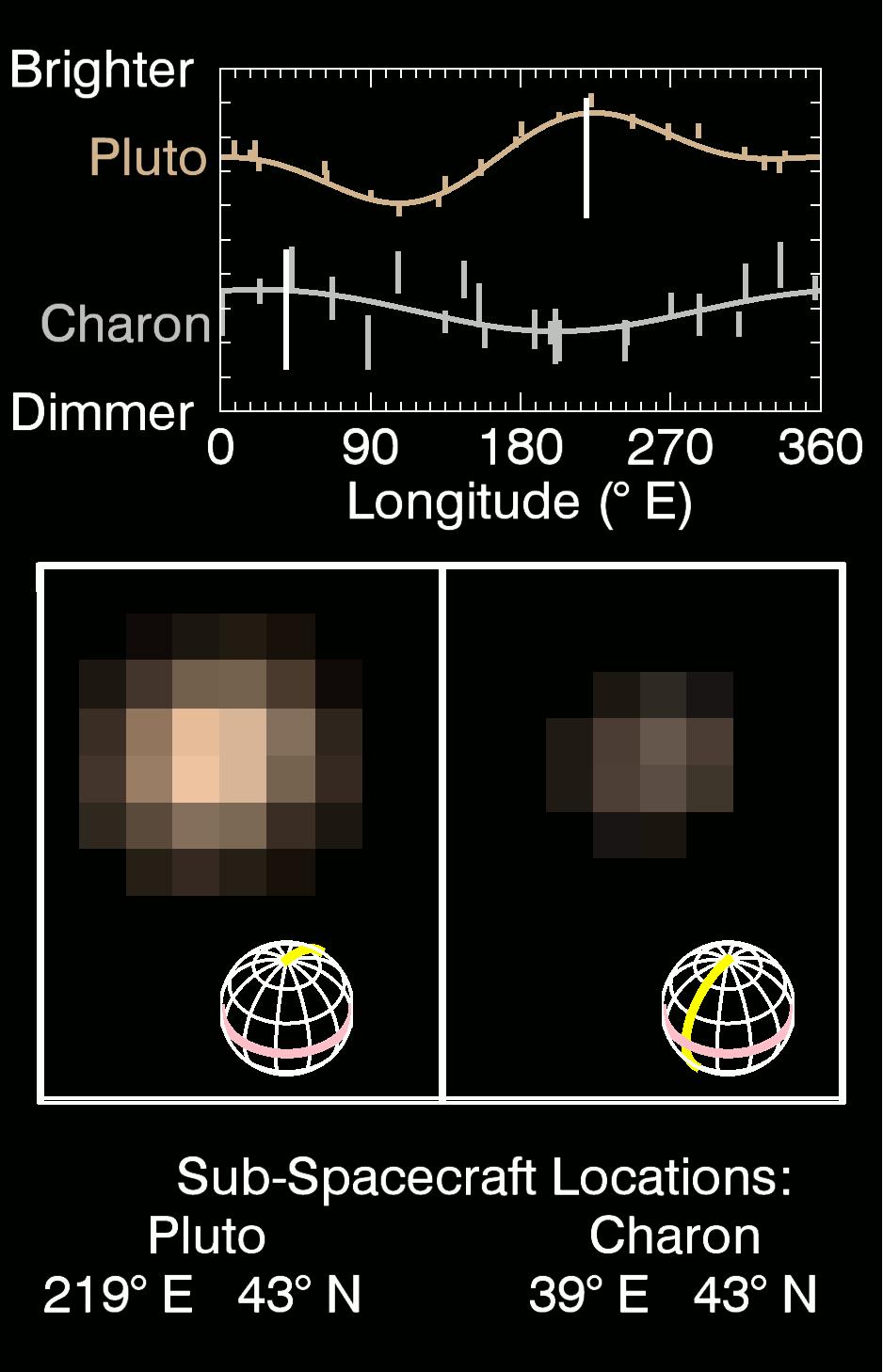
2015-07-01 |
Charon
|
New Horizons
|
MVIC
|
938x1458x3 |

|
-
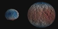
PIA19692:
-
True Color of Pluto and Charon
Full Resolution:
TIFF
(1.371 MB)
JPEG
(126.7 kB)
|
|
|
2015-10-01 |
Charon
|
New Horizons
|
LORRI
MVIC
|
1621x907x1 |
|
-
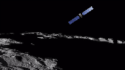
PIA19965:
-
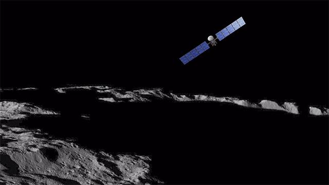
Flying over Charon
Full Resolution:
TIFF
(587.9 kB)
JPEG
(74.33 kB)
|
|
|
2005-07-01 |
Comet
|
Spitzer Space Telescope
|
|
646x486x3 |
|
-
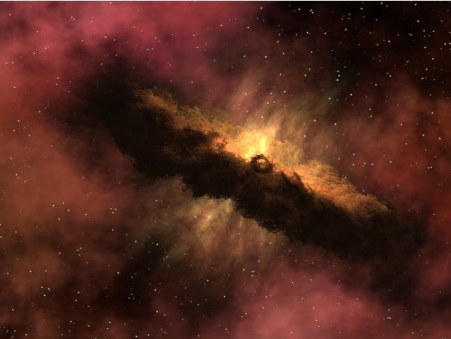
PIA02107:
-
Genesis of a Comet (Artist's Concept)
Full Resolution:
TIFF
(943.1 kB)
JPEG
(30.67 kB)
|
|
|
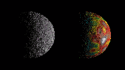
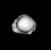
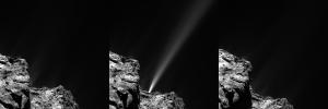
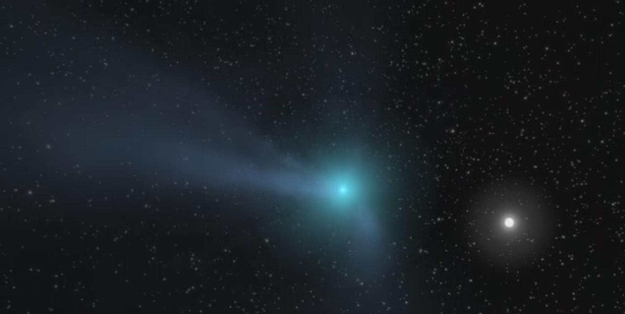
2014-05-15 |
Comet
|
Rosetta
|
OSIRIS
|
1000x1000x3 |
|
-
PIA18376:
-
Rosetta's Comet Comes Alive
Full Resolution:
TIFF
(1.003 MB)
JPEG
(121.1 kB)
|
|
|
2014-07-03 |
Comet
|
NEOWISE
|
NEOWISE Telescope
|
1329x957x3 |
|
-
PIA18460:
-
Infrared View of a Comet and Distant Galaxy
Full Resolution:
TIFF
(3.817 MB)
JPEG
(142.7 kB)
|
|
|
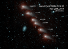
2014-07-17 |
Comet
|
Rosetta
|
OSIRIS
|
480x480x1 |
|
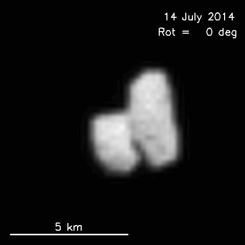
-
PIA18403:
-
Rotation and Shape of Rosetta Mission's Target Comet
Full Resolution:
TIFF
(230.8 kB)
JPEG
(8.872 kB)
|
|
|
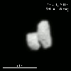
2014-07-24 |
Comet
|
Rosetta
|
OSIRIS
|
1000x1000x1 |
|
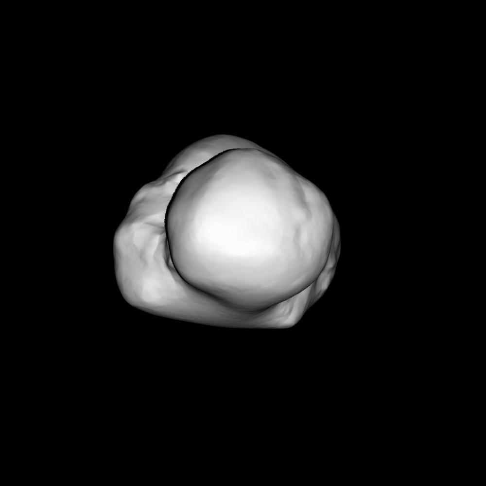
-
PIA18419:
-
Rotating Shape Model of Rosetta's Comet Target
Full Resolution:
TIFF
(1.001 MB)
JPEG
(21.47 kB)
|
|
|
2014-11-13 |
Comet
|
Rosetta
|
OSIRIS
|
400x400x1 |
|
-
PIA18877:
-
Descent to the Surface of a Comet
Full Resolution:
TIFF
(160.4 kB)
JPEG
(3.961 kB)
|
|
|
2015-01-13 |
Comet
|
NEOWISE
|
NEOWISE Telescope
|
1280x720x3 |
|
-
PIA19101:
-
One Year of NEOWISE Observations Mapped
Full Resolution:
TIFF
(2.766 MB)
JPEG
(59.78 kB)
|
|
|
2015-08-11 |
Comet
|
Rosetta
|
OSIRIS
|
3000x1000x1 |
|
-
PIA19867:
-
Rosetta Comet In Action (Animation)
Full Resolution:
TIFF
(1.677 MB)
JPEG
(171.4 kB)
|
|
|
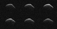
2016-03-24 |
Comet
|
Goldstone Deep Space Network (DSN)
|
Goldstone Solar System Radar
|
960x500x1 |
|
-
PIA20542:
-
Comet Frozen In Time by NASA Radar
Full Resolution:
TIFF
(452.2 kB)
JPEG
(109.6 kB)
|
|
|
2016-10-07 |
Comet
|
Kepler
Rosetta
|
|
1786x1030x1 |
|
-
PIA21072:
-
Comet 67P Seen by Kepler
Full Resolution:
TIFF
(400.4 kB)
JPEG
(46.74 kB)
|
|
|
2017-07-25 |
Comet
|
|
|
1992x1000x3 |

|
-
PIA21749:
-
Comet Illustration (Animation)
Full Resolution:
TIFF
(2.536 MB)
JPEG
(73.51 kB)
|
|
|
2019-04-15 |
Comet
|
NEOWISE
|
NEOWISE Telescope
|
3927x2209x3 |
|
-
PIA23165:
-
Comet C/2018 Y1 Iwamoto
Full Resolution:
TIFF
(22.3 MB)
JPEG
(1.462 MB)
|
|
|
2005-07-13 |
Cygnus
|
W. M. Keck Observatory
|
Keck I Telescope
|
640x480x3 |
|
-
PIA03520:
-
Land of Three Suns (Artist's Concept Animation)
Full Resolution:
TIFF
(23.04 MB)
JPEG
(574 kB)
|
|
|
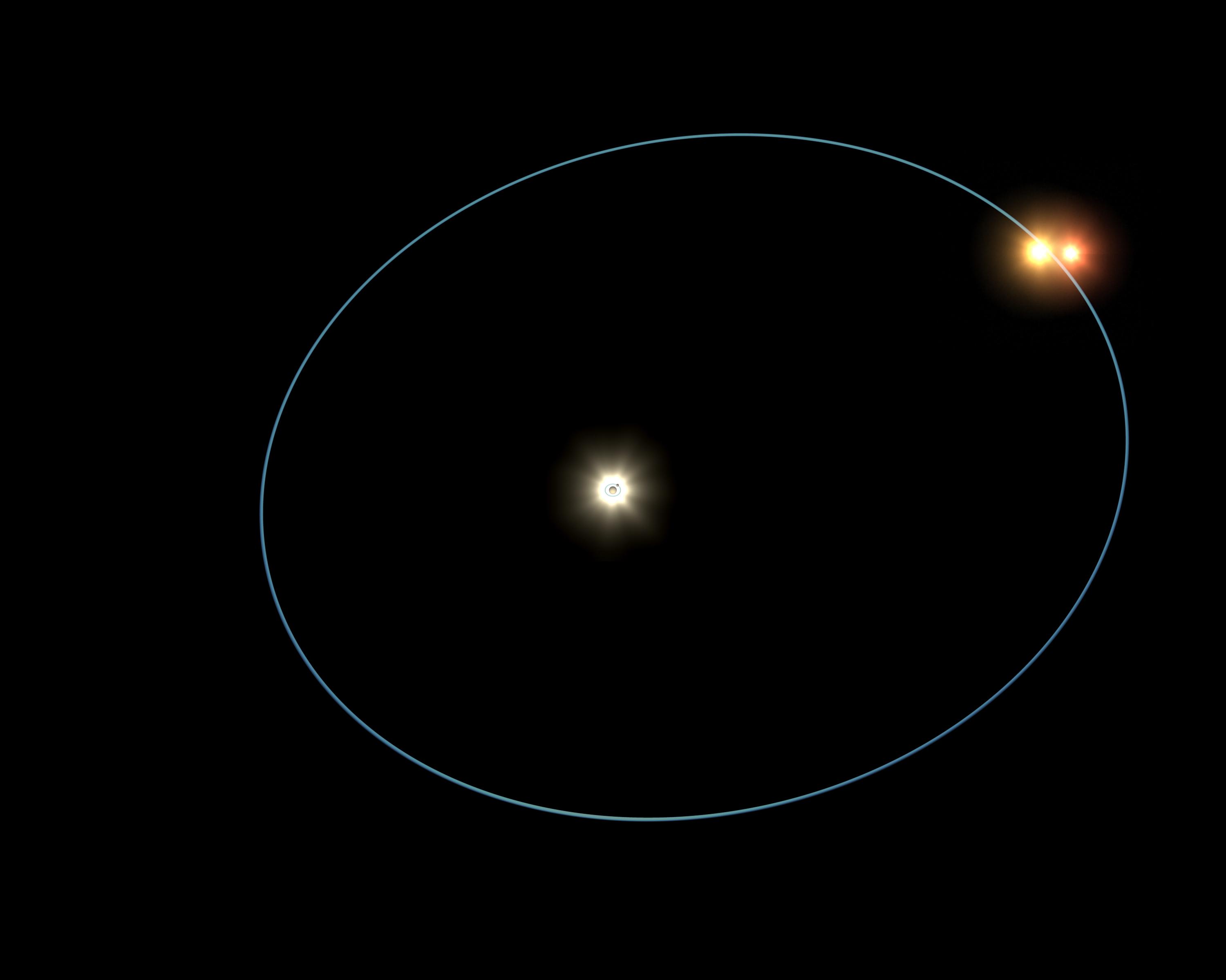
2005-07-13 |
Cygnus
|
W. M. Keck Observatory
|
Keck I Telescope
|
3000x2400x3 |
|
-
PIA03521:
-
Circus Family of Stars (Artist's Concept)
Full Resolution:
TIFF
(21.6 MB)
JPEG
(147.3 kB)
|
|
|
2019-04-04 |
Deimos
|
Mars Science Laboratory (MSL)
|
Mastcam
|
256x256x1 |
|
-
PIA23134:
-
Curiosity Observes Deimos Eclipse: Sol 2350
Full Resolution:
TIFF
(52.08 kB)
JPEG
(3.197 kB)
|
|
|
2024-03-05 |
Deimos
|
Mars 2020 Rover
|
Mastcam-Z
|
1535x917x3 |
|
-
PIA26249:
-
Perseverance Views a Transit of Deimos
Full Resolution:
TIFF
(667.5 kB)
JPEG
(30.82 kB)
|
|
|
2004-12-13 |
Dione
|
Cassini-Huygens
|
Composite Infrared Spectrometer
Imaging Science Subsystem
Ultraviolet Imaging Spectrograph
Visual and Infrared Mapping Spectrometer
|
452x484x3 |
|
-
PIA06149:
-
Dione Flyby Animation
Full Resolution:
|
|
|
2005-03-03 |
Dione
|
Cassini-Huygens
|
ISS - Narrow Angle
|
1016x900x1 |

|
-
PIA06199:
-
Cassini's Private Eclipse
Full Resolution:
TIFF
(93.28 kB)
JPEG
(23.22 kB)
|
|
|
2005-10-17 |
Dione
|
Cassini-Huygens
|
ISS - Wide Angle
|
500x500x1 |

|
-
PIA07749:
-
Ice Moon Rendezvous
Full Resolution:
TIFF
(250.5 kB)
JPEG
(19.76 kB)
|
|
|
2015-06-01 |
Dione
|
Cassini-Huygens
|
ISS - Narrow Angle
|
1024x1024x1 |
|
-
PIA18319:
-
Dione Dwarfing Rhea
Full Resolution:
TIFF
(1.05 MB)
JPEG
(73.61 kB)
|
|
|
2022-11-11 |
Eagle Nebula
|
Wide-field Infrared Survey Explorer (WISE)
|
|
3400x3400x3 |
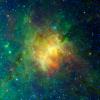
|
-
PIA25433:
-
The Eagle Nebula Observed by WISE
Full Resolution:
TIFF
(34.69 MB)
JPEG
(1.01 MB)
|
|
|
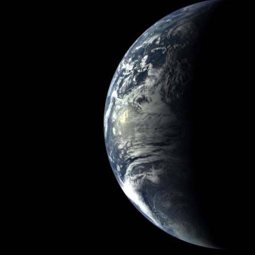
1996-01-29 |
Earth
|
Galileo
|
Solid-State Imaging
|
800x800x3 |
|
-
PIA00114:
-
Earth - South America (First Frame of Earth Spin Movie)
Full Resolution:
TIFF
(760.1 kB)
JPEG
(50.21 kB)
|
|
|
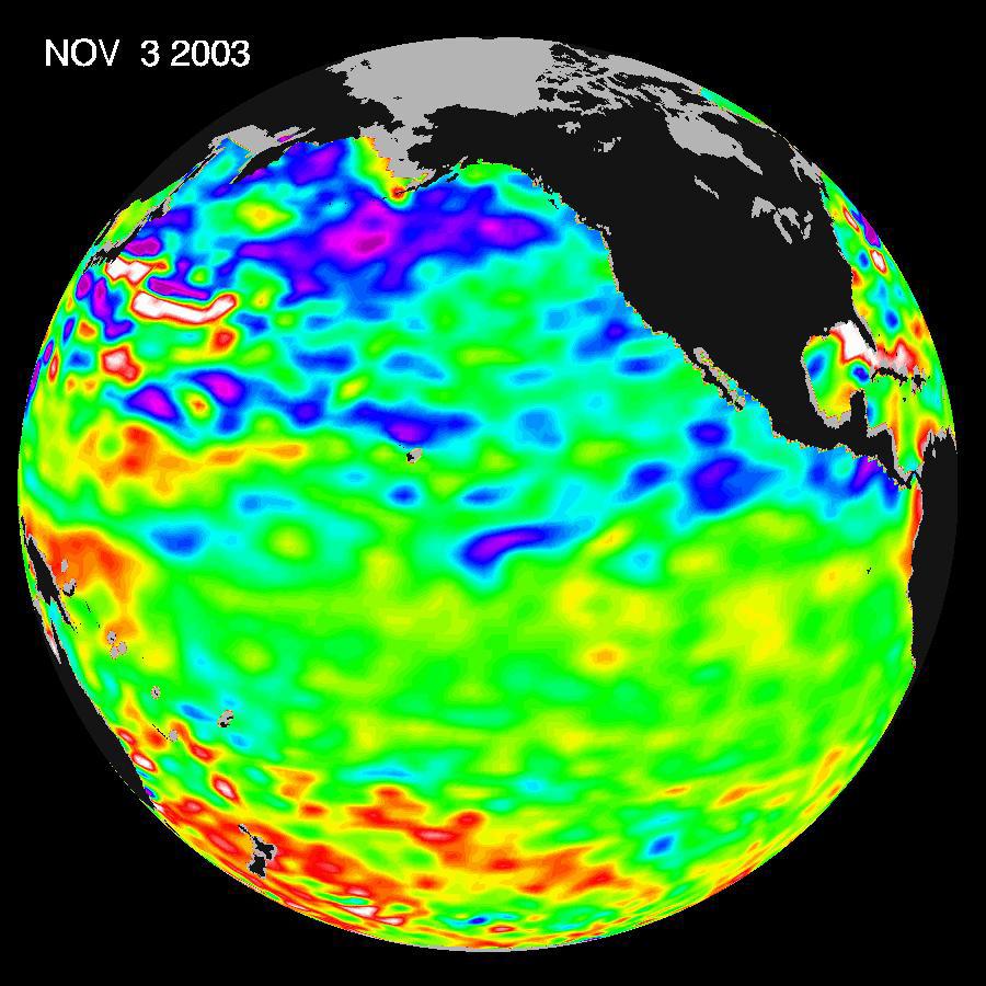
2003-11-18 |
Earth
|
Jason-1
|
Altimeter
|
900x900x3 |
|
-
PIA04878:
-
A Mostly Quiet Pacific
Full Resolution:
TIFF
(1.523 MB)
JPEG
(113.4 kB)
|
|
|
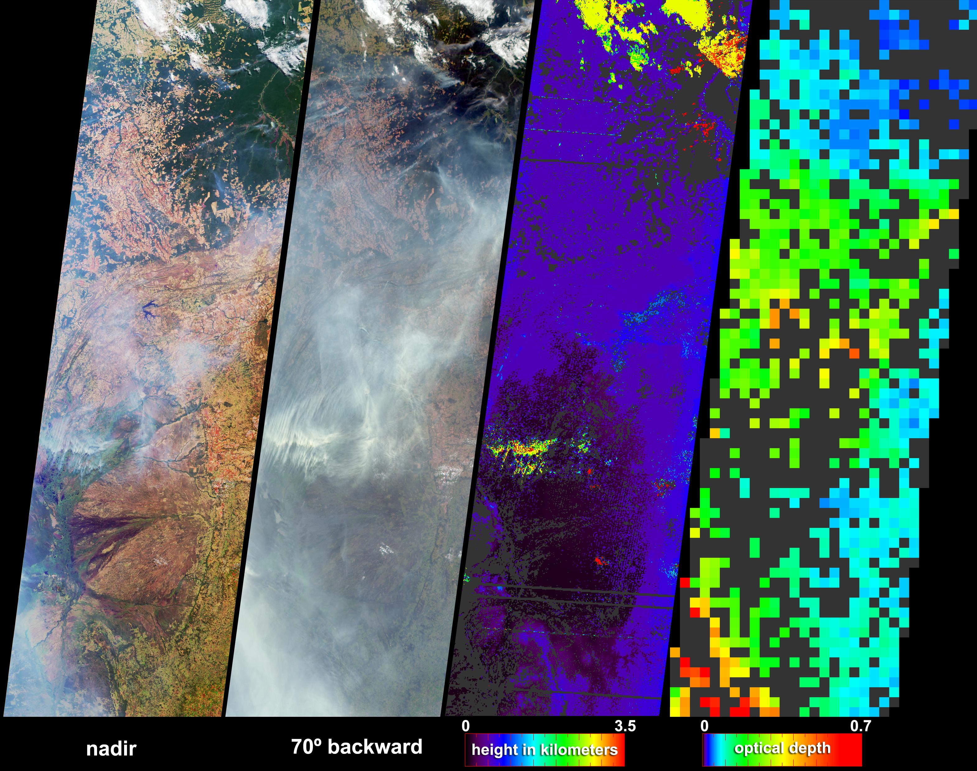
2004-07-07 |
Earth
|
Terra
|
MISR
|
3141x2477x3 |
|
-
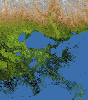
PIA04362:
-
Fire and Deforestation near the Xingu River
Full Resolution:
TIFF
(13.92 MB)
JPEG
(1.079 MB)
|
|
|
2010-02-19 |
Earth
|
GRACE
|
K-Band Ranging System
|
1279x720x3 |
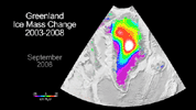
|
-
PIA12845:
-
Greenland Gains Some, Loses More
Full Resolution:
TIFF
(2.766 MB)
JPEG
(101.2 kB)
|
|
|
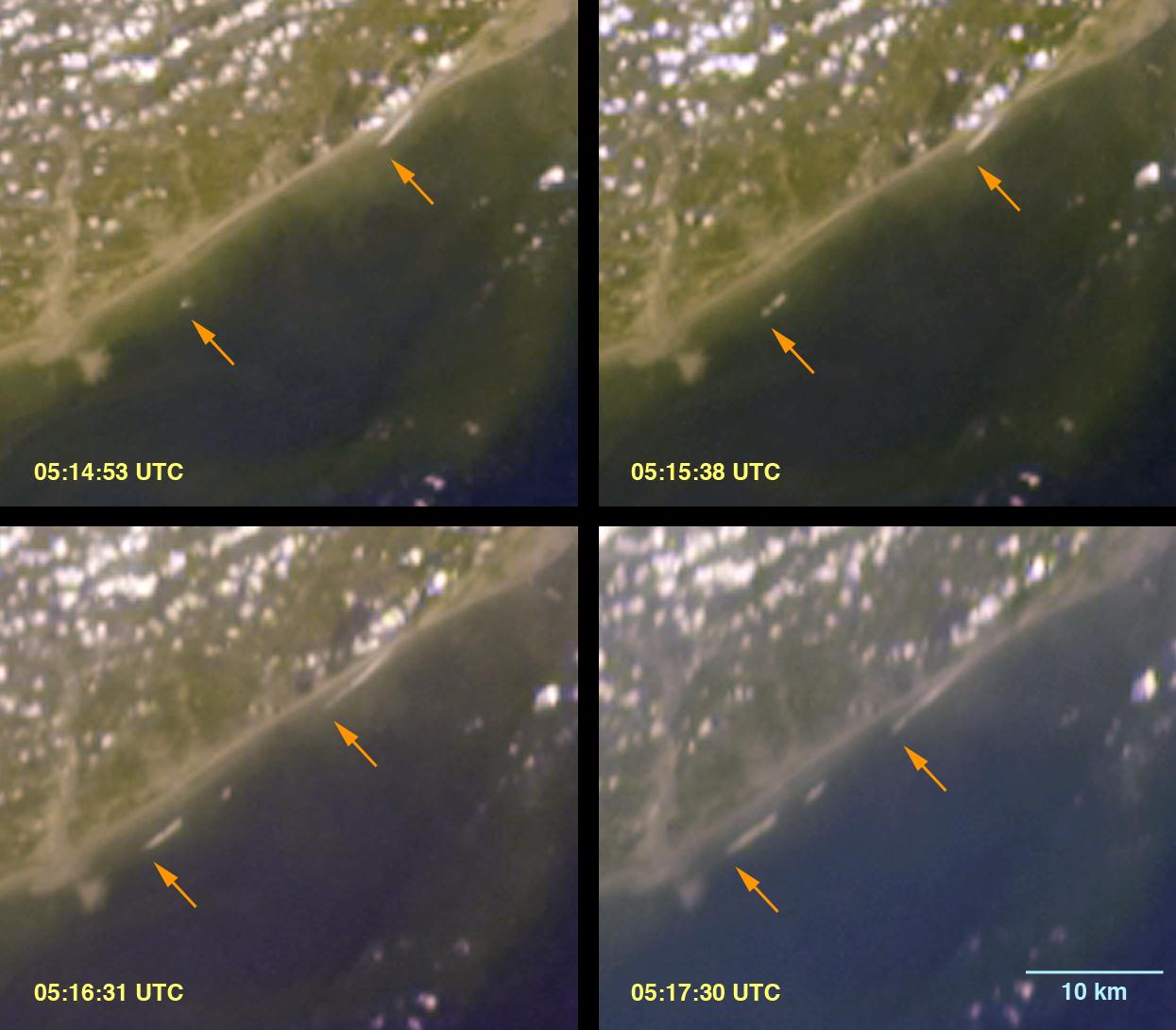
2005-01-12 |
Earth
|
Terra
|
MISR
|
1245x1090x3 |
|
-
PIA04372:
-
Breaking Tsunami Waves along India's Eastern Coast
Full Resolution:
TIFF
(3.174 MB)
JPEG
(100.1 kB)
|
|
|
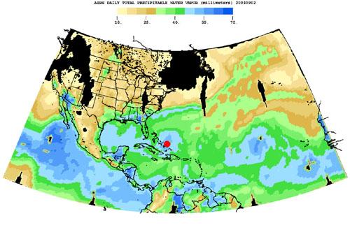
2004-08-30 |
Earth
|
Aqua
|
AIRS
|
500x342x3 |
|
-
PIA00433:
-
Hurricane Frances as Observed by NASA's Spaceborne Atmospheric Infrared
Sounder (AIRS) - Total Water Vapor Time Series
Full Resolution:
TIFF
(344.8 kB)
JPEG
(36.3 kB)
|
|
|
2005-06-02 |
Earth
|
Aura
|
MLS
|
720x540x3 |
|
-
PIA07255:
-
Aura Microwave Limb Sounder Animation Illustrating the Interaction Between
Temperatures and Chemicals Involved in Ozone Destruction, 2004-2005 Arctic Winter
Full Resolution:
TIFF
(1.168 MB)
JPEG
(60.91 kB)
|
|
|
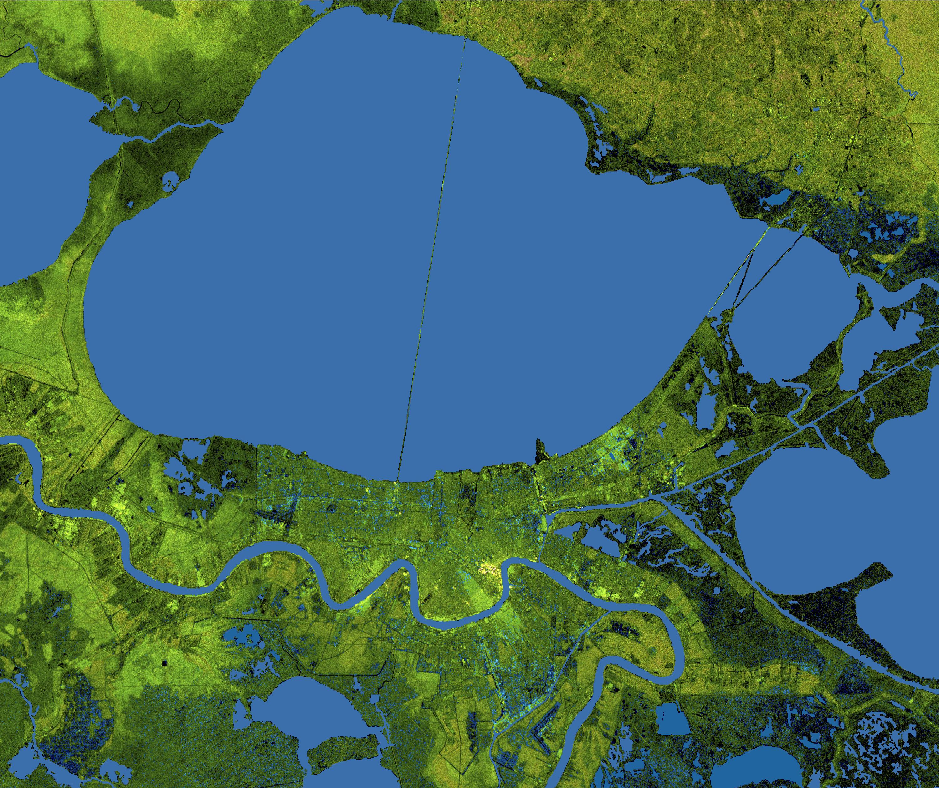
2005-08-29 |
Earth
|
Shuttle Radar Topography Mission (SRTM)
|
C-Band Imaging Radar
X-Band Radar
|
3000x2519x3 |

|
-
PIA04174:
-
New Orleans Topography, Radar Image with Colored Height
Full Resolution:
TIFF
(22.67 MB)
JPEG
(1.437 MB)
|
|
|
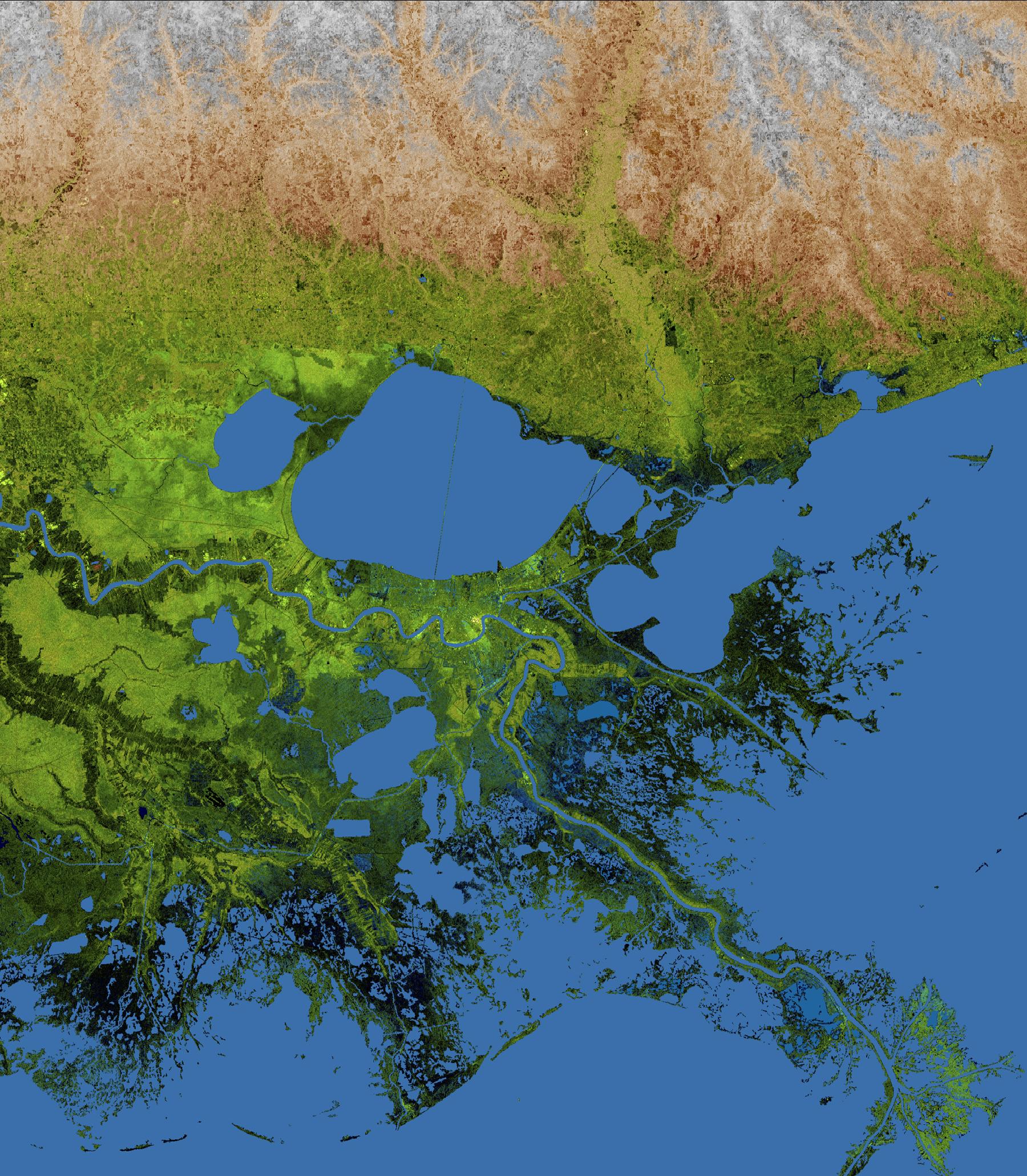
2005-08-29 |
Earth
|
Shuttle Radar Topography Mission (SRTM)
|
C-Band Imaging Radar
X-Band Radar
|
1800x2061x3 |
|
-
PIA04175:
-
Mississippi Delta, Radar Image with Colored Height
Full Resolution:
TIFF
(11.15 MB)
JPEG
(781.5 kB)
|
|
|
2005-08-31 |
Earth
|
Terra
|
MISR
|
3008x3164x3 |
|
-
PIA04383:
-
The Roiling Clouds of Katrina
Full Resolution:
TIFF
(28.55 MB)
JPEG
(525 kB)
|
|
|
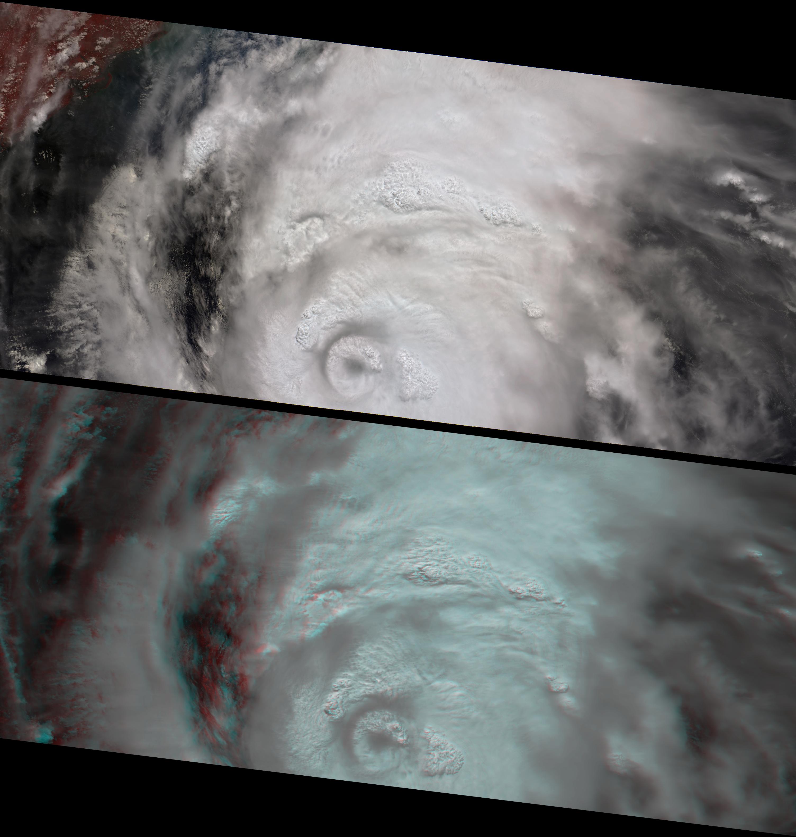
2005-09-22 |
Earth
|
Shuttle Radar Topography Mission (SRTM)
|
C-Band Imaging Radar
X-Band Imaging Radar
|
3621x1525x3 |
|
-
PIA06674:
-
Hurricane Rita Track
Radar Image with Topographic Overlay
Full Resolution:
TIFF
(16.57 MB)
JPEG
(452.1 kB)
|
|
|
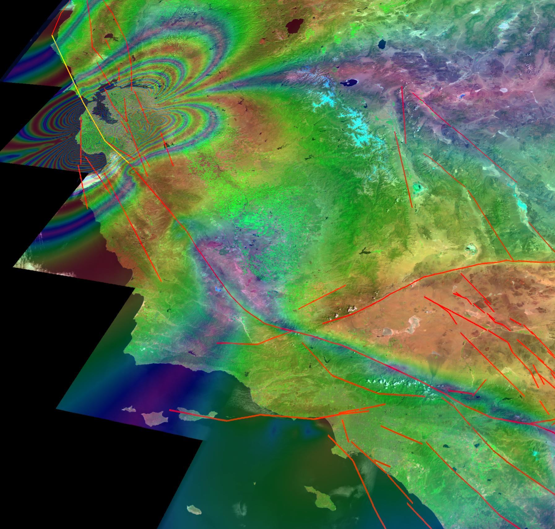
2005-10-13 |
Earth
|
Landsat
|
Interferometric Synthetic Aperture Radar
|
1793x1706x3 |
|
-
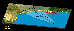
PIA03032:
-
New Forecast of San Francisco Earthquake Risk
Full Resolution:
TIFF
(9.19 MB)
JPEG
(411 kB)
|
|
|
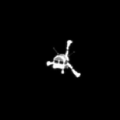
2005-12-22 |
Earth
|
Stardust
|
|
714x481x3 |
|
-
PIA03245:
-
Spacecraft -- Capsule Separation (Animation)
Full Resolution:
TIFF
(1.032 MB)
JPEG
(33.19 kB)
|
|
|
2005-12-22 |
Earth
|
Stardust
|
|
600x444x3 |
|
-
PIA03247:
-
Rehearsal: Infrared Views of Landing and Retrieval (Animation)
Full Resolution:
TIFF
(800.3 kB)
JPEG
(22.8 kB)
|
|
|
2005-12-22 |
Earth
|
Stardust
|
|
717x417x3 |
|
-
PIA03248:
-
Entry, Descent, Landing Animation (Animation)
Full Resolution:
TIFF
(898.3 kB)
JPEG
(35.84 kB)
|
|
|
2005-12-22 |
Earth
|
Stardust
|
|
715x481x3 |
|
-
PIA03249:
-
Spacecraft Trajectory (Animation)
Full Resolution:
TIFF
(1.033 MB)
JPEG
(25.15 kB)
|
|
|
2005-08-02 |
Earth
|
MESSENGER
|
MDIS - Wide Angle
|
507x507x3 |

|
-
PIA10120:
-
Earth Departure Movie
Full Resolution:
TIFF
(772.2 kB)
JPEG
(16.44 kB)
|
|
|
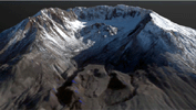
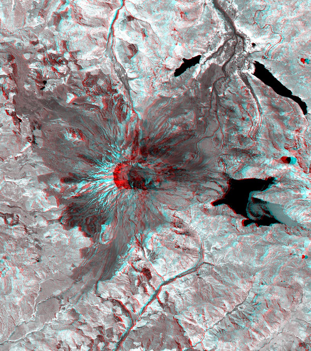
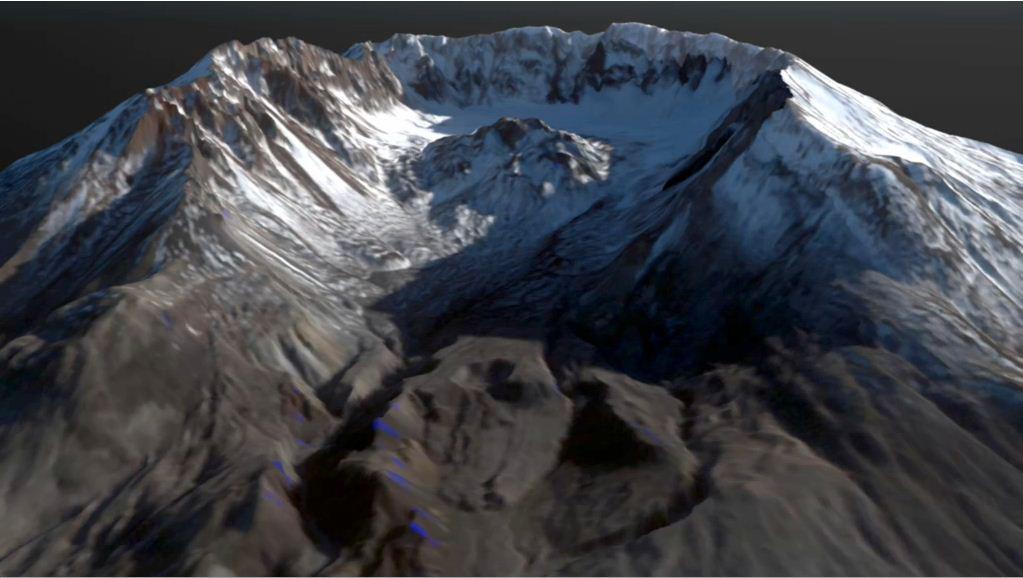
2001-10-22 |
Earth
|
Terra
|
ASTER
|
1200x1354x3 |
|
-
PIA11160:
-
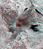
Mt. St. Helens
Full Resolution:
TIFF
(4.88 MB)
JPEG
(460.2 kB)
|
|
|
2001-10-22 |
Earth
|
Terra
|
ASTER
|
340x256x3 |

|
-
PIA11166:
-
Mt. Fuji, Japan
Full Resolution:
TIFF
(261.6 kB)
JPEG
(12.14 kB)
|
|
|
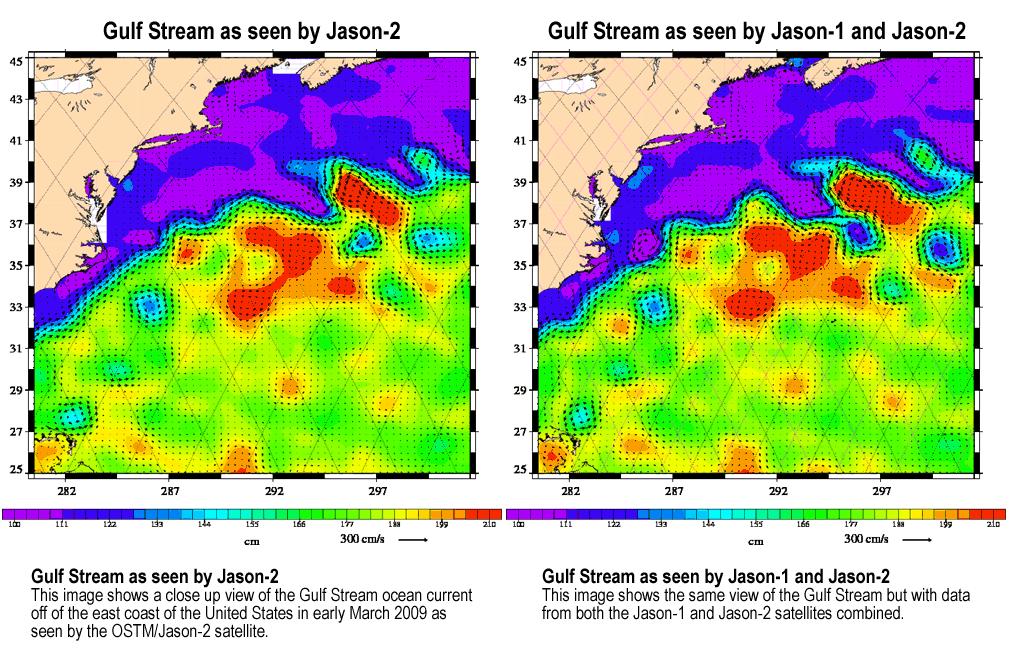
2009-04-27 |
Earth
|
Jason-1
OSTM/Jason-2
|
Altimeter
|
1010x654x3 |
|
-
PIA11997:
-
OSTM/Jason-2 and Jason-1 Tandem Mission View of the Gulf Stream
Full Resolution:
TIFF
(663 kB)
JPEG
(187.6 kB)
|
|
|
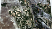
2009-06-29 |
Earth
|
Terra
|
ASTER
|
1281x718x3 |
|
-
PIA12094:
-
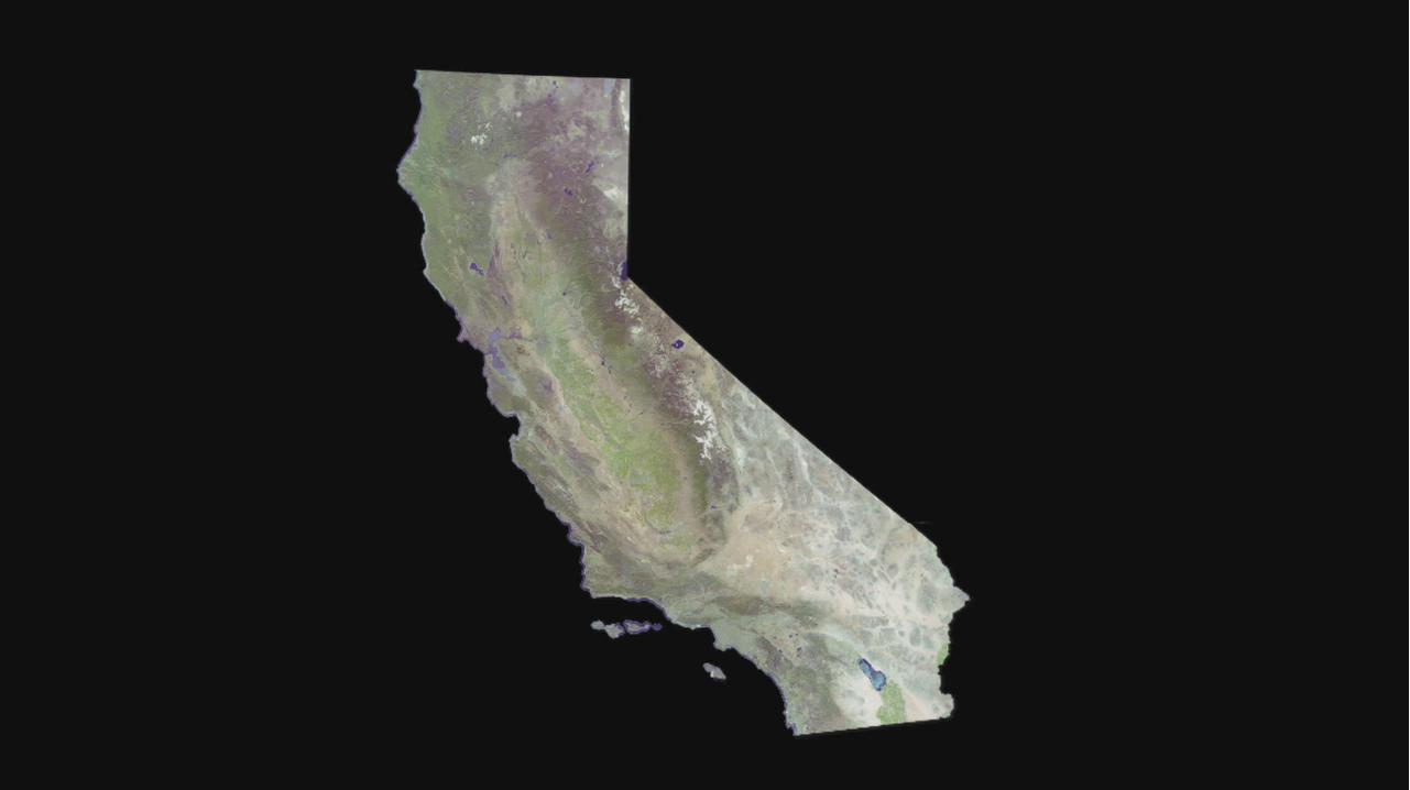
Cruising Over California
Full Resolution:
TIFF
(2.762 MB)
JPEG
(37.04 kB)
|
|
|
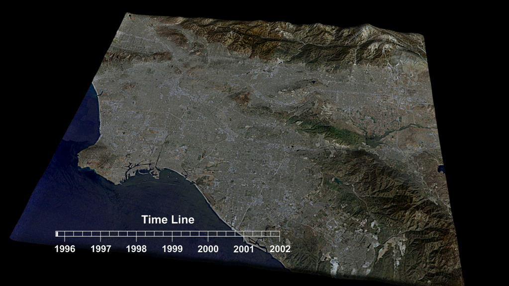
2009-06-29 |
Earth
|
Terra
|
ASTER
|
1280x720x3 |
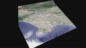
|
-
PIA12095:
-
Cruising Over Los Angeles
Full Resolution:
TIFF
(2.768 MB)
JPEG
(86.7 kB)
|
|
|
2009-09-04 |
Earth
|
Aqua
|
AIRS
|
640x500x3 |
|
-
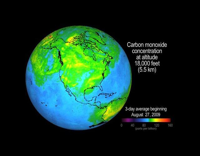
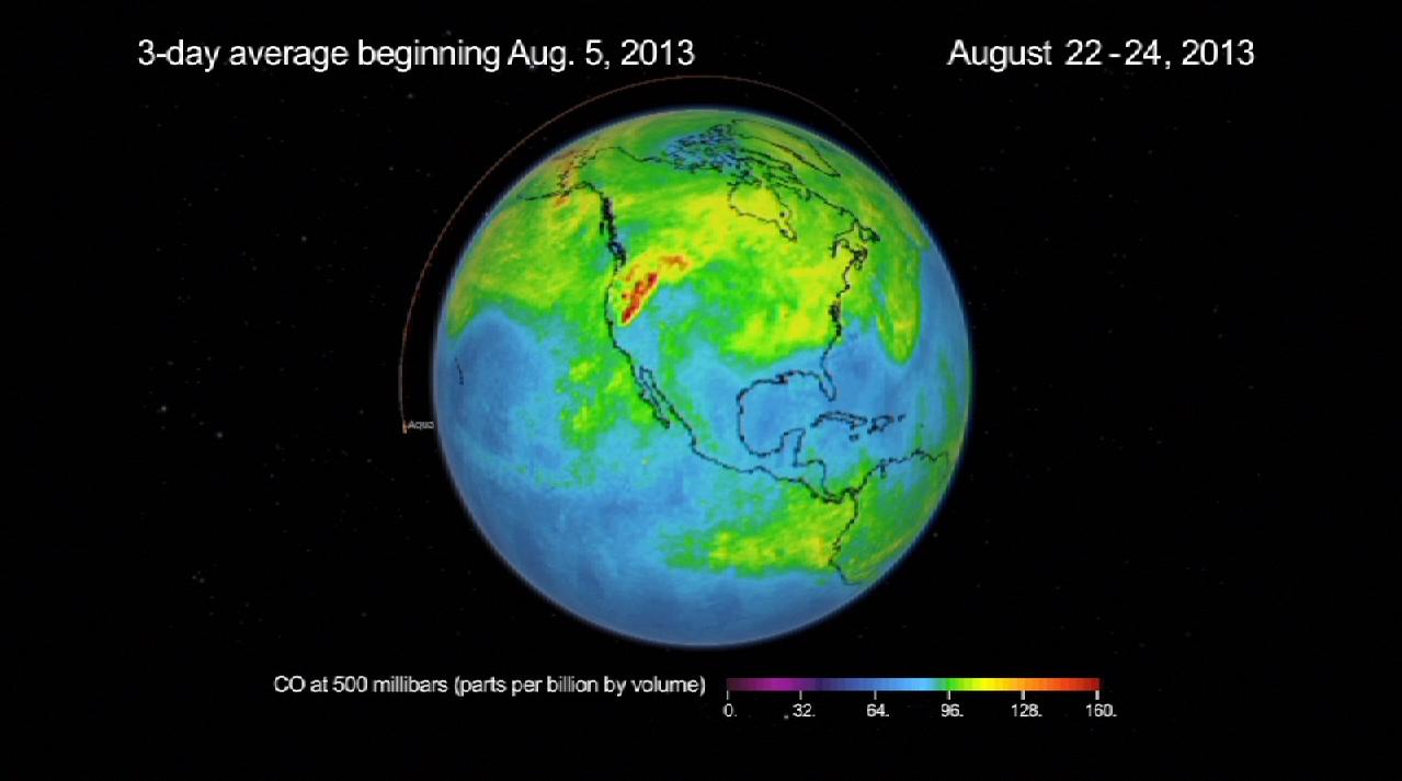
PIA12195:
-
Concentration and Transport of Carbon Monoxide from the California Wildfires
Full Resolution:
TIFF
(961.2 kB)
JPEG
(32.29 kB)
|
|
|
2010-07-07 |
Earth
|
GRACE
|
K-Band Ranging System
|
777x745x3 |

|
-
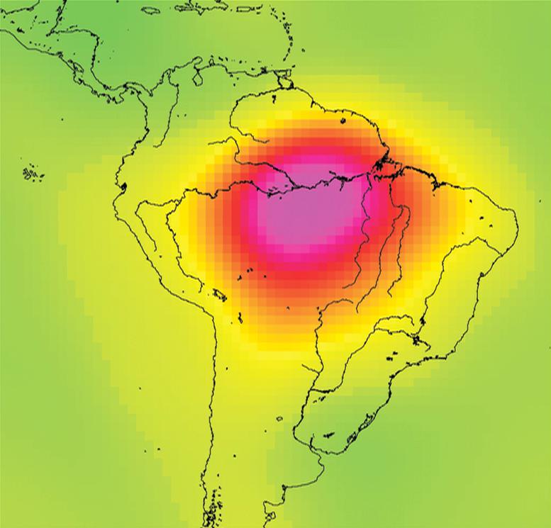
PIA13243:
-
Measuring Water Storage in the Amazon
Full Resolution:
TIFF
(1.739 MB)
JPEG
(51.9 kB)
|
|
|
2011-06-09 |
Earth
|
Terra
|
MISR
|
1205x1545x3 |
|
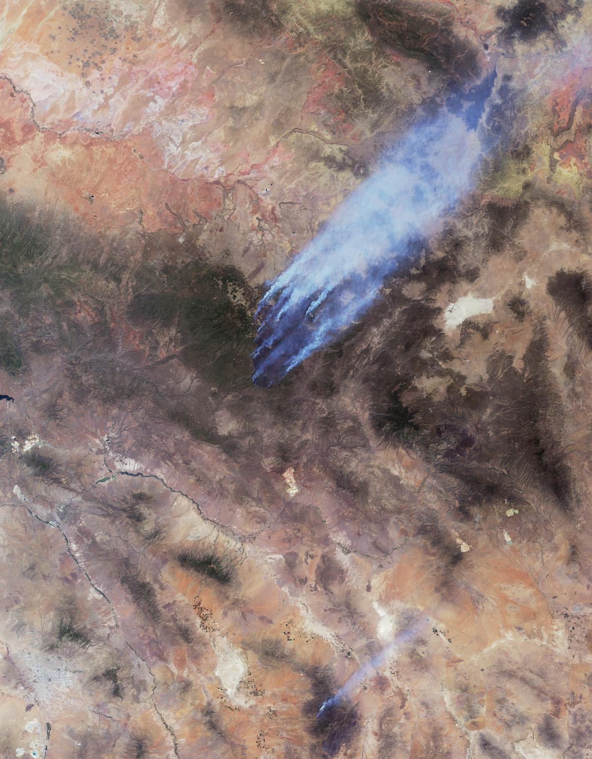
-
PIA14270:
-
Arizona Wildfires Burn Out of Control
Full Resolution:
TIFF
(5.592 MB)
JPEG
(322.2 kB)
|
|
|
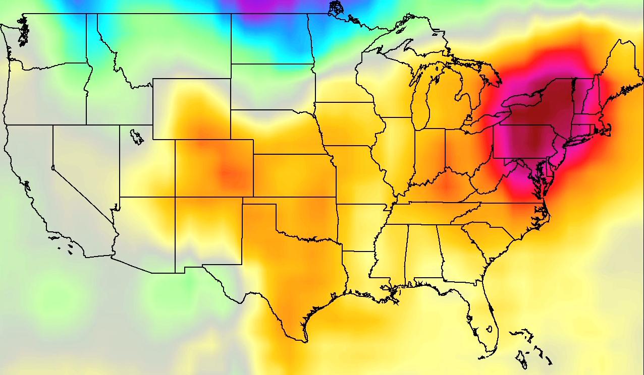
2011-07-26 |
Earth
|
Aqua
|
AIRS
|
1276x744x3 |
|
-
PIA14480:
-
NASA AIRS Movies Show Evolution of U.S. 2011 Heat Wave
Full Resolution:
TIFF
(2.851 MB)
JPEG
(114.3 kB)
|
|
|
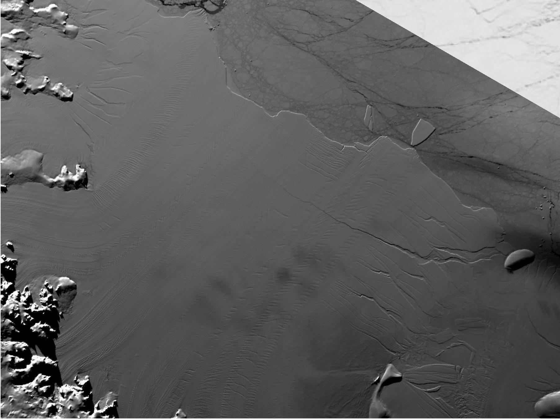
2011-08-18 |
Earth
|
|
|
455x256x3 |
|
-
PIA14557:
-
Flow of Ice Across Antarctica
Full Resolution:
TIFF
(350 kB)
JPEG
(35.4 kB)
|
|
|
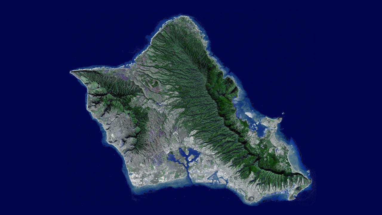
2011-10-17 |
Earth
|
Terra
|
ASTER
|
1280x720x3 |
|
-
PIA14898:
-
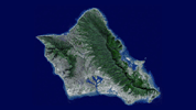
NASA Flyover of Oahu, Hawaii
Full Resolution:
TIFF
(2.768 MB)
JPEG
(93.48 kB)
|
|
|
2012-02-06 |
Earth
|
Terra
|
ASTER
|
1023x575x3 |
|
-
PIA13200:
-
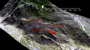
Esperanza Wildfire Animation
Full Resolution:
TIFF
(1.767 MB)
JPEG
(141.8 kB)
|
|
|
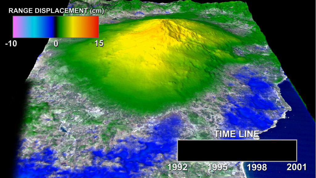
2012-02-06 |
Earth
|
European Remote Sensing Satellite Mission (ERS)
|
Synthetic Aperture Radar (SAR)
|
1024x576x3 |
|
-
PIA13201:
-
Mount Etna InSAR Time Series Animation
Full Resolution:
TIFF
(1.772 MB)
JPEG
(100.7 kB)
|
|
|
2012-02-06 |
Earth
|
|
|
1023x574x3 |
|
-
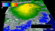
PIA13203:
-
Kamoamoa Flow Field Animation
Full Resolution:
TIFF
(1.764 MB)
JPEG
(72.41 kB)
|
|
|
2012-02-06 |
Earth
|
|
|
1023x578x3 |
|
-
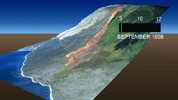
PIA15004:
-
Growth of the Mount St. Helens Lava Dome, September 24-October 14, 2004
Full Resolution:
TIFF
(1.776 MB)
JPEG
(73.99 kB)
|
|
|
2012-02-06 |
Earth
|
Shuttle Radar Topography Mission (SRTM)
|
|
1024x576x3 |
|
-
PIA13204:
-
Lost Hills Subsidence Animation
Full Resolution:
TIFF
(1.772 MB)
JPEG
(116.7 kB)
|
|
|
2012-02-06 |
Earth
|
European Remote Sensing Satellite Mission (ERS)
|
Synthetic Aperture Radar (SAR)
|
1023x576x3 |
|
-
PIA13202:
-
Southern California INSAR Time Series
Full Resolution:
TIFF
(1.77 MB)
JPEG
(87.02 kB)
|
|
|
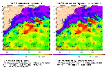
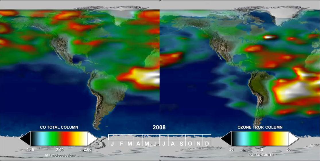
2012-02-06 |
Earth
|
Aura
|
TES
|
1115x560x3 |
|
-
PIA15005:
-
Annual Variation in Global CO and O3
Full Resolution:
TIFF
(1.876 MB)
JPEG
(70.63 kB)
|
|
|
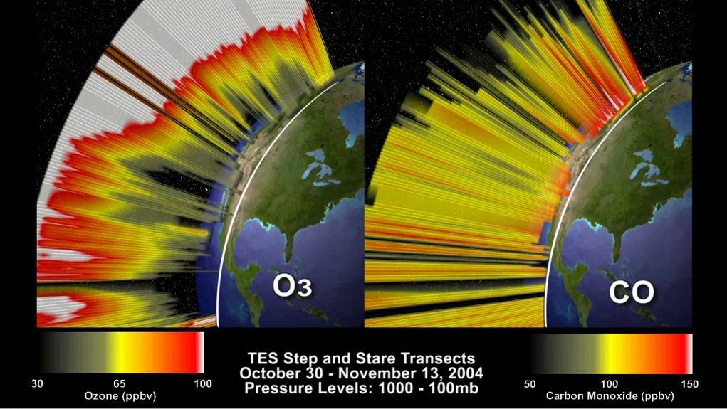
2012-02-06 |
Earth
|
Aura
|
TES
|
1021x575x3 |
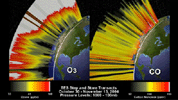
|
-
PIA15006:
-
O3 and CO Transects over North America
Full Resolution:
TIFF
(1.764 MB)
JPEG
(110.1 kB)
|
|
|
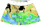
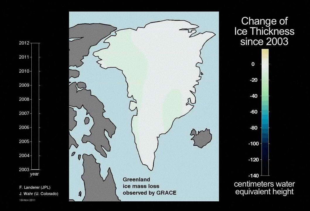
2012-02-02 |
Earth
|
GRACE
|
K-Band Ranging System
|
1058x720x3 |
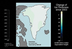
|
-
PIA13955:
-
Ice Mass Loss on Greenland, 2003-2011
Full Resolution:
TIFF
(2.288 MB)
JPEG
(78.67 kB)
|
|
|
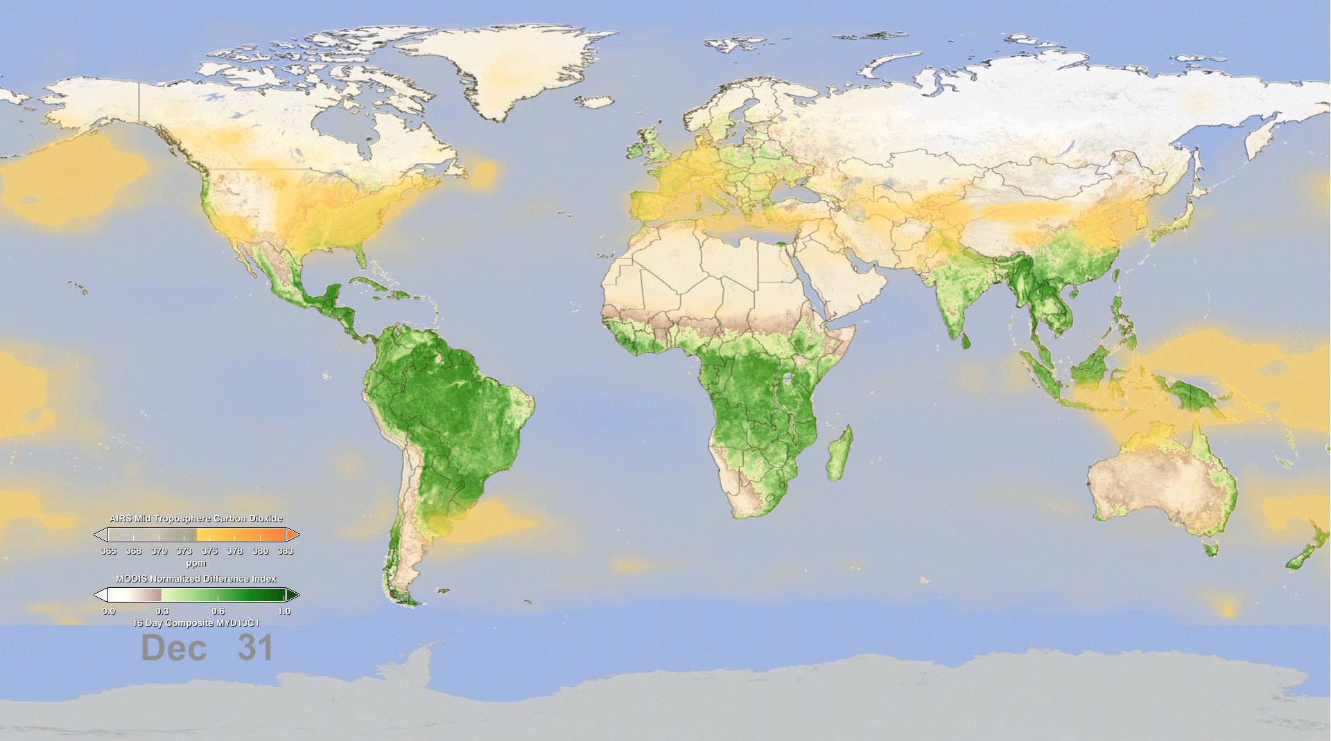
2012-06-29 |
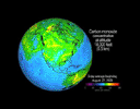
Earth
|
Aqua
|
AIRS
MODIS
|
1920x1070x3 |

|
-
PIA15838:
-
Effect of Seasonal Vegetation Cycle on Global Atmospheric Carbon Dioxide
Full Resolution:
TIFF
(6.166 MB)
JPEG
(200.6 kB)
|
|
|
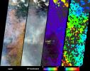
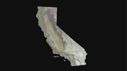
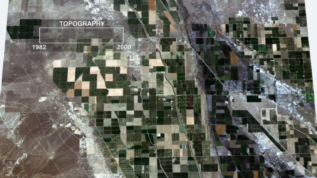
2012-10-01 |
Earth
|
Terra
|
ASTER
InSAR
|
1024x575x3 |
|
-
PIA16293:
-
InSAR Measurements of Subsidence in California's Central Valley (June 2007--December 2010)
Full Resolution:
TIFF
(1.767 MB)
JPEG
(81.67 kB)
|
|
|
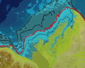
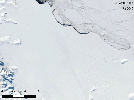
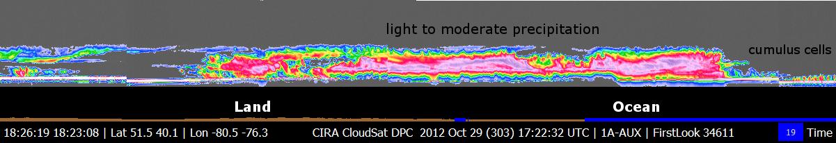
2012-10-30 |
Earth
|
CloudSat
|
Cloud Profiling Radar (CPR)
|
1201x206x3 |
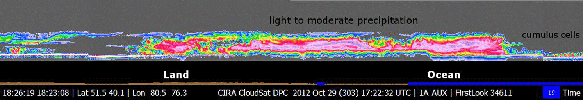
|
-
PIA16201:
CloudSat's View of Hurricane Sandy
Full Resolution:
TIFF
(742.7 kB)
JPEG
(52.4 kB)
|
|
|
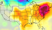
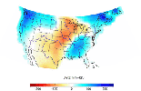
2013-08-27 |
Earth
|
Aqua
|
AIRS
|
1279x713x3 |
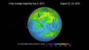
|
-
PIA17433:
-
NASA's AIRS Instrument Sees Spread of Pollution from Western Wildfires
Full Resolution:
TIFF
(2.737 MB)
JPEG
(60.04 kB)
|
|
|
2013-10-26 |
Earth
|
GRACE
|
K-Band Ranging System
|
1297x708x3 |
|
-
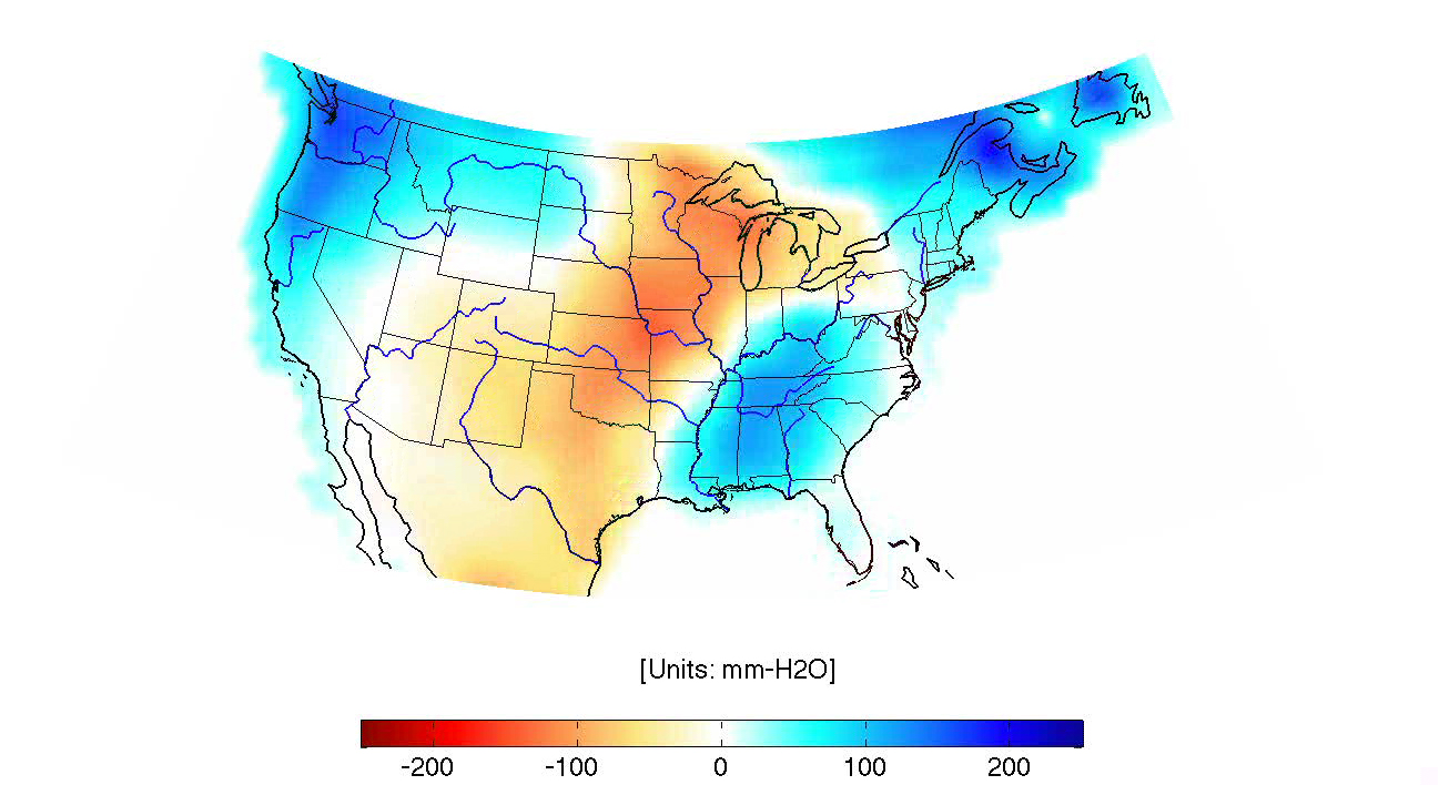
PIA14268:
-
GRACE Land Water Storage Monthly Changes over the United States, 2003 – Early 2013
Full Resolution:
TIFF
(690.1 kB)
JPEG
(464 kB)
|
|
|
2013-12-10 |
Earth
|
Juno
|
Waves
|
1920x834x3 |

|
-
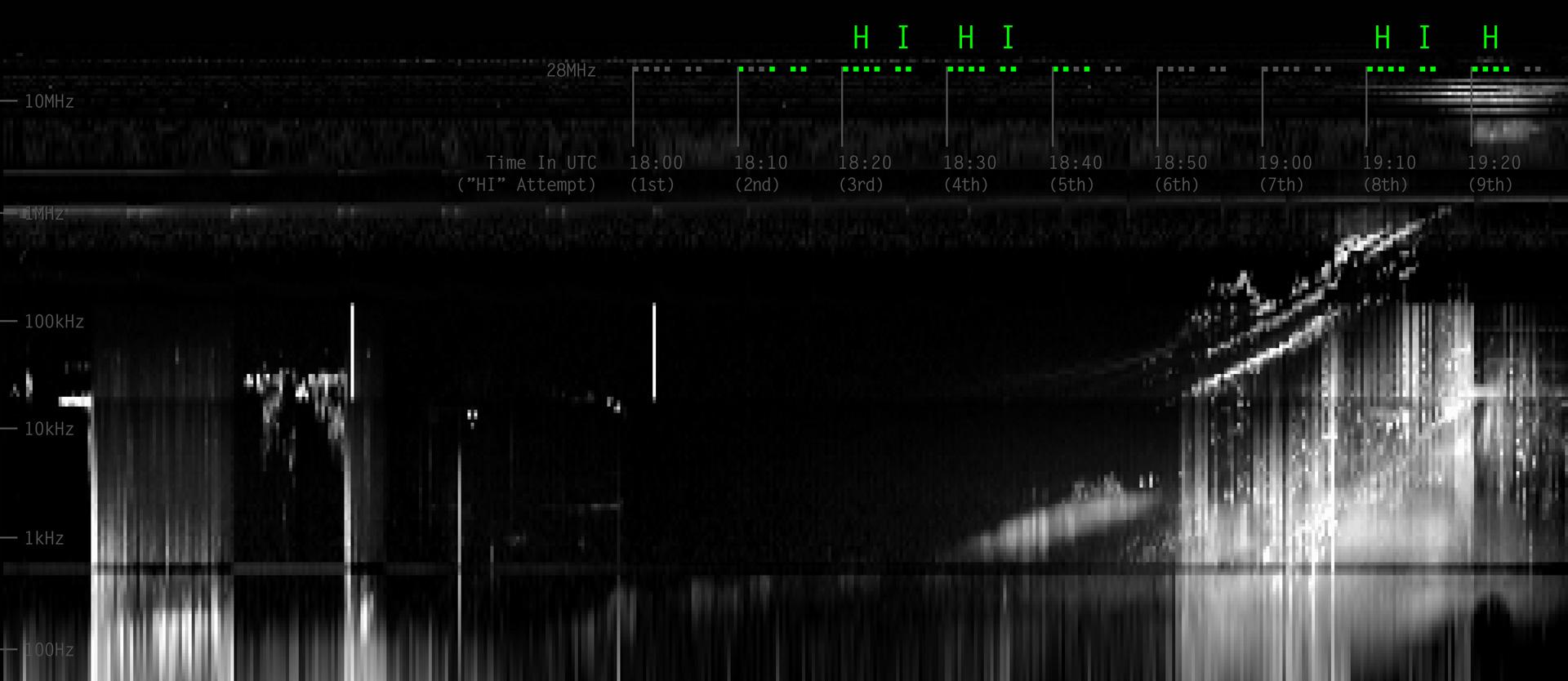
PIA17744:
-
Juno Detects a Ham Radio "HI" from Earth
Full Resolution:
TIFF
(4.806 MB)
JPEG
(136.4 kB)
|
|
|
2013-12-10 |
Earth
|
Juno
|
Star Tracker
|
483x376x3 |

|
-
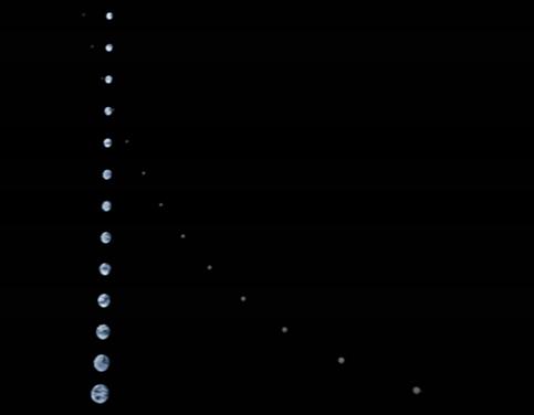
PIA17748:
-
Juno's Approach to the Earth-Moon System
Full Resolution:
TIFF
(545.2 kB)
JPEG
(5.373 kB)
|
|
|
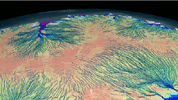
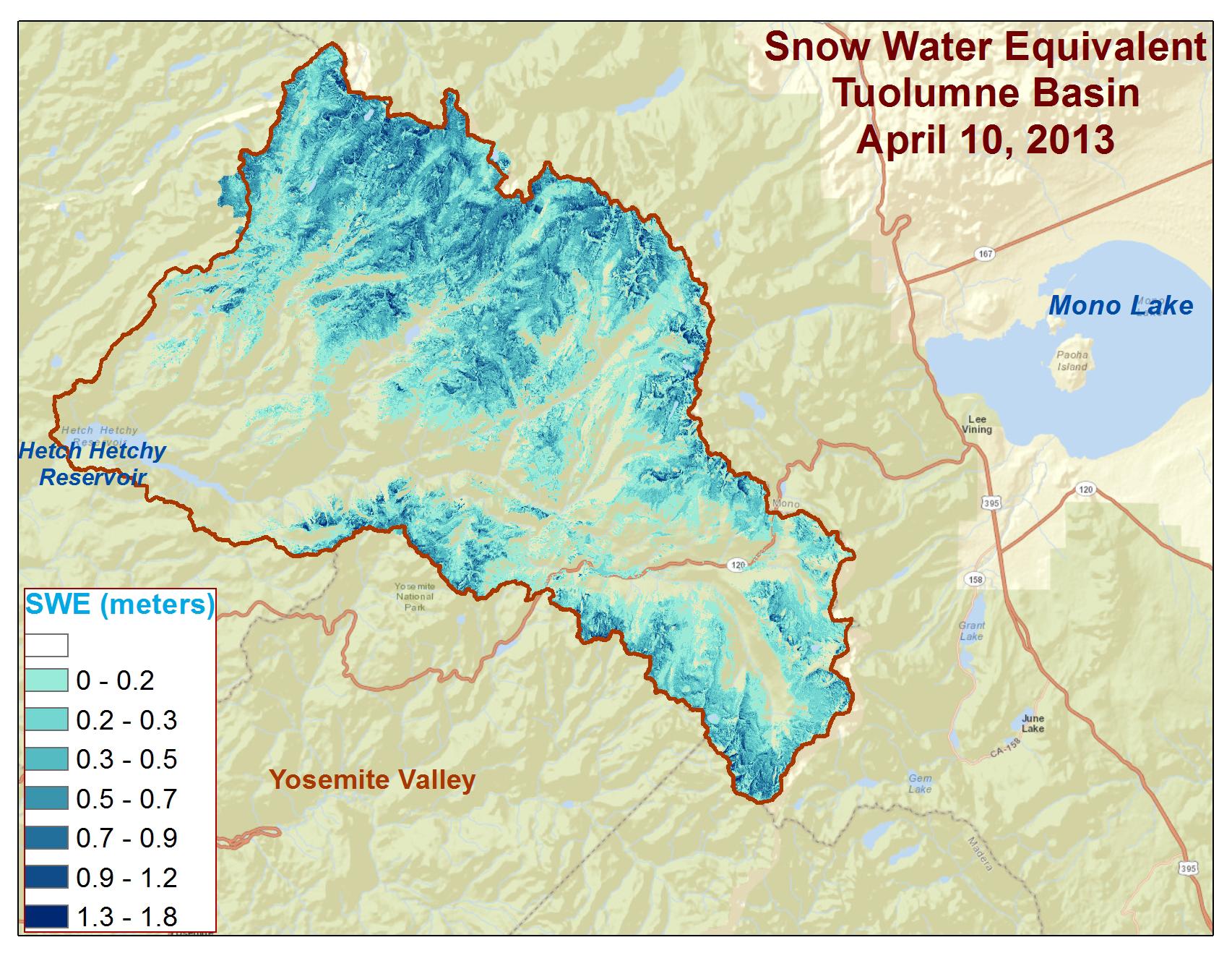
2013-12-09 |
Earth
|
Airborne Snow Observatory
|
|
639x361x3 |
|
-
PIA17774:
-
Measuring Snowpack from the Sky
Full Resolution:
TIFF
(692.5 kB)
JPEG
(55.78 kB)
|
|
|
2013-12-09 |
Earth
|
Airborne Snow Observatory
|
|
1705x1318x3 |
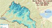
|
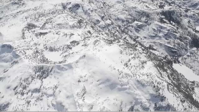
-
PIA17775:
-
Spatial Distribution of Tuolumne River Basin Mapped by Airborne Snow Observatory
Full Resolution:
TIFF
(6.744 MB)
JPEG
(340.4 kB)
|
|
|
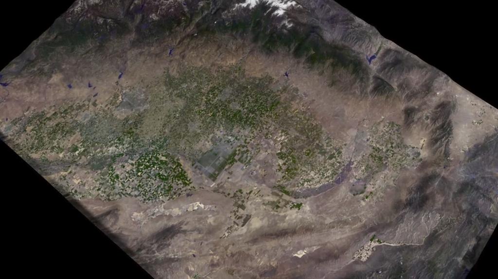
2014-03-05 |
Earth
|
Terra
|
MODIS
|
436x348x3 |
|
-
PIA18035:
-
Warm Rivers Play Role in Arctic Sea Ice Melt (Animation)
Full Resolution:
TIFF
(455.6 kB)
JPEG
(23.57 kB)
|
|
|
2014-08-08 |
Earth
|
LDSD
|
|
959x540x3 |
|
-
PIA18644:
-
Firing the Saucer
Full Resolution:
TIFF
(520.2 kB)
JPEG
(91.48 kB)
|
|
|
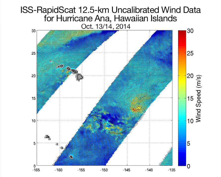
2014-10-21 |
Earth
|
RapidScat
|
ISS-RapidScat
|
895x718x3 |

|
-
PIA18834:
-
Hurricane Ana Viewed by NASA's ISS-RapidScat
Full Resolution:
TIFF
(1.929 MB)
JPEG
(136.3 kB)
|
|
|
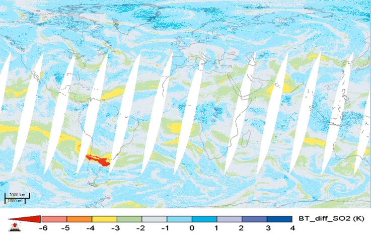
2015-05-07 |
Earth
|
Aqua
|
AIRS
|
737x467x3 |
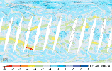
|
-
PIA19385:
-
NASA's AIRS Instrument Tracks Transport of Sulfur Dioxide from Chilean Volcanic Eruption (Animation)
Full Resolution:
TIFF
(1.033 MB)
JPEG
(69.56 kB)
|
|
|
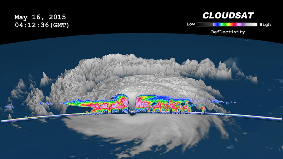
2015-05-22 |
Earth
|
CloudSat
|
MODIS
|
960x540x3 |
|
-
PIA19475:
-
NASA's CloudSat Peers Into the Eye of Powerful Typhoon Dolphin
Full Resolution:
TIFF
(1.556 MB)
JPEG
(61.88 kB)
|
|
|
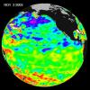
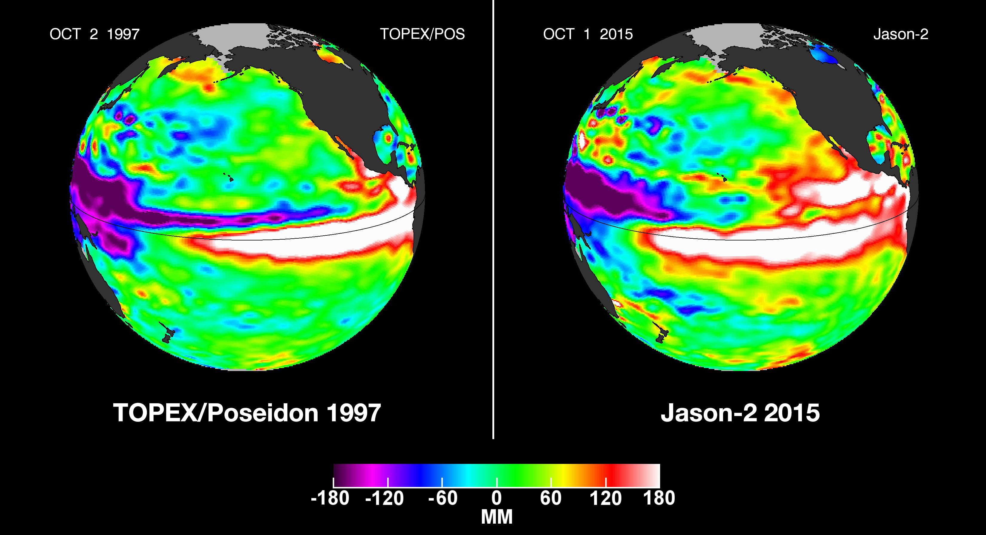
2015-10-19 |
Earth
|
OSTM/Jason-2
|
Altimeter
|
3300x1791x3 |
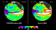
|
-
PIA20009:
-
NASA Studying 2015 El Niño Event as Never Before
Full Resolution:
TIFF
(6.183 MB)
JPEG
(459.8 kB)
|
|
|
2015-11-06 |
Earth
|
RapidScat
|
ISS-RapidScat
|
2816x2134x3 |
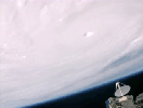
|
-
PIA20049:
-
RapidScat and Hurricane Patricia
Full Resolution:
TIFF
(8.031 MB)
JPEG
(159.9 kB)
|
|
|
2016-05-11 |
Earth
|
Aqua
|
AIRS
|
914x569x3 |
|
-
PIA20664:
-
Ozone Hole Formation Over South Pole Observed by NASA's AIRS
Full Resolution:
TIFF
(1.122 MB)
JPEG
(31.32 kB)
|
|
|
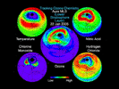
2016-10-04 |
Earth
|
Terra
|
MISR
|
493x1040x1 |
|
-
PIA21070:
-
Hurricane Matthew over Haiti seen by NASA's MISR
Full Resolution:
TIFF
(303.2 kB)
JPEG
(32.93 kB)
|
|
|
2016-10-14 |
Earth
|
Aqua
|
MODIS
VIIRS
|
1000x1000x3 |
|
-
PIA21098:
-
NASA's CloudSat Looks Hurricane Nicole in the Eye
Full Resolution:
TIFF
(2.794 MB)
JPEG
(195.4 kB)
|
|
|
2017-01-13 |
Earth
|
Aqua
|
AIRS
|
649x464x3 |
|
-
PIA21209:
-
Series of Storms Battering California Tracked by NASA's AIRS Instrument
Full Resolution:
TIFF
(312.2 kB)
JPEG
(346.4 kB)
|
|
|
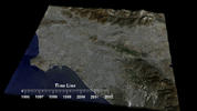
2017-04-11 |
Earth
|
Terra
|
MISR
|
2240x3584x3 |
|
-
PIA21581:
-
NASA's MISR Tracks Growth of Rift in the Larsen C Ice Shelf
Full Resolution:
TIFF
(13.35 MB)
JPEG
(776 kB)
|
|
|
2017-06-02 |
Earth
|
Terra
|
MISR
|
447x447x3 |
|
-
PIA21655:
-
NASA's MISR Spots Alaskan Volcano's Latest Eruption
Full Resolution:
TIFF
(285 kB)
JPEG
(245.2 kB)
|
|
|
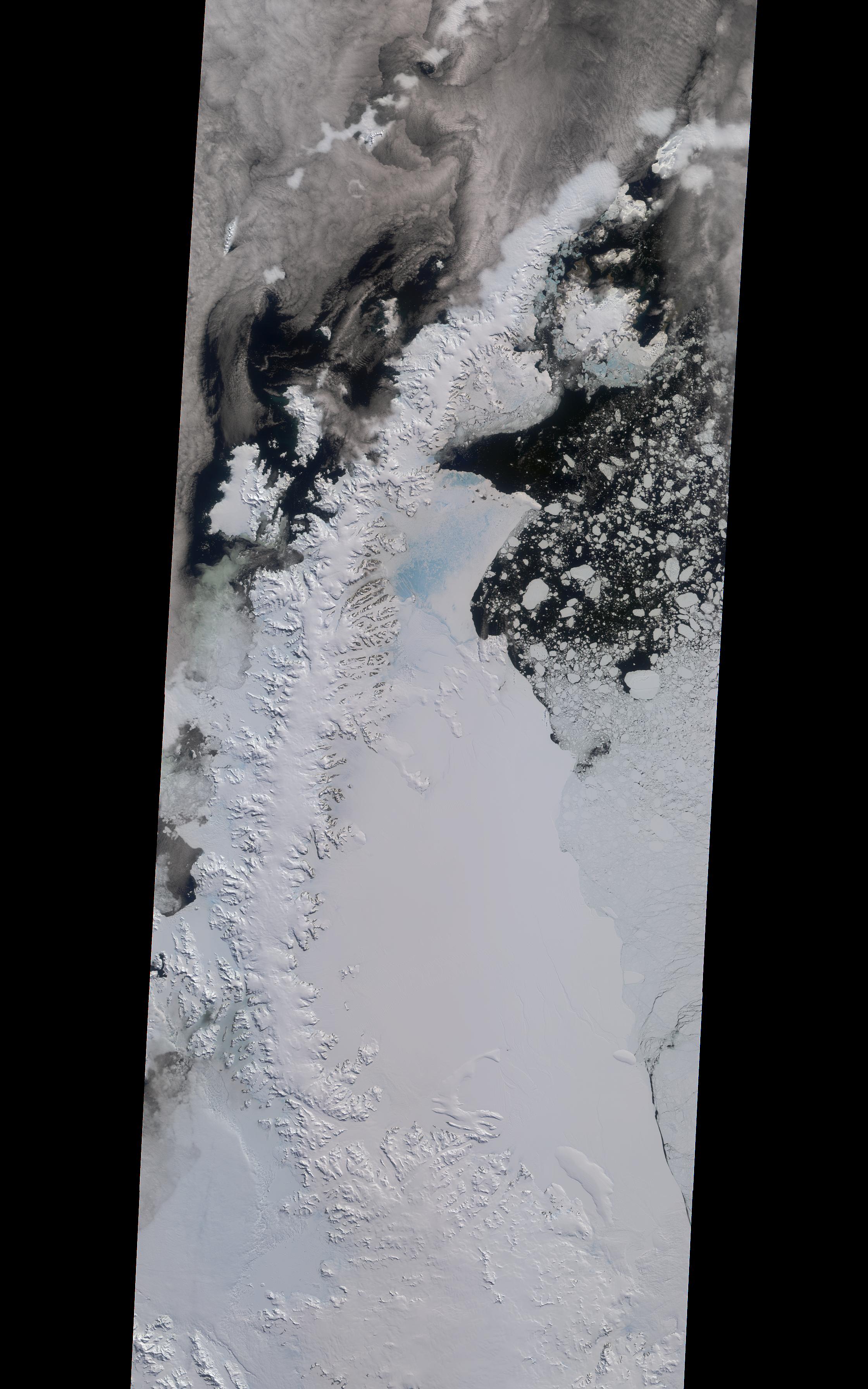
2017-07-14 |
Earth
|
Suomi NPP
Terra
|
MODIS
VIIRS
|
1805x1350x1 |
|
-
PIA21785:
-
Spawning of Massive Antarctic Iceberg Captured by NASA Animation
Full Resolution:
TIFF
(1.693 MB)
JPEG
(201.4 kB)
|
|
|
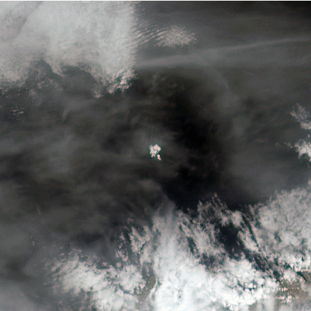
2017-08-29 |
Earth
|
CloudSat
|
Cloud Profiling Radar (CPR)
|
960x540x3 |
|
-
PIA17392:
-
NASA's CloudSat Sees Tropical Storm Harvey in 3D
Full Resolution:
TIFF
(1.012 MB)
JPEG
(68.11 kB)
|
|
|
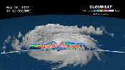
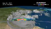
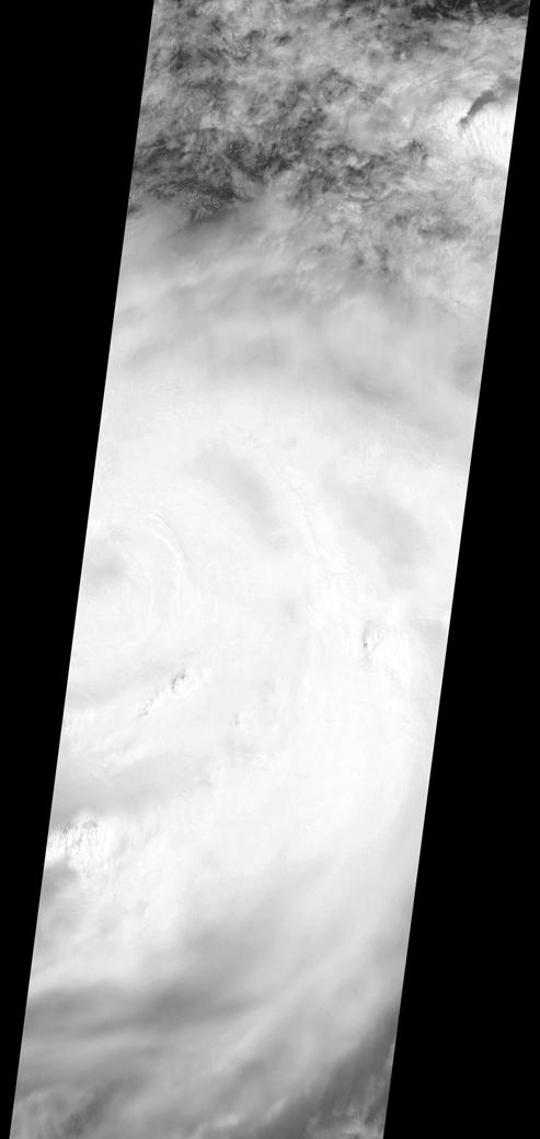
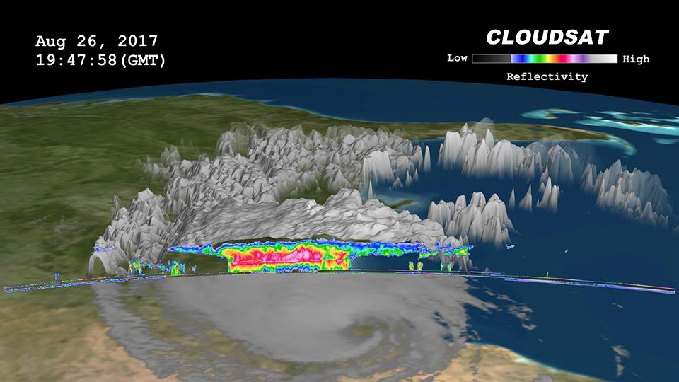
2017-09-08 |
Earth
|
CloudSat
|
Cloud Profiling Radar (CPR)
|
1672x938x3 |
|
-
PIA21947:
-
Powerful Hurricane Irma Seen in 3D by NASA's CloudSat
Full Resolution:
TIFF
(1.206 MB)
JPEG
(50.3 kB)
|
|
|
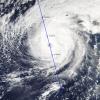
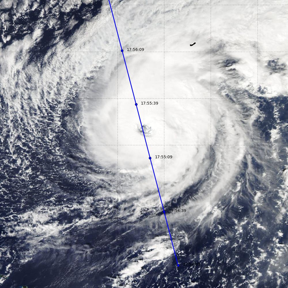
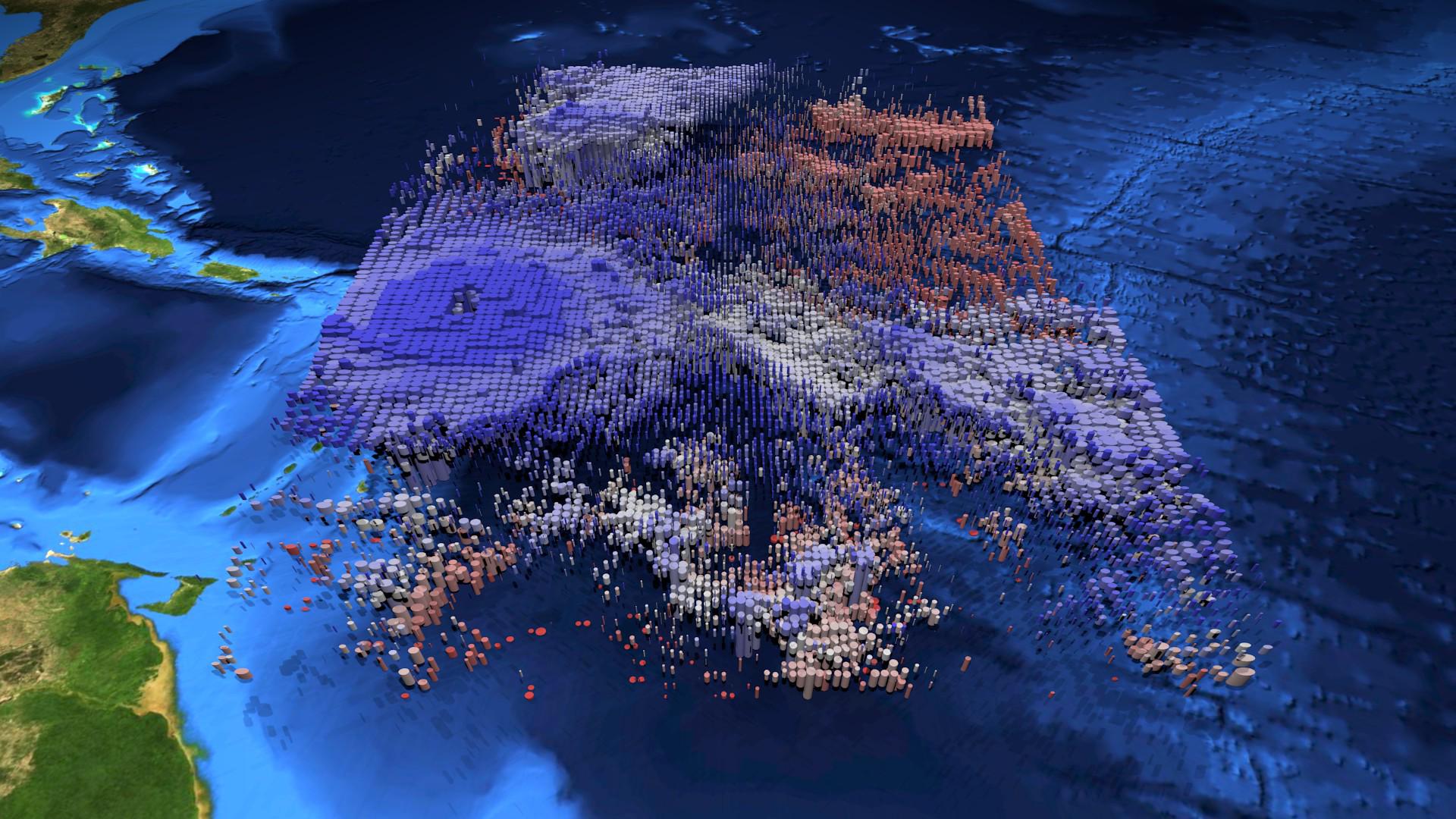
2017-09-08 |
Earth
|
Terra
|
MISR
|
4715x4843x3 |
|
-
PIA21946:
-
New NASA Images of Irma's Towering Clouds
Full Resolution:
TIFF
(24.52 MB)
JPEG
(1.312 MB)
|
|
|
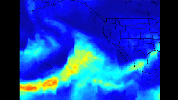
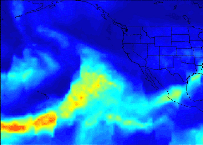
2017-09-08 |
Earth
|
Aqua
|
AIRS
|
1920x1080x3 |

|
-
PIA21950:
-
Hurricane Irma's Cloud Structure as Seen by NASA's AIRS
Full Resolution:
TIFF
(6.223 MB)
JPEG
(323.8 kB)
|
 Planetary Data System


