My
List |
Addition Date
|
Target
|
Mission
|
Instrument
|
Size
|

|
2005-09-12 |
Mars
|
Mars Global Surveyor (MGS)
|
Mars Orbiter Camera (MOC)
|
967x979x3 |
|
-
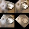
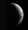
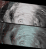
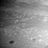
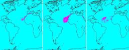
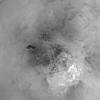
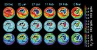
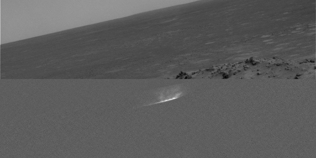
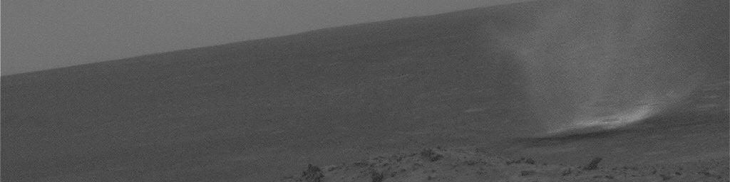
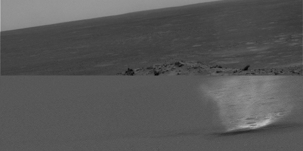
PIA05079:
-
Celebrating 8 Years at Mars: Repeated Weather Events
Full Resolution:
TIFF
(2.844 MB)
JPEG
(123.5 kB)
|
|
|
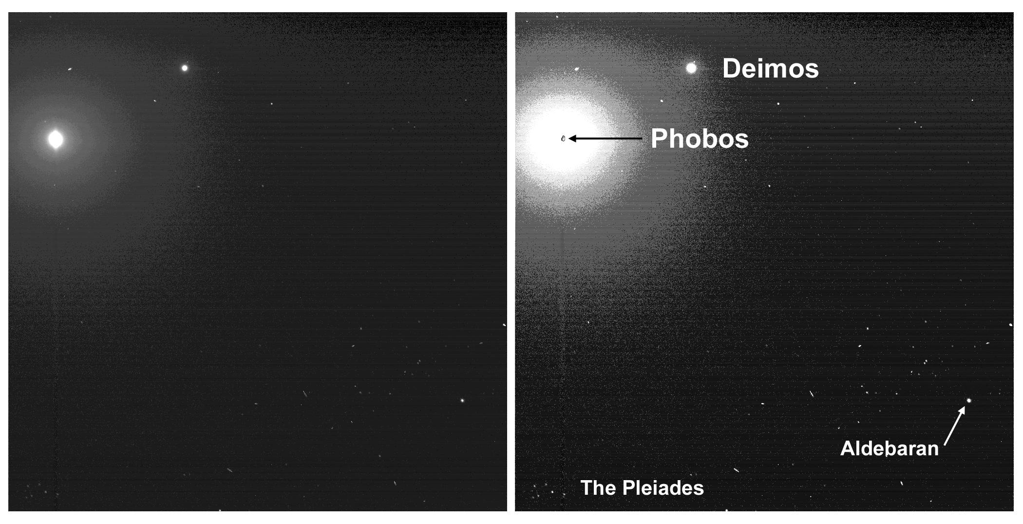
2005-09-11 |
Mars
|
Mars Exploration Rover (MER)
|
Panoramic Camera
|
1091x1161x6 |
|
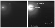
-
PIA06340:
-
Two Moons and the Pleiades from Mars

Full Resolution:
TIFF
(1.268 MB)
JPEG
(134.9 kB)
|
|
|
2005-09-11 |
Mars
|
Mars Exploration Rover (MER)
|
Panoramic Camera
|
2100x1075x1 |
|
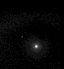
-
PIA06339:
-
Two Moons and the Pleiades from Mars
Full Resolution:
TIFF
(2.261 MB)
JPEG
(349.4 kB)
|
|
|
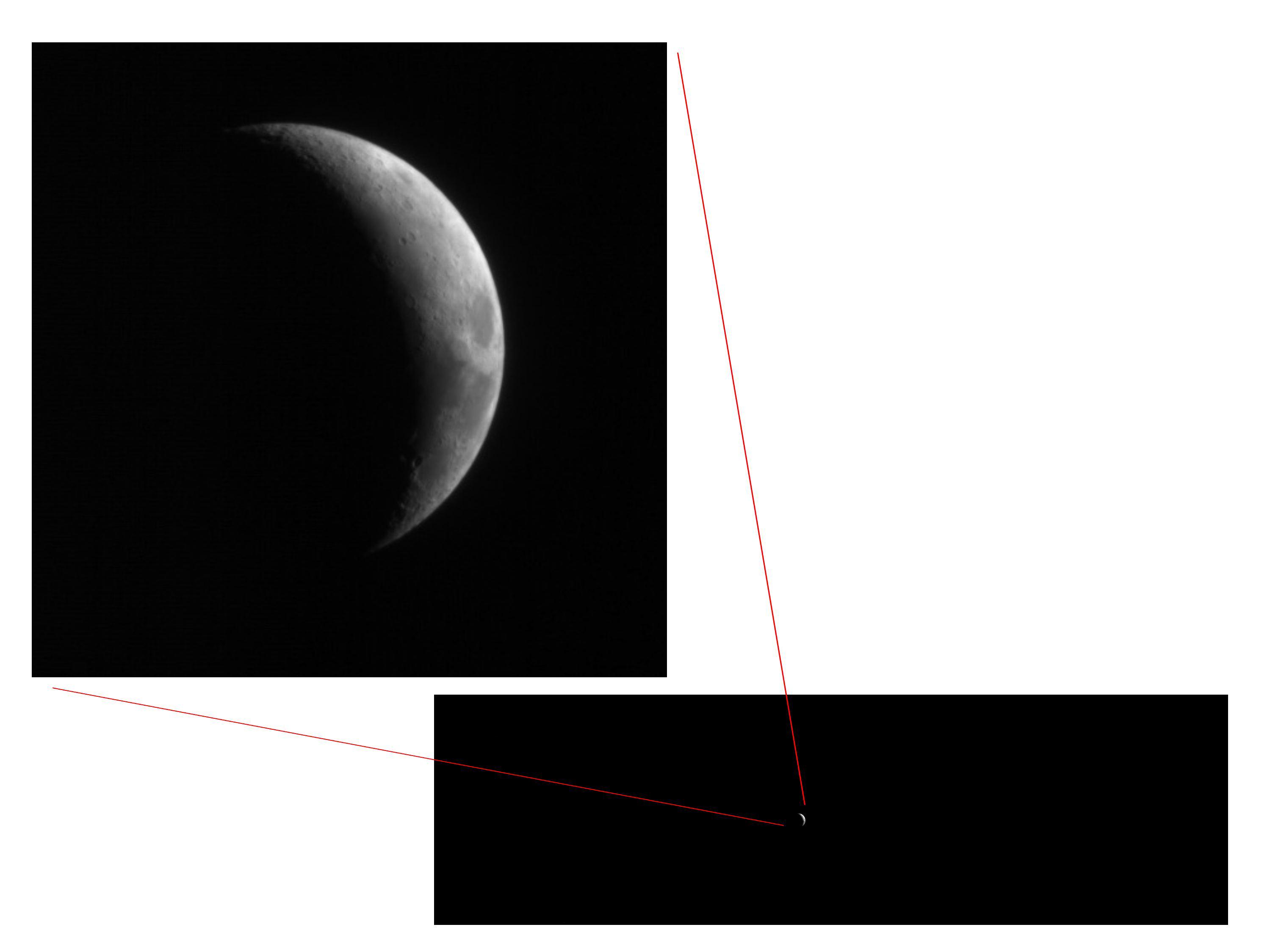
2005-09-10 |
Moon
|
Mars Reconnaissance Orbiter (MRO)
|
HiRISE
|
2999x2249x3 |
|
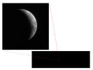
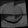
-
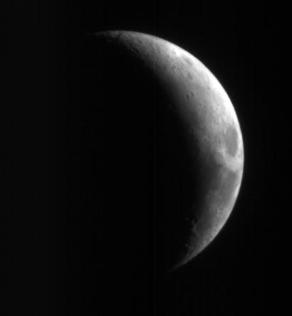
PIA08005:
-
Full-Frame Reference for Test Photo of Moon
Full Resolution:
TIFF
(20.23 MB)
JPEG
(167.9 kB)
|
|
|
2005-09-10 |
Moon
|
Mars Reconnaissance Orbiter (MRO)
|
HiRISE
|
410x443x1 |
|
-
PIA08002:
-
High-Resolution Mars Camera Test Image of Moon
Full Resolution:
TIFF
(182.1 kB)
JPEG
(6.301 kB)
|
|
|
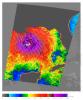
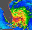
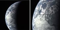
2005-09-07 |
Earth
|
Terra
|
MISR
|
1050x1792x3 |
|
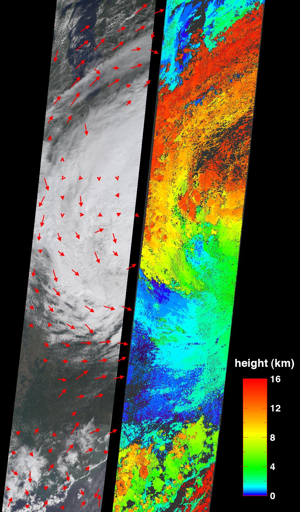
-
PIA04384:
-
Cloud Spirals and Outflow in Tropical Storm Katrina
Full Resolution:
TIFF
(5.652 MB)
JPEG
(452.3 kB)
|
|
|
2005-09-07 |
Ceres
|
Hubble Space Telescope
|
Advanced Camera for Surveys
|
250x250x3 |
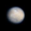
|
-
PIA10235:
-
Color View of Ceres
Full Resolution:
TIFF
(187.9 kB)
JPEG
(3.807 kB)
|
|
|
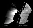
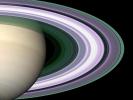
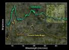
2005-09-05 |
Saturn
|
Cassini-Huygens
|
Visual and Infrared Mapping Spectrometer
|
1052x903x3 |
|
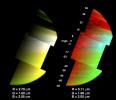
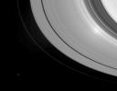
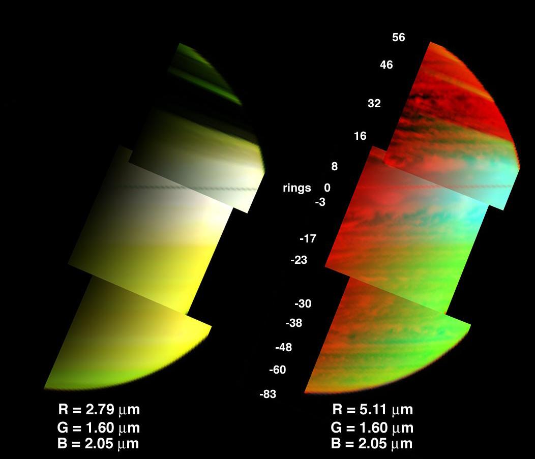
-
PIA03559:
-
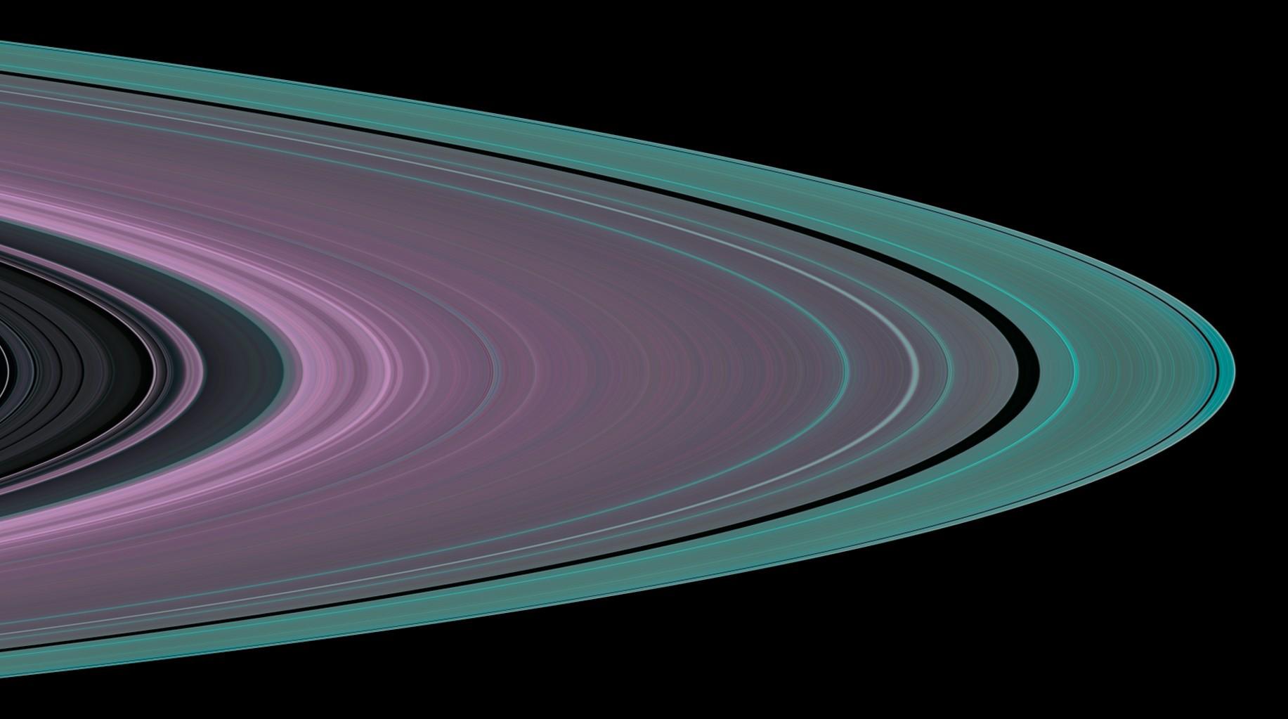
A 3-D View of Saturn's Clouds and Hazes
Full Resolution:
TIFF
(2.854 MB)
JPEG
(56.17 kB)
|
|
|
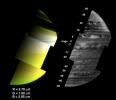
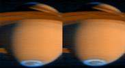
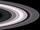
2005-09-05 |
Saturn
|
Cassini-Huygens
|
Visual and Infrared Mapping Spectrometer
|
1052x912x1 |
|
-
PIA03558:
-
A New View of Saturn - Black and White
Full Resolution:
TIFF
(960.7 kB)
JPEG
(48.37 kB)
|
|
|
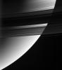
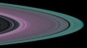
2005-09-05 |
Saturn
|
Cassini-Huygens
|
Visual and Infrared Mapping Spectrometer
|
1052x909x3 |
|
-
PIA03557:
-
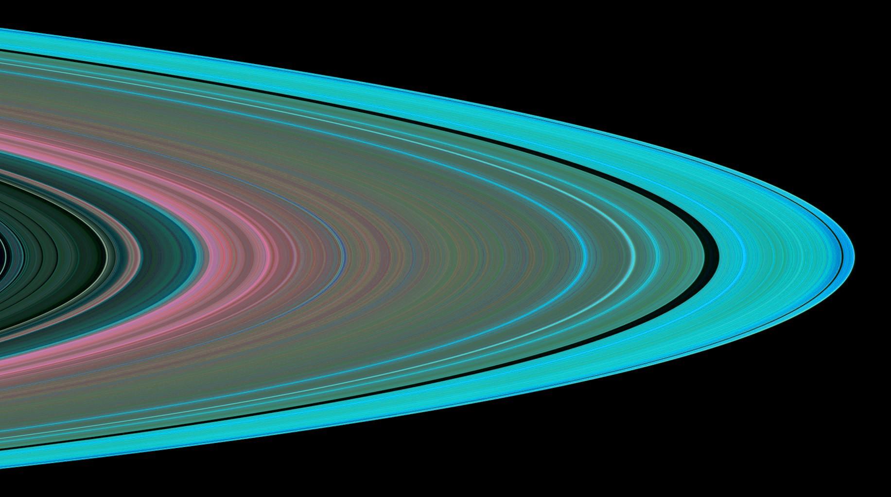
A New View of Saturn
Full Resolution:
TIFF
(2.873 MB)
JPEG
(53.56 kB)
|
|
|
2005-09-03 |
Mars
|
Mars Global Surveyor (MGS)
|
Mars Orbiter Camera (MOC)
|
672x1247x1 |

|
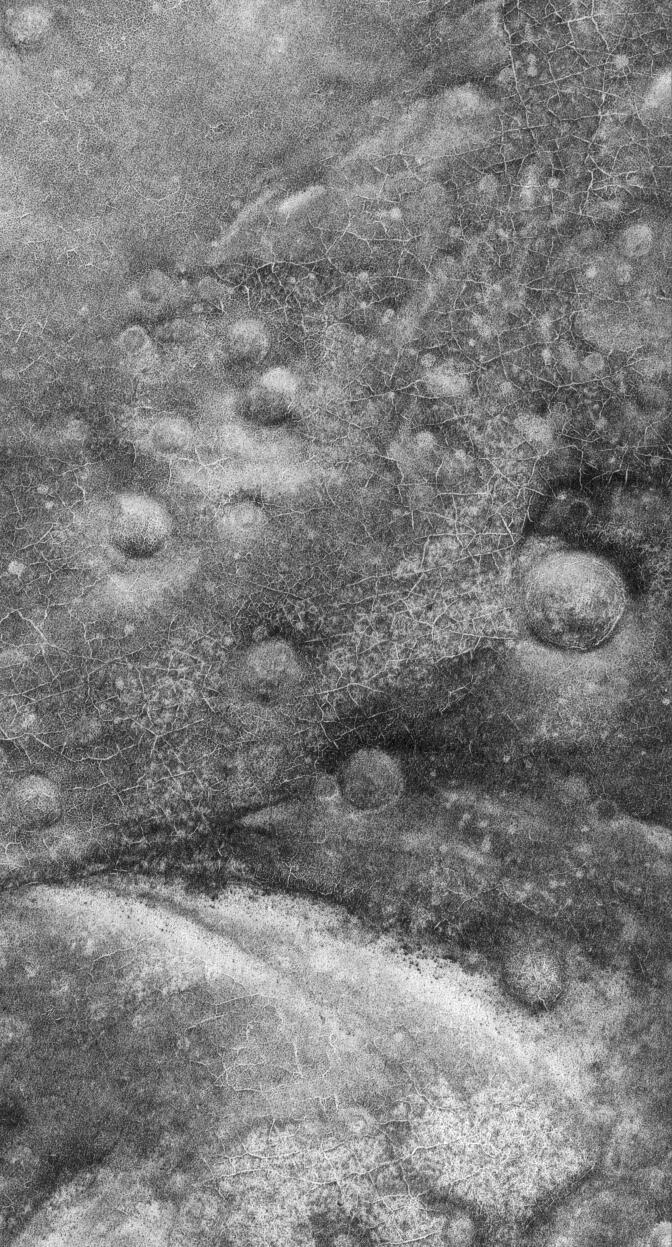
-
PIA04212:
-
Polygons and Craters
Full Resolution:
TIFF
(839 kB)
JPEG
(248.8 kB)
|
|
|
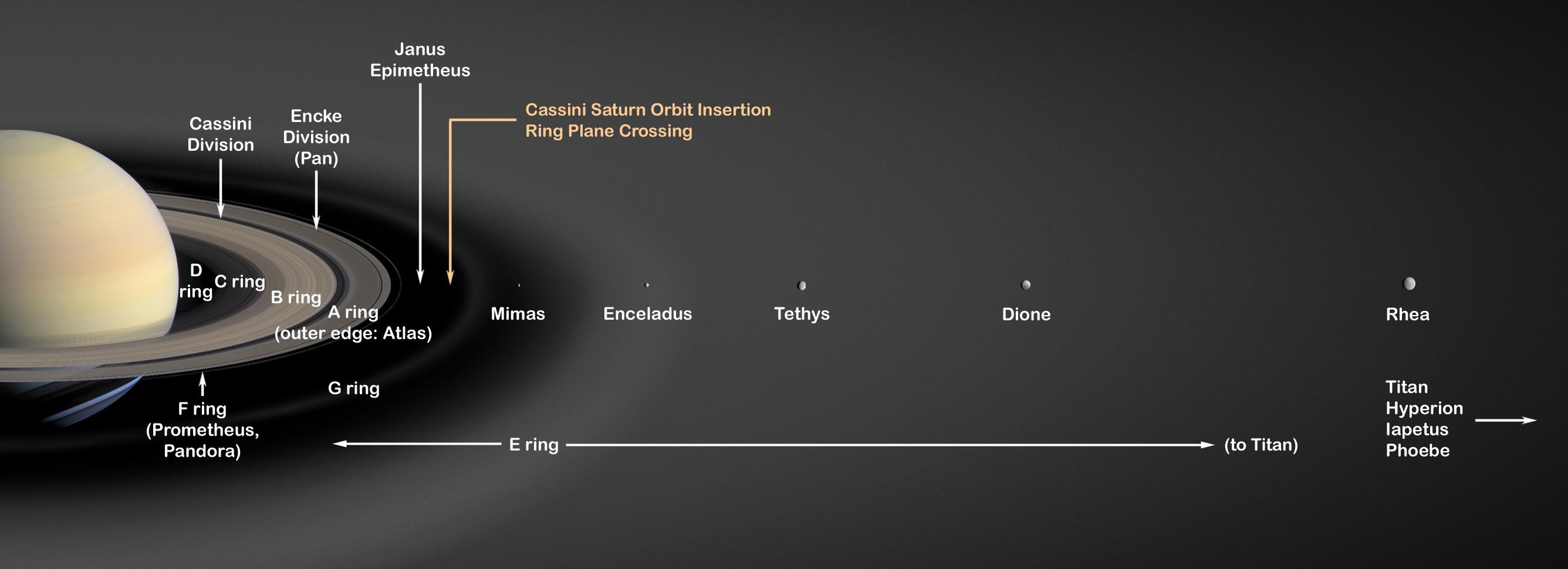
2005-09-02 |
S Rings
|
Cassini-Huygens
|
ISS - Wide Angle
|
896x1023x1 |
|
-
PIA07578:
-
Diagnostic Darkness
Full Resolution:
TIFF
(917.8 kB)
JPEG
(45.63 kB)
|
|
|
2005-08-31 |
Mars
|
Mars Exploration Rover (MER)
|
Panoramic Camera
|
13838x3319x3 |
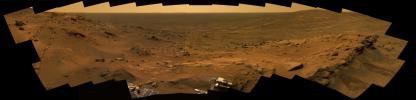
|
-
PIA04179:
A Whale of a Panorama
Full Resolution:
TIFF
(137.8 MB)
JPEG
(4.095 MB)
QTVR
(4.479 MB)
|
|
|
2005-08-31 |
Earth
|
Terra
|
MISR
|
3008x3164x3 |
|
-
PIA04383:
-
The Roiling Clouds of Katrina
Full Resolution:
TIFF
(28.55 MB)
JPEG
(525 kB)
|
|
|
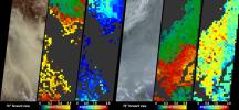
2005-08-30 |
Earth
|
Aqua
|
AIRS
|
900x695x3 |
|
-
PIA04178:
-
Hurricane Katrina as Observed by NASA's Spaceborne Atmospheric Infrared Sounder (AIRS)
Full Resolution:
TIFF
(1.879 MB)
JPEG
(125 kB)
|
|
|
2005-08-29 |
Earth
|
QuikScat
|
SeaWinds Scatterometer
|
1272x1531x3 |
|
-
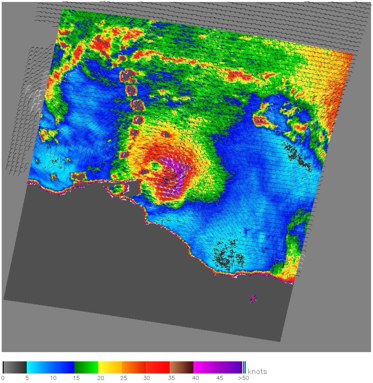
PIA04176:
-
Hurricane Katrina
Full Resolution:
TIFF
(5.849 MB)
JPEG
(446.3 kB)
|
|
|
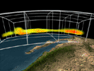
2005-08-29 |
Earth
|
Shuttle Radar Topography Mission (SRTM)
|
C-Band Imaging Radar
X-Band Radar
|
1800x2061x3 |
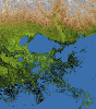
|
-
PIA04175:
-
Mississippi Delta, Radar Image with Colored Height
Full Resolution:
TIFF
(11.15 MB)
JPEG
(781.5 kB)
|
|
|
2005-08-29 |
Earth
|
Shuttle Radar Topography Mission (SRTM)
|
C-Band Imaging Radar
X-Band Radar
|
3000x2519x3 |

|
-
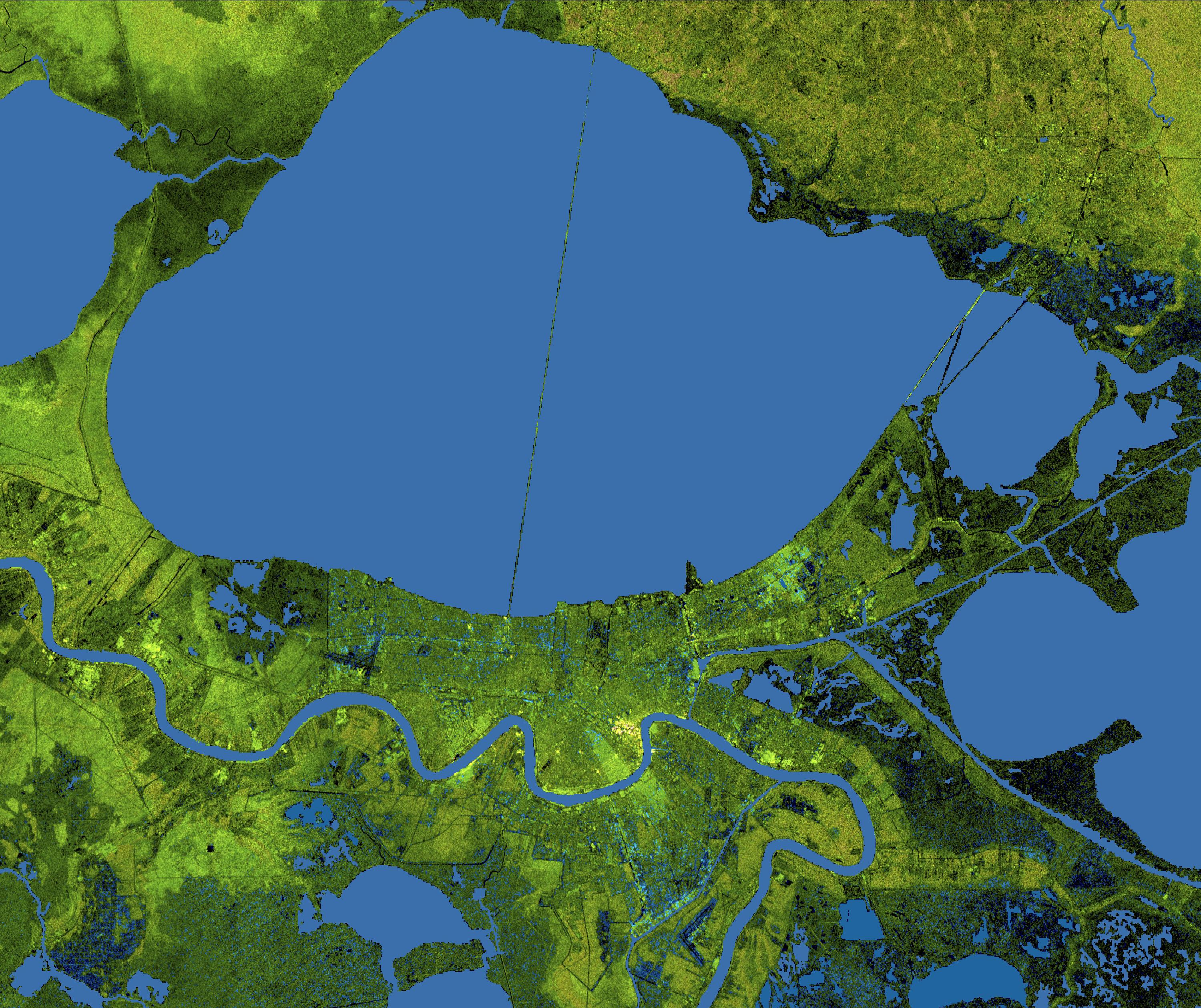
PIA04174:
-
New Orleans Topography, Radar Image with Colored Height
Full Resolution:
TIFF
(22.67 MB)
JPEG
(1.437 MB)
|
|
|
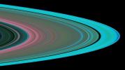
2005-08-29 |
S Rings
|
Cassini-Huygens
|
|
2672x970x3 |

|
-
PIA03550:
-
Saturn's Rings (Artist's Concept)
Full Resolution:
TIFF
(7.784 MB)
JPEG
(125.3 kB)
|
|
|
2005-08-25 |
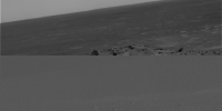
Mars
|
Mars Exploration Rover (MER)
|
Microscopic Imager
|
2265x2262x1 |
|
-
PIA04169:
-
Mars Climate Continues to Fascinate
Full Resolution:
TIFF
(5.13 MB)
JPEG
(461.2 kB)
|
|
|
2005-08-25 |
Earth
|
QuikScat
|
SeaWinds Scatterometer
|
835x773x3 |
|
-
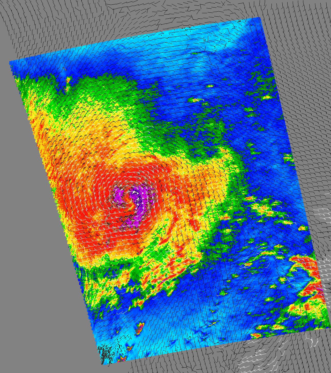
PIA07432:
-
Tropical Storm Katrina
Full Resolution:
TIFF
(1.939 MB)
JPEG
(229.8 kB)
|
|
|
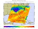
2005-08-24 |
Earth
|
Aqua
|
AIRS
|
3200x2400x3 |
|
-
PIA07938:
-
AIRS Storm Front Approaching California (animation)
Full Resolution:
TIFF
(23.04 MB)
JPEG
(629.5 kB)
|
|
|
2005-08-22 |
Earth
|
Mars Reconnaissance Orbiter (MRO)
|
MARCI
|
700x80x1 |

|
-
PIA04160:
Calibration View of Earth and the Moon by Mars Color Imager
Full Resolution:
TIFF
(56.29 kB)
JPEG
(1.314 kB)
|
|
|
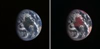
2005-08-22 |
Earth
|
Mars Reconnaissance Orbiter (MRO)
|
MARCI
|
85x75x3 |
|
-
PIA04159:
-
Calibration Image of Earth by Mars Color Imager
Full Resolution:
TIFF
(19.39 kB)
JPEG
(870)
|
|
|
2005-08-15 |
Saturn
|
Cassini-Huygens
|
ISS - Narrow Angle
|
1020x1020x1 |
|
-
PIA07564:
-
Filaments and Vortices
Full Resolution:
TIFF
(1.042 MB)
JPEG
(210.7 kB)
|
|
|
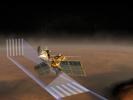
2005-08-12 |
|
Mars Reconnaissance Orbiter (MRO)
|
|
2430x3000x3 |
|
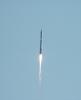
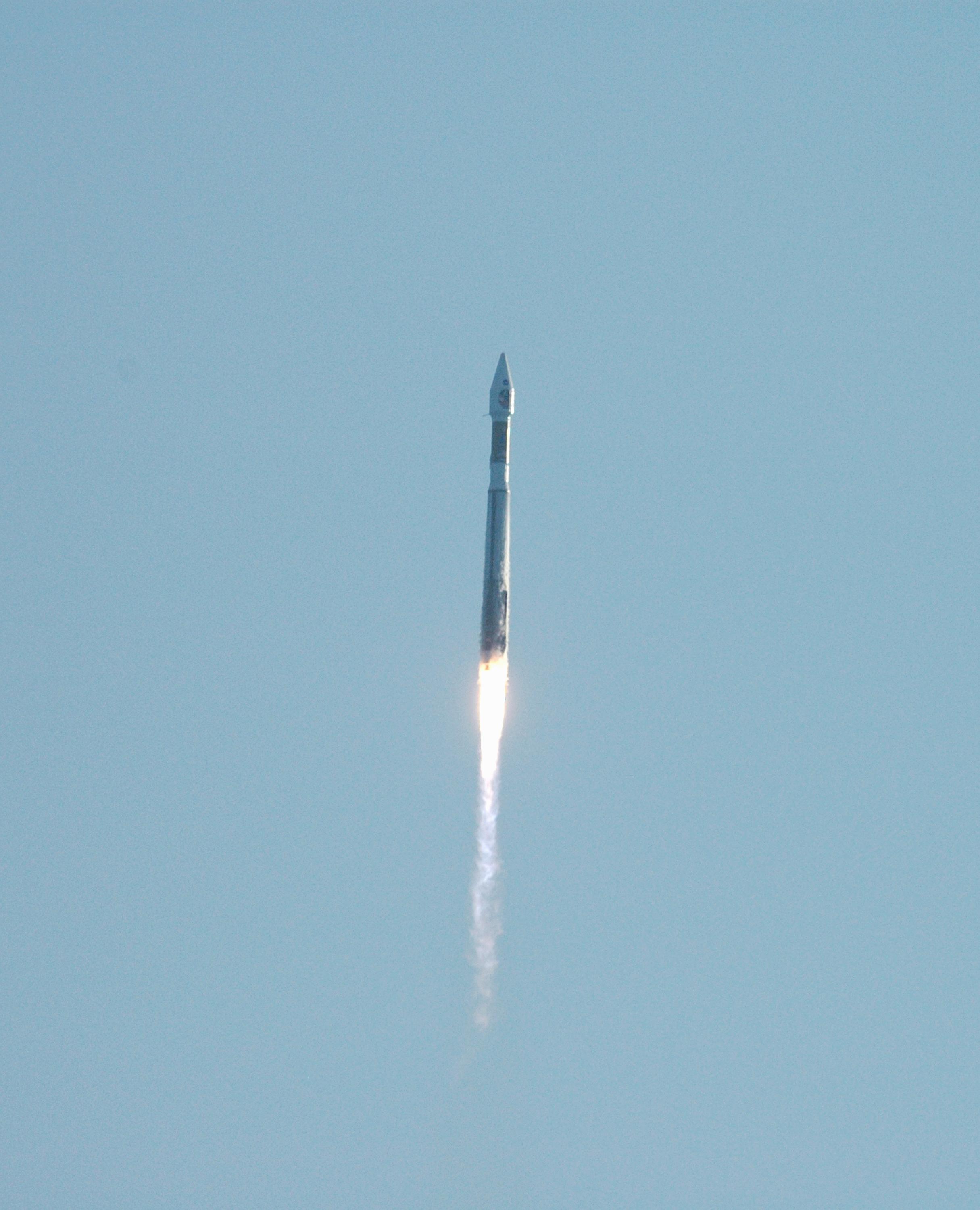
-
PIA04144:
-
Mars Reconnaissance Orbiter (MRO) Multipurpose Mission Successfully
Launched
Full Resolution:
TIFF
(21.89 MB)
JPEG
(517.4 kB)
|
|
|
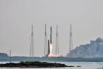
2005-08-12 |
|
Mars Reconnaissance Orbiter (MRO)
|
|
2178x3000x3 |
|
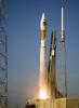
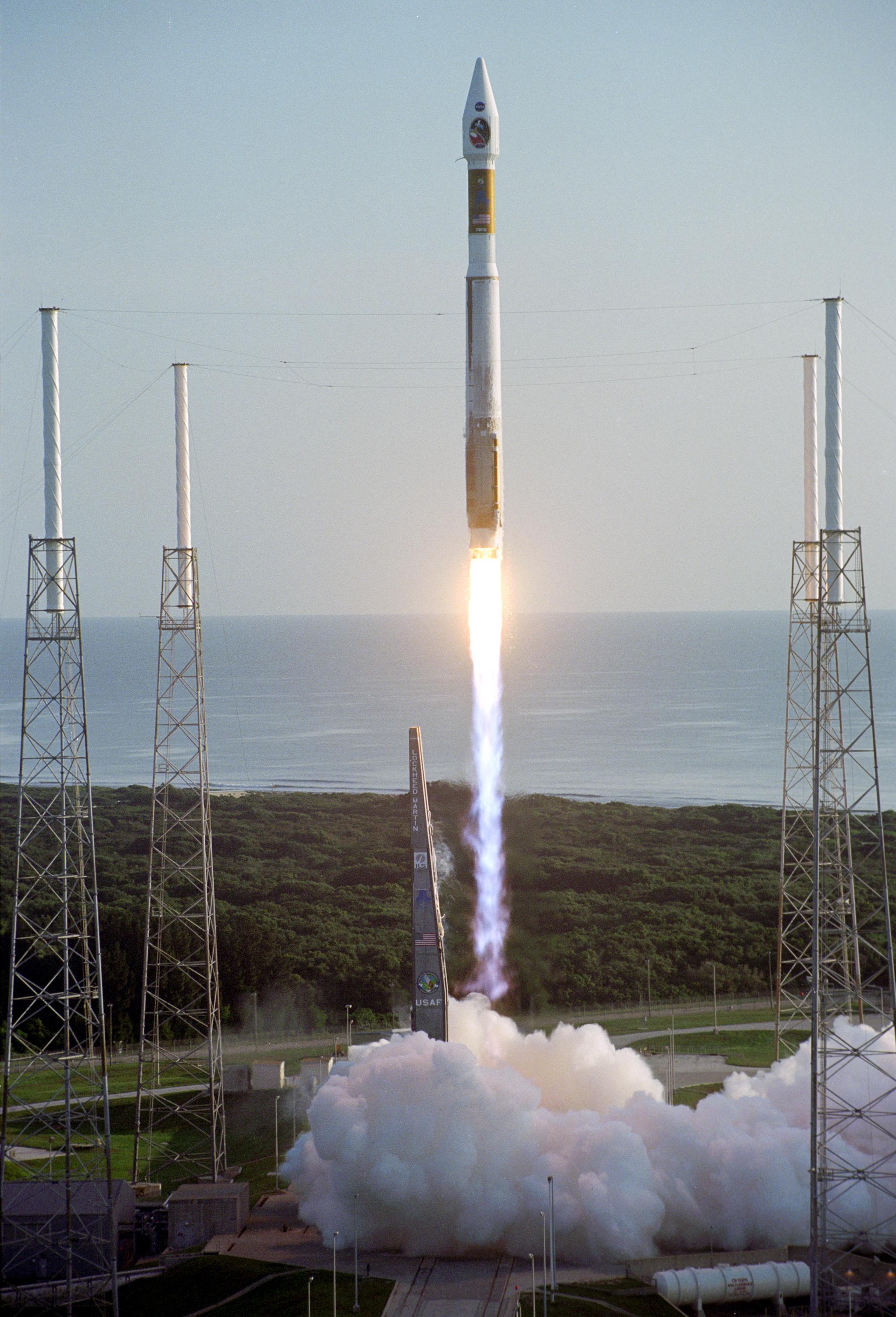
-
PIA04143:
-
Mars Reconnaissance Orbiter (MRO) Lifts Off
Full Resolution:
TIFF
(19.63 MB)
JPEG
(391 kB)
|
|
|
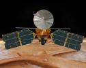
2005-08-12 |
|
Mars Reconnaissance Orbiter (MRO)
|
|
2042x3000x3 |
|
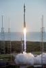
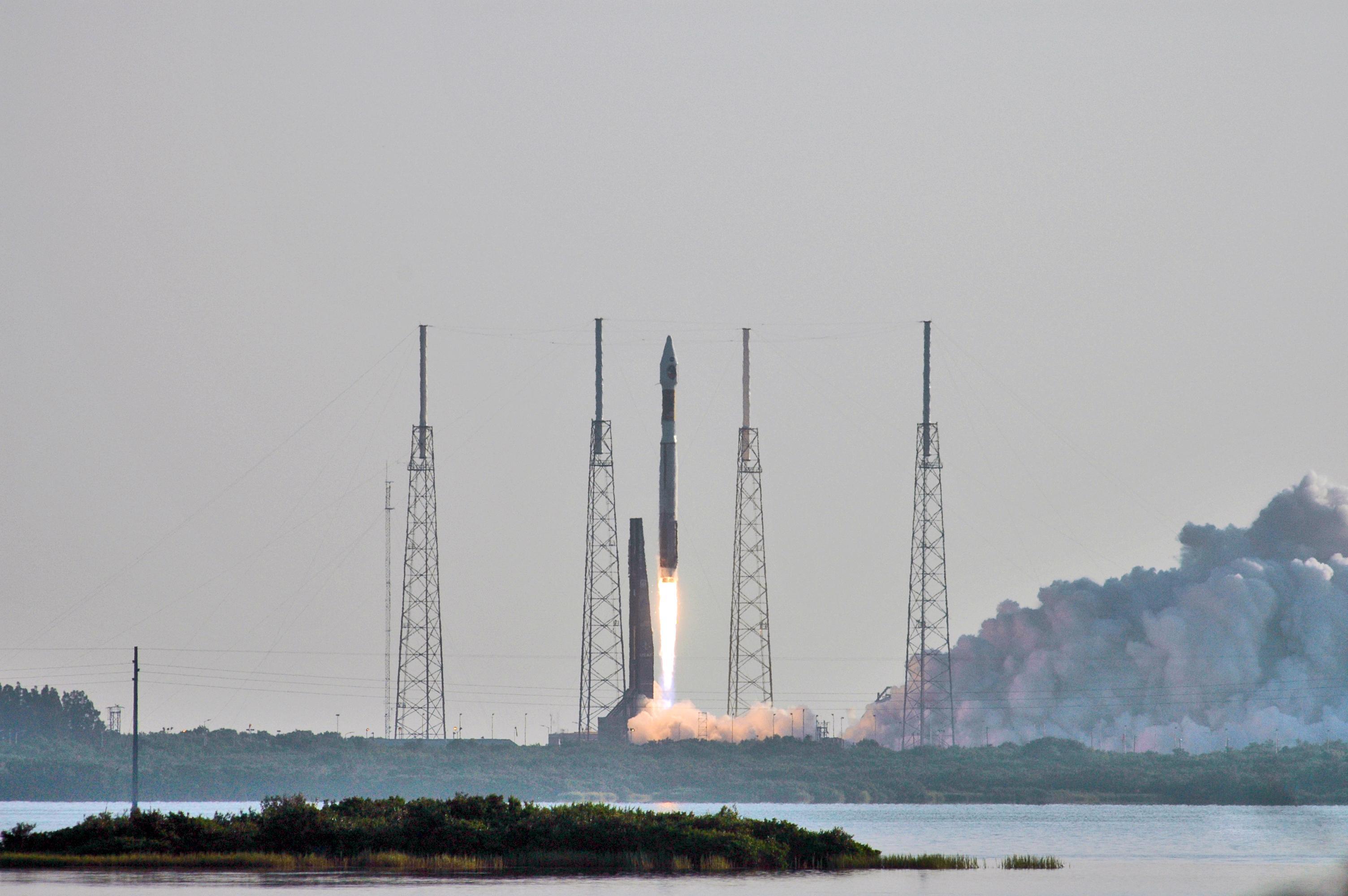
-
PIA04142:
-
Mars Reconnaissance Orbiter (MRO) Roars Away
Full Resolution:
TIFF
(18.4 MB)
JPEG
(710.6 kB)
|
|
|
2005-08-12 |
|
Mars Reconnaissance Orbiter (MRO)
|
|
3008x2000x3 |
|
-
PIA04141:
-
Mars Reconnaissance Orbiter (MRO) Launches
Full Resolution:
TIFF
(18.05 MB)
JPEG
(485.5 kB)
|
|
|
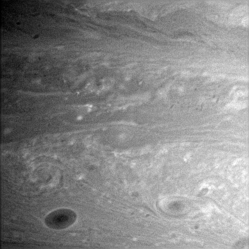
2005-08-11 |
Saturn
|
Cassini-Huygens
|
ISS - Narrow Angle
|
2020x1008x3 |

|
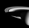
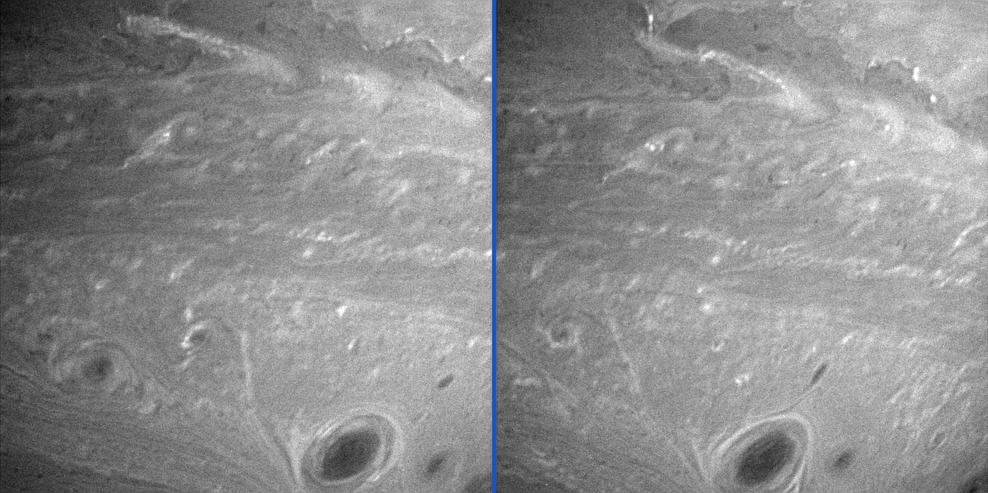
-
PIA07562:
-
Saturn's Anti-Hurricanes
Full Resolution:
TIFF
(6.117 MB)
JPEG
(461 kB)
|
|
|
2005-08-04 |
Saturn
|
Cassini-Huygens
|
UVIS
|
637x348x3 |
|
-
PIA06436:
-
Saturn's Auroras
Full Resolution:
TIFF
(666 kB)
JPEG
(14.74 kB)
|
|
|
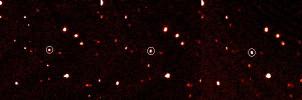
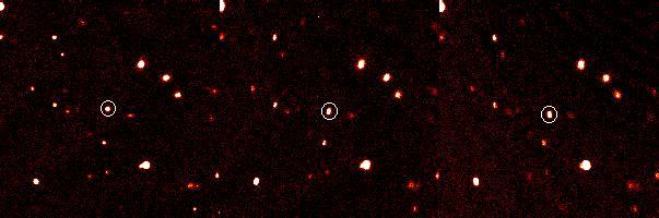
2005-08-03 |
Eris
|
|
Samuel Oschin Telescope
Palomar Adaptive Optics System
|
603x200x3 |
|
-
PIA03034:
-
Tenth Planet Discovered
Full Resolution:
TIFF
(362.4 kB)
JPEG
(21.18 kB)
|
|
|
2005-08-03 |
Earth
|
Terra
|
MISR
|
2390x1110x3 |
|
-
PIA04382:
-
The Size of Dust and Smoke
Full Resolution:
TIFF
(7.968 MB)
JPEG
(230.9 kB)
|
|
|
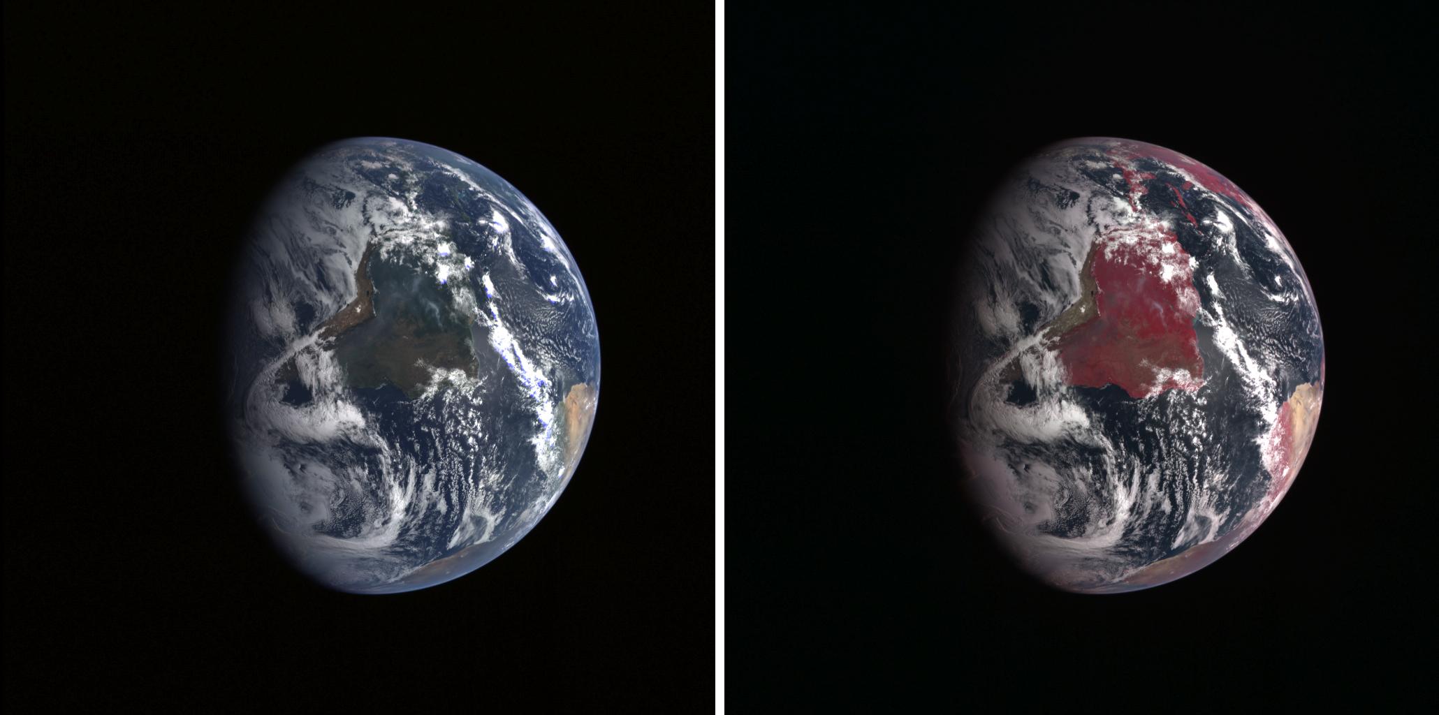
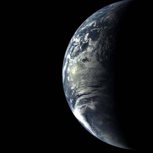
2005-08-02 |
Earth
|
MESSENGER
|
MDIS - Wide Angle
|
2060x1024x3 |
|
-
PIA10122:
-
Twins Image
Full Resolution:
TIFF
(6.337 MB)
JPEG
(151.9 kB)
|
|
|
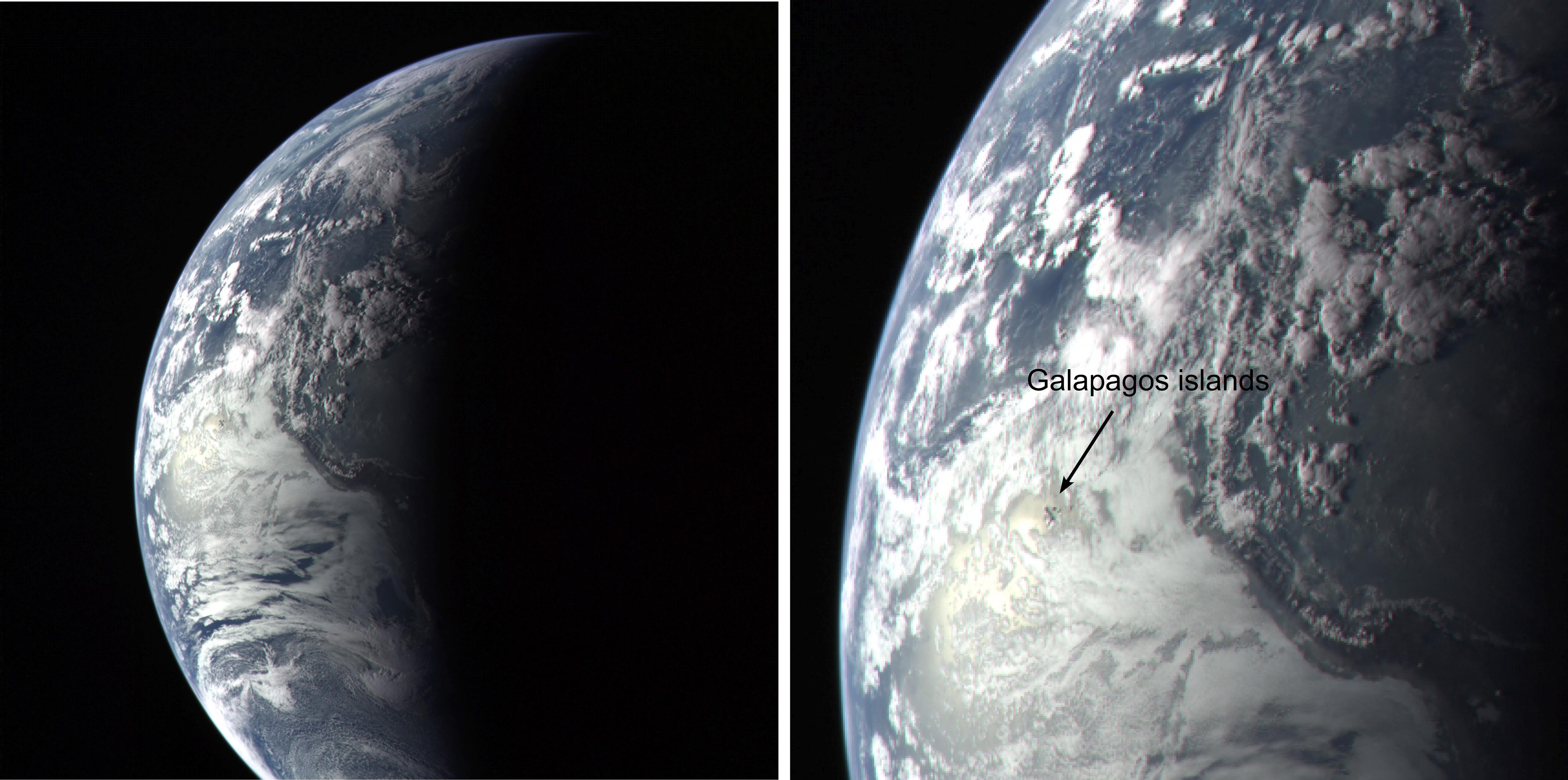
2005-08-02 |
Earth
|
MESSENGER
|
MDIS - Wide Angle
|
4500x2238x3 |
|
-
PIA10121:
-
Galapagos Islands Image
Full Resolution:
TIFF
(30.21 MB)
JPEG
(771.1 kB)
|
|
|
2005-08-02 |
Earth
|
MESSENGER
|
MDIS - Wide Angle
|
507x507x3 |

|
-
PIA10120:
-
Earth Departure Movie
Full Resolution:
TIFF
(772.2 kB)
JPEG
(16.44 kB)
|
|
|
2005-08-01 |
Mars
|
Mars Global Surveyor (MGS)
|
Mars Orbiter Camera (MOC)
|
1024x2027x1 |
|
-
PIA04130:
-
Frozen Carbon Dioxide
Full Resolution:
TIFF
(2.078 MB)
JPEG
(430.3 kB)
|
|
|
2005-07-29 |
Enceladus
|
Cassini-Huygens
|
Imaging Science Subsystem
Composite Infrared Spectrometer
|
973x965x3 |
|
-
PIA06433:
-
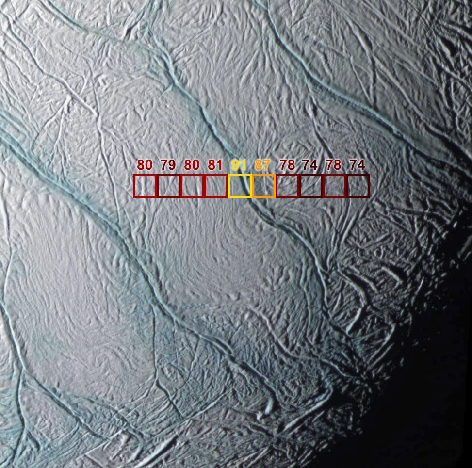
Warm Fractures on Enceladus
Full Resolution:
TIFF
(941.7 kB)
JPEG
(172.6 kB)
|
|
|
2005-07-29 |
Enceladus
|
Cassini-Huygens
|
Composite Infrared Spectrometer
|
648x371x3 |
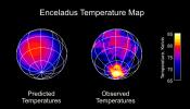
|
-
PIA06432:
-
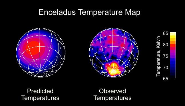
Enceladus Temperature Map
Full Resolution:
TIFF
(242.4 kB)
JPEG
(38.18 kB)
|
|
|
2005-07-28 |
Earth
|
Terra
|
MISR
|
1222x3591x3 |
|
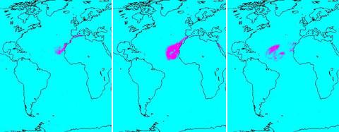
-
PIA03539:
-
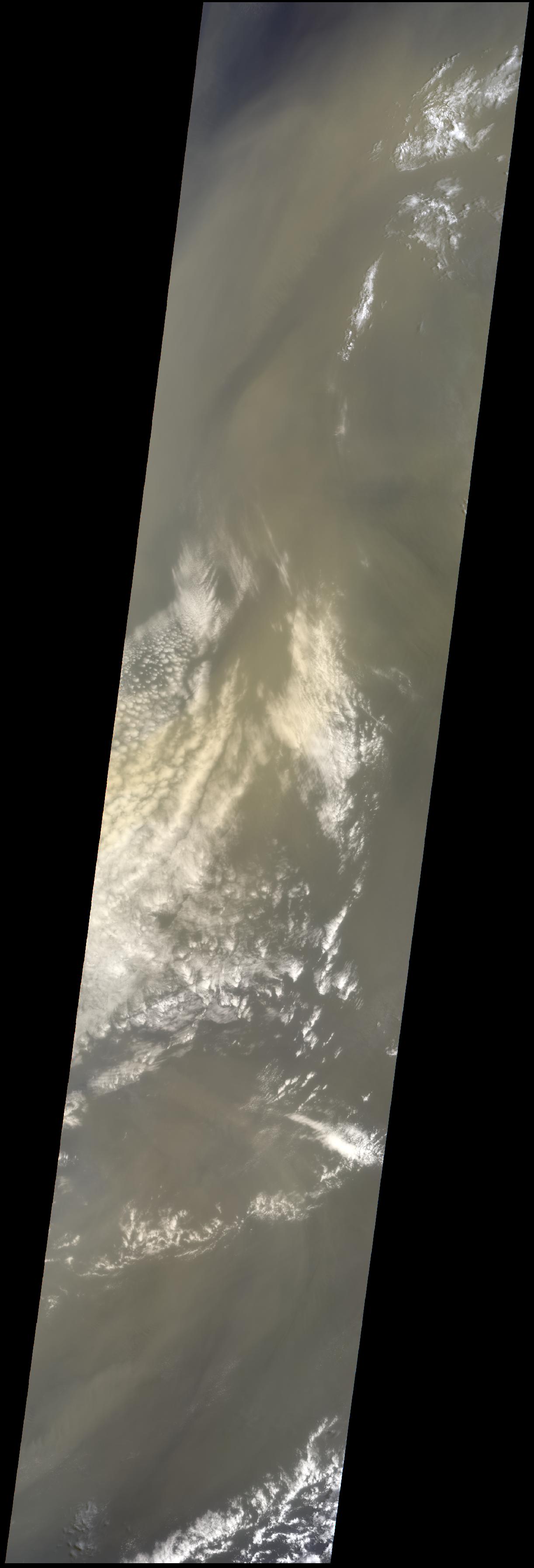
Saharan Dust Cloud Sails Toward U.S.
Full Resolution:
TIFF
(13.18 MB)
JPEG
(208.9 kB)
|
|
|
2005-07-28 |
Mars
|
Mars Exploration Rover (MER)
|
Panoramic Camera
|
22780x6000x3 |

|
-
PIA07216:
Opportunity's 'Rub al Khali' Panorama
Full Resolution:
TIFF
(410 MB)
JPEG
(7.105 MB)
QTVR
(7.756 MB)
|
|
|
2005-07-27 |
|
Spitzer Space Telescope
|
|
2526x1827x3 |
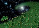
|
-
PIA03538:
-
Ingredients for Life (Artist's Concept)
Full Resolution:
TIFF
(13.86 MB)
JPEG
(575.9 kB)
|
|
|
2005-07-27 |
|
Spitzer Space Telescope
|
Infrared Spectrograph (IRS)
|
2361x1506x3 |
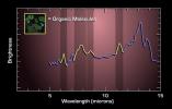
|
-
PIA03537:
-
Charting Ingredients for Life
Full Resolution:
TIFF
(10.68 MB)
JPEG
(174.6 kB)
|
|
|
2005-07-25 |
Saturn
|
Cassini-Huygens
|
Radio and Plasma Wave Science Instrument
|
516x349x3 |
|
-
PIA07967:
-
Bizarre Sounds of Saturn's Radio Emissions
Full Resolution:
TIFF
(541 kB)
JPEG
(61.17 kB)
|
|
|
2005-07-25 |
Saturn
|
Cassini-Huygens
|
Radio and Plasma Wave Science Instrument
|
516x332x3 |
|
-
PIA07966:
-
Eerie Sounds of Saturn's Radio Emissions
Full Resolution:
TIFF
(514.7 kB)
JPEG
(55.08 kB)
|
|
|
2005-07-18 |
Earth
|
QuikScat
|
SeaWinds Scatterometer
|
1535x1575x3 |
|
-
PIA07969:
-
Hurricane Emily
Full Resolution:
TIFF
(7.266 MB)
JPEG
(561 kB)
|
|
|
2005-07-18 |
Earth
|
QuikScat
|
SeaWinds Scatterometer
|
1280x1440x3 |
|
-
PIA07968:
-
Super Typhoon Haitang
Full Resolution:
TIFF
(5.536 MB)
JPEG
(636.7 kB)
|
|
|
2005-07-15 |
Earth
|
Aqua
|
AIRS
|
480x187x3 |
|
-
PIA00448:
-
Sahara Dust Cloud
Full Resolution:
TIFF
(269.8 kB)
JPEG
(18.24 kB)
|
|
|
2005-07-15 |
Saturn
|
Cassini-Huygens
|
ISS - Wide Angle
|
760x592x1 |
|
-
PIA07543:
-
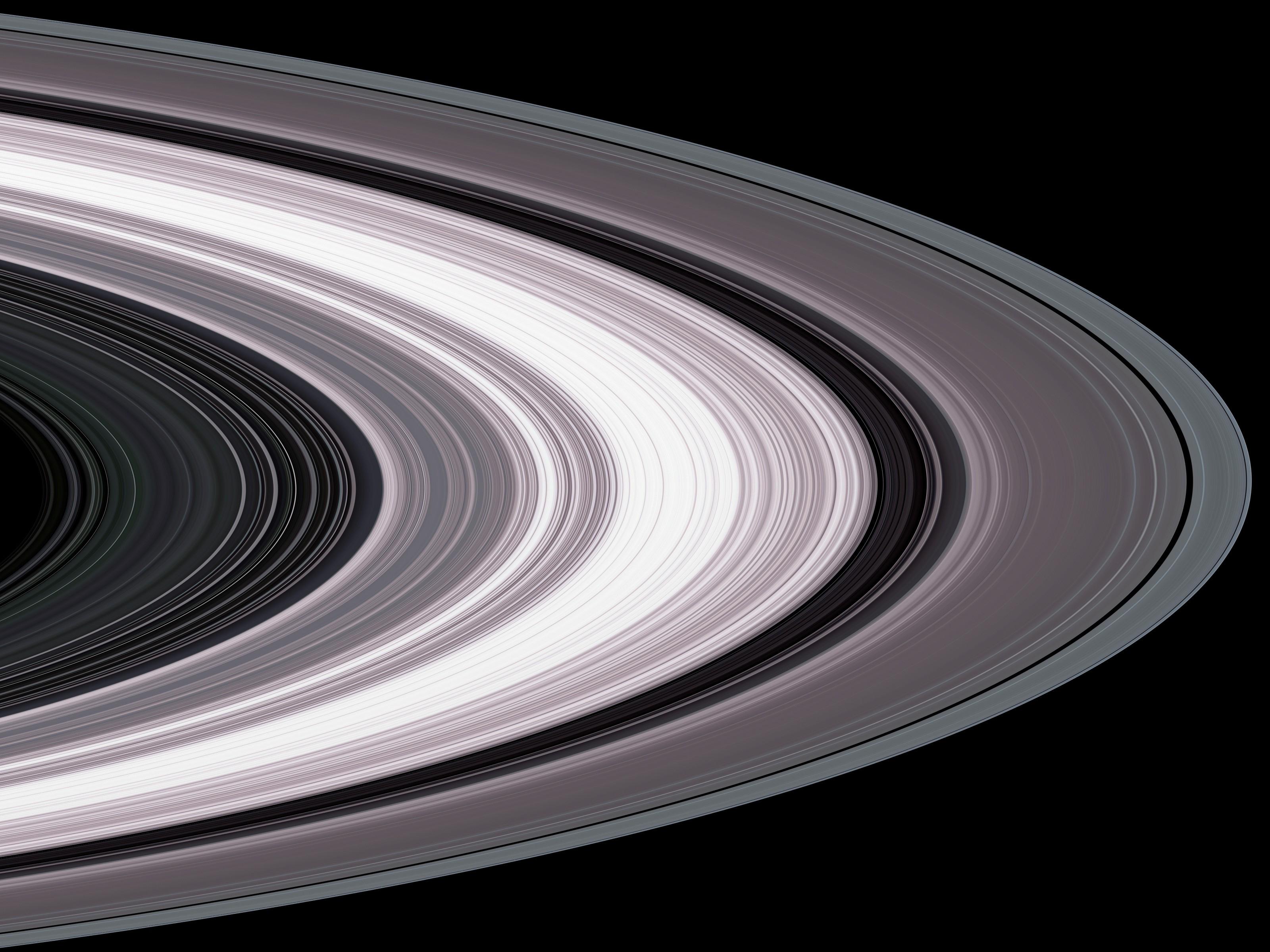
Rings At Opposition
Full Resolution:
TIFF
(450.6 kB)
JPEG
(21.8 kB)
|
|
|
2005-07-13 |
Mars
|
Mars Global Surveyor (MGS)
|
Mars Orbiter Camera (MOC)
|
806x806x16 |
|
-
PIA03997:
-
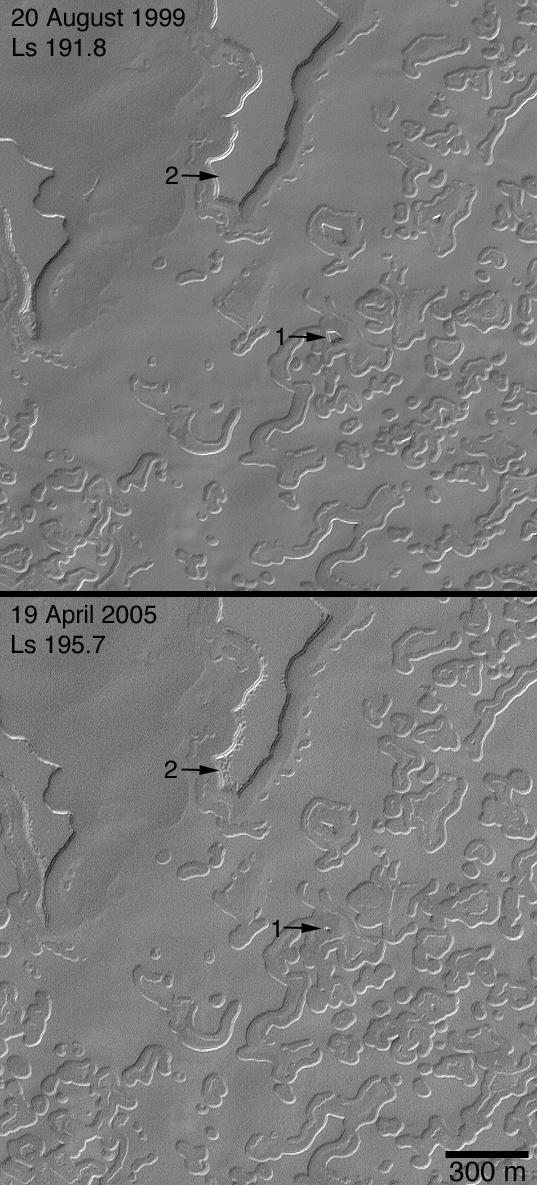
The Changing South Polar Cap of Mars: 1999-2005
Full Resolution:
TIFF
(650.5 kB)
JPEG
(70.56 kB)
|
|
|
2005-07-08 |
Mars
|
Mars Global Surveyor (MGS)
|
Mars Orbiter Camera (MOC)
|
836x1582x1 |

|
-
PIA03990:
-
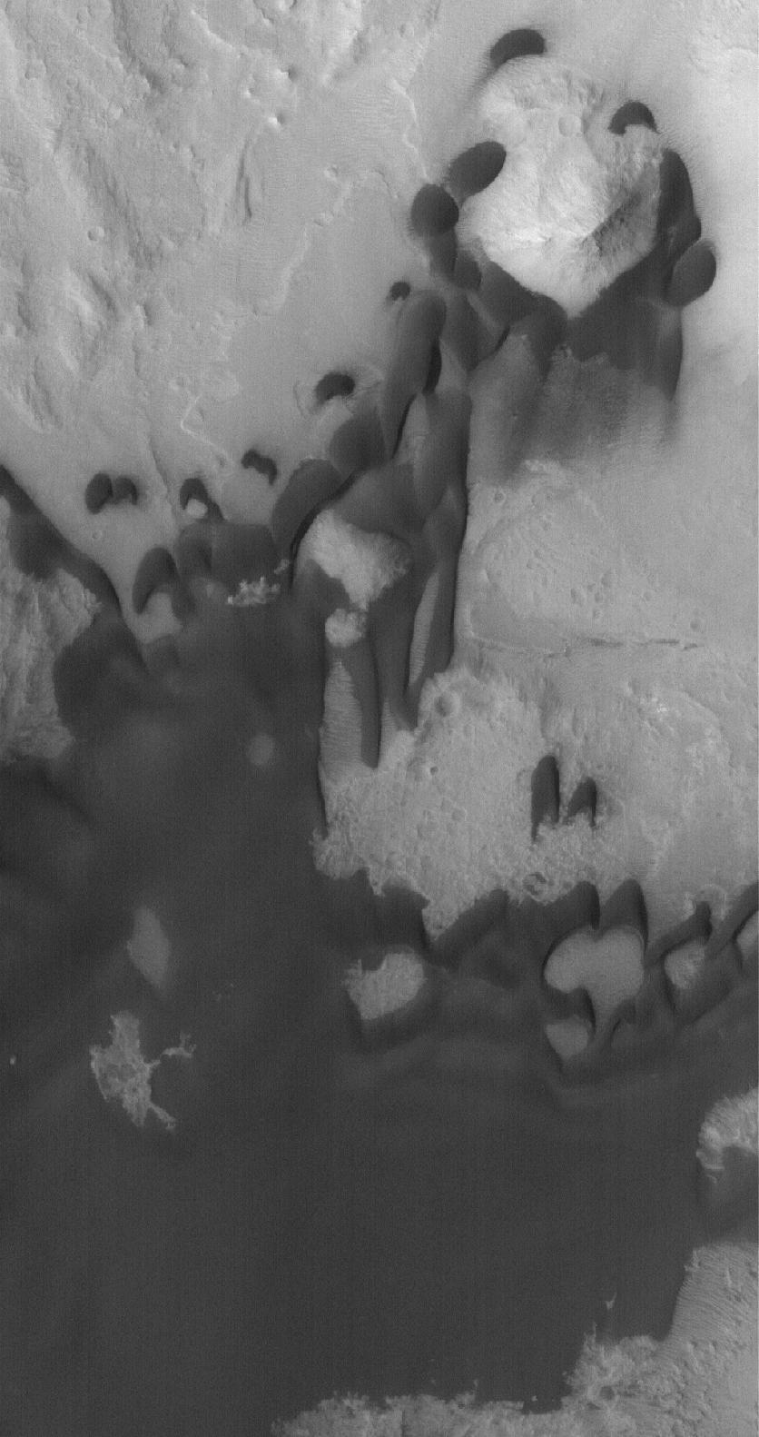
Ganges Chasma Sands
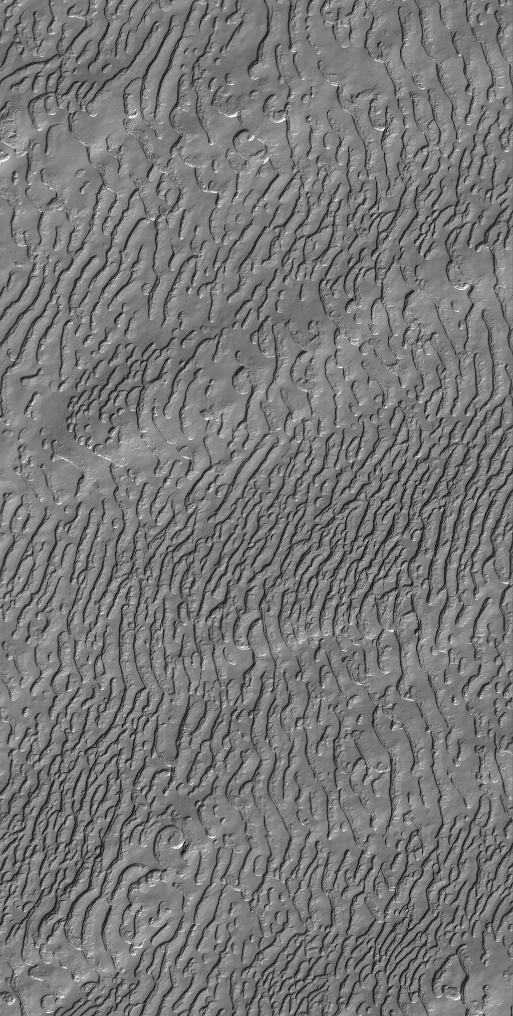
Full Resolution:
TIFF
(1.324 MB)
JPEG
(140 kB)
|
|
|
2005-07-08 |
Saturn
|
Cassini-Huygens
|
ISS - Wide Angle
|
977x967x1 |
|
-
PIA07538:
-
Saturn's Icy Realm
Full Resolution:
TIFF
(946 kB)
JPEG
(45.46 kB)
|
|
|
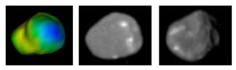
2005-06-28 |
Titan
|
Cassini-Huygens
|
ISS - Narrow Angle
|
967x969x3 |
|
-
PIA06240:
-
Land of Lakes?
Full Resolution:
TIFF
(2.815 MB)
JPEG
(55.78 kB)
|
|
|
2005-06-27 |
Mars
|
Mars Global Surveyor (MGS)
|
Mars Orbiter Camera (MOC)
|
2048x4050x1 |

|
-
PIA03969:
-
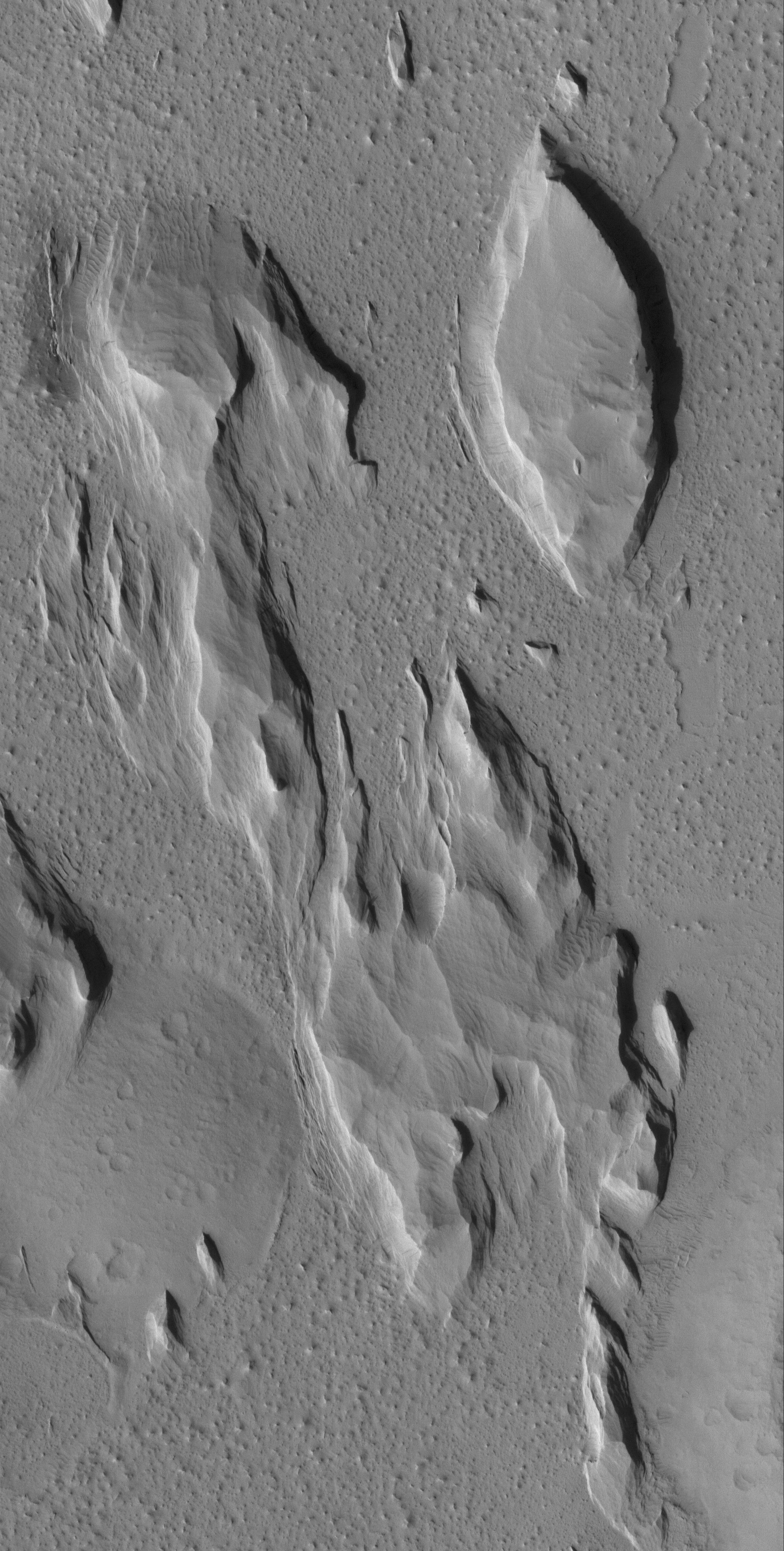
South Amazonis Yardangs
Full Resolution:
TIFF
(8.303 MB)
JPEG
(1.092 MB)
|
|
|
2005-06-23 |
Rhea
|
Cassini-Huygens
|
ISS - Wide Angle
|
310x329x1 |
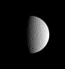
|
-
PIA07527:
-
Rhea's Memory
Full Resolution:
TIFF
(102.3 kB)
JPEG
(4.882 kB)
|
|
|
2005-06-22 |
Earth
|
Terra
|
MISR
|
1362x1004x3 |

|
-
PIA04381:
-
Where on Earth...? MISR Mystery Image Quiz #22: Ganges Plain
Full Resolution:
TIFF
(4.107 MB)
JPEG
(295.8 kB)
|
|
|
2005-06-13 |
Mars
|
2001 Mars Odyssey
|
THEMIS
|
2024x3350x1 |
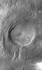
|
-
PIA03948:
-
Arsia Mons Mosaic
Full Resolution:
TIFF
(6.787 MB)
JPEG
(1.012 MB)
|
|
|
2005-06-10 |
Mars
|
Mars Exploration Rover (MER)
|
Panoramic Camera
|
2486x1914x3 |

|
-
PIA07997:
-
A Moment Frozen in Time
Full Resolution:
TIFF
(14.29 MB)
JPEG
(105.7 kB)
|
|
|
2005-06-10 |
Cassiopeia A
|
Hubble Space Telescope
Spitzer Space Telescope
|
IRAC
Visible Light
Chandra X-ray Telescope
|
1835x1348x3 |
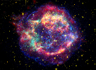
|
-
PIA03519:
-
Cassiopeia A: Death Becomes Her
Full Resolution:
TIFF
(7.432 MB)
JPEG
(263.6 kB)
|
|
|
2005-06-10 |
Cassiopeia A
|
Spitzer Space Telescope
|
IRAC
|
2842x1622x3 |
|
-
PIA03518:
-
A Year in the Life of an Infrared Echo
Full Resolution:
TIFF
(13.83 MB)
JPEG
(301.2 kB)
|
|
|
2005-06-10 |
Cassiopeia A
|
Spitzer Space Telescope
|
IRAC
|
2826x774x3 |
|
-
PIA03517:
Dead Star Rumbles
Full Resolution:
TIFF
(6.562 MB)
JPEG
(138.9 kB)
|
|
|
2005-06-08 |
Earth
|
Terra
|
MISR
|
1058x696x3 |
|
-
PIA04380:
-
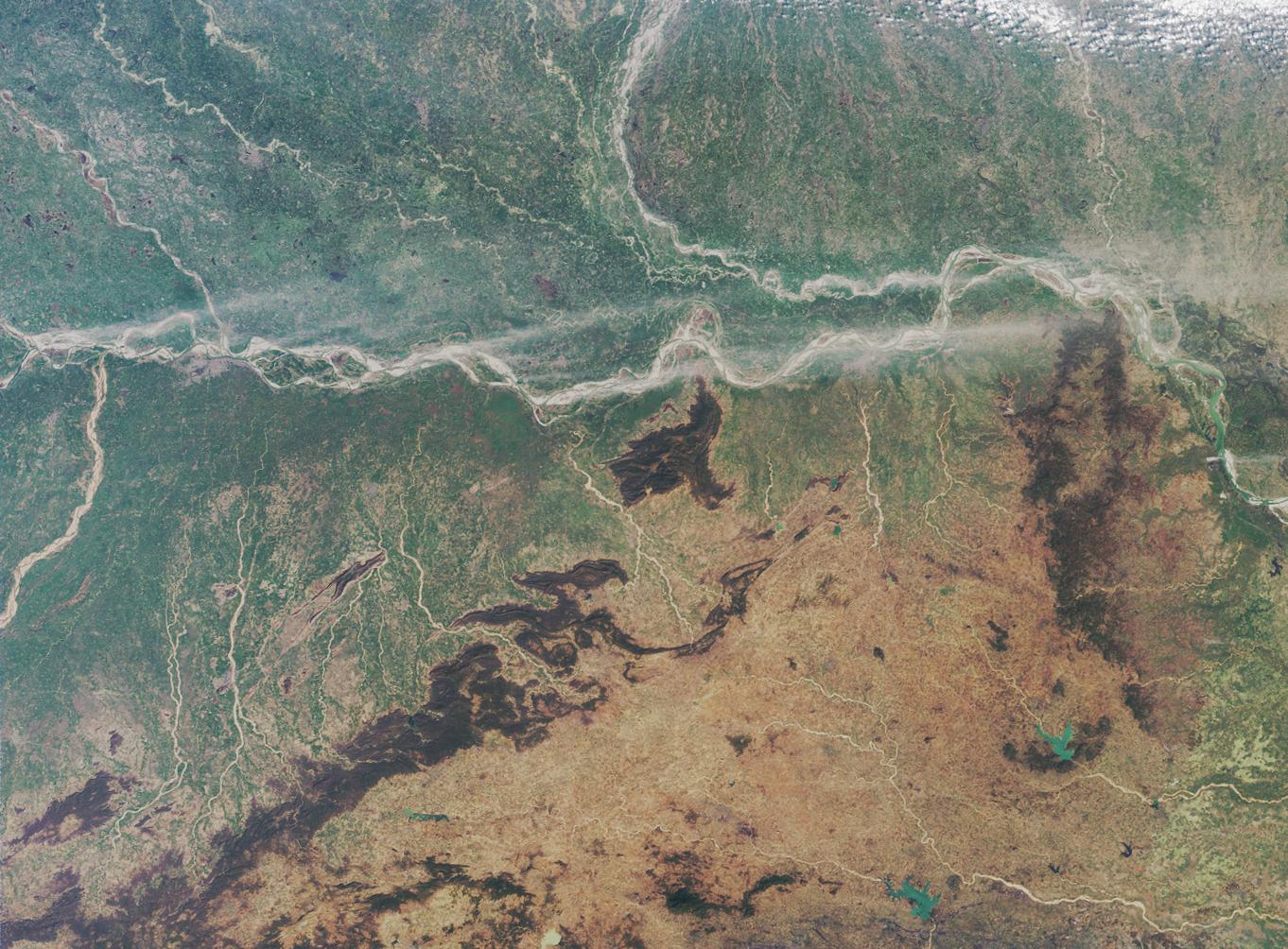
Rice Cultivation in Northwest Italy
Full Resolution:
TIFF
(2.212 MB)
JPEG
(217.1 kB)
|
|
|
2005-06-08 |
Titan
|
Cassini-Huygens
|
Visual and Infrared Mapping Spectrometer
|
349x477x3 |
|
-
PIA07964:
-
Geologic Map of Titan Volcano
Full Resolution:
TIFF
(500.2 kB)
JPEG
(37.35 kB)
|
|
|
2005-06-03 |
|
Mars Reconnaissance Orbiter (MRO)
|
|
6125x4850x3 |
|
-
PIA07245:
-
Mars Reconnaissance Orbiter, Front View (Artist's Concept)
Full Resolution:
TIFF
(89.12 MB)
JPEG
(3.989 MB)
|
|
|
2005-06-03 |
|
Mars Reconnaissance Orbiter (MRO)
|
|
6000x4500x3 |
|
-
PIA07240:
-
Mars Climate Sounder (Artist's Concept)
Full Resolution:
TIFF
(81 MB)
JPEG
(2.163 MB)
|
|
|
2005-06-03 |
Mars
|
Mars Global Surveyor (MGS)
|
Mars Orbiter Camera (MOC)
|
706x2078x1 |

|
-
PIA07995:
-
MOC's 200,000th Image
Full Resolution:
TIFF
(1.469 MB)
JPEG
(204.5 kB)
|
|
|
2005-06-03 |
Mars
|
Mars Global Surveyor (MGS)
|
Mars Orbiter Camera (MOC)
|
611x514x1 |

|
-
PIA07996:
-
MOC's 200,001st Image
Full Resolution:
TIFF
(314.6 kB)
JPEG
(27.99 kB)
|
|
|
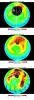
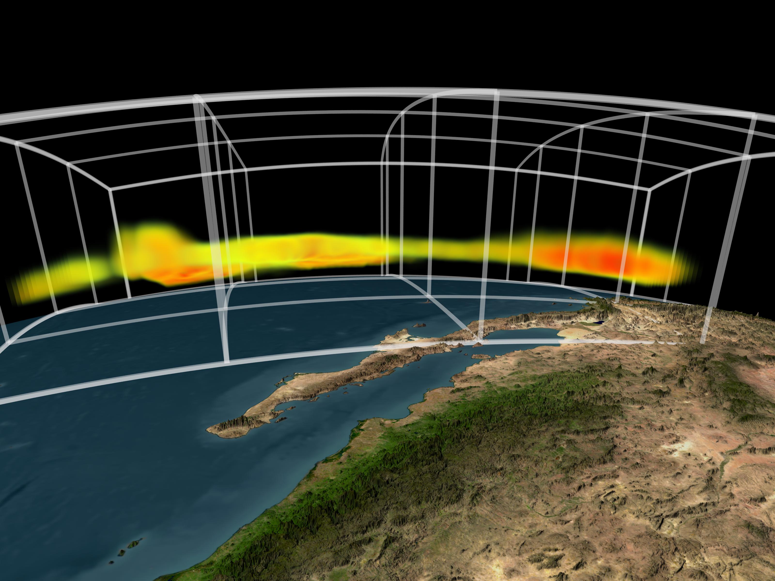
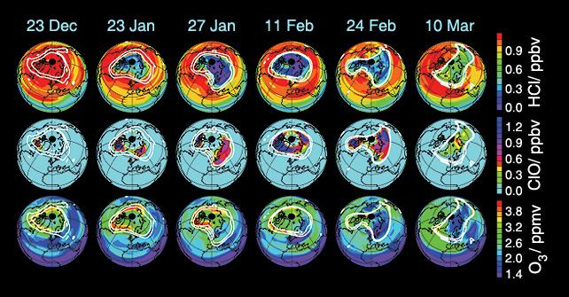
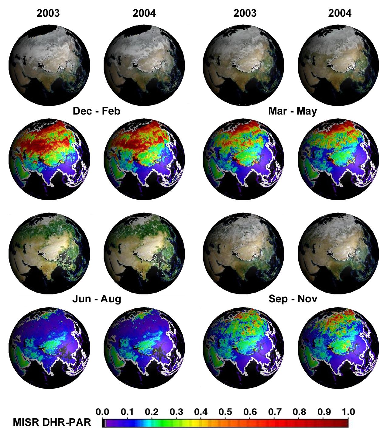
2005-06-02 |
Earth
|
Aura
|
MLS
|
720x540x3 |
|
-
PIA07255:
-
Aura Microwave Limb Sounder Animation Illustrating the Interaction Between
Temperatures and Chemicals Involved in Ozone Destruction, 2004-2005 Arctic Winter
Full Resolution:
TIFF
(1.168 MB)
JPEG
(60.91 kB)
|
|
|
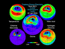
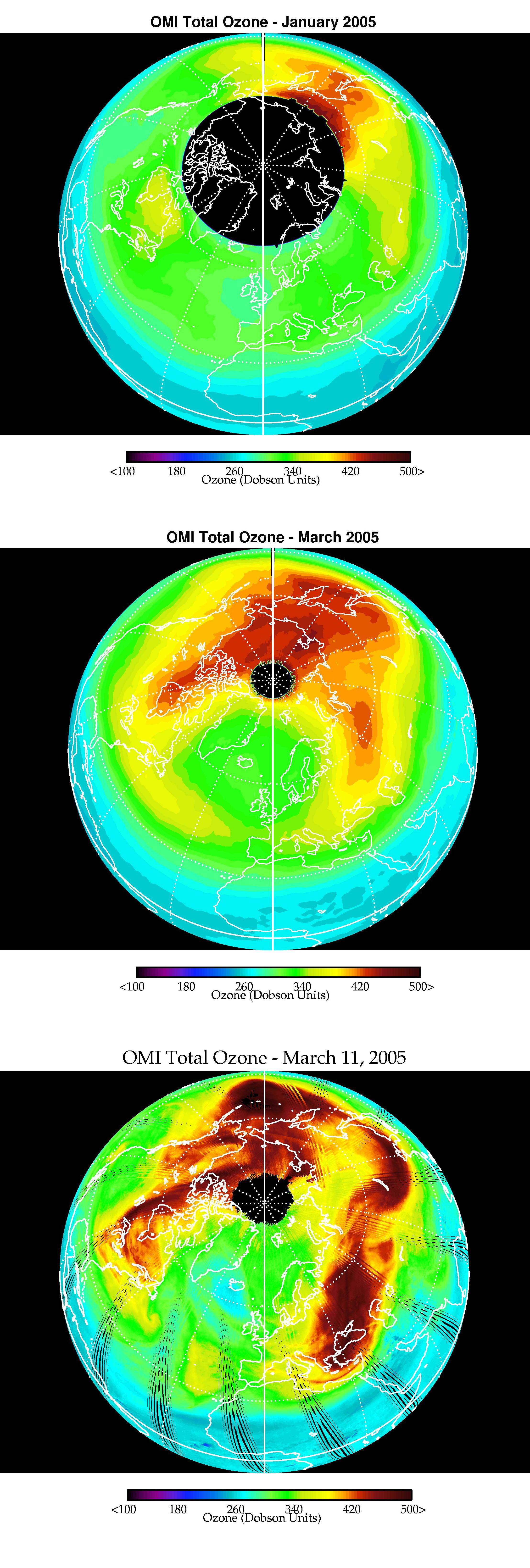
2005-06-02 |
Earth
|
Aura
|
Ozone Monitoring Instrument
|
2215x6554x3 |
|
-
PIA07254:
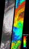
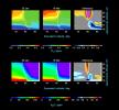
-
Selected Measurements of Total Arctic Column Ozone Amounts from Aura's Ozone Monitoring Instrument, 2004-2005 Arctic Winter
Full Resolution:
TIFF
(43.6 MB)
JPEG
(1.489 MB)
|
|
|
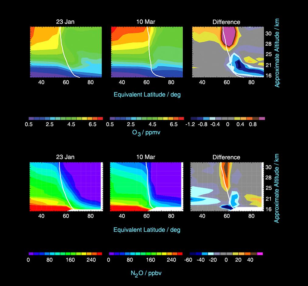
2005-06-02 |
Earth
|
Aura
|
MLS
|
642x335x3 |
|
-
PIA07252:
-
Aura's Microwave Limb Sounder Estimates of Ozone Loss, 2004/2005 Arctic Winter
Full Resolution:
TIFF
(646.1 kB)
JPEG
(65.28 kB)
|
|
|
2005-06-02 |
Earth
|
Aura
|
MLS
|
1013x939x3 |
|
-
PIA07994:
-
Microwave Limb Sounder Measurements Depicting the Relationship Between Nitrous Oxide Levels and Ozone Loss, 2004-2005 Arctic Winter
Full Resolution:
TIFF
(2.858 MB)
JPEG
(93.72 kB)
|
|
|
2005-06-01 |
Mars
|
Mars Exploration Rover (MER)
|
Panoramic Camera
|
250x1000x3 |

|
-
PIA07228:
-
Earth as Seen from Mars
Full Resolution:
TIFF
(751 kB)
JPEG
(23.25 kB)
|
|
|
2005-05-31 |
|
Galaxy Evolution Explorer (GALEX)
|
GALEX Telescope
|
2154x2154x3 |
|
-
PIA07251:
-
Surprise Ultraviolet Party in the Sky
Full Resolution:
TIFF
(13.94 MB)
JPEG
(1.617 MB)
|
|
|
2005-05-31 |
|
Galaxy Evolution Explorer (GALEX)
|
GALEX Telescope
|
2154x2154x3 |
|
-
PIA07250:
-
It's Not a Bird or a Plane
Full Resolution:
TIFF
(13.94 MB)
JPEG
(1.486 MB)
|
|
|
2005-05-31 |
Amalthea
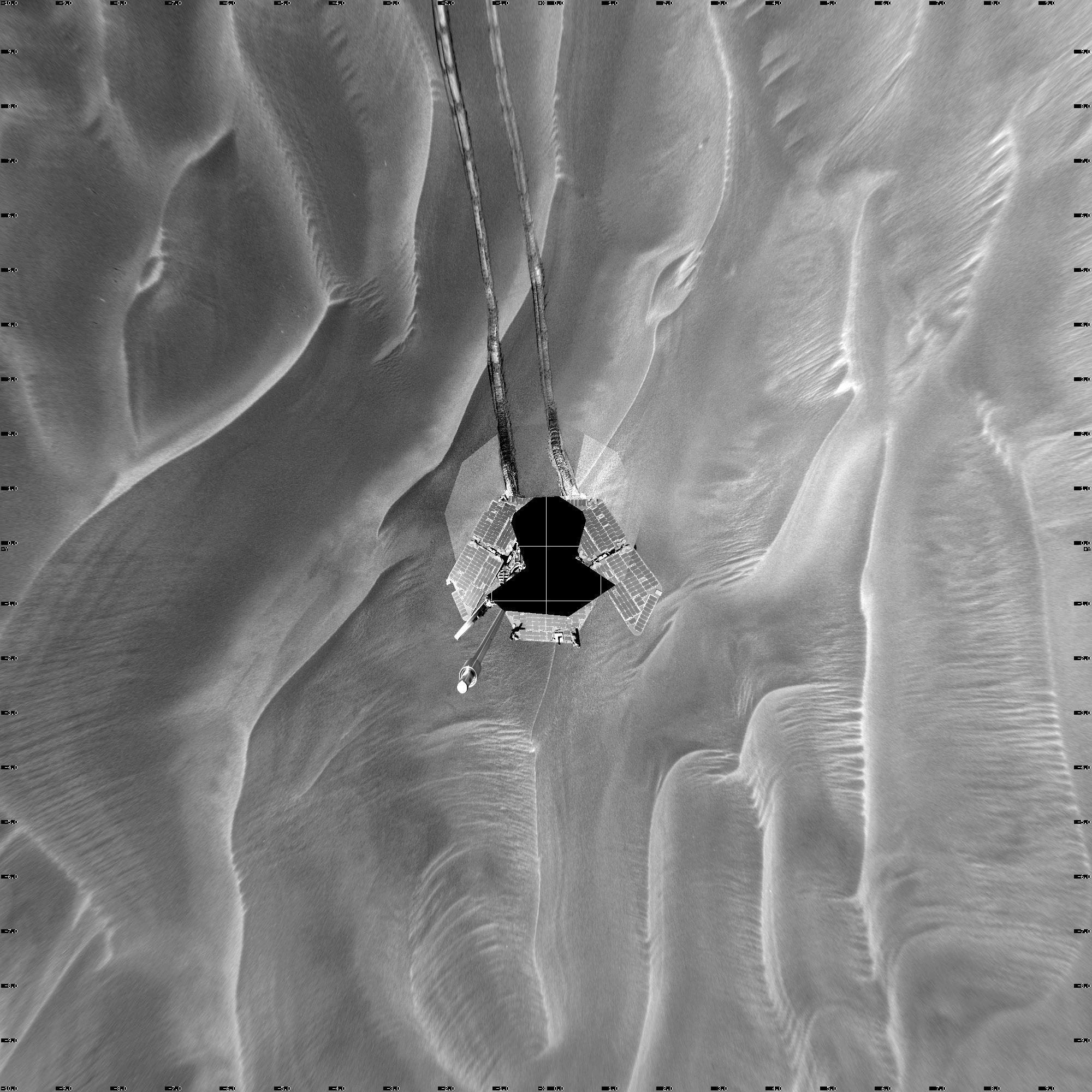
|
Galileo
Voyager
|
Solid-State Imaging
|
1800x541x3 |
|
-
PIA07248:
-
Amalthea, A Rubble-Pile Moon
Full Resolution:
TIFF
(2.926 MB)
JPEG
(42.38 kB)
|
|
|
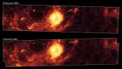
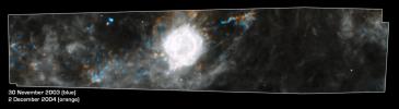
2005-05-30 |
Carina Nebula
|
Spitzer Space Telescope
|
IRAC
|
6614x5196x3 |
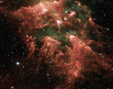
|
-
PIA03515:
-
All Pillars Point to Eta
Full Resolution:
TIFF
(103.1 MB)
JPEG
(3.749 MB)
|
|
|
2005-05-25 |
Titan
|
Cassini-Huygens
|
Visual and Infrared Mapping Spectrometer
|
600x1000x3 |
|
-
PIA07877:
-
Red Spot on Titan
Full Resolution:
TIFF
(1.802 MB)
JPEG
(22.81 kB)
|
|
|
2005-05-23 |
Saturn
|
Cassini-Huygens
|
Radio Science Subsystem
|
1833x1023x3 |
|
-
PIA07960:
-
Waves and Small Particles in Ring A
Full Resolution:
TIFF
(5.634 MB)
JPEG
(148.9 kB)
|
|
|
2005-05-23 |
Saturn
|
Cassini-Huygens
|
Radio Science Subsystem
|
1833x1023x3 |
|
-
PIA07875:
-
Small Particles in Ring A
Full Resolution:
TIFF
(5.634 MB)
JPEG
(112.4 kB)
|
|
|
2005-05-23 |
Saturn
|
Cassini-Huygens
|
Radio Science Subsystem
|
3200x2400x3 |
|
-
PIA07873:
-
Radio Occultation: Unraveling Saturn's Rings
Full Resolution:
TIFF
(23.04 MB)
JPEG
(664.6 kB)
|
|
|
2005-05-23 |
Saturn
|
Cassini-Huygens
|
Radio Science Subsystem
|
3200x2400x3 |
|
-
PIA07872:
-
Small Particles in Saturn's Rings
Full Resolution:
TIFF
(23.04 MB)
JPEG
(739.8 kB)
|
|
|
2005-05-23 |
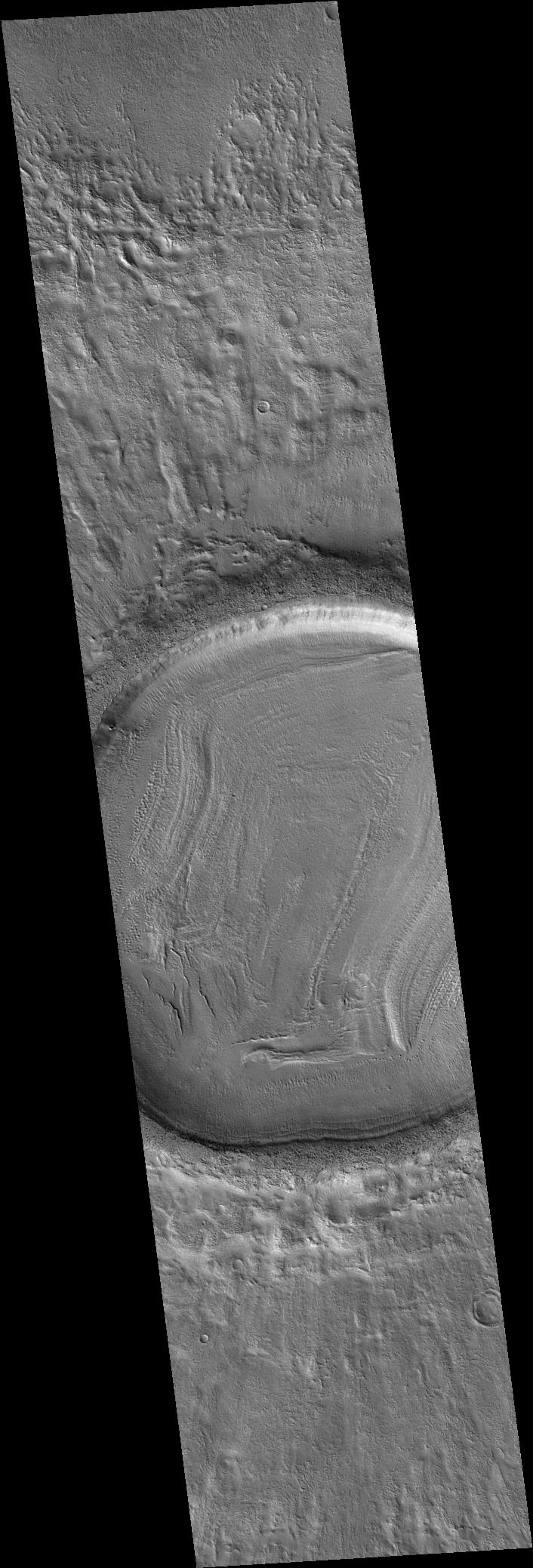
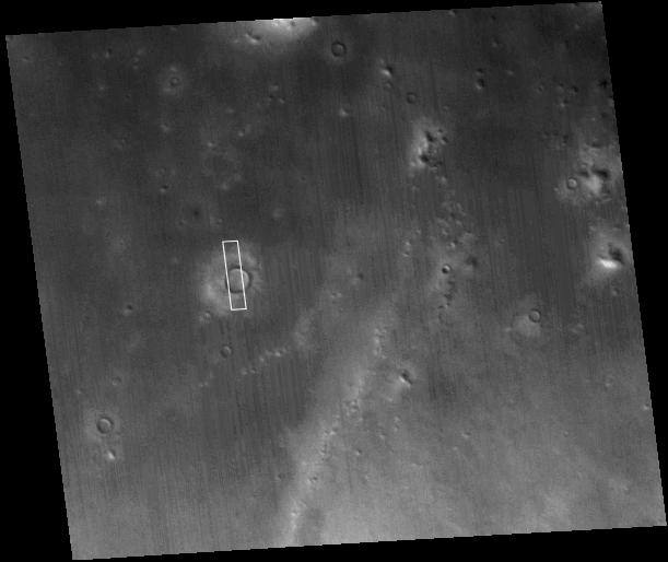
Mars
|
Mars Global Surveyor (MGS)
|
Mars Orbiter Camera (MOC)
|
537x1185x1 |
|
-
PIA07972:
-
Four Mars Years of Change
Full Resolution:
TIFF
(637.2 kB)
JPEG
(108.4 kB)
|
|
|
2005-05-19 |
|
Mars Global Surveyor (MGS)
Mars Express (MEX)
|
Mars Orbiter Camera (MOC)
|
254x156x1 |
|
-
PIA07944:
-
Mars Express Seen by Mars Global Surveyor
Full Resolution:
TIFF
(39.89 kB)
JPEG
(1.044 kB)
|
|
|
2005-05-19 |
|
2001 Mars Odyssey
Mars Global Surveyor (MGS)
|
Mars Orbiter Camera (MOC)
|
350x350x3 |
|
-
PIA07943:
-
Mars Odyssey Seen by Mars Global Surveyor (3-D)
Full Resolution:
TIFF
(368.1 kB)
JPEG
(8.865 kB)
|
|
|
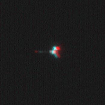
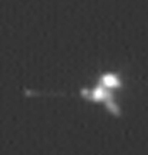
2005-05-19 |
|
2001 Mars Odyssey
Mars Global Surveyor (MGS)
|
Mars Orbiter Camera (MOC)
|
488x513x1 |

|
-
PIA07942:
-
Mars Odyssey Seen by Mars Global Surveyor
Full Resolution:
TIFF
(250.8 kB)
JPEG
(7.568 kB)
|
|
|
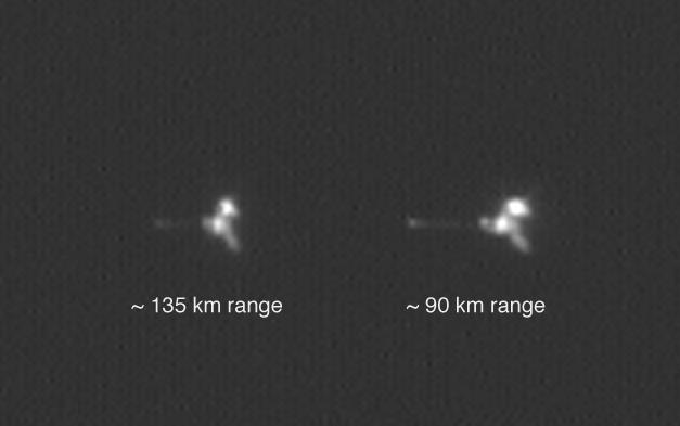
2005-05-19 |
|
2001 Mars Odyssey
Mars Global Surveyor (MGS)
|
Mars Orbiter Camera (MOC)
|
627x393x1 |

|
-
PIA07941:
-
Mars Odyssey from Two Distances in One Image
Full Resolution:
TIFF
(246.9 kB)
JPEG
(14 kB)
|
|
|
2005-05-18 |
Earth
|
Terra
|
MISR
|
1786x943x3 |
|
-
PIA04379:
-
Drought in the Black Hills
Full Resolution:
TIFF
(5.06 MB)
JPEG
(368.5 kB)
|
|
|
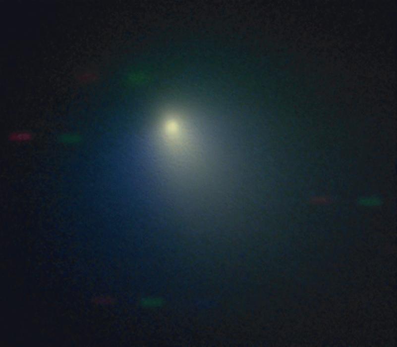
2005-05-16 |
Tempel 1
|
|
Kitt Peak National Observatory's 2.1 m Telescope
|
801x701x3 |

|
-
PIA07881:
-
Kitt Peak Observes Comet
Full Resolution:
TIFF
(563.8 kB)
JPEG
(28.49 kB)
|
|
|
2005-05-10 |
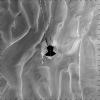
Mars
|
Mars Exploration Rover (MER)
|
Navigation Camera
|
2706x2076x3 |
|
-
PIA07930:
-
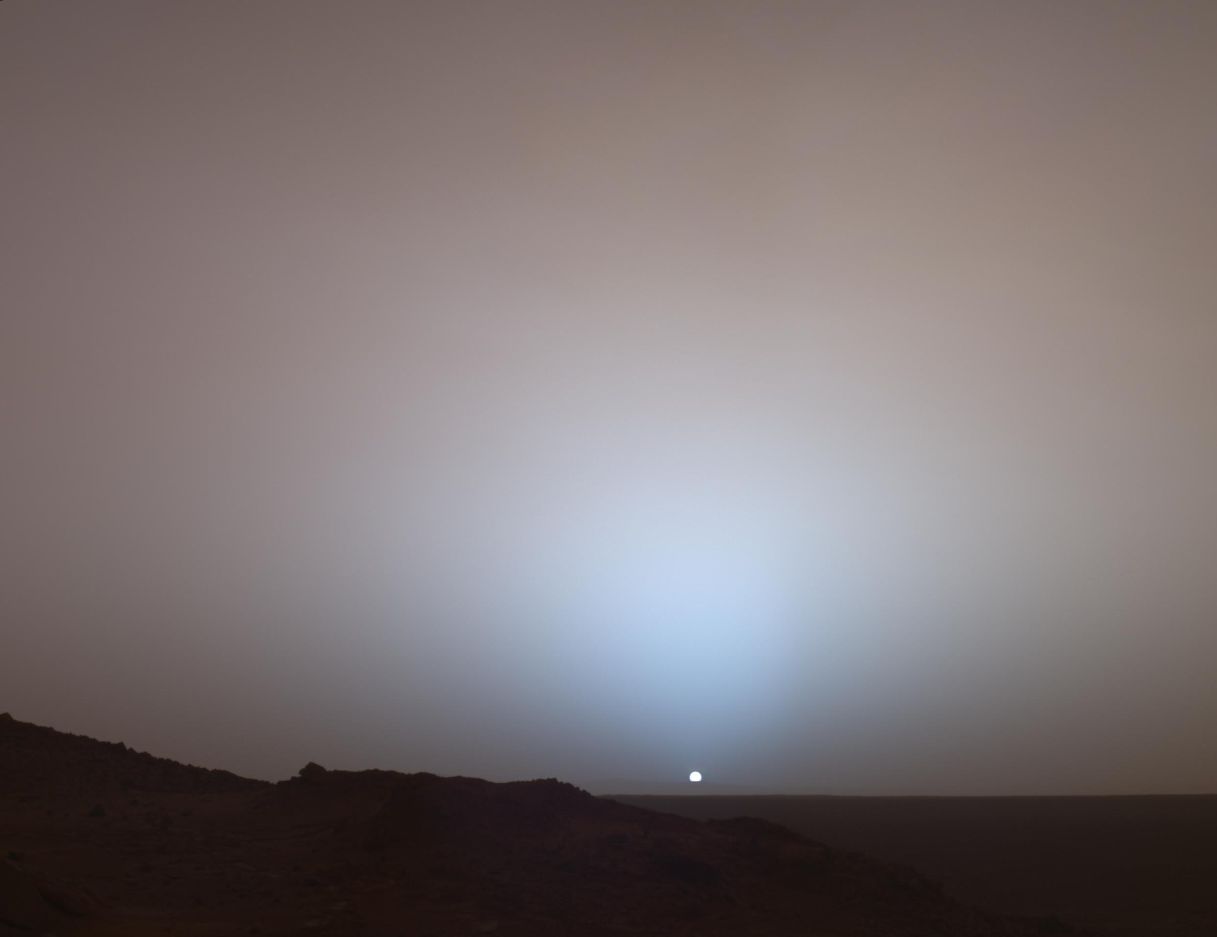
Twilight at Gusev
Full Resolution:
TIFF
(16.87 MB)
JPEG
(158.3 kB)
|
|
|
2005-05-06 |
Mars
|
Mars Exploration Rover (MER)
|
Navigation Camera
|
2000x2000x1 |
|
-
PIA07922:
-
Opportunity's Sol 446 Position, with Relative Heights
Full Resolution:
TIFF
(4.004 MB)
JPEG
(552.8 kB)
|
|
|
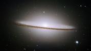
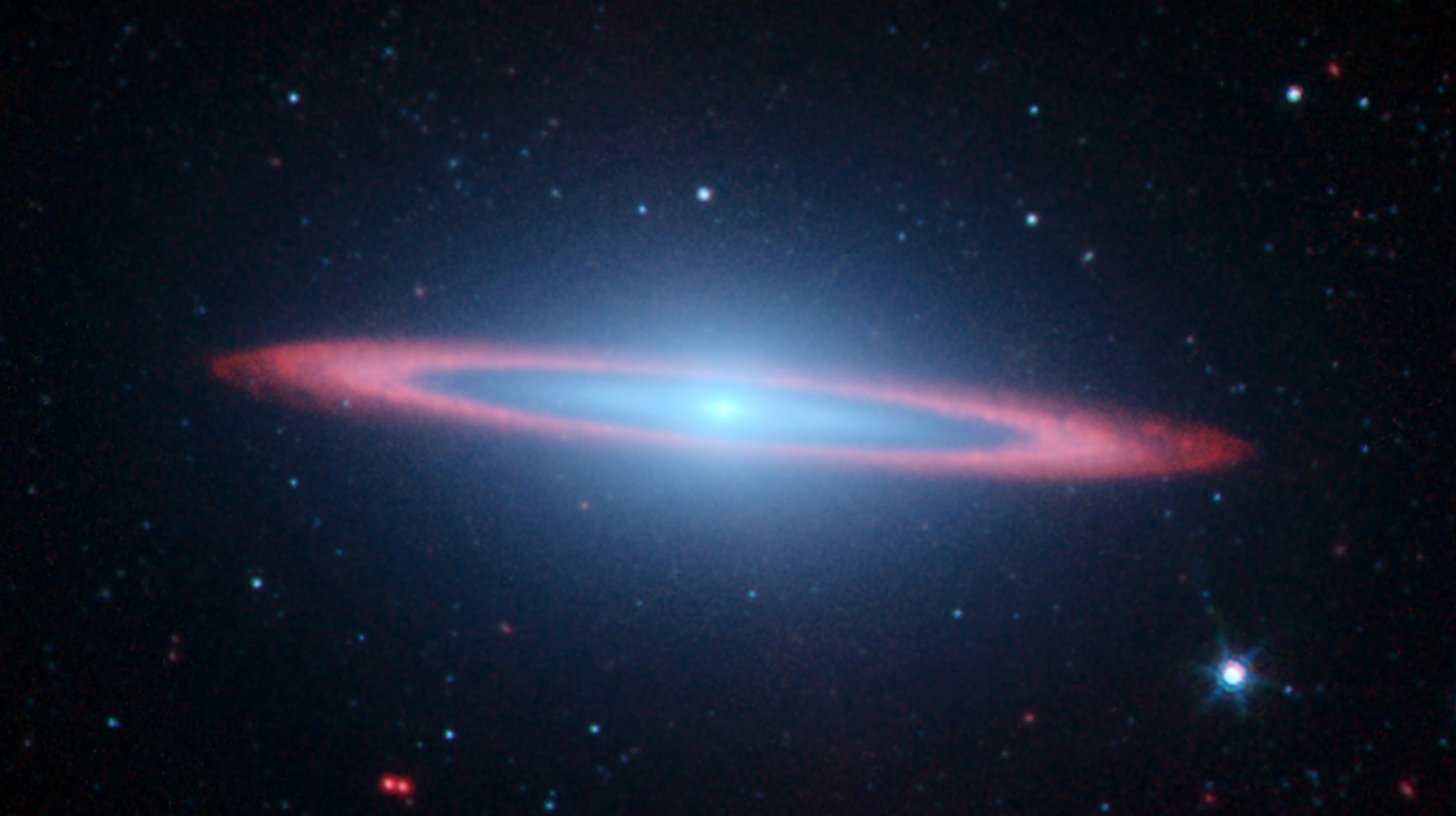
2005-05-05 |
|
Hubble Space Telescope
|
Visible Light
|
3000x1681x3 |
|
-
PIA15226:
-
Hubble Spies Spectacular Sombrero
Full Resolution:
TIFF
(15.13 MB)
JPEG
(427.2 kB)
|
|
|
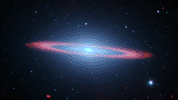
2005-05-04 |
Messier 104
|
Hubble Space Telescope
Spitzer Space Telescope
|
IRAC
Visible Light
|
3000x1681x3 |
|
-
PIA07899:
-
Spitzer Spies Spectacular Sombrero
Full Resolution:
TIFF
(15.13 MB)
JPEG
(214.2 kB)
|
|
|
2005-05-04 |
Earth
|
Terra
|
MISR
|
1264x1445x3 |
|
-
PIA04378:
-
Seasonal Changes in Earth's Surface Albedo
Full Resolution:
TIFF
(5.485 MB)
JPEG
(291.8 kB)
|
|
|
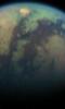
2005-05-02 |
Titan
|
Cassini-Huygens
|
ISS - Narrow Angle
|
972x1004x3 |
|
-
PIA06236:
-
Titan: Complex 'Anti-greenhouse'
Full Resolution:
TIFF
(2.932 MB)
JPEG
(26.78 kB)
|
|
|
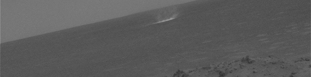
2005-04-21 |
Mars
|
Mars Exploration Rover (MER)
|
Navigation Camera
|
1024x256x1 |
|
-
PIA07863:
Gusev Dust Devil Movie, Sol 459 (Enhanced)
Full Resolution:
TIFF
(262.6 kB)
JPEG
(29.71 kB)
|
|
|
2005-04-21 |
Mars
|
Mars Exploration Rover (MER)
|
Navigation Camera
|
1024x512x1 |
|
-
PIA07862:
-
Gusev Dust Devil Movie, Sol 459 (Plain and Isolated)
Full Resolution:
TIFF
(525 kB)
JPEG
(63.68 kB)
|
|
|
2005-04-21 |
Mars
|
Mars Exploration Rover (MER)
|
Navigation Camera
|
1024x256x1 |
|
-
PIA07861:
Gusev Dust Devil Movie, Sol 456 (Enhanced)
Full Resolution:
TIFF
(262.6 kB)
JPEG
(28.19 kB)
|
|
|
2005-04-21 |
Mars
|
Mars Exploration Rover (MER)
|
Navigation Camera
|
1024x512x1 |
|
-
PIA07860:
-
Gusev Dust Devil Movie, Sol 456 (Plain and Isolated)
Full Resolution:
TIFF
(525 kB)
JPEG
(61.05 kB)
|
|
|
2005-04-20 |
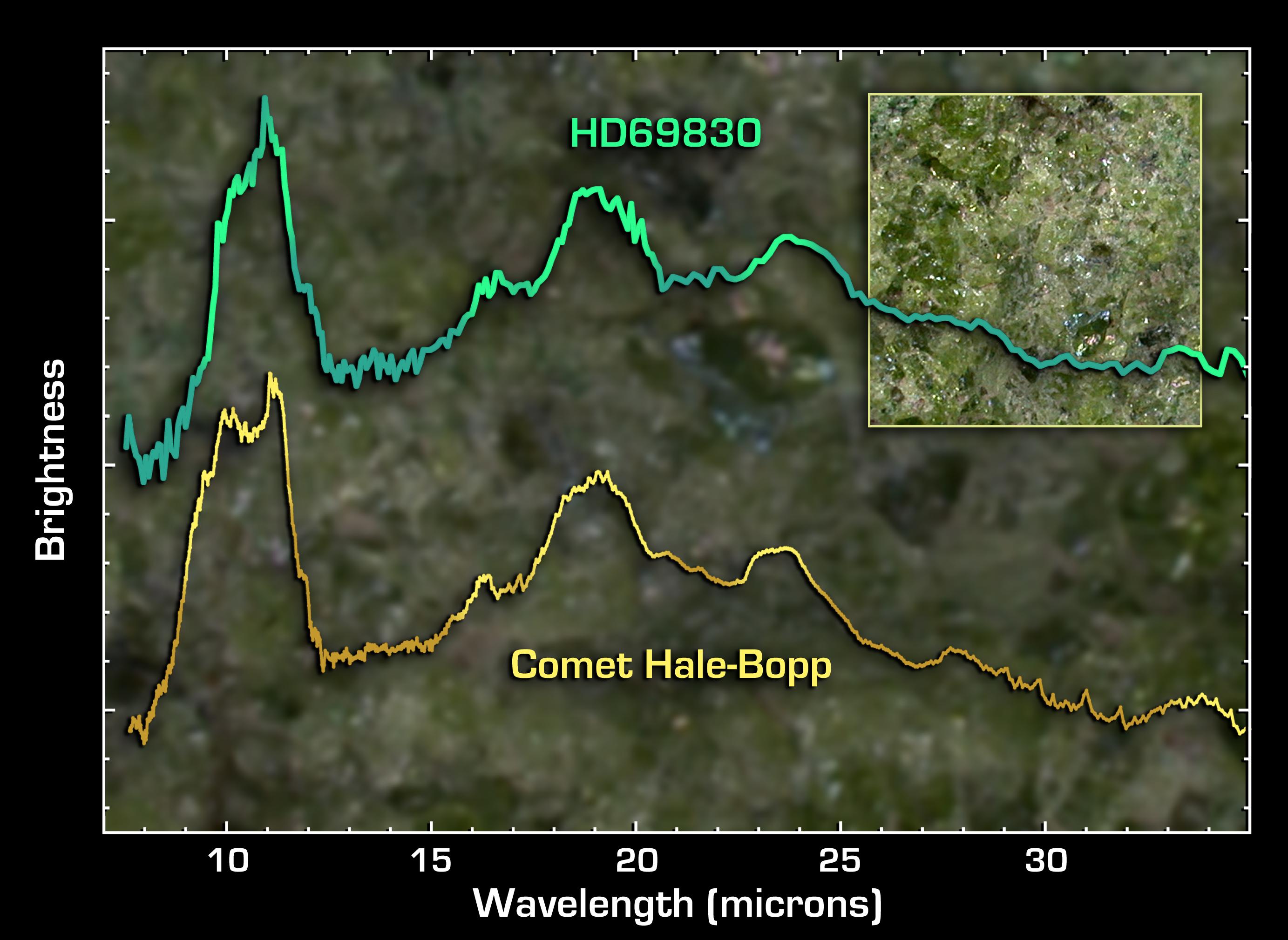
HD 69830
|
Spitzer Space Telescope
|
Infrared Spectrograph (IRS)
|
2766x2019x3 |
|
-
PIA07852:
-
Super-Comet or Big Asteroid Belt?
Full Resolution:
TIFF
(16.75 MB)
JPEG
(375.2 kB)
|
|
|
2005-04-18 |
RCW 79
|
Spitzer Space Telescope
|
IRAC
|
2440x2440x3 |

|
-
PIA07841:
-
A Bubble Bursts
Full Resolution:
TIFF
(17.88 MB)
JPEG
(657.5 kB)
|
 Planetary Data System


