My
List |
Addition Date
|
Target
|
Mission
|
Instrument
|
Size
|

|
2003-12-04 |
Earth
|
Terra
|
MISR
|
2895x3200x3 |

|
-
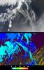
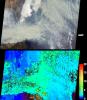
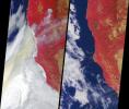
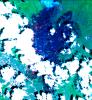
PIA04347:
-
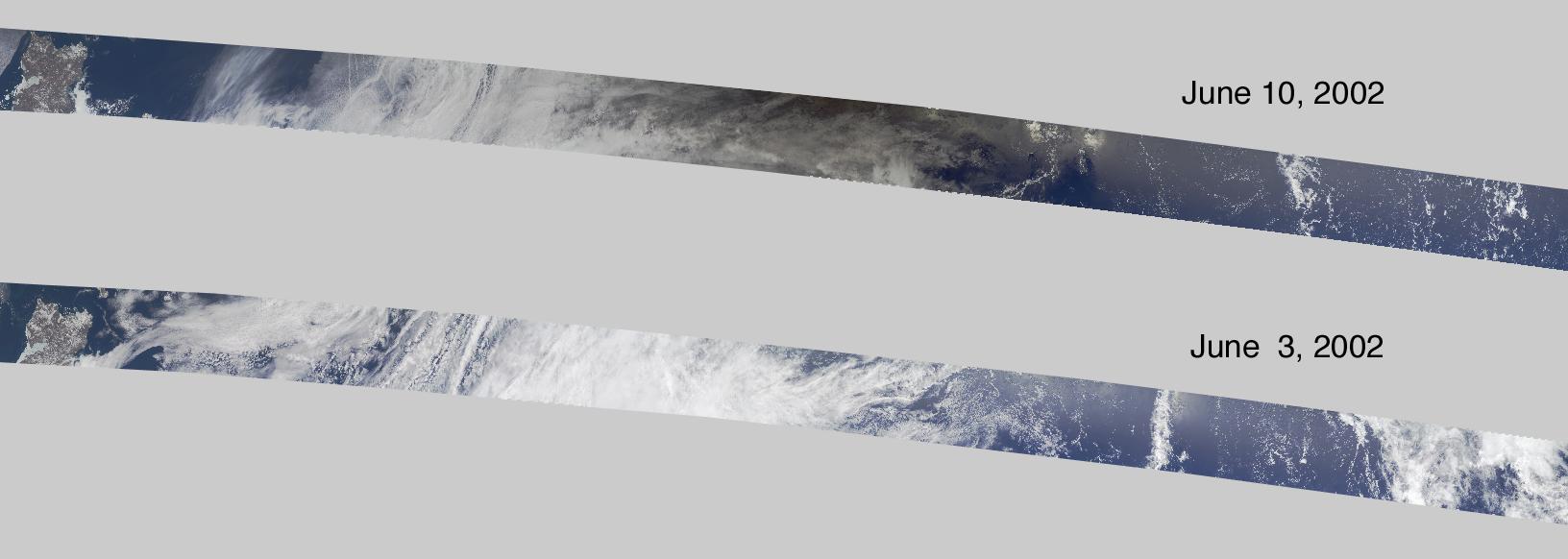
Capturing the Motion of an Eclipse Shadow
Full Resolution:
TIFF
(15.8 MB)
JPEG
(452.3 kB)
|
|
|
2003-11-26 |
Earth
|
Terra
|
MISR
|
877x1185x3 |

|
-
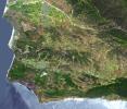
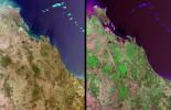
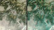
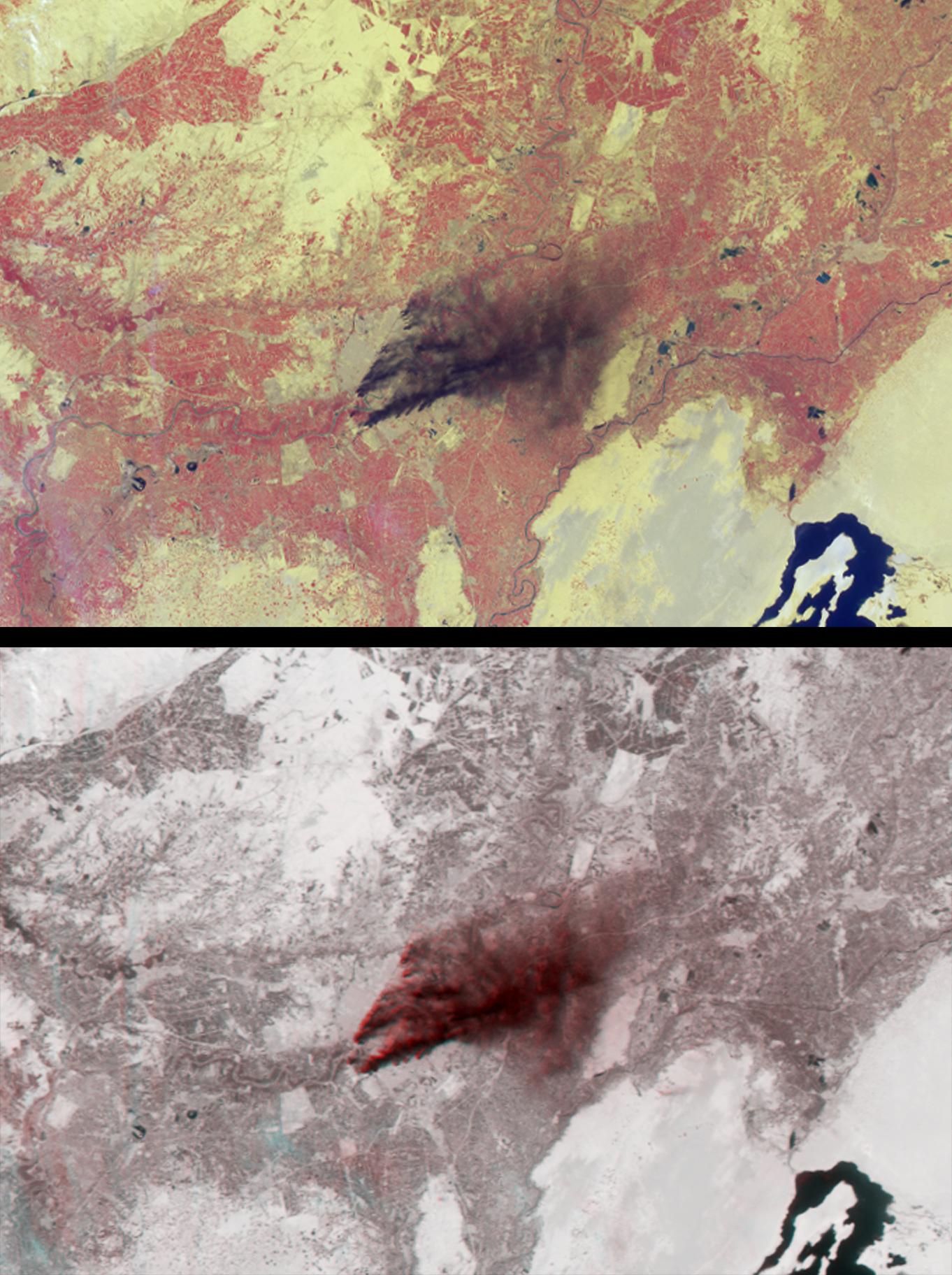
PIA04346:
-
Burn Scars Across Southern California
Full Resolution:
TIFF
(3.121 MB)
JPEG
(253.8 kB)
|
|
|
2003-11-19 |
Earth
|
Terra
|
ASTER
|
4038x3056x3 |

|
-
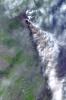
PIA04879:
-
Old Fire/Grand Prix Fire, California
Full Resolution:
TIFF
(37.02 MB)
JPEG
(3.971 MB)
|
|
|
2003-11-19 |
Earth
|
Terra
|
MISR
|
1200x1128x3 |
|
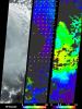
-
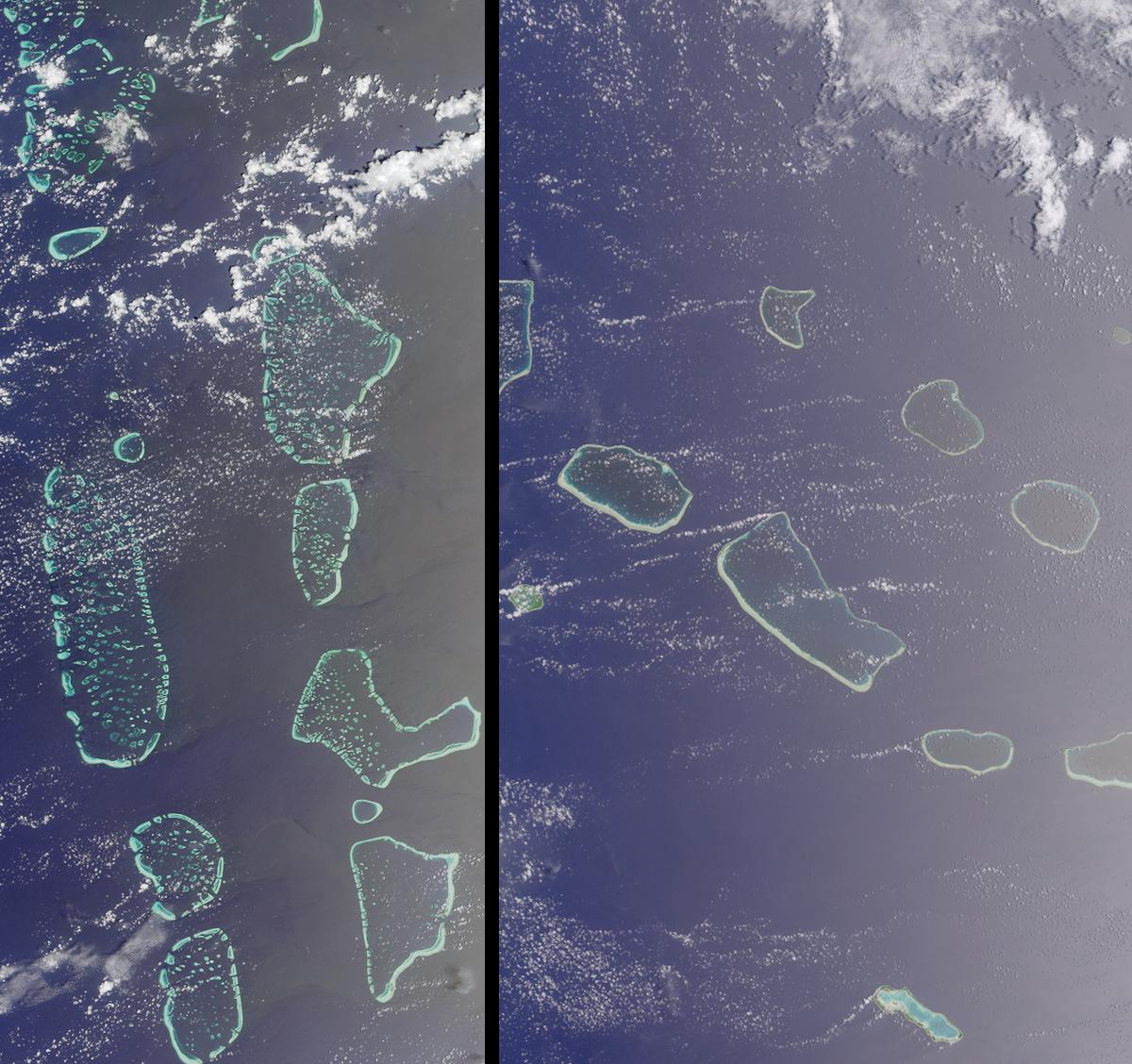
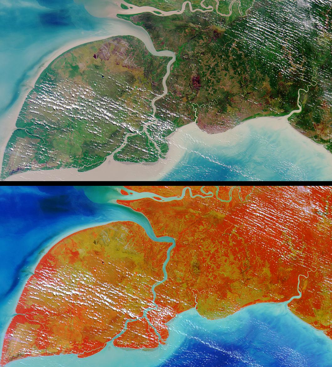
PIA04345:
-
Where on Earth...? MISR Mystery Image Quiz 16:
Maldives in the Indian Ocean and Tuamotu, French Polynesia
Full Resolution:
TIFF
(4.066 MB)
JPEG
(207 kB)
|
|
|
2003-11-12 |
Earth
|
Terra
|
MISR
|
945x805x3 |

|
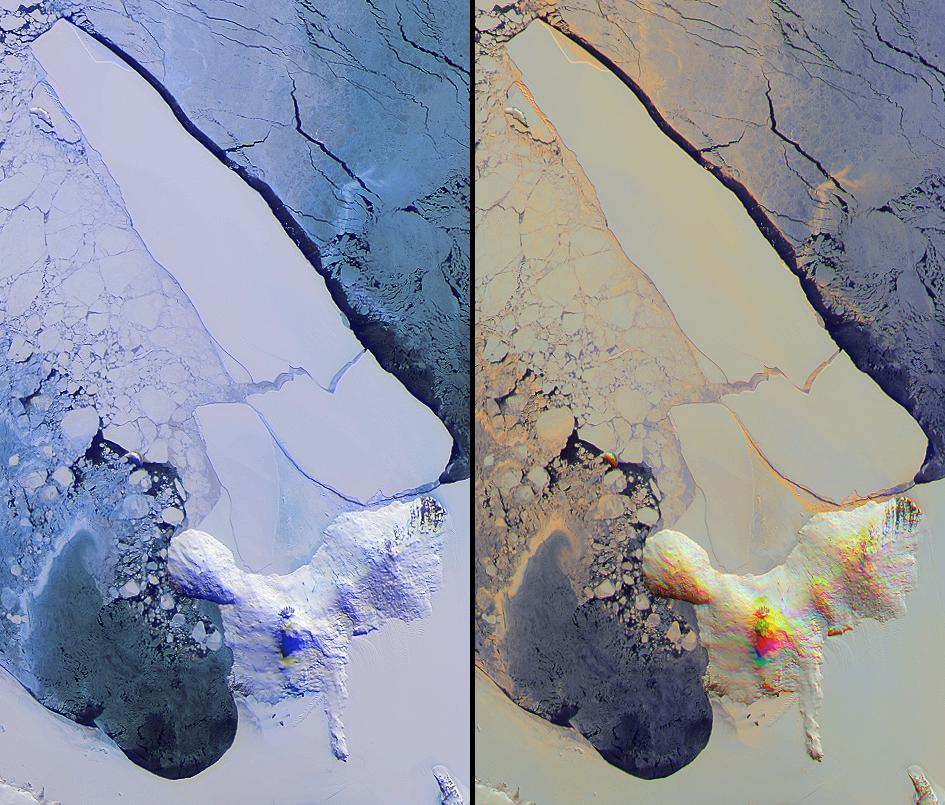
-
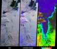
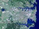
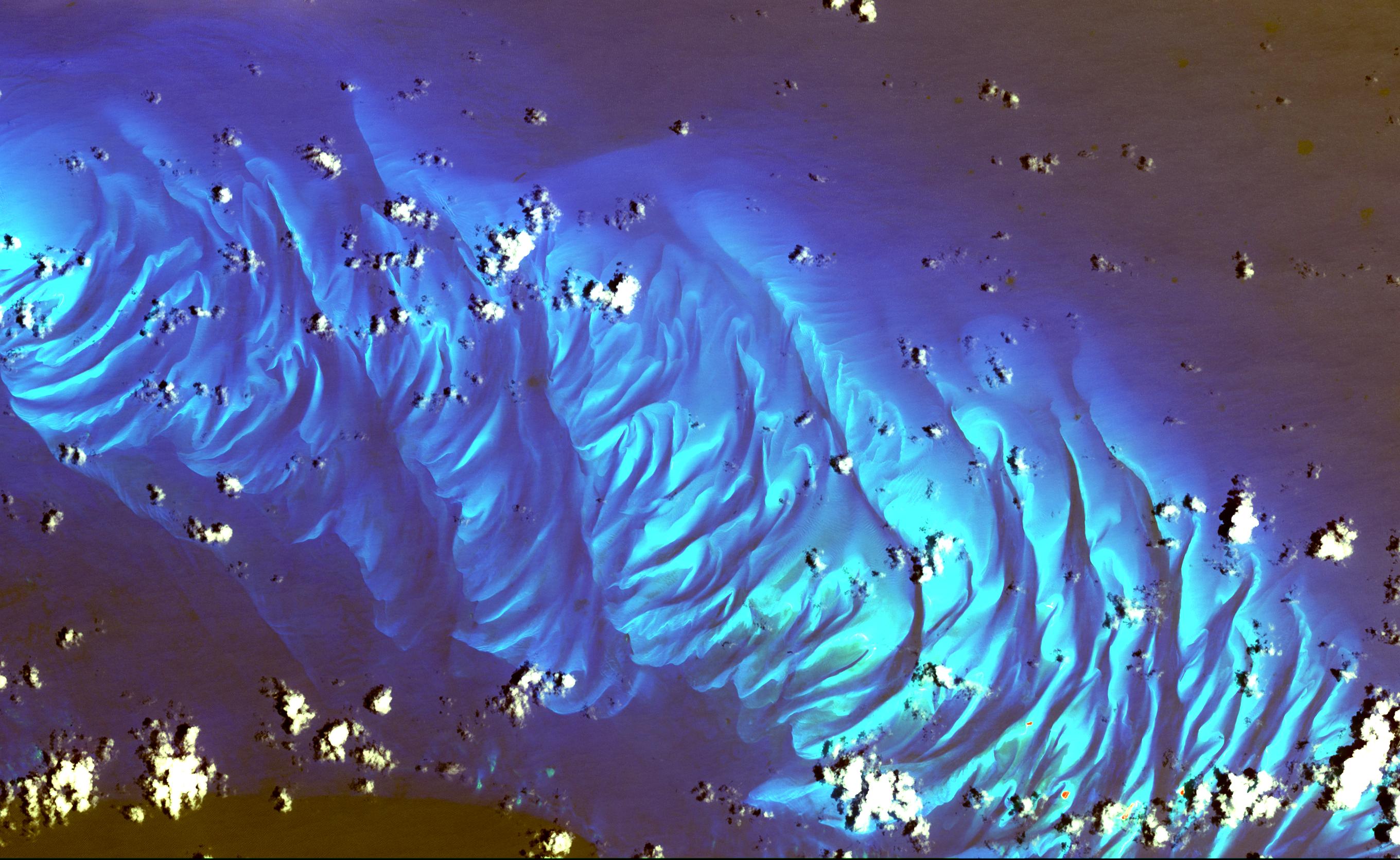
PIA04344:
-
Breakup of the World's Largest Iceberg
Full Resolution:
TIFF
(2.286 MB)
JPEG
(151 kB)
|
|
|
2003-10-29 |
Earth
|
Terra
|
MISR
|
2464x2300x3 |
|
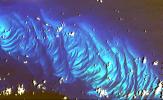
-
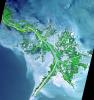
PIA04343:
-
Wildfires Rage in Southern California
Full Resolution:
TIFF
(9.506 MB)
JPEG
(846.2 kB)
|
|
|
2003-10-22 |
Earth
|
Terra
|
MISR
|
1539x2131x3 |
|
-
PIA04342:
-
Austral Winter and Spring in Queensland's Brigalow Belt
Full Resolution:
TIFF
(9.856 MB)
JPEG
(730.1 kB)
|
|
|
2003-10-08 |
Earth
|
Terra
|
MISR
|
1270x1468x3 |

|
-
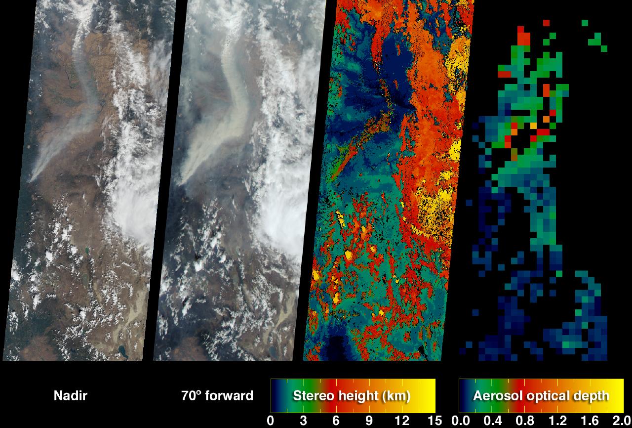
PIA04341:
-
Smoke from Siberian Taiga Fires
Full Resolution:
TIFF
(3.225 MB)
JPEG
(357.2 kB)
|
|
|
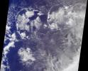
2003-09-24 |
Earth
|
Terra
|
MISR
|
1291x1683x3 |
|
-
PIA04340:
-
Where on Earth...? MISR Mystery Image Quiz #15: Kamchatka Peninsula, Russia
Full Resolution:
TIFF
(6.525 MB)
JPEG
(394.6 kB)
|
|
|
2003-09-18 |
Earth
|
Terra
|
MISR
|
1011x1115x3 |
|
-
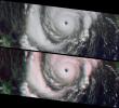
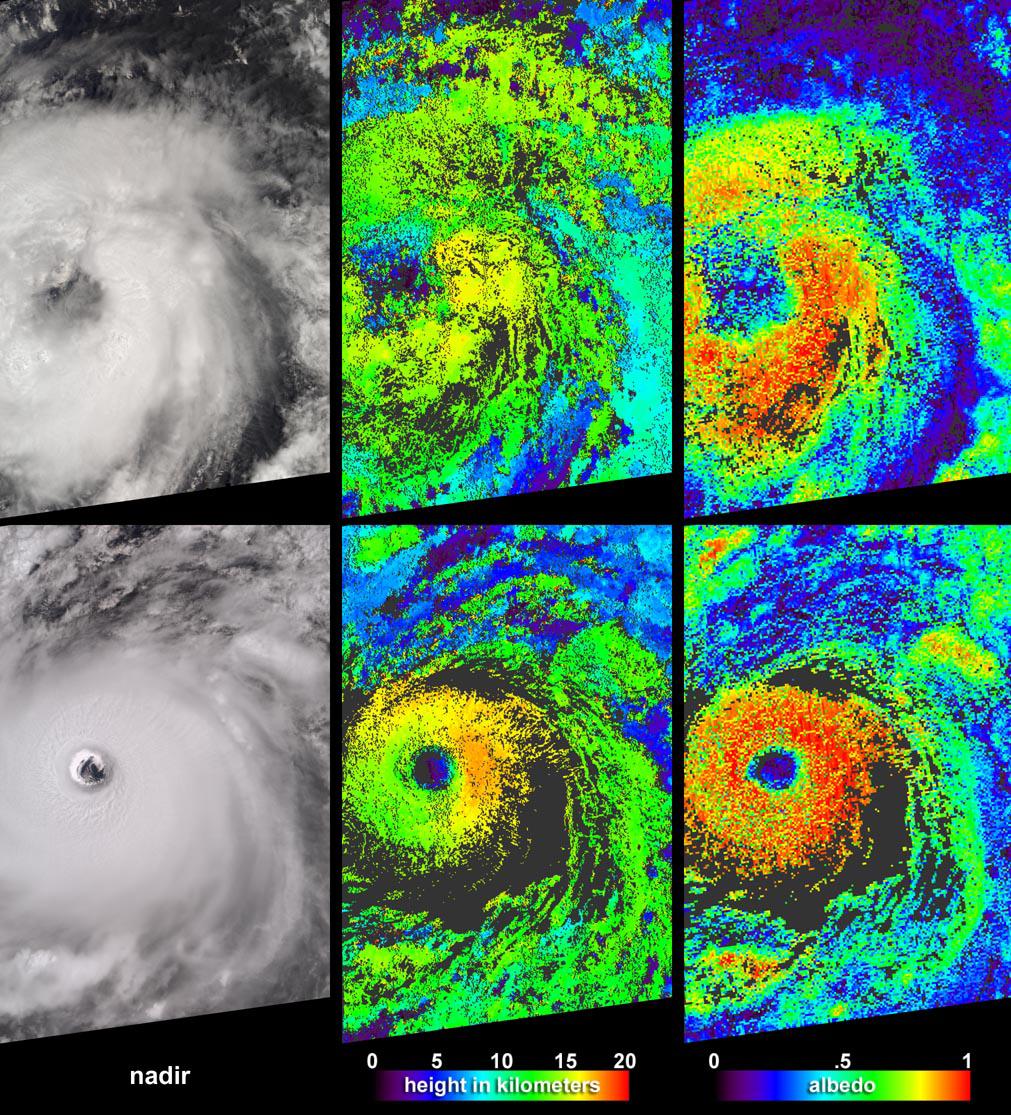
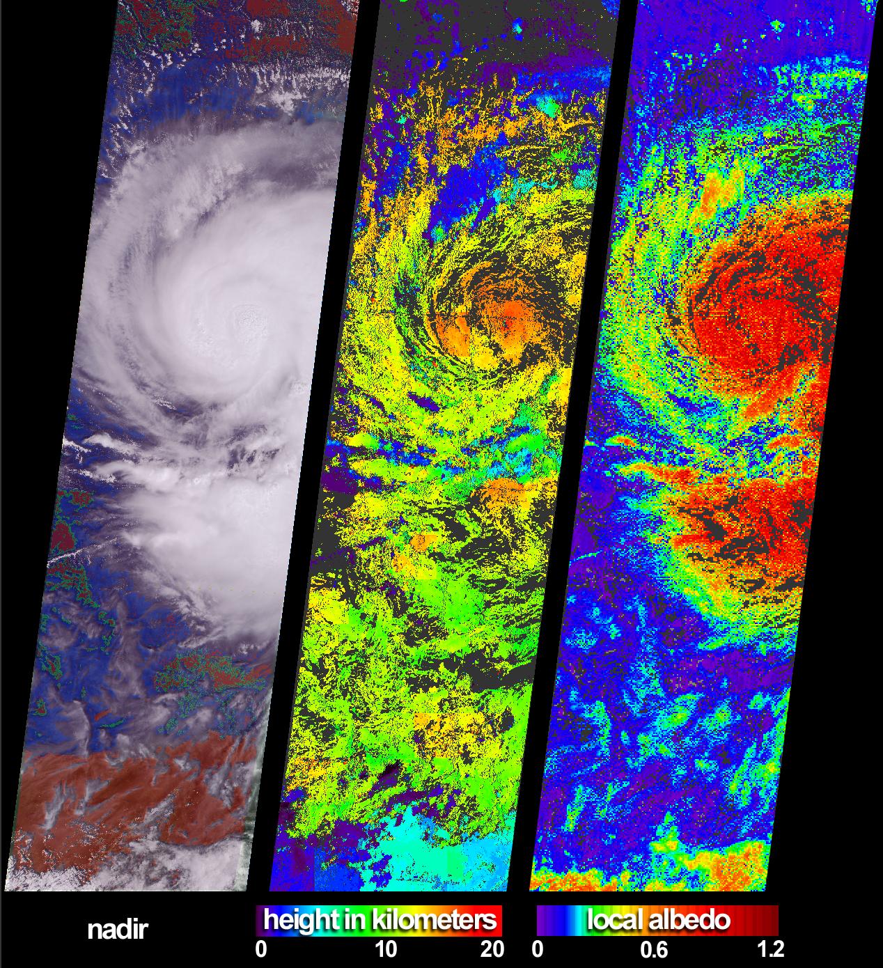
PIA04339:
-
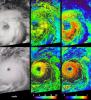
Aspects of Hurricane Isabel
Full Resolution:
TIFF
(3.386 MB)
JPEG
(348.3 kB)
|
|
|
2003-09-10 |
Earth
|
Terra
|
MISR
|
1280x866x3 |
|
-
PIA04338:
-
Smoke Plumes from the B&B Complex Fires, Oregon
Full Resolution:
TIFF
(2.02 MB)
JPEG
(215.1 kB)
|
|
|
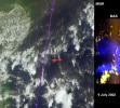
2003-08-13 |
Earth
|
Terra
|
MISR
|
1798x920x3 |
|
-
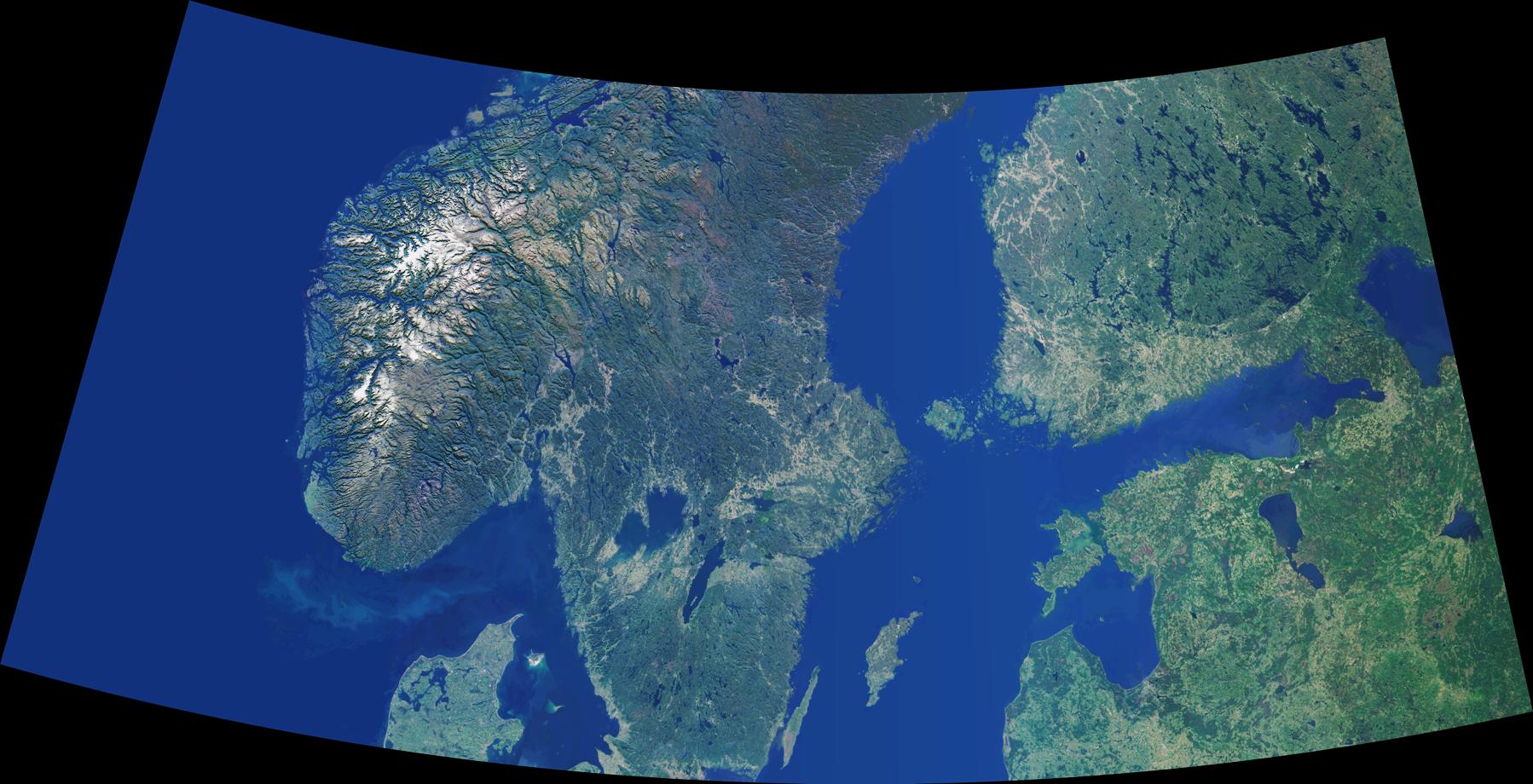
PIA04337:
-
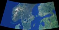
Scandinavia and the Baltic Region
Full Resolution:
TIFF
(2.677 MB)
JPEG
(234.7 kB)
|
|
|
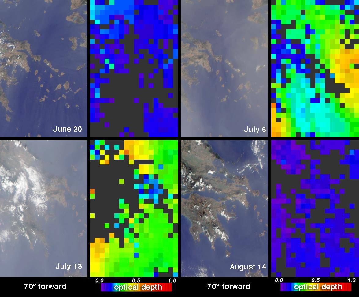
2003-07-16 |
Earth
|
Terra
|
MISR
|
1174x970x3 |

|
-
PIA04336:
-
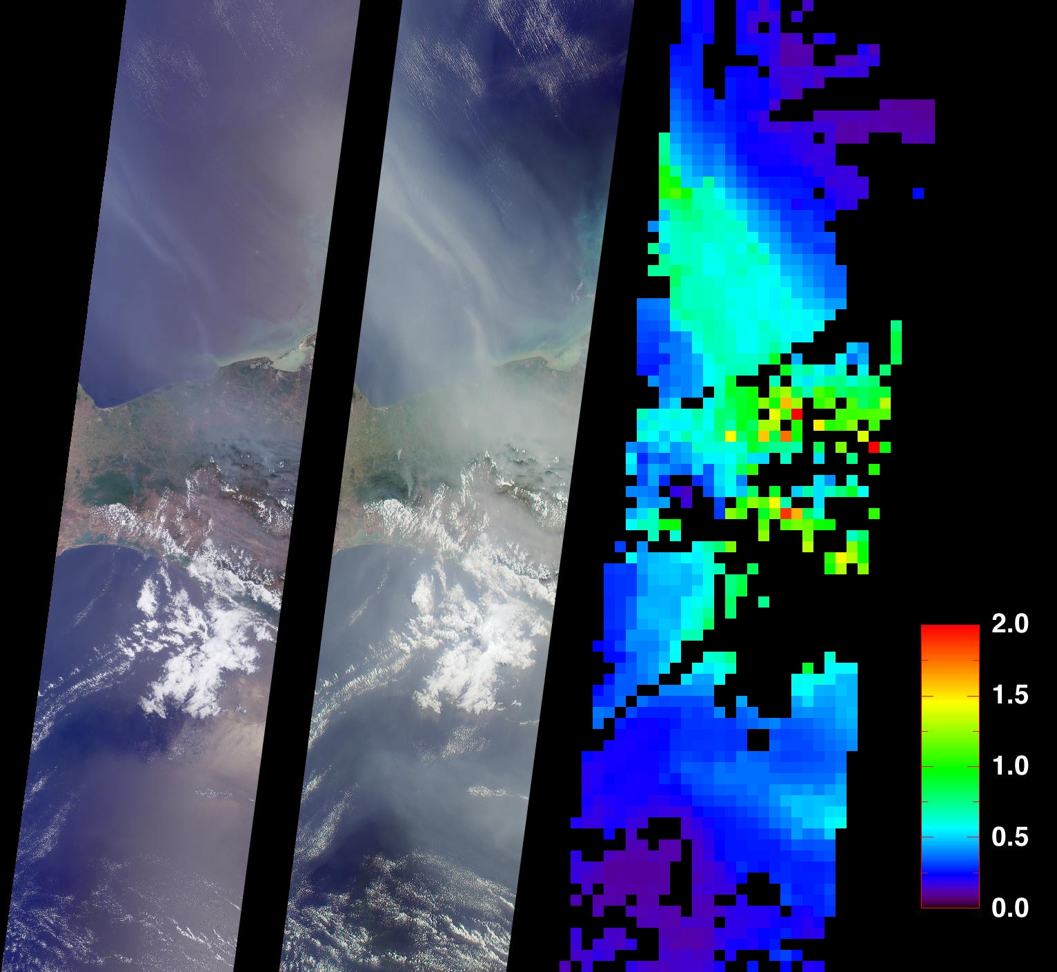
Summer Aerosols over Greece
Full Resolution:
TIFF
(1.67 MB)
JPEG
(123 kB)
|
|
|
2003-07-01 |
Earth
|
Terra
|
ASTER
|
2748x3156x3 |

|
-
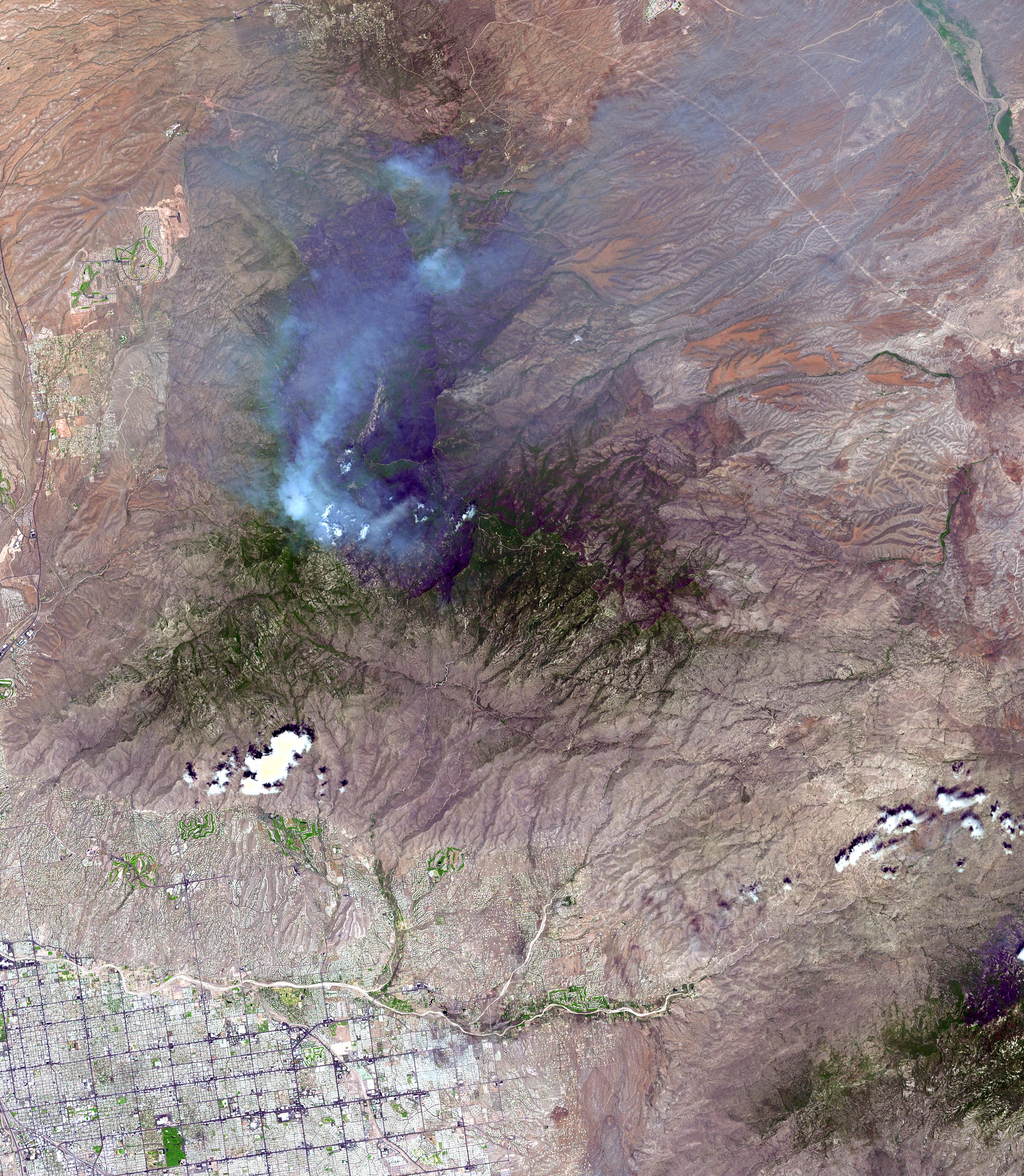
PIA04602:
-
Aspen Fire, Arizona
Full Resolution:
TIFF
(26.02 MB)
JPEG
(2.055 MB)
|
|
|
2003-06-25 |
Earth
|
Terra
|
MISR
|
1438x620x3 |

|
-
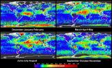
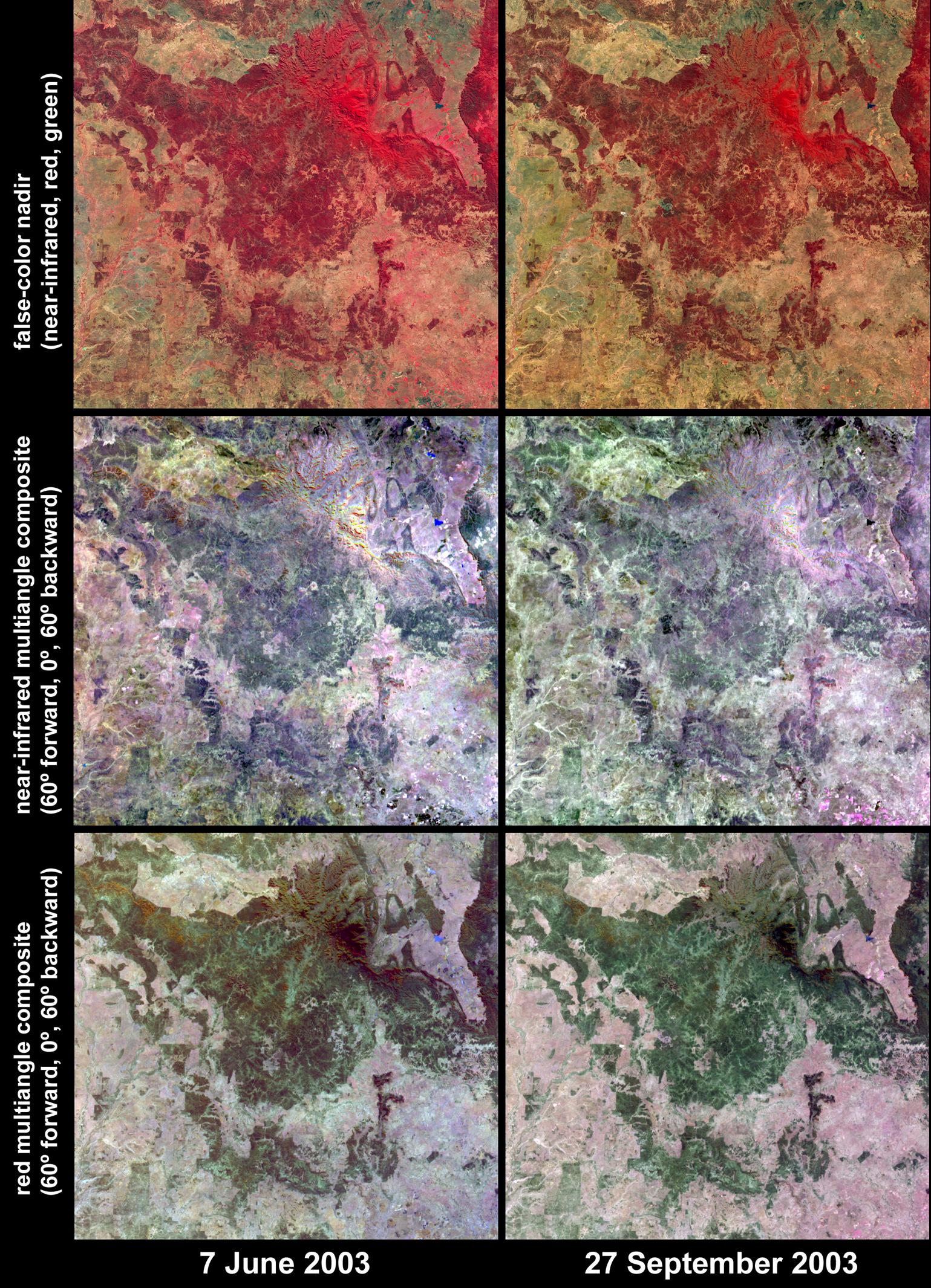
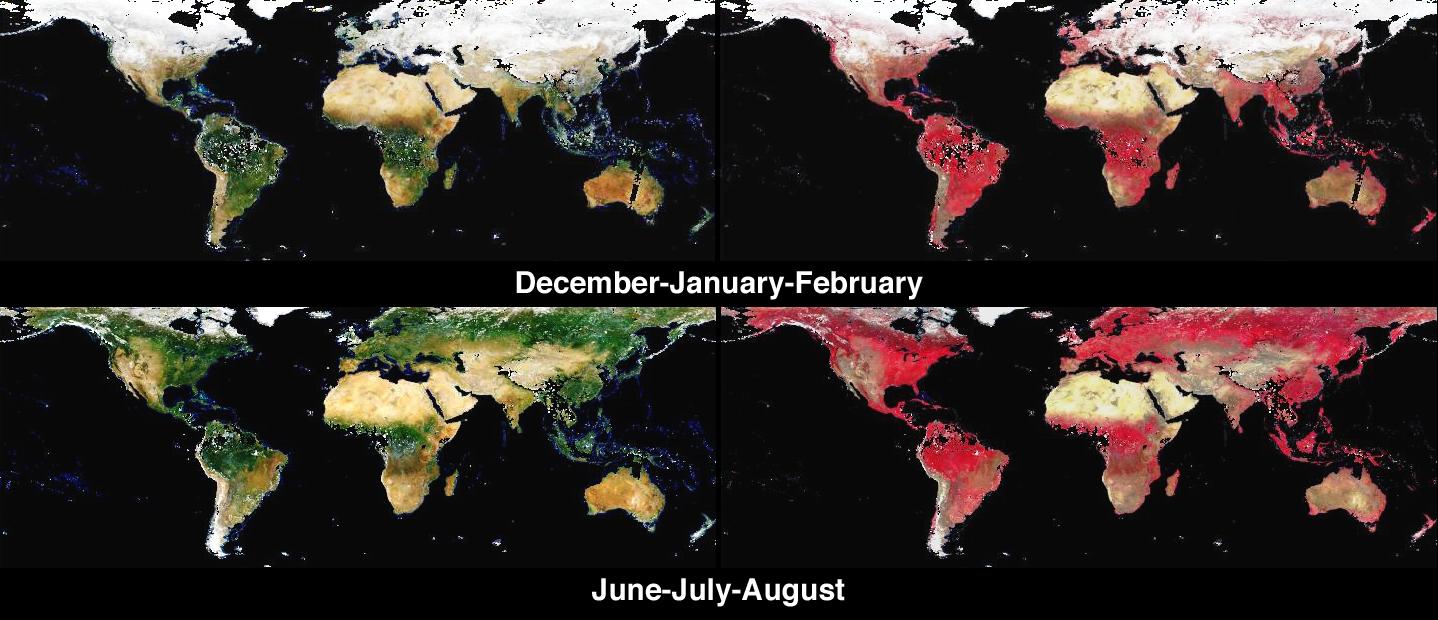
PIA04335:
-
Global and Seasonal Surface Albedos from MISR
Full Resolution:
TIFF
(1.217 MB)
JPEG
(140.9 kB)
|
|
|
2003-06-11 |
Earth
|
Terra
|
MISR
|
1797x2300x3 |
|
-
PIA04334:
-
Students and NASA Study Aerosols over Baltimore
Full Resolution:
TIFF
(7.608 MB)
JPEG
(720 kB)
|
|
|
2003-06-04 |
Earth
|
Terra
|
MISR
|
1466x896x3 |
|
-
PIA04333:
-
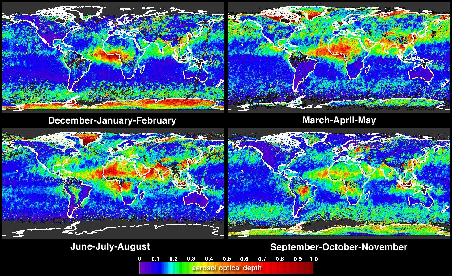
Global and Seasonal Aerosol Distributions from MISR
Full Resolution:
TIFF
(3.079 MB)
JPEG
(530.4 kB)
|
|
|
2003-06-03 |
Earth
|
Terra
|
MISR
|
400x309x3 |
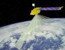
|
-
PIA04498:
-
Artist's Concept of Terra Satellite with MISR Onboard
Full Resolution:
TIFF
(297 kB)
JPEG
(22.06 kB)
|
|
|
2003-05-28 |
Earth
|
Terra
|
MISR
|
1078x1282x3 |
|
-
PIA04332:
-
Where on Earth...? MISR Mystery Image Quiz #14:
Anatahan Island
Full Resolution:
TIFF
(3.775 MB)
JPEG
(186.6 kB)
|
|
|
2003-05-21 |
Earth
|
Terra
|
MISR
|
794x858x3 |

|
-
PIA04331:
-
Oil Slicks on Lake Maracaibo, Venezuela
Full Resolution:
TIFF
(1.895 MB)
JPEG
(115.7 kB)
|
|
|
2003-05-15 |
Earth
|
Terra
|
MISR
|
2400x2400x3 |
|
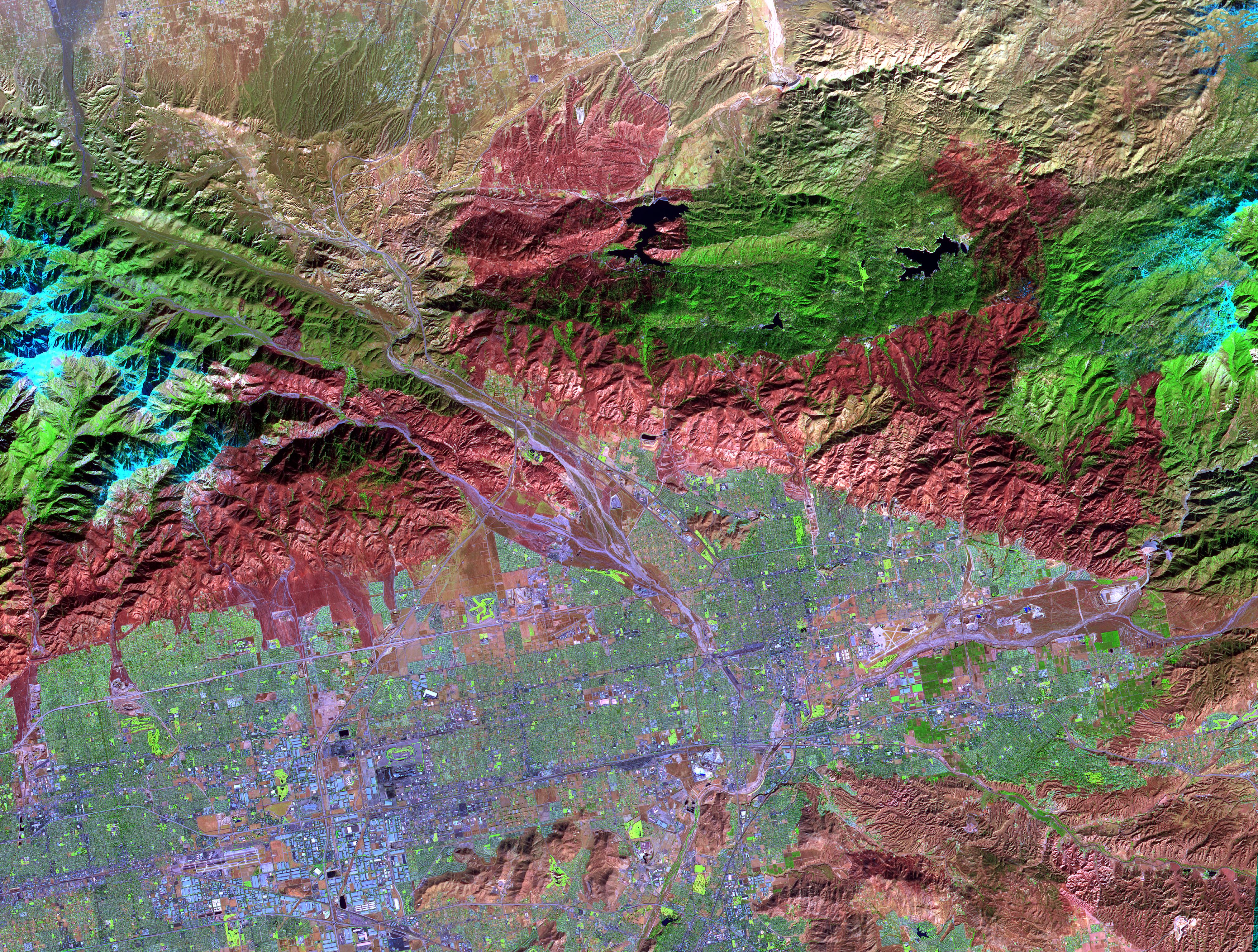
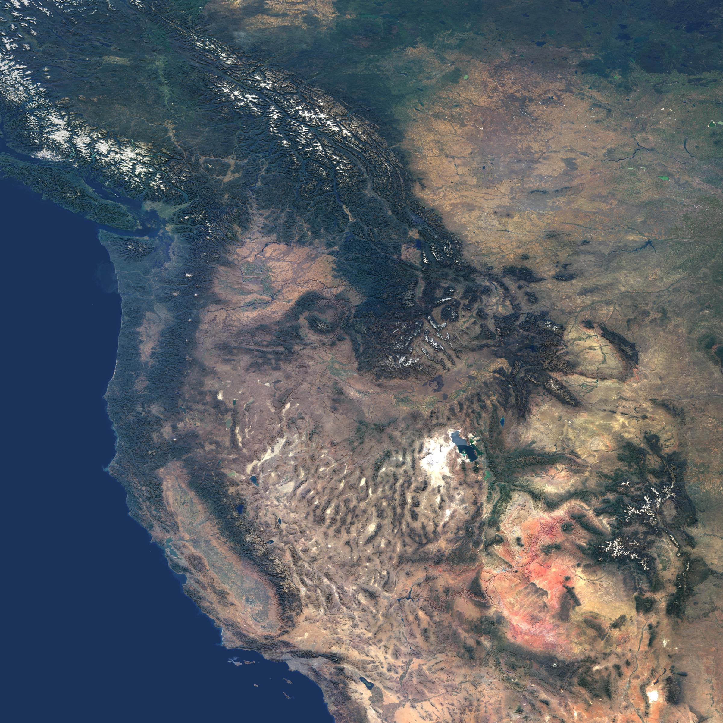
-
PIA04330:
-
Western United States and Southwestern Canada
Full Resolution:
TIFF
(14.96 MB)
JPEG
(980 kB)
|
|
|
2003-05-07 |
Earth
|
Terra
|
MISR
|
2476x2291x3 |

|
-
PIA04329:
-
Multi-layer Clouds Over the South Indian Ocean
Full Resolution:
TIFF
(17.04 MB)
JPEG
(975 kB)
|
|
|
2003-04-30 |
Earth
|
Terra
|
MISR
|
2156x3424x3 |
|
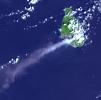
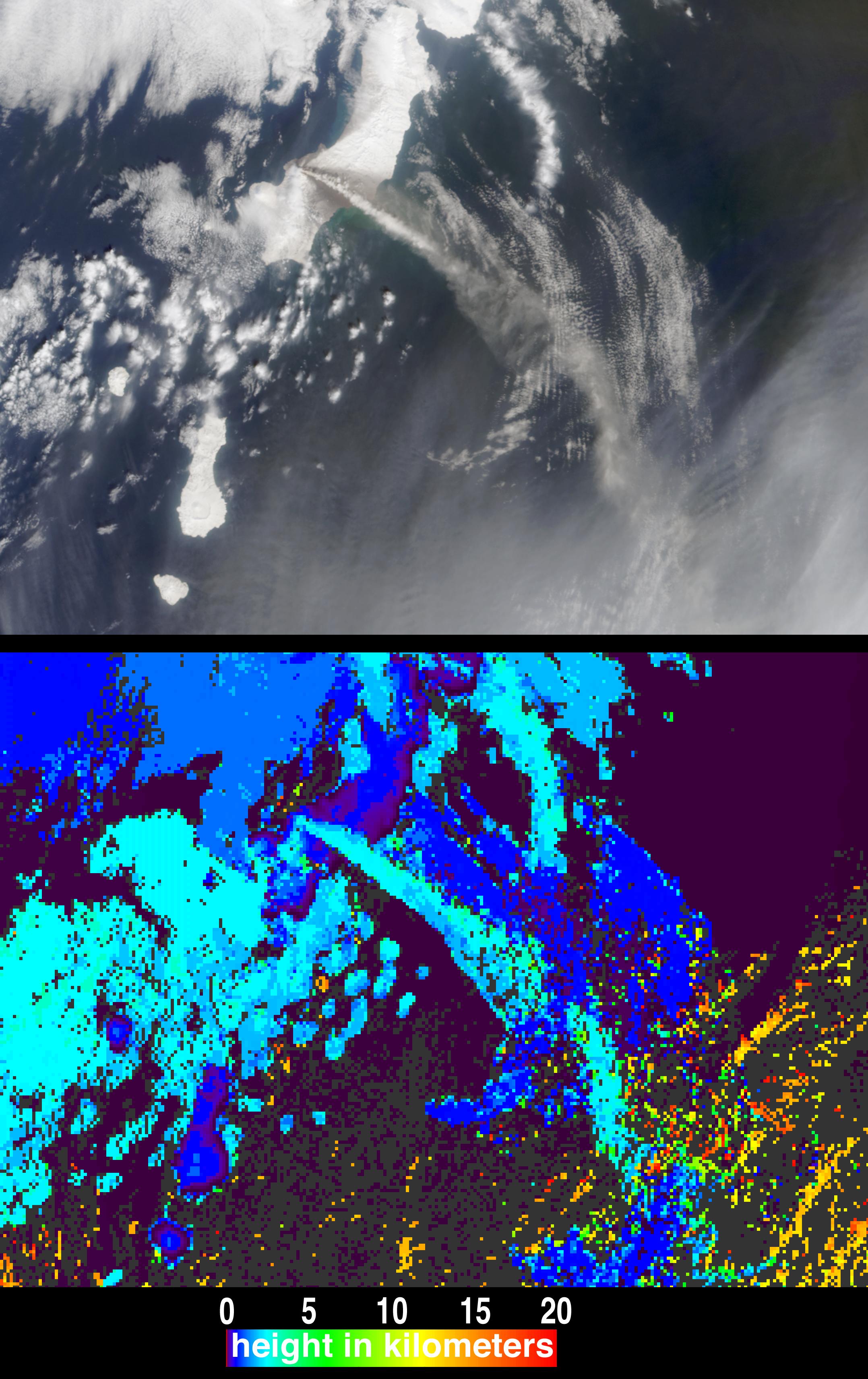
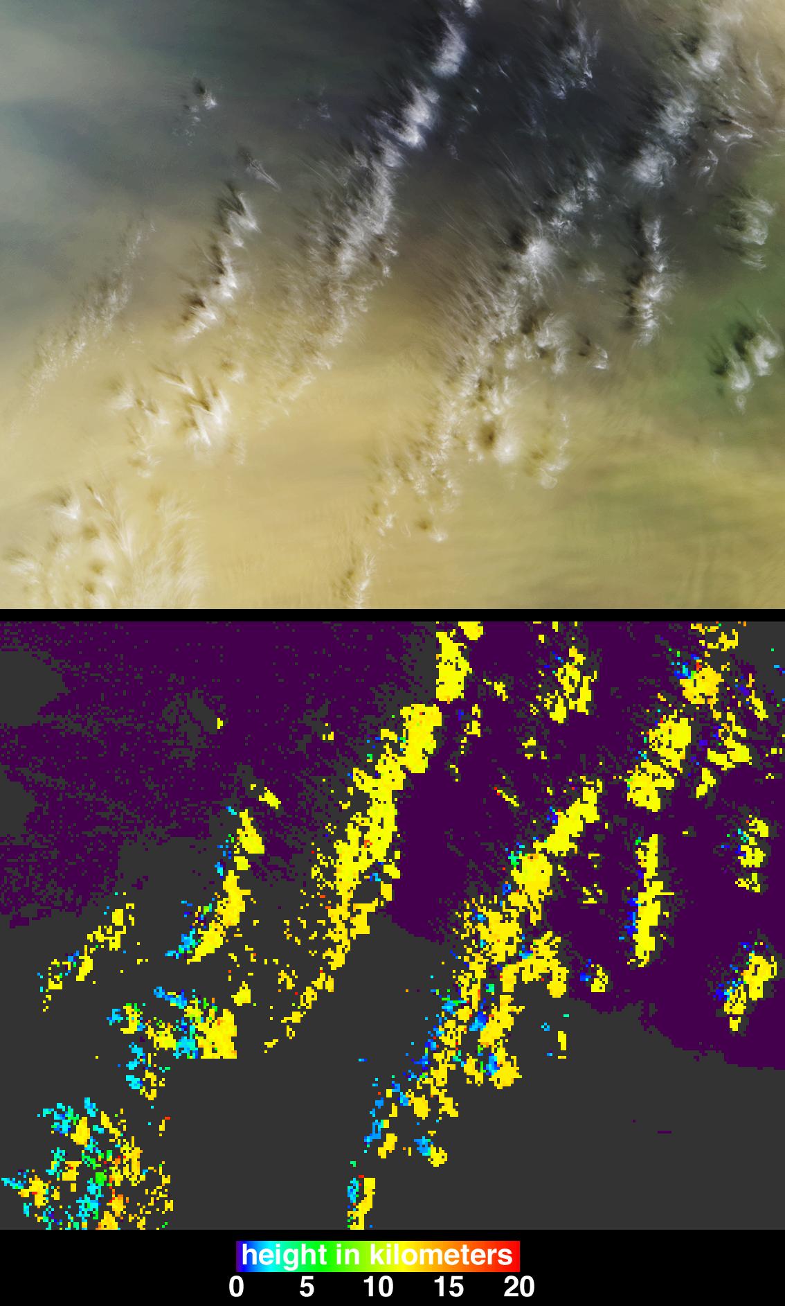
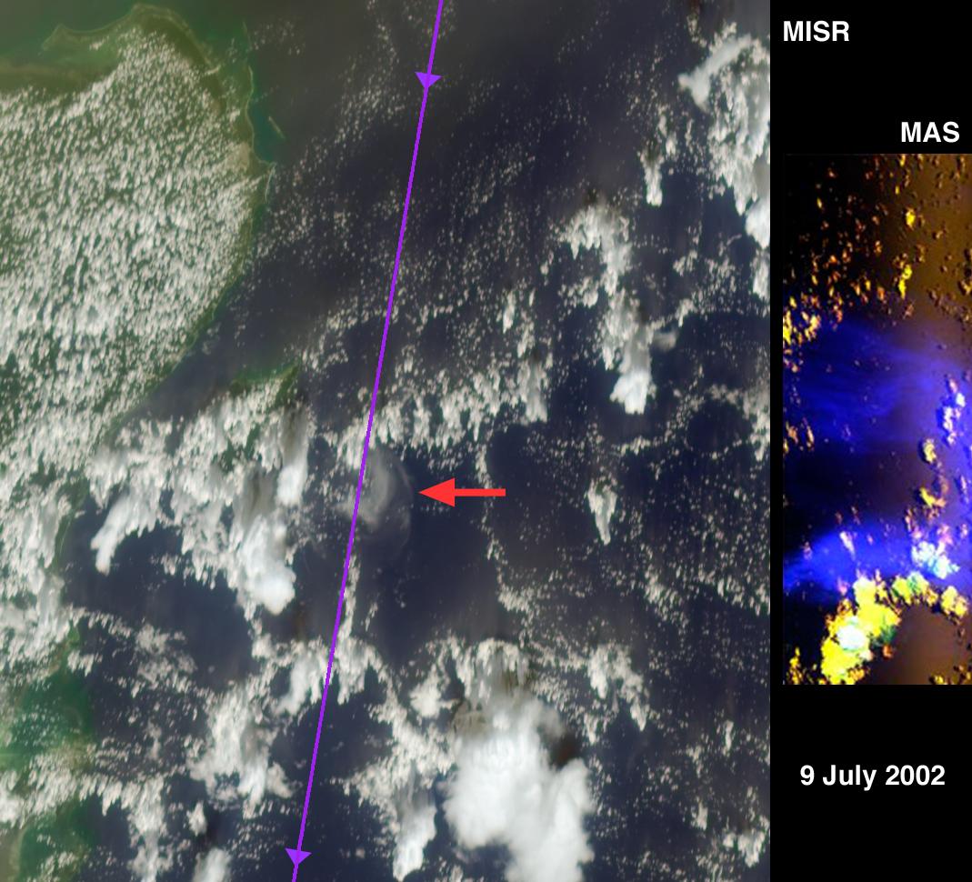
-
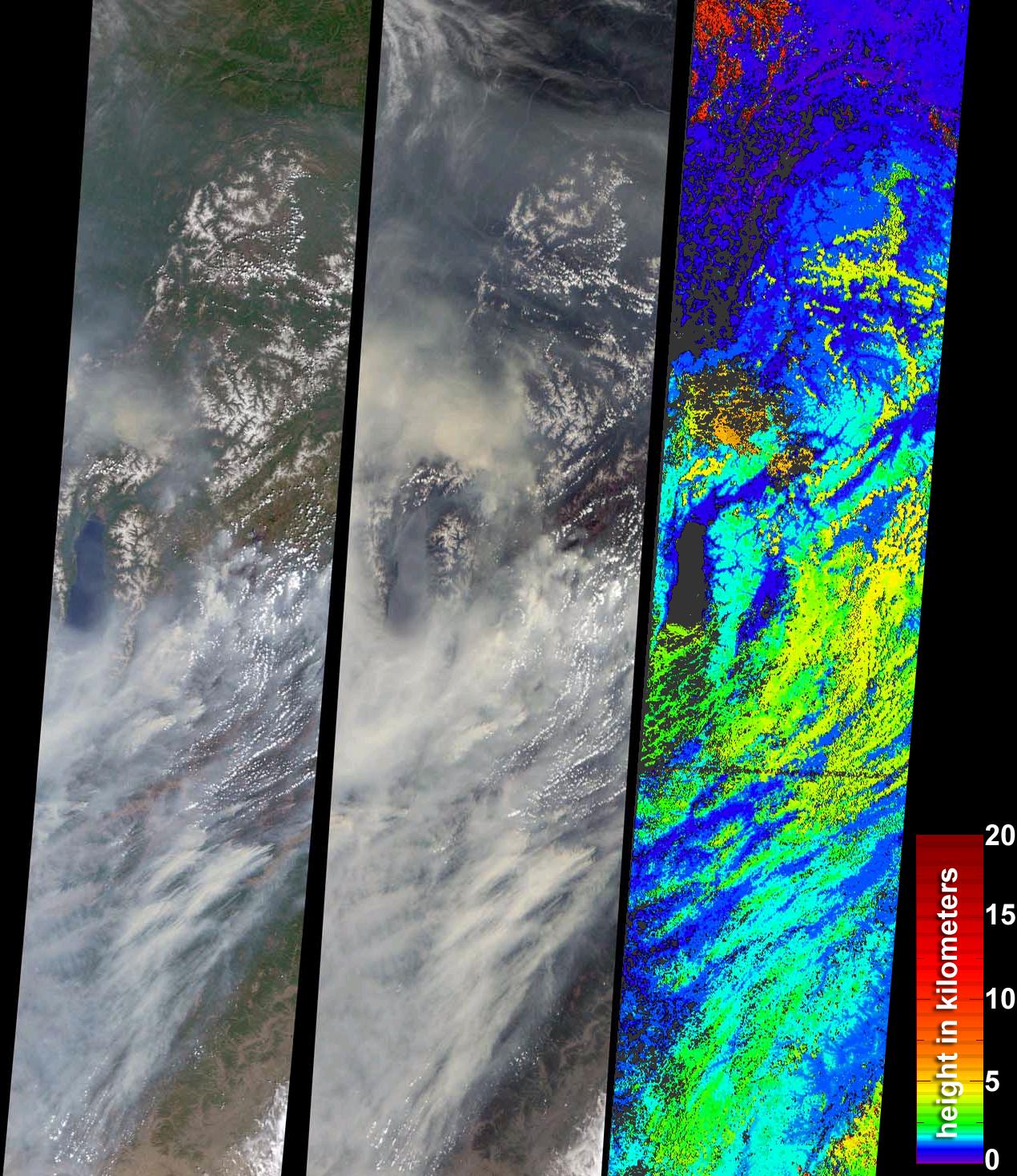
PIA04328:
-
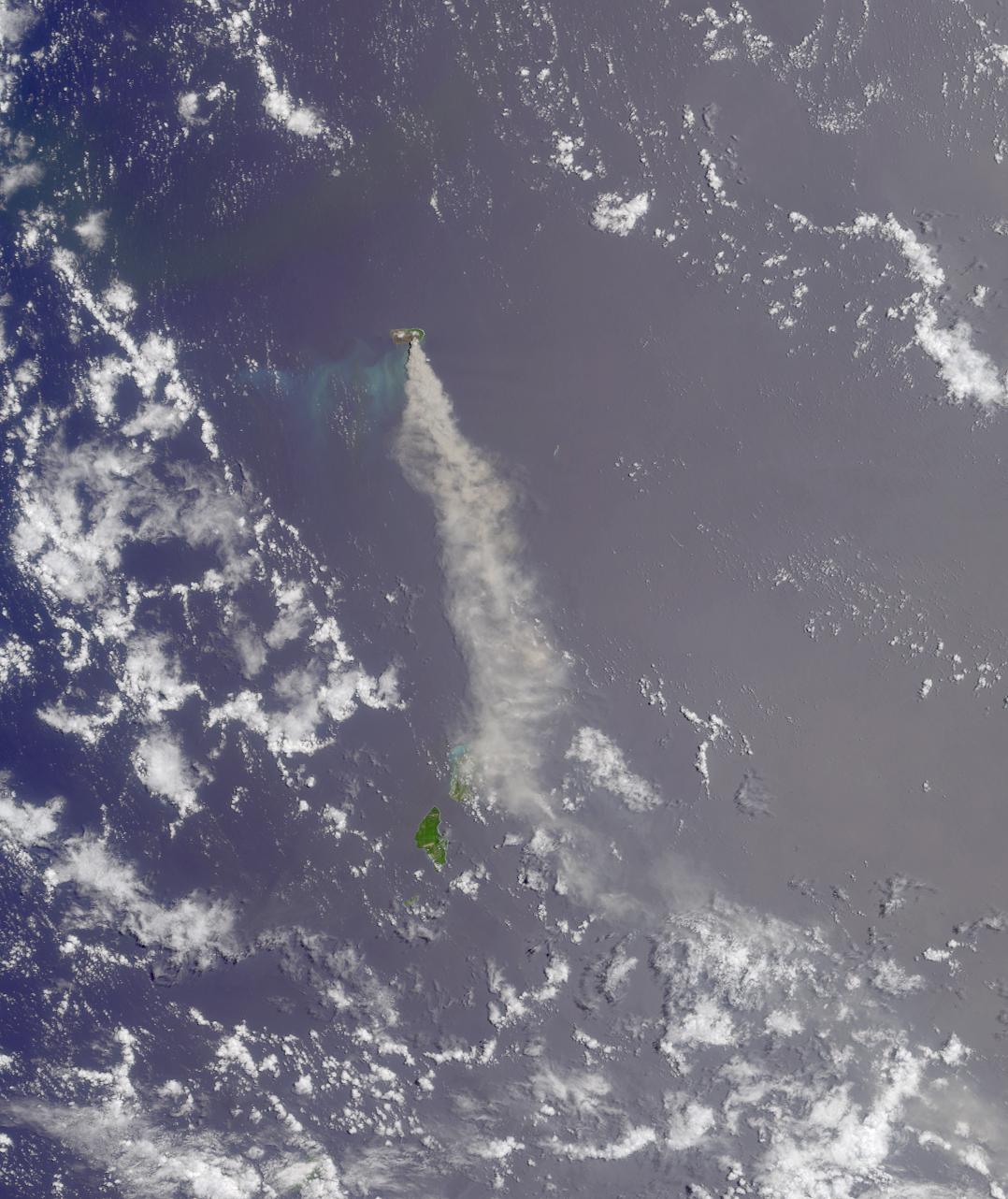
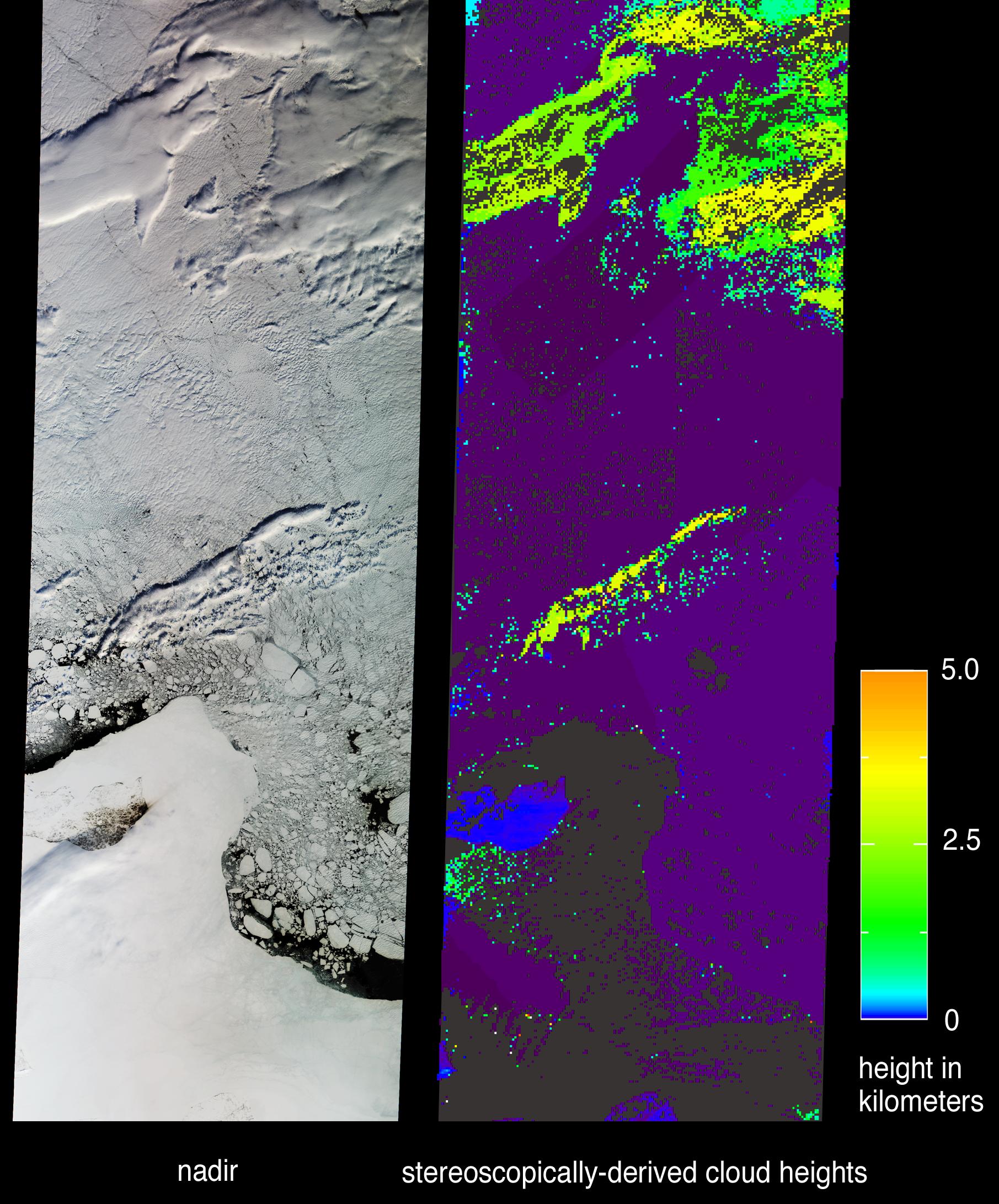
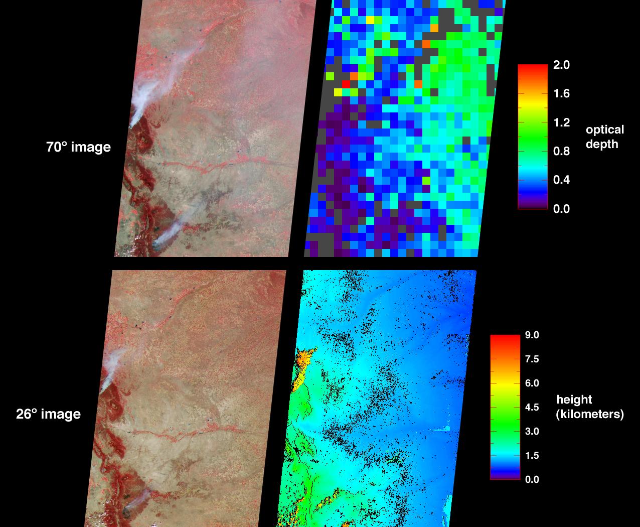
Height and Motion of the Chikurachki Eruption Plume
Full Resolution:
TIFF
(9.229 MB)
JPEG
(473.8 kB)
|
|
|
2003-04-23 |
Earth
|
Terra
|
MISR
|
1314x1756x3 |
|
-
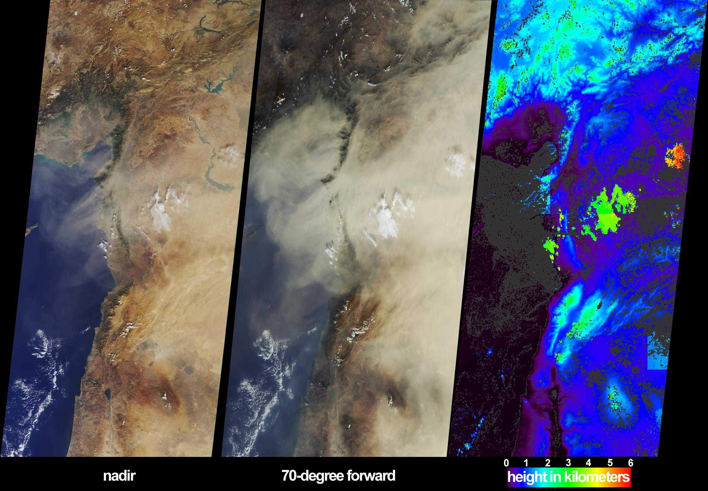
PIA04276:
-
Smoke from Asian Fires Traverses the Pacific
Full Resolution:
TIFF
(2.465 MB)
JPEG
(234.7 kB)
|
|
|
2003-04-16 |
Moon
|
Terra
|
MISR
|
1080x1050x3 |
|
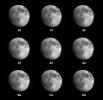
-
PIA04327:
-
MISR Views the Moon
Full Resolution:
TIFF
(427.4 kB)
JPEG
(58.07 kB)
|
|
|
2003-04-11 |
Earth
|
Terra
|
ASTER
|
3782x2037x3 |
|
-
PIA03899:
-
NASA Keeps Watch on a Potential Disaster in the Icy Andes
Full Resolution:
TIFF
(23.11 MB)
JPEG
(1.499 MB)
|
|
|
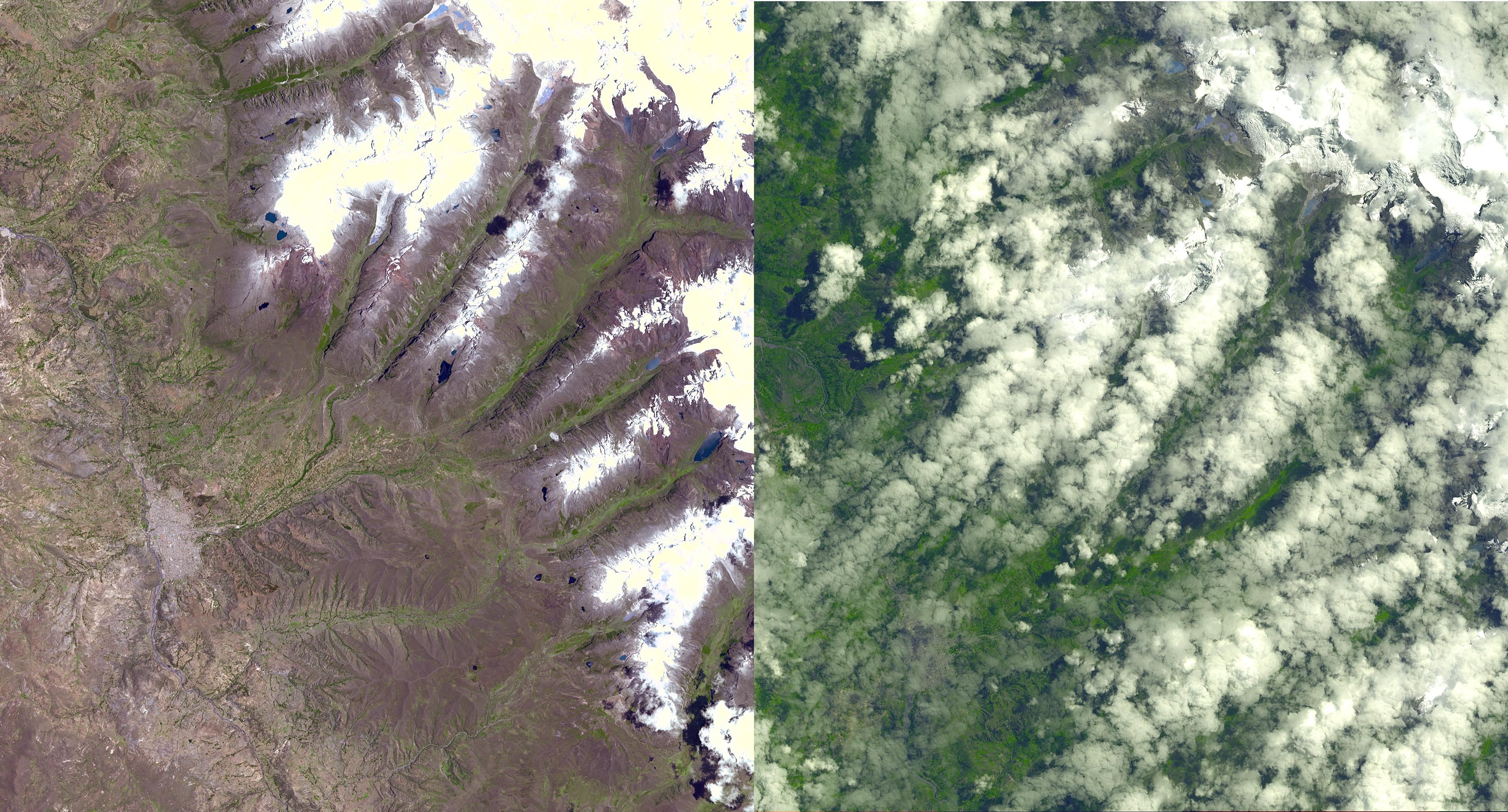
2003-04-09 |
Earth
|
Terra
|
MISR
|
1362x1824x3 |
|
-
PIA04326:
-
Oil Fire Plumes Over Baghdad
Full Resolution:
TIFF
(7.24 MB)
JPEG
(331.6 kB)
|
|
|
2003-04-02 |
Earth
|
Terra
|
MISR
|
2366x1722x3 |

|
-
PIA04325:
-
Aerosols over Central and Eastern Europe
Full Resolution:
TIFF
(7.249 MB)
JPEG
(538.7 kB)
|
|
|
2003-04-02 |
Earth
|
Terra
|
ASTER
|
2115x2139x3 |
|
-
PIA03898:
-
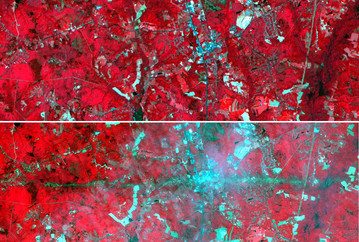
Huaraz, Peru
Full Resolution:
TIFF
(13.59 MB)
JPEG
(963.6 kB)
|
|
|
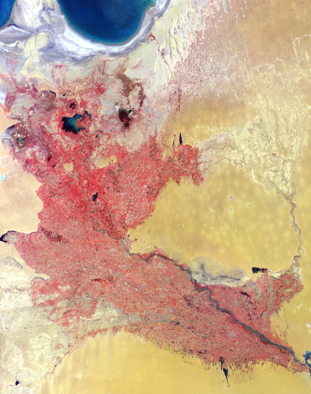
2003-03-26 |
Earth
|
Terra
|
MISR
|
1344x2219x3 |
|
-
PIA04324:
-
Windswept Shores of the Aral Sea
Full Resolution:
TIFF
(8.956 MB)
JPEG
(470.1 kB)
|
|
|
2003-03-19 |
Earth
|
Terra
|
MISR
|
1060x1344x3 |

|
-
PIA04323:
-
Where on Earth...? MISR Mystery Image Quiz #13: Western Uzbekistan and Northeastern Turkmenistan
Full Resolution:
TIFF
(4.28 MB)
JPEG
(247.6 kB)
|
|
|
2003-03-12 |
Earth
|
Terra
|
MISR
|
1134x1885x3 |
|
-
PIA04322:
-
Casting Light and Shadows on a Saharan Dust Storm
Full Resolution:
TIFF
(3.043 MB)
JPEG
(250.3 kB)
|
|
|
2003-03-05 |
Earth
|
Terra
|
MISR
|
1521x1041x3 |
|
-
PIA04321:
-
Drought and Burn Scars in Southeastern Australia
Full Resolution:
TIFF
(4.759 MB)
JPEG
(334.3 kB)
|
|
|
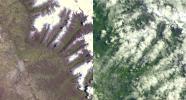
2003-02-26 |
Earth
|
Terra
|
MISR
|
691x1200x3 |
|
-
PIA04320:
-
Seasonal Surface Changes in Namibia and Central Angola
Full Resolution:
TIFF
(2.107 MB)
JPEG
(111.5 kB)
|
|
|
2003-02-19 |
Earth
|
Terra
|
MISR
|
1218x1896x3 |

|
-
PIA04319:
-
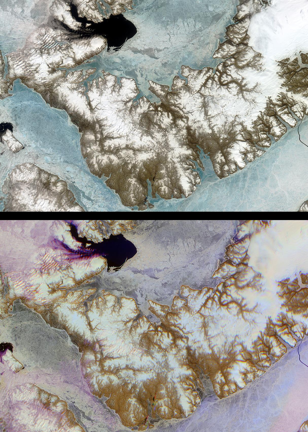
Lutzow-Holm Bay and the Shirase Glacier, Antarctica
Full Resolution:
TIFF
(6.023 MB)
JPEG
(290.1 kB)
|
|
|
2003-02-12 |
Earth
|
Terra
|
MISR
|
2070x2288x3 |
|
-
PIA03897:
-
Smoke over Nigeria and the Gulf of Guinea
Full Resolution:
TIFF
(5.98 MB)
JPEG
(681.2 kB)
|
|
|
2003-02-05 |
Earth
|
Terra
|
MISR
|
782x1146x3 |
|
-
PIA03895:
-
Dewatering Effects from the Gujarat earthquake
Full Resolution:
TIFF
(2.692 MB)
JPEG
(143.6 kB)
|
|
|
2003-01-29 |
Earth
|
Terra
|
MISR
|
3200x1420x3 |

|
-
PIA04303:
-
Aerosols over Houston and Galveston Bay
Full Resolution:
TIFF
(7.279 MB)
JPEG
(305 kB)
|
|
|
2003-01-22 |
Earth
|
Terra
|
MISR
|
1632x1869x3 |
|
-
PIA04302:
-
Fires in the Australian Capital Territory
Full Resolution:
TIFF
(4.485 MB)
JPEG
(560.5 kB)
|
|
|
2003-01-18 |
Earth
|
Terra
|
ASTER
|
3685x2635x3 |
|
-
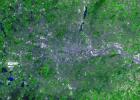
PIA04301:
-
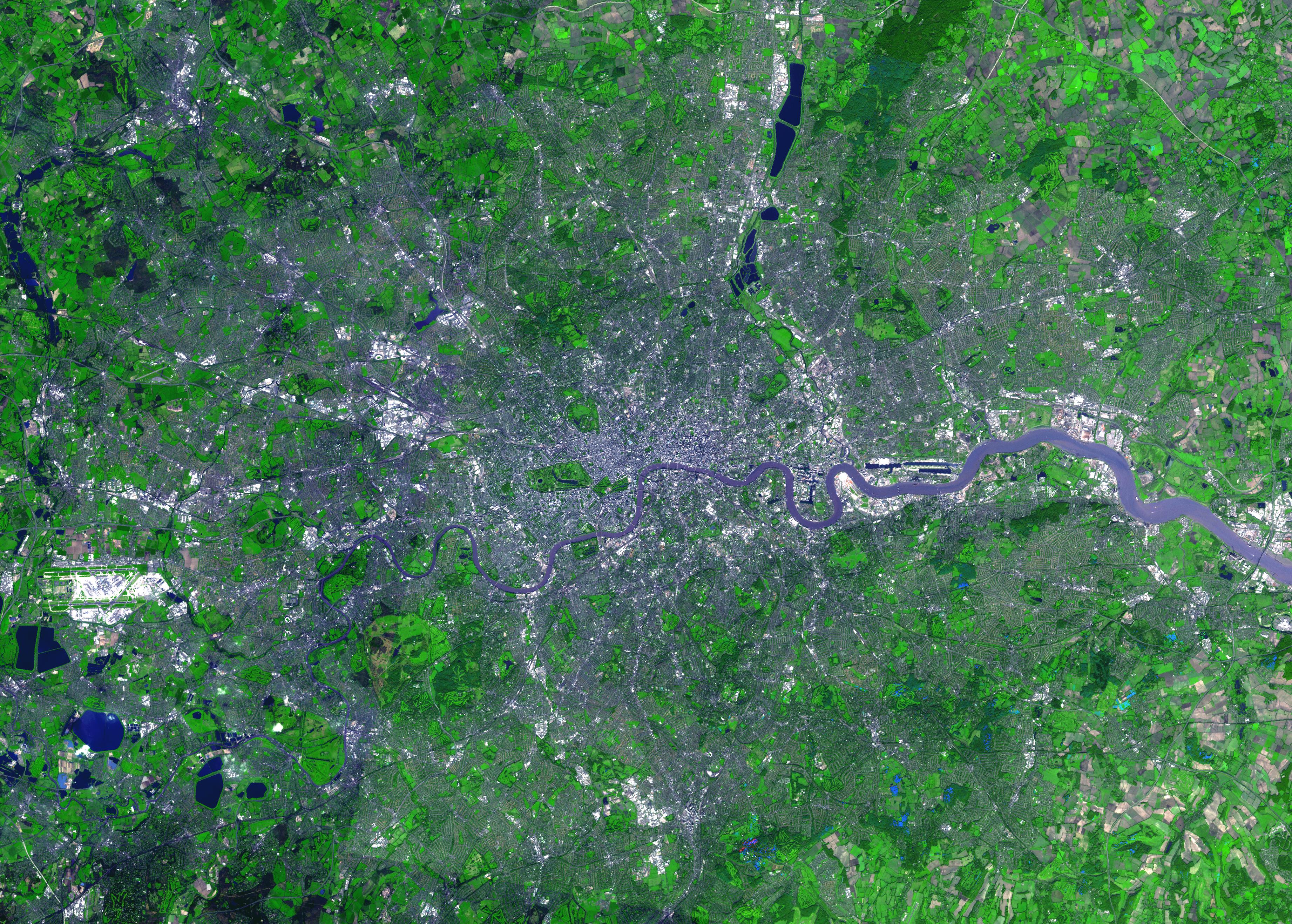
London, England
Full Resolution:
TIFF
(23.03 MB)
JPEG
(2.731 MB)
|
|
|
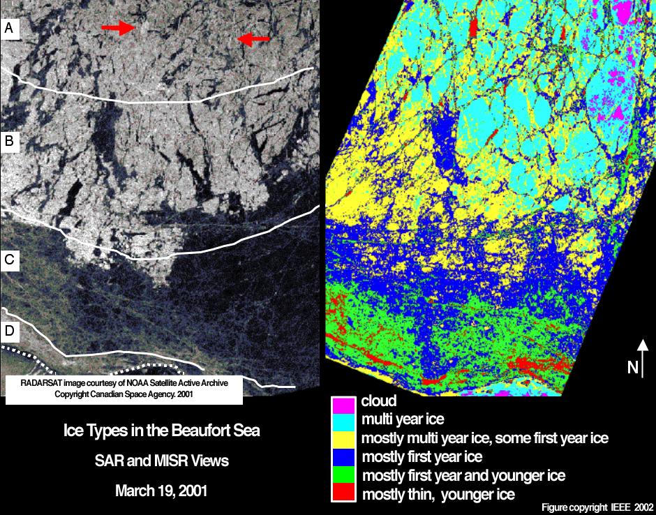
2003-01-15 |
Earth
|
Terra
|
MISR
|
940x738x3 |
|
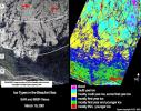
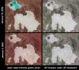
-
PIA04300:
-
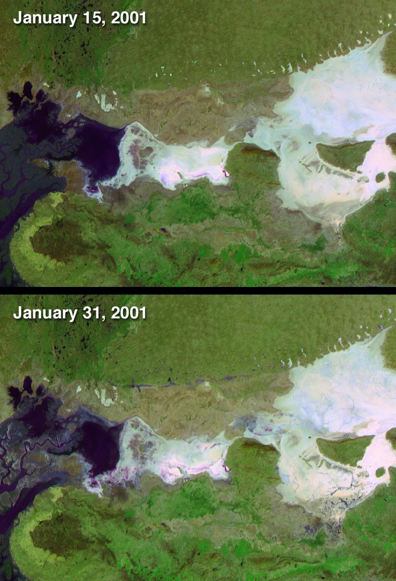
Ice Types in the Beaufort Sea, Alaska
Full Resolution:
TIFF
(971.8 kB)
JPEG
(215.5 kB)
|
|
|
2003-01-08 |
Earth
|
Terra
|
MISR
|
1559x1368x3 |
|
-
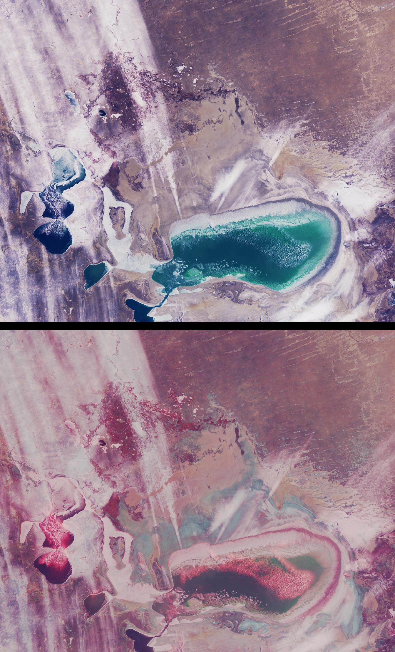
PIA03749:
-
Salt Playas of the Bolivian Altiplano
Full Resolution:
TIFF
(5.821 MB)
JPEG
(270.9 kB)
|
|
|
2003-01-08 |
Earth
|
Terra
|
ASTER
|
1914x1960x3 |
|
-
PIA03893:
-
Anti-Atlas Mountains, Morocco
Full Resolution:
TIFF
(11.27 MB)
JPEG
(1.133 MB)
|
|
|
2003-01-02 |
Earth
|
Terra
|
MISR
|
1522x1789x3 |
|
-
PIA03748:
-
Stratified Arctic Clouds
Full Resolution:
TIFF
(8.183 MB)
JPEG
(436.8 kB)
|
|
|
2002-12-23 |
Earth
|
Terra
|
ASTER
|
700x910x3 |

|
-
PIA03891:
-
Santa Claus, Ga./Ind.
Full Resolution:
TIFF
(1.914 MB)
JPEG
(205.6 kB)
|
|
|
2002-12-18 |
Earth
|
Terra
|
MISR
|
889x906x3 |
|
-
PIA03747:
-
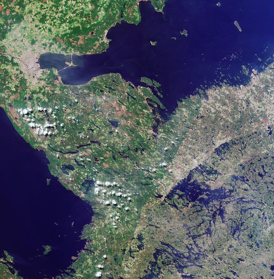
Where on Earth...? MISR Mystery Image Quiz #12:
Border between Russia and Finland
Full Resolution:
TIFF
(2.419 MB)
JPEG
(204.7 kB)
|
|
|
2002-12-13 |
Earth
|
Terra
|
ASTER
|
3441x1982x3 |

|
-
PIA03890:
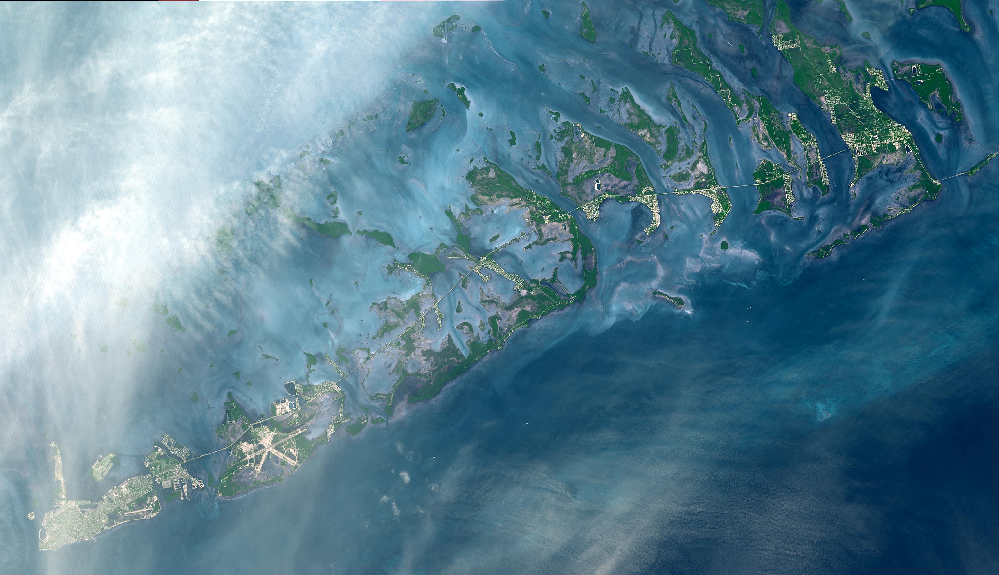
-
Florida Keys
Full Resolution:
TIFF
(20.46 MB)
JPEG
(724 kB)
|
|
|
2002-12-11 |
Earth
|
Terra
|
MISR
|
1260x1014x3 |
|
-
PIA03746:
-
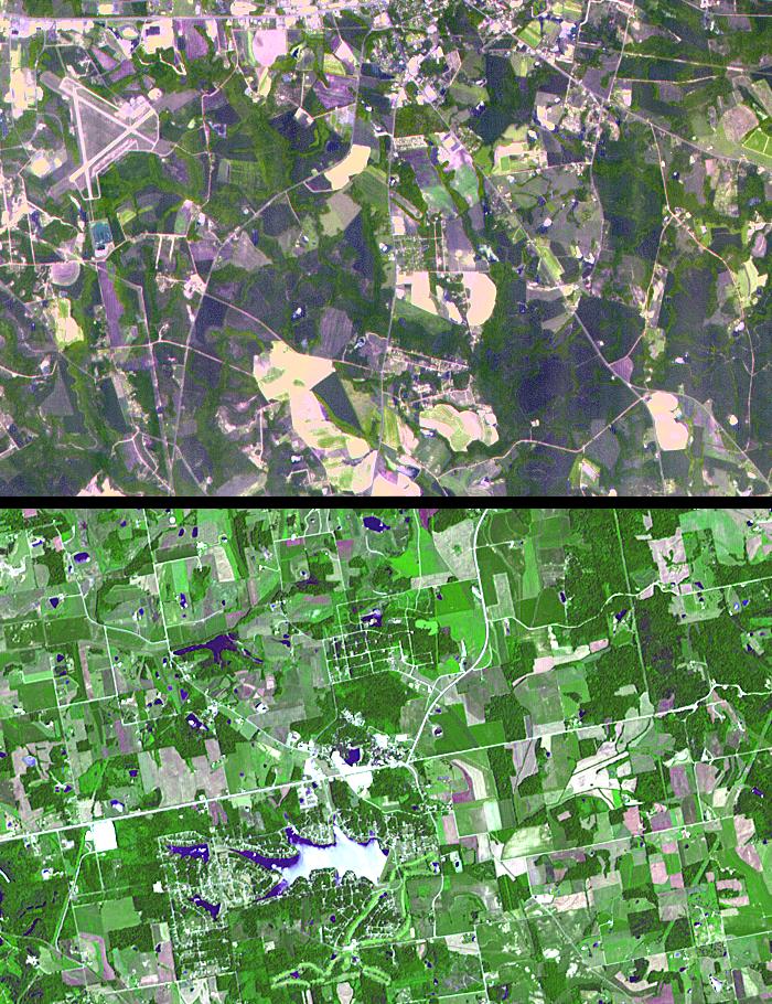
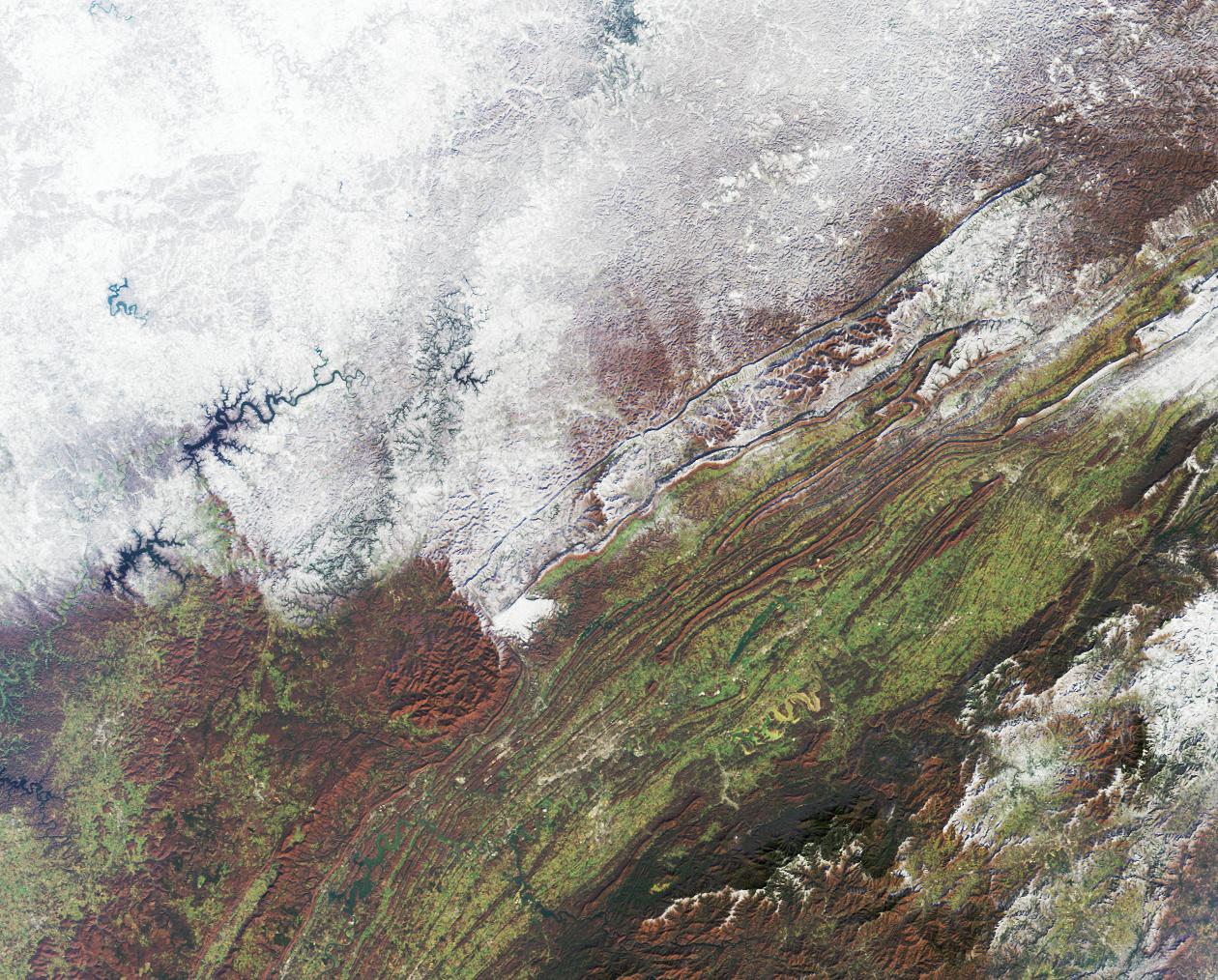
Snowfall in Southern Appalachia
Full Resolution:
TIFF
(3.837 MB)
JPEG
(345.9 kB)
|
|
|
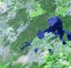
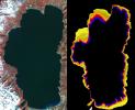
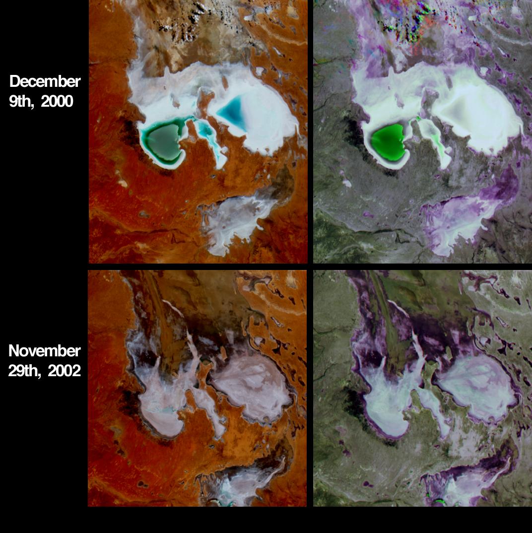
2002-12-04 |
Earth
|
Terra
|
MISR
|
1072x1074x3 |

|
-
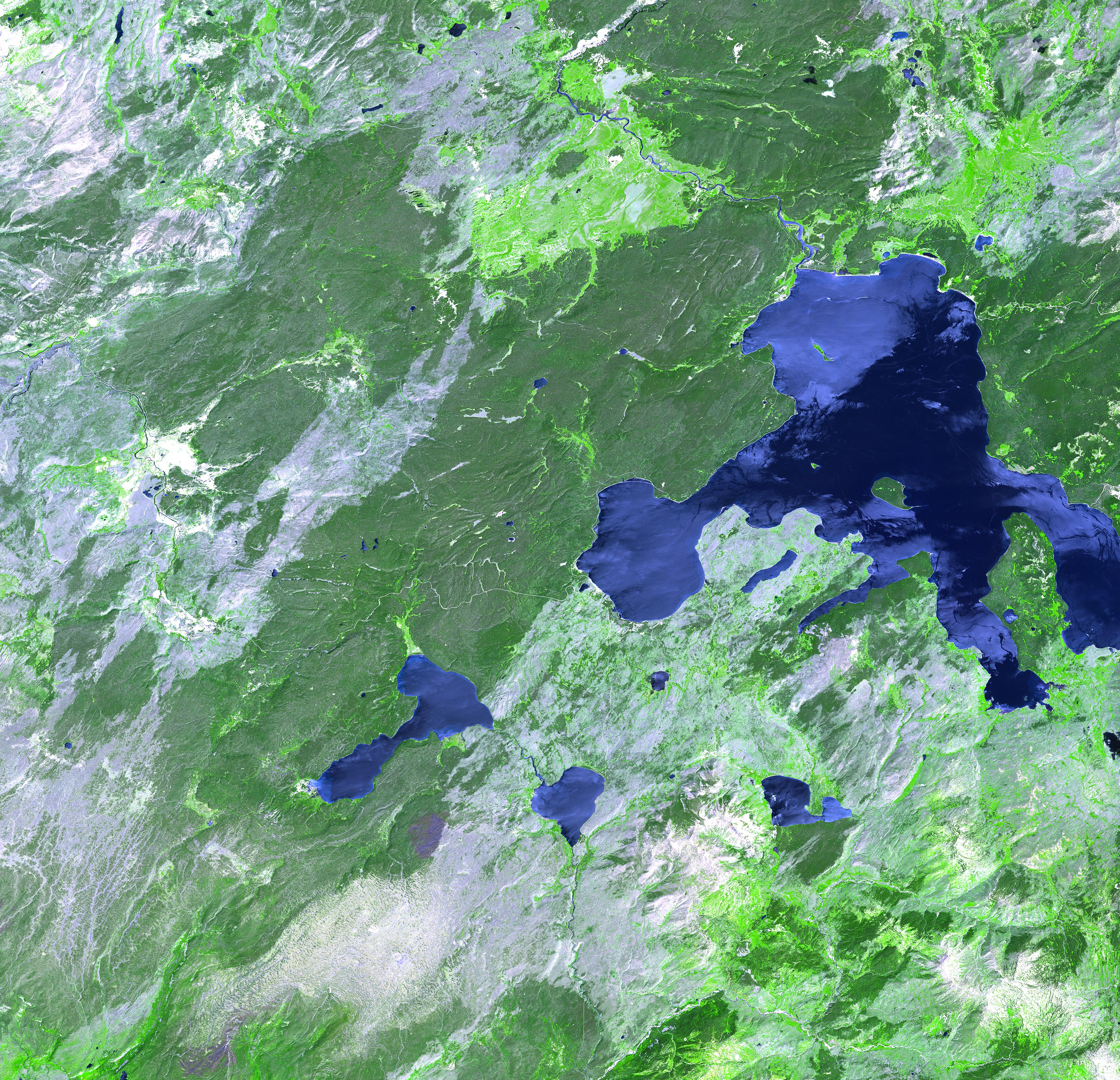
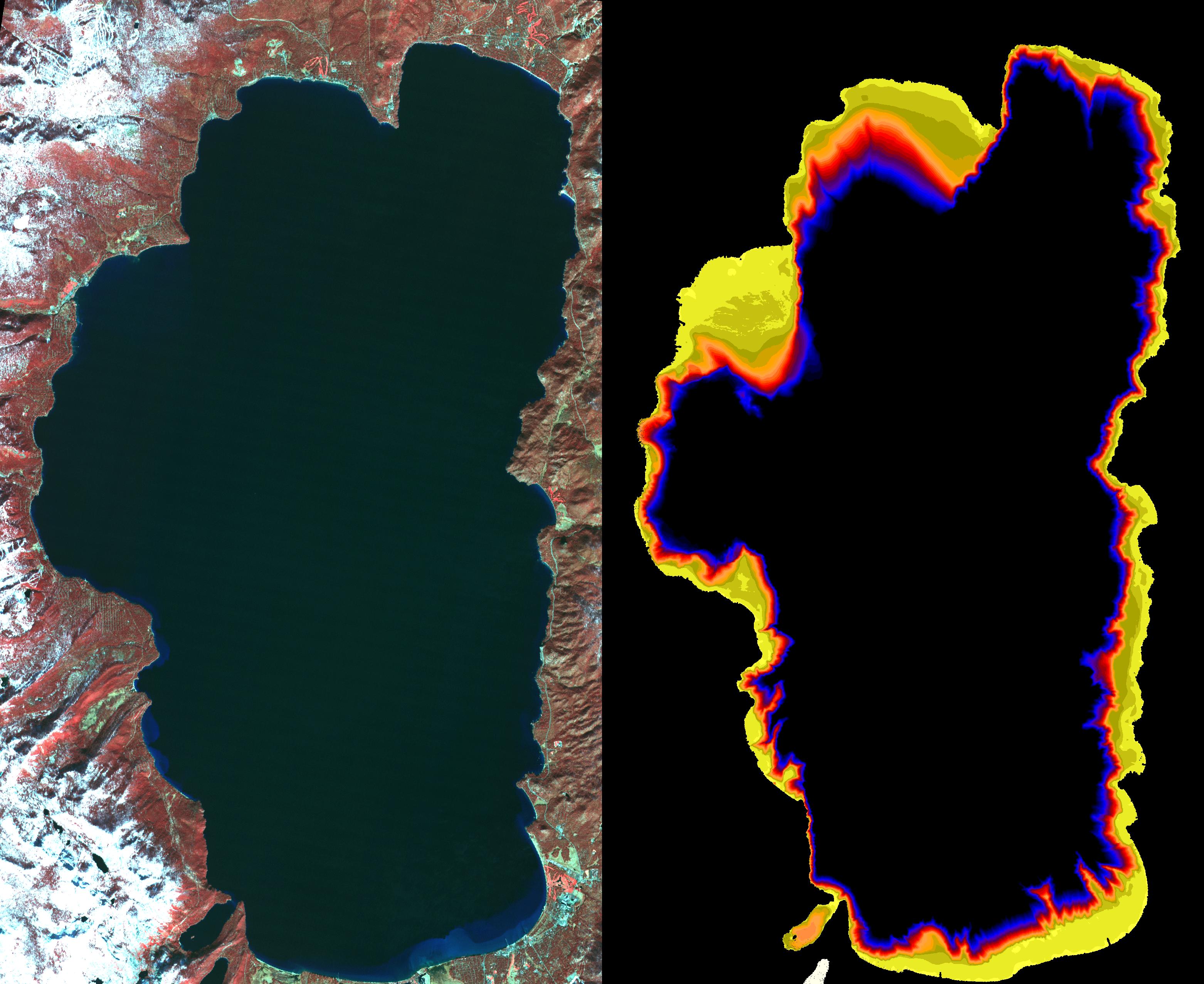
PIA03736:
-
Fluctuations of Lake Eyre, South Australia
Full Resolution:
TIFF
(3.036 MB)
JPEG
(160.9 kB)
|
|
|
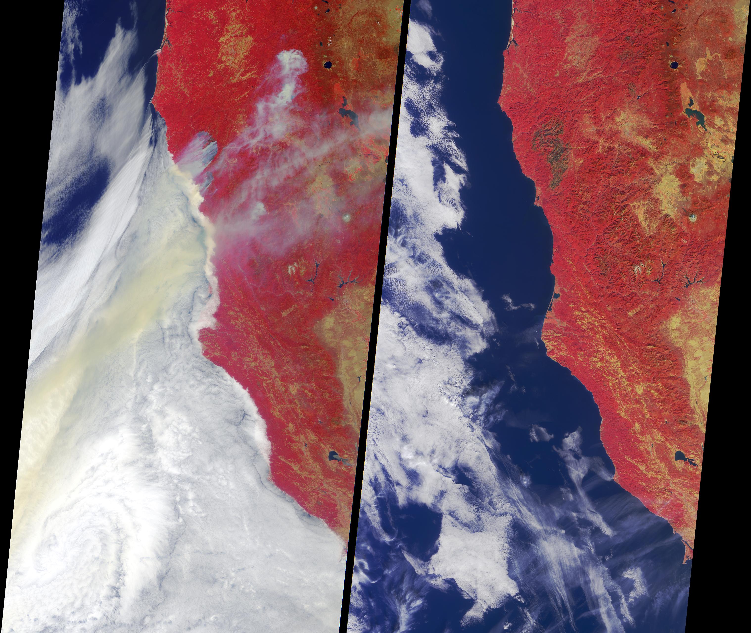
2002-11-27 |
Earth
|
Terra
|
MISR
|
3036x2560x3 |
|
-
PIA03735:
-
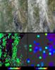
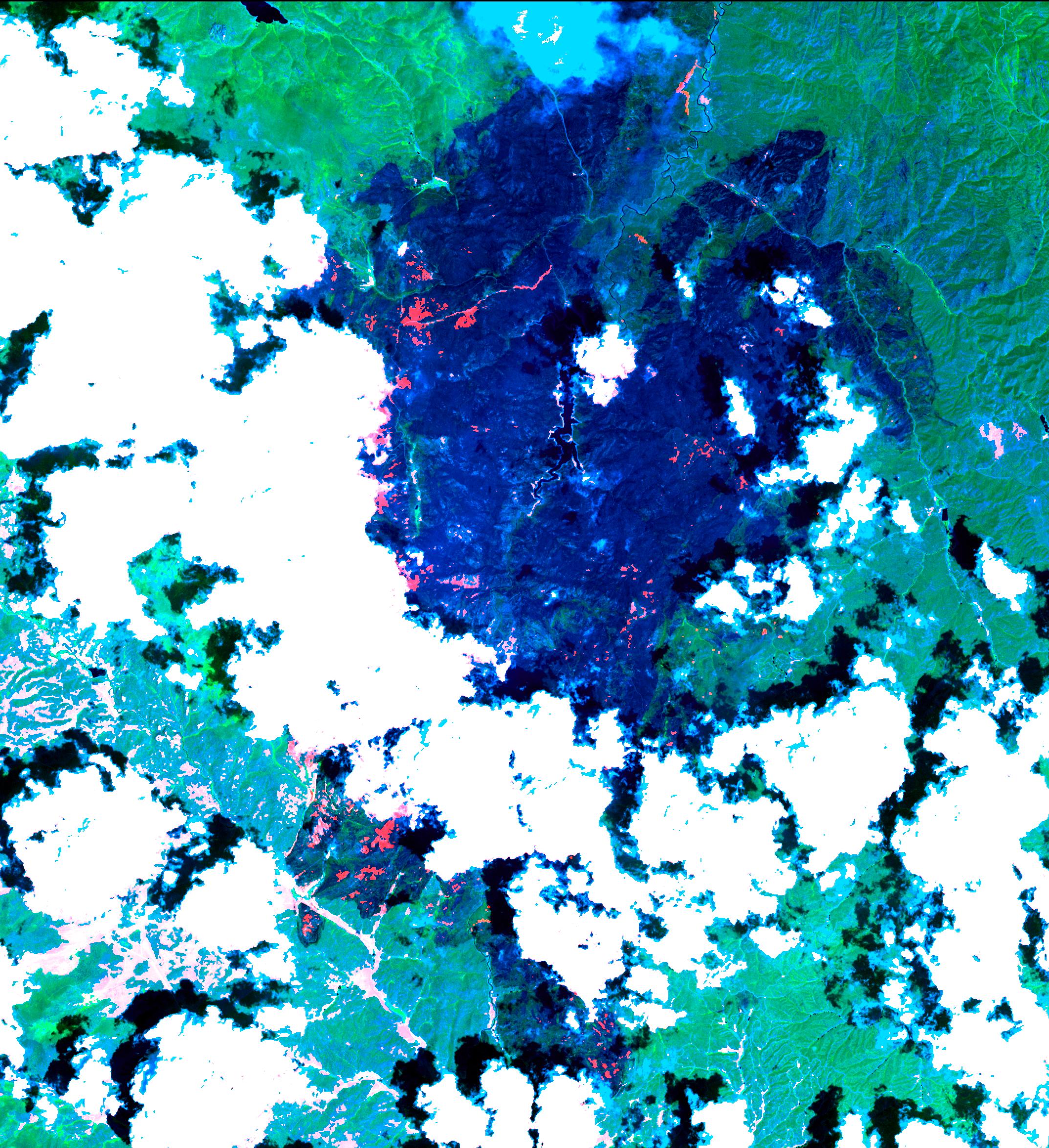
The Biscuit Wildfire
Full Resolution:
TIFF
(20.79 MB)
JPEG
(983.6 kB)
|
|
|
2002-11-20 |
Earth
|
Terra
|
MISR
|
2207x1900x3 |
|
-
PIA03734:
-
Clouds and Ice of the Lambert-Amery System, East Antarctica
Full Resolution:
TIFF
(10.41 MB)
JPEG
(737.3 kB)
|
|
|
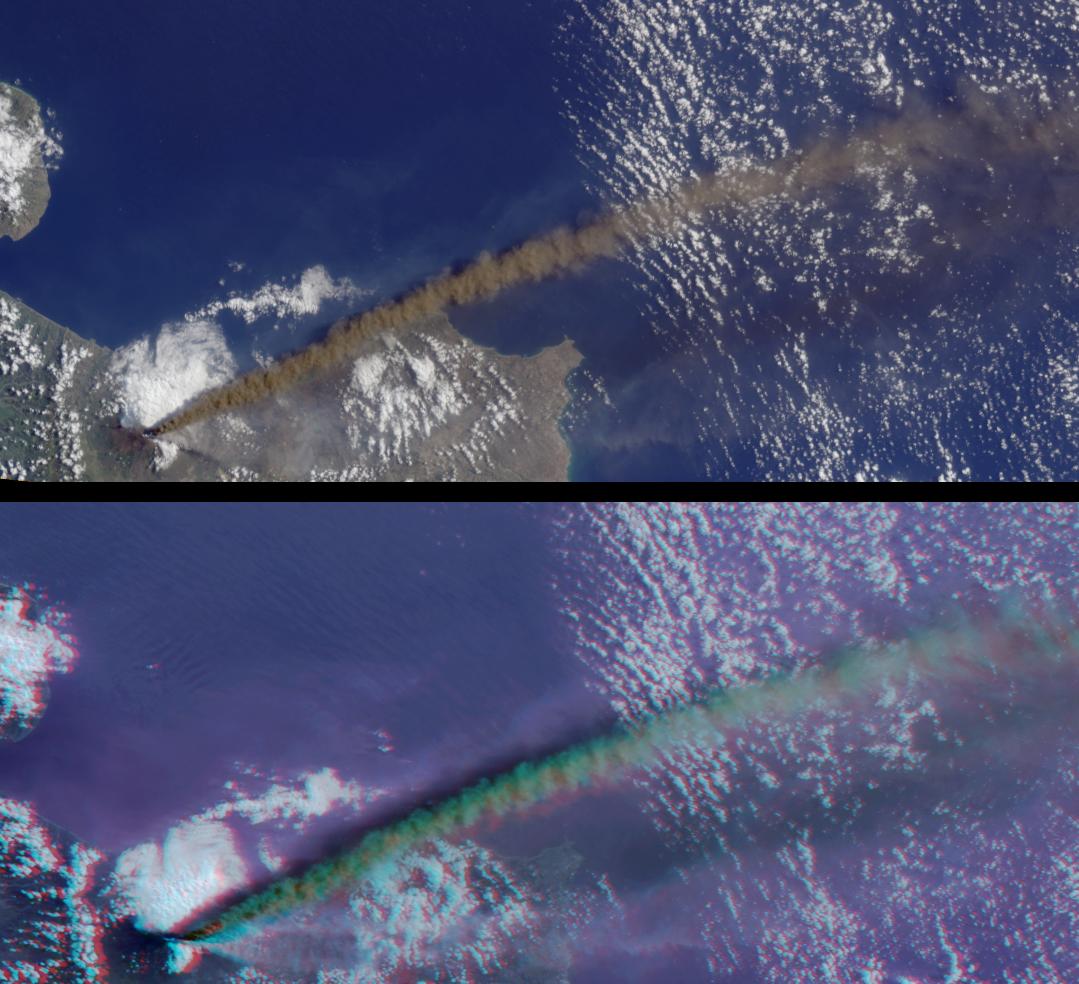
2002-11-13 |
Earth
|
Terra
|
MISR
|
1079x984x3 |

|
-
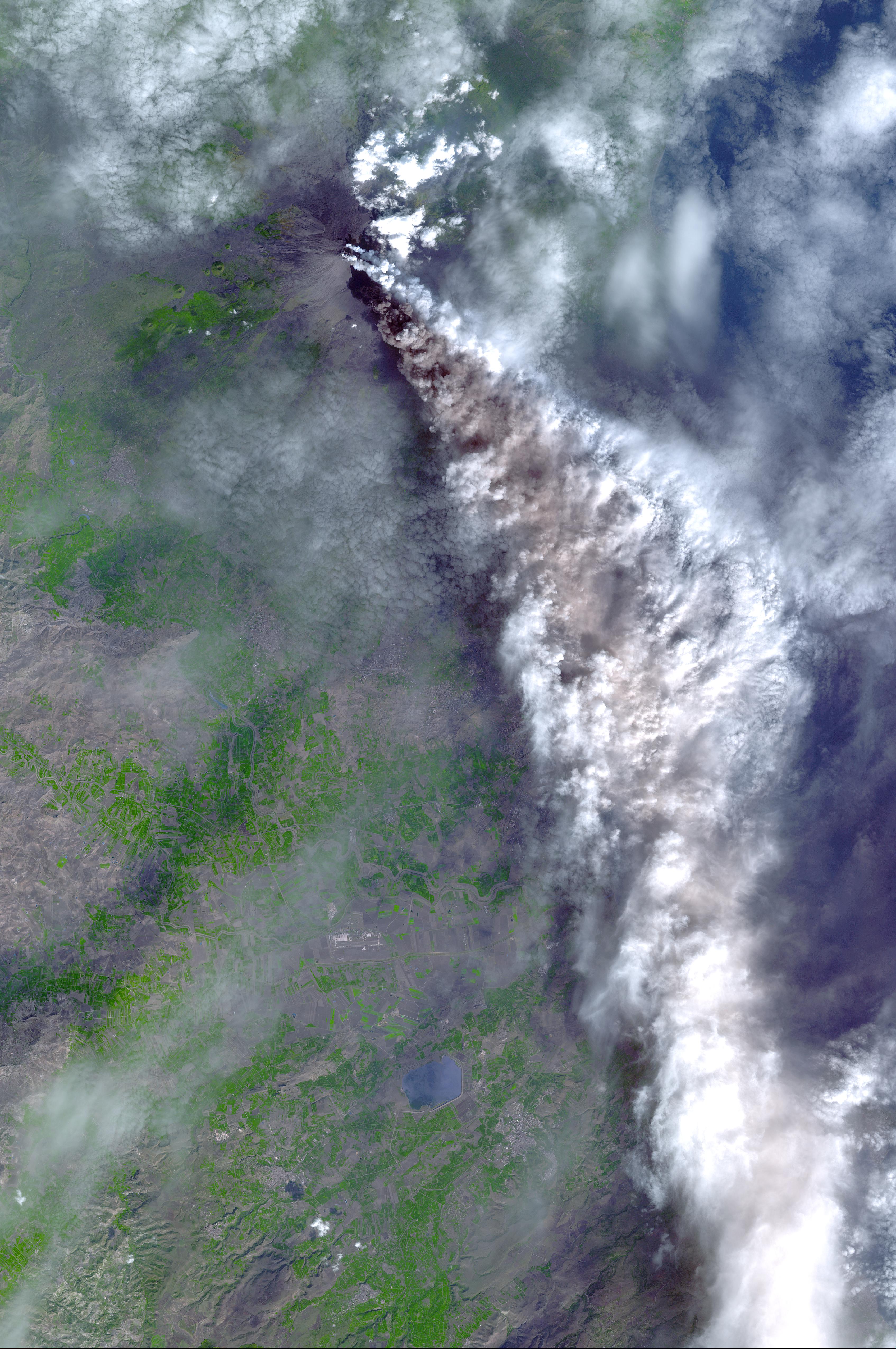
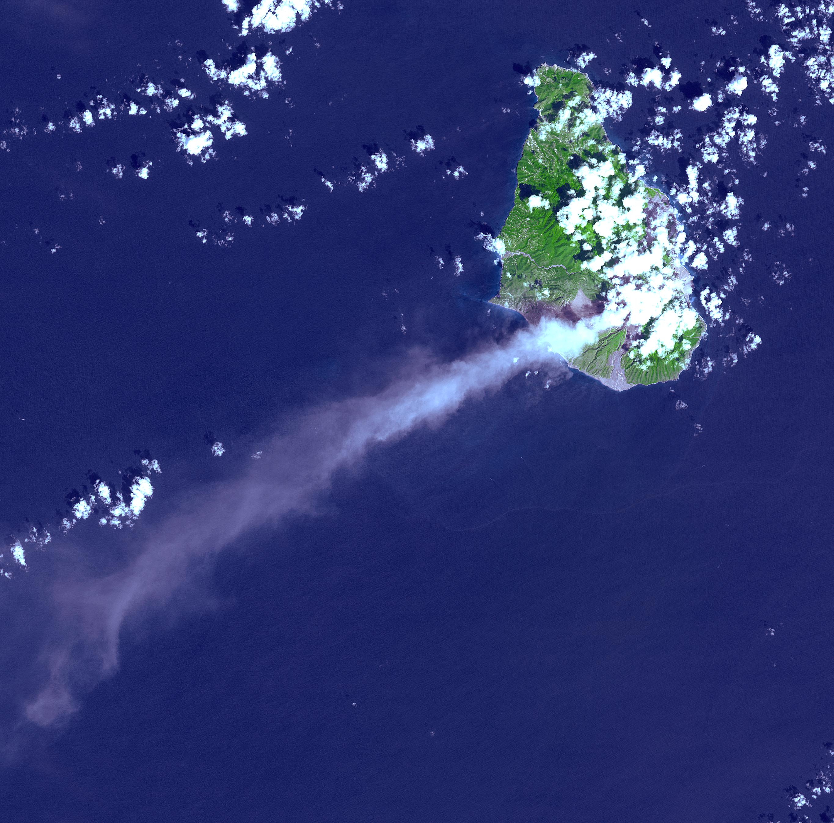
PIA03733:
-
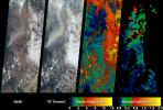
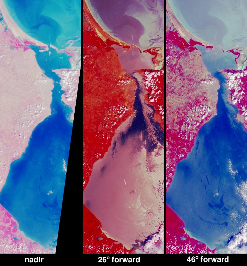
Multi-angle Portrayals of Mt. Etna's Plume
Full Resolution:
TIFF
(2.551 MB)
JPEG
(138.7 kB)
|
|
|
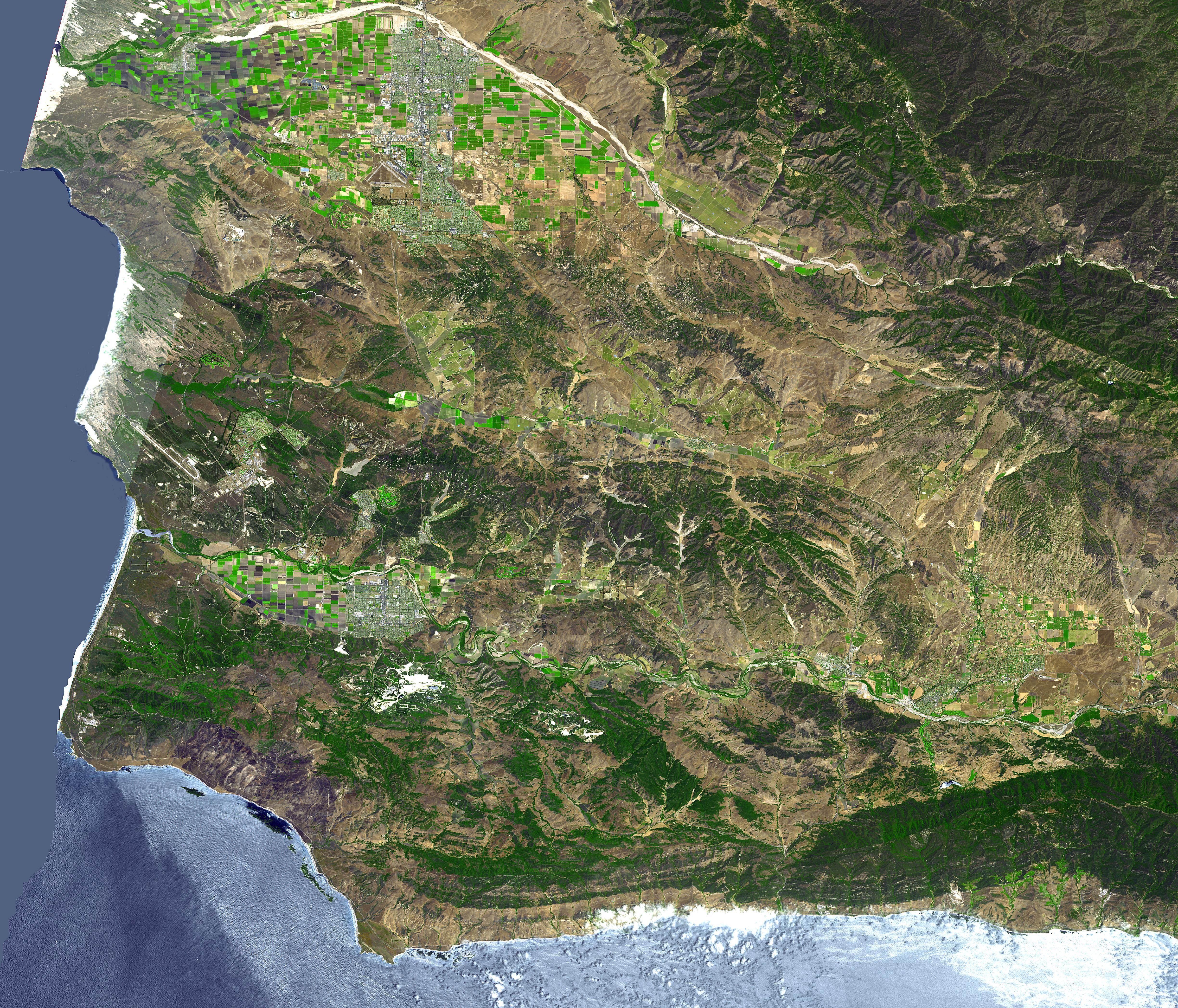
2002-11-07 |
Earth
|
Terra
|
ASTER
|
4896x4188x3 |
|
-
PIA03882:
-
Lompoc, CA
Full Resolution:
TIFF
(61.51 MB)
JPEG
(5.752 MB)
|
|
|
2002-11-07 |
Earth
|
Terra
|
ASTER
|
3388x5100x3 |
|
-
PIA03881:
-
Mt. Etna, Italy
Full Resolution:
TIFF
(51.84 MB)
JPEG
(2.133 MB)
|
|
|
2002-11-07 |
Earth
|
Terra
|
ASTER
|
2730x2694x3 |
|
-
PIA03880:
-
Soufriere Hills Volcano
Full Resolution:
TIFF
(17.55 MB)
JPEG
(964.6 kB)
|
|
|
2002-11-06 |
Earth
|
Terra
|
MISR
|
1506x847x3 |

|
-
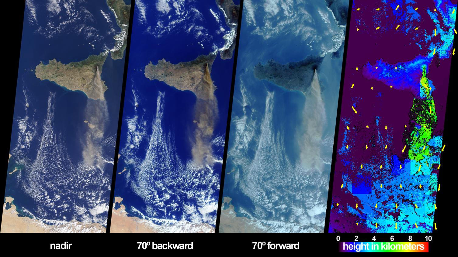
PIA03732:
-
Sicily's October Sky
Full Resolution:
TIFF
(3.316 MB)
JPEG
(236.5 kB)
|
|
|
2002-11-01 |
Earth
|
Shuttle Radar Topography Mission (SRTM)
Terra
|
ASTER
C-Band Interferometric Radar
|
1152x870x3 |

|
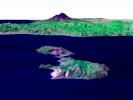
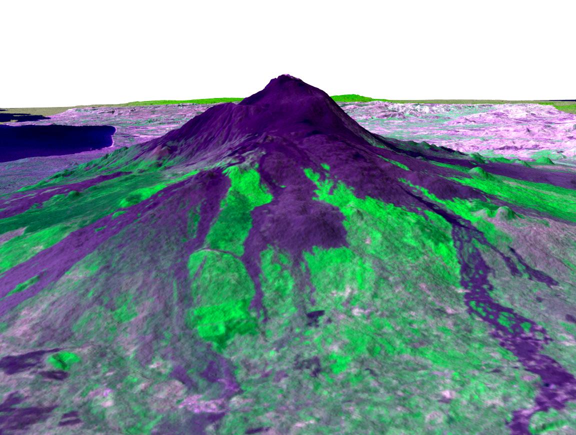
-
PIA03371:
-
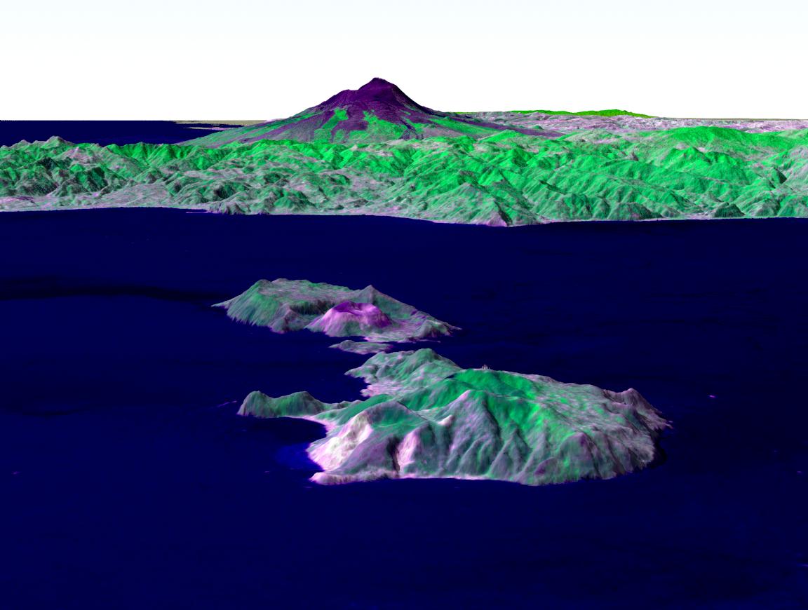
Perspective View, Mt. Etna, Italy
Full Resolution:
TIFF
(2.617 MB)
JPEG
(148.7 kB)
|
|
|
2002-11-01 |
Earth
|
Shuttle Radar Topography Mission (SRTM)
Terra
|
ASTER
C-Band Interferometric Radar
|
1152x870x3 |
|
-
PIA03370:
-
Perspective View, Mt. Etna, Italy & the Aeolian Islands
Full Resolution:
TIFF
(1.534 MB)
JPEG
(86.35 kB)
|
|
|
2002-10-30 |
Earth
|
Terra
|
MISR
|
2328x1614x3 |
|
-
PIA03731:
-
Dust Shrouds the Eastern Mediterranean
Full Resolution:
TIFF
(7.947 MB)
JPEG
(501.8 kB)
|
|
|
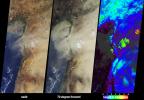
2002-10-29 |
Earth
|
Terra
|
ASTER
|
1400x1100x3 |
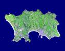
|
-
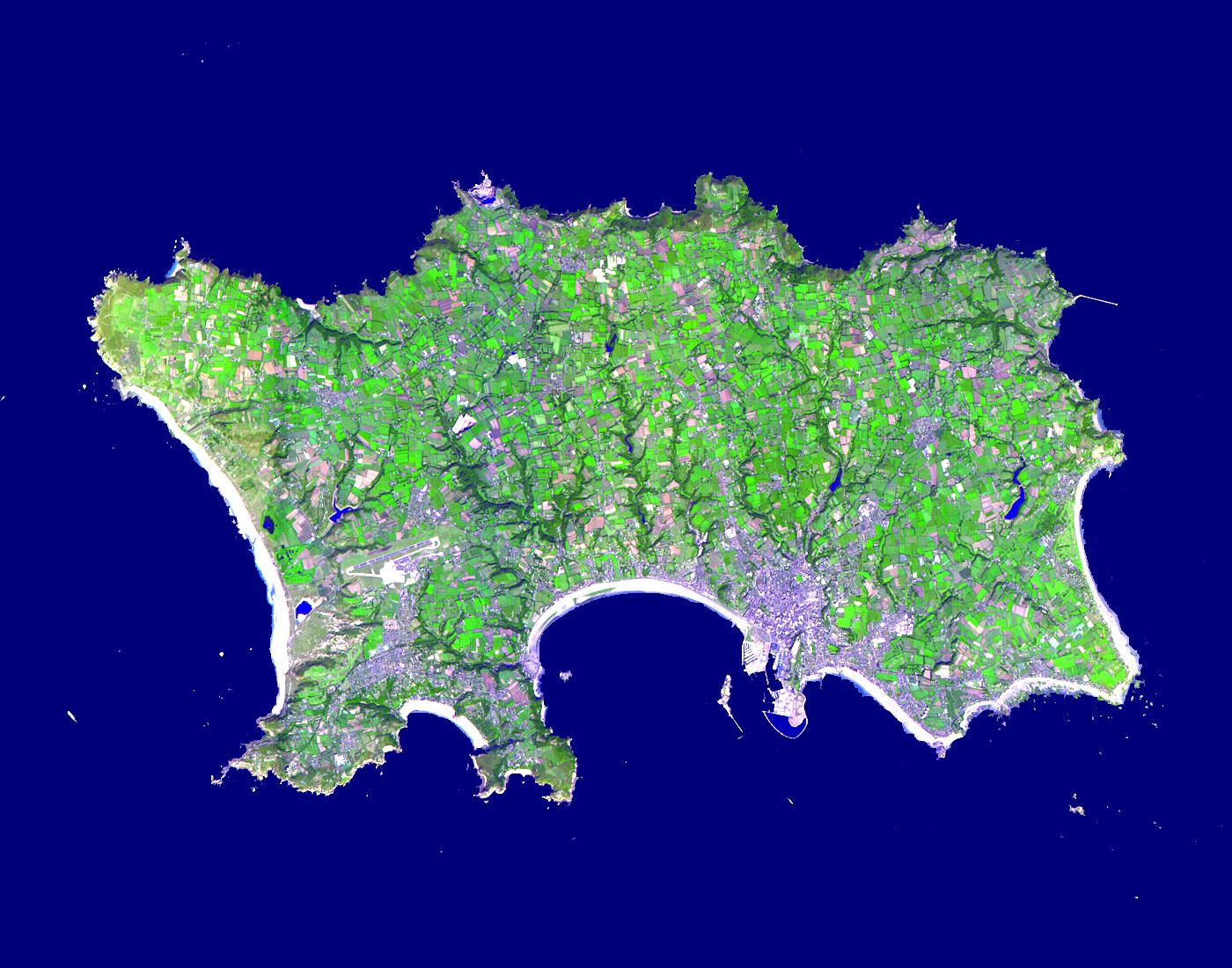
PIA03879:
-
Isle of Jersey
Full Resolution:
TIFF
(2.241 MB)
JPEG
(236.9 kB)
|
|
|
2002-10-23 |
Earth
|
Terra
|
MISR
|
1180x764x3 |
|
-
PIA03730:
-
Where on Earth...? MISR Mystery Image Quiz #11:
Queensland, Australia
Full Resolution:
TIFF
(2.443 MB)
JPEG
(154.5 kB)
|
|
|
2002-10-22 |
Earth
|
Terra
|
ASTER
|
2720x1670x3 |
|
-
PIA03877:
-
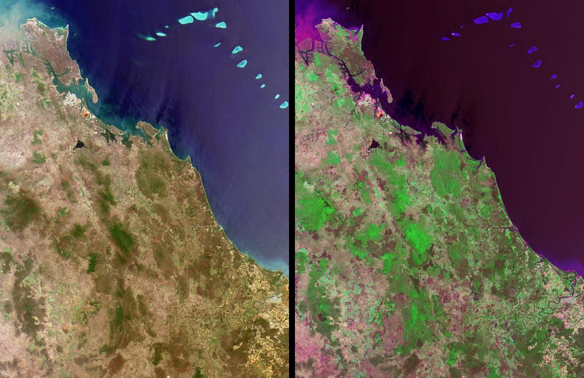
Tarpum Bay, Bahamas
Full Resolution:
TIFF
(10.64 MB)
JPEG
(522.8 kB)
|
|
|
2002-10-16 |
Earth
|
Terra
|
MISR
|
742x861x3 |

|
-
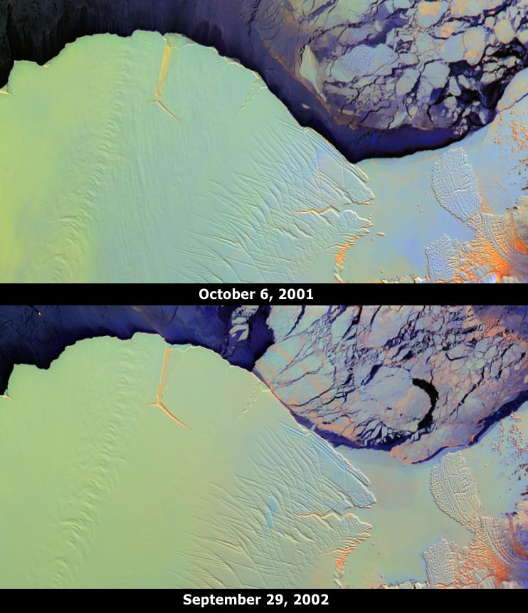
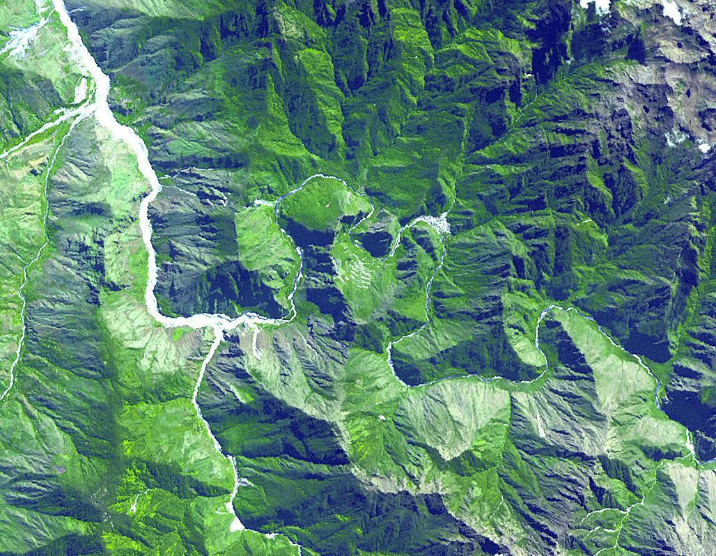
PIA03729:
-
Amery Ice Shelf's "Loose Tooth" Gets Looser
Full Resolution:
TIFF
(1.696 MB)
JPEG
(92.43 kB)
|
|
|
2002-10-15 |
Earth
|
Terra
|
ASTER
|
4812x4642x3 |
|
-
PIA03875:
-
Yellowstone Park
Full Resolution:
TIFF
(67.01 MB)
JPEG
(6.522 MB)
|
|
|
2002-10-09 |
Earth
|
Terra
|
MISR
|
3584x3252x3 |
|
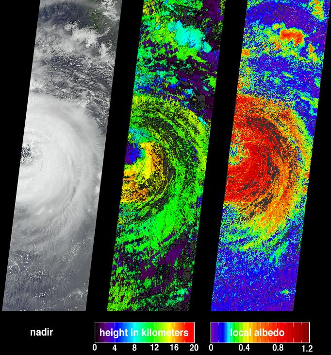
-
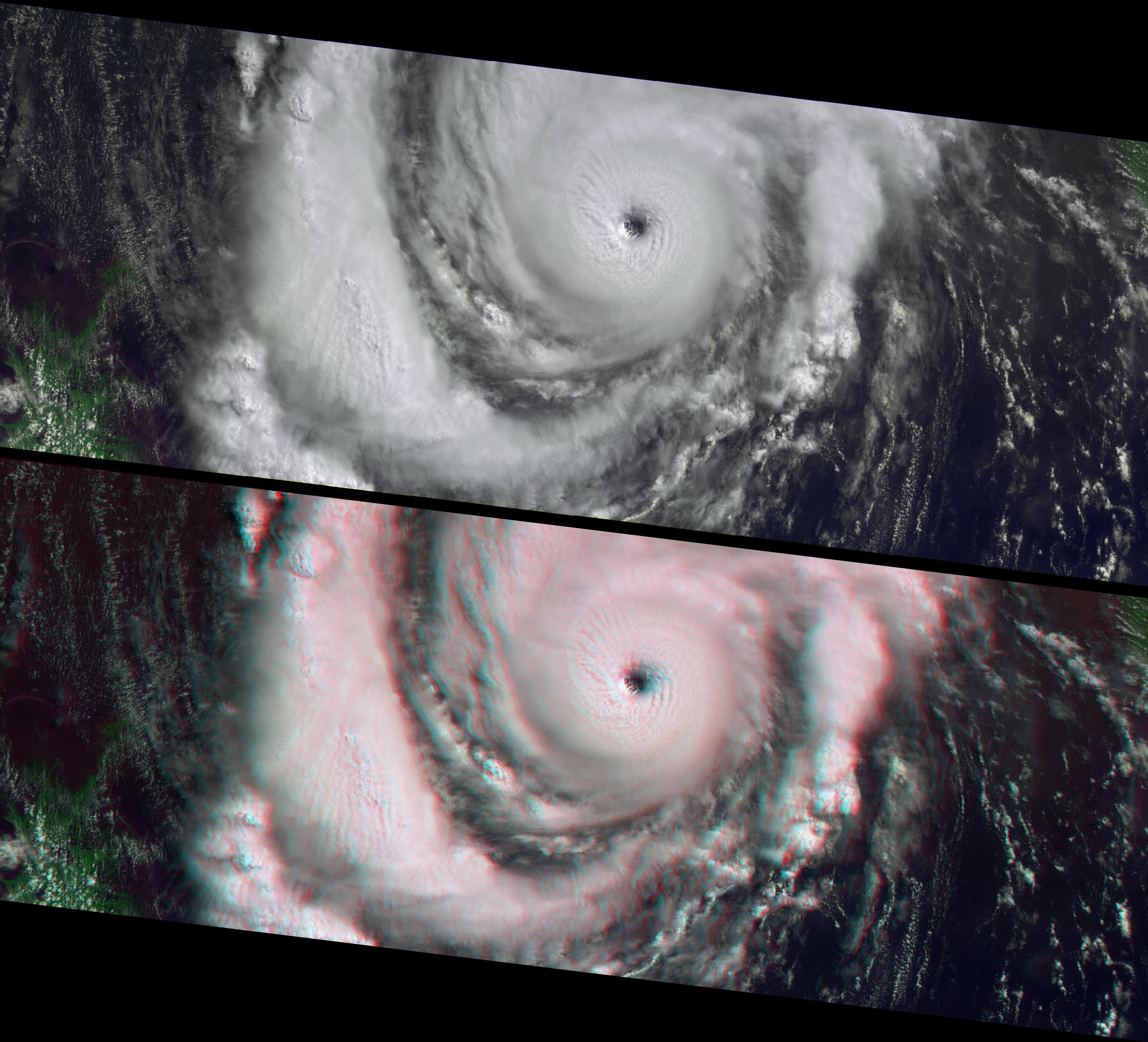
PIA03728:
-
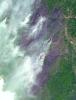
Hurricane Lili Heads for Louisiana Landfall
Full Resolution:
TIFF
(24.35 MB)
JPEG
(921.7 kB)
|
|
|
2002-10-02 |
Earth
|
Terra
|
MISR
|
2400x1086x3 |
|
-
PIA03727:
-
Smoke over Rondonia, Brazil
Full Resolution:
TIFF
(5.422 MB)
JPEG
(282.9 kB)
|
|
|
2002-09-25 |
Earth
|
Terra
|
MISR
|
1268x1390x3 |
|
-
PIA03726:
-
The Clouds of Isidore
Full Resolution:
TIFF
(2.718 MB)
JPEG
(563.5 kB)
|
|
|
2002-09-24 |
Earth
|
Terra
|
ASTER
|
2576x2308x3 |
|
-
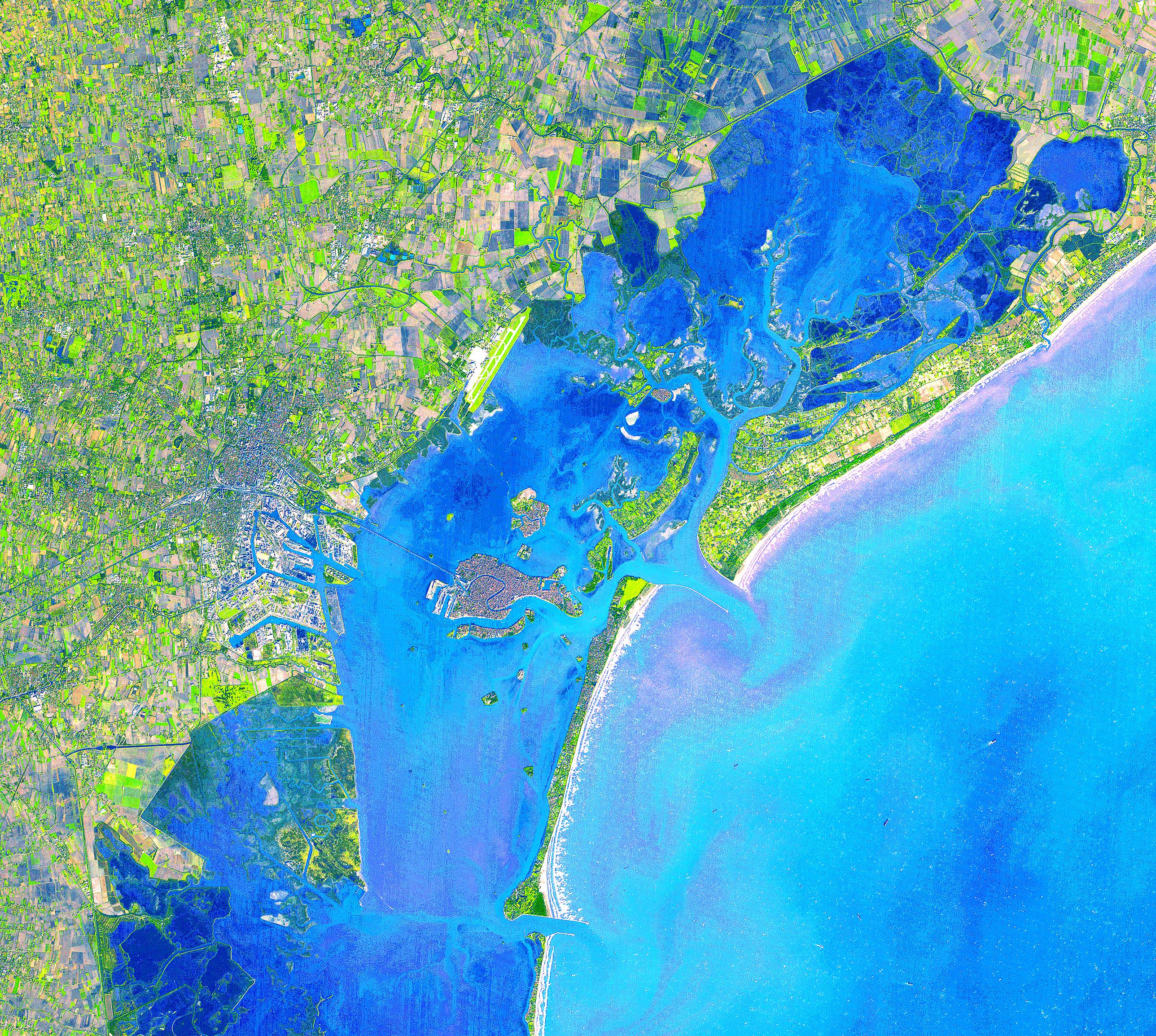
PIA03860:
-
Venice, Italy
Full Resolution:
TIFF
(17.56 MB)
JPEG
(2.723 MB)
|
|
|
2002-09-18 |
Earth
|
Terra
|
MISR
|
1341x2060x3 |
|
-
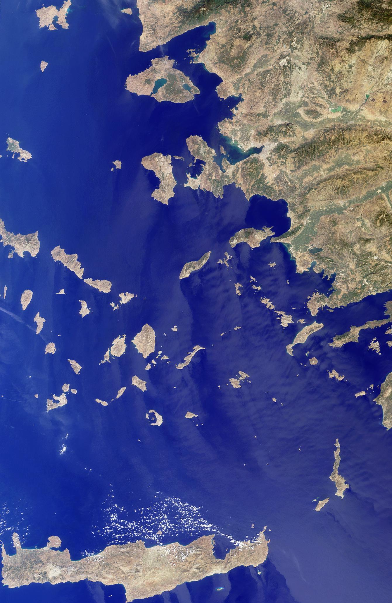
PIA03725:
-
Islands in the Midst of the World
Full Resolution:
TIFF
(8.296 MB)
JPEG
(411.5 kB)
|
|
|
2002-09-17 |
Earth
|
Terra
|
ASTER
|
1192x998x3 |
|
-
PIA03859:
-
Iturralde Crater, Bolivia
Full Resolution:
TIFF
(3.573 MB)
JPEG
(482.4 kB)
|
|
|
2002-09-15 |
Earth
|
Terra
|
ASTER
|
4850x7960x3 |
|
-
PIA03858:
-
Dongting Lake, China
Full Resolution:
TIFF
(107.1 MB)
JPEG
(5.536 MB)
|
|
|
2002-09-11 |
Earth
|
Terra
|
MISR
|
682x730x3 |
|
-
PIA03724:
-
Typhoon Sinlaku
Full Resolution:
TIFF
(1.015 MB)
JPEG
(157.7 kB)
|
|
|
2002-09-04 |
Earth
|
Terra
|
MISR
|
1058x1169x3 |
|
-
PIA03723:
-
Where on Earth...? MISR Mystery Image Quiz #10:
Pulau Kimaam, West Papua
Full Resolution:
TIFF
(3.411 MB)
JPEG
(295.4 kB)
|
|
|
2002-09-03 |
Earth
|
Terra
|
ASTER
|
3966x3732x3 |
|
-
PIA03857:
-
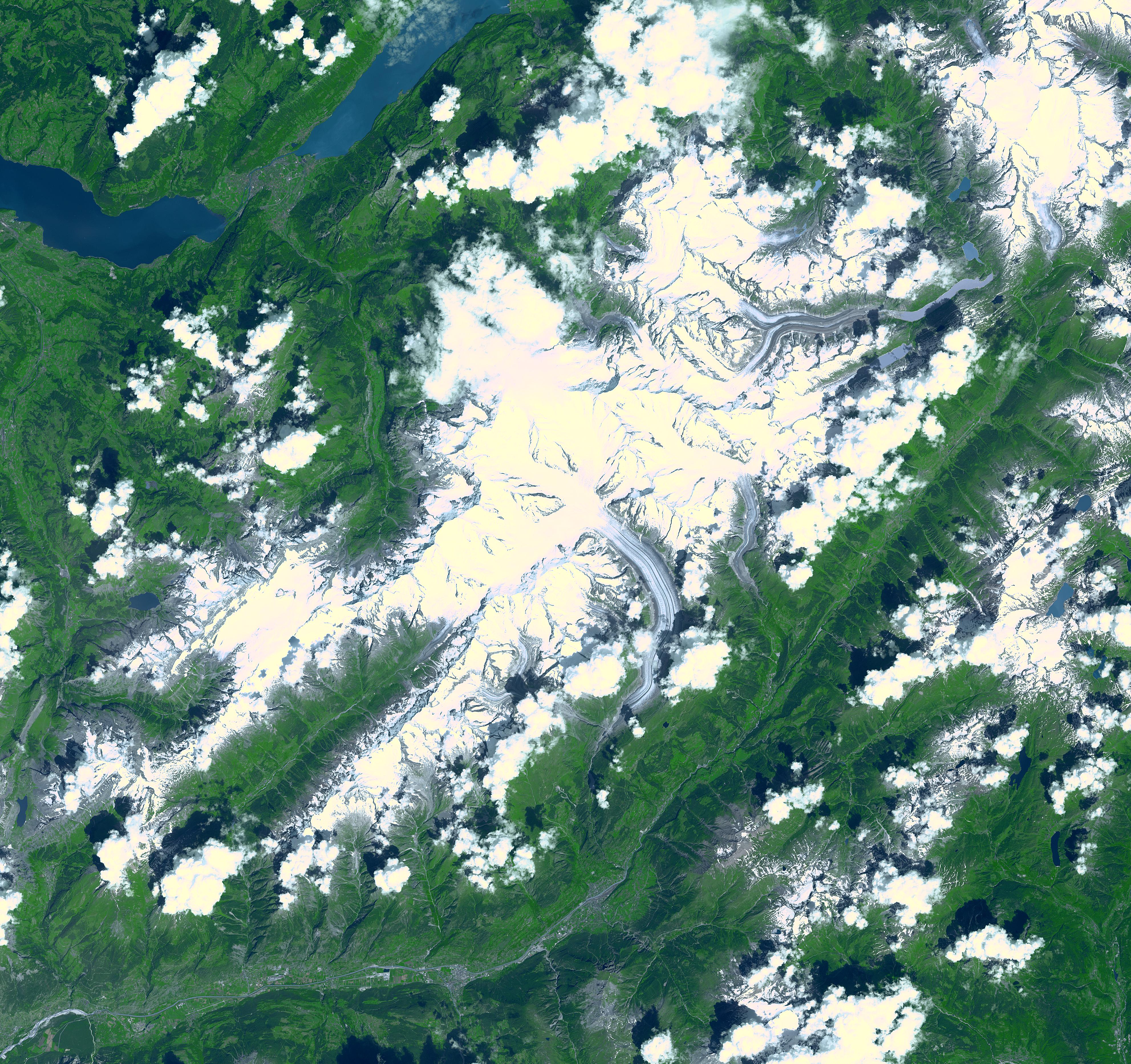
Aletsch Glacier, Switzerland
Full Resolution:
TIFF
(49.02 MB)
JPEG
(3.103 MB)
|
|
|
2002-08-28 |
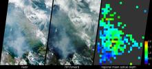
Earth
|
Terra
|
MISR
|
1392x805x3 |
|
-
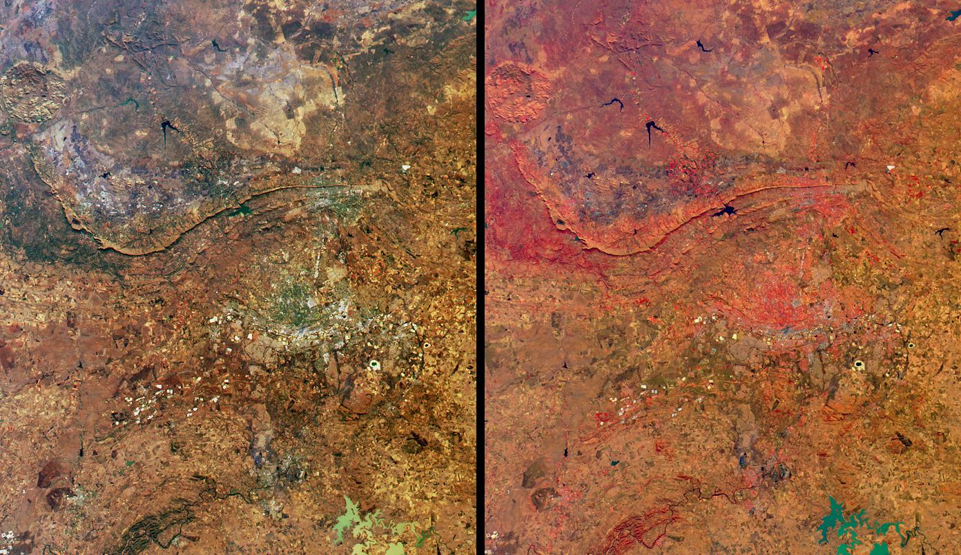
PIA03722:
-
Highlights from Johannesburg, Gauteng Province, South Africa
Full Resolution:
TIFF
(3.862 MB)
JPEG
(313 kB)
|
|
|
2002-08-22 |
Earth
|
Terra
|
ASTER
|
2976x3942x3 |
|
-
PIA03856:
-
Biscuit Fire, OR
Full Resolution:
TIFF
(38.28 MB)
JPEG
(1.679 MB)
|
|
|
2002-08-21 |
Earth
|
Terra
|
MISR
|
1964x2808x3 |
|
-
PIA03721:
-
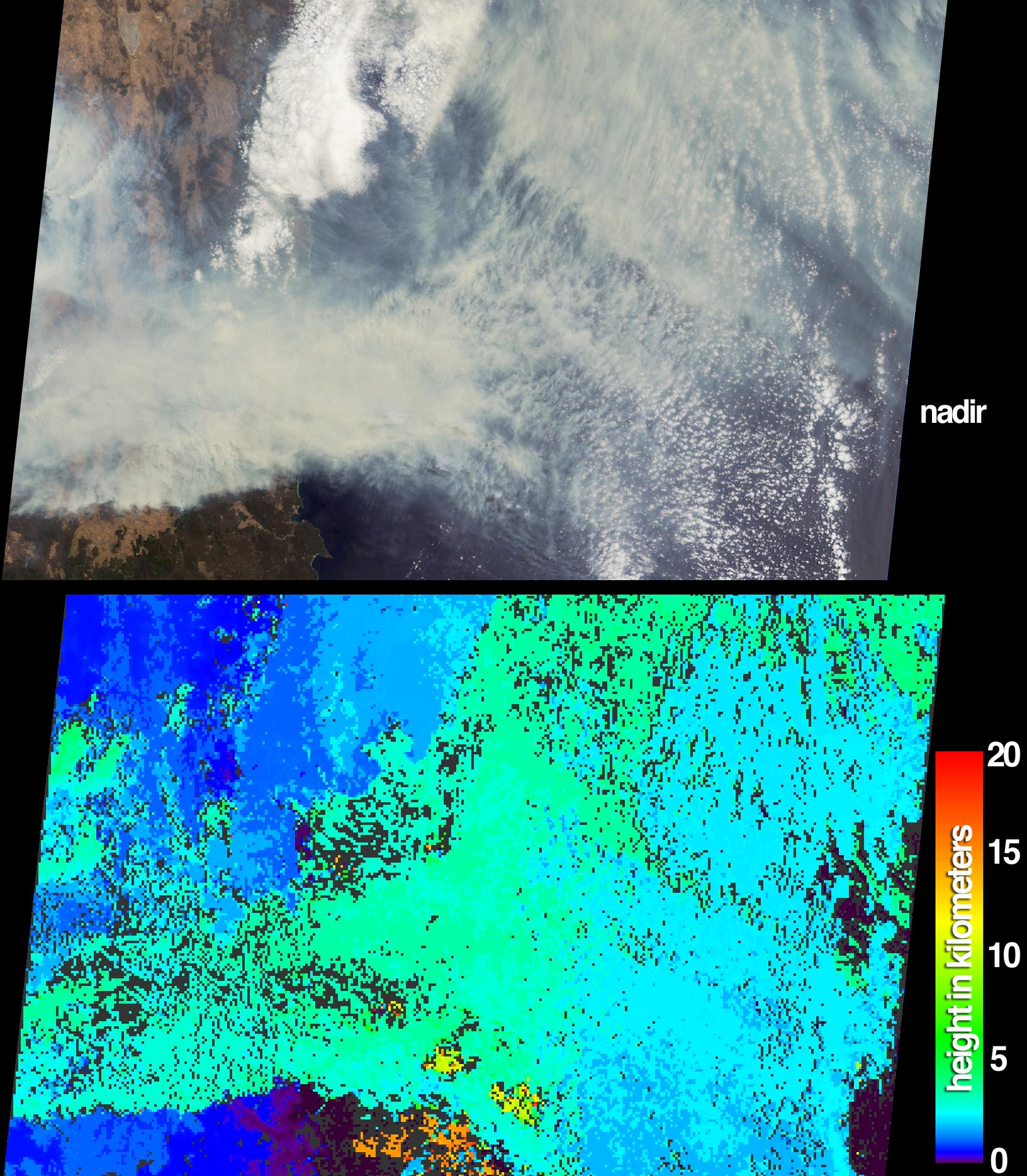
MISR Global Images See the Light of Day
Full Resolution:
TIFF
(10.38 MB)
JPEG
(910.9 kB)
|
|
|
2002-08-14 |
Earth
|
Terra
|
MISR
|
1548x1256x3 |
|
-
PIA03720:
-
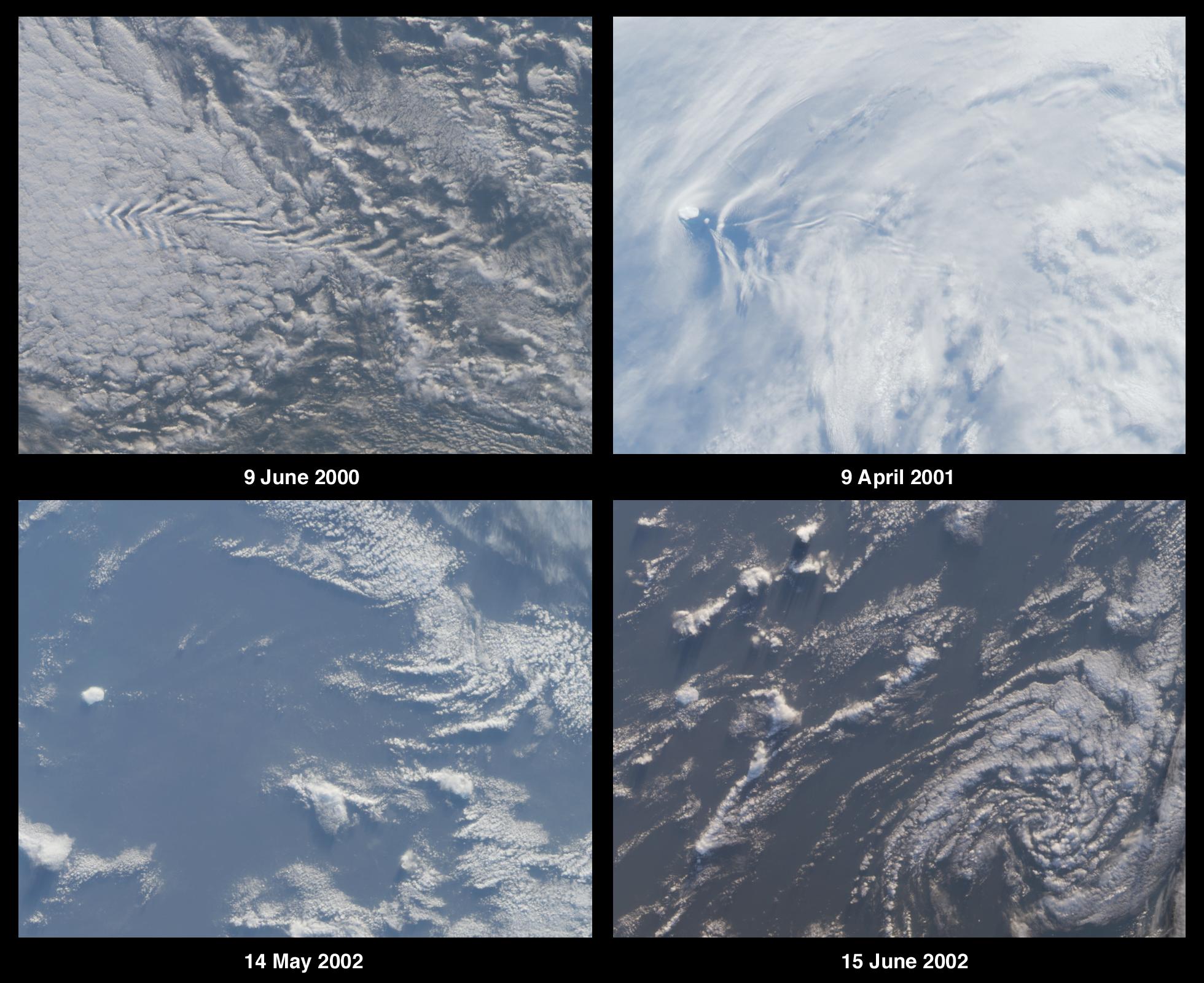
Cloud Arcs in the Western Pacific
Full Resolution:
TIFF
(4.871 MB)
JPEG
(316.7 kB)
|
|
|
2002-08-07 |
Earth
|
Terra
|
MISR
|
1069x970x3 |
|
-
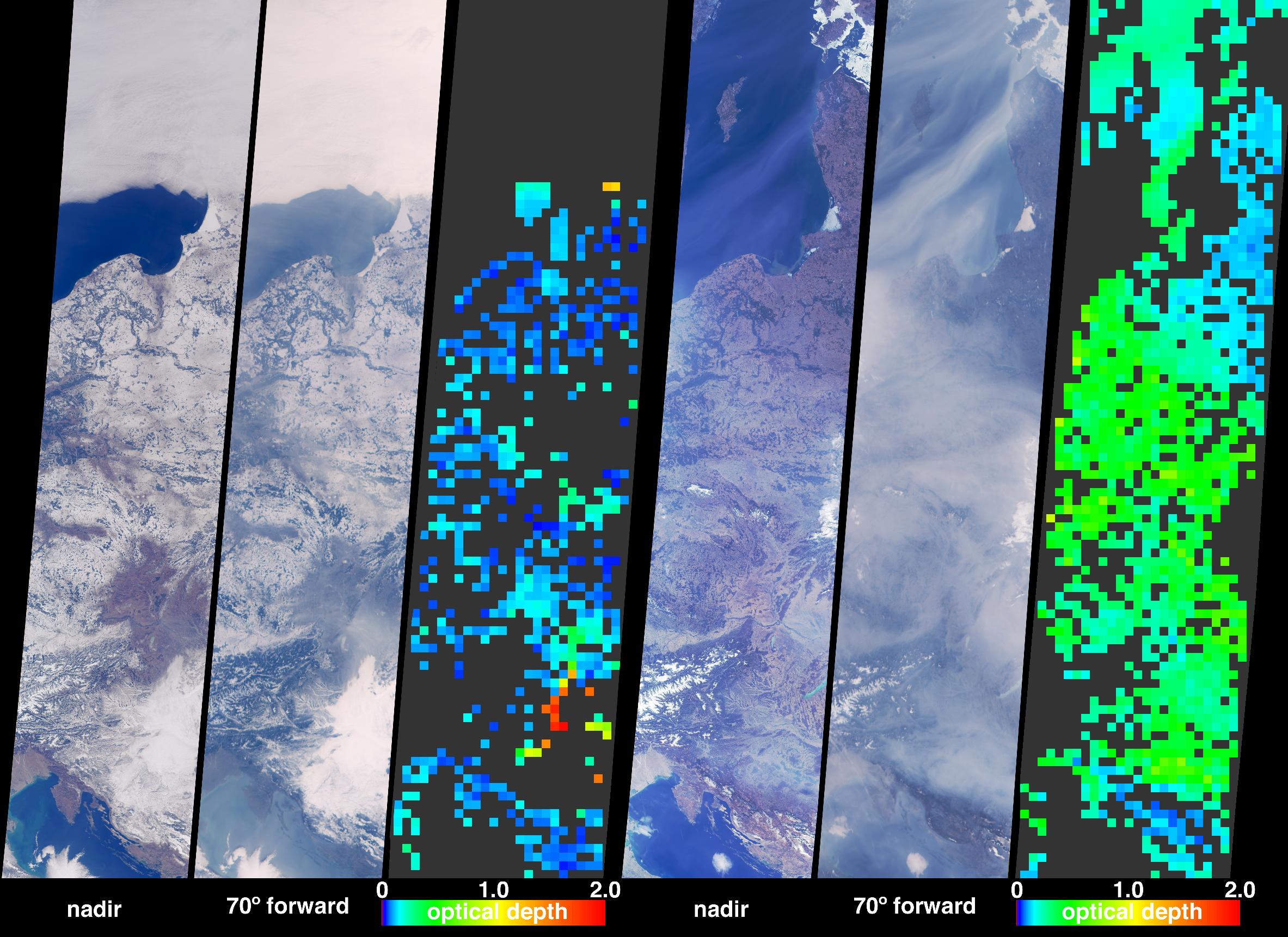
PIA03719:
-
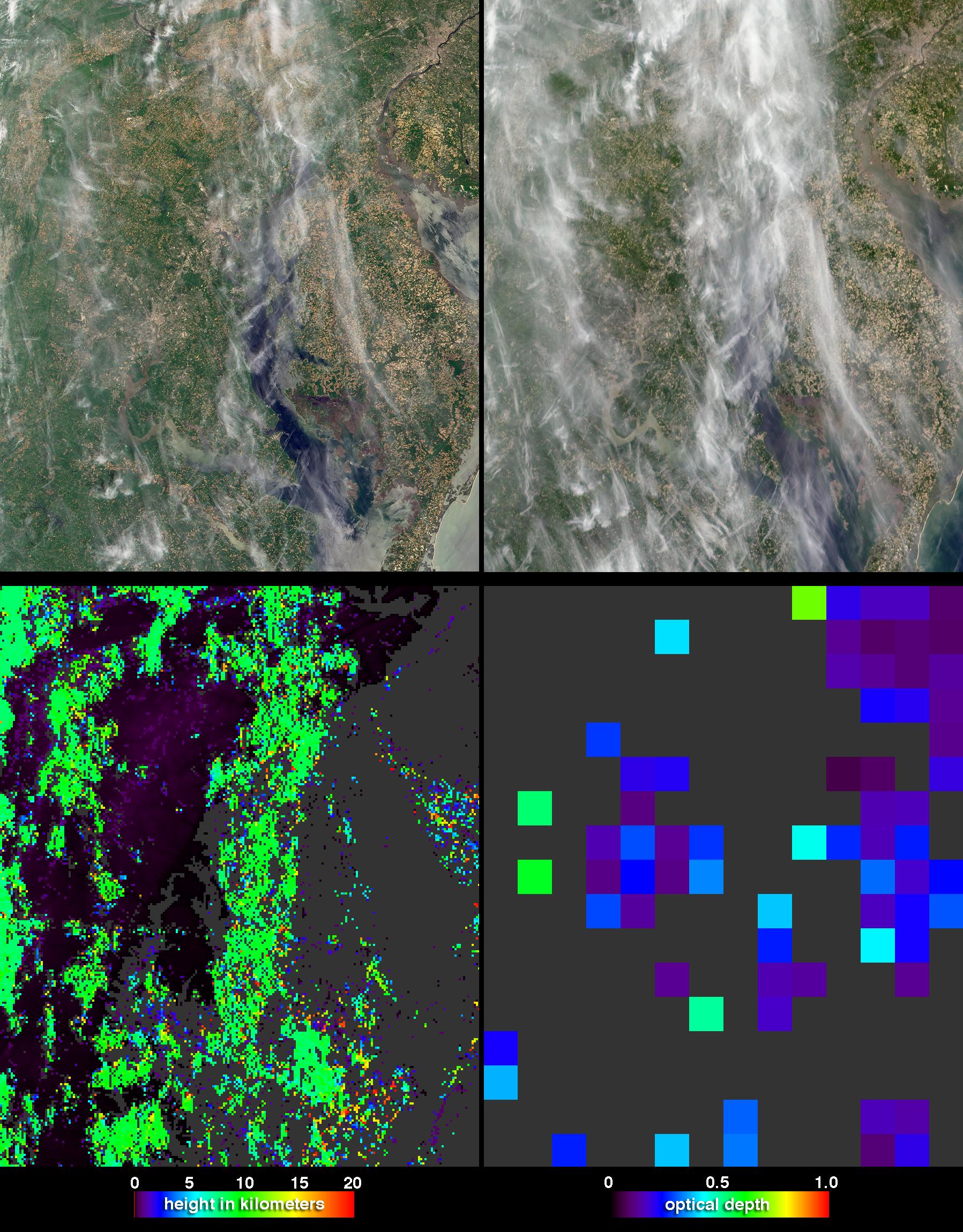
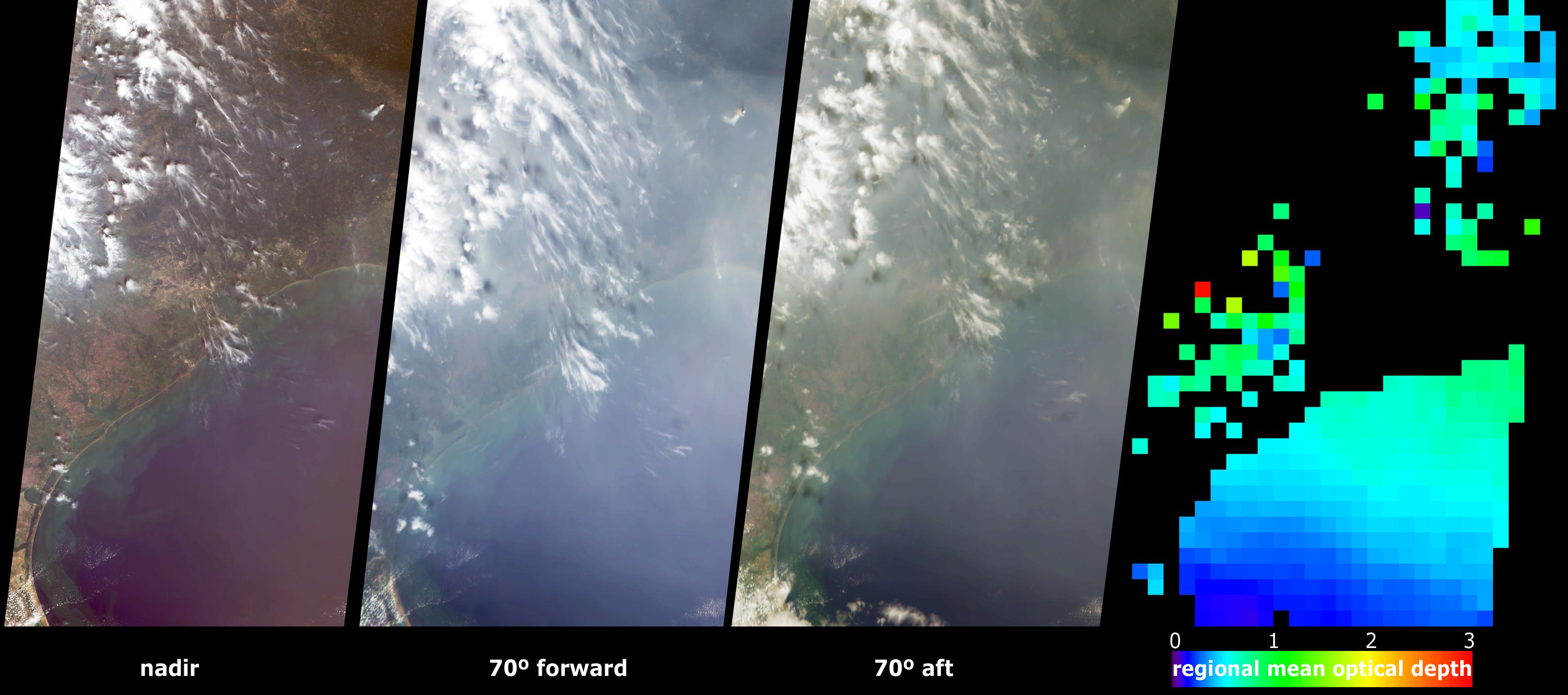
A Hard Look at Thin Clouds
Full Resolution:
TIFF
(2.909 MB)
JPEG
(154.1 kB)
|
|
|
2002-08-06 |
Earth
|
Terra
|
ASTER
|
3124x2554x3 |
|
-
PIA03854:
-
NASA Images Show Decreased Clarity in Lake Tahoe's Water
Full Resolution:
TIFF
(6.831 MB)
JPEG
(703 kB)
|
|
|
2002-07-31 |
Earth
|
Terra
|
ASTER
|
1028x798x3 |
|
-
PIA03853:
-
Machu Picchu, Peru
Full Resolution:
TIFF
(3.095 MB)
JPEG
(270 kB)
|
|
|
2002-07-31 |
Earth
|
Terra
|
MISR
|
1351x1348x3 |
|
-
PIA03718:
-
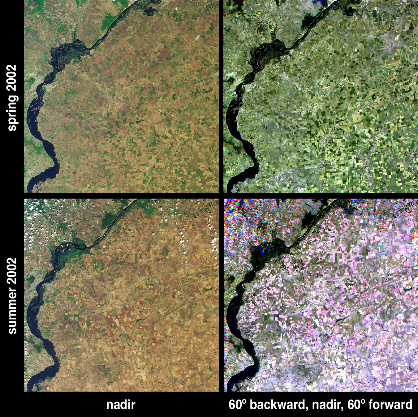
Summer Harvest in Saratov, Russia
Full Resolution:
TIFF
(4.347 MB)
JPEG
(486.5 kB)
|
|
|
2002-07-25 |
Earth
|
Terra
|
ASTER
|
3924x2394x3 |
|
-
PIA03852:
-
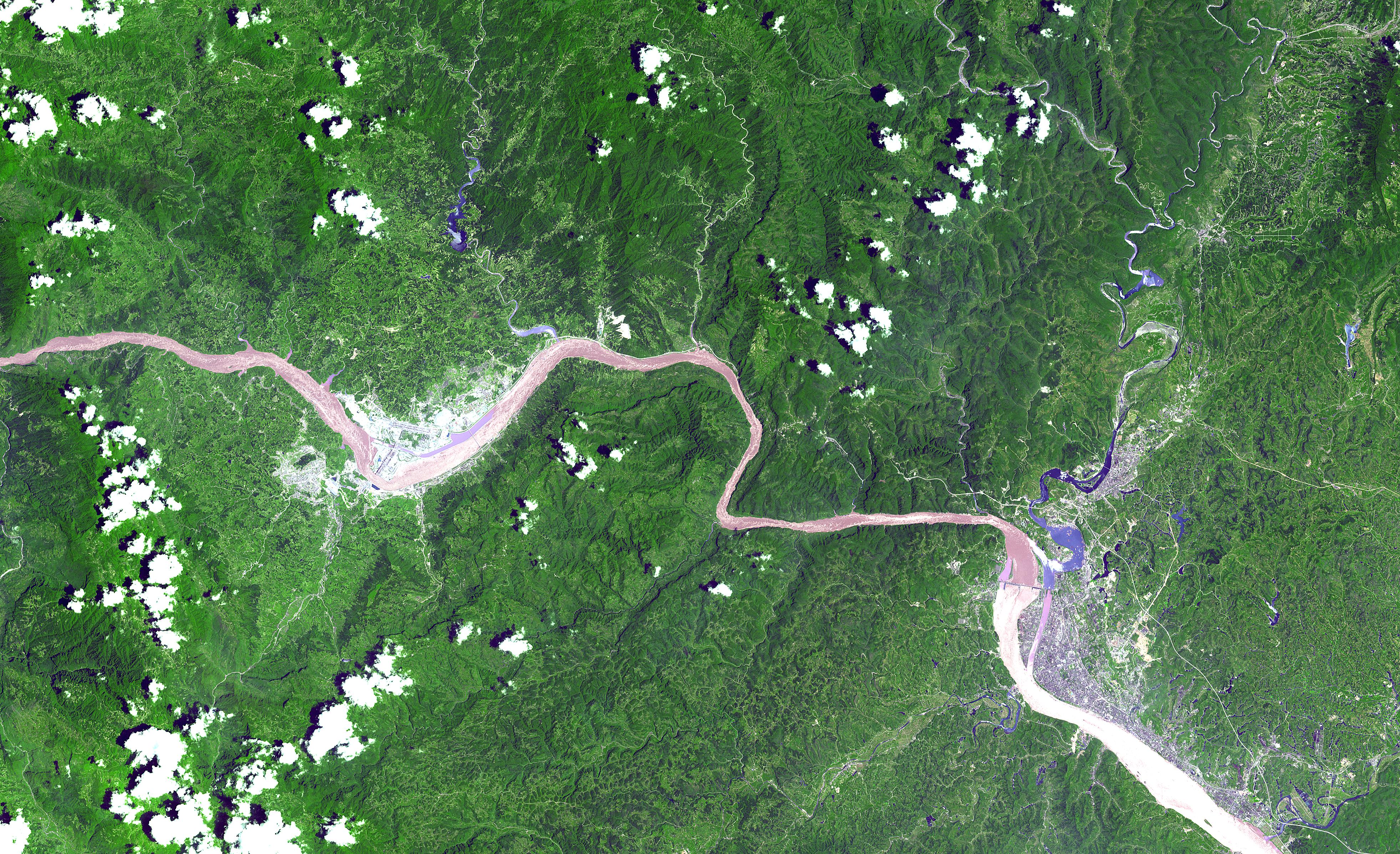
Three Gorges Dam, China
Full Resolution:
TIFF
(32.99 MB)
JPEG
(2.964 MB)
|
|
|
2002-07-24 |
Earth
|
Terra
|
MISR
|
1811x2182x3 |
|
-
PIA03717:
-
Distinguishing Clouds from Ice over the East Siberian Sea, Russia
Full Resolution:
TIFF
(5.682 MB)
JPEG
(565.9 kB)
|
|
|
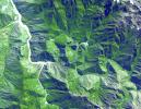
2002-07-17 |
Earth
|
Terra
|
MISR
|
1806x1070x3 |
|
-
PIA03716:
-
A Hazy Day in Mexico City
Full Resolution:
TIFF
(4.875 MB)
JPEG
(285.2 kB)
|
|
|
2002-07-16 |
Earth
|
Terra
|
ASTER
|
3885x2852x3 |
|
-
PIA03851:
-
Manaus, Brazil
Full Resolution:
TIFF
(37.82 MB)
JPEG
(2.893 MB)
|
|
|
2002-07-10 |
Earth
|
Terra
|
MISR
|
1960x1600x3 |
|
-
PIA03715:
-
Where on Earth...? MISR Mystery Image Quiz #9:
Bouvet Island, Norway
Full Resolution:
TIFF
(6.148 MB)
JPEG
(350.8 kB)
|
|
|
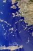
2002-07-03 |
Earth
|
Terra
|
MISR
|
1214x1700x3 |
|
-
PIA03714:
-
Mars Researchers Rendezvous on Remote Arctic Island
Full Resolution:
TIFF
(6.404 MB)
JPEG
(518.2 kB)
|
|
|
2002-06-26 |
Earth
|
Terra
|
MISR
|
1276x1050x3 |
|
-
PIA03713:
-
Smoke from Colorado Wildfires
Full Resolution:
TIFF
(1.64 MB)
JPEG
(184.2 kB)
|
|
|
2002-06-19 |
Earth
|
Terra
|
MISR
|
1632x582x3 |

|
-
PIA03712:
-
Darkened Skies over the Pacific
Full Resolution:
TIFF
(800.2 kB)
JPEG
(79.16 kB)
|
|
|
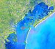
2002-06-18 |
Earth
|
Terra
|
ASTER
|
2146x2349x3 |
|
-
PIA03499:
-
Hayman Fire, Colorado
Full Resolution:
TIFF
(7.811 MB)
JPEG
(952.3 kB)
|
|
|
2002-06-12 |
Earth
|
Terra
|
MISR
|
1660x933x3 |
|
-
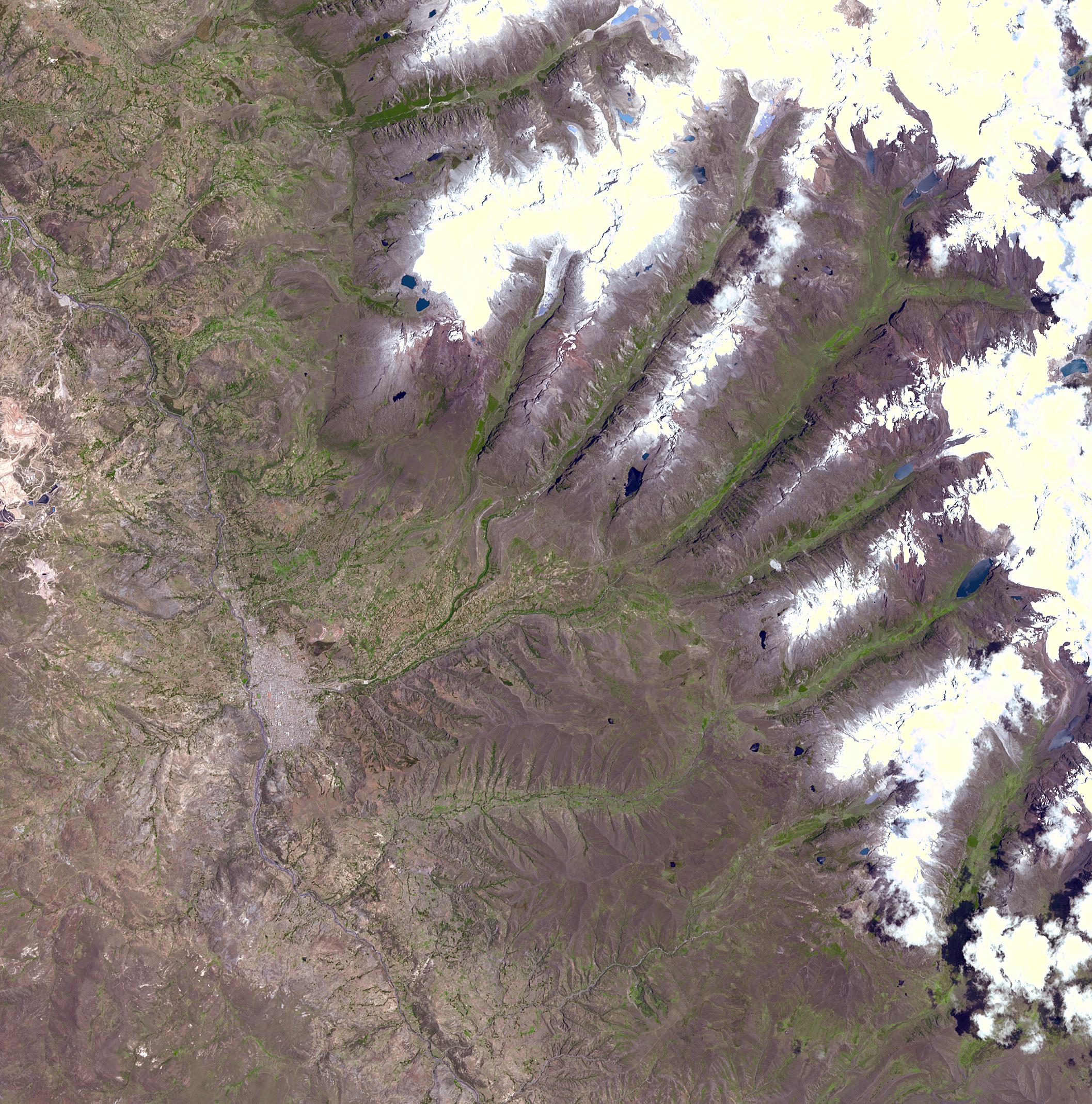
PIA03711:
-
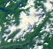
Spectacular Mountain Views of Northwest Colorado
Full Resolution:
TIFF
(5.47 MB)
JPEG
(442.1 kB)
|
|
|
2002-06-11 |
Earth
|
Terra
|
ASTER
|
2840x2155x3 |
|
-
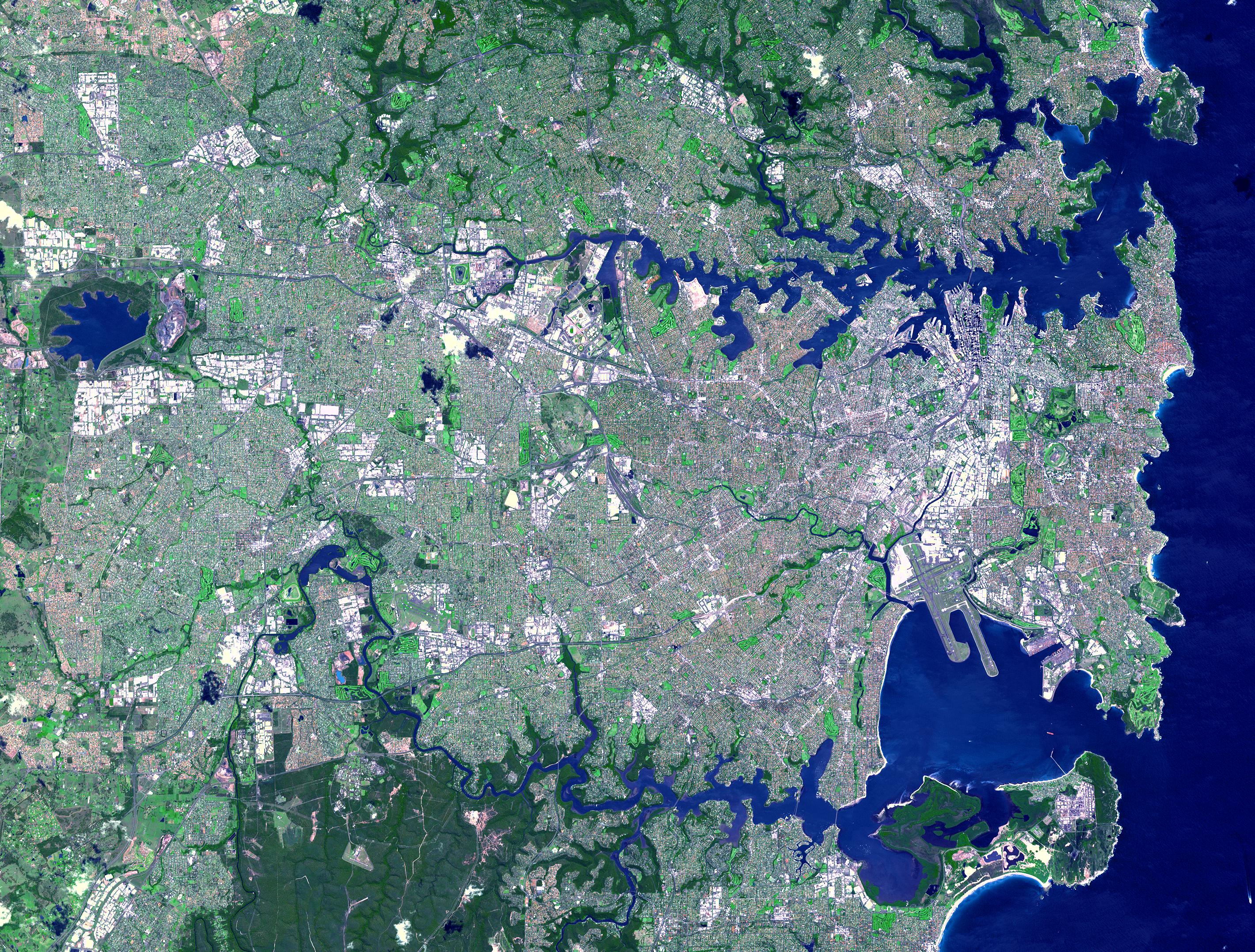
PIA03498:
-
Sydney, Australia
Full Resolution:
TIFF
(22.68 MB)
JPEG
(2.19 MB)
|
|
|
2002-06-11 |
Earth
|
Terra
|
ASTER
|
3594x3819x3 |
|
-
PIA03497:
-
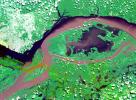
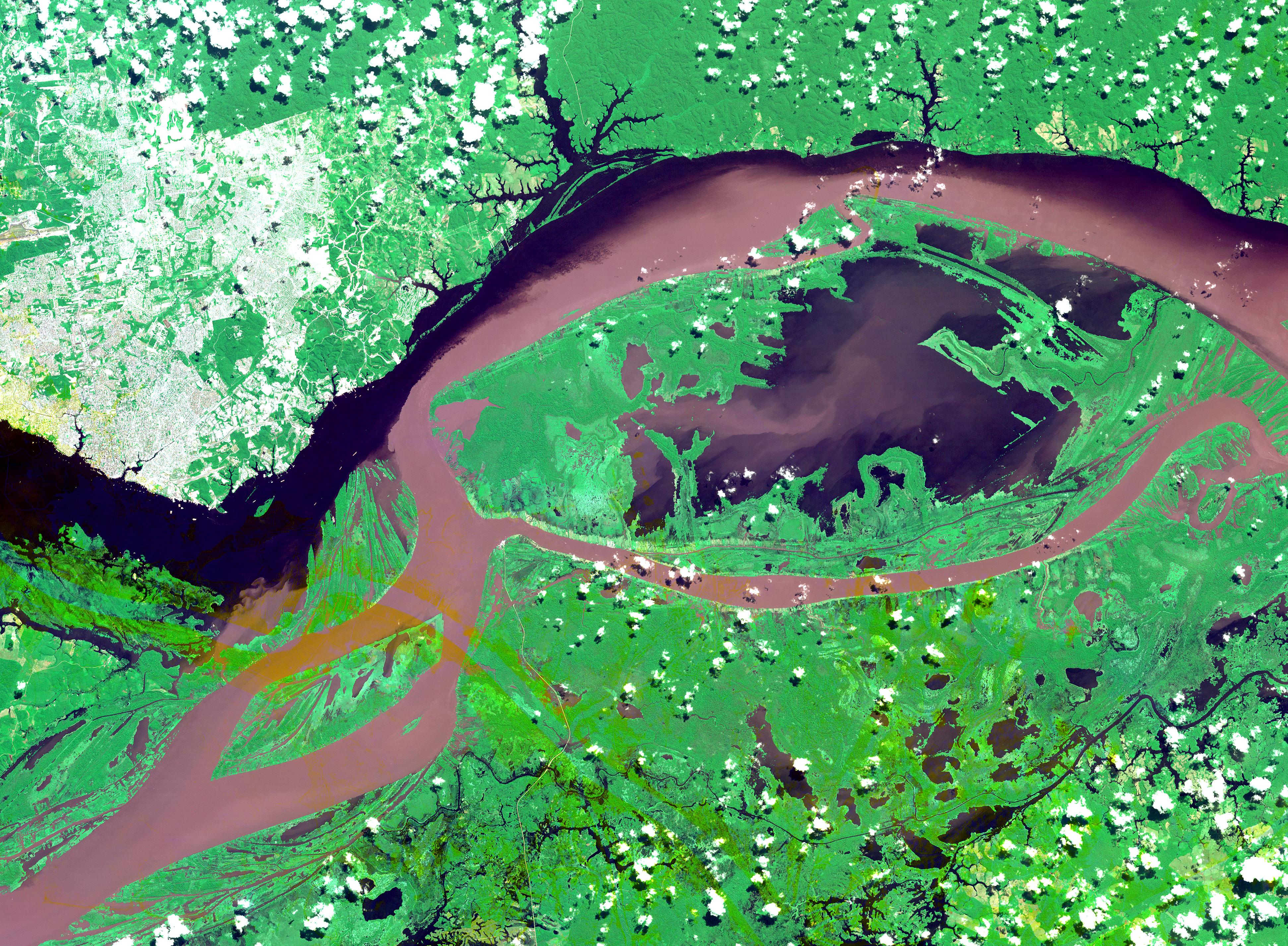
Mississippi River Delta
Full Resolution:
TIFF
(46.09 MB)
JPEG
(3.446 MB)
|
|
|
2002-05-29 |
Earth
|
Terra
|
MISR
|
1100x872x3 |
|
-
PIA03710:
-
Closed Large Cell Clouds in the South Pacific
Full Resolution:
TIFF
(2.559 MB)
JPEG
(138.3 kB)
|
|
|
2002-05-22 |
Earth
|
Terra
|
MISR
|
1063x1565x3 |
|
-
PIA03709:
-
Okefenokee Swamp Fire, Georgia
Full Resolution:
TIFF
(4.625 MB)
JPEG
(247.1 kB)
|
|
|
2002-05-15 |
Earth
|
Terra
|
MISR
|
1079x802x3 |
|
-
PIA03708:
-
Where on Earth...? MISR Mystery Image Quiz #8:
Yarlung Tsangpo River, China
Full Resolution:
TIFF
(2.709 MB)
JPEG
(225.4 kB)
|
|
|
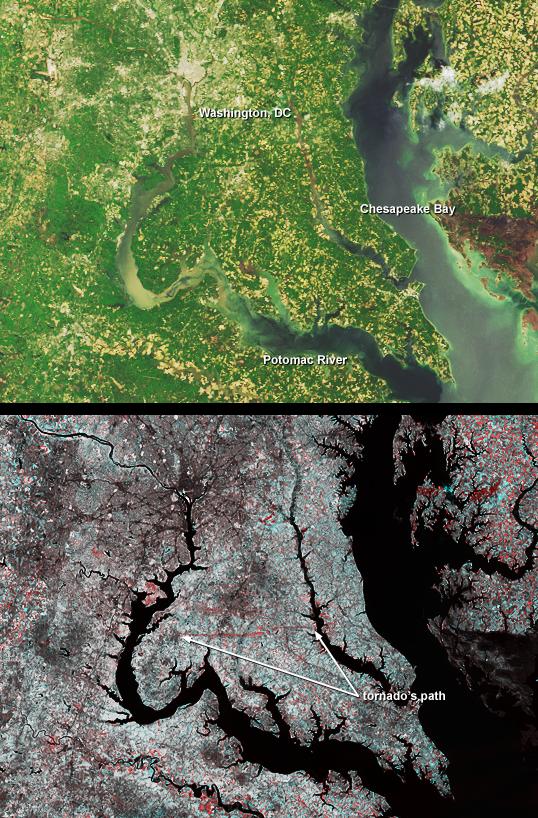
2002-05-10 |
Earth
|
Terra
|
MISR
|
538x818x3 |
|
-
PIA03707:
-
Tornado Cuts Through La Plata, Maryland
Full Resolution:
TIFF
(1.009 MB)
JPEG
(148.9 kB)
|
|
|
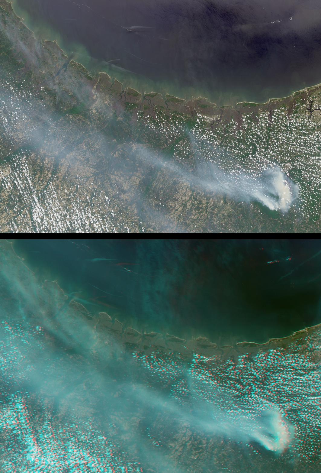
2002-05-08 |
Earth
|
Terra
|
MISR
|
1532x1408x3 |
|
-
PIA03706:
-
Smoke from Fires in Southern Mexico
Full Resolution:
TIFF
(3.367 MB)
JPEG
(189.6 kB)
|
|
|
2002-05-07 |
Earth
|
Terra
|
ASTER
|
1200x600x3 |
|
-
PIA03494:
-
La Plata, Maryland
Full Resolution:
TIFF
(3.1 MB)
JPEG
(253.9 kB)
|
 Planetary Data System


